Would you like to save this?
Northwest Nevada is less a region than a wide canvas of silence, broken only by wind, sagebrush, and the scatter of towns that hold to the land with stubborn resolve. Distances here are measured not in miles but in the long gaps between fuel stops, the creak of old fences, and the time it takes for a storm to cross the valley floor.
The towns that endure in this corner of the state do so on their own terms. Some are reduced to weather-beaten shacks and rusting mine works, others cling to ranchland that still produces cattle or alfalfa, and a few remain as waypoints on the road to nowhere in particular. Each one carries a thread of Nevada’s mining and frontier history, but the edges have softened into stillness.
Visitors who reach these places rarely arrive by accident. Gravel tracks and forgotten county roads lead into high basins and dry riverbeds, and with each turn the world narrows to a handful of cabins, a lone post office, or a saloon that refuses to close. The quiet here is not curated—it is simply the natural state of things.
To move through these 25 towns is to see the full measure of Nevada’s remote identity: frontier settlements, rail spurs, and hamlets pressed against desert ranges. Together they sketch out a map of seclusion, a record of how people once carved lives into hard ground and how, even now, a few still choose to stay.
25. Midas: A Gold Rush Relic Lost to Time
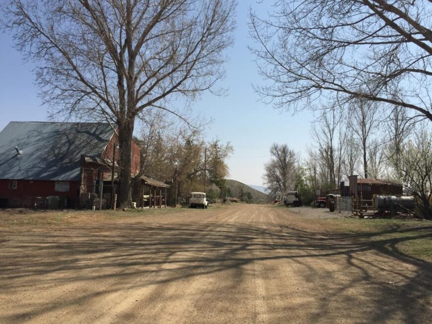
Midas, Nevada sits hidden amid the sagebrush hills of Elko County, far from roaring interstates and city lights, reached only by lonely gravel roads that stretch across the high desert. This nearly forgotten mining settlement feels frozen in time, its weathered cabins and rusted tin roofs whispering stories to the wind.
The town hums with a stillness that borders on sacred—dusty, sun-baked, and hushed, like a secret the desert keeps close. Visitors explore the old Midas Saloon, wander relics from the early-1900s gold rush, and hike rugged trails where wild horses appear like ghosts on the horizon.
There’s no true industry left here—only flickers of past prosperity and a handful of stubborn souls who refuse to let the place die. It’s the kind of remote corner that reminds you how quietly the world can breathe.
Where is Midas?
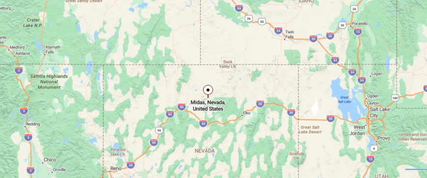
Midas is a historic mining outpost in northeastern Elko County, Nevada, sitting more than 5,700 feet up in the Owyhee foothills. Once known as Gold Circle, it lies about 43 miles north of Interstate 80, beyond the tiny exit town of Golconda.
The trip ends on packed dirt roads that wind through desert scrub before revealing a handful of old structures and a still-running saloon. It’s remote and reachable—a living ghost town where time seems to linger in the dust.
24. Tuscarora: High-Desert Artist Sanctuary

Tuscarora, Nevada lies tucked in a lonely fold of the Independence Mountains, far from any major highway and reached only by long stretches of gravel road. Once a bustling 19th-century silver camp, it now feels like an artist’s hideaway where time unravels slowly beneath wide-open skies.
Weathered cabins, rusted mining relics, and dirt lanes create a landscape that is equal parts historical and haunting. Visitors can explore the Tuscarora Pottery School, wander the old cemetery perched on a hill, and hike nearby canyons where mule deer linger among the sage.
Only a handful of resident artists and ranching families remain, making their living through craft and livestock. It’s the kind of secluded place that teaches you the art of quiet living.
Where is Tuscarora?
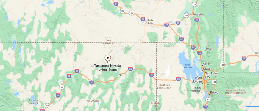
Tuscarora sits high in Nevada’s Tuscarora Mountains, about 40 miles north of Carlin and 50 miles from Elko. Once a bustling mining camp, it now holds only a handful of weathered buildings and a stubborn thread of community.
Visitors reach it by climbing narrow, winding roads through sagebrush and rocky slopes. It’s remote but lived-in—a quiet settlement where the past never fully let go.
23. Mullen Pass: Windswept Ridge Outpost
Mullen Pass, Nevada is a high desert gap carved between the Virginia Mountains and the Pah Rah Range, where the wind seems to own the land more than people ever did. Sagebrush sweeps right up to the rocky slopes, and the wide sky feels as if it’s pressing down on the ridgeline. Travelers heading toward Pyramid Lake slip through without noticing, but the pass itself carries the kind of austere beauty that makes you pause.
Old wagon tracks still etch the volcanic soil, hinting at a time when prospectors and ranchers threaded this corridor with grit and mule teams. Today, only pronghorn, hawks, and the occasional backcountry hiker linger on the ridges. The sense of exposure is total—no trees for cover, no houses in sight, just wind and stone trading blows.
Where is Mullen Pass?
Mullen Pass lies in Washoe County, Nevada, linking the Virginia Mountains to the Pah Rah Range on the western edge of Pyramid Lake. About 30 miles north of Reno along State Route 446, it’s a drive that opens into sweeping desert views.
There’s little to stop for except the scenery itself—layered volcanic ridges, wide basins, and a reminder of how Nevada’s landscapes can feel immense even at a simple mountain gap.
22. Getchell: Mining Hamlet on the Edge
Getchell, Nevada rests in the lonely foothills of the Osgood Mountains, just far enough from main highways to feel almost erased from the map. Once pulsing with activity from its gold and silver mines, the town has slipped into a calm desert hush.
Wind sweeps over sagebrush flats and weathered mining remnants, carrying whispers of the past across the open land. Modern visitors sift for agates in nearby beds, wander rusted-out mine ruins, and hike arid trails where jackrabbits dart among greasewood shrubs.
Only a few rotational workers remain at nearby mining operations, giving the place a ghost-town feel without fully abandoning it. It’s the kind of hidden corner that reminds you how powerfully silence can speak.
Where is Getchell?
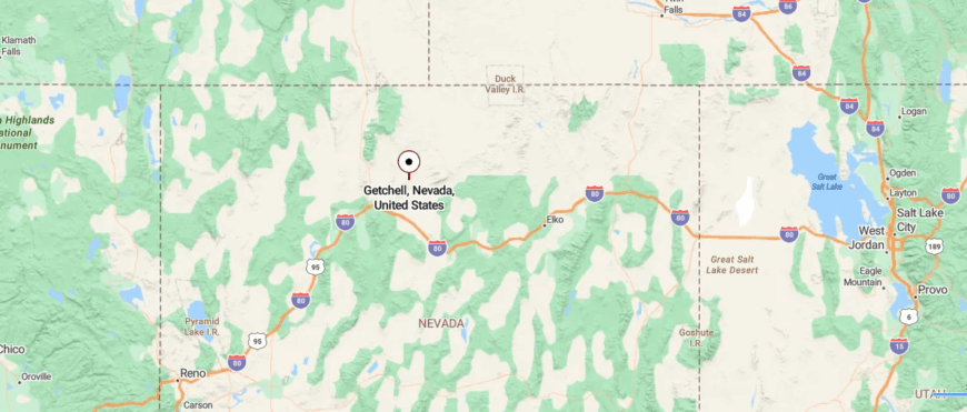
Getchell isn’t a town but a gold-mining site in Humboldt County, Nevada, tucked into the Osgood Mountains about 35 miles northeast of Winnemucca. It lies off Nevada State Route 789, reached by driving north from Golconda through dry canyon country.
The site has operated on and off since the 1930s, producing both gold and tungsten. It’s still reachable by road, yet feels swallowed by the rugged, empty sweep of the Great Basin.
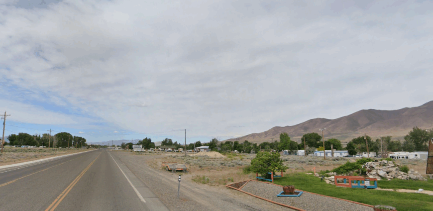
21. Chimney Dam: Reservoir Country Escape
Chimney Dam, Nevada lies beside a remote reservoir in Humboldt County, far from busy highways and surrounded by vast sagebrush plains. A scattering of primitive campsites and aging picnic tables give it an untamed, off-grid feel.
Desert winds ripple across still waters while distant mountains create a timeless, watchful backdrop. Travelers fish for trout and smallmouth bass, paddle at dawn, and watch for migrating birds drifting along the rocky shoreline.
Aside from seasonal anglers and wandering campers, few linger long in this wild basin. It’s the sort of hidden escape that makes you slow down and savor the quiet.
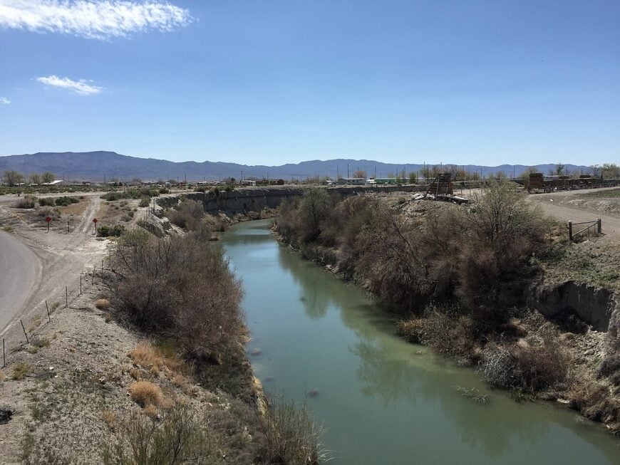
Where is Chimney Dam?
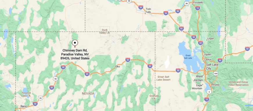
Chimney Dam sits in Humboldt County, Nevada, about 48 miles north of Winnemucca on the Little Humboldt River. Built in 1974, it backs a quiet 2,000-acre reservoir used for both irrigation and fishing.
Visitors leave Interstate 80 and follow long rural roads through sagebrush flats before the lake gradually appears. It’s reachable by vehicle, yet carries the calm, remote hush of a desert waterhole far from town lights.
20. Rebel Creek: Hidden Mountain Ranchlands
Rebel Creek, Nevada lies tucked in a remote corner of Humboldt County, accessed by rough ranch roads that disappear into the vast sagebrush desert. Surrounded by the Santa Rosa Range, the small settlement feels swallowed by wild country where mountains rise abruptly from valley floors.
Old corrals, hay fields, and scattered ranch houses hint at a life built on grit and cattle work. Visitors explore nearby trails into rugged canyons, fish high-mountain streams, and watch pronghorn weave through open range.


Only a handful of ranching families and seasonal hunters pass through, giving the area a near-forgotten silence. It’s the kind of secluded place where the wind carries more stories than people ever will.
Where is Rebel Creek?

Rebel Creek is a remote spot in northeastern Humboldt County, Nevada, just east of U.S. Route 95 near the Quinn River Valley. Located a few miles north of Orovada, it once held a post office and carries a name born from a long-ago feud.
Travelers leave the main road and slip onto a lonely dirt route that skirts sage flats and ranchland. It’s easy to miss, yet still rooted in the vast, wind-swept quiet of northern Nevada.
19. Quinn River Crossing: Desert River Outpost
Would you like to save this?
Quinn River Crossing, Nevada sits deep in the Black Rock Desert, far from paved roads and surrounded by endless stretches of sagebrush and alkali flats. Once a stage stop and ranching outpost, it now feels like a lonely ripple in time where silence dominates the landscape.
Weathered fences and leaning cabins hint at the travelers and cattle that once moved through this rugged terrain. Adventurous visitors explore dry riverbeds, trace historic wagon routes, and watch sunsets ignite the nearby Granite Range.
A few ranchers and wild mustangs still roam the area, keeping human presence sparse. It’s the kind of remote place that makes you feel both small and startlingly alive.
Where is Quinn River Crossing?
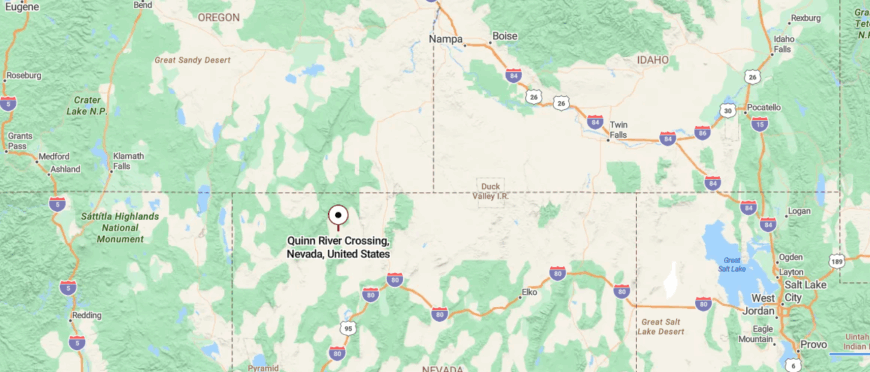
Quinn River Crossing lies in Humboldt County’s vast Quinn River Valley, about 55 miles northwest of Winnemucca. Set far from major highways, it’s surrounded by open sagebrush and high-desert silence.
Travelers reach it via rural roads branching off U.S. 95 or State Route 140, followed by isolated dirt tracks. It’s drivable, yet feels like an almost-forgotten dot on Nevada’s endless horizon.
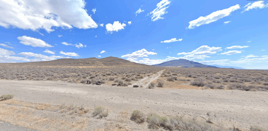
18. Leonard Creek: Remote Fish & Hunt Retreat

Leonard Creek, Nevada rests in a remote stretch of the Black Rock Desert, tucked against the slopes of the Jackson Mountains and far from any paved road. The isolation here is profound—just wide-open sky, wind-ruffled sagebrush, and the distant silhouette of cattle corrals blinking into view.
Once a modest ranching hub, the site now feels almost abandoned, its weathered outbuildings slowly surrendering to sand and time. Explorers venture in to follow dusty tracks, watch wild mustangs graze on open range, and hike into nearby canyons where bighorn sheep cling to rocky ledges.
Seasonal ranchers and hardy hunters pass through, keeping solitude as the land’s most faithful companion. It’s the kind of forgotten place where the desert teaches you how to listen again.
Where is Leonard Creek?
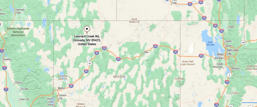
Leonard Creek winds through Humboldt County’s high-desert basin at nearly 4,000 feet, hidden among sweeping sage flats. Far from major highways, it lies off a patchwork of dirt tracks branching from State Route 140 or U.S. 95.
The approach is remote and rugged, with ridgelines distant on the horizon. It’s accessible with effort, yet feels like a faint ripple of water in an otherwise silent expanse.
17. Jungo: Desert Rail Spur Ghost Town
Jungo, Nevada sits alone along a desolate dirt road west of Winnemucca, where the Black Rock Desert begins to swallow the horizon. Once a bustling railroad stop and mining supply point, it has faded into near abandonment with crumbling buildings and rusting relics scattered across the flats.
The only sounds are desert wind and the distant rumble of freight trains passing far beyond its borders. Curious travelers wander through the skeletal remains of the old Jungo Hotel, peer into collapsed sheds, and trace half-buried rail spurs disappearing into sand.
Aside from transient geologists and wandering explorers, few people ever linger here. It’s the kind of stark, forgotten place that makes you feel alone in the best possible way.
Where is Jungo?
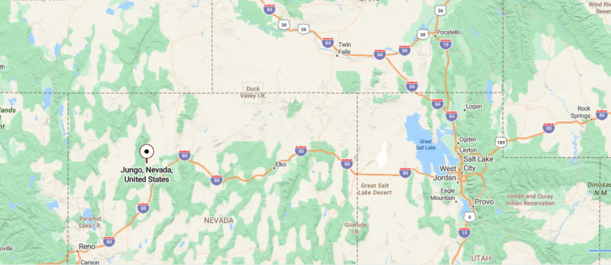
Jungo is a ghost town in Humboldt County, Nevada, roughly halfway between Winnemucca and Sulphur along an old county road. Once a stop with a hotel, store, and post office, today it stands empty of buildings and bustle.
Travelers follow long unpaved stretches beside the former Western Pacific rail line to reach what’s left. It’s still drivable, yet feels like arriving at the edge of a vanished world.
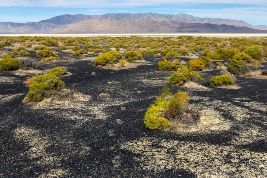
16. Rosebud Canyon: Hidden Mountain Nook
Rosebud Canyon, Nevada lies hidden in a narrow cut of the Humboldt Range, reached only by rough ranch tracks that twist through sagebrush-covered foothills. The canyon feels intensely remote, its steep walls sheltering cottonwood trees, trickling springs, and the ruins of old prospecting camps lost to time.
Echoes bounce between rock faces while hawks circle overhead, giving the place a wild, almost secretive energy. Adventurers hike through willow-lined draws, search for quartz and jasper, and watch mule deer browse in the cool evening shadows.
Aside from an occasional ranch hand or rockhound, few people ever venture this far off-grid. It’s the kind of quiet hideaway that makes you believe the desert still keeps secrets.
Where is Rosebud Canyon?
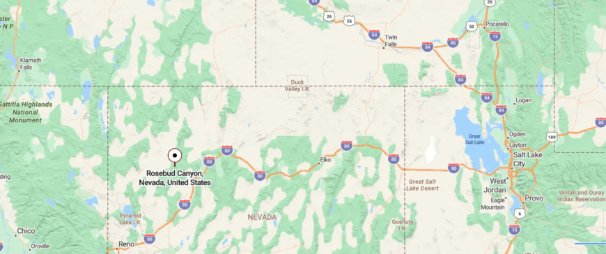
Rosebud Canyon cuts into Pershing County’s Kamma Mountains at nearly 4,700 feet above sea level. Located north of Rosebud Peak and overlooking the edge of the Black Rock Desert, it sits far from any major highway.
Reaching it means turning off paved roads onto rough tracks that follow dry washes and rugged terraces. It’s accessible by vehicle, yet once inside, it feels like a silent pocket of untouched Nevada.
15. Bottle Creek: Quiet Life Near the Refuge
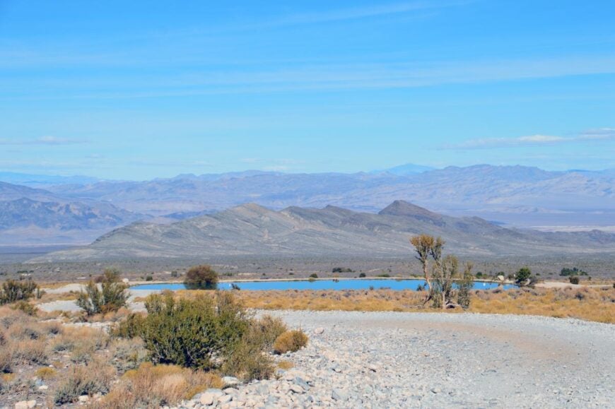
Bottle Creek, Nevada lies deep in the foothills of the Pine Forest Range, far from paved roads and tucked behind miles of sagebrush and volcanic rock. With only a scattering of abandoned mining shacks and weathered corrals, it feels like a place forgotten by time.
Dry creekbeds wind through cottonwood stands where coyotes call at dusk and rusted ore carts rest in silence. Explorers search nearby opal claims, hike rocky ridgelines for sweeping views, and camp beneath night skies so bright they seem unreal.
Aside from occasional rockhounds and passing ranchers, few visitors ever reach this secluded spot. It’s the kind of hidden corner where solitude feels like a gift waiting to be opened.
Where is Bottle Creek?
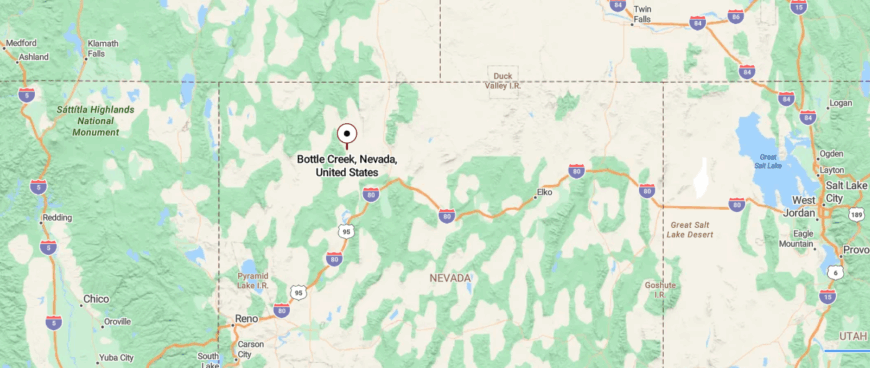
Bottle Creek is a small stream flowing through Humboldt County, Nevada, at just over 4,100 feet above sea level. Hidden among sagebrush plains and far from major roads, it slips quietly through the Great Basin’s remote interior.
Access comes only via dirt tracks branching from U.S. 95 or State Route 140. It’s reachable with effort, yet feels like a faint, secret line of water etched into endless desert.
14. Sulphur: Historic Desert Waystation
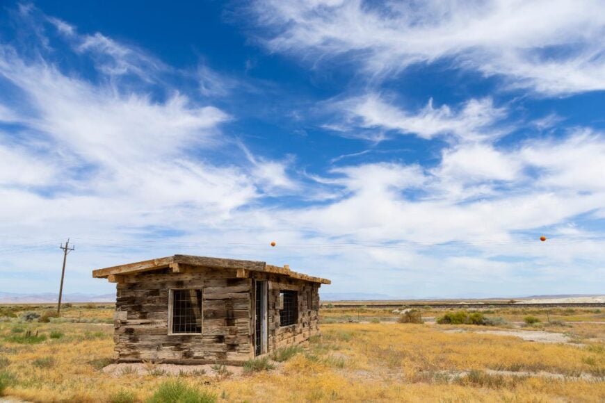
Sulphur, Nevada sits along a lonely stretch of the Black Rock Desert, where dusty dirt roads and faded railroad tracks hint at a busier past long gone. Once a small depot for the Western Pacific Railroad, the town has mostly crumbled back into the alkaline flats.
The wind sweeps through rusted rail cars and scattered foundations, carrying only the sound of sand brushing against metal. Curious travelers stop to photograph the old water tower, wander cracked platforms, and follow faint tracks leading toward distant playa horizons.
With no residents left—only pronghorn, coyotes, and the occasional desert rover—the place feels eerily frozen in time. It’s the kind of stark isolation that makes the silence almost mesmerizing.
Where is Sulphur?
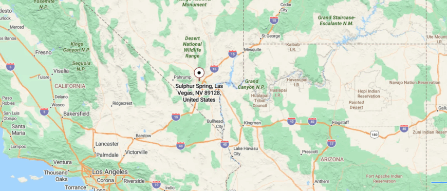
Sulphur is a ghost town in northwestern Humboldt County, Nevada, sitting at over 6,100 feet on the edge of the Black Rock Desert. Once a bustling rail stop tied to nearby sulfur deposits, it now holds only scattered ruins from its mining heyday.
Travelers reach it via rugged backcountry tracks along the old Feather River rail route. It’s still accessible, yet feels etched with the quiet, windblown echoes of boomtown life long gone.
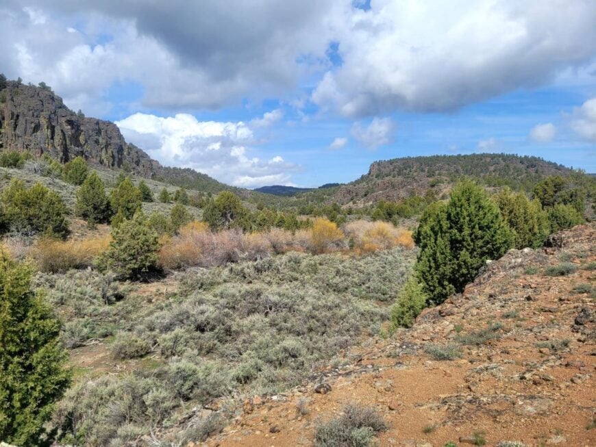
13. Pole Creek: Mountain Stream Hideaway
Would you like to save this?
Pole Creek, Nevada hides in a remote valley of the Independence Mountains, reached only by rugged ranch roads that snake through miles of sagebrush and basalt outcrops. The solitude here is striking—just cottonwood-lined streambeds, grazing cattle, and the distant silhouette of snow-dusted peaks.
Weathered corrals and empty bunkhouses hint at its past life as a ranching stopover, now mostly surrendered to the elements. Explorers follow the creek to spot beaver dams, hike narrow canyons where bighorn sheep cling to cliffs, and watch golden eagles sweep across the open sky.
Aside from a few seasonal cowhands and backcountry hunters, human presence is fleeting. It’s the kind of place where quiet isn’t just heard—it’s felt deep in your bones.
Where is Pole Creek?
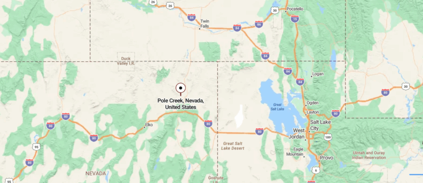
Pole Creek flows quietly through Humboldt County’s desert basin, not far from the historic townsite of Golconda. Set at about 4,600 feet, it winds between sagebrush flats and low ridges, far from paved highways.
Access comes by branching off U.S. 95 onto rough dirt tracks that cross open land. It’s reachable, yet feels like a small, hidden ribbon of water lost in Nevada’s wide silence.
12. Unionville: Mark Twain’s High-Desert Hideaway
Unionville, Nevada lies tucked in the foothills of the Humboldt Mountains, reached only by a winding dirt road far from modern highways. Once a silver boomtown that briefly claimed Mark Twain as a resident, it has quieted into a scattering of stone cabins, apple trees, and weathered barns.
The creek that threads through Cottonwood trees gives the place a rare softness in the desert. Visitors wander past historic buildings, poke around old mine shafts, and hike nearby Star Peak for sweeping Humboldt Valley views.
Only a handful of homesteaders remain, tending goats, donkeys, and garden plots amid the ruins. It’s the kind of secluded haven where history breathes and stillness feels eternal.
Where is Unionville?
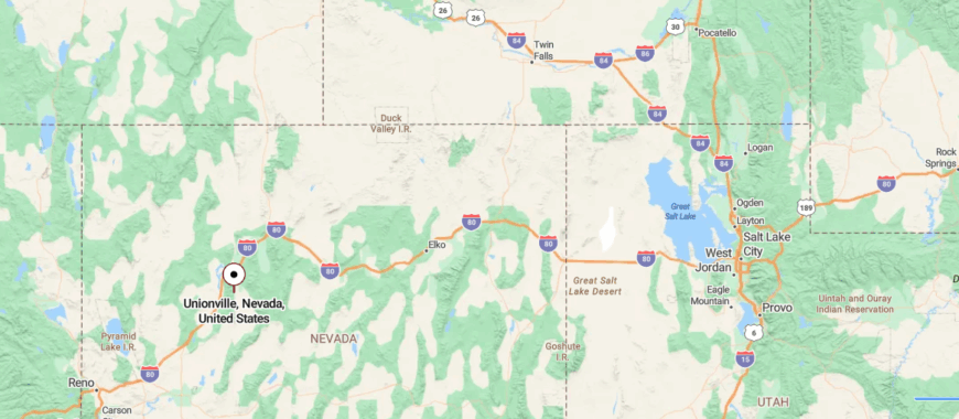
Unionville is a near-forgotten mining town in Pershing County, tucked south of Interstate 80 at the base of the Humboldt Range. Once a booming silver camp in the 1860s, it now houses only a handful of residents among crumbling stone buildings and historic ranches.
Reached by taking Unionville Road off the interstate, the drive winds through sage-covered foothills before the town appears. It’s easy enough to reach, yet feels like a place where history keeps watch in the stillness.
11. Dixie Valley: Deserted Ranchland Basin
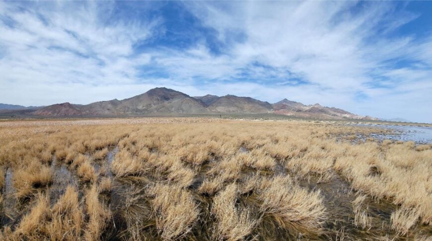
Dixie Valley, Nevada rests in a broad wind-swept basin east of Fallon, surrounded by jagged desert mountains that seem to fence it off from the rest of the world. Once a lively ranching community, it was abandoned in the 1980s after the U.S. Navy purchased the land for nearby electronic warfare training.
Empty homes now sag into the sagebrush, their fences rusting and windmills creaking in the relentless desert wind. Explorers follow rough roads to wander ghostly homesteads, watch wild horses on the flats, and catch fiery sunsets over the Stillwater Range.
Aside from the occasional roar of passing military jets, silence rules the valley. It’s the kind of remote place where you feel tiny beneath the endless Nevada sky.
Where is Dixie Valley?
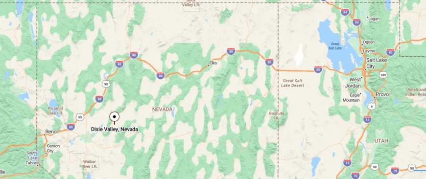
Dixie Valley lies in remote Churchill County, Nevada, once a ranching basin and now part of the Navy’s Fallon training range. Located more than 35 miles east of Fallon off U.S. Route 50, it’s reached only by a long dirt road stretching across stark desert flats.
Scattered ruins, wells, and rusted tanks are all that remain of its past community. It’s accessible, yet feels like a lonely, surreal echo trapped between nature and military shadow.
10. Golconda: Tranquility at the Edge of the Wilderness

Golconda is a small community with an approximate population of 200 residents. I love that it’s a place where you can truly disconnect, surrounded by the vast expanse of the Nevada wilderness.
Outdoor enthusiasts can explore the nearby Sonoma Range, which offers hiking and hunting opportunities, or relax in the natural hot springs that the area is known for.
Historically, Golconda was a mining town, and while mining played a significant role in its past, today it enjoys a quieter existence with a focus on ranching and agriculture.
What makes Golconda secluded is its sparse population and its location away from major urban centers, providing a peaceful retreat for those seeking solitude. A hidden gem here is the Golconda Summit, where you can catch breathtaking sunsets that paint the sky in hues of orange and purple.
Where is Golconda?
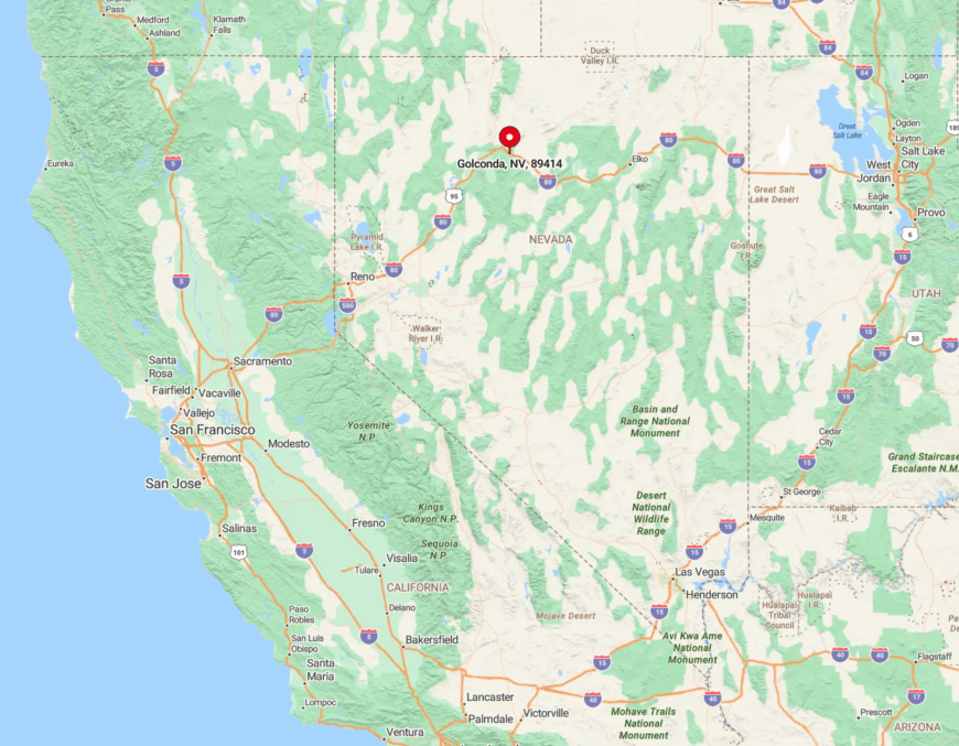
Nestled in Humboldt County, Golconda is located about 15 miles east of Winnemucca along Interstate 80. Its seclusion stems from being surrounded by open desert landscapes and the nearby mountain ranges that shield it from the hustle of city life.
Getting there is relatively straightforward via I-80, but once you arrive, you’ll feel miles away from the nearest metropolis. I find that the expansive views and the sense of peace you get in Golconda make the journey well worth it.
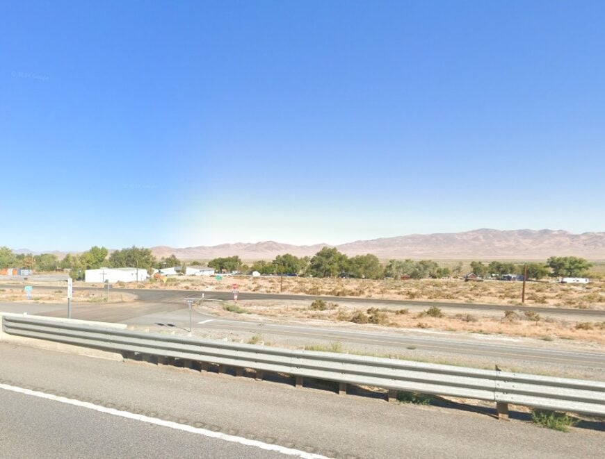
9. Imlay: Historic Seclusion Near Thunder Mountain
Imlay is a quaint town with a population hovering around 170 people. What draws me to Imlay is its rich history and the unique attraction of Thunder Mountain Monument, an intriguing collection of folk art made from concrete and found objects.
The town doesn’t have much in the way of industry aside from some small-scale ranching and services catering to travelers along Interstate 80.
Its seclusion comes from both its small size and its location amidst vast stretches of Nevada’s high desert. One of Imlay’s hidden treasures is the Thunder Mountain Monument itself—a testament to creativity and resilience that’s off the beaten path.
Where is Imlay?

Would you like to save this?
Located in Pershing County, Imlay sits just off Interstate 80, about 35 miles southwest of Winnemucca. Despite its proximity to the highway, the town feels isolated due to the surrounding desert and the lack of neighboring communities.
Accessing Imlay is easiest by car, and while the drive is straightforward, the expansive desert landscapes make it feel like you’re venturing into a remote frontier. For me, the seclusion is part of the charm, offering a quiet respite from the crowded rest stops along the interstate.
8. Kings River: An Isolated Riverside Haven
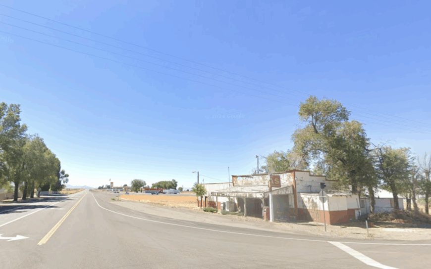
Kings River is an unincorporated community with a population of fewer than 50 people. I find this tiny hamlet appealing for its serene setting along the Kings River, offering a peaceful environment perfect for fishing and bird-watching.
The area is primarily supported by ranching, with vast open lands dedicated to livestock and farming. Its seclusion is amplified by the rolling hills and absence of commercial development, making it an ideal spot for those seeking a simple, quiet life.
One of the area’s best-kept secrets is the abundance of wildlife that can be observed along the riverbanks—a nature enthusiast’s dream come true.
Where is Kings River?
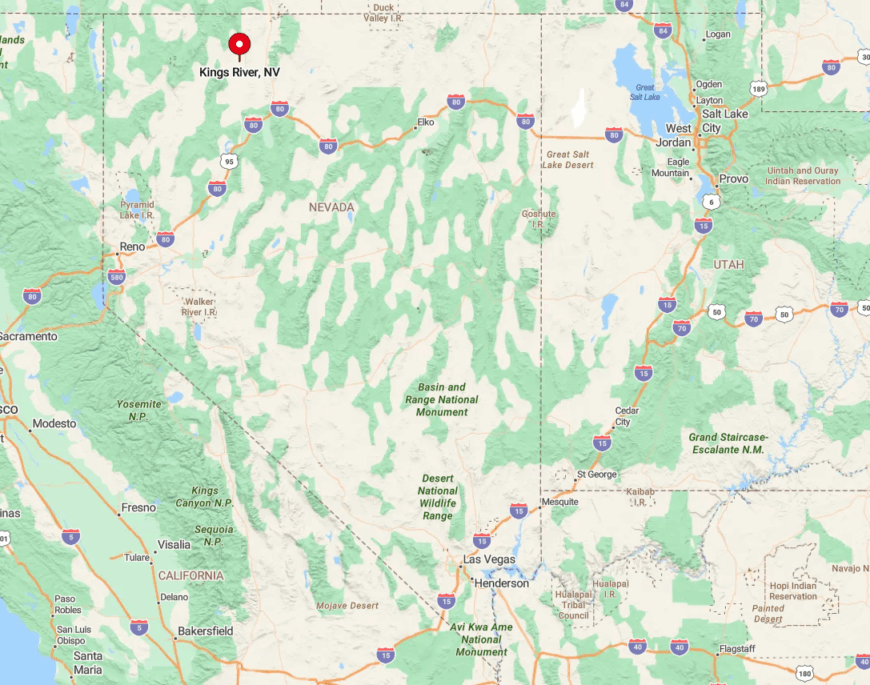
Kings River is tucked away in Humboldt County, approximately 65 miles north of Winnemucca. The remoteness is evident as you navigate the lesser-traveled roads that lead you deeper into Nevada’s backcountry.
Getting there requires a bit of planning—typically via State Route 140 and a series of county roads—but the journey rewards you with solitude and unspoiled landscapes. I believe the effort to reach Kings River only enhances the sense of escape from the everyday world.
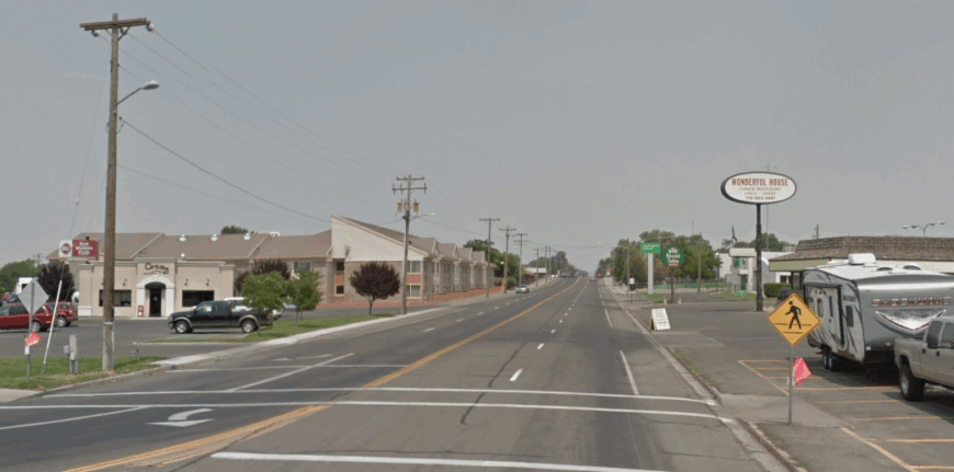
7. Orovada: Quiet Living Amidst Farmland
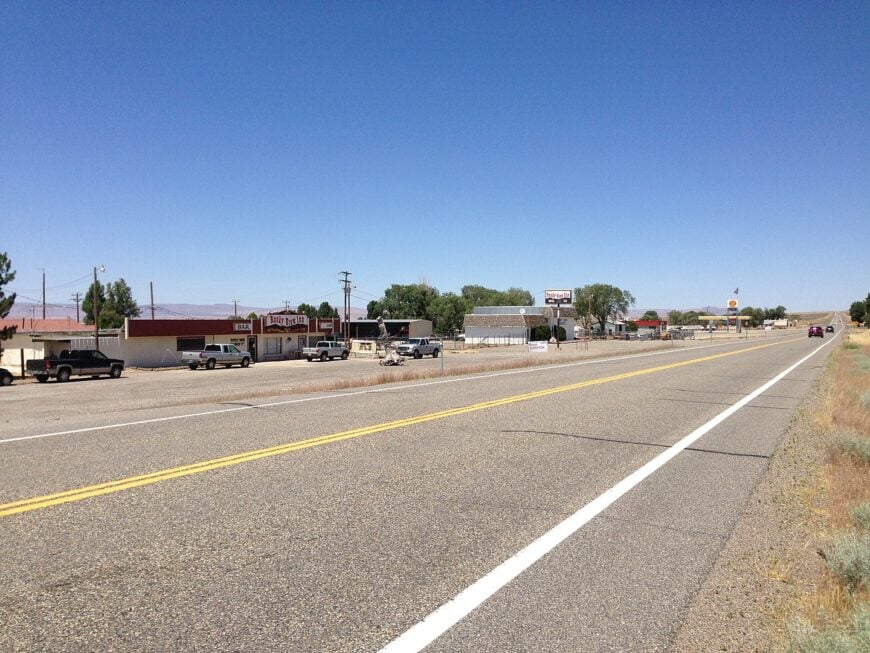
Orovada is a small agricultural community with around 150 residents. Surrounded by vast farmland, I appreciate how the town embodies the essence of rural living.
The primary industry here is agriculture, with alfalfa fields and cattle ranches stretching as far as the eye can see. Activities are centered around the outdoors, and one can enjoy peaceful drives through the countryside or visit local farms for fresh produce.
Orovada’s seclusion is due to its distance from larger towns and its immersion in the expansive agricultural landscape. A hidden gem is the stunning backdrop of the Santa Rosa Range, offering picturesque views that change with the seasons.
Where is Orovada?
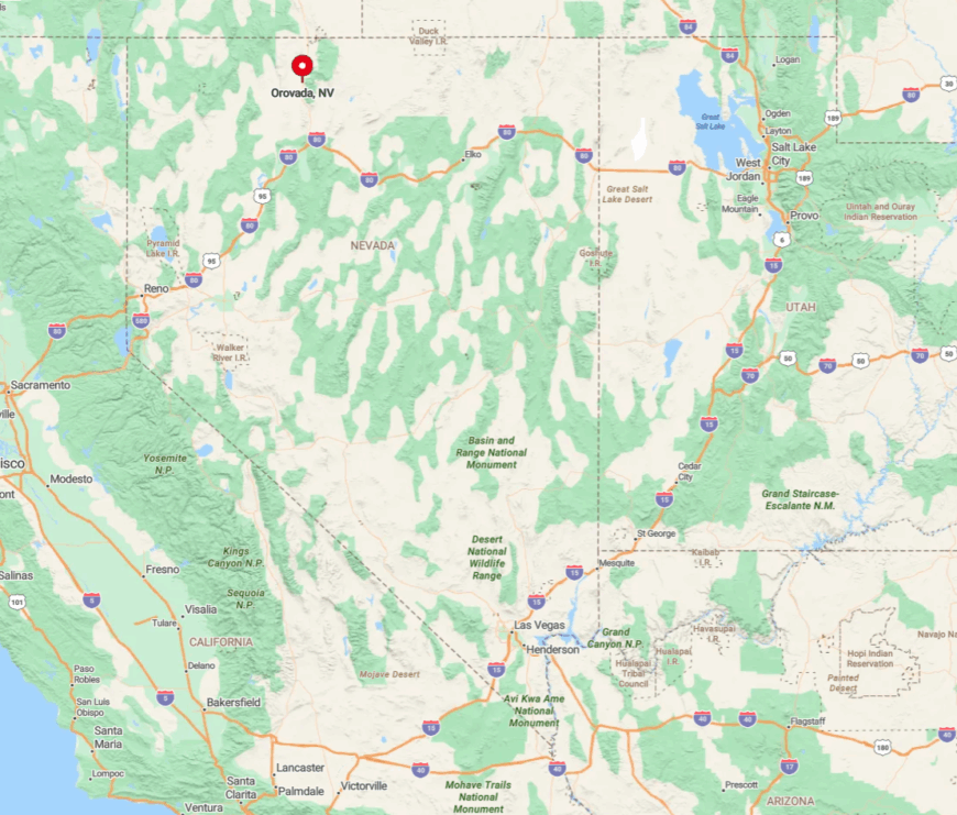
Located in Humboldt County, Orovada sits along U.S. Route 95, about 45 miles north of Winnemucca. The town’s remote feeling comes from the endless fields and the wide-open skies that define the area.
Accessibility is straightforward via U.S. 95, but the scarcity of urban development around Orovada makes it feel much farther from civilization than it actually is. For me, the journey through the rolling farmland to reach Orovada is a peaceful experience in itself.
6. Paradise Valley: Seclusion in a Picturesque Valley
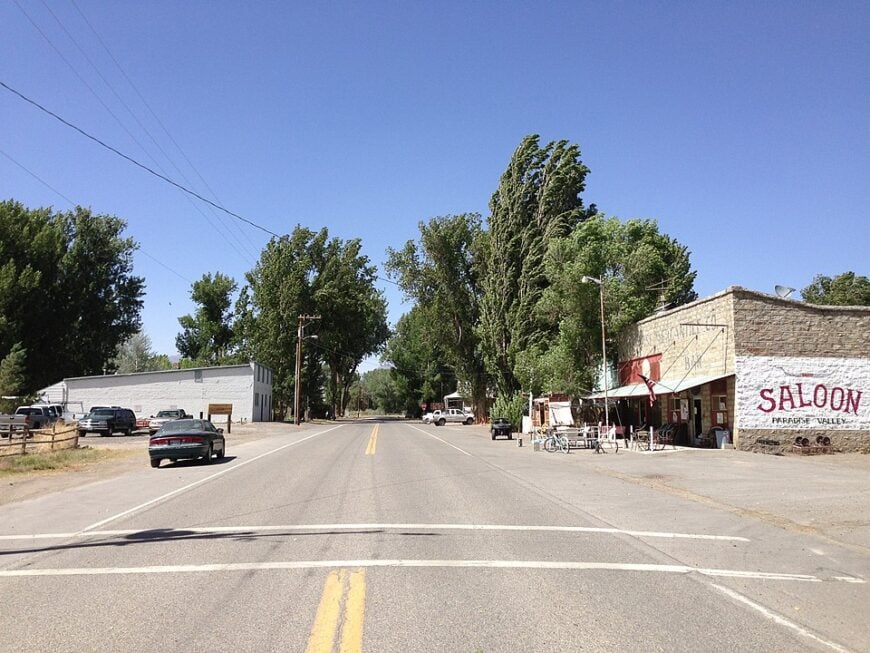
Paradise Valley is a charming town with a population of approximately 100 people. Nestled between the Santa Rosa Range and the Double H Mountains, it’s a place where I find tranquility amidst stunning natural beauty.
The town offers opportunities for hiking, horseback riding, and exploring historical sites like the historic Paradise Valley Saloon. The main industries are ranching and some farming, contributing to its rural character.
Paradise Valley’s seclusion is a result of its geographical location and the surrounding natural barriers, creating a tight-knit community that values privacy. A favorite spot of mine is the nearby Paradise Valley Creek, perfect for a quiet afternoon of fishing.
Where is Paradise Valley?
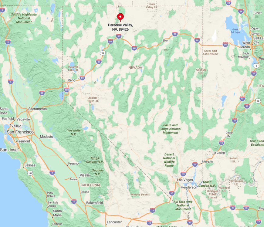
Paradise Valley is situated about 40 miles northeast of Winnemucca in Humboldt County. To reach this secluded spot, you’ll travel along State Route 290, winding through scenic landscapes that highlight Nevada’s rugged charm.
The town’s isolation is enhanced by the mountain ranges that encircle it, limiting through traffic and preserving its peaceful environment. I always feel a sense of calm when approaching Paradise Valley, as the journey itself feels like a step back in time.
5. McDermitt: A Peaceful Cross-Border Community
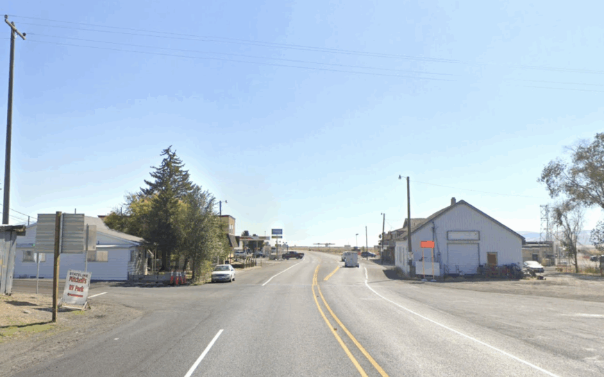
McDermitt is a small town straddling the Nevada-Oregon border, with a combined population of around 500 residents. I appreciate its unique position, offering the best of both states in a tranquil setting.
Activities here include exploring the surrounding desert, visiting local historical sites, and experiencing the area’s rich Native American heritage. The local economy revolves around ranching, mining, and some service businesses catering to travelers.
McDermitt’s seclusion comes from its remote location and the vast open spaces that surround it, making it a peaceful place to unwind. A notable spot is the Fort McDermitt Indian Reservation, where you can learn about the local culture and history.
Where is McDermitt?
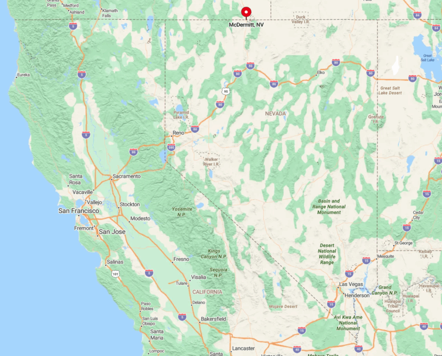
McDermitt is located along U.S. Route 95, about 73 miles north of Winnemucca, right on the Nevada-Oregon border. The town’s remote setting is accentuated by the expansive desert landscapes and the lack of significant development in the area.
Access is primarily via U.S. 95, but the long stretches of open road contribute to the feeling of isolation. For me, the journey to McDermitt is an opportunity to reflect and enjoy the stark beauty of the high desert.
4. Denio: Serenity on the Nevada-Oregon Border

Denio is a tiny community with around 40 residents, offering a serene escape nestled near the Pueblo Mountains. I enjoy the simplicity of life here, with activities like fishing in the nearby Trout Creek or soaking in the Denio Junction Hot Springs.
The town has minimal industry—mostly ranching and a few local businesses—adding to its peaceful ambiance. Denio’s seclusion is amplified by natural barriers and the vast stretches of uninhabited land around it. A hidden gem is the Sheldon National Wildlife Refuge nearby, where you can witness diverse wildlife in their natural habitat.
Where is Denio?
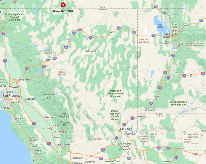
Denio is located in Humboldt County on the Nevada side of the border, accessible via State Route 140. The town is about 100 miles north of Winnemucca, and the drive takes you through some of the most remote areas in the state.
The isolation is due to both the distance from larger towns and the rugged terrain that surrounds Denio. Getting there involves a commitment to the open road, but I find that the serene environment upon arrival is well worth the trip.
3. Vya: Nevada’s Remote Frontier Hamlet

Vya is perhaps one of the most secluded places I’ve visited, with a population of fewer than 10 people. This ghost town offers a glimpse into Nevada’s frontier past, with remnants of old buildings and homesteads dotting the landscape.
There are no industries to speak of, which contributes to its peaceful solitude. The extreme remoteness and low density make Vya an ideal spot for those seeking complete seclusion in the high desert. One of the best-kept secrets here is the night sky—free from light pollution, it’s a stargazer’s paradise.
Where is Vya?
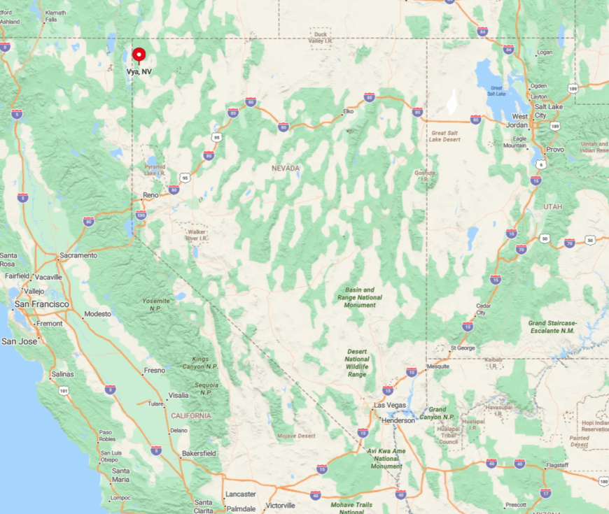
Vya is located in Washoe County, near the northwest corner of Nevada. Reaching Vya requires travel along dirt roads off of State Route 34, and it’s about 140 miles northwest of Gerlach.
The town’s seclusion is the result of both its geographical isolation and the challenging terrain that surrounds it. Access is limited and often dependent on weather conditions, but for those like me who seek solitude, the journey to Vya is an adventure in itself.
2. Empire: A Quiet Retreat Amidst Desert Landscapes
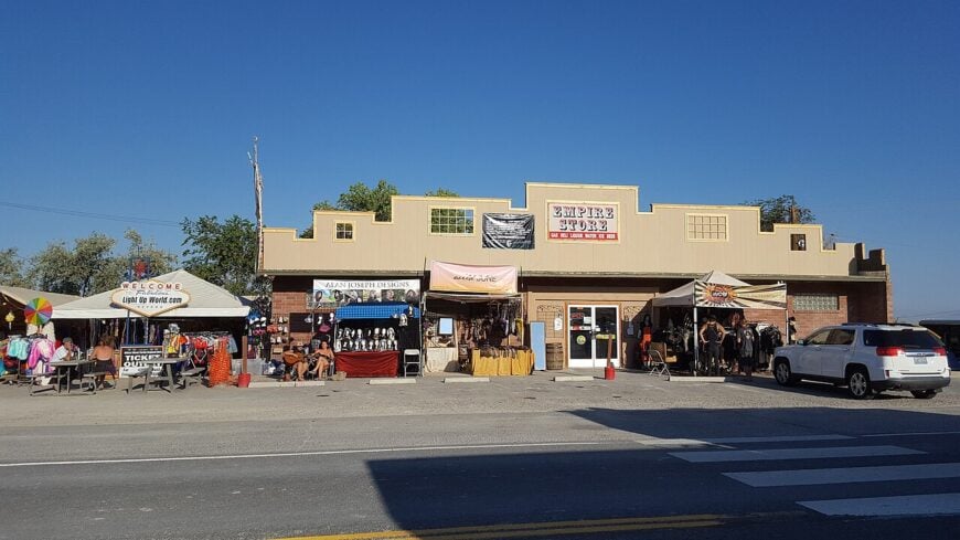
Empire is a small community with a population that has fluctuated around 200 people, especially after the reopening of the local gypsum plant. I find Empire intriguing for its resilience and the sense of community among residents.
Activities here are centered around the outdoors, with the Black Rock Desert offering endless exploration opportunities. The primary industry is gypsum mining, which has been the town’s lifeblood.
Empire’s seclusion comes from its location deep within the desert and the vast distances between it and larger towns. A hidden gem is the Empire Store, a hub for locals where you can experience genuine Nevada hospitality.
Where is Empire?

Empire is located in Washoe County, approximately 100 miles north of Reno via State Route 447. The town sits on the edge of the Black Rock Desert, which adds to its remote feeling.
Accessing Empire involves a long drive through stretches of open desert, reinforcing its secluded nature. For me, the stark beauty of the landscape and the quiet of the desert make Empire a special retreat.
1. Gerlach: Hidden Oasis in the Black Rock Desert
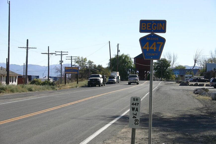
Gerlach is a tiny town with around 200 residents, known to many as the gateway to the Burning Man festival held annually in the nearby Black Rock Desert. Outside of the festival season, I love how Gerlach returns to its peaceful roots, offering solitude amid vast desert landscapes.
Activities include soaking in natural hot springs, exploring art installations left behind from festivals, and venturing into the desert for off-road adventures. The main industries are limited to tourism and services related to the festival, but most of the year, it’s a quiet, close-knit community.
Gerlach’s seclusion is emphasized by the expansive desert surrounding it and the minimal development in the area. A hidden treasure here is Guru Road, an outdoor art installation that’s a testament to local creativity and spirit.
Where is Gerlach?
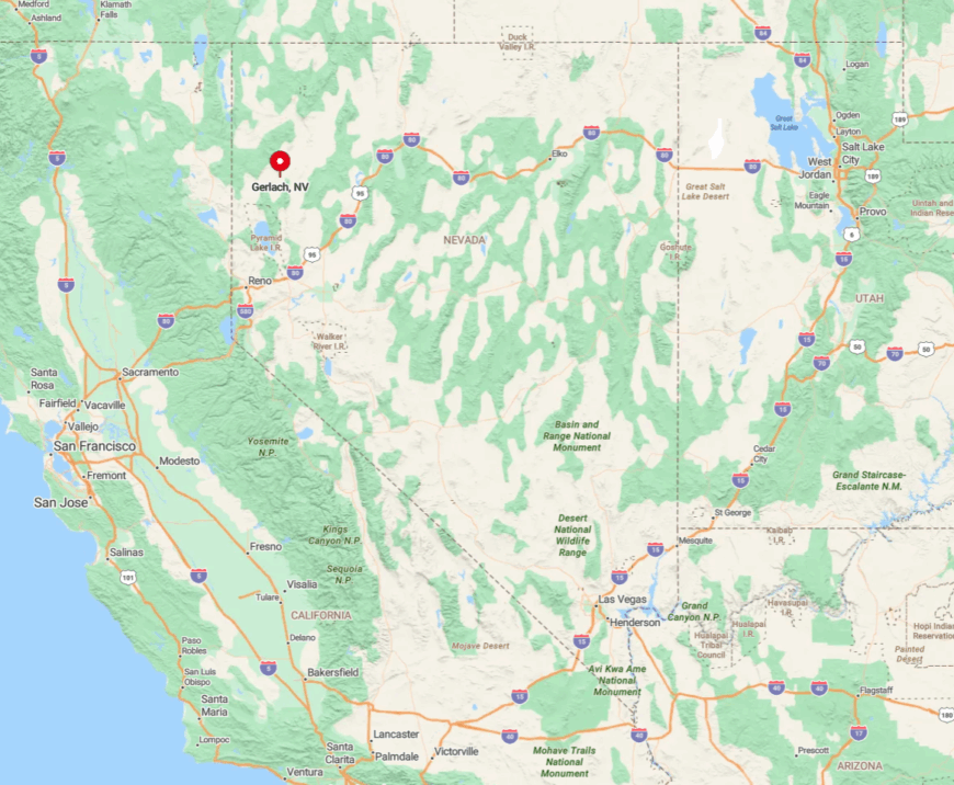
Gerlach is situated in Washoe County, about 100 miles north of Reno, at the end of State Route 447. The town’s remote location in the northwest corner of Nevada contributes to its isolated feel.
Getting there involves a drive through scenic desert landscapes, and services become sparse the closer you get. I find that the journey to Gerlach is part of the experience, offering a transition from the bustling city to the serene silence of the desert.