Would you like to save this?
The high ridges and shadowed hollows of Western Virginia hide small communities where porch lights still outnumber streetlights and where silence is interrupted only by wind through spruce and the occasional pickup rumbling past a feed store.
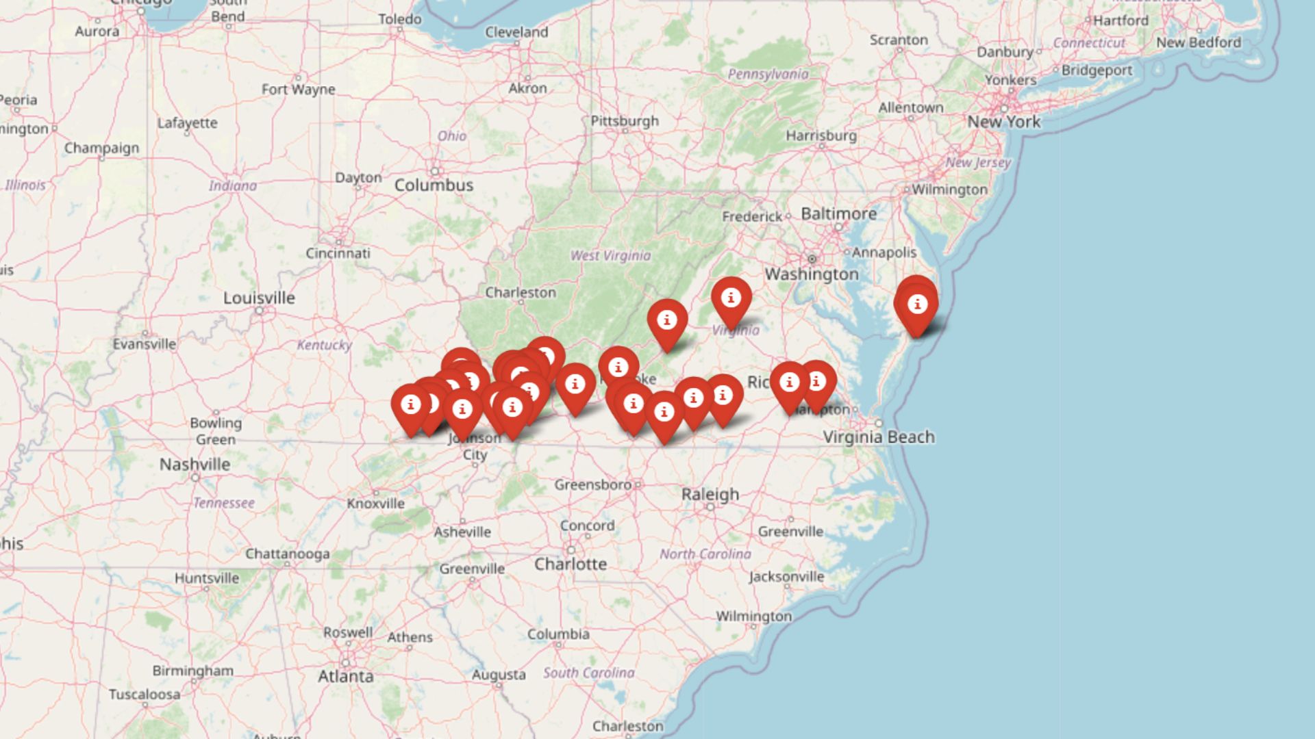
We gathered 10 of the region’s most secluded neighborhoods—places buffered by national forest acreage, rimmed by valleys that turn mountain miles into real distance, and blessed with skies dark enough to showcase every star in the Milky Way.
Most of these enclaves count their neighbors by the dozen rather than the thousand, keeping a tight sense of community while still leaving room for broad pastures or dense hardwood stands.
Residents here favor feed mills over malls and back roads over bypasses, yet weekend visitors find fly-fishing runs, waterfall hikes, and family-run diners serving country ham that never left the county.
Each spot offers its own hidden surprises, from bison herds to century-old stone chimneys, all preserved by geography that politely discourages sprawling development.
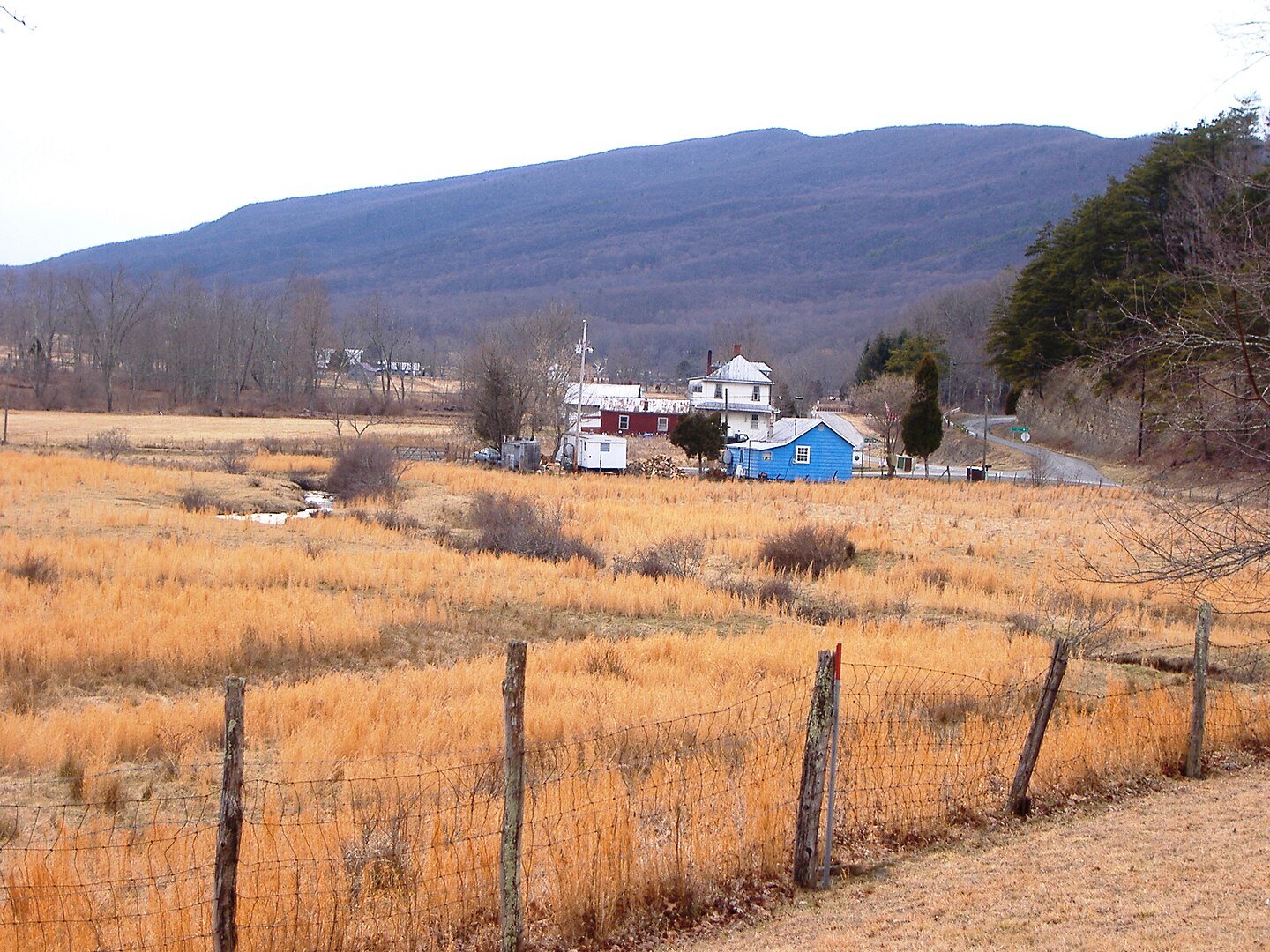
10. Newport – Giles County
Newport stretches like a ribbon along Sinking Creek, blending century-old clapboard homes with newer cabins tucked into pine-scented hillsides. You can see anglers stalking native trout, paddlers running spring flows, and locals gathering at the historic Newport Farmer’s Market for pies that rarely survive the drive home.
The community of roughly nine hundred enjoys concerts at nearby Mountain Lake Lodge, the hidden gem where “Dirty Dancing” was filmed, yet remains removed from resort bustle.
Dramatic sandstone bluffs rise behind back yards, while Brush Mountain forms a natural sound wall against the collegiate hum of Blacksburg, eighteen miles away. Wildflower hunters prize Fenwick Mines trails for trillium carpets each April. After dark, the only glow comes from porch bulbs and fireflies.
Where is Newport?
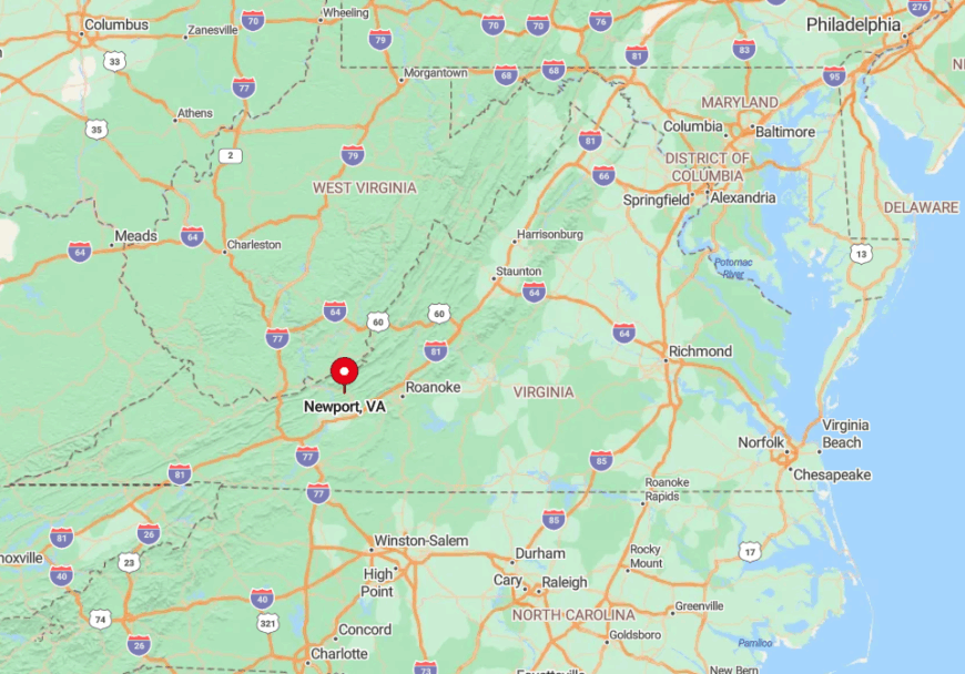
Newport sits on Route 42, southeast of Giles County’s core, linking to U.S. 460 by a curvy connector favored by sports-car clubs. The village lies in a narrow trench between Brush Mountain and the Sinking Creek Mountain ridge.
Drivers from Blacksburg crest Mountain Lake Road, descend switchbacks, and cross a covered bridge that announces the edge of town. Despite proximity to Virginia Tech, the final miles feel like a separate era entirely.
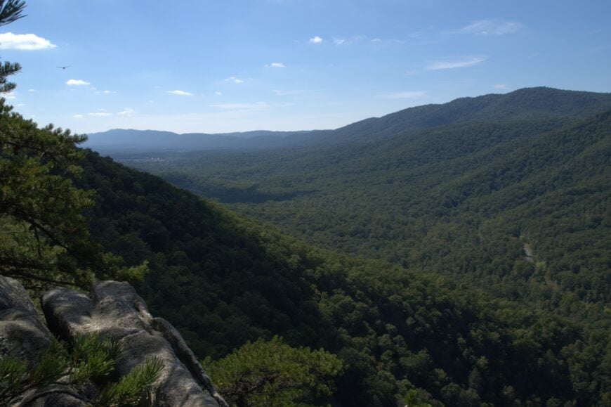
9. Paint Bank – Craig County
Paint Bank occupies a remote meadow along Potts Creek where crimson clay once provided war-paint pigment to native tribes, giving the place its colorful name.
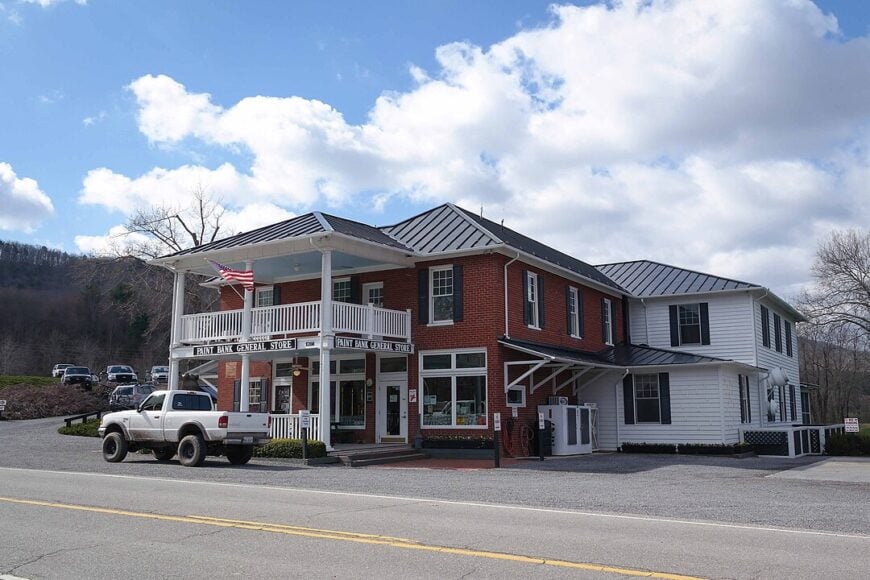
You can watch bison grazing behind split-rail fences at Hollow Hill Farm, dine on their burgers at the rocking-chair-lined Swinging Bridge Restaurant, and browse a general store that doubles as the post office.
Outdoor pursuits include caving in Tawney’s Tunnel, casting into native brook-trout pools, and photographing fall fog drifting across emerald pastures. Fewer than ninety folks reside here full-time, leaving plenty of elbow room between century-old log homes and modern cabins.
A quaint caboose-turned-inn beside the creek offers an overnight secret for rail buffs. With no light pollution, the Milky Way becomes an after-dinner show.
Where is Paint Bank?
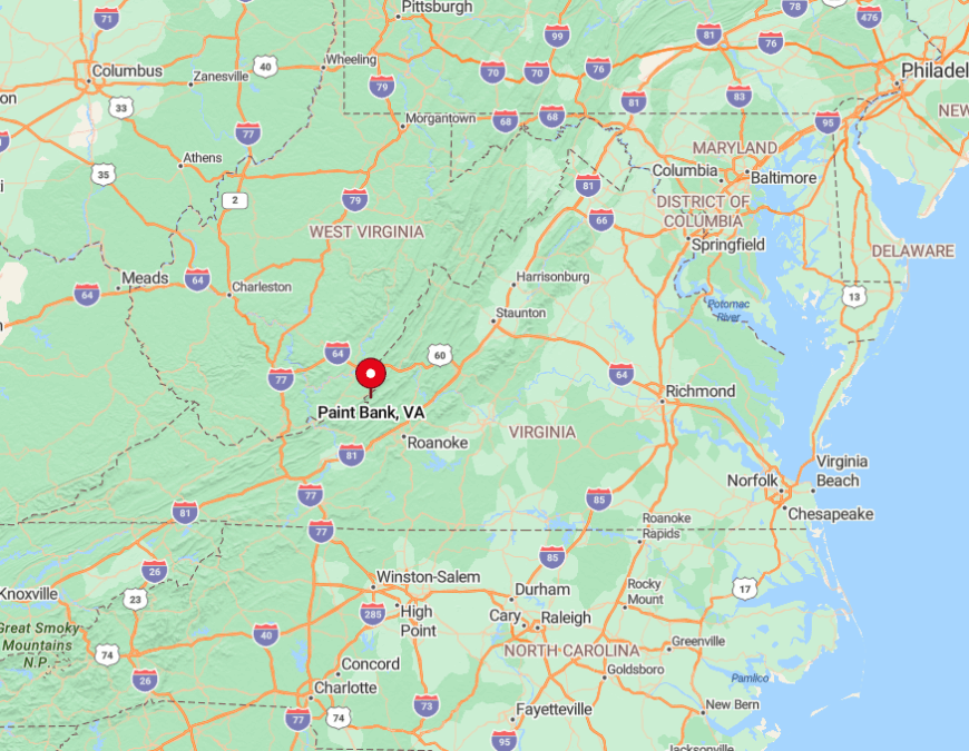
The settlement sits on VA 311 near the West Virginia border, about forty mountain miles north of Roanoke. Flanked by Potts Mountain and Peters Mountain, the valley feels cinched off from sprawl in every direction.
Travelers wind up 311’s hairpins, crest Potts Mountain, then drop into Paint Bank’s sudden expanse of open pasture. The nearest traffic signal is twenty-two miles away in New Castle.
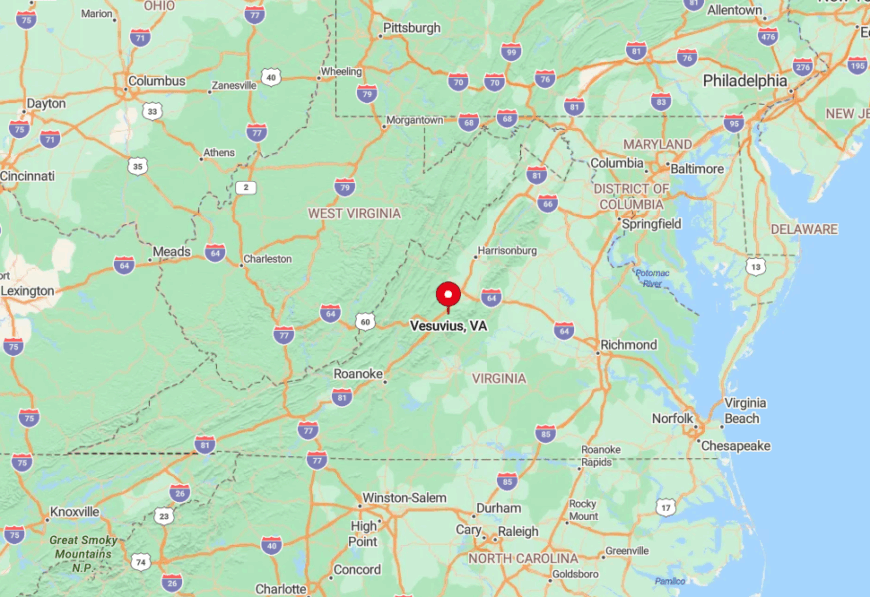
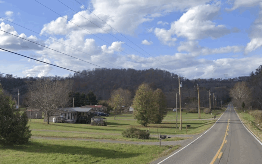
8. Vesuvius – Rockbridge County
Vesuvius clings to the Blue Ridge foothills beneath lofty Parkway overlooks, its stone chimneys and board-and-batten cottages strung along the South Fork of the Tye River.
You can spend mornings sipping coffee to waterfall murmurs at Crabtree Falls, six miles south, and afternoons exploring defunct iron-ore furnace ruins hidden in laurel thickets.
About four hundred fifty residents share generous woodland lots where deer outnumber delivery vans. Evening entertainment often involves spotting the Shenandoah Valley’s distant twinkle from porch swings while owls trade calls.
The century-old Post Office doubles as a gossip hub and sells postcards that few tourists ever see. Maple syrup from Sugar Tree Country Store offers a sweet taste of hyper-local agriculture.
Where is Vesuvius?
Would you like to save this?
Roughly halfway between Lexington and Waynesboro, Vesuvius lies off Exit 205 of I-81, then twenty slow minutes east along State Route 56. The climb crosses the Norfolk Southern rail line, passes orchards, and slips beneath the Blue Ridge Parkway at Tye River Gap.
Its steep valley walls shelter the village from interstate noise and winter winds alike. Weekend hikers often park in town before tackling the Appalachian Trail’s Mau-Har loop above.
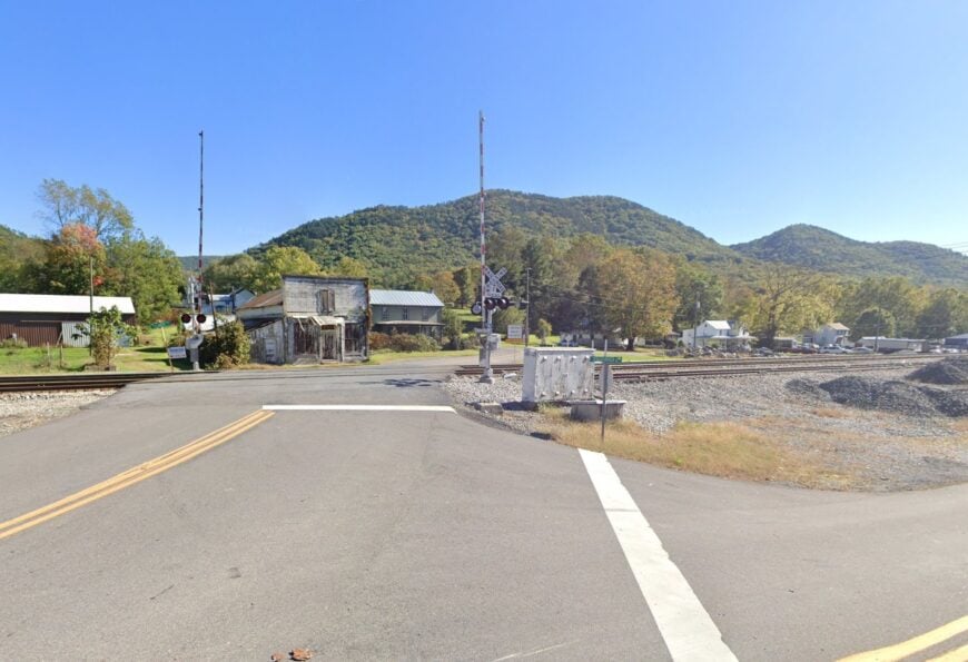
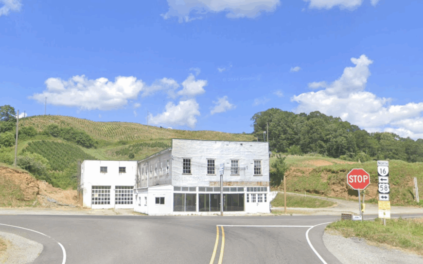
7. Cripple Creek – Wythe County
Cripple Creek weaves through a secluded valley where clear trout water parallels gravel lanes dotted with century-old barns. You can watch riders trotting Tennessee Walkers along the New River Trail extension, while anglers stalk native brown trout in shaded pools.
The settlement’s two hundred residents value elbow room, with most homesteads sitting on one-acre minimums or larger. Summers bring roadside blackberry stands, and autumn sees neighbors gather for apple-butter boils that scent the hollow for days.
An abandoned ore-tram line, now a hidden hiking path, offers glimpses of early mining history. The lack of through traffic keeps bird calls and creek song at center stage.
Where is Cripple Creek?
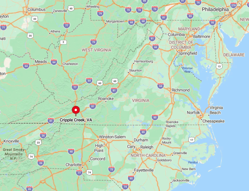
The hamlet hides twelve miles west of Wytheville, accessed by Route 94 and a network of numbered county roads. Jefferson National Forest ridges flank both sides, forming a natural buffer against development.
Drivers reach the valley by cresting Brushy Mountain, then descending switchbacks that encourage cautious speeds and frequent camera stops. Cell service fades on approach, confirming you have arrived.
6. Mouth of Wilson – Grayson County
Mouth of Wilson spans the banks where Wilson Creek meets the New River, hosting hillside cabins, weathered farmhouses, and the storied Oak Hill Academy campus. You can kayak gentle New River shoals, cycle the Virginia Creeper Trail’s less-traveled western spur, and sample sorghum cookies at Hale-Willis General Store.
Only about one hundred twenty year-round residents live here, ensuring darkness deep enough to reveal satellites skating across the sky. The forested shoulders of Mount Rogers tower overhead, delivering crisp air and snow flurries that linger longer than in lowland towns.
A hidden suspension footbridge just upstream offers photographers an unrivaled sunrise perch. Summer afternoons echo with fiddle tunes from impromptu jams under the store’s porch roof.
Where is Mouth of Wilson?

Situated on U.S. 58 near the North Carolina border, Mouth of Wilson sits fifteen curvy miles west of Independence, the county seat. High ridgelines force the highway to snake along river contours, making the trip unhurried and scenic.
Travelers coming from I-81 exit at Marion and navigate VA 16 over Iron Mountain before dropping into the New River valley. Those winding roads, while slow, keep traffic light and serenity high.
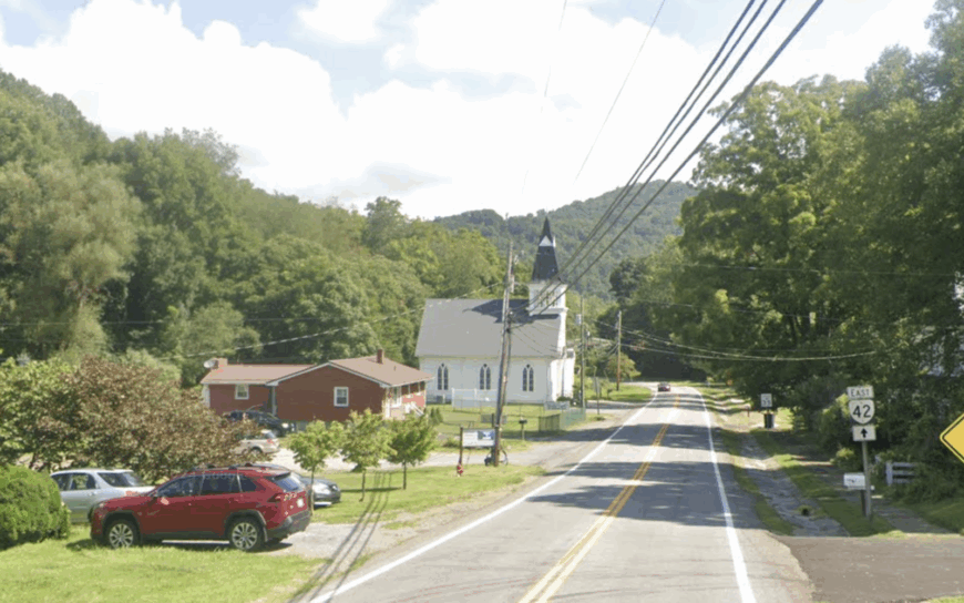
5. Ceres – Bland County
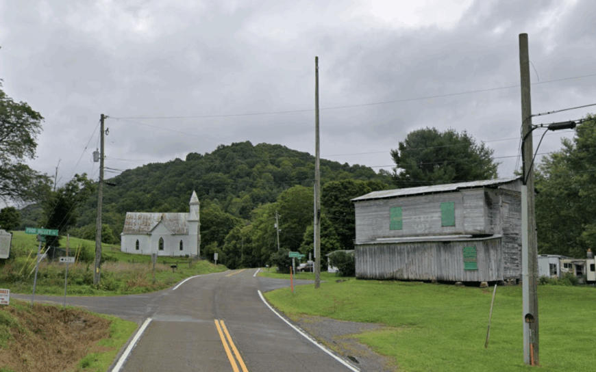
Ceres rests in a quiet bowl along Wolf Creek, guarded by Walker Mountain’s long rampart that muffles interstate roar from far-off I-81.
You can spend mornings exploring Salt Trail wildflower meadows, afternoons tubing the creek, and evenings swapping stories around communal bonfires at the old schoolhouse now repurposed as a community center. Roughly one hundred twenty residents farm rolling hayfields or commute to Bland once a week for supplies.
Fields still host barn dances, and neighbors share venison jerky during deer season. Hidden behind corn rows, a limestone cave called Dead Air hosts rare bat colonies viewed only during annual biology outings. Small-town clocks here tick by the seasons, not the hours.
Where is Ceres?
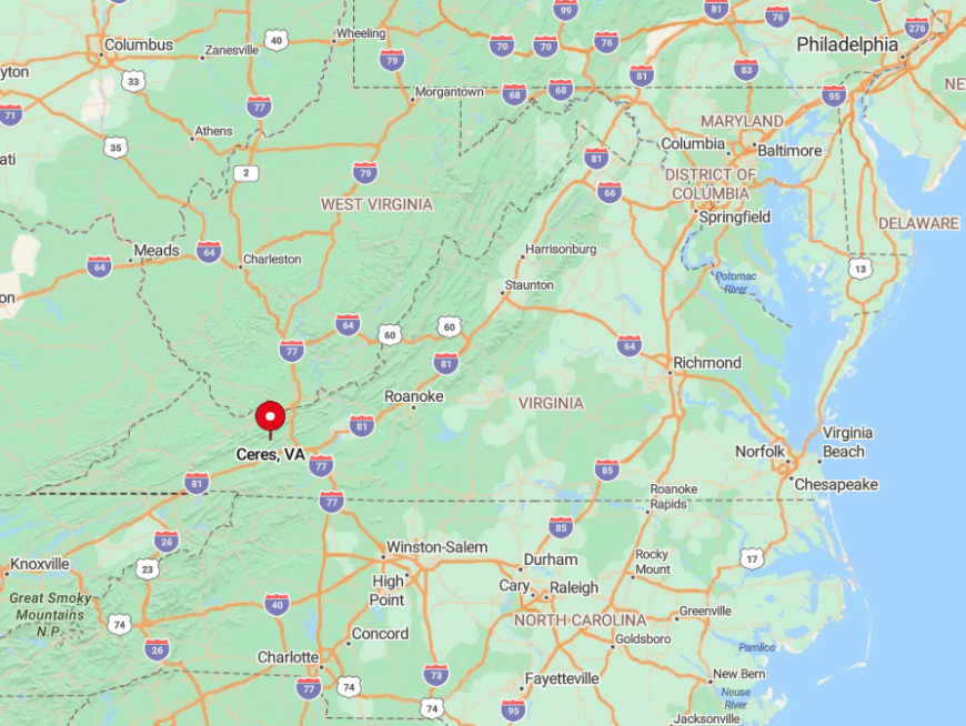
The community lies off VA 42, twenty miles southwest of Bland and far from any four-lane highway. Walker Mountain’s rim forces travelers to approach through a single gap following Wolf Creek’s bends.
From Wytheville, drivers cross scenic Kimberling Creek Valley before climbing into the bowl, a route that rewards with valley vistas at every hairpin. Postal routes still arrive by rural carrier three times a week, underscoring the town’s gentle pace.
4. Bent Mountain – Roanoke County Plateau
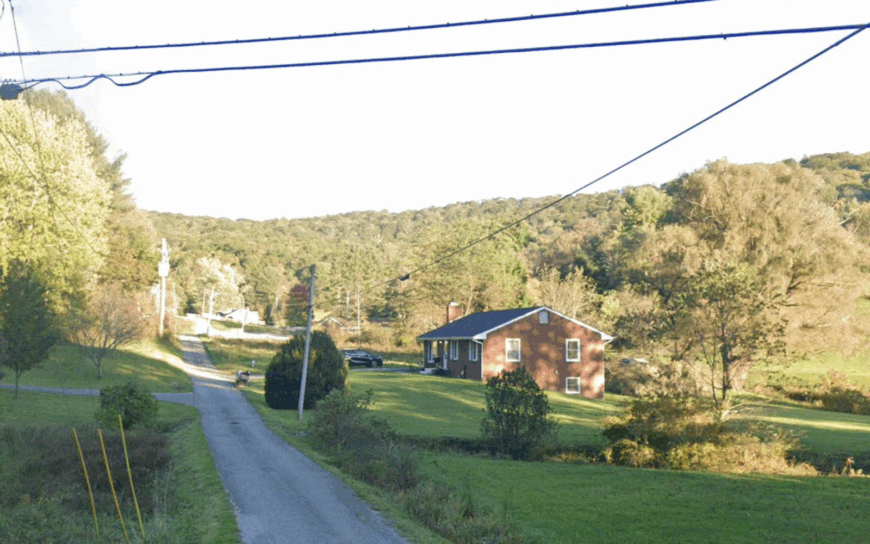
Bent Mountain crowns a high plateau 3,200 feet above sea level, where estate-sized lots and horse farms look out over Roanoke’s distant glow. You can drive the Blue Ridge Parkway overlooks at dawn, then pick berries at Ikenberry Orchards before lunch.
The unincorporated area hosts about seven hundred twenty residents scattered across meadows bordered by mixed hardwood forest that blazes red come October. Constant breezes make this one of Virginia’s quiet paragliding secrets, with pilots launching from a sod farm that doubles as a hayfield.
Nights drop ten degrees cooler than the valley, perfect for campfires beside split-rail fences. A forgotten CCC-built fire tower off Fire Tower Road offers clandestine sunset views for those willing to bushwhack a quarter mile.
Where is Bent Mountain?
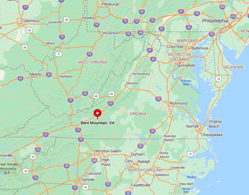
Seventeen winding miles south of downtown Roanoke, Bent Mountain sits along U.S. 221 just before the road climbs to meet the Parkway. The plateau is bounded by the Blue Ridge escarpment, making city noise a faint rumor on clear nights.
From I-81, motorists exit at Cave Spring, then ascend Bent Mountain Road’s hairpins bordered by rhododendron tunnels. The journey’s last switchback reveals open pasture and instant sky.
3. Deerfield – Western Augusta County

Deerfield lies between Shenandoah Mountain and Walker Mountain, a valley of broad farms where morning fog drapes like cotton across 1-acre-plus parcels.
You can spot kestrels hovering over hayfields, join neighbors for turkey shoots behind the volunteer fire station, and hike the hidden Ramsey’s Draft trailhead minutes from town. Traffic rarely exceeds farm tractors, preserving the hush carved by roughly one hundred fifty residents.
A century-old depot, now a community library, houses a trove of railroad history for curious visitors. Each August, the Valley Bluegrass Festival turns a cow pasture into a weekend stage without ever overwhelming the settlement.
Local legend claims Bigfoot once wandered nearby Paddy Knob, a rumor kept alive by playful wood-carved signs along Route 629.
Where is Deerfield?
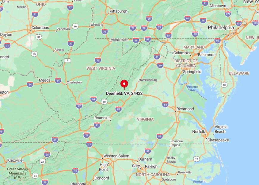
The village sits thirty winding miles west of Staunton via VA 254 and VA 629, roads that narrow to one lane beneath canopies of sugar maple. Vast National Forest acreage flanks both sides, insulating the valley from growth corridors east of the Blue Ridge.
Travelers crest Deerfield Gap, where a roadside pull-off frames the entire basin like a natural amphitheater. Beyond that point, cell towers give way to silos and the pace downshifts naturally.
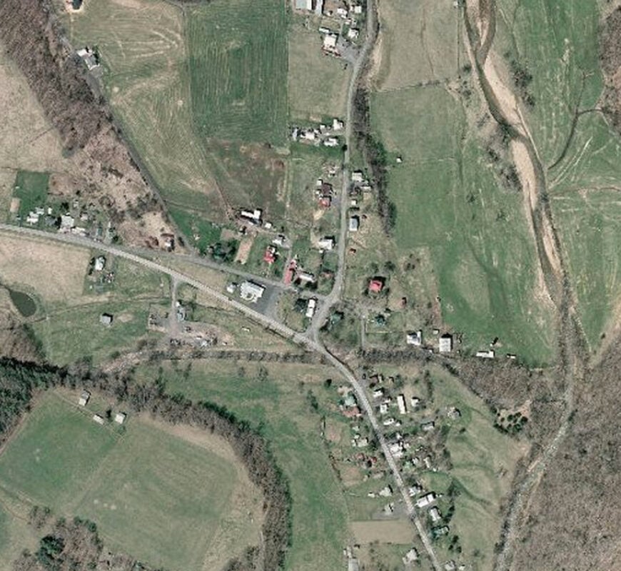
2. Mustoe – Bath County

Mustoe clings to the banks of the Jackson River, no stoplight in sight, and only forest roads snaking through George Washington National Forest’s rugged ridgelines.
You can fish for wild rainbows beneath rhododendron arches, forage ramps on shaded slopes, and gather each July for a potluck at the one-room church whose steeple doubles as the community’s lightning rod.
Permanent population hovers near fifty, thinly scattered on big wooded lots where porch swings squeak louder than passing cars. An informal rock-skipping contest each spring draws families to a secluded river bend known only to locals.
The abandoned C&O railbed now serves as a secret biking path, carpeted in moss and serenaded by wood thrush. Without commercial glare, fireflies choreograph dusk in spectacular fashion.
Where is Mustoe?
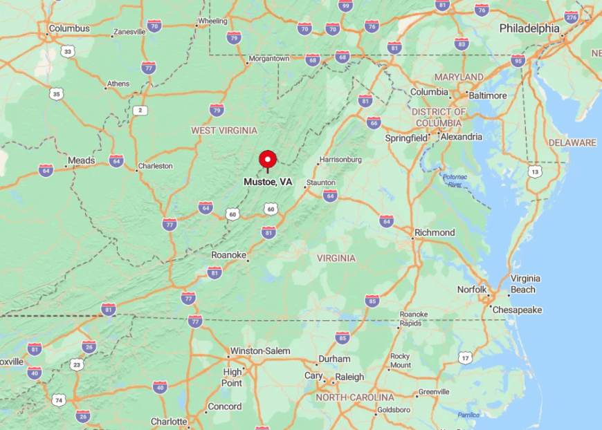
Positioned on Route 220, Mustoe lies ten miles south of Monterey and thirty miles from the nearest grocery chain in Covington. The hamlet sits in a steep river gorge, shielding it from cell signals and summer heat alike.
Access requires following hairpin turns through Warm Springs Mountain, a route treasured by sports-car enthusiasts for its banked curves. Arriving travelers spot Mustoe’s clapboard church first, a white beacon announcing peace and quiet ahead.
1. McDowell – Highland County
Would you like to save this?
McDowell gathers around a crossroads in the Bullpasture River valley, a tiny constellation of historic farmhouses and barns encircled by the Allegheny Mountains’ protective ring.
You can visit Civil War battlefield markers, wade for smallmouth bass, and share picnic tables at the Sugar Tree Country Store that doubles as the post office. The population stands near one hundred thirty-five, yet weekend festivals swell numbers just enough to fill the grassy parking lot behind the feed mill.
Artists paint plein-air scenes of ridge shoulders reflected in river eddies, capturing light that few outsiders witness. Hidden upstream, the Confederate Breastworks overlook offers both history and a 360-degree panorama that’s rarely crowded.
Where is McDowell?
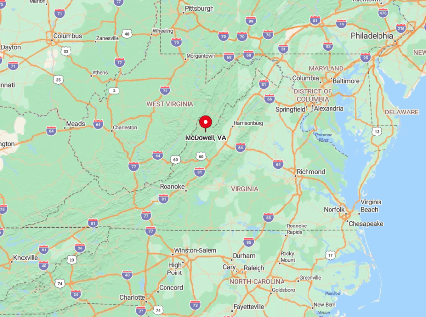
The hamlet sits along U.S. 250, thirty-two curvy miles west of Staunton and fifty-five miles east of Elkins, West Virginia. Surrounded by national forest land, city lights never breach the valley floor, preserving starlit skies.
Travelers climb Shenandoah Mountain, cross the state line for a brief moment, then descend switchbacks into McDowell’s gentle pastures. The last gas pump is an old-style analog unit beside the general store, signaling arrival in one of Virginia’s quietest corners.