
Would you like to save this?
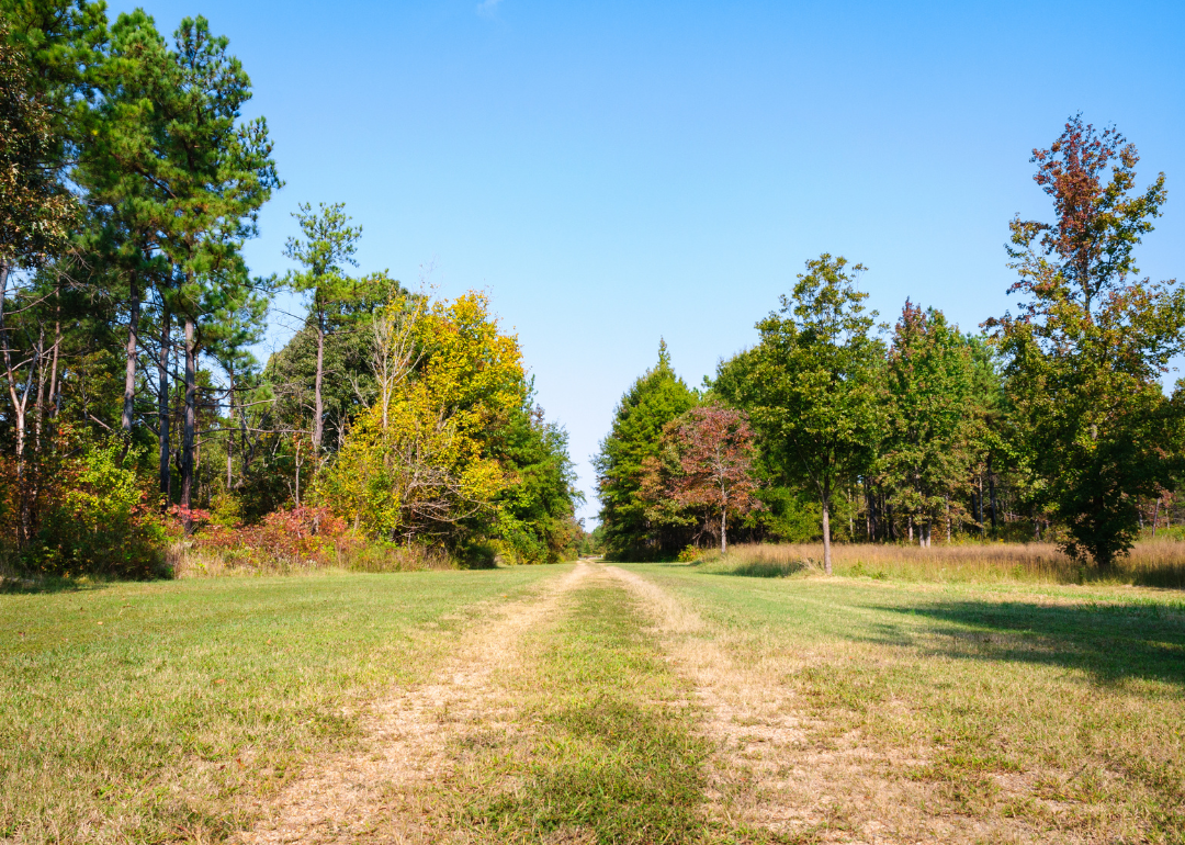
Counties with the shortest life expectancy in South Carolina
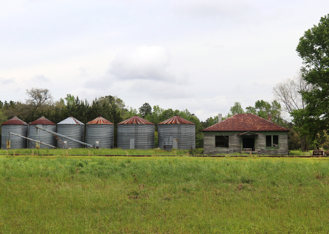
Life expectancy can be affected by a variety of factors. About 25% of your lifespan is determined by genetics, according to the National Library of Medicine. Health and wellness habits—like following a balanced, nutrient-rich diet; not smoking; drinking minimal alcohol; maintaining a healthy weight; and staying physically active—can add more than a decade to your life, research from the National Institutes of Health shows. While these factors are significant, another important element that you might not have considered is your environment and community.
While life expectancy generally increases annually in the United States—jumping from about 70.8 years old to 77.5 between 1970 and 2022, according to the Centers for Disease Control and Prevention—this particular metric can vary from state to state or even county to county. In some parts of the country, the average lifespan is getting shorter based on a variety of risk factors on top of health, including socioeconomic factors like poverty, unemployment, income, and education.
According to a 2020 study from researchers at Penn State, West Virginia, and Michigan State Universities, communities with a higher population density, more fast food restaurants, and a high number of extraction industry-based jobs tend to have shorter life expectancies.
To find out how life expectancy varies within South Carolina, Stacker used 2024 County Health Rankings & Roadmaps from the University of Wisconsin Population Health Institute to identify the counties with the shortest life expectancy. Life expectancy measures the average number of years from birth a person can expect to live and is calculated based on the number of deaths in a given time period and the average number of people at risk of dying during that period. Counties with unreliable or insufficient data were excluded from the analysis. Mortality data came from the National Vital Statistics System.
Read on to see if your county is on the list.
You may also like: Counties with the worst droughts in South Carolina

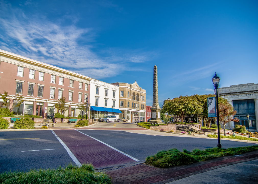
#23. Abbeville County
– Life expectancy: 73.3 years
— 1.9 years lower than the state average
About
Abbeville County has a rich historical background and a strong sense of community, with local pride evident in its architecture, events, and traditions. The economy is supported by manufacturing, agriculture, and small businesses that serve residents and neighboring areas. Educational institutions and healthcare services contribute to the well-being and development of the community.
County government provides key services such as public safety, emergency management, and infrastructure maintenance. Residents enjoy a variety of recreational opportunities, cultural festivals, and historic sites that foster connection and civic engagement. Abbeville County blends its historical roots with ongoing efforts to support growth and community vitality.
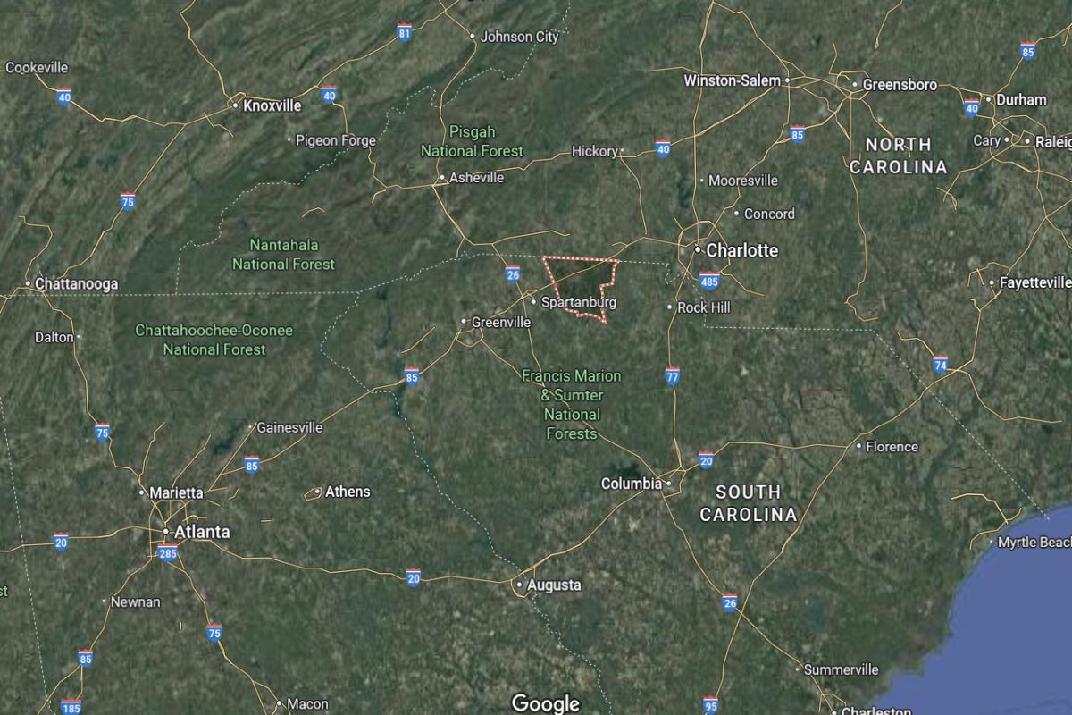
Where is Abbeville County?
Abbeville County is located in northwestern South Carolina, about 50 miles west of Columbia and 45 miles south of Greenville. The county seat, Abbeville, lies roughly 20 miles west of Greenwood and 30 miles north of the Georgia border. It is part of the Piedmont region with a mix of rolling hills and rural landscapes.
The area is approximately 65 miles east of Athens, Georgia and 75 miles southwest of Spartanburg. U.S. Route 72 and State Route 28 provide main access through the county. Abbeville County is also about 40 miles northwest of Aiken.

#22. Sumter County
– Life expectancy: 72.7 years
— 2.5 years lower than the state average
About
Sumter County features a diverse economy supported by manufacturing, healthcare, education, and military-related industries. The community benefits from a range of public services, cultural institutions, and strong civic engagement. Local pride is reflected in historic preservation, public events, and investment in infrastructure.
County government manages essential operations including law enforcement, emergency services, and community development. Residents enjoy recreational amenities, arts programs, and family-friendly activities that strengthen community bonds. Sumter County continues to grow while honoring its traditions and enhancing quality of life for its citizens.
Where is Sumter County?
Sumter County is located in central South Carolina, about 45 miles east of Columbia and 30 miles west of Florence. The county seat, Sumter, lies roughly 25 miles southeast of Camden and 20 miles north of Manning. It is part of the Midlands region and known for Shaw Air Force Base.
The area is approximately 70 miles northwest of Charleston and 90 miles northeast of Augusta, Georgia. U.S. Routes 15 and 76 run through the county, providing key transportation links. Sumter County is also about 50 miles south of Darlington.

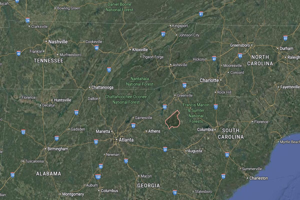
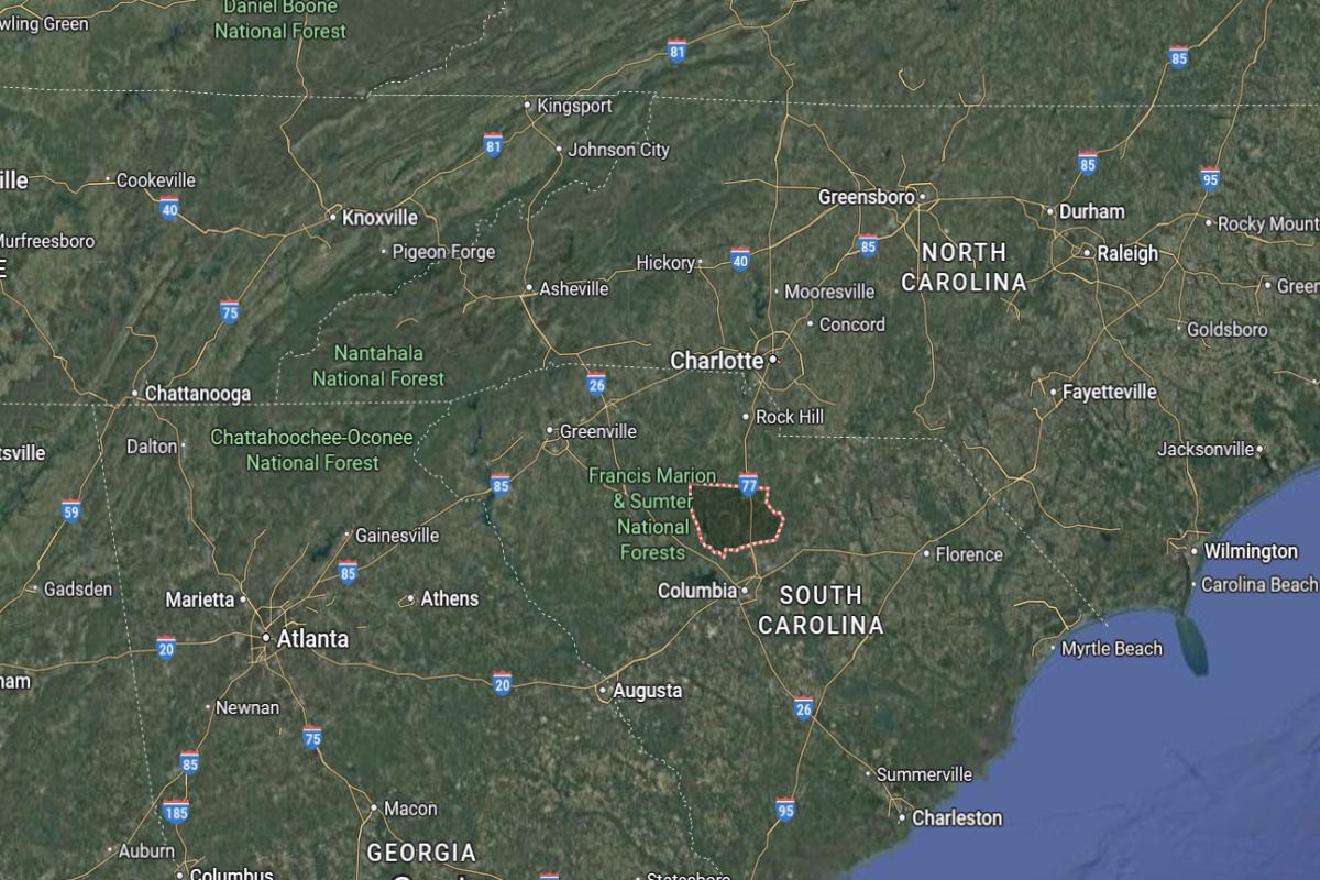
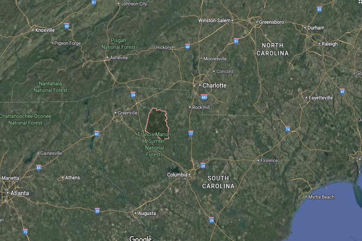
#21. McCormick County
– Life expectancy: 72.4 years
— 2.8 years lower than the state average
About
McCormick County is a rural community with a strong emphasis on natural beauty, history, and small-town charm. The local economy is supported by forestry, tourism, and small businesses that reflect the county’s character. Residents value peaceful living, close community ties, and cultural heritage.
County services include emergency management, infrastructure maintenance, and community support programs. Recreational opportunities such as hiking, fishing, and festivals attract both locals and visitors. McCormick County maintains its rural identity while encouraging community involvement and sustainable growth.
Where is McCormick County?
McCormick County is located in western South Carolina, about 70 miles west of Columbia and 35 miles north of Augusta, Georgia. The county seat, McCormick, lies roughly 25 miles southwest of Greenwood and 30 miles southeast of Elberton, Georgia. It borders the Savannah River and includes part of Lake Thurmond.
The area is approximately 55 miles east of Athens, Georgia and 80 miles south of Greenville. U.S. Route 378 and State Route 28 run through the county, offering regional connectivity. McCormick County is also about 40 miles northwest of Aiken.

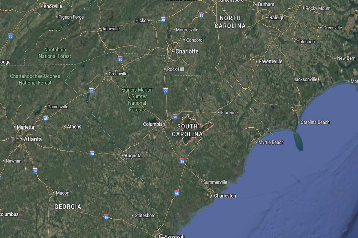
#20. Clarendon County
– Life expectancy: 72.2 years
— 3.0 years lower than the state average
About
Clarendon County is known for its agricultural roots, strong community values, and blend of rural charm with modern development. The economy includes farming, manufacturing, and local commerce, with support from schools and healthcare facilities. Residents take pride in their heritage and active civic life.
The county government provides essential services such as emergency response, infrastructure, and public safety. Outdoor recreation, cultural events, and local traditions contribute to a vibrant community atmosphere. Clarendon County continues to foster growth while preserving its historical and cultural identity.
Where is Clarendon County?
Clarendon County is located in central South Carolina, about 65 miles southeast of Columbia and 30 miles west of Florence. The county seat, Manning, lies roughly 25 miles north of Summerton and 20 miles south of Sumter. It is situated near Lake Marion, one of the state’s largest reservoirs.
The area is approximately 75 miles northwest of Charleston and 90 miles northeast of Savannah, Georgia. Interstate 95 and U.S. Route 301 provide major access through the county. Clarendon County is also about 40 miles east of Orangeburg.

#19. Chesterfield County
– Life expectancy: 72.1 years
— 3.1 years lower than the state average
About
Chesterfield County offers a mix of rural landscapes, small towns, and a growing economic base rooted in agriculture, manufacturing, and local businesses. The community values education, family, and tradition, supported by schools, health services, and civic organizations. Residents enjoy a relaxed pace of life with access to essential services and community events.
County government manages functions such as infrastructure, emergency services, and public safety to meet local needs. Outdoor recreation, festivals, and cultural programs foster a strong sense of identity and neighborly connection. Chesterfield County balances progress with preservation, maintaining its character while supporting community well-being.
Where is Chesterfield County?
Chesterfield County is located in northern South Carolina, about 70 miles northeast of Columbia and 75 miles southeast of Charlotte, North Carolina. The county seat, Chesterfield, lies roughly 20 miles northeast of Hartsville and 30 miles northwest of Bennettsville. It borders North Carolina and is part of the Pee Dee region.


The area is approximately 55 miles southwest of Fayetteville, North Carolina and 45 miles north of Florence. U.S. Routes 1 and 52 run through the county, connecting it to nearby towns and cities. Chesterfield County is also about 60 miles east of Rock Hill.
You may also like: These are the most prevalent disabilities in South Carolina

#18. Laurens County
– Life expectancy: 71.9 years
— 3.3 years lower than the state average
About
Laurens County has a diverse economy supported by manufacturing, agriculture, and a growing service sector that contributes to community stability. The area is known for its rich history, local pride, and commitment to education and workforce development. Residents benefit from a balance of rural charm and access to modern services.
The county government provides essential operations including emergency management, infrastructure maintenance, and law enforcement. Cultural events, historic landmarks, and outdoor recreation offer meaningful experiences for families and visitors. Laurens County continues to grow while preserving its heritage and fostering strong community ties.
Where is Laurens County?
Laurens County is located in northwestern South Carolina, about 40 miles southeast of Greenville and 60 miles northwest of Columbia. The county seat, Laurens, lies roughly 25 miles south of Spartanburg and 30 miles north of Greenwood. It is part of the Piedmont region and features a mix of small towns and rural landscapes.
The area is approximately 90 miles northeast of Augusta, Georgia and 75 miles southwest of Charlotte, North Carolina. Interstate 385 and U.S. Route 221 provide key transportation routes through the county. Laurens County is also about 50 miles west of Rock Hill.

Would you like to save this?
#17. Bamberg County
– Life expectancy: 71.8 years
— 3.4 years lower than the state average
About
Bamberg County is rooted in agriculture and small-town tradition, with a close-knit community that values its heritage and resilience. The local economy includes farming, education, and public services that support the daily lives of residents. Emphasis is placed on family, faith, and preserving local identity.
County government provides essential services such as emergency response, road maintenance, and public safety. Residents enjoy community events, recreational activities, and strong civic involvement. Bamberg County maintains its rural character while working to support growth and improve quality of life.
Where is Bamberg County?
Bamberg County is located in southwestern South Carolina, about 60 miles south of Columbia and 45 miles north of Savannah, Georgia. The county seat, Bamberg, lies roughly 20 miles east of Barnwell and 30 miles west of Orangeburg. It is a rural area with farmland and small communities.
The area is approximately 70 miles northwest of Charleston and 40 miles south of St. Matthews. U.S. Route 78 and State Route 61 provide access through the county. Bamberg County is also about 55 miles southeast of Aiken.

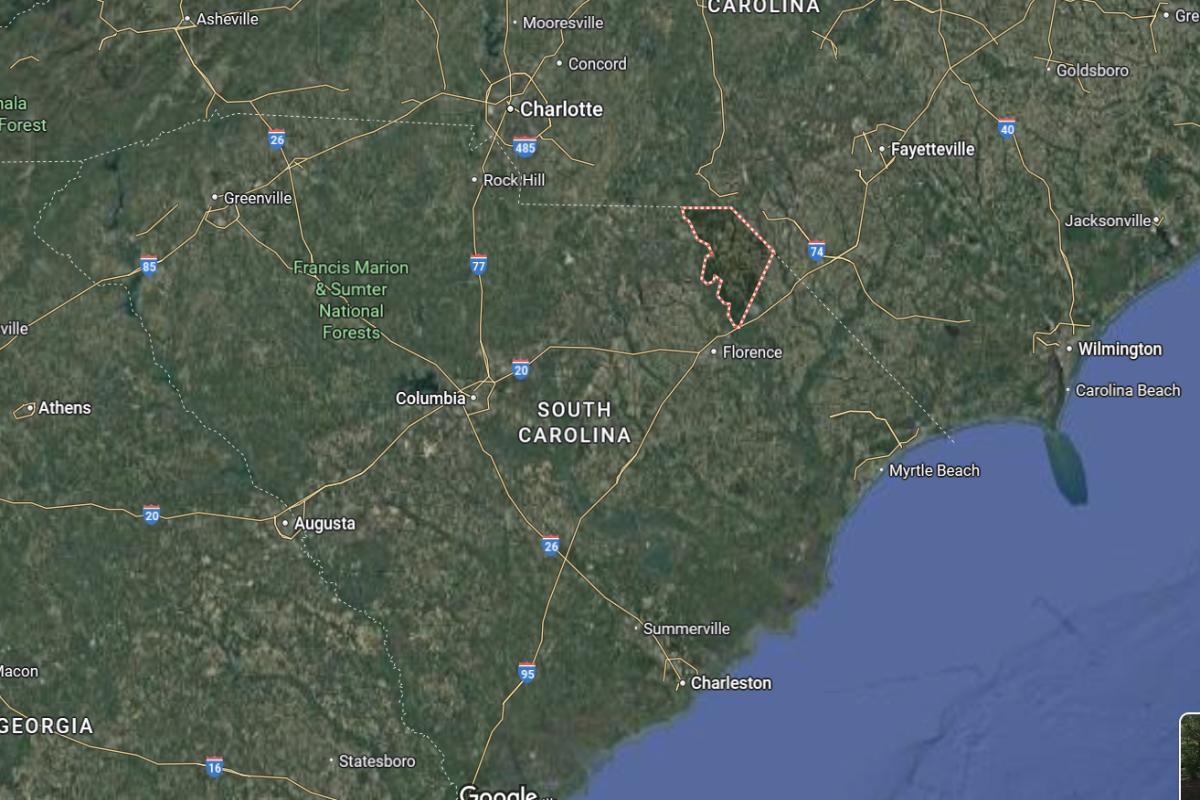
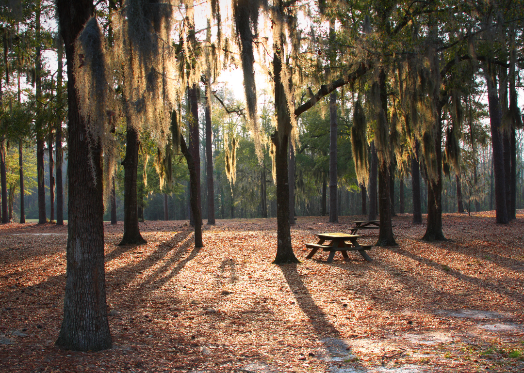
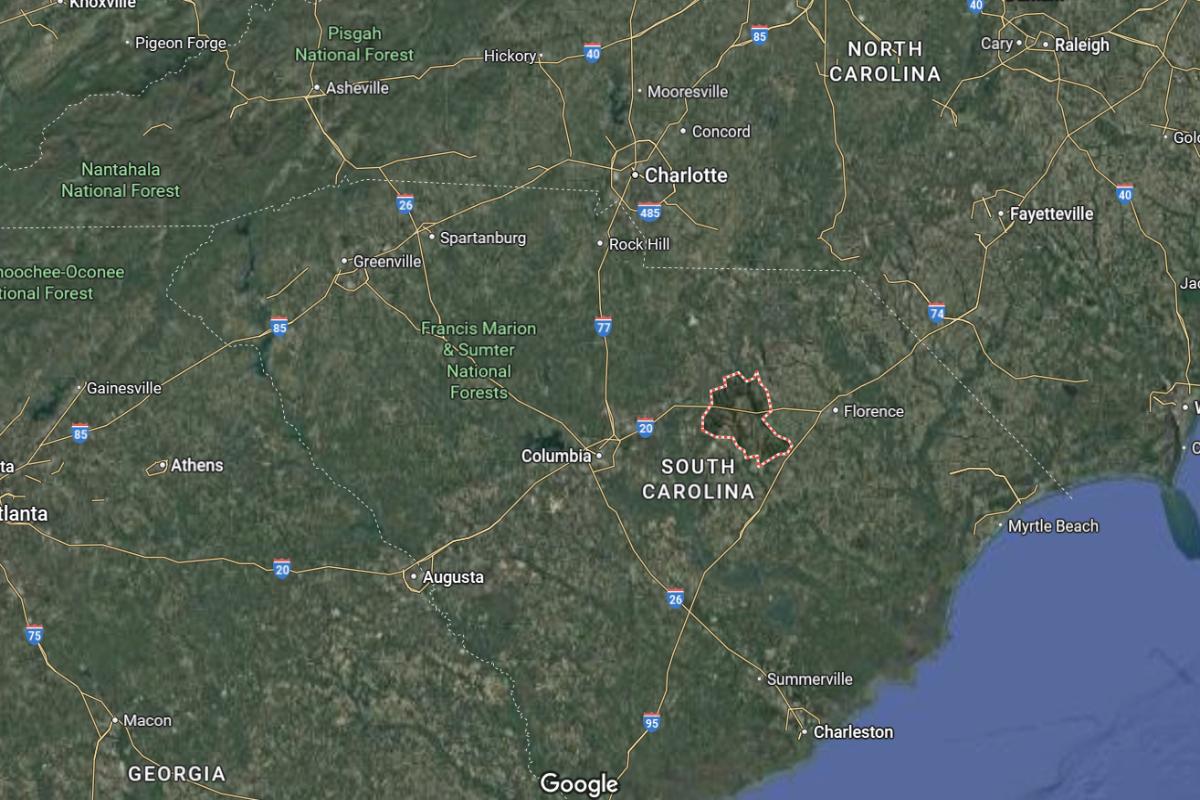
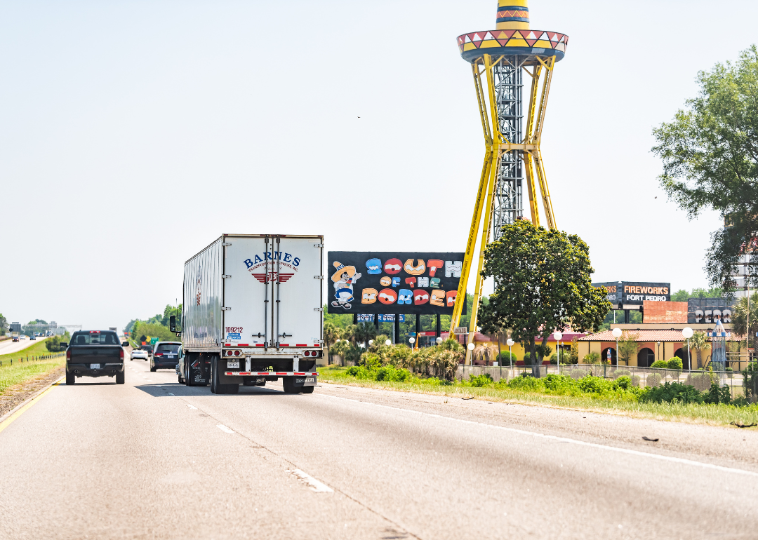
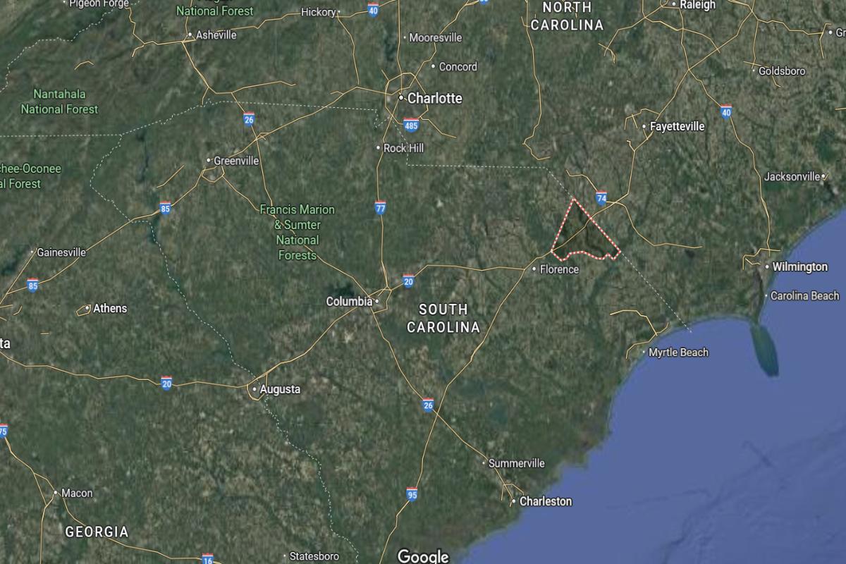
#16. Florence County
– Life expectancy: 71.3 years
— 3.9 years lower than the state average
About
Florence County has a thriving economy supported by healthcare, manufacturing, education, and transportation industries. The community benefits from modern infrastructure, cultural institutions, and a strong commitment to economic and workforce development. Residents experience a blend of urban convenience and small-town values.
County government manages key services including law enforcement, emergency management, and public health programs. Events, parks, and arts programs contribute to a vibrant and connected community. Florence County continues to grow while preserving its history and enhancing the quality of life for its citizens.
Where is Florence County?
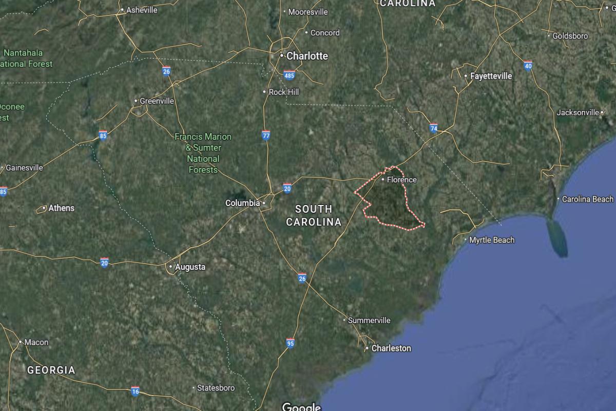
Florence County is located in northeastern South Carolina, about 80 miles east of Columbia and 70 miles northwest of Myrtle Beach. The county seat, Florence, lies roughly 30 miles southeast of Darlington and 40 miles northeast of Sumter. It is a regional transportation hub situated along Interstates 20 and 95.
The area is approximately 90 miles north of Charleston and 60 miles south of Fayetteville, North Carolina. U.S. Routes 52 and 76 provide additional connections across the region. Florence County is also about 45 miles west of Conway.
#15. Cherokee County (tie)
– Life expectancy: 71.0 years
— 4.2 years lower than the state average
About
Cherokee County blends industrial development with a strong sense of heritage and community pride. The economy is driven by manufacturing, agriculture, and small businesses that support local employment and services. Residents benefit from educational institutions, healthcare access, and a variety of civic organizations.
The county government oversees essential services such as emergency response, public safety, and infrastructure maintenance. Community events, historic landmarks, and recreational spaces provide opportunities for connection and leisure. Cherokee County continues to honor its roots while promoting progress and quality of life.
Where is Cherokee County?
Cherokee County is located in the northern part of South Carolina, near the North Carolina border. It lies about 50 miles southwest of Charlotte, North Carolina, making it part of the greater Charlotte metropolitan area. The county seat, Gaffney, is situated roughly 20 miles northeast of Spartanburg.
Cherokee County is approximately 90 miles northwest of Columbia, the state capital of South Carolina. It’s about 110 miles southwest of Asheville, North Carolina, nestled near the foothills of the Blue Ridge Mountains. Its position along Interstate 85 provides easy access to regional cities and cross-state travel.
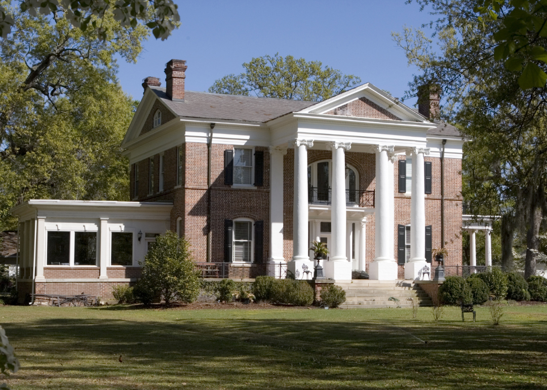
#15. Darlington County (tie)
– Life expectancy: 71.0 years
— 4.2 years lower than the state average
About
Darlington County has a diverse economy supported by manufacturing, agriculture, and motorsports, contributing to its regional significance. The community values tradition, education, and civic involvement, with schools and local institutions playing central roles. Residents enjoy a mix of rural and urban lifestyles with access to essential services.
County government provides key operations including emergency management, infrastructure maintenance, and law enforcement. Cultural events, recreational facilities, and historical sites offer residents opportunities for engagement and enjoyment. Darlington County continues to grow while preserving its heritage and strengthening community ties.
Where is Darlington County?
Darlington County is located in the northeastern part of South Carolina, within the Pee Dee region. It lies about 70 miles northeast of Columbia, the state capital, and approximately 12 miles northwest of Florence, a regional hub. The county seat, Darlington, is easily accessible via major highways including I-20 and US 52.
The county is roughly 90 miles northwest of Myrtle Beach, providing access to the Atlantic coast. It sits about 110 miles east of Greenville and approximately 65 miles southeast of Charlotte, North Carolina. Darlington County’s central location places it within a manageable distance of both inland and coastal cities.
You may also like: Counties with the highest rates of strokes in South Carolina

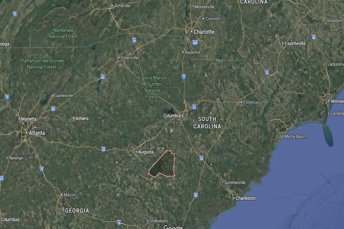
#15. Orangeburg County (tie)
– Life expectancy: 71.0 years
— 4.2 years lower than the state average
About
Orangeburg County has a diverse economic base that includes agriculture, manufacturing, education, and healthcare, supporting both urban and rural communities. The area is known for its cultural heritage, strong educational institutions, and community pride. Residents benefit from a combination of tradition and progressive development.
County government provides essential services such as public safety, emergency management, and infrastructure support. Community events, recreational facilities, and historic landmarks contribute to a vibrant and inclusive environment. Orangeburg County continues to promote growth while honoring its deep-rooted history and values.
Where is Orangeburg County?
Orangeburg County is located in the central part of South Carolina. It lies about 40 miles south of Columbia, the state capital, and roughly 75 miles northwest of Charleston. The city of Orangeburg, which is the county seat, is situated near the intersection of I-26 and US 301.
The county is approximately 95 miles southeast of Greenville and around 65 miles northeast of Augusta, Georgia. It sits about 115 miles southwest of Myrtle Beach, offering access to both inland and coastal regions. Orangeburg County’s location makes it a key connector between major South Carolina cities.
#12. Barnwell County
– Life expectancy: 70.8 years
— 4.4 years lower than the state average
About
Barnwell County is shaped by its agricultural heritage, industrial presence, and strong sense of community. The local economy includes farming, manufacturing, and public services that support a balanced rural lifestyle. Education, family values, and civic engagement are central to daily life.
County government oversees operations such as emergency services, infrastructure maintenance, and community development. Residents enjoy access to recreational areas, cultural events, and historic landmarks that reflect the county’s identity. Barnwell County continues to uphold its traditions while investing in long-term growth and community well-being.
Where is Barnwell County?
Barnwell County is located in the southwestern part of South Carolina. It lies about 60 miles south of Columbia and approximately 40 miles east of Augusta, Georgia. The city of Barnwell, the county seat, sits near the intersection of SC Highways 3 and 278.
The county is around 90 miles northwest of Charleston and about 70 miles southwest of Orangeburg. It is also roughly 115 miles southeast of Greenville. Barnwell County’s position places it near the Georgia border and within reach of major South Carolina cities.
Would you like to save this?
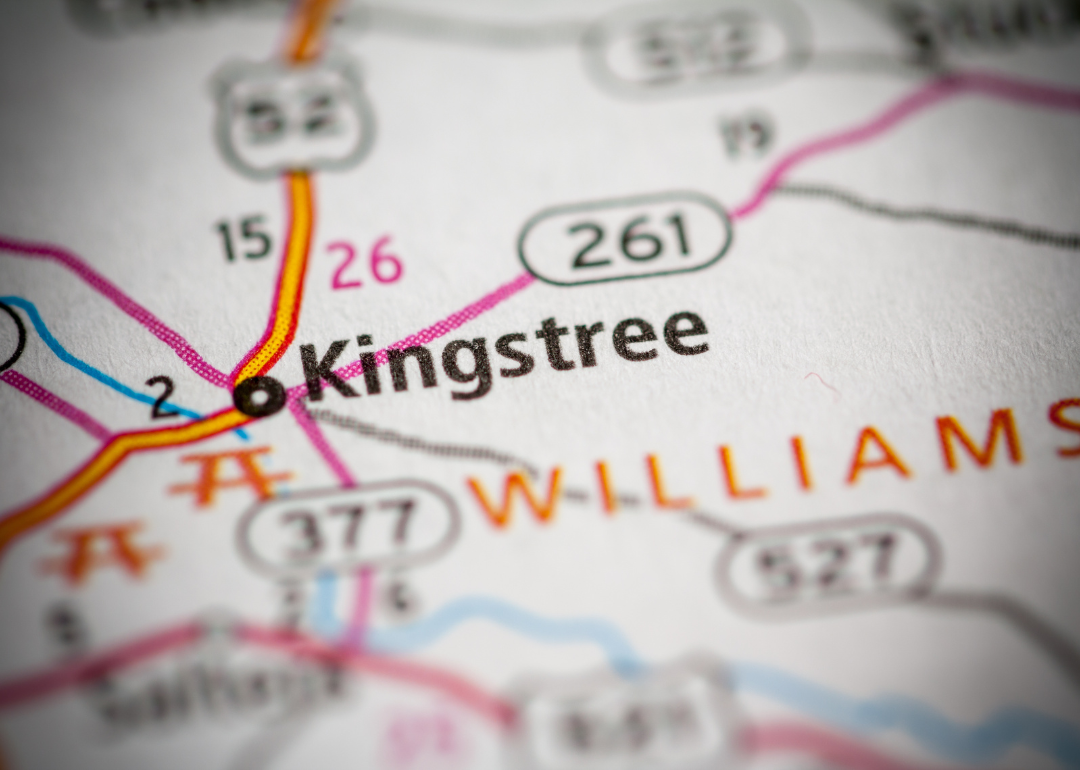
#11. Williamsburg County
– Life expectancy: 70.5 years
— 4.7 years lower than the state average
About
Williamsburg County is a rural community with deep agricultural roots and a strong cultural heritage. The local economy is supported by farming, small businesses, and public services that sustain daily life. Residents value tradition, family, and a close-knit way of living.
County government provides essential services such as public safety, infrastructure maintenance, and emergency response. Cultural festivals, historic landmarks, and natural areas offer opportunities for recreation and community engagement. Williamsburg County remains committed to preserving its heritage while fostering a supportive and connected community.
Where is Williamsburg County?
Williamsburg County is located in the eastern part of South Carolina within the Lowcountry region. It lies about 75 miles northeast of Charleston and roughly 65 miles west of Myrtle Beach. Kingstree, the county seat, is situated near the intersection of US Highways 52 and 521.
The county is approximately 90 miles southeast of Columbia and around 110 miles east of Augusta, Georgia. It is also about 135 miles southeast of Greenville. Williamsburg County’s location offers access to both coastal and inland areas of the state.
#10. Hampton County (tie)
– Life expectancy: 70.3 years
— 4.9 years lower than the state average
About
Hampton County is known for its agricultural heritage, quiet rural communities, and strong family values. The local economy is driven by farming, forestry, and small businesses that support the needs of residents. Education and public service play important roles in sustaining community life.
County government provides services such as emergency management, infrastructure upkeep, and public health support. Residents enjoy outdoor recreation, seasonal events, and a culture of neighborly connection. Hampton County continues to uphold its traditions while encouraging steady, community-focused growth.
Where is Hampton County?

Hampton County is located in the southern part of South Carolina, near the Georgia border. It lies about 75 miles west of Charleston and roughly 55 miles north of Savannah, Georgia. The county seat, Hampton, is positioned near US Highways 278 and 601.
The county is approximately 65 miles south of Columbia and around 100 miles southeast of Augusta, Georgia. It sits about 120 miles southwest of Myrtle Beach. Hampton County’s location provides access to both the Lowcountry coast and key inland cities.

#10. Fairfield County (tie)
– Life expectancy: 70.3 years
— 4.9 years lower than the state average
About
Fairfield County blends historical significance with a commitment to rural charm and community development. The economy is supported by manufacturing, agriculture, and local government services that provide stability and employment. Residents value education, heritage, and a strong sense of local identity.
The county government delivers key services including emergency response, infrastructure maintenance, and public safety. Community life is enriched by cultural events, outdoor recreation, and historic landmarks. Fairfield County remains dedicated to preserving its traditions while supporting growth and quality of life for its residents.
Where is Fairfield County?
Fairfield County is located in the central part of South Carolina, just north of the state capital. It lies about 30 miles north of Columbia and approximately 85 miles south of Charlotte, North Carolina. The county seat, Winnsboro, is situated near US Highways 321 and 21.
The county is around 95 miles southeast of Greenville and roughly 115 miles northwest of Charleston. It is also about 135 miles southwest of Myrtle Beach. Fairfield County’s central location makes it a key connector between major urban and rural areas of the state.
You may also like: Movies and TV shows casting in South Carolina

#8. Union County
– Life expectancy: 69.9 years
— 5.3 years lower than the state average
About
Union County has a strong foundation in manufacturing, agriculture, and small business, creating a balanced and resilient local economy. The community is deeply connected to its historical roots, with a focus on education, family, and civic pride. Residents enjoy a close-knit atmosphere supported by essential public services.
County government provides operations such as law enforcement, infrastructure maintenance, and emergency services. Cultural festivals, parks, and historical landmarks contribute to a vibrant and engaged community life. Union County continues to preserve its heritage while promoting sustainable development and resident well-being.
Where is Union County?
Union County is located in the northern part of South Carolina, within the Piedmont region. It lies about 35 miles southeast of Spartanburg and approximately 70 miles southwest of Charlotte, North Carolina. The county seat, Union, is accessible via SC Highways 9 and 49.
The county is around 90 miles north of Columbia and roughly 120 miles northwest of Charleston. It also sits about 115 miles northeast of Augusta, Georgia. Union County’s location places it within reach of major cities in both South Carolina and North Carolina.
#7. Marlboro County
– Life expectancy: 69.8 years
— 5.4 years lower than the state average
About
Marlboro County is rooted in agriculture and manufacturing, with a community that values hard work, tradition, and local pride. The economy is supported by farming, industry, and public services that provide stability and opportunity. Residents benefit from educational institutions, healthcare access, and a strong sense of place.
County government handles essential services such as infrastructure, emergency response, and community development. Recreational activities, historic landmarks, and cultural events strengthen community bonds and enhance quality of life. Marlboro County remains dedicated to preserving its identity while supporting growth and civic engagement.
Where is Marlboro County?
Would you like to save this?
Marlboro County is located in the northeastern corner of South Carolina, near the North Carolina border. It lies about 80 miles northeast of Columbia and approximately 50 miles northwest of Myrtle Beach. The county seat, Bennettsville, is situated close to US Highways 15 and 401.
The county is roughly 100 miles southeast of Charlotte, North Carolina, and around 120 miles northeast of Augusta, Georgia. It is also about 140 miles east of Greenville. Marlboro County’s position provides access to both the inland Piedmont and the coastal plains of the Carolinas.
#6. Allendale County
– Life expectancy: 69.5 years
— 5.7 years lower than the state average
About
Allendale County is a rural community with deep agricultural roots and a strong sense of heritage. The local economy is supported by farming, education, and public services that sustain everyday life. Residents value tradition, resilience, and close community connections.
County government provides essential functions such as emergency services, infrastructure maintenance, and public health support. Cultural events, local gatherings, and access to outdoor spaces contribute to a sense of unity and pride. Allendale County remains focused on preserving its rural identity while working toward long-term community growth.
Where is Allendale County?
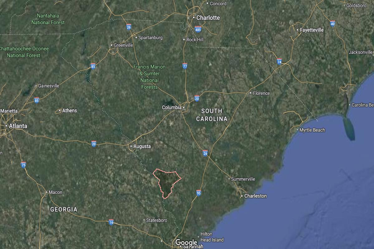
Allendale County is located in the southwestern part of South Carolina, close to the Georgia border. It lies about 75 miles south of Columbia and approximately 45 miles east of Augusta, Georgia. The county seat, Allendale, is near the junction of US Highways 301 and 278.
The county is roughly 95 miles northwest of Savannah, Georgia, and about 105 miles west of Charleston. It also sits around 130 miles southeast of Greenville. Allendale County’s position offers convenient access to both inland and coastal regions of South Carolina and Georgia.
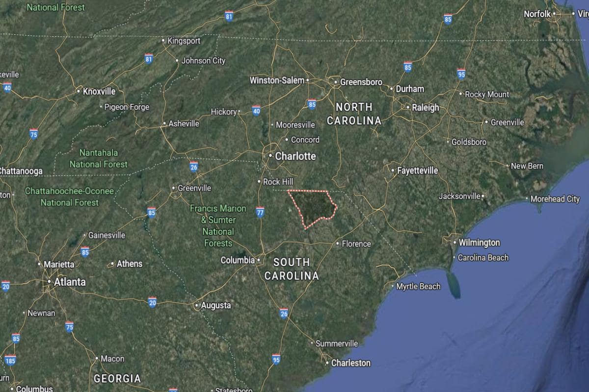
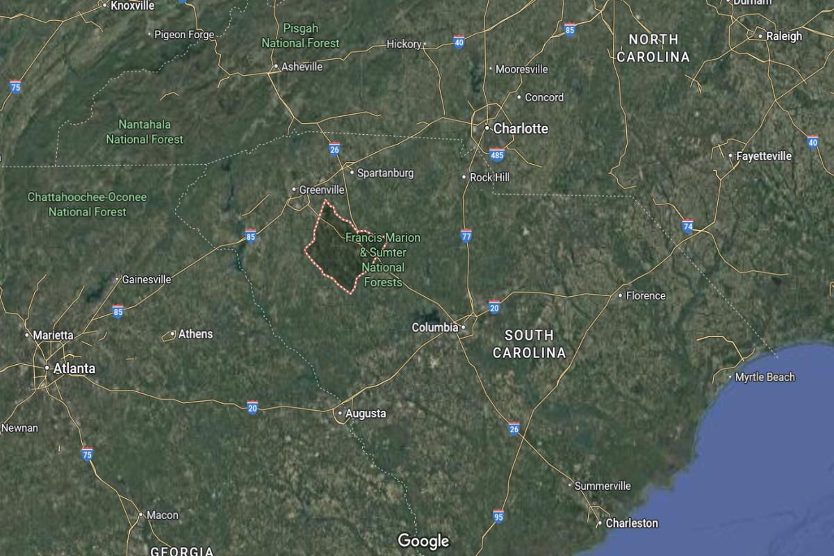
#5. Chester County (tie)
– Life expectancy: 69.3 years
— 5.9 years lower than the state average
About
Chester County has a balanced economy supported by manufacturing, agriculture, and a growing service sector. The community values its historical roots, educational opportunities, and strong family ties. Residents benefit from local institutions that provide healthcare, schooling, and civic support.
The county government delivers essential services such as law enforcement, emergency response, and infrastructure management. Recreational spaces, cultural events, and historical sites enhance quality of life and community engagement. Chester County continues to preserve its traditions while fostering development and long-term stability.
Where is Chester County?
Chester County is located in the northern part of South Carolina, within the Piedmont region. It lies about 45 miles north of Columbia and approximately 50 miles south of Charlotte, North Carolina. The county seat, Chester, is accessible via US Highways 321 and 21.
The county is around 90 miles southeast of Greenville and about 120 miles northwest of Charleston. It is also roughly 130 miles southwest of Raleigh, North Carolina. Chester County’s central location provides easy access to both South Carolina’s capital and the Charlotte metropolitan area.
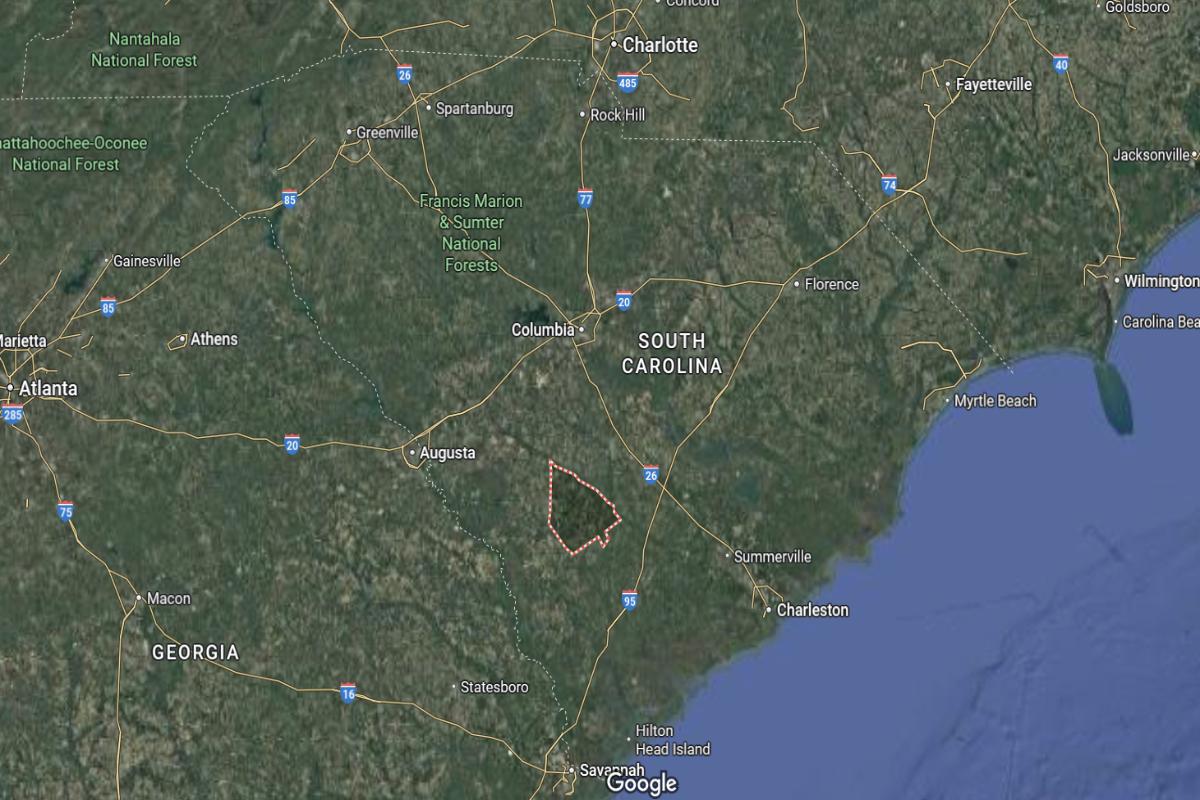
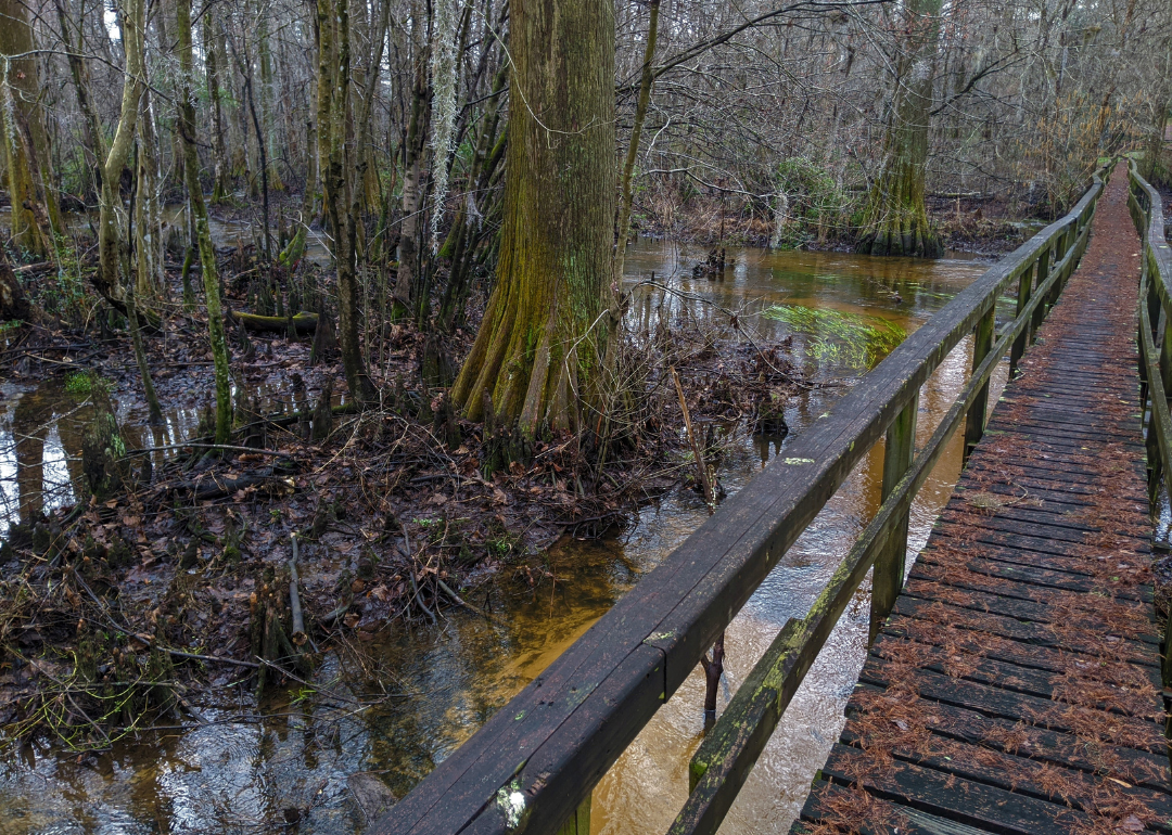
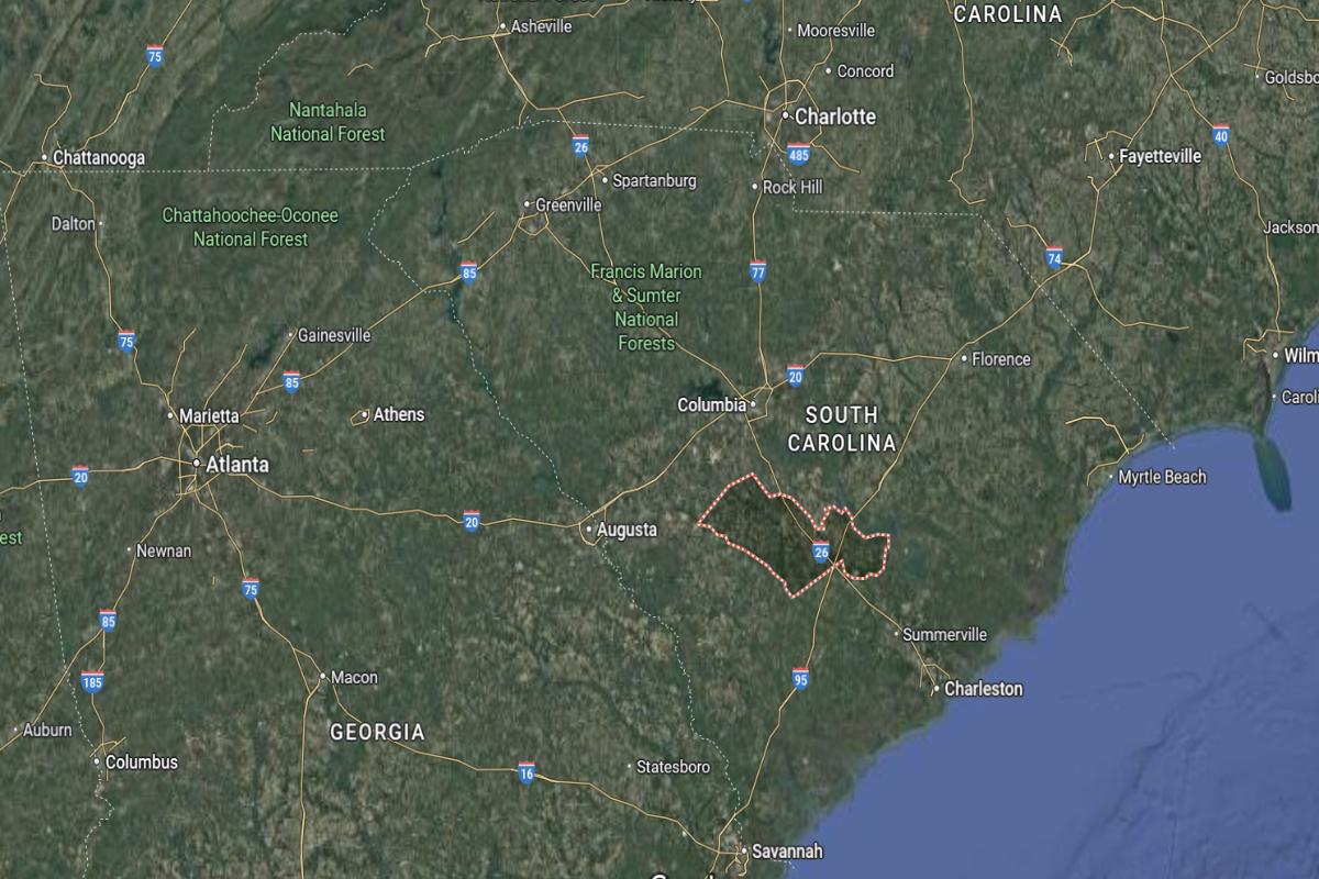
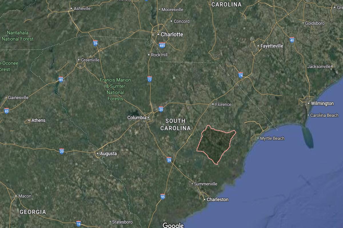
#5. Colleton County (tie)
– Life expectancy: 69.3 years
— 5.9 years lower than the state average
About
Colleton County is known for its blend of natural beauty, historic charm, and strong agricultural traditions. The economy includes farming, forestry, manufacturing, and tourism, supported by local businesses and community services. Residents enjoy a relaxed lifestyle with access to education, healthcare, and civic resources.
County government provides key services such as emergency management, public safety, and infrastructure maintenance. Cultural festivals, outdoor recreation, and historic landmarks contribute to a vibrant and connected community. Colleton County remains committed to preserving its heritage while encouraging growth and community well-being.
Where is Colleton County?
Colleton County is located in the southern Lowcountry region of South Carolina. It lies about 45 miles west of Charleston and approximately 80 miles south of Columbia. The county seat, Walterboro, is near the intersection of I-95 and US Highway 17.
The county is roughly 65 miles northeast of Savannah, Georgia, and about 115 miles southeast of Augusta, Georgia. It is also around 130 miles south of Greenville. Colleton County’s position offers strategic access to coastal cities and inland regions alike.
You may also like: Highest-rated beer in South Carolina
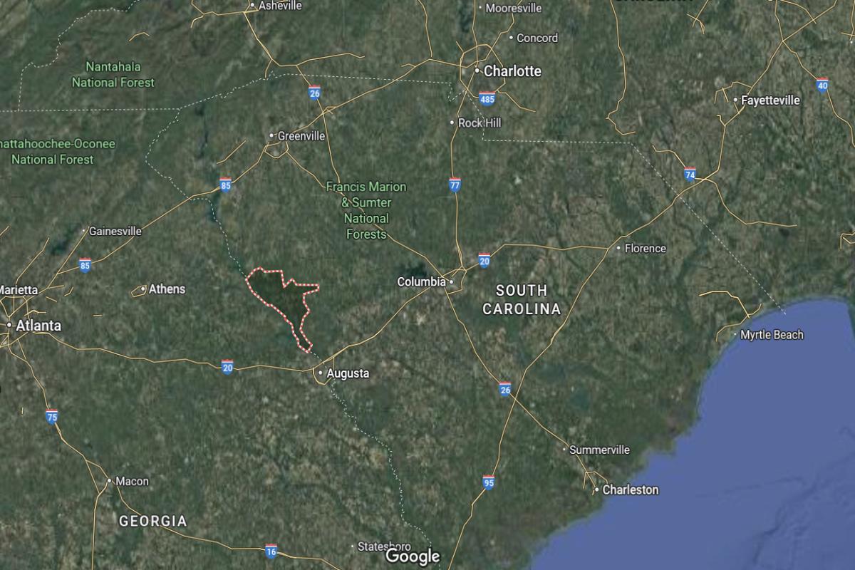
#3. Lee County
– Life expectancy: 69.1 years
— 6.1 years lower than the state average
About
Lee County is a close-knit rural community with a strong foundation in agriculture, manufacturing, and local business. The economy is supported by farming, public services, and educational institutions that serve the area’s residents. A sense of pride, tradition, and community involvement defines daily life.
The county government provides essential services including emergency response, infrastructure upkeep, and public health programs. Residents participate in cultural events, enjoy recreational opportunities, and support efforts to preserve local history. Lee County continues to uphold its values while promoting sustainable development and community support.
Where is Lee County?
Lee County is located in the central eastern part of South Carolina. It lies about 50 miles east of Columbia and approximately 30 miles west of Florence. The county seat, Bishopville, is near the junction of I-20 and US Highway 15.
The county is roughly 90 miles northwest of Myrtle Beach and about 120 miles northeast of Augusta, Georgia. It sits around 110 miles southeast of Charlotte, North Carolina. Lee County’s location connects the Midlands to the Pee Dee and coastal regions.
#2. Marion County
– Life expectancy: 69.0 years
— 6.2 years lower than the state average
About
Marion County is grounded in agriculture, manufacturing, and a strong sense of community heritage. The local economy is supported by small businesses, public services, and educational institutions that serve both urban and rural areas. Residents value tradition, family, and a spirit of resilience.
County government delivers essential services including emergency management, infrastructure maintenance, and public safety. Cultural festivals, historic sites, and recreational spaces offer opportunities for connection and enrichment. Marion County remains focused on preserving its identity while encouraging thoughtful growth and community well-being.
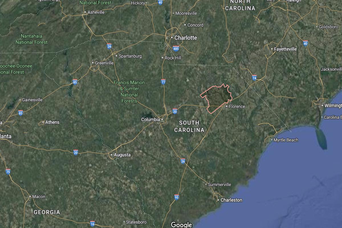
Where is Marion County?
Marion County is located in the northeastern part of South Carolina, within the Pee Dee region. It lies about 25 miles southeast of Florence and approximately 50 miles northwest of Myrtle Beach. The county seat, Marion, is accessible via US Highways 76 and 501.
The county is around 95 miles northeast of Charleston and roughly 90 miles east of Columbia. It also sits about 120 miles southeast of Charlotte, North Carolina. Marion County’s location provides convenient access to both inland cities and the Atlantic coast.
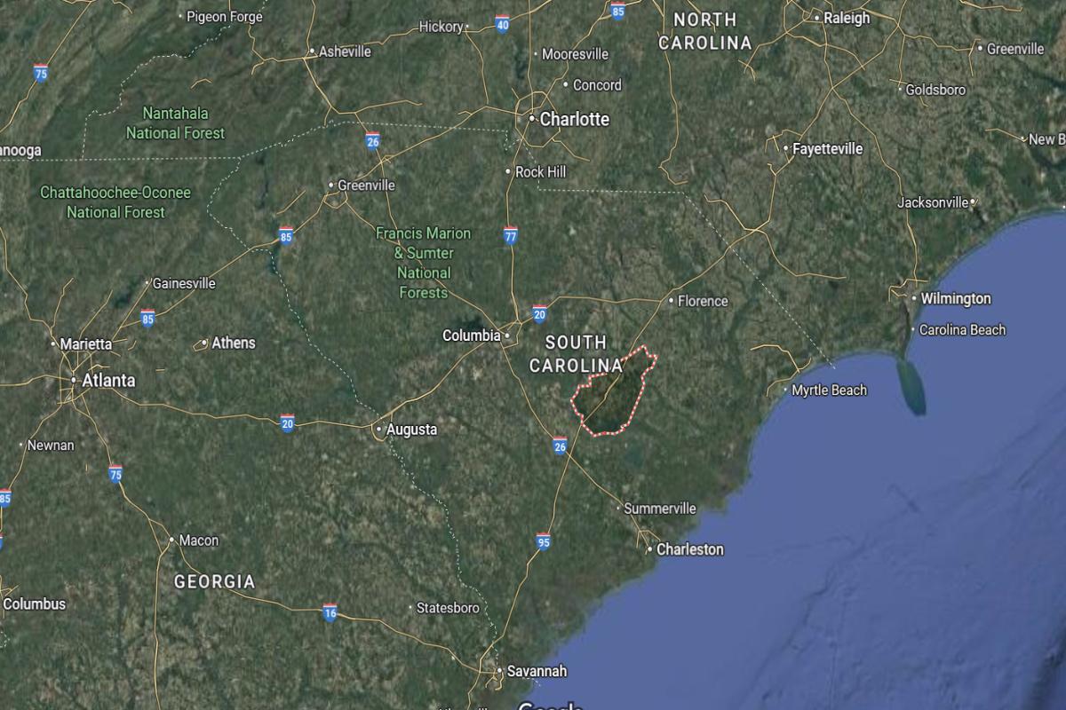
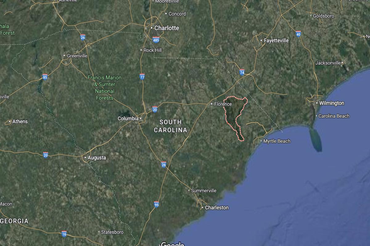
#1. Dillon County
– Life expectancy: 67.9 years
— 7.3 years lower than the state average
About
Dillon County is supported by a diverse economy rooted in agriculture, manufacturing, and transportation services. The community values hard work, local traditions, and strong family connections that shape daily life. Schools, healthcare facilities, and small businesses contribute to a stable and engaged population.
County government oversees essential services including law enforcement, emergency response, and infrastructure maintenance. Residents enjoy community events, recreational activities, and cultural programs that foster unity and pride. Dillon County continues to honor its heritage while promoting growth and improved quality of life.
Where is Dillon County?
Dillon County is located in the northeastern corner of South Carolina, near the North Carolina border. It lies about 30 miles northeast of Florence and approximately 80 miles northwest of Myrtle Beach. The county seat, Dillon, is situated along I-95 and US Highway 301.
The county is around 100 miles northeast of Columbia and about 105 miles southeast of Charlotte, North Carolina. It is also roughly 135 miles east of Greenville. Dillon County’s location makes it a key connector between coastal areas and inland regions of both Carolinas.
This story features data reporting by Karim Noorani, writing by Kiersten Hickman, and is part of a series utilizing data automation across 49 states.
By Stacker