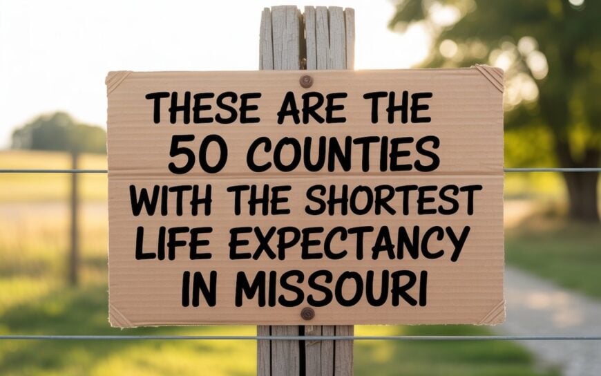
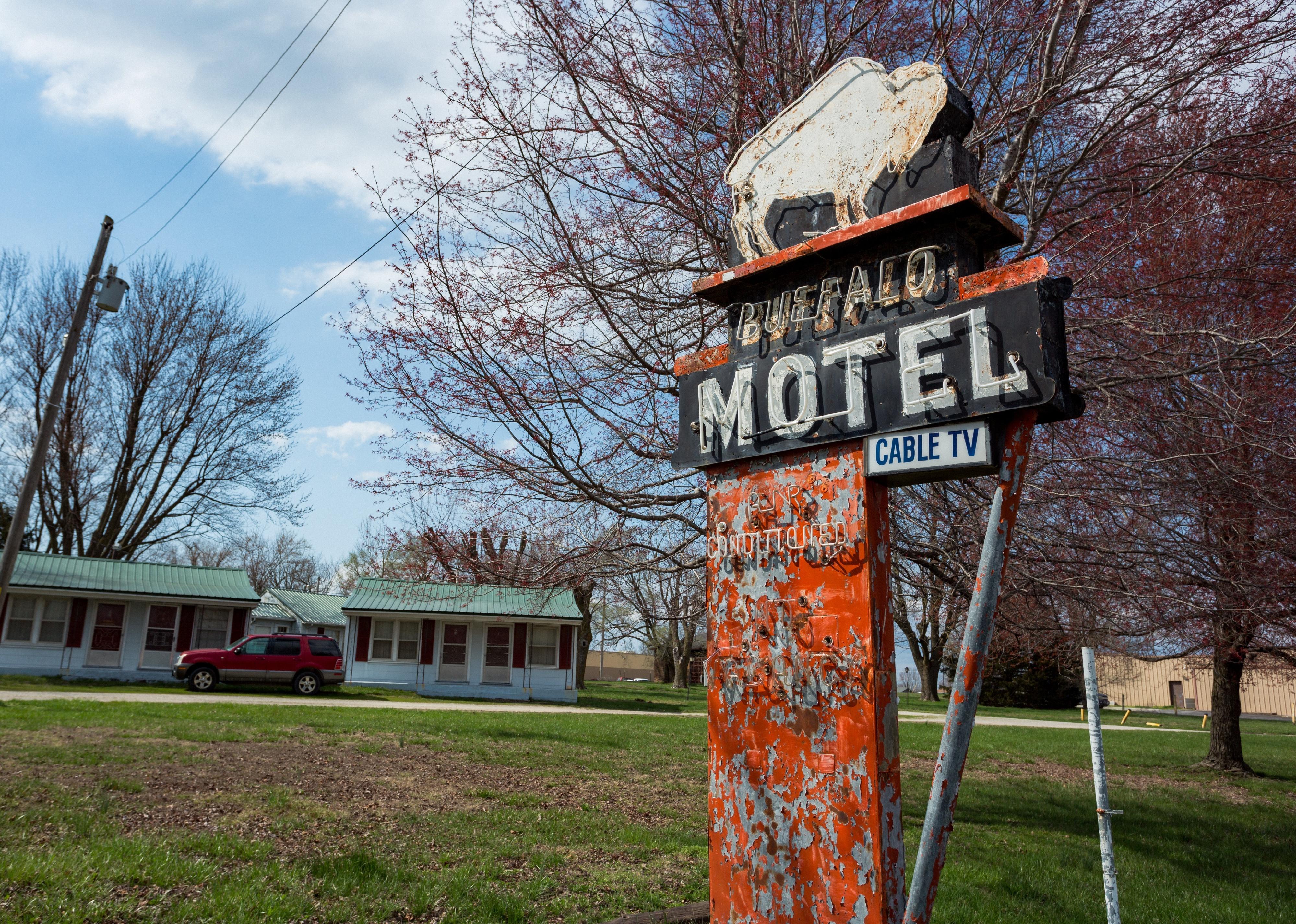
Counties with the shortest life expectancy in Missouri
Life expectancy can be affected by a variety of factors. About 25% of your lifespan is determined by genetics, according to the National Library of Medicine. Health and wellness habits—like following a balanced, nutrient-rich diet; not smoking; drinking minimal alcohol; maintaining a healthy weight; and staying physically active—can add more than a decade to your life, research from the National Institutes of Health shows. While these factors are significant, another important element that you might not have considered is your environment and community.
In order to come up with the very specific design ideas, we create most designs with the assistance of state-of-the-art AI interior design software.
While life expectancy generally increases annually in the United States—jumping from about 70.8 years old to 77.5 between 1970 and 2022, according to the Centers for Disease Control and Prevention—this particular metric can vary from state to state or even county to county. In some parts of the country, the average lifespan is getting shorter based on a variety of risk factors on top of health, including socioeconomic factors like poverty, unemployment, income, and education.
According to a 2020 study from researchers at Penn State, West Virginia, and Michigan State Universities, communities with a higher population density, more fast food restaurants, and a high number of extraction industry-based jobs tend to have shorter life expectancies.
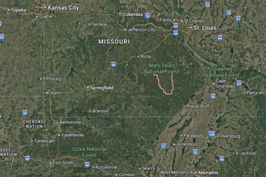
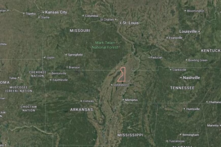
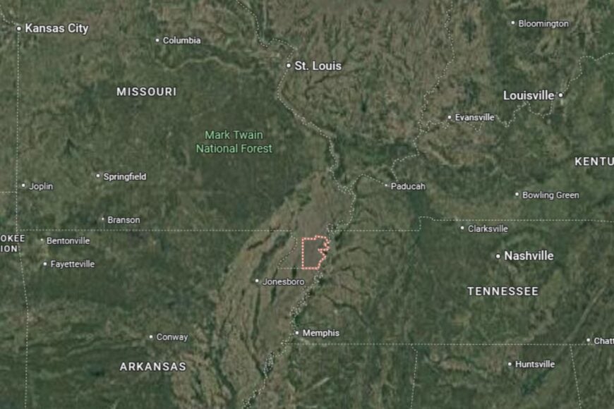
To find out how life expectancy varies within Missouri, Stacker used 2024 County Health Rankings & Roadmaps from the University of Wisconsin Population Health Institute to identify the counties with the shortest life expectancy. Life expectancy measures the average number of years from birth a person can expect to live and is calculated based on the number of deaths in a given time period and the average number of people at risk of dying during that period. Counties with unreliable or insufficient data were excluded from the analysis. Mortality data came from the National Vital Statistics System.
Read on to see if your county is on the list.
You may also like: How opioid prescriptions to Medicaid patients in Missouri stack up
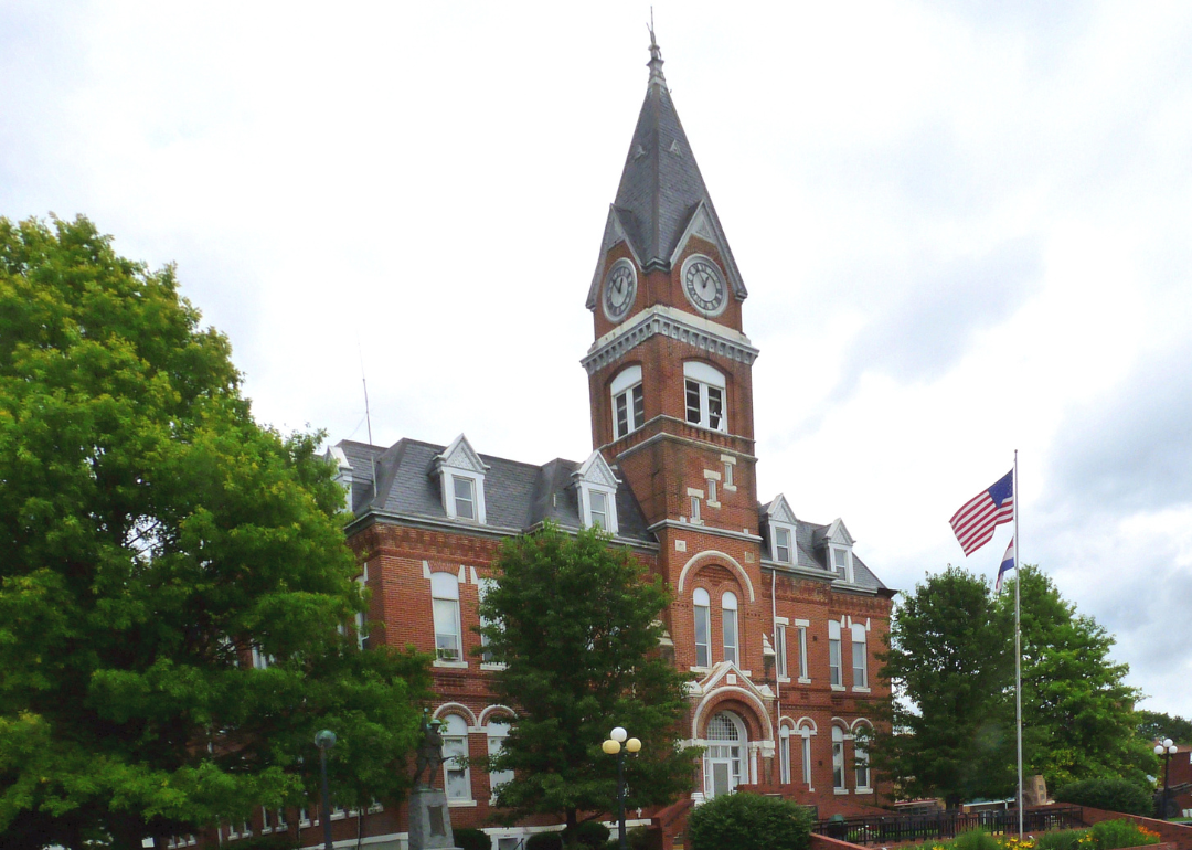
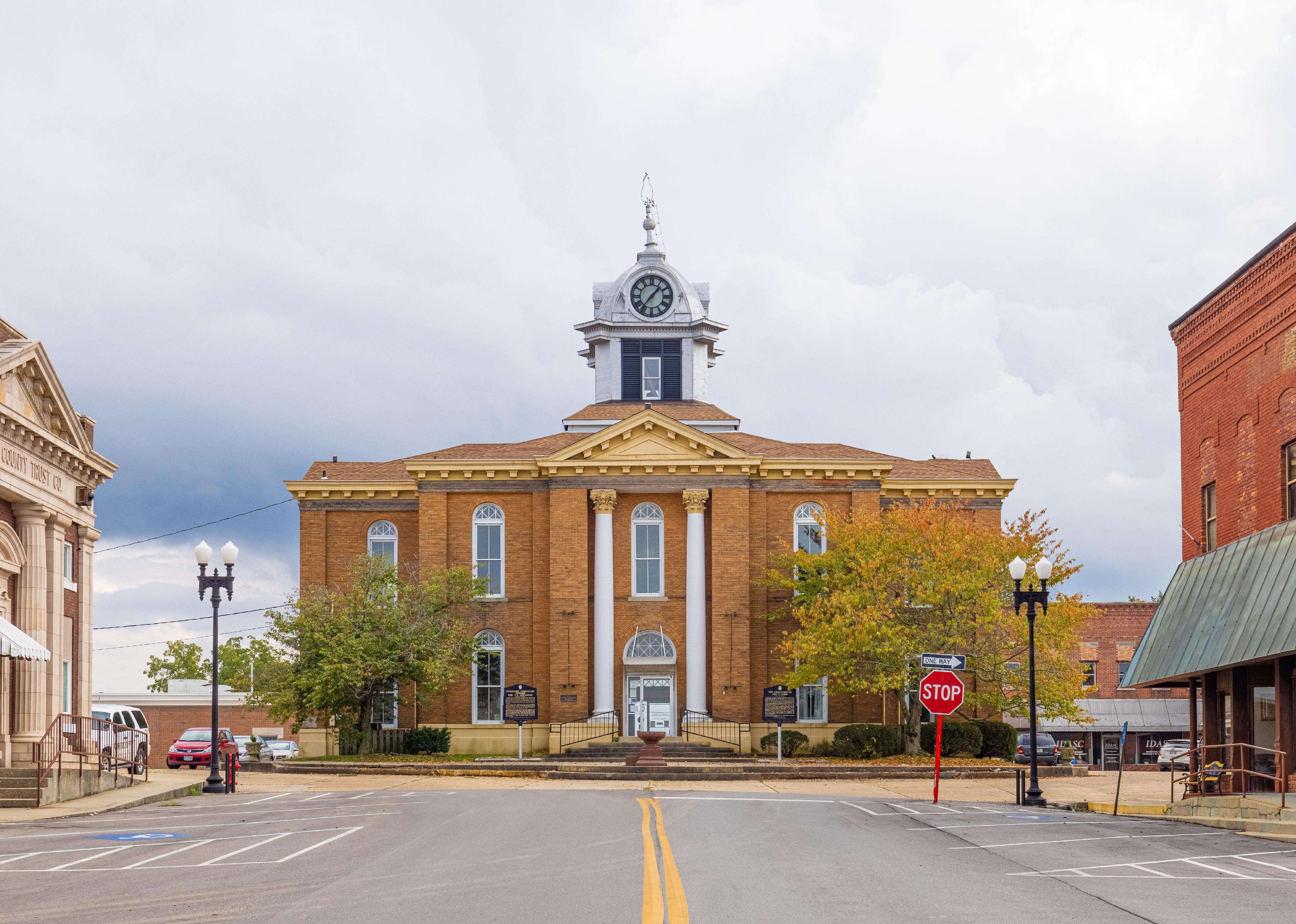
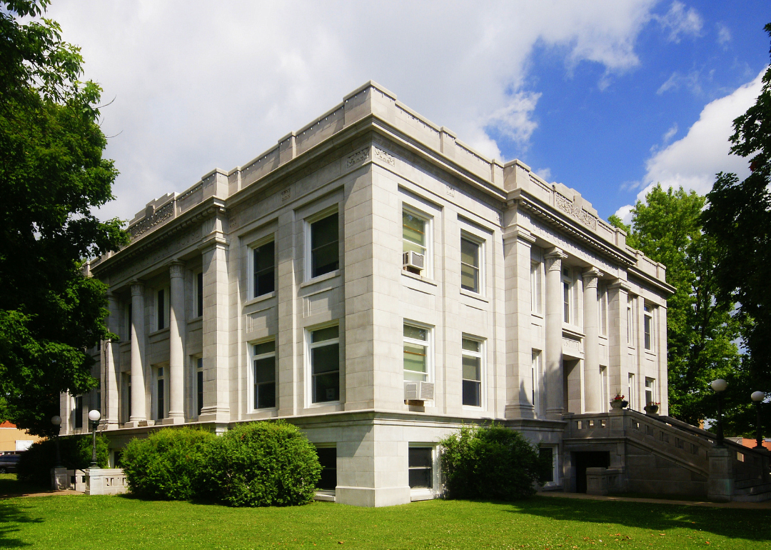
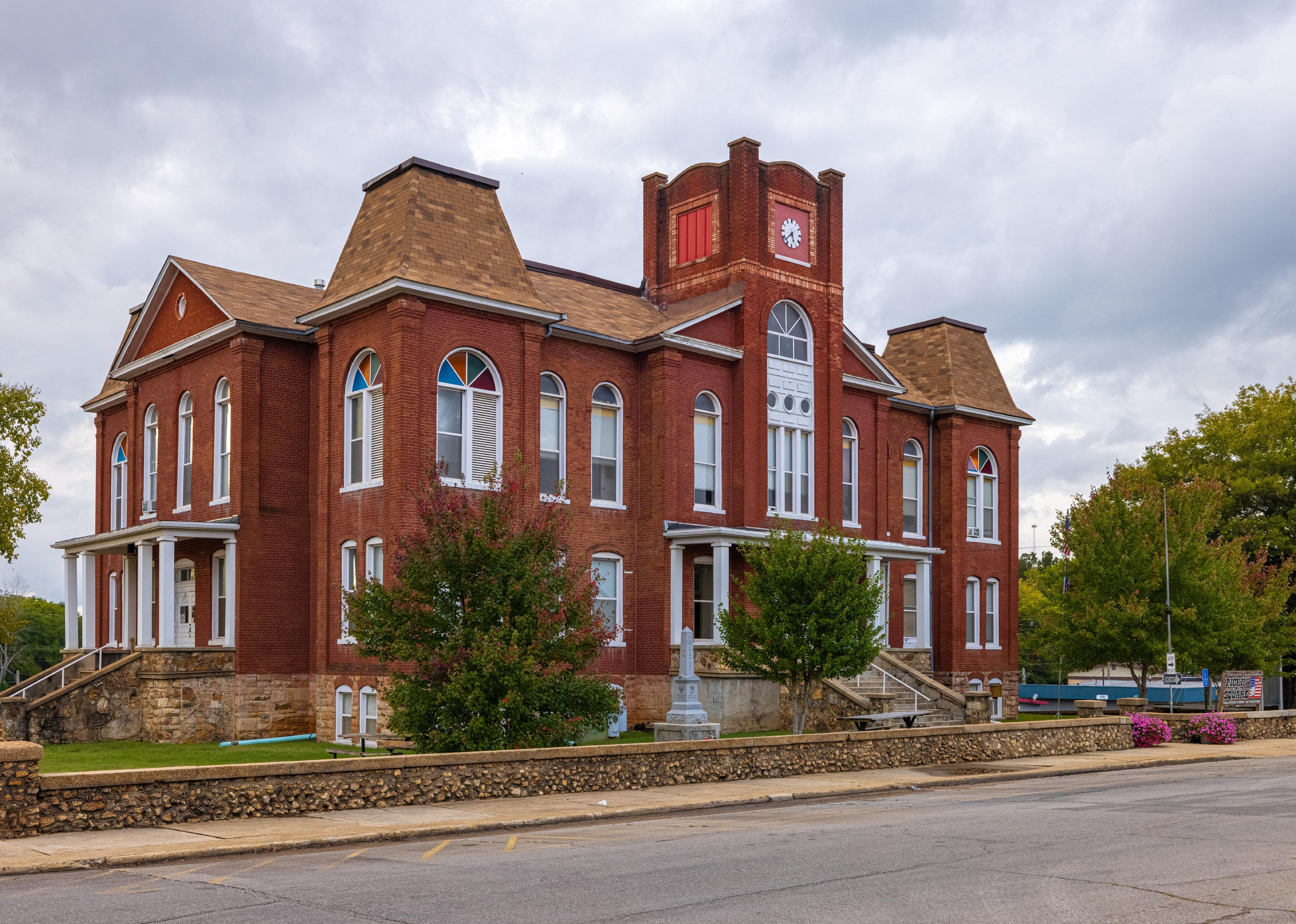
#50. Morgan County
– Life expectancy: 74.8 years
— 1.0 years lower than the state average

About
Morgan County is a central Missouri county best known for its access to the Lake of the Ozarks, a major hub for tourism and recreation. While agriculture remains important, the local economy benefits from boating, fishing, and hospitality industries tied to the lake. Residents enjoy a mix of rural living and seasonal tourism energy.
Community life is strengthened by festivals, local fairs, and small-town pride. Healthcare, schools, and civic organizations provide stability, while outdoor activities attract both locals and visitors. Morgan County thrives on a balance of farming roots and lake-centered recreation.
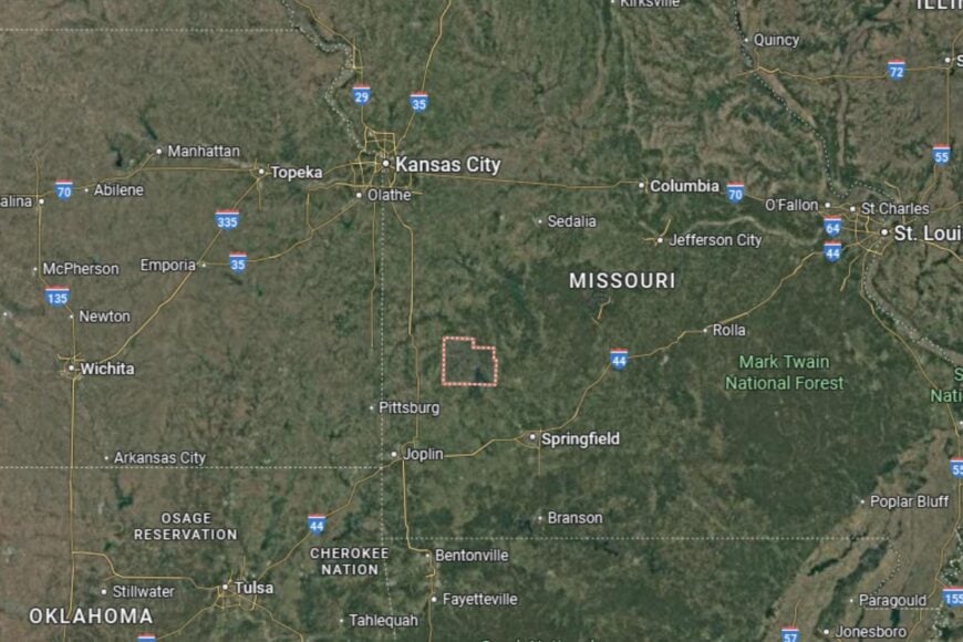
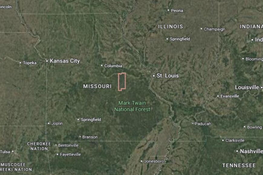
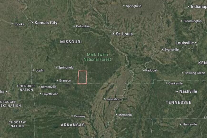
Where is Morgan County?
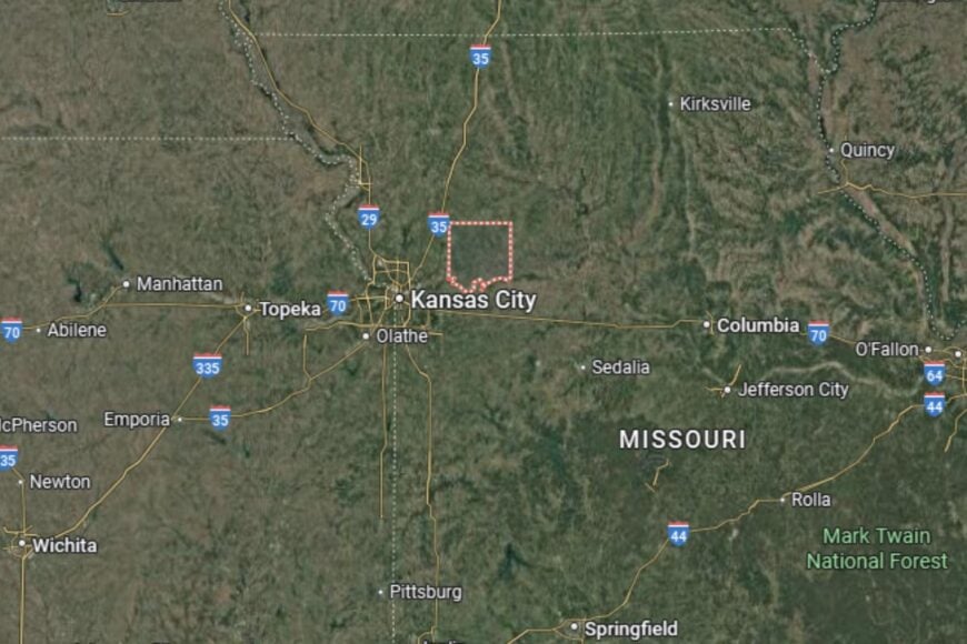
Morgan County is located in central Missouri, about 50 miles southwest of Jefferson City. The county seat, Versailles, sits along Missouri Highway 52, offering easy access to nearby regions.
The county is bordered by Camden to the south and Moniteau to the north. Its position near the Lake of the Ozarks makes it a popular destination for outdoor enthusiasts. Morgan County combines natural beauty with small-town character.
#49. Polk County (tie)
– Life expectancy: 74.7 years
— 1.1 years lower than the state average

About
Polk County blends agricultural traditions with higher education and cultural life. Farming and ranching provide a steady foundation, while Bolivar, the county seat, is home to Southwest Baptist University, giving the area an academic influence. Residents value both rural simplicity and opportunities for learning.
Community events, sports, and festivals bring people together, while healthcare and civic organizations support local stability. Outdoor recreation, including fishing and camping, rounds out the county’s appeal. Polk County is a place where education and agriculture work side by side.
Where is Polk County?
Polk County is located in southwestern Missouri, about 30 miles north of Springfield. The county seat, Bolivar, lies along U.S. Highway 13, which connects the area to larger regional centers.
The county is bordered by Hickory to the north and Greene to the south. Its rolling farmland and wooded areas provide both scenic beauty and agricultural productivity. Polk County’s location makes it a vital part of Missouri’s Ozarks region.
#48. Henry County (tie)
– Life expectancy: 74.7 years
— 1.1 years lower than the state average
About
Henry County is a western Missouri county with a rich agricultural base and a strong sense of community. Farming, especially corn and soybeans, drives the economy, while small industries and services support the towns. Clinton, the county seat, serves as a regional hub for healthcare and retail.
Community pride is reflected in county fairs, parades, and civic organizations that bring people together. Residents enjoy outdoor opportunities such as fishing and boating on Truman Lake. Henry County maintains its farming traditions while embracing modern services.
Where is Henry County?
Henry County is located in western Missouri, about 70 miles southeast of Kansas City. The county seat, Clinton, lies along Missouri Highway 7, a major route through the region.
The county is bordered by Johnson to the north and Benton to the south. Truman Lake, a large reservoir, adds to its recreational appeal. Henry County’s location makes it both an agricultural producer and a recreational destination.
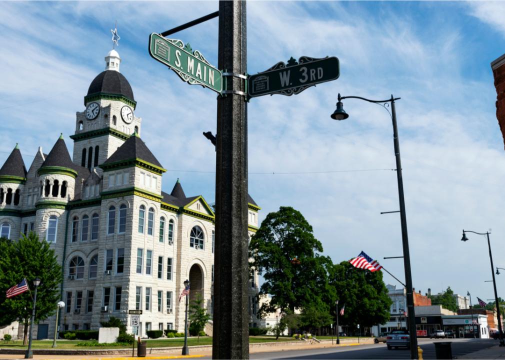
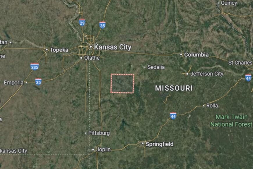
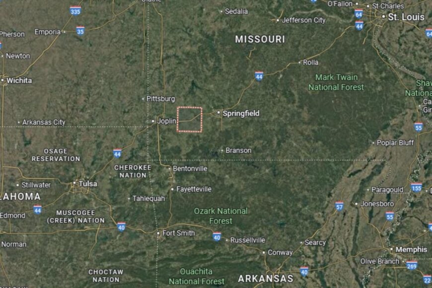
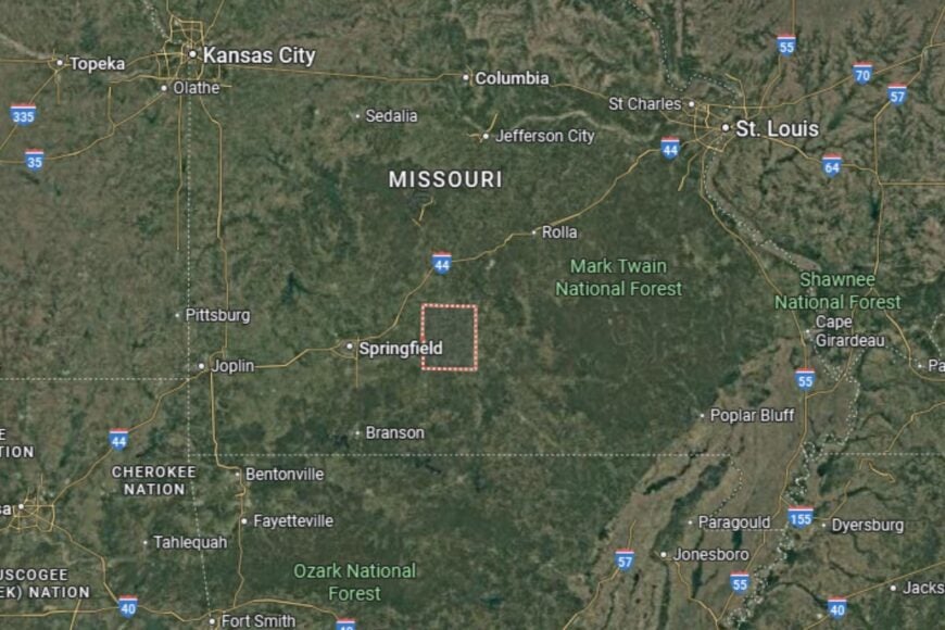
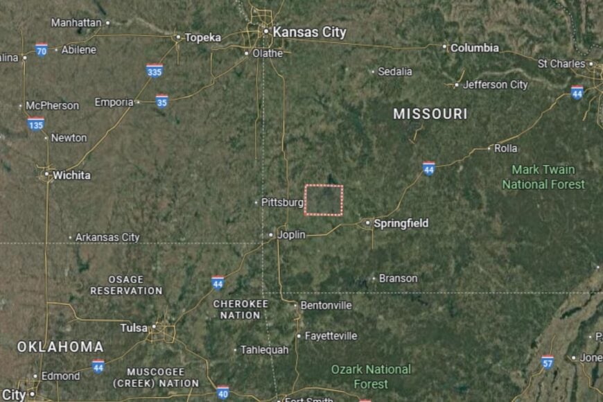
#47. Jasper County (tie)
– Life expectancy: 74.6 years
— 1.2 years lower than the state average
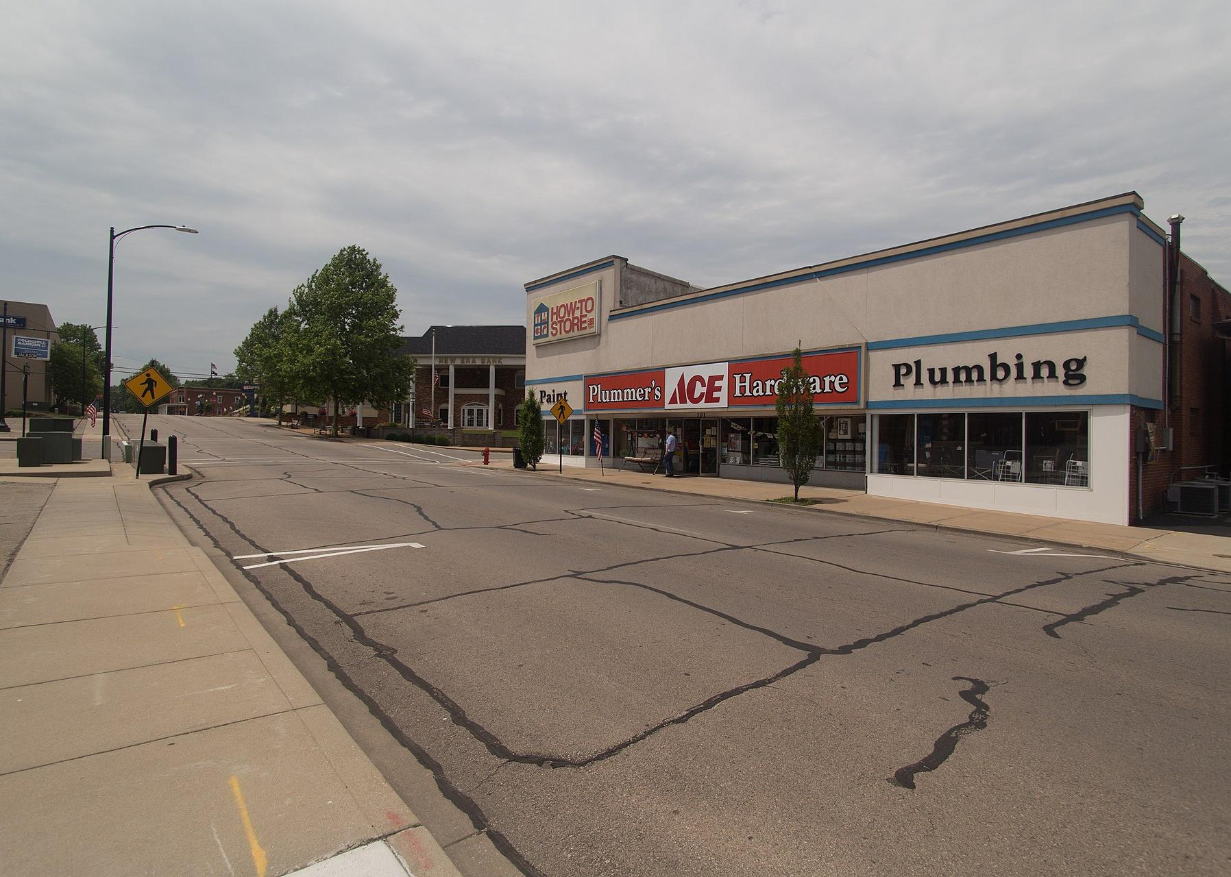
About
Jasper County combines farming with a strong industrial and cultural presence. Agriculture plays a role, but cities like Joplin and Carthage make the county a hub for commerce, healthcare, and education in southwestern Missouri. The area has deep ties to Route 66 and a history shaped by mining.
Community life is vibrant, with festivals, art events, and historic districts that highlight local pride. Residents benefit from both rural traditions and urban conveniences. Jasper County thrives on its mix of heritage, industry, and cultural activity.
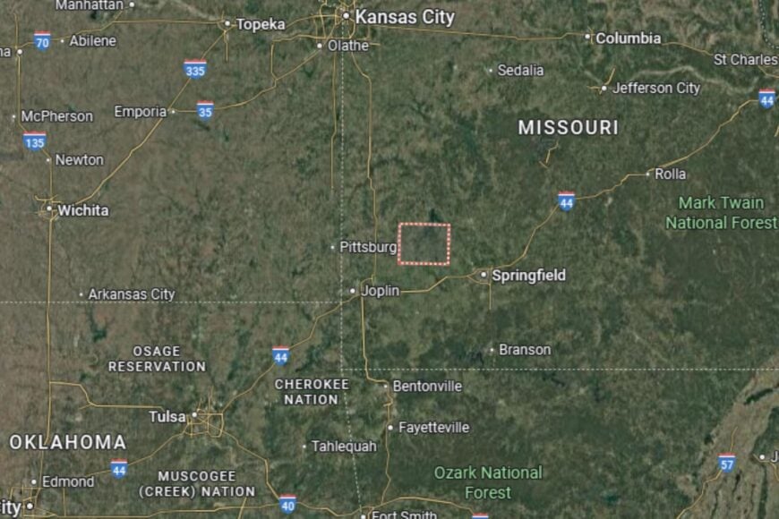
Where is Jasper County?
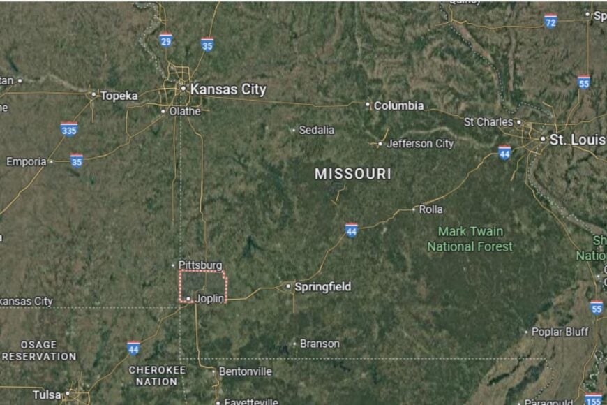
Jasper County is located in southwestern Missouri, directly along the Kansas border. The county seat, Carthage, lies along Interstate 49 and Historic Route 66, giving it excellent connectivity.
The county borders Newton to the south and Barton to the north. Its location makes it part of the Joplin metropolitan area, a key hub in the region. Jasper County is both historically significant and economically diverse.
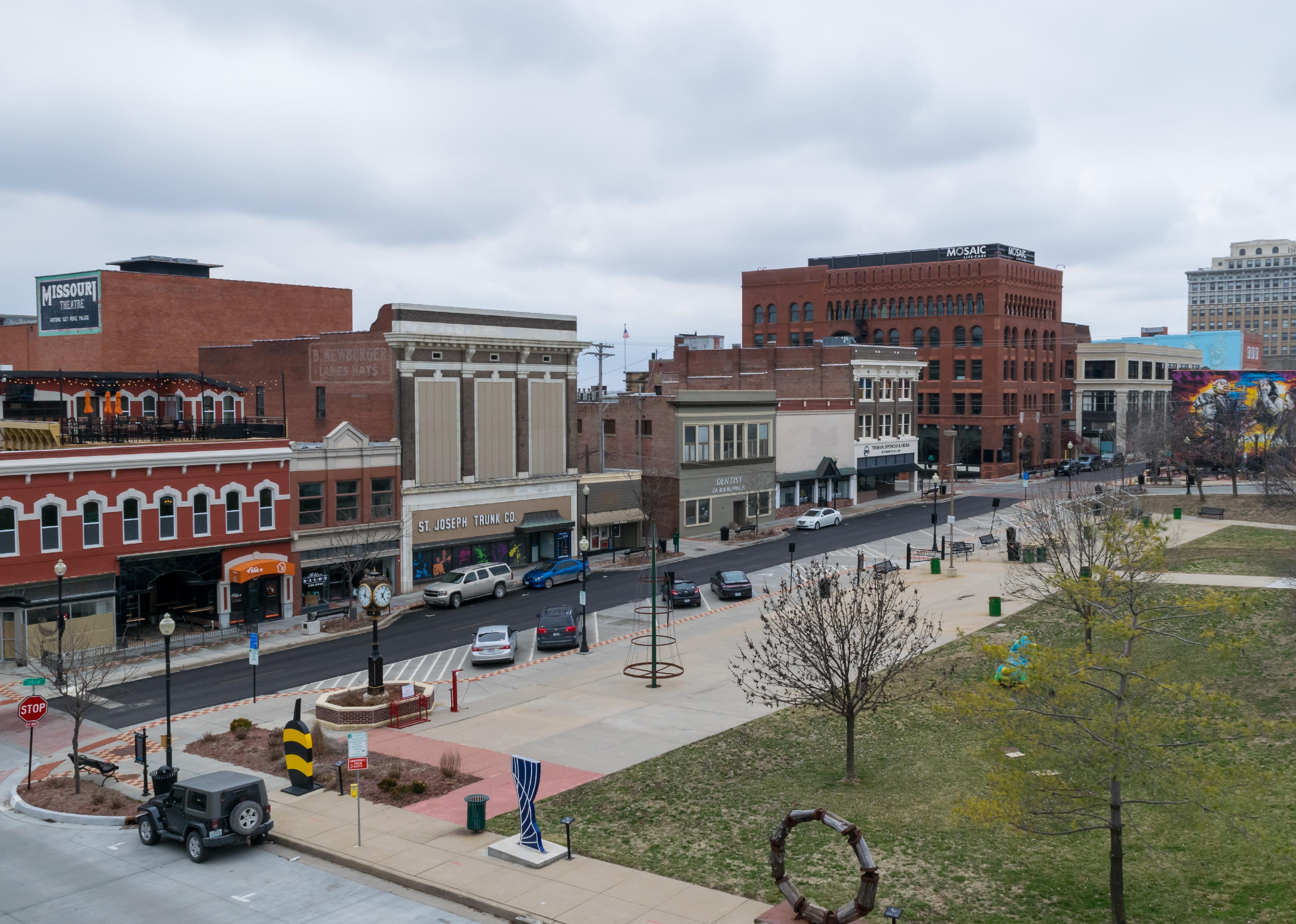
#46. Buchanan County (tie)
– Life expectancy: 74.6 years
— 1.2 years lower than the state average
You may also like: Which movies were filmed in Missouri?
About
Buchanan County is a northwestern Missouri county with a strong urban and industrial identity. St. Joseph, the county seat, anchors the local economy with healthcare, education, and manufacturing. While agriculture still plays a role, the county has long been shaped by its position as a transportation and trade hub.
Community life is enriched by historic architecture, museums, and cultural events. Parks, trails, and civic organizations add to residents’ quality of life. Buchanan County reflects both the history and growth of Missouri’s riverfront communities.
Where is Buchanan County?
Buchanan County is located in northwestern Missouri, about 55 miles north of Kansas City. The county seat, St. Joseph, lies along Interstate 29 and U.S. Highway 36, providing direct access to regional markets.
The county is bordered by Andrew to the north and Platte to the south. Its position along the Missouri River has shaped both its history and economy. Buchanan County stands as one of Missouri’s key industrial and cultural centers.
#45. Gentry County (tie)
– Life expectancy: 74.6 years
— 1.2 years lower than the state average
About
Gentry County is a small, rural county where farming defines daily life. Grain crops like corn and soybeans dominate the fields, while livestock production adds to the economy. Its towns are small but close-knit, with traditions rooted in agriculture and family values.
Community pride is seen in county fairs, local gatherings, and schools that bring neighbors together. Residents enjoy a slower pace of life and the natural beauty of rural Missouri. Gentry County remains a place where farming and tradition are inseparable.
Where is Gentry County?
🔥 Would you like to save this?
Gentry County is located in northwestern Missouri, about 90 miles northeast of Kansas City. The county seat, Albany, lies along U.S. Highway 136, an important east–west corridor.
The county borders Worth County to the north and Nodaway County to the west. Its rolling farmland and prairies dominate the geography, anchoring Gentry County in Missouri’s agricultural heartland.
#44. Cedar County (tie)
– Life expectancy: 74.5 years
— 1.3 years lower than the state average
About
Cedar County is a rural county in southwest Missouri where agriculture is central to the economy. Farming, ranching, and small businesses support the area, while Stockton Lake provides recreation and tourism opportunities. Residents value both their farming traditions and the natural resources around them.
Community life includes fairs, festivals, and civic organizations that highlight local pride. Outdoor enthusiasts enjoy fishing, boating, and camping at Stockton Lake. Cedar County thrives on its combination of rural strength and recreational appeal.
Where is Cedar County?
Cedar County is located in southwestern Missouri, about 50 miles northwest of Springfield. The county seat, Stockton, sits along Missouri Highway 32.
The county is bordered by St. Clair to the north and Dade to the south. Stockton Lake, a large reservoir, shapes its economy and lifestyle. Cedar County’s location gives it both agricultural productivity and recreational draw.
#43. Stoddard County (tie)
– Life expectancy: 74.5 years
— 1.3 years lower than the state average
About
Stoddard County is a southeastern Missouri county with a strong agricultural base. Cotton, soybeans, and rice farming dominate the local economy, reflecting its location in the Bootheel region. Residents value their farming traditions and the stability of rural living.
Community spirit is celebrated through fairs, parades, and civic events. Parks, schools, and local organizations foster strong connections among residents. Stoddard County is defined by its agricultural heritage and tight-knit communities.
Where is Stoddard County?
Stoddard County is located in southeastern Missouri, about 30 miles west of the Mississippi River. The county seat, Bloomfield, lies along U.S. Highway 60, a major east–west route.
The county borders Cape Girardeau to the north and Dunklin to the south. Its fertile soils make it one of Missouri’s key farming areas. Stoddard County’s geography places it in the heart of the Bootheel’s agricultural belt.
#42. Ray County (tie)
– Life expectancy: 74.5 years
— 1.3 years lower than the state average

About
Ray County combines a strong agricultural tradition with suburban influences from nearby Kansas City. Farming remains important, with corn and soybeans dominating, but commuting has grown as residents seek opportunities in the metro area. This balance gives Ray County both rural charm and suburban access.
Local events, schools, and civic programs reinforce the county’s sense of identity. Residents enjoy a mix of small-town living and proximity to city amenities. Ray County thrives on its dual role as farmland and suburban community.
Where is Ray County?
Ray County is located in western Missouri, about 35 miles northeast of Kansas City. The county seat, Richmond, sits along Missouri Route 10 and Missouri Route 13, providing access to nearby regional hubs.
The county borders Clay County to the west and Carroll County to the east. Its geography includes rolling farmland and wooded areas, placing Ray County firmly within the Kansas City metropolitan region while retaining a rural identity.
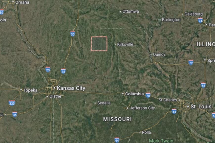
#41. Douglas County (tie)
– Life expectancy: 74.5 years
— 1.3 years lower than the state average
You may also like: Counties where children have the best opportunity for economic mobility in Missouri
About
Douglas County is a southern Missouri county known for its rugged Ozark landscape. Farming and ranching, particularly cattle, are the backbone of the economy, though the terrain makes agriculture more challenging than in other regions. Residents appreciate the county’s natural beauty and self-reliant traditions.
Community life centers on schools, fairs, and small-town events. Outdoor recreation, including hunting, hiking, and fishing, is a major part of local culture. Douglas County is defined by its Ozark heritage and rural resilience.
Where is Douglas County?
Douglas County is located in southern Missouri, about 40 miles southeast of Springfield. The county seat, Ava, lies along Missouri Highway 5.
The county is bordered by Wright to the north and Ozark to the south. Its geography is dominated by hills, forests, and streams typical of the Ozarks. Douglas County’s location makes it both scenic and distinctly rural.
#40. Atchison County (tie)
– Life expectancy: 74.5 years
— 1.3 years lower than the state average
About
Atchison County is a sparsely populated county in the far northwest corner of Missouri. Agriculture dominates the economy, with corn and soybeans covering the fertile floodplains. Small towns provide the foundation for community life, where neighbors know each other and traditions are carried forward.
Local pride is strong, with festivals, fairs, and civic organizations tying residents together. Hunting, fishing, and birdwatching along the Missouri River are popular outdoor activities. Atchison County thrives on its farmland and the endurance of rural culture.
Where is Atchison County?
Atchison County is located in the far northwestern corner of Missouri, directly bordering Iowa and Nebraska. The county seat, Rock Port, sits along Interstate 29, a major north–south highway.
The Missouri River forms its western boundary, connecting it historically to trade and transportation. Neighboring counties include Holt to the south and Page County, Iowa, to the north. Atchison County’s position at a tri-state junction makes it geographically distinctive.
#39. Marion County (tie)
– Life expectancy: 74.5 years
— 1.3 years lower than the state average
About
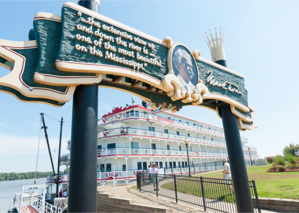
Marion County is a northeastern Missouri county known for its Mississippi River heritage. Hannibal, the county seat, is famous as the boyhood home of Mark Twain, giving the area international recognition. Agriculture, river commerce, and tourism all play roles in the local economy.
Residents benefit from cultural events, historic landmarks, and outdoor recreation along the river. Schools, healthcare services, and civic organizations provide stability. Marion County blends agricultural strength with cultural heritage and tourism.
Where is Marion County?
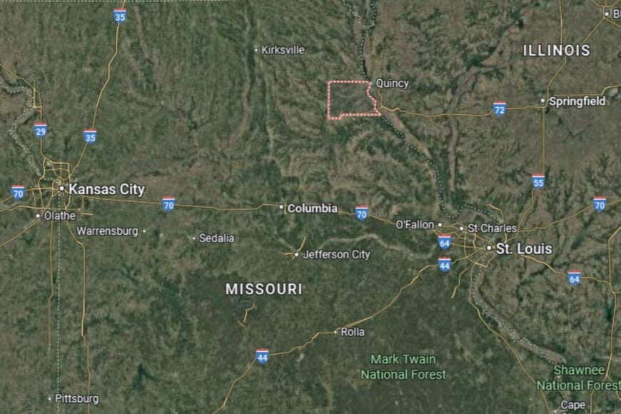
🔥 Would you like to save this?
Marion County is located in northeastern Missouri, along the Mississippi River. The county seat, Hannibal, lies about 100 miles north of St. Louis along U.S. Highway 61.
The county borders Ralls to the south and Lewis to the north. Its riverfront location has long made it a transportation and trade hub. Marion County’s geography ties it directly to Missouri’s river history.
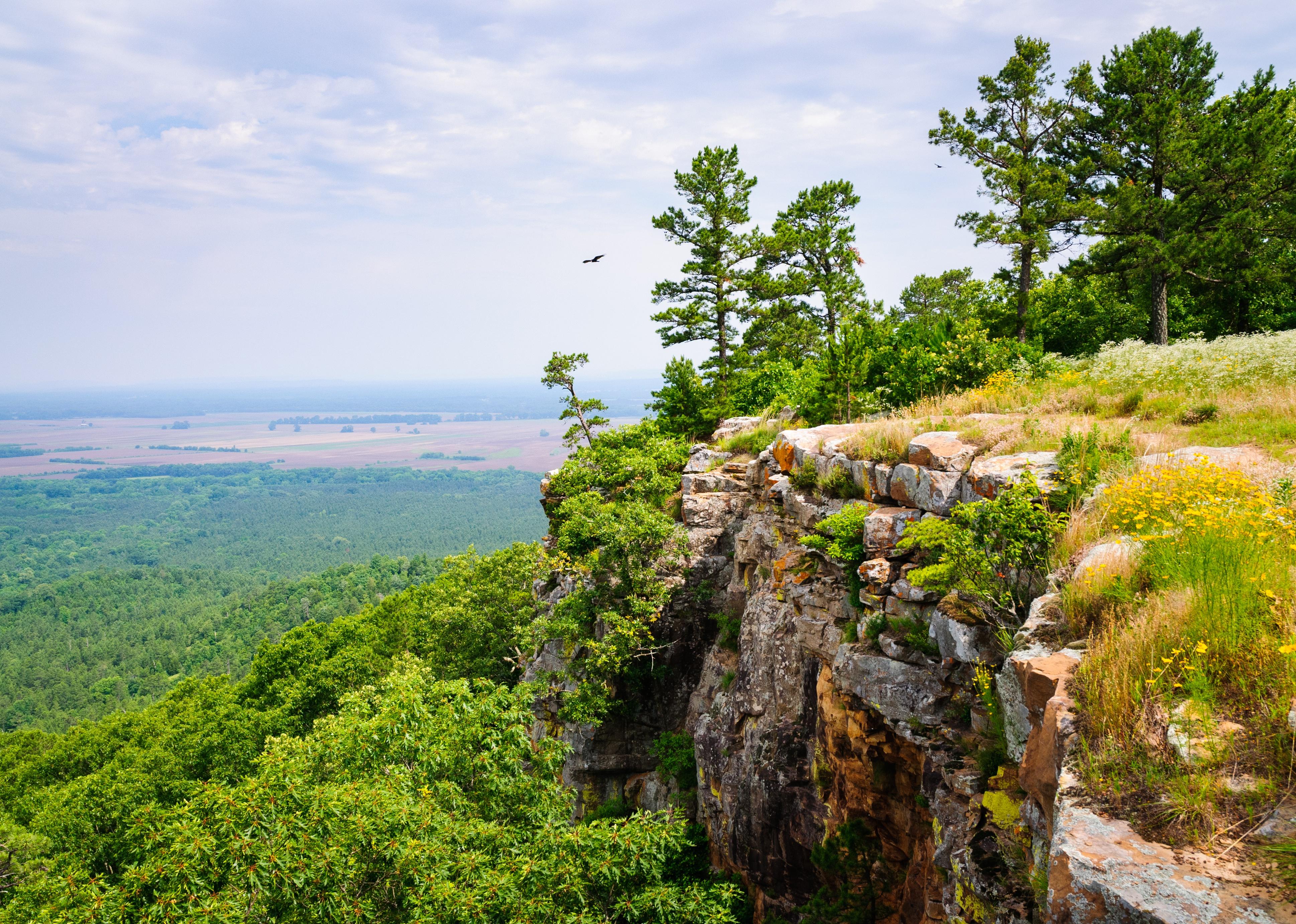
#38. Ozark County (tie)
– Life expectancy: 74.4 years
— 1.4 years lower than the state average
About
Ozark County is a southern Missouri county defined by rugged landscapes and natural beauty. Farming and ranching are limited by terrain, but forestry, tourism, and small-scale agriculture contribute to the economy. Residents value self-reliance and the quiet pace of Ozark living.
Community life centers on fairs, school events, and churches that knit residents together. Outdoor recreation—especially fishing, hiking, and boating on Bull Shoals Lake—is a major draw. Ozark County is a place where nature and community remain closely connected.
Where is Ozark County?

Ozark County lies in southern Missouri along the Arkansas border. The county seat, Gainesville, is located on Missouri Highway 5, which runs north–south through the Ozarks.
It is bordered by Douglas County to the north and Oregon County to the east. Bull Shoals Lake defines much of its southern edge, offering both recreation and economic value. Ozark County’s geography makes it a gateway to the heart of the southern Ozarks.
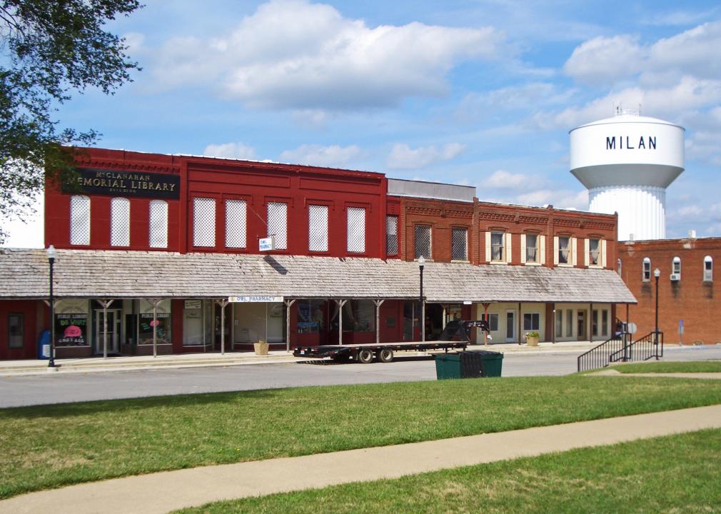
#37. Sullivan County (tie)
– Life expectancy: 74.4 years
— 1.4 years lower than the state average

About
Sullivan County is a northern Missouri county where agriculture is the foundation of life. Corn and soybean fields stretch across the prairies, while small livestock farms provide additional support. Its towns are modest but proud, with traditions rooted in farming and family.
Community events, county fairs, and school activities bring residents together. Hunting, fishing, and outdoor activities remain a part of everyday culture. Sullivan County exemplifies the resilience of small-town rural Missouri.
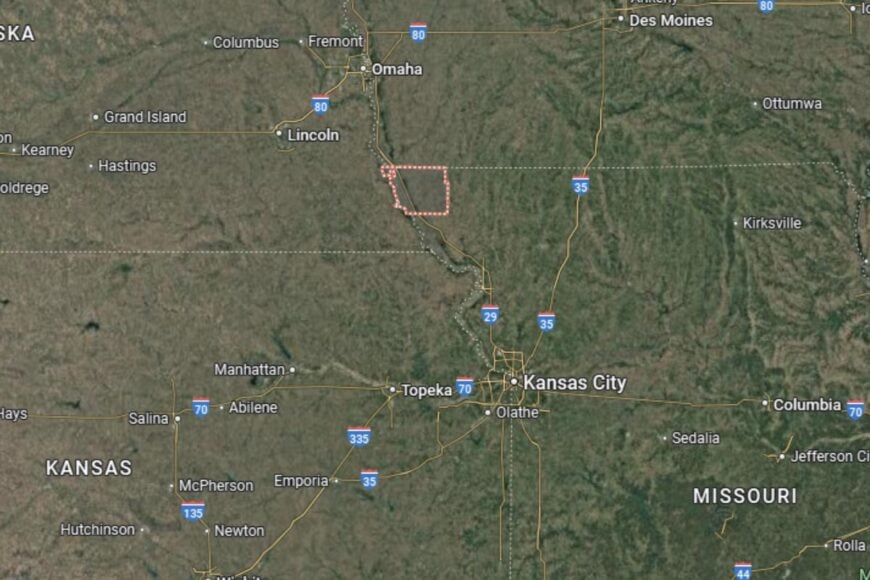
Where is Sullivan County?
Sullivan County is located in north-central Missouri, about 40 miles north of Macon. The county seat, Milan, lies along Missouri Highway 6, which connects it to neighboring regions.
The county borders Putnam to the north and Linn to the south. Its rolling farmland and prairies dominate the landscape. Sullivan County’s location keeps it firmly tied to Missouri’s agricultural economy.
#36. Vernon County (tie)
– Life expectancy: 74.4 years
— 1.4 years lower than the state average
You may also like: Highest-rated breweries in Missouri

About
Vernon County is a western Missouri county with strong agricultural traditions and a unique Civil War history. Farming and ranching dominate the economy, while Nevada, the county seat, serves as a regional hub for healthcare, retail, and education. The county also has historic significance as the site of several Civil War battles.
Residents enjoy a mix of small-town living and historical pride. Community events, museums, and festivals highlight local heritage, while outdoor activities keep families connected. Vernon County balances farming roots with cultural history.
Where is Vernon County?

Vernon County is located in western Missouri, along the Kansas border. The county seat, Nevada, lies along U.S. Highway 54 and U.S. Highway 71, providing strong regional access.
The county borders Bates to the north and Barton to the south. Its location gives it both agricultural productivity and historic character. Vernon County is a gateway between Missouri and Kansas farm country.
#35. Caldwell County (tie)
– Life expectancy: 74.4 years
— 1.4 years lower than the state average
About
Caldwell County carries a fascinating chapter of American history as one of the original settlements for members of the Church of Jesus Christ of Latter-day Saints in the 1830s. That legacy still draws interest from historians. Today, the economy blends farming with small businesses that serve its rural communities.
Community life is marked by schools, fairs, and historic preservation efforts that celebrate its unique past. Outdoor recreation includes hunting, fishing, and exploring the rolling hills typical of northwestern Missouri. Caldwell County’s identity is shaped as much by its history as its farmland.
Where is Caldwell County?

Caldwell County is located in northwestern Missouri, about 60 miles northeast of Kansas City. The county seat, Kingston, lies along Missouri Highway 13.
It is bordered by Livingston County to the north and Ray County to the south. Its location makes it both historically significant and firmly tied to Missouri’s agricultural belt. Caldwell County is where history and rural tradition intersect.
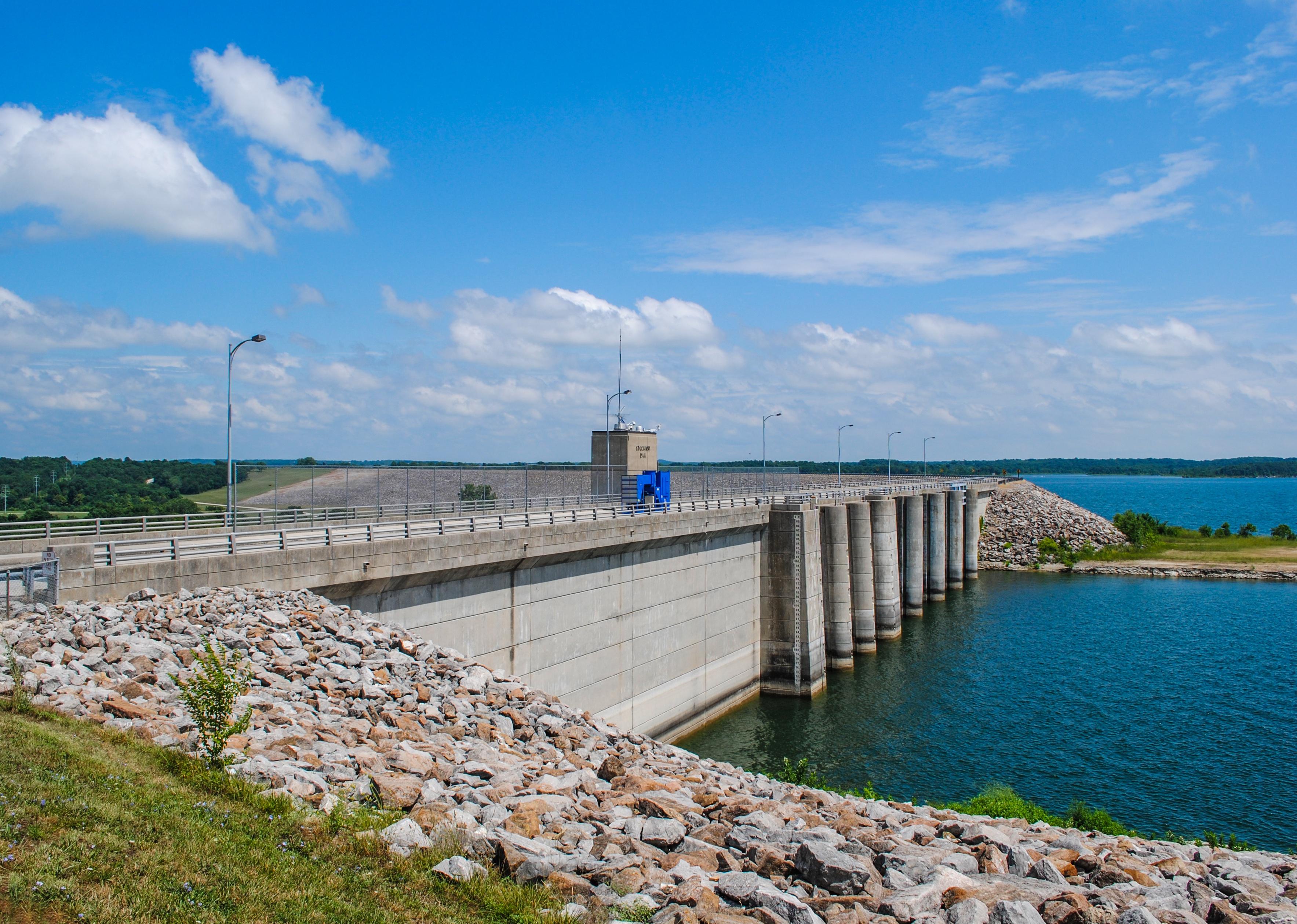
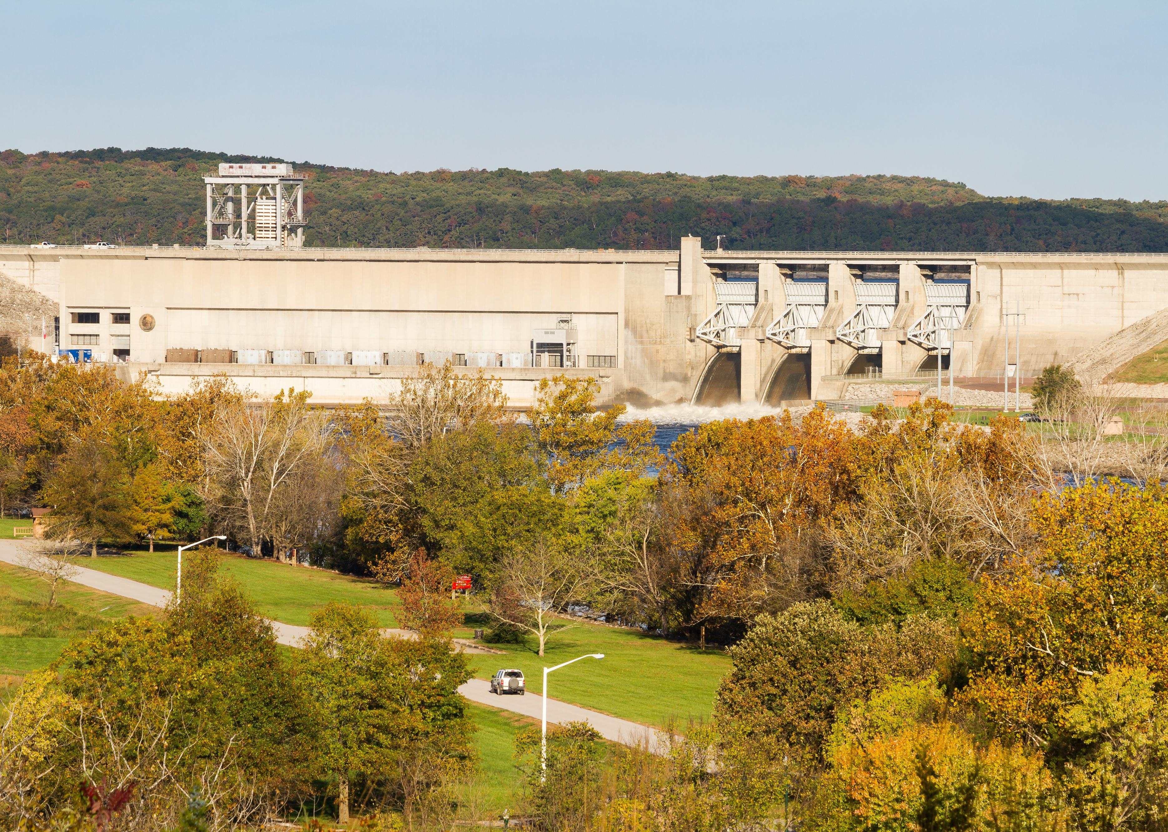
#34. Benton County (tie)
– Life expectancy: 74.3 years
— 1.5 years lower than the state average

🔥 Would you like to save this?
About
Benton County is best known for its ties to Truman Lake, a massive reservoir that fuels tourism and recreation. Fishing, boating, and camping draw visitors year-round, making tourism a major economic driver alongside traditional farming. Residents enjoy both a rural lifestyle and the benefits of being near one of Missouri’s largest lakes.
The county also has cultural appeal, with local art galleries, antique shops, and community events in towns like Warsaw. Benton County represents a blend of outdoor adventure, small-town charm, and natural beauty.
Where is Benton County?
Benton County is located in central Missouri, about 75 miles southeast of Kansas City. The county seat, Warsaw, sits along U.S. Highway 65 and near Truman Dam.
The county is bordered by Pettis to the north and Hickory to the south. Its geography is dominated by lake shoreline and rolling Ozark foothills. Benton County’s location makes it a recreational hub in central Missouri.
#33. Lawrence County (tie)
– Life expectancy: 74.3 years
— 1.5 years lower than the state average
About
Lawrence County, nestled in the Ozarks, blends agricultural traditions with historic ties to Route 66. Farming is still important, but tourism and small manufacturing also play roles in the economy. Mount Vernon, the county seat, is home to the annual Apple Butter Makin’ Days festival, a beloved local tradition.
Cultural pride is strong, with historic courthouses and Route 66 landmarks highlighting its heritage. Outdoor enthusiasts enjoy the rivers and trails that wind through the region. Lawrence County thrives on its mix of rural charm and cultural identity.
Where is Lawrence County?
Lawrence County is located in southwestern Missouri, about 30 miles west of Springfield. The county seat, Mount Vernon, lies along Interstate 44, a key east–west route across the state.
The county is bordered by Greene to the east and Jasper to the west. Its position along Route 66 ties it to America’s transportation history. Lawrence County is both agriculturally rich and historically memorable.
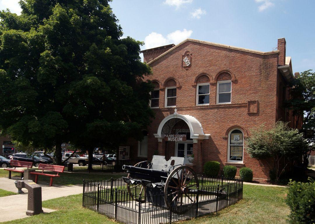
#32. Pulaski County
– Life expectancy: 74.2 years
— 1.6 years lower than the state average
About
Pulaski County is unique in Missouri as the home of Fort Leonard Wood, a major U.S. Army training installation. The base drives much of the county’s economy, alongside small businesses, hospitality, and outdoor tourism. Agriculture plays a smaller role compared to neighboring counties.
Community life benefits from cultural diversity brought by military families. Museums, historic sites, and outdoor activities such as floating the Gasconade and Big Piney Rivers add to the county’s character. Pulaski County blends rural roots with military tradition.
Where is Pulaski County?

Pulaski County is located in central Missouri, in the Ozark Plateau. The county seat, Waynesville, lies along Interstate 44 between Springfield and St. Louis.
The county is bordered by Phelps to the east and Laclede to the west. Its landscape features rivers, hills, and forested valleys. Pulaski County’s location makes it both a military hub and a natural getaway.
#31. Putnam County
– Life expectancy: 74.0 years
— 1.8 years lower than the state average
You may also like: Counties with the longest life expectancy in Missouri
About
Putnam County is a quiet northern Missouri county where farming remains the central way of life. Corn, soybeans, and livestock dominate the economy, but its rural culture is also defined by close-knit towns and a love of the outdoors.
Community events highlight the area’s traditions, from fairs to hunting season gatherings. Unionville, the county seat, offers small-town amenities alongside historic charm. Putnam County reflects the quiet strength of Missouri’s northern plains.
Where is Putnam County?

Putnam County is located in north-central Missouri, directly along the Iowa border. The county seat, Unionville, sits at the junction of U.S. Highway 136 and Missouri Highway 5.
The county borders Appanoose County, Iowa, to the north and Sullivan County to the south. Its rolling farmland and prairies are typical of the region. Putnam County’s location ties it to both Missouri and southern Iowa agricultural networks.
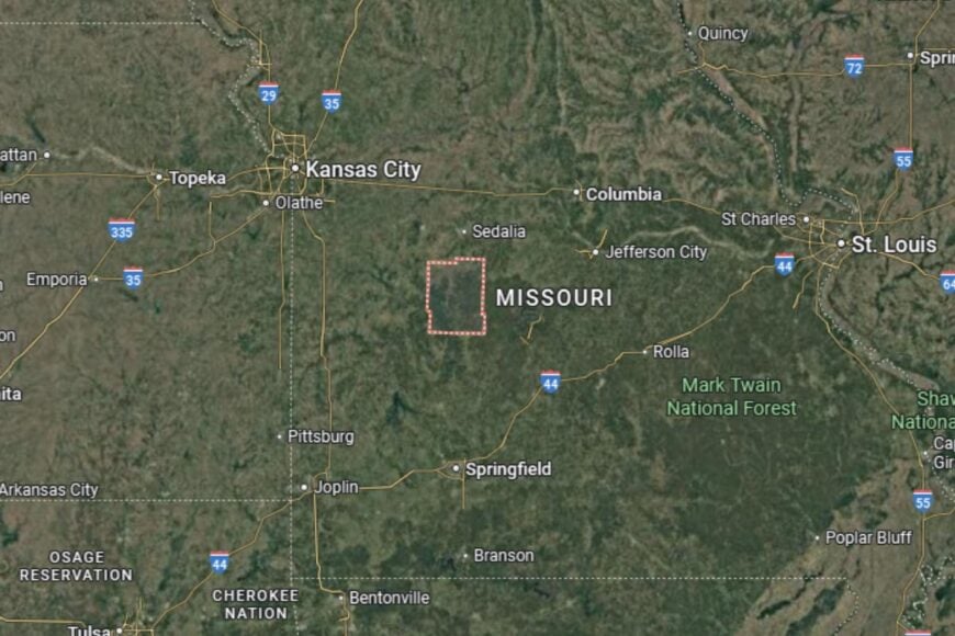
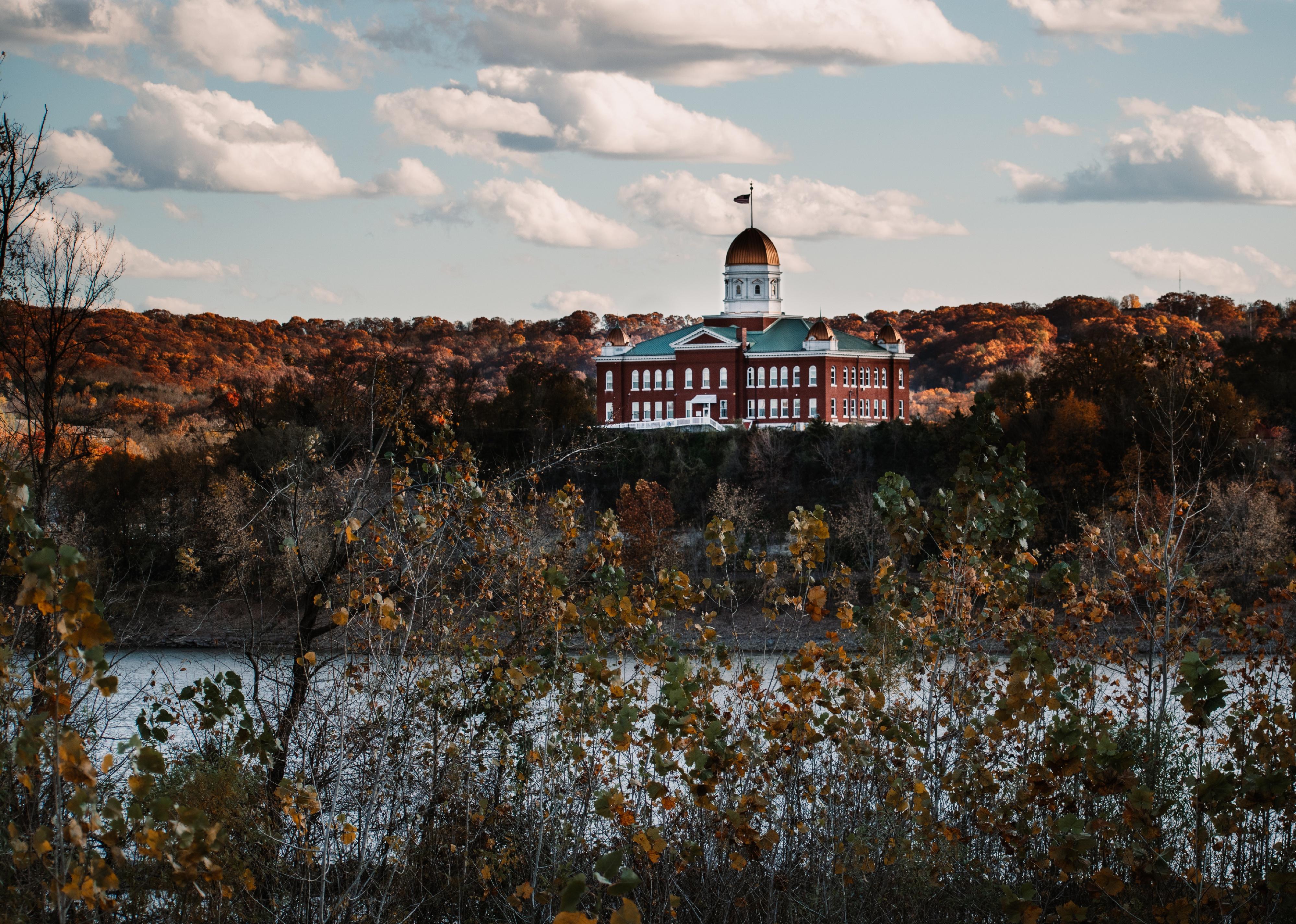
#30. Phelps County
– Life expectancy: 73.9 years
— 1.9 years lower than the state average

About
Phelps County is known as an educational and research hub in Missouri thanks to Missouri University of Science and Technology in Rolla. The university attracts students from across the globe, fueling innovation and a strong local economy. Beyond education, the county also supports healthcare, manufacturing, and small business.
Cultural life is enriched by the university, with art, music, and science festivals bringing people together. Outdoor recreation thrives as well, with rivers and forests nearby. Phelps County blends academia with small-town Missouri life.
Where is Phelps County?
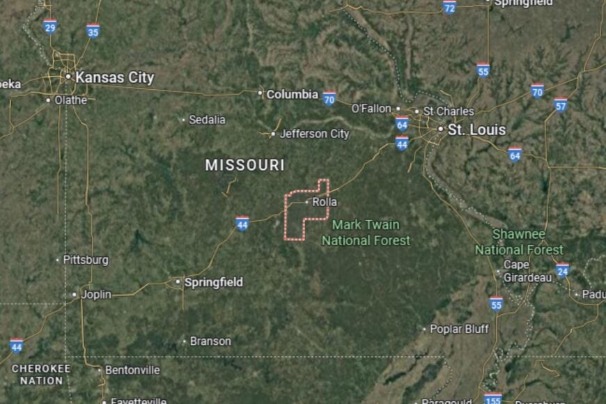
Phelps County is located in central Missouri, about 100 miles southwest of St. Louis. The county seat, Rolla, sits directly along Interstate 44, a major cross-state route.
The county is bordered by Pulaski to the west and Dent to the southeast. Its landscape includes parts of the Ozark Highlands and the Gasconade River. Phelps County is a crossroads of education, culture, and outdoor adventure.
#29. Montgomery County (tie)
– Life expectancy: 73.8 years
— 2.0 years lower than the state average
About
Montgomery County is a mix of agriculture and transportation influence, with Interstate 70 running through its center. Corn and soybean farming are staples, while wineries and small businesses add character. The county has historic significance with sites tied to early Missouri settlement.
Community activities often center on fairs, school sports, and local history. Its blend of fertile farmland and easy access to Missouri’s metro areas gives Montgomery County a dual rural-urban identity.
Where is Montgomery County?

Montgomery County is located in east-central Missouri, between Columbia and St. Louis. The county seat, Montgomery City, sits just off Interstate 70.
The county is bordered by Audrain to the north and Warren to the east. Its proximity to major highways makes it well connected, while its farmland roots keep it grounded. Montgomery County serves as a bridge between rural Missouri and urban centers.
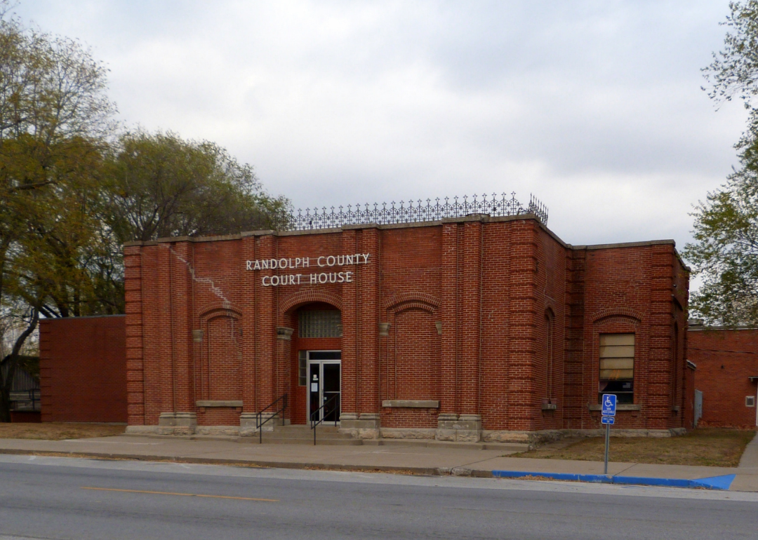
#28. Randolph County (tie)
– Life expectancy: 73.8 years
— 2.0 years lower than the state average

About
Randolph County is historically known as the “Randolph Coalfield,” with a legacy of mining that shaped its towns. Today, agriculture and small industries drive the economy, with Moberly, the county seat, serving as a regional hub for business and education. The area also has ties to railroad history.
Residents enjoy a strong cultural scene, with theaters, festivals, and historic architecture adding charm. Outdoor opportunities, from fishing to hiking, round out local life. Randolph County balances history with small-town progress.
Where is Randolph County?
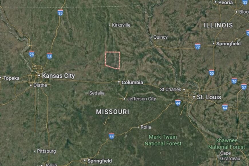
Randolph County is located in north-central Missouri, about 35 miles north of Columbia. The county seat, Moberly, lies along U.S. Highway 63, a key north–south route.
It is bordered by Macon to the north and Howard to the south. Its location places it within easy reach of larger cities while retaining its rural identity. Randolph County is both historically significant and regionally connected.
#27. Oregon County (tie)
– Life expectancy: 73.8 years
— 2.0 years lower than the state average
About
Oregon County sits deep in the Ozarks, where rugged terrain and forests dominate the landscape. Agriculture and logging are key economic drivers, but outdoor tourism is increasingly important thanks to the Eleven Point National Scenic River. Residents value independence and the quiet pace of rural life.
Cultural identity is tied to the natural environment, with festivals and events celebrating Ozark heritage. Hunting, fishing, and canoeing bring both locals and visitors to the county’s rivers and hills. Oregon County thrives on its blend of tradition and natural beauty.
Where is Oregon County?
Oregon County is located in southern Missouri, along the Arkansas border. The county seat, Alton, sits on U.S. Highway 160, connecting it to surrounding Ozark communities.
It is bordered by Ripley County to the west and Howell County to the north. Its rugged terrain of rivers, forested hills, and valleys defines the landscape, making Oregon County a natural retreat in Missouri’s Ozark Highlands.
#26. Reynolds County (tie)
– Life expectancy: 73.7 years
— 2.1 years lower than the state average
You may also like: Counties where homes are selling the fastest in Missouri
About
Reynolds County is a scenic area in the eastern Ozarks known for its stunning landscapes. Johnson’s Shut-Ins State Park and the Black River make it a destination for outdoor enthusiasts. Agriculture and forestry support the economy, but tourism tied to natural attractions is vital.
Residents enjoy community life shaped by the outdoors—fishing, hiking, and swimming are part of everyday recreation. Festivals and local traditions highlight pride in the county’s rugged beauty. Reynolds County is one of Missouri’s natural treasures.
Where is Reynolds County?
Reynolds County is located in southeastern Missouri, about 90 miles south of St. Louis. The county seat, Centerville, is a small town nestled in the Ozark hills.
It is bordered by Iron County to the north and Carter to the south. Its geography features rivers, forests, and state parks. Reynolds County’s location makes it a prime destination for Missouri outdoor tourism.
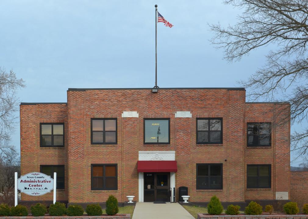
#25. Texas County (tie)
– Life expectancy: 73.7 years
— 2.1 years lower than the state average
About
Texas County is Missouri’s largest county by land area, sitting in the heart of the Ozarks. Agriculture remains vital, especially cattle ranching, while forestry and logging play a major role thanks to its vast wooded landscapes. The county’s history includes deep Ozark settlement roots, with small towns and family farms shaping its culture for generations.
Community life is defined by its rural character, with county fairs, rodeos, and hunting-season gatherings serving as highlights. Scenic rivers like the Big Piney and the Current make Texas County a haven for outdoor enthusiasts and a stronghold of Ozark traditions.
Where is Texas County?

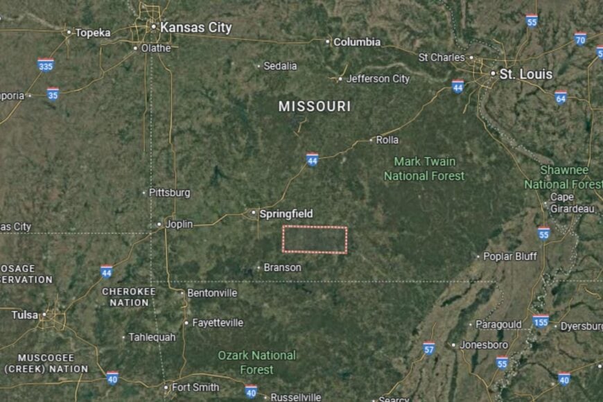
Texas County is located in southern Missouri, about 70 miles east of Springfield. The county seat, Houston, sits along U.S. Highway 63, a major north–south route through the Ozarks.
It is bordered by Dent County to the north and Howell County to the south. Its large size and heavily forested terrain make it both agriculturally productive and naturally scenic, a crossroads of the central Ozarks.
#24. Wright County (tie)
– Life expectancy: 73.7 years
— 2.1 years lower than the state average
About
Wright County is a southern Missouri county where agriculture and small-town traditions define daily life. Dairy and cattle farming play a major role, alongside crops like hay and corn. Its towns are modest but carry strong Ozark cultural traditions, emphasizing family and self-reliance.
The county is also known for its outdoor lifestyle, with ample opportunities for hunting, fishing, and hiking. Community pride comes alive in annual fairs, music events, and school gatherings. Wright County reflects the resilience and cultural heritage of the Ozarks.
Where is Wright County?
Wright County is located in southern Missouri, about 50 miles east of Springfield. The county seat, Hartville, sits along Missouri Highway 5.
It is bordered by Laclede County to the north and Douglas County to the south. Its rolling hills and wooded valleys create a scenic backdrop for rural living. Wright County’s location makes it a quiet but firmly rooted part of the Ozark region.
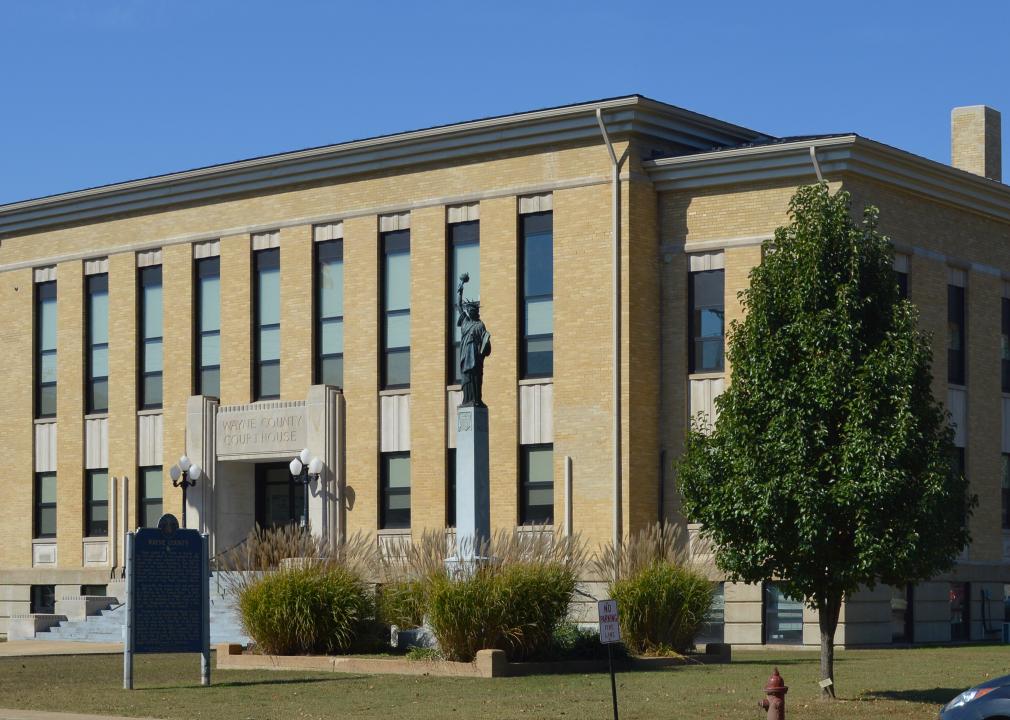
#23. Wayne County
– Life expectancy: 73.6 years
— 2.2 years lower than the state average
About
Wayne County is a southeastern Missouri county where outdoor recreation drives much of local life. Clearwater Lake and Sam A. Baker State Park attract thousands of visitors each year, making tourism an important complement to farming and small businesses. Logging and forestry also contribute to the economy.
Residents enjoy a close-knit lifestyle centered on festivals, school events, and community pride. The natural beauty of rivers and forests ensures Wayne County remains a destination for both residents and travelers.
Where is Wayne County?
Wayne County is located in southeastern Missouri, about 110 miles south of St. Louis. The county seat, Greenville, is located near U.S. Highway 67.
It is bordered by Iron County to the north and Butler County to the south. Its geography is defined by lakes, rivers, and forested Ozark terrain. Wayne County is an outdoor haven in the Missouri Ozarks.
#22. Gasconade County
– Life expectancy: 73.5 years
— 2.3 years lower than the state average
About
Gasconade County is a county with deep German-American roots, reflected in its historic towns, wineries, and festivals. Agriculture remains important, but the Missouri Rhineland wine region around Hermann gives the county a unique cultural and economic identity. Tourism tied to wine, history, and the Missouri River is a major driver.
Cultural pride is reflected in Oktoberfest celebrations, museums, and historic architecture. Residents benefit from both rural traditions and a thriving tourism industry. Gasconade County blends Old World heritage with modern Missouri charm.
Where is Gasconade County?
Gasconade County is located in east-central Missouri, about 80 miles west of St. Louis. The county seat, Hermann, lies along the Missouri River and U.S. Highway 19.
It is bordered by Franklin County to the east and Osage County to the west. Its rolling hills and river valleys make it a scenic and culturally distinctive region. Gasconade County’s location has made it a hub for Missouri’s wine industry.
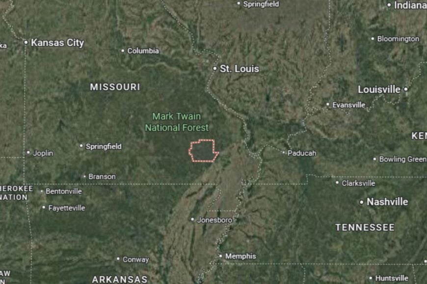
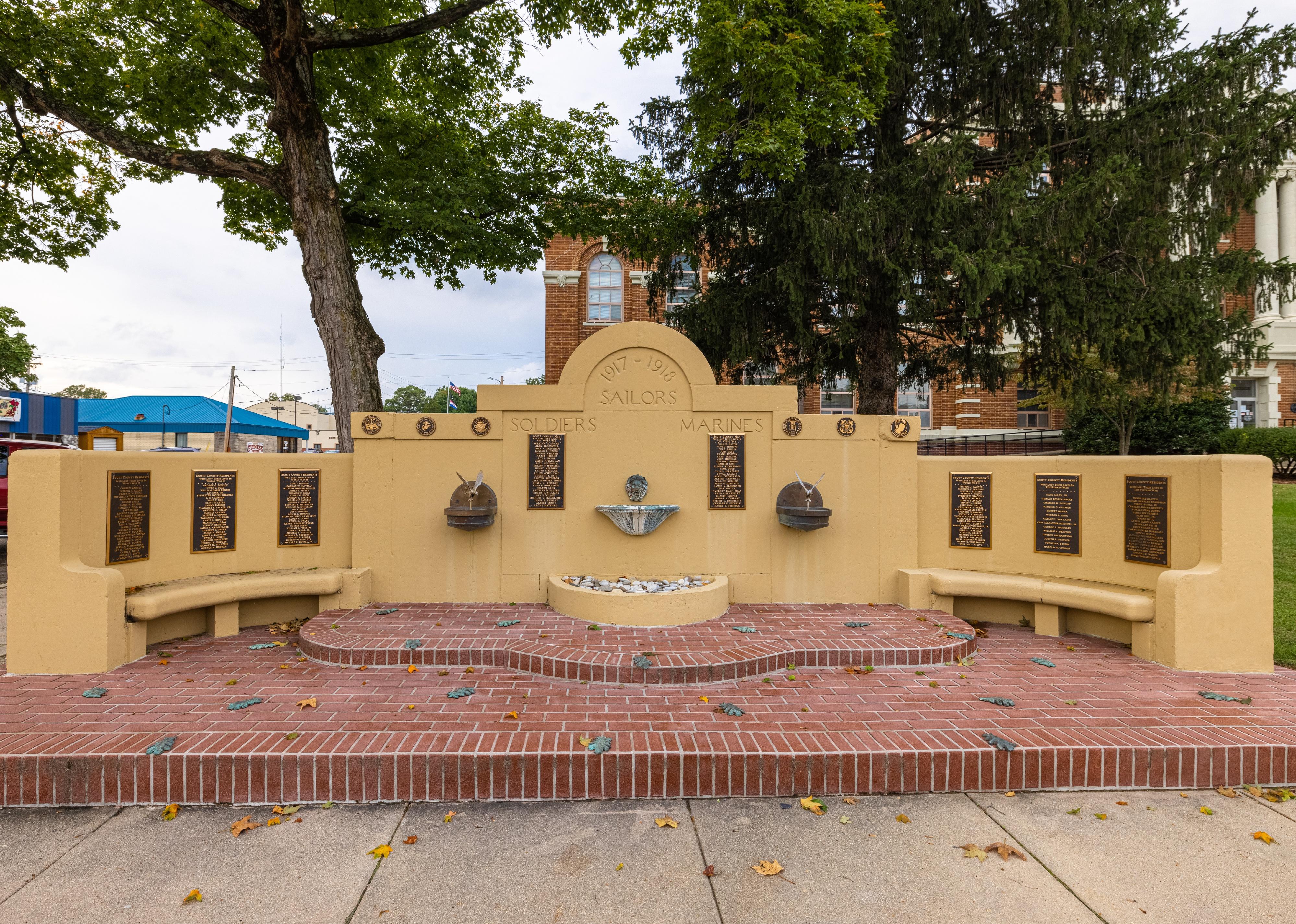
#21. Scott County
– Life expectancy: 73.3 years
— 2.5 years lower than the state average
You may also like: Counties with the lowest cost of living in Missouri

About
Scott County is a southeastern Missouri county with strong agricultural roots, particularly in cotton, soybeans, and rice farming. Its fertile lands have long made it one of the state’s key farming areas. The county also benefits from its proximity to the Mississippi River, which supports trade and transportation.
Community pride is reflected in fairs, sports, and cultural events that unite residents. Sikeston, the largest city, is famous for Lambert’s Café, “the home of throwed rolls,” which draws visitors from across the country.
Where is Scott County?
Scott County is located in southeastern Missouri, about 35 miles south of Cape Girardeau. The county seat, Benton, sits along Interstate 55, a major north–south route.
It is bordered by Cape Girardeau County to the north and Mississippi County to the south. Its location along the Mississippi River makes it both agriculturally productive and regionally significant. Scott County blends farm culture with quirky roadside Americana.
#20. Madison County
– Life expectancy: 73.2 years
— 2.6 years lower than the state average
About
Madison County is a southeastern Missouri county nestled in the Ozark Mountains. Its rugged terrain supports agriculture on a smaller scale, but the county is best known for its mining history. Granite quarries, in particular, have shaped both the economy and the landscape.
Community life thrives on outdoor traditions, with hiking, fishing, and camping in the Mark Twain National Forest playing a big role. Festivals and historic landmarks in towns like Fredericktown highlight the county’s deep ties to Missouri’s Ozark culture.
Where is Madison County?
Madison County is located about 80 miles south of St. Louis. The county seat, Fredericktown, sits along U.S. Highway 67, which links the area to larger markets.
It is bordered by St. Francois County to the north and Wayne County to the south. Its geography of forests, rivers, and mountains defines both its challenges and beauty. Madison County is a gateway into Missouri’s rugged Ozarks.
#19. Howell County
– Life expectancy: 73.1 years
— 2.7 years lower than the state average
About
Howell County, located in south-central Missouri, is a blend of agriculture, education, and healthcare. West Plains, the county seat, is a regional hub that serves southern Missouri and northern Arkansas with hospitals, schools, and retail centers. Farming, particularly cattle and hay production, remains an important part of its identity.
Cultural life is enriched by concerts, festivals, and the West Plains Civic Center, which brings entertainment to the region. Residents enjoy easy access to outdoor recreation on the North Fork and Eleven Point Rivers. Howell County is both a service hub and an Ozark stronghold.
Where is Howell County?
Howell County is located in southern Missouri, directly along the Arkansas border. The county seat, West Plains, lies on U.S. Highway 63.
It is bordered by Texas County to the north and Oregon County to the east. Its landscape of hills, rivers, and farmland gives it both agricultural productivity and recreational appeal. Howell County’s location makes it a vital link between Missouri and Arkansas.
#18. Dade County
– Life expectancy: 72.9 years
— 2.9 years lower than the state average

About
Dade County is a rural southwestern Missouri county where farming, ranching, and small-town traditions dominate. Agriculture is central, but Stockton Lake, which stretches into the county, provides recreation and tourism opportunities. Greenfield, the county seat, is known for its historic courthouse square and community events.
Residents enjoy a slower pace of life centered on outdoor activities, fairs, and school gatherings. Hunting, fishing, and camping are everyday pastimes. Dade County balances rural simplicity with access to Ozark recreation.
Where is Dade County?
Dade County is located in southwestern Missouri, about 40 miles northwest of Springfield. The county seat, Greenfield, sits along Missouri Highway 160.
It is bordered by Cedar County to the north and Lawrence County to the south. Stockton Lake provides a scenic and economic anchor. Dade County’s location places it firmly in Missouri’s Ozark foothills.
#17. Laclede County
– Life expectancy: 72.8 years
— 3.0 years lower than the state average
About
Laclede County is a central Missouri county where agriculture and transportation have long defined local life. Lebanon, the county seat, has historic ties to Route 66, drawing travelers with roadside attractions and motels that still celebrate the Mother Road. Farming and manufacturing also play key roles in the economy.
Community pride is evident in Route 66 festivals, outdoor events, and civic activities. Bennett Spring State Park, one of the most popular trout fishing destinations in Missouri, adds both tourism and outdoor recreation to the county’s appeal.
Where is Laclede County?
Laclede County is located in central Missouri, about 50 miles northeast of Springfield. The county seat, Lebanon, lies directly along Interstate 44.
It is bordered by Pulaski County to the northeast and Dallas County to the west. Its geography includes rolling hills, rivers, and forested valleys. Laclede County’s location connects it to both historic tourism and modern interstate commerce.
#16. St. Francois County
– Life expectancy: 72.6 years
— 3.2 years lower than the state average
You may also like: Best counties to raise a family in Missouri

About
St. Francois County is known for its mining heritage, as it lies in Missouri’s historic Lead Belt. Mining shaped the county’s towns and economy, though today manufacturing, retail, and healthcare have diversified its base. Park Hills, Farmington, and Bonne Terre serve as cultural and economic centers.
Community life is active with fairs, sports, and museums that celebrate its industrial heritage. Outdoor recreation includes hiking in St. Joe State Park, one of Missouri’s most popular off-road vehicle areas. St. Francois County balances history with modern growth.
Where is St. Francois County?
St. Francois County lies in southeastern Missouri, about 70 miles south of St. Louis. The county seat, Farmington, is located along U.S. Highway 67.
It is bordered by Jefferson County to the north and Ste. Genevieve County to the east. Rolling hills, forests, and remnants of mining districts define its geography and tie it closely to Missouri’s Lead Belt.
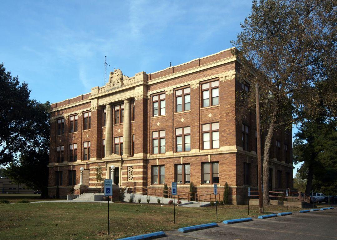
#15. St. Louis (tie)
– Life expectancy: 72.4 years
— 3.4 years lower than the state average
About
St. Louis is Missouri’s largest urban hub and cultural capital. The economy is highly diverse, with strengths in healthcare, finance, higher education, and manufacturing. The city is internationally known for the Gateway Arch, its sports teams, and its role as a historic center of river trade and immigration.
Residents enjoy access to world-class museums, music venues, and universities. At the same time, the city faces challenges related to health disparities and poverty, which impact life expectancy. St. Louis represents Missouri’s most metropolitan lifestyle.
Where is St. Louis?
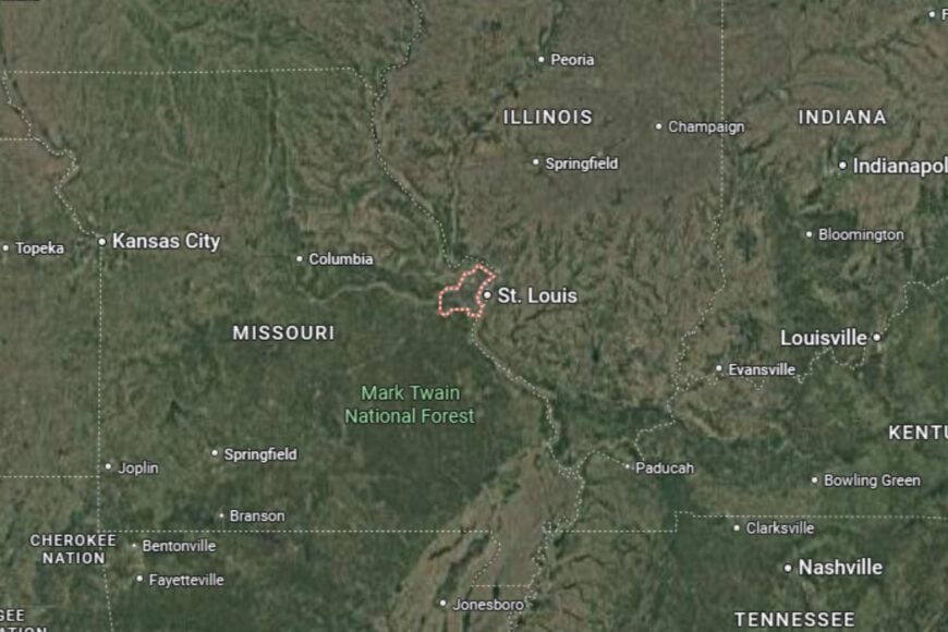
St. Louis is located in eastern Missouri, directly along the Mississippi River and across from Illinois. It is served by Interstates 70, 64, and 44, making it one of the most connected cities in the Midwest.
The city is independent and not part of St. Louis County, which surrounds it. Its location on the river has shaped centuries of history, from fur trade to industrial expansion. St. Louis remains a gateway between the Midwest and the wider world.
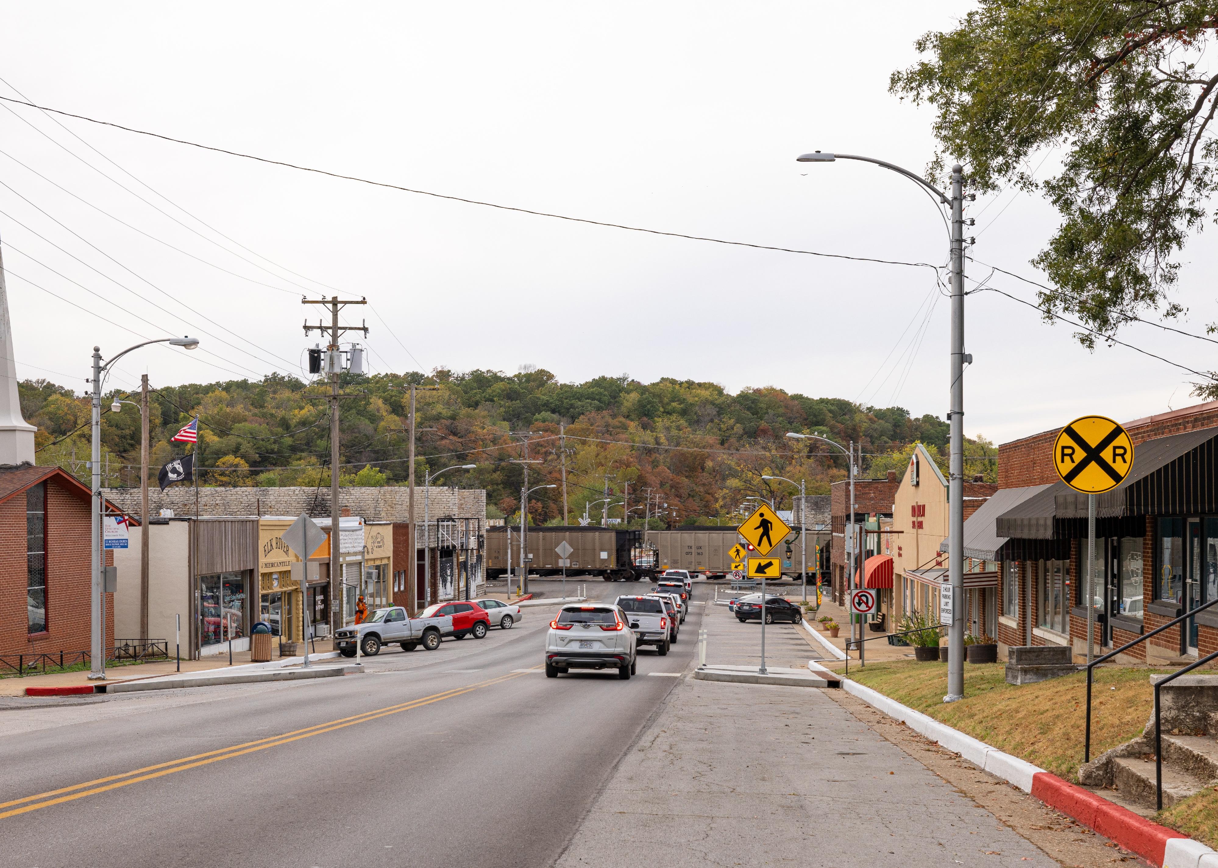
#14. McDonald County (tie)
– Life expectancy: 72.4 years
— 3.4 years lower than the state average
About
McDonald County sits in Missouri’s far southwest corner, offering a mix of rugged Ozark scenery and agricultural activity. Farming and poultry production are staples, but outdoor tourism also plays a role thanks to Elk River, which attracts float trips and campers. The county prides itself on its natural beauty and recreational lifestyle.
Community traditions include local fairs, festivals, and strong church-centered social life. The area’s rivers and hills make outdoor recreation a year-round attraction. McDonald County blends rural productivity with outdoor adventure.
Where is McDonald County?
McDonald County sits in Missouri’s extreme southwest corner, bordering both Arkansas and Oklahoma. The county seat, Pineville, lies along Interstate 49, connecting it to larger markets.
It is bordered by Newton County to the north and Barry County to the east, while Benton County, Arkansas, lies to the south. Its rivers and wooded Ozark hills give McDonald County both rugged scenery and a tri-state identity.
#13. Dallas County
– Life expectancy: 72.3 years
— 3.5 years lower than the state average
About
Dallas County is a rural county where farming dominates, but it also has deep ties to Missouri’s pioneer history. Agriculture, particularly cattle and hay production, shapes the economy. Small towns like Buffalo reflect traditional Ozark culture, with strong community bonds and local pride.
Cultural identity is tied to festivals, fairs, and school events. Residents also take advantage of the county’s outdoor assets, from rivers to wooded hills. Dallas County is a place where pioneer spirit and rural tradition endure.
Where is Dallas County?

Dallas County is located in southwestern Missouri, about 35 miles north of Springfield. The county seat, Buffalo, sits along U.S. Highway 65.
It is bordered by Polk County to the west and Laclede County to the east. The Niangua River winds through the area, offering scenic beauty and recreation. Dallas County’s location keeps it firmly within Missouri’s Ozark region.
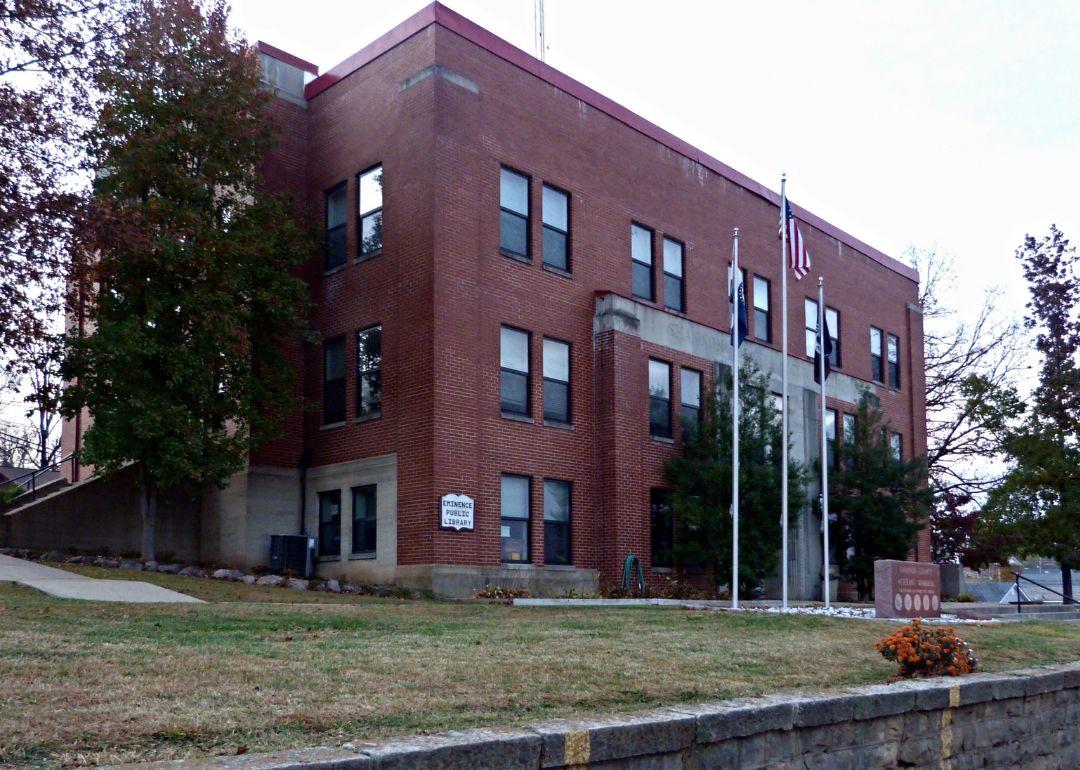
#12. Shannon County (tie)
– Life expectancy: 71.9 years
— 3.9 years lower than the state average
About
Shannon County is renowned for its natural wonders, particularly its caves, springs, and rivers. Much of the county is within the Ozark National Scenic Riverways, making tourism a major part of the economy alongside traditional farming and forestry. Residents value independence and outdoor traditions.
Cultural pride shines through festivals celebrating Ozark heritage. Canoeing, hiking, and camping attract thousands of visitors, highlighting the county’s role as a natural playground. Shannon County thrives on its wilderness character.
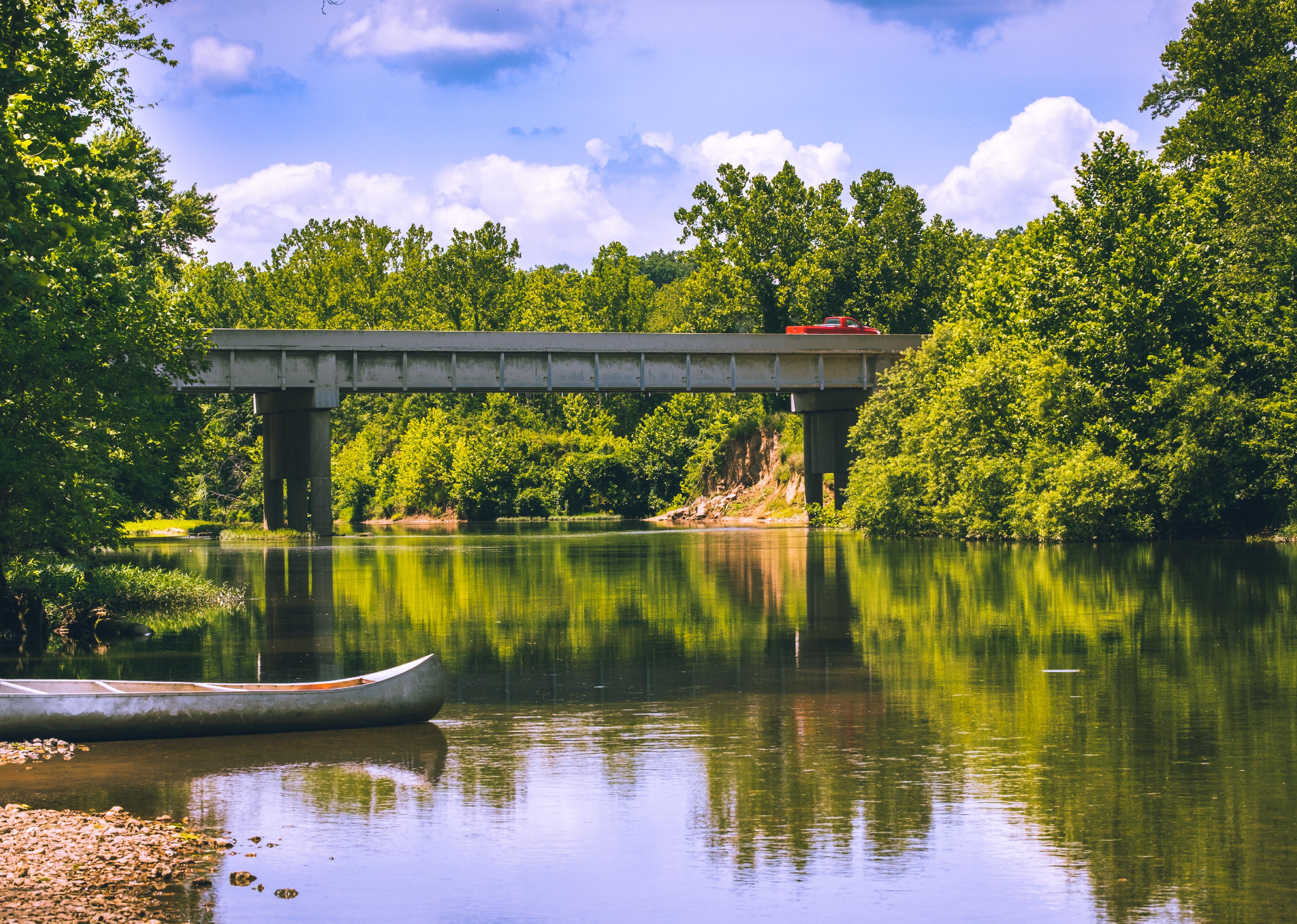
Where is Shannon County?
Shannon County is located in southern Missouri, deep in the Ozarks. The county seat, Eminence, is a hub for river tourism, situated along Missouri Highway 19.
It is bordered by Dent County to the north and Carter County to the southeast. Its geography features the Current and Jacks Fork Rivers, along with extensive caves and forests. Shannon County is one of Missouri’s most scenic natural retreats.
#11. Crawford County (tie)
– Life expectancy: 71.9 years
— 3.9 years lower than the state average
You may also like: How compensation compares between Missouri staff and travel nurses
About
Crawford County blends farming with outdoor tourism and a proud mining heritage. Steelville, the county seat, is known as the “Floating Capital of Missouri,” thanks to the Meramec, Huzzah, and Courtois Rivers that draw visitors for canoeing and camping. Small-scale mining and quarrying also shaped its history.
Community identity is strengthened by festivals, live music, and historic landmarks. Outdoor recreation plays a central role in both lifestyle and economy. Crawford County is where the Ozarks’ natural beauty meets small-town tradition.
Where is Crawford County?
Crawford County is located in east-central Missouri, about 80 miles southwest of St. Louis. The county seat, Steelville, is near Missouri Highway 19 and Interstate 44.
It is bordered by Franklin County to the north and Phelps County to the west. Its rivers and hills make it a prime destination for outdoor recreation. Crawford County’s location places it at the edge of Missouri’s Ozark highlands.
#10. Dent County (tie)
– Life expectancy: 71.8 years
— 4.0 years lower than the state average

About
Dent County is an Ozark county with a strong tradition of forestry and outdoor recreation. Salem, the county seat, is known as the “Gateway to the Ozark Natural Scenic Riverways,” drawing tourists for canoeing, camping, and hiking. Timber harvesting and small-scale farming round out the economy.
Cultural life reflects Ozark heritage, with festivals, bluegrass music, and fairs bringing residents together. Residents enjoy a slower pace of life, tied to both the land and the rivers that define the area. Dent County is where rugged landscapes meet a proud rural identity.
Where is Dent County?
Dent County lies in south-central Missouri, about 90 miles east of Springfield. The county seat, Salem, sits at the junction of Missouri Highways 19 and 32.
It is bordered by Crawford County to the northeast and Shannon County to the southeast. Forested hills, springs, and rivers shape its rugged Ozark landscape, making it a natural gateway to the Scenic Riverways.
#9. Carter County (tie)
– Life expectancy: 71.8 years
— 4.0 years lower than the state average
About
Carter County is defined by its wild Ozark landscape, much of which lies within the Ozark National Scenic Riverways. The Current River is the lifeblood of the county, attracting thousands of visitors for floating, fishing, and camping. Agriculture exists, but tourism is a major economic driver.
Community pride is reflected in festivals and outdoor events that celebrate the county’s natural heritage. Residents enjoy a close relationship with the land, valuing independence and the freedom of wide-open spaces. Carter County thrives as a natural escape in Missouri.
Where is Carter County?

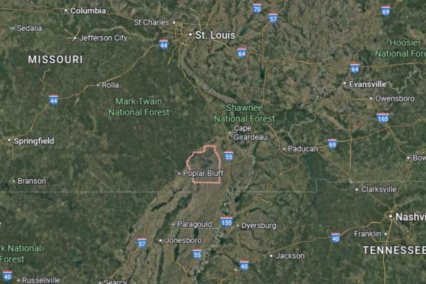
Carter County is located in southern Missouri, about 60 miles west of Poplar Bluff. The county seat, Van Buren, sits along U.S. Highway 60.
It is bordered by Shannon County to the northwest and Ripley County to the south. Its geography features forested hills, rivers, and caves. Carter County’s location makes it one of the state’s premier outdoor recreation destinations.
#8. Mississippi County
– Life expectancy: 71.7 years
— 4.1 years lower than the state average
About
Mississippi County sits in the Missouri Bootheel, where the fertile floodplains of the Mississippi River dominate the landscape. Agriculture is the backbone of the economy, with cotton, soybeans, and corn among its top crops. The county has deep historical ties to river trade and the Civil War.
Community life revolves around farming traditions, fairs, and small-town connections. Residents take pride in the productivity of their land, as well as their resilience in managing floods and natural challenges. Mississippi County blends river history with agricultural strength.
Where is Mississippi County?
Mississippi County is located in the southeastern corner of Missouri, along the Mississippi River. The county seat, Charleston, lies near Interstate 57 and U.S. Highway 60.
It is bordered by Scott County to the west and New Madrid County to the south. Its geography is dominated by flat farmland and river floodplains. Mississippi County’s location ties it directly to the Mississippi River’s economy and culture.
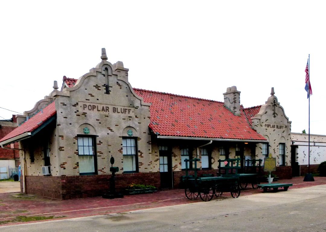
#7. Butler County
– Life expectancy: 71.4 years
— 4.4 years lower than the state average
About
Butler County is a southeastern Missouri county that serves as a regional hub for commerce, healthcare, and education. Poplar Bluff, the county seat, is known as the “Gateway to the Ozarks” and anchors much of the area’s economy. Agriculture and manufacturing also play important roles.
Residents enjoy cultural life through theaters, festivals, and historic landmarks. Outdoor recreation is abundant, with the Black River and nearby Mark Twain National Forest offering opportunities for fishing, boating, and hiking. Butler County balances regional services with outdoor living.
Where is Butler County?
Butler County is located in southeastern Missouri, about 150 miles south of St. Louis. The county seat, Poplar Bluff, sits at the junction of U.S. Highways 60 and 67.
It is bordered by Wayne County to the north and Ripley County to the west. Its geography combines flat river valleys with rolling Ozark foothills. Butler County’s location makes it both a service hub and an outdoor destination.
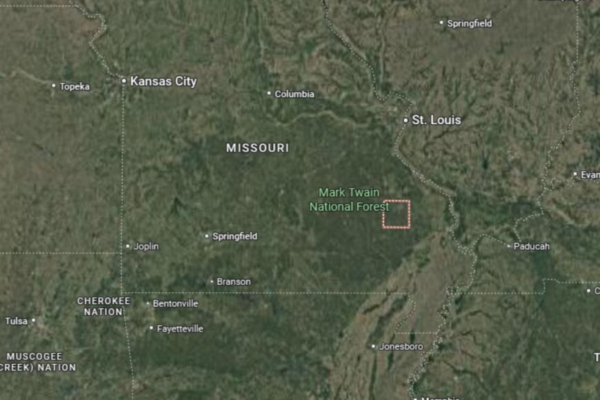
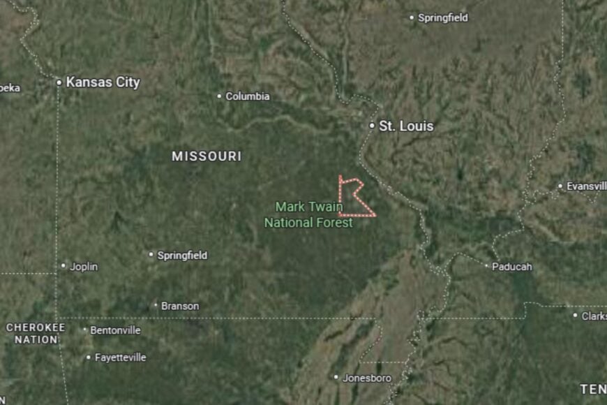
#6. Iron County
– Life expectancy: 71.1 years
— 4.7 years lower than the state average
You may also like: Counties with the most bridges in Missouri
About
Iron County is rich in natural resources and history, with mining at its core. The county’s name comes from its vast iron ore deposits, and the old mining town of Pilot Knob played a key role in Missouri’s Civil War history. Today, tourism tied to Elephant Rocks State Park and Taum Sauk Mountain, the state’s highest point, helps drive the economy.
Residents celebrate their heritage through festivals and historic reenactments. Outdoor recreation, including hiking, camping, and rock climbing, reflects the county’s rugged terrain. Iron County is where Missouri’s mining legacy meets natural wonder.
Where is Iron County?
Iron County is located in southeastern Missouri, about 90 miles south of St. Louis. The county seat, Ironton, sits near Missouri Highway 21.
It is bordered by Washington County to the north and Reynolds County to the south. Its geography includes mountains, forests, and unique geological formations. Iron County’s location makes it a highlight of Missouri’s Ozark highlands.
#5. Washington County
– Life expectancy: 71.0 years
— 4.8 years lower than the state average

About
Washington County is part of Missouri’s historic Lead Belt, with mining shaping its economy and culture for more than two centuries. While mining has declined, the county’s history is preserved in museums and landmarks. Agriculture, forestry, and small-scale manufacturing are now central to its economy.
Residents celebrate traditions through county fairs, festivals, and cultural gatherings. Outdoor recreation thrives at parks and conservation areas, offering fishing, hiking, and camping. Washington County blends a proud mining legacy with rural resilience.
Where is Washington County?
Washington County is located in east-central Missouri, about 70 miles southwest of St. Louis. The county seat, Potosi, sits along Missouri Highway 21.
It is bordered by Jefferson County to the northeast and Iron County to the south. Its geography includes forests, hills, and remnants of old mining districts. Washington County’s location ties it to Missouri’s industrial and natural heritage.
#4. New Madrid County
– Life expectancy: 70.5 years
— 5.3 years lower than the state average
About
New Madrid County sits in the Bootheel and is historically famous for the powerful New Madrid earthquakes of 1811–1812. The fertile Mississippi River floodplains make it one of Missouri’s top agricultural counties, producing cotton, corn, and soybeans. Farming drives the economy, while history gives the county a unique identity.
Community life centers on fairs, local history programs, and the Mississippi River’s role in shaping both culture and economy. Residents take pride in living in an area that is both productive and historically significant.
Where is New Madrid County?
New Madrid County is located in southeastern Missouri, along the Mississippi River. The county seat, New Madrid, lies directly on the river and near Interstate 55.
It is bordered by Mississippi County to the north and Pemiscot County to the south. Its geography is flat, fertile farmland shaped by river floodplains. New Madrid County’s location makes it both agriculturally rich and historically unique.
#3. Ripley County
– Life expectancy: 70.0 years
— 5.8 years lower than the state average
About
Ripley County is a rugged Ozark county known for its forests, rivers, and outdoor recreation. Agriculture and timber production remain vital, but tourism tied to the Current River and Mark Twain National Forest is increasingly important. Doniphan, the county seat, is a historic town that anchors community life.
Festivals, river events, and small-town traditions bring residents together. Hunting, fishing, and camping are cornerstones of life here. Ripley County thrives on its balance of rural simplicity and natural beauty.
Where is Ripley County?
Ripley County is located in southeastern Missouri along the Arkansas border. Doniphan, the county seat, sits on U.S. Highway 160 near the Current River.
It is bordered by Carter County to the north and Butler County to the northeast. Its geography of forested hills and river valleys creates a rugged landscape typical of the Ozarks.
#2. Dunklin County
– Life expectancy: 69.8 years
— 6.0 years lower than the state average
About
Dunklin County is in the heart of Missouri’s Bootheel, where agriculture is the lifeblood of the economy. Cotton, soybeans, and rice dominate, making it one of the most productive farming regions in the state. Kennett, the county seat, also has a strong music heritage—famed pop star Sheryl Crow hails from here.
Community life revolves around farming traditions, fairs, and music events that highlight local pride. Residents are connected by both their land and their culture. Dunklin County combines agricultural power with cultural significance.
Where is Dunklin County?
Dunklin County is located in southeastern Missouri, directly along the Arkansas border. The county seat, Kennett, sits near U.S. Highway 412.
It is bordered by Pemiscot County to the east and Butler County to the north. Its geography consists of flat, fertile farmland ideal for large-scale agriculture. Dunklin County’s location ties it closely to the Mississippi Delta region.
#1. Pemiscot County
– Life expectancy: 67.4 years
— 8.4 years lower than the state average
About
Pemiscot County ranks lowest in life expectancy in Missouri but holds a unique place in the state’s geography and economy. It sits at the southeasternmost corner of the Bootheel, where cotton and soybean farming are dominant. The county has faced challenges with poverty and flooding, but its agricultural productivity remains vital.
Community identity is tied to its land, with fairs, school events, and local traditions keeping connections strong. The Mississippi River shapes both the opportunities and struggles of life here. Pemiscot County embodies the resilience of Missouri’s Bootheel.
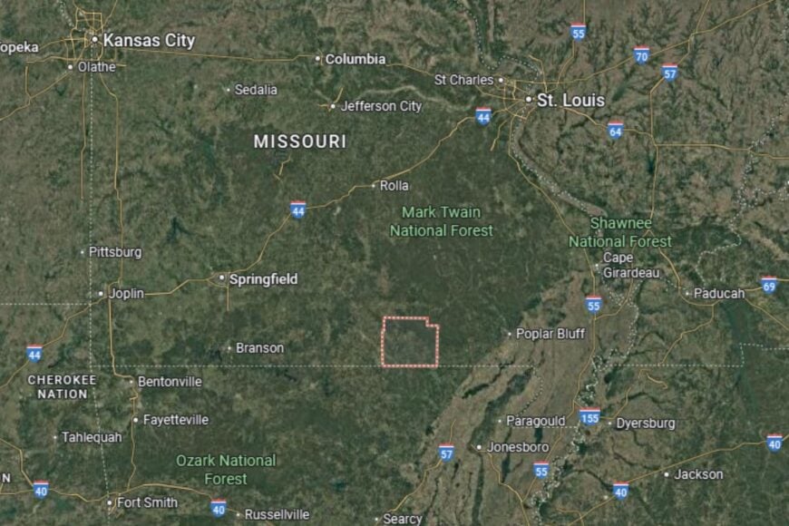
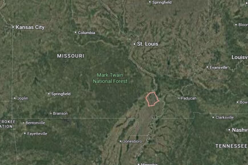
Where is Pemiscot County?
Pemiscot County is located in the extreme southeastern tip of Missouri, bordered by both Arkansas and Tennessee. The county seat, Caruthersville, lies directly along the Mississippi River and near Interstate 155.
It is bordered by Dunklin County to the west and New Madrid County to the north. Its flat river plains make it one of the state’s most fertile agricultural areas. Pemiscot County’s location makes it both geographically unique and economically significant.
This story features data reporting by Karim Noorani, writing by Kiersten Hickman, and is part of a series utilizing data automation across 49 states.
You may also like: Best-performing Missouri stocks last week
By Stacker