🔥 Would you like to save this?
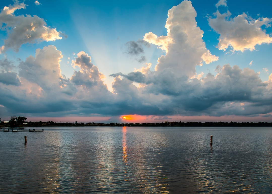
Counties with the shortest life expectancy in Minnesota
Life expectancy can be affected by a variety of factors. About 25% of your lifespan is determined by genetics, according to the National Library of Medicine. Health and wellness habits—like following a balanced, nutrient-rich diet; not smoking; drinking minimal alcohol; maintaining a healthy weight; and staying physically active—can add more than a decade to your life, research from the National Institutes of Health shows. While these factors are significant, another important element that you might not have considered is your environment and community.
In order to come up with the very specific design ideas, we create most designs with the assistance of state-of-the-art AI interior design software. Also, assume links that take you off the site are affiliate links such as links to Amazon. this means we may earn a commission if you buy something.
While life expectancy generally increases annually in the United States—jumping from about 70.8 years old to 77.5 between 1970 and 2022, according to the Centers for Disease Control and Prevention—this particular metric can vary from state to state or even county to county. In some parts of the country, the average lifespan is getting shorter based on a variety of risk factors on top of health, including socioeconomic factors like poverty, unemployment, income, and education.
According to a 2020 study from researchers at Penn State, West Virginia, and Michigan State Universities, communities with a higher population density, more fast food restaurants, and a high number of extraction industry-based jobs tend to have shorter life expectancies.
To find out how life expectancy varies within Minnesota, Stacker used 2024 County Health Rankings & Roadmaps from the University of Wisconsin Population Health Institute to identify the counties with the shortest life expectancy. Life expectancy measures the average number of years from birth a person can expect to live and is calculated based on the number of deaths in a given time period and the average number of people at risk of dying during that period. Counties with unreliable or insufficient data were excluded from the analysis. Mortality data came from the National Vital Statistics System.
Read on to see if your county is on the list.
You may also like: Counties with the highest rates of high blood pressure in Minnesota
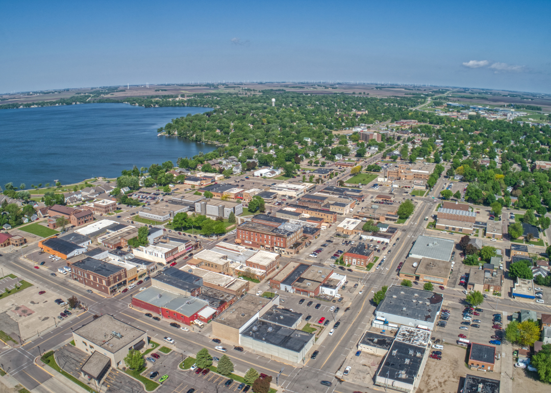
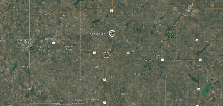
#44. Nobles County (tie)
– Life expectancy: 79.4 years
— 0.3 years lower than the state average
About
Nobles County stretches across the open prairies of southwest Minnesota, where wide skies and fertile farmland define the horizon. Worthington, the county seat, has grown as a cultural and economic hub, shaped by agriculture, immigration, and its role as a regional crossroads. The prairie landscape gives the county both its foundation and its enduring character.
Life flows through harvest festivals, community gatherings, and traditions rooted in both heritage and new diversity. Agriculture continues as the backbone of the local economy, while education and commerce broaden opportunities. Nobles County reflects a place where prairie land, cultural variety, and community strength remain closely linked.
Where is Nobles County?
Nobles County is in southwestern Minnesota, bordered by Rock County to the west, Murray County to the north, and Jackson County to the east. It lies about 160 miles southwest of Minneapolis and shares its southern border with the state of Iowa. The county’s landscape is defined by open prairies, fertile farmland, and glacially formed lakes and streams.
Worthington, the county seat, is centrally located and serves as the region’s commercial and cultural hub. Smaller communities include Adrian to the west and Rushmore near the eastern edge. With its strong agricultural base and mix of small towns, Nobles County reflects the rural character of Minnesota’s prairie lands.
#43. Redwood County (tie)
– Life expectancy: 79.3 years
— 0.4 years lower than the state average
About
Redwood County sits in southwest Minnesota, with Redwood Falls serving as its county seat and main center of activity. Its history is rooted in farming and settlement along the Minnesota River, which still shapes both the economy and the landscape. Agriculture remains the backbone, supported by small industries and local trade.
Community life is reflected in school traditions, county fairs, and civic gatherings that keep residents connected. Parks and riverfront spaces add recreation and natural beauty to daily living. Redwood County represents a balance of agricultural strength, community pride, and steady regional growth.
Where is Redwood County?

Redwood County is located in southwestern Minnesota, bordered by Renville County to the north, Brown County to the east, and Lyon County to the west. It lies about 110 miles southwest of Minneapolis and is part of the prairie region of the state. The Minnesota River forms much of its northern boundary, adding to the county’s fertile agricultural landscape.
Redwood Falls, the county seat, sits near the Minnesota River and serves as the hub of government and commerce. Other communities include Walnut Grove to the west and Morgan to the east, both tied to the county’s farming traditions. With its mix of farmland, river valleys, and historic sites, Redwood County highlights the agricultural and cultural heritage of southwestern Minnesota.
#42. Chisago County (tie)
– Life expectancy: 79.3 years
— 0.4 years lower than the state average
About
Chisago County rests in eastern Minnesota, shaped by its lakes, forests, and Scandinavian heritage. Early settlers brought traditions that remain visible in festivals, architecture, and community life, with Lindström and Center City reflecting that cultural legacy. The St. Croix River forms part of its border, anchoring both history and recreation.
Traditions are carried forward through local celebrations, church gatherings, and seasonal events that honor cultural roots. At the same time, the county has grown with new residents drawn by its proximity to the Twin Cities and natural beauty. Chisago County reflects a place where heritage, land, and modern community remain firmly tied.
Where is Chisago County?
Chisago County is in eastern Minnesota, bordered by Pine County to the north, Washington County to the south, and Isanti County to the west. It lies along the St. Croix River, which forms the eastern boundary with Wisconsin. The county’s landscape features rolling hills, forests, and numerous lakes, reflecting its position in the state’s transition zone between prairie and woodland.
Center City, the county seat, is located near the geographic center and sits along scenic North Center Lake. Other communities include Lindstrom, known for its Swedish heritage, and North Branch in the northern part of the county. With its mix of lakes, riverfront, and cultural history, Chisago County offers both natural beauty and a strong small-town character.
#41. Douglas County (tie)
– Life expectancy: 79.3 years
— 0.4 years lower than the state average
About
Douglas County lies in west-central Minnesota, where more than 250 lakes shimmer across rolling hills and prairies. Alexandria, the county seat, blends small-town life with a role as a regional center for tourism, commerce, and culture. The abundance of lakes and natural beauty gives the county a rhythm shaped by water and land.
Summer recreation, fishing, and festivals tie the community to its setting, while schools, businesses, and civic traditions sustain daily life year-round. Agriculture and tourism work side by side, creating a balance between heritage and modern growth. Douglas County reflects a place where natural beauty and community life are deeply intertwined.
Where is Douglas County?
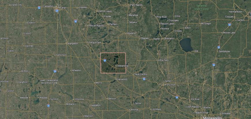
Douglas County is in west-central Minnesota, bordered by Otter Tail County to the north, Pope County to the east, and Stevens County to the west. It lies about 130 miles northwest of Minneapolis and is part of the state’s lake country. The county is known for its glacial terrain, with more than 250 lakes scattered across its rolling hills.
Alexandria, the county seat, sits near the center and serves as the main hub for commerce and tourism. Smaller communities include Osakis to the northeast and Kensington to the west. With its abundant lakes, parks, and resorts, Douglas County has become a popular destination for recreation and vacationing in Minnesota.
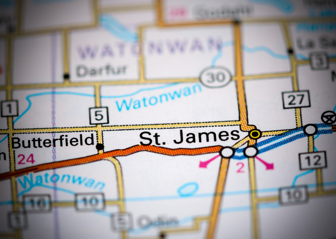
#40. Watonwan County
– Life expectancy: 79.2 years
— 0.5 years lower than the state average
You may also like: How drunk driving fatalities in Minnesota compare to the rest of the US
About
Watonwan County sits in south-central Minnesota, with St. James as its county seat and center of activity. The county’s identity is shaped by farming traditions, small-town commerce, and a steady rhythm of rural life. Agriculture, particularly crop and livestock production, forms the backbone of its economy.
Community ties are strengthened through school events, county fairs, and local gatherings that keep traditions alive. Parks and nearby lakes provide space for recreation and family life. Watonwan County reflects a balance of agricultural heritage, community pride, and small-town connection.
Where is Watonwan County?
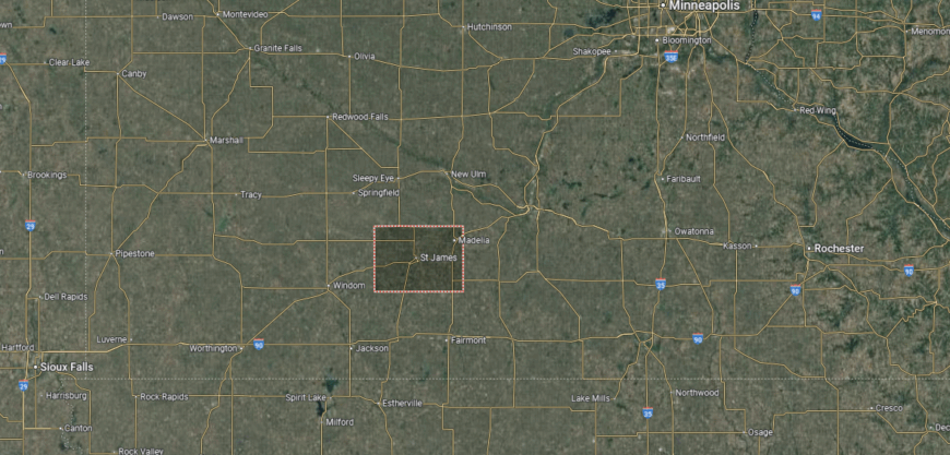
Watonwan County is in south-central Minnesota, bordered by Brown County to the east, Martin County to the south, and Cottonwood County to the west. It lies about 120 miles southwest of Minneapolis and is part of the fertile prairie farmland of the region. The Watonwan River flows through the county, shaping much of its landscape.
St. James, the county seat, is centrally located and serves as the primary hub for government and commerce. Other communities include Madelia to the northeast and Butterfield in the northern section. With its strong agricultural base and small-town network, Watonwan County reflects the rural character of southern Minnesota.
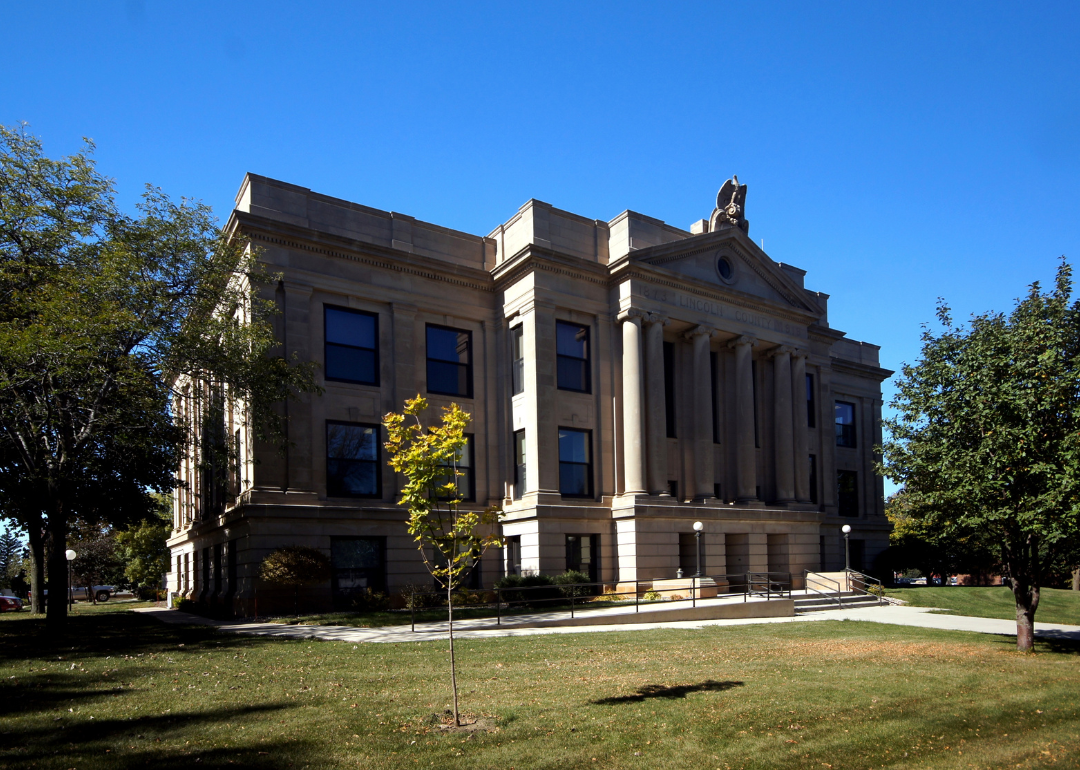
#39. Lincoln County
– Life expectancy: 79.1 years
— 0.6 years lower than the state average

About
Lincoln County rests along Minnesota’s southwestern border, where prairies and farmland define its landscape. Established in the late 1800s and named after President Abraham Lincoln, the county carries both national memory and local heritage. Ivanhoe, the county seat, reflects the character of a community rooted in agriculture and small-town tradition.
Heritage is carried forward in courthouse gatherings, county fairs, and community festivals that highlight both pride and continuity. Farming remains the foundation of daily life, while wind energy and small industries add modern dimensions to the local economy. Lincoln County stands as a place where history, land, and rural spirit remain closely tied.
Where is Lincoln County?
🔥 Would you like to save this?
Lincoln County is located in southwestern Minnesota, bordered by Yellow Medicine County to the north, Pipestone County to the south, and Lyon County to the east. It shares its western boundary with the state of South Dakota. The county lies about 160 miles southwest of Minneapolis and is characterized by open prairie and rolling farmland.
Ivanhoe, the county seat, is near the western edge and serves as the center of local government. Other communities include Tyler to the east and Hendricks near the South Dakota line. With its agricultural foundation and prairie landscape, Lincoln County highlights the rural traditions of Minnesota’s southwest corner.
#38. Mower County (tie)
– Life expectancy: 79.0 years
— 0.7 years lower than the state average
About
Mower County lies in southeastern Minnesota, where fertile prairies stretch wide and rivers wind quietly through farmland. Austin, the county seat, grew from agricultural roots into a regional center shaped by industry, education, and culture. The open land and waterways remain steady markers of the county’s identity.
Festivals, school traditions, and community events bring people together, while local parks and trails keep residents connected to the landscape. Agriculture continues as a foundation, joined by food production and commerce as drivers of the economy. Mower County reflects a place where land, community, and work flow together in balance.
Where is Mower County?
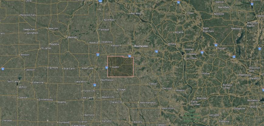
Mower County is in southeastern Minnesota, bordered by Dodge County to the north, Fillmore County to the east, and Freeborn County to the west. Its southern boundary connects directly with the state of Iowa. The county lies about 100 miles south of Minneapolis and is characterized by fertile farmland, prairies, and the Cedar River flowing through it.
Austin, the county seat, is centrally located and serves as the largest city and commercial hub. Smaller communities include Grand Meadow to the northeast and LeRoy near the Iowa border. With its agricultural economy and strong community ties, Mower County reflects the rural character of southern Minnesota.
#37. Crow Wing County (tie)
– Life expectancy: 79.0 years
— 0.7 years lower than the state average
About
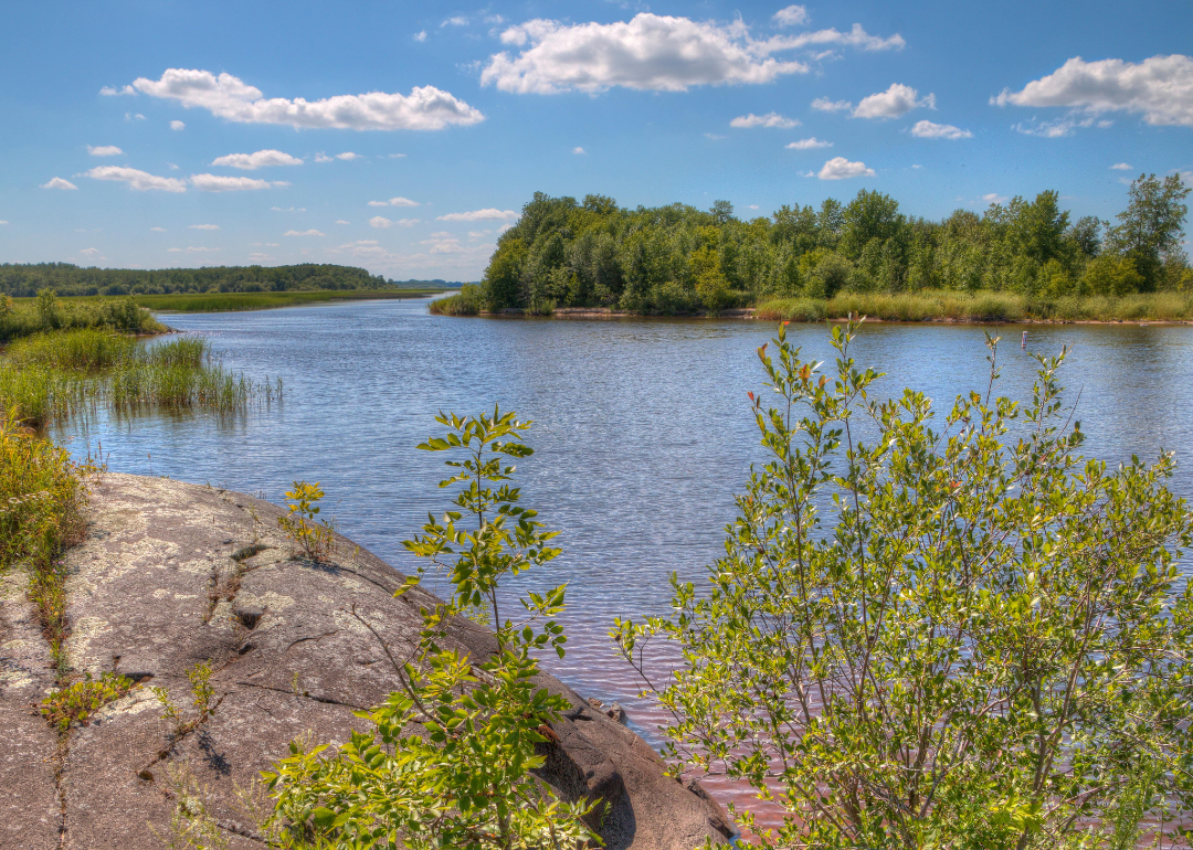
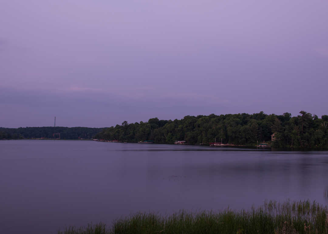
Crow Wing County sits in central Minnesota, with Brainerd as its county seat and regional hub. The county’s identity is shaped by its lakes, forests, and role as a center for tourism and commerce in the north. Outdoor recreation, from fishing to boating, has long defined much of its growth and appeal.
Community ties are strengthened through school activities, local festivals, and civic events that connect residents year-round. Tourism and small industry complement traditional livelihoods, adding variety to the economy. Crow Wing County reflects a steady mix of natural setting, recreation, and community life.
Where is Crow Wing County?
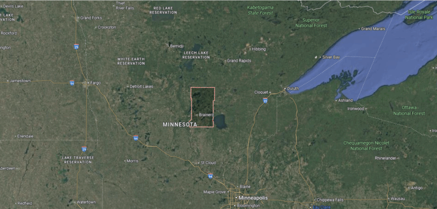
Crow Wing County is located in central Minnesota, bordered by Cass County to the north, Aitkin County to the east, and Morrison County to the south. It lies about 125 miles northwest of Minneapolis and is part of the state’s lake country. The Mississippi River flows through the county, joined by numerous lakes and forested areas that define its landscape.
Brainerd, the county seat, is situated along the Mississippi River and serves as the primary hub of commerce and government. Other communities include Crosby to the east and Crosslake in the northern lake region. With its mix of waterways, forests, and recreation areas, Crow Wing County has become a popular destination for both residents and visitors seeking outdoor activities.
#36. Clay County (tie)
– Life expectancy: 78.9 years
— 0.8 years lower than the state average
About
Clay County rests along Minnesota’s western border, where the Red River shaped early settlement and trade. Moorhead, the county seat, reflects this heritage as a river town that grew into a center for culture, education, and commerce. The county’s history is tied to farming, immigration, and the development of prairie communities across the fertile valley.
Traditions are preserved in museums, cultural festivals, and community gatherings that honor both heritage and growth. Agriculture remains a defining presence, while education and industry strengthen the county’s modern role. Clay County reflects a place where river history, prairie land, and community pride remain closely connected.
Where is Clay County?
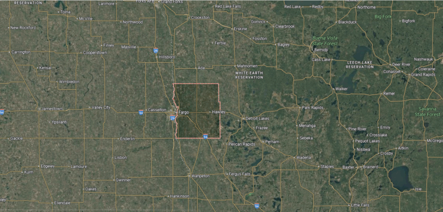
Clay County is in northwestern Minnesota, bordered by Norman County to the north, Becker County to the east, and Wilkin County to the south. Its western boundary follows the Red River of the North, which separates it from North Dakota. The county lies about 240 miles northwest of Minneapolis and is part of the fertile Red River Valley.
Moorhead, the county seat, sits along the Red River directly across from Fargo, North Dakota, forming a major urban and economic center. Other communities include Barnesville to the south and Hawley to the east, both tied to the county’s agricultural roots. With its combination of rich farmland and metropolitan influence, Clay County connects rural Minnesota with the Fargo–Moorhead region.
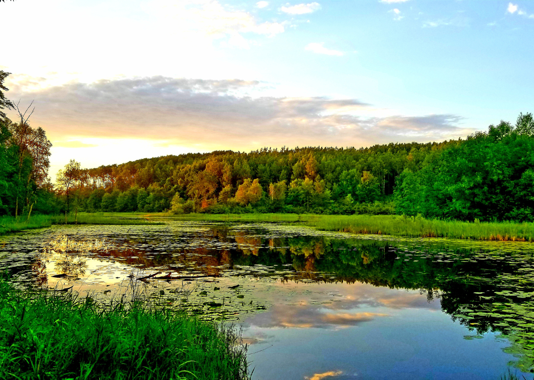
#35. Lake of the Woods County (tie)
– Life expectancy: 78.9 years
— 0.8 years lower than the state average
You may also like: Highest-rated free things to do in Minnesota, according to Tripadvisor
About
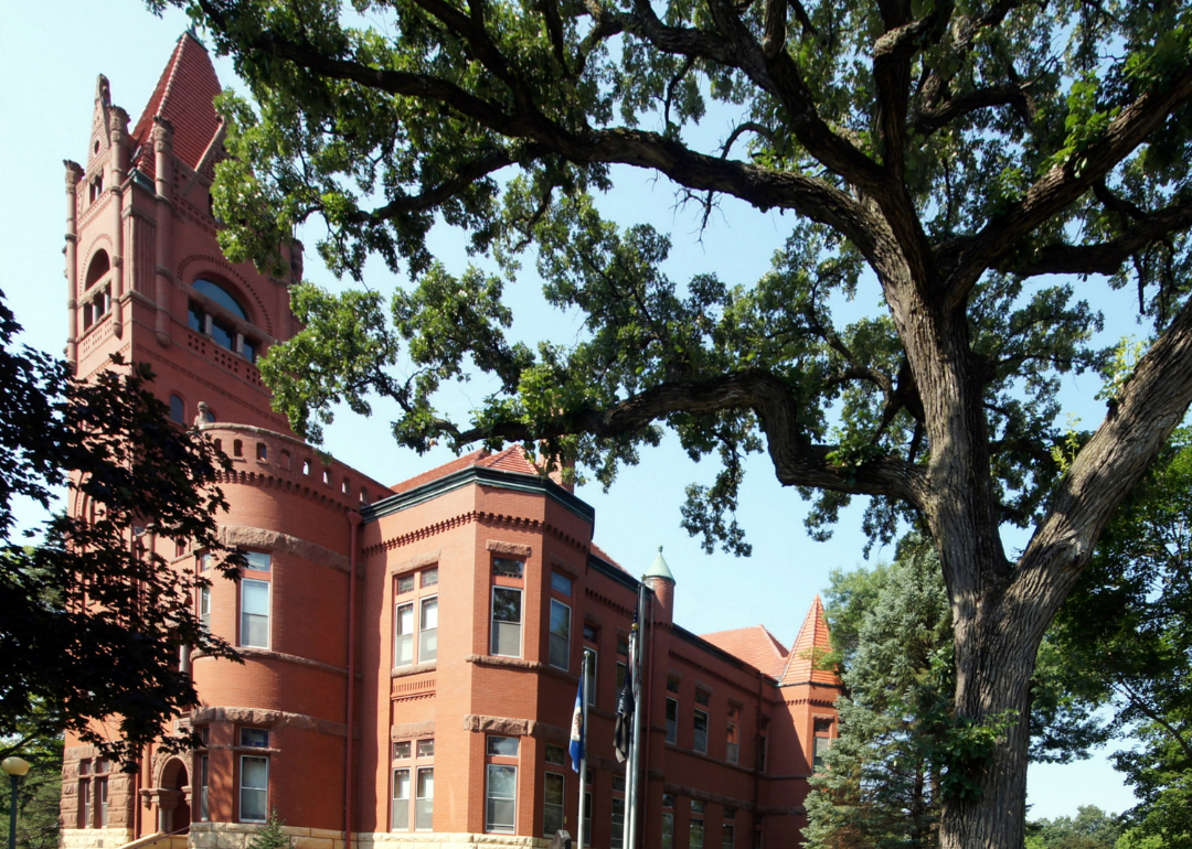
Lake of the Woods County lies at Minnesota’s northern edge, where vast waters and remote forests shape both life and identity. Baudette, the county seat, sits along the Rainy River, serving as a gateway to the sprawling lake that gives the county its name. The wilderness and waterways define its character more than population or development.
Seasons mark the rhythm of community life—summer fishing, autumn hunting, winter snow, and spring thaw. Tourism and outdoor traditions sustain the economy, while small-town ties keep residents connected across wide distances. Lake of the Woods County reflects a place where water, wilderness, and resilience remain inseparable.
Where is Lake of the Woods County?
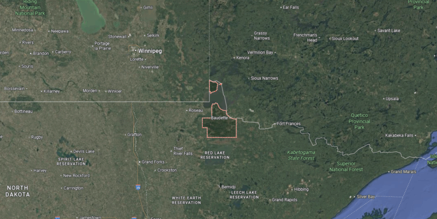
Lake of the Woods County is in far northern Minnesota, bordered by Roseau County to the west, Koochiching County to the east, and Canada to the north. It lies about 320 miles north of Minneapolis and is defined largely by its namesake lake. The county also includes the Northwest Angle, the northernmost point of the contiguous United States.
Baudette, the county seat, is located along the Rainy River about 115 miles northeast of Grand Forks, North Dakota. Angle Inlet, in the Northwest Angle, can only be reached by traveling through Canada or crossing the lake. With its remote setting and international boundaries, the county occupies one of Minnesota’s most distinctive locations.
#34. Isanti County
– Life expectancy: 78.8 years
— 0.9 years lower than the state average
About
Isanti County sits in east-central Minnesota, with Cambridge as its county seat and community hub. Its identity is shaped by farming traditions, small-town life, and the influence of Scandinavian settlement. Growth from the Twin Cities has added suburban development while keeping rural roots visible.
Local life is centered on school events, county fairs, and civic gatherings that highlight community pride. Parks, trails, and riverfront areas provide recreation and a steady link to the landscape. Isanti County reflects a blend of heritage, natural setting, and modern growth.
Where is Isanti County?
Isanti County is in east-central Minnesota, bordered by Chisago County to the east, Anoka County to the south, and Mille Lacs County to the northwest. It lies about 45 miles north of Minneapolis, placing it within commuting distance of the Twin Cities. The county’s landscape is shaped by prairie, forests, and numerous small lakes.
Cambridge, the county seat, sits near the center and serves as the primary hub of government and commerce. Other communities include Isanti to the south and Braham to the north along the Kanabec County line. With its mix of rural areas and growing suburban connections, Isanti County links central Minnesota to the Twin Cities region.
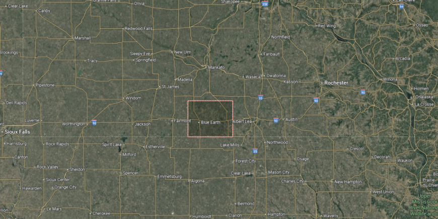
#33. Faribault County (tie)
– Life expectancy: 78.7 years
— 1.0 years lower than the state average
About
Faribault County rests in southern Minnesota, where fertile prairie soil has long supported farming communities. Blue Earth, the county seat, grew as a hub along early settlement routes and remains the civic and cultural heart of the region. The county’s history is tied to agriculture, pioneer life, and the steady growth of rural towns.
Heritage is celebrated through fairs, museums, and community events that keep early traditions alive. Farming continues to anchor the economy, while small industries and commerce provide balance. Faribault County reflects a place where prairie land, history, and community pride remain firmly connected.
Where is Faribault County?
🔥 Would you like to save this?
Faribault County is located in southern Minnesota, bordered by Blue Earth County to the east, Martin County to the west, and Freeborn County to the south. Its southern boundary meets the state of Iowa, while it lies about 125 miles southwest of Minneapolis. The county’s terrain is part of the fertile prairie farmland of the region.
Blue Earth, the county seat, is positioned near the center along Interstate 90. Other communities include Wells to the northeast and Minnesota Lake on the northern edge. With its location along the Iowa border and major highways, Faribault County serves as a connection between southern Minnesota and northern Iowa.
#32. Pope County (tie)
– Life expectancy: 78.7 years
— 1.0 years lower than the state average
About
Pope County lies in west-central Minnesota, where rolling hills and quiet lakes shape both its scenery and identity. Glenwood, the county seat, rests along Lake Minnewaska, serving as a civic and cultural center while reflecting the county’s strong connection to the water. Farming and small-town traditions remain steady foundations of life here.
Community rhythms follow the seasons—summer festivals, lake recreation, and gatherings in town squares bring people together. Agriculture and tourism work side by side, linking heritage to modern opportunity. Pope County reflects a place where land, water, and community life remain inseparably tied.
Where is Pope County?
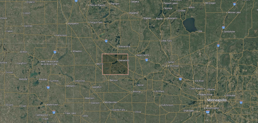
Pope County is in west-central Minnesota, bordered by Douglas County to the north, Stearns County to the east, and Stevens County to the west. It lies about 130 miles northwest of Minneapolis and sits within the state’s glacial lake region. The county’s landscape is defined by rolling hills, farmland, and several large lakes, including Lake Minnewaska.
Glenwood, the county seat, is located on the eastern shore of Lake Minnewaska near the county’s center. Other communities include Starbuck to the southwest and Villard to the northeast. With its central location and scenic lakes, Pope County links Minnesota’s agricultural prairies with its recreational lake country.
#31. Grant County (tie)
– Life expectancy: 78.7 years
— 1.0 years lower than the state average
About
Grant County sits in west-central Minnesota, with Elbow Lake as its county seat and community center. Its identity is rooted in agriculture, with farming shaping both the economy and rural traditions. The county’s small population fosters strong local connections and a steady pace of life.
Community pride shows in school events, county fairs, and civic gatherings that bring neighbors together. Parks and lakes add recreation and natural beauty to daily routines. Grant County reflects a blend of agricultural strength, small-town spirit, and close community ties.
Where is Grant County?
Grant County is in west-central Minnesota, bordered by Otter Tail County to the north, Douglas County to the east, and Stevens County to the south. It lies about 160 miles northwest of Minneapolis and is part of the Red River Valley watershed. The county’s geography features prairie farmland, glacial hills, and a scattering of small lakes.
Elbow Lake, the county seat, is near the center and serves as the hub of local government. Other communities include Ashby to the north and Herman to the south. With its rural location and agricultural base, Grant County reflects the farming traditions of western Minnesota.
#30. Goodhue County (tie)
– Life expectancy: 78.7 years
— 1.0 years lower than the state average
You may also like: Counties with the worst commutes in Minnesota
About
Goodhue County lies along the Mississippi River in southeastern Minnesota, where bluffs, valleys, and river trade shaped early settlement. Red Wing, the county seat, became known for its pottery, riverfront commerce, and historic architecture that still mark the city today. The county’s history reflects Native American heritage, European immigration, and the growth of farming communities across fertile land.
Traditions live on through cultural festivals, historic sites, and civic gatherings that honor both heritage and progress. Agriculture, manufacturing, and tourism together support a diverse economy rooted in land and history. Goodhue County reflects a place where river heritage, cultural pride, and community life remain firmly connected.
Where is Goodhue County?

Goodhue County is in southeastern Minnesota, bordered by Dakota County to the north, Wabasha County to the southeast, and Rice County to the west. The Mississippi River forms its eastern boundary with Wisconsin, and the county lies about 55 miles southeast of Minneapolis–St. Paul. Its landscape is made up of river valleys, bluffs, and fertile farmland.
Red Wing, the county seat, is positioned along the Mississippi River and serves as a regional hub. Other communities include Cannon Falls to the northwest and Zumbrota near the center of the county. With its riverfront setting and historic towns, Goodhue County links the Twin Cities to the Mississippi River Valley.
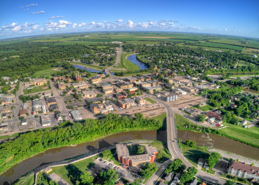
#29. Morrison County (tie)
– Life expectancy: 78.6 years
— 1.1 years lower than the state average
About
Morrison County rests in central Minnesota, where the Mississippi River winds through forests, farmland, and small towns. Little Falls, the county seat, reflects both historic charm and its role as a regional center along the river. The landscape of water and woodland gives the county a natural rhythm that shapes daily life.
Seasonal festivals, riverfront gatherings, and school traditions weave community ties across the county. Farming, manufacturing, and tourism work together to sustain its economy while preserving its rural character. Morrison County represents a place where river, land, and community remain deeply connected.
Where is Morrison County?
Morrison County is in central Minnesota, bordered by Crow Wing County to the north, Mille Lacs County to the east, and Todd County to the west. It lies about 100 miles northwest of Minneapolis and is part of the Upper Mississippi River Valley. The terrain includes river bottoms, rolling farmland, and stretches of forest.
Little Falls, the county seat, is located along the Mississippi River near the center of the county. Other communities include Pierz to the southeast and Royalton near the southern border. With its mix of riverfront, agriculture, and historic towns, Morrison County reflects the character of central Minnesota.
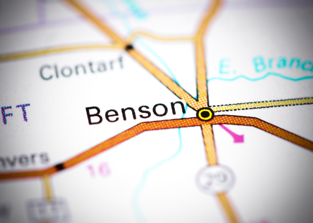
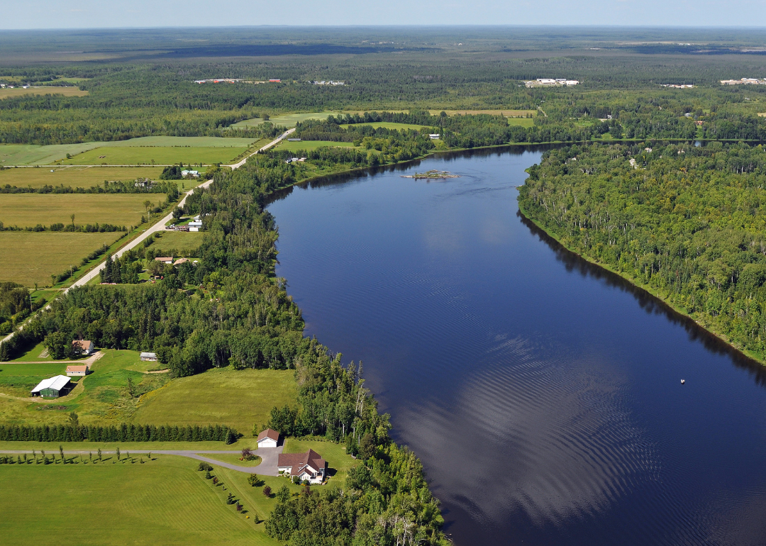
#28. Swift County (tie)
– Life expectancy: 78.6 years
— 1.1 years lower than the state average
🔥 Would you like to save this?
About
Swift County sits in western Minnesota, with Benson as its county seat and hub of local activity. Farming has long shaped the county’s identity, with agriculture forming the foundation of its economy and rural life. Small-town traditions and steady civic institutions provide a sense of continuity.
Community pride is carried through school events, fairs, and gatherings that keep neighbors connected. Parks and open prairies add space for recreation and family life. Swift County reflects a balance of agricultural strength, small-town spirit, and community ties.
Where is Swift County?
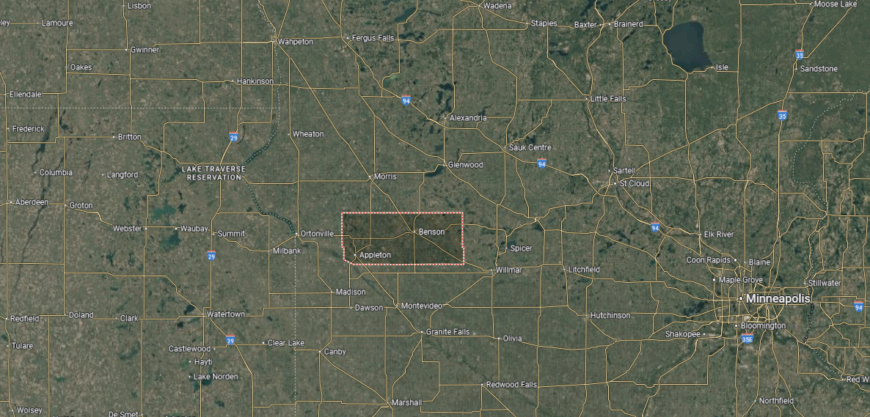
Swift County is in west-central Minnesota, bordered by Pope County to the north, Chippewa County to the south, and Kandiyohi County to the east. It lies about 125 miles west of Minneapolis in the prairie region of the state. The county’s landscape is dominated by farmland, open plains, and sections of the Chippewa River.
Benson, the county seat, is located near the center and serves as the primary hub of commerce and government. Other communities include Appleton to the west and Kerkhoven in the eastern part of the county. With its agricultural setting and small-town network, Swift County represents the rural traditions of western Minnesota.
#27. Koochiching County (tie)
– Life expectancy: 78.6 years
— 1.1 years lower than the state average
About
Koochiching County lies along Minnesota’s northern border, where forests, rivers, and wilderness have long defined its story. International Falls, the county seat, grew from timber and paper industries and remains closely tied to its role on the Rainy River at the U.S.–Canada line. The county’s history reflects Native American heritage, frontier trade, and the endurance of remote northern communities.
Traditions are carried forward through cultural events, cross-border connections, and gatherings that highlight resilience in a rugged setting. Forestry, paper production, and tourism anchor the economy, with outdoor recreation drawing visitors year-round. Koochiching County reflects a place where history, industry, and wilderness remain inseparable.
Where is Koochiching County?
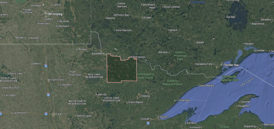
Koochiching County is in far northern Minnesota, bordered by Canada to the north, St. Louis County to the east, and Itasca County to the south. It lies about 300 miles north of Minneapolis and is one of the state’s largest counties by land area. The Rainy River and Rainy Lake form much of its northern boundary with Ontario.
International Falls, the county seat, sits along the Rainy River directly across from Fort Frances, Ontario. Smaller communities include Littlefork to the south and Big Falls along the Big Fork River. With its remote northern location and international border, Koochiching County is a gateway between Minnesota and Canada.
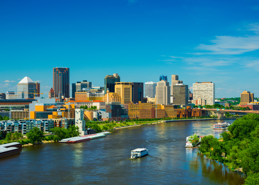
#26. Ramsey County
– Life expectancy: 78.4 years
— 1.3 years lower than the state average
About
Ramsey County anchors the Twin Cities metro with Saint Paul as both county seat and state capital. Its identity is shaped by government, commerce, education, and a rich cultural life that reflects generations of growth and diversity. The Mississippi River runs through its heart, linking history with the present.
Community life thrives through festivals, sports, and civic traditions that bring people together in urban neighborhoods and historic districts. Education, healthcare, and government institutions drive the economy while maintaining strong community roots. Ramsey County represents a place where civic leadership, cultural variety, and community spirit converge.
Where is Ramsey County?
Ramsey County is in southeastern Minnesota, bordered by Anoka County to the north, Washington County to the east, and Hennepin County to the west. It lies about 10 miles east of Minneapolis and is one of the smallest counties in the state by land area, yet among the most densely populated. The Mississippi River flows through its southern boundary, shaping much of its geography.
Saint Paul, the county seat, is also the state capital and a major hub for government, culture, and commerce. Other communities include Maplewood to the east, Roseville to the north, and Shoreview in the northwest. With its central urban location, Ramsey County anchors the Twin Cities metropolitan region.
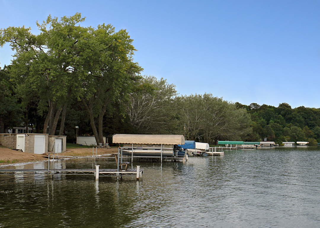
#25. Aitkin County
– Life expectancy: 78.2 years
— 1.5 years lower than the state average
You may also like: Best-performing Minnesota stocks last week
About
Aitkin County rests in north-central Minnesota, where rivers, lakes, and dense forests shape both setting and tradition. The Mississippi River flows through its heart, joining with Mille Lacs Lake and countless waterways that define the landscape. Farming, logging, and outdoor life have long provided the rhythm of daily living here.
Seasons guide community life—ice fishing and snowmobiling in winter, boating and festivals in summer, and steady gatherings in towns throughout the year. Tourism and recreation stand alongside agriculture and forestry as anchors of the economy. Aitkin County reflects a place where water, woods, and community remain deeply connected.
Where is Aitkin County?
Aitkin County is in central Minnesota, bordered by Itasca County to the north, Crow Wing County to the west, and Carlton County to the east. It lies about 120 miles north of Minneapolis and stretches across the Mississippi River headwaters region. The county’s terrain includes forests, wetlands, and hundreds of lakes.
Aitkin, the county seat, is located near the Mississippi River in the southern part of the county. Other communities include McGregor to the east and Hill City to the north. With its northern location and abundance of waterways, Aitkin County is closely tied to outdoor recreation and natural resources.
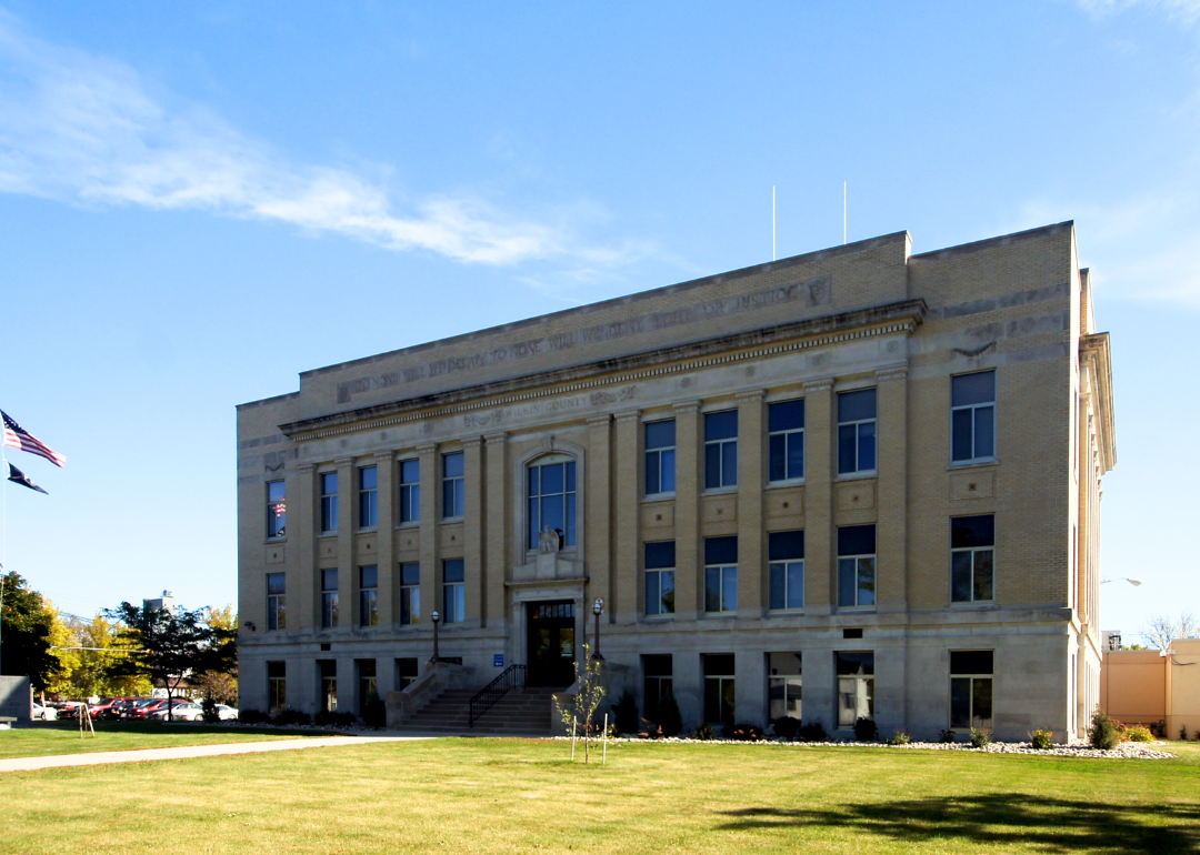
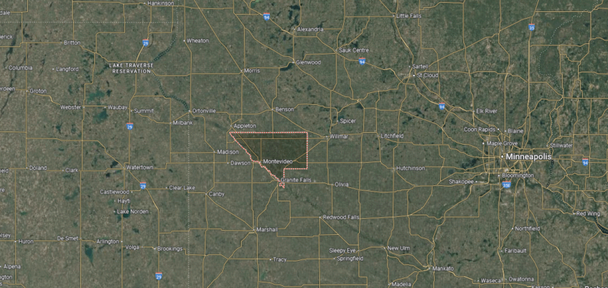
#24. Renville County
– Life expectancy: 78.1 years
— 1.6 years lower than the state average
About
Renville County sits in southern Minnesota, with Olivia as its county seat and center of community life. The county’s identity is strongly tied to farming, as some of the most fertile agricultural land in the state lies here. Corn, soybeans, and related agribusiness form the backbone of its economy.
Local life is shaped by school activities, county fairs, and gatherings that highlight rural pride. Parks, trails, and small-town traditions provide balance to the county’s work on the land. Renville County reflects a steady rhythm of agriculture, community spirit, and small-town connection.
Where is Renville County?
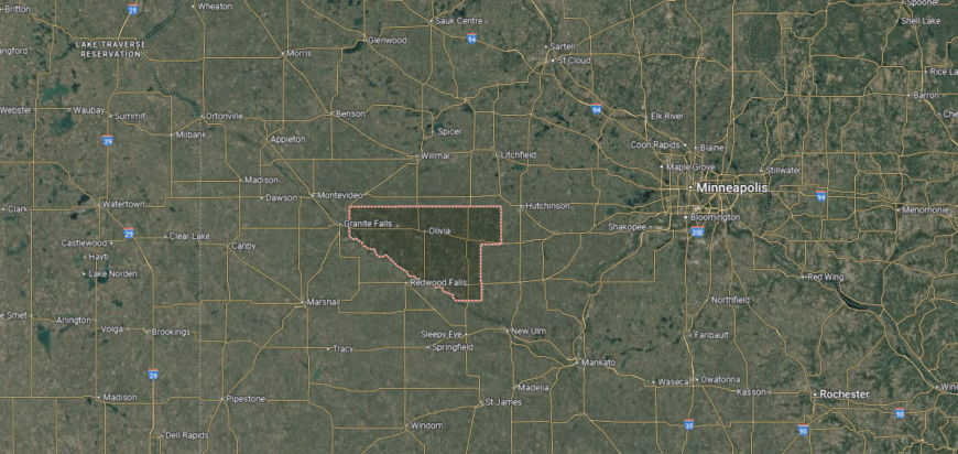
Renville County is in south-central Minnesota, bordered by Kandiyohi County to the north, Brown County to the south, and Redwood County to the west. It lies about 100 miles southwest of Minneapolis and sits within the Minnesota River Valley. The county’s landscape is dominated by fertile farmland and prairie plains.
Olivia, the county seat, is near the center and serves as the hub of government and commerce. Other communities include Fairfax to the south and Bird Island to the west. With its strong agricultural base and central location, Renville County reflects the farming traditions of southern Minnesota.
#23. Big Stone County
– Life expectancy: 78.0 years
— 1.7 years lower than the state average
About
Big Stone County rests along Minnesota’s western edge, where the Minnesota River begins its journey from Big Stone Lake. Early settlement was shaped by river trade, farming, and the wide prairies that stretch across the county. Ortonville, the county seat, reflects this heritage as both a river town and a community anchored in small-town traditions.
Heritage is carried forward through festivals, courthouse gatherings, and community events that honor the county’s river and prairie roots. Farming remains central to the economy, joined by tourism drawn to Big Stone Lake and nearby natural areas. Big Stone County reflects a place where history, land, and community pride remain firmly connected.
Where is Big Stone County?
Big Stone County is in western Minnesota, bordered by Traverse County to the north and Lac qui Parle County to the south. Its western edge follows the Minnesota–South Dakota border, with the county named after Big Stone Lake, which forms part of that boundary. It lies about 160 miles west of Minneapolis, in the prairie region of the state.
Ortonville, the county seat, is located along Big Stone Lake on the South Dakota line. Other communities include Clinton to the northeast and Graceville in the northern part of the county. With its lakeside setting and agricultural land, Big Stone County links Minnesota’s prairies with its western borderlands.
#22. Norman County (tie)
– Life expectancy: 77.9 years
— 1.8 years lower than the state average
About
Norman County lies in northwestern Minnesota, where the Red River Valley stretches wide with fertile fields and open skies. Ada, the county seat, serves as the civic and cultural center of a region deeply tied to agriculture and rural tradition. The flat prairie landscape gives the county both its economic strength and its quiet beauty.
Life here follows the rhythm of the land—planting in spring, harvest in fall, and community events that mark the seasons. Farming forms the backbone of daily living, while schools, fairs, and local festivals strengthen connections. Norman County reflects a place where prairie, people, and tradition remain firmly linked.
Where is Norman County?
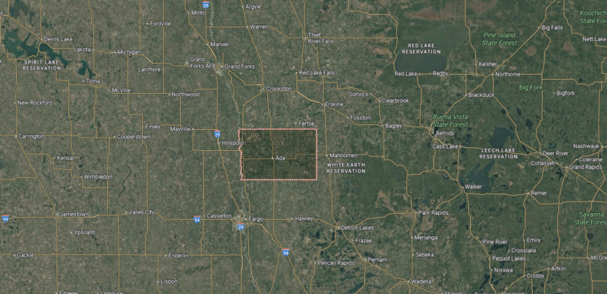
Norman County is in northwestern Minnesota, bordered by Polk County to the north, Clay County to the south, and Mahnomen County to the east. Its western boundary follows the Red River of the North, which also forms the state line with North Dakota. The county lies about 240 miles northwest of Minneapolis in the fertile Red River Valley.
Ada, the county seat, is positioned near the center and serves as the hub for local government and commerce. Other communities include Twin Valley to the east and Hendrum to the southwest along the Red River. With its rich farmland and border location, Norman County is strongly tied to agriculture and the Red River Valley region.
#21. Cottonwood County (tie)
– Life expectancy: 77.9 years
— 1.8 years lower than the state average
About
Cottonwood County sits in southern Minnesota, with Windom as its county seat and hub of local activity. Farming has long defined the county, with crops and livestock forming the backbone of its economy. Small towns and rural communities maintain a steady rhythm shaped by agricultural life.
Community spirit shows in school events, county fairs, and local festivals that bring people together. Parks and lakes provide recreation and a connection to the natural setting. Cottonwood County reflects a blend of agricultural strength, small-town life, and community pride.
Where is Cottonwood County?
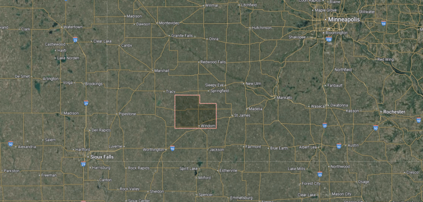
Cottonwood County is in southern Minnesota, bordered by Redwood County to the north, Jackson County to the south, and Brown County to the east. It lies about 140 miles southwest of Minneapolis and is part of the prairie region of the state. The county’s landscape is defined by fertile farmland, rolling plains, and small lakes scattered throughout.
Windom, the county seat, is located near the center along the Des Moines River. Other communities include Mountain Lake to the east and Westbrook to the west. With its agricultural base and prairie setting, Cottonwood County reflects the rural traditions of southwestern Minnesota.
#20. Benton County (tie)
– Life expectancy: 77.7 years
— 2.0 years lower than the state average
You may also like: Best counties to live in Minnesota
About
Benton County is one of Minnesota’s earliest-settled counties, established along the Mississippi River in the central part of the state. Foley, the county seat, reflects both its historic roots and its role as a community connected to nearby regional centers. The county’s story is tied to farming, river trade, and the steady growth of towns across fertile land.
Traditions live on through fairs, historic sites, and local events that highlight the link between past and present. Agriculture remains important, while modern commerce and industry add new dimensions to the economy. Benton County reflects a place where history, land, and community continue to move together.
Where is Benton County?
Benton County is in central Minnesota, bordered by Morrison County to the north, Sherburne County to the south, and Mille Lacs County to the east. It lies about 70 miles northwest of Minneapolis and is part of the Upper Mississippi River region. The county’s landscape includes river valleys, farmland, and stretches of forest.
Foley, the county seat, is near the center and serves as the hub of local government. Other communities include Sauk Rapids along the Mississippi River and Rice near the northern boundary. With its mix of farmland, small towns, and riverfront areas, Benton County connects rural central Minnesota with the St. Cloud metropolitan area.
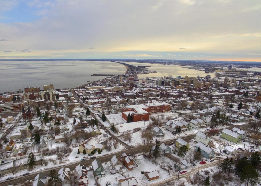
#19. St. Louis County (tie)
– Life expectancy: 77.7 years
— 2.0 years lower than the state average
About
St. Louis County spans the vast forests and lakes of northern Minnesota, stretching from the Iron Range to the Boundary Waters. Duluth, the county seat, rises along the shores of Lake Superior, serving as both a port city and cultural center. The county’s identity is deeply tied to natural resources—iron mining, timber, and waterways that have long shaped its story.
Life moves with the seasons—harsh winters, vibrant summers, and a rhythm marked by both industry and recreation. Outdoor traditions, from fishing and canoeing to skiing and snowmobiling, connect people to the land year-round. St. Louis County reflects a place where wilderness, work, and community stand inseparably bound.
Where is St. Louis County?
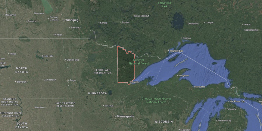
St. Louis County is in northeastern Minnesota, bordered by Lake County to the east, Itasca County to the west, and Carlton County to the south. It also shares an international boundary with Ontario, Canada, to the north. Covering more than 6,800 square miles, it is the largest county in Minnesota by land area and includes parts of the Boundary Waters and Lake Superior shoreline.
Duluth, the county seat, is located along Lake Superior and serves as a major port city and regional hub. Other communities include Hibbing and Virginia on the Iron Range, as well as Ely near the Boundary Waters Canoe Area Wilderness. With its vast forests, lakes, and mining history, St. Louis County is one of the most geographically and economically diverse regions in the state.
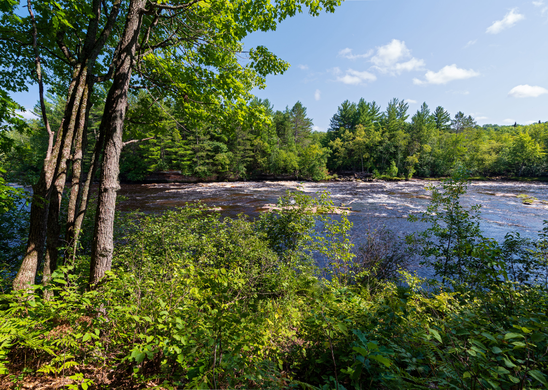
#18. Polk County (tie)
– Life expectancy: 77.4 years
— 2.3 years lower than the state average
About
Polk County sits in northwestern Minnesota, with Crookston as its county seat and center of civic life. The Red River Valley’s fertile soils have long supported farming, making agriculture the foundation of the county’s economy. Its towns reflect a balance of rural tradition and regional connection.
Community ties are strengthened through school events, county fairs, and local festivals that highlight shared pride. Parks, trails, and nearby rivers add space for recreation and family life. Polk County reflects a steady mix of agricultural strength, small-town identity, and community connection.
Where is Polk County?
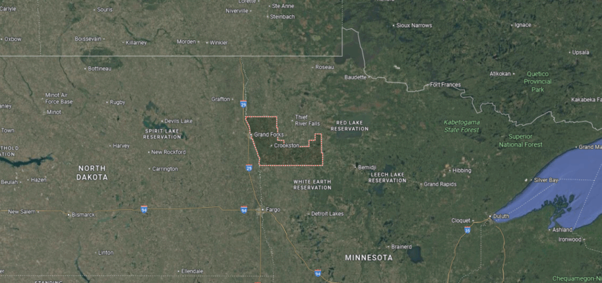
Polk County is in northwestern Minnesota, bordered by Marshall County to the north, Norman County to the south, and Red Lake County to the east. Its western edge follows the Red River of the North, which also forms the state line with North Dakota. The county lies about 280 miles northwest of Minneapolis and is part of the fertile Red River Valley.
Crookston, the county seat, is located near the center and serves as the main hub of government and commerce. Other communities include East Grand Forks along the Red River and Fosston in the eastern part of the county. With its agricultural base and position along the Minnesota–North Dakota border, Polk County plays an important role in the Red River Valley region.
#17. Pine County (tie)
– Life expectancy: 77.4 years
— 2.3 years lower than the state average
About
Pine County lies in east-central Minnesota, its name drawn from the vast pine forests that once fueled the logging industry. Hinckley, the county seat, carries the memory of the great fire of 1894, a defining moment that shaped the resilience of its communities. Farming, forestry, and small-town traditions have since guided the county’s steady development.
Heritage is preserved through museums, festivals, and local gatherings that honor both logging history and pioneer life. Modern life blends agriculture, tourism, and outdoor recreation, keeping the land central to the county’s identity. Pine County reflects a place where history, resilience, and natural setting remain closely tied.
Where is Pine County?
Pine County is in east-central Minnesota, bordered by Carlton County to the north, Chisago County to the south, and Kanabec County to the west. Its eastern boundary follows the St. Croix River, which also marks the state line with Wisconsin. The county lies about 90 miles north of Minneapolis–St. Paul and covers part of the Mille Lacs Uplands.
Pine City, the county seat, is located near the center along the Snake River. Other communities include Hinckley to the north and Sandstone in the central section. With its forests, rivers, and easy access to the Twin Cities, Pine County serves as a gateway to northern Minnesota.
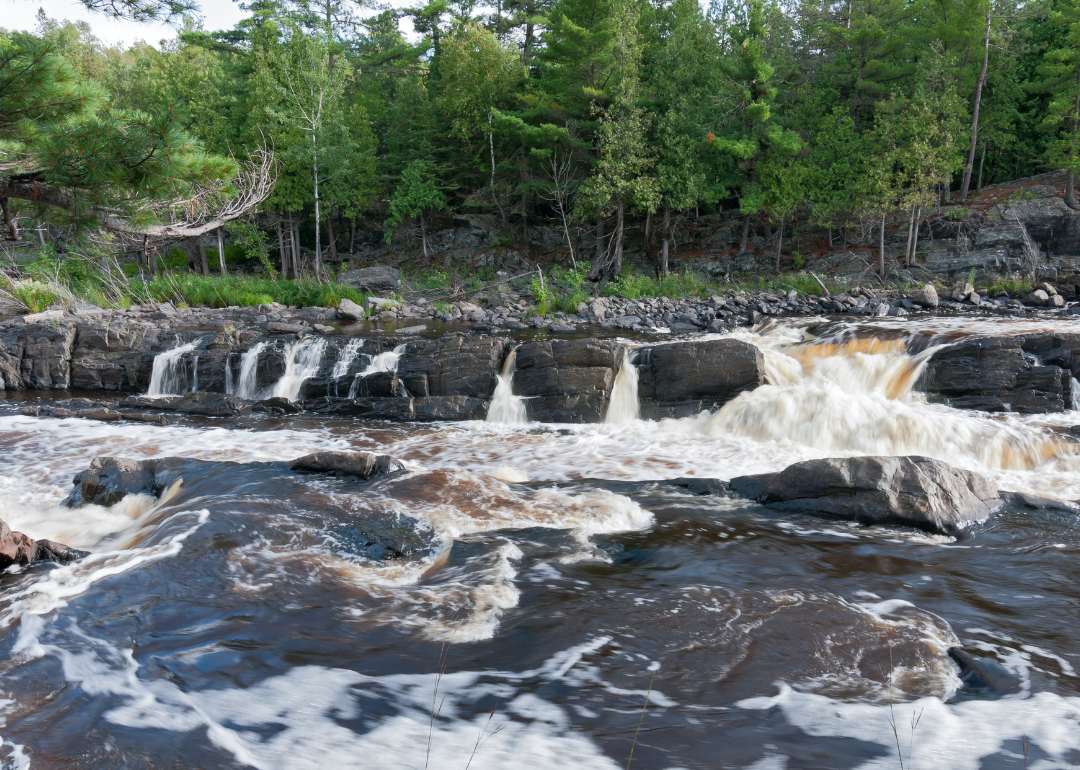
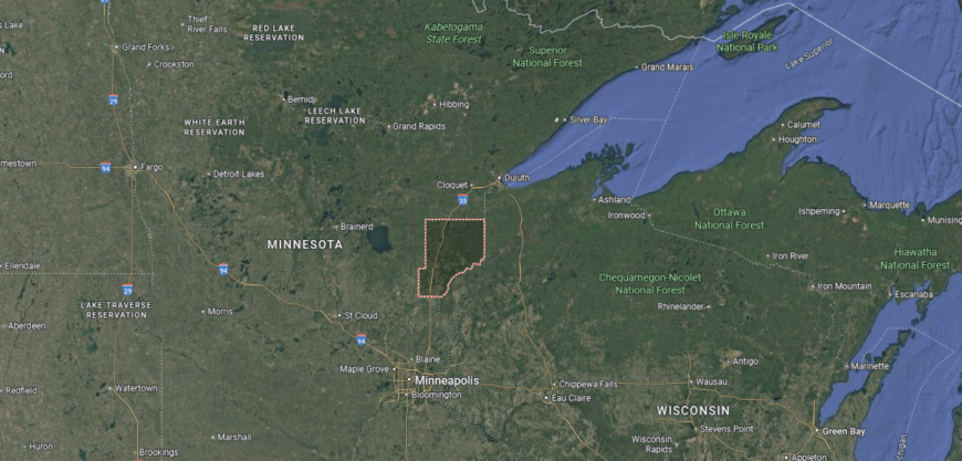
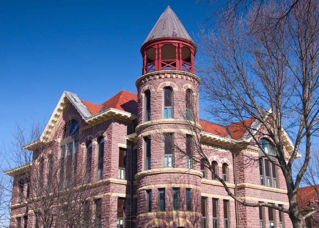
#16. Carlton County (tie)
– Life expectancy: 77.3 years
— 2.4 years lower than the state average
About
Carlton County rests in northeastern Minnesota, where forested hills and winding rivers give shape to the land. Cloquet, the county seat, reflects both industry and community, with timber and paper production long tied to its story. The county’s position near Lake Superior connects it to regional trade and the natural beauty of the North Shore.
Seasonal rhythms guide life—winter sports, summer festivals, and autumn harvest traditions keep communities active year-round. Forestry, manufacturing, and tourism together sustain the economy while keeping the landscape central. Carlton County reflects a place where land, work, and community remain inseparably linked.
Where is Carlton County?
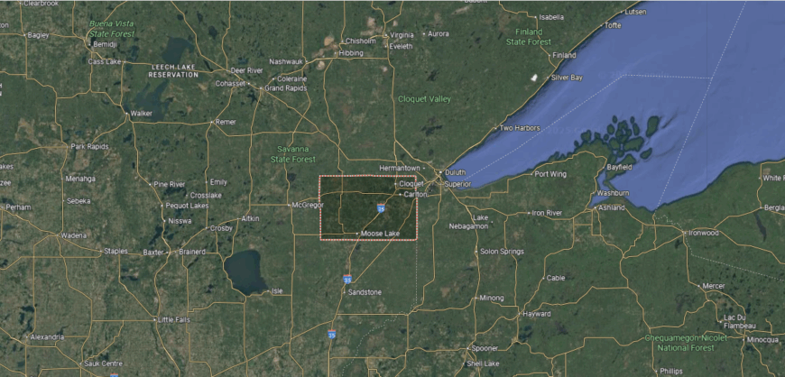
Carlton County is in northeastern Minnesota, bordered by St. Louis County to the north, Pine County to the south, and Aitkin County to the west. Its eastern boundary meets the state of Wisconsin, with the St. Louis River flowing through the region. The county lies about 20 miles southwest of Duluth and forms part of the Lake Superior basin.
Carlton, the county seat, is located near the center and sits close to Jay Cooke State Park. Other communities include Cloquet along the St. Louis River and Moose Lake in the southern part of the county. With its proximity to Duluth and Lake Superior, Carlton County combines forested landscapes with strong regional connections.
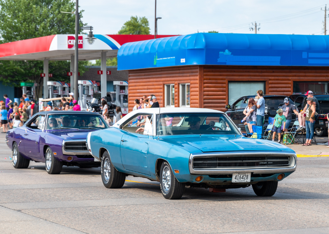
#15. Rock County (tie)
– Life expectancy: 77.3 years
— 2.4 years lower than the state average
You may also like: The best beach towns in Minnesota
About
Rock County sits at Minnesota’s southwestern corner, with Luverne as its county seat and cultural hub. The county’s name reflects its distinctive prairie landscape, marked by quartzite outcrops that give the land a rugged character. Farming has long formed the backbone of the economy, supported by small-town commerce.
Community pride is reflected in school traditions, county fairs, and local festivals that bring residents together. Parks and the Blue Mounds State Park highlight the natural beauty of the prairie. Rock County represents a steady mix of agricultural strength, small-town life, and unique landscape.
Where is Rock County?
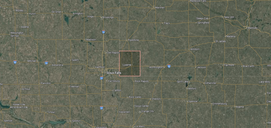
Rock County is in the far southwestern corner of Minnesota, bordered by Pipestone County to the north and Nobles County to the east. Its western boundary meets South Dakota, while the southern edge borders Iowa. The county lies about 175 miles southwest of Minneapolis in the prairie region of the state.
Luverne, the county seat, is positioned near the center and serves as the hub for government and commerce. Other communities include Hills near the Iowa border and Steen close to the South Dakota line. With its location at the junction of two state borders, Rock County anchors Minnesota’s southwestern corner.
#14. Kanabec County
– Life expectancy: 77.2 years
— 2.5 years lower than the state average
About
Kanabec County rests in east-central Minnesota, its name derived from the Ojibwe word for “snake,” a reference to the Snake River that winds through its landscape. Mora, the county seat, reflects both pioneer settlement and Scandinavian traditions that shaped community life. Logging, farming, and the river itself all played central roles in the county’s early development.
Heritage endures through festivals, museums, and local events that celebrate both Native and immigrant influences. Farming and small industry remain important, while outdoor recreation connects residents to rivers, forests, and trails. Kanabec County reflects a place where history, culture, and natural setting remain closely bound.
Where is Kanabec County?
Kanabec County is in east-central Minnesota, bordered by Aitkin County to the north, Pine County to the east, and Mille Lacs County to the west. It lies about 70 miles north of Minneapolis–St. Paul and is part of the Mille Lacs Uplands region. The county’s landscape includes forests, farmland, and the Snake River flowing through its center.
Mora, the county seat, is near the middle and serves as the hub for government and commerce. Other communities include Ogilvie to the west and Grasston in the southern section. With its river valleys and wooded terrain, Kanabec County connects rural Minnesota with the northern edge of the Twin Cities region.
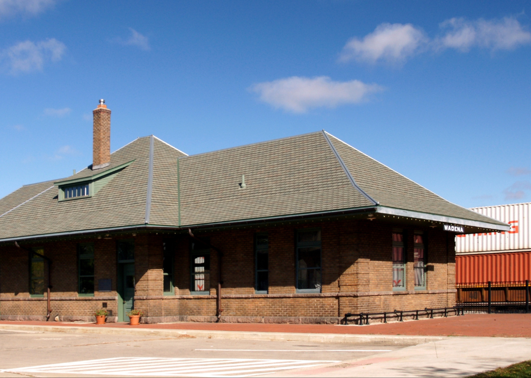
#13. Wadena County (tie)
– Life expectancy: 77.1 years
— 2.6 years lower than the state average
About
Wadena County lies in central Minnesota, where forests meet open prairie and rivers weave quietly through the land. The county seat, Wadena, serves as a crossroads community, blending rural tradition with a role as a regional hub. Its identity is shaped by the balance of farmland, woodland, and waterways that frame daily life.
Seasons bring their rhythm—winter snow, spring planting, summer festivals, and autumn harvest gatherings. Agriculture and forestry remain important, while small businesses and recreation add diversity to the economy. Wadena County reflects a place where land, people, and tradition flow together in harmony.
Where is Wadena County?
Wadena County is in central Minnesota, bordered by Hubbard County to the north, Todd County to the south, and Otter Tail County to the west. It lies about 150 miles northwest of Minneapolis and sits within the transitional zone between prairie and forest. The county’s geography includes rolling farmland, forests, and several rivers, including the Crow Wing River.
Wadena, the county seat, is located near the center and serves as the primary hub of local government and commerce. Other communities include Sebeka to the north and Menahga in the northeast. With its mix of farmland, woodlands, and river valleys, Wadena County reflects the character of central Minnesota.
#12. Roseau County (tie)
– Life expectancy: 77.1 years
— 2.6 years lower than the state average
About
Roseau County sits in far northwestern Minnesota, with the city of Roseau as its county seat and community center. Farming, forestry, and small industry have long anchored the county’s economy, alongside its reputation as a hub for snowmobile manufacturing. Its position near the Canadian border gives it strong cross-border connections.
Community life is reflected in school events, local festivals, and civic gatherings that highlight both pride and tradition. Outdoor recreation in forests, rivers, and fields shapes daily living year-round. Roseau County represents a steady mix of rural strength, industry, and northern community spirit.
Where is Roseau County?
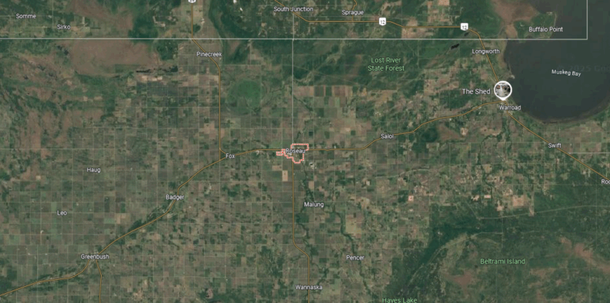
Roseau County is in far northwestern Minnesota, bordered by Kittson County to the west, Lake of the Woods County to the east, and Marshall County to the south. Its northern boundary forms part of the international border with Manitoba, Canada. The county lies about 350 miles northwest of Minneapolis and is part of the Red River Valley and northern forest region.
Roseau, the county seat, is positioned near the center and serves as a hub for government and commerce. Other communities include Warroad to the northeast along Lake of the Woods and Greenbush in the western part of the county. With its mix of farmland, forests, and border location, Roseau County connects Minnesota to Canada while reflecting both prairie and woodland traditions.
#11. Itasca County (tie)
– Life expectancy: 77.1 years
— 2.6 years lower than the state average
About
Itasca County lies in northern Minnesota, where forests, lakes, and rivers have long defined both settlement and industry. Grand Rapids, the county seat, grew from logging and paper production while also serving as a cultural and commercial hub for the region. The county is named for Lake Itasca, the headwaters of the Mississippi River, a landmark central to Minnesota’s history.
Heritage is carried forward through museums, festivals, and community traditions that honor logging history and pioneer life. Forestry, mining, and tourism anchor the economy, while outdoor recreation connects residents and visitors to the land. Itasca County reflects a place where history, natural resources, and community spirit remain closely tied.
Where is Itasca County?
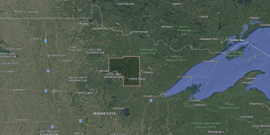
Itasca County is in north-central Minnesota, bordered by Koochiching County to the north, St. Louis County to the east, and Cass County to the south. It lies about 200 miles north of Minneapolis and covers a vast area of forests, lakes, and rivers. The county is home to the headwaters of the Mississippi River at Lake Itasca.
Grand Rapids, the county seat, is located near the southwest portion of the county along the Mississippi River. Other communities include Deer River to the west and Bigfork in the northern section. With its extensive woodlands, waterways, and historic significance, Itasca County is a key part of Minnesota’s northland region.
#10. Chippewa County
– Life expectancy: 77.0 years
— 2.7 years lower than the state average
You may also like: Demand for these health care jobs is increasing most in Minnesota
About
Chippewa County rests in western Minnesota, where the Minnesota River winds past open prairies and farmland. Montevideo, the county seat, has long stood at the meeting of rivers and trails, shaping its role as both a trading center and community hub. The wide fields and waterways give the county a steady, grounded character.
Seasons shape life here—planting and harvest, river festivals, and gatherings that carry local traditions forward. Agriculture remains central, while parks and river valleys provide places for recreation and reflection. Chippewa County reflects a place where land, water, and community remain deeply intertwined.
Where is Chippewa County?
Chippewa County is in west-central Minnesota, bordered by Swift County to the north, Renville County to the east, and Lac qui Parle County to the west. It lies about 120 miles west of Minneapolis in the prairie region of the state. The Minnesota River forms much of its southeastern boundary, shaping the county’s fertile farmland.
Montevideo, the county seat, is located near the confluence of the Minnesota and Chippewa Rivers. Other communities include Clara City to the northeast and Milan to the northwest. With its river valleys and agricultural base, Chippewa County reflects the rural character of western Minnesota.
#9. Wilkin County (tie)
– Life expectancy: 76.8 years
— 2.9 years lower than the state average
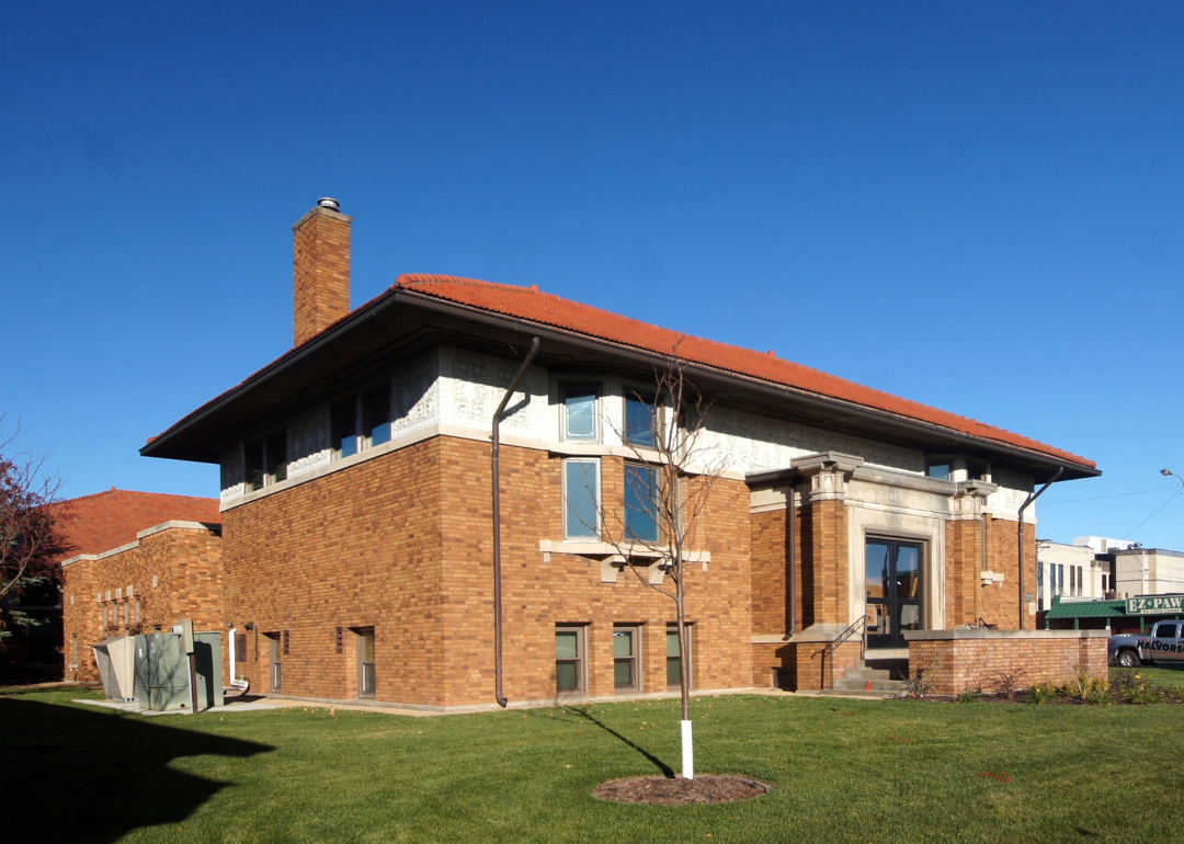
About
Wilkin County sits in western Minnesota along the Red River, with Breckenridge as its county seat and community hub. The county’s identity is tied to fertile farmland, with crops and livestock forming the backbone of its economy. Its location on the border with North Dakota makes it part of a broader regional network of trade and community.
Local pride is reflected in school traditions, county fairs, and civic gatherings that strengthen community ties. Parks, trails, and riverfront spaces add opportunities for recreation and family life. Wilkin County represents a steady mix of agricultural strength, small-town spirit, and regional connection.
Where is Wilkin County?
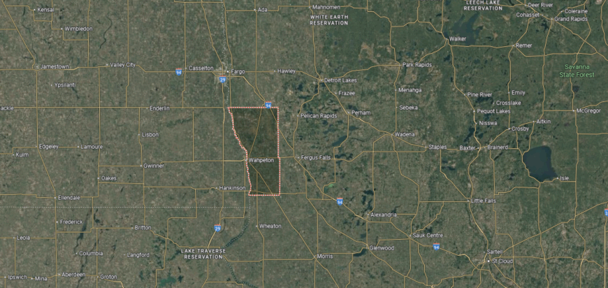
Wilkin County is in western Minnesota, bordered by Clay County to the north, Otter Tail County to the east, and Grant County to the southeast. Its western boundary follows the Red River of the North, which separates Minnesota from North Dakota. The county lies about 200 miles northwest of Minneapolis in the fertile Red River Valley.
Breckenridge, the county seat, is situated on the Red River directly across from Wahpeton, North Dakota. Other communities include Rothsay to the north and Campbell near the southern border. With its strong agricultural base and border location, Wilkin County serves as a connection between Minnesota’s prairie farmland and North Dakota’s plains.
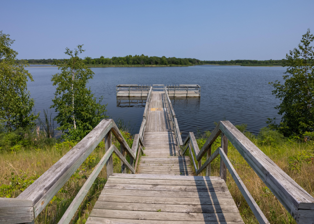
#8. Becker County (tie)
– Life expectancy: 76.8 years
— 2.9 years lower than the state average
About
Becker County lies in northwestern Minnesota, where lakes and forests have shaped both settlement and tradition. Detroit Lakes, the county seat, grew as a center for trade and recreation, drawing on its location along early travel routes and waterways. The county’s history reflects Native American heritage, pioneer farming, and the steady rise of tourism around its lakes.
Heritage continues through cultural festivals, museums, and gatherings that honor both history and community spirit. Farming, forestry, and tourism together form the county’s economic base, with seasonal recreation tying residents and visitors to the land. Becker County reflects a place where history, culture, and natural beauty remain closely bound.
Where is Becker County?
Becker County is in west-central Minnesota, bordered by Mahnomen County to the north, Otter Tail County to the south, and Clay County to the west. It lies about 200 miles northwest of Minneapolis and is part of the state’s lake region. The county’s geography includes forests, rolling hills, and more than 400 lakes formed by glacial activity.
Detroit Lakes, the county seat, is located near the center and serves as the primary hub for commerce and tourism. Other communities include Frazee to the southeast and Lake Park near the western edge. With its abundance of lakes and natural scenery, Becker County is a popular destination for outdoor recreation in Minnesota.
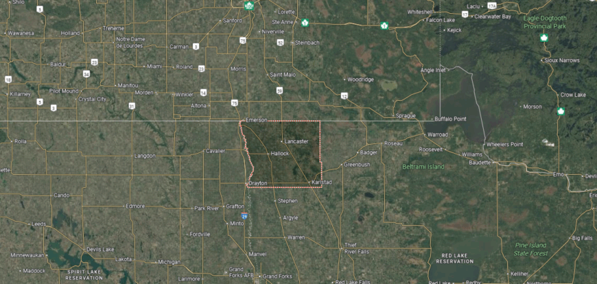
#7. Kittson County
– Life expectancy: 76.4 years
— 3.3 years lower than the state average
About
Kittson County rests at Minnesota’s far northwest corner, where prairie fields stretch wide to meet the Red River and the Canadian border. Small towns and open farmland define its character, with Hallock as the county seat and community hub. The vast horizon and quiet rhythm of rural life give the county a sense of openness and resilience.
Life follows the pace of the land—planting, harvest, and seasonal gatherings that carry traditions forward. Farming anchors the economy, while cross-border connections add another layer to daily life. Kittson County reflects a place where prairie, community, and frontier spirit remain inseparably linked.
Where is Kittson County?
Kittson County is in the far northwestern corner of Minnesota, bordered by Canada to the north and North Dakota to the west along the Red River. To the east lies Roseau County, while Marshall County sits to the southeast. The county is about 360 miles northwest of Minneapolis and lies within the Red River Valley’s fertile prairie lands.
Hallock, the county seat, is near the center of the county along U.S. Highway 75. Other communities include Karlstad in the eastern section and Lancaster close to the Canadian border. With its border location and agricultural base, Kittson County anchors Minnesota’s northwest corner.
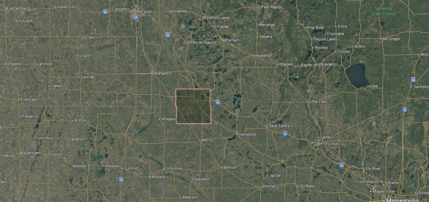
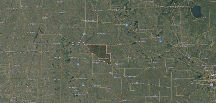
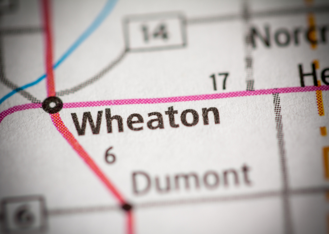
#6. Traverse County
– Life expectancy: 76.3 years
— 3.4 years lower than the state average
About
Traverse County sits along Minnesota’s western border, with Wheaton as its county seat and civic center. It is the state’s least populated county, giving it a quiet, close-knit character shaped by farmland and prairie landscapes. Agriculture remains the foundation of its economy and daily life.
Community pride is carried through school events, county fairs, and gatherings that bring neighbors together. Parks, lakes, and open spaces provide opportunities for recreation and reflection. Traverse County reflects a steady mix of rural tradition, small-town spirit, and prairie setting.
Where is Traverse County?
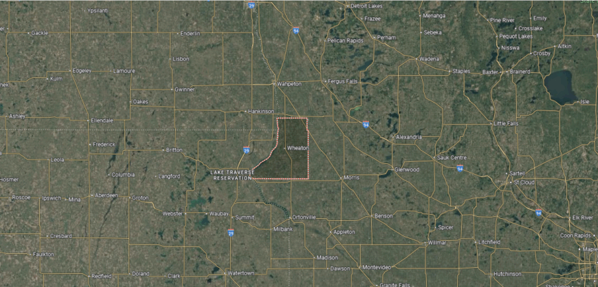
Traverse County is in western Minnesota, bordered by Big Stone County to the south, Stevens County to the east, and Wilkin County to the north. Its western edge follows the Minnesota–South Dakota border along the Bois de Sioux River. The county lies about 180 miles northwest of Minneapolis in the Red River Valley region.
Wheaton, the county seat, is located near the center and serves as the hub for local government and commerce. Other communities include Browns Valley at the northern tip and Dumont in the southern part. With its prairie farmland and border location, Traverse County reflects the agricultural traditions of western Minnesota.
#5. Cass County
– Life expectancy: 75.8 years
— 3.9 years lower than the state average
You may also like: Bestselling cars in Minnesota
About
Cass County lies in north-central Minnesota, where forests and lakes have long shaped its story. Walker, the county seat, reflects the county’s development from logging camps and pioneer settlements into a community tied closely to Leech Lake. Native American heritage, logging history, and frontier life remain central to its identity.
Traditions are preserved through cultural events, museums, and gatherings that honor both Native and settler legacies. Tourism, forestry, and recreation form the economic base, with fishing, boating, and hiking connecting people to the land year-round. Cass County reflects a place where history, culture, and natural beauty remain deeply bound.
Where is Cass County?
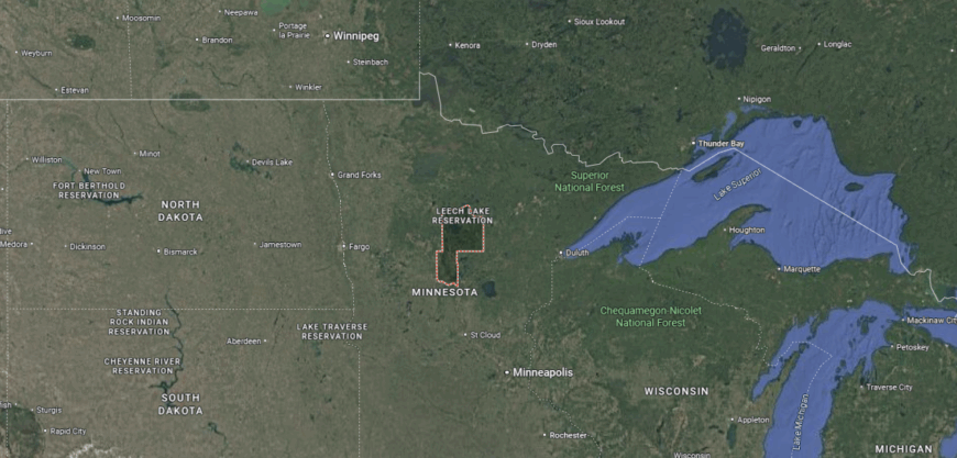
Cass County is in north-central Minnesota, bordered by Itasca County to the north, Crow Wing County to the east, and Hubbard County to the west. It lies about 160 miles northwest of Minneapolis and covers a large part of Minnesota’s lake country. The Mississippi River flows through the county, along with hundreds of lakes and forested areas.
Walker, the county seat, is near the western shore of Leech Lake, one of Minnesota’s largest lakes. Other communities include Pine River to the south and Cass Lake to the north. With its forests, waterways, and extensive recreational areas, Cass County is a central part of Minnesota’s northwoods region.
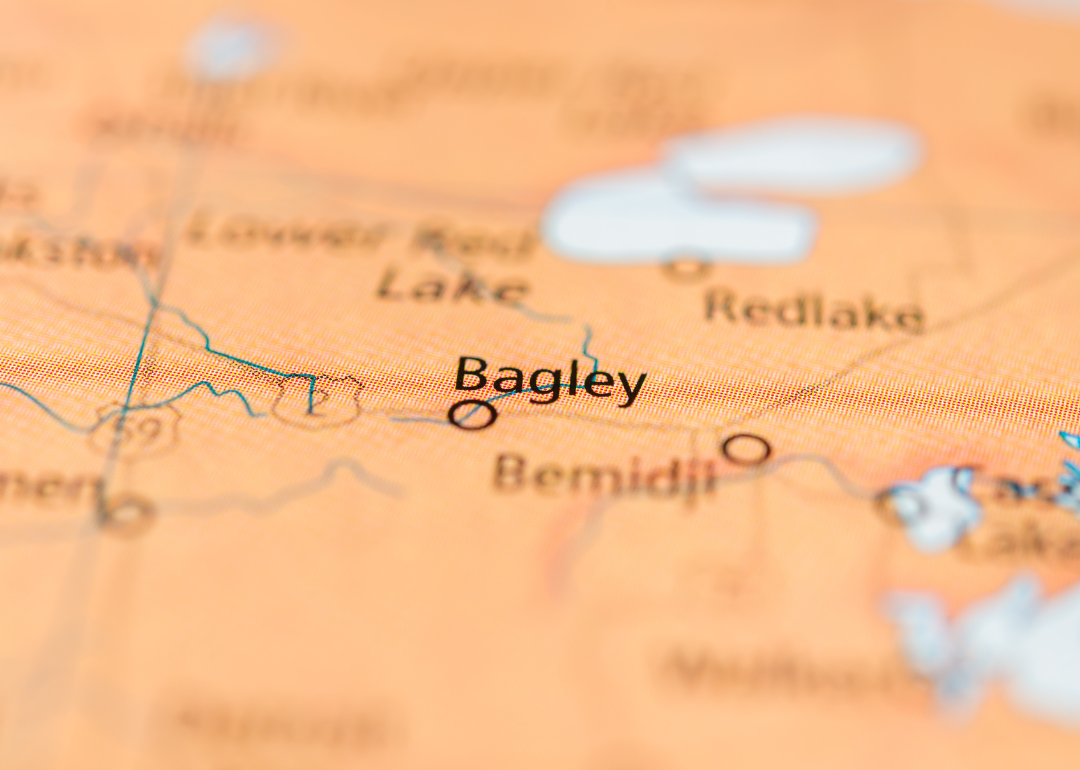
#4. Clearwater County
– Life expectancy: 75.2 years
— 4.5 years lower than the state average
About
Clearwater County rests in northern Minnesota, where rivers, forests, and lakes shape both scenery and way of life. Bagley, the county seat, reflects a small-town character rooted in logging, farming, and the steady traditions of rural living. The headwaters of the Mississippi and the expanse of Itasca State Park tie the county’s identity to the land.
Life follows the rhythm of the seasons—winter brings quiet and snow, spring renewal, summer festivals, and autumn harvest. Tourism and recreation blend with farming and forestry to support the economy. Clearwater County reflects a place where water, woods, and community remain deeply connected.
Where is Clearwater County?
Clearwater County is in northwestern Minnesota, bordered by Beltrami County to the north, Hubbard County to the east, and Mahnomen County to the south. It lies about 200 miles northwest of Minneapolis and is part of the state’s forest and lake region. The county includes the headwaters of the Mississippi River at Lake Itasca.
Bagley, the county seat, is located near the center along U.S. Highway 2. Other communities include Clearbrook to the west and Gonvick in the northwest. With its mix of forests, lakes, and historic waterways, Clearwater County reflects the natural character of northern Minnesota.
#3. Beltrami County
– Life expectancy: 75.1 years
— 4.6 years lower than the state average
About
Beltrami County sits in northern Minnesota, with Bemidji as its county seat and cultural hub. Its identity is tied to the Mississippi River’s headwaters, the presence of lakes and forests, and its role as a regional center for government, education, and commerce. Native American heritage and frontier settlement remain part of its story.
Community life is carried through school traditions, local festivals, and civic events that strengthen ties across a diverse population. Tourism, education, and small industry complement farming and forestry as parts of the economy. Beltrami County reflects a blend of natural setting, cultural heritage, and modern community life.
Where is Beltrami County?
Beltrami County is in northern Minnesota, bordered by Koochiching County to the north, Cass County to the south, and Clearwater County to the west. It lies about 225 miles northwest of Minneapolis and covers a vast area of forests, lakes, and wetlands. Upper Red Lake and Lake Bemidji are two of its most prominent water features.
Bemidji, the county seat, is located near the center along Lake Bemidji and the Mississippi River. Other communities include Blackduck to the north and Tenstrike in the eastern section. With its extensive waterways and forested landscape, Beltrami County serves as a hub of northern Minnesota’s lake country.
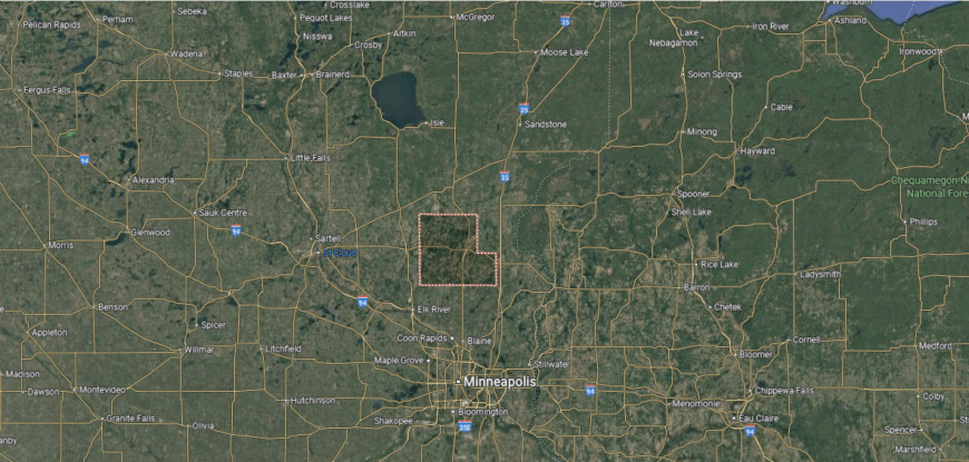
#2. Mille Lacs County
– Life expectancy: 74.6 years
— 5.1 years lower than the state average
About
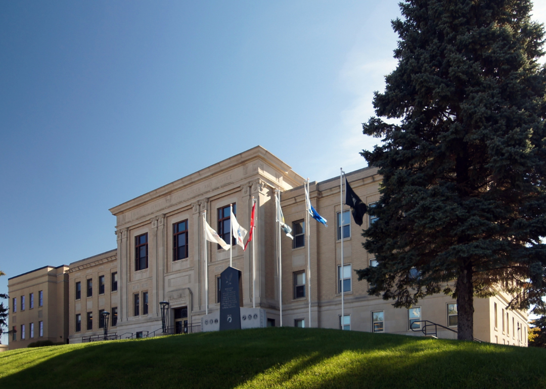
Mille Lacs County rests in east-central Minnesota, its name tied to the great lake that has long been central to the region’s identity. Princeton and Milaca, the county’s main communities, reflect a history shaped by Native American heritage, logging, and pioneer settlement. The lake itself remains both a cultural landmark and an economic anchor.
Heritage is honored through museums, powwows, and community events that highlight traditions carried across generations. Tourism and outdoor recreation complement farming and small industry, linking modern life to historic roots. Mille Lacs County reflects a place where culture, land, and community remain deeply connected.
Where is Mille Lacs County?
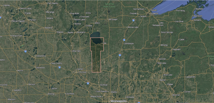
Mille Lacs County is in central Minnesota, bordered by Kanabec County to the east, Benton County to the west, and Sherburne County to the south. It lies about 70 miles north of Minneapolis and includes part of Mille Lacs Lake, one of the state’s largest lakes, along its eastern boundary. The county’s terrain features forests, farmland, and numerous smaller lakes and rivers.
Milaca, the county seat, is near the center and serves as the hub for local government. Other communities include Princeton to the south and Onamia near Mille Lacs Lake. With its mix of farmland, lake country, and easy access to the Twin Cities, Mille Lacs County connects central Minnesota to one of the state’s premier recreational regions.
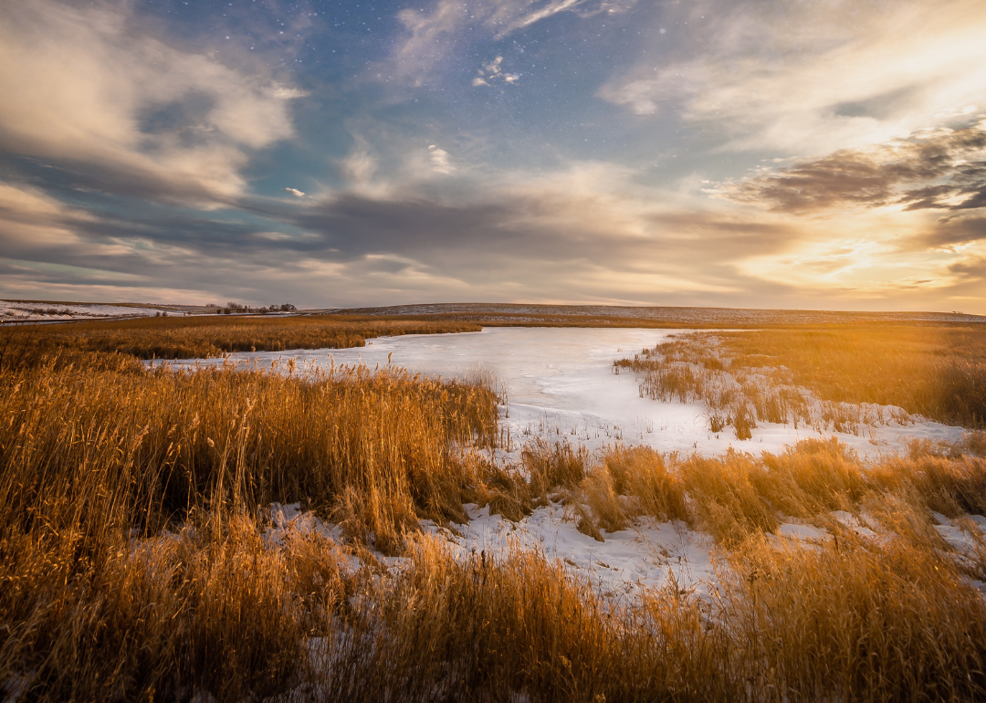
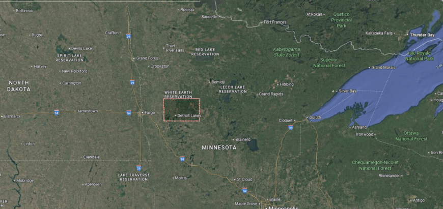
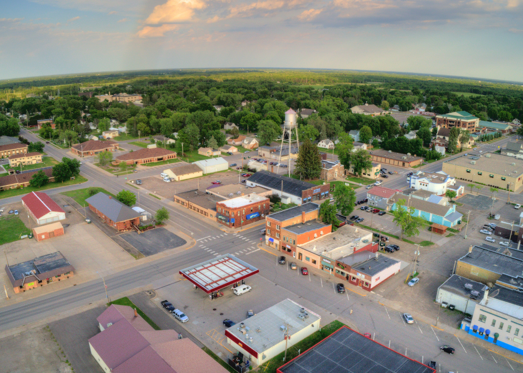
#1. Mahnomen County
– Life expectancy: 68.7 years
— 11.0 years lower than the state average
About
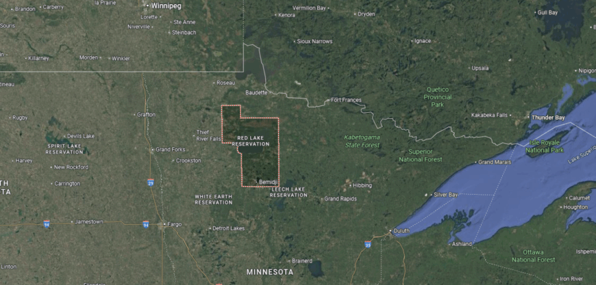
Mahnomen County lies in northwestern Minnesota, its name meaning “wild rice” in Ojibwe, a reflection of the lakes and wetlands that shape both land and tradition. The county seat, Mahnomen, serves as the civic and cultural center of a region deeply tied to Native American heritage. As the only county fully within the White Earth Indian Reservation, it holds a unique identity rooted in both land and people.
Life here follows the rhythm of the water and the seasons—rice harvesting, community gatherings, and celebrations that carry culture forward. Farming, tribal enterprises, and tourism form the base of the economy, supported by the strength of local traditions. Mahnomen County reflects a place where natural abundance, heritage, and community spirit remain inseparably linked.
Where is Mahnomen County?
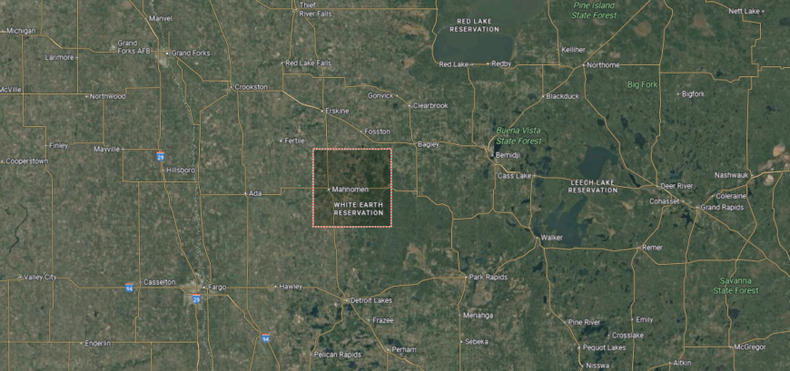
Mahnomen County is in northwestern Minnesota, bordered by Polk County to the west, Clearwater County to the east, and Norman County to the south. It lies about 250 miles northwest of Minneapolis and is the only county entirely within the White Earth Indian Reservation. The county’s geography includes prairie, forest, and lakes formed by glacial activity.
Mahnomen, the county seat, is located near the center along U.S. Highway 59. Other communities include Bejou to the south and Waubun near the eastern border. With its tribal lands, farmland, and natural areas, Mahnomen County reflects both Native American heritage and rural Minnesota traditions.
This story features data reporting by Karim Noorani, writing by Kiersten Hickman, and is part of a series utilizing data automation across 49 states.
By Stacker