
🔥 Would you like to save this?
Counties with the shortest life expectancy in New York
Life expectancy can be affected by a variety of factors. About 25% of your lifespan is determined by genetics, according to the National Library of Medicine. Health and wellness habits—like following a balanced, nutrient-rich diet; not smoking; drinking minimal alcohol; maintaining a healthy weight; and staying physically active—can add more than a decade to your life, research from the National Institutes of Health shows. While these factors are significant, another important element that you might not have considered is your environment and community.
While life expectancy generally increases annually in the United States—jumping from about 70.8 years old to 77.5 between 1970 and 2022, according to the Centers for Disease Control and Prevention—this particular metric can vary from state to state or even county to county. In some parts of the country, the average lifespan is getting shorter based on a variety of risk factors on top of health, including socioeconomic factors like poverty, unemployment, income, and education.
According to a 2020 study from researchers at Penn State, West Virginia, and Michigan State Universities, communities with a higher population density, more fast food restaurants, and a high number of extraction industry-based jobs tend to have shorter life expectancies.
To find out how life expectancy varies within New York, Stacker used 2024 County Health Rankings & Roadmaps from the University of Wisconsin Population Health Institute to identify the counties with the shortest life expectancy. Life expectancy measures the average number of years from birth a person can expect to live and is calculated based on the number of deaths in a given time period and the average number of people at risk of dying during that period. Counties with unreliable or insufficient data were excluded from the analysis. Mortality data came from the National Vital Statistics System.
Read on to see if your county is on the list.
You may also like: Best places to live in New York
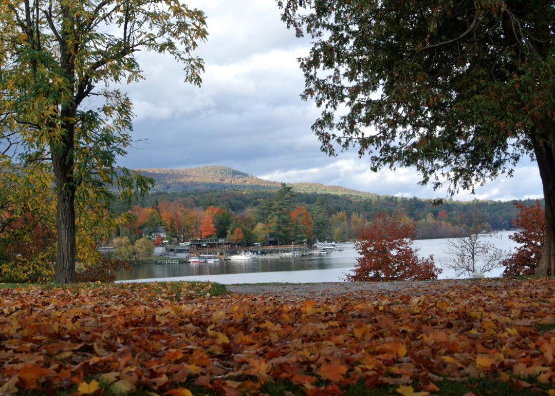
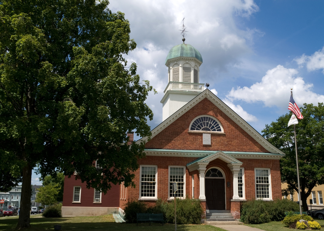
#31. Warren County (tie)
– Life expectancy: 78.1 years
— 1.6 years lower than the state average
About
Warren County blends natural beauty with tourism, outdoor recreation, and a strong sense of local identity. Its economy is supported by hospitality, small business, and seasonal industries centered around lakes, trails, and scenic attractions. The landscape offers year-round opportunities for hiking, boating, and winter sports.
In order to come up with the very specific design ideas, we create most designs with the assistance of state-of-the-art AI interior design software.
Community life emphasizes preservation, cultural events, and environmental stewardship. Residents value a relaxed pace, local traditions, and access to recreational amenities. The area maintains a welcoming atmosphere with a mix of permanent residents and seasonal visitors.
Where is Warren County?

Warren County, New York, is located in the eastern part of the state, approximately 55 miles north of Albany and about 90 miles south of the Canadian border. The county seat, Queensbury, lies just south of Lake George and is around 40 miles east of Saratoga Springs. It is also about 85 miles southwest of Rutland, Vermont.
The county is roughly 160 miles northeast of Syracuse and about 200 miles north of New York City. Warren County is approximately 75 miles southeast of Ticonderoga. Its location places it within the Adirondack region, offering access to lakes, mountains, and outdoor recreation.
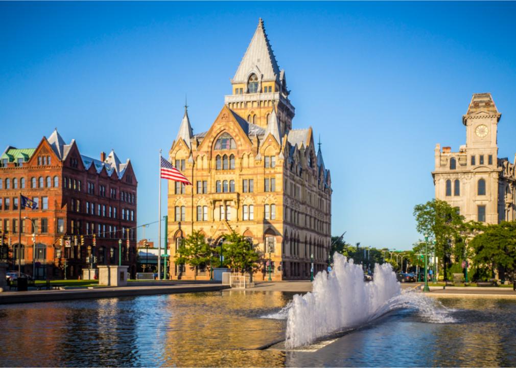
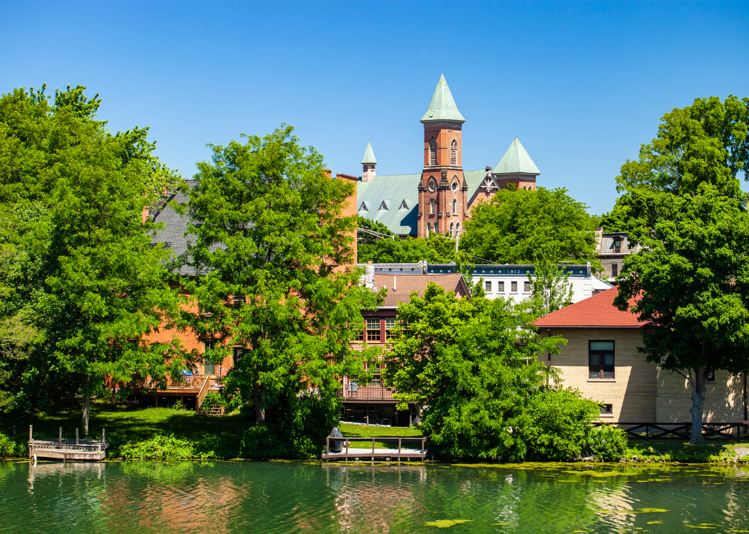
#30. Onondaga County (tie)
– Life expectancy: 78.1 years
— 1.6 years lower than the state average
About
Onondaga County combines urban energy with natural landscapes and a strong educational and cultural foundation. The local economy is diverse, with strengths in healthcare, education, manufacturing, and technology. Parks, lakes, and trails provide year-round outdoor recreation and scenic enjoyment.
The community values innovation, heritage, and civic engagement, reflected in public programs, institutions, and events. Development is focused on revitalization, sustainability, and inclusive growth. Residents enjoy a balance of city life, community spirit, and access to natural beauty.
Where is Onondaga County?

Onondaga County, New York, is located in the central part of the state, approximately 85 miles east of Rochester and about 150 miles west of Albany. The county seat, Syracuse, lies along Interstates 81 and 90 and is around 75 miles south of Watertown. It is also about 35 miles north of Cortland.
The county is roughly 195 miles northwest of New York City and about 145 miles east of Buffalo. Onondaga County is approximately 90 miles southeast of Oswego. Its central location provides access to major transportation routes and serves as a key economic and educational hub in upstate New York.
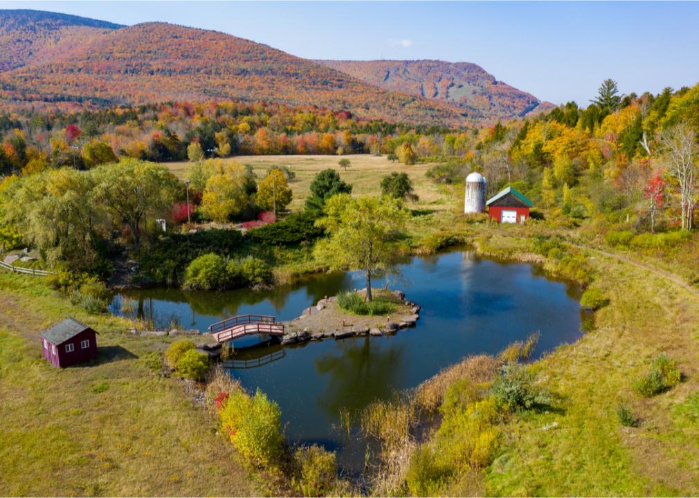
#29. Greene County (tie)
– Life expectancy: 78.1 years
— 1.6 years lower than the state average
About
Greene County is known for its mountainous terrain, artistic heritage, and strong connection to outdoor recreation. Tourism, local crafts, and small businesses form the foundation of its economy, supported by seasonal visitors and a close-knit year-round community. Forests, rivers, and trails offer a peaceful retreat and active lifestyle.
The county values environmental preservation, creative expression, and historical significance through community events and conservation efforts. Growth is modest and mindful, aimed at maintaining the area’s natural and cultural integrity. Residents appreciate a quiet, scenic environment enriched by tradition and creativity.
Where is Greene County?

Greene County, New York, is located in the eastern part of the state, approximately 35 miles south of Albany and about 60 miles northeast of Kingston. The county seat, Catskill, lies near the Hudson River and is around 25 miles east of the Catskill Park region. It is also about 80 miles southwest of Bennington, Vermont.
The county is roughly 120 miles north of New York City and about 160 miles east of Binghamton. Greene County is approximately 90 miles northwest of Poughkeepsie. Its location places it at the northern edge of the Catskill Mountains, offering both rural charm and access to scenic recreation areas.
#28. Yates County (tie)
– Life expectancy: 77.9 years
— 1.8 years lower than the state average
About
Yates County features a blend of rural charm, agricultural richness, and scenic lakefront landscapes. Its economy is rooted in farming, especially vineyards and dairy, along with tourism tied to natural beauty and local wineries. Quiet roads, rolling hills, and water access create a serene setting.
The community emphasizes heritage, craftsmanship, and a strong agricultural identity. Local events, markets, and traditions support a close-knit, self-sustaining way of life. Residents enjoy a peaceful environment grounded in nature, family, and hard work.
Where is Yates County?

Yates County, New York, is located in the western part of the state, approximately 50 miles southeast of Rochester and about 55 miles southwest of Syracuse. The county seat, Penn Yan, lies along the northern end of Keuka Lake and is around 25 miles west of Geneva. It is also about 40 miles north of Elmira.
The county is roughly 190 miles northwest of New York City and about 90 miles east of Buffalo. Yates County is approximately 70 miles northeast of Jamestown. Its location places it within the Finger Lakes region, offering access to scenic lakes, vineyards, and rural landscapes.

#27. Wayne County (tie)
– Life expectancy: 77.9 years
— 1.8 years lower than the state average
About
Wayne County offers a rural landscape shaped by agriculture, historic towns, and access to natural resources. The economy relies on fruit farming, particularly apples, alongside manufacturing and local businesses. Scenic byways, waterways, and farmlands define its visual and cultural character.
The community values tradition, self-reliance, and preservation through festivals, historical societies, and civic pride. Growth is steady and supports both agricultural legacy and modern needs. Residents enjoy a quiet lifestyle rooted in hard work, heritage, and natural beauty.
Where is Wayne County?

Wayne County, New York, is located in the north-central part of the state, approximately 25 miles east of Rochester and about 50 miles west of Syracuse. The county seat, Lyons, lies near the Erie Canal and is around 30 miles south of Lake Ontario. It is also about 35 miles north of Geneva.
The county is roughly 210 miles northwest of Albany and about 250 miles northwest of New York City. Wayne County is approximately 85 miles east of Buffalo. Its location places it in the Finger Lakes region, offering a mix of agricultural land, waterways, and small-town communities.
You may also like: Counties where the most opioids are dispensed in New York

#26. Franklin County
– Life expectancy: 77.8 years
— 1.9 years lower than the state average
About
Franklin County is known for its vast natural landscapes, rural communities, and strong connection to outdoor activities. The economy is supported by agriculture, tourism, forestry, and public services, offering stability across seasons. Lakes, mountains, and open space provide a peaceful and active environment.
The community values heritage, independence, and environmental stewardship through local traditions and conservation efforts. Development remains modest, focusing on sustainability and maintaining regional character. Residents enjoy a slower pace of life surrounded by natural beauty and community pride.
Where is Franklin County?

Franklin County, New York, is located in the northern part of the state, approximately 70 miles northwest of Plattsburgh and about 90 miles northeast of Watertown. The county seat, Malone, lies near U.S. Route 11 and is around 15 miles south of the Canadian border. It is also about 50 miles west of Lake Placid.
The county is roughly 160 miles north of Albany and about 175 miles northwest of Montpelier, Vermont. Franklin County is approximately 210 miles north of Syracuse. Its location places it within the Adirondack region, offering rural landscapes and proximity to international crossings.
🔥 Would you like to save this?
#25. Seneca County (tie)
– Life expectancy: 77.7 years
— 2.0 years lower than the state average
About
Seneca County features a rich blend of agricultural heritage, historical significance, and scenic lakefront settings. Its economy is driven by farming, wineries, tourism, and local craftsmanship that reflect the area’s rural strengths. Open landscapes, vineyards, and small towns create a peaceful and inviting environment.
The community values tradition, sustainability, and civic pride through events, historical sites, and conservation efforts. Growth is approached with care, supporting both economic opportunity and preservation of local character. Residents enjoy a quiet, community-focused lifestyle rooted in nature and history.
Where is Seneca County?

Seneca County, New York, is located in the Finger Lakes region of the state, approximately 45 miles west of Syracuse and about 40 miles southeast of Rochester. The county seat is shared between Waterloo and Ovid, with Waterloo lying near U.S. Route 20 and about 20 miles north of Ithaca. It is also around 30 miles east of Canandaigua.
The county is roughly 175 miles northwest of Albany and about 225 miles northwest of New York City. Seneca County is approximately 90 miles east of Buffalo. Its location places it between Seneca Lake and Cayuga Lake, offering access to wineries, lakeside towns, and rural countryside.

#24. Schenectady County (tie)
– Life expectancy: 77.7 years
— 2.0 years lower than the state average
About
Schenectady County blends a rich industrial history with modern revitalization and cultural energy. Its economy includes healthcare, education, technology, and manufacturing, anchored by longstanding institutions and new innovation. Parks, rivers, and historic architecture contribute to the area’s unique character.
The community emphasizes arts, education, and civic involvement through festivals, theaters, and local initiatives. Development supports a balance between historic preservation and urban growth. Residents enjoy a dynamic, diverse environment rooted in tradition and progress.
Where is Schenectady County?

Schenectady County, New York, is located in the eastern part of the state, approximately 20 miles northwest of Albany and about 40 miles east of Amsterdam. The county seat, Schenectady, lies along the Mohawk River and is around 30 miles north of Hudson. It is also about 45 miles south of Saratoga Springs.
The county is roughly 155 miles north of New York City and about 130 miles west of Springfield, Massachusetts. Schenectady County is approximately 175 miles east of Syracuse. Its location places it within the Capital Region, offering a mix of urban access and surrounding suburban communities.
#23. St. Lawrence County
– Life expectancy: 77.6 years
— 2.1 years lower than the state average
About
St. Lawrence County is defined by its expansive natural landscapes, academic presence, and deep-rooted rural traditions. The economy is shaped by agriculture, education, healthcare, and outdoor tourism, offering a mix of stability and seasonal activity. Rivers, forests, and farmlands provide space for both recreation and reflection.
The community values resilience, education, and environmental stewardship through local institutions, events, and conservation efforts. Development remains modest, focused on maintaining the region’s rural identity and natural resources. Residents enjoy a peaceful, community-oriented lifestyle shaped by nature and heritage.
Where is St. Lawrence County?

St. Lawrence County is located in the northernmost part of New York State, bordering Canada along the St. Lawrence River. It sits approximately 200 miles north of Syracuse and about 350 miles northwest of New York City. The county is part of the Adirondack region and includes portions of the Adirondack Park, making it both rural and scenic.
The county seat, Canton, lies roughly 120 miles south of Ottawa, Ontario, across the Canadian border. St. Lawrence County is also about 90 miles northeast of Watertown, New York, and roughly 140 miles northwest of Lake Placid. It is the largest county by area in New York State, offering a mix of wilderness, small towns, and cross-border proximity.

#22. Erie County (tie)
– Life expectancy: 77.5 years
— 2.2 years lower than the state average
About
Erie County blends urban vibrancy with historical depth and strong regional pride. Its economy is powered by healthcare, education, advanced manufacturing, and a growing tech sector. Cultural institutions, sports, and revitalized neighborhoods contribute to a lively and diverse atmosphere.
The community values innovation, heritage, and inclusivity through public programs, festivals, and civic engagement. Development focuses on sustainability, economic opportunity, and preserving architectural character. Residents enjoy a dynamic mix of city energy, community spirit, and access to natural beauty.
Where is Erie County?

Erie County is in western New York State, bordering Lake Erie and situated along the Canadian border. The county seat is Buffalo, located about 20 miles from Niagara Falls and roughly 90 miles southwest of Rochester. Erie County is also approximately 370 miles northwest of New York City.
Buffalo, the county’s largest city, is about 100 miles southeast of Toronto, Ontario, across the Niagara River. Erie County lies around 180 miles west of Syracuse and 60 miles west of Batavia. Its location near major transportation corridors and international crossings makes it a key hub for trade and travel in the region.
You may also like: Metros in New York that are best for nurses
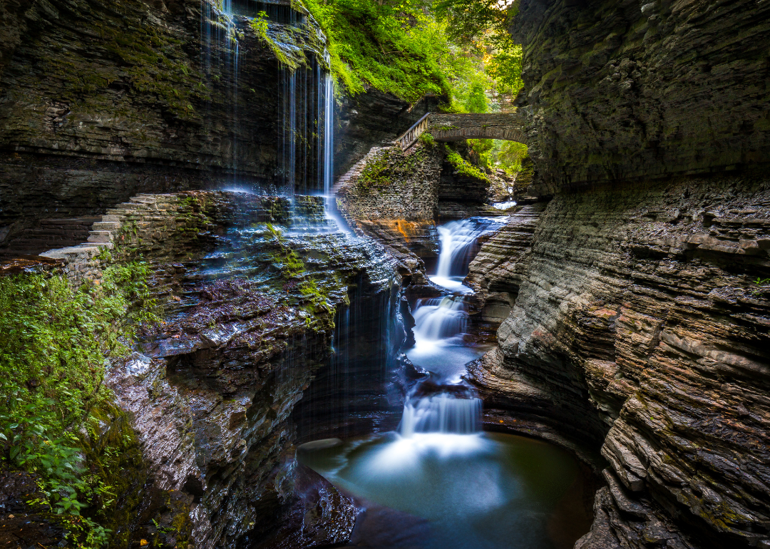
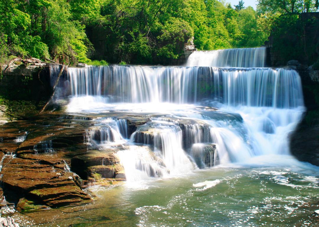
#21. Schuyler County (tie)
– Life expectancy: 77.5 years
— 2.2 years lower than the state average
About
Schuyler County is known for its scenic beauty, small-town charm, and strong ties to agriculture and tourism. Vineyards, farms, and natural attractions support a local economy that thrives on seasonal visitors and community-based businesses. Waterfalls, trails, and lakes enhance the county’s outdoor appeal.
The community values heritage, sustainability, and a close-knit atmosphere reflected in local events and preservation efforts. Growth is modest and carefully managed to protect the area’s character and environment. Residents enjoy a quiet, nature-centered lifestyle rooted in tradition and local pride.
Where is Schuyler County?

Schuyler County is located in the Finger Lakes region of central New York State, nestled between Seneca Lake and Cayuta Lake. The county seat, Watkins Glen, is about 25 miles north of Elmira and roughly 90 miles southeast of Rochester. It lies approximately 150 miles west of Albany, the state capital.
Schuyler County is around 230 miles northwest of New York City and about 65 miles southwest of Syracuse. The area is known for its scenic landscapes, with Watkins Glen State Park and nearby vineyards drawing visitors. Its central location makes it accessible from multiple major cities in western and central New York.
#20. Allegany County (tie)
– Life expectancy: 77.5 years
— 2.2 years lower than the state average
About
Allegany County features a rural landscape shaped by agriculture, forests, and a strong educational presence. Its economy relies on farming, manufacturing, and higher education, supported by small towns and local enterprises. Rolling hills, open land, and quiet communities define its peaceful character.
The community values resilience, tradition, and self-reliance through local events, civic pride, and preservation efforts. Development is modest, focused on sustainability and enhancing quality of life. Residents enjoy a slower pace surrounded by natural beauty and strong community connections.
Where is Allegany County?

Allegany County is located in the southwestern part of New York State, bordering Pennsylvania to the south. The county seat, Belmont, is about 90 miles southeast of Buffalo and roughly 70 miles south of Rochester. It is situated around 75 miles west of Elmira, placing it in a rural and hilly section of the state.
The county lies approximately 300 miles northwest of New York City and 180 miles southwest of Syracuse. Allegany County is also about 35 miles south of Hornell, providing regional access to nearby towns and small cities. Its location along the state border makes it part of the Southern Tier region of New York.
🔥 Would you like to save this?
#19. Genesee County (tie)
– Life expectancy: 77.5 years
— 2.2 years lower than the state average
About
Genesee County blends agricultural strength with small-town character and a steadily diversifying economy. Farming, particularly dairy and crop production, remains central, while manufacturing and service industries contribute to local stability. Open fields, historic villages, and community events shape the region’s identity.
The community values education, preservation, and civic involvement through schools, fairs, and local initiatives. Growth is carefully managed to support both rural heritage and economic opportunity. Residents enjoy a balanced lifestyle rooted in tradition, innovation, and strong community ties.
Where is Genesee County?

Genesee County is located in western New York State between Buffalo and Rochester. The county seat, Batavia, is about 35 miles east of Buffalo and 30 miles west of Rochester. It is approximately 70 miles southwest of Rochester’s neighbor, Syracuse.
The county lies around 240 miles northwest of New York City and about 120 miles west of the state capital, Albany. Genesee County is also about 60 miles northeast of Jamestown and 80 miles southeast of Niagara Falls. Its central location between major upstate cities makes it a key corridor for travel and commerce in western New York.
#18. Delaware County (tie)
– Life expectancy: 77.5 years
— 2.2 years lower than the state average
About
Delaware County is characterized by its mountainous terrain, agricultural roots, and a quiet rural atmosphere. The economy centers around farming, forestry, tourism, and small-scale artisanal businesses. Scenic valleys, rivers, and forests offer opportunities for recreation and peaceful living.
The community values independence, environmental stewardship, and local heritage through events, markets, and conservation efforts. Development remains modest and community-driven, aimed at preserving the natural and cultural landscape. Residents enjoy a slower pace of life deeply connected to nature and tradition.
Where is Delaware County?

Delaware County is located in the southeastern part of New York State, within the Catskill Mountains region. The county seat, Delhi, is about 85 miles southwest of Albany and roughly 60 miles east of Binghamton. It sits approximately 150 miles northwest of New York City.
The county is about 95 miles southeast of Syracuse and around 80 miles northeast of Scranton, Pennsylvania. Delaware County is also about 40 miles west of Kingston, placing it within reach of the Hudson Valley. Its mountainous setting and proximity to several state routes make it a key part of upstate New York’s rural corridor.
#17. Washington County (tie)
– Life expectancy: 77.5 years
— 2.2 years lower than the state average
About
Washington County offers a mix of agricultural heritage, historic charm, and scenic rural landscapes. Its economy is largely supported by farming, local artisans, and small businesses that reflect the area’s traditional values. Rolling hills, open fields, and peaceful towns define the visual character of the region.
The community emphasizes preservation, self-reliance, and strong civic identity through fairs, cultural events, and conservation efforts. Growth is modest and focused on maintaining the county’s rural nature and historical integrity. Residents enjoy a quiet lifestyle grounded in community pride and connection to the land.
Where is Washington County?

Washington County is located in northeastern New York State, along the border with Vermont. The county seat, Fort Edward, is about 50 miles north of Albany and 20 miles southeast of Glens Falls. It lies approximately 160 miles north of New York City.
The county is around 35 miles east of Saratoga Springs and 100 miles south of Burlington, Vermont. Washington County is also about 120 miles southwest of Montpelier, Vermont’s capital. Its location places it within the eastern edge of the Adirondack foothills and the upper Hudson Valley.
You may also like: The best beach towns in New York

#16. The Bronx (tie)
– Life expectancy: 77.3 years
— 2.4 years lower than the state average
About
The Bronx is a vibrant urban borough known for its cultural richness, artistic influence, and historical significance. Its economy is supported by healthcare, education, retail, and small businesses that reflect a diverse and dynamic population. Parks, museums, and iconic landmarks contribute to a strong sense of place.
The community values resilience, creativity, and social connection through festivals, public art, and neighborhood initiatives. Ongoing development focuses on revitalization, affordable housing, and infrastructure improvements. Residents take pride in a bold identity shaped by heritage, diversity, and community spirit.
Where is The Bronx?

The Bronx is one of the five boroughs of New York City, located in the southeastern part of New York State. It sits directly north of Manhattan and is about 10 miles from Times Square. The Bronx is approximately 75 miles south of Poughkeepsie and 25 miles southwest of White Plains.
It lies around 150 miles south of Albany and about 100 miles northeast of Philadelphia, Pennsylvania. The Bronx is also roughly 30 miles west of Stamford, Connecticut. Its location places it at the crossroads of major urban and suburban areas in the New York metropolitan region.
#15. Jefferson County (tie)
– Life expectancy: 77.3 years
— 2.4 years lower than the state average
About
Jefferson County is defined by its blend of natural beauty, military presence, and strong rural traditions. The local economy benefits from agriculture, tourism, defense, and small businesses that serve both residents and visitors. Lakes, rivers, and open landscapes offer abundant opportunities for outdoor recreation.
The community emphasizes resilience, civic pride, and support for both local heritage and economic growth. Development is guided by a desire to balance modern needs with preservation of the area’s character. Residents enjoy a lifestyle rooted in nature, tradition, and close-knit communities.
Where is Jefferson County?

🔥 Would you like to save this?
Jefferson County is located in northern New York State along the eastern shore of Lake Ontario and borders Canada via the St. Lawrence River. The county seat, Watertown, is about 70 miles north of Syracuse and roughly 30 miles south of the Thousand Islands Bridge to Ontario. It is approximately 160 miles northwest of Albany.
The county is around 200 miles north of Binghamton and 320 miles northwest of New York City. Jefferson County is also about 90 miles west of Plattsburgh and 120 miles south of Ottawa, Ontario. Its strategic location near waterways and international crossings makes it a key point for regional travel and commerce.
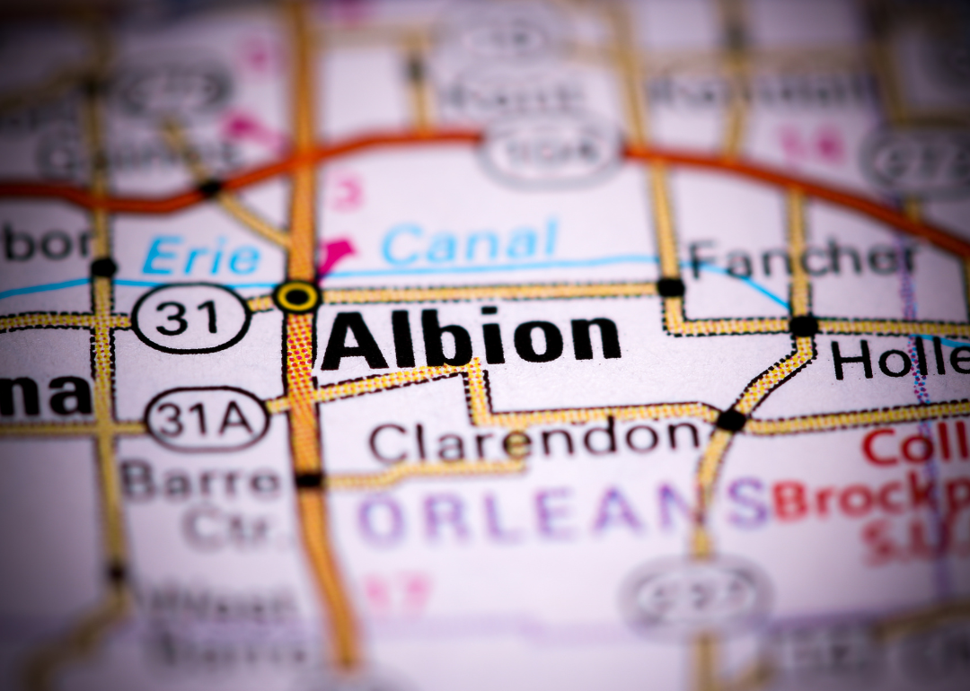
#14. Orleans County (tie)
– Life expectancy: 77.2 years
— 2.5 years lower than the state average
About
Orleans County is shaped by its agricultural legacy, historic towns, and close-knit rural communities. The economy is largely driven by farming—especially fruit and vegetable production—alongside small manufacturing and local services. Quiet roads, open fields, and traditional architecture define the county’s landscape.
The community values heritage, self-sufficiency, and civic engagement through local festivals, markets, and preservation efforts. Growth is steady and intentional, aiming to protect farmland and small-town character. Residents enjoy a peaceful environment grounded in hard work, tradition, and community pride.
Where is Orleans County?

Orleans County is located in western New York State, along the southern shore of Lake Ontario. The county seat, Albion, is about 40 miles west of Rochester and approximately 50 miles northeast of Buffalo. It lies around 65 miles east of Niagara Falls.
The county is roughly 250 miles northwest of New York City and about 100 miles west of Syracuse. Orleans County is also around 35 miles north of Batavia, making it centrally positioned between major upstate cities. Its proximity to Lake Ontario and regional highways supports access to trade and agriculture.

#13. Broome County (tie)
– Life expectancy: 77.2 years
— 2.5 years lower than the state average
About
Broome County blends industrial heritage with educational and cultural development in a dynamic urban-rural setting. The economy is supported by healthcare, education, manufacturing, and emerging technology sectors. Parks, rivers, and revitalized city centers offer residents a mix of natural beauty and modern amenities.
The community values innovation, resilience, and tradition through local institutions, events, and civic engagement. Development focuses on economic renewal, sustainability, and enhancing quality of life. Residents enjoy a balance of opportunity, heritage, and a strong sense of place.
Where is Broome County?

Broome County is located in the south-central part of New York State, bordering Pennsylvania to the south. The county seat, Binghamton, is about 75 miles south of Syracuse and roughly 60 miles north of Scranton, Pennsylvania. It is approximately 140 miles northwest of New York City.
The county lies around 120 miles southwest of Albany and 90 miles east of Elmira. Broome County is also about 100 miles southeast of Rochester. Its location along major highways and near the state border makes it a regional hub for transportation and commerce.
#12. Steuben County
– Life expectancy: 77.1 years
— 2.6 years lower than the state average
About
Steuben County features a mix of rolling hills, small towns, and a strong foundation in manufacturing and agriculture. Its economy includes glassmaking, healthcare, tourism, and farming, offering both industrial strength and rural character. Scenic landscapes and historic villages add to the county’s visual and cultural appeal.
The community values craftsmanship, tradition, and local pride through events, museums, and public initiatives. Growth is balanced with preservation to protect natural beauty and regional identity. Residents enjoy a peaceful lifestyle rooted in heritage, innovation, and connection to the land.
Where is Steuben County?

Steuben County is located in the southwestern part of New York State, within the Southern Tier region. The county seat, Bath, is about 45 miles west of Elmira and roughly 90 miles south of Rochester. It is approximately 120 miles southeast of Buffalo.
The county lies around 230 miles northwest of New York City and about 110 miles southwest of Syracuse. Steuben County is also about 25 miles north of the Pennsylvania border. Its location provides access to Finger Lakes attractions and several key interstate routes.
You may also like: Best public colleges in New York
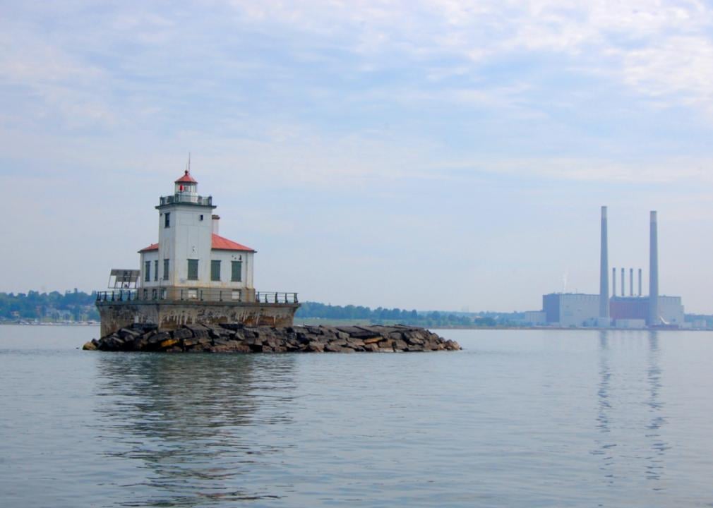
#11. Oswego County
– Life expectancy: 76.8 years
— 2.9 years lower than the state average
About
Oswego County is known for its connection to water, manufacturing roots, and strong sense of community. The economy is supported by energy production, education, agriculture, and seasonal tourism. Waterfronts, forests, and open countryside offer recreation and scenic value throughout the year.
The community emphasizes resilience, environmental stewardship, and historical preservation through local programs and civic engagement. Development efforts focus on revitalization, sustainability, and economic opportunity. Residents enjoy a mix of rural charm, natural beauty, and access to essential services.
Where is Oswego County?

Oswego County is located in central New York State, along the southeastern shore of Lake Ontario. The county seat, Oswego, is about 35 miles northwest of Syracuse and approximately 65 miles east of Rochester. It is around 160 miles west of Albany.
The county lies roughly 300 miles northwest of New York City and about 90 miles north of Ithaca. Oswego County is also about 50 miles south of Watertown. Its location near Lake Ontario and central highways supports access to regional ports and trade routes.
#10. Sullivan County (tie)
– Life expectancy: 76.7 years
— 3.0 years lower than the state average
About
Sullivan County offers a blend of scenic landscapes, cultural revival, and a rich legacy in arts and entertainment. The local economy benefits from tourism, agriculture, hospitality, and wellness-focused development. Forests, rivers, and rolling hills provide a peaceful backdrop for both residents and visitors.
The community values creativity, environmental stewardship, and local heritage through festivals, farmers markets, and preservation initiatives. Growth is focused on revitalizing downtowns and promoting sustainable living. Residents enjoy a tranquil lifestyle with access to nature, culture, and community spirit.
Where is Sullivan County?

Sullivan County is located in the southeastern part of New York State, within the Catskill Mountains. The county seat, Monticello, is about 95 miles northwest of New York City and roughly 85 miles southwest of Albany. It is approximately 70 miles northeast of Scranton, Pennsylvania.
The county lies around 60 miles west of Poughkeepsie and about 120 miles southeast of Binghamton. Sullivan County is also around 90 miles east of Binghamton’s neighbor, Elmira. Its mountainous terrain and proximity to urban centers make it a popular area for recreation and rural living.
#9. Chautauqua County (tie)
– Life expectancy: 76.7 years
— 3.0 years lower than the state average
About
Chautauqua County is known for its cultural institutions, agricultural traditions, and lakefront beauty. The economy is supported by tourism, education, manufacturing, and grape farming, creating a diverse and stable foundation. Scenic lakes, vineyards, and rural towns contribute to a peaceful, inviting atmosphere.
The community values lifelong learning, the arts, and historical preservation through festivals, museums, and local initiatives. Development supports both economic vitality and environmental conservation. Residents enjoy a rich quality of life rooted in nature, creativity, and strong community ties.
Where is Chautauqua County?

Chautauqua County is located in the westernmost part of New York State, bordering Lake Erie and Pennsylvania. The county seat, Mayville, is about 70 miles southwest of Buffalo and roughly 50 miles west of Jamestown. It is approximately 140 miles northeast of Cleveland, Ohio.
The county lies around 250 miles northwest of New York City and about 100 miles southwest of Rochester. Chautauqua County is also about 60 miles northwest of Olean. Its position near major state and interstate routes supports tourism and commerce across state lines.
#8. Cortland County (tie)
– Life expectancy: 76.7 years
— 3.0 years lower than the state average
About
Cortland County features a balance of small-town charm, educational presence, and natural beauty. Its economy is driven by higher education, manufacturing, agriculture, and tourism, creating a diverse and resilient community base. Rolling hills, parks, and trails offer year-round outdoor opportunities.
The community values tradition, learning, and civic engagement through local events, schools, and preservation efforts. Development focuses on sustainability and enhancing the quality of life while maintaining the area’s rural character. Residents enjoy a peaceful lifestyle enriched by community spirit and natural surroundings.
Where is Cortland County?

Cortland County is located in central New York State, within the Finger Lakes region. The county seat, Cortland, is about 35 miles south of Syracuse and roughly 30 miles northeast of Ithaca. It is approximately 80 miles southwest of Albany.
The county lies around 190 miles northwest of New York City and about 60 miles north of Binghamton. Cortland County is also about 100 miles southeast of Rochester. Its location offers convenient access to major universities and regional highways in upstate New York.
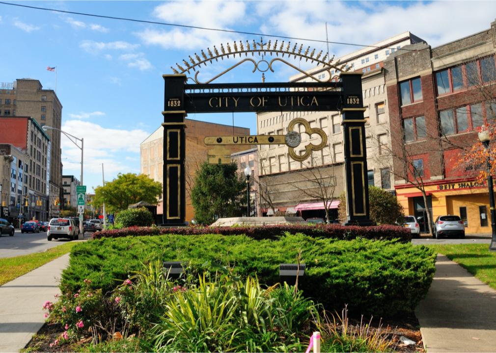
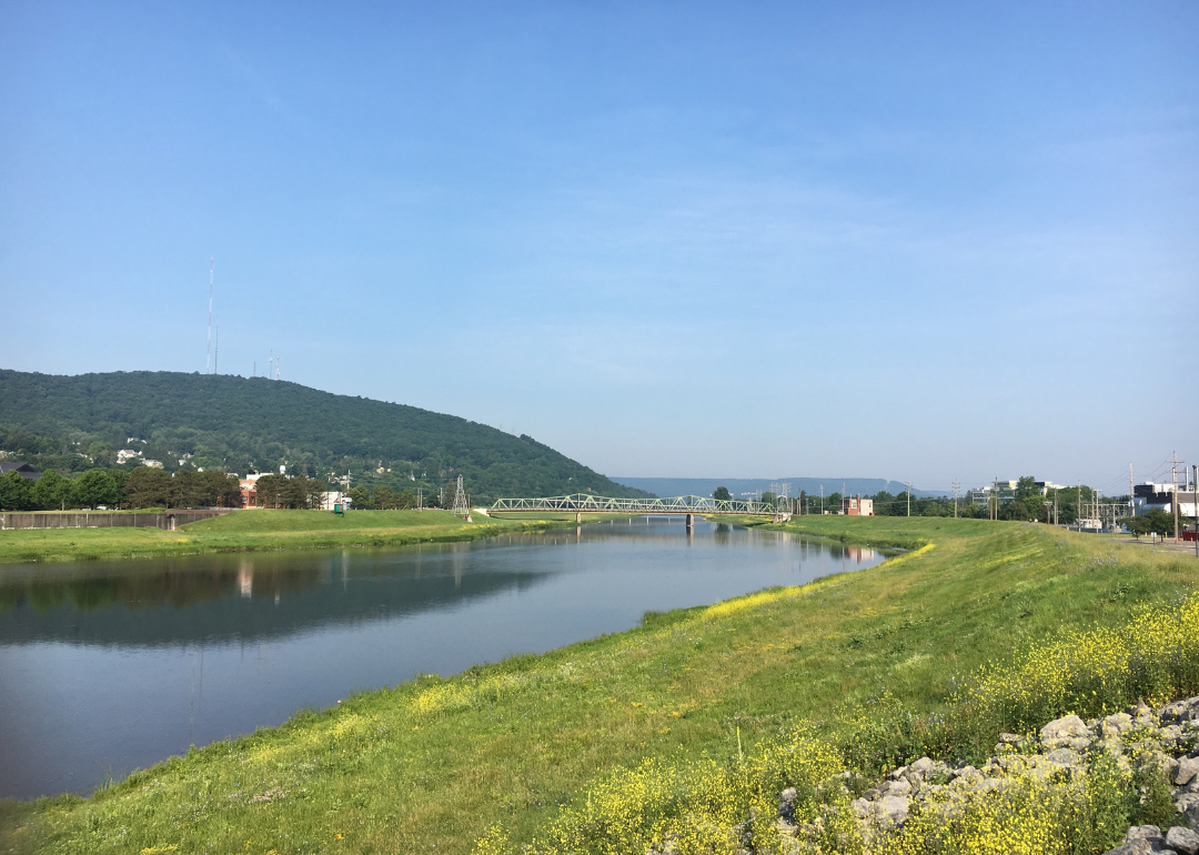
#7. Oneida County
– Life expectancy: 76.6 years
— 3.1 years lower than the state average
About
Oneida County blends historical legacy with economic diversity and cultural vibrancy. Its economy is supported by healthcare, education, manufacturing, and growing technology sectors. Parks, museums, and revitalized downtowns contribute to a strong sense of place and community pride.
The county values innovation, heritage, and inclusivity through public initiatives, festivals, and educational programs. Development focuses on sustainability, economic growth, and preserving historical character. Residents enjoy a balanced lifestyle rooted in tradition, progress, and community connection.
Where is Oneida County?

Oneida County is located in central New York State, just east of the Finger Lakes region. The county seat, Utica, is about 55 miles east of Syracuse and approximately 95 miles northwest of Albany. It is around 200 miles north of New York City.
The county lies roughly 90 miles northeast of Binghamton and about 140 miles east of Rochester. Oneida County is also about 100 miles south of the Adirondack High Peaks region. Its central position supports connections between eastern and western parts of upstate New York.
You may also like: Counties where children have the best opportunity for economic mobility in New York
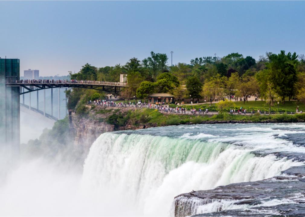
#6. Niagara County
– Life expectancy: 76.2 years
— 3.5 years lower than the state average
About
Niagara County is defined by its natural wonders, industrial heritage, and agricultural strength. The economy is driven by tourism, manufacturing, viticulture, and renewable energy initiatives. Scenic landscapes, waterfalls, and farmland offer a mix of beauty, productivity, and recreation.
The community values heritage, innovation, and resilience through cultural events, historic preservation, and economic revitalization. Growth efforts aim to balance environmental sustainability with new investment. Residents enjoy a diverse lifestyle shaped by natural landmarks, local pride, and evolving opportunity.
Where is Niagara County?

Niagara County is located in western New York State, along the border with Ontario, Canada. The county seat, Lockport, is about 20 miles east of Niagara Falls and roughly 30 miles north of Buffalo. It is approximately 75 miles west of Rochester.
The county lies around 370 miles northwest of New York City and about 170 miles west of Syracuse. Niagara County is also about 100 miles southeast of Toronto, across the Niagara River. Its position near international crossings and Lake Ontario supports tourism and trade in the region.
#5. Montgomery County
– Life expectancy: 76.0 years
— 3.7 years lower than the state average
About
Montgomery County blends agricultural traditions with a deep historical legacy and small-town character. The economy is supported by farming, manufacturing, and local enterprises that reflect the county’s rural foundation. Rolling hills, river valleys, and historic sites create a scenic and culturally rich environment.
The community values preservation, self-reliance, and civic pride through festivals, museums, and revitalization efforts. Development is steady and mindful, focusing on enhancing infrastructure while protecting heritage. Residents enjoy a peaceful, community-centered lifestyle rooted in tradition and resilience.
Where is Montgomery County?

Montgomery County is located in eastern New York State, within the Mohawk Valley region. The county seat, Fonda, is about 40 miles northwest of Albany and roughly 30 miles east of Utica. It is approximately 180 miles north of New York City.
The county lies around 95 miles southeast of Syracuse and about 130 miles east of Rochester. Montgomery County is also about 60 miles northeast of Binghamton. Its location along the Mohawk River and key transportation routes connects it to major cities across upstate New York.
#4. Fulton County
– Life expectancy: 75.9 years
— 3.8 years lower than the state average
About
Fulton County offers a mix of historical industry, natural beauty, and small-town living. Its economy has transitioned from leather and glove manufacturing to include healthcare, education, and tourism. Lakes, forests, and mountain views provide residents with abundant recreational opportunities.
The community values tradition, resilience, and progress through local events, preservation efforts, and economic revitalization. Growth is focused on sustainability and maintaining the area’s scenic and cultural identity. Residents enjoy a quiet, connected lifestyle with access to nature and community support.
Where is Fulton County?

Fulton County is located in east-central New York State, at the southern edge of the Adirondack Mountains. The county seat, Johnstown, is about 45 miles northwest of Albany and roughly 25 miles west of Saratoga Springs. It is approximately 175 miles north of New York City.
The county lies around 85 miles east of Utica and about 95 miles southeast of Lake Placid. Fulton County is also about 70 miles northeast of Binghamton. Its location provides access to both mountain recreation and the Mohawk Valley corridor.
#3. Chenango County
– Life expectancy: 75.8 years
— 3.9 years lower than the state average
About
Chenango County is characterized by its rolling farmland, quiet towns, and strong agricultural and manufacturing roots. The local economy relies on dairy farming, small industries, and local businesses that support a rural lifestyle. Forests, rivers, and open space provide a peaceful setting for recreation and everyday living.
The community values tradition, self-reliance, and civic engagement through fairs, heritage festivals, and volunteerism. Growth is modest and focused on preserving the area’s rural charm and natural resources. Residents enjoy a close-knit atmosphere grounded in hard work, nature, and local pride.
Where is Chenango County?

Chenango County is located in south-central New York State, within the Appalachian Plateau region. The county seat, Norwich, is about 40 miles north of Binghamton and approximately 60 miles south of Utica. It is around 120 miles southwest of Albany.
The county lies about 180 miles northwest of New York City and roughly 80 miles southeast of Syracuse. Chenango County is also about 50 miles east of Ithaca. Its central location connects rural communities to several major upstate cities.
#2. Cattaraugus County (tie)
– Life expectancy: 75.5 years
— 4.2 years lower than the state average
About
Cattaraugus County offers a rich blend of natural beauty, cultural heritage, and rural resilience. Its economy is supported by tourism, agriculture, manufacturing, and small businesses that reflect the county’s diverse landscape. Forested hills, rivers, and outdoor destinations draw visitors and support an active lifestyle.
The community values tradition, self-sufficiency, and environmental stewardship through local events, historic preservation, and conservation initiatives. Development is steady and focused on sustaining rural character while encouraging economic opportunity. Residents enjoy a peaceful, grounded way of life enriched by nature and strong community ties.
Where is Cattaraugus County?

Cattaraugus County is located in the southwestern part of New York State, bordering Pennsylvania to the south. The county seat, Little Valley, is about 50 miles south of Buffalo and approximately 70 miles east of Erie, Pennsylvania. It is around 150 miles southeast of Cleveland, Ohio.
The county lies about 300 miles northwest of New York City and roughly 90 miles southwest of Rochester. Cattaraugus County is also about 30 miles west of Olean. Its position in the western foothills of the Allegheny Plateau makes it part of New York’s Southern Tier.
You may also like: Counties in New York with more precipitation over the past year than average
#1. Chemung County (tie)
– Life expectancy: 75.5 years
— 4.2 years lower than the state average
About
Chemung County combines industrial history, cultural resources, and scenic landscapes into a well-rounded community. Its economy is supported by healthcare, manufacturing, education, and transportation services. Rivers, parks, and trails offer residents and visitors spaces for recreation and reflection.
The community values heritage, innovation, and civic pride through museums, festivals, and public engagement. Development efforts focus on revitalizing urban areas while preserving natural and historical assets. Residents enjoy a balance of tradition, progress, and access to both nature and amenities.
Where is Chemung County?

Chemung County is located in the Southern Tier of New York State, near the Pennsylvania border. The county seat, Elmira, is about 90 miles south of Rochester and approximately 30 miles west of Ithaca. It is around 140 miles southwest of Albany.
The county lies about 220 miles northwest of New York City and roughly 55 miles north of Williamsport, Pennsylvania. Chemung County is also about 110 miles southeast of Buffalo. Its location makes it a key connector between central New York and northern Pennsylvania.
This story features data reporting by Karim Noorani, writing by Kiersten Hickman, and is part of a series utilizing data automation across 49 states.
By Stacker


