Would you like to save this?
Southern Tennessee hides pockets of quiet where hardwood forest, rolling pasture, and forgotten ridge roads muffle life’s usual clatter.
The towns below share three traits: modest populations, landscapes that invite exploration, and just enough distance from commerce to keep nights dark and mornings still. Each one offers its own mix of farm culture, outdoor recreation, and neighbor-to-neighbor self-reliance.
Readers in search of room to breathe will find genuine breathing space here. From forest enclaves along the Natchez Trace to ridge-top hamlets overlooking Alabama, these places remind us that quiet can still be found without leaving Tennessee.
25. Saulsbury – Pines, Rails, and a Sleepy State-Line Stop
Saulsbury feels like a whispered address on the Hardeman County map, where longleaf pines guard empty sidings and front porches look out over pasture. Its seclusion comes from the Mississippi line at its back and two-lane roads that never seem in a hurry.
The vibe is unpolished and peaceful—tin roofs, small churches, and the soft clatter of a distant freight drifting through the trees. Spend an hour photographing vintage storefronts, cast for bream in farm ponds (with permission), drive slow along hedgerows listening for bobwhite, or poke around antique sheds on the edge of town.
Ranching and small timber jobs keep hands busy. By evening, crickets drown out everything but your own thoughts. It’s the sort of quiet that settles into your shoulders.
Where is Saulsbury?

Tucked in far southwestern Tennessee, Saulsbury sits in Hardeman County right on the Mississippi state line, about 18 miles southwest of Bolivar. You reach it via State Route 57, a two-lane ribbon running through pine and pasture.
Services are sparse, which is exactly why the town stays hushed. It’s close enough for a Saturday drive, but far enough to feel off the clock.
24. Hickory Valley – Bottomland Oaks and Gravel Lanes
Hickory Valley keeps a low profile beneath big oaks and bottomland hardwoods, a tiny Hardeman County crossroad with more birdsong than traffic. Its tucked-away feel comes from miles of farm blocks and gravel lanes that seem to end at barns or creeks.
The vibe is gently timeworn—screen doors, porch swings, and the faint scent of hay. Watch woodpeckers work the fencerows, walk a sunrise loop past cotton rows, picnic under giant oaks, or follow quiet county roads toward the Hatchie’s oxbows. Farming is the metronome here.
When the evening breeze stirs the leaves, the town seems to exhale. It’s the kind of place where a whole day passes between sirens.
Where is Hickory Valley?

You’ll find Hickory Valley in south-central Hardeman County, roughly 12 miles south of Bolivar. State Route 18 gets you close; the last miles are calm county blacktop through fields and timber.
There’s no reason to rush—no one else does. It’s nearby on the map and far in feeling.
23. Grand Junction – Bird-Dog Capital in a Quiet Corner
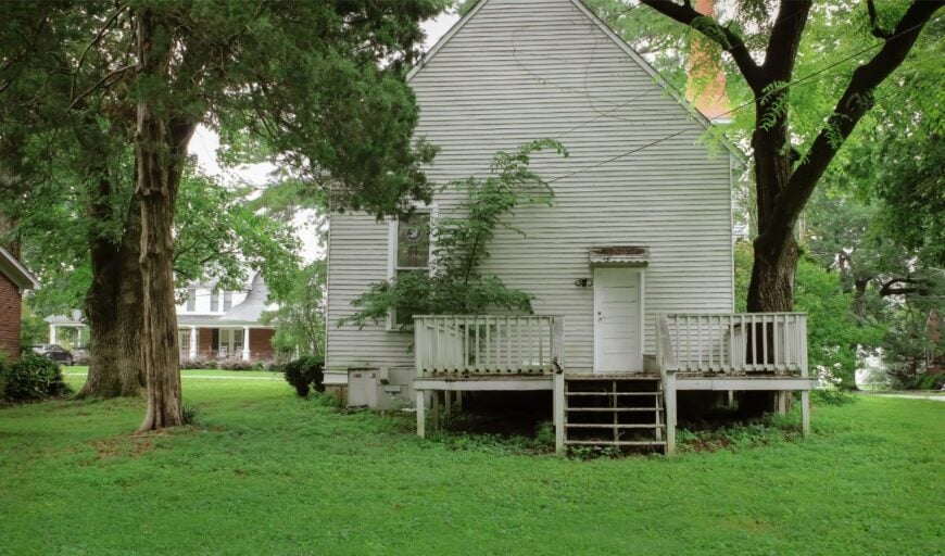
Grand Junction wears its reputation softly, a small town where field-trial lore lives beside sleepy storefronts and shade trees. Seclusion holds because US-72 skims past the edge while most life happens on side streets and surrounding pasture.
The vibe is heritage-rich and unhurried—museum plaques, kennel barns, and the occasional handler jogging a dog at dawn. Visit the National Bird Dog Museum, stroll the little downtown, detour to nearby plantation field-trial grounds in season, or meander backroads where meadowlarks whistle from fence posts.
Agriculture and sporting events share the calendar. Even celebrations never quite raise the volume past conversation level. It’s a gentle place for people who like their days wide and quiet.
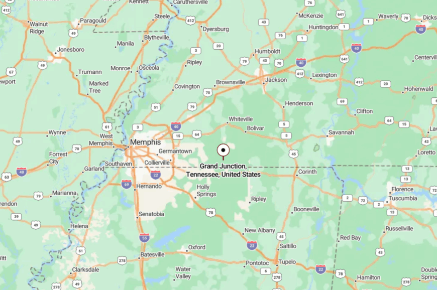
Where is Grand Junction?
Would you like to save this?
On Tennessee’s southwestern edge, Grand Junction sits in Hardeman County, a few minutes from the Mississippi line and about 25 miles southeast of Collierville. US-72 brings you close; local streets slow you down.
The bypass keeps heavy traffic away, preserving the hush downtown. It’s close to the highway, but it feels comfortably tucked behind it.
22. Silerton – Two Counties, One Sleepy Depot
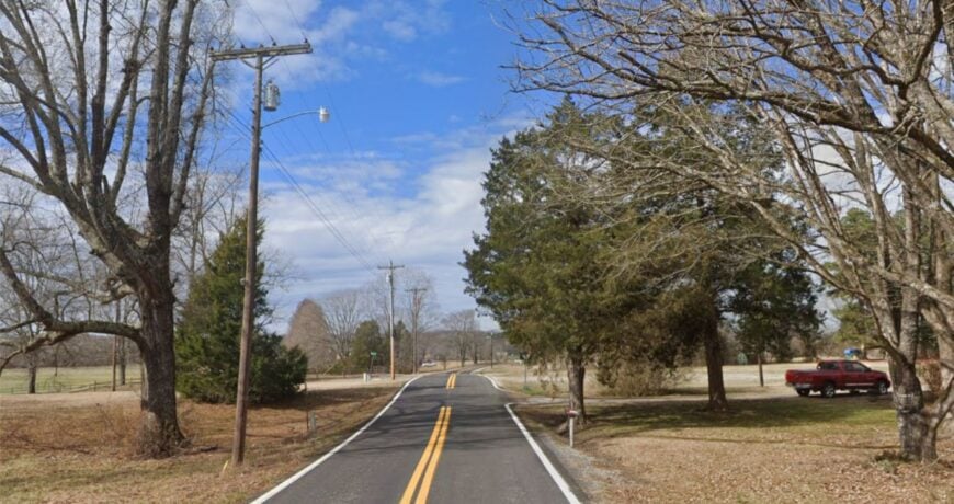
Silerton straddles the Hardeman–Chester line with a remnant depot, a few shaded blocks, and fields that begin where backyards end. Seclusion is baked in: there’s no commercial strip and nearly every road feels like a side road.
The vibe is hushed and photogenic—peeling paint, tidy gardens, and train whistles that sound like memory. Snap pictures of the old rail corridor, wander past hay bales stacked like sculptures, watch for red-tailed hawks along the treeline, or make a day trip to nearby Chickasaw State Park for lake loops.
Farming drives the week, with a sprinkle of forestry and crafts. Night comes quickly here, along with honest dark. It’s small enough that you notice the wind changing.
Where is Silerton?
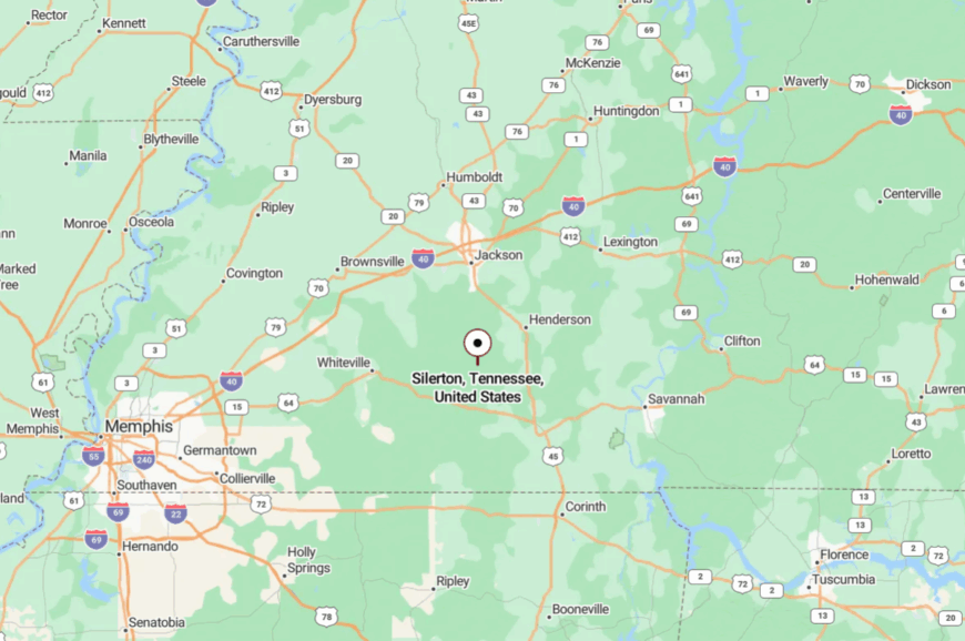
Silerton sits about 15 miles north of Bolivar and 12 miles southwest of Henderson. The simplest approach is a stitchwork of county roads off US-45 or SR-100, both narrowing as you draw near.
Those last turns filter out through-traffic. It’s close enough for a picnic and far enough to feel undiscovered.
21. Stantonville – Backroads to the Big River
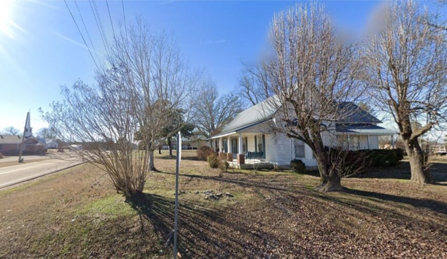
Stantonville keeps to itself on McNairy County high ground, a handful of quiet streets with pines for neighbors. Its seclusion comes from distance—larger towns are a drive away, and the Tennessee River sits out of sight beyond low ridges.
The vibe is porch-swing calm: lawn chairs in shade, tractors crossing at a lazy angle, church bells on the hour. Cast for catfish at Pickwick country boat ramps, wander Shiloh National Military Park’s silent fields, hike at Big Hill Pond State Park, or browse a diner menu where the special is announced like local news.
Farming anchors the economy. Nights here are starry and soft-spoken. It’s a good place to relearn unhurried.
Where is Stantonville?
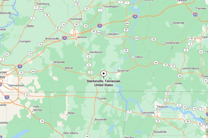
You’ll find Stantonville in eastern McNairy County, about 12 miles north of the Pickwick Dam area and 10 miles west of Savannah. Reach it by State Route 142 or SR-57 and a network of calm, curving byways.
The last miles coil through timber and pasture. You arrive feeling like you’ve set the volume to low.
20. Bethel Springs – Creek Bottoms and a Café Breakfast

Bethel Springs hums at a breakfast-counter pace, with a few blocks of storefronts backed by creeks and timber. Seclusion comes from its placement between bigger errands—most folks pass by on their way to somewhere else, which keeps the town itself hushed.
The vibe is neighborly and practical: early coffee, friendly waves, and noon whistle hunger. Hike or paddle Big Hill Pond State Park, detour to Selmer’s antique shops, fish small ponds after a rain, or take a sunset lap on roads that smell of pine.
Agriculture, small shops, and school-day rhythms split the week. The quiet here isn’t empty; it’s comfortable. It’s the kind of small that fits just right.
Where is Bethel Springs?
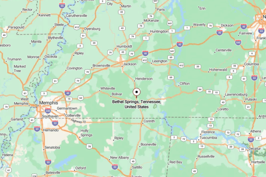
Set in north-central McNairy County, Bethel Springs sits about 6 miles north of Selmer along US-45. The approach is two-lane and easy, but traffic thins the moment you turn onto side streets.
Services cluster in neighboring towns, preserving the calm. It’s close to what you need and far from what you don’t.
19. Ramer – Fence Lines, Field Edges, and Soft Afternoons

Ramer spreads out in a light grid under open sky, as modest as a whispered hello. Its secluded feel comes from being tucked near the Mississippi line, with long distances between crossroads and longer distances between distractions.
The vibe is straight-from-the-soil: co-op scales, tractors dozing under sheds, and dogs choosing the shade. Wander quiet lanes for barn photos, fish farm ponds with permission, trace Civil War history at nearby sites, or aim your day toward Pickwick country when the water calls.
Farming and a few small trades keep things steady. When the sun leans west, everything slows to match it. It’s the sort of town where time minds its manners.
Where is Ramer?
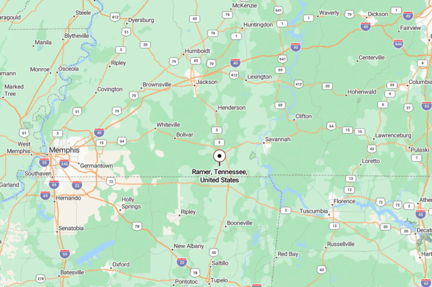
Ramer sits in southern McNairy County, roughly 10 miles south of Selmer and 8 miles from the Mississippi border. US-45 and SR-57 get you near; the rest is easy county blacktop.
With no bypass or big box in sight, the streets stay spare. You arrive and immediately hear the quiet.
18. Pocahontas – Pines, Gravel, and a Hint of Battlefield
Pocahontas feels like a forest clearing with a name, half-hidden on the Hardeman–McNairy line. Seclusion is its signature—patches of pine and creek bottoms keep sightlines short, and the nearest crowds tend to be deer.
The vibe is lightly haunted and very photogenic: old rails, aging storefronts, and the hush of history in the air. Explore Big Hill Pond State Park’s boardwalks, roll to nearby Shiloh National Military Park, bird along bottomland corridors, or shoot golden-hour photos of weathered timber and tin.
Timber, farm work, and park visitors make the modest economy hum. Night brings owls and a sky without glare. It’s quiet enough to hear your own footfall.
Where is Pocahontas?

You’ll find Pocahontas near the Hardeman–McNairy county line in southwest Tennessee, about 14 miles north of Corinth, Mississippi. Access is via SR-57 and a lattice of calm county roads.
The last turns curve through tall pines and creek dips. It’s close to the parks, far from the noise.
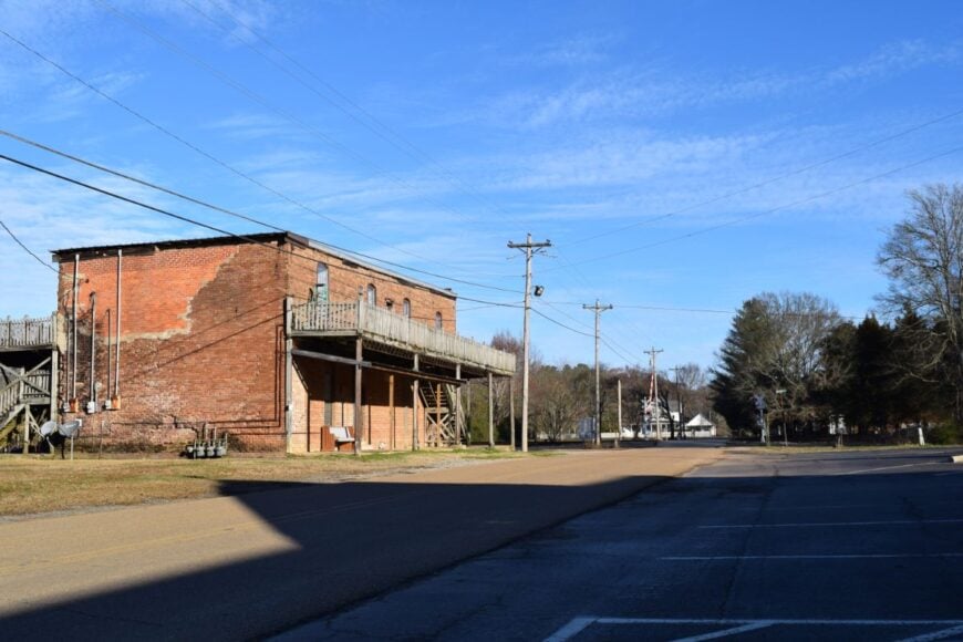
17. Saltillo – River Porches and Sandbar Sunsets

Saltillo leans into the Tennessee River’s wide, slow rhythm—porches aimed at the water, jon boats easing into morning fog. Its seclusion comes from the river itself and the miles of bottomland hardwoods that muffle sound.
The vibe is river-country simple: bait shops, boat ramps, and catfish suppers under string lights. Cast from a sandbar at dusk, paddle slackwater coves, walk the riverfront for heron and osprey, or day-trip to Pickwick country when the wind is up.
A mix of fishing tourism and small-town services keeps lights on. When the sun drops, the river keeps talking. It’s the sort of place where you start measuring time by the water.
Where is Saltillo?
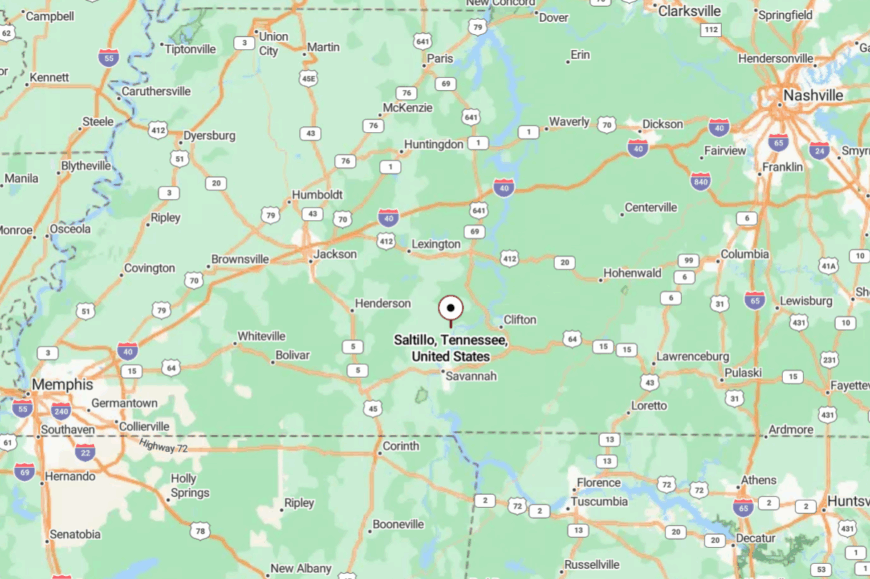
Saltillo sits on the Tennessee River in Hardin County, about 14 miles northwest of Savannah. State Route 69 and riverside byways bring you in with long looks at water and woods.
Boat ramps outnumber billboards out here. It’s easy to reach and easier to stay put.
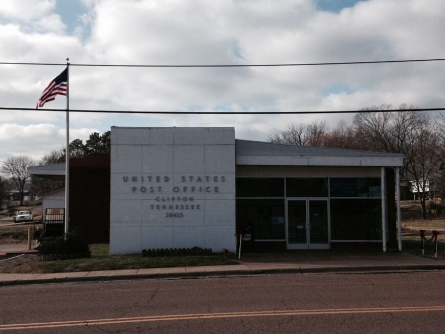
16. Clifton – Bluffs, Brick, and a Quiet Bend in the River
Would you like to save this?
Clifton perches on high ground above a shimmering river bend, a pocket of brick storefronts and tidy porches facing miles of blue. Seclusion arrives courtesy of the Tennessee River and the long, rolling miles between towns in Wayne County.
The vibe is small-seat historic—old homes, shade trees, and a marina that seems to speak in whispers. Stroll the bluff walk, launch a kayak at first light, tour local history museums and river lore, or cruise to river islands for a picnic.
Tourism, small shops, and seasonal river traffic set the tune. Even on holiday weekends, the town wears its calm like a favorite jacket. It’s a river town that keeps its voice low.
Where is Clifton?
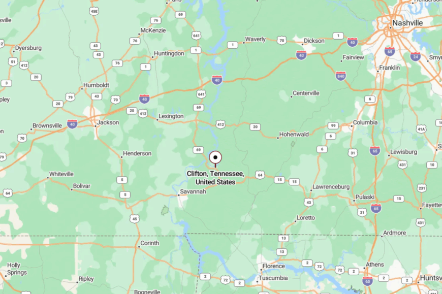
In western Wayne County, Clifton lies about 25 miles west of Waynesboro and due north of the Tennessee River channel. Reach it via SR-128 or SR-228—both two-lane, both scenic.
The last hill hides the river until you’re nearly there. It’s close to the channel and far from the rush.
15. Collinwood – Natchez Trace Porchlight
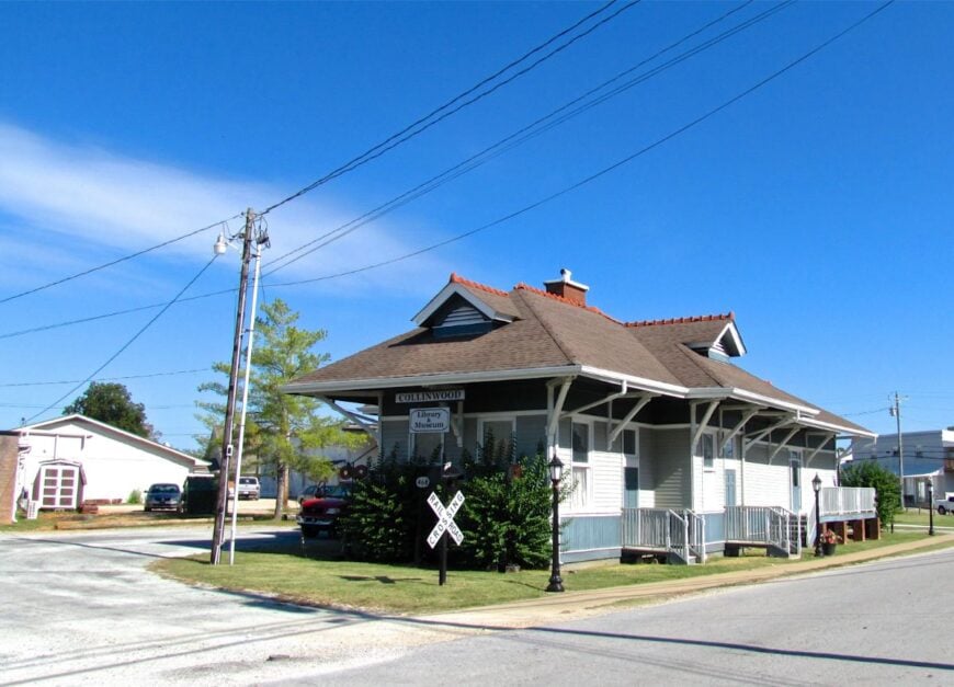
Collinwood is a Trace town at heart, with porches facing the breeze and trail stories traded like recipes. Seclusion comes from the protected corridor of the Natchez Trace and miles of forest that stand between here and anywhere loud.
The vibe is friendly-frontier: a café that knows your name by the second visit, vintage gas pumps, and hikers clomping through with smiles. Walk the Trace greenway, browse a small museum, float the nearby Buffalo River, or time your visit for a local bluegrass pick.
Tourism tied to the Parkway mingles with farm and shop work. Nights fall into perfect dark out here. It’s a place that makes an early bedtime feel like a treat.
Where is Collinwood?

You’ll find Collinwood in southern Wayne County, roughly 12 miles south of Waynesboro and just east of the Natchez Trace Parkway. The Parkway or SR-13 will guide you under a canopy of hardwoods.
Services are modest and close-stitched around Main. It’s close to the Trace, far from the clamor.
14. Ethridge – Amish Lanes and Open Sky
Ethridge spreads out under a big Lawrence County sky, where gravel lanes lead to farmstands and horse-drawn buggies clip past fencerows. Its seclusion grows from wide acreage, limited lighting, and a rhythm tied to weather more than watches.
The vibe is agrarian and quietly bustling—produce wagons, cedar-crafted furniture, and smoke from woodstoves in winter. Visit Amish markets for quilts and jams, book a wagon tour of backroads, fish the Elk River headwaters, or browse roadside barns stacked with handmade chairs.
Farming is the whole sentence here, with tourism the gentle comma. Even weekends never feel crowded. It’s a place where silence tastes like fresh bread.
Where is Ethridge?
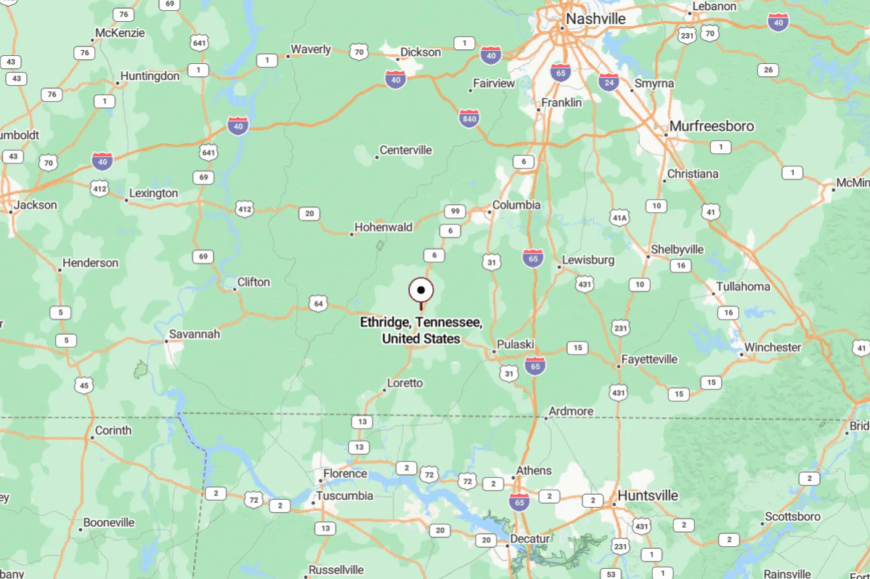
Ethridge sits just north of Lawrenceburg in Lawrence County, a short hop off US-43. Once you turn onto side roads, the asphalt narrows and the pace drops.
Yield to buggies and mind the dust—those are the rules. It’s close to a highway, yet it feels pleasantly pre-highway.
13. Lynnville – Storybook Streets in Horse Country
Lynnville looks like a postcard someone kept in a desk drawer—painted doors, a tiny depot museum, and café pie cooling by the window. Seclusion sticks because the town is wrapped in horse farms and long drives lined with blackboard fence.
The vibe is storybook and sincere: carved signs, tidy storefronts, and greetings that linger. Browse the depot museum, window-shop antiques, walk shady lanes out to pasture edges, or take a slow loop to covered bridges and creek crossings nearby.
Small shops and farm work share the lift. When the train horn echoes across hills, it feels like a memory arriving on time. It’s the sort of quiet that makes you smile without noticing.
Where is Lynnville?
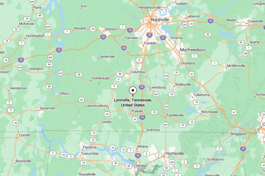
Set in northern Giles County, Lynnville is about 10 miles north of Pulaski and 25 miles south of Columbia. US-31 and a short jog of county roads deliver you to Main Street.
The last mile is all pasture and board fence. It’s near the bigger names, yet solidly in its own world.
12. Petersburg – Three-County Crossroads with a Whisper

Petersburg sits where lines blur—Lincoln, Marshall, and a brush of Moore County meeting under a small set of steeples. Seclusion stems from its position between larger hubs and the way creeks and ridges break up direct routes.
The vibe is classic small-town: a square, a few cafés, and century homes with wraparound porches. Photograph the old storefronts, cast for sunfish in nearby creeks, browse a seasonal farmers’ market, or follow country lanes to hilltop cemeteries with sweeping views.
Farming and school-day commutes carry most of the traffic. After dusk, the square belongs to crickets. It’s a gentle whisper of a town, and that’s the charm.
Where is Petersburg?
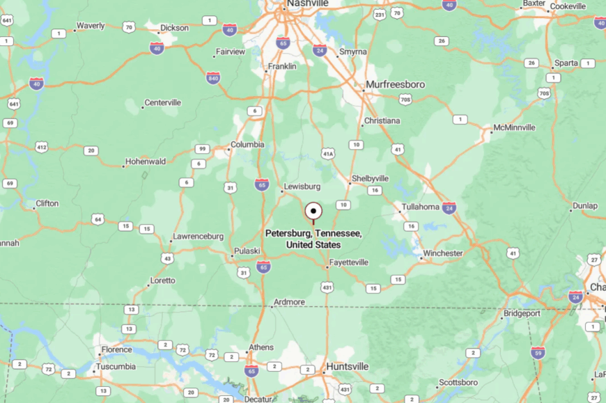
You’ll find Petersburg near the southern middle of Tennessee, roughly 14 miles east of Pulaski and 20 miles west of Fayetteville. State routes weave in; the last approach is always two lanes and tree-lined.
There’s no fast way in, which is the point. It’s close enough to visit often and far enough to miss when you leave.
11. Orme – Pocket Valley at the End of the Road
Orme rests in a cul-de-sac of mountains at Tennessee’s southeastern corner, a little cluster of homes cupped by steep ridges. Its seclusion is literal—one paved road in, switchbacks on either side, and cliffs that turn the world away.
The vibe is mountain-quiet: front porches with big views, creek talk after rain, and dogs that nap where the sun lands. Hike ridge spurs for overlooks, skip stones in pocket creeks, watch hawks ride thermals over the valley, or wander historic sites from the coal-camp era.
A mix of retirees, remote workers, and a few trades carry the week. Night drops clean and starry. It’s the kind of valley that teaches voices to soften.
Where is Orme?
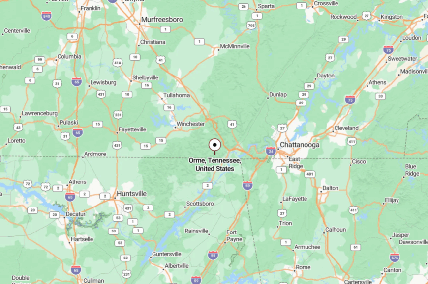
Orme sits in southern Marion County at the Alabama line, about 10 miles south of South Pittsburg as the crow flies. Reach it via SR-156/US-72 and a final winding spur through the mountains.
Those last curves slow everyone to local speed. It’s close to the world on a map, and very far in spirit.
10. Cypress Inn – Natchez Trace Forest Enclave
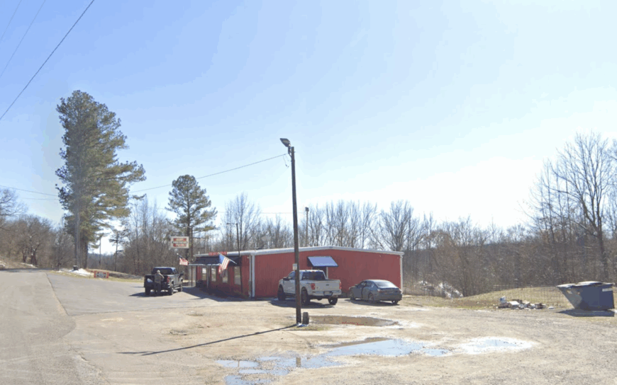
Home to roughly 250 residents, Cypress Inn sits deep in Wayne County hardwoods where whip-poor-wills often outnumber porch lights. Visitors fill days paddling Bluewater Creek, horseback riding sections of the Natchez Trace National Scenic Trail, or hunting morels on shaded ridges each spring.
Tourism tied to the Parkway mixes with small-scale forestry and cabin rentals to form the town’s modest economy. No commercial strip interrupts the widely spaced cabins; instead, gravel drives disappear into oak and hickory thickets, ensuring privacy and pitch-black skies once the sun sets.
A single combination café-general store handles mail drops, hot coffee, and gossip, underscoring how limited services keep the settlement self-contained. Dense forest on every side and the absence of industry hum anchor Cypress Inn’s seclusion.
Where is Cypress Inn?
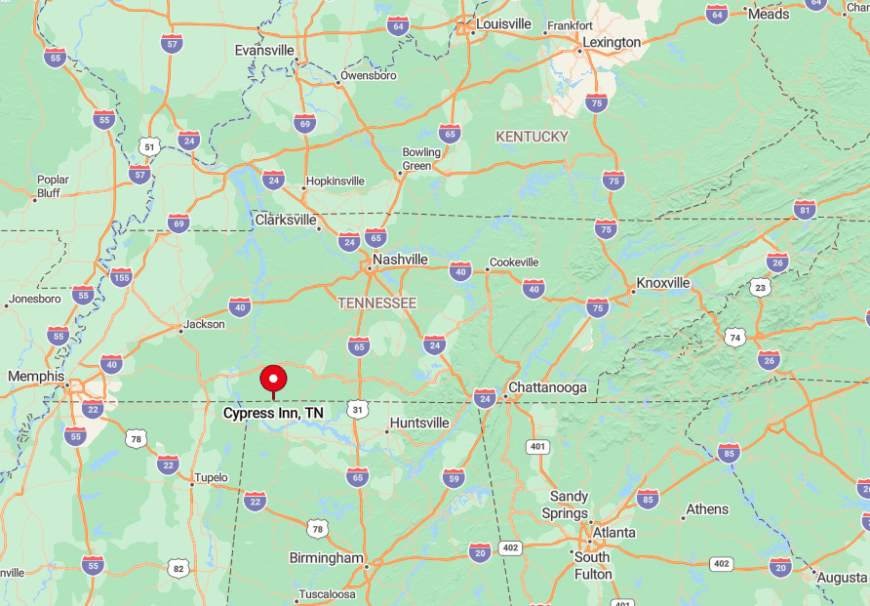
The community hugs the Alabama line in southwestern Wayne County, roughly midway between Collinwood and Florence, Alabama. Towering timber and the protected corridor of the Natchez Trace Parkway block both visual and noise intrusions from larger towns.
Drivers reach Cypress Inn by exiting the Parkway at mile marker 350 and following County Road 1 for seven winding miles; cell coverage fades almost immediately. Those few turns separate the hamlet so completely that night skies reveal Milky Way detail unseen in most of the state.
9. Sherwood – Lost Cove’s Hidden Valley
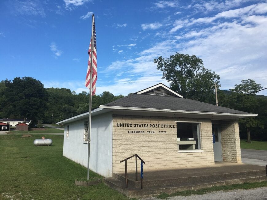
Fewer than 1,000 people live in Sherwood, a farming pocket tucked beneath limestone bluffs on the southern edge of Franklin County. Hikers explore Lost Cove Cave, trace wildflower-lined fence rows, or fish crow creek pools fed by hidden springs.
Hay, corn, and a small limestone quarry provide most paychecks, while a weekly produce stand next to the volunteer fire hall supplies any fresh goods not grown at home. Cliffs to the east and the Cumberland Plateau escarpment to the west form natural walls that hush traffic from nearby U.S. 64.
Sherwood keeps one gas pump, a post office housed in a converted rail depot, and little else, which preserves the sense of stepping decades back in time. Even on holiday weekends, only the sound of church bells and tractor engines breaks the valley stillness.
Where is Sherwood?
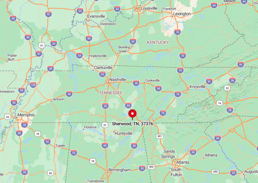
Sherwood lies 15 miles south of Winchester, hard against the Alabama border along State Route 56. The approach involves a steep drop off Keith Springs Mountain, a descent that effectively seals the valley from casual pass-throughs.
Rail service ended years ago, so personal vehicle is the lone practical way in or out. That single paved road and surrounding cliffs make the community feel far more remote than the mileage suggests.
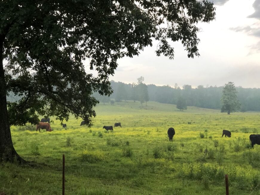
8. Dellrose – State-Line Horse Country
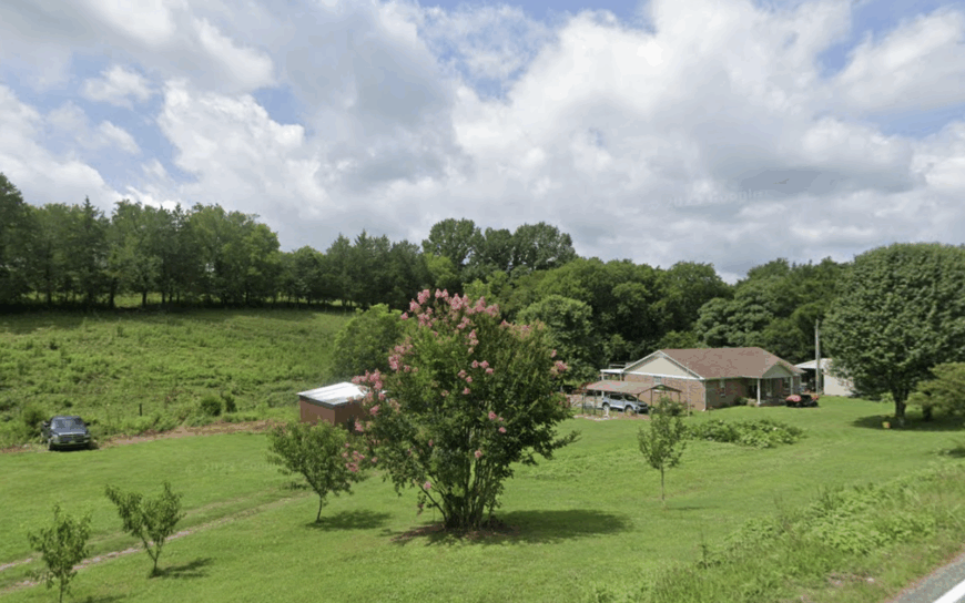
About 400 residents call Dellrose home, sharing rolling Lincoln County pastureland where barn roofs stand taller than most mailboxes. Weekends revolve around trail rides along the Elk River, auctions at the Dellrose Horse Sale barn, and picnics beneath century-old pecan trees.
Equine breeding, cattle grazing, and specialty hay form the backbone of the local economy, with one blacksmith still shoeing horses behind his tin-roofed shop. Low ridges buffer the settlement from the hum of Interstate 65, and miles of unfenced sky lend sunrise and sunset an arena-size stage.
Farmhouses sit on five-acre spreads or larger, so neighbors remain friendly yet far enough apart to protect late-night guitar strumming on porch swings. That open space and the lack of streetlights conserve Dellrose’s quiet character.
Where is Dellrose?
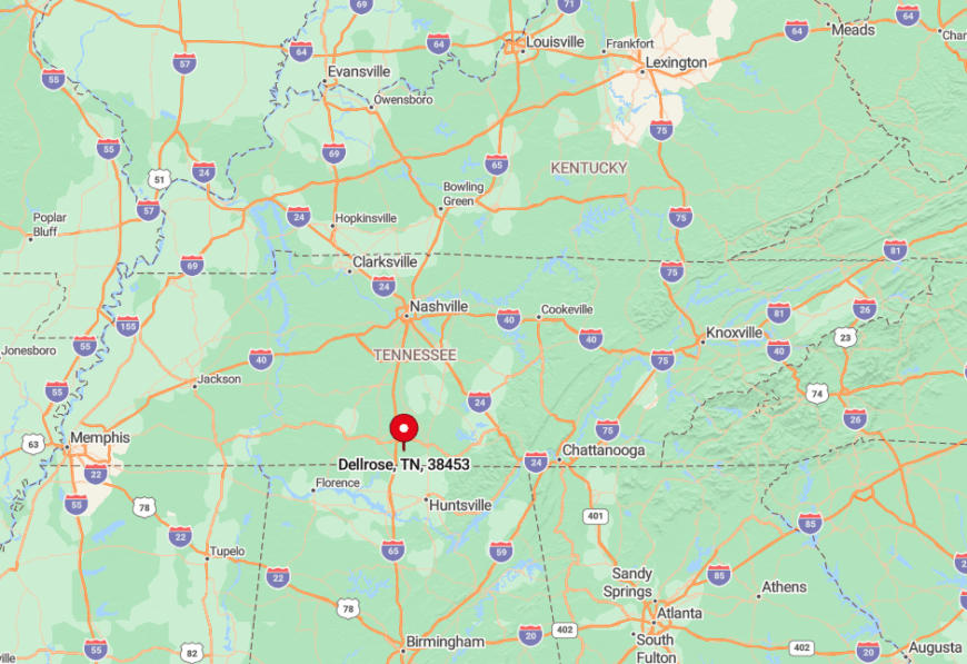
Dellrose borders Alabama at the southwestern corner of Lincoln County, roughly 12 miles west of Fayetteville. Travelers exit I-65 at the Ardmore interchange, then meander east on State Route 273 through alternating soybean fields and pine stands.
No public transit serves the area, and GPS occasionally drops signal in the surrounding hollows, reinforcing the off-grid feeling. The final turn onto the old Millville Pike often shares the road with horseback riders, a sure sign one has arrived.
7. Leoma – Buffalo River Backroads
Approximately 1,200 people live in Leoma, where Buffalo River oxbows, Amish-built barns, and a lone traffic light set the daily rhythm. Canoe rentals launch paddlers onto cool, slow-moving water ideal for smallmouth fishing, while roadside stands sell sorghum and cedar furniture crafted by nearby Amish families.
Cattle, hay, and woodworking shops drive the modest economy, supplemented by a handful of backyard sawmills. The crossroads sits more than a dozen miles from Lawrenceburg’s neon, and most surrounding roads narrow to one lane before dead-ending at pastures or timber plots.
Nights bring only cricket song and the faint scent of sweet feed drifting from barns. That isolation, though soft-spoken, is palpable the moment the highway’s last rumble fades.
Where is Leoma?
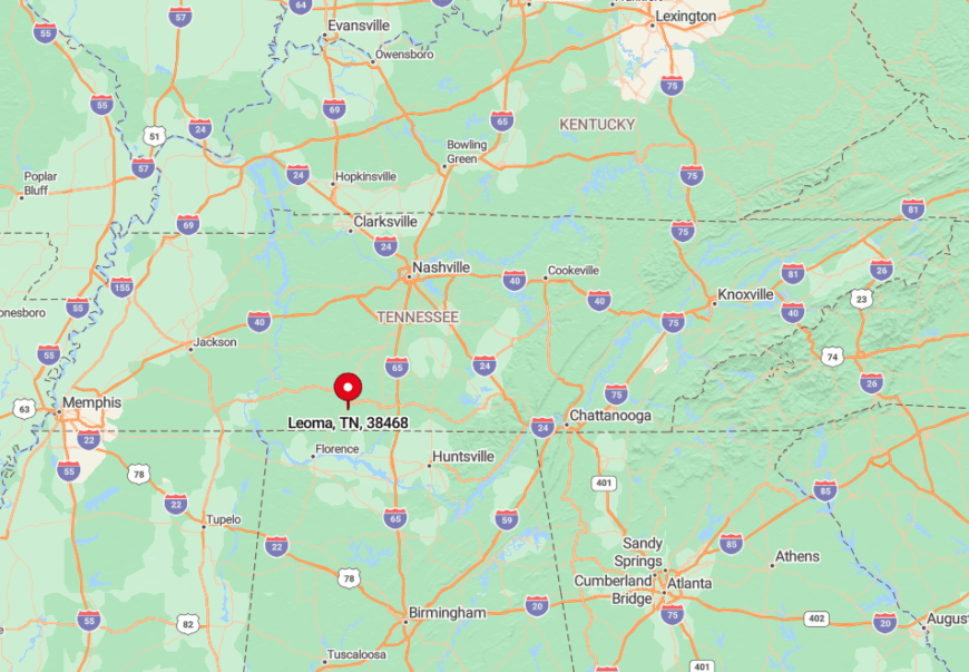
Leoma occupies central Lawrence County along U.S. 43, yet the community itself sprawls along secondary County Roads 10 and 14 rather than the highway. Dense pine groves and the meandering Buffalo River shield homes from through traffic.
Visitors often exit U.S. 43 onto Prosperity Road, then follow backroads that lose cell service but gain sweeping bottomland views. Those twists and turns filter out hurried motorists, leaving Leoma to its unhurried pace.
6. Lutts – Hillside Haven off the Natchez Trace
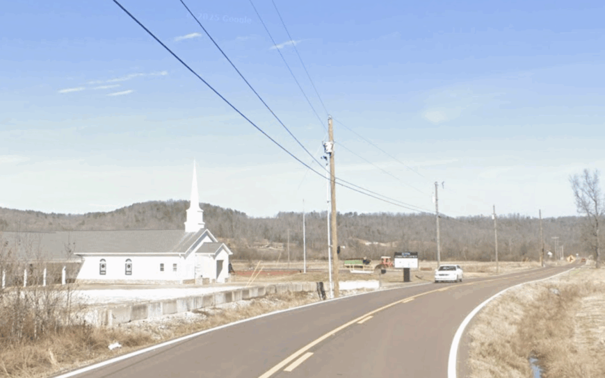
Lutts claims roughly 900 residents scattered across steep Wayne County knobs where hollows hold morning mist well past sunrise. Locals gather for quilting circles at the community center, stargaze on ridge pull-offs famed for meteor showers, or hike to Chalk Creek Falls by way of unmarked footpaths.
Small timber operations, cattle, and home-based crafts provide income, supported by a post office that doubles as social hub. No state highway cuts through town; instead, serpentine lanes climb wooded ridgelines that discourage all but intentional visitors.
Fireflies illuminate summer nights in numbers rarely seen elsewhere, a perk of skies unmarred by artificial light. Even delivery drivers joke that GPS surrenders before reaching the last switchback, cementing Lutts’ deep quiet.
Where is Lutts?
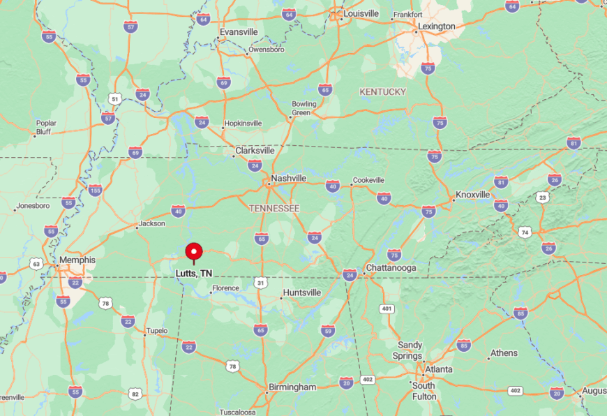
The settlement sits west of Waynesboro near the Natchez Trace Parkway, accessible primarily via State Route 203 and a maze of ridge roads. Thick forest and sudden elevation changes hide the community from passersby on the Parkway itself.
Reaching Lutts involves a twenty-five-mile drive from Savannah, the nearest town with a full grocery store. That distance, coupled with hills that block radio and cell signals, keeps gatherings intimate and traffic sparse.
5. Culleoka – Creek-Laced Countryside
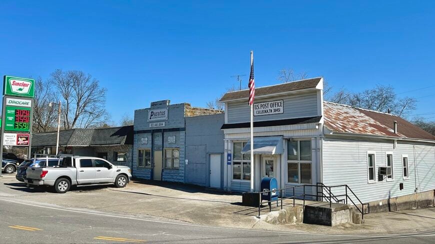
Roughly 3,400 people live in Culleoka, a Maury County hamlet where brick storefronts meet sprawling cattle farms along the Duck River watershed. Day-trippers sip small-batch coffee inside the 1906 general store, kayak spring-fed tributaries, or photograph historic Woldridge Farm’s Victorian outbuildings.
Beef cattle, dairy herds, and remote workers connected via fiber internet make up the diverse local economy. Ten miles of winding creek-lined roads separate Culleoka from Columbia’s city limits, and the lack of chain retailers maintains a distinctly rural flavor.
Crickets and barred owls compose the night soundtrack, as streetlamps stop at the old depot. That buffer of fields and watercourses safeguards the town’s slow tempo.
Where is Culleoka?
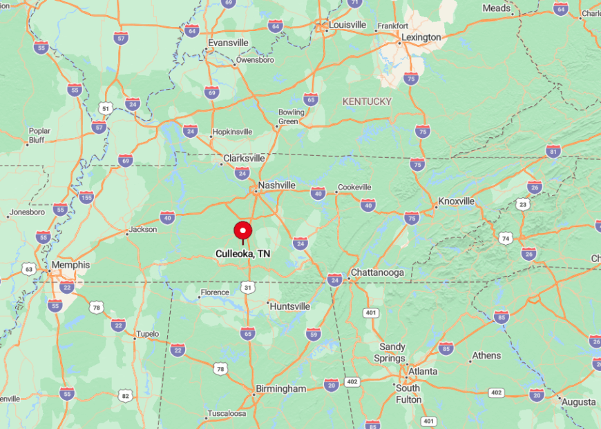
Culleoka lies in north-central Maury County, about an hour south of Nashville via I-65 and U.S. 31. Most visitors leave U.S. 31 at Mooresville Pike, then follow Knob Creek Road past hay bales and limestone bluffs into the village center.
The final stretch is narrow and shaded, discouraging heavy traffic and large trucks. As a result, the hamlet remains quiet even during regional festival weekends.
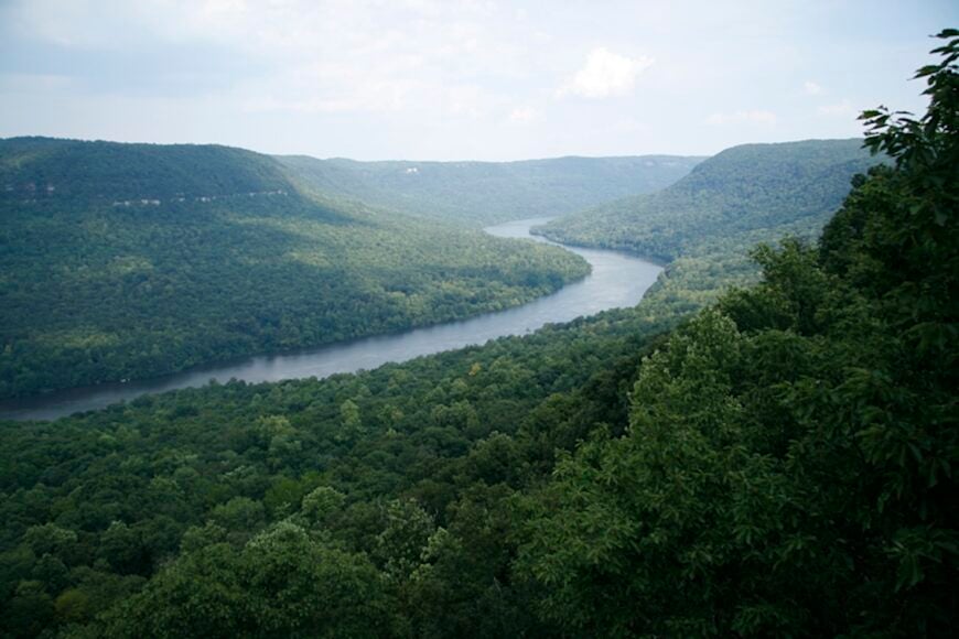
4. Gruetli-Laager – Swiss Plateau Seclusion
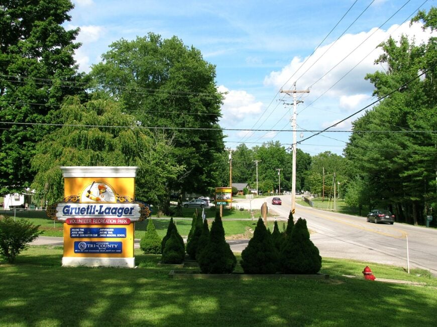
Nearly 1,700 residents occupy Gruetli-Laager, a Grundy County town founded by Swiss immigrants atop the Cumberland Plateau.
Heritage vineyards still produce muscadine wine, hikers tackle nearby Fiery Gizzard Trail segments, and the Stoker-Stampfli Farm Museum hosts cheese-making demonstrations that nod to the original settlers.
Forestry, small vineyards, and craft sawmills dominate the local job scene, while a single grocery keeps shelves of both staples and German chocolate. Perched at 1,800 feet, the plateau’s dense forest and gravel drives on multi-acre lots screen the town from I-24 traffic roaring more than a thousand feet below.
Even passing thunderstorms arrive muted after losing force on the escarpment. Residents relish balcony views across fog-filled valleys that few outside the community ever see.
Where is Gruetli-Laager?
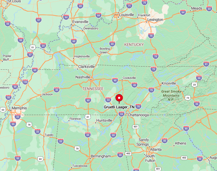
The town sits along State Route 108, roughly 50 miles west of Chattanooga. Access from the lowlands requires ascending switchbacks that deter casual detours.
Public transit never reaches the plateau towns, so personal vehicle is essential, with winter travel sometimes requiring four-wheel drive. That elevation barrier and limited road network seal Gruetli-Laager in its own quiet air pocket.
3. Belvidere – Limestone Spring Refuge
Belvidere hosts around 500 residents in a mosaic of hayfields and karst springs south of Winchester. Anglers cast for rainbow trout where cold springs bubble from limestone seams, while history buffs tour Falls Mill’s 1873 water-powered machinery still grinding cornmeal each Saturday.
Hay, small livestock, and the specialty flour produced at the mill support the local economy, augmented by seasonal u-pick berry farms. Wooded hills wrap around the community, dampening sound and blocking any line of sight to nearby U.S. 64.
Homesteads average two acres, enough to keep neighbors visible yet distant. On summer evenings, only the low rush of spring water breaks the hush blanketing Belvidere.
Where is Belvidere?
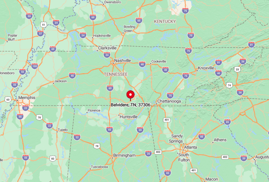
The village lies in southern Franklin County, about eight miles west of Winchester via Blair Pond Road. Limestone ridges funnel traffic onto this two-lane route, naturally limiting flow.
Visitors often stop at Owl Hollow Road’s springhouse, a relic locals still use for cooling watermelon. With no bus lines and minimal signage, Belvidere welcomes only those determined to reach it.
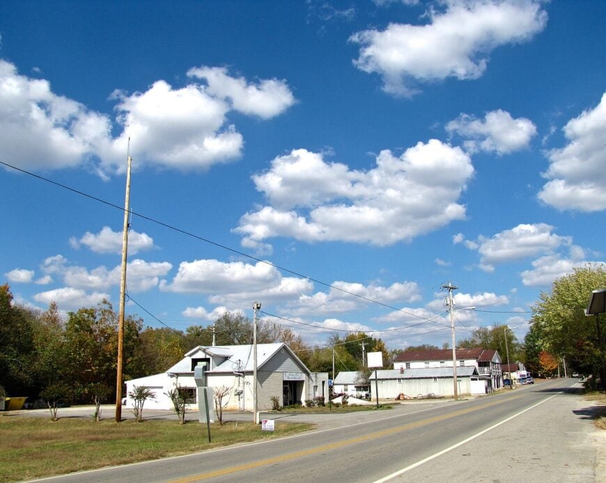
2. Five Points – Quiet Crossroads of Lawrence County
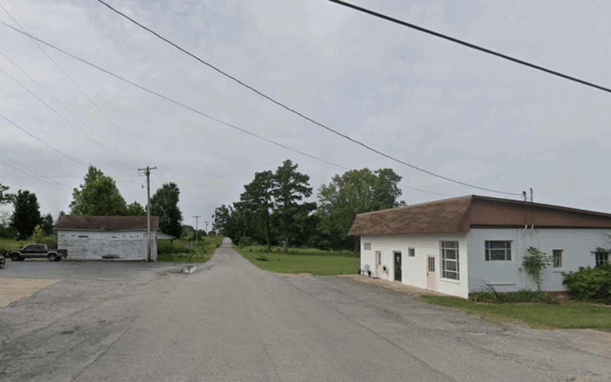
Five Points claims barely 450 inhabitants clustered around a single flashing light where Tennessee Routes 98 and 242 meet. Bird-watchers roam Laurel Hill Wildlife Management Area, antique hunters browse Five Points Market, and locals share catfish suppers at the volunteer fire hall.
Beef cattle, limited timber harvests, and home gardening sustain most households, while school-day traffic is the heaviest flow the junction sees. Pine groves and low, undeveloped pasture shield homes from wind and outside noise alike, and the nearest chain restaurant sits over fifteen miles away.
Yards sprawl gently, giving even small cottages broad horizons. The collective result is a hush that settles by dusk and rarely lifts before dawn.
Where is Five Points?
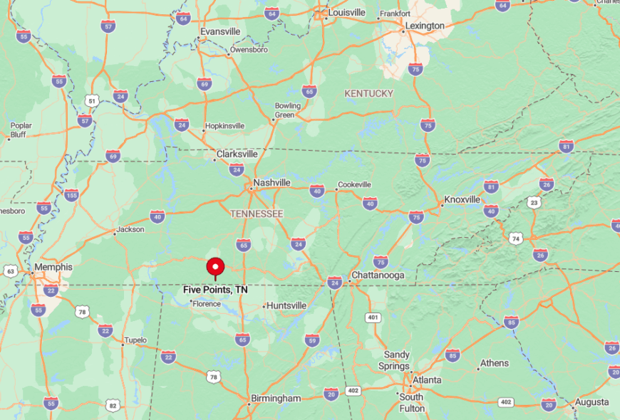
Positioned in southwestern Lawrence County, Five Points sits roughly halfway between Loretto and the Natchez Trace Parkway. Motorists often exit U.S. 43 at Loretto, then follow SR 98 through alternating pine and pasture until spotting the modest “Five Points” sign.
No public transport reaches the crossroads, and fuel is available only from a solitary two-pump station that closes at dark. Those limitations keep spur-of-the-moment visitors to a minimum.
1. Minor Hill – Ridge-Top Farmstead Retreat
Minor Hill tops the list with about 1,000 residents spread across Giles County high ground overlooking Alabama. Dawn hikes up Fire Tower Road deliver panoramic views, while Civil War buffs explore the skirmish site where Confederate General John Hunt Morgan’s cavalry once camped.
Soybeans, corn, and a small metal-fabrication shop supply local paychecks, supplemented by a weekly bluegrass jam at the city pavilion. The ridge acts as both scenic stage and natural barricade, placing a 20-minute drive between residents and Pulaski’s nearest big-box store.
Even local roads snake along contour lines, making through-traffic impractical. Those curves, combined with ridge-top breezes and unobstructed skies, seal Minor Hill’s reputation as a deep, uninterrupted calm.
Where is Minor Hill?
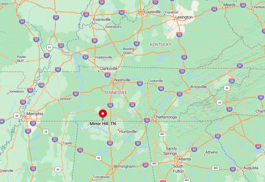
The community sits on the southernmost heights of Giles County, less than two miles from the Alabama line along Highway 11. Sky-high vantage points keep cell towers out of sight and preserve horizon-to-horizon stargazing.
Travelers often approach from Pulaski, climbing steadily until farmland opens onto 360-degree vistas. Limited road connections and the ridge’s natural buffer help keep Minor Hill hushed even on holiday weekends.