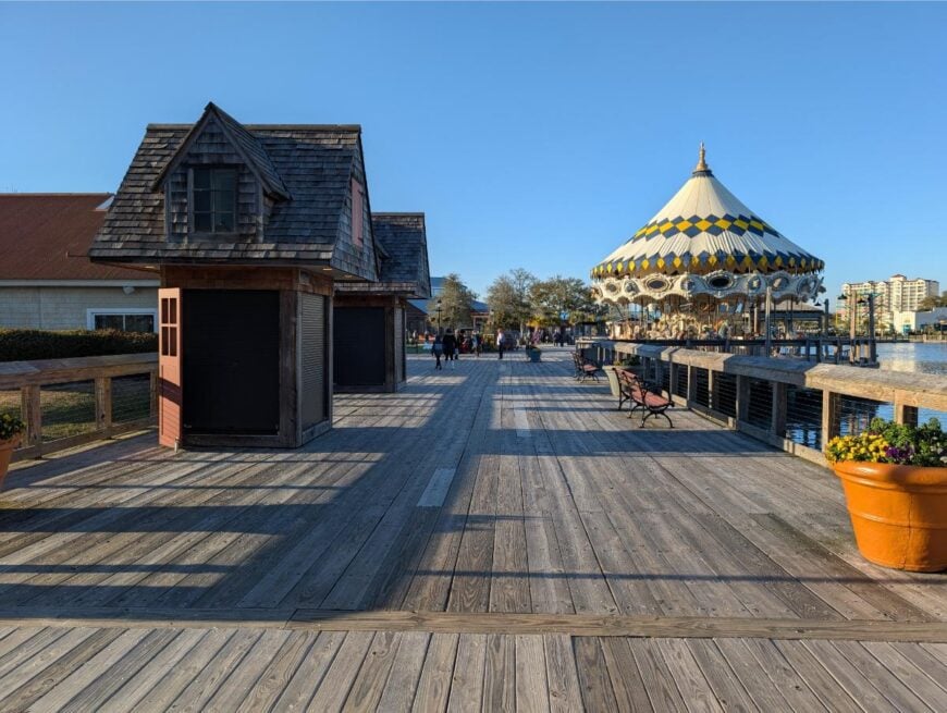
The northeast corner of South Carolina hides a ribbon of rivers, pine flats, and farm lanes where small communities keep to an easy rhythm few travelers ever witness.
In order to come up with the very specific design ideas, we create most designs with the assistance of state-of-the-art AI interior design software. Also, assume links that take you off the site are affiliate links such as links to Amazon. this means we may earn a commission if you buy something.
We mapped twenty five of these towns and found places where porch lights outnumber streetlights, morning mist lingers over soy fields, and blackwater creeks carry only the sound of crickets.
Each town sits well away from interstates and resort traffic, yet each offers its own pocket of history, nature, and understated charm. Taken together, they form a quiet constellation stretching from Georgetown County to the North Carolina line.
For anyone dreaming of a deeper stillness—whether for a weekend wander or a life change—these are the dots worth connecting on the Pee Dee backroads. Here is the countdown, mile by peaceful mile.
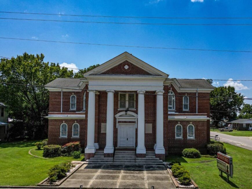
25. Bucksport
Bucksport, in Horry County, was established in the 1820s by Henry Buck, who built a major sawmill operation along the Waccamaw River. The town became a key supplier of pine and cypress lumber for shipbuilding and construction across the Southeast.
When the mills declined, residents turned to small-scale forestry, farming, and river-based work. Today, many people commute to Conway and Myrtle Beach for jobs, while Bucksport provides housing and basic services.
Tourism tied to the Waccamaw, including boat tours and marinas, adds seasonal income. Bucksport’s economy reflects its timber heritage while leaning on commuting and recreation to sustain the community.
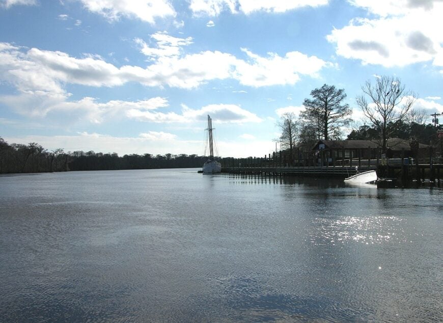
Where is Bucksport?
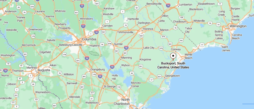
Bucksport is a small community in Horry County, eastern South Carolina, set along the Waccamaw River. It lies about 15 miles southwest of Myrtle Beach, reached by U.S. Highway 701 and local river roads.
The area is surrounded by cypress swamps, pine woods, and farmland, giving it a distinctly quiet, rural setting. With its riverside location and distance from the coast’s bustle, Bucksport feels like a hidden corner where the water and woods shape daily life.
24. Pamplico

Pamplico, in Florence County, has long been tied to agriculture, with cotton and tobacco forming the backbone of its economy for much of its history. Farming shaped both the land and the town’s development, with warehouses, gins, and markets once bustling during harvest seasons.
While agriculture remains important, many residents now commute to Florence and nearby towns for jobs in manufacturing, healthcare, and retail. Small businesses, schools, and churches provide local employment and keep the community active.
The town also benefits from its location along the Pee Dee River, which supports recreation and draws visitors during seasonal events. Pamplico’s economy balances its farming heritage with modern commuting and regional industry links.
Where is Pamplico?
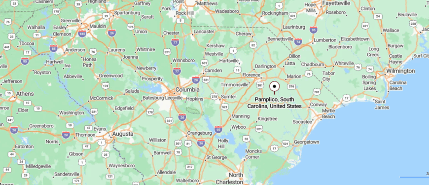
Pamplico is a small town in Florence County, northeastern South Carolina, surrounded by farmland and pine woods along the Pee Dee River. It sits about 20 miles south of Florence, reached by State Highway 51, a two-lane road that winds through fields and rural communities.
The setting is quiet and agricultural, with wide stretches of open land defining the landscape. With its riverside proximity and country backdrop, Pamplico carries the feel of a town tucked away from busier routes.
23. Green Sea
Green Sea, in Horry County, has always been an agricultural community, with tobacco, corn, and soybeans forming the foundation of its economy. Generations of families relied on farming, and the town became known for its tobacco warehouses and barns that once dotted the landscape.
As tobacco declined, row crops and livestock replaced much of the income, while many residents began commuting to nearby Loris, Conway, and Myrtle Beach for work. Small businesses, churches, and schools provide steady local employment and community services.
Seasonal farm operations and produce markets also support the economy, tying the area’s livelihood closely to the land. Green Sea’s economy remains rooted in agriculture, even as commuting and regional industries supplement family incomes.
Where is Green Sea?
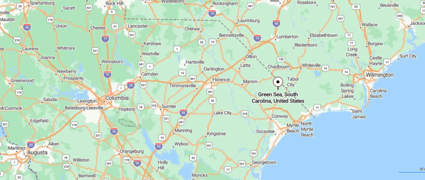
Green Sea is a rural community in Horry County, northeastern South Carolina, surrounded by farmland and stretches of pine forest. About 30 miles northwest of Myrtle Beach, it is reached by State Highway 9 and smaller country roads that wind through open fields.
The area is largely agricultural, with crops and wide flatlands shaping its landscape. Set apart from the coast, Green Sea feels like a quiet pocket of countryside away from tourist paths.
22. Mullins
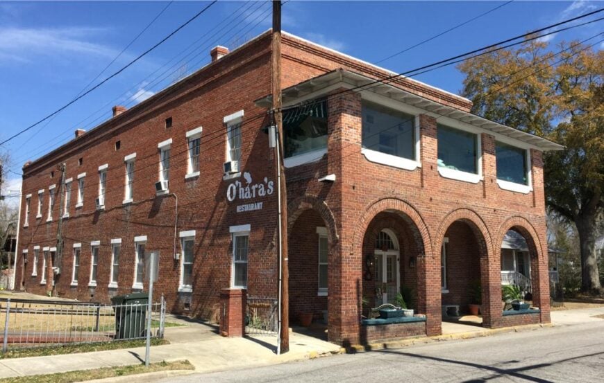
Mullins, in Marion County, built its identity as the “Tobacco Capital of the World,” with warehouses and auctions that once dominated the local economy. For much of the 20th century, tobacco farming and trade supported farmers, merchants, and transport businesses throughout the region.
As the industry declined, Mullins shifted toward manufacturing, small business, and service jobs to sustain its workforce. Many residents now commute to Florence and Myrtle Beach, linking the town’s economy to broader regional markets.
Tourism tied to the South Carolina Tobacco Museum and annual festivals also adds modest income. Mullins’ economy continues to balance its historic farming roots with modern reliance on manufacturing, services, and commuting.
Where is Mullins?
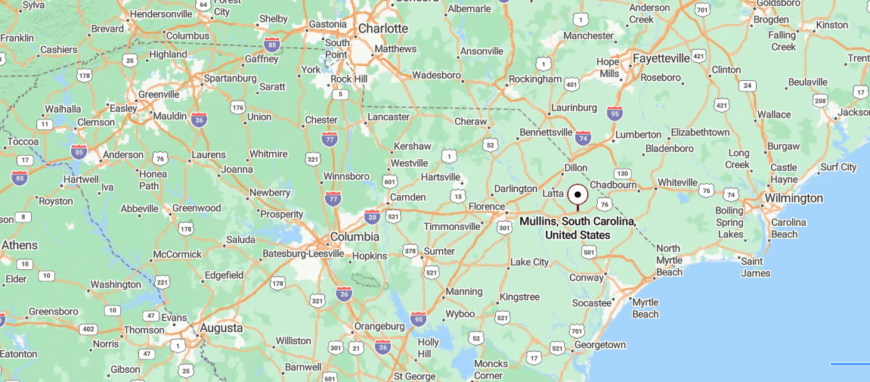
Mullins is a small city in Marion County, northeastern South Carolina, set in the Pee Dee region’s farmland and pine woods. About 40 miles inland from Myrtle Beach, it is reached by U.S. Route 76, a two-lane highway that runs through fields and small towns.
The community is known historically for tobacco farming, with wide stretches of agricultural land surrounding its neighborhoods. With its rural backdrop and distance from the coast, Mullins carries the quiet feel of a town rooted in the countryside.
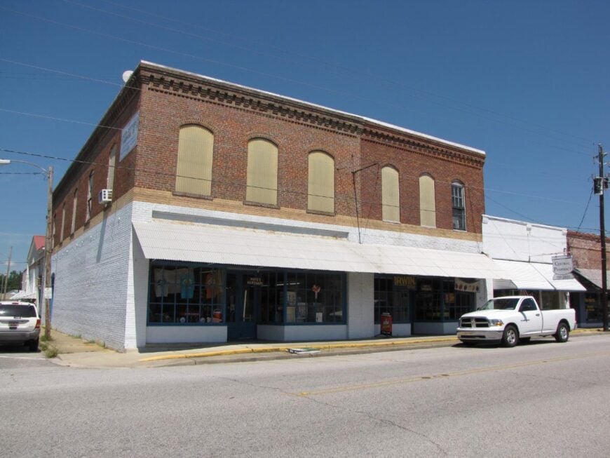
21. Sellers

Sellers, in Marion County, developed as a small farming community where cotton, tobacco, and other row crops shaped the local economy. For decades, families relied on agriculture, with warehouses, gins, and small shops supporting seasonal work.
As farming declined, the town saw a reduction in local industry, and many residents began commuting to larger towns such as Marion, Mullins, and Florence for jobs. Small businesses, churches, and schools continue to provide limited but important local employment.
The economy also benefits modestly from hunting, small-scale farming, and seasonal trade in the surrounding countryside. Sellers’ economy today reflects the challenges of rural South Carolina—still rooted in agriculture, but dependent on commuting and regional connections for stability.
Where is Sellers?
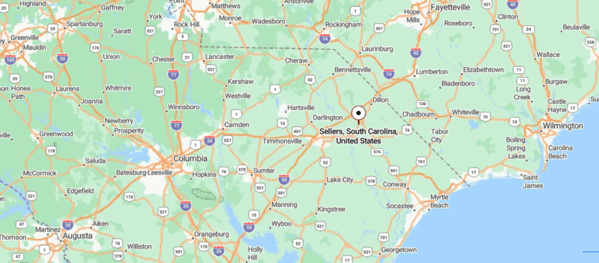
Sellers is a tiny town in Marion County, northeastern South Carolina, surrounded by farmland and quiet backroads. About 8 miles south of Marion, it is reached by U.S. Route 301, a rural highway that passes through fields and pine stands.
The town itself is small, with just a few streets set against the open countryside. With its modest size and agricultural setting, Sellers feels like a quiet stop tucked away from busier routes.
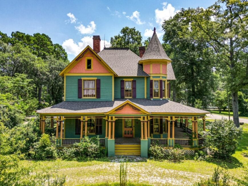
20. Lake View
Lake View, in Dillon County, has long depended on farming as the base of its economy, with tobacco, cotton, and row crops supporting generations of families. Small businesses, feed stores, and gins once kept the town busy during harvest seasons.
As agriculture declined, residents increasingly turned to commuting for work in nearby Dillon, Marion, and even across the border in North Carolina. Local schools, shops, and churches provide steady employment and remain anchors of the community’s economy.
Proximity to Interstate 95 also brings some commercial activity, with travelers stopping in the area for services. Lake View’s economy remains grounded in its agricultural roots while adapting through commuting and regional trade.
Where is Lake View?
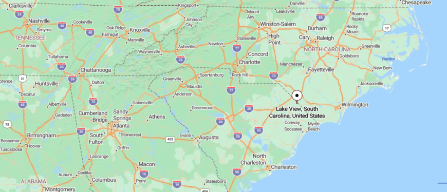
Lake View is a small town in Dillon County, northeastern South Carolina, set near the Little Pee Dee River. About 12 miles southeast of Dillon, it is reached by State Highway 9, a rural route that winds through farmland and wooded stretches.
The town is surrounded by open fields, creeks, and patches of pine forest that keep it closely tied to the land. With its countryside setting and river nearby, Lake View holds the quiet rhythm of a town apart from the rush of larger places.
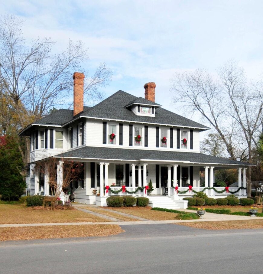
19. Clio
🔥 Would you like to save this?
Clio, in Marlboro County, grew as an agricultural town where cotton and tobacco dominated the economy for more than a century. The town once bustled with gins, warehouses, and rail connections that moved crops to larger markets.
As farming declined, Clio’s economy contracted, leaving many residents to commute to Bennettsville, Florence, or Rockingham, North Carolina, for work. Local employment now comes mainly from schools, small businesses, and government services that keep the community functioning.
Some income also comes from small-scale farming and seasonal work in the surrounding countryside. Clio’s economy reflects the challenges of rural South Carolina—deeply rooted in agriculture but reliant on outside jobs to sustain its population.
Where is Clio?
Clio is a small town in Marlboro County, northeastern South Carolina, surrounded by farmland and gentle pine ridges. About 10 miles east of Bennettsville, it is reached by State Highway 381, a country road that passes fields and quiet homesteads.
The town is modest in size, with neighborhoods and churches set against its rural backdrop. With its simple landscape and distance from larger towns, Clio carries the calm of a place tucked into the countryside.
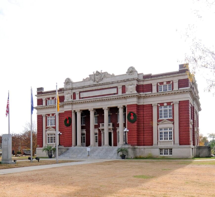
18. Latta
Latta, in Dillon County, developed as a railroad and agricultural town, with cotton and tobacco forming the backbone of its early economy. Warehouses, gins, and rail connections once kept the town thriving as crops moved to larger markets.
As traditional farming declined, many residents began commuting to Dillon, Florence, and nearby industries for steady employment. Local schools, small businesses, and government services remain important employers within the town itself.
Tourism adds a modest boost, as visitors are drawn to Latta’s historic district and nearby attractions like the Dillon Motor Speedway. Latta’s economy today blends its agricultural heritage with commuting and small-scale commerce that keeps the community steady.
Where is Latta?
Latta is a town in Dillon County, northeastern South Carolina, set along flat farmland and pine woods. About 20 miles east of Florence, it is reached by U.S. Route 301 and nearby Interstate 95, which connect it to larger routes while keeping it rural.
The town is known for its historic district, with preserved homes and buildings that reflect its small-town past. Surrounded by open fields and quiet roads, Latta holds the pace of a community rooted in the countryside.
17. Floyd Dale
Floyd Dale, in Dillon County, has always been tied to agriculture, with cotton, tobacco, and other row crops shaping the backbone of its economy. The town once supported gins, warehouses, and small businesses that served surrounding farm families.
As large-scale farming declined, many residents turned to commuting for jobs in Dillon, Marion, and Florence, linking the local economy to nearby cities. Small-scale farming, forestry, and seasonal agricultural work continue to play a role in sustaining households.
Local schools, churches, and small shops provide limited but steady employment within the community itself. Floyd Dale’s economy today reflects a shift from its farming past to a mix of commuting, rural trade, and modest agricultural activity.
Where is Floyd Dale?
Floyd Dale is an unincorporated community in Dillon County, northeastern South Carolina, surrounded by flat farmland and patches of pine forest. It sits about 6 miles south of Dillon, reached by U.S. Route 301, a two-lane road that cuts through fields and rural homesteads.
The landscape is wide and open, with agricultural land defining much of its setting. With its small scale and country backdrop, Floyd Dale feels like a quiet stop just beyond the reach of busier towns.
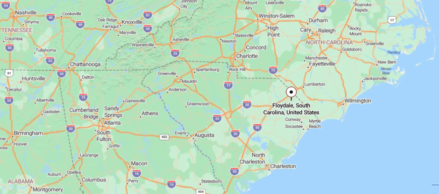
16. Nichols

Nichols, in Marion County, built its early economy on cotton, tobacco, and timber, with the railroad carrying goods to larger markets. Farming supported local stores, gins, and warehouses, making the town a small commercial hub for nearby rural families.
As agriculture declined, many residents sought work in Marion, Mullins, and Dillon, while others turned to small businesses and trades. The town faced economic hardship after devastating flooding from Hurricane Matthew in 2016, which damaged homes and businesses.
Recovery efforts and regional commuting now form much of the economic backbone, while small farming and forestry remain present. Nichols’ economy reflects both resilience and struggle, balancing its agricultural heritage with the challenges of rebuilding and adapting.
Where is Nichols?
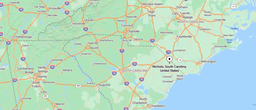
Nichols is a small town in Marion County, northeastern South Carolina, set near the banks of the Little Pee Dee River. About 35 miles inland from Myrtle Beach, it is reached by State Highway 9, a rural route that winds through farmland and pine woods before crossing into the river valley.
The community is surrounded by flat fields, creeks, and patches of forest that give it a quiet, rural character. Though small, its riverside location ties it closely to the landscape around it. With its distance from larger cities, Nichols feels like a town set apart, where the countryside shapes daily life.
15. Oak Grove
Oak Grove, an unincorporated community in Dillon County, has grown as a suburban economy tied closely to nearby Columbia. Once largely farmland, the area transitioned into residential neighborhoods as highways expanded and commuters moved closer to the capital city.
Retail, restaurants, and service businesses along U.S. 1 and nearby corridors provide steady local employment. Many residents work in Columbia’s government, healthcare, and education sectors, making commuting a central part of the local economy.
Small construction firms and real estate also contribute, reflecting ongoing suburban growth. Oak Grove’s economy today is less about farming and more about its role as a residential and commercial extension of the Columbia metro area.
Where is Oak Grove?
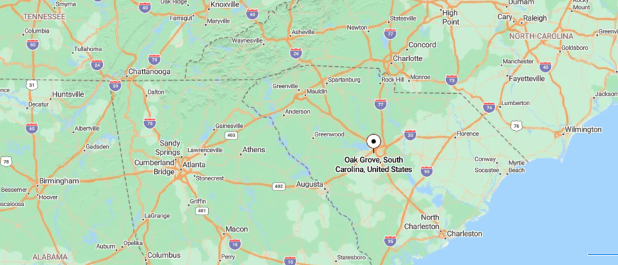
Oak Grove is an unincorporated community in Dillon County, northeastern South Carolina, surrounded by flat farmland and stretches of pine forest. It lies about 10 miles southwest of Dillon, reached by rural county roads branching off U.S. Route 301.
The area is sparsely settled, with open fields, creeks, and quiet homesteads spread across the landscape. With its country backdrop and distance from larger towns, Oak Grove holds the calm of a community tucked into the countryside.
14. Tatum
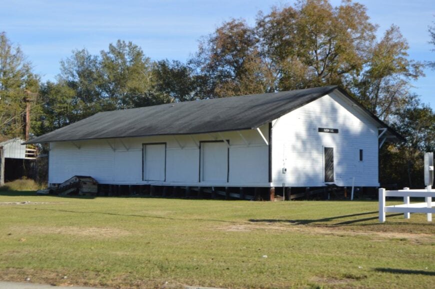
Tatum, in Marlboro County, began as a small farming town where cotton and tobacco shaped the early economy. The arrival of the railroad supported warehouses and local trade, giving farmers access to larger markets.
As agriculture declined, the town’s commercial activity slowed, leaving many residents dependent on commuting to Bennettsville, Laurinburg, and other nearby cities for work. Today, local employment comes mainly from schools, churches, and a handful of small businesses.
Farming and forestry continue to provide some income, though on a smaller scale than in the past. Tatum’s economy remains modest, sustained by commuting and the agricultural heritage that once defined it.
Where is Tatum?
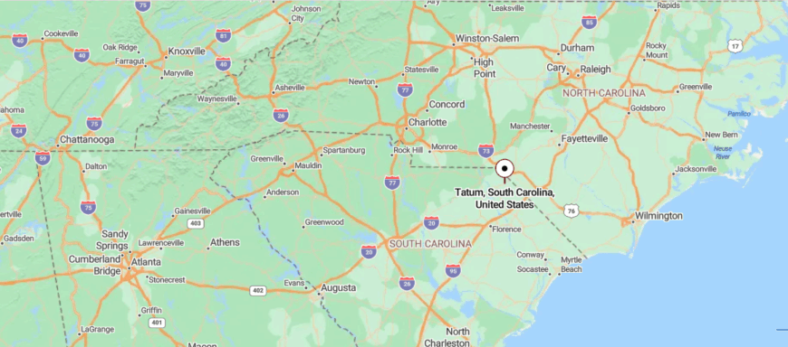
Tatum is a tiny town in Marlboro County, northeastern South Carolina, surrounded by farmland and open countryside. About 15 miles south of Bennettsville, it is reached by State Highway 381, a quiet two-lane road passing fields and scattered homesteads.
The community is very small, with just a few streets nestled in its rural setting. With its simple layout and wide landscapes, Tatum carries the quiet seclusion of a place far from busier centers.
13. Dunbar
🔥 Would you like to save this?
Dunbar, in Marlboro County, has long been a farming community where cotton and tobacco once drove the local economy. The decline of those crops reduced commercial activity, leaving the area more reliant on small-scale farming and forestry.
Many residents now commute to Bennettsville, Cheraw, and other nearby towns for work in manufacturing, healthcare, and retail. Local employment mainly comes from schools, churches, and a handful of small businesses that support daily needs.
Hunting, fishing, and outdoor recreation provide only modest supplemental income but remain tied to the rural lifestyle. Dunbar’s economy today reflects its agricultural roots while depending heavily on commuting and regional industries for stability.
Where is Dunbar?
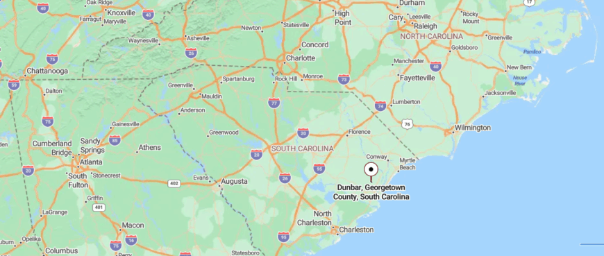
Dunbar is a rural community in Marlboro County, northeastern South Carolina, set among farmland and patches of pine woods. It sits about 12 miles southeast of Bennettsville, reached by State Highway 38 and smaller country roads that wind through open fields.
The landscape is quiet and agricultural, with creeks and woodlots shaping its surroundings. With its modest size and out-of-the-way setting, Dunbar feels like a settlement tucked gently into the countryside.
12. Wahee
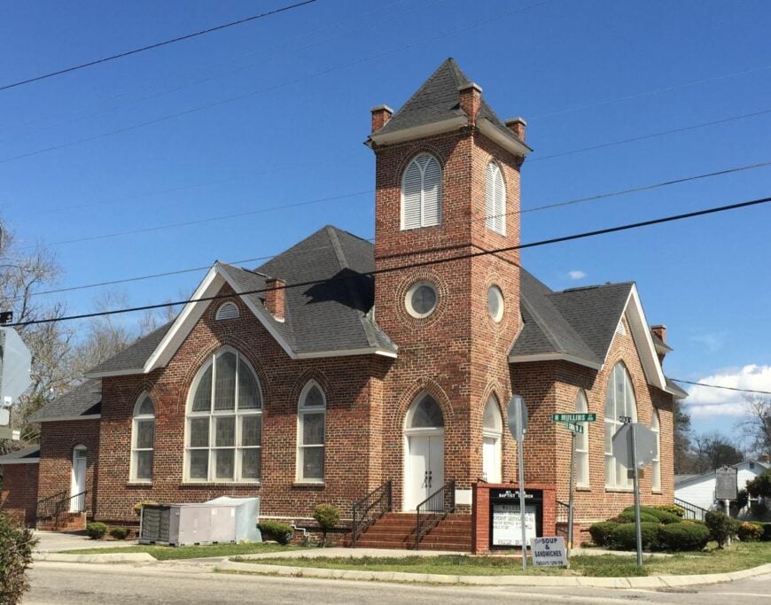
Wahee, in Marion County, developed as a small agricultural settlement along the Great Pee Dee River. Cotton, tobacco, and later row crops formed the backbone of its economy, with the river once serving as a transport route for goods.
As large-scale farming declined, many residents shifted to commuting for work in Marion, Mullins, and Florence. Small-scale agriculture, forestry, and seasonal labor still provide income for local families.
The community benefits modestly from its river location, with hunting, fishing, and recreation adding supplemental activity. Wahee’s economy remains grounded in its farming past while relying on regional employment to sustain daily life.
Where is Wahee?
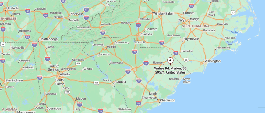
Wahee is a small unincorporated community in Marion County, northeastern South Carolina, lying close to the Great Pee Dee River. About 10 miles west of Marion, it is reached by rural county roads branching off U.S. Route 76 as they narrow toward the river.
The area is marked by farmland, wooded tracts, and river bottoms that give it a quiet, secluded feel. With its riverside setting and open countryside, Wahee feels like a place set apart from the busier parts of the county.
11. Jordanville
Jordanville, in Horry County, developed as a rural farming community where tobacco and corn were the backbone of the local economy. The town once supported barns, gins, and small shops that kept the agricultural cycle moving.
As tobacco declined, residents increasingly commuted to Conway, Loris, and Myrtle Beach for work in construction, tourism, and retail. Farming and forestry still provide some income, though on a smaller scale than in the past.
Local schools, churches, and a handful of businesses remain steady employers within the community. Jordanville’s economy today reflects the shift from crop production to commuting and service-based work tied to the growth of Horry County.
Where is Jordanville?
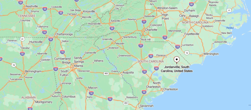
Jordanville is a rural community in Horry County, northeastern South Carolina, surrounded by farmland and pine woods. It lies about 15 miles northwest of Conway, reached by State Highway 905, a two-lane route that winds through quiet countryside.
The area is lightly settled, with open fields and scattered homesteads spread across the landscape. With its simple setting and distance from larger towns, Jordanville carries the calm of a place tucked into the rural heart of the county.
10. Brittons Neck
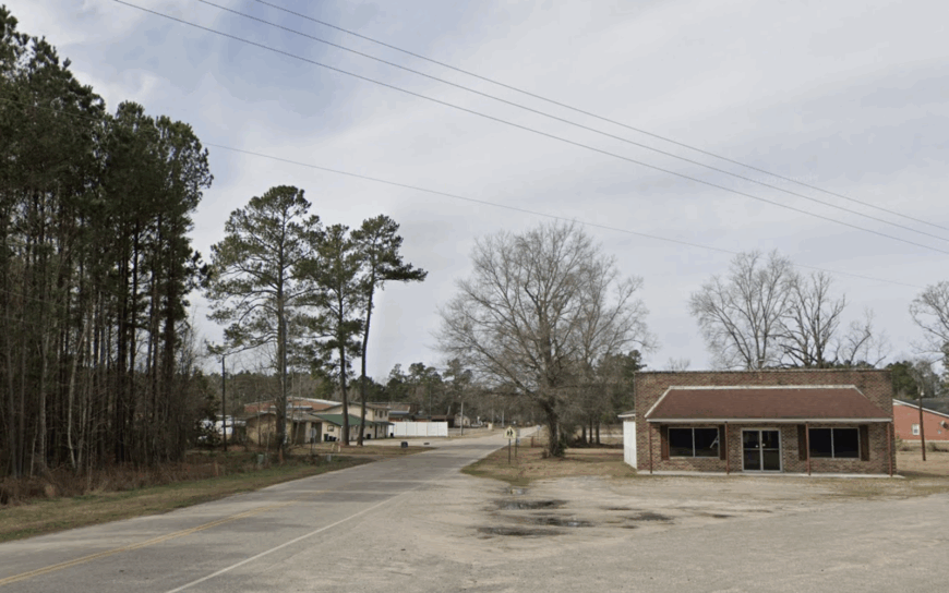
With roughly 500 residents scattered along shady dirt roads, Brittons Neck feels more like a long, looping neighborhood than a town. Paddlers drift past its boat ramps into the Great Pee Dee River, while history buffs hunt for colonial earthworks at the forgotten Britton’s Ferry site.
Row-crop farming and small timber tracts provide most of the paychecks, and a family-run catfish hatchery rounds out local commerce. There are no hotels, stoplights, or chain restaurants, only live oaks dripping with Spanish moss and the low hum of tractors in distant fields.
The nearest grocery store is nearly fifteen minutes away, reinforcing a sense of splendid isolation. All of this combines to make Brittons Neck one of the coast plain’s truest off-the-grid pockets.
Where is Brittons Neck?
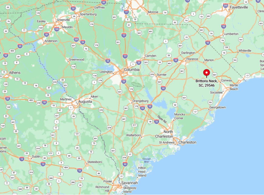
The hamlet lies in southern Marion County, tucked between SC 908 and the Great Pee Dee River’s broad bend. Miles of farmland buffer it from Marion, Conway, or any sizable town, and cell signals often fade once the pavement narrows.
Reaching Brittons Neck requires a slow drive down Highway 908, then a turn onto Reeves Ferry Road where the tree canopy closes overhead. The reward is a place where GPS feels optional and the night sky comes without glare.
9. Plantersville
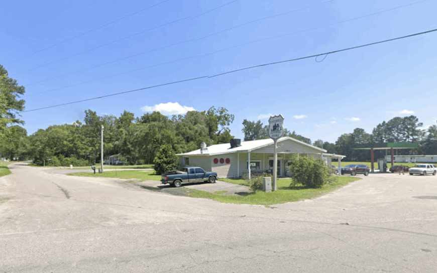
Around 1,200 people call Plantersville home, though many homesteads sit behind gates along the Waccamaw River and are easy to miss. Visitors explore weather-stained rice dikes, photograph tiny praise houses, or launch canoes into the tannin-rich Black River.
Heritage tours and boutique farms give a modest economic lift, but most residents work in small-scale forestry, shellfish gathering, or drive to Georgetown for paychecks.
Thick tidal marsh and private plantation lands seal the area from the swirl of nearby Myrtle Beach. Even midday, traffic rarely rises above a few pickups and the occasional horse trailer. The hush that lingers between mossy live oaks is Plantersville’s signature draw.
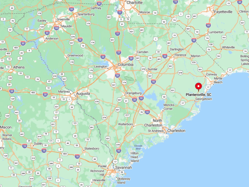
Where is Plantersville?
🔥 Would you like to save this?
Plantersville sits on US 701, twelve miles north of Georgetown and almost invisible behind brick gateposts and pine woods. The Atlantic Intracoastal Waterway flanks one side and the Great Pee Dee River hems the other, leaving only two-lane roads for access.
That watery buffer shields the community from coastal development and tour-bus routes. Travelers reach it by exiting US 17 onto 701, then watching odometer readings rather than billboards.
8. Gresham
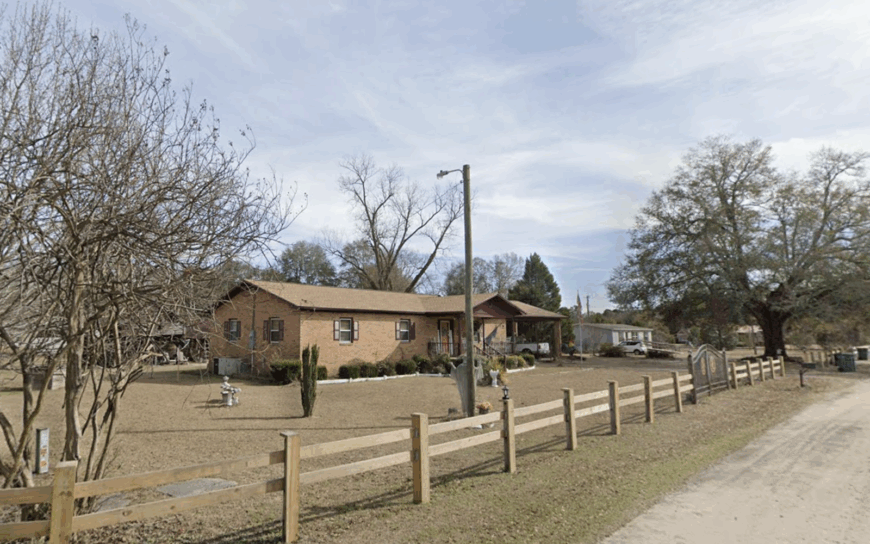
Only about 300 residents live at the crossroads of SC 41 and SC 908, where Gresham’s weathered feed store and single gas pump serve as the informal town square.
Anglers haul in redbreast sunfish from the cypress-lined Lynches River, and hunters trade stories at dawn before slipping into nearby Woodbury Wildlife Management Area. Corn, soybean, and peanut fields anchor the local economy, supplemented by a family sawmill that hums whenever orders roll in.
The nearest fast-food sign is twenty miles away, underscoring just how lightly traveled these roads remain. Most evenings, the loudest sound is the slap of a screen door or the whistle of a freight train miles off. This quiet network of farm lanes gives Gresham its enduring seclusion.
Where is Gresham?
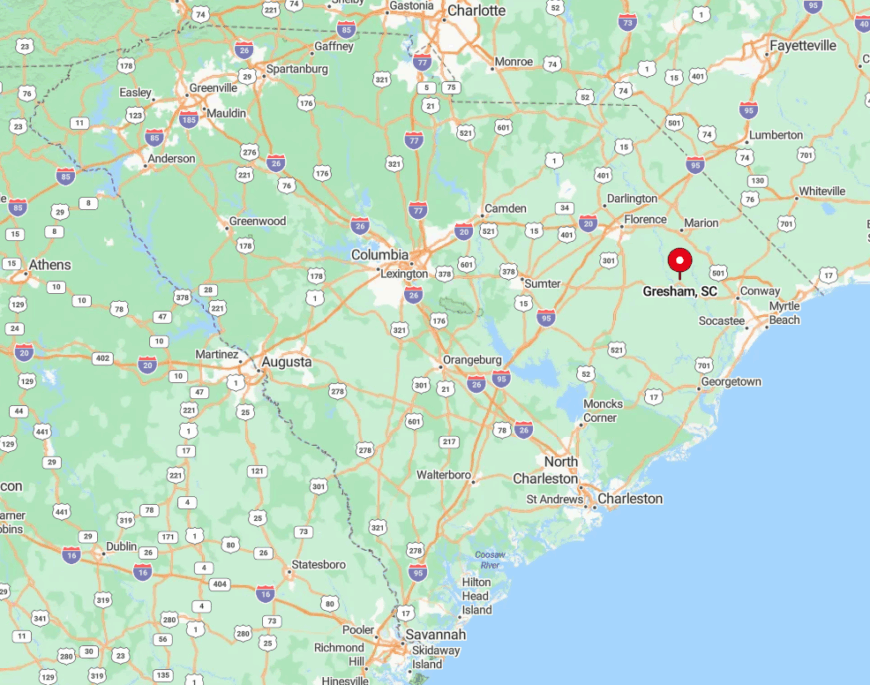
The village lies in southern Marion County, seven miles from the Lynches River landing and almost equidistant from Hemingway and Johnsonville. Dense pine plantations and low-lying swamps fringe every exit route, limiting through-traffic.
Visitors approach on SC 41, slowing for roaming hounds and tractors sharing the pavement. GPS units often reroute onto gravel, reinforcing the sense of being tucked far from any urban grid.
7. Fork
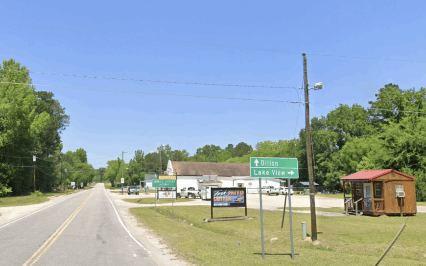
Fork’s 1,100 or so residents are spread across a quilt of family farms wedged between the Pee Dee and Little Pee Dee Rivers. Locals fish for catfish at Parker’s Ferry, harvest soy and cotton, and gather at Fork Presbyterian’s monthly oyster roast.
Agriculture and small-scale logging remain the chief livelihoods, with seasonal farm stands adding pocket cash. Two rivers on three sides and a forested state line on the fourth make the settlement easy to miss and hard to stumble upon.
Nights settle in with little more than frog chorus and the distant rumble of combines. That boundary of water and woods preserves Fork’s welcome isolation.
Where is Fork?
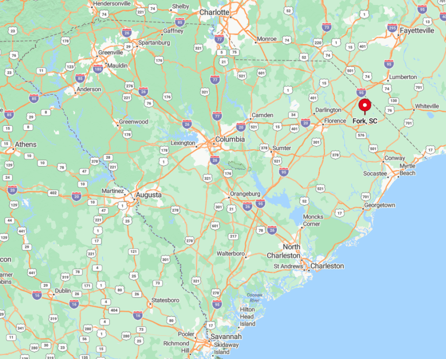
Fork occupies eastern Dillon County off SC 41 Alt., roughly nine miles south of Dillon but separated by miles of floodplain. The dual-river geography forces motorists onto one of two narrow bridges, which discourages casual pass-throughs.
Reaching town usually involves a slow cruise down River Road, where cornfields meet water oaks. Those who venture in find more fields than front porches and a sky unbroken by streetlights.
6. Kingsburg
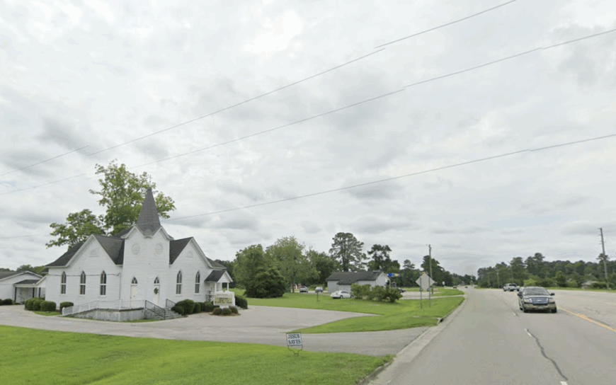
Fewer than 500 people live in Kingsburg, a sweep of tobacco flats and sunflower plots edging the Lynches River. Photographers set up tripods at dawn to capture lone grain silos rising from fog-laden fields, while paddlers slide canoes into Moccasin Bluff Landing a few miles north.
Tobacco barns, peanut warehouses, and a seed-cleaning co-op form the core industries, and most commerce wraps by 5 p.m. The absence of retail strips, combined with twenty-plus miles to Florence city limits, keeps visitor numbers low.
Bright stars replace neon signs once the sun slips behind the pines. That wide, unlit horizon is Kingsburg’s badge of remoteness.
Where is Kingsburg?
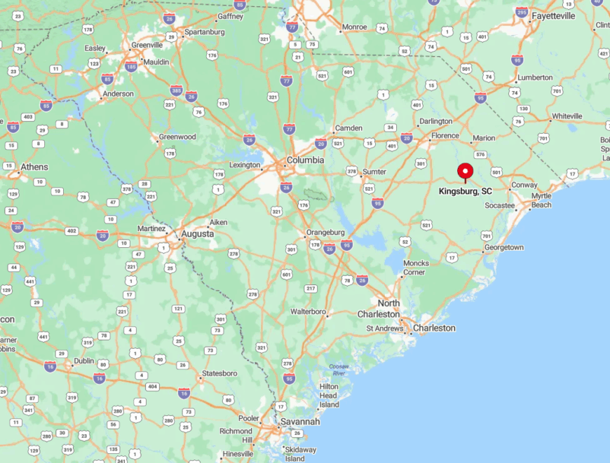
The settlement rests in southeastern Florence County where SC 51 intersects narrow county roads that seldom see heavy traffic. Floodplain woods and farm tracts provide a natural buffer from US 52 and I-95.
Drivers exit SC 327, weave along River Road, and cross the Lynches to arrive in Kingsburg, often passing more tractors than cars. The journey feels half a century slower than the interstate just twenty minutes away.
5. Nesmith
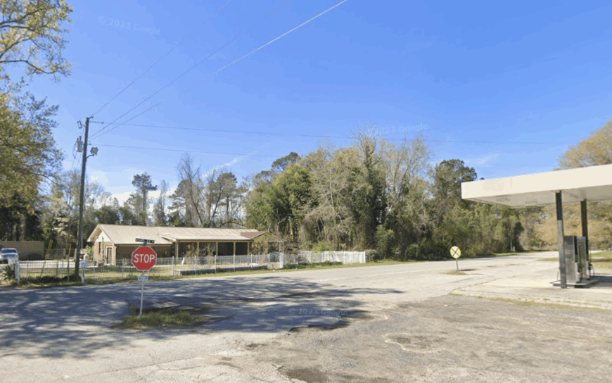
Estimated population hovers near 250, yet Nesmith claims a surprising number of hunting lodges hidden among its longleaf pines. Guests spend dawns stalking whitetail deer or scouting wild turkey, then visit a one-room post office where locals swap stories.
Timber and guided hunts supply most income, with a smattering of blueberry farms adding seasonal work. Gravel church drives, scattered cemeteries, and a near-total lack of commercial lighting create an enveloping stillness every evening.
A radio tower flashing on the horizon is often the only man-made beacon. Such low density and purposeful land management seal Nesmith’s secluded status.
Where is Nesmith?
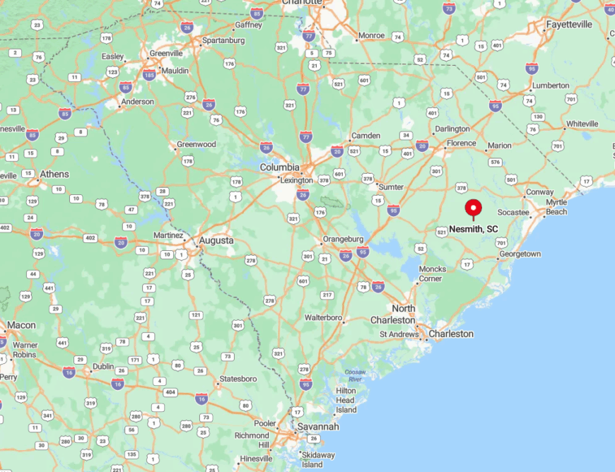
Nesmith sits in northern Williamsburg County, a good 18-mile trek from the county seat of Kingstree. Sand roads connect it to SC 41/51, and heavy rainfall can make some routes muddy for days.
The nearest gas pump sits ten miles away in Hemingway, ensuring limited passers-by. Anyone arriving has likely planned the trip, not chanced upon it.
4. Rains
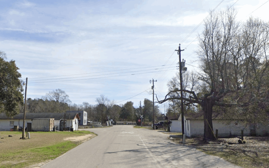
Rains numbers barely 150 residents, most living within earshot of the abandoned Atlantic Coast Line rail spur that gave the community its start. Photographers favor sunrise over the aging depot and vast cotton rows that fade into open sky. Farming makes up the lion’s share of local income, with a small cotton gin operating each fall.
Empty railbeds, broad fields, and only one flashing traffic signal underscore the settlement’s emptiness. Summer sunsets paint the sky without interruption from buildings higher than two stories. That boundless horizon is the very definition of seclusion.
Where is Rains?
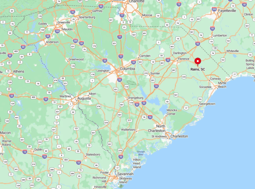
Located on US 501 in western Marion County, Rains lies halfway between Marion and Dillon yet feels a world apart once the highway dips behind tree lines. Beyond a lone convenience store, services vanish quickly, and side roads turn to gravel within minutes.
Travelers exit US 501 onto Bay Catfish Road to reach the old depot, often sharing the route with farm equipment. With no rail traffic since the 1980s, the quiet is nearly absolute.
3. Evergreen
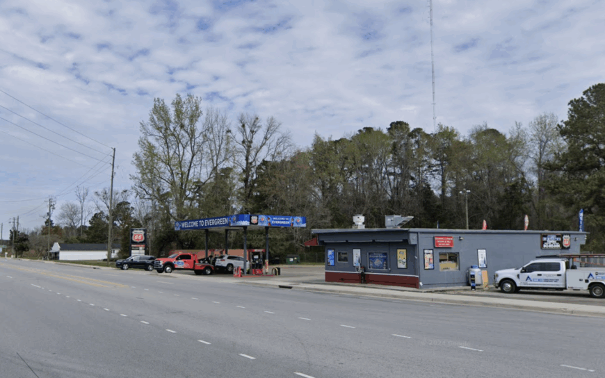
Evergreen’s roughly 400 residents cluster along a two-mile ribbon of asphalt that threads between cypress swamps and open pasture. Early risers watch fog lift above hay bales, while birders listen for prothonotary warblers deep in the swamp margins.
Beef cattle, hay production, and small produce plots form the backbone of income, supplemented by seasonal hunting leases. No streetlights line the main road, and mailboxes serve as the primary landmarks.
Even GPS sometimes struggles in the dense canopy, confirming how thinly settled the area is. Evergreen’s stillness greets every visitor before a single handshake.
Where is Evergreen?
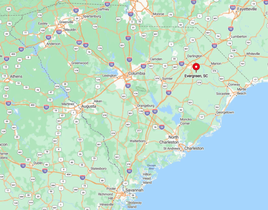
The community sits in eastern Florence County, reached by turning off SC 51 onto River Road and then Evergreen Road, both flanked by endless pine. Surrounding swamps make road expansion unlikely, preserving the one-way-in, one-way-out feel.
The closest town with a grocery store is Pamplico, ten miles northwest. That modest distance is enough to keep night skies pitch-black and traffic sparse.
2. Little Rock
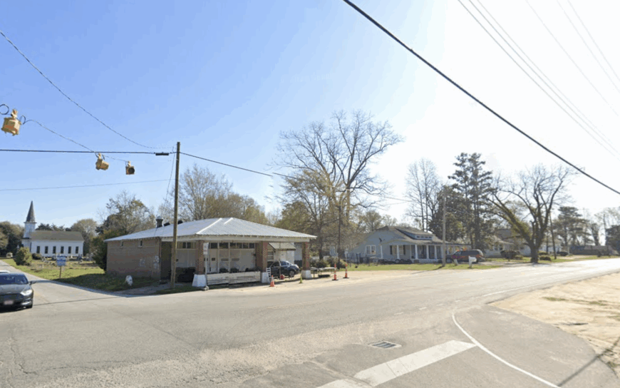
Some 1,700 people reside among Little Rock’s clapboard farmhouses, roadside boiled-peanut stands, and wide peanut fields. Weekends bring bargain hunters to the century-old Poplar Hill School flea market, while locals fish for bream in nearby Hamer Bay.
Peanuts and soybeans dominate farm income, with a heritage sweet-potato processing shed adding autumn jobs. The town’s heart beats at a single four-way stop, and beyond it are miles of unmarked farm lanes.
Light pollution is so minimal that the Milky Way is a routine sight. Those vast tracts of undeveloped acreage guard Little Rock’s solitude.
Where is Little Rock?
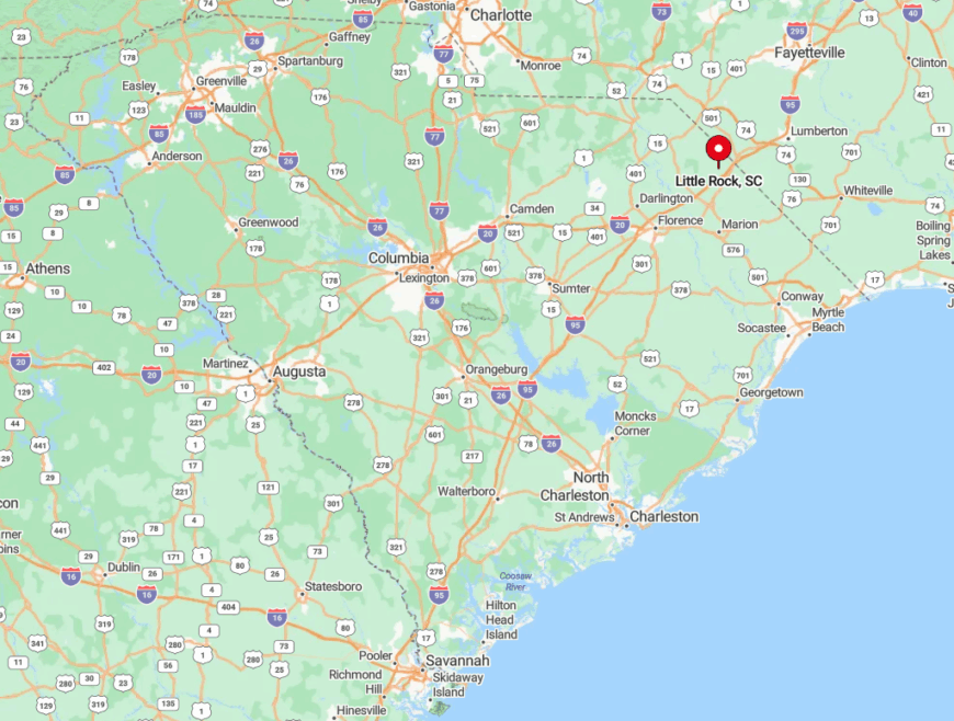
Situated near the North Carolina border in northern Dillon County, Little Rock sits just off US 501 yet sees little through-traffic. Travelers exit the highway onto SC 57, passing only silos and grain bins before arriving at the crossroads.
Two rail crossings and a scattering of barns define its modest skyline. With larger towns fifteen minutes away in every direction, quiet reigns after sunset.
1. Centenary
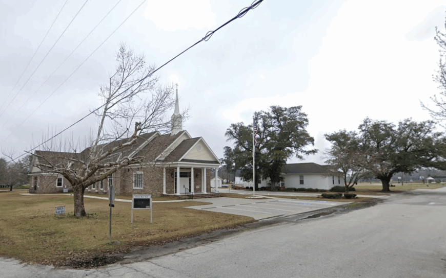
Around 600 residents form a close circle around Centenary’s cluster of century-old churches and tidy pecan groves. Sunday services spill into pot-luck lunches under metal farm sheds, and visitors often detour to photograph the 1906-built Centenary Methodist sanctuary.
Cotton, soy, and pecans create steady if modest incomes, and a family-owned beekeeper ships honey statewide. The absence of a single stoplight, combined with fields stretching ten miles in any direction, ensures minimal noise and zero traffic jams. Nighttime cricket song replaces sirens or highway drone.
Where is Centenary?
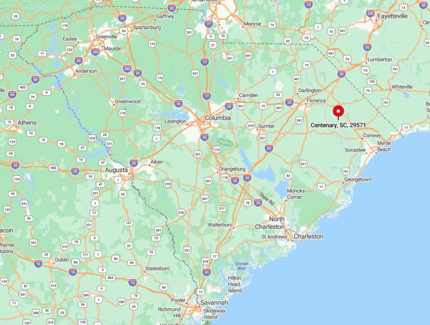
Centenary occupies western Marion County along SC 41A, over ten miles from the nearest commercial intersection in Marion. Encircling crop fields and a lack of direct interstate access keep the community tucked out of sight from casual travelers.
The simplest route is SC 41A from Marion, which narrows to two tight lanes flanked by pecan rows. By the time the church steeple emerges, visitors realize they’ve entered a world that hasn’t rushed in decades.


