🔥 Would you like to save this?
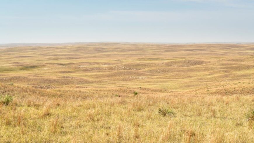
Stretching beneath an endless sky, western Nebraska shelters a string of villages where the outside world feels very far away. These are places with more cattle than people, where gravel crunches under the mail truck twice a day and the Milky Way glows like a porch light.
Our look at 25 of them shows how geography, history, and a stubborn streak of independence still shape daily life on the High Plains. From river islands that drown out road noise to dune ridges that swallow cell signals, seclusion takes many forms here.
In order to come up with the very specific design ideas, we create most designs with the assistance of state-of-the-art AI interior design software.
Set aside notions of bustle and discover the quiet side of the Cornhusker State. Each stop on the countdown offers its own brand of solitude, plus a few surprises for travelers willing to make the trip.
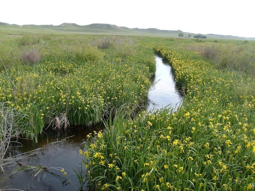
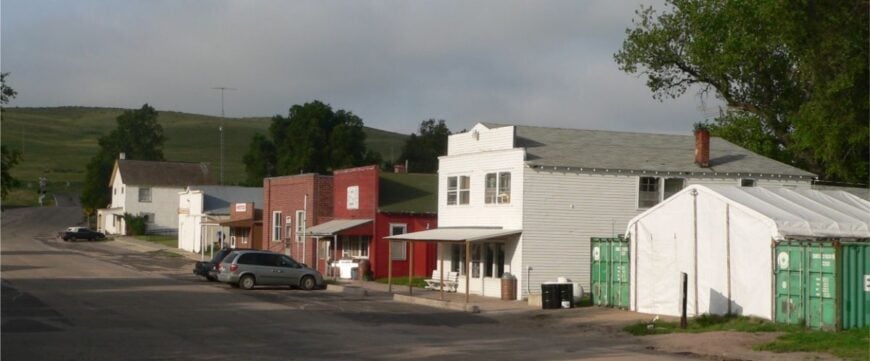
25. Arthur – County Seat on a Near-Empty Map
Arthur feels like a pause in the road rather than a destination, a tiny county seat where the courthouse lawn doubles as a gathering place after church. Its isolation comes from miles of Sandhills in every direction and the fact that most folks are out on ranch spreads rather than in town.
The air smells faintly of hay and sun-baked cedar fence posts, and you can hear your boots on the boardwalk outside the café. Pop into the one-room Pilgrim Holiness Church or the Arthur County Museum to trace the area’s homesteading roots.
Anglers slip away to nearby lakes for perch and pike, while birders watch hawks ride the wind above the dunes. Cattle and hay keep the economy steady, but the pace feels unhurried, measured in seasons rather than quarters. It’s the sort of place where a handshake still settles most things, and the quiet feels earned.
Where is Arthur?
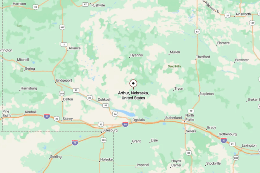
Tucked in the west-central Sandhills, Arthur sits along Nebraska Highway 92, about 35 miles north of Ogallala and I-80. You reach it on a two-lane blacktop that rolls like a gentle ocean over grass-covered dunes.
Services thin quickly once you leave the interstate, adding to the sense of distance. It’s close enough to reach in an afternoon, yet far enough that the horizon seems to follow you all the way there.
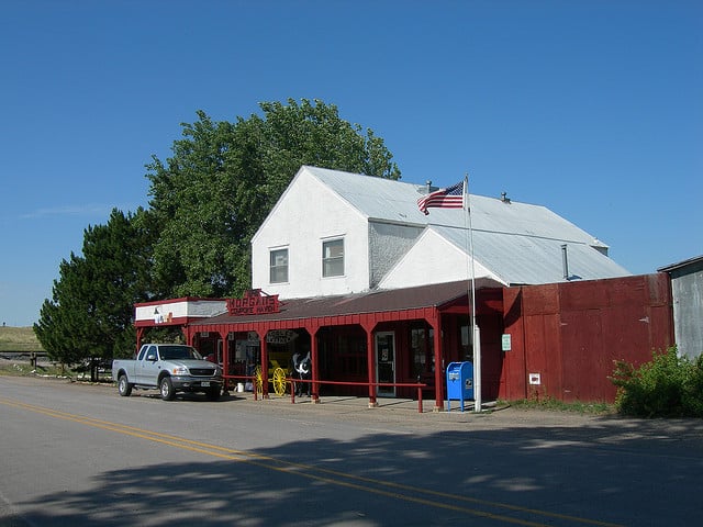
24. Ashby – Windmills and Wide Horizons
Ashby is hardly more than a dot in Grant County, a place where windmills outnumber porches and the sky runs unbroken. Seclusion comes from long stretches of open range and a grid of sandy roads that keep through-traffic away.
The vibe is plainspoken and ranch-bred: pickups dusted in caliche, gloves drying on fence posts, and meadowlarks stitching the silence. Travelers nose into the old storefronts, snap photos beside weathered elevators, and detour for sunrise shots over the rolling hills.
Spring brings booming prairie-chicken displays on nearby lek grounds, and fall is for quiet drives to spot pronghorn. Most folks here work cattle or hay, and conversations are as practical as they are friendly. If you crave a place where time moves with the breeze, Ashby has a way of convincing you to linger.
Where is Ashby?
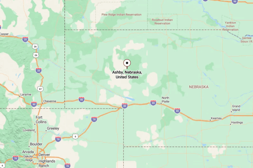
Ashby sits on Highway 2 between Hyannis and Bingham in the heart of the Sandhills. It’s roughly 60 miles northwest of Mullen and about the same east of Alliance.
The approach is a ribbon of a two-lane road with long gaps between services and even longer views. Arrive with a full tank and you’ll feel the world fall away in stages.
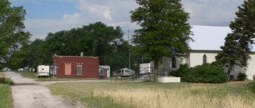
23. Ellsworth – A Depot without the Crowd
Ellsworth looks like a set from an old western—elevator, depot, a handful of sturdy buildings—and then the quiet steps in. It’s secluded because it lies on a forgotten stretch of county roads where ranch traffic is the norm and passing cars are events.
The town gives off a practical charm: neat fences, tidy corrals, and hand-painted signs that still point the way. Stop at the general store for coffee and conversation, then explore nearby grassland tracks where nighthawks skim the dusk.
Photographers love the contrast of silver rails and sea-green hills; birders work the shelterbelts for migrating songbirds. Life here leans on cattle, hay, and the rhythm of shipping season. You leave with dust on your boots and the sense that simplicity is still possible.
Where is Ellsworth?
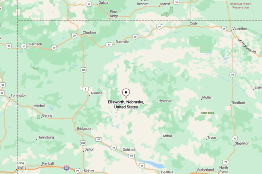
You’ll find Ellsworth in Sheridan County, northeast of Alliance and just off Highway 2 on lightly traveled gravel spurs. It’s about 35 miles from the nearest larger services in Alliance.
Reaching it means easing off the byway and trusting the section-line roads that thread the dunes. The map shows it plainly, but arriving still feels like discovering a secret.
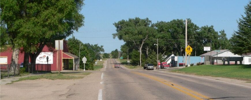
22. Bingham – Half-Stop on the Byway
Bingham sits small and steady on the Sandhills Scenic Byway, a whistle-stop with big skies and few distractions. Its seclusion stems from the miles of grazing country that surround it and the sparse population that keeps evenings almost soundless.
The mood is unhurried: grain trucks rumble past, dogs sleep in the shade, and the mail carrier waves to everyone by name. Travelers pause for fuel or a sandwich, then wander side roads to find windmills silhouetted against storm-gray skies.
Nearby, anglers try their luck at stock ponds while photographers chase golden-hour light across the hills. Ranching is the backbone; everything else fits around branding dates and haying weather. Bingham’s charm is the way it makes stillness feel like a luxury.
Where is Bingham?
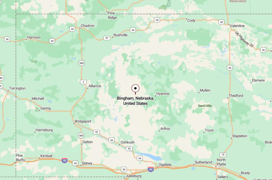
Located in Sheridan County along Highway 2, Bingham lies roughly midway between Hyannis and Ellsworth. The drive is classic Sandhills—rolling grades, sweeping bends, and little in the way of roadside clutter.
Services are limited, which keeps traffic sparse and the nights dark. It’s on the map, but it feels off the grid.
21. Tryon – Prairie County Seat with Ghost-Town Quiet
Tryon is the tiny seat of McPherson County, a courthouse cluster ringed by ranchland where the wind writes its own agenda. It’s secluded because there’s no interstate, no rail, and no town of size for many miles—just section roads and sky.
The vibe is plain and welcoming: white-steepled church, a few weathered businesses, and neighbors who check on each other after storms. Visitors stop for pie in town, then drive gravel loops to watch hawks kite over fencelines and deer step from draws at dusk.
History buffs track down old school sites and early homestead markers; stargazers bring lawn chairs and settle in. Ranching and county offices keep the lights on, but time keeps the pace. Tryon is a reminder that quiet can be a community value.
Where is Tryon?
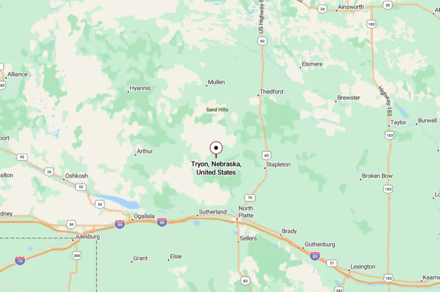
Set in the west-central Sandhills, Tryon sits at the junction of Highways 92 and 97, about 35 miles north of North Platte. The approach is two-lane all the way, folding through dunes and ranch gates.
Cell coverage flickers as the hills rise and fall, adding to the distance you feel from town life. It’s easy to reach, but you’ll swear the sky got bigger on the way.
20. Seneca – A River Town that Whispered Back
Seneca’s storefronts are few, its pace hushed, and the Middle Loup River slides by like a whispered story. Seclusion comes from depopulation and the long run of prairie that separates it from larger neighbors; trains used to stop here, but now time does. The feel is evocative: cottonwoods creak, meadowlarks trade songs, and the wind knocks a shutter now and then.
Visitors paddle stretches of the Middle Loup, fish quiet eddies, or photograph the old bridge girders at sunset. Fossil hunters and rockhounds explore draws south of town, careful to leave the land as they found it.
Cattle and hay fields anchor what remains of the economy; everything else is memory and sky. Seneca tugs at you—the beauty of a small place refusing to disappear.
Where is Seneca?
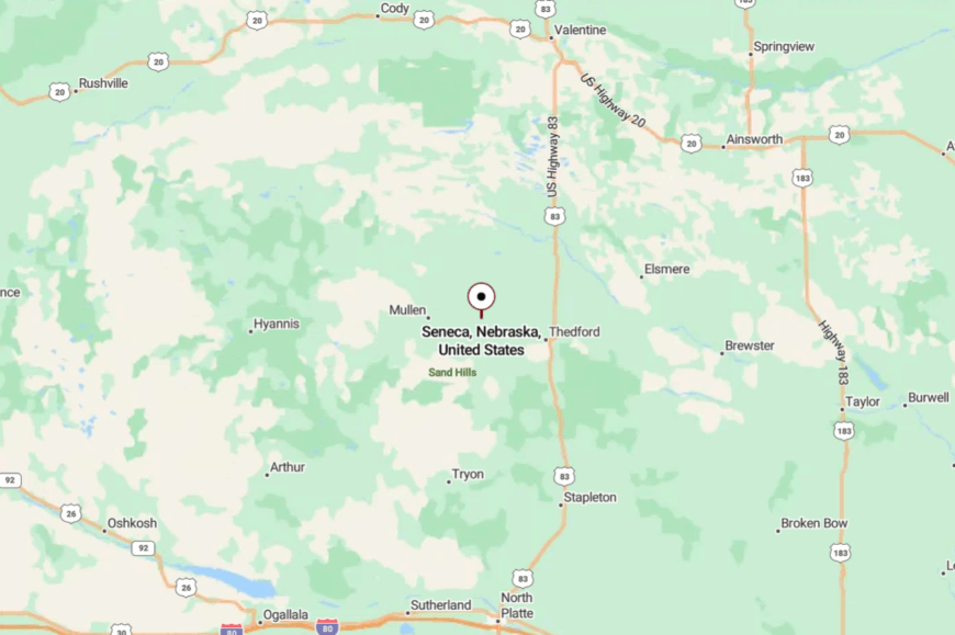
On Highway 2 in Thomas County, Seneca lies about 10 miles west of Thedford and roughly 70 miles east of Mullen. The drive follows rail and river, with dunes rising like waves on either side.
Services are sparse, which keeps the roadside free of neon and noise. You arrive to find that the quiet is part of the scenery.
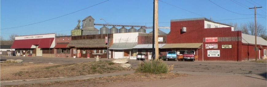
19. Lewellen – Gateway to the Big Lake’s Quiet Side
🔥 Would you like to save this?
Lewellen feels tucked away despite its proximity to water, folded into cottonwoods near the North Platte where the road bends and slows. It’s secluded because most travelers head for busier lake beaches, leaving this little riverside town to anglers and locals.
The vibe is mellow and artsy in spots, with galleries in old storefronts and porch conversations that spill into twilight. Paddle the river backwaters, wander the cemetery hill for big-sky views, or drive to the western shores of Lake McConaughy for quiet sand.
Birders come in spring and fall to watch migrations stream along the river corridor. Farming and lake-season visitors keep a few businesses humming without crowding the streets. Lewellen is the rare place where the water draws people—and then hushes them.
Where is Lewellen?
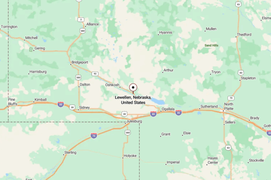
Situated in Garden County at the west end of Lake McConaughy, Lewellen lies along Highways 26 and 92 about 25 miles east of Oshkosh. You reach it by following the river valley as the bluffs tighten and the road curves.
The interstate is a world away, and so are the crowds. It feels like a front porch between dunes and water.
18. Oshkosh – Quiet Bend on the North Platte
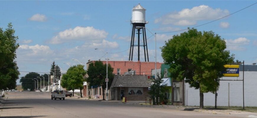
Oshkosh is a small county seat where the North Platte loops lazily past, and the days keep to ranch and farm rhythms. Its seclusion comes from the long distances between neighbors and the wide, open corridors of grassland that surround the town.
The mood is friendly and no-nonsense: grain trucks at sunrise, kids on bikes by afternoon, and stars by the million after dark. Duck into the local museum, fish for catfish below the bridge, or take scenic drives toward Sandhills lakes.
Photographers chase storm light on the horizon while rockhounds poke at gravel bars after high water. Agriculture is the backbone, and it sets a pace that favors patience over hurry. You’ll leave with dust on the tailgate and a quieter heart.
Where is Oshkosh?
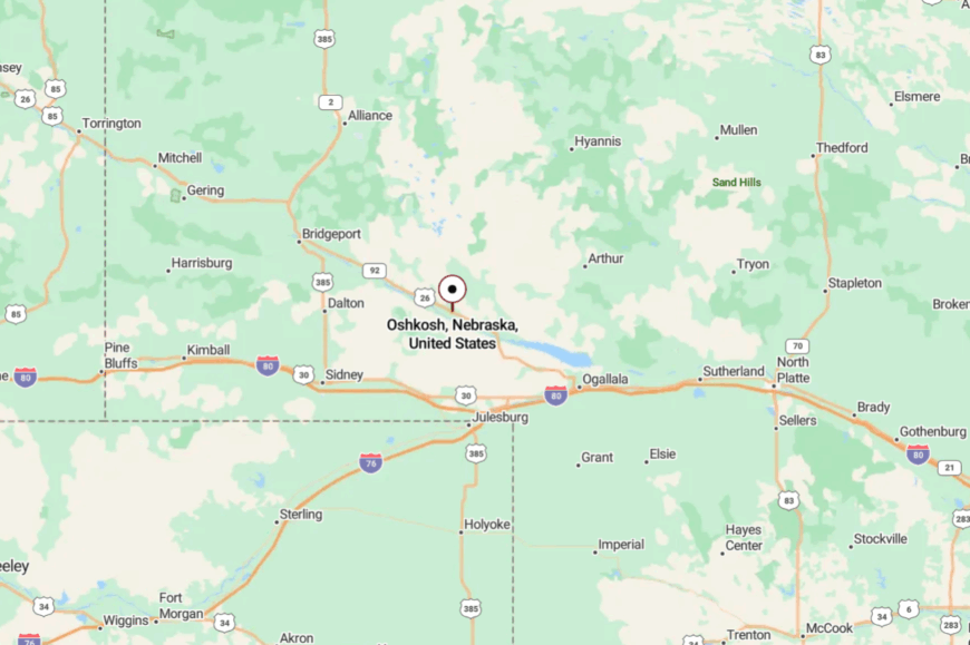
Oshkosh sits in Garden County on Highway 26, about 45 miles northwest of Ogallala. The approach follows the river valley where fields and pasture trade places mile by mile.
With interstates distant and services spread out, the town keeps its unhurried feel. It’s near the river’s edge, but far from the world’s racket.
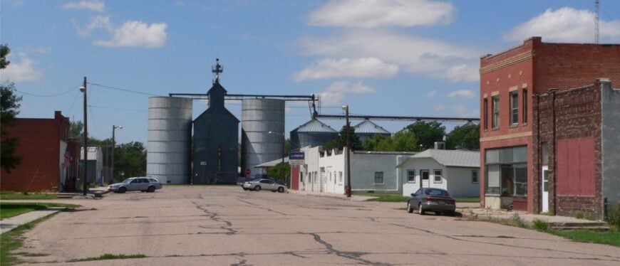
17. Dix – Elevator, Depot, and the Sound of Wind
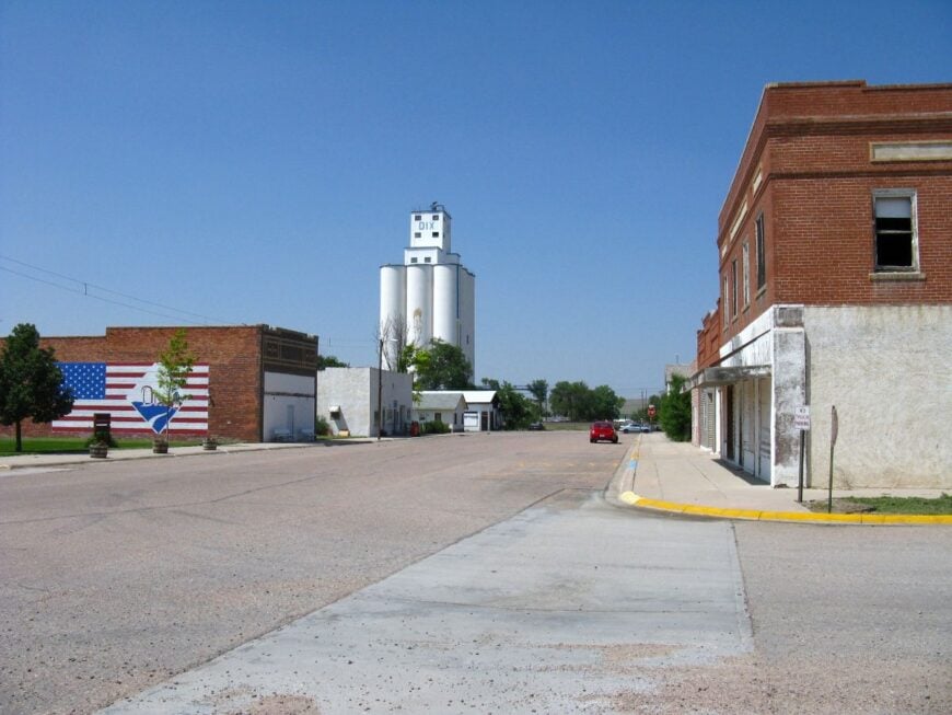
Dix is the definition of small: a clutch of streets, a proud elevator, and trains that pass like clockwork without much fuss. It’s secluded because it sits off the main interstate flow, buffered by pasture and a scattering of shelterbelts.
The vibe is quietly industrious—tidy yards, porch flags, and neighbors who wave from pickup cabs. Visitors admire the classic main street geometry, photograph old rail sidings, and roam gravel roads for sunset vistas. Come fall, hunters work nearby draws for birds while stargazers claim the dark.
Farming and the rail line shape the day; everything else fits between harvests. Dix reminds you that ordinary can be beautiful when the wind is your soundtrack.
Where is Dix?
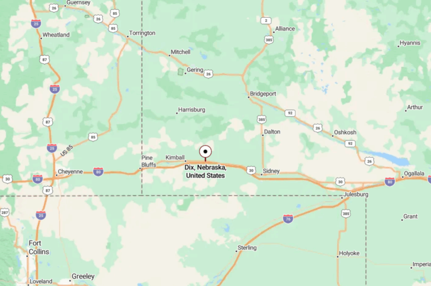
Found in Kimball County along old U.S. 30, Dix lies about 12 miles east of Kimball and a few miles north of I-80. Most travelers exit the interstate, then ease onto the parallel two-lane highway that threads small towns like beads.
The slight detour thins traffic to almost nothing. It’s a short hop from the highway, but it feels worlds away.
16. Gurley – A Prairie Pause North of the Interstate
Gurley sits quietly on the plains, its brick storefronts and grain bins guarding streets where kids still ride bikes at dusk. Seclusion is built in—five miles north of the interstate and surrounded by fields that run to the horizon.
The mood is vintage small town: a café that knows your name, a post office with real bulletin boards, and lawn chairs that migrate toward evening shade. Browse the little museum, cast for trout in Lodgepole Creek stretches, or ride the gravel to photograph thunderheads building over wheat.
Railfans count cars on long freights, and birders work hedgerows for sparrows in winter. Grain and dryland farming keep things steady and seasonal. Gurley’s gift is the feeling that nothing urgent can catch you here.
Where is Gurley?
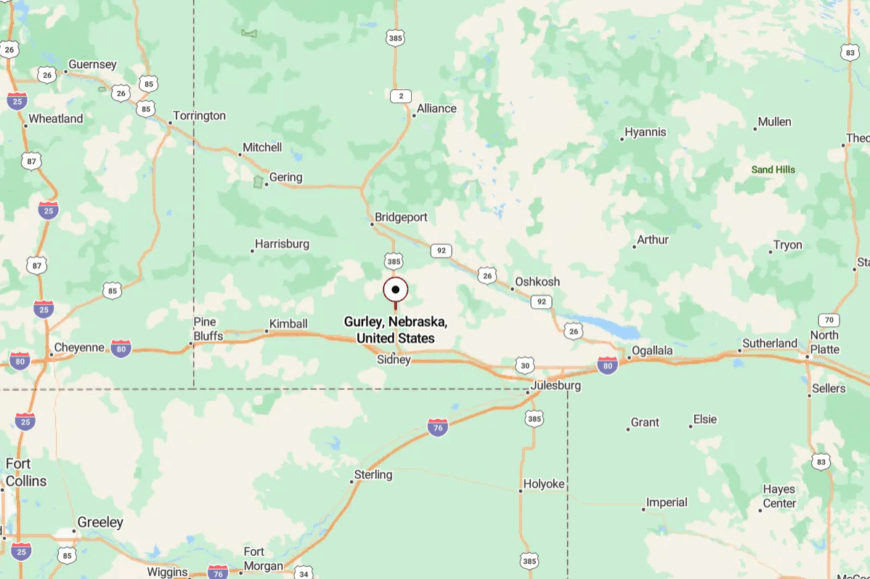
In Cheyenne County on U.S. 385, Gurley sits about 10 miles north of Sidney and I-80. The route is a simple two-lane northbound through open country.
With no big-box glow and few signs, the town appears almost by surprise. You’ll know you’ve arrived when the elevator rises like a lighthouse from the fields.
15. Dalton – Wheat Town with Night-Sky Views
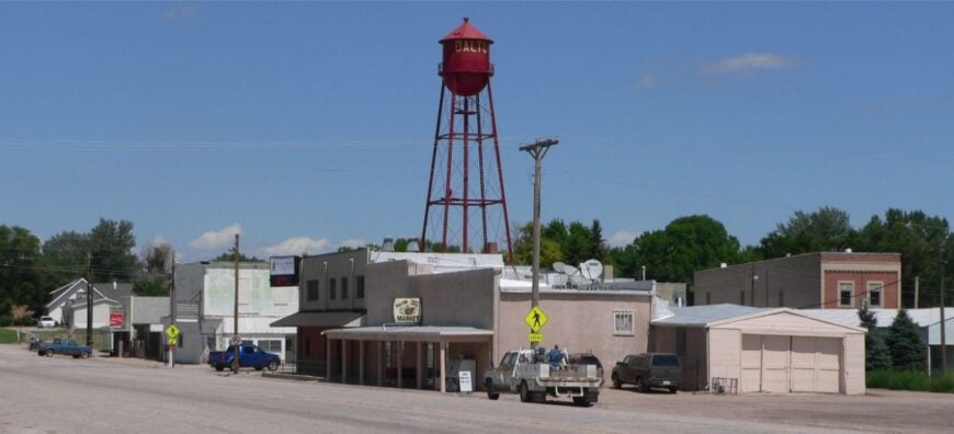
Dalton feels like a postcard from the Great Plains—elevator skyline, tidy grid, and porch talk that drifts down the block. It’s secluded by distance and by the way the land flattens noise and flings it toward the horizon.
The town vibe is neighborly and old-school: Friday games at the field, pies at the fundraiser, and pickup beds full of seed sacks. Visit the local historical display, fish farm ponds with permission, or drive out at dusk to watch lightning march across the western sky.
Photographers love the grain harvest season when the fields glow like brass. Farming is the anchor, and the schedule respects the weather above all. Stay a little and you’ll start measuring time in sunsets.
Where is Dalton?
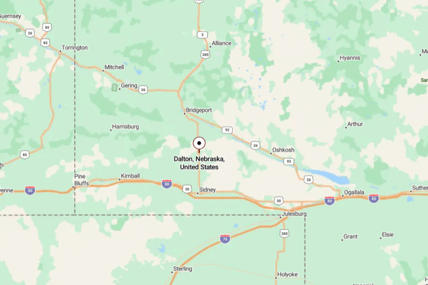
Dalton rests in Cheyenne County on Highway 385, around 20 miles north of Sidney. The road in is arrow-straight, crossing open country with more cattle than cars.
Without interstate hum or big-city spillover, the nights get truly dark. It’s easy to find, but even easier to forget the clock once you’re there.
14. Harrisburg – Lone Courthouse on the Divide
Harrisburg, the county seat of Banner County, sits like a lone outpost on the High Plains divide. Its seclusion is literal—no rail, no interstate, just ranches stitched together by gravel roads and big-sky distance. The vibe is spare and sturdy: courthouse lawn mowed tight, pickups lined by the café, wind easing the screen door shut.
Visitors explore nearby buttes and badlands, picnic by spring-fed draws, and scan ridgelines for mule deer at dusk. Geology buffs roam the breaks where ancient sediments tell a quiet story.
Ranching and county work keep a small circle of life going in a steady rhythm. Harrisburg is the kind of quiet that feels like confidence.
Where is Harrisburg?
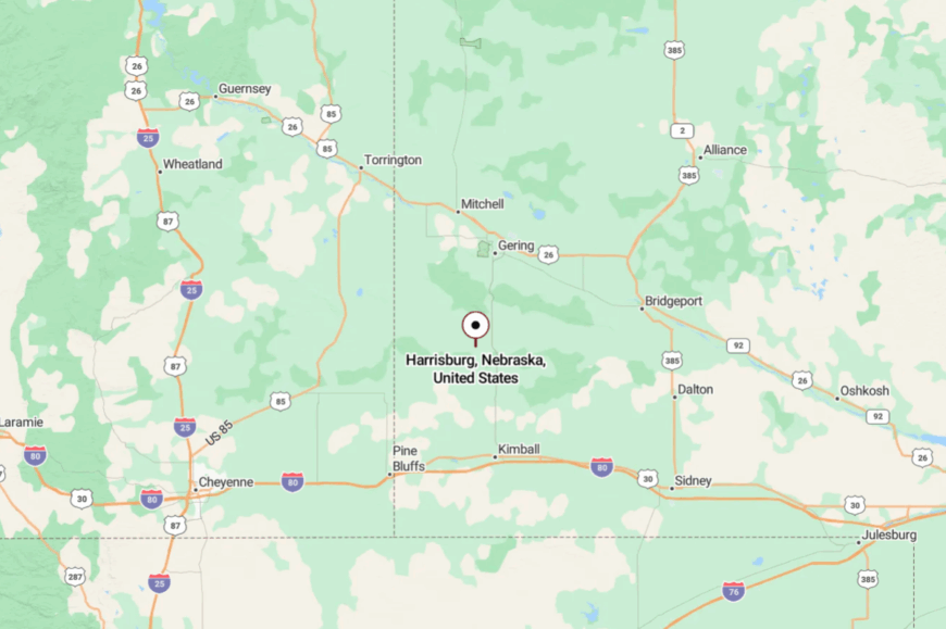
You’ll find Harrisburg in Banner County, roughly 25 miles south of Gering via Highway 71 and county roads. The last miles often involve gravel that slows you down and clears your head. With few services and fewer signs, the landscape does most of the talking. It’s close to the bluffs—and far from everything else.
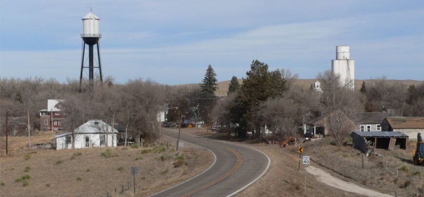
13. Hemingford – Shelterbelts and Summer Evenings
🔥 Would you like to save this?
Hemingford spreads under tidy shelterbelts, a prairie town with parks that smell of cut grass and lilac in June. Seclusion comes from being a step removed from bigger neighbors, framed by dryland fields and the long swing of the seasons. The vibe is wholesome and lived-in: farmers at the co-op early, kids at the pool late, and a main street that still feels like Saturday night. Browse local shops, cast for trout in nearby ponds, and drive to Box Butte Reservoir for uncrowded shoreline. In the fall, orchards and pumpkin patches turn weekends into small-town festivals. Agriculture hums in the background, steady as a metronome. Hemingford’s calm sneaks up on you and asks you to stay for one more evening.
Where is Hemingford?
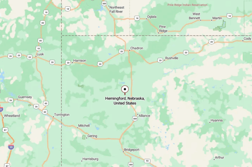
Placed in Box Butte County on Highway 2, Hemingford is about 18 miles northwest of Alliance. The approach rolls through open country where elevators mark the horizon. With the interstate far away, traffic thins to locals and wanderers. It’s the sort of arrival where you roll down the window just to hear the wind.
12. Merriman – Edge of the Big Country
Merriman feels like a frontier hinge on the edge of the immense Cherry County range. It’s secluded by distance—long runs of ranchland, scattered windmills, and gravel tracks that tie it to neighbors rather than highways.
The mood is classic Sandhills: modest, weather-tough, and generous with hellos. Ride the backroads to Niobrara River overlooks, watch sharptails dance on spring leks, or fish quiet bends where willows touch the current.
Nearby, the Samuel R. McKelvie National Forest offers lonely trails and star-spattered nights. Ranching rules here, and time follows the cattle. Merriman’s allure is the feeling that the land itself is the main street.
Where is Merriman?
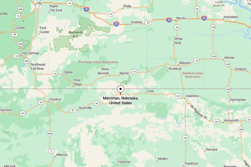
On Highway 20 in western Cherry County, Merriman sits about 60 miles west of Valentine and 30 miles east of Gordon. The road in is two-lane and open, with few distractions beyond sky and grass.
Services are minimal, which helps keep the nights deep and the days slow. It’s close enough for a day trip, yet big-country quiet wraps it like a blanket.
11. Chappell – Calm at the Colorado Line’s Elbow
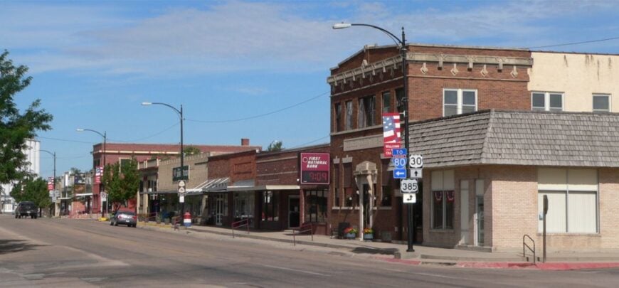
Chappell is a gentle bend in the plains where grain elevators and green lawns share space with old shade trees. Seclusion comes from its perch on the far-west edge of the Platte country, with interstates nearby but not intrusive and long views in every direction.
The vibe is easygoing: golfers stroll nine at sundown, anglers slip to ponds south of town, and neighbors trade stories over pie downtown. Browse antique spots, walk the park loop where orioles flash in summer, and drive the old Lincoln Highway for a dose of history without the crowds.
Harvest brings a subtle bustle, but evenings drift back to quiet as lights blink on porch by porch. Farming and small-town services keep the hum steady without ever getting loud. Chappell is a reminder that edges can feel like sanctuaries.
Where is Chappell?
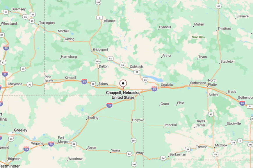
Set in Deuel County along old U.S. 30, Chappell sits about 20 miles east of Sidney and just north of I-80. Most visitors exit the interstate and follow the original highway as it relaxes into town.
The short detour leaves semi traffic behind and restores the sound of birds and sprinklers. It’s close enough to reach quickly, but far enough to feel like you’ve stepped off the main stage.
10. Whitman – A Sandhills Hamlet Lost in a Sea of Grass
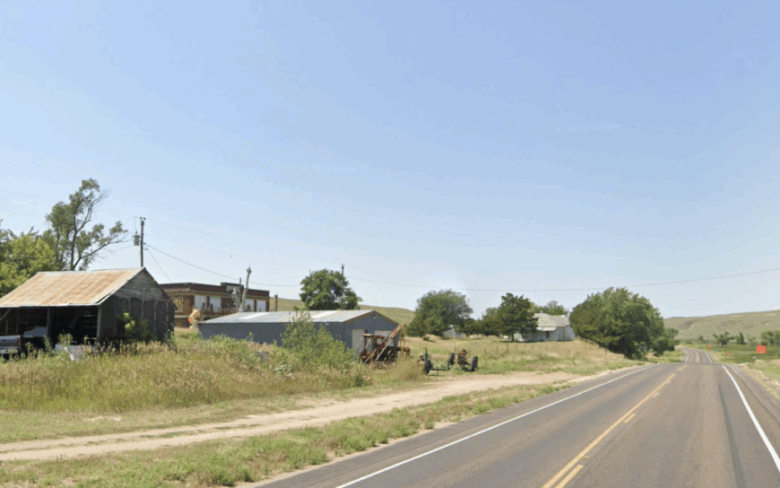
With fewer than 100 residents, Whitman feels more like a ranch headquarters than a town. Visitors come for birdwatching at nearby Diamond Bar Lake or to ride horses across the rolling dune ridges of the Sandhills.
Cattle ranching dominates the local economy, and the tiny post office doubles as a hub for feed orders and brand inspections. Our favorite hidden corner is the restored one-room Pleasant Hill School, still used for community potlucks when branding season winds down.
Thousands of acres of private range wrap Whitman in a green buffer that muffles highway noise and blocks cell reception for long stretches. Trains whistle on the BNSF line once in a while, yet the space between those moments can feel as wide as the prairie horizon.
Where is Whitman?
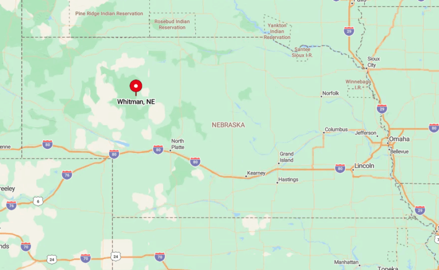
Whitman sits on Nebraska Highway 2 in Grant County, about 75 miles north of I-80. Sand dunes up to 300 feet tall surround the village, creating natural sound walls and limiting radio and data signals.
Most travelers reach it by following the two-lane Sandhills Scenic Byway from Broken Bow or Alliance, a drive lined with unfenced grasslands and few services. Once in town, expect gravel streets, ample parking, and directions given by windmill counts rather than street numbers.
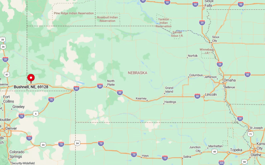
9. Bushnell – Nebraska’s Quiet Western Gateway
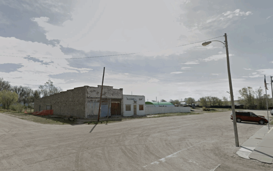
Bushnell counts roughly 120 residents, many of whom greet each other every morning at the lone café on Chestnut Street. Hikers wander the nearby bluffs to spot pronghorn, while railfans photograph long Union Pacific freights climbing toward Sherman Hill.
The local economy rests on dry-land wheat, custom hay cutting, and a small but steady stream of travelers topping off fuel before crossing into Wyoming. The Bushnell Rural Fire District hosts a yearly pancake feed that doubles as the village’s biggest social event.
Set on wide lots bordered by weathered board fencing, homes sit far enough apart that even barking dogs sound distant. With no grocery, hotel, or traffic light, Bushnell offers prairie silence broken only by wind and the whistle of meadowlarks.
Where is Bushnell?
🔥 Would you like to save this?
Positioned a mile east of the Wyoming line on old US 30, Bushnell is the first or last Nebraska town depending on direction. Its low ridgeline hides the interstate eight miles south, blocking highway noise and keeping the skyline free of billboards.
Travelers exit I-80 at Kimball and follow County Road 59 or drop off US 30 after Pine Bluffs, each approach involving open pasture and few signposts. Cell service returns once you crest the bluff outside town, a subtle reminder of how quickly modern connections can fade on the high plains.
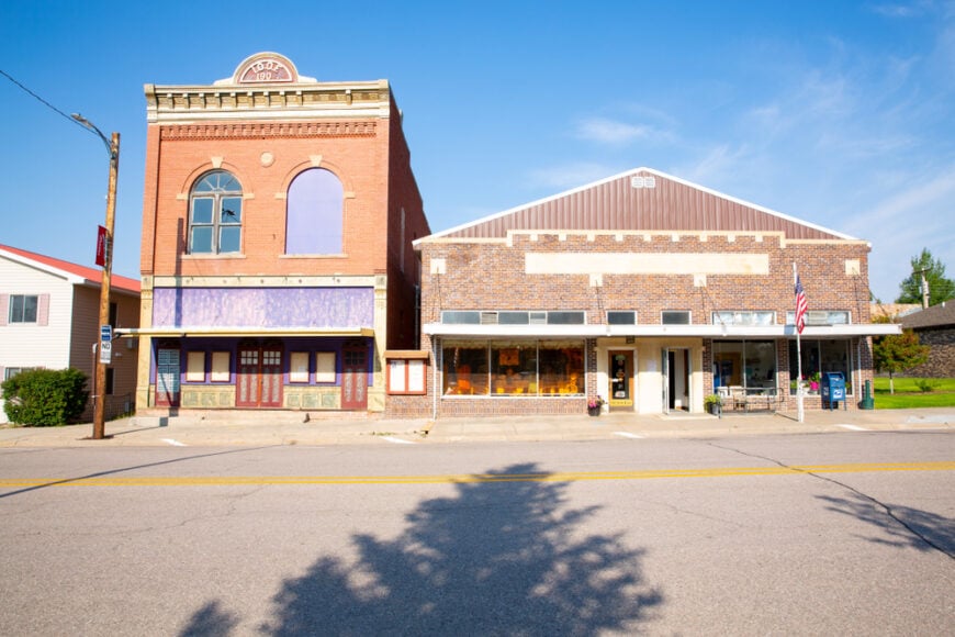
8. Lisco – Riverside Seclusion on the North Platte
Only about 60 people call Lisco home, their backyards shaded by old cottonwoods that lean over the North Platte River. Anglers wade the shallows for channel catfish, while birders scan the sandbars for piping plovers and least terns.
Cattle grazing and hay production along the river bottom remain the chief livelihoods, with an occasional hunting guide service operating out of converted barns.
A must-see landmark is the 1928 Lisco State Aid Bridge, a graceful concrete arch that once carried the Lincoln Highway and now hosts picnics and photography sessions.
The absence of chain stores keeps nights dark and quiet, and mosquitoes may be the loudest companions after sunset. With the closest big box retailer nearly fifty miles away, locals plan supply runs like mini expeditions, underscoring just how removed Lisco truly is.
Where is Lisco?
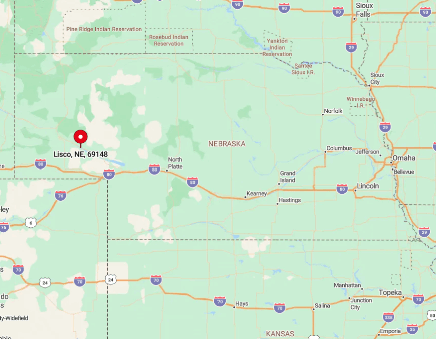
Lisco lies in Garden County along Nebraska Highway 92, midway between Oshkosh and Broadwater. River bends and cottonwood groves block sightlines in every direction, making the village invisible until travelers cross the last levee. Reaching it involves a scenic drive from Interstate 80 at Ogallala, then forty miles of two-lane road flanked by pasture and corn pivots. Train tracks parallel the highway, and passing locomotives serve as both guide and soundtrack for those seeking the riverside hideaway.
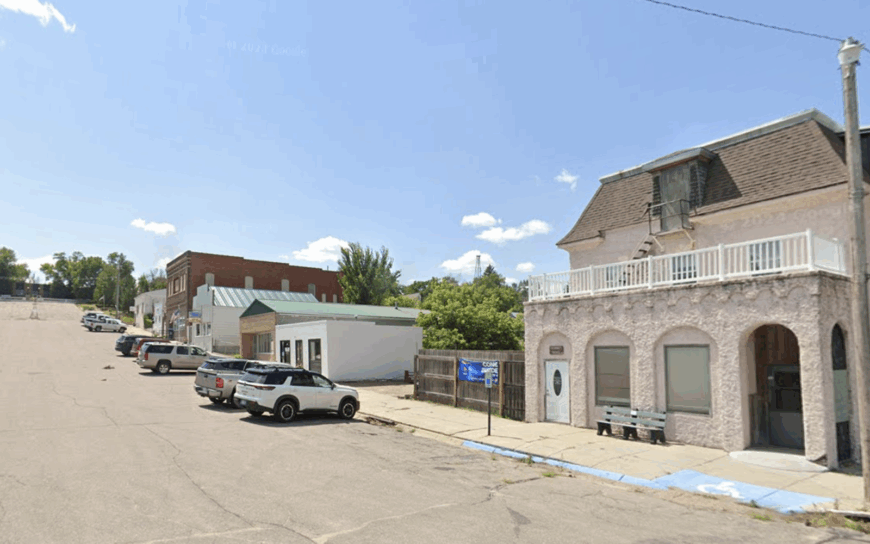
7. Harrison – The Pine Ridge Stronghold
Home to about 250 residents, Harrison feels like a frontier outpost tucked beneath the Pine Ridge escarpment. Day trips include fossil hunting at nearby Agate Fossil Beds, hiking the Soldier Creek Wilderness, and feasting on fry bread at the annual Sioux County Fair.
Ranching, county government, and a modest tourism trade support local businesses such as Longhorn Bar and the Sioux Sundries grocery. The Sioux County Historical Museum holds a little-known collection of Lakota beadwork, offering a quiet corner for history buffs.
Ninety miles separate Harrison from the nearest interstate, and the surrounding ponderosa pines swallow both light and sound once dusk arrives. With sky quality readings that rival remote observatories, residents often gather at the rodeo grounds for impromptu stargazing parties.
Where is Harrison?
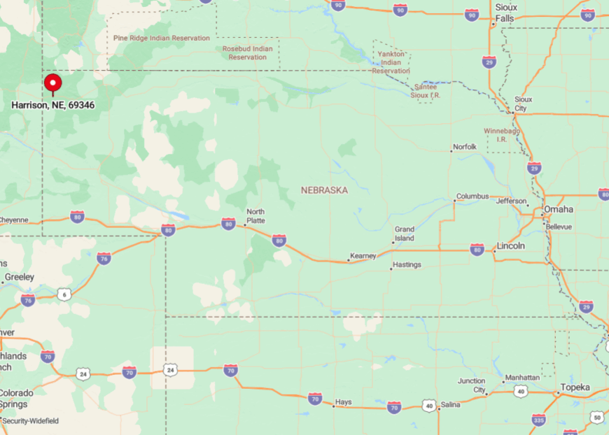
Harrison sits near Nebraska’s northwest corner on Highway 20, only 13 miles from both Wyoming and South Dakota. Sheer buttes and thick timber limit radio towers, contributing to pockets where even AM stations crackle.
Most visitors reach town via a picturesque, curving ascent from Crawford, climbing 1,500 feet and leaving cellular service on the valley floor. Winter storms can shut the route for days, trapping travelers in a place where backup generators and neighborly coffee pots keep things running.
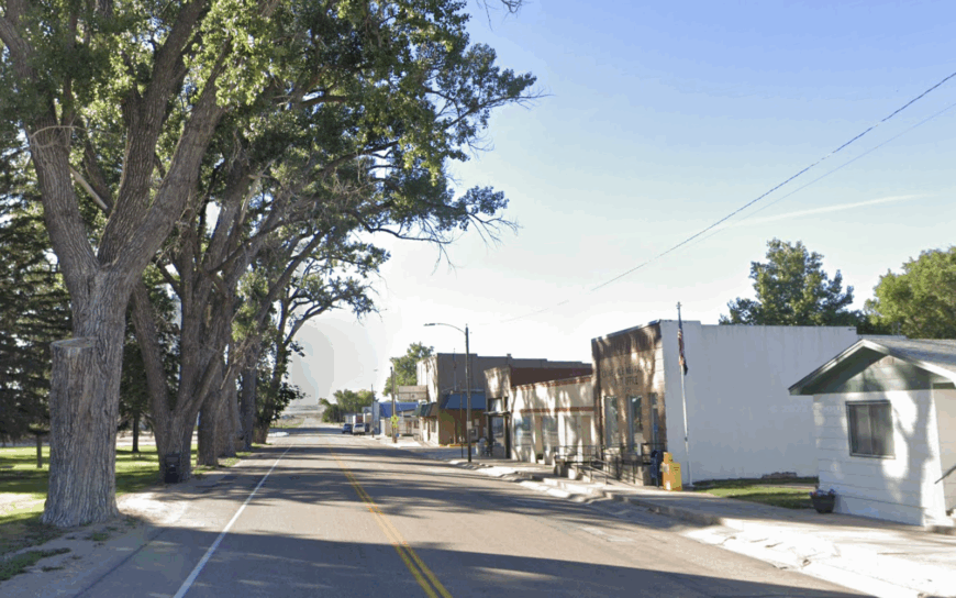
6. Hyannis – Remote Heart of the Sandhills
Hyannis claims roughly 190 inhabitants and a Main Street wide enough to spin a cattle trailer without backing. Fishing at nearby Alkali and Smith Lakes, browsing the Grant County Museum, and saddling up for prairie chicken viewing tours headline the local pastime list.
The town’s economic pulse comes from cow-calf operations and the Grant County Fair, where purebred bulls often draw higher bids than pickup trucks. A local secret is the public artesian well on Maple Avenue where travelers fill water jugs that emerge cold even on August afternoons.
Surrounded by grass-covered dunes that roll for hundreds of miles, Hyannis hears more from meadowlarks than from passing traffic. Streetlights dim after midnight, allowing the Sandhills’ famous starfields to claim the sky without competition.
Where is Hyannis?
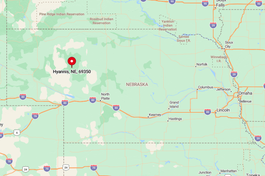
Located at the junction of Highways 2 and 61, Hyannis ranks as the only incorporated spot within a sixty-mile radius. With no commercial air service and only one Greyhound stop a day, access remains as sparse as the population.
Drivers follow the Sandhills Scenic Byway, a ribbon of blacktop cutting through grass waves that can look eerily like ocean swells. Snowdrifts sometimes bury the shoulders, making four-wheel-drive and extra fuel standard equipment for winter trips.
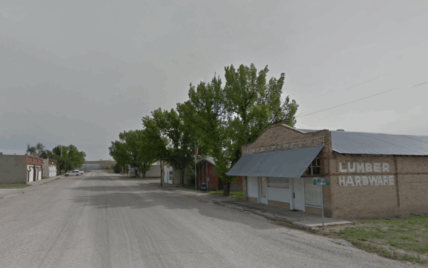
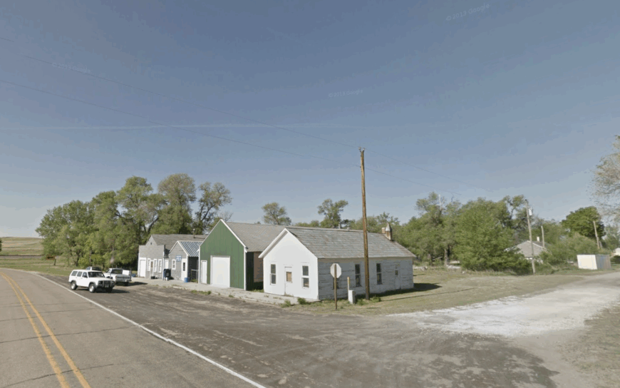
5. Lodgepole – Prairie Peace off the Old Lincoln Highway
Lodgepole’s 300 residents rest behind hundred-year-old brick storefronts that once catered to Model T travelers on the Lincoln Highway. Today, antique shoppers sift through Prairie Treasures mall, anglers cast for trout in Lodgepole Creek, and kids race the restored 1912 merry-go-round at Legion Park.
Farming and a small grain elevator keep the rail spur busy during harvest, while home-based quilt shops supply extra income for several families. The local library, housed in a former bank, hosts Friday night film reels that draw crowds from neighboring ranches.
Because the village sits five miles north of Interstate 80, truck noise never reaches the tidy grid of elm-lined streets. Unbroken wheat fields stretch to every horizon, masking Lodgepole from passersby who blur past at seventy-five miles an hour.
Where is Lodgepole?
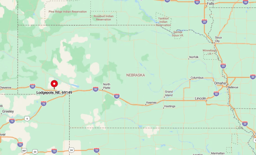
Lodgepole lies in Cheyenne County along old US 30, nearly halfway between Sidney and Chappell. Gentle creek bluffs form a natural sound barrier, enhancing the town’s hush during evening porch sessions.
Most visitors exit I-80 at either mile marker 59 or 72, then wind along county lanes past grain bins and center-pivot rigs. A single flashing yellow light marks the entrance, and the welcome sign often carries the handwritten weather report for travelers who stop to read it.
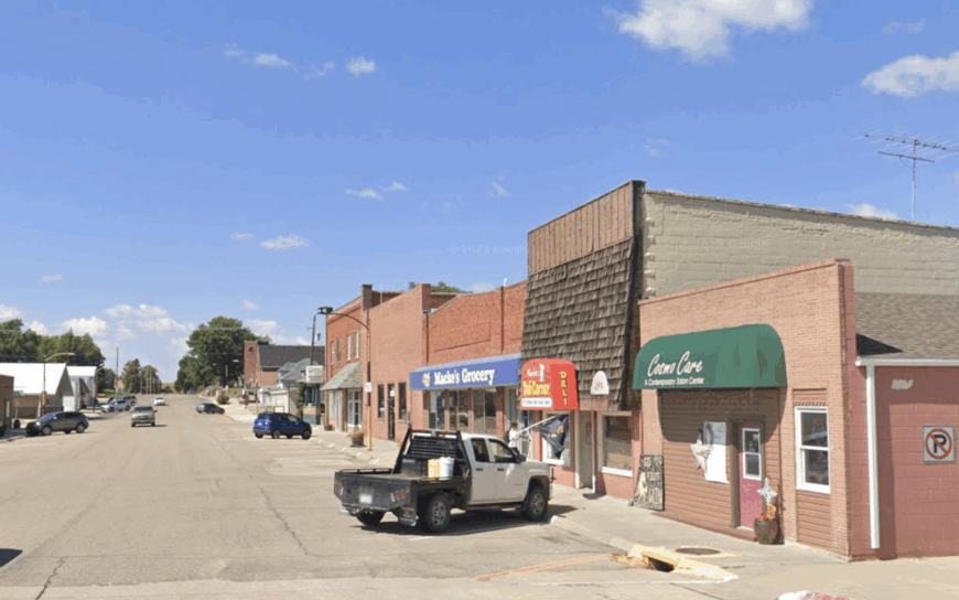
4. Lakeside – Ranch Country at the Edge of Crescent Lake Refuge
Fewer than 100 people reside in Lakeside, where corrals and haystacks stand between scattered houses rather than sidewalks. Wildlife photographers flock to nearby Crescent Lake National Wildlife Refuge to capture sandhill cranes lifting off the marsh at dawn.
Ranching is the only major industry, with cowboys trailing herds along sandy two-tracks that double as school bus routes. A hidden gem is the tiny Lakeside General Store, stocked with tack, tackle, and the best homemade cinnamon rolls for fifty miles.
Because the nearest paved highway sits 25 miles away, even pickup traffic is rare and conversation carries across the valley unbroken. At night, frogs and nighthawks provide the soundtrack, amplified by the absence of ambient hum from powerlines or pavement.
Where is Lakeside?
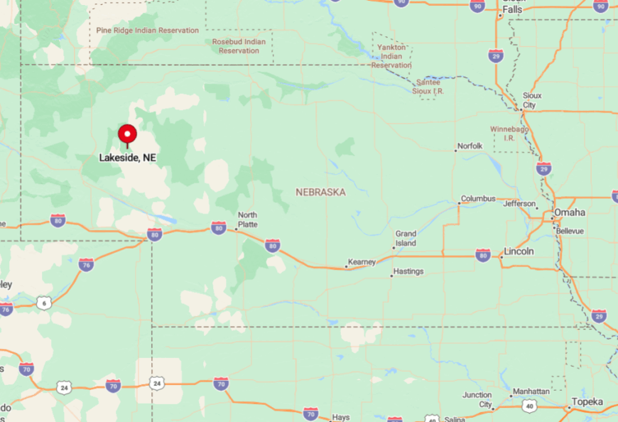
Lakeside rests in Sheridan County northeast of Alliance, reached primarily via gravel roads branching off Highway 2. Sandhills topography creates radio dead zones and forces vehicles to slow, reinforcing the sense of separation.
Visitors often rely on paper maps because GPS directions fail once tires leave the asphalt. Upon arrival, a single streetlight at the community hall announces civilization, though the prairie quickly reclaims darkness beyond its glow.
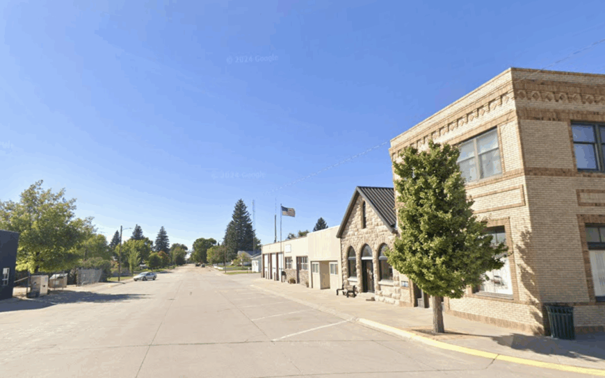
3. Mullen – Golf Greens and Endless Grasslands
Mullen, with about 500 residents, feels bigger than it is thanks to two world-class golf courses carved into nearby dunes. Golfers tee off at Sand Hills Golf Club or The Prairie Club, while anglers head to the Middle Loup River for canoe runs and trout fishing.
The local economy balances cattle, tourism tied to the greens, and a growing cottage industry crafting cedar furniture from windbreak scraps. Hidden just south of town, the Seneca Rattlesnake Site draws herpetologists each spring to monitor one of Nebraska’s largest prairie rattler dens.
Mullen’s grid of extra-wide streets dates to the horse-and-wagon era and still allows farm equipment to park without blocking traffic. Because the next settlement of any size stands more than seventy miles away, the village owns the night sky and most of the daylight horizon too.
Where is Mullen?
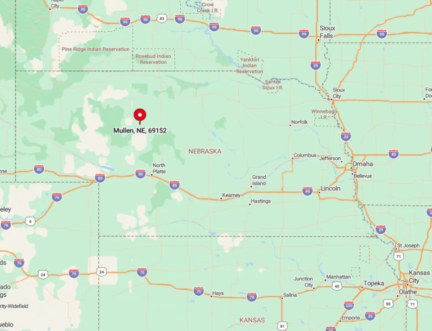
Mullen sits at the crossroads of Highways 2 and 97 in Hooker County. Rolling dunes and sparse tree cover mean nothing taller than a grain elevator breaks the skyline for dozens of miles.
Access from the east involves two hours of uninterrupted prairie on the Byway, while drivers from the north brave a patchwork of county roads with occasional open-range cattle. A single daily stop by the Chicago-to-Denver Amtrak Thruway bus supplements private vehicles for those willing to schedule around it.
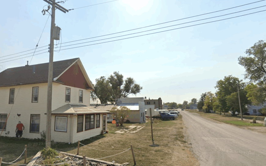
2. Potter – Vintage Charm on Wide-Open Plains
Potter hosts roughly 330 residents who gather under the neon clock at the Potter Sundry for its famous Tin Roof Sundae. Visitors stroll vintage storefronts, bowl at the restored 1920s duckpin lanes, and time their trips for the summer Potter Car Bowl car show.
Dry-land wheat and a cooperative grain elevator shape the workday, though remote workers have begun to claim second-story lofts above Main Street. The grassroots Potter Community Theater stages plays in a former opry house, a rarity for a town this size.
Fifteen rural miles buffer Potter from Sidney’s interstate traffic, leaving nights so quiet that train horns echo across the plains for minutes. Vacant lots often run a full acre, granting residents private views of lightning storms rolling in from Colorado.
Where is Potter?
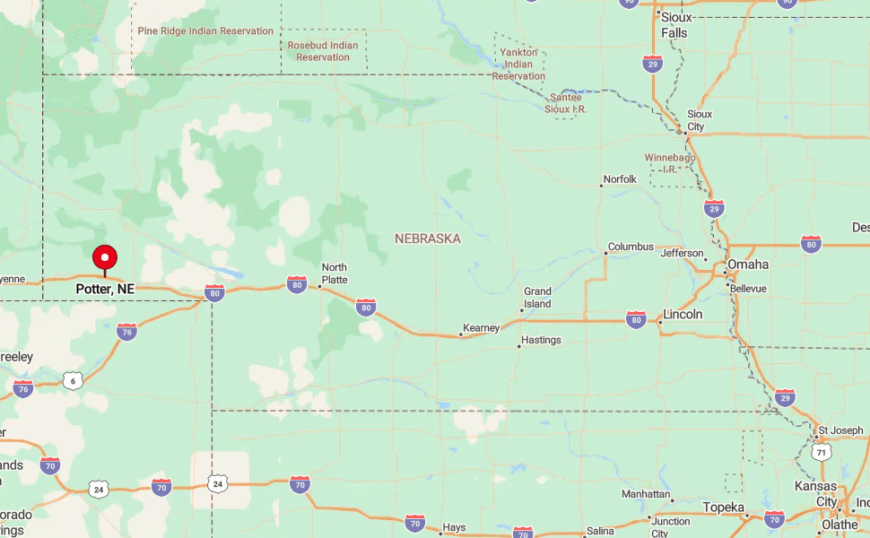
Potter sits along old US 30 in Cheyenne County, four miles north of Interstate 80 yet psychologically much farther. Gentle draws and grain fields surround the village, providing both farmland and a natural barrier to sprawl.
Most arrivals take exit 48 and follow a frontage road that soon narrows to a two-lane strip flanked by golden wheat. Amtrak’s California Zephyr glides past without stopping, a reminder that fast travel and slow living can occupy the same landscape without meeting.
1. Whitney – Quiet Crossroads Below the Pine Ridge
Only about 70 people remain in Whitney, a former railroad junction where stone storefronts stand watch over empty track beds. Explorers hike nearby Coffee Mill Butte, fish White River backwaters, and photograph the ghostly ruins of the 1880s Mari Sandoz homestead.
Cattle ranching rules the economy, though a handful of artisans sell pine-cone wreaths and leatherwork at the seasonal roadside market. The historic St. Agnes Catholic Church, quarried from local sandstone, hosts an annual soup supper that draws families from three counties.
Encircled by 100-mile views of shortgrass prairie, Whitney sees more migrating raptors than tourist traffic. Streetlights went dark years ago, giving residents unfiltered stars and a level of nighttime silence that newcomers find both eerie and irresistible.
Where is Whitney?
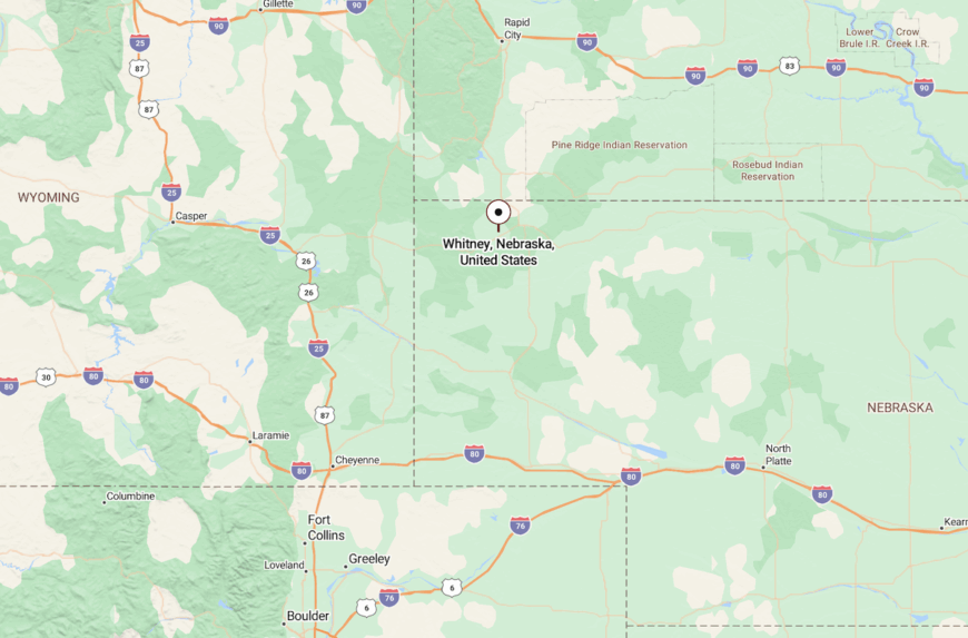
Whitney lies on Highway 20 in Dawes County, sixteen miles west of Chadron and an hour from the nearest commercial airport. The Pine Ridge forms a rugged wall to the north, while vast ranch holdings spread southward, sealing the town off from development corridors.
Travelers usually arrive via a gentle climb out of the White River valley, a route that loses cell coverage as soon as the last set of silos disappears in the rearview mirror. A small pull-off by the old depot serves as parking, orientation point, and often the spot where visitors realize they can hear their own footsteps on the gravel.


