Would you like to save this?
Tucked into the rolling hills and river valleys below Buffalo and Rochester, Southwest New York holds a pocket-size collection of towns where gravel crunches under tires, barns outnumber traffic lights, and black-skied nights still showcase the Milky Way.
Our tour counts down 25 of the quietest places in Chautauqua, Cattaraugus, and Allegany Counties—spots where populations rarely top 1,800 and every side road seems to end at a maple grove, a trout riffle, or a weathered church.
Each settlement offers its own blend of dairy lanes, forest ridges, and water-edged hideaways that make it feel comfortably distant from the thrum of the Thruway. We highlight what residents do for work, where visitors can wander, and the quirks that keep these communities blissfully off most GPS searches.
Whether the draw is an abandoned rail depot, a hidden artist colony, or a covered bridge no wider than a hay wagon, these towns invite deep breaths and long pauses. Let’s wind south and west toward the Pennsylvania line and count them down.
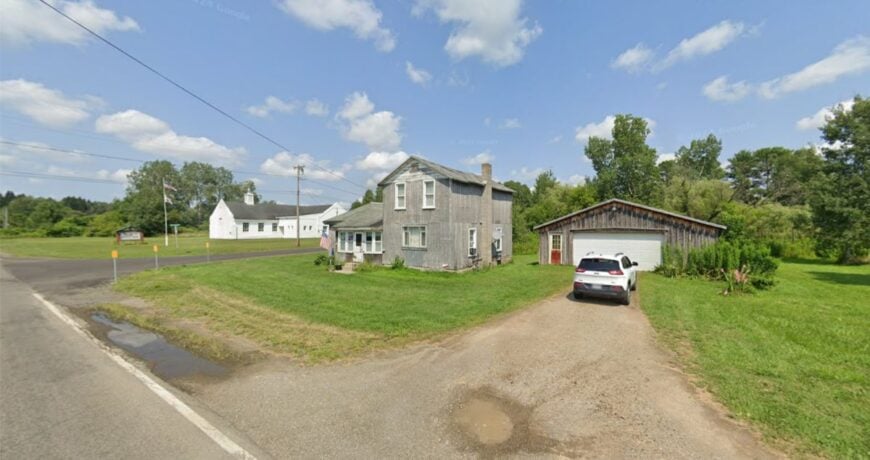
25. Kiantone’s Creekside Lanes and Border Quiet
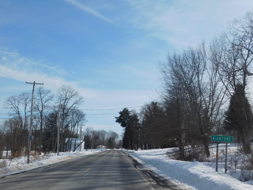
Kiantone feels tucked away at the very bottom of Chautauqua County, where the Conewango Creek loops through hayfields and woodlots like a lazy ribbon. The quiet comes from being wedged between creek banks and low ridges, with few roads that actually go “through” to anywhere else.
Farmsteads sit back from the lane behind windbreaks of Norway spruce, and at night you hear little more than owls and the soft rush of water. Wanderers fish slow bends for smallmouth, pedal country loops that pass more barns than mailboxes, or nose into roadside stands for maple and fresh eggs.
A couple of simple diners and repair shops nod to a blue-collar, self-reliant economy where people do a bit of everything. The vibe is humble and friendly—no fuss, no crowds, just long horizons and porches that invite lingering. It’s the kind of place that reminds you how quiet the world can be.
Where is Kiantone?
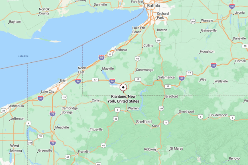
Set at New York’s southwestern edge, Kiantone touches the Pennsylvania line just south of Jamestown. It’s a short drive from US-62, but most approaches arrive by two-lane farm roads that meander along the Conewango.
You reach it by drifting off the main routes and following the creek until the traffic thins to tractors. Close enough to town for a supply run, far enough that dusk still belongs to crickets.
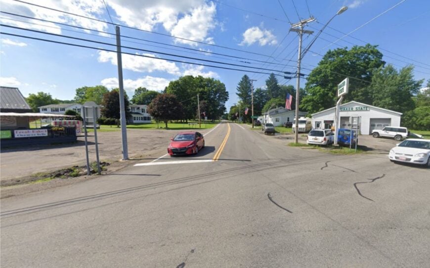
24. Harmony’s Stone Towers and Driftwood Meadows
Harmony feels hidden in plain sight—broad, open farms broken by pockets of dark hemlock and whimsical stone formations. Distance from four-lane highways and a patchwork of lightly traveled backroads keeps the soundscape to birds and the occasional buggy.
Locals talk softly over coffee at crossroads markets, then spend afternoons fixing fences or splitting wood. Visitors wander Panama Rocks’ mossy corridors, paddle quiet stretches of French Creek headwaters, or browse seasonal stands for sweet corn and jam.
Dairy and small workshops anchor the economy, with summer bringing a trickle of hikers and geology buffs. The town’s mood is easygoing and slightly magical, like stumbling on an outdoor cathedral built by time. Stay long enough and the ridgelines start to feel like old friends.
Where is Harmony?
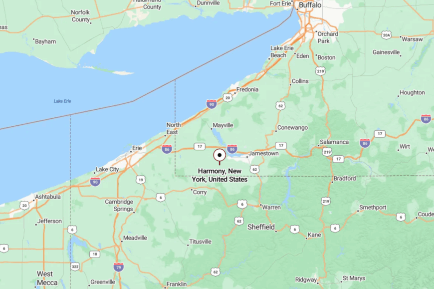
Tucked in the southwest of Chautauqua County, Harmony lies southwest of Jamestown and just north of the Pennsylvania border. The simplest path comes via NY-474 and a web of county roads that slip from farm to forest.
You’ll slow for curves, crest a hill, and suddenly the countryside opens wide. It’s close enough for a day trip, yet hushed enough to make your shoulders drop.
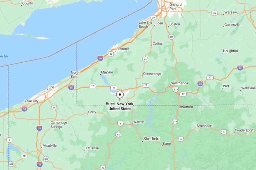
23. Busti’s Lantern-Dim Lanes by the Lake’s Edge
Busti is the quiet side of lake country—fields and sugarbushes fanning out from a few low hamlets where porch lights glow like fireflies. Seclusion comes from sitting between upland farms and backdoor routes around Chautauqua Lake, a world away from resort bustle.
The rhythm here is barns at dawn and tractors at dusk, punctuated by church suppers and school ballgames. Stroll the Busti Mill and its little green, walk hedgerows alive with meadowlarks, or angle feeder creeks for trout after a rain.
Dairy, maple, and small trades keep folks working without fanfare. The vibe is steady, old-fashioned, and neighborly in that “wave from the wheel” way. It’s a soft-spoken corner that asks little and gives you your peace back.
Where is Busti?
Would you like to save this?
South of Lakewood and west of Jamestown, Busti sits in the south-central lobe of Chautauqua County. You come in on two-lane roads that skirt the lake and slip past long fencerows.
There’s no fast way through—just slower, prettier ones. It feels like the lake’s back porch, with the noise politely kept at bay.
22. Mina’s Mist-Lifted Mornings Around a Border Lake
Mina hides around the bends of Findley Lake and a lattice of wooded hills that seem to muffle the world. Even with the interstate not far away, most days, you hear loons more than traffic.
Cottages tuck behind birches, and old farm lanes dip into pockets of shadow where cell bars fade. Rent a rowboat at dawn, wander lake loops by bicycle, browse small antique barns, or ski cross-country when the shoreline turns to lace.
Seasonal tourism mixes with dairy and service trades, giving locals year-round reasons to stay. The mood is lakeside-gentle and slightly nostalgic, like a postcard that someone kept writing on. You come for the still water and stay for the hush.
Where is Mina?
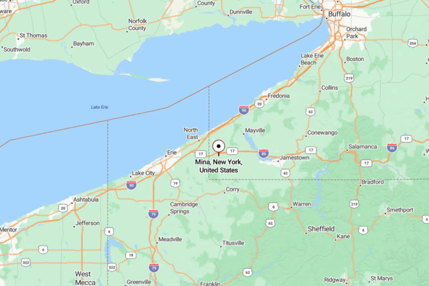
Perched in the extreme southwest of Chautauqua County, Mina straddles the New York–Pennsylvania line near Findley Lake. Most visitors exit I-86 at Sherman or Findley Lake, then slow to county-road pace.
The last miles curve around water and pastures until the lake appears between trees. It’s reachable in minutes, yet those minutes feel deliciously long.
21. Sherman’s Quilt of Ridges and Quiet Backstreets
Sherman’s tranquility comes quietly—one moment you’re passing open pasture, the next you’ve slipped into a neat little grid where life moves at a gentler pace. Set apart from major highways and tucked among protective hills, the town enjoys light traffic and star-filled skies.
Farmers tend hayfields within sight of town, while maple lines drip into steel buckets come spring. Hike breezy hilltops, browse small antique corners, catch a summer concert on the green, or snowshoe quiet edges after a storm.
Agriculture and small trades support most folks, with festivals adding a lively hum now and then. The vibe is welcoming and work-worn, with just enough charm to make you linger. It’s a place that rewards unhurried weekends and long walks at dusk.
Where is Sherman?
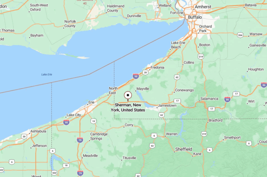
Near Chautauqua County’s western hills, Sherman sits a short hop north of the state line and west of Chautauqua Lake. You reach it by exiting I-86 and letting county roads unwind the last few miles.
The landscape rises and falls, and with each fold the world grows quieter. By the time you park on Main Street, you’ve shed half your breath.
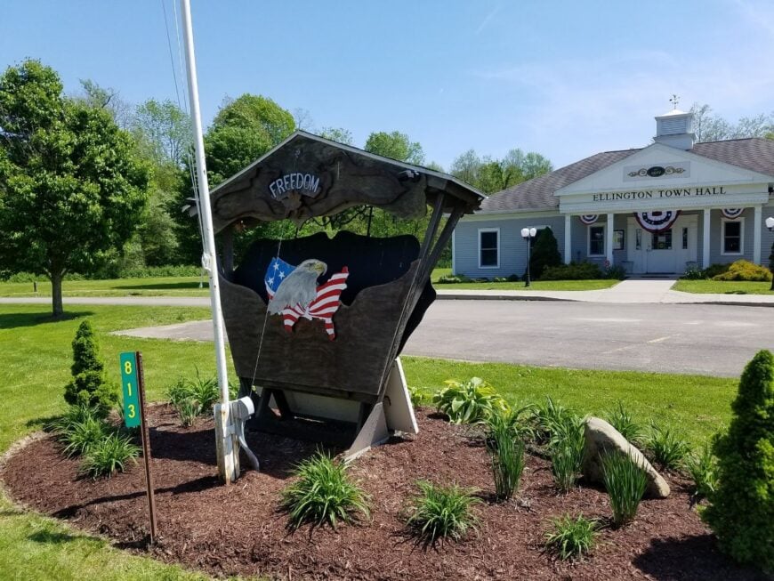
20. Ellington’s Creek Bends and Sugar Maples
Ellington spreads out along the Conewango like a long, calm breath—farmsteads guarded by maples and fields that go on until they don’t. Part of the seclusion is how the creek, hills, and limited through-routes conspire to keep life slow.
Mornings smell like cut hay; evenings belong to whip-poor-wills and porch talk. Drop a line in shaded pools, wander the annual town picnic, detour to country auctions, or ramble gravel lanes where foxes cross at twilight.
Dairy and logging have long shared the work here, with craft side hustles tucked in barns. The mood is rustic and sincere, the kind of place that never forgot how to wave. It’s where a still day can stretch into a still life.
Where is Ellington?
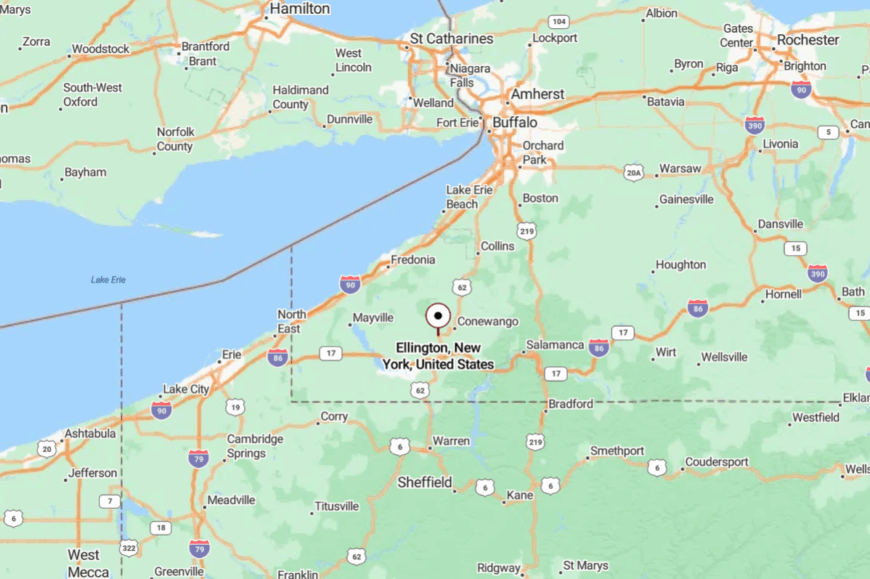
Set in east-central Chautauqua County, Ellington sits southeast of Jamestown along the Conewango Creek. Approaches come via NY-83 and a network of quiet county roads.
You ease in as the fields widen and the shoulders narrow. It’s not out of the way—just out of the rush.
19. Cherry Creek’s Valley Floor and Ridge-Top Breezes

Cherry Creek drifts between a green valley floor and airy ridgelines where the wind talks to the grass. Without a major highway cutting through, traffic thins to pickups and grain trucks.
The small main street is practical—feed, fuel, a bite to eat—while the countryside handles the scenery. Ride horses on country lanes, hike state forest spurs, snowmobile well-kept trails, or watch hay wagons stack up like summer architecture. Farms and seasonal recreation keep the local ledger balanced.
The vibe is hands-on and sun-worn, with just enough lift from the hills to feel free. On certain evenings, the light gets honey-soft, and the whole town exhales.
Where is Cherry Creek?
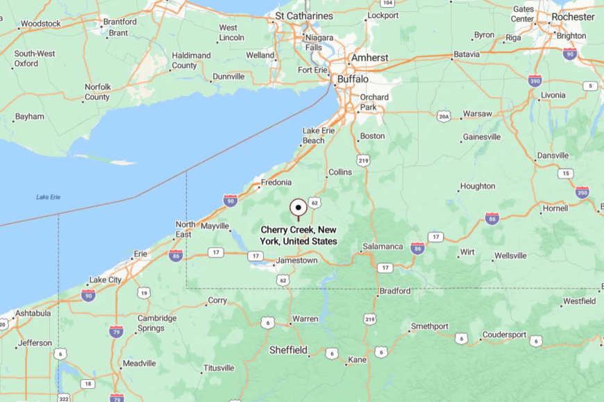
Northeast of Jamestown in Chautauqua County’s interior, Cherry Creek sits off the bigger corridors. You reach it via NY-83 or NY-322 and then slower county connectors.
The last miles roll gently, then settle into a wide, quiet bowl. It’s close enough to the lake towns, yet far enough to be its own world.
18. Arkwright’s High Meadows and Whispering Turbines
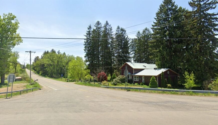

Arkwright’s solitude runs on elevation: high meadows, long views, and roads that crest and disappear into the sky. Set away from four-lane routes, it trades bustle for big weather and bigger sunsets.
Homesteads lean into the wind, and nights come quick over pasture and maple. Walk ridge roads that overlook the county, explore seasonal waterfalls in tucked ravines, visit a sugarhouse in late winter, or picnic where the horizon goes wide.
Farming and energy both leave their quiet signatures, each in tune with the land’s open scale. The vibe is airy, spare, and soulful—more meadow hymn than town square. If spaciousness is a kind of silence, Arkwright sings it.
Where is Arkwright?
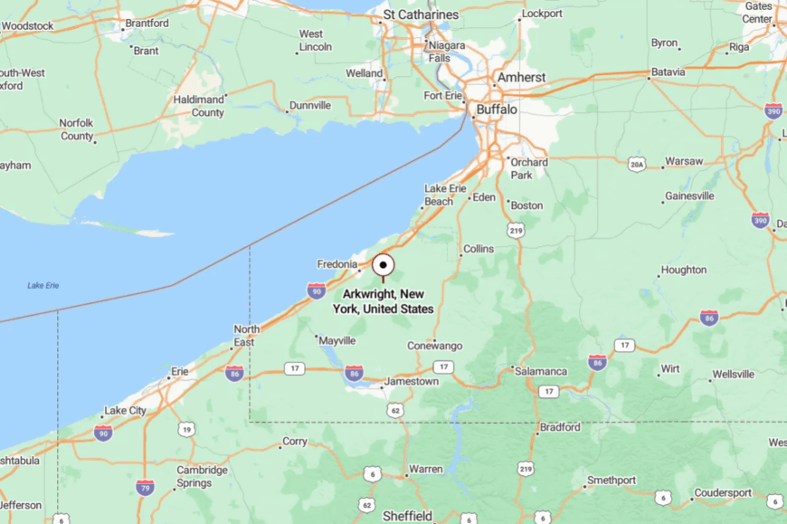
Central-northern Chautauqua County holds Arkwright between Forestville and Cassadaga. Getting there means leaving US-20 or NY-60 for climbing two-lanes that shrug off hurry.
The last stretch rides the spine of the hills. It’s a place you arrive at with a view instead of a welcome sign.
17. Napoli’s Wooded Hollows and Quiet Workshops
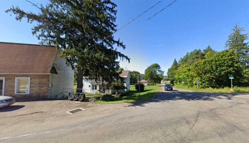
Napoli keeps to itself among soft hills in Cattaraugus County, where woodlots, meadows, and Amish homesteads string along backroads. The lack of a direct highway route encourages a slower, purposeful kind of travel.
Horses trace the shoulders; sawdust hangs in the air near small shops and mills. Browse roadside stands for quilts and cheeses, walk Boutwell Hill State Forest’s shaded paths, or fish farm-pond edges at dawn.
Dairy, woodworking, and maple shape most days, with neighbors helping neighbors more often than not. The mood is humble and deeply rooted, a quiet that’s earned by steady hands. It’s as restful as a shaded porch in late July.
Where is Napoli?
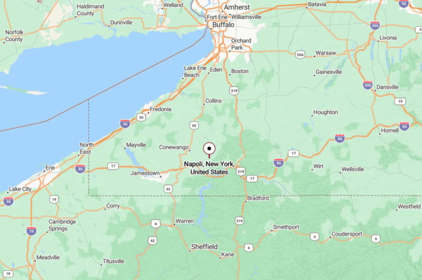
In central Cattaraugus County, Napoli sits southwest of Little Valley and east of Randolph. You reach it on county roads branching from NY-242 or NY-394.
The approach is all fields, fences, and slow curves. It’s the kind of distance measured more in minutes of calm than miles.
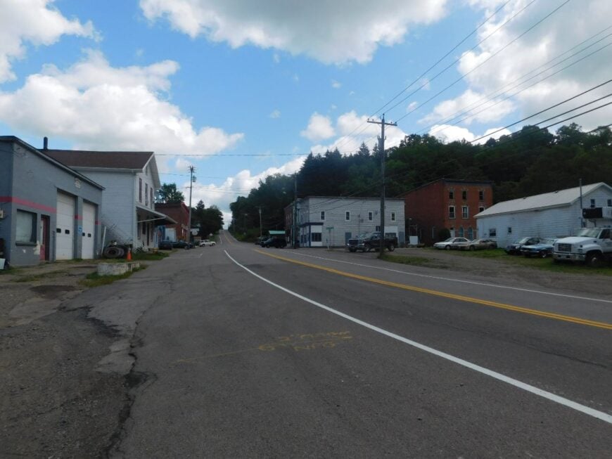
16. Otto’s River Turns and Stone-Quiet Lanes
Would you like to save this?
Otto lies where the ridges lean toward Cattaraugus Creek, and roads seem to follow water more than maps. With no fast route slicing through, trucks prefer other valleys and the nights get properly dark.
Old farmhouses keep watch over tidy lots; sugar smoke and cut hay mark the seasons. Cast for trout in cool runs, walk backcountry snowshoe trails, browse a hidden gallery or two, or join a church supper when the calendar turns.
Agriculture and cottage crafts stitch the economy together. The vibe is soft-spoken and slightly artistic—practical first, but never plain. It’s a corner that rewards anyone who appreciates a well-kept quiet.
Where is Otto?
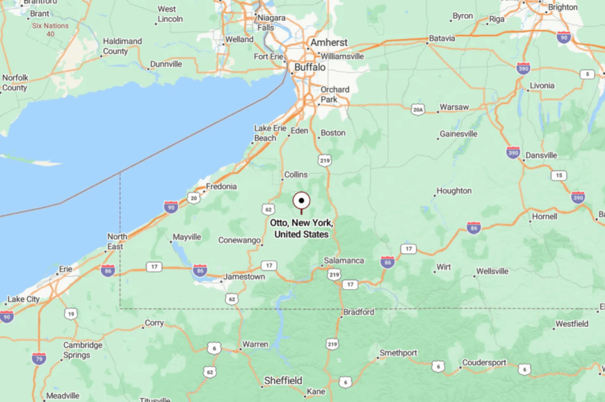
North-central Cattaraugus County holds Otto between East Otto and Cattaraugus village. From US-219 or NY-242, you follow county routes that narrow as the hedgerows rise.
The last miles drift into creek country, where the air feels cooler. It’s easy to find on a map and hard to leave in your heart.
15. Lyndon’s Hill-Island Farms Above the World
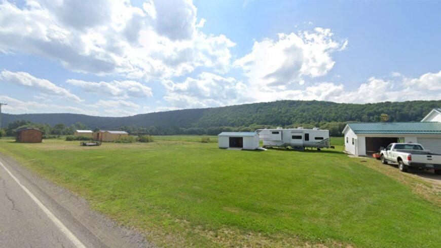
Lyndon feels like a small archipelago of farms set on hilltops, each one with its own horizon line. Seclusion comes from height, distance, and the absence of any true “main drag.”
When the wind runs the ridge, you hear it before you see it, and the stars arrive early. Walk field edges bright with milkweed, hunt snow in woodlots that keep it late, or bike ridge roads where the grades make you honest.
Hay, beef cattle, and maple pay the bills one season at a time. The mood is lean, sturdy, and beautifully spare. If you want the sky to feel bigger, this is where to stand.
Where is Lyndon?
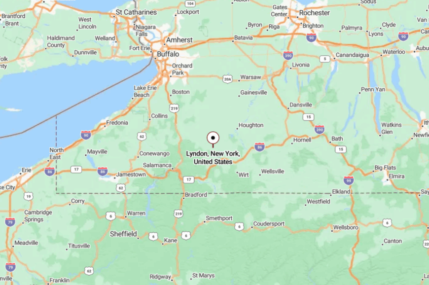
Eastern Cattaraugus County tucks Lyndon between Franklinville and Cuba. The approach is via NY-98 or NY-305 before you climb county routes to the ridgeline.
Switchbacks and long grades slow everything down. By the top, the quiet feels like altitude.
14. Farmersville’s Open Plains and Long Horizons
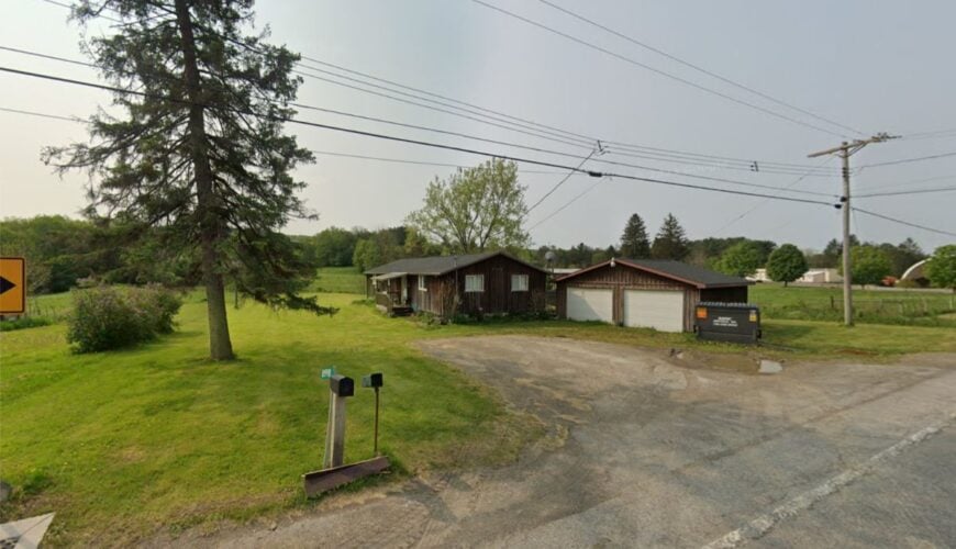
Farmersville spreads out in broad strokes—long fields, straight fences, and roads that seem to run until the earth curves. With no major town center and few reasons for through-traffic, the soundscape is mostly wind and meadow birds.
Old barns wear their work with pride, and mailboxes stand like mile markers to the past. Watch red-tails hover over hayfields, walk country cemeteries shaded by maples, join a community sale day, or ice fish nearby lakes when winter locks in. Grain, dairy, and small trades keep the gears turning.
The vibe is practical and open-hearted, a place that trusts the steady pace. Here, distance feels like a kind of freedom.
Where is Farmersville?
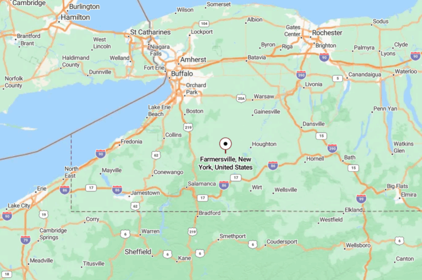
Northeast of Olean in Cattaraugus County, Farmersville sits between Franklinville and Freedom. Drivers arrive via NY-98 or NY-243 and then let county roads do the rest.
The landscape flattens into fields with plenty of sky. It’s close to the routes, but the routes don’t rush it.
13. Humphrey’s Folded Hills and Forest Porches
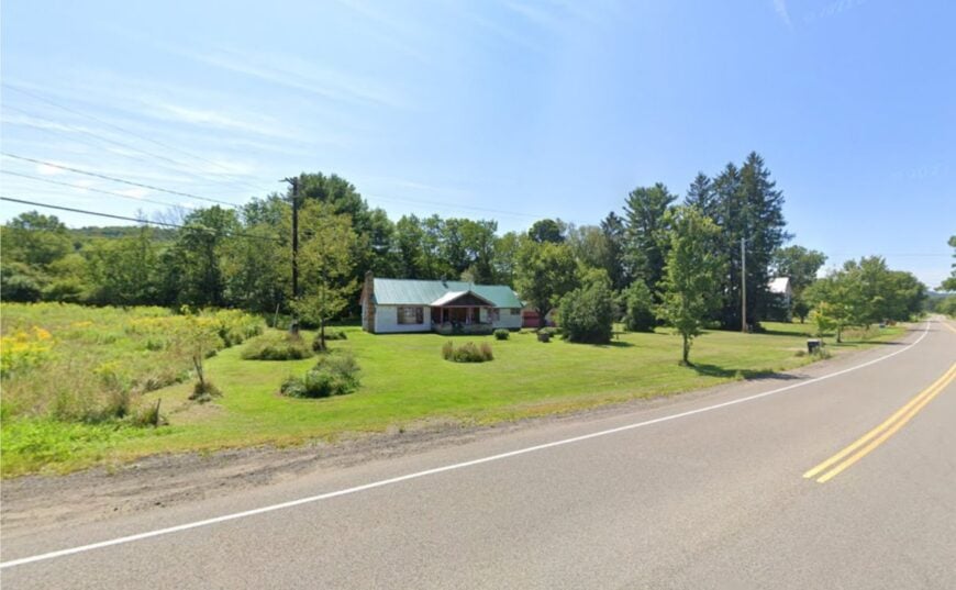
Humphrey is the hush between busier valleys—folded hills, second-growth hardwoods, and cabins tucked a good walk from the lane. Without a commercial center or big road, the town keeps its own slow company.
Smoke curls from woodstoves as deer step out at the tree line, and time gets measured by chores. Hike backroads toward Bear Creek State Forest, pick blackberries along stone fences, or ski quiet logging tracks after a soft snow.
Many folks split their work between small trades, commuting, and the land itself. The vibe is wood-warm and unhurried, all soft edges and kind distances. It’s where a Sunday afternoon can last all week.
Where is Humphrey?
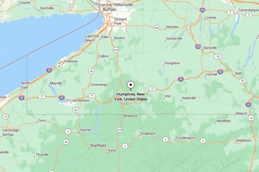
Set in central Cattaraugus County, Humphrey lies between Great Valley and Franklinville. You reach it by leaving US-219 or NY-98 for narrow county routes that wind through timber.
The grades are gentle but persistent, and cell service comes and goes. It’s near popular hills, yet somehow keeps its voice low.
12. Caneadea’s River Flats and Lake-Bright Evenings
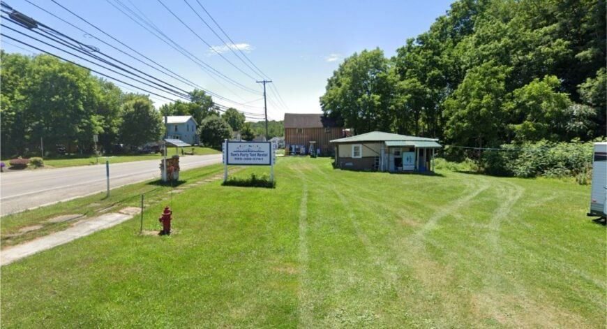
Caneadea gathers along the Genesee River and the glint of Rushford Lake, a quilt of flats and uplands that muffle the world outside. The town feels secluded because the river, hills, and a lack of big arteries slow everything to a human pace.
Church bells and lake loons share the soundtrack, and night skies punch with stars. Paddle the Genesee on a summer morning, walk the old rail grade, cast for bass at dusk, or browse small campus events in Houghton when the leaves turn.
Farming, education, and seasonal lake life mingle without crowding. The mood is wholesome and quietly spirited, equal parts hymnal and paddle splash. It’s the sort of calm that lingers long after the drive home.
Where is Caneadea?
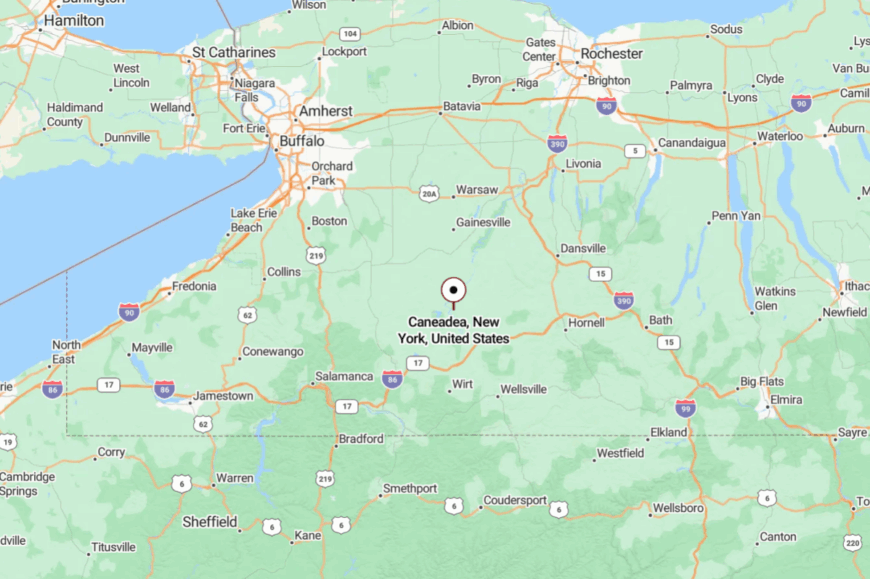
North-central Allegany County holds Caneadea between Belfast and Hume, with Rushford Lake just to the west. NY-19 and NY-243 get you close before country roads take over.
The last miles follow the river or skirt the lake’s coves. It’s close to several towns, but feels content to be its own harbor.
11. Alma’s Oil Hills and Border Backroads
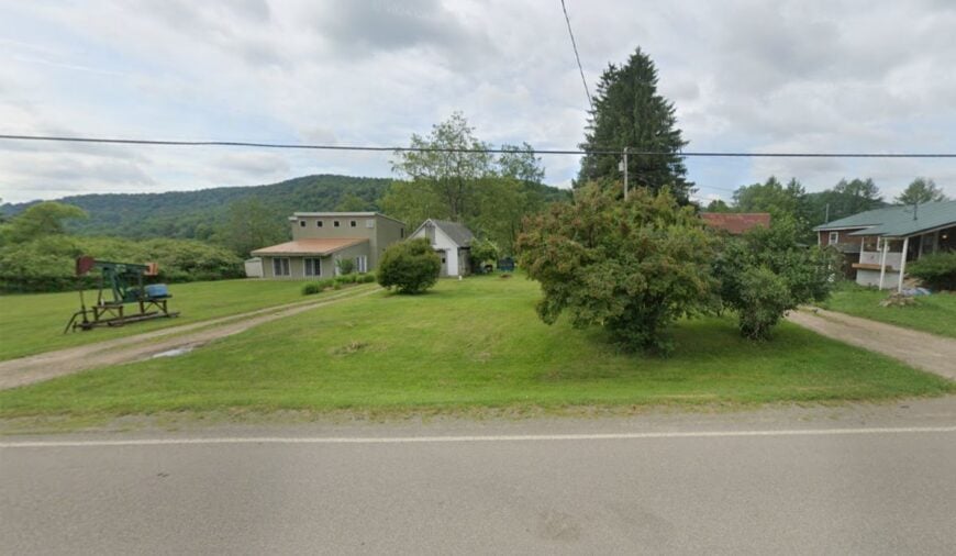
Alma sits right on the southern line of Allegany County, a township of shoulder-high ferns, old pump jacks, and hollows that swallow sound. Its seclusion comes from steep, narrow valleys and a spiderweb of roads that choose curves over speed.
Porch lights glow against deep woods, and fog clings to Alma Pond like a secret. Walk the shore for beaver sign, climb an oil-patch hillside at sunrise, trace stone piles from vanished farms, or watch stars pool over the state forest.
Small energy work, hunting camps, and homestead projects make up much of the local economy. The vibe is rugged and quietly loyal, a place that holds its stories close. Come ready for stillness—you’ll leave with it in your pockets.
Where is Alma?
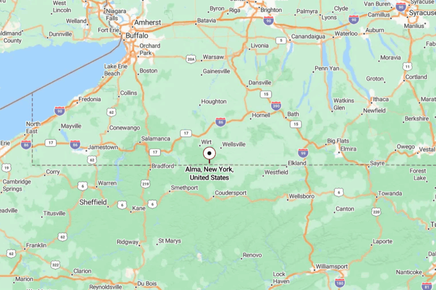
In New York’s far southwest corner of Allegany County, Alma presses against the Pennsylvania border south of Wellsville. You reach it by dropping off NY-417 or NY-19 onto sinuous county roads that keep their shade.
The last turns ride along streams and under tall maple canopies. It’s right there on the map, but it feels a world removed when you arrive.
10. Carrollton’s Hilltop Cabins Overlooking a River Confluence
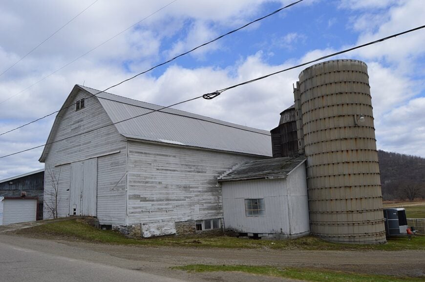
Carrollton’s 1,200 or so residents perch along forested benches above the meeting point of the Allegheny and Tunungwant Rivers, where morning fog lifts to reveal bald-topped ridges and wood-smoke chimneys.
Anglers work the riffles below while hikers follow the Finger Lakes Trail spur to fire-tower views that seem borrowed from the Adirondacks.
Timber work and seasonal cabin rentals shape the local economy, though a few small maple operations line Route 417. Apart from a lone convenience store and the whistle of passing freight trains, little disturbs the quiet.
The town’s spread-out hamlets of Limestone and Carrollton Center create natural buffers, and cell coverage still fades on the back roads. Add steep hills, dense hemlocks, and a near-absence of commercial lighting, and the place feels miles farther from Olean than the odometer shows.
Where is Carrollton?
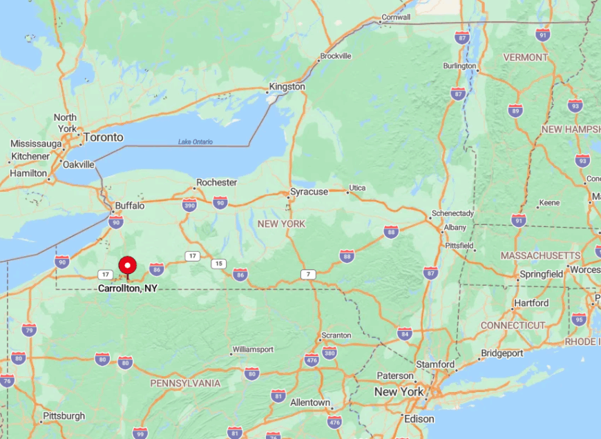
This Cattaraugus County town bumps against the Pennsylvania border about 90 minutes south of Buffalo. Hemlock-laden slopes hem in the valley, limiting development and leaving long stretches of Route 219 and 417 with little more than deer crossings.
Drivers typically exit I-86 at Salamanca or Allegany, then wind a dozen rural miles to reach Carrollton’s hilltop cabins. Narrow switchbacks and seasonal snow deepen the sense of remoteness, making arrival feel like an arrival in another era.
9. Clymer’s Covered Bridges Amid Cornfields
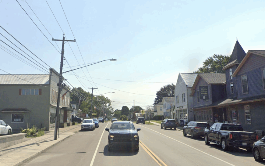
Roughly 1,700 people call Clymer home, sharing a quilt of dairy farms, tidy Amish homesteads, and two photogenic covered bridges—Sherman Road and Riffle Creek—that date to the 1870s.
Cyclists and leaf-peepers roam the gentle drumlin hills while winter brings cross-country skiers to Peek’n Peak Resort just over the line. Milk processing, corn silage, and small woodworking shops anchor the economy, and a weekly produce auction draws growers from three counties.
Streetlights fade quickly outside the hamlet, replaced by barn swallows and the distant thud of silo unloaders. Because the town sits in a corner where three state routes dead-end at county lanes, through-traffic is almost nonexistent.
That isolation, plus a topography that folds outward like waves, leaves visitors cocooned in amber fields and hushed woodlots.
Where is Clymer?
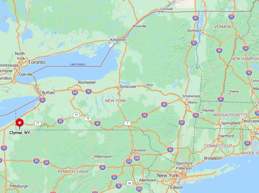
Located in southwestern Chautauqua County, Clymer straddles Route 474 about five miles north of the Pennsylvania line. The nearest four-lane highway, I-86, lies 20 miles to the south, and Lake Erie’s bustle is a half-hour north, insulating the town on both sides.
Most travelers exit the interstate at Sherman or Findley Lake, then navigate a checkerboard of farm roads. The lack of direct interstate access, plus ridges that block radio and cell signals, keeps Clymer delightfully tucked away.
8. Willing’s Quiet Genesee River Bend
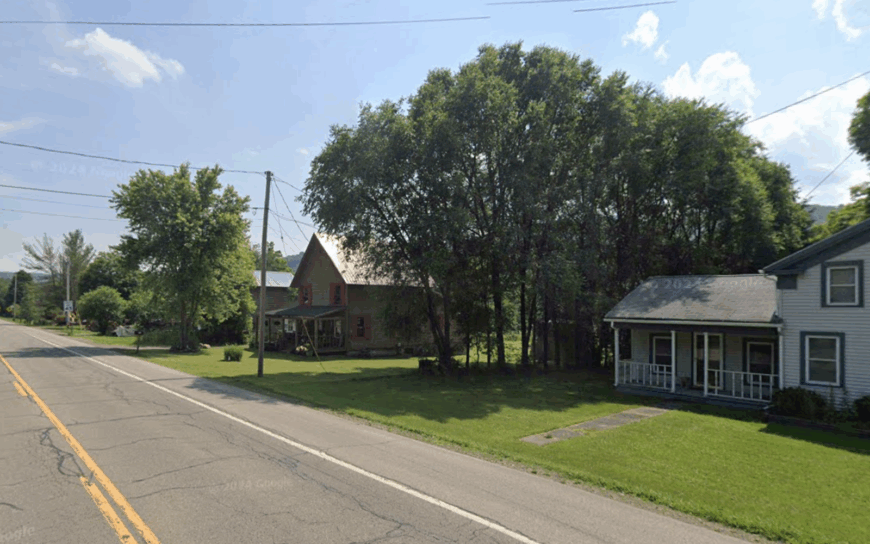
Home to roughly 1,350 residents, Willing stretches along the Genesee River where calm pools nurture smallmouth bass and riverside cottonwoods shade solitary picnic tables. Kayakers slip past limestone outcrops while birders wander the Vandermark State Forest for warbler migrations.
Agriculture dominates—beef, alfalfa, and maple syrup—augmented by a growing cluster of home-based pottery studios advertised only by hand-painted signs. Nights fall softly; porch lights reflect off the river while the nearest fast-food sign glows 15 miles north in Wellsville.
Rolling foothills of the Allegheny Plateau muffle highway noise, and many gravel drives extend a quarter-mile before reaching a mailbox. That geographic padding allows residents to feel worlds away without actually crossing county lines.
Where is Willing?
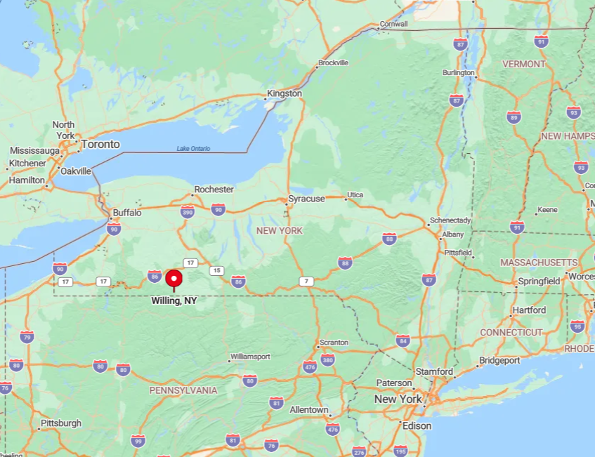
Willing hugs the southern edge of Allegany County, about ten minutes from the Pennsylvania border and 90 minutes east of Jamestown. Its river flats lie below surrounding hills, shielding the valley from sight until visitors descend County Route 29.
The town is reached by following NY-19 south from Wellsville, then turning onto a series of signed but lightly traveled county routes. Absence of major arteries and the single narrow bridge over the Genesee naturally limit visitor flow, preserving the hush.
7. Leon’s Amish Lanes and Meadowed Forests
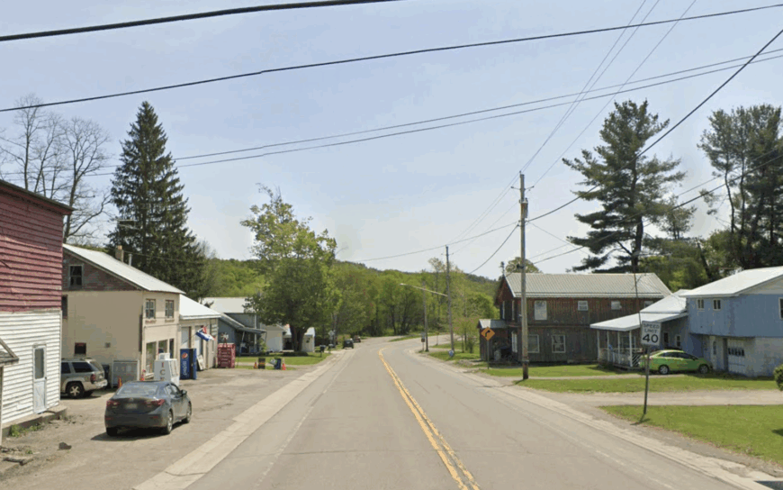
Leon’s population hovers near 1,275, but horse hooves often outnumber car engines along Route 62, where Amish families sell quilts, cheese curds, and hand-planed furniture.
Travelers can explore Amish Community Park’s nature trail, hunt morels in Boutwell Hill State Forest, or watch draft teams plow the low meadows each spring.
Dairy and handcrafted goods fuel the local economy, with roadside stands offering maple crème and fresh eggs on the honor system. Few power lines cross open fields, and rolling hardwood ridges disrupt cell towers, enhancing the time-capsule feeling.
Street names like Eldredge and Church Road appear on weathered wooden posts, further underscoring Leon’s quiet pace. The combination of horse-drawn traffic, limited retail, and deep forest buffers casts a calming spell that lingers long after the visit.
Where is Leon?
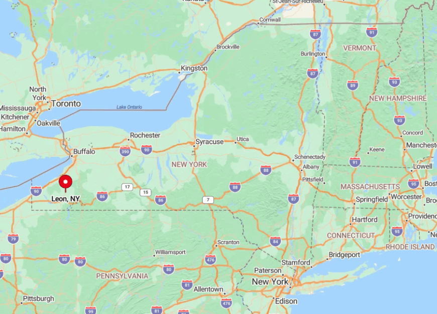
Set in east-central Cattaraugus County, Leon lies midway between Gowanda and Randolph, accessible primarily via two-lane NY-62. The hamlet sits in a shallow basin ringed by Boutwell Hill’s 1,900-foot crest, which keeps radio and cellular signals spotty.
Drivers coming from I-86 exit at Randolph and thread eight miles of winding county roads before horse-and-buggy triangles appear. Lack of a nearby interstate or rail spur means Leon remains a destination only for those who purposely seek it out.
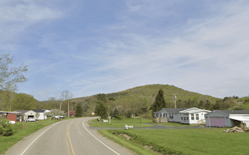
6. West Almond’s Scenic Farmsteads on a Four-Mile Ridge
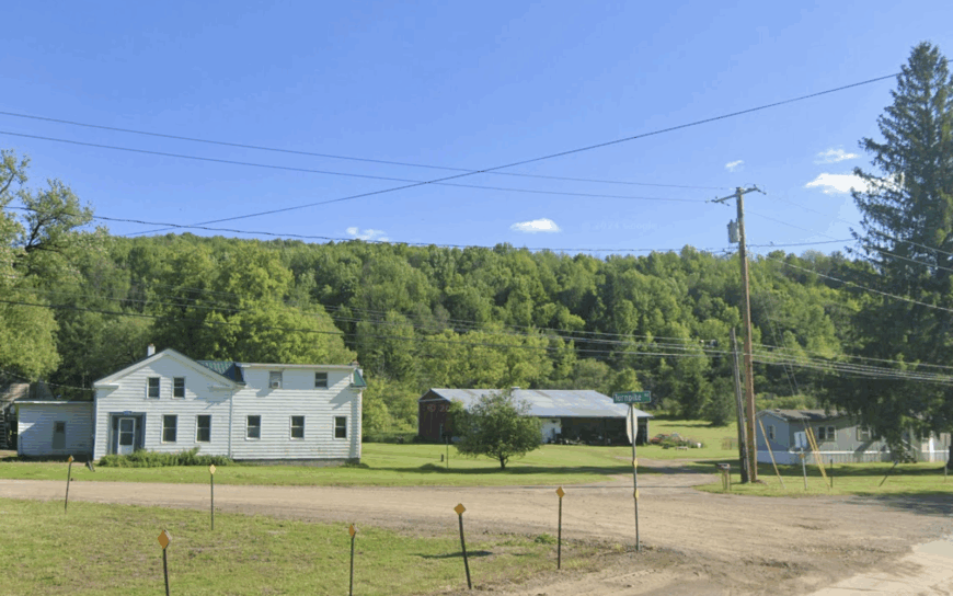
With roughly 350 residents, West Almond ranks among New York’s smallest towns, its white church and former one-room schoolhouse sitting high on a four-mile ridge above the Canacadea Creek valley.
Photographers arrive for sunsets that ignite hilltop hayfields, and mountain bikers test the hand-cut loops in Keaney Road State Forest. Maple syrup, hay, and seasonal hunting cabins form the backbone of local income, with a single volunteer fire hall serving as community hub.
No gas station, no store, not even a stoplight interrupts the scenery. Distance to the nearest grocery—12 miles to Hornell—underscores the ridge’s isolation. Winter wind scours the plateau, and drifting snow often closes the ridge road, reinforcing why West Almond feels like a mountaintop island.
Where is West Almond?
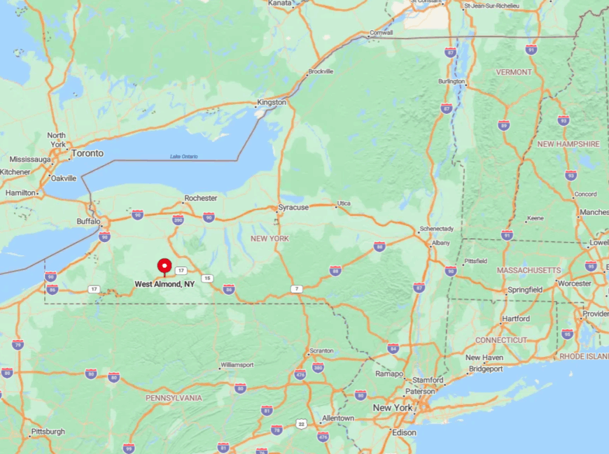
Perched in northern Allegany County, West Almond lies just south of I-86 but is reached only by climbing County Route 2’s switchbacks from the Almond exit. The ridge shelters the hamlet from highway glare and noise, giving the illusion that the interstate never existed.
Visitors who miss the single sign on the exit ramp can easily drive past without knowing the town sits above them. Limited winter maintenance and steep grades contribute to a sense of isolation found few other places so close to a four-lane road.
5. South Valley’s Misty Allegheny Reservoir Shores
South Valley hosts about 240 permanent residents, their cabins sprinkled between Onoville Marina and the New York-Pennsylvania state line along the Allegheny Reservoir. Summer boaters explore glassy coves, while autumn brings migrating osprey and bald eagles that patrol the flooded treetops.
Tourism and a handful of bait-and-tackle shops sustain the spare economy; many households also lease timber rights or tap sugar maples for extra income. Fog often drifts off the reservoir at dawn, shrouding cottages and muting sound to paddles lapping against aluminum hulls.
The town has no main street, just a web of lakeside lanes that end at water or state forest. Dense hills rise sharply on three sides, sealing the shoreline community into its own moist microclimate.
Where is South Valley?
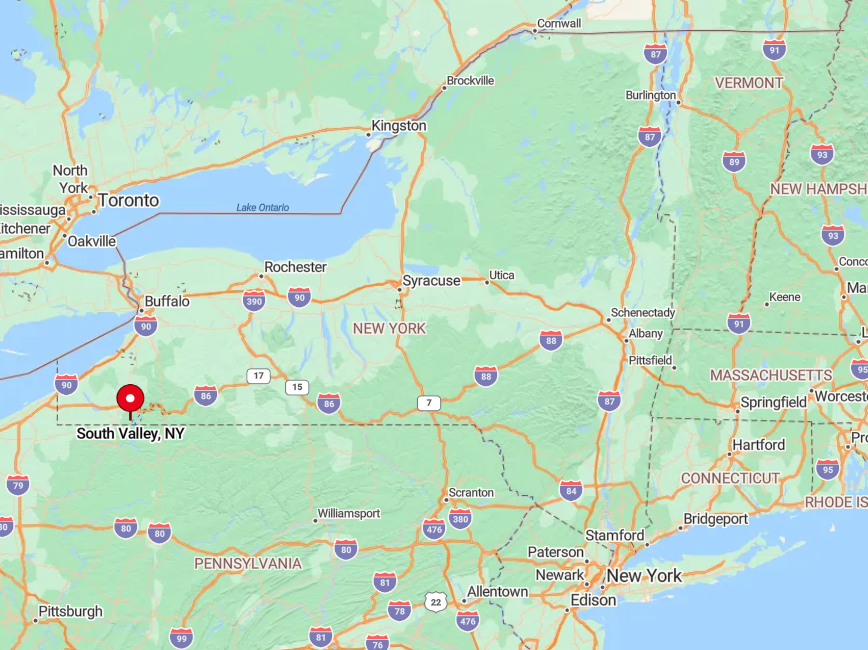
South Valley occupies the far southwest corner of Cattaraugus County, hugging the backwaters created by the Kinzua Dam. Only two paved roads enter: NY-950A from Steamburg and West Perimeter Road from the Pennsylvania side.
The nearest grocery sits 25 minutes away in Salamanca, and winter ice frequently closes the shoreline drive. Those slim access points preserve the town’s peaceful atmosphere, making every visit feel like a boat-in retreat even when arriving by car.
4. East Otto’s Rolling Hills and Tiny Artist Colony
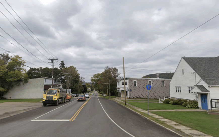
East Otto’s roughly 1,000 residents dine beneath century-old maples at the weekly farmer’s market, then browse an unlikely cluster of studios on East Otto-Springville Road, including Griffis Sculpture Park’s 450 acres of whimsical iron forms.
Horseback riders share gravel lanes with antique tractors, and anglers slip into Cattaraugus Creek for trophy-class steelhead each fall. Dairy farming and creative arts share top billing in the local economy; many barns double as galleries when hay season ends.
Cell reception fades in hollows, and hills practice natural crowd control: you’ll crest one then see nothing but pasture for miles. A single general store handles mail, bait, and coffee, leaving residents to rely on each other more than on retail chains. The result is a community where art and agriculture blend under a wide, quiet sky.
Where is East Otto?
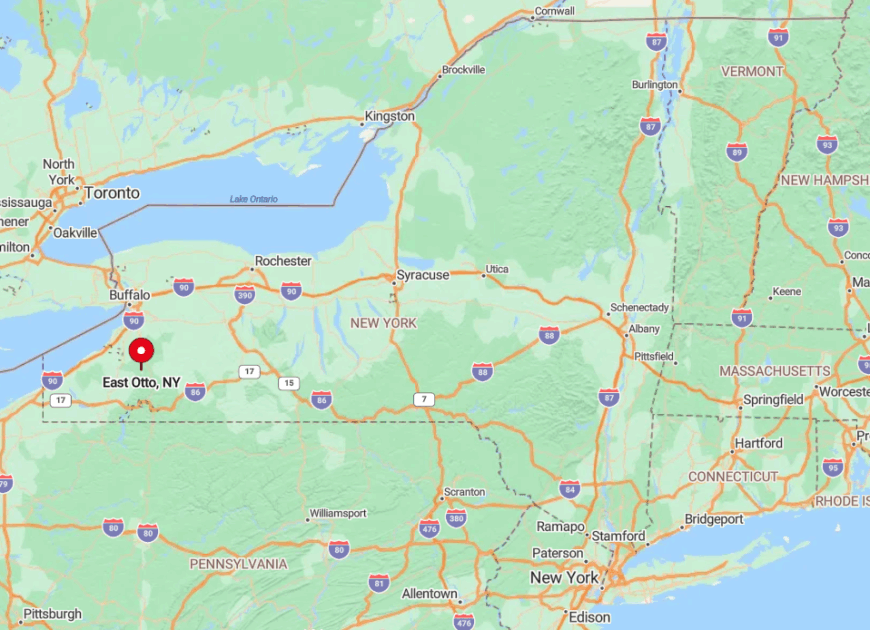
Situated northeast of Ellicottville in north-central Cattaraugus County, East Otto is reachable by turning off US-219 onto Plato Road, then following winding county routes through hardwood glens. No state highway crosses town lines, and the nearest four-lane stretch lies 20 miles away in Hamburg.
Winter storms barrel across Lake Erie and stall over the hills, often closing school and sealing roads in knee-deep powder. These seasonal barriers, coupled with a lack of through-routes, keep East Otto pleasantly secluded year-round.
3. Birdsall’s Empty Rail Station and Endless Pines
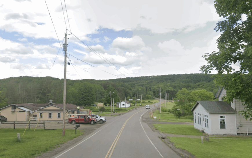
Birdsall counts about 190 residents, most living along County Route 15B where an abandoned rail depot still watches over the valley like a ghostly conductor. Hikers follow the old right-of-way, now part of the Genesee Valley Greenway, beneath mile-long corridors of white pine that whisper in the wind.
Beef cattle and timber provide modest incomes, though a seasonal maple festival in the old Grange Hall draws a surprising crowd. The absence of any retail besides a part-time farm stand means residents plan weekly runs to Alfred or Hornell.
Birdsall sits more than 20 miles from the nearest four-lane road, and low traffic counts keep the soundscape to crickets and distant sawmills. This deep-country quiet turns the vacant rail line and scattered one-acre homesteads into a living museum of rural stillness.
Where is Birdsall?
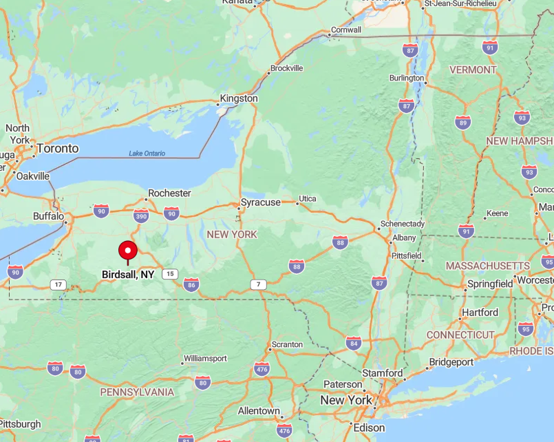
Birdsall occupies north-central Allegany County, wedged between NY-21 to the west and NY-19 to the east, yet connected to neither by direct highway. Visitors usually leave I-86 at Almond or Belmont and meander 25 minutes through forested switchbacks before the hamlet appears.
Elevations rise above 2,000 feet, placing Birdsall in a snow belt that frequently isolates it after lake-effect storms. Sparse signage and a network of seasonal dirt roads ensure only intentional travelers find their way here.
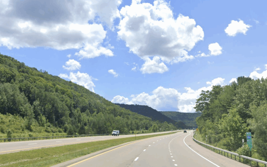
2. Red House: New York’s Least-Populated Town
With barely 30 full-time residents, Red House holds the title of the state’s smallest town, existing almost entirely within Allegany State Park’s northern reaches.
Residents share hemlock gorges threaded by beaver ponds, and stargazers bask in skies so dark that the Andromeda Galaxy is visible to the naked eye.
Seasonal park employment and a handful of private cabin rentals supply limited income, while the surrounding 65,000 acres of forest deliver year-round recreation—from back-country skiing on Patterson Trail to paddling the namesake Red House Lake.
There are no stores, no gas pumps, and only one public road lit by a streetlamp. Because most visitors stick to the park’s developed areas, the few private pockets remain blissfully quiet even on summer weekends. As the sun sets, only barred owls break the silence in this virtually roadless sanctuary.
Where is Red House?
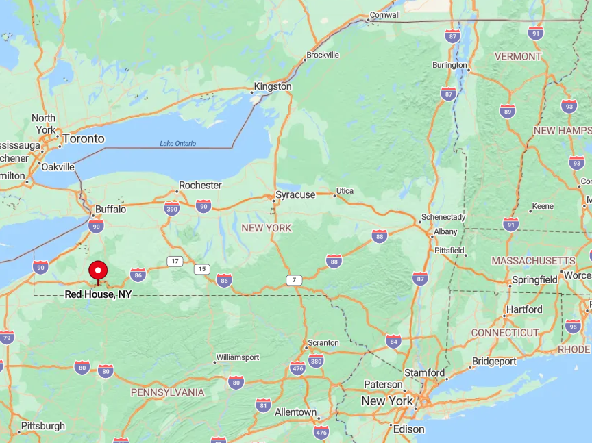
Red House lies in the south-central portion of Allegany State Park, a few miles south of the I-86 exit at Salamanca yet hidden by multiple gated park roads. The town’s cabins sit in hollows unreachable without crossing park boundaries, and winter gate closures further restrict access.
Most travelers enter via the Red House Administration entrance, then follow forest roads that wind deep into the valley. The park’s protective envelope of wilderness ensures Red House remains a pocket of near-complete seclusion.
1. French Creek’s Hidden Dairy Valley
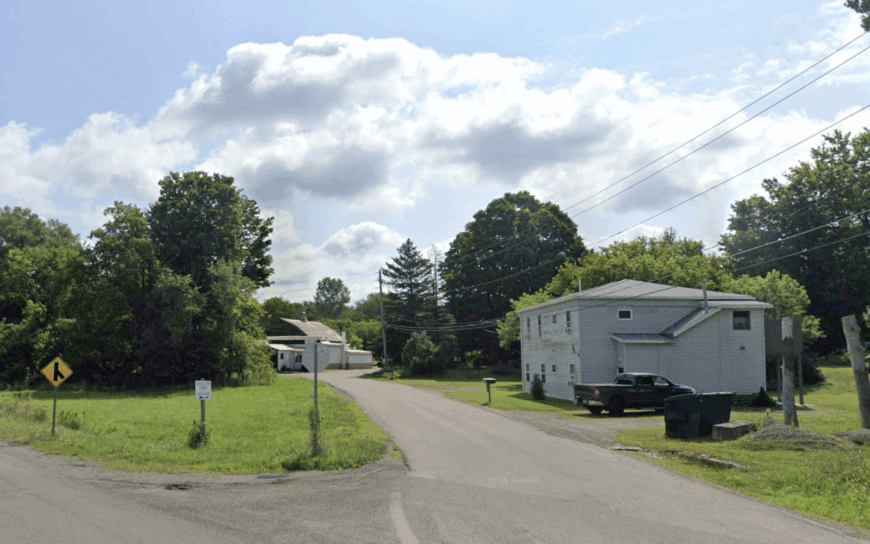
French Creek shelters about 925 residents in a bowl-shaped farming basin bordered by tree-cloaked ridges where sunrise paints mist over neatly parceled pastures.
Cyclists trace gravel lanes past weather-worn barns, while birders scout the spring migration at the French Creek Marsh—a wetlands complex few outside the township know exists.
Dairy remains king, supplemented by artisan cheese production and seasonal agri-tourism events such as the midsummer Pasture Walk. Low-slung hills block sightlines to neighboring towns, and only a faint glow from Erie, Pennsylvania, occasionally tints the northern horizon.
With the nearest full-service supermarket 25 minutes away in Corry, life here unfolds at the cadence of milking schedules and tractor traffic. The enveloping ridges, sparse settlement, and single blinking light at the crossroads combine to make French Creek feel hours removed from the Thruway rush.
Where is French Creek?
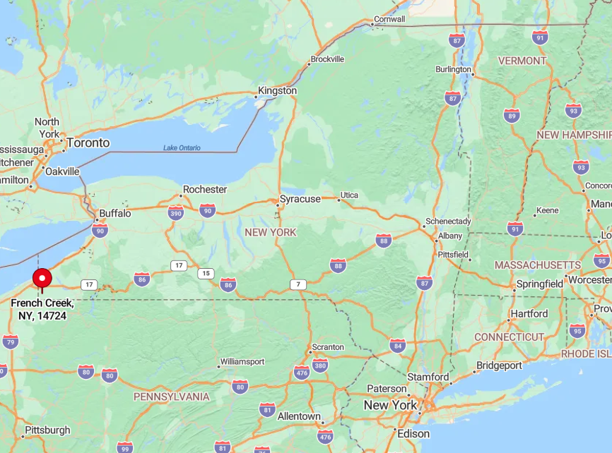
Nestled in the extreme southwest corner of Chautauqua County, French Creek lies just east of the Pennsylvania line and south of Findley Lake. Reaching the valley involves exiting I-86 at Sherman, then descending six miles of county highways that twist through ridges before bottoming out in fertile pastureland.
Because no state route runs through town and winter storms frequently drift across the open fields, access can feel weather-dependent. This blend of tucked-away geography and limited infrastructure keeps French Creek one of New York’s best-kept rural secrets.