🔥 Would you like to save this?
Southern Louisiana still holds pockets of near–silence where tides, cattle, and rustling reeds set the tempo of daily life. Our roundup of ten secluded towns traces the Gulf shoreline and the reaches of the Atchafalaya basin, pausing in places where population counts stay in the low hundreds and the night skies stay dark.
Each stop offers its own blend of marsh, prairie, or oak-covered ridge, along with time-tested livelihoods such as shrimping, rice farming, and bird guiding. Visitors find room to breathe on acre-plus lots, long stilted docks, and winding parish roads that rarely see traffic.
In order to come up with the very specific design ideas, we create most designs with the assistance of state-of-the-art AI interior design software. Also, assume links that take you off the site are affiliate links such as links to Amazon. this means we may earn a commission if you buy something.
Hidden gems appear in the form of private bird rookeries, salt-dome jungles, and houseboat clusters that never show up on standard travel brochures. We invite readers to explore these out-of-the-way corners where Louisiana’s quieter character still thrives.
25. Lucky – Farmland Quiet by Black Lake
Lucky sits deep in Bienville Parish, where pine forests stretch for miles and the roads thin into silence. With a population barely topping double digits, it feels more like a clearing in the woods than a town.
Time moves slowly here—marked by the rhythm of chirping cicadas, rustling trees, and the distant hum of passing storms. There’s little to do but listen: to nature, to your own breath, to the quiet.
Locals live simply, often off the land or by the pace of small-town routines. There are no crowds, no hurry, no glare—just stillness held beneath the Southern sky. It’s the kind of place that makes solitude feel like comfort.
Where is Lucky?
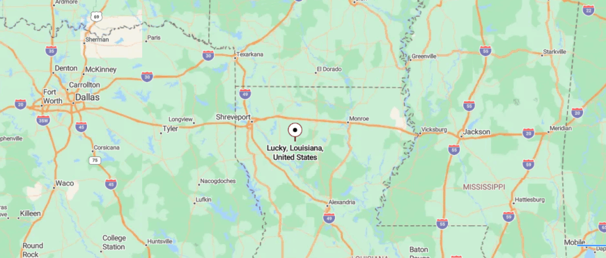
Lucky lies in northern Louisiana’s Bienville Parish, where Highways 9 and 4 meet among pine forests and quiet farmland. It’s about 30 miles southeast of Ruston, reached by rural roads that gradually empty of traffic and sound.
With just over 230 residents, Lucky feels spread out and hushed, more space than settlement. Modest homes sit among trees, and the woods stretch endlessly around them. It’s a place where stillness settles easily. Even the road seems to exhale as you arrive.
24. Kraemer – Wetland Enclosure by Bayou Boeuf
Kraemer lies deep in the bayou country of Lafourche Parish, surrounded by winding waterways, moss-draped trees, and cypress groves that seem to fold the world inward. The roads in are narrow and quiet, often ending in boat launches or gravel shoulders beside still water.
Life here flows with the tide—fishing, trapping, and small-scale farming shaping the rhythm of each day. Canoes drift through the swamps, herons stand watch in the shallows, and evenings settle in with frogsong and distant thunder.
There’s no downtown, just a scattering of homes on stilts and a few gathering spots for neighbors to catch up. The landscape leads everything here—slow, quiet, and filled with presence. It’s the kind of place where nature doesn’t just surround you—it holds you close.
Where is Kraemer?
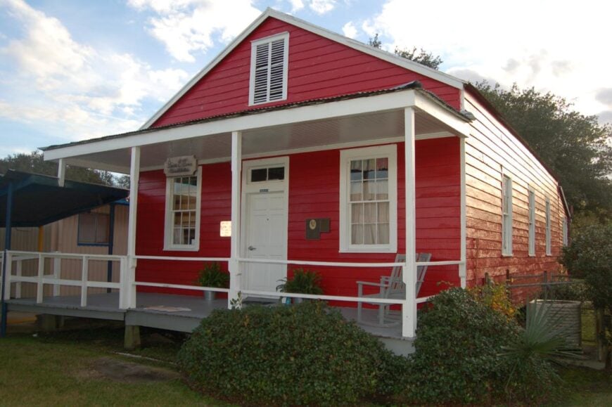
Kraemer—locally known as Bayou Boeuf—sits in southeastern Louisiana’s Lafourche Parish, about 35 miles southwest of New Orleans. It’s reached by winding rural roads that drift past cypress trees and marshland. With around 1,100 residents, the community feels quiet and close to the water.
Landmarks like the Little Red Schoolhouse and bayou-front homes anchor it gently. There’s no rush here, only the slow rhythm of life by the bayou. It’s a place where arrival feels like slipping into still water.
23. Robert – Woodland Peace near Tickfaw Corridor
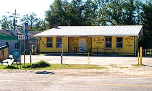
Robert sits tucked between pine forests and swampland, where Highway 190 slips quietly through Tangipahoa Parish and disappears into trees. Though close to larger towns, it feels distant—shielded by forest and the hum of the nearby Tangipahoa River.
The town itself is modest, with scattered homes, a few local stores, and long stretches where the road feels empty. Nature sets the mood here: fishing in backwater bayous, birdwatching near the riverbanks, or just listening to the cicadas as dusk sets in.
Locals live simply—many tied to small businesses, farming, or weekend life on the water. It’s the kind of place that feels paused between two worlds: close enough to reach, quiet enough to forget you did. The stillness here doesn’t shout—it waits.
Where is Robert?
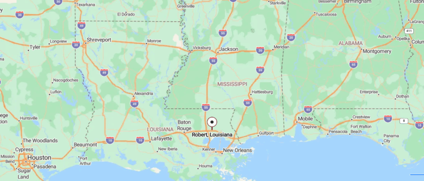
Robert sits in southeastern Louisiana’s Tangipahoa Parish, just east of Hammond where U.S. 190 meets LA 445 and I‑12. The drive in shifts quickly from highway flow to quiet roads lined with pine and bayou.
With around 1,300 residents and a single traffic light, the town feels steady and unhurried. A campground, a head-start center, and quiet neighborhoods fill the space more than storefronts. Even its role in the Deepwater Horizon response now rests beneath still skies.
22. Arnaudville – Bayou Junction in Two‑Parish Stillness
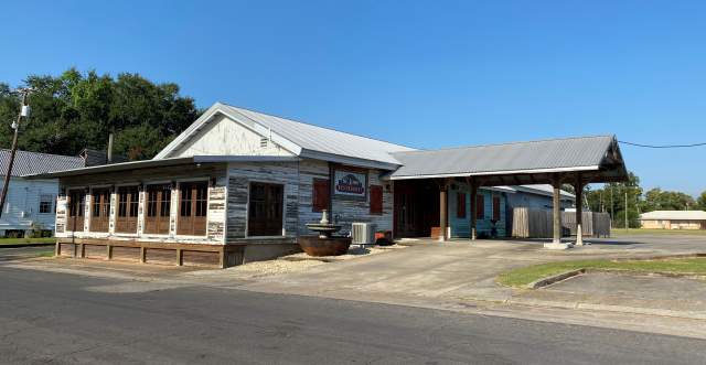
Arnaudville sits at the meeting of Bayou Teche and Bayou Fuselier, where the water winds slow and the air feels thick with history and song. Though just a short drive from Lafayette, it feels distant—wrapped in mossy oaks, old Creole cottages, and the hum of French still spoken on porches.
The roads here curve gently, leading to hidden art studios, family-run boudin shops, and quiet fishing spots tucked behind reeds. Artists and musicians gather at small festivals or in backyards, where Cajun fiddles drift into the evening air.
The pace is unhurried, shaped by water, culture, and deep roots in the land. People live by craft, farming, and old rhythms that don’t bend to modern noise. It’s the kind of place where creativity grows in the quiet.
Where is Arnaudville?
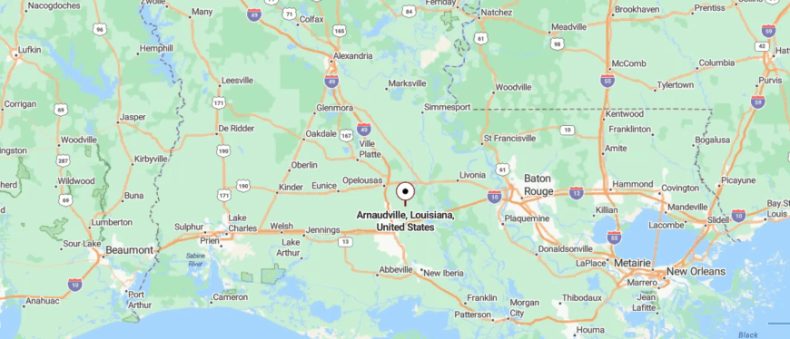
Arnaudville rests where Bayou Teche and Bayou Fuselier meet, tucked into St. Landry and St. Martin Parishes about 60 miles west of New Orleans. You reach it by winding rural highways shaded by oaks and sugar cane.
With around 1,000 residents, the town feels intimate and wrapped in water. Cajun culture runs deep—folk art, French immersion, and bayou music flow as naturally as the currents. Small breweries and mossy trees lend a quiet charm. It’s a place where life drifts gently, and the bayou sets the pace.
21. Butte La Rose – Atchafalaya Basin Watercamp Haven
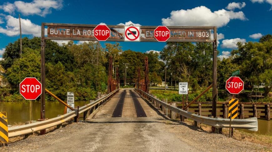
Butte La Rose sits deep in the Atchafalaya Basin, where cypress knees rise from still water and the only roads in seem to end at the swamp. Surrounded by wetlands and hidden from highways, it feels more like an island than a town—quiet, isolated, and cradled by the river.
Life here leans into the land: fishing lines cast from docks, boats slipping through bayous, and porches built high above the floodplain. There’s no main street, just a scattering of homes and fish camps watching the water roll by.
Locals live by the tides, the seasons, and the slow rhythm of the swamp. Tourism trickles in, but never disrupts the calm. It’s the kind of place where the silence is thick and full of life.
Where is Butte La Rose?
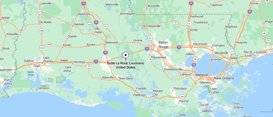
Butte La Rose sits on a river bend deep in the Atchafalaya Basin, where the Atchafalaya River splits and the wetlands widen. Located in St. Martin Parish, it’s reached by a single road—LA 3177 off I‑10—that winds through swamp and silence.
A few full-time residents and hundreds of seasonal camps give it the feel of a hidden outpost. The Atchafalaya Welcome Center stands as its quiet anchor. Surrounded by water and levees, the place moves with the rhythm of the bayou. It’s where the world slows—and the wild feels like home.
20. Clio – Isolated Riverbank Amid Swamps
Clio rests quietly in Livingston Parish, tucked between pine flats and swampy bends of the Amite River. There are no gas stations, no flashing lights—just a few scattered homes, some aging docks, and the slow hush of the river nearby.
The hum of passing trucks is rare. Instead, you’ll hear wind in the cane grass, frogsong after sunset, and the occasional splash from an outboard engine somewhere out in the backwaters. Life here leans into routine—gardens, fishing lines, slow drives to Killian or Springfield.
Clio doesn’t advertise its presence. You won’t pass through by accident. It’s the kind of place you find only if you’re looking for it—or returning to it. Stillness isn’t a backdrop here—it’s the main attraction.
Where is Clio?
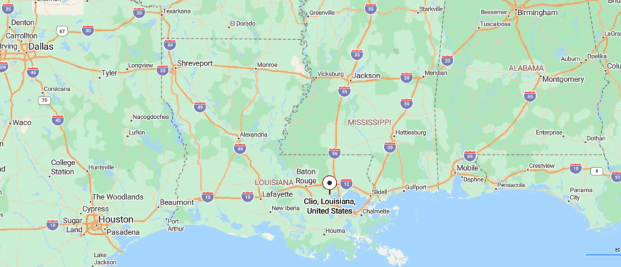
Clio rests along the Amite River in Livingston Parish, about 3 miles southwest of Killian. Reached by a single rural road, it’s surrounded by wetlands and backed by a fading past. Remnants of sawmill life and old cemetery plots hint at what once was.
There’s no town center—just river, trees, and quiet. With no official population, Clio feels more memory than map. It’s a place where silence settles like mist on still water.
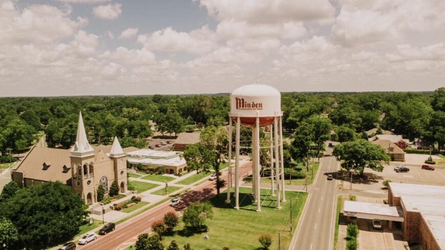
19. Minden – Antique Hearts in Northern Quiet
🔥 Would you like to save this?
Tucked among piney woods and gently rolling hills, Minden feels like a town paused somewhere between memory and stillness. Though not far from larger highways, it holds its own quiet rhythm—shaped by 19th-century homes, tree-lined streets, and a deep Southern calm.
The historic downtown hums softly with antique shops, bakeries, and faded signs that seem untouched by time. Nature edges close here—Lake Bistineau lies just south, offering quiet trails, slow paddles, and thick cypress groves draped in moss.
Life moves steadily, with deep roots in timber, tradition, and family. The days stretch long, and the air often feels thick with stories. It’s the kind of place that doesn’t rush to be known—but lingers once it is.
Where is Minden?
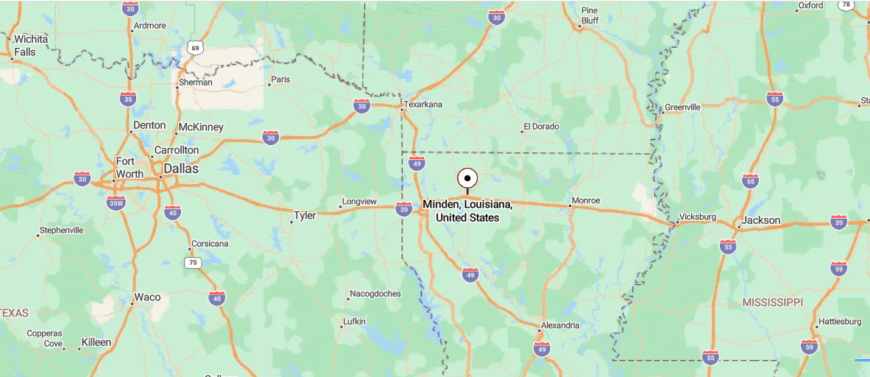
Minden rests in northwestern Louisiana’s Webster Parish, about 28 miles east of Shreveport along Bayou Dorcheat. It’s reached by U.S. Highway 80, where the road narrows into a brick-lined downtown of historic storefronts.
With just over 10,800 residents, the town balances small-town calm with deep roots in German-American and Civil War history. Museums, antique shops, and moss-draped oaks offer quiet charm. Nearby lakes and bayous add to its gentle pace.
18. Olla – Central Hill‑Country Stillness
Olla sits quietly in the northern stretch of LaSalle Parish, where pine forests edge the town and long roads lead away into stillness. It’s far from major cities, and that distance settles into the pace of life—unhurried, familiar, and framed by trees.
The historic downtown carries the marks of time, with faded brick buildings, an old theater marquee, and stories tucked behind weathered doors. Locals gather for festivals or walk the trails near Little River, where quiet waters reflect the sky.
Logging, farming, and community sustain the rhythm here. It’s a place where front porches still matter and strangers don’t stay strangers long. The kind of town where quiet isn’t just a setting—it’s a way of life.
Where is Olla?
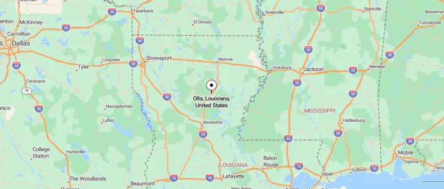
Olla is tucked into northwestern LaSalle Parish, about 40 miles southeast of Monroe, reached by LA Highway 125 off U.S. 165. Pine-lined roads lead into a quiet town of around 1,300 people, where life moves at a steady, unhurried pace.
Its historic downtown hosts bluegrass festivals and community events beneath brick storefronts and shady trees. The Wishing Tree and town square give it a rooted, lived-in charm. Surrounded by bayou forest and calm, Olla feels gently held by the land. It’s a place where tradition lingers and time takes its time.
17. Holly Beach – Untamed Shoreline off‑grid Riviera
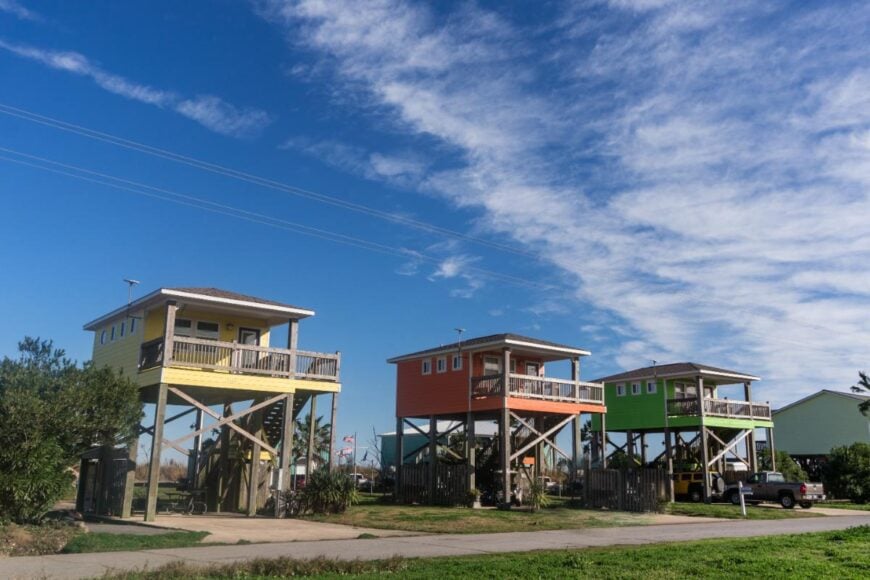
Holly Beach rests along the Gulf Coast, where the road fades into shoreline and the sky stretches wide over salt and sand. Often called the “Cajun Riviera,” it feels far removed—isolated by marshes, open water, and the long, empty drive that brings you there.
Rows of raised beach houses dot the shoreline, weathered by storms and sun, standing quiet between visits. There are no big hotels or boardwalks—just wind, waves, and the call of gulls above the tide. Visitors come to fish, collect shells, or watch storms roll across the water in a place that never feels rushed.
Life here is shaped by the elements and the people who know how to live alongside them. It’s the kind of place that disappears behind you just as quietly as it appears.
Where is Holly Beach?
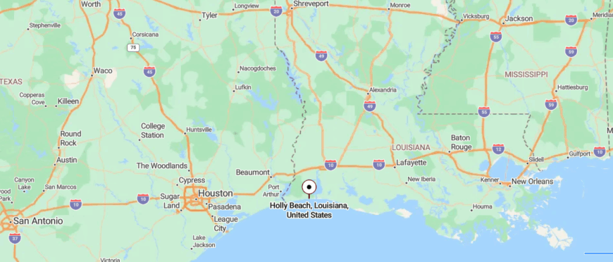
Holly Beach sits on Louisiana’s Gulf Coast in Cameron Parish, where LA 27 meets the sea and the land gives way to sand. About 40 miles south of Lake Charles, it’s reached by marsh-lined roads that end at a scatter of raised beach camps.
With no gas stations, shops, or hotels, the place feels raw and wide open. A few residents remain, but most visitors come to fish, camp, and breathe in the quiet. Dunes stretch in one direction, wetlands in another.
16. Isle de Jean Charles – Causeway‑only Island at the Bayou’s End
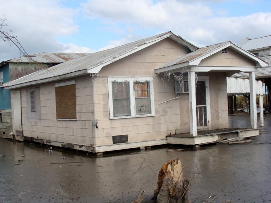
Isle de Jean Charles lies at the edge of Louisiana’s disappearing coast, a narrow strip of land slowly surrendering to rising waters and sky. Reached by a single road that often floods, it feels more like the end of the world than just the end of the parish.
The island is home to Native American families who’ve lived here for generations—surrounded by marsh, memory, and a deep connection to the land. Fishing and crabbing still shape daily life, while storms and tides steadily reshape the shoreline.
There are no shops, no crowds—just stilted homes, wind in the reeds, and water on all sides. The silence here feels sacred, threaded with resilience. It’s the kind of place that holds onto its roots even as the ground shifts beneath them.
Where is Isle de Jean Charles?
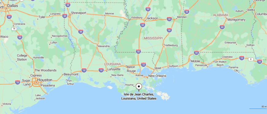
Isle de Jean Charles lies deep in Terrebonne Parish, Louisiana, at the edge of the Gulf where land slips steadily into marsh. It’s reached by a single narrow road from Houma, often threatened by rising water. Once 22,000 acres, the island has eroded to just over 300, with only a few families remaining.
There are no stores, no churches—just homes on stilts and the wind moving through bayou grass. It’s a place shaped by Native heritage and the quiet urgency of loss. Here, arrival feels like entering the last line of a fading story.
15. Roberts Cove – German Cajun Enclave in Acadiana
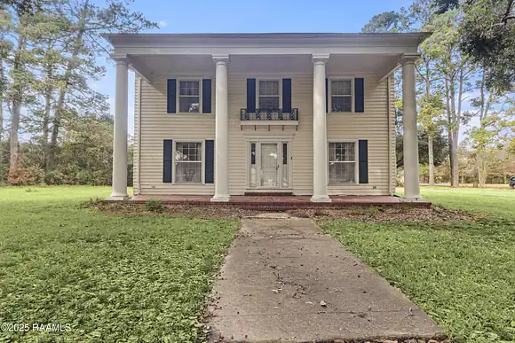
Roberts Cove rests quietly in the open countryside of Acadia Parish, surrounded by sugarcane fields and oak trees that seem to stand guard over its deep roots. The roads leading in are quiet, bordered by wide skies and the occasional rusted gate, giving the town a sense of gentle isolation.
Settled by German Catholics in the 1800s, the community has held tight to its heritage—reflected in its chapel, annual festival, and rows of family farms. Visitors wander in for the Germanfest or to hear stories passed down in both English and memory.
Life here is shaped by faith, family, and the slow beauty of rural living. You won’t find crowds or traffic—just the echo of footsteps on gravel and the scent of fresh-cut cane. It’s the kind of place where heritage lingers in the quiet.
Where is Roberts Cove?
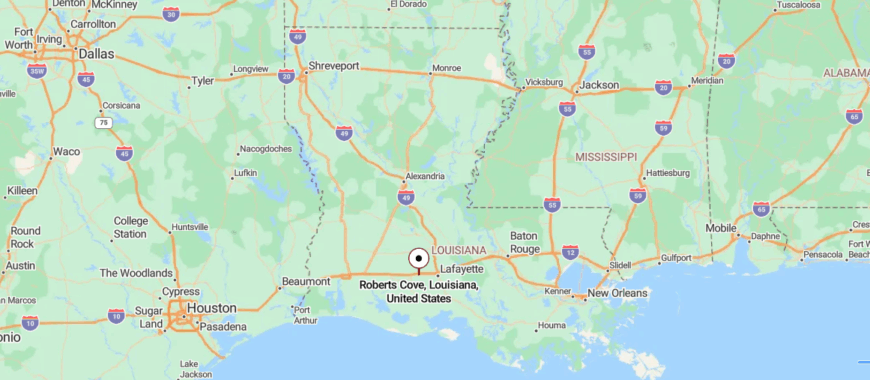
Roberts Cove sits just northwest of Rayne in Acadia Parish, tucked among prairie farmland and quiet country roads. Founded by German Catholic settlers in 1881, it remains a rural enclave with deep cultural roots. There’s no town center—just family farms, St. Leo IV Church, and a museum preserving its heritage.
Each October, Germanfest brings life back to its fields with music and tradition. The rest of the year, the place moves gently, shaded by oaks and memory. It’s where history lingers softly in the still air.
14. St. Francisville – Riverside Calm in the Florida Parishes
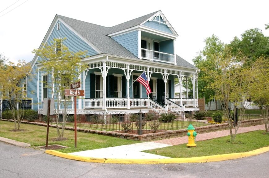
St. Francisville sits high on the bluffs above the Mississippi River, where winding roads and live oaks lead you into a town that feels both hidden and timeless. Though not far from Baton Rouge, it carries a stillness that settles in its shaded streets and antebellum homes.
Spanish moss drapes from branches, and history lingers in the breeze—felt in quiet cemeteries, weathered churches, and creaking porches. Visitors wander through gardens, paddle the nearby river, or walk the trails at Tunica Hills where waterfalls surprise the forest floor.
Local shops and cafés hum softly in old buildings that wear their age well. The town thrives on heritage, art, and the slow draw of Southern quiet. It’s the kind of place where the past feels alive, and the present knows not to rush it.
Where is St. Francisville?
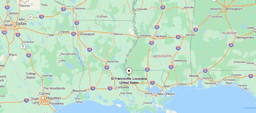
St. Francisville sits high on a Mississippi River ridge in West Feliciana Parish, about 30 miles north of Baton Rouge. Reached via U.S. 61, the road narrows into a town of moss-draped oaks and preserved antebellum homes.
With around 1,500 residents, it feels both stately and still. Churches, courthouses, and nearby plantations whisper stories of the past. Gardens bloom quietly, and the river rolls just out of view. It’s a place where time settles in with grace.
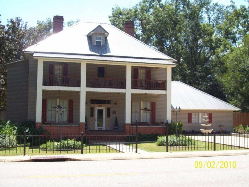
13. Pollock – Forest‑Fringed Quiet on Kisatchie Edge
🔥 Would you like to save this?
Pollock rests along the edge of Kisatchie National Forest, where dense pine trees and winding roads keep it quietly out of reach. Though just north of Alexandria, it feels worlds away—surrounded by woods, wildlife, and the soft hush of forest air.
The town itself is small and steady, shaped by logging roots and a close-knit rhythm of daily life. Trails nearby lead deep into the forest, where you can hike for hours without seeing another soul.
Locals fish hidden creeks, ride horses down old paths, and gather where the woods open up to sky. Life here leans into the land and moves without hurry. It’s the kind of place where the trees feel taller than time.
Where is Pollock?
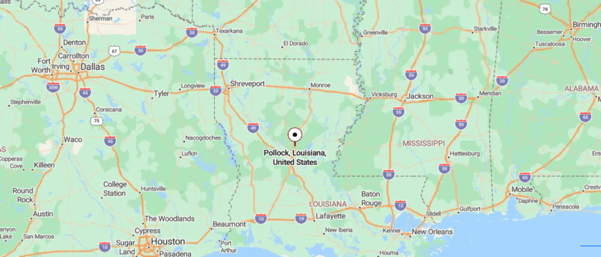
Pollock sits quietly in northern Louisiana’s Grant Parish, about 40 miles west of Alexandria along Louisiana Highway 8. You arrive via roads lined with pines that slowly give way to spaced homes and a modest downtown.
With just over a thousand residents, the town has a steady, easy rhythm. Simple storefronts, a few churches, and access to Kisatchie National Forest lend it a quietly rooted feel. Pine needles carpet the ground; the air holds a stillness you can almost hear. It’s a place where every arrival feels like a gentle exhale.
12. Springfield – Parish Seat Stillness in Livingston
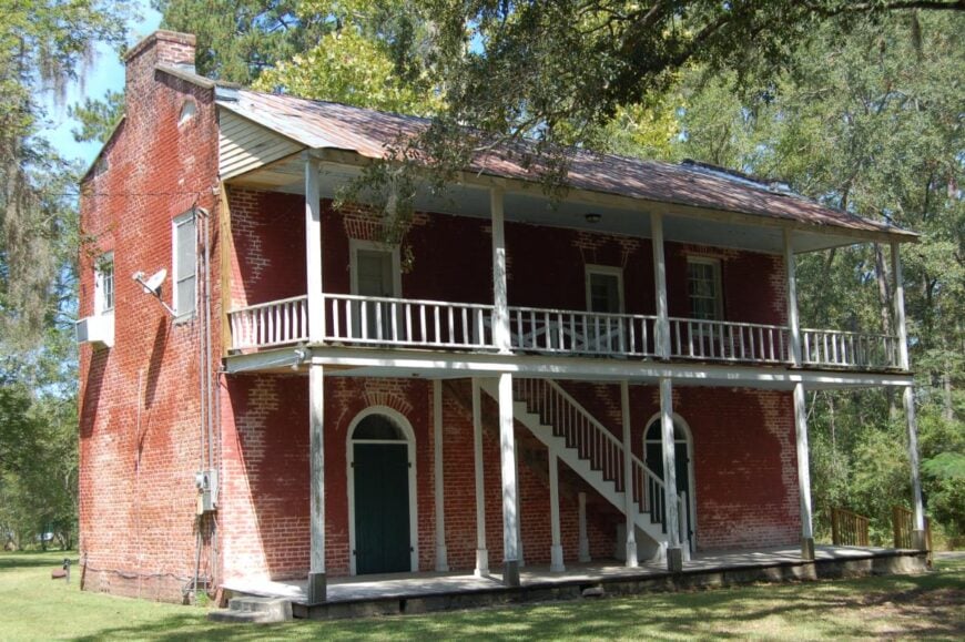
Springfield sits tucked between river bends and quiet backroads in Livingston Parish, surrounded by swamp, pine, and the slow drift of bayou water. Though close to larger towns, it holds a peaceful rhythm shaped by its watery borders and shaded streets.
The Tickfaw River weaves along the edge, inviting boaters, fishers, and wanderers into still corners and hidden inlets. Locals gather at the marina, paddle into the state park, or simply sit on porches while the cypress sways.
Life here flows with the current—calm, close, and just distant enough to feel apart from the noise. Some make a living through tourism, others through time-tested trades. It’s the kind of place where the river leads everything, even your thoughts.
Where is Springfield?
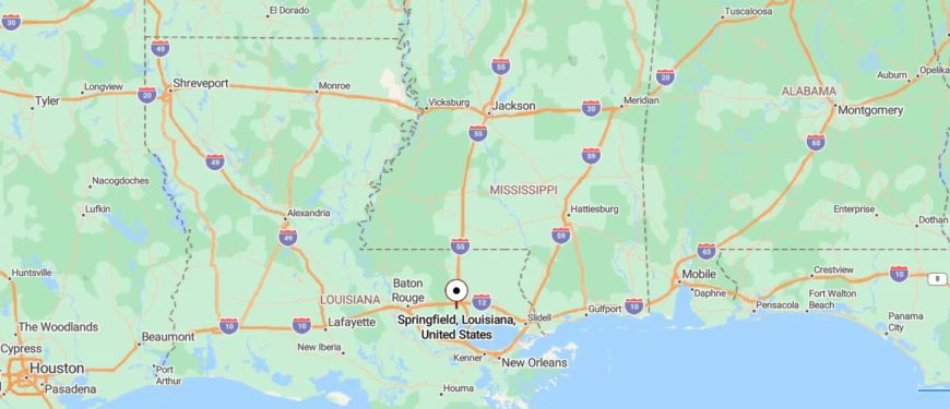
Springfield lies in Livingston Parish along the Natalbany River, about 7 miles from Tickfaw State Park. It’s reached by quiet roads off LA 42, where mossy oaks and river bends guide you in.
With around 460 residents, the town feels small but deeply rooted. An 1835 courthouse and nearby Carter Plantation hint at its layered past. The river moves slowly here—and so does time. It’s a place where history and hush walk side by side.
11. Loreauville – Bayou Teche Village Off‑Grid by Design
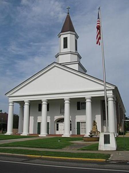
Loreauville sits quietly along Bayou Teche, where sugarcane fields stretch wide and the water flows with a lazy grace. It’s off the main routes, surrounded by farmland and moss-draped trees that soften the edges of time.
The town’s rhythm is slow and steady—marked by front porch visits, quiet Catholic traditions, and the hum of boats moving gently through the bayou. Nearby parks and boat launches offer easy access to nature, where herons glide low and cypress shadows ripple on the water.
Most locals work in agriculture or nearby mills, their lives rooted deep in the land. There’s no rush here—just a calm that rises with the mist each morning. It’s the kind of place where the bayou writes the story.
Where is Loreauville?
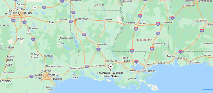
Loreauville sits along Bayou Teche in Iberia Parish, about 8 miles from New Iberia, reached by LA 86 through fields and quiet water edges. The road narrows into a shaded Main Street where oaks lean over porches and history lingers.
With around 650 residents, the town is small but rich in Cajun tradition—boat-building, sugar cane, and zydeco rhythms. St. Joseph’s Church and local festivals hold the heart of the place. Life moves to the pace of the bayou here.
10. Grand Chenier – Windswept Ridge on the Gulf
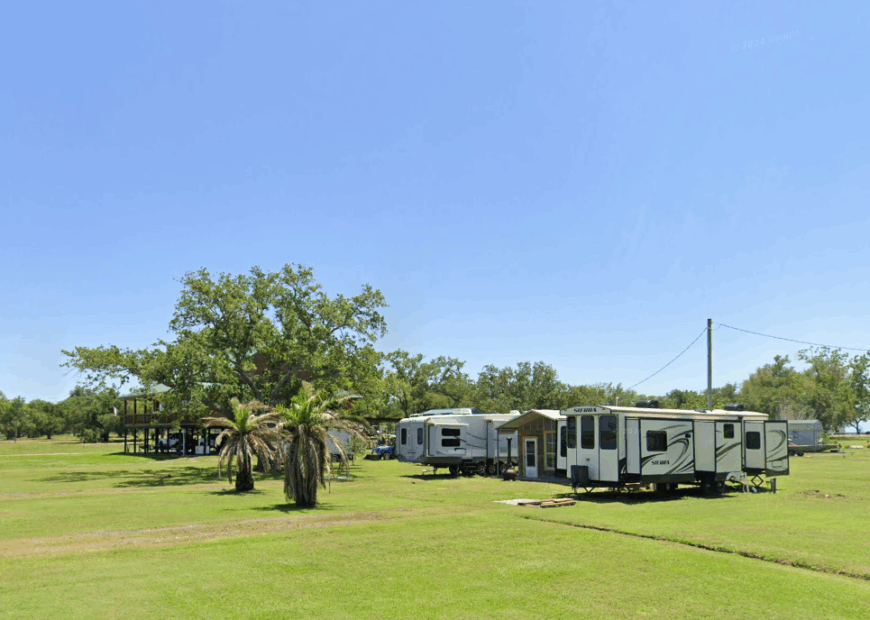
Grand Chenier counts roughly 300 residents spread along a narrow live-oak ridge that rises just high enough above surrounding marsh to stay dry. Days revolve around surf fishing, crabbing from backyard piers, and watching spoonbills glide over Rockefeller Wildlife Refuge a few miles east.
Cattle ranching dominates the local economy, with herds grazing on wide pastures carved from former prairie, while seasonal shrimpers trailer their boats to nearby landings. The community’s sole convenience store closed years ago, so gas, groceries, and mail require a drive of more than twenty miles.
Wind whipping off the Gulf keeps the ridge free of mosquitoes most evenings, making sunsets feel like private showings held only for those who live here. The lack of commercial lighting, restaurants, and cellular service underscores how completely Grand Chenier sits apart from modern bustle.
Where is Grand Chenier?
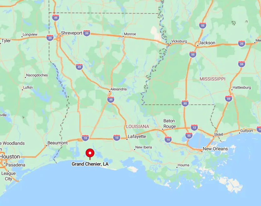
This unincorporated village lies in Cameron Parish along Louisiana Highway 82, about forty miles east of the parish seat in Cameron and seventy miles south of Lake Charles. Vast marshes and wildlife refuges border both sides of the two-lane road, so travelers pass more egrets than vehicles on the trip in.
Storm-surge levees and swing bridges mark the only land routes, and there is no public transit. Visitors typically drive in from Lake Charles or Lafayette, stocking up on supplies before making the final, empty stretch to the ridge.
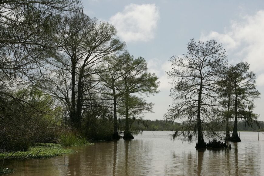
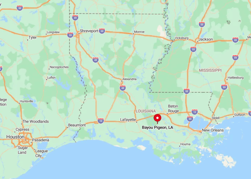
9. Bayou Pigeon – Camps on the Edge of the Atchafalaya
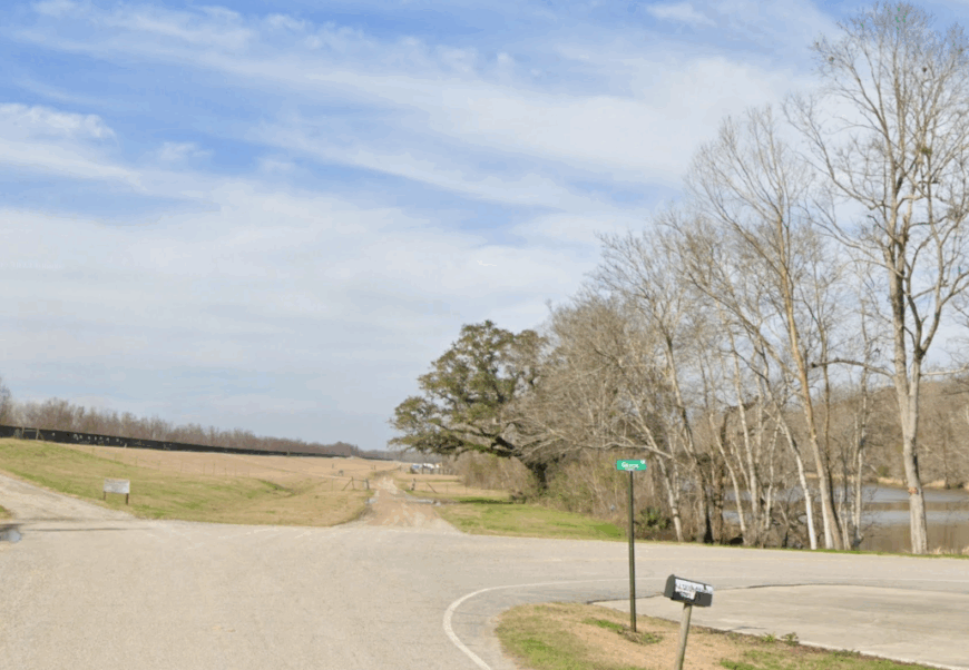
Home to fewer than 500 people, Bayou Pigeon lines up stilted fishing camps and cypress-shaded cabins along one parish road that dead-ends at the water. Locals fill days with crawfish trapping, bass tournaments in the Atchafalaya Spillway, and front-porch music sessions that echo across the still bayou.
Commercial crawfish and alligator harvesting keep small boat sheds busy each spring, while a handful of oilfield-service yards add sparse industrial activity. Between houses, dense moss-draped forests muffle sound so thoroughly that the sputter of a passing outboard becomes notable news.
Streetlights are scarce, and the nearest grocery store sits twenty miles north in Plaquemine, preserving a near-total auditory hush at night. The distance from any highway, coupled with a single exit road vulnerable to flooding, shields Bayou Pigeon from casual visitors.
Where is Bayou Pigeon?
🔥 Would you like to save this?
Bayou Pigeon occupies a thin sliver of Iberville Parish along Louisiana Highway 75, tucked between the Atchafalaya River levee and vast cypress swamp. Isolation deepens because the road terminates at the settlement, forcing all traffic to turn around for the return trip.
Baton Rouge sits nearly an hour away, and cell service fades as soon as drivers leave Interstate 10. Arrival involves a leisurely ride down levee tops and across wooden bridges that hint at the quiet ahead.
8. Cypremort Point – Marshland Hideaway
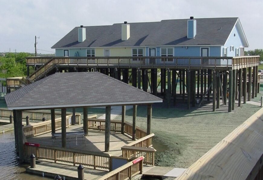
Fewer than 500 year-round residents share this St. Mary Parish peninsula, though weekenders swell numbers when south winds promise redfish runs. Life centers on Cypremort Point State Park, kitesurfing the steady Gulf breeze, and cleaning shrimp under spreading live oaks after sunset.
Guiding services, oyster leases, and part-time vacation rentals form the modest economic backbone, supporting a single café and bait shack. A lone road bisects oak thickets and ends at Vermilion Bay, so beach walks rarely meet another soul.
Waterfront lots run wide, giving every home its own dock and unobstructed view of exploding pink skies each evening. With no school, bank, or fuel station on the peninsula, residents plan errands like mini-road trips, reinforcing the sense of being tucked far away.
Where is Cypremort Point?
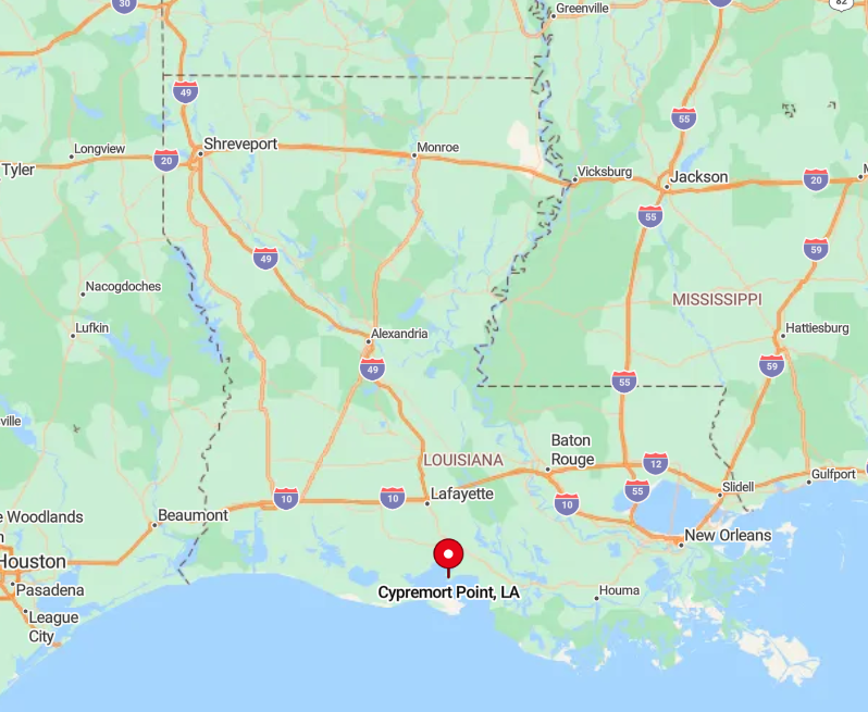
Reachable by Louisiana Highway 319, Cypremort Point juts into Vermilion Bay about twenty miles south of New Iberia and forty miles from the nearest interstate. Marsh stretches on both sides of the causeway approach, and the final miles carry only local traffic.
Any detour requires turning around, since the road literally meets the water. Most visitors drive in with coolers, picnic gear, and spare gasoline, knowing the last fuel pump sits back on Highway 90.
7. Forked Island – Vermilion’s Quiet Rice Country
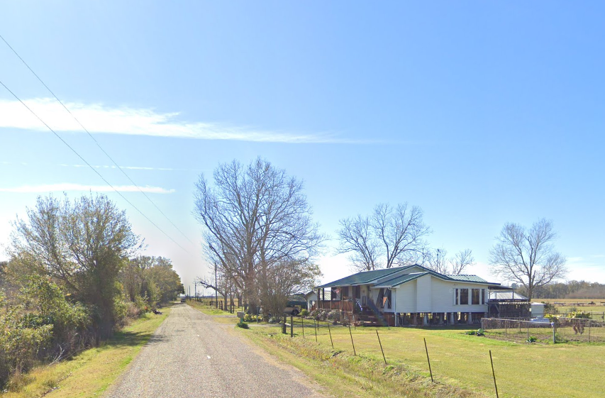
Approximately 400 people reside among live-oak tunnels and checkerboard rice fields that give Forked Island its pastoral rhythm. Birders park along farm roads to spy ibis and sandhill cranes, while hunters launch pirogues into secluded potholes during duck season.
Rice farming, crawfish ponds, and tractor repair shops supply nearly every local job, supplemented by school bus routes that wind between levees. The settlement rests a dozen miles from any four-lane highway, so daytime traffic is usually just a grain truck or a neighbor’s ATV.
Evenings bring a hum from irrigation pumps and little else, letting whip-poor-wills cut through the quiet. Generous lot sizes and hedgerows of palmetto add yet another layer of privacy to this inland marsh-prairie blend.
Where is Forked Island?
Forked Island lies in southern Vermilion Parish, roughly twenty-five miles south of Abbeville and well west of crowded coastal routes. Louisiana Highway 82 skirts the edge of town, but most homes sit on parish gravel roads branching deep into rice country.
The flat landscape offers few landmarks, so first-time visitors often rely on grain silos for navigation. Driving remains the only practical access, with the nearest regional airport an hour away in Lafayette.
6. Cocodrie – End-of-the-Road Shrimping Village
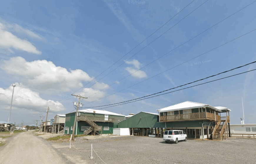
Cocodrie hosts around 300 permanent residents who rise early to catch white shrimp and spend afternoons mending nets beneath tin-roof sheds. Charter captains haul anglers into Terrebonne Bay, while the public LUMCON marine center occasionally opens its research aquarium for a quietly fascinating diversion.
Shrimping and oyster harvesting dominate employment, though a few coastal scientists rent cottages for seasonal fieldwork. Cocodrie’s housing sits on high pilings, each camp isolated on an acre or more of marsh that feels like floating land.
After sunset, the odor of boiled shrimp mixes with cordgrass in air free of traffic fumes, accentuating the town’s remoteness. The final twenty-five-mile drive past levees, pump stations, and alligator-lined canals reinforces a sense that the highway simply ran out of ambition and stopped here.
Where is Cocodrie?
Located at the southern tip of Louisiana Highway 56, Cocodrie sits in Terrebonne Parish about twenty-five miles below Houma. Marsh and open bay flank both sides of the road, so unexpectedly high tides can cover stretches of asphalt, discouraging casual travel.
No bridges continue beyond town, making boats the only onward option. Most visitors trailer their vessels from Houma, stocking up there before the road narrows and cell coverage fades.
5. Pecan Island – Prairie Meets Marsh
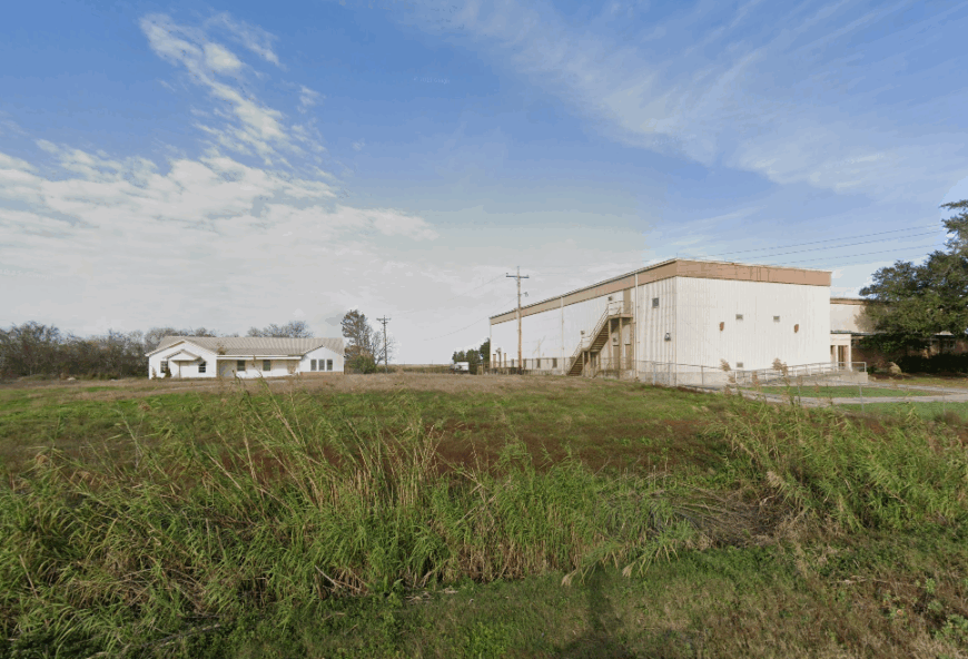
Pecan Island’s full-time population hovers near 250, scattered along a grassy ridge that lifts just above the surrounding coastal marsh. Residents pass free hours spotting teal over White Lake, herding cattle between cordgrass flats, and sharing shrimp étouffée at the volunteer fire station on bingo nights.
Cattle grazing, duck-lease operations, and small oilfield service yards keep the local economy ticking. The settlement stretches for miles along Louisiana Highway 82, but houses sit on wide homesteads that make neighbors feel comfortably distant.
Nights remain so dark that Milky Way views draw amateur astronomers from inland parishes. Shielded by more than fifty miles of undeveloped marshland, Pecan Island maintains quiet interrupted only by whistling ducks and the occasional supply truck.
Where is Pecan Island?
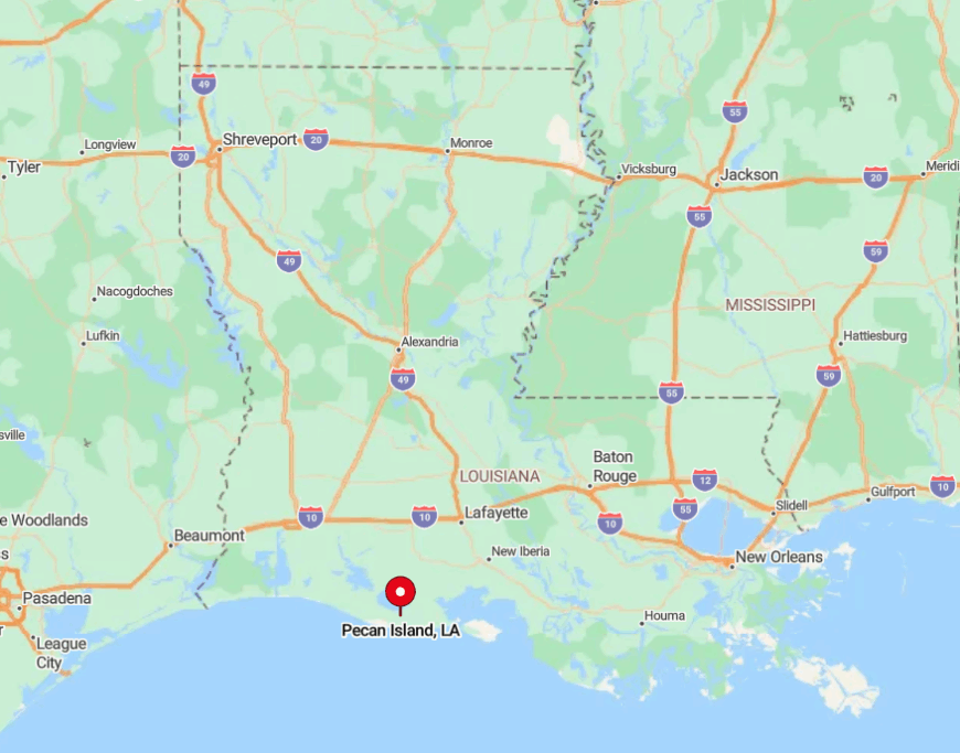
Situated in southwestern Vermilion Parish, Pecan Island lies about forty-five miles south of Abbeville on the coastal Highway 82 ribbon. Marsh, former prairies, and levees surround the town, eliminating alternative land routes.
Visitors should fill fuel tanks before the drive, as the only local pumps keep limited hours. Storm-evacuation signage along the way reminds travelers how narrowly this ridge stands between open water and open sky.
4. Avery Island – Salt Dome Sanctuary
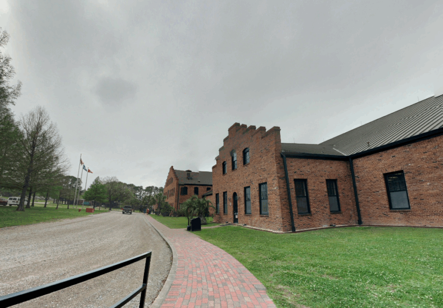
Only about 200 residents live atop this famous salt dome, most of them connected to the pepper fields and aging barrel warehouses that create the world’s Tabasco sauce.
Sightseers wander Jungle Gardens in search of snowy egrets, explore Buddha’s centuries-old shrine, and sample experimental hot-sauce flavors at the country store.
Pepper cultivation, salt mining, and sauce bottling serve as the primary employers, with guided tours providing a secondary income stream. Dense oak groves and curtains of Spanish moss hide cottages from one another, while gated private roads keep traffic to a minimum.
At night, cicadas all but drown out distant highway noise, reinforcing the island’s separate identity. The combination of guarded access, thick forest, and surrounding swamps ensures a degree of privacy unmatched in nearby Iberia Parish.
Where is Avery Island?
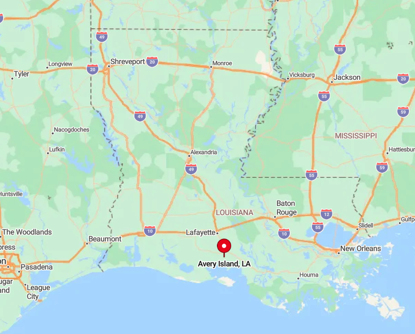
Avery Island rests a few miles south of New Iberia, reached by a single toll bridge over Bayou Petite Anse. The island’s perimeter is encircled by swamp and salt marsh, blocking any casual cutoff or backroad.
Drivers arrive via Highway 329, which ends at the factory gates, making the approach feel exclusive. Public transit does not reach the island, so private vehicle remains the only entry method.
3. Belle River – Houseboats Beneath Spanish Moss
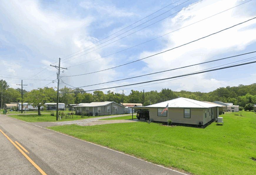
Roughly 300 people, many residing on floating camps or levee-side cabins, call Belle River home along its placid namesake waterway. Anglers target sac-a-lait under mossy branches, and locals gather at Pierre Part storeboats for evening boudin runs.
Crawfish harvesting, bait sales, and small engine repair power the economy, supplemented by houseboat rentals for adventurous weekenders. Sparse streetlights and deeply shaded canals leave nights almost pitch-black, perfect for firefly watching from screened porches.
The nearest interstate lies more than thirty miles away, and GPS signals often falter beneath oak canopies, adding to the town’s stealthy charm. Roomy plots and floating docks mean residents rarely see neighbors unless they pirogue over for coffee.
Where is Belle River?
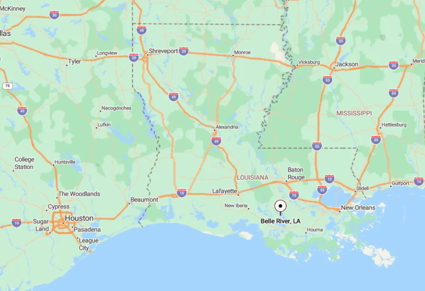
Straddling the St. Martin and Assumption Parish line, Belle River sits at the very end of Louisiana Highway 70 south of Pierre Part. The community is bounded by levees, swamp forest, and broad floodways, leaving only two narrow roads as entrances.
Travel beyond the settlement requires a boat, since highways stop where the river widens. Visitors often launch from Pierre Part then motor downstream to reach floating camps hidden from the road.
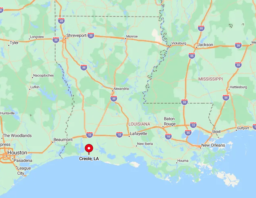
2. Creole – Prairie Grassland by the Refuge
Creole supports about 400 residents who oversee herds of Brangus cattle on open prairie beside canals that lead to the Sabine and Cameron refuges. Days fill with bird-watching tours, cast-net lessons for redfish, and community gumbo cook-offs under the plate-steel roof of the century-old schoolhouse.
Ranching, alligator farming, and refuge maintenance jobs form most paychecks, though many folks also run airboat tours in winter. Wide pastures stretch so far that houses seem to float on grass, and the nearest grocery store sits forty miles up the road in Lake Arthur.
Salt-marsh breezes keep bugs at bay and carry the distant clang of windmills turning above water wells. With only two small churches, a post office, and no stoplights, Creole offers a stillness prized by both longtime ranchers and newly arrived naturalists.
Where is Creole?
Creole lies along Highway 82 in eastern Cameron Parish, about fifteen miles east of the Calcasieu Ship Channel and nearly seventy miles from Lake Charles. Expansive tidal flats and federal wildlife refuges flank the highway, preventing suburban expansion.
The road itself is one of the few elevated stretches in the area, so during high water the town becomes an island of sorts. Access is strictly by car or pickup, with the closest commercial airport more than an hour away.
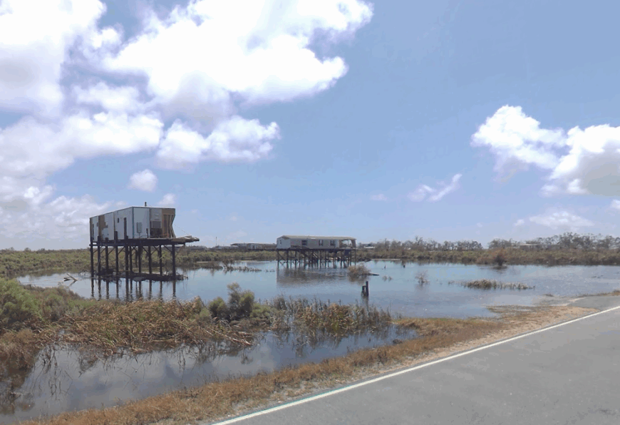
1. Pointe-aux-Chenes – Village Between the Bayous
Pointe-aux-Chenes shelters fewer than 800 residents, many of whom belong to the Pointe-au-Chien Indian Tribe and still craft traditional palmetto-leaf baskets on shaded porches.
Typical afternoons involve crabbing off personal footbridges, paddling to wooden spoil-bank islands that host hidden shell middens, and cleaning garfish for weekend fricassee.
Shrimping, oyster tonging, and tribal eco-tour guiding furnish most incomes, with a small boatyard offering seasonal work. The town hugs a ridge between two bayous, and homes perch on tall pilings with multi-acre lots that keep neighbors distant.
Nightfall brings the scent of marsh mud and the rustle of marsh hens rather than engine noise or neon glare. The single winding road into town skirts forested ridges, ensuring only visitors with purpose make the drive.
Where is Pointe-aux-Chenes?
Located in southern Terrebonne Parish, Pointe-aux-Chenes sits at the terminus of Louisiana Highway 665, about twenty miles below Montegut. Marsh flanks both sides of the road, and raised bridges over tidal passes can close during storms, heightening the community’s isolation.
There are no alternate land routes, so the village effectively sits on its own peninsula. Travelers start from Houma, follow bayou-side lanes south, then continue until the pavement ends and the prairie sky takes over.