🔥 Would you like to save this?
Southern Connecticut is hardly a blank spot on the map, yet pockets of real quiet remain for anyone willing to trade four-lane speed for winding back roads and wide-open skies.
We gathered 25 towns where night sounds still come from barred owls, where porch lights sit acres apart, and where the nearest chain store may be fifteen miles away.
In order to come up with the very specific design ideas, we create most designs with the assistance of state-of-the-art AI interior design software.
Each place keeps its own rhythm through strict zoning, natural buffers, or plain stubborn geography, proving that solitude can thrive even within reach of the coast and the commuter rail.
Hidden farms, dark-sky preserves, and historic lanes weave through these communities, rewarding visitors who slow down long enough to notice. From river bluffs to forested ravines, the following countdown highlights what sets each haven apart and exactly where to find it.
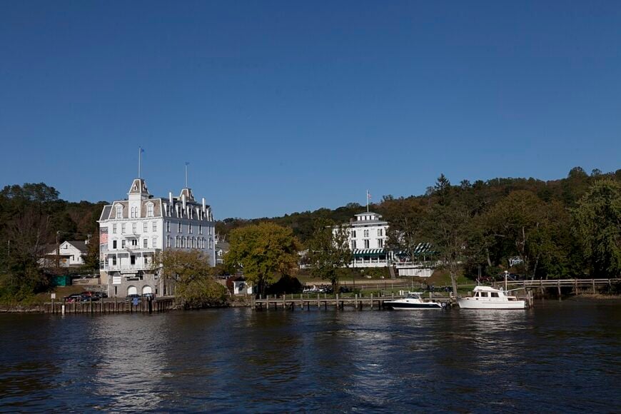
25. Chester
Chester is a hilltop town steeped in charm, with quiet lanes, 18th-century homes, and maple-shaded galleries tucked behind stone walls. Its village center feels more like a secret garden than a destination—where coffee shops overlook brooks and footbridges, not parking lots.
On weekdays, the silence is near total; only the rustle of leaves or the clip of a dog’s paws on pavement might break it. Despite its artsy vibe, Chester has preserved its rural bones through tight zoning and a setting bounded by forest.
It’s the kind of place where even the main road bends like a whisper.
Where is Chester?
Chester lies in southern Middlesex County, nestled in the hills above the Connecticut River. It’s north of Old Saybrook and reachable mainly via Route 148 and Route 9.
The town’s location—sheltered between river, ridge, and forest—keeps it distant from major thoroughfares. With no direct rail stop and just one stoplight in town, it stays blissfully off most travel itineraries.
24. Essex
Essex is the kind of town where time slows with the tide, and the loudest sound may be a seagull over the marina. Steeped in maritime history, it trades bustle for grace, with old ship captains’ homes and narrow lanes shaded by elms.
The town’s charm is deliberate, and the pace unhurried—locals know the tide table better than traffic patterns. Even with tourists passing through in summer, there are wooded corners and riverfront paths where solitude holds steady.
This is a coastal town that doesn’t shout—only nods.
Where is Essex?
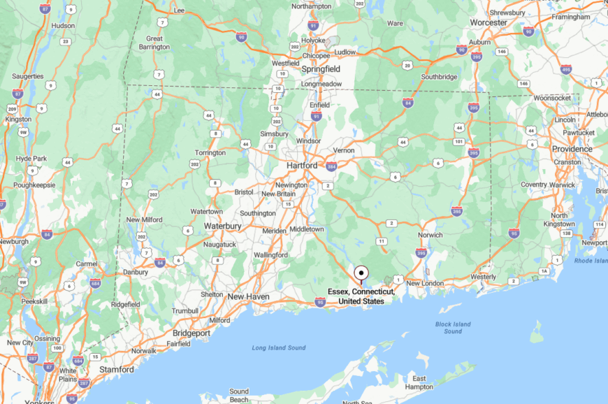
Essex sits along the lower Connecticut River in southern Middlesex County, just inland from Old Saybrook. The town is split into three villages, all connected by winding roads and water.
Shielded from the speed of I-95 and with no commercial strips, Essex remains accessible only to those who seek it. The river and surrounding wetlands naturally reinforce its quiet presence.
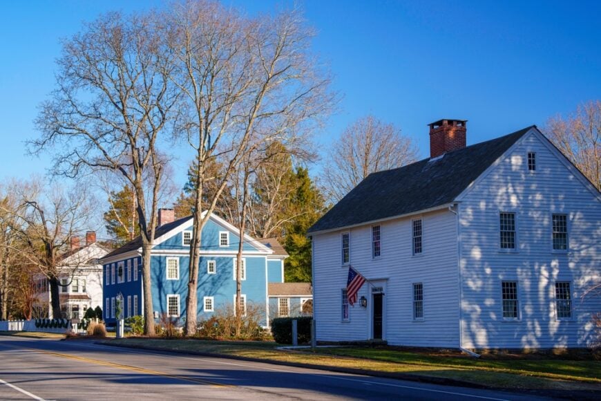
23. Old Lyme

Old Lyme is equal parts salt marsh and storybook, a quiet blend of seacoast cottages and colonial lanes with weathered shingles and lupine-lined fences. The town’s roots in the American Impressionist movement echo through its still landscapes and slow afternoons.
Here, artists and farmers coexist, and narrow roads veer suddenly into woods or open fields. Night falls softly over this riverside town, and the stars compete only with the flicker of dock lanterns.
Old Lyme and its close country cousin Lyme are adjacent towns in southeastern Connecticut, separated primarily by the Connecticut River and a few winding backroads—but they’re essentially two halves of the same historic area.
Despite being near major highways, Old Lyme never feels in a rush.
Where is Old Lyme?
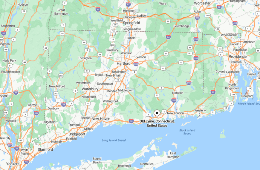
Old Lyme lies at the mouth of the Connecticut River, bordered by Long Island Sound and flanked by salt marshes. It’s technically close to I-95 but buffered by tidal inlets, historic zoning, and conservation land.
That natural insulation keeps the hum of highways at bay and maintains the quiet that defines the town.
22. Madison
Madison is a beach town that’s learned to keep to itself. Past the bustle of its bookstore and coffee shop, gravel lanes wind toward salt ponds and cedar-shrouded homes set deep into coastal woods.
It’s a town where walking to the beach at dusk feels like a ritual, and evenings are filled with bird calls, not car horns. Strict planning rules and a deeply rooted sense of local pride keep the shoreline dotted with trees, not condos.
Even on summer days, the silence lingers in its back roads.
Where is Madison?
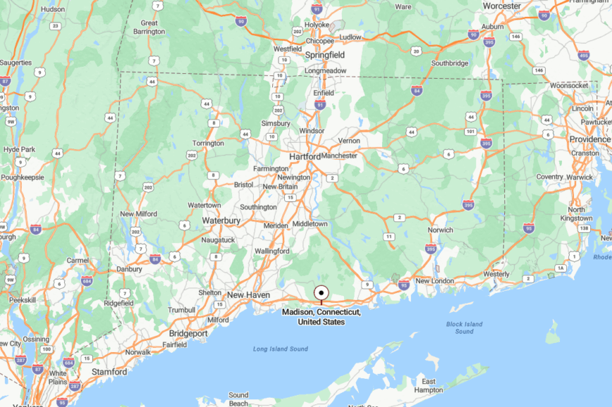
Madison is in southern New Haven County, along the Long Island Sound between Guilford and Clinton. While Route 1 cuts through town, the highways and train lines bypass its wooded backstreets.
The state park and wetlands near Hammonasset block overdevelopment and help preserve Madison’s slow rhythm and natural hush.
21. Westbrook
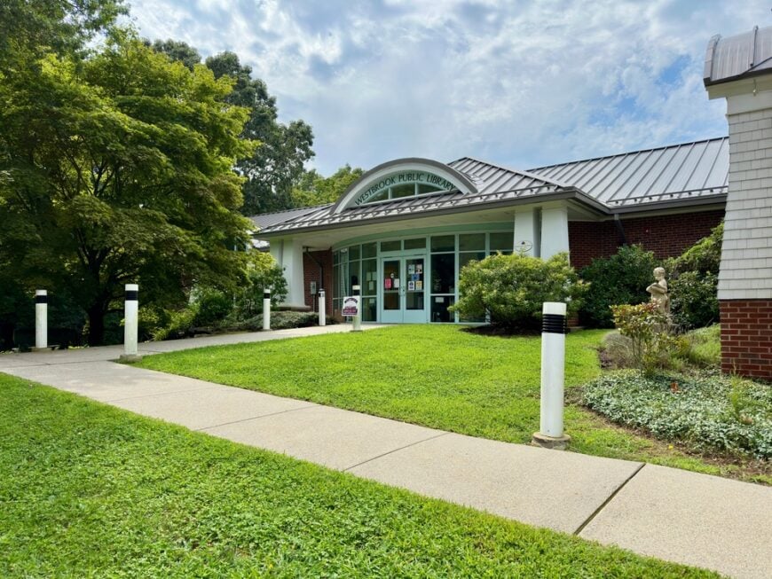
Westbrook hugs the shore with a quiet grace, its marinas hushed on weekdays and its inlets glowing gold at sunset. The center is small—a few shops and weathered steeples—but the surrounding area feels untouched.
Beach cottages perch at the edge of saltgrass, and most roads end in views of the Sound or stretches of forest. Even with a train station nearby, the town keeps its corners curled inward.
Westbrook’s beauty is its calm.
Where is Westbrook?
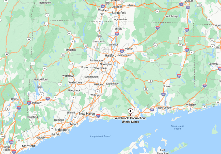
Westbrook is in Middlesex County, between Old Saybrook and Clinton, right along Long Island Sound. It’s easily missed if you don’t exit purposefully off Route 1.
The narrow grid and coastal wetlands ensure the town remains quiet and mostly residential, with traffic filtered through just a few entry points.
20. Deep River
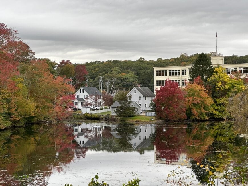
Deep River is a quiet port town where forested hills fall toward the Connecticut River, and life feels paused between ferry crossings. Formerly a shipbuilding hub, it now favors solitude over steam.
Its brick buildings and modest homes keep close to each other, but the surrounding woods and protected coves create distance from the world beyond. Even the air feels slower here—moss-sweet and river-cooled.
Few places in the lower valley feel this still.
Where is Deep River?
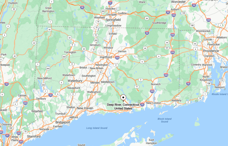
Deep River lies along the western bank of the Connecticut River, south of Chester and north of Essex. It’s part of the Lower Connecticut River Valley region and sits off Route 9.
Its placement between hills and marshland, along with a lack of through-traffic, preserves its status as one of the state’s best-kept waterside retreats.
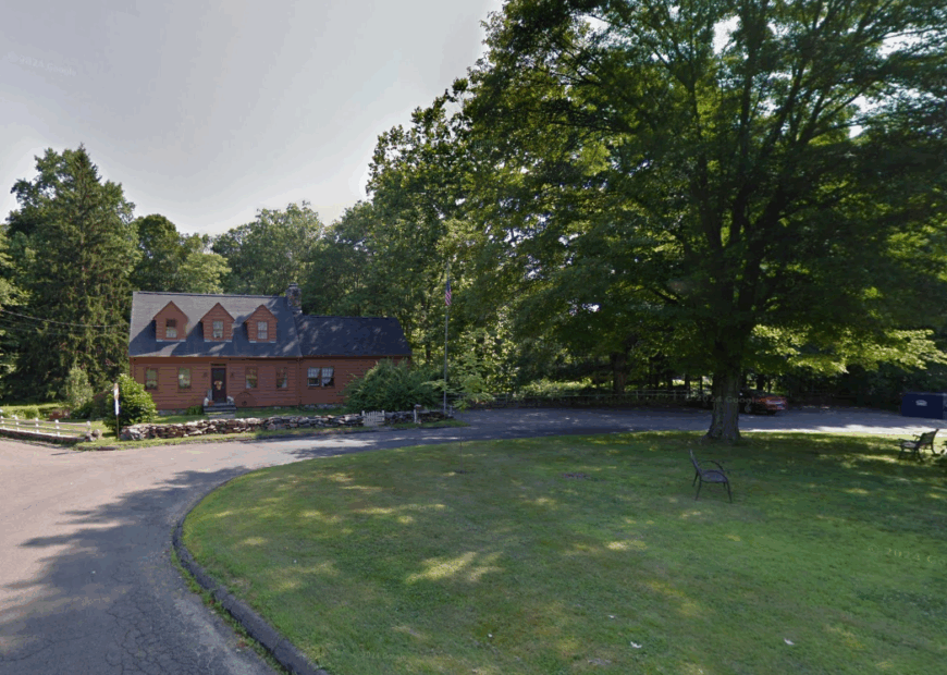
19. North Branford
🔥 Would you like to save this?
North Branford feels like a town caught between stone and sky, with traprock ridges rising behind quiet farms and low-slung houses. There’s no real rush here—just gentle routines and old gravel roads that trail off into the woods.
Quarry work once defined it, but now nature has reclaimed much of that space with trail systems and wildlife corridors. It’s a place of hidden streams, tall grasses, and fields that seem to lean back into time.
The feeling of distance comes not from geography, but from rhythm.
Where is North Branford?
Located in southern New Haven County, just east of New Haven and north of Branford, North Branford is easy to miss. The town sprawls into woodlots and hills that conceal its neighborhoods from the highway hum.
Lack of commercial sprawl and proximity to the Totoket Mountain range reinforce its secluded character.
18. Guilford

Guilford is known for its historic green, but what truly defines it are the lanes that meander beyond that center—past stone walls, colonial homes, and salt marshes that shimmer at low tide.
The town’s deeper edges are filled with winding roads where homes peek through trees and deer wander unbothered. Residents prize the quiet and guard it through open-space initiatives and strict development rules.
It’s a town that speaks in hushed tones, even when close to the shore.
Where is Guilford?
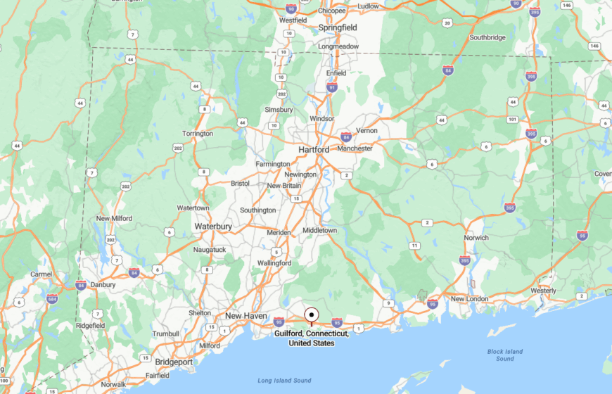
Guilford is located along the Long Island Sound, just east of New Haven. While Route 1 and I-95 skirt its southern edge, the heart of the town sits back among woods and fields.
The town’s preservation efforts and broad conservation lands act as natural barriers, giving it an almost rural feel despite its coastal location.
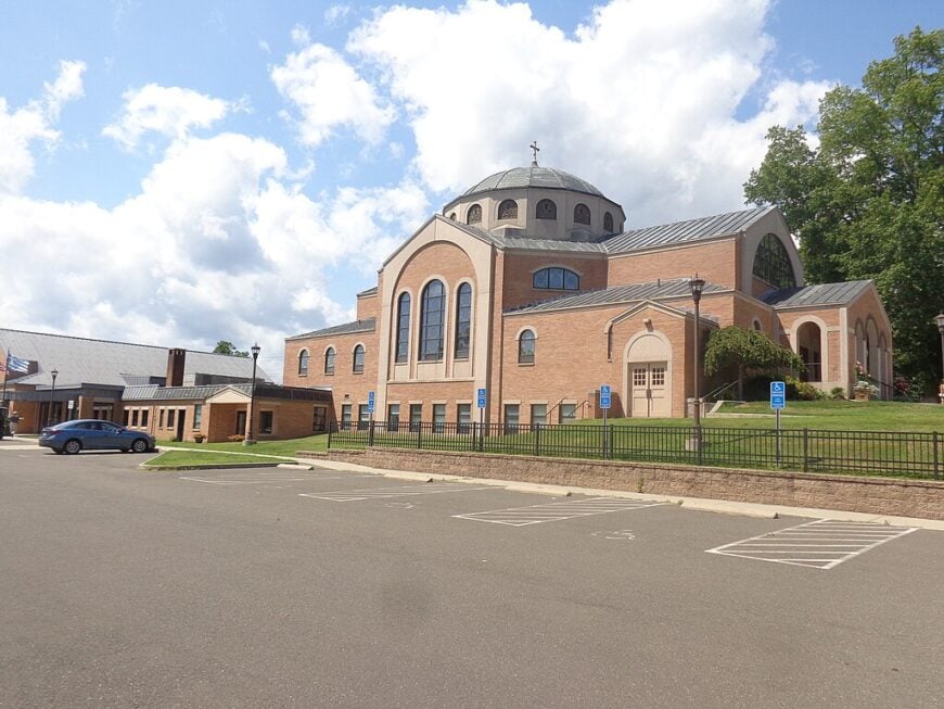
17. Durham
Durham is a place where hayfields roll into the horizon and silos mark the time more reliably than clocks. Home to Connecticut’s oldest fair, it maintains an agricultural spirit that keeps sprawl at bay.
Even the roads here seem older—narrower, more deliberate. The town center is small but dignified, surrounded by homes that sit well back from the road beneath twin maples and oaks.
Durham feels miles away from everything, even when it isn’t.
Where is Durham?
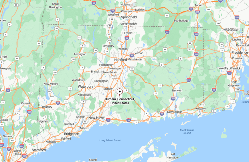
Durham sits in the northwestern corner of Middlesex County, bordered by Middlefield and Madison. It’s nestled just below the traprock ridges that define Connecticut’s central spine.
Most visitors arrive via Route 17, a tree-lined highway that winds gently through farms and open land. That sense of arrival through quiet countryside enhances the town’s deeply rural atmosphere.
16. Beacon Falls
Beacon Falls is a mill town wrapped in woodland, where the Naugatuck River winds through steep ravines and clapboard homes cling to the hills. Even with a train stop, it feels more hidden than found.
Its compact downtown quickly fades into trails and timber, and on certain roads, the sound of the river drowns out all else. Stone foundations and shuttered factories give it an echo of the past, but the real magic lies in its silence.
It’s a place that asks for nothing and gives peace in return.
Where is Beacon Falls?
Beacon Falls is in western New Haven County, between Seymour and Naugatuck. Though served by the Waterbury rail line, its station is small, and the surrounding ridges buffer the town from wider expansion.
Tucked between forest preserves and steep slopes, Beacon Falls remains a valley retreat, not a stopover.
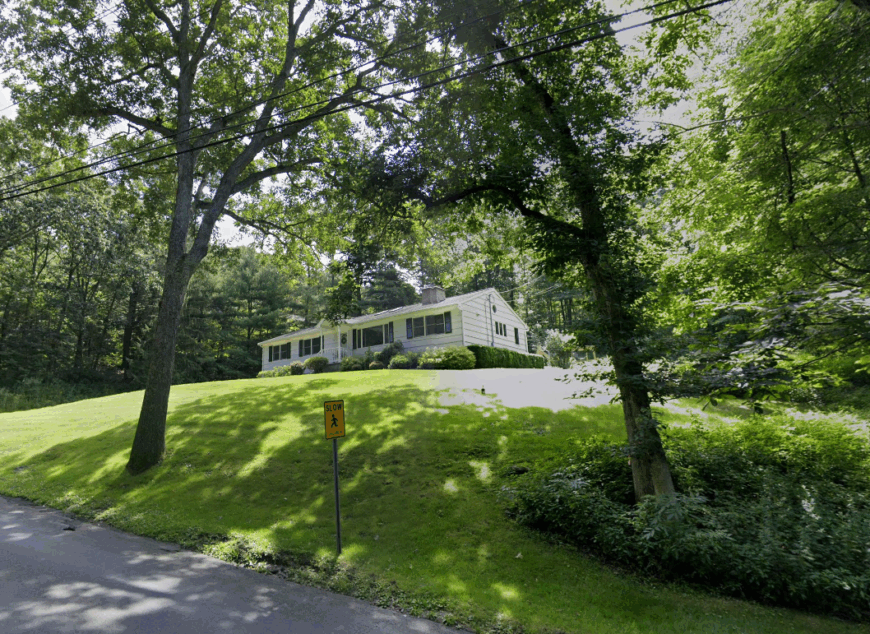
15. Orange
Orange is a quiet town hidden in plain sight—residential, pastoral, and edged with open fields and woodlots. Though close to New Haven, it resists sprawl with a deep sense of tradition and preservation.
Cows still graze beside quiet roads, and the town green hosts more family events than commercial ones. You’ll find history here not in museums, but in the feel of the air and the width of the fields.
In Orange, stillness is cultivated.
Where is Orange?
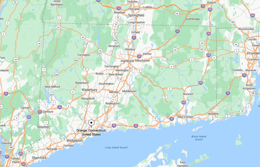
Orange lies in southern New Haven County, west of Milford and north of West Haven. It’s just a few miles from Long Island Sound but separated by elevation and farmland.
Because it lacks a downtown strip and major intersections, most travel flows around it—not through it—helping preserve its gentle hush.
14. Monroe
Monroe balances wooded silence with open farmland, its quiet roads curving past fieldstone walls and sun-dappled brooks. Evenings here belong to the wind through pines, and mornings rise slowly with mist drifting over inland ponds.
While the town holds its own modest center, the real Monroe stretches outward—where barns fade into forests and the only traffic light may be a maple tree casting afternoon shadows across the lane.
Where is Monroe?
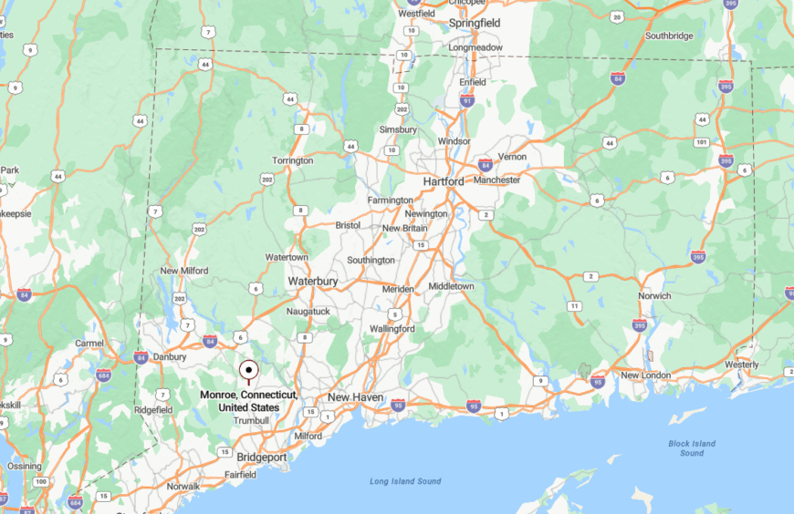
Monroe sits in eastern Fairfield County, between Newtown and Trumbull, with its boundaries shaped by steep ridges and watershed lands. Without a train station or commercial corridor, Monroe filters traffic through meandering roads like Routes 110 and 111—each turn more rural than the last. The absence of highway access keeps Monroe quietly self-contained.
13. Woodbury
🔥 Would you like to save this?
Woodbury spreads across a series of low hills and deep woods, where galleries and orchards rise behind moss-covered stone fences. Locals browse antique barns, harvest apples in silence, and walk trails where horse hooves once packed the earth smooth.
Even the air feels older here—seasoned by haylofts and woodsmoke—and the land holds a softness that resists hurry.
Where is Woodbury?
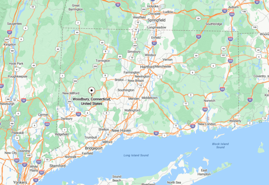
Tucked into the northwest corner of New Haven County, Woodbury lies north of Southbury and west of Middlebury. Route 6 curves through town, but development thins quickly beyond the green. Protected watershed zones and the Orenaug Hills contain sprawl and create long stretches of uninterrupted woodland.
12. Easton

Easton is a town of ponds, pastures, and quiet dignity, with clapboard homes that look unchanged since the 1800s. The air carries the scent of maple and lilac, and much of the land remains in active farming or protected conservation.
Even at midday, some roads seem to hum with stillness. Here, the hush isn’t enforced—it’s inherited.
Where is Easton?
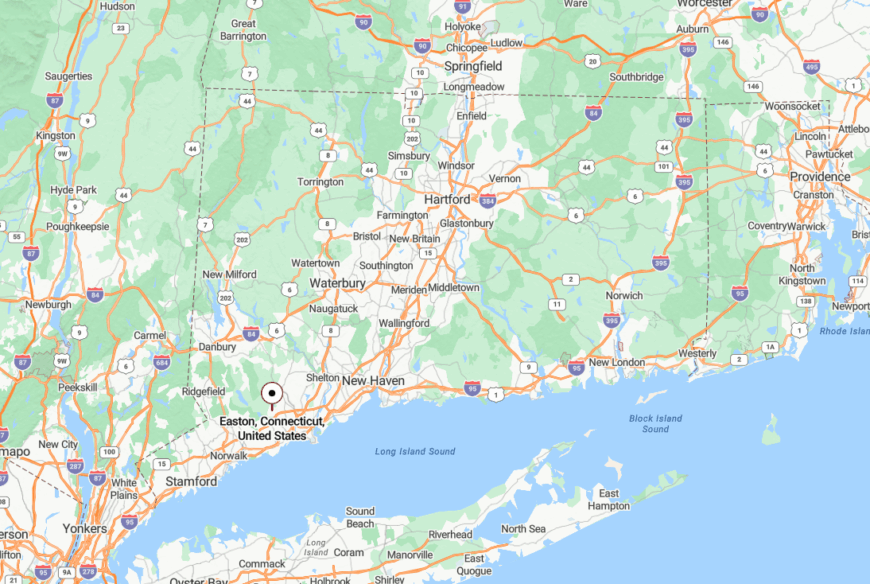
Easton occupies the northern edge of Fairfield, between Weston and Redding. It’s bounded by the Hemlock and Aspetuck Reservoirs, which form natural walls against expansion. With no commercial strip and only a handful of narrow routes like Route 59 threading through, Easton preserves a near-rural peace just miles from the coastline.
11. Woodbridge
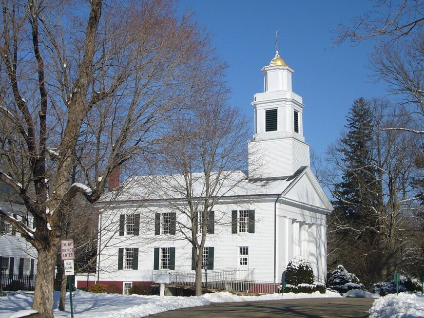
Woodbridge is a wooded hill town hidden in the shadow of New Haven, where sweeping lawns slope toward streams and deer trails. Its residential lanes drift through forests with names like Racebrook and Wepawaug, muffling even the thought of a horn.
There are no billboards, no neon signs—just the rhythm of crickets and the hush of wooded silence.
Where is Woodbridge?
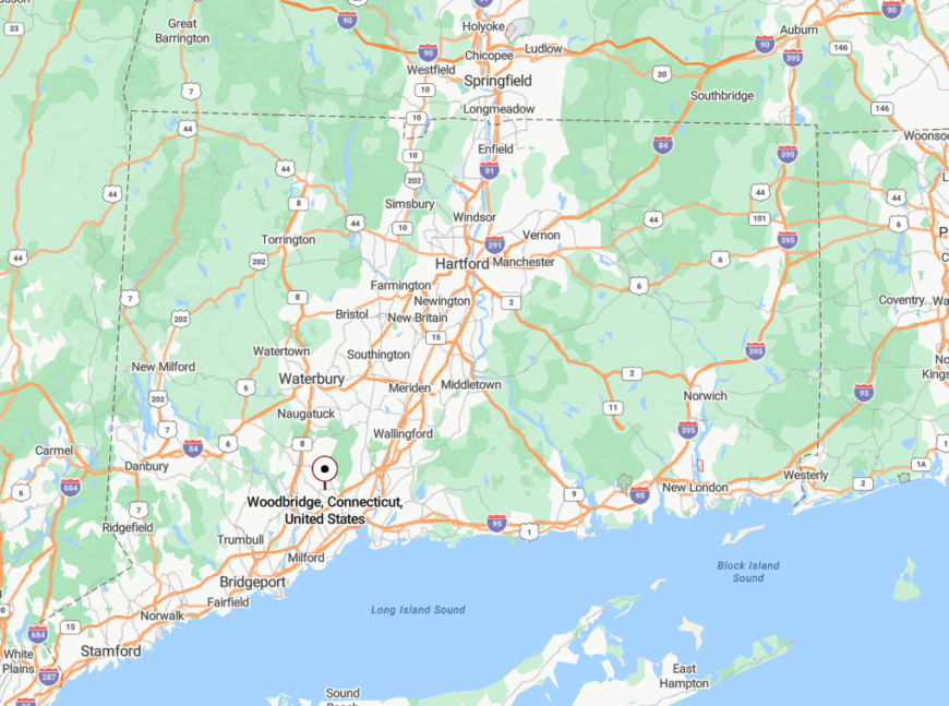
Woodbridge lies directly west of New Haven in southern New Haven County, but a patchwork of land trusts and topographical rises screens it from urban hum. Most visitors follow Route 114 or Route 63—slow, tree-lined roads that lead not through but into its canopy-draped neighborhoods. Even proximity to the Merritt Parkway doesn’t break the town’s calm.
10. Bridgewater
Bridgewater has about 1,700 residents, most of whom live on hilltop homesteads overlooking the Housatonic River. Weekends revolve around farm tours, kayaking runs that start at the Town Boat Launch, and leaf-peeping drives along Route 133.
Small-scale agriculture and home-based studios make up the main sources of income, with many residents also telecommuting to Danbury’s tech firms. The town bans drive-through eateries and keeps commercial zoning to a single general store, which limits outside traffic.
Lots average more than two acres, so houses sit far apart and the night is ruled by barred-owl calls rather than car horns. With the nearest supermarket fifteen miles away in New Milford, Bridgewater keeps its secluded feel without sacrificing basic necessities.
Where is Bridgewater?
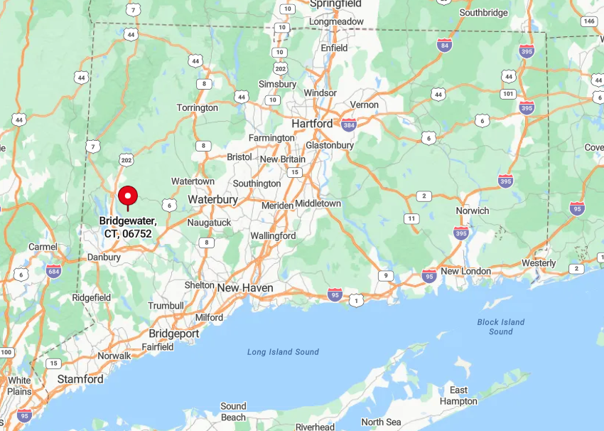
Bridgewater sits on a ridgeline in the northwest corner of Fairfield County, just north of the Housatonic’s Lake Lillinonah section. Forested slopes isolate it from the four-lane sprawl of Route 7 on the opposite riverbank.
Drivers reach town via the narrow steel-truss bridge from Brookfield or by curving up the two-lane Route 133 that dead-ends at Main Street. Those limited approaches preserve an “ended road” atmosphere that keeps pass-through traffic almost nonexistent.
9. Roxbury
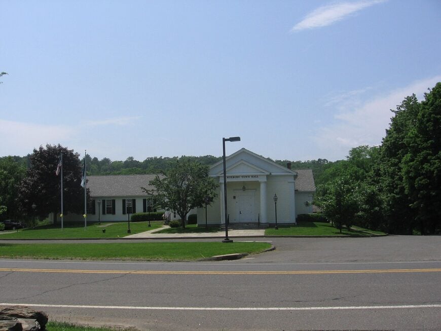
Only about 2,200 people call Roxbury home, and most live behind the iconic stone walls that lace its undulating farm country. Residents spend free days hiking the Roxbury Land Trust’s thirty-two trail miles, photographing the 1740s Mine Hill Preserve, or browsing apples at Maple Bank Farm.
Hay production, horses, and high-end artisanal food operations form the modest local economy, supplemented by remote workers who prize the town’s broadband and quiet. Nearly half the roads remain unpaved, so dust clouds and tractor ruts discourage casual through-drivers.
Minimum lot sizes of five acres in the farm district spread homes thinly across the hills, and town bylaws prohibit streetlights, keeping the Milky Way plainly visible. The absence of a central business zone keeps nighttime noise to crickets and coyotes, giving Roxbury an authentic back-country hush.
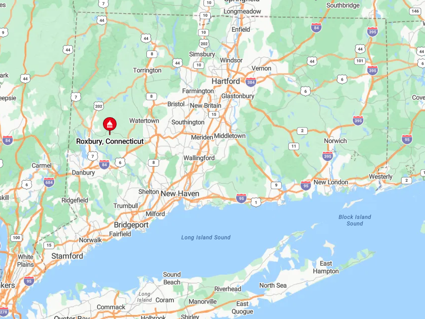
Where is Roxbury?
🔥 Would you like to save this?
Roxbury lies ten miles southwest of Woodbury in rural Litchfield County. The Shepaug River Valley and a collar of protected forest land block direct routes from the busier Route 8 corridor.
Visitors must snake along Routes 67 or 317, both winding two-lane roads that discourage speed. This layout leaves Roxbury only thirty minutes from I-84 yet psychologically a world away.
8. Killingworth
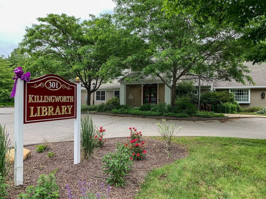
Killingworth’s woodland parcels shelter roughly 6,400 residents among stone-bound fields and white-pined ridges. Locals fish for trout in the Hammonasset River, bike the Airline Rail Trail, and picnic beside the covered bridge in Chatfield Hollow State Park.
The economy centers on small contracting firms, garden nurseries, and home offices that serve the shoreline towns but prefer a forested address. Zoning requires five-acre minimums in most districts, so mailboxes often stand hundreds of feet apart on shared gravel drives.
Boundaries with Cockaponset State Forest and two large reservoirs intercept cut-through traffic from Route 1, granting Killingworth a back-road calm even on summer weekends. Evening skies remain dark enough for the local astronomy club to hold star parties in hayfields without light filters.
Where is Killingworth?
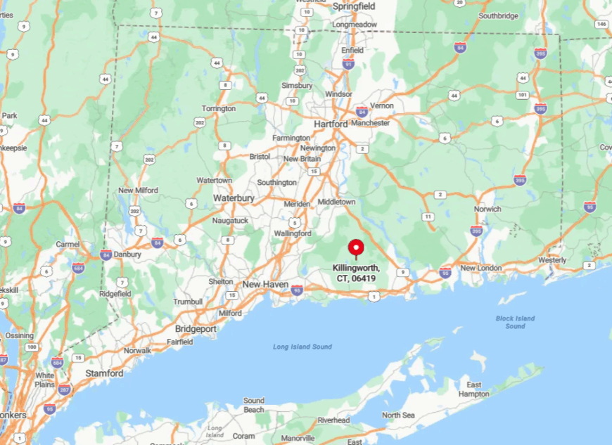
The town rests midway between New Haven and Old Saybrook, five miles inland from Long Island Sound in south-central Connecticut. Rolling hills hide it from Interstate 95’s ocean of headlights, and the nearest train stop is twenty minutes away in Clinton.
Access comes via Routes 80 and 81, a pair of two-lane state roads lined with stone walls and maples. That geographic pocket creates a buffer that keeps beach traffic firmly on the shoreline and away from Killingworth’s wooded heart.
7. Lyme
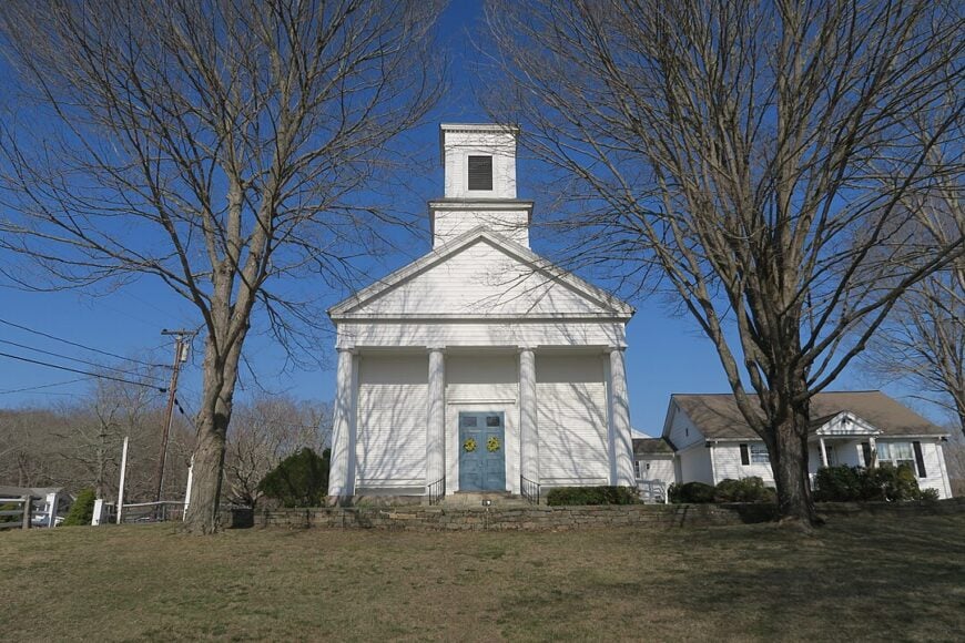
Home to about 2,400 people, Lyme is draped across the Connecticut River’s east bank where ridges fall into secluded coves. Residents paddle from Hamburg Cove at dawn, hike the Selden Creek Preserve, or shop for heirloom seeds at Ballek’s Garden Center.
Local livelihoods include small vineyards, shellfish aquaculture, and seasonal art galleries clustered near the ferry landing. Over half of the town is conservation land managed by land trusts and state agencies, so new construction is scarce.
Houses sit on one- to ten-acre parcels tucked behind stone gates, making neighborhood lights nearly impossible to spot from the river channel. The absence of chain stores and through highways strengthens Lyme’s sense of removed tranquility despite the relative bustle across the water in Old Lyme. Lyme is more rural, hilly, and buffered by conservation land with fewer through-roads.
Where is Lyme?
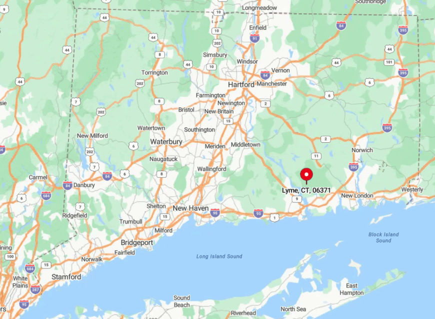
Lyme occupies the narrowest curve of the lower Connecticut River, opposite Old Lyme and south of East Haddam. High bluffs and a tangle of estuarine creeks mean no interstate or rail line cuts through town.
Visitors generally reach Lyme via the Chester–Hadlyme ferry or by meandering along Route 156, both scenic byways that slow traffic to thirty-five miles per hour. The river, protected marshes, and limited crossings together insulate the community from coastal congestion.
6. East Haddam
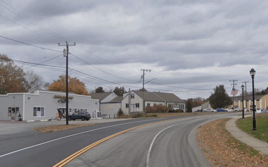
East Haddam counts roughly 9,000 residents scattered around Bashan Lake, Moodus Reservoir, and miles of forested hills. Day outings include catching a show at the historic Goodspeed Opera House, climbing the stone tower in Gillette Castle State Park, and swimming off the town-maintained beach at Lake Hayward.
Tourism tied to these sights blends with small farming and craft brewing to anchor the local economy. Zoning demands at least three acres per dwelling, while reservoir watersheds legally bar dense development.
Because the famous swing bridge over the Connecticut River is the only direct route from Route 9, visitor flow remains modest outside summer weekends. The resulting quiet allows loon calls on the lakes to outnumber car horns even in July.
Where is East Haddam?
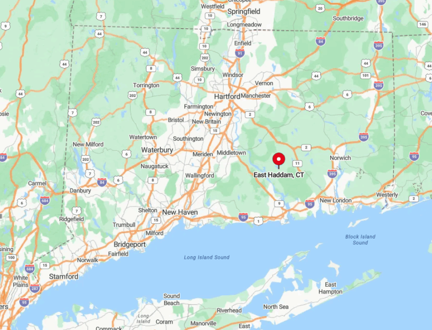
The town lies on the east bank of the Connecticut River, ten miles north of Old Saybrook in southern Middlesex County. Ridges of schist and a checkerboard of state parks block straight-line travel from coastal highways.
Drivers approach by exiting Route 9 at Haddam, crossing the narrow 1913 swing bridge, and winding up Route 82 through forest. With the bridge closed several times a day for boat traffic, the journey itself helps preserve East Haddam’s slower tempo.
5. Sherman
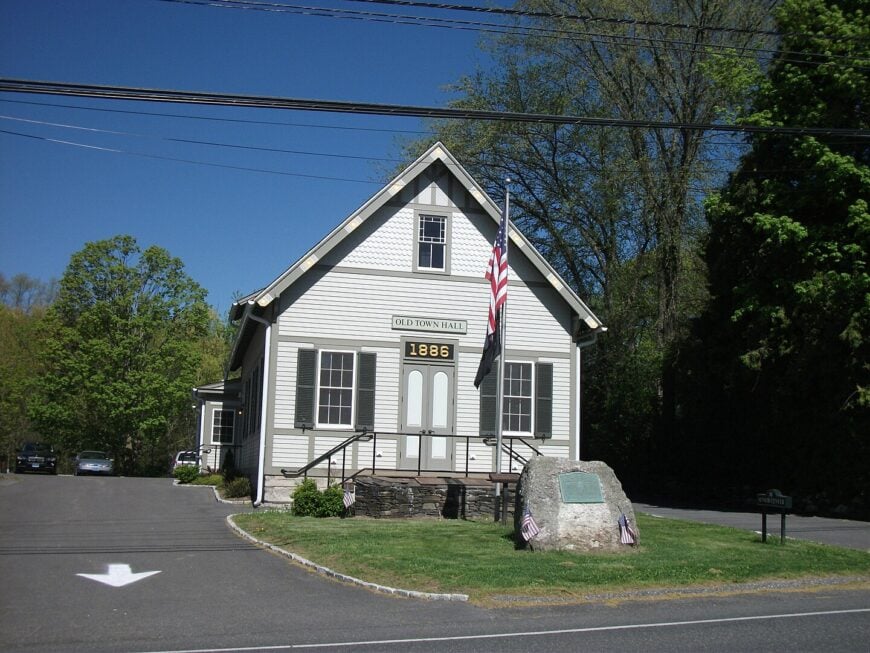
Sherman, the northernmost town in Fairfield County, shelters about 3,600 residents between Candlewood Lake and the New York state line. Boating on the lake, hiking in Hadlow Preserve, and waffles at the White Silo Farm & Winery’s barn events fill weekend calendars.
Real estate, specialty farming, and home-based digital work dominate employment, with many residents commuting once or twice a week to White Plains or Manhattan. Only one traffic light exists, and zoning maintains one-acre minimums that quickly rise to two around the lake, spacing cottages into the treeline.
The vessel-only western border and Pootatuck State Forest to the east box in roadways, eliminating shortcuts between Route 7 and Route 22 in New York. Even July vacationers rarely hear more than outboard motors and cicadas after dark, affirming Sherman’s place as a back-pocket hideout.
Where is Sherman?
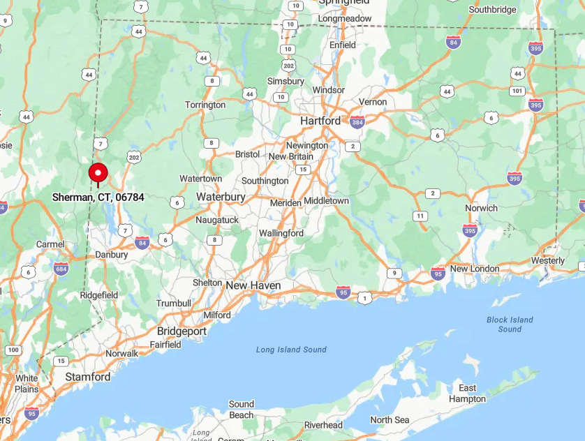
Sherman wraps around the north end of Candlewood Lake, about twenty miles north of Danbury. The lake itself and steep drumlin hills keep high-speed corridors at bay.
Access comes mainly from the serpentine Route 37 or by boat via the public launch in New Fairfield. Because no interstate passes within ten miles, traffic remains mostly local even during foliage season.
4. Weston
Weston’s estimated population of 10,300 lives among hardwood ridgelines and the Saugatuck River Valley’s rocky ledges. Residents frequent Devil’s Den Preserve, canoe calm stretches of the river, and browse produce at Lachat Town Farm’s Friday markets.
Professional services and remote finance work, rather than retail, sustain the tax base, as the town has no commercial strip beyond a small center with a market and post office. Mandatory two-acre lots and a town-wide ban on streetlights maintain low density and dark skies despite Weston’s presence in affluent Fairfield County.
Natural buffers of reservoir land and the river gorge separate it from Route 7 and the Merritt Parkway, muting any hum of commuter traffic. These policies let residents hear spring peepers instead of delivery trucks even though Westport’s shoreline boutiques sit only six miles away.
Where is Weston?
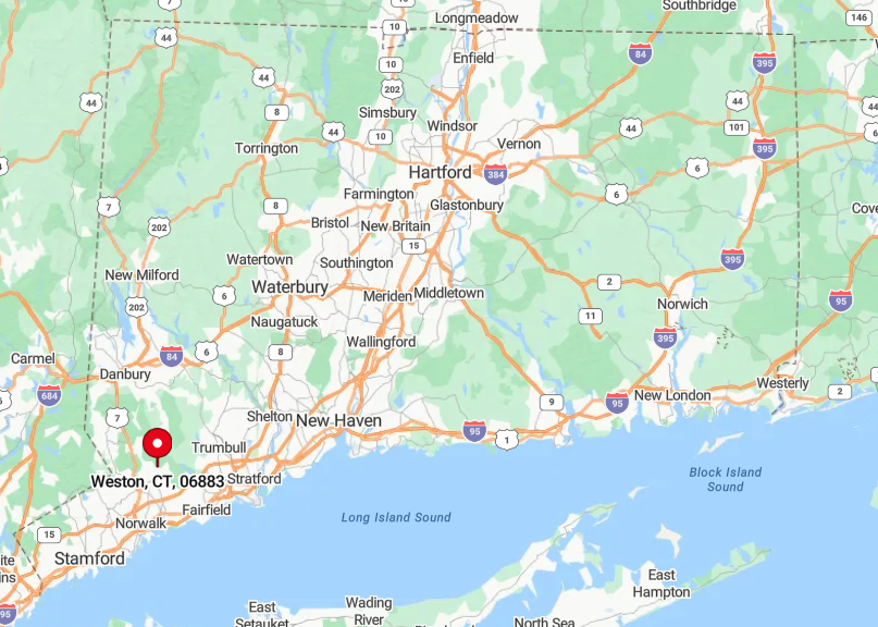
Weston occupies the hills between Westport and Redding in southwest Connecticut. The Aspetuck and Saugatuck reservoir systems create water-company greenbelts that deter direct road building.
Travelers must thread along Routes 53 or 57, both narrow and winding, with no train station within town limits. This limited access, coupled with surrounding woodlands, keeps Weston quietly detached from the county’s busy coastal strip.
3. North Stonington

About 5,200 people reside in North Stonington, a spread of colonial farmhouses and cedar swamps bordered by Pachaug State Forest. Days off revolve around blueberry picking at Holmberg Orchards, horseback rides across Hewitt Farm’s meadows, and waterfall hunting along Wyassup Brook.
Agriculture and small-scale viticulture drive the local economy, while several residents work at nearby Foxwoods Casino yet choose country nights over neon lights.
More than half the land remains undeveloped, and zoning allows only one house per two acres outside the village, so clusters of light disappear quickly after sunset.
The forest’s 27,000 acres, plus aquifer-protection zones, block direct access from I-95 and Route 2 despite their proximity. As a result, North Stonington enjoys quiet even on summer weekends when Mystic five miles away bustles with tourists.
Where is North Stonington?
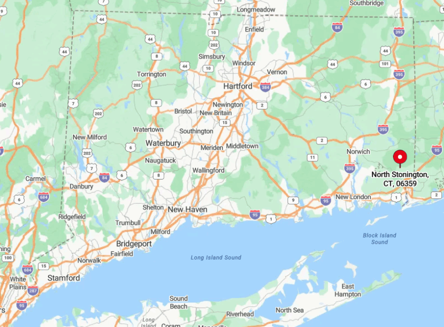
The town lies in southeastern Connecticut, wedged between the Rhode Island border and the Mystic River corridor. Ridges of the Pawcatuck River watershed and the bulk of Pachaug Forest isolate it from shoreline traffic.
Visitors exit I-95 at Exit 92, then wind north along Route 2 for seven miles of farm scenery. Lack of a rail stop and the forest’s maze of dirt fire roads keep the census lanes blissfully empty.
2. Salem

Salem hosts roughly 4,200 residents in a basin of hidden meadows and stone-ringed ponds just north of the Route 11 stub. Locals spend weekends paddling Gardner Lake, wandering Fairy Lake Farm’s pick-your-own fields, and catching bluegrass sets at the Salem Historic Society’s music nights.
Employment leans on niche farming, artisanal cheese operations, and flexible work tied to New London’s defense industry down the road. Five-acre homestead requirements and an absence of a true town center keep commercial lighting to a single blinking caution beacon on Route 85.
Encircling hills and forest tracts disrupt cell service in pockets, reinforcing the sense of being off the map. Because most travelers stay on I-395 or Route 2, Salem’s back lanes hear more farm tractors than delivery vans.
Where is Salem?
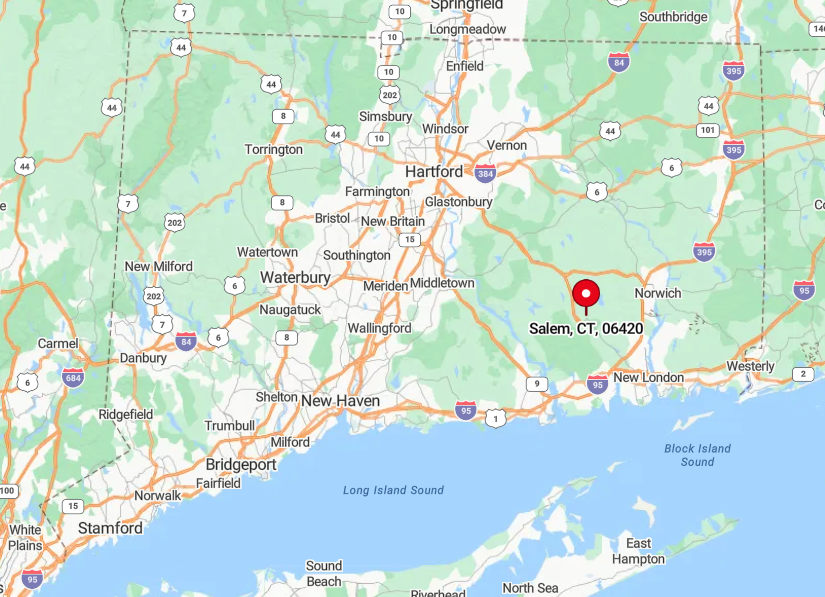
Salem sits twelve miles northwest of New London, bordered by Colchester, Montville, and East Haddam. The unfinished Route 11 ends abruptly at its southeast corner, diverting through traffic onto distant highways.
Drivers approach via Routes 82 or 85, both rolling two-laners lined with sugar maples and stone walls. This gap in the highway network preserves Salem’s quiet pockets despite its position near two small cities.
1. Redding

Around 8,900 people reside in Redding, a landscape of forested ravines, colonial lanes, and the glacially carved Norwalk River Valley. Outdoor life centers on 4,000-acre Huntington State Park, waterfalls along Devil’s Den’s red trail, and Saturday mornings at the longstanding New Pond Farm market.
The local economy blends equestrian stables, organic farms, and professional commuters who ride the branch-line train only as far as Westport. Sixty percent tree cover, three active land trusts, and zoning that favors two-acre parcels scatter homes thinly.
Deep gorges and one-lane bridges over the Saugatuck cut off logical east-west shortcuts, so delivery apps require extra lead time here. These natural barriers ensure nights stay as dark as they were when Mark Twain summered nearby over a century ago.
Where is Redding?
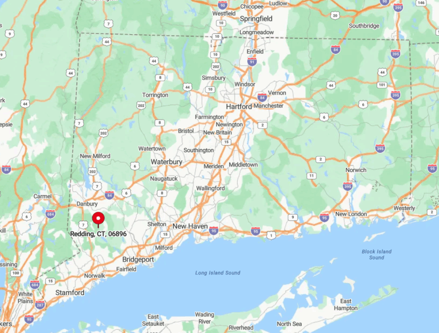
Redding lies in northern Fairfield County, sandwiched between Bethel and Ridgefield yet tucked away from their commercial strips. The absence of a numbered highway through town, combined with the steep Topstone and Hemlock Reservoir watersheds, blocks regional drive-through traffic.
Travelers typically exit the Merritt Parkway at Route 58 or leave I-84 at Bethel, then weave along shoulder-less back roads that crest and plunge through forest. The railroad’s single-track branch offers limited service, which, along with the terrain, cements Redding’s status as our quietest Southern Connecticut refuge.