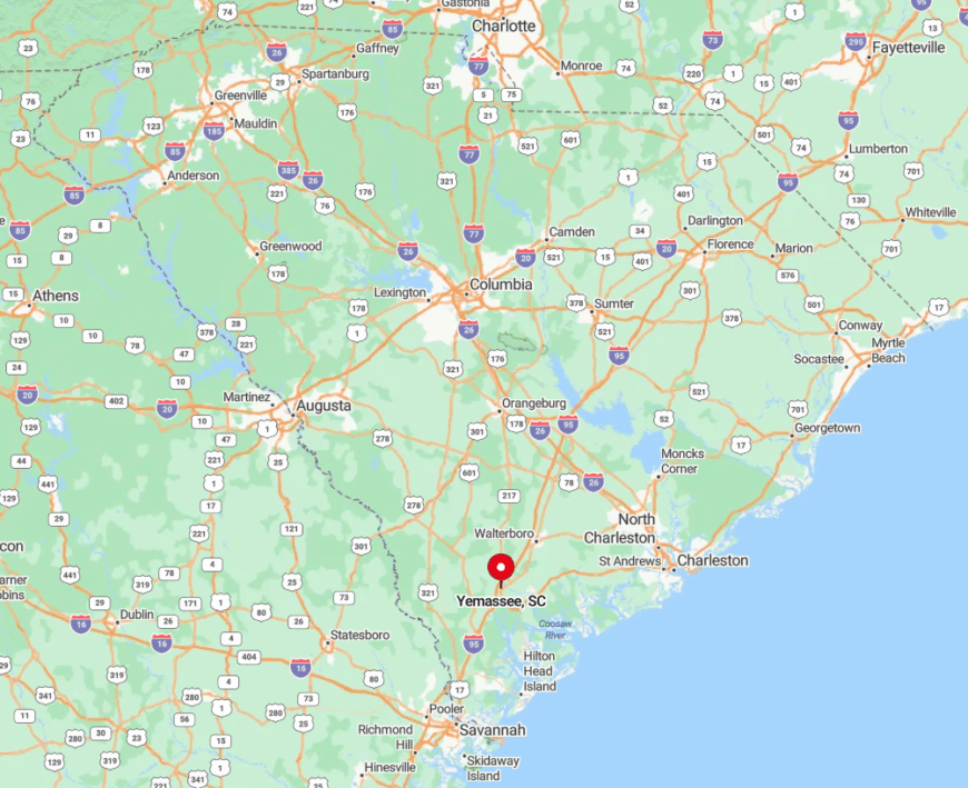
Quiet roads, moss-draped oaks, and water that stretches to the horizon—Southeast South Carolina still hides pockets where the rush of modern life feels far away. Our roundup explores 25 such towns, each with its own rhythm, its own hidden corners, and just enough neighbors to fill a café booth.
In order to come up with the very specific design ideas, we create most designs with the assistance of state-of-the-art AI interior design software. Also, assume links that take you off the site are affiliate links such as links to Amazon. this means we may earn a commission if you buy something.
We touch on shrimp-boat docks that creak in the breeze, ferry rides where dolphins draft in the wake, and crossroads where the nearest traffic light sits miles off. Readers will find historic chapels, abandoned airstrips, and mile-wide marsh views that hush even the most energetic visitor.
These places remind us why Lowcountry storytellers speak softly; the landscape does most of the talking. Pack bug spray, an extra memory card, and a taste for porch swings—seclusion in South Carolina has many addresses.
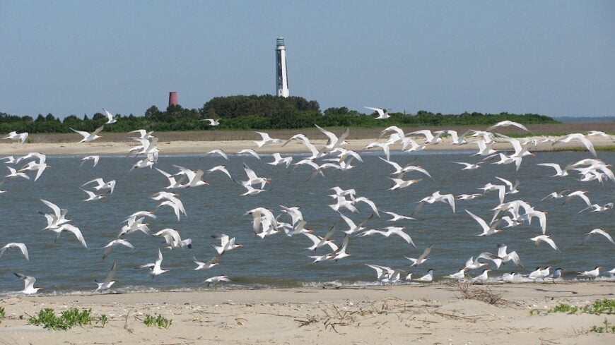
25. Edisto Island: Tides, Tabby Ruins, and Porches Facing West
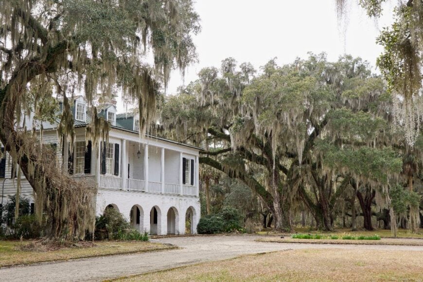
Edisto Island feels worlds away, with salt marshes, tidal creeks, and sandy roads leading to cottages that have stood for generations. The vibe is rustic and deeply tied to the rhythm of the tides, with tabby concrete ruins whispering of a colonial past.
Visitors kayak through ACE Basin estuaries, comb seashell-strewn beaches at Botany Bay, or linger at local seafood shacks that serve hushpuppies hot from the fryer. Many residents still work in fishing or eco-tourism, carrying on the island’s longstanding relationship with the water.
With few chain businesses and nights dark enough to see the Milky Way, the island feels timeless. It’s the kind of place where a porch swing at dusk provides more entertainment than a screen ever could.
Where is Edisto Island?

Edisto Island sits about 45 miles southwest of Charleston, at the end of SC 174. Access requires crossing causeways that wind past spartina grass and abandoned rice fields, heightening the sense of leaving the mainland behind.
The island is hugged by the Atlantic on one side and the ACE Basin’s marshes on the other. By the time you cross the Dawhoo River Bridge, the rest of the world already feels far away.
24. Wadmalaw Island: Tea Fields and Backwater Stillness
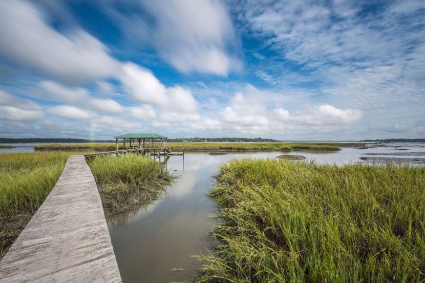
Wadmalaw Island hides just south of Charleston yet feels like a secret world of its own, buffered by tidal creeks and mossy oak corridors. The mood here is pastoral, with fields of camellias and the only tea plantation in North America stretching across quiet acres.
Travelers sip sweet tea at Charleston Tea Garden, explore Deep Water Vineyard, or paddle through Bohicket Creek where dolphins surface at dawn. Farming and small-batch winemaking remain anchors, with little sign of suburban creep.
There are no large hotels or resorts—just cottages, chapels, and dirt lanes that glow in late afternoon light. Time slows here, reminding visitors that silence is a luxury.
Where is Wadmalaw Island?
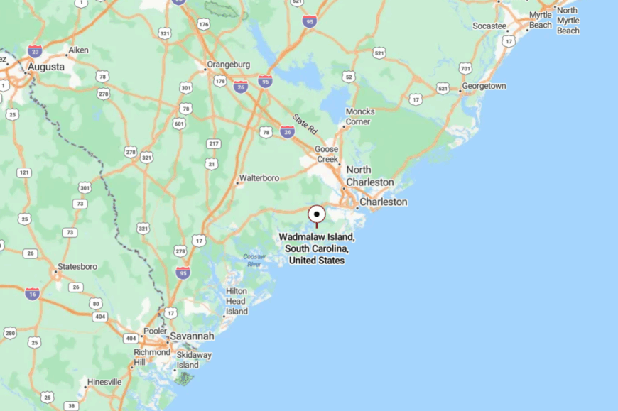
Wadmalaw Island rests about 20 miles south of downtown Charleston, reached by a series of narrow bridges past Johns Island. The island is surrounded on all sides by salt marsh and tidal rivers, limiting through traffic.
SC 700 delivers most visitors, a two-lane road lined with pecan orchards and century-old oaks. The last few miles feel like a narrowing tunnel into another era.
23. Meggett: Creekside Calm at the Edge of Charleston County
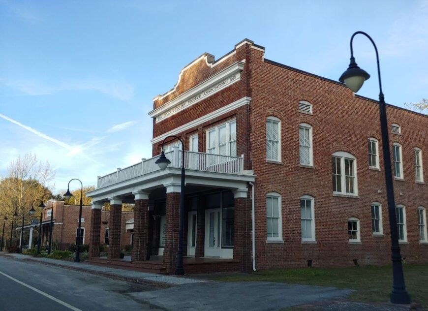
Meggett, with just over 1,000 residents, holds a rare balance of coastal wetlands and farmland stretching to the horizon. The town vibe is slow and agrarian, dotted with shrimp docks, old farmhouses, and gardens heavy with figs and collards.
Activities lean toward crabbing on Toogoodoo Creek, photographing sunflower fields, and strolling Meggett County Park with its long marsh boardwalks. Many residents still live by small-scale fishing or seasonal farming, passing traditions down through family lines.
The night air hums with frogs and cicadas, free of neon glow or city traffic. For those who come, Meggett feels like the Lowcountry distilled into its quietest form.
Where is Meggett?
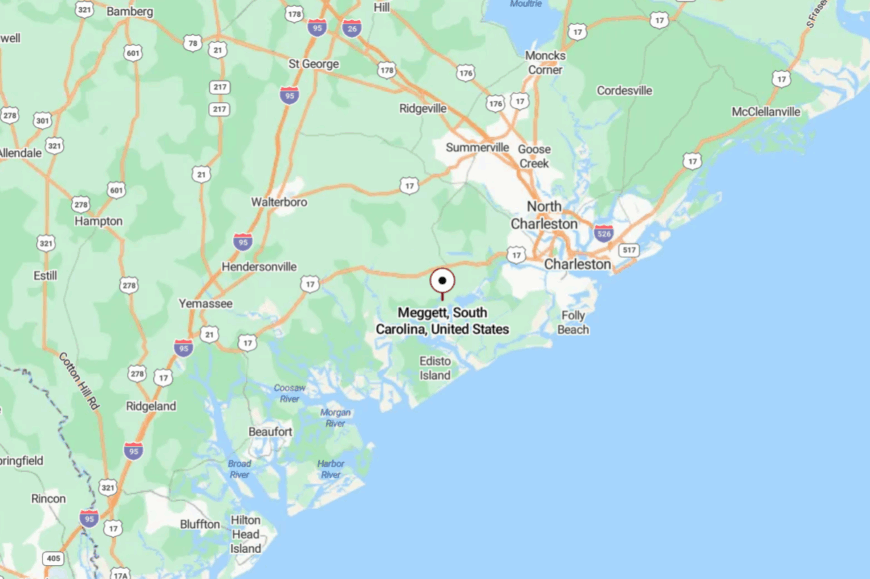
Meggett lies in southwestern Charleston County, about 30 miles from downtown Charleston. It’s reached by SC 165, which narrows to two lanes as it winds through pine forests and creeklands.
The town hugs tidal rivers that act as natural buffers, keeping it insulated from development. By the time you pass the marshes of Toogoodoo, you feel the pace of life slowing.
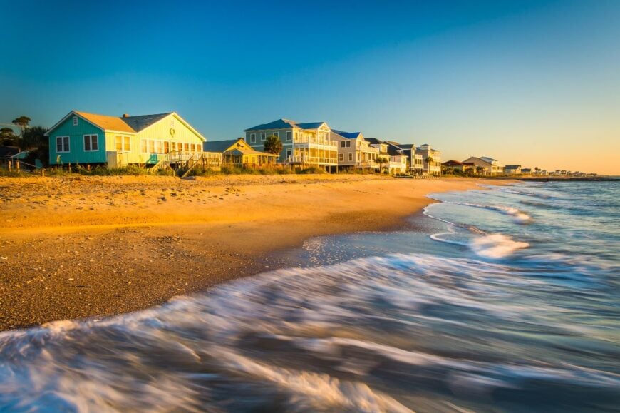
22. Seabrook, Beaufort County: Pastures and Port Royal Breezes
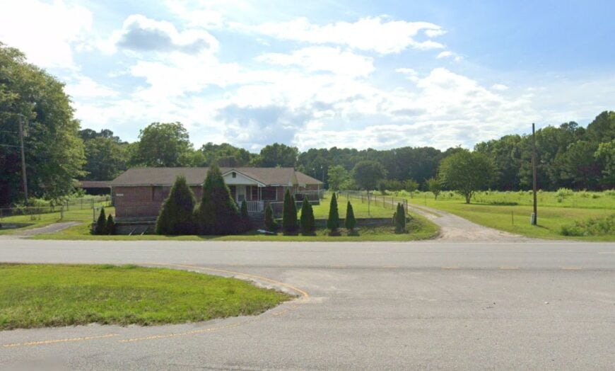
Seabrook is a wide-stretched community where open farmland meets the quiet shallows of Whale Branch. Its mood is pastoral and understated, with horses grazing near clapboard houses and locals gathering at roadside produce stands.
Visitors fish off low bridges, explore antebellum ruins tucked in the woods, or kayak the tidal creeks that glisten at sunset. Farming and small marine repair businesses shape the local economy, while Beaufort’s bustle stays a world away.
The air smells of salt and plowed earth, a reminder that both land and water shape life here. The town’s pull lies in its unadorned beauty, where quiet is the rule rather than the exception.
Where is Seabrook?
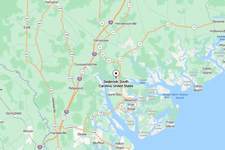
Seabrook sits about 7 miles north of Beaufort, just off U.S. 21. Surrounded by tidal waters and wetlands, it feels tucked away despite its nearness to the county seat.
Narrow rural roads weave through pine groves before opening onto broad pastures. By the time you reach Whale Branch Bridge, you know you’ve crossed into quieter country.
21. Bennett’s Point: End of the Road in the ACE Basin
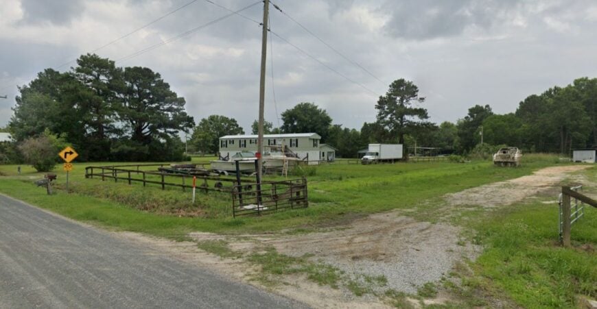
Bennett’s Point feels like the Lowcountry’s last whispered note, where the blacktop gives way to marsh and sky. The vibe is salt-soaked and quietly wild—shrimp boats idle at small docks, egrets patrol the mudflats, and porches face water the color of tea.
Days slip by with kayak drifts on Mosquito Creek, birding at Donnelley Wildlife Management Area, and casting for redfish along oyster-studded banks. There’s no real “downtown”—just a landing, a few cottages, and the steady work of fishing, guiding, and tending boats.
Nights are dark enough to hear the tide turn, and stars come on like lanterns over the spartina. What secludes it is simple: water on three sides, miles of protected estuary, and a road that chooses to end rather than pass through. It’s the kind of place that teaches you how to breathe a little slower.
Where is Bennett’s Point?
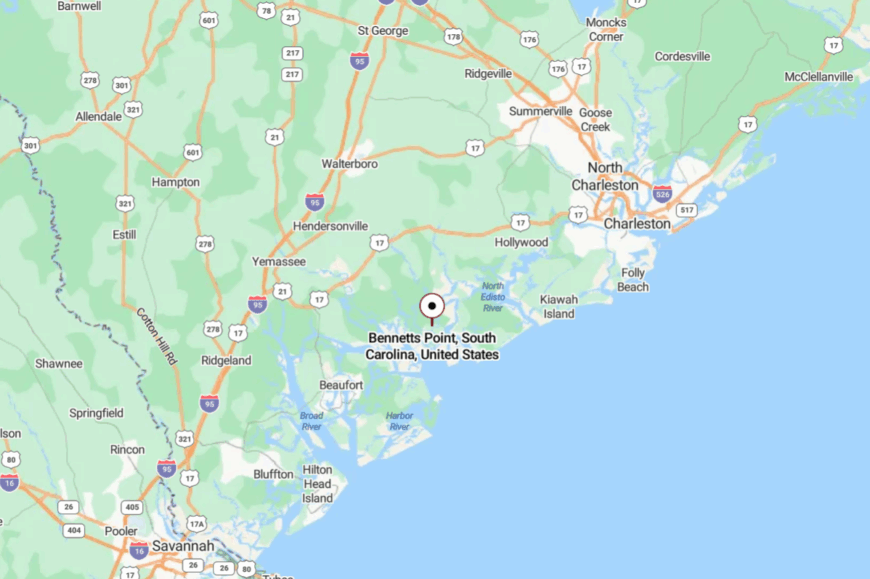
Tucked deep in Colleton County’s ACE Basin, Bennett’s Point sits roughly 20 miles southeast of Walterboro. You reach it by following SC 303 and Bennett’s Point Road until the marsh hems you in and options fall away.
With estuaries and wildlife lands surrounding it, the community stays naturally insulated from development. It’s close enough for a day trip, but far enough to feel like the map fades at the edges.
20. Jacksonboro: A River Hamlet with Revolutionary Ghosts
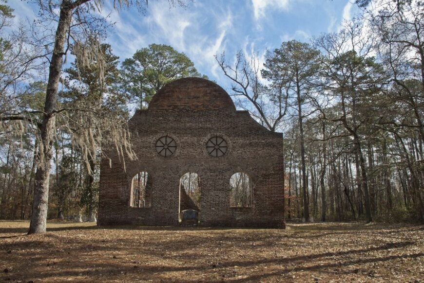
Jacksonboro, tiny and understated, hugs the banks of the Edisto River where history lingers in quiet corners. The town vibe is both rustic and haunted, with abandoned houses leaning toward the water and tales of colonial meetings held in its single standing chapel.
Travelers pause to fish at the riverbank, photograph the Pon Pon Chapel of Ease ruins, or explore shaded roads that dip into the marsh. Farming and forestry remain the backbone of local life, with little sign of modern development.
The river floods with cypress knees at high tide, making evenings shimmer with reflections. Jacksonboro feels like a whispered story still waiting to be told.
Where is Jacksonboro?
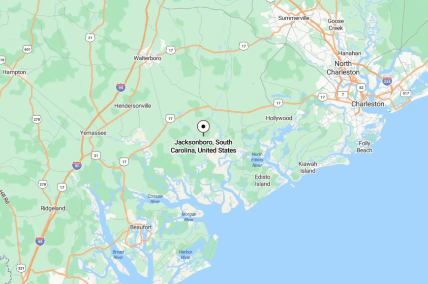
Jacksonboro lies in Colleton County along U.S. 17, about 35 miles southwest of Charleston. The Edisto River shapes its edges, with swamp and marsh hemming in the roads.
Travelers cross narrow bridges and long stretches of forest to reach it. Arrival feels less like entering a town and more like discovering a memory preserved by the river.
19. Hollywood: Rural Roads and Porch Conversations
🔥 Would you like to save this?
Despite its glamorous name, Hollywood is a farming town where watermelons, soybeans, and roadside stands define the landscape. Its vibe is neighborly and grounded, with evenings spent in church halls or on porches facing the marsh.
Visitors can fish at Bulow Landing, tour historic farms, or birdwatch along the ACE Basin’s protected estuaries. Agriculture anchors the economy, supplemented by fishing and small family businesses.
Nights are marked by the distant lowing of cattle and the glow of fireflies over fields. Hollywood’s quiet charm lies in its unhurried pace and unassuming grace.
Where is Hollywood?
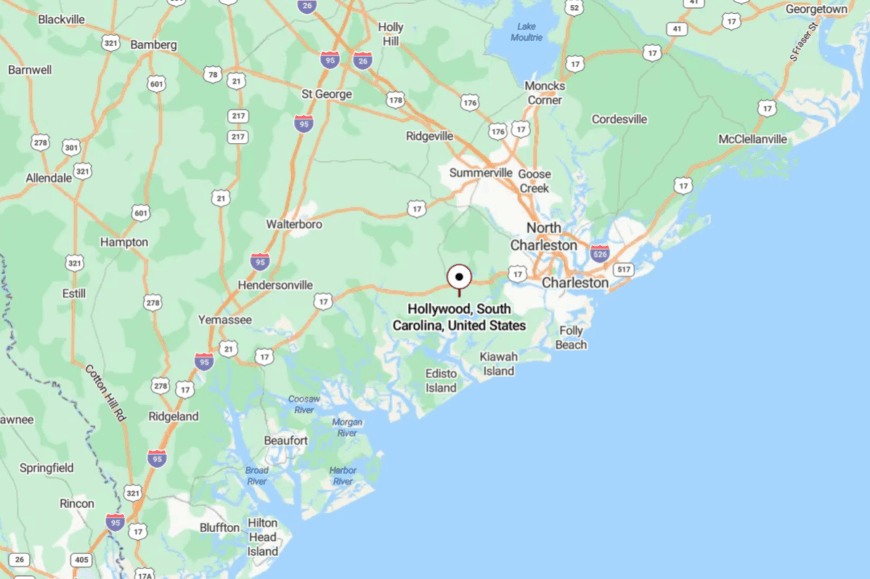
Hollywood rests about 20 miles southwest of Charleston, accessible by SC 162 and SC 165. Surrounded by marsh and farmland, it has resisted the sprawl that crept closer with every passing decade.
Roads curve through pecan orchards and soybean fields before revealing the town. Close enough to Charleston, yet still a world apart, it holds onto its rural calm.
18. Saint Helena Island: Gullah Roots and Ocean Breezes
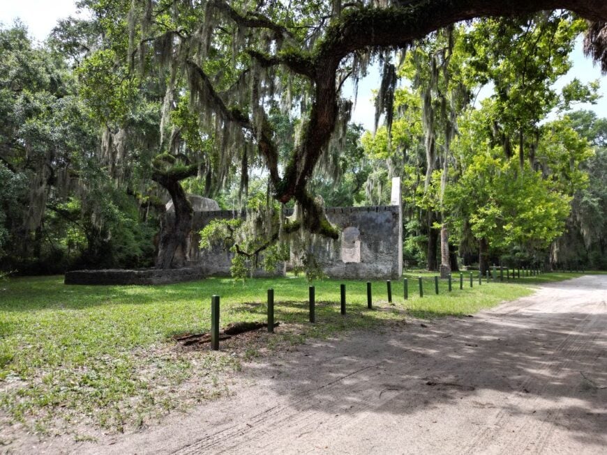
Saint Helena Island carries a deep cultural heritage, where Gullah traditions thrive alongside tidal rhythms. The vibe is soulful and vibrant yet deeply secluded, with praise houses and fishing shacks standing amid live oaks.
Visitors wander the Penn Center, one of the first schools for freed slaves, kayak tidal creeks, or buy handmade sweetgrass baskets. Oystering, shrimping, and heritage tourism form the backbone of the economy.
Nights are filled with gospel echoes and the sound of waves across Port Royal Sound. To step onto Saint Helena is to step into living history, preserved by saltwater barriers and pride of place.
Where is Saint Helena Island?
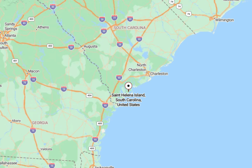
Saint Helena Island lies east of Beaufort, accessible via Sea Island Parkway (U.S. 21). Surrounded by waterways, it feels insular even though bridges connect it to the mainland.
Travelers pass through salt marsh corridors and causeways before reaching its heart. The island’s natural and cultural buffers protect its timeless atmosphere.
17. Ravenel: Pines and Produce Stands on the Edge of Nowhere
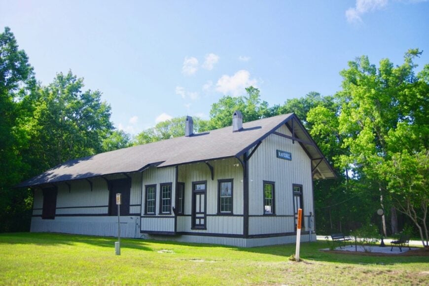
Ravenel blends pinewood stillness with a strong farming presence, making it feel like a pause between Charleston and the countryside beyond. Its vibe is plainspoken and earthy, where tractors outnumber commuters and community gatherings center on farm stands.
Visitors shop for heirloom tomatoes, explore the swampy margins of the Stono River, or attend summer festivals that feature bluegrass and barbecue. Agriculture dominates the landscape, with small businesses tied to farming or lumber.
The two-lane highways are often empty, broken only by cicada song and passing freight trains. Ravenel invites you to measure time in crops and sunsets rather than clocks.
Where is Ravenel?
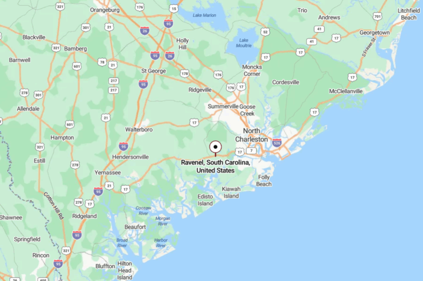
Ravenel lies along U.S. 17, about 20 miles west of Charleston. Surrounded by pine forests and farmland, it has little traffic beyond those passing through.
The journey is a straight, quiet road flanked by pecan orchards and feed silos. Once there, the air feels still enough to settle in your chest.
16. Cottageville: Railroad Echoes and Cypress Shade
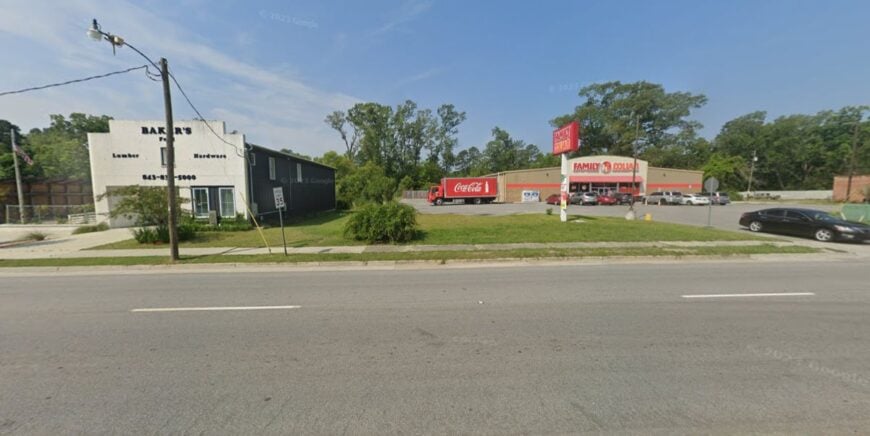
Cottageville, with fewer than 1,500 residents, sits in a landscape shaped by long-abandoned rail lines and thick forests. Its vibe is hushed and nostalgic, with old cottages dotting shaded lanes and neighbors greeting one another at the town’s single diner.
Visitors hike in Colleton State Park, fish the Edisto River, or explore the remnants of tobacco barns hidden in pine groves. Small logging operations and farming fuel the economy, keeping life rooted in the land.
Trains pass only rarely, their whistles fading into the canopy. Cottageville feels like a town that decided to stay tucked away on purpose.
Where is Cottageville?
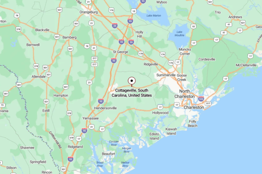
Cottageville lies about 40 miles west of Charleston, off U.S. 17A in Colleton County. It’s reached through winding two-lane roads bordered by pines and farmland.
The Edisto River skirts its edge, providing both beauty and natural isolation. By the time you arrive, the outside world feels comfortably distant.
15. Lobeco: Farm Fields and Wide Horizons
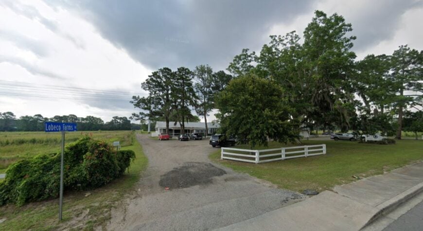
Lobeco is more crossroads than town, its fields stretching far between scattered houses and a single country store. The vibe is deeply rural and agricultural, with rows of tomatoes, corn, and squash defining the landscape.
Visitors often stop to fish tidal creeks, tour roadside farms, or explore nearby ACE Basin preserves. Farming dominates livelihoods here, with produce markets carrying on decades of tradition.
The land is so open that sunsets seem to last forever, painting fields gold and crimson. Lobeco charms those who find peace in quiet abundance.
Where is Lobeco?
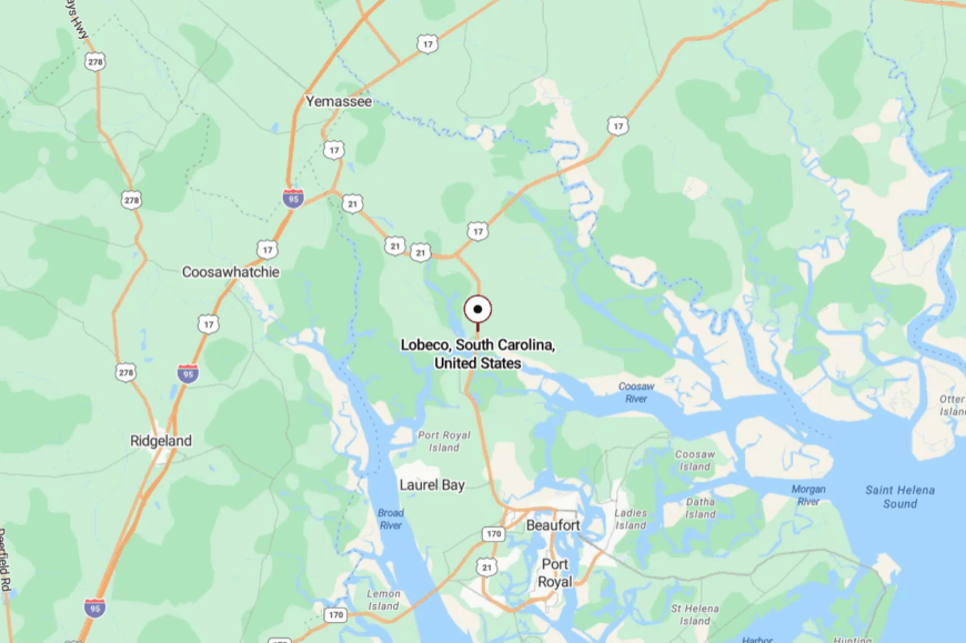
Lobeco lies about 10 miles north of Beaufort, along U.S. 21. The community is surrounded by farmland and estuarine waters, which limit development.
Roads narrow into two-lane country stretches, with produce stands marking the way. Arrival feels like entering the soft-spoken heart of the Lowcountry.
14. Ridgeland: Pines, Rails, and a Downtown Frozen in Time
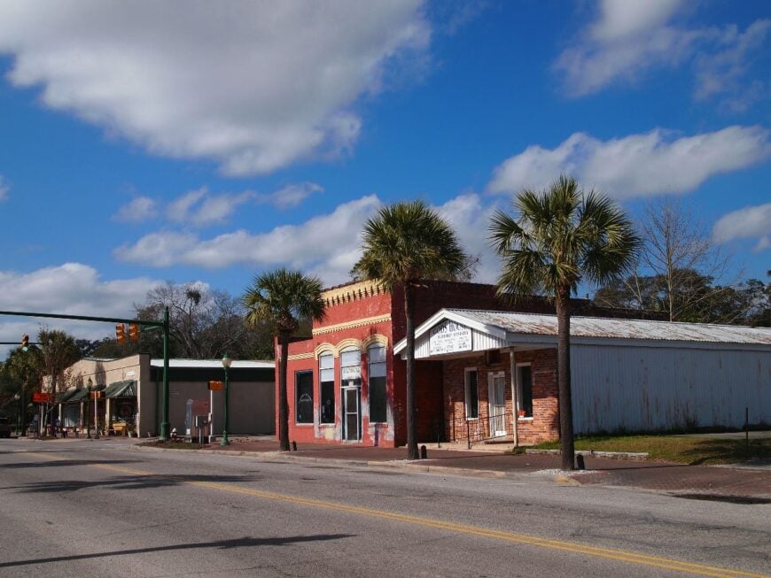
Ridgeland keeps its quiet dignity as Jasper County’s small seat, framed by pine forests and aging rail lines. The mood is old-fashioned and steady, with a brick downtown lined by antique stores, diners, and a courthouse clock tower.
Visitors wander Morris Center for Lowcountry Heritage, bike forested trails, or fish Lake Warren just up the road. The economy blends government, small business, and timber, avoiding the sprawl of nearby I-95.
Life moves at a measured pace, punctuated by church bells and the distant hum of freight. Ridgeland’s gift is its steady reminder that not every small town has to chase growth.
Where is Ridgeland?
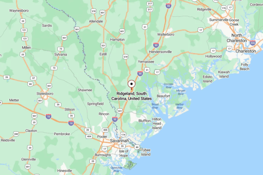
Ridgeland sits about 35 miles north of Savannah, just off I-95. Despite the highway’s nearness, thick pine buffers mute the traffic and enclose the town.
U.S. 17 and SC 336 cut through, delivering travelers to its historic heart. Stepping into downtown feels like walking into a storybook version of the South.
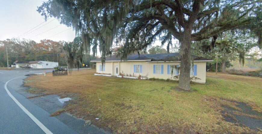
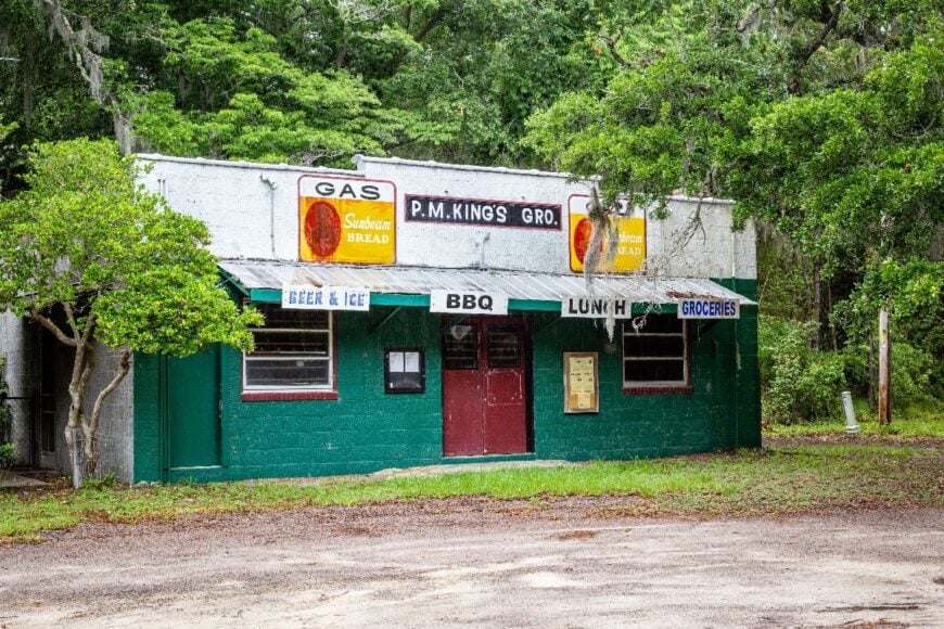
13. Coosawhatchie: A Name, a River, and Little Else
🔥 Would you like to save this?
Coosawhatchie is scarcely more than a bend in the road, but its stillness lingers like the tide on its namesake river. The vibe is starkly quiet, with abandoned houses, live oaks, and the ruins of an old courthouse marking its presence.
Travelers fish the Coosawhatchie River, wander sandy lanes, or picnic under ancient trees where Civil War troops once camped. There is little economy beyond farming and forestry, with residents scattered across large tracts of land.
Silence settles quickly here, broken only by wind in the pines and the splash of mullet in the river. Coosawhatchie feels like a pause in the world’s rush.
Where is Coosawhatchie?
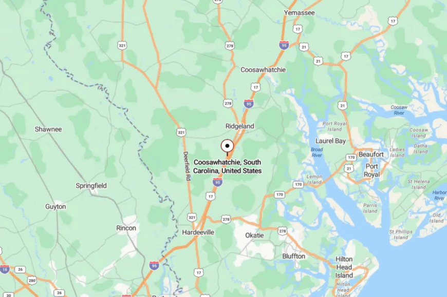
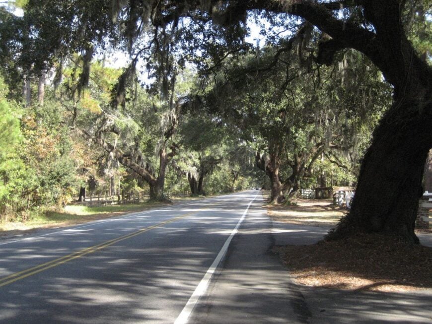
Coosawhatchie lies along U.S. 17 in Jasper County, just north of Ridgeland. The river and tidal creeks insulate it, while pine forests press close on either side.
Access comes via narrow lanes that slip under canopies of moss-draped oak. By the time you glimpse the river, you know you’ve entered a forgotten pocket.
12. Rockville: Regatta Traditions at the Edge of Wadmalaw
Rockville is a pocket-size town shaded by immense live oaks, where time keeps step with wind and tide. The vibe is historic and salt-air serene—Greek Revival cottages, clipped lawns, and a harbor that glints between branches.
Visitors stroll past centuries-old homes, watch dolphins work the creeks, or plan a summer visit around the storied Sea Island Regatta. With no strip malls or neon, daily life leans on boats, small inns, and the gentle churn of seasonal tourism.
What keeps it secluded is geography: tucked at the southern tip of Wadmalaw Island, buffered by Bohicket Creek and marsh. Even sound seems softer here—rigging tapping masts, gulls calling, water slapping pilings. It’s the kind of place that reminds you how quiet the world can be.
Where is Rockville?

Rockville sits at the far end of Wadmalaw Island in Charleston County, about 28 miles southwest of downtown Charleston. Most travelers come via Maybank Highway across Johns Island, then narrow lanes that slip beneath moss-hung oaks.
Water and marsh wrap the town on multiple sides, limiting through-traffic and growth. It’s close to the city on a map, but the last miles feel like a crossing into another century.
11. Bluffton’s Outskirts: River Breezes Beyond the Buzz
While Bluffton’s core has grown lively, its rural edges remain hushed, tucked along the May River with dirt roads threading through pinewoods. The mood is part marshland rustic, part historic charm, with oyster roasts and front porches still shaping daily life.
Visitors kayak May River, browse artist studios hidden in cottages, or explore old farm roads that fade into mossy creeks. Oyster harvesting and small-scale tourism sustain the area, balanced with deep-rooted families who never left.
Evenings glow with sunsets over the tidal flats, painting the landscape in fiery hues. These outskirts remind you that seclusion can exist just steps beyond a busy town.
Where is Bluffton’s Outskirts?
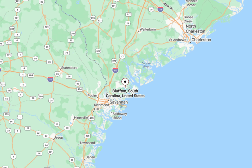
The outskirts lie west of Hilton Head, along SC 46 and U.S. 278. Roads narrow into sandy tracks past live oaks before they slip toward the river.
Though Bluffton proper bustles, its fringes still feel removed from modern noise. Out here, the river does most of the talking.
10. Daufuskie Island: A Bridge-less Escape on the Atlantic Intracoastal
Daufuskie Island claims barely 450 year-round residents, yet its beach runs spread for miles without footprints. Days fill easily with horseback rides along Bloody Point, tastings at the island’s tiny rum distillery, and tours of Gullah cottages where indigo once ruled the soil.
Local jobs center on shellfish harvesting, seasonal tourism, and the artisans who craft ironwork and hand-inked batik at School Grounds Coffee. Absence of cars and a ban on chain businesses keep nights silent save for palmetto fronds in the wind.
Streetlights are rare, so stargazing competes only with the blinking Tybee lighthouse far across the water. A lack of any bridge ensures visitors arrive only on purpose, preserving a sense of edge-of-the-map calm.
Where is Daufuskie Island?
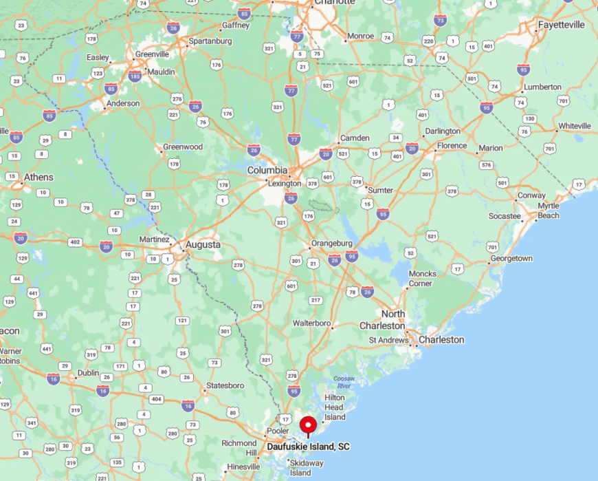
The island floats between Hilton Head and Savannah, tucked inside the Atlantic Intracoastal Waterway. Its seclusion rests in saltwater boundaries on all sides and a marsh buffer wider than most rivers.
Ferries leave from Bluffton or Harbour Town, and golf carts meet every boat on a sandy pier once patrolled by oyster shuckers. Private boats can tie up at Freeport Marina, yet many first-timers are struck by how quickly the mainland skyline disappears behind spartina grass.
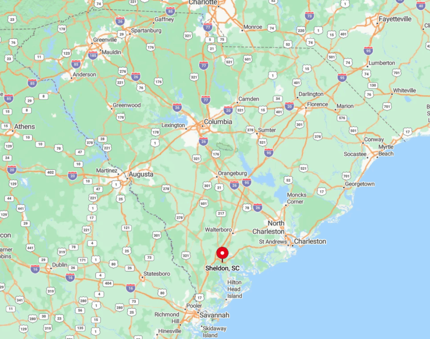
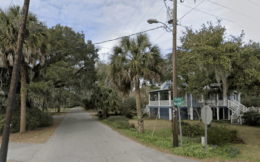
9. Sheldon, Beaufort County: Moss-Draped Ruins and Mile-Wide Spacing
Sheldon supports roughly 240 residents scattered across former rice and indigo plantations that now grow longleaf pine. Visitors wander the haunting columns of Old Sheldon Church, picnic by the salt-killed oak alley, and kayak Horse Island’s brackish creeks rich with bald eagle sightings.
Timber management and small-plot farming provide the primary paychecks, while a single family store doles out bait, biscuits, and local gossip. Each homestead typically sits on ten-plus acres, so neighbors greet one another through binoculars, not back fences.
Cell service flickers, which residents treat as a welcome filter against hurried calls. With Beaufort’s hum twenty miles south, Sheldon’s pine buffer guards a stillness broken only by cicadas and passing deer.
Where is Sheldon?
🔥 Would you like to save this?
The community lies off U.S. 21, north of Beaufort and west of Whale Branch. Its remote feel comes from tidal creeks that force roads to snake around marsh fingers, stretching travel times.
Drivers reach Sheldon by exiting I-95 at Yemassee, then following farm lanes lined with pecan orchards and sawdust piles. The journey ends at Old Sheldon Church Road, where GPS directions yield to the faint smell of river mud.
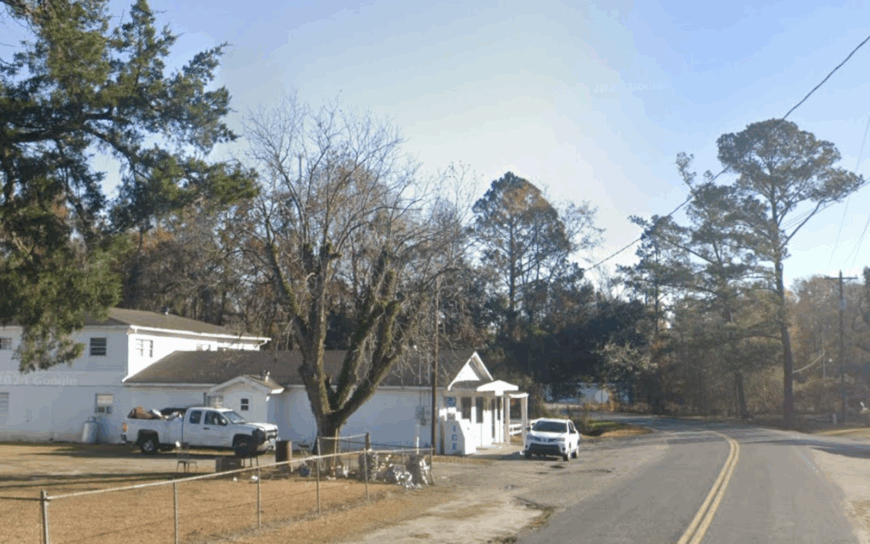
8. McClellanville: Shrimp Boats and Silence Between Forest and Sea
McClellanville counts about 550 neighbors, most of whom wave from the working docks on Jeremy Creek. Afternoons might include sampling white shrimp straight from the trawler, cycling under 400-year-old live oaks, or birding Cape Romain Refuge for roseate spoonbills.
Commercial fishing remains the backbone industry, backed by small oyster shucking sheds and a smattering of art studios in weathered storefronts. Encircled by the Francis Marion National Forest to the west and federally protected marsh to the east, the village faces natural barriers that discourage sprawl.
Hurricanes have come and gone, but clapboard cottages still outnumber vacation rentals. After sunset, the loudest sound is the slap of rigging against wooden masts.
Where is McClellanville?
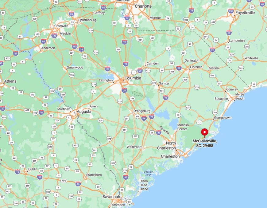
The town rests midway between Charleston and Georgetown along U.S. 17, yet dense pine stands mask the turnoff signs. Long stretches of two-lane pavement deliver visitors, followed by a final mile on Pinckney Street that ends at the water’s edge.
No commercial airport lies closer than forty-five miles, putting arrival solidly in road-trip territory. Those who make it are rewarded with marsh views unspoiled by hotels or billboards.
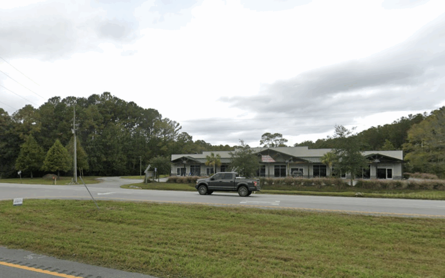
7. Garnett, Hampton County: One Crossroads, Endless Horizons
Garnett’s resident count barely clears 180, and most evenings the single blinking light at U.S. 321 feels like the only movement for miles. Folks rise early to tend soybean fields, mend fence lines, or haul pine logs to small sawmills that dot the county.
Entertainment often means chasing fireflies, exploring 1930s tobacco barns, or setting telescopes on unpolluted night skies where the Milky Way sprawls like a chalk smear. Services are sparse—just a post office, farm supply, and church potlucks that double as town meetings.
With dirt roads forming a lattice around the hamlet, dust clouds replace traffic jams. Cotton rows on all horizons make it plain: Garnett’s seclusion is not an oversight but a way of life.
Where is Garnett?
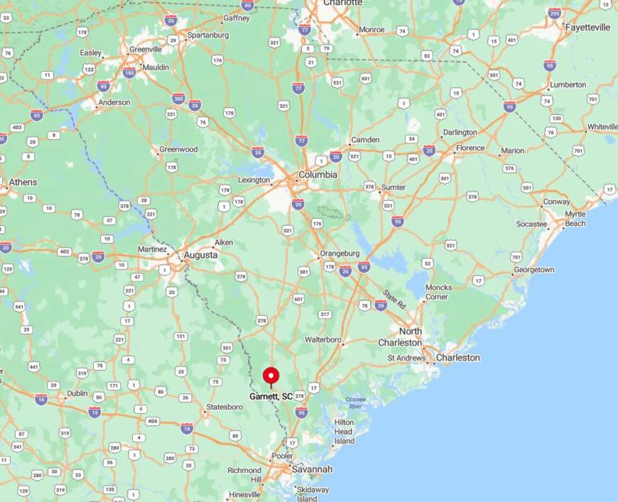
Positioned ten miles north of the Georgia state line, Garnett sits at the junction of U.S. 321 and S.C. 119. Swaths of managed pine and fallow fields cloak it from any interstate roar.
Travelers exit I-95 at Estill or Hardeeville, then drift through two-lane roads where deer sightings outnumber passing cars. Lack of public transit reinforces the town’s alone-in-the-world feeling.
6. Awendaw: Marshland Labyrinth North of Charleston
Awendaw hosts roughly 1,300 residents spread along serpentine creeks ideal for redfish pursuits and sunset paddles. Weekends bring bluegrass concerts at Awendaw Green, oyster roasts at Seewee Outpost, and hikes on the Palmetto Trail where wild orchids bloom in spring.
Small-scale crabbing, boat repair, and eco-tourism anchor the job scene, with many households still relying on family gardens. The protective embrace of Francis Marion National Forest hems the community against Charleston’s steady march, preserving wide front yards and star-lit nights.
Zoning favors five-acre lots, so houses peek from palmetto stands rather than line suburban cul-de-sacs. Even cell towers are camouflaged as pines to keep the skyline low and wild.
Where is Awendaw?
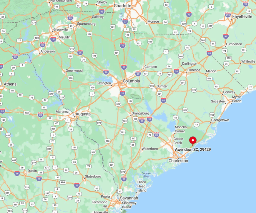
Awendaw sits about 25 miles up U.S. 17 from Charleston, where the highway slips behind forest canopy and marsh flats. With Francis Marion National Forest on one side and the Intracoastal Waterway on the other, the town feels bracketed by wilderness.
Access is almost entirely along that north–south corridor, with few alternate routes beyond local spurs. Limited regional bus service exists, but most visitors rely on cars—or kayaks arriving via tidal creeks—to reach the village’s quiet edge.
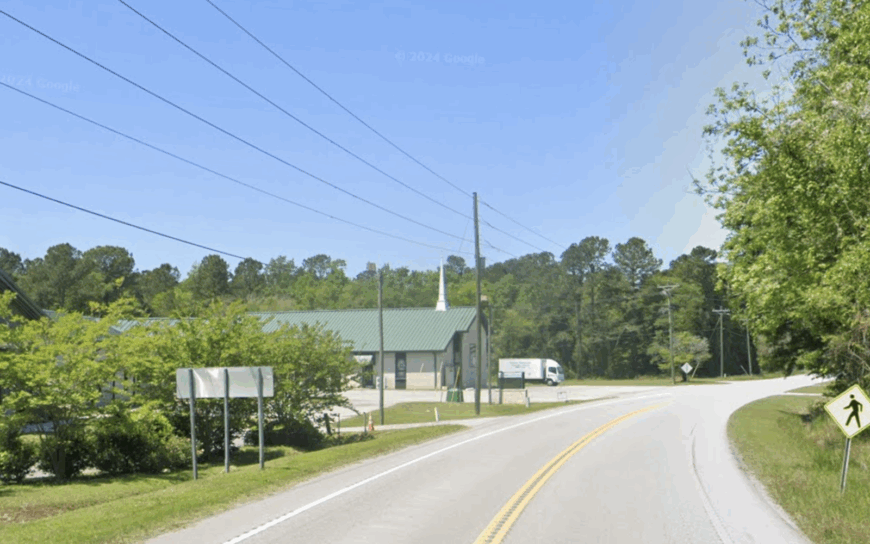
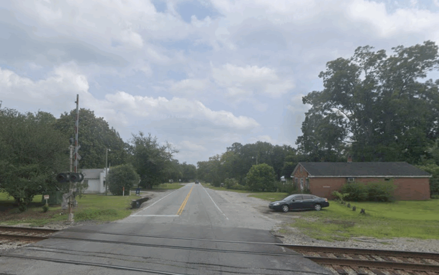
5. Estill: Railroad Echoes in a One-Square-Mile Town
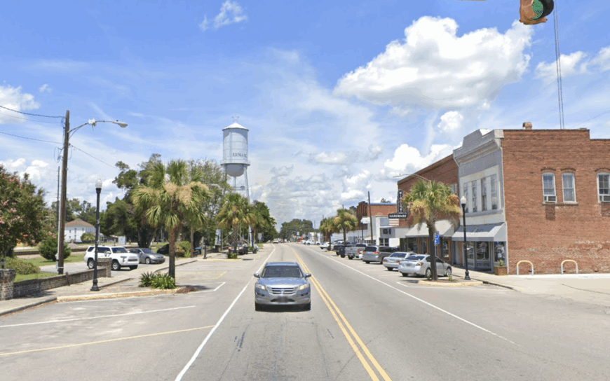
Estill’s population sits close to 2,000, all packed within a square-mile grid laid out by Atlantic Coast Line engineers in 1900. Today, travelers admire brick façades along Martin Luther King Avenue, browse vintage hardware at Rizer’s General Store, and photograph the shuttered depot where steam whistles once ruled the air.
Timber harvesting and a prison industry complex provide steady employment, while a weekly farmers’ market sells collards sourced from sandy fields outside town limits.
Surrounding pine plantations and abandoned rail spurs act as a natural moat, limiting subdivisions. Many houses date to the 1920s, their wide porches ideal for late-night train spotting even though freights pass only a few times a week. Estill’s compact footprint and leafy perimeter foster a stillness broken mostly by cicadas.
Where is Estill?
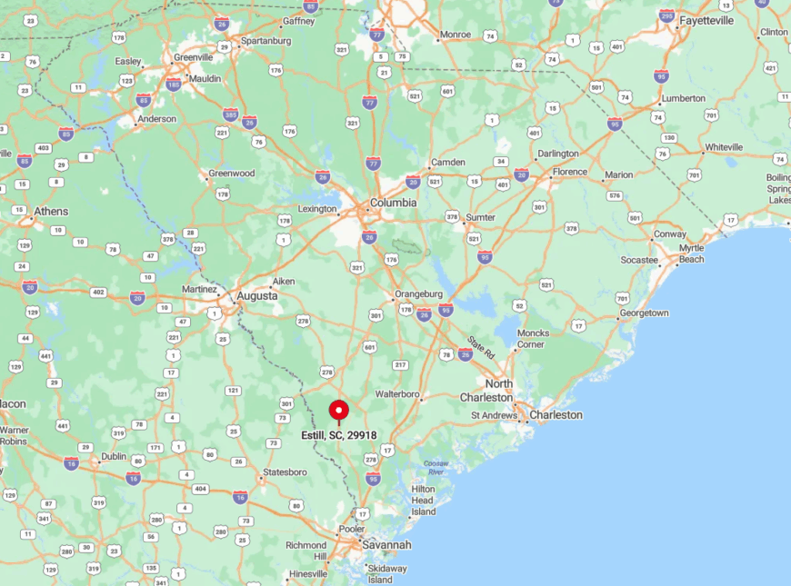
The town rests on U.S. 321 about thirty minutes west of Hampton’s county seat. Forest roads and an absence of nearby interstates require deliberate travel planning. Amtrak rumbles through without stopping, hinting at once-bustling rail days now gone.
Drivers coming from Savannah or Columbia often remark on the sudden switch from multilane highways to quiet avenues shaded by loblolly pines.
4. Pineville, Berkeley County: Where Santee River Cypress Rule
Pineville’s full-time roster hovers near 140 souls, many descended from families who farmed rice along the Santee before dams tamed the river.
Recreation leans toward duck hunts in autumn, paddle trips under ancient cypress knees, and Sunday services inside 1760-era St. Stephen’s Chapel with its hand-wrought nails still visible.
Farming and small-scale logging provide most income, though a growing interest in heritage tourism has introduced a handful of bed-and-breakfasts. Miles of swamp and reservoir shoreline act as a watery barricade, leaving roads to zigzag around submerged forests.
Nightfall produces deep quiet aside from owls that patrol the levees. Locals say you can hear the lake breathe when winds sweep through Spanish moss.
Where is Pineville?

The village sits just north of Lake Moultrie, accessible via S.C. 45 from St. Stephen. Only two paved roads enter town, both bordered by flooded timber and alligator sunning spots.
The nearest grocery lies fourteen miles away, prompting weekly caravan trips. Visitors often arrive by bass boat, tying up at Arrowhead Landing before walking to the chapel under a canopy of tupelo.
3. Green Pond, Colleton County: Tidal Creeks and Endless Wildlife
Green Pond supports roughly 320 permanent residents who share panoramic marsh views within the ACE Basin, one of the East Coast’s largest intact estuaries.
Days begin with wood-stork flyovers, detour to the Bear Island Wildlife Management Area for photography, and end with porch sits where spartina grass rustles like paper fans.
Small shrimp docks, guided hunting outfits, and home gardening shape the local economy; big-box commerce never made it past the county line. Single-lane Bennett’s Point Road is often the only sign of human engineering, and even that dips beneath live-oak branches heavy with moss.
Limited cell towers and an unwritten code against bright exterior lights protect nighttime darkness. With Charleston an hour away yet mentally distant, Green Pond remains a secret whispered among birders and boat folk.
Where is Green Pond?
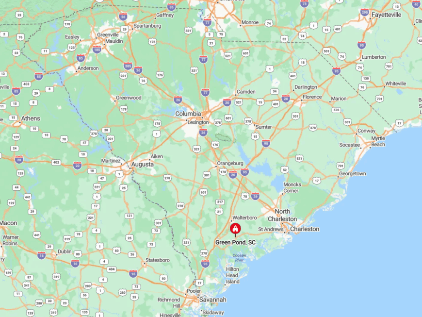
Green Pond lies southeast of Walterboro in Colleton County, reached primarily by SC 303 and then Bennett’s Point Road as it narrows into two-lane blacktop flanked by pine and marsh. The route winds through remnants of old rice fields and oak corridors before easing into open estuary country.
The community sits at the edge of the ACE Basin, bounded by tidal marsh on three sides and the Ashepoo River on the fourth. With no interstates nearby and only a handful of feeder roads, arrival feels deliberate, as if you’ve chosen to trade speed for stillness.
2. Dale: Forgotten Airfields and Expansive Salt Flats
Dale counts close to 700 inhabitants dispersed across Beaufort County’s northern salt flats where WWII runways sit cracked beneath crabgrass.
Residents explore the abandoned Marine Corps Air Station Laurel Bay outpost, cast for red drum at Wimbee Creek, and browse Geechie seafood shacks that pepper S.C. 462. Agriculture, small engine repair, and seasonal oyster picking remain core livelihoods, with family plots often passing through generations untouched.
Five-acre zoning and tidal creeks separate homes like islands, keeping porch lights distant enough for meteor watching. Old bunkers now host barn owls, a reminder of a military bustle long gone. Highway 21 hums nearby, yet sound fades once live oaks swallow the pavement.
Where is Dale?

The community sits twelve miles north of Beaufort along a bend in U.S. 21, though marsh vistas disguise its presence until the last second. Only two feeder roads cross the old airfield, forcing visitors into slow loops past palmetto scrub.
The closest airport is Savannah’s, nearly an hour south, making personal vehicles or charter shuttles essential. Boaters can motor up the Whale Branch to a small public ramp that rarely hosts more than three trailers.
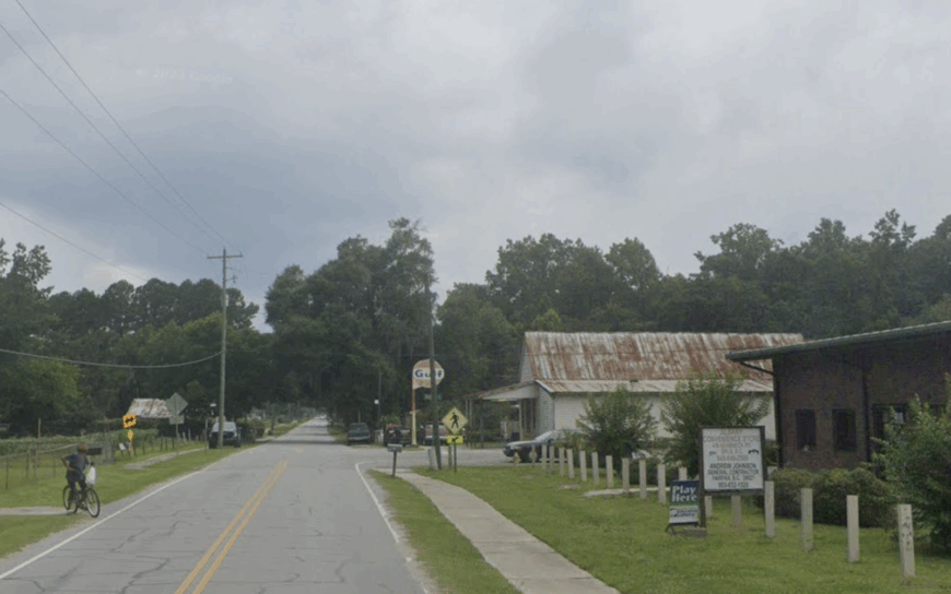
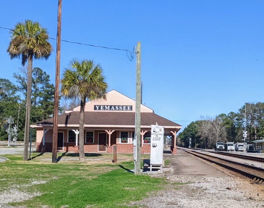
1. Yemassee’s Outskirts: Lowcountry Cottages Beneath Century-Old Oaks
Beyond Yemassee’s tiny Amtrak stop, less than 750 residents scatter across pastureland where horses graze near clapboard cottages trimmed in haint blue.
Saturday drives include boiled-peanut runs along Pocotaligo Road, trail rides through live-oak alleys, and impromptu photo shoots at Harold’s Country Store—famous for hoop cheese and sawdust floors.
Local work centers on equine boarding, heirloom vegetable farming, and rail maintenance for the line that still whistles through twice a day. Broad fields, minimal street lighting, and zoning that favors agricultural acreage keep subdivisions at bay.
Fireflies rival porch bulbs in July, and even freight horns muffle quickly among the oaks. With Charleston, Savannah, and Beaufort all about an hour away, Yemassee’s edges hold the quiet center of a Lowcountry triangle.
Where is Yemassee?
The outskirts stretch along the border of Hampton and Beaufort counties, fanning out from Exit 33 on I-95. Rural routes like Old Salkehatchie Highway weave past tomato farms and cypress ponds, providing multiple scenic back-door entries.
Amtrak’s Palmetto line offers a rare rail option, though most travelers rely on cars to hop between antique shops and pick-your-own berry fields. Once the interstate curve disappears from rear-view mirrors, the only clock seems to be the tide lapping against cypress knees.


