Northwest Texas is dotted with tiny settlements where prairie winds carry more stories than traffic noise, and the night sky still rules the schedule.
In order to come up with the very specific design ideas, we create most designs with the assistance of state-of-the-art AI interior design software. Also, assume links that take you off the site are affiliate links such as links to Amazon. this means we may earn a commission if you buy something.
Our round-up visits twenty five such places, each one wrapped in its own brand of quiet, whether that means a lone grain elevator whistling in the breeze or a handful of canyon-rim cabins lit by coyote-gaze moonlight.
Readers will find hints for day trips, photo outings, or even a slower life change, all backed by details only locals usually share. Populations run from double digits to near-ghost, yet each town keeps a modest pulse through ranch work, farming, or courthouse duties.
The common thread is distance: distance from big-box stores, from four-lane highways, and from anything that might hurry the clock. Let the countdown begin.
25. Tascosa – A Vanished Frontier Capitol
Tascosa, once called “Old Tascosa,” began as a booming cattle town in the late 1800s, serving as a trading and supply hub for ranchers across the Texas Panhandle. The town’s economy thrived on cattle drives, saloons, and merchants until the railroad bypassed it, causing business to shift elsewhere.
By the early 20th century, the economy collapsed, leaving only remnants of its frontier past. Today, the site survives as part of Cal Farley’s Boys Ranch, where agriculture, education, and ranching sustain the community.
Tourism also contributes, as visitors come to see the historic courthouse and cemetery that recall its Wild West heritage. Tascosa’s economy is a mix of heritage tourism and ranch operations, with its cowboy past still defining its identity.
Where is Tascosa?
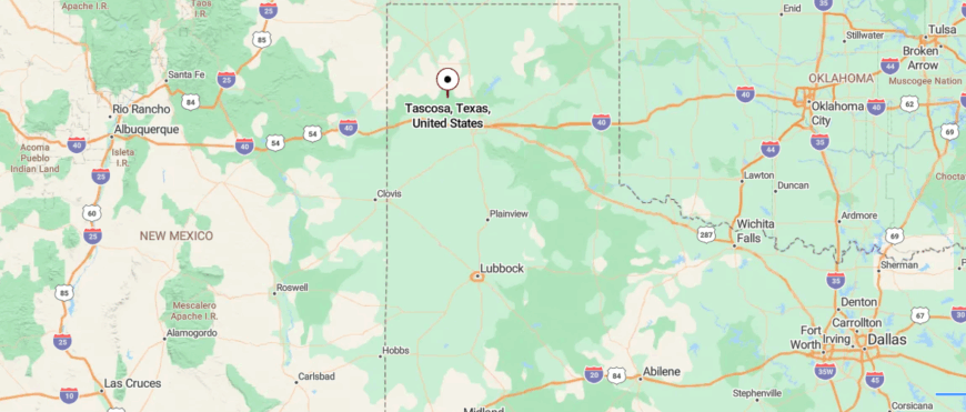
Tascosa is a ghost town in Oldham County, Texas, once known as the “Cowboy Capital of the Plains.” It lies about 35 miles northwest of Amarillo, reached by U.S. Route 385 before turning onto county roads that cross the Canadian River valley.
The site sits on open plains edged by mesas and riverbottoms, a landscape that once drew ranchers and outlaws alike. Now quiet and largely abandoned, Tascosa holds the stark seclusion of a town long reclaimed by the land.
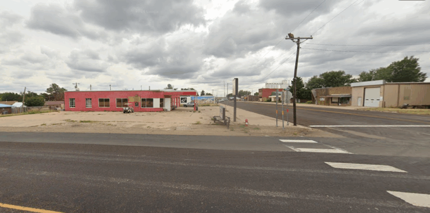
24. Farnsworth – Grain Towers on the Prairie
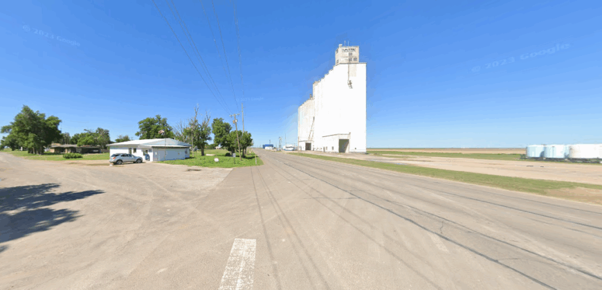
Farnsworth, in Ochiltree County, was established in the early 20th century as a stop on the Panhandle and Santa Fe Railway. The town’s economy grew around farming and ranching, with grain, cotton, and cattle shipped out by rail.
Grain elevators and supply stores became central businesses, supporting local producers and workers. As rail use declined, trucking and modern farming practices replaced much of the old shipping economy.
Many residents now commute to nearby Perryton for jobs in oil, agriculture services, and retail. Farnsworth’s economy remains rooted in agriculture, supported by regional industries that keep the community tied to the land.
Where is Farnsworth?
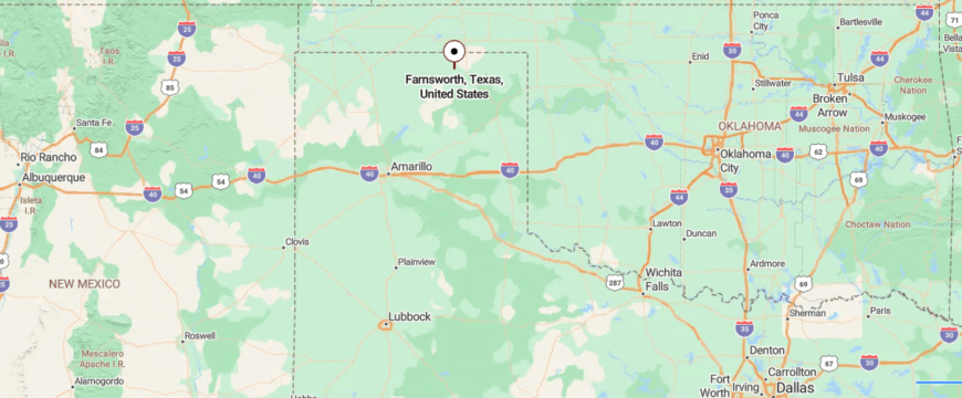
Farnsworth is a small unincorporated community in Ochiltree County, in the Texas Panhandle. It sits about 10 miles west of Perryton, reached by State Highway 15 as it runs through wide stretches of farmland and open plains.
The area is flat and agricultural, with grain elevators and farmsteads marking the horizon. With its remote prairie setting, Farnsworth feels like a quiet stop tucked into the vast openness of the Panhandle.
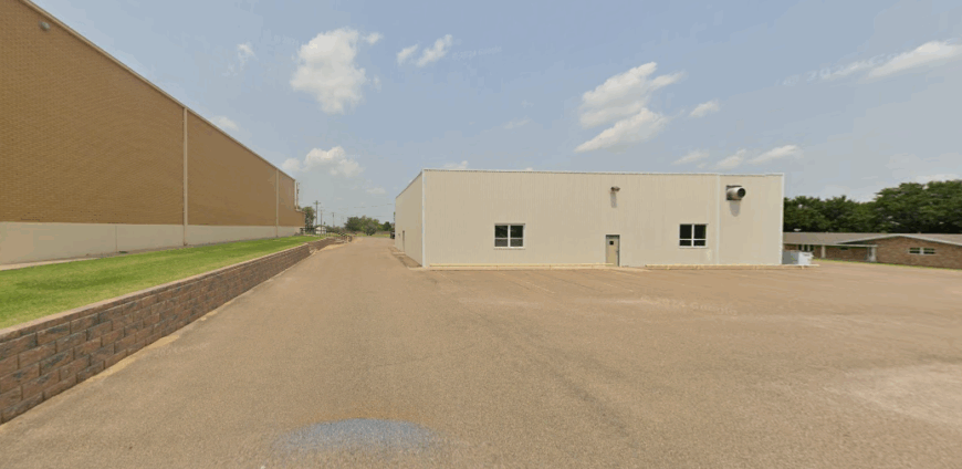
23. Darrouzett – A German-Lutheran Enclave
Darrouzett, tucked in the far northern reaches of Lipscomb County, has always been a ranching town at heart. Its economy grew around cattle, wheat, and sorghum, with the wide plains providing both pasture and farmland.
The arrival of the Santa Fe Railroad in the early 20th century gave local farmers a way to move crops and livestock, sustaining the small community. Today, agriculture still anchors the economy, though many residents also travel to larger towns for work or rely on small businesses in the village.
Hunting leases and rural tourism bring modest seasonal income to the area, with wide horizons and quiet roads attracting visitors looking for solitude. Darrouzett’s economy remains grounded in the land, a reminder of how tradition and hard work still shape life in the Texas Panhandle.
Where is Darrouzett?
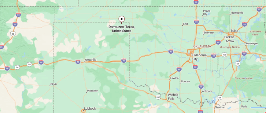
Darrouzett is a small town in Lipscomb County, in the far northeastern corner of the Texas Panhandle. About 15 miles west of the Oklahoma line, it is reached by U.S. Highway 60 and Farm to Market Road 2246 as they cross open prairie.
The landscape is broad and level, with farmland and ranchland stretching toward distant horizons. With its remote setting and wide skies, Darrouzett carries the quiet feel of a town set deep in the Panhandle plains.
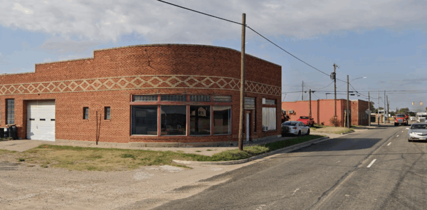
22. Follett – Wheatland at the Border’s Edge
Follett, in Lipscomb County near the Oklahoma border, was founded with the arrival of the Panhandle and Santa Fe Railway in the early 20th century. The railroad allowed local ranchers and farmers to move cattle, wheat, and sorghum to broader markets, making agriculture the town’s economic backbone.
Grain elevators, supply stores, and small businesses developed to support the farming community. While rail service declined, modern trucking and large-scale farming kept agriculture at the center of the local economy.
Many residents also commute to larger towns or work in oil and gas jobs connected to the surrounding region. Follett’s economy remains a blend of farming, ranching, and regional industry, with strong ties to its agricultural roots.
Where is Follett?
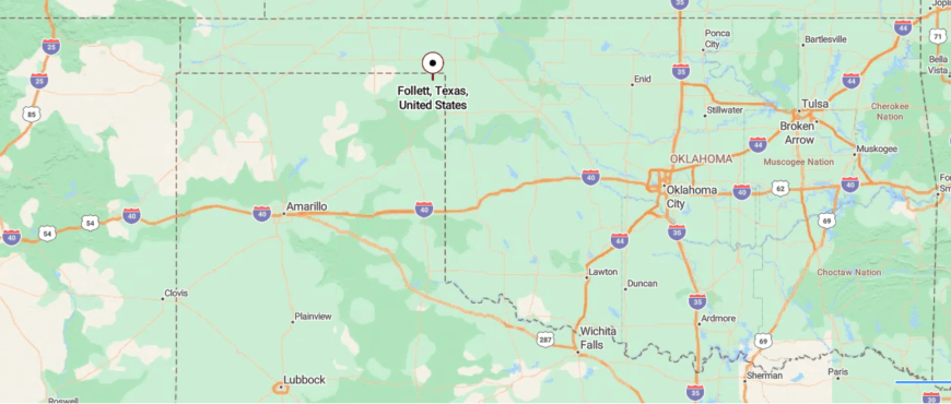
Follett is a small town in far northeastern Lipscomb County, Texas, set amid the open plains near the Oklahoma border. About 20 miles northeast of the county seat, Lipscomb, it is reached by U.S. Highway 15 and quiet rural roads that roll past farms and wide pastureland.
The town has long been tied to agriculture, with grain elevators and ranching shaping its landscape and pace of life. Surrounded by open fields and big skies, Follett feels like a quiet outpost on the edge of the Texas Panhandle.
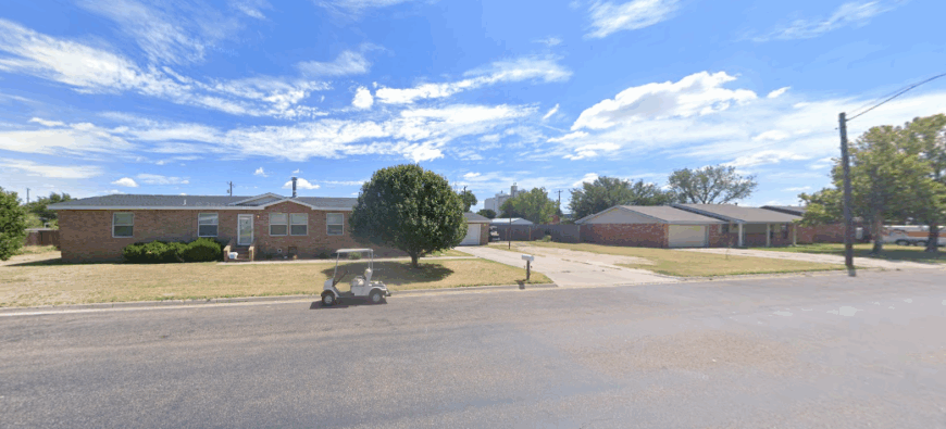
21. Higgins – Prairie Junction with a Tornado Past
Higgins, tucked into the northeast corner of Lipscomb County, grew up along the railroad when it became a vital shipping point for cattle and crops. For decades, ranching and farming provided steady work, with wheat, corn, and livestock forming the backbone of the local economy.
As rail traffic declined, trucking and highway trade took over, keeping goods and people moving through the area. Small businesses, schools, and service jobs now anchor the town, while agriculture still supports many families.
Hunting leases and outdoor recreation in the surrounding prairies and rolling hills bring in seasonal visitors. Higgins’s economy blends its ranching heritage with modern connections to regional markets, sustaining a community that thrives on its resilience.
Where is Higgins?
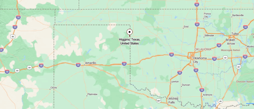
Higgins is a small town in Lipscomb County, tucked into the rolling plains of the far northeastern Texas Panhandle. It sits near the Oklahoma border, about 20 miles east of Shattuck and along U.S. Highway 60, which threads through wide stretches of farmland and prairie.
The community has long been tied to ranching and agriculture, with cattle and crops shaping much of the local economy. Surrounded by open skies and quiet fields, Higgins carries the peaceful, out-of-the-way character of a town far from the state’s busier centers.
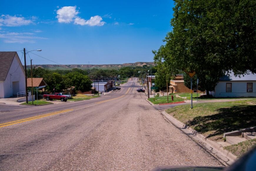
20. Booker – A Crossroads with Fading Rails
Booker, set in Lipscomb County near the Oklahoma line, began as a stop along the Panhandle and Santa Fe Railway, giving local farmers a way to reach larger markets. Wheat, cotton, and cattle became the backbone of its economy, supported by grain elevators and small agricultural businesses.
Over time, oil and gas activity joined farming as an important source of jobs and revenue in the region. Many residents also work in surrounding towns, balancing traditional agricultural life with modern commuting.
Local shops and schools provide steady employment and serve as the social anchors of the community. Booker’s economy thrives on its mix of old rural traditions and the industries that have allowed it to endure on the open plains.
Where is Booker?
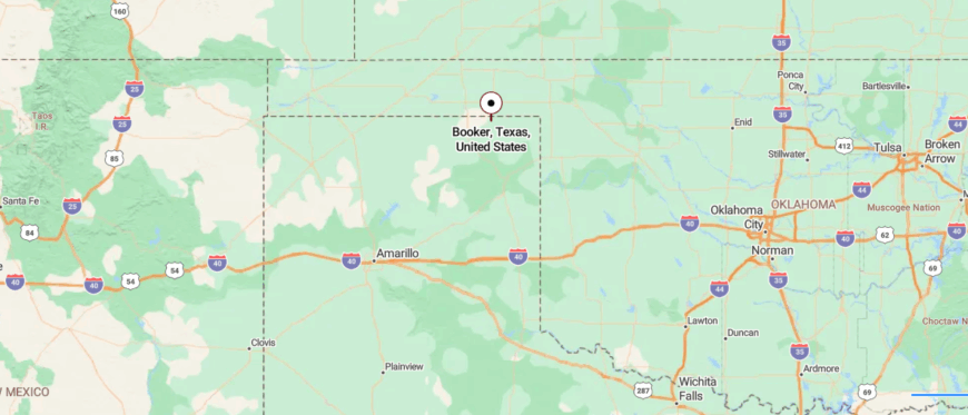
Booker is a small town in Lipscomb and Ochiltree Counties, in the northeastern Texas Panhandle near the Oklahoma line. About 20 miles east of Perryton, it is reached by U.S. Highway 83 and State Highway 15, which cross through flat stretches of farmland and prairie.
The town developed around agriculture, with fields of wheat and grain elevators marking the horizon. Set in the wide-open plains, Booker feels like a close-knit community surrounded by endless sky and fields.
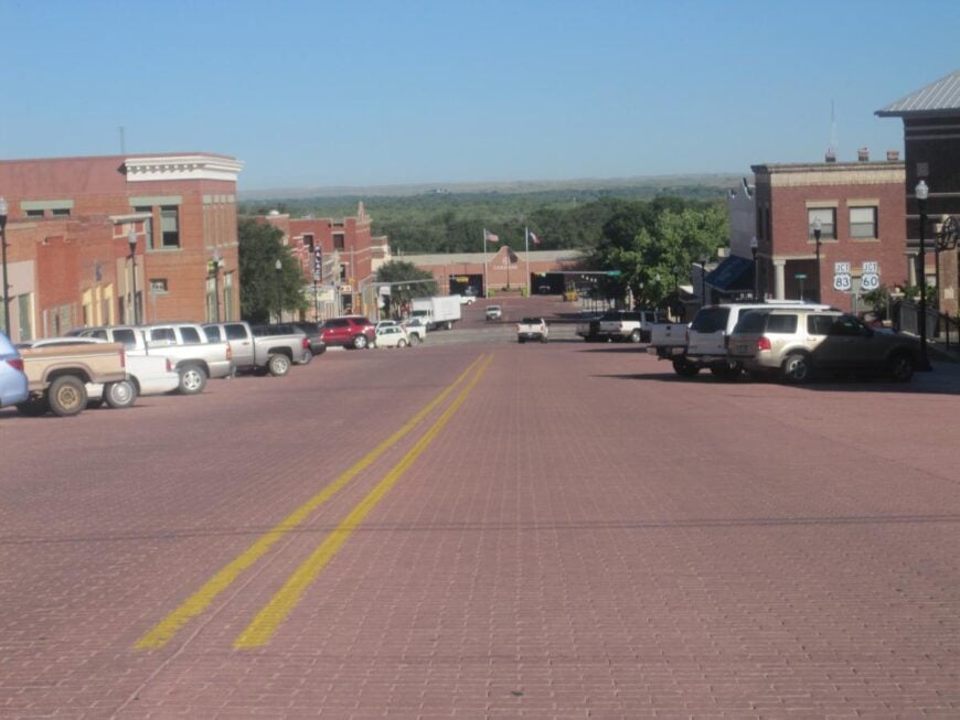
19. Miami – Courthouse Town on Red Deer Creek
🔥 Would you like to save this?
Miami, the lone incorporated town in Roberts County, grew as a railroad and ranching hub in the late 1800s. Cattle and sheep ranching anchored its economy, with rail lines once carrying livestock and goods across the High Plains.
Oil and natural gas exploration later brought new jobs, adding to the town’s traditional agricultural base. Today, Miami remains small but serves as the county seat, with schools, local businesses, and government offices providing steady employment.
Visitors often pass through on scenic drives across the Panhandle, stopping to explore historic sites and the quiet streets that tell of its frontier past. Miami’s economy balances ranching roots with energy and service work, sustaining a community that feels both resilient and rooted.
Where is Miami?
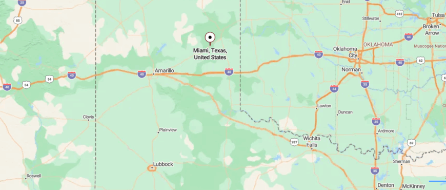
Miami is a small town and the county seat of Roberts County in the Texas Panhandle. It sits along U.S. Highway 60, about 20 miles east of Pampa, surrounded by rolling grasslands and ranch country.
The town grew up as a stop along the Panhandle and Santa Fe Railway, and ranching and agriculture remain central to its economy. With its wide-open landscapes and distance from larger cities, Miami carries the quiet, close-knit atmosphere of a remote Texas prairie town.
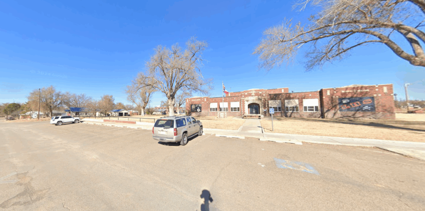
18. Canadian – River Bluff Town with Artistic Streak
Canadian, the lone city in Hemphill County, grew up along the Canadian River as a shipping point for cattle and farm goods. Ranching has long been the backbone of its economy, with cattle and wheat shaping both the land and the livelihoods of local families.
The arrival of the railroad in the late 1800s helped the town flourish as a market center for the surrounding Panhandle. Today, ranching and agriculture remain important, while small businesses, schools, and healthcare provide steady employment.
Tourism also plays a role, with visitors drawn to the River Valley Pioneer Museum, Lake Marvin, and the scenic breaks that frame the community. Canadian’s economy blends tradition and resilience, giving the town a quiet strength rooted in its land and history.
Where is Canadian?
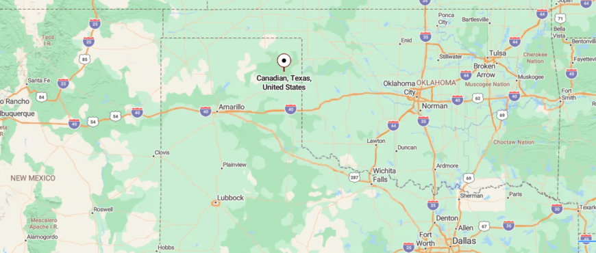
Canadian is a small city in Hemphill County, northeastern Texas, set in the Canadian River Valley. About 45 miles southeast of Perryton, it is reached by U.S. Highway 60 and State Highway 83 across wide ranchland.
The town is a hub for ranching and agriculture, with mesas and river breaks shaping the surrounding landscape. With its open views and quiet pace, Canadian feels like a remote outpost in the Texas Panhandle.
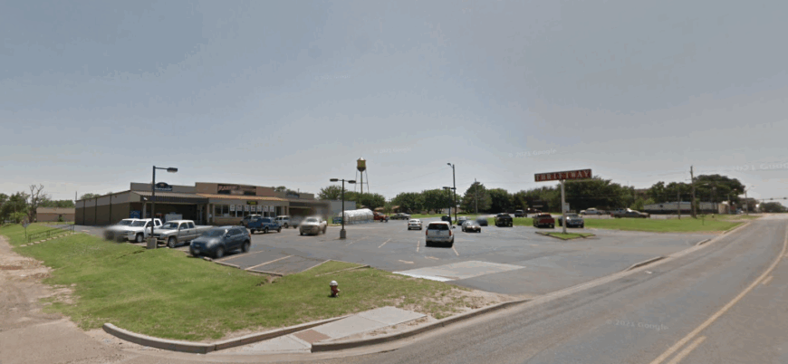
17. Lefors – A Former Oil Boomtown
Lefors, in Gray County, began as a ranching settlement where cattle and farming shaped the early economy. The discovery of oil and natural gas in the region later brought jobs and growth, tying the town to the energy industry.
As drilling slowed, agriculture once again became the steady backbone for many families. Local schools, small businesses, and services provide limited employment within the community.
Many residents commute to nearby Pampa for work in oil, retail, and manufacturing. Lefors’ economy today reflects its ranching roots, the legacy of energy, and reliance on regional jobs to sustain the town.
Where is Lefors?
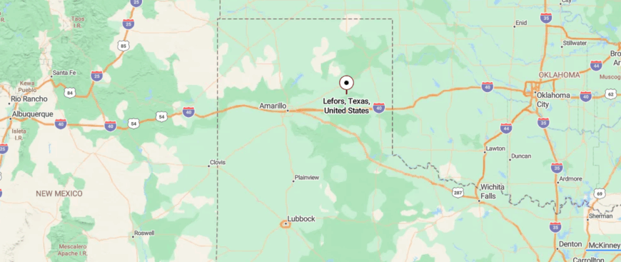
Lefors is a small town in Gray County, in the eastern Texas Panhandle, surrounded by rolling plains and ranchland. About 12 miles southeast of Pampa, it is reached by State Highway 273, a two-lane road that winds through open country.
The community is closely tied to farming, ranching, and the oil industry, which have long shaped its character. With its rural backdrop and quiet setting, Lefors carries the feel of a town tucked into the wide Texas plains.
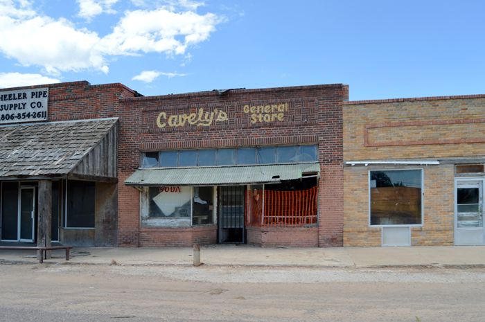
16. Wheeler – County Seat with a Prairie Backdrop
Wheeler, the county seat of Wheeler County, has long been a ranching and farming community at the far eastern edge of the Texas Panhandle. Its economy was built on cattle, wheat, and other crops, with local businesses and grain elevators supporting the agricultural trade.
Oil and gas development later added another layer of income and employment, helping the town weather the ups and downs of farming. Today, Wheeler serves as a small commercial hub for the surrounding rural area, with schools, shops, and healthcare services anchoring daily life.
Visitors sometimes stop to explore the historic courthouse square or attend community events that celebrate the town’s roots. Wheeler’s economy remains firmly tied to the land, where hard work and heritage continue to shape its future.
Where is Wheeler?
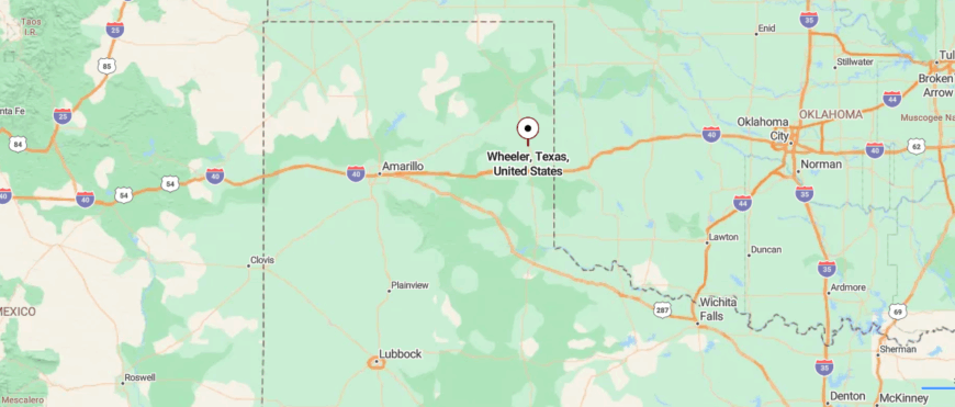
Wheeler is the county seat of Wheeler County in the northeastern Texas Panhandle, set amid open prairie and gently rolling hills. About 20 miles west of the Oklahoma border, it is reached along U.S. Highway 83, which stretches north toward Canadian and south toward Shamrock.
Agriculture and ranching form the backbone of the local economy, with cattle, crops, and small-town commerce sustaining the community. With its wide skies and rural landscape, Wheeler feels like a quiet crossroads town on the far edge of Texas.
15. Mobeetie – Oldest Town in the Panhandle
Mobeetie, the “Mother City of the Texas Panhandle,” was born in the late 1800s around Fort Elliott and the cattle trails that crossed the plains. Its early economy thrived on ranching, trade, and the flow of goods that passed through its frontier outpost.
When the fort closed and the railroad bypassed the town, much of that early prosperity faded. Ranching and small-scale farming carried families forward, providing steady though modest livelihoods.
Today the community remains small, with local services and the Wheeler County Historical Museum drawing visitors interested in its pioneer past. Mobeetie’s economy may be quieter now, but its history as an early Panhandle hub still gives the town a lasting weight.
Where is Mobeetie?
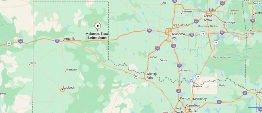
Mobeetie, often called the “Mother City of the Panhandle,” is one of the oldest towns in Wheeler County, Texas, set near the Canadian River on open prairie. About 12 miles southeast of the county seat of Wheeler, it is reached along U.S. Highway 152 and quiet country roads.
The town has deep historical roots as an early frontier settlement, with the Old Mobeetie Jail Museum offering a glimpse into its storied past. Surrounded by wide skies and sweeping grasslands, Mobeetie feels like a peaceful remnant of an earlier Texas.
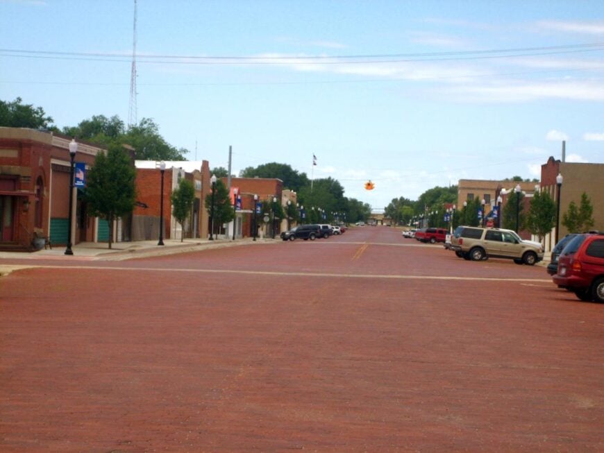
14. Shamrock – Neon Relic of Route 66
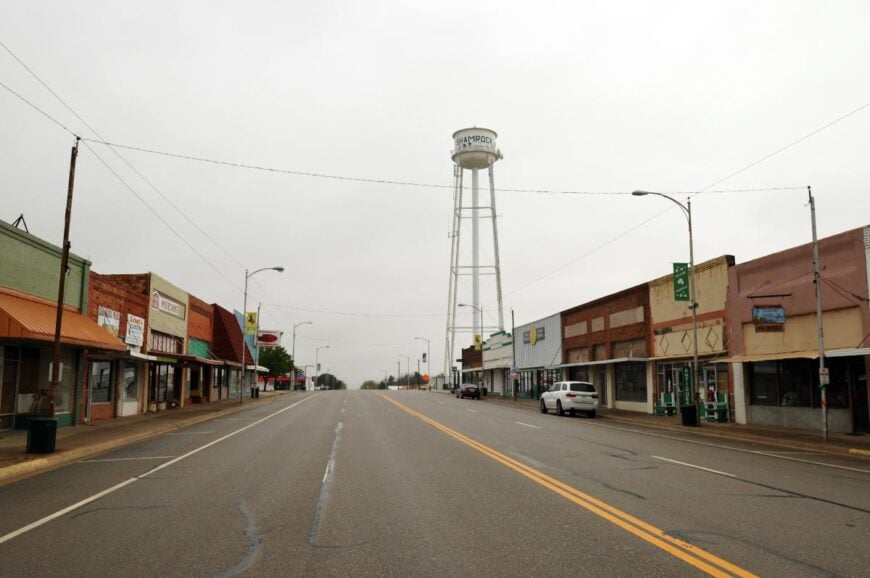
Shamrock, in Wheeler County, grew as a railroad and ranching town before becoming a major stop along historic Route 66. Its economy was long tied to cattle, farming, and the businesses that served travelers moving across the Panhandle.
The famous Tower Station and U-Drop Inn became landmarks, bringing steady tourism income as Route 66 travelers passed through. Today, agriculture remains important, while highway traffic along I-40 and annual events like the St. Patrick’s Day Festival provide boosts to local businesses.
Small shops, schools, and healthcare facilities also anchor the community’s economy. Shamrock’s livelihood blends its ranching roots with tourism and highway commerce, keeping the town connected to both its past and present.
Where is it Shamrock?
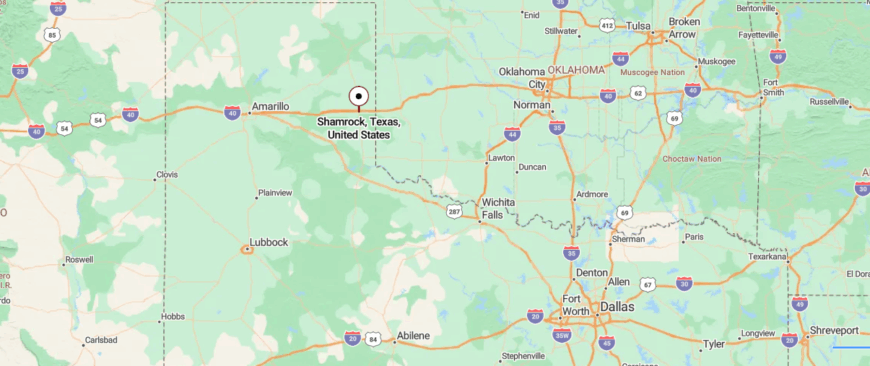
Shamrock is a small city in Wheeler County, Texas, located along historic Route 66 about 15 miles west of the Oklahoma border. It is reached by U.S. Highway 83 and Interstate 40, making it a longtime crossroads in the Panhandle.
The town is known for its Irish heritage and annual St. Patrick’s Day Festival, as well as the iconic U-Drop Inn Café on old Route 66. With its mix of highway history and rural surroundings, Shamrock carries both a nostalgic and small-town feel.
13. Panhandle – Prairie Town Anchored by the Courthouse
🔥 Would you like to save this?
Panhandle, the county seat of Carson County, developed as a ranching and farming community supported by the arrival of the railroad in the late 1800s. Wheat, cattle, and other crops formed the backbone of its economy, with grain elevators and supply stores serving local producers.
Oil and gas exploration later added another layer of jobs and revenue, tying the town to the energy industry that still shapes the region. Today, agriculture and energy remain vital, while schools, county government, and small businesses provide steady employment.
Many residents also commute to Amarillo for work, linking Panhandle’s economy to the larger metro area. The town’s economy reflects a balance of ranching tradition, energy development, and its role as a regional service center.
Where is it Panhandle?
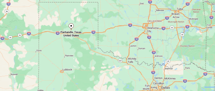
Panhandle is the county seat of Carson County, in the northern Texas Panhandle, set on flat plains surrounded by farmland and ranchland. About 30 miles east of Amarillo, it is reached by U.S. Highway 60, a straight route that cuts through wide-open prairie.
The community has long ties to agriculture and the oil industry, with fields and grain elevators marking the horizon. With its open skies and quiet setting, Panhandle feels like a small town anchored in the vast sweep of the plains.
12. Claude – Rim Town South of Amarillo
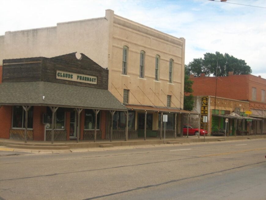
Claude, the county seat of Armstrong County, grew as a ranching and farming hub after the arrival of the Fort Worth and Denver City Railway in the late 1800s. Cattle, wheat, and cotton anchored the economy, with the railroad providing markets for local producers.
As transportation shifted, trucking replaced rail, but agriculture has remained the town’s backbone. Small businesses, schools, and county government provide steady jobs for residents, while some commute to Amarillo for work in industry and services.
Tourism also plays a modest role, with travelers stopping to see the historic courthouse and the Armstrong County Museum. Claude’s economy today blends its deep agricultural roots with modern commuting and small-scale tourism.
Where is it Claude?
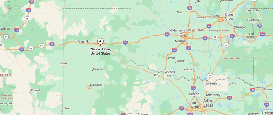
Claude is the county seat of Armstrong County in the Texas Panhandle, surrounded by open rangeland and prairie. About 30 miles southeast of Amarillo, it is reached by U.S. Highway 287, a route that runs across wide, flat country.
The town is closely tied to ranching and farming, with its history rooted in early cattle trails and settlement. With its rural backdrop and distant horizons, Claude carries the calm of a small town set deep in the plains.
11. Vega – Gateway but Still Remote
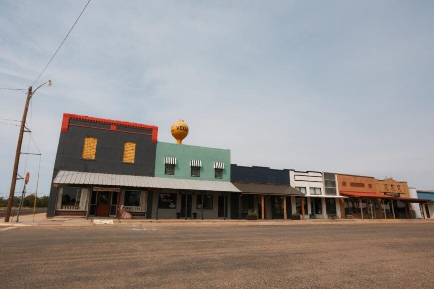
Vega, the county seat of Oldham County, developed as a ranching community supported by the railroad and later by highway travel. Cattle and wheat production formed the core of its economy, with grain elevators and livestock markets serving area ranchers and farmers.
The arrival of Route 66 brought steady business to diners, gas stations, and motels, tying the town to the highway economy. Today, I-40 continues that role, with travelers stopping for food, fuel, and local services that sustain small businesses.
Schools, county government, and agriculture remain important employers for residents. Vega’s economy rests on a mix of ranching heritage, highway commerce, and its role as the county’s service center.
Where is it Vega?
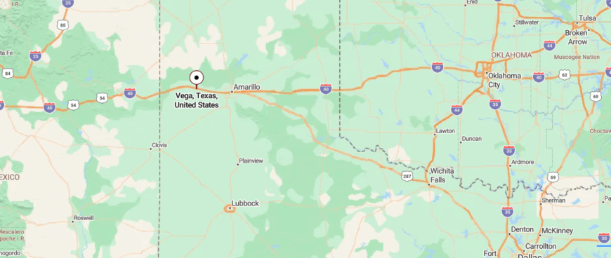
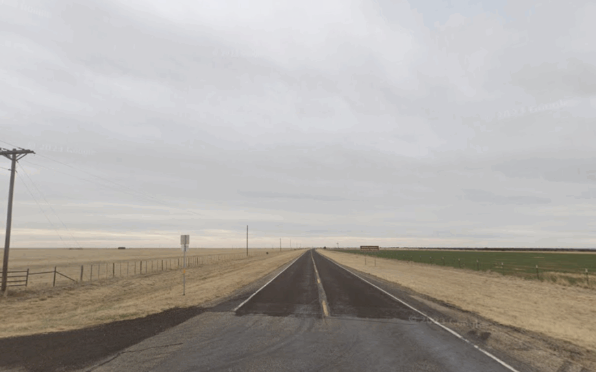
Vega is the county seat of Oldham County, in the western Texas Panhandle, set along the historic path of Route 66. About 30 miles west of Amarillo, it is reached by Interstate 40, which parallels the old highway across open prairie.
The community is marked by its ranching roots and classic roadside landmarks that recall its place on America’s Mother Road. With wide skies and a quiet stretch of plains, Vega feels like a small crossroads town where history and landscape meet.
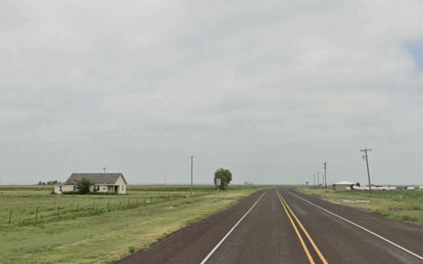
10. Paloduro – Canyon Rim Cabins with Coyotes for Neighbors
Paloduro shelters roughly 45 residents in scattered ranch houses and vacation cabins perched above the second-largest canyon in the United States.
Sunrise horseback rides along Rock Garden Trail, birding for roadrunners, and porch-side stargazing fill most itineraries, while hardy hikers drop into Palo Duro Canyon State Park just minutes away.
Livelihoods center on guest ranch operations, small-scale cattle herds, and seasonal guiding services that make use of the rugged terrain. No streetlights, scant cell coverage, and a rim landscape that falls abruptly into 800-foot walls grant the settlement an immediate sense of being removed from elsewhere.
Grocery runs require planning because the nearest full-service store sits almost an hour north in Amarillo. Even freight trains stay distant, leaving night sounds to coyotes and the rustle of juniper.
Where is Paloduro?
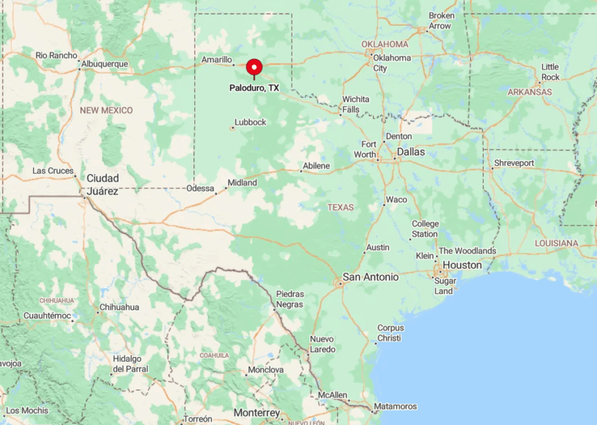
Paloduro lies in southern Armstrong County along Ranch Road 1151, eight gravel miles east of Texas Highway 217. The community sits on the high plains edge, with the canyon drop isolating it from towns on three sides and making cellular towers ineffective.
Visitors usually reach it by exiting Interstate 27 at Canyon, stocking up on supplies, then following the park road until pavement yields to caliche. Winter ice or spring washouts can briefly close the route, so locals keep a weather eye before venturing toward the city.
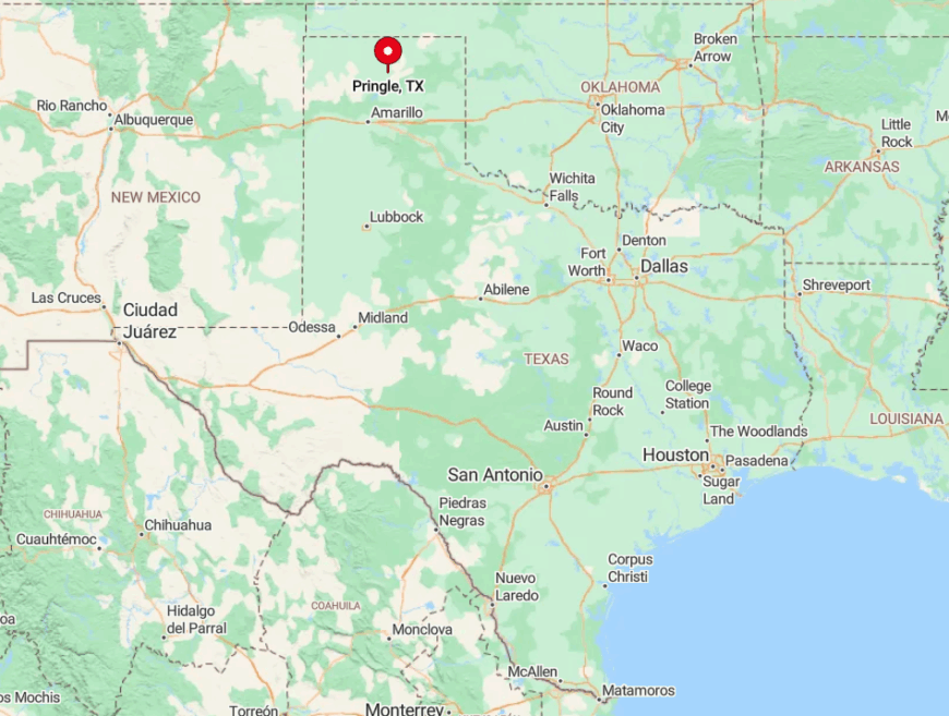
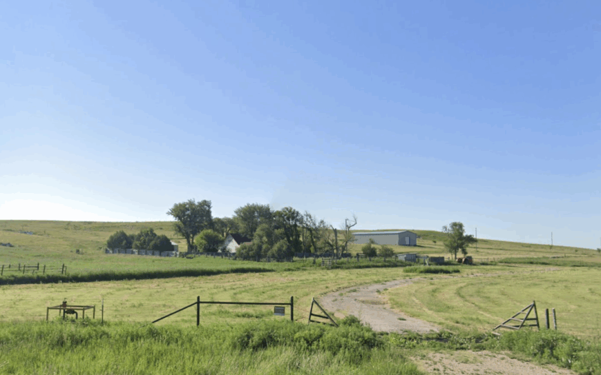
9. Pringle – Tiny Outpost at the Edge of the Canadian Breaks
Pringle claims about 20 year-round inhabitants, most of whom manage adjoining ranches or maintain oil service equipment stored in aging pole barns. Days pass with fence checking, quail calls, and the rare treat of a cold soda from a porch cooler because the town never supported a store.
Cattle ranching remains the primary industry, joined by sporadic work tied to nearby wind-energy leases spread across the breaks. What makes Pringle feel lost in time is the lack of visual clutter: only dusty barns, wind-scarred mesquite, and the sweeping Canadian River escarpment interrupt the horizon.
Traffic amounts to an occasional feed truck kicking up caliche. With no school, post office, or street signs, visitors often drive through before realizing they have already seen it.
Where is Pringle?
🔥 Would you like to save this?
The settlement sits in northern Hutchinson County on Farm-to-Market Road 1598, roughly 16 miles north of Stinnett. The Canadian Breaks form a natural moat to the east, leaving only section roads that dead-end at rimrock ledges and adding many extra miles to any errand.
Travelers from Amarillo take US 87 to Dumas, then a string of farm roads that pass more pumpjacks than houses. Good tires and a full tank are wise because services disappear north of Dumas.
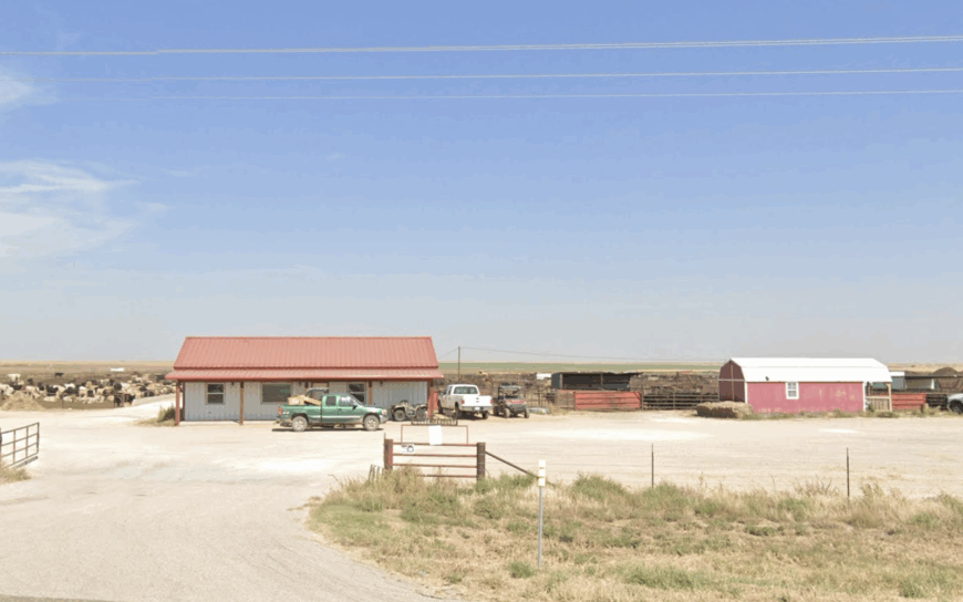
8. Morse – Windmills, Grain Bins, and Endless Horizon
Morse hosts close to 100 people who cluster near the cooperative gin, school gym turned community hall, and a row of tidy frame houses fronting Highway 136. Locals spend weekends at nearby Lake Palo Duro fishing for channel cats or cheering six-man football games in neighboring Gruver.
Work hinges on dryland wheat, sorghum, and cow-calf operations, plus seasonal jobs at the towering concrete grain bins that cast the only midday shade. The town’s seclusion springs from a grid of mile-square section roads that feel identical in every direction, making GPS more comfort blanket than a requirement.
Most nights are so quiet that the faint hum of distant irrigation engines can be tracked by ear. Porch lights wink out early, leaving the Milky Way as the brightest feature on Main Street.
Where is Morse?
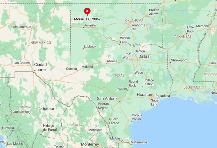
Morse lies in Hansford County, where State Highway 136 threads between Amarillo and Gruver. Fields rather than rivers or hills isolate the town; eighty-mile vistas mean help looks closer than it is.
Reaching Morse from Amarillo requires a straight sixty-mile drive north with only one fuel stop at Sanford before the road empties again. Locals recommend topping off in Amarillo because prices jump at the lone pump in Sanford.
7. Ware – Grain Silos Standing Guard over Empty Plains
Ware’s official population fluctuates around a dozen, though most addresses belong to ranch hands who drift in and out with branding season. The primary landmark is a pair of 120-foot gray silos once owned by Santa Fe that still whistle when northers barrel across the plains.
Aside from part-time grain storage, industry boils down to seasonal wheat harvests and a bit of hunting-lease income during November’s pheasant opener. Ware feels secluded in part because it never had civic services: the school closed in the 1940s, the post office in 1954, and the last store shortly thereafter.
Daily sounds are confined to meadowlark calls and the metallic creak of silo ladders. Photographers favor dawn here, when long shadows turn the elevators into giant sundials against the pale sky.
Where is Ware?
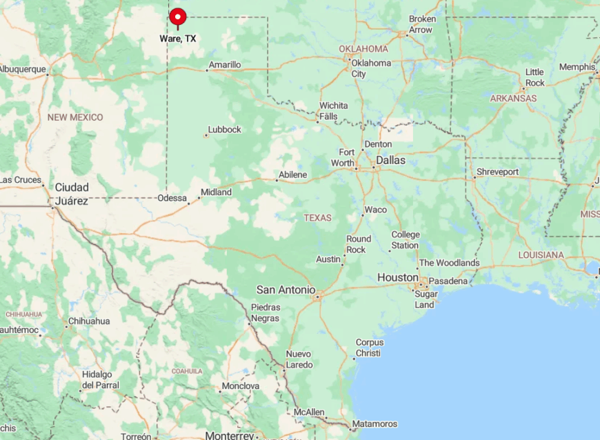
The ghost settlement sits on US 60 about 18 miles west of Amarillo in Potter County. It is ringed by privately owned cropland, so most side roads dead-end at locked gates, discouraging casual visitors.
Access is easiest by pulling onto the wide highway shoulder next to the elevators, a spot still marked “Ware” on railroad timetables. The nearest services are in Vega to the west, making Ware a quick out-and-back for those chasing prairie light.
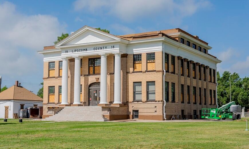
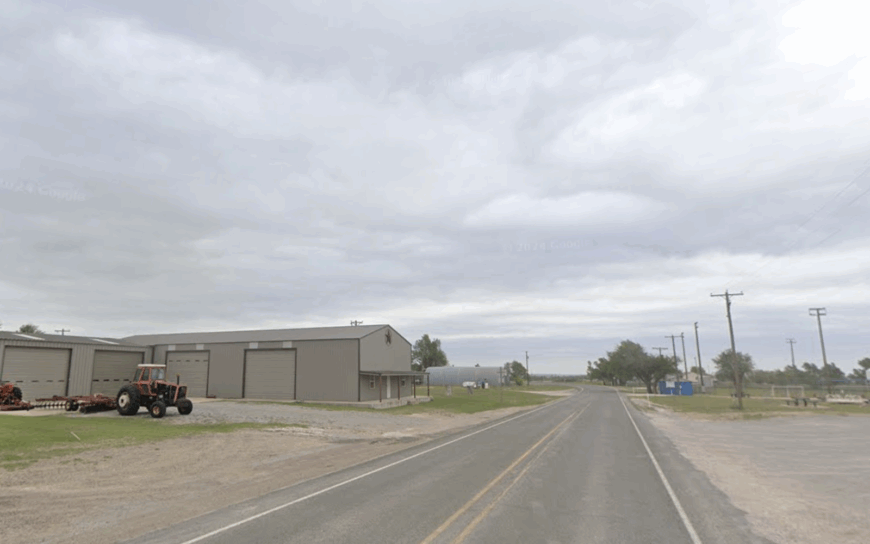
6. Lipscomb – Historic Courthouse, 34 Residents, Zero Hustle
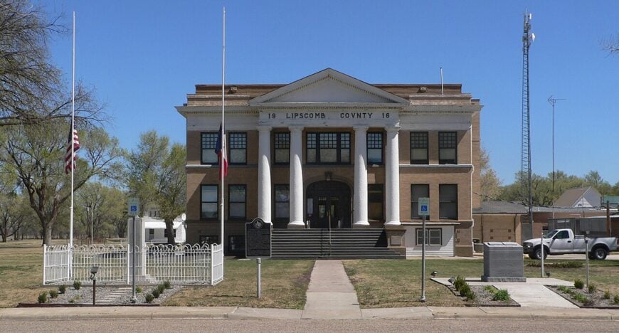
Lipscomb counts 34 residents, a number that swells only during the annual County Reunion when families return for barbecue and domino tournaments under the shade of cottonwoods.
The 1916 red-brick courthouse anchors a square where visitors can browse a two-room museum curated by volunteers who keep dusty typewriters and early cattle brands on display. Ranching dominates, and a few oil field support jobs flicker in and out, but time seems committed to porch conversations rather than commerce.
Narrow paved lanes turn to gravel a block off the square, and the nearest traffic light stands 34 miles away in Canadian. Lack of lodging keeps tourist numbers low, so even on event days, the cricket chorus reigns by nightfall. Locals boast that they can still name every dog in town, a claim hard to dispute.
Where is Lipscomb?
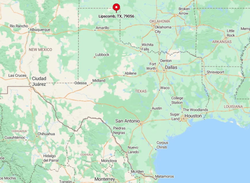
Lipscomb rests in its namesake county along FM 305, ten miles south of the Oklahoma line. Rolling ranchland forms a quiet buffer, and only two paved routes touch the courthouse, limiting pass-through traffic.
Travelers usually approach from Highway 60 at Canadian, following a gentle roller-coaster of ranch gates and playa lakes. Winter storms occasionally glaze the pavement, turning the last ten miles into ice tracks that even locals respect.
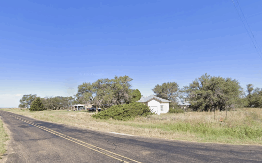
5. Allison – Sagebrush Silence on the Prairie Rim
Roughly 150 people live in Allison, most in clapboard homes facing TX 114, where a few mailboxes and a volunteer fire station double as the civic center. Residents hunt mule deer in the breaks of Gageby Creek, swap stories at Shorty’s Cafe on Saturdays, and watch high school basketball in nearby Wheeler.
Employment revolves around cow-calf ranches, dryland sorghum, and small service gigs linked to the Panhandle oil patch. Isolation stems from the Canadian River escarpment to the north and sparsely traveled ranch roads everywhere else, giving night skies an ink-black depth prized by amateur astronomers.
Steady breezes rattle sagebrush but carry few man-made sounds apart from the slow groan of a windmill. Pickup tracks often remain the only tire marks on Main for days.
Where is Allison?
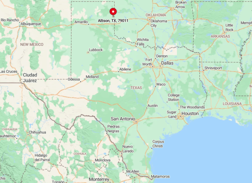
This prairie hamlet sits in northeastern Wheeler County, five miles west of the county line on State Highway 114. The highway sees mostly ranch trucks and grain haulers, leaving long stretches with no headlights.
Drivers from Amarillo head east on I-40, exit at Shamrock, then weave north through rolling plains for about 40 minutes. Cell service fades after Shamrock, so locals still rely on CB radios during winter storms.
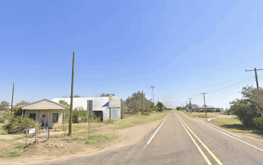
4. Dozier – Wheat Fields as Far as the Eye Can See
Dozier’s head count hovers near 40, all of whom work their year around wheat planting and harvest schedules. Social life centers on a modest community hall that doubles as a polling place and potluck venue after church services that rotate among nearby ranch houses.
The town’s lone elevator still loads Burlington Northern cars each June, offering the main non-ranch paycheck. Nearly treeless terrain flattens to the horizon, absorbing highway noise and amplifying the call of meadowlarks, which adds to the near-monastic calm.
A north wind can sweep wheat chaff for miles without stirring a single stop sign because there aren’t any in town. Even the post office flagpole was removed after the branch closed, leaving the elevator as the tallest structure for twenty miles.
Where is Dozier?
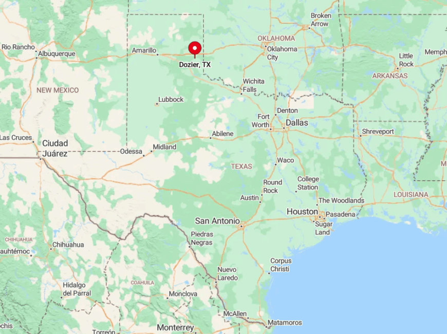
Dozier sits in eastern Collingsworth County along State Highway 203, roughly 12 miles northwest of Wellington. It feels tucked away because the highway parallels the Oklahoma state line and carries mostly local farm traffic.
Travelers coming from Childress or Shamrock must commit to an hour of two-lane blacktop without services. The nearest gas and groceries sit back in Wellington, so wheat truck drivers top off before dawn.
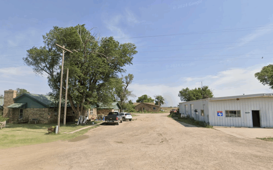
3. Flomot – A One-Intersection Cotton Crossroads
Flomot’s 180 residents occupy a crossroads in Floyd County where FM 97 meets FM 599 under an enormous cotton boll mural painted onto the former gin’s sheet-metal wall.
Residents host brisket cookouts at the community center, fish at nearby Caprock Reservoir, and meet for morning coffee at Bev’s Kitchen, which also sells farm parts if someone needs a combine belt in a hurry. Cotton farming rules the income ledger, with a few sheep ranches making use of land too sandy for row crops.
The town feels remote because the closest larger town, Floydada, is 27 miles of an empty highway away and only two paved roads reach the intersection.
That distance means traffic rarely exceeds a dozen vehicles a day outside harvest season. Dust devils spinning through picked fields often provide the most animated scene on a given afternoon.
Where is Flomot?
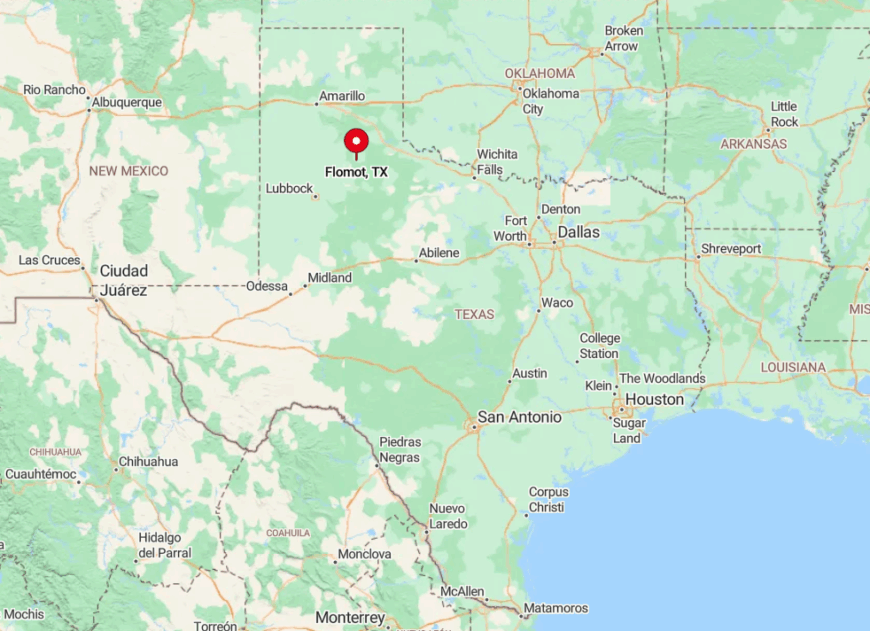
Flomot lies near the border of Motley and Floyd counties, a stone’s throw from the banks of the North Pease River. The Caprock Escarpment south of town blocks radio towers and weather fronts alike, deepening the sense of remove.
Travelers from Lubbock follow US 62 to Ralls, then a succession of county roads that gradually lose traffic and cell bars. Locals keep a spare fuel can in the pickup because the town’s lone pump closes at 6 p.m.
2. Wayside – Ranch Country Hidden Behind Palo Duro’s Rims
Wayside supports about 30 residents, many of whom run cow-calf pairs across mesas edged by yucca and mesquite draws.
Popular pastimes include canyon-edge picnics, exploring old stagecoach ruts along Tule Canyon, and night sessions at a private observatory owned by a retired Amarillo astronomer who occasionally welcomes visitors. Ranching dominates the economy, complemented by modest income from dove-hunting leases each September.
Its deep quiet owes to the fact that the nearest gas pump stands in Claude, 25 miles north, while the canyon walls absorb sound and block faint glows from bigger towns.
Mail arrives every other day at roadside boxes, and emergency services require dispatch from Tulia. The combination of canyon geography and low population lets crickets and cattle sounds rule the soundscape.
Where is Wayside?
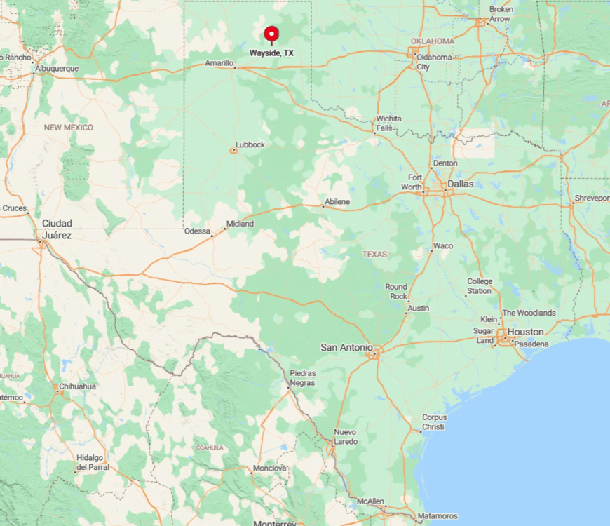
Wayside occupies a lonely spot in northern Swisher County on FM 285, south of Palo Duro Canyon State Park’s less-traveled southern rim. Sheer canyon walls hem in the community to the west, and clay roads crossing private ranches limit approach from other directions.
Drivers leaving I-27 at Tulia should expect a 40-minute cruise with no services past the halfway mark. During heavy rains, FM 285 can flood where it dips into Tule Creek, briefly isolating residents.
1. Glenrio – A Ghost Town Frozen on the Old Route 66
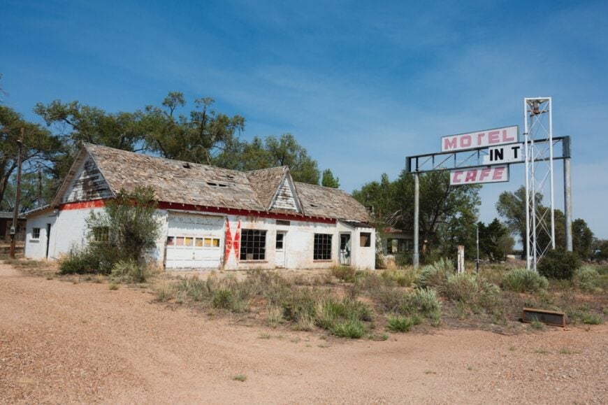
Glenrio’s present-day population rarely tops five, a number that includes a seasonal caretaker and the occasional road-tripping artist camping in a boarded-up motel room. Visitors photograph cracked neon signs, fractured pavement of the original Route 66, and freight trains slipping past like distant memories.
There is no current industry, though movie location scouts drop in often enough that locals keep a modest guest ledger in case Hollywood calls. Seclusion comes not just from emptiness but from the spooky intactness of 1950s storefronts that seem paused mid-sentence.
No services exist, so travelers must carry water and fuel before rolling in under the huge West Texas sky. After sunset, wind rattles sheet-metal awnings, creating the only dialogue for miles.
Where is Glenrio?
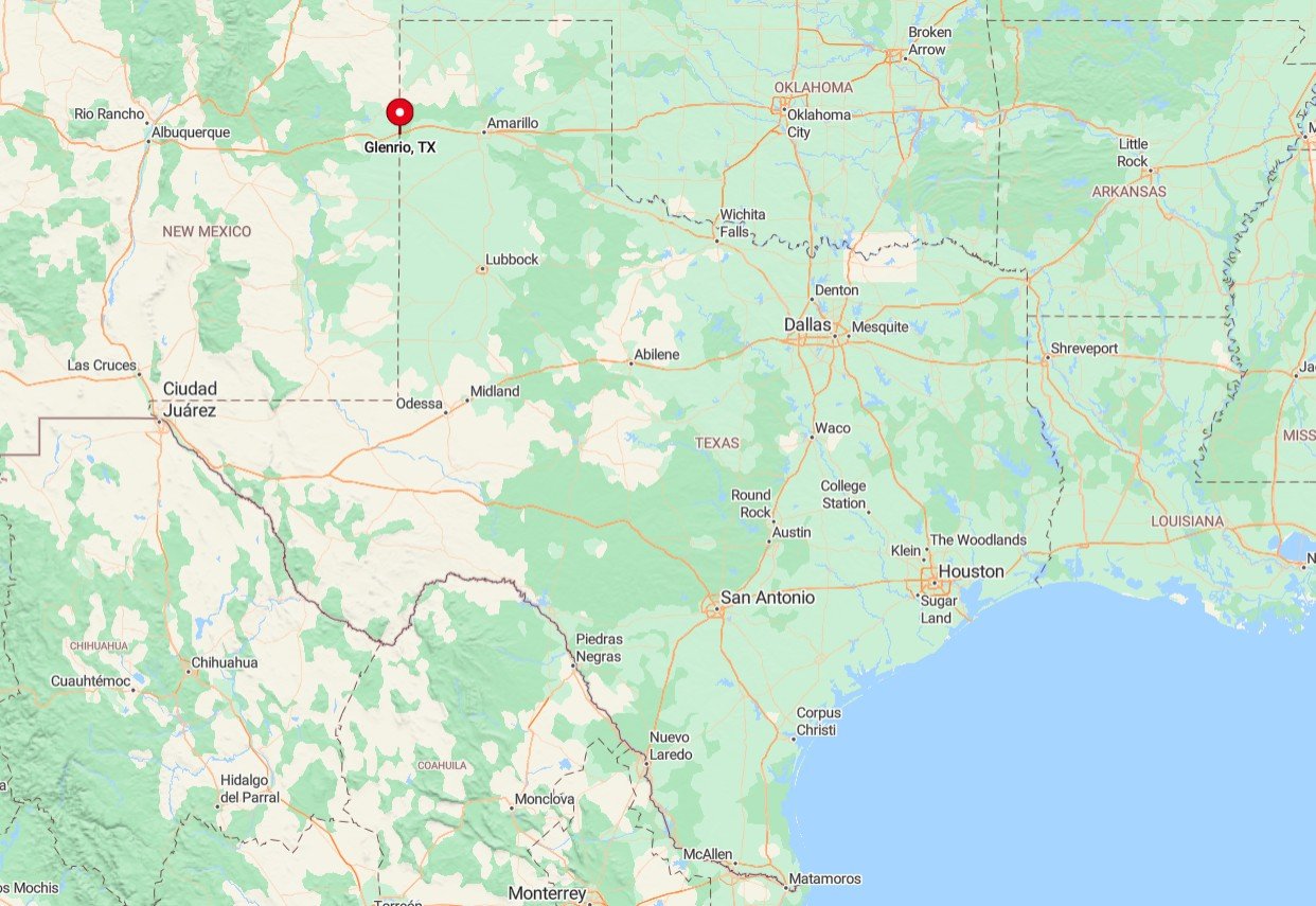
Glenrio straddles the Texas-New Mexico line on the ghost stretch of old US 66, now accessible via the I-40 service road about 42 miles west of Amarillo. The town is flanked by ranchland and Union Pacific rails, with no nearby communities to feed it traffic.
Reaching Glenrio involves exiting Interstate 40 at mile marker 0 and following the broken-pavement access road until the road ends in silence. Its desolation grows after dark when passing interstate trucks sound like distant surf yet never come into view.


