🔥 Would you like to save this?
Northwest Oklahoma is peppered with tiny dots on the map that most travelers speed past without a second glance. We find these outposts ideal for anyone who enjoys open horizons, skies packed with stars, and the hum of wind through prairie grass in place of city chatter.
Each community on this countdown keeps its population low, its traditions intact, and its visitors happily surprised by just how much there is to see once you slow down.
In order to come up with the very specific design ideas, we create most designs with the assistance of state-of-the-art AI interior design software.
From basalt mesas brushing New Mexico’s line to ghost elevators guarding silent rail sidings, the region offers retreats where neighbors sit miles apart and Main Street traffic can be counted on one hand.
Our survey begins at the far western edge of the state and works eastward, spotlighting landscapes as varied as red-rock canyons, gypsum bluffs, and sunflower-striped fields. Pack plenty of water, a full tank of gas, and an appreciation for quiet because these 25 towns specialize in exactly that.
25. Felt – Wind, Mesas, and a Two-Dozen-Neighbor Town
Felt is the sort of Panhandle hamlet you reach on purpose, not by accident, and that’s exactly why it feels so peaceful. Seclusion here is built into the landscape—vast ranches, long horizons, and the basalt shoulders of Black Mesa country keeping the world at arm’s length.
The vibe is plainspoken and sky-obsessed: windmills ticking, pasture gates clanking, and sunsets that unspool for miles. Things to do include stargazing under truly dark skies, hiking mesa country on nearby public lands, birding along shelterbelts, and photographing storm light rolling across the grasslands.
Ranching is the steady heartbeat, with just enough travelers in meteor-shower season to fill a spare cabin. Even the breeze seems to slow down as it crosses these sections. It’s the kind of quiet that turns time into something you can hear.
Where is Felt?
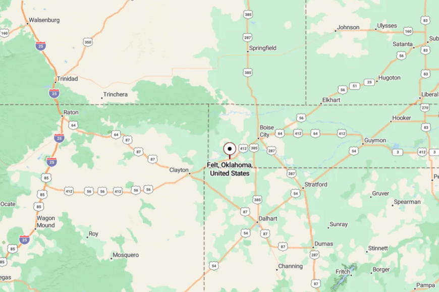
Felt sits in far western Cimarron County, near the New Mexico line and about 25 miles southwest of Boise City. You reach it via U.S. 56 and a short jog on county roads through open ranchland.
There are no major highways or big towns nearby, which helps the silence hold. It’s close enough for a day’s wander, but far enough to feel like the map thins out around you.
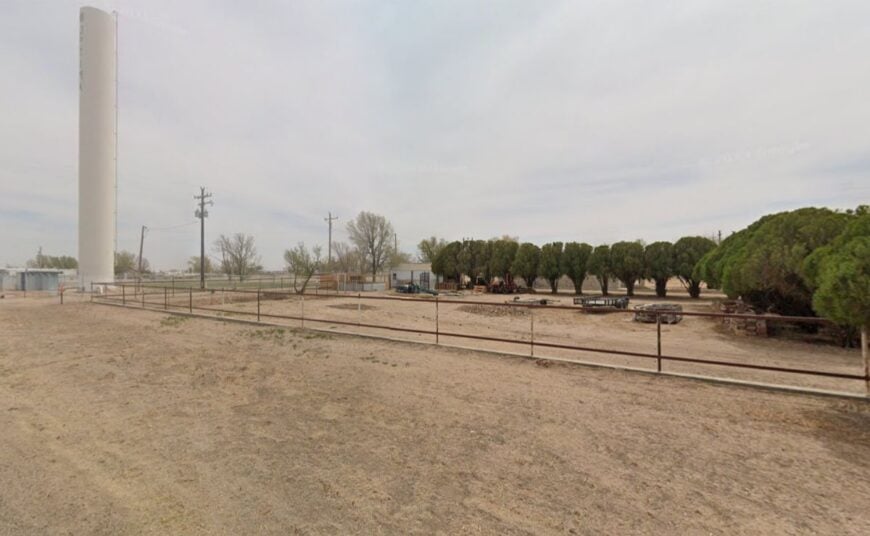
24. Wheeless – A Ghosted Crossroads in Mesa Country
Wheeless is a near-empty outpost where an old schoolhouse and scattered homesteads sit beneath mesas and sky. Its seclusion is absolute—no through traffic, few neighbors, and county roads that turn to gravel long before you arrive.
The vibe is photogenic and a little eerie: wind in fence wire, barn swallows under eaves, and distant thunderheads shouldering the plains. Wander the quiet lanes for black-and-white-worthy images, scan the grass for pronghorn, watch summer lightning storms from a safe pullout, or simply let the silence soak in.
Ranching carries on over the horizon, mostly unseen. Nights drop like a curtain here, and the stars step forward. It’s a place that makes solitude feel like a luxury, not a lack.
Where is Wheeless?
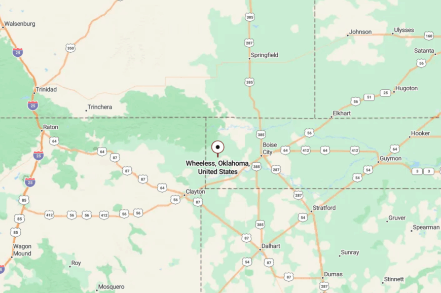
Wheeless rests in northwestern Cimarron County, northwest of Kenton and a few dusty miles from the New Mexico border. Access is via unpaved county roads branching off OK-325 or NM-456 depending on your approach.
Services are many miles away, so you arrive prepared. It’s close to the mesas, far from the modern rush.
23. Optima – Prairie Streets by a Quiet Reservoir
Optima is a tiny town where blocks run out into open prairie and the wind writes its own agenda. It feels secluded because big interstates bypass Texas County and nearby Optima Lake’s wide open shores keep development sparse.
The vibe is sun-faded and friendly—pickup waves, backyard gardens, and the occasional grain truck humming past. Things to do include birding at Optima National Wildlife Refuge, walking the shoreline at low water, spotting deer at daybreak, and chasing dramatic Panhandle skies with a camera.
Farming and refuge-related tourism set the seasonal pace. Even on busy days, you can hear meadowlarks over the road noise. It’s the kind of small that helps you breathe deeper.
Where is Optima?

Optima sits in eastern Texas County along U.S. 54, about 9 miles east of Guymon. A short drive south leads to the wildlife refuge and the quiet expanses around Optima Lake.
Once you leave town limits, it’s all sky and pasture. You’re minutes from services, yet it feels a world away.
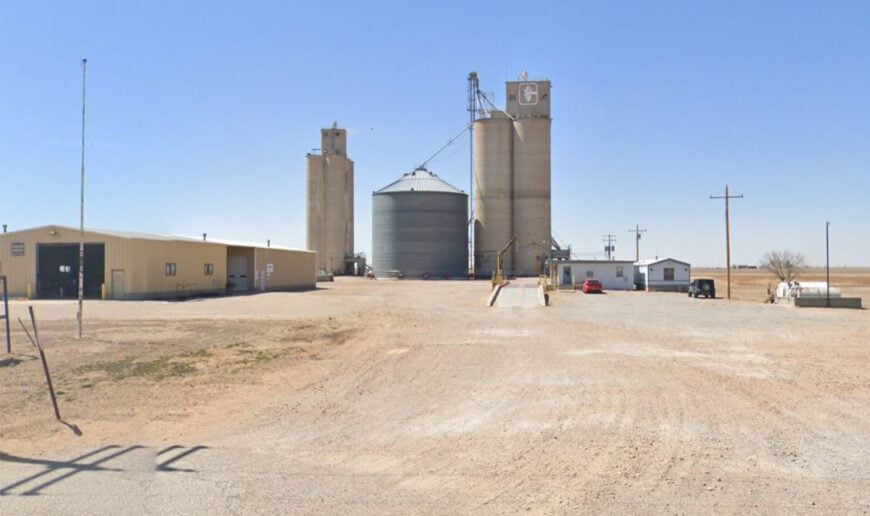
22. Adams – Elevators, Playa Lakes, and Long Light
Adams gathers around a grain elevator and a handful of roads that fade into the pasture. Its isolation comes from section-line grids and the long gap between small towns typical of the northern Panhandle.
The vibe is practical and spare: wind-silvered tanks, old rail sidings, and evenings that smell like dust and rain. Walk the quiet streets at golden hour, photograph windmills against thunderheads, watch shorebirds at seasonal playa lakes, or take a slow drive to see pronghorn along the fences.
Agriculture keeps the calendar steady here. You measure a day by the angle of light, not by traffic. It’s the kind of country that resets your sense of scale.
Where is Adams?
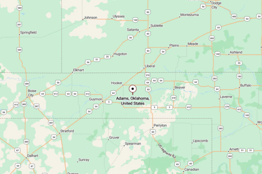
Adams is in north-central Texas County, northeast of Guymon and west of Hooker on county roads that track old rail lines. You’ll exit the highway for a few miles of straight, quiet pavement and caliche.
Gas and groceries live in the larger neighbors, not here. It’s easy to reach—and easier still to linger.
21. Hardesty – Cottonwoods Along the Beaver

Hardesty keeps to itself along the Beaver River bottoms, where cottonwoods flash silver in a steady Panhandle wind. Seclusion comes from the miles between towns and the way the river corridor pulls life into its own green pocket.
The vibe is modest and family-steady—Friday lights at the school, church suppers, and tractors easing down backstreets. Spend time birding near riparian edges, walking levee paths, glassing for deer at dawn, or day-tripping to the quiet shores near Optima Wildlife Refuge.
Grain and ranch work share the load with school and service jobs. Even the highway feels unhurried by the time it reaches here. It’s a little town that offers a lot of sky.
Where is Hardesty?
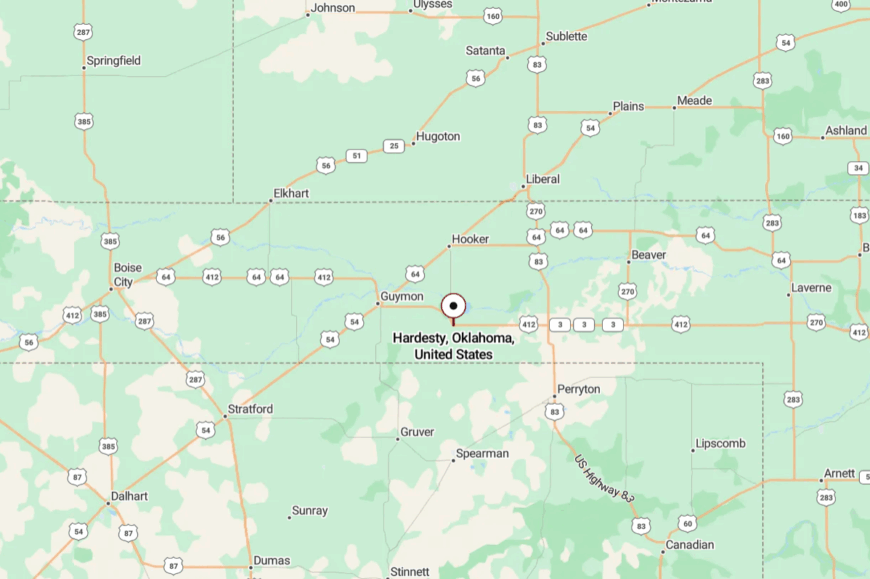
Hardesty sits in southeastern Texas County along U.S. 412/OK-3, roughly 20 miles southeast of Guymon. You arrive after long stretches of open rangeland broken by river timber.
Services are concentrated in larger hubs, which helps Hardesty stay quiet. It’s close to the river and far from hurry.
20. Hough – A Prairie Ghost with a Schoolhouse Story
Hough is a ghosted hamlet where the most eloquent building might be the old schoolhouse, standing stubbornly against the seasons. Its seclusion is complete—no storefronts, no noise, just wind over grass and the occasional pickup on a far road.
The vibe is haunting and photograph-friendly: peeling paint, ironwork gates, and horizons that swallow sound. Bring a camera for golden-hour textures, scan for horned larks along the road, watch for distant freight under huge skies, or stargaze without a single streetlight to spoil the view.
Agriculture hums beyond sightlines, but the townsite dozes in its own time. Here, stillness has history. It’s the kind of quiet that makes you whisper without knowing why.
Where is Hough?

Hough lies in eastern Texas County on section-line roads between Goodwell and Hooker. Reaching it means leaving the highway for graded clay and caliche that stretches like a ruler to the horizon.
There are no services on-site—plan ahead. You’ll find plenty of room for thoughts and photos once you arrive.
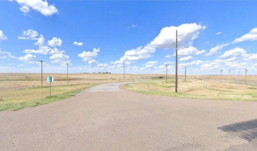
19. Balko – Prairie Porches and Big-Sky Nights
🔥 Would you like to save this?
Balko sits low to the ground amid open pasture and grain, its porches angled to catch the evening breeze. It stays secluded because Beaver County towns are thinly spaced and highways pass by without piling on traffic.
The vibe is practical and neighborly—co-op scales, church potlucks, and dogs who know every truck in town. Cast for catfish in the Beaver River, scout pronghorn at sunrise, birdwatch along shelterbelts, or road-trip to prairie overlooks that seem to tilt into forever.
Farming and ranching are the local language. Nights turn truly dark out here, and the constellations get a little louder. It’s the kind of small place that steadies your step.
Where is Balko?
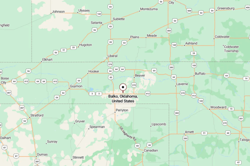
Balko is in eastern Beaver County along U.S. 270, about 22 miles east of Beaver. You roll past silos and pasture gates before the town gathers around the highway.
Services are modest, which keeps the pace gentle. It’s easy to find and easier to slow down in.
18. Knowles – A Few Streets and a Lot of Horizon

Knowles is a pocket-sized town whose grid dissolves into grassland almost as soon as it begins. Its off-the-grid feeling comes from distance—few neighbors, long drives to groceries, and plenty of space between fencelines.
The vibe is salt-of-the-earth quiet: tractors at idle, morning doves on the lines, and cottonwoods rattling near the river. Things to do include photographing vintage storefronts, fishing local bends of the Beaver River, birding along windbreaks, and taking slow loops down caliche roads to watch the light change.
Agriculture underpins the week, with just enough passing traffic to keep the post office busy. On windless nights, you can hear cows low from a mile away. It’s the kind of stillness that never feels empty.
Where is Knowles?
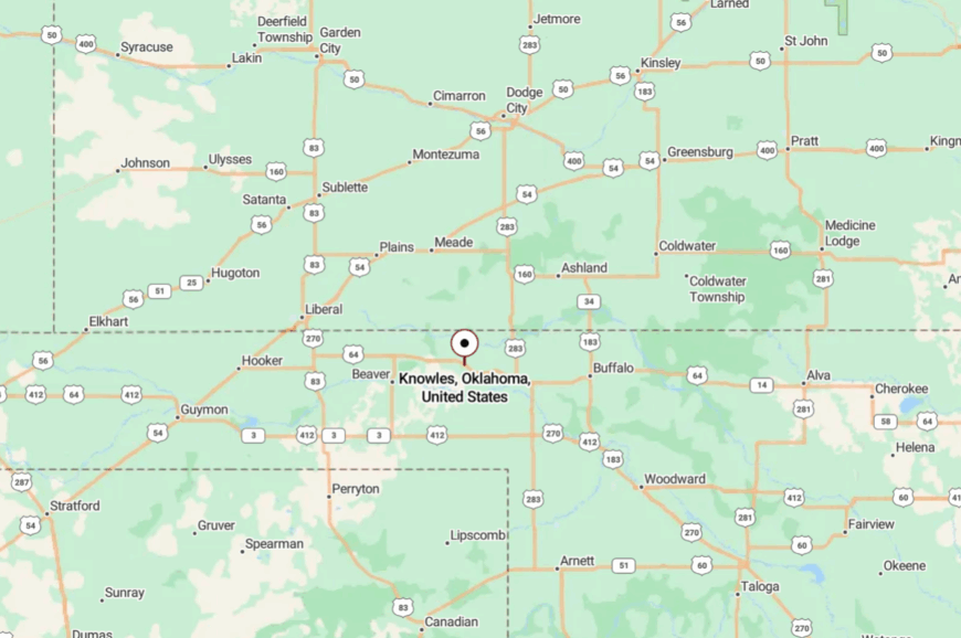
Knowles sits in northern Beaver County near the Beaver River, about 12 miles northeast of Beaver on Oklahoma county roads. You step off the main highway for a meander through pasture country.
There’s no rush in the approach, which suits the town fine. You arrive with the horizon as your escort.
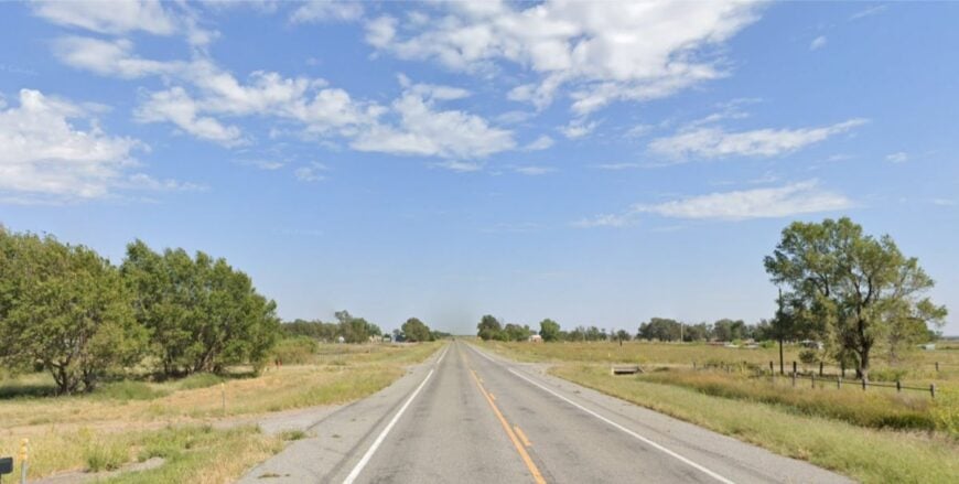
17. Elmwood – A Quiet Split in the Roads
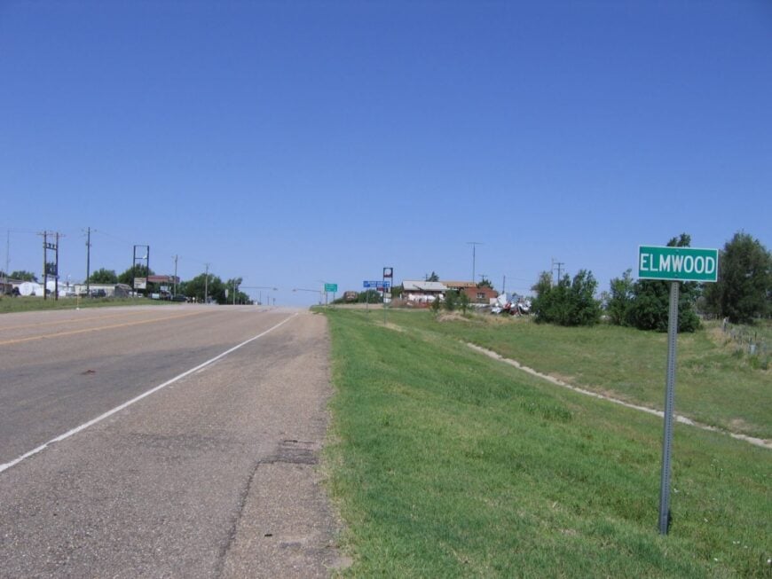
Elmwood is a tiny crossroads where two big routes meet but somehow don’t disturb the calm. Seclusion here is more about sparseness than distance—few buildings, fewer signs, and plenty of wind over grass.
The vibe is minimalist and useful: a church, a handful of homes, and long views in every direction. Picnic under cottonwoods at a nearby bridge, fish small river bends, follow gravel spurs into prairie canyons, or time a visit for a wildflower bloom.
Ranch trucks set the daily rhythm, and most errands head to Beaver. Even with highways nearby, the soundscape stays mostly sky. It’s a reminder that small can be very, very wide.
Where is Elmwood?
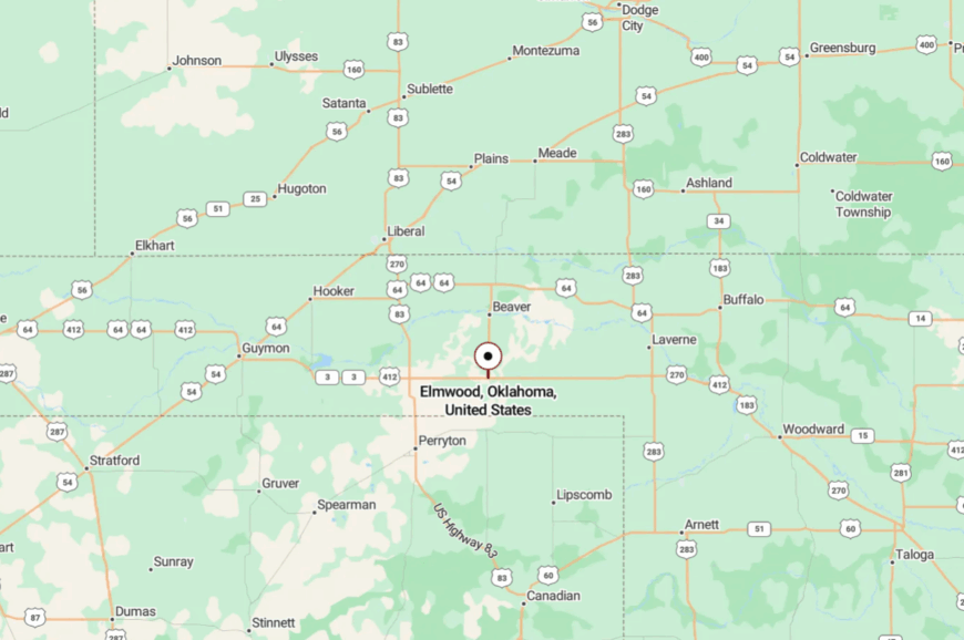
Elmwood lies near the junction of U.S. 270/412/OK-3 in central Beaver County, roughly 8 miles west of Beaver. Despite the intersection, the settlement itself is spare and quiet.
You roll in on pavement and leave on gravel if you like, chasing views. It’s close to the map’s bold lines, yet it feels tucked between them.
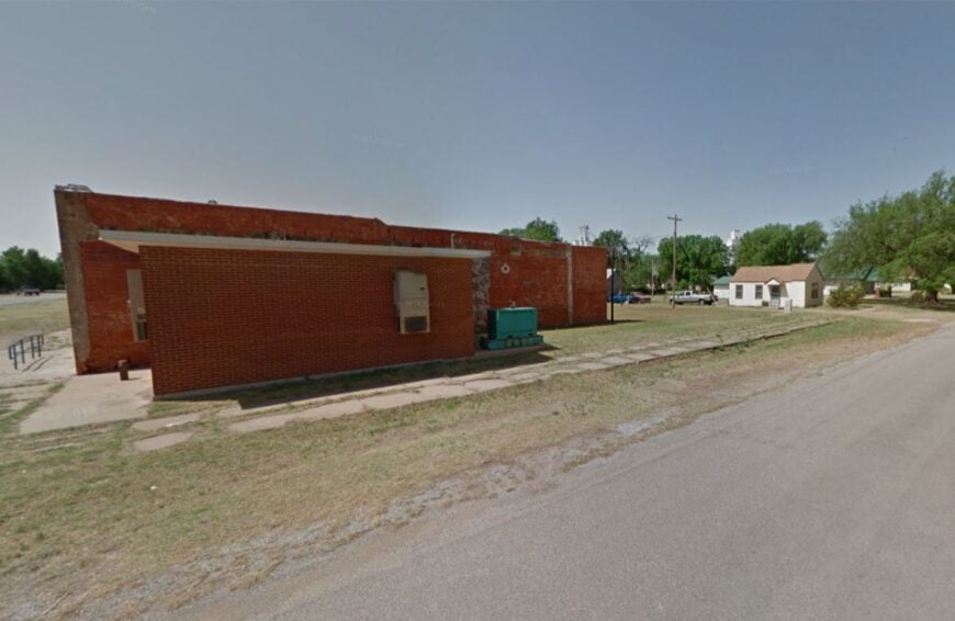
16. Rosston – Stone Corners and River Breaks
Rosston holds to a few calm streets not far from the Cimarron’s hidden bends. Its secluded feel comes from the long miles to larger towns and the way red-earth breaks and cedar draws muffle the world.
The vibe is small and steadfast—church bells, feed deliveries, and porch talk on breezy evenings. Explore nearby river overlooks, walk backroads for wild turkeys and deer sign, visit a local cemetery shaded by old bois d’arc trees, or photograph barns against storm-lit skies.
Ranching and small farms shape the week. Night falls fast and dark out here, revealing a sky that keeps good company. It’s the kind of place that teaches you to listen to the wind.
Where is Rosston?
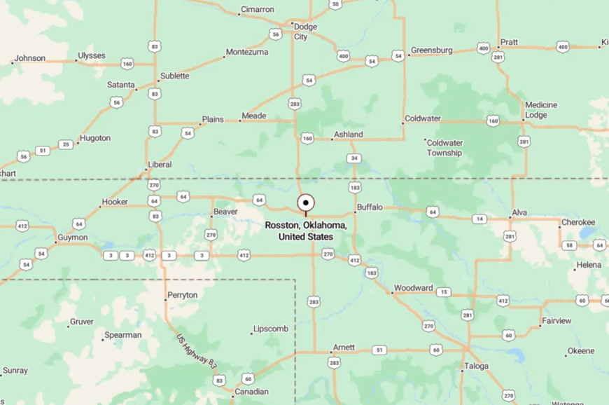
Rosston is in western Harper County, a short hop south of the Kansas line and about 12 miles west of Laverne. You reach it via lightly traveled state and county roads through ranch country.
Big highways keep their distance, preserving the hush. It’s nearby on the map and far in feeling.
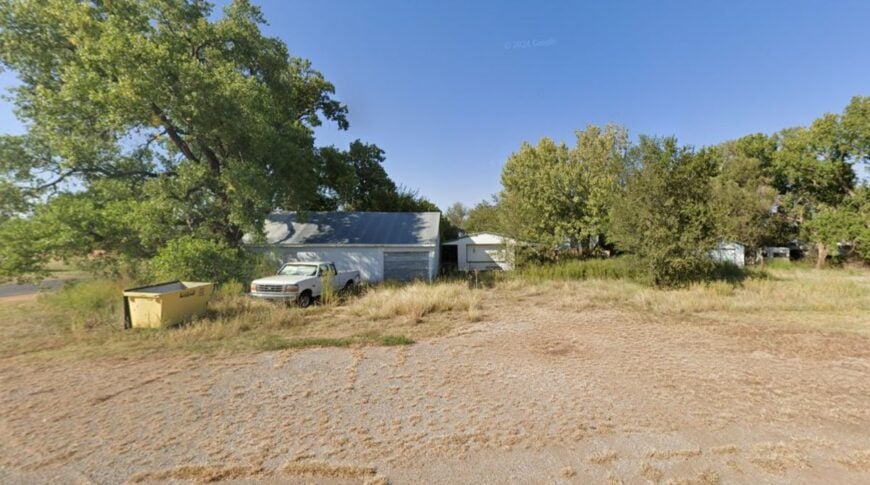
15. Freedom – Canyons, Caverns, and a Frontier Pace

Freedom looks out over the Cimarron breaks with a frontier calm that fits the land. Its seclusion is carved by canyon country and long drives between neighbors, with only a handful of businesses to mark town life.
The vibe is western and unfussy—historic storefronts, rodeo weekends, and coffee steam curling into cool morning air. Things to do include exploring Alabaster Caverns State Park, scanning cliff edges for turkey vultures, fishing shaded river holes, and driving red-dirt roads to surprise overlooks.
Ranching and seasonal tourism share the calendar. Even busy days feel unhurried when the canyon walls start catching evening light. It’s the kind of small town that makes time behave.
Where is Freedom?
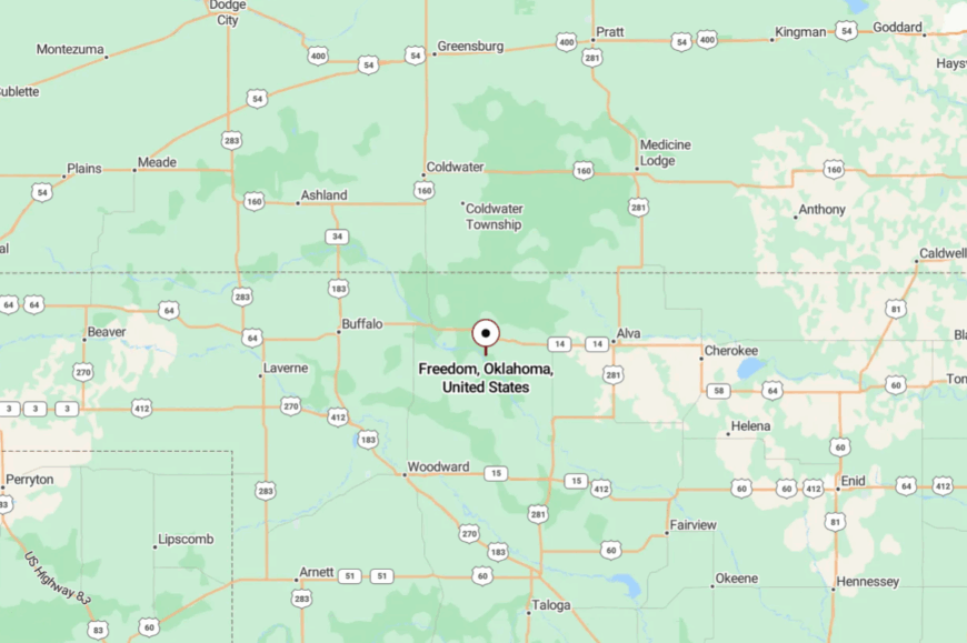
Freedom sits in western Woods County along U.S. 281, about 25 miles northwest of Alva. The approach winds through red-rock country and gypsum bluffs.
Services are modest, and that’s part of the appeal. You arrive with canyon air and leave with red dust on your boots.
14. Dacoma – Elevator Shadows and Big Wheat
Dacoma gathers around its elevator and a tidy grid of streets, with wheat fields stretching to a blue-edged horizon. It feels secluded because Woods County towns sit far apart and the nearest stoplight is many miles away.
The vibe is humble and sunny—flowerbeds by front steps, porch flags, and quiet mornings broken by a distant train horn. Things to do include sunrise walks past grain bins, birding along the field edges, photographing harvest scenes (with permission), and detouring to nearby prairie lakes.
Farming is the daily metronome here. Nights are dark and cricket-loud. It’s the kind of easy calm that sneaks up on you.
Where is Dacoma?

Dacoma sits in south-central Woods County on U.S. 281/OK-45, roughly 9 miles south of Alva. You roll through open country where the sky does most of the talking.
Distances are honest out here, so plan fuel and snacks. You’ll find the quiet waiting right at the town limits.
13. Mutual – Shelterbelts and Sunday-Morning Streets
🔥 Would you like to save this?
Mutual is a close-stitched village of shelterbelts and modest porches, easy to miss and easy to love once you turn in. Its off-the-radar feel comes from side-road access and the long stretch to bigger hubs.
The vibe is neighborly and no-rush—mowers humming, kids biking gravel alleys, and dogs napping in the shade. Walk the calm streets at dusk, birdwatch along hedgerows, drive south to the Gloss Mountains for a short hike, or picnic under elms that remember cooler decades.
Ranch and farm work share space with commutes to Woodward. After dark, porch talk replaces screens. It’s the kind of place where the quiet feels hand-made.
Where is Mutual?
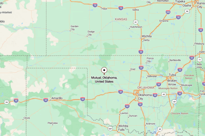
Mutual sits in eastern Woodward County just off U.S. 412, about 16 miles east of Woodward. You leave the highway for a brief jog on county pavement lined with fields.
The last mile already feels slower. It’s close to services, but set apart by choice and by trees.
12. Sharon – Quiet Blocks on the Prairie Wind

Sharon keeps its footprint small: a few quiet blocks, tidy yards, and prairie wind threading the cottonwoods. Seclusion comes from the distance between towns and the way U.S. 60 moves traffic past without building it up.
The vibe is small-town steady—church bells, Friday ballgames, and a café where the coffee is always ready. Things to do include an evening drive to Fort Supply Lake for fishing, sunrise birding near creek bottoms, a day trip to Boiling Springs State Park, or photographing big-sky cloudscapes over wheat.
Work mixes ranching, farming, and Woodward commutes. The slow here feels intentional. It’s the kind of place where a front porch counts as an address.
Where is Sharon?
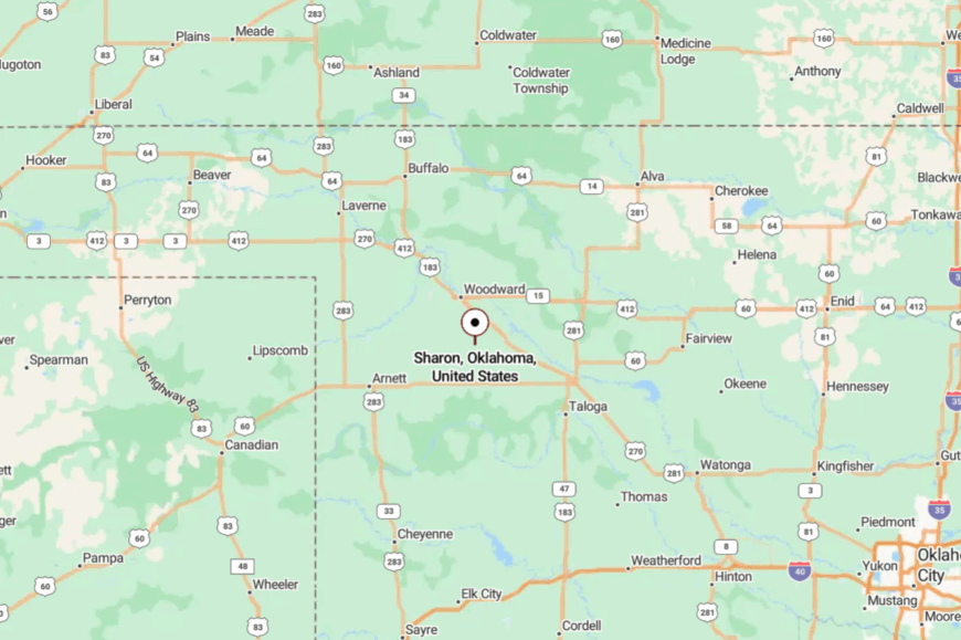
Sharon sits in southeastern Woodward County along U.S. 60, about 12 miles southeast of Woodward. You approach on gentle two-lane curves past shelterbelts and fields.
Services concentrate in Woodward, keeping Sharon’s evenings quiet. It’s close enough for errands, far enough for stars.
11. Jet – Salt Flats, Cranes, and Soft Mornings
Jet feels like a gateway to another planet—the bright salt flats of the Great Salt Plains just down the road. Its seclusion is shaped by wildlife refuge lands, a small, scattered population, and a travel rhythm that peaks in spring and fall but never gets loud.
The vibe is bird-friendly and unhurried: binoculars on dashboards, crystaling buckets in truck beds, and sunrise coffee steaming in the cool. Things to do include digging for selenite crystals at the Great Salt Plains, birding sandhill crane migrations, fishing quiet coves, and watching storms stride across the flats from a safe distance.
Farming and refuge-related tourism share the stage. When evening falls, the flats blush pink and the town exhales. It’s the kind of quiet that leaves a glow on your memory.
Where is Jet?
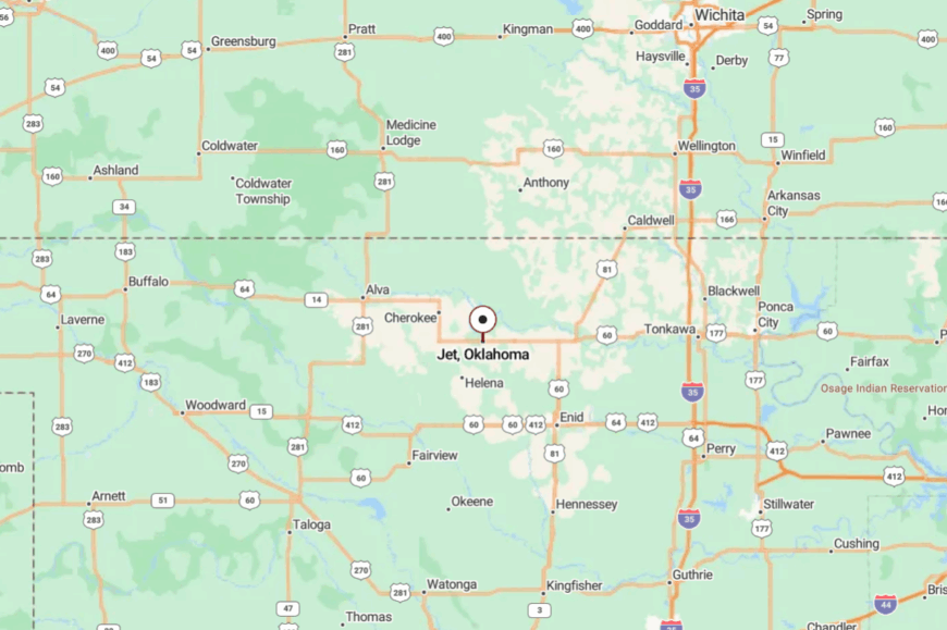
Jet sits in northern Alfalfa County at the junction of U.S. 64 and OK-38, about 8 miles south of the Great Salt Plains dam. You reach the refuge via simple, scenic two-lane roads that skirt fields and shelterbelts.
Town services are modest, with bigger needs met in Cherokee or Enid. It’s close to the wonders out on the flats, yet far from the noise they could bring.
10. Kenton – A Red-Mesa Hamlet at Oklahoma’s Far Western Tip
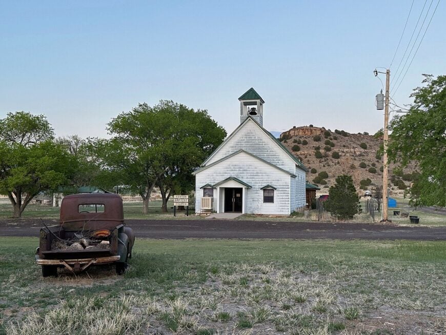
Roughly two dozen residents share Kenton’s cluster of adobe-tinted homes and historic stone buildings. Hikers tackle the Black Mesa Summit Trail nearby, fossil hunters comb Carrizo Creek, and amateur astronomers set up telescopes at Black Mesa State Park’s designated dark-sky zone.
Cattle ranching and seasonal tourism provide most of the local income, with small guest cabins filling on meteor-shower weekends. We appreciate how the town’s nearest neighbor with basic services sits 35 miles away, ensuring traffic noise never drowns out coyotes.
Giant basalt mesas surround the settlement like natural walls, giving every household multiple acres of elbow room. The result is an almost otherworldly stillness accented by brilliant night skies.
Where is Kenton?
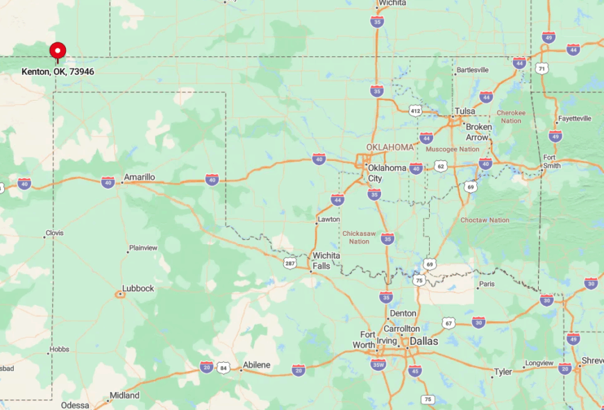
Kenton occupies the extreme western tip of the Oklahoma Panhandle, three miles from New Mexico and nine miles from Colorado. The community’s isolation stems from both geography and policy, as no state highways intersect the mesas here, and cell coverage fades fast.
Reaching it requires a scenic drive on State Highway 325 from Boise City, the Cimarron County seat. Travelers usually meet fewer than a dozen vehicles during the hour-long journey.
9. Avard – Ghost-Town Grain Elevators in an Ocean of Wheat
Fewer than fifteen year-round residents inhabit Avard’s scattering of farmsteads and abandoned storefronts. Bird-watchers stop to scan the nearby Avard Migratory Bird Refuge, and railroad buffs photograph the towering 1920s concrete elevators that dominate the skyline.
Wheat and cattle remain the economic backbone, though trains still swap freight cars at the lonely siding. Half the platted town blocks sit in waist-high prairie grass, proof of a boom that fizzled when passenger service ended.
Mile-wide crop fields separate each home, ensuring porch lights remain rare beacons on the horizon. We find the haunting silence broken only by rumbling grain cars and western meadowlarks.
Where is Avard?

🔥 Would you like to save this?
Avard stands in western Woods County, 12 miles southwest of Alva. The settlement’s seclusion is heightened by the fact that State Highway 45 bypasses it by three miles, leaving a county road as the only direct link.
Visitors exit the highway at unmarked gravel intersections and follow the elevator silhouettes to town. The nearest grocery store is a 20-minute drive away in Alva.
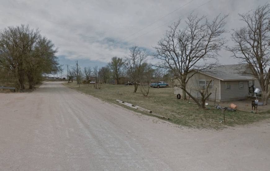
8. Selman – Hidden Ranches Among the Gypsum Bluffs
Selman claims close to sixty residents are scattered across cedar-blanketed hills. Outdoor enthusiasts hike the Selman Ranch trails during the annual Selman Bat Watch, where 1.5 million Mexican free-tailed bats emerge from a nearby cave at dusk.
Ranching and limited oil leasing supply most paychecks, while a small community center hosts quilting bees and potluck suppers. Cedar ridges act as sound buffers, so wind rustling junipers replaces highway drone.
Acre-plus lots back onto the Cimarron River Wildlife Management Area, guaranteeing no sudden subdivisions. We admire how the nearest stoplight sits more than twenty miles east in Buffalo.
Where is Selman?
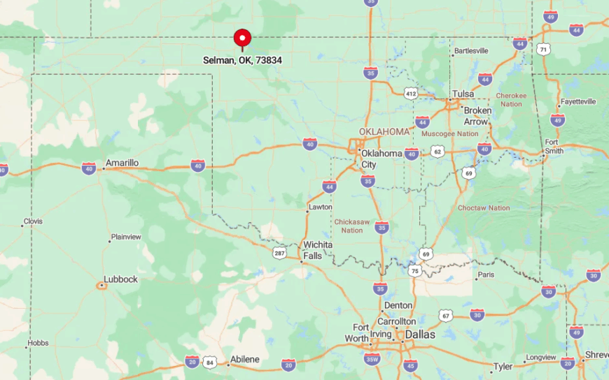
The town lies in Harper County along State Highway 270, roughly midway between Woodward and Buffalo. Its tucked-away position inside the Gypsum Hills creates a labyrinth of draws and cliffs that screen the settlement from through traffic.
Drivers reach Selman by winding along a two-lane blacktop that threads cattle guards and low water crossings. The route feels like a private road once you pass the last oil pump jack.
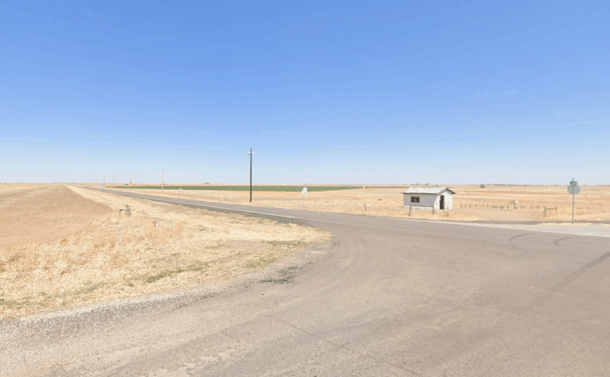
7. Tangier – Shelterbelt-Wrapped Prairie Crossroads
Tangier’s population hovers near ninety, with farmhouses clustered around a lone church and co-op shop. Locals host summer ice-cream socials and stage tiny Friday-night rodeos in a volunteer-built arena.
Wheat, sorghum, and livestock anchor the economy, while a handful of custom harvest crews base their equipment here. Dense rows of cedar and elm, planted during Dust Bowl recovery efforts, encircle each property and mute the U.S.
Highway 412 is just to the north. Miles of open rangeland keep light pollution low enough for clear views of the Milky Way. We note that many residents share more fence line with pronghorn than with neighbors.
Where is Tangier?
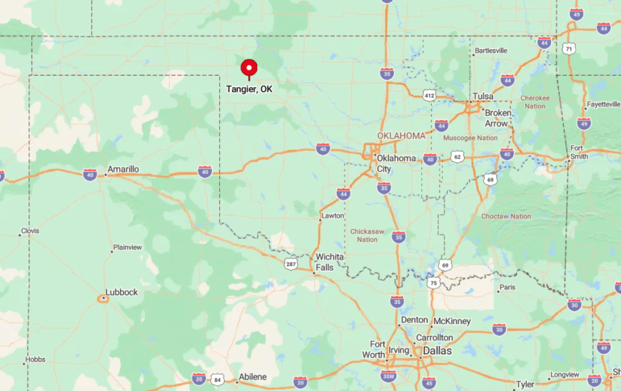
The crossroads sits in east-central Woodward County, twelve miles west of Mutual. Despite the nearby highway, the town hides on a parallel county road, so most travelers miss it entirely. Access involves turning south onto a gravel lane marked only by a faded “Tangier” sign. The closest gas pump is back in Woodward.
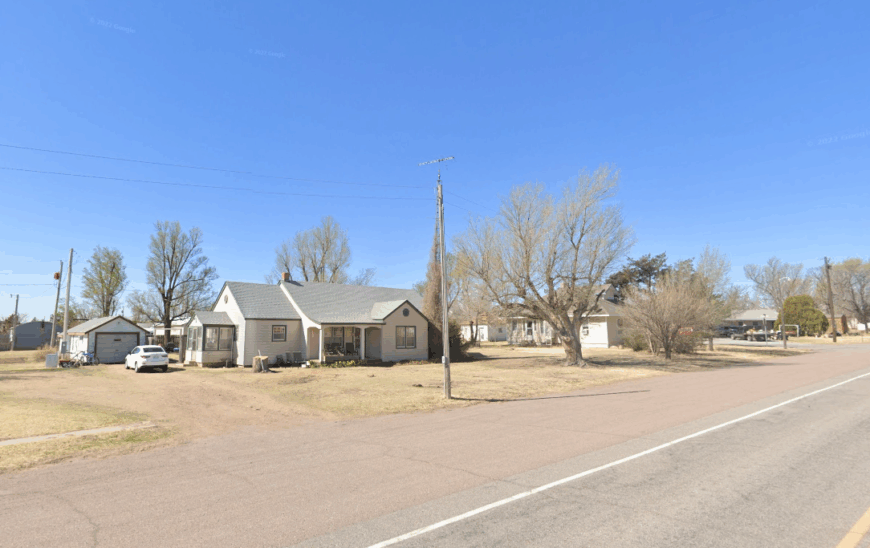
6. Straight – Railroad Siding Lost in Endless Sorghum
About thirty people reside in Straight, their homes dotted along a single dirt road that parallels the old Rock Island rail line. Photographers love the setting sun sinking behind square-mile sections of sorghum, and hunters use the area as a base for pheasant season.
Dryland farming provides nearly every job, supplemented by seasonal grain-hauling. With no businesses beyond an inactive depot and an aging church, daily life feels paused in mid-century.
Horizon-to-horizon views confirm the absence of nearby settlements or power-line clutter. We count fewer porch lights here than railcars stored on the sidetrack.
Where is Straight?
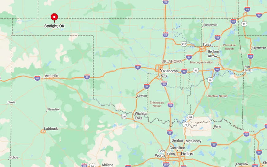
Straight lies in Texas County, eight miles northwest of Guymon. A web of section-line roads crosses the prairie, yet none are paved, reinforcing the sense of remoteness.
Visitors leave U.S. Highway 64 at Mile 54, then bump along graded clay for fifteen minutes. Rain can render the surface slippery, so locals check the weather before venturing out.
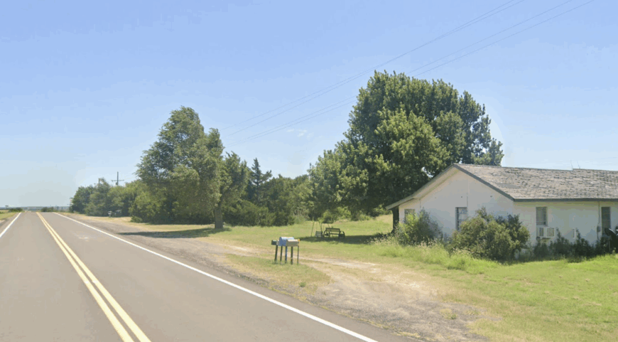
5. Gate – Stone Storefronts and Cedar Creek Bottoms
Gate supports roughly eighty residents who gather at a pair of stone storefronts dating to 1910. Day-trippers picnic at nearby Gate Canyon, explore petroglyphs etched by Plains tribes, and hunt turkey along Cedar Creek.
Cattle operations and small-scale hay farms keep Main Street’s feed store busy, while a volunteer fire department doubles as the town’s social hub. Acre-sized yards, towering cottonwoods, and the lack of chain stores give Gate a timeless feel.
Traffic counts rarely top a dozen vehicles per day on State Highway 270. We often hear creek frogs louder than engines here.
Where is Gate?
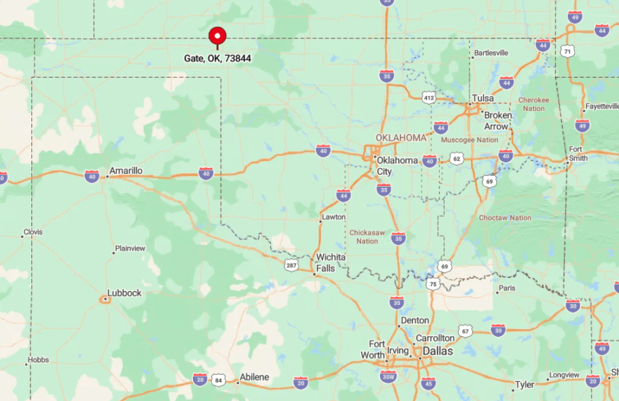
The village sits in Beaver County, three miles south of the Kansas line. Flanked by wooded ravines, it is screened from the nearest four-lane highway by rolling ranchland. Travelers use State Highway 281, then turn onto a narrower spur that ends at Gate’s stone façades. The closest supermarket is a half-hour away in Laverne.
4. Harmon – Windmill Country Off the Paved Grid
Just under fifty people call Harmon home, their mailboxes scattered along gravel spurs that trace section fences. Visitors come to photograph vintage windmills spinning above short-grass prairie and to fish at the seldom-crowded Beaver River bridge.
Livestock auctions in distant Woodward provide commerce, while small gas leases supplement ranch income. No paved road reaches the town’s center, and the absence of streetlights keeps the skies ink-black.
Thousands of open acres separate each ranch yard, so most conversation travels by two-way radio. We relish the pure silence broken only by windmill creaks.
Where is Harmon?

Harmon sits in Ellis County, thirteen miles southeast of Arnett as the crow flies. Getting there involves a series of numbered county roads that shift from asphalt to caliche to plain dirt. The route crosses cattle guards and unsigned intersections, ensuring few accidental visitors. Four-wheel drive comes in handy after heavy rain.
3. Hopeton – Sunflower Fields and Silent Grain Silos
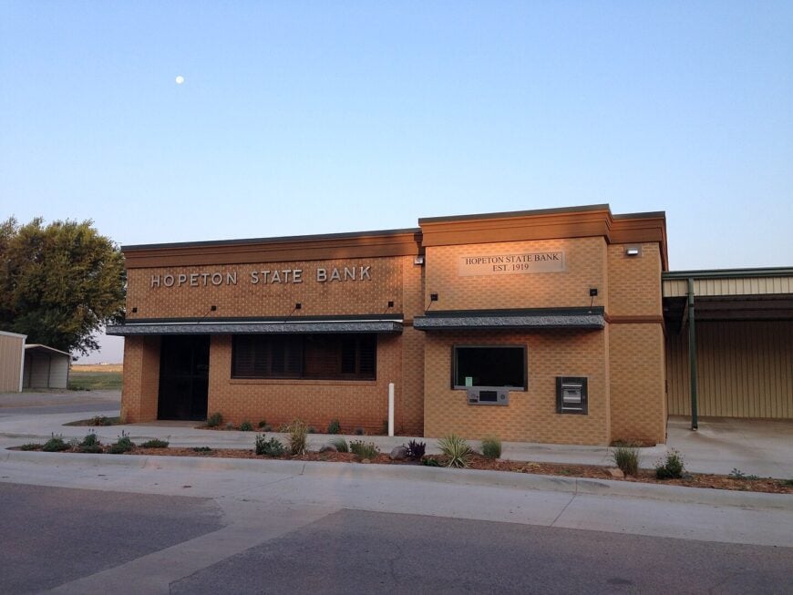
Hopeton maintains a population near eighty, orbiting around a dormant grain elevator that once loaded boxcars on the Santa Fe spur. Photographers line up each August when surrounding fields blaze yellow with sunflowers, and birders seek out burrowing owls nesting in the prairie dog town south of the tracks.
Agriculture, chiefly wheat and canola, fuels most paychecks, though some residents commute to nearby Alva for college or hospital work. Empty railbeds and quiet streets keep ambient noise low enough to hear quail whistling at dawn.
Half-acre and larger lots provide ample space for gardens and sheds. We find the town’s 15-mile gap from Alva maintains its small-town hush despite modern conveniences close by.
Where is Hopeton?

The settlement is in Woods County along State Highway 281, but its handful of cross streets sit a mile east of the pavement, effectively hiding it. Tall grain silos act as the only landmark on the otherwise flat plain.
Drivers reach Hopeton via a paved access road, then follow an abandoned spur line into the neighborhood. Most services require a return trip to Alva.
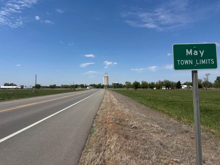
2. May – Cottonwood-Shaded Lanes in the Gypsum Hills
May lists around forty residents occupying century-old homes on multi-acre plots. Travelers explore nearby Alabaster Caverns State Park, cast lines in the meandering Cimarron River, and admire gypsum bluffs glowing pink at sunset. Ranching and gas-field maintenance supply employment, and a tiny café doubles as the post office.
White-cliff escarpments and creek-cut draws hem the town, leaving population density well below one hundred people per square mile. With no streetlights, the Milky Way regularly steals the show. We notice that conversations still happen from porch swings, not smartphones.
Where is May?
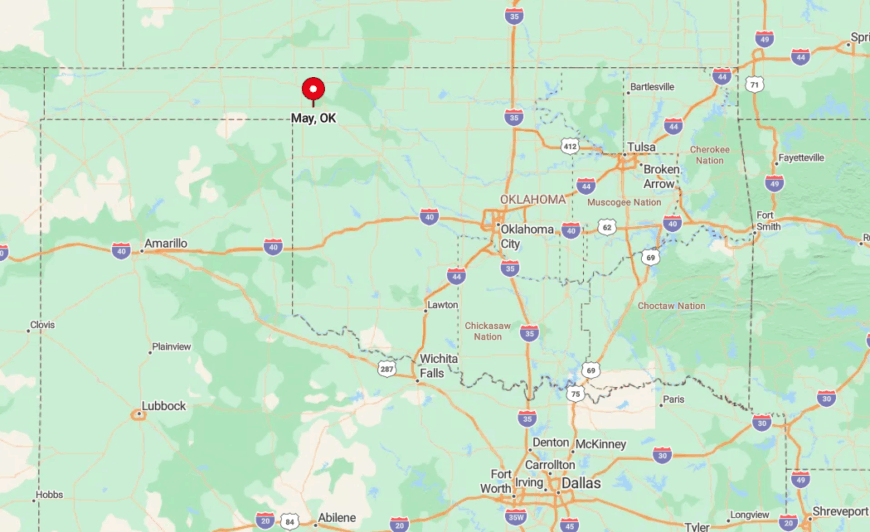
May occupies the far northwest corner of Harper County along State Highway 46. The community’s seclusion comes from being hemmed in by rugged Gypsum Hills that deter major road construction.
Most visitors exit U.S. Highway 270 at a small brown sign and follow a winding route through cattle gates. The nearest traffic signal is in Woodward, nearly 40 miles south.
1. Slapout – One-Store Intersection Under Infinite Sky
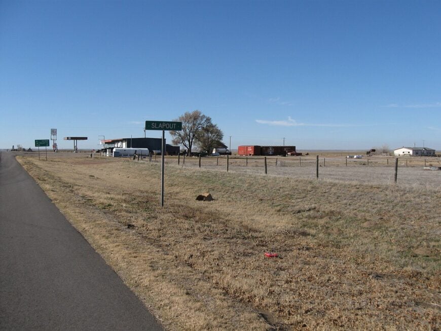
Slapout supports fewer than ten permanent residents clustered around a lone general store with a bright red roof. Travelers pause for fuel, homemade jerky, and local gossip before continuing along the empty stretch of U.S. Highway 412. Ranching dominates the landscape, with occasional oil pump jacks nodding in the distance.
Vast pastureland on all sides keeps engine noise faint and nighttime darkness complete. The closest urban center, Beaver, is 30 miles east, reinforcing the sense of self-reliance. We find the silence here almost tangible once the store’s generator kicks off after closing time.
Where is Slapout?
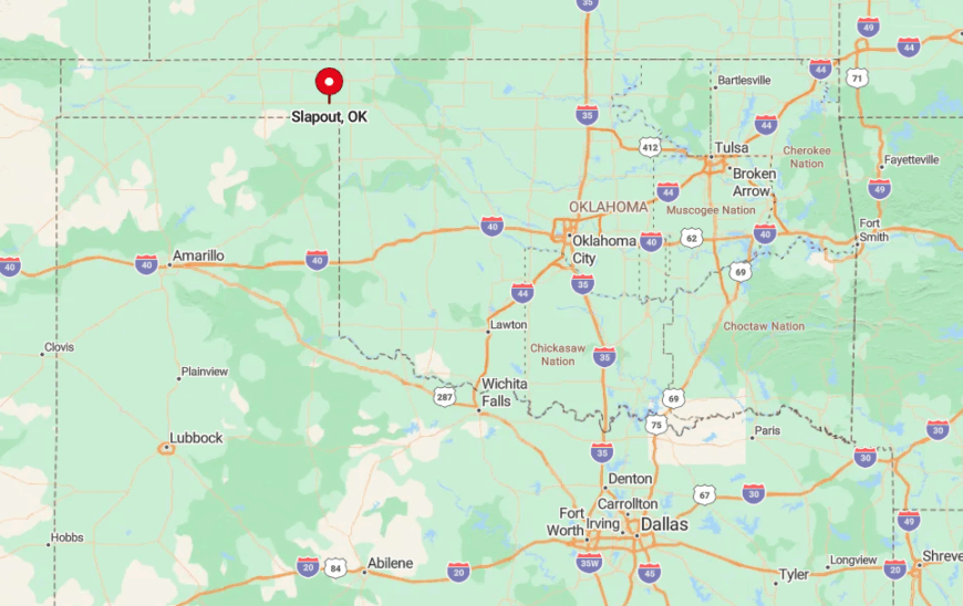
The hamlet stands in Beaver County at the junction of U.S. 412 and State Highway 3, though the “junction” consists of a single paved intersection. Surrounding land is so flat that the store’s porch light can be seen for miles, yet no other buildings interrupt the horizon.
Most visitors arrive by highway, as no rail line or bus route serves the area. After dark, drivers rely on distant radio towers to orient themselves during the empty twenty-minute run to Beaver.


