🔥 Would you like to save this?
Eastern Colorado often slips under the radar, yet its far-flung hamlets provide a rare brand of quiet—one built on wheat-scented breezes, prairie sunsets, and roads so empty a lone pickup raises a mile of dust. We rounded up ten places where neighbors still wave from porches and the night sky never competes with city glare.
These towns are small—smaller than most high-school graduating classes—but each holds a story, a landmark, or a local tradition worth the detour. From the volcanic sentinels of Two Buttes to America’s tiniest jail in Haswell, every stop proves that seclusion doesn’t have to mean monotony.
In order to come up with the very specific design ideas, we create most designs with the assistance of state-of-the-art AI interior design software. Also, assume links that take you off the site are affiliate links such as links to Amazon. this means we may earn a commission if you buy something.
If a slower pace sounds appealing, start plotting a route through the high-plains hush. Below, the countdown begins.
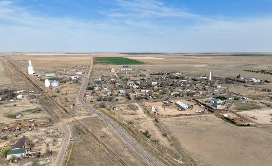
10. Karval
Karval claims roughly 35 year-round residents, most living on sprawling one-acre ranch sites or larger spreads that blur into the surrounding short-grass prairie.
Bird-watchers descend each spring for the Mountain Plover Festival, while hunters comb the adjacent Karval State Wildlife Area for dove, pronghorn, and the occasional trophy white-tail. Agriculture dominates; a solitary grain elevator and several family cattle operations keep the local economy ticking.
A community hall hosts potlucks, card nights, and an October craft fair that draws folks from counties away. With no stoplights, no gas station, and the nearest full grocery fifty miles off, peace settles over the town like fresh snow. Endless horizons and mile-wide skies guarantee that even voices seem to disappear into the grass.
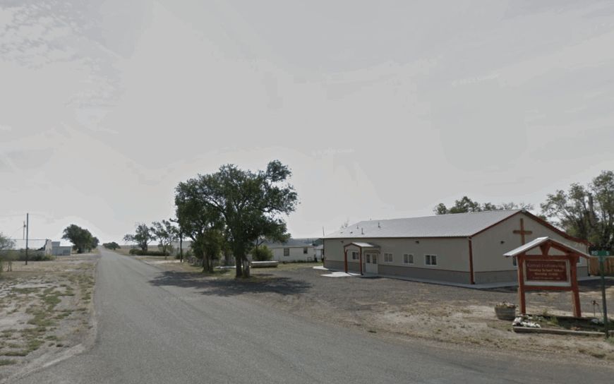
Where is Karval?
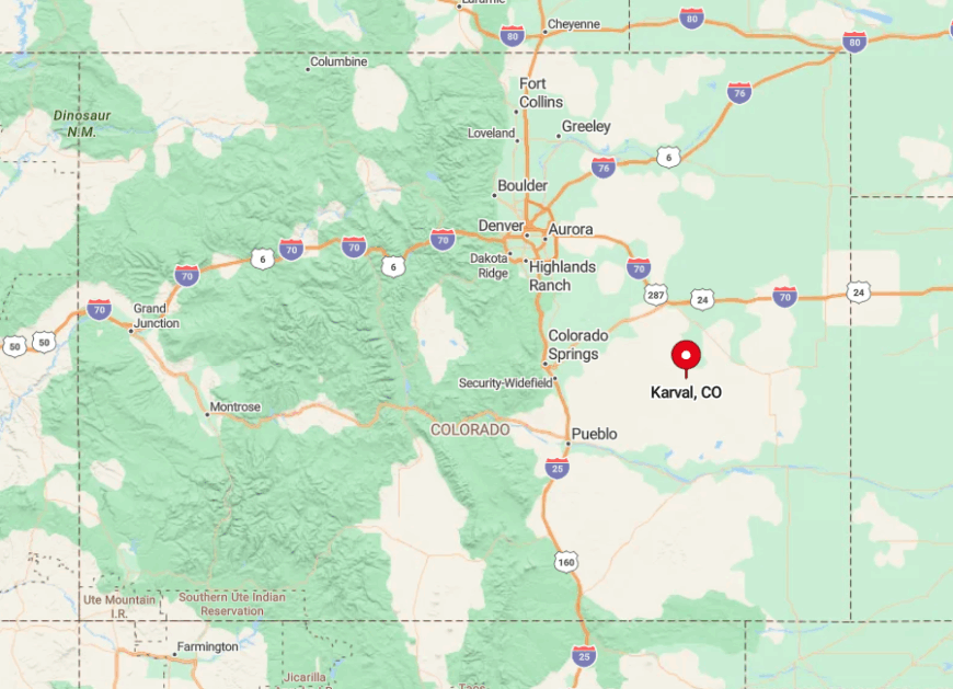
Karval sits in south-central Lincoln County, a good hour southeast of Limon and an equal distance north of Ordway. Unpaved county roads form the last stretch, and after dark the only guideposts are windmill silhouettes and the glow of distant farmhouses.
State Highway 94 misses the town by twenty-three miles, helping preserve the sense that Karval sits inside its own quiet bubble. Travelers usually reach it by following County Road G from Hugo, a route that turns from asphalt to gravel long before the town sign appears.
9. Branson
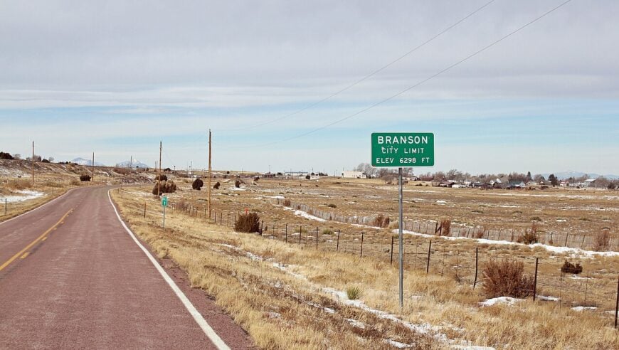
Home to about 60 residents, Branson occupies Colorado’s extreme southern tip where sagebrush meets sandstone mesas. Visitors can explore century-old brick storefronts, hike Madrid Canyon, or photograph pronghorn herds against the distant Sangre de Cristo range.
Ranching is the lifeblood here, with cow-calf operations and seasonal hay cutting employing most of the population. The school gym doubles as a community center, and Friday chili suppers are still announced on a hand-lettered board outside the post office.
Main Street’s boarded windows and gently rattling screen doors whisper of better railroad days, yet the town’s very emptiness forms its charm. With Trinidad more than an hour north and Raton Pass closing in bad weather, Branson feels tucked away in its own pocket of prairie time.
Where is Branson?
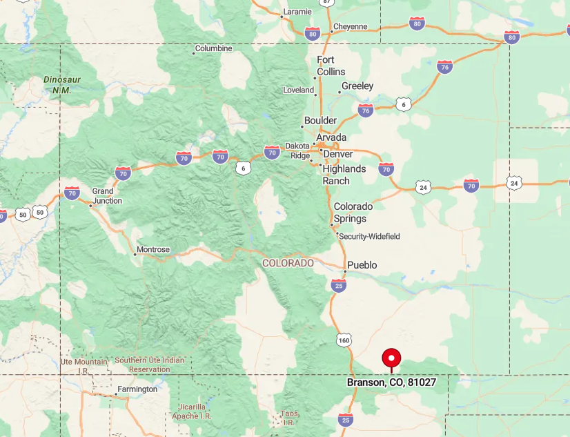
Branson lies three miles north of the New Mexico line in Las Animas County, reached via steep-shouldered Highway 389. The route meanders through open range and mesas that block cell reception for long stretches, reinforcing the isolation.
The nearest commercial airport sits 110 miles away in Pueblo, and winter storms can briefly strand drivers until plows arrive from Trinidad. Those who make the trip are rewarded with mesa-top vistas and night skies bright enough to read by starlight.
8. Two Buttes

Fewer than 50 people call Two Buttes home, their houses clustered beneath twin volcanic plugs that rise like sentries above the plains. Anglers frequent the 1,300-acre Two Buttes Reservoir State Wildlife Area, casting for largemouth bass and spotting golden eagles on the cliff faces.
Dryland farming—mostly winter wheat and milo—shares the economic stage with a handful of cow-calf ranches. A tiny café inside the old Sinclair station serves green-chile cheeseburgers to hunters and locals alike on weekends.
Distance is this town’s security system; U.S. Highway 287 sweeps past twenty-five miles west, leaving the main street in a near-perpetual hush. Abandoned storefronts testify to boom-and-bust cycles, yet the buttes themselves remain unchanged guardians of the settlement below.
Where is Two Buttes?
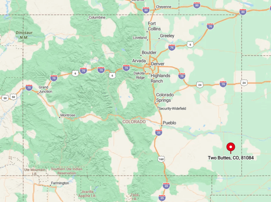
Two Buttes sits in extreme southeast Baca County, thirty minutes northeast of Springfield via County Road A. The last ten miles are gravel, punctuated by cattle guards and the occasional lesser prairie-chicken fluttering across the track.
Because rail lines bypassed the area decades ago and the reservoir blocks any straight-line route, traffic is virtually nonexistent. Visitors typically aim for sunrise, when alpenglow paints the buttes rose-gold and the only soundtrack is meadowlark song.
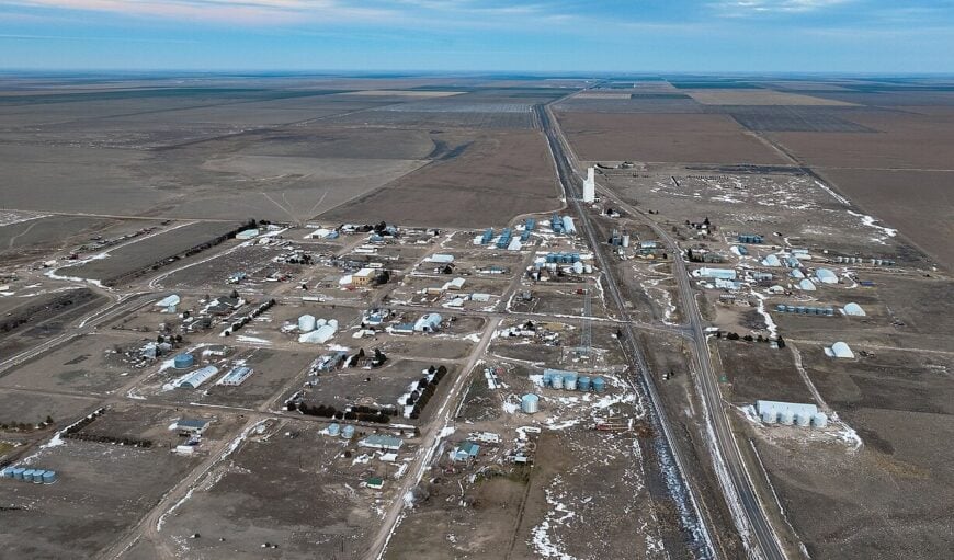
7. Haswell
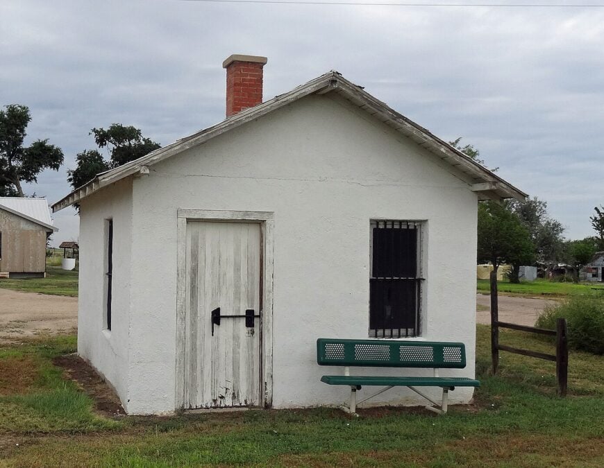
Haswell’s census hovers near 70, and its proudest landmark is an eight-by-ten-foot wooden shack billed as America’s smallest jail. Kids ride bicycles down broad dirt streets to the Kiowa County Library outpost, while parents tend cattle or service the nearby wind-energy towers that dot former wheat ground.
An annual Antique Tractor Pull brings in vendors selling funnel cakes and homemade parts for pre-1940 Farmalls. Half the town’s perimeter remains raw prairie, broken only by yucca clumps and the glint of old barbed wire.
Without a bank, pharmacy, or even a café most days, quiet reigns until a Union Pacific freight train barrels by on the hour. The sense of space stretches in every direction, reminding visitors just how large the plains can feel.
Where is Haswell?
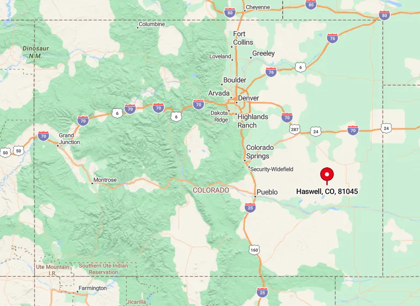
Positioned on State Highway 96, Haswell lies eighty-five miles east of Pueblo and fifty-five west of Eads. While the blacktop does reach town, services taper off rapidly once the Arkansas River valley fades in the rearview mirror.
Amtrak’s Southwest Chief rumbles through after midnight but no longer stops, leaving personal vehicles as the only practical link. With cell towers sparse, a paper map or downloaded GPS remains the safest bet for newcomers.
6. Wild Horse
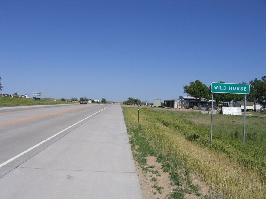
Wild Horse registers only a handful of year-round residents—locals joke the population can fit in a single pickup.
The town’s weather-worn grain elevator and collapsed mercantile draw photographers chasing prairie nostalgia, while nearby Sand Creek Massacre National Historic Site offers sobering history fifteen miles north.
Remaining livelihoods revolve around cattle and custom hay baling; the once-busy rail spur was pulled in the 1950s. Locals meet at the old schoolhouse, now a community room, for domino tournaments and potluck stews each second Saturday.
Twenty miles separate Wild Horse from the nearest gas pump, and mail still arrives via rural route from Kit Carson. With starlight bright enough to cast shadows, the settlement embodies off-the-grid calm.
Where is Wild Horse?
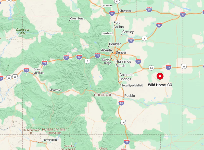
Wild Horse sits in western Cheyenne County, just south of U.S. Highway 40 on County Road 41. Travelers exit the highway onto packed dirt that can turn to gumbo during summer cloudburst.
The nearest interstate interchange lies eighty miles west in Limon, ensuring traffic remains farm trucks and the occasional adventure motorcyclist. Those who reach the ghostly elevator often have the place to themselves, save for meadowlarks perched on sagging telegraph poles.
5. Sheridan Lake
Roughly 50 people live in Sheridan Lake, their homes scattered along the south shore of a 1,100-acre reservoir stocked with wiper and crappie. Summer brings anglers, waterfowl hunters, and sunset picnickers to the state wildlife area, while autumn finds residents cheering six-man football at the combined Plainview School.
Farming and cattle remain economic mainstays, supplemented by seasonal jobs with Colorado Parks and Wildlife. An unstaffed grain elevator and a fuel island operated by key-card serve both locals and highway travelers.
Fifteen miles separate the community from any true commercial strip, leaving nights serenaded by owls rather than car stereos. The water itself forms a natural buffer, limiting sprawl and keeping horizons uncluttered.
Where is Sheridan Lake?
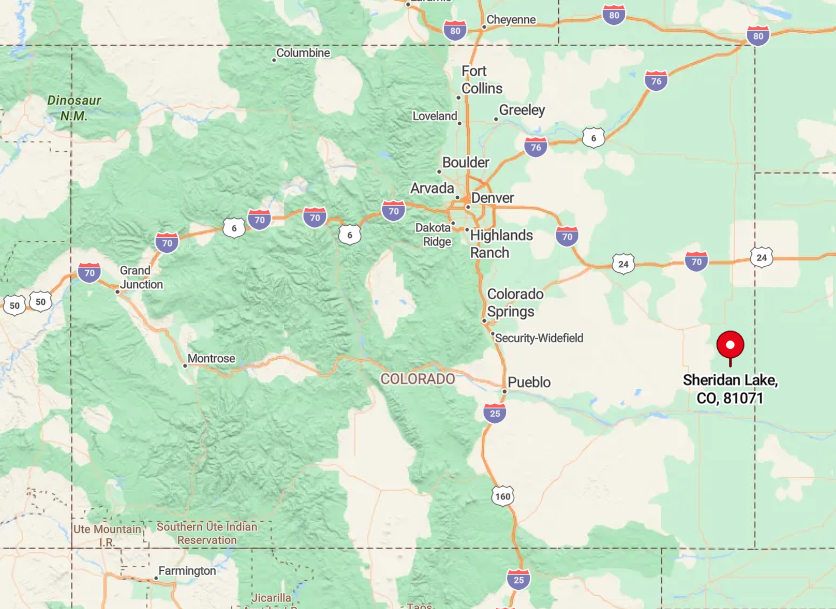
Nestled along U.S. Highway 385 in Kiowa County, Sheridan Lake lies sixty miles south of Burlington and forty north of Lamar. Despite the highway connection, low traffic counts—often under 600 vehicles a day—maintain a tranquil atmosphere.
Amtrak riders can disembark in Lamar and rent a car, but most visitors simply drive, watching for pronghorn that treat the pavement as open range. Gravel turnouts provide shoreline access, yet after dark the only lights come from the occasional passing semi and the Milky Way overhead.
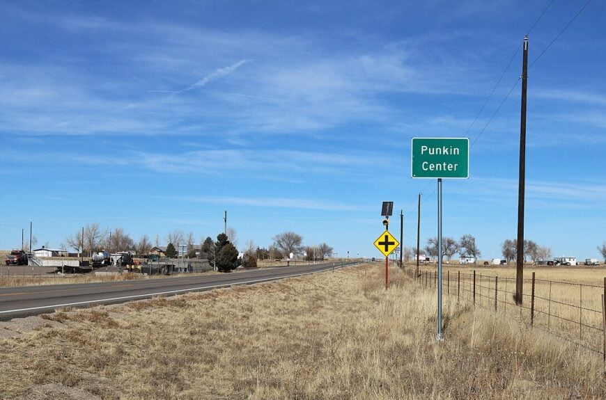
4. Punkin Center
🔥 Would you like to save this?
Punkin Center isn’t even a census-designated place; no more than a dozen homesteads surround the lonely junction of State Highways 94 and 71. The landmark is a single country store offering diesel, fried burritos, and local gossip beneath pumpkin-orange trim that honors the town’s name.
Cattle ranching blankets the rolling acres around it, and distant wind turbines flash red aircraft beacons each night. Bird hunters stop for coffee at dawn before heading toward Rush State Wildlife Area, and soon share the counter with truckers swapping road reports.
With no school, church, or bar, social life hinges on chance meetings at the crossroads. After sunset, headlights vanish for minutes at a time, leaving the prairie to coyotes and the hum of distant turbines.
Where is Punkin Center?
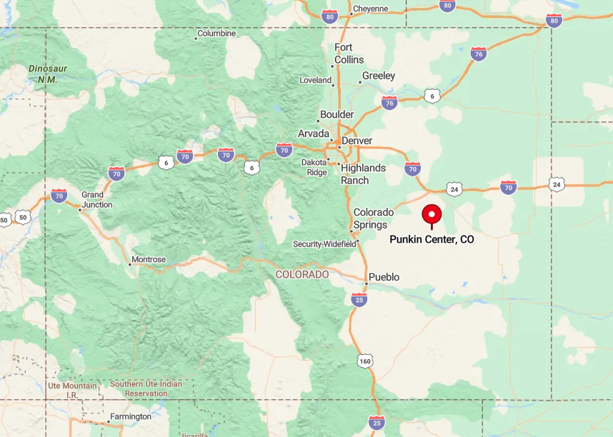
The settlement lies in Lincoln County, 55 miles southeast of Colorado Springs via Highway 94. Traffic thins dramatically east of Ellicott, and the final twenty miles pass nothing but fence lines and stock ponds.
The nearest bus depot and medical clinic are both in Limon, forty minutes north by a two-lane highway. For travelers, cell coverage often drops outside of town, so the store’s payphone—yes, still functional—remains a quirky lifeline.
3. Joes

Approximately 80 residents inhabit Joes, a hamlet famous for the “Wonder Boys” basketball team that won national acclaim in the 1920s. Today, visitors stop to photograph the art-deco Joes School gym, then sample homemade kolaches at the community café operating on Friday mornings.
Dryland wheat and cattle rule the economy, augmented by a grain cooperative that loads unit trains bound for Gulf ports. Locals stage a summer Wheat Festival with tractor pulls and a free watermelon feed on the gym lawn.
Gravel roads stretch in every direction, creating a soundscape of rustling wheat and meadowlarks rather than engines. Being 100 miles from Denver yet lacking direct interstate access keeps Joes’ traffic counts low and solitude high.
Where is Joes?
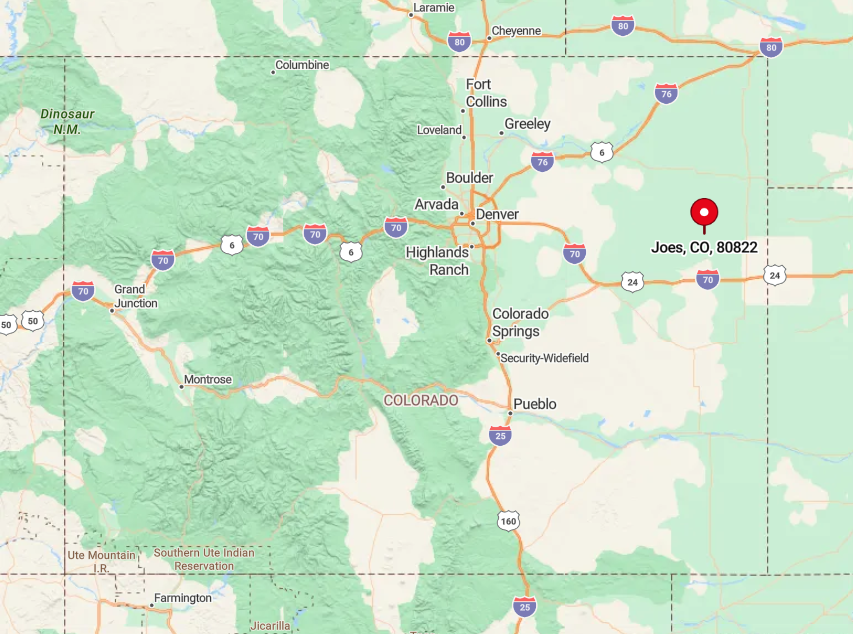
Joes sits in Yuma County, just south of U.S. Highway 36 and twenty-five miles east of Cope. Drivers from the Front Range usually exit I-70 at Stratton and follow county roads north through wide-open wheat country.
The last gas station before town is a card-lock pump in Kirk, so visitors top up early. With rail only for freight and no commercial flights within seventy miles, the best arrival plan is an unrushed road trip.
2. Idalia
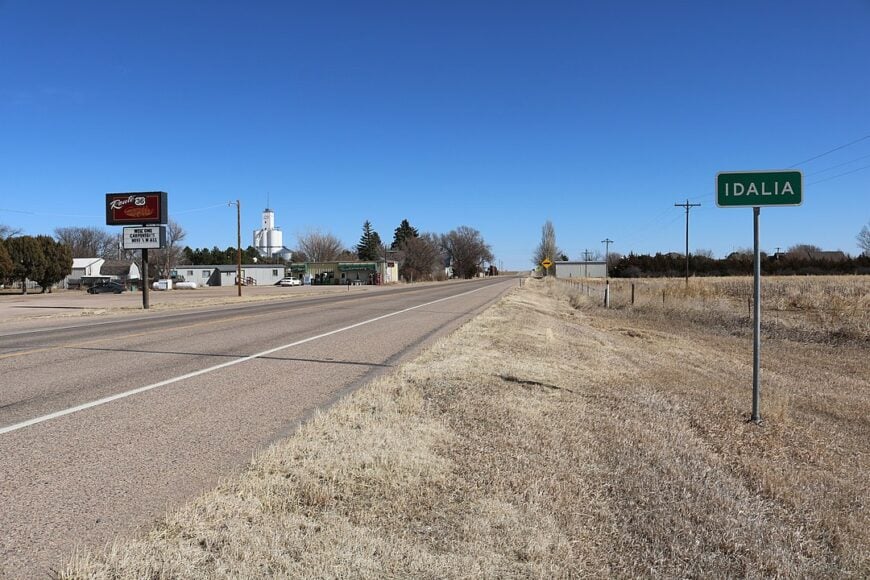
Idalia hosts roughly 100 people and a surprisingly active community hall that doubles as a steakhouse every Saturday night. Outdoor enthusiasts explore the nearby breaks of the Republican River, finding hidden cottonwood groves and mule-deer bedding grounds few outsiders see.
Wheat, corn, and sunflower fields surround the village, and a bulk-fuel distributor offers steady employment. The volunteer fire department organizes a fall Oktoberfest complete with polka band—proof that small doesn’t mean sleepy.
Homes spread across acre-plus lots, separated by windbreaks and cattle fences that absorb highway noise. With the nearest true shopping thirty miles off in Burlington, evenings remain filled with cricket song and the occasional distant train horn.
Where is Idalia?
Situated along U.S. Highway 36 in eastern Yuma County, Idalia lies a dozen miles west of the Kansas border. Despite the highway, sparse traffic and surrounding river valleys create a pocket of calm broken only by harvest convoy noise each July.
Interstate 70 sits thirty miles south via lightly patrolled county roads, but most visitors appreciate the slower, more scenic route. Greyhound discontinued service years ago, so personal vehicle or bicycle remains the sole ticket in.
1. Campo
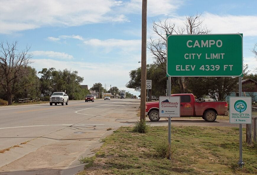
Campo, population about 100, serves as a quiet gateway to the vast Comanche National Grassland that blankets southeastern Colorado. Travelers detour here to hike Picture Canyon’s ancient rock art, scout Lesser Prairie-Chicken leks at dawn, or sip coffee at the simple brick café where ranch hands share rainfall reports.
Cattle ranching and seasonal tourism provide livelihoods, while a compact K-12 school anchors community events ranging from bingo nights to branding-day barbecues.
Twice a year, star-party enthusiasts gather on the football field to take advantage of Bortle-1 darkness—some of the clearest skies in the lower forty-eight. Highway 287 skirts town yet carries little more than long-haul truck traffic after nightfall, so silence reigns once the last rig passes.
Protected public lands on three sides keep development at bay, ensuring Campo’s horizons stay wide and wild.
Where is Campo?

Campo occupies Baca County’s southern tier on U.S. Highway 287, only eight miles north of the Oklahoma line and forty south of Springfield. Despite the numbered highway, distances are formidable: the nearest commercial airport is 150 miles away in Amarillo, Texas.
The town sits between two units of Comanche National Grassland, and unpaved forest roads weave into canyon country where GPS signals fade. Reaching Campo is simple—follow 287 straight south—but leaving the quiet behind proves harder than most expect.