Would you like to save this?
Western Montana still shelters pockets of quiet where gravel crunches louder than traffic and the night sky rules the schedule. From river-bottom hay fields to ridge-top cabins, these hamlets and homesteads invite residents to trade congestion for the scent of lodgepole and larch.
We gathered ten of the most secluded neighborhoods stretching from the Idaho line to the Crown of the Continent, spots where mailboxes are few and neighbors wave from half a mile away.
Each community offers its own mix of adventure—fly-fishing runs, backcountry ski lines, or simply the pleasure of listening to wolves sing on a cold January night.
Population counts are best guesses, Wi-Fi can be temperamental, yet the sense of breathing room is beyond measure. Now, let’s count them down, starting with the farthest-flung hideouts and working toward the merely remote.
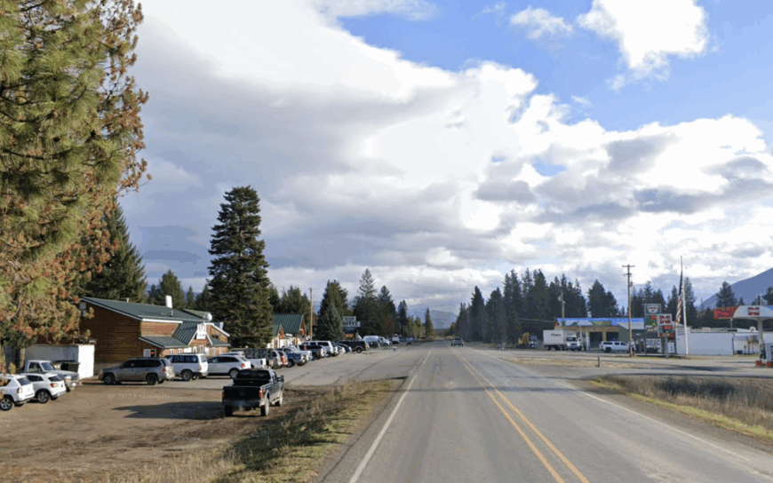
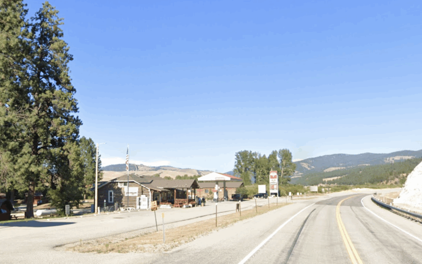
10. Petty Creek Benchlands – Near Alberton, Mineral County
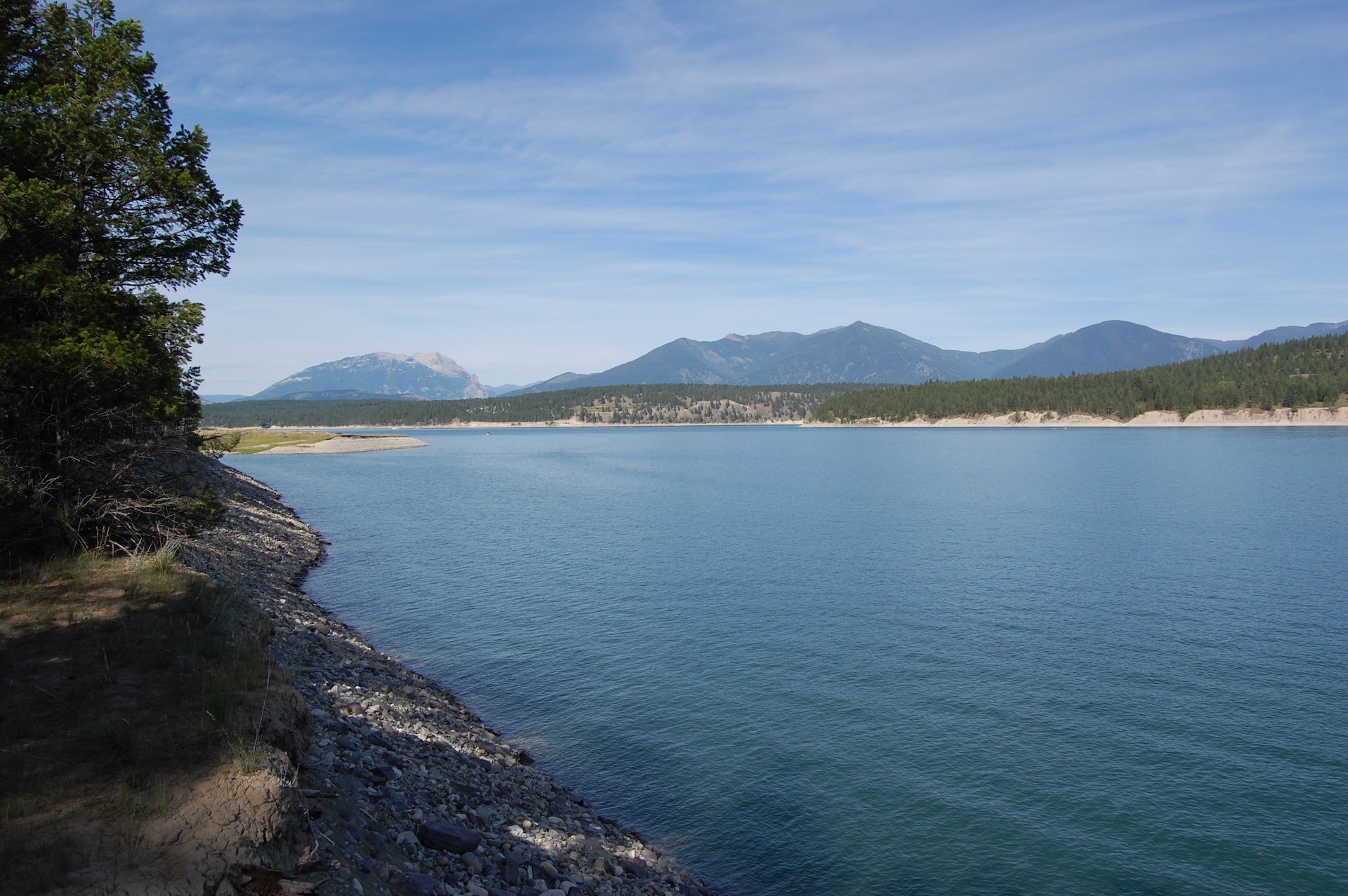
High above the turquoise bends of the Clark Fork River, the Petty Creek benchlands unfold in a patchwork of sage, bunchgrass, and scattered ponderosa pine. Wide verandas face the Sapphire Mountains, and sunsets here can paint the sky in layers of tangerine no photo filter can match.
There are fewer than seventy residents across the entire bench, leaving nights dark enough for meteor showers to steal the show. Horseback riders enjoy seamless access to old Forest Service trails, while rafters run the Alberton Gorge just down the hill.
Local lore speaks of a hidden cave where Ponderosa pitch was once harvested for lanterns, reachable after a hardy half-day scramble. Community spirit shines during August’s potluck picnic at the Petty Creek School, now a lovingly restored one-room museum.
Where is Petty Creek?
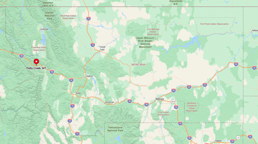
From I-90 at Alberton, a paved road follows Petty Creek for ten miles before switching to gravel and climbing steep switchbacks onto the benches. The plateau sits roughly a thousand feet above the valley floor, granting panoramic views yet remaining sheltered from floodwaters below.
Missoula is a manageable forty-minute commute, though many residents stock up monthly to limit trips. Wildlife crossings are common, so dusk drivers slow for roaming bighorn sheep.
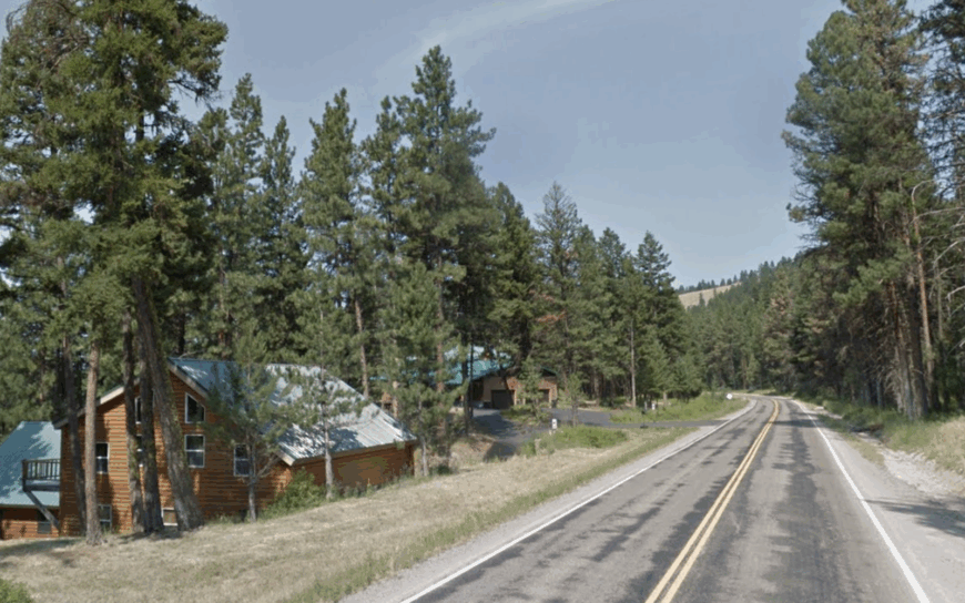
9. Trout Creek Highlands – Sanders County
The pine-covered slopes rising above the Clark Fork cradle a handful of five-acre homesteads where deer far outnumber cars. Morning coffee often pairs with the sight of a bald eagle cruising thermals that swirl over Noxon Reservoir.
It’s estimated 30-40 people live here year-round, drawn by the promise of quiet and endless firewood. Residents spend weekends boating to hidden coves, picking morel mushrooms after spring rains, or exploring the defunct Vermilion River gold dredge piles.
A little-known perk is the community’s lending library housed in a vintage Forest Service trailer, tucked behind the volunteer fire station. Star parties on clear fall nights reveal Andromeda with the naked eye, an experience city visitors rarely forget.
Where is Trout Creek?
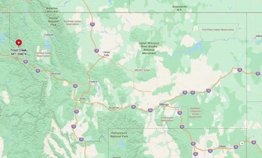
The Highlands sit three miles south of Trout Creek via Marten Creek Road, then up a gated private lane that winds through thick timber. Elevation gain provides sweeping views of the Cabinet Mountains and keeps summer evenings a few degrees cooler than the river valley.
The nearest grocery is a small market in Trout Creek; larger markets run to Sandpoint, Idaho, and take just over an hour. Gravel is well-maintained, but spring thaw can turn driveways into an off-road adventure.
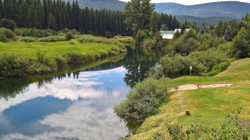
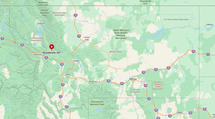
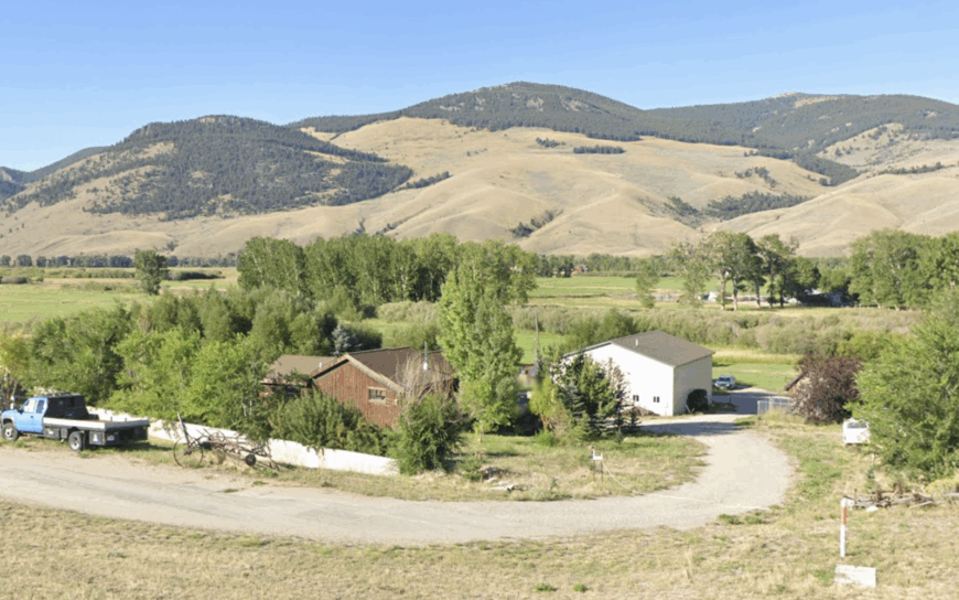
8. Woodworth Meadows – Between Seeley Lake and Ovando, Missoula County
Woodworth Meadows opens like a green bowl between conifer ridges, its hay fields dotted with widely spaced log homes on ten-acre tracts. In June, yellow balsamroot carpets the ground, and sandhill cranes serenade sunrise from the marsh edges.
Roughly 90 residents winter over, many of whom participate in a neighborly rotation of snowplowing the long drive into Highway 83.
Recreation runs year-round: cross-country skiing on packed ranch lanes, berry picking in nearby Cottonwood Lakes Roadless Area, and casting dry flies to gullible cutthroat in the Clearwater River.
The hidden jewel is a century-old, spring-fed icehouse kept operational as a communal walk-in cooler for game meat and surplus garden bounty. Evenings often end with a sky free of light pollution—perfect for spotting the faint shimmer of the northern lights.
Where is Woodworth?
Would you like to save this?
Access begins twelve miles north of Seeley Lake at Woodworth Road, a quiet spur that marches west for five miles before breaking into private lanes. The meadows sit on a high plateau that drains toward the Blackfoot, giving the area rich alluvial soil and surprise moose visits.
Missoula is seventy miles south, though Ovando’s tiny mercantile provides just-in-time essentials. Snowfall is generous, so residents keep tractors chained and fuel tanks topped off by Halloween.
7. Big Hole River Benchlands – Near Wisdom, Beaverhead County
On the high sagebrush benches outside Wisdom, ranches command 360-degree views of the Pioneer and Anaconda ranges with mile-long driveways as the price of admission. Winter can be brutal—Wisdom regularly records the state’s coldest lows—yet hardy residents relish the crystalline air and crunch of hoarfrost underfoot.
There are likely 60 folks scattered across this expanse, most with draft horses or hearty Angus herds. Summer brings anglers chasing famed Big Hole brown trout, while winter sees backcountry skiers carving fresh turns off Crystal Park’s wind-loaded ridges.
An understated treasure is the community curling sheet, cleared each January on a frozen irrigation pond and lit by kerosene lanterns. Evenings end early; when the mercury dips below minus thirty, every breath sparkles in the moonlight like floating diamonds.
Where is Big Hole River?
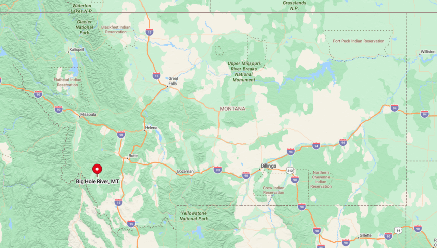
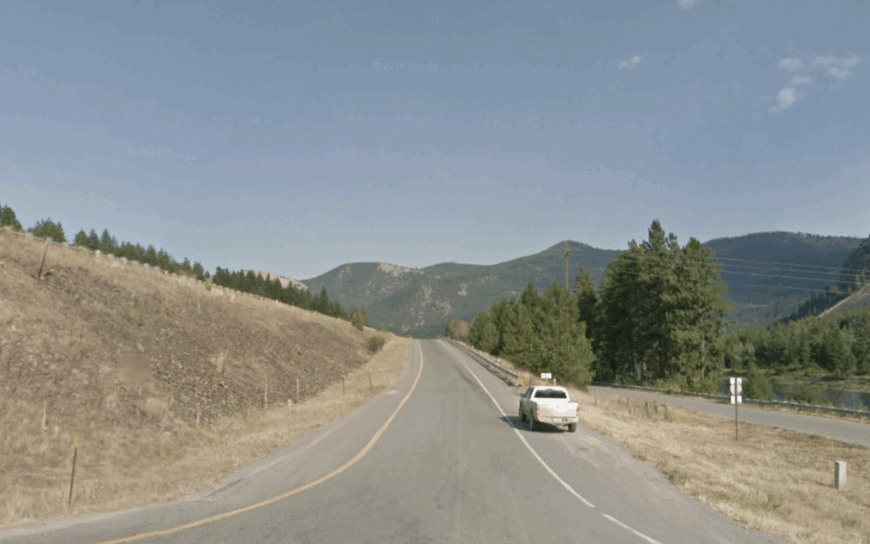
From Wisdom, follow MT-278 north two miles, then turn onto a series of unsigned ranch roads that climb gently above the river. The benches sit at nearly 6,500 feet, granting dramatic vistas and cooler summers than the valley floor.
Dillon, an hour away, serves as the supply hub, though most residents plan monthly trips due to variable road conditions. Expect open-range cattle wandering the gravel—local etiquette dictates a patient, five-mile-per-hour crawl until they shuffle aside.
6. Ninemile Valley Wooded Lots – Missoula County
Beyond the historic Remount Depot, the Ninemile drainage splays into forested benches where cabins peek between larch and fir. Residents enjoy immediate access to hundreds of square miles of Lolo National Forest, their doorsteps often doubling as trailheads for mountain biking, snowshoeing, and huckleberry picking.
It’s estimated to have roughly 250 year-round inhabitants, though the trees keep them well concealed. Community life orbits around the Ninemile Community Center’s potlucks and the annual barn dance, where fiddles echo off log walls hewn nearly a century ago.
A seldom-noticed gem is the forest-service native plant greenhouse, offering volunteer days that end with free seedlings for backyard restoration projects. Late October brings an elk migration so intense that bugles echo through the valley half the night.
Where is Ninemile Valley?
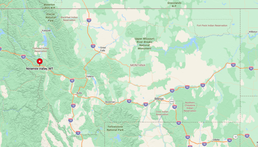
The valley branches northwest from I-90 at Huson, then parallels Ninemile Creek for twenty miles on a paved but narrow road. Elevation climbs gradually, and the surrounding ridges funnel cool air, keeping summer nights refreshingly crisp.
Missoula lies thirty minutes away, making supply runs easy while preserving the sense of remoteness. Winter plowing is dependable to mile marker sixteen; beyond that, residents often mount studded tires and carry chains.
5. Star Meadows Basin – West of Whitefish, Flathead County
Star Meadows feels like a secret parkland: open grassy flats encircled by lodgepole pine and larch, with a meandering creek reflecting the Milky Way on clear nights. Homes are spaced on five-to-twenty-acre plots, so even a neighbor’s generator hum rarely intrudes.
There are about eighty people here, many of whom telecommute between morning ski laps at nearby Blacktail Mountain. Summer brings horseback gatherings at the rustic community arena and blueberry picking along Star Meadow Creek’s oxbows.
A hidden treat is the tiny roadside stand selling goat-milk ice cream made on a local micro-dairy; flavors change with whatever berries ripen that week. Come October, the western larch turns gold, lighting the basin like a lantern in the dusk.
Where is Star Meadows?
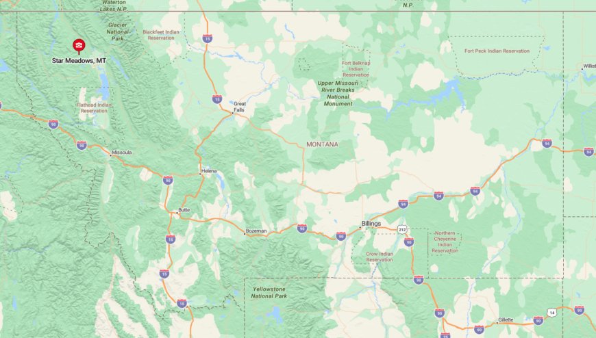
Access begins west of Whitefish via Twin Bridges Road, then narrows onto Star Meadows Road for twenty-five miles of twists over roller-coaster terrain. The final stretch is gravel but well-graded, cresting a low divide before dropping into the basin.
Kalispell sits forty-five minutes away, yet snowstorms can double that time; residents monitor road conditions with a private radio repeater. The meadows rest at 4,700 feet, so snowfall lingers, keeping mud season mercifully short.
4. Upper Swan Valley Retreats – Condon, Missoula County

Between the Mission and Swan ranges, large forest-edged lots near Condon back onto thousands of acres of public land, making elk sightings almost routine. Residents tap artisan wells, heat with larch firewood, and enjoy night skies that feel close enough to touch.
Roughly 300 permanent residents are spread along a thirty-mile corridor, each with enough breathing room to forget there’s a neighbor at all.
Recreation options abound: paddling the chain of Clearwater lakes, ski-touring up Morrell Mountain, or browsing the surprising selection of local art at the Swan Valley Community Hall.
A lesser-known delight is the Condon Airfield’s monthly pancake breakfast, where bush pilots swap flight tales beside gleaming Super Cubs. In autumn, tamarack needles drift like golden snow, carpeting driveways in a hush that signals winter’s approach.
Where is Upper Swan Valley?
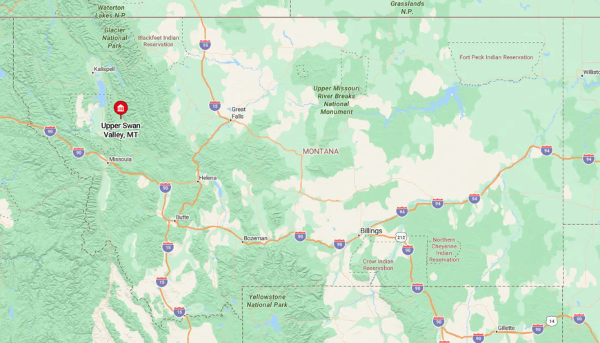
Montana Highway 83 threads the valley roughly halfway between Seeley Lake and Swan Lake, with gravel spurs such as Rumble Creek Road leading to hidden cul-de-sacs. The Mission Mountains to the west rise abruptly, their snowfields feeding countless cascades audible on still nights.
Missoula sits an hour and a half south; Kalispell is a similar distance north, giving residents two options for major shopping. Winter storms can drop heavy, wet snow, so many drive vehicles equipped with both studded tires and two cords of firewood in the bed.
3. Sula Basin Ranchlands – Ravalli County
At the southern tip of the Bitterroot Valley, Sula’s ranchlands unfurl behind wooded hills and the East Fork of the Bitterroot River, providing sweeping meadow vistas and absolute stillness after sunset.
Herds of elk graze fence lines at dawn, sharing space with maybe 120 year-round residents scattered across broad pastures. We hear locals divide their time between casting dry flies to cutthroat in the East Fork, tending heritage cattle, and soaking weary muscles at Lost Trail Hot Springs.
Winter evenings often see auroras rippling above the Anaconda-Pintlers, thanks to minimal light pollution. A well-kept secret is the berry-laden homesteader hedge along the abandoned Milwaukee Road grade, prized for pies that win the Sula Community Fair every August.
Life here moves to the rhythm of seasons and irrigation water, not the ticking of a clock.
Where is Sula Basin?
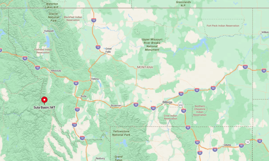
Follow U.S. 93 south from Hamilton for forty miles, then turn east onto MT 472, which shadows the East Fork for fourteen scenic miles. The basin sits at 4,600 feet, flanked by the Bitterroot Range to the west and the Pintlers to the east, creating a snow globe effect each winter.
Supplies come from Darby or Hamilton, so freezers stay stocked before storms. Lost Trail Pass lies ten minutes south, offering alpine skiing by day and hot-spring soaks by night.
2. Polebridge North Fork Flats – Flathead County
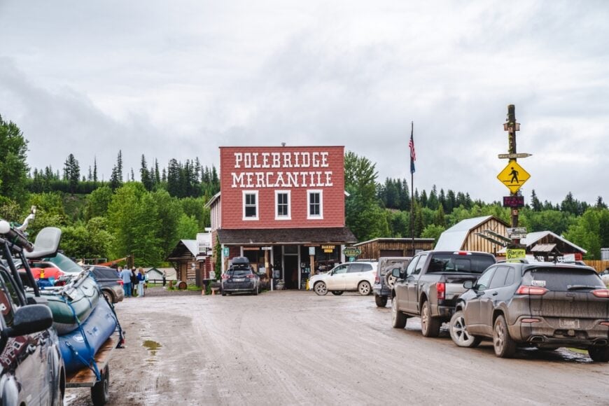
South of the Canadian line and thirty-five miles of dirt road from the nearest highway, the off-grid cabins along the North Fork of the Flathead River give residents mile-wide vistas of Glacier’s Livingston Range. Solar arrays hum quietly, while kerosene lamps still glow in a few classic log homes.
About eighty people live here, keeping the famous Polebridge Mercantile’s bakery in business with demands for huckleberry bear claws.
Daily entertainment includes paddling the emerald North Fork, tracking wolves in fresh snow, and swapping stories at the Northern Lights Saloon beneath strings of solar-powered bulbs.
A not-so-obvious treasure is the tiny community library housed in an old U.S. Customs shed, stocked entirely by paperbacks traded over the bar. Nights are so dark that residents often see satellites reflecting the sun long after twilight fades.
Where is Polebridge?
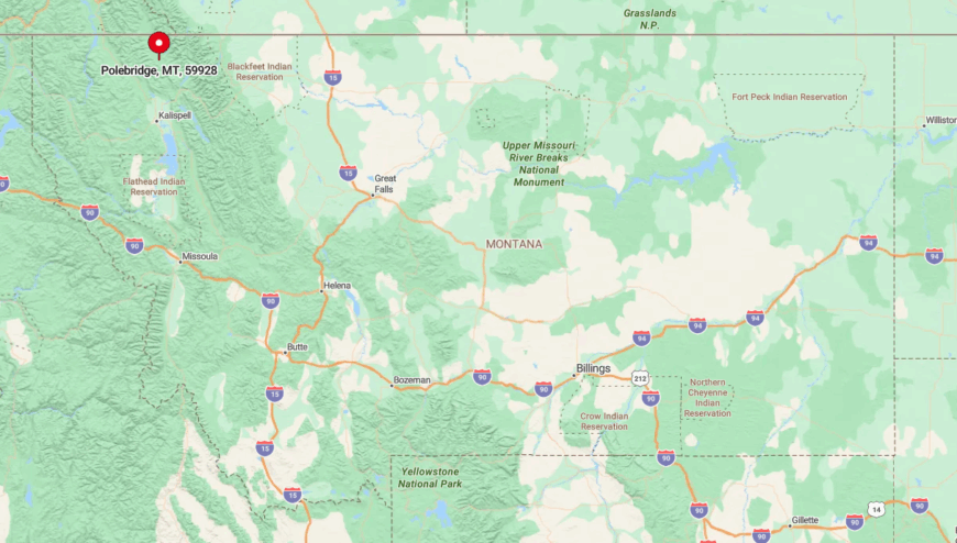
Access begins in Columbia Falls, where County Road 486 heads north for forty-seven rough, beautiful miles hugging Glacier’s boundary. The final stretch past Polebridge continues another five miles along the river to scattered flats with no grid power and minimal signage.
Winter travel demands four-wheel drive, chains, and patience; locals mark drifts with willow branches to guide newcomers. Summer, by contrast, sees dust clouds from day-trippers, so residents plan grocery runs at dawn or dusk.
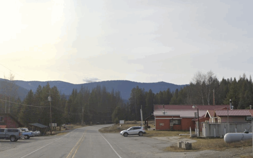
1. Yaak Valley Homesteads – Lincoln County
Would you like to save this?
Tucked deep in the Kootenai National Forest near the Canadian border, the scattered homesteads of the Yaak Valley sit on multi-acre parcels amid dense timber and winding gravel roads, creating a true end-of-the-road refuge.
Stories tell of folks spending entire winters without seeing a stranger, which seems plausible with a population hovering near 150. We hear residents fill days with backcountry skiing, foraging chanterelles, and casting into gin-clear tributaries of the Yaak River.
The Dirty Shame Saloon serves as the unofficial town square, offering live music and a warming wood stove when nights plunge below zero. Hidden among the spruces is a Cold-War-era radar base turned artist residency, where sculptors trade chain-saw how-tos for studio space.
Bears outnumber dogs, yet mailbox theft is unheard of—the nearest thief would need an extra tank of gas just to find the place.
Where is Yaak Valley?
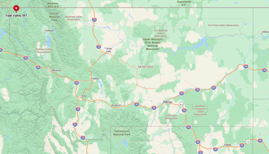
From Libby, head northwest on MT 567, a serpentine paved route that turns to gravel after the gold-rush relic of Yaak Falls. The valley stretches thirty miles to the Idaho line, boxed by the Purcell Mountains and drenched in nearly seventy inches of annual precipitation.
Services consist of a post office, the saloon, and a seasonal food truck, so residents haul supplies from Libby or Troy once a month. Snow lingers through April; when plows finally reach the homesteads, the hum of chainsaws signals another season of firewood gathering in Western Montana’s most secluded corner.