🔥 Would you like to save this?
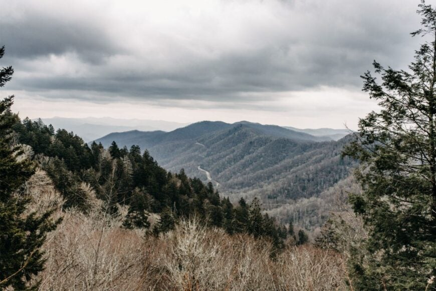
Eastern Tennessee holds more than famous overlooks and bustling gateway towns; tucked between its ridges are villages where mail still arrives at a leisurely pace and porch lights sparkle like distant constellations.
Our roundup explores 25 of those hideaways, places where two-lane roads replace interstates and morning mist keeps tourists guessing what lies beyond the next switchback.
In order to come up with the very specific design ideas, we create most designs with the assistance of state-of-the-art AI interior design software.
Each community offers its own mix of mountain culture, outdoor adventure, and hard-won tranquility. Some sit beside blue ribbon trout streams, others perch on high balds, but all share one trait: they remain largely untouched by crowds.
We share the details that make them special for anyone dreaming of quieter horizons in the Volunteer State. Slip into the passenger seat and discover where the pavement narrows and the world slows down.
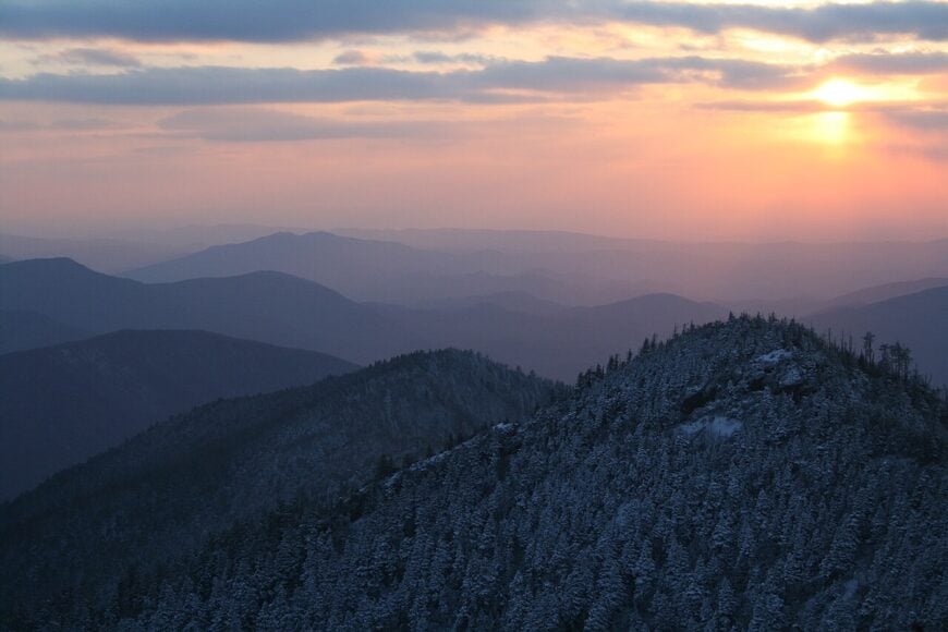
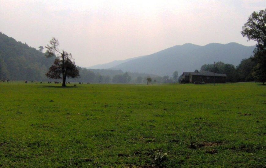
25. Wears Valley – A Quiet Fold Between Ridges
Wears Valley feels like a green pocket stitched between Cove Mountain and the wide back of the Smokies, a place where mornings open with rooster calls and fog drifting off pasture grass.
Its seclusion comes from being a side valley off the main tourist corridors, with no interstate and only a few two-lane roads threading in. The vibe is agrarian and peaceful: white-fenced meadows, old barns, and cabins tucked into hemlock shade. Spend slow hours at Metcalf Bottoms along the river, hike to the Walker Sisters Cabin, wander the Foothills Parkway overlooks, or sip cider at a roadside stand.
Small lodges, craft cabins, and hayfields underpin the local rhythm. Sunsets burn soft behind the ridge, and the world gets very small in the nicest way. It’s the kind of place that reminds you to measure time by shadows instead of schedules.
Where is Wears Valley?
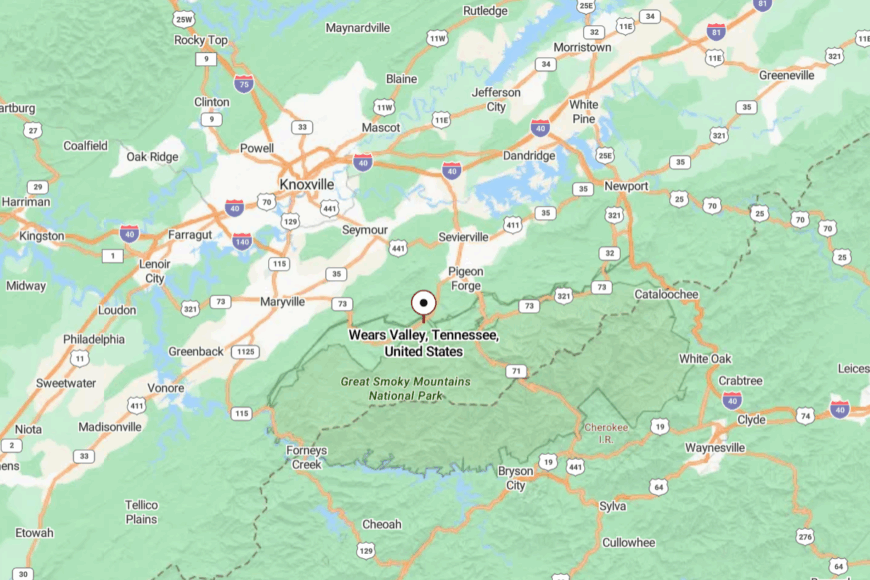
Set in Sevier County between Townsend and Pigeon Forge, Wears Valley sits just south of US 321 and north of the national park boundary. It’s roughly 15 miles from Pigeon Forge, yet shielded by rolling farmland and a ring of wooded hills.
You reach it on curving two-lane roads like Wears Valley Road and Lyon Springs. It’s close enough for groceries, far enough for stars.
24. Pittman Center – A Parkside Village That Stayed Small
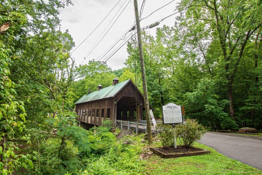
Pittman Center is what happens when a mountain town grows up next to a national park and decides to stay modest. Seclusion comes from the way the ridges crowd the Little Pigeon River and from the town’s deliberate pace—no neon, little noise.
The vibe is woodsmoke and water: clapboard churches, schoolhouse history, and the steady hush of river over stone. Walk the Greenbrier entry into Great Smoky Mountains National Park, fish quiet runs for trout, explore Emerts Cove Covered Bridge, or meander old homestead sites.
A mix of school, small services, and cabin rentals supports the week. Even with visitors around, you can hear the creek think. It’s the kind of quiet that feels looked after.
Where is Pittman Center?
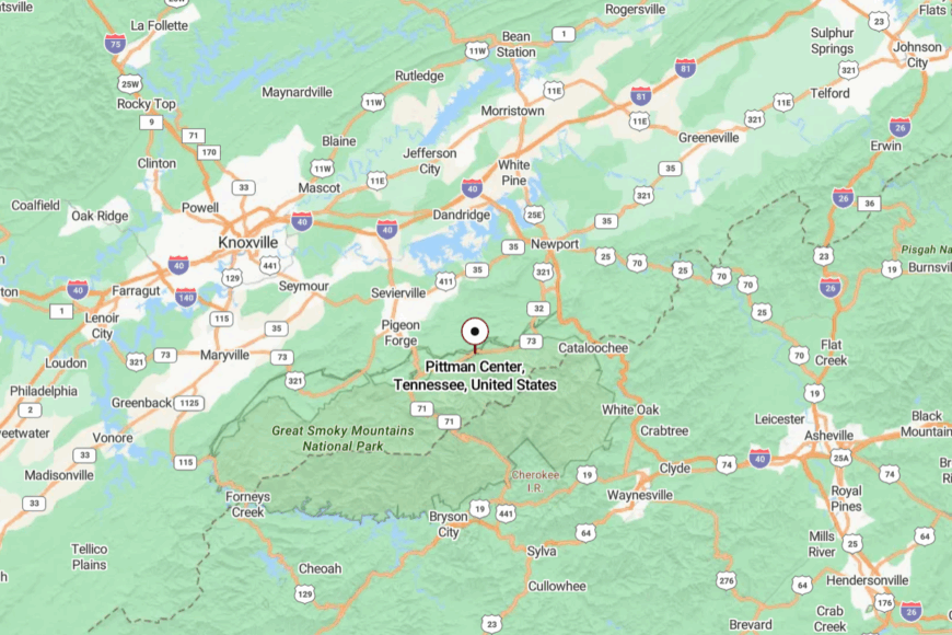
Tucked on the east side of Sevier County, Pittman Center rests along the Middle Prong of the Little Pigeon River, about 10 miles from Gatlinburg. Approaches narrow from US 321 into Greenbrier and backroads that follow the water.
The park boundary hems in development on one side while hills hold the other. You arrive by river-song and stay for the hush.
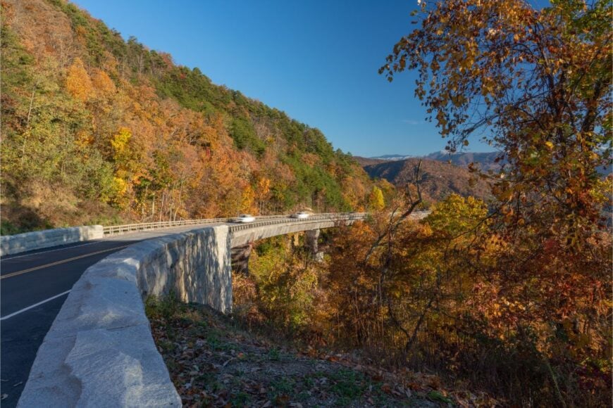
23. Walland – Gate to Foothills and Farm Light
Walland sits where fields lean into the first blue folds of the Smokies, a place of big porches and bigger skies. Its seclusion is shaped by distance from interstates and by the parklands—Little River and Foothills Parkway—pressing close.
The vibe is pastoral and practical: cattle in morning mist, a country store, children waving from a hay wagon. Drive the Foothills Parkway’s knife-edge overlooks, paddle a slow stretch of Little River, linger at Tuckaleechee Caverns down the road, or watch fireflies glitter over pasture.
Farming and small hospitality knit the days together. At dusk, mountains turn the color of plums, and everything gets quiet at once. It’s the soft gateway that feels like a destination.
Where is Walland?
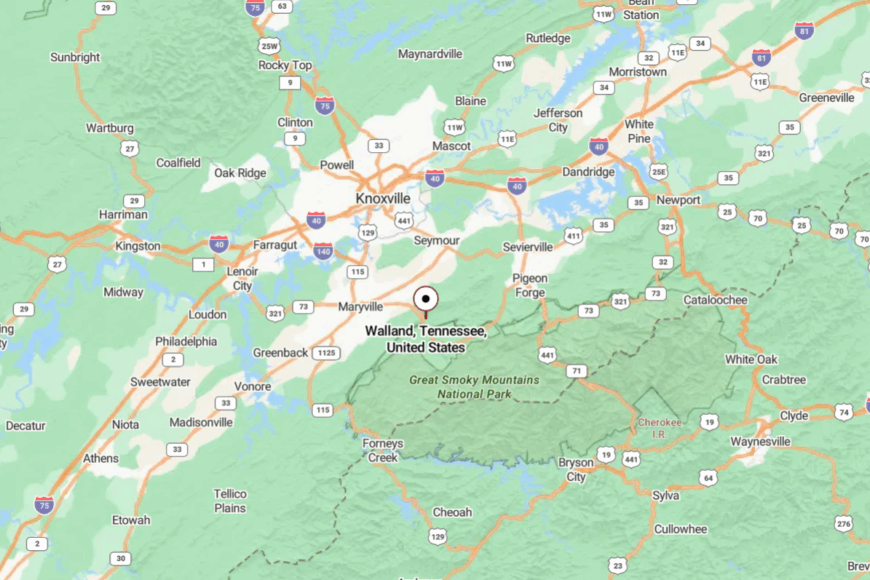
In northern Blount County, Walland lies about 8 miles east of Maryville along US 321. The route in is two-lane and scenic, bending with the river and pasture fences.
Hills cut off shortcuts, so traffic stays human-sized. It’s close to town, yet it breathes like the countryside.
22. Del Rio – French Broad Bends and Ridge-Shadow Roads
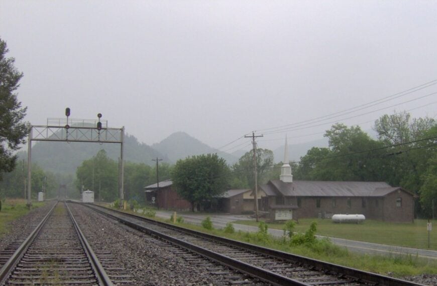
Del Rio curls along the French Broad River where the mountains keep the sun a little longer in the morning. Seclusion here comes from steep ridgelines, dead-end hollows, and a rail-and-river past that never turned into a highway hub.
The vibe is rustic and river-wise: front porches, stacked wood, and garden plots stitched into the flats. Wade-fish for smallmouth, wander to Paint Rock and its ancient petroglyphs just over the line, drive the curvy approach of TN-107, or picnic beside classically weathered barns.
Logging, small farms, and seasonal river work make up much of the week. Train whistles echo off the cliffs like old stories. It’s the sort of place where the day slows until you notice the herons.
Where is Del Rio?
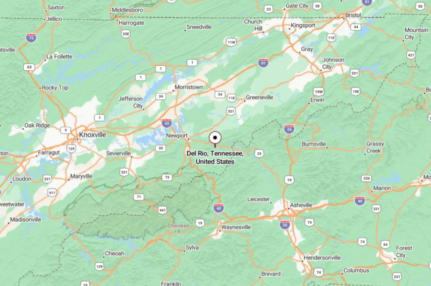
Del Rio sits in southeastern Cocke County near the North Carolina border, roughly 18 miles east of Newport. You’ll follow US 25/70 and then slip onto narrower river roads that cling to the bends.
Ridges on both sides make the valley feel pocketed and private. By the time the pavement straightens, you’re already unwound.
21. Parrottsville – Oldest-Feeling New Morning
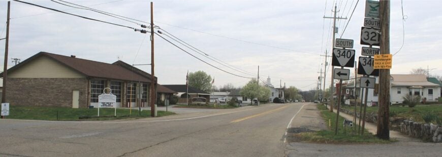
Parrottsville keeps its streets short and its horizons broad, with clapboard homes, church steeples, and fields running up to the tree line. Its off-the-grid feeling comes from distance to interstates and an agricultural belt that has resisted sprawl.
The vibe is old-time friendly: produce stands, potluck suppers, and a courthouse lawn that knows every season. Tour country lanes to historic farms, hike nearby Rankin Bottoms WMA for migratory birds, browse antique corners, or sip coffee as tractors hum past.
Farming anchors much of daily life. Dawn here smells like hay and river fog. It’s a small town that wears its years lightly.
Where is Parrottsville?
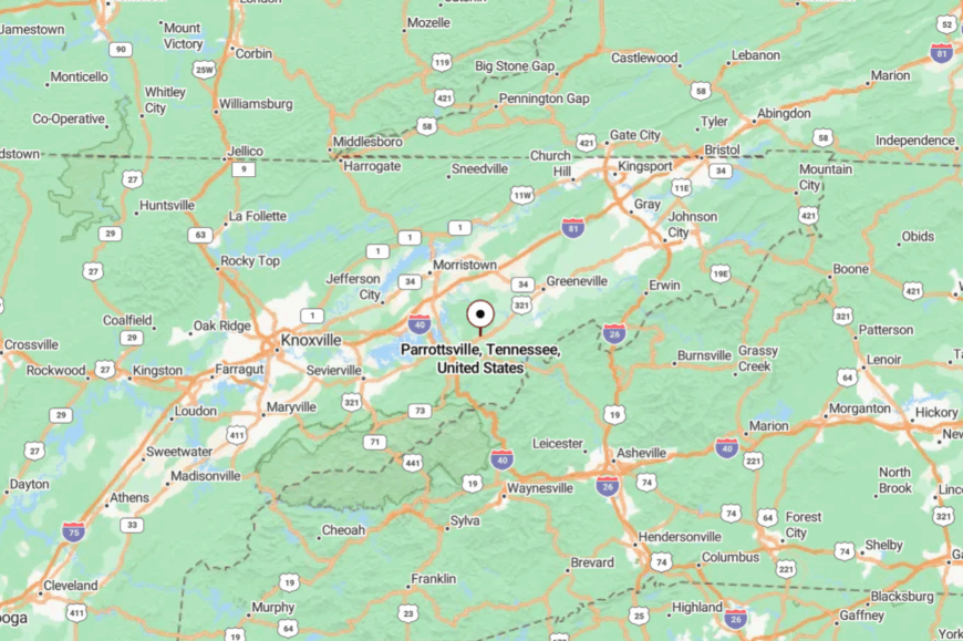
In northern Cocke County, Parrottsville sits about 10 miles northeast of Newport along US 321. The approach is all two-lane, shifting from creek bottoms to low ridges.
With no fast bypass, through-traffic simply doesn’t linger. It’s the quiet between bigger dots on the map.
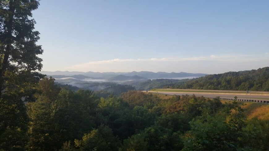
20. Hartford – Gorge Outpost with Whitewater Bones
Hartford is little more than a bend in the Pigeon River with outfitters and clapboard houses tucked under rock shoulders. Despite a nearby interstate exit, the gorge walls and narrow bridges keep the place feeling removed from everywhere else.
The vibe is river-wet and woodsy: rafts drying on racks, train tracks, and evenings that smell like rain and pines. Paddle the Upper Pigeon, hike the short pull-offs into green ravines, visit historic structures at the tiny district, or chase views along old service roads.
Seasonal tourism and forest work keep the lights warm. When the fog settles in the gorge, it feels like the world forgot the turn. It’s a pocket-sized frontier.
Where is Hartford?
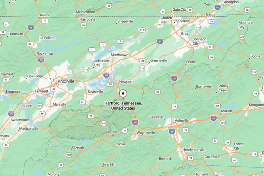
Hartford sits at Tennessee’s far eastern edge in Cocke County, a few miles from the North Carolina line. Most travelers exit I-40 but quickly slow onto one-lane bridges and riverside byways.
Cliffs squeeze the road, which is prone to rockfall and occasional closures. The gorge makes even close distances feel far.
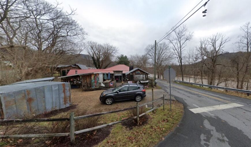
19. Flag Pond – Switchbacks, Spruce, and State-Line Air
🔥 Would you like to save this?
Flag Pond hangs onto steep hillsides in Unicoi County, where switchbacks climb like question marks. Its seclusion comes from the old highway’s abandonment—interstate traffic roars elsewhere—and from hollows that end where creeks begin.
The vibe is high-country quiet: wood smoke in cold weather, spring peepers in April, and AT hikers drifting through for resupply. Walk to Margarette Falls and Bailey Falls, fish cold runs of the South Indian Creek, browse a country store for apple butter, or trace the old US-23 for vintage vistas.
Small farms and commuter drives to Erwin and Asheville weave the workweek. Nights are dark enough that stars crowd the sky. It’s the sort of quiet that feels earned by the climb.
Where is Flag Pond?
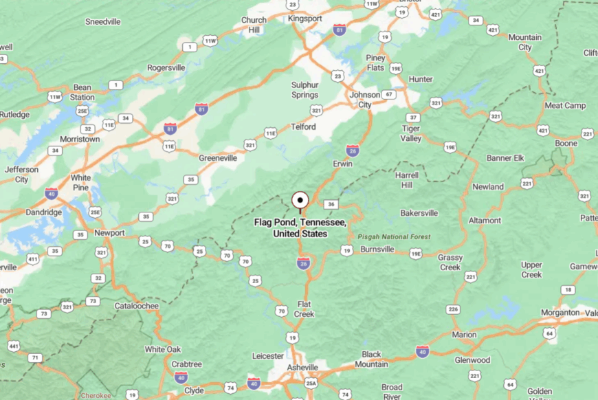
In far northeastern Tennessee near the North Carolina border, Flag Pond lies about 12 miles southeast of Erwin. You reach it via old US-23 or steep county roads that twist through gaps.
Interstate exits are close, but the last miles are slow and winding. The hills make a gentle fortress around town.
18. Unaka Springs – Nolichucky Mist and River Porches
Unaka Springs is more a riverside string of porches than a town, with cabins facing the Nolichucky where morning fog moves like breath. Seclusion comes from the gorge itself and the absence of any need to hurry—trains, rafters, and herons set the tempo.
The vibe is retro and restful: vintage motel signs, squeak of screen doors, laughter drifting from rafts at takeout. Float the Nolichucky on a gentle release, hike to views above Chestoa, hunt spring wildflowers along the river trail, or soak on a porch with a paperback.
Guiding, small rentals, and seasonal service work keep it humming just enough. The sound of water becomes the town clock. It’s close to everything and somehow apart from it all.
Where is Unaka Springs?
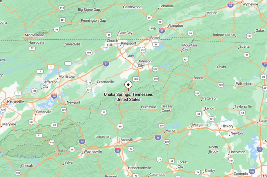
Set along the Nolichucky River in Unicoi County, Unaka Springs sits a few miles south of Erwin. Access is via narrow riverside roads off TN-107 and TN-81 that slip under rails and beside bluffs.
The gorge walls tighten the view and quiet the noise. It feels like a place the river decided to keep.
17. Hampton – Lakes, Waterfalls, and a Mountain Gate
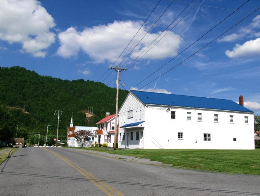
Hampton tucks into a notch where Laurel Fork meets Doe River, a little town with big water in every direction. Its sense of remove comes from being bracketed by ridges and held close by Watauga Lake’s coves.
The vibe is trail-ready and neighborly: coolers in truck beds, anglers at first light, kids on bikes under sycamores. Hike to Laurel Falls, launch a kayak on Watauga Lake, explore Dennis Cove and the Appalachian Trail, or picnic at the swinging bridge over the river.
Small businesses and recreation jobs blend with commuting to Elizabethton. Even on sunny weekends, you can find a cove that belongs only to you. It’s a gateway that feels like a hideaway.
Where is Hampton?
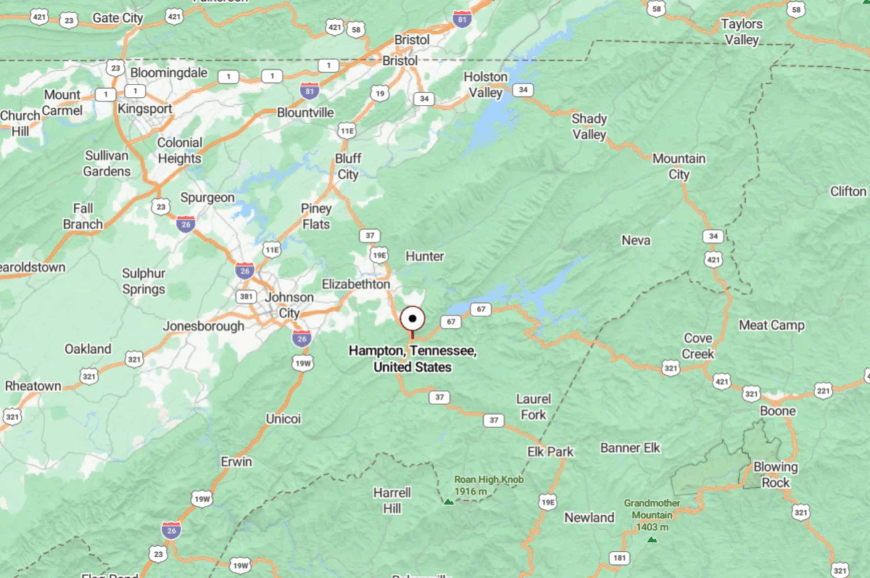
Hampton lies in Carter County on US-321/19E, about 8 miles southeast of Elizabethton. The road folds into the mountains as it nears the lake and narrows further toward Dennis Cove.
Steep walls and water limit sprawl, so traffic thins quickly. The last mile feels like a promise kept.
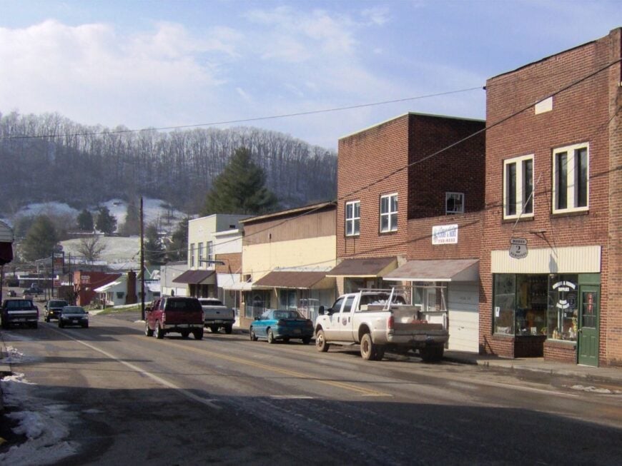
16. Laurel Bloomery – Fiddle Tunes and Ridge Light
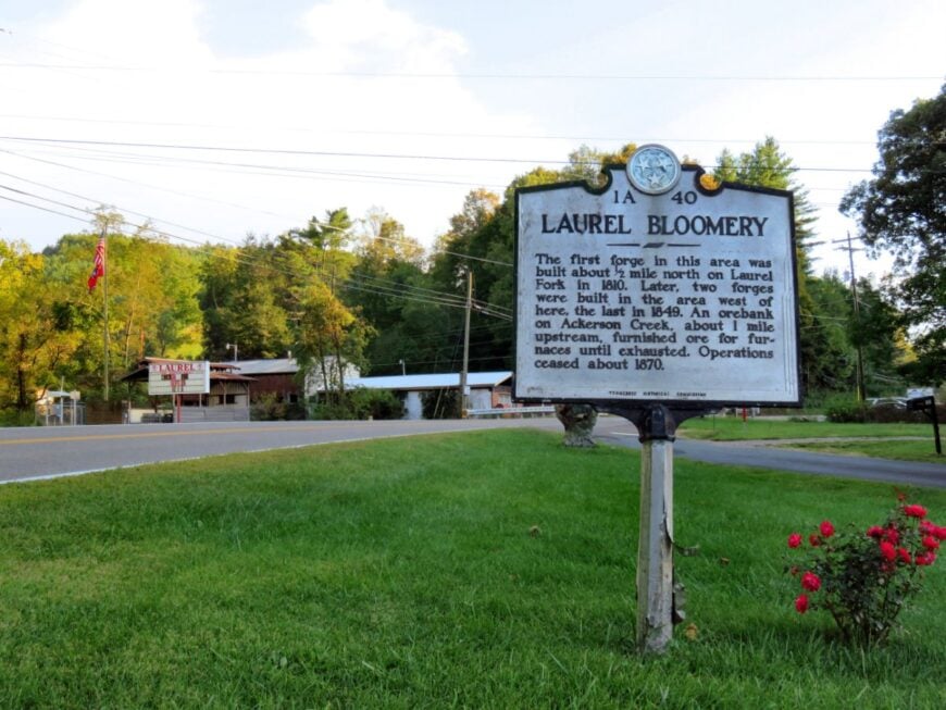
Laurel Bloomery sits where fields meet high ridges in Tennessee’s far, far northeast, a community that keeps a violin case by the door. Seclusion here is a matter of geography—near the state line, away from fast roads, and shadowed by Holston Mountain.
The vibe is homespun and musical: church dinners, jam sessions, and porches looking out on hayfields. Walk backroads to hilltop cemeteries, fish cool creeks, hike up toward the Holston crest, or time a visit for the Old Time Fiddlers’ events nearby.
Small farms and cross-border commutes make up most of the week. Evening light pools in the hollows, and the hills grow taller. It’s the sort of quiet that leaves room for a song.
Where is Laurel Bloomery?
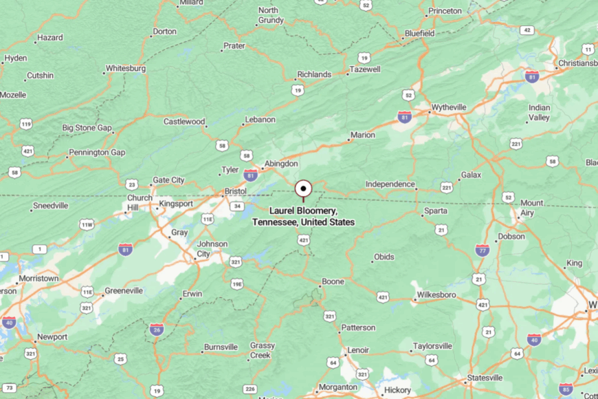
In Johnson County near the Virginia line, Laurel Bloomery is roughly 10 miles northeast of Mountain City. You’ll reach it on TN-91 and narrower county lanes that trace the folds of Holston Mountain.
The last stretches are winding and lightly traveled. By arrival, you’ve traded chatter for crickets.
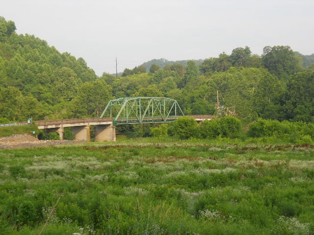
15. Sneedville – Clinch River Bend with Long Views
Sneedville keeps its pace steady at the center of Hancock County, ringed by the ridges of the Unaka foothills. Its seclusion is cultural and topographic—no interstate nearby, just the Clinch River and switchbacks over Newman’s Ridge.
The vibe is courthouse-square and mountain-honest: hardware stores, murals, and neighbors who know the weather by smell. Paddle slow miles on the Clinch, hunt spring ramps on shaded slopes, explore historic Melungeon heritage sites, or drive to high overlooks where hawks hang on the wind.
Farming, small shops, and county services steady the week. On clear days, the valley looks like it goes on forever. It’s a deep-breath kind of town.
Where is Sneedville?
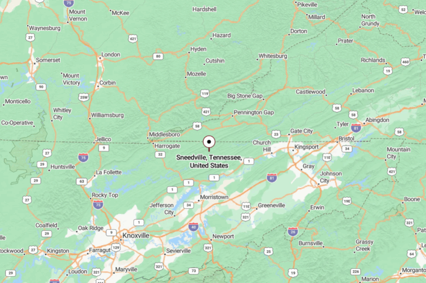
Sneedville sits in far northeastern Tennessee, about 25 miles northwest of Rogersville via TN-31 and ridge-climbing backroads. Approaches twist over steep saddles before dropping to the river flats.
With no quick route in, traffic stays sparse. Distance here is measured more in curves than miles.
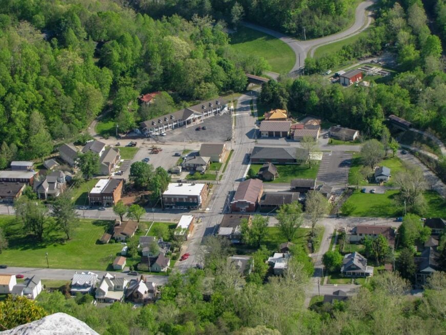
14. Kyles Ford – Clinch-Side Cabins and Quiet Ferries Past
Kyles Ford is little more than a river crossing and a scatter of cabins where the Clinch runs green and slow. Its tucked-away feel comes from being far off any fast corridor and hemmed by steep, wooded hillsides.
The vibe is river-simple: screen doors, hummingbirds, and a dock with a pair of canoes tied off. Watch mussel restoration work from the riverbank, paddle gentle shoals, fish at dusk, or wander wildflower roads in spring.
Small outfitters and weekend rentals keep a light footprint. Nights here arrive with whip-poor-wills and the ripple of fish. It’s the kind of quiet that keeps its promises.
Where is Kyles Ford?
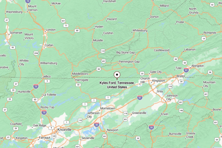
On the Hancock/Hawkins county line, Kyles Ford lies roughly 20 miles northeast of Sneedville along TN-33. You reach it by a ribbon of two-lane highway that shadows the Clinch.
Steep bluffs close the horizon and muffle the world. The last bend always feels like a reveal.
13. Cumberland Gap – Village Beneath a Famous Pass
🔥 Would you like to save this?
Cumberland Gap clings to the foot of the mountains below the storied saddle where pioneers once crossed. Seclusion lingers because the modern highway bypasses the village through a tunnel, leaving brick sidewalks and porch swings to set the mood.
The vibe is historic and hushed: picket fences, park rangers, and church bells tucked into leafy streets. Walk to Tri-State Peak where three states meet, tour the historic Hensley Settlement by shuttle, browse artisan shops, or hike along Gap Cave’s cool mouth. Park employment and small tourism businesses carry the week.
When streets go quiet, the pass whispers like an old story retold. It’s a postcard that lives slowly.
Where is Cumberland Gap?
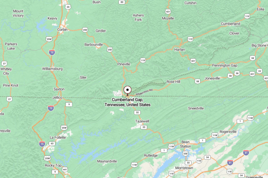
On Tennessee’s far north edge in Claiborne County, the village sits about 2 miles south of the KY/VA lines. US-25E now dives through the mountain, leaving the old road for walkers and local traffic.
Approaches narrow under stone and forest as you slip off the highway. The past and present meet softly here.
12. Sharps Chapel – Peninsulas, Barns, and Lake Silence
Sharps Chapel stretches along peninsulas that reach into the blue fingers of Norris Lake, a countryside of barns framed by water. Its seclusion is part geography, part patience—long drives around coves turn five miles into fifteen.
The vibe is lakeside-rural: jon boats at dawn, farmstands at crossroads, and cranes stalking shallow coves. Launch a kayak into mirror-still water, wander the Chuck Swan WMA roads for wildlife, explore historic Angle Farm, or fish for stripers at first light.
Farming, marinas, and WMA work make up the week. When the wind dies, you can hear a heron’s wings. It’s quiet, so wide it feels like water.
Where is Sharps Chapel?
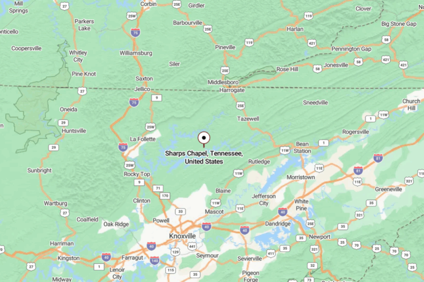
Set in Union County, northeast of Knoxville, Sharps Chapel is about 12 miles from Maynardville by curving backroads. You reach it on TN-33, then wind across narrow causeways and ridge spines.
The water breaks up the map into long, slow loops. It’s as close as the crow flies, far as the road goes.
11. Farner – Blue Ridges, Copper History, and a State-Line Bend
Farner is a hush at the end of a ridge road near the North Carolina line, a handful of homes, a church, and a store where the porch knows your name. Its seclusion comes from the folds of the Cherokee National Forest and the fact that highways skirt elsewhere.
The vibe is borderland and wooded: creek talk, rhododendron tunnels, and occasional freight horns drifting up-valley. Walk to Hiwassee River overlooks, explore copper-mining history in nearby Ducktown, then come back to silence, fish small streams, or ride scenic TN-68 over Buck Bald.
Forest work, small trades, and cross-border commutes stitch the week together. Even time seems to idle here between ridges. It’s a good place to remember how to be unhurried.
Where is Farner?
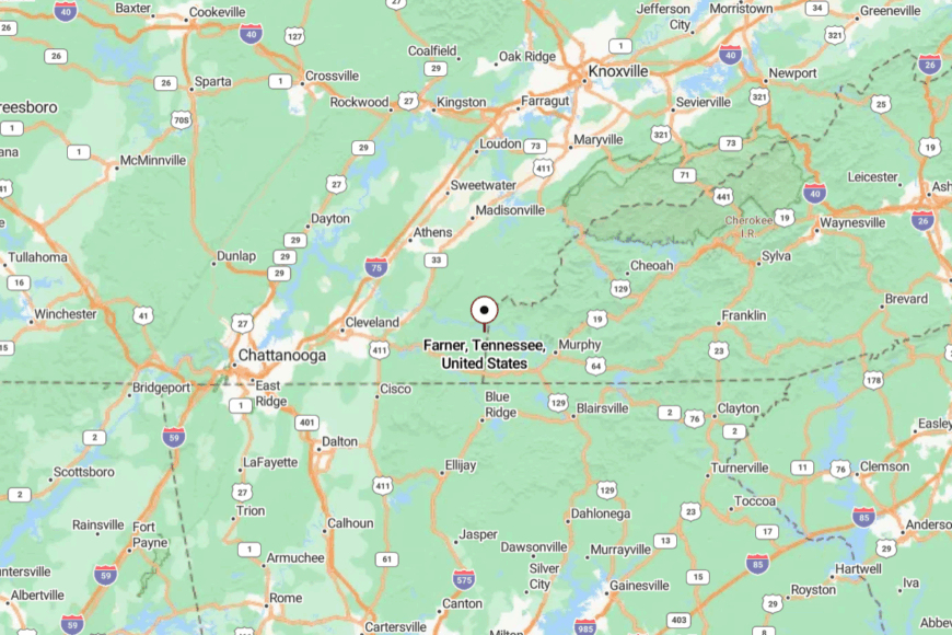
In far southeastern Polk County, Farner lies about 6 miles north of Copperhill along TN-68 near the North Carolina border. Approaches bend along creeks and slide under timber before climbing toward low gaps.
With no interstate nearby, the last miles feel deliberately slow. When you arrive, the ridges close the door behind you.
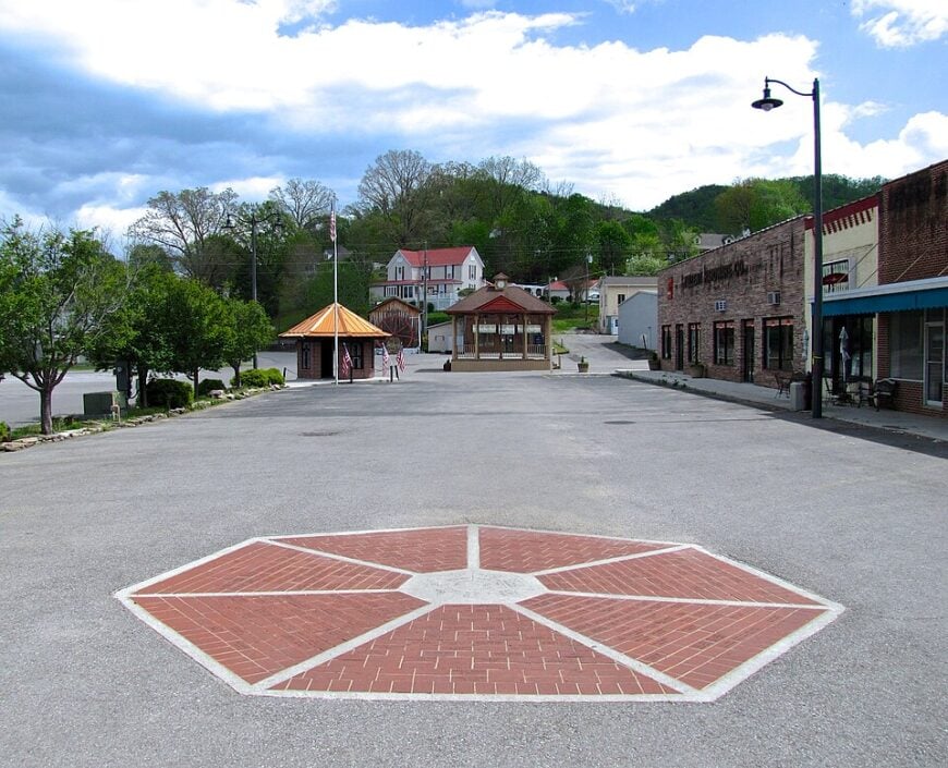
10. Townsend – The Peaceful Side of the Smokies
Townsend supports fewer than 500 full-time residents. Visitors spend mornings cycling the 11-mile scenic loop in Cades Cove, photographing elk and weathered cabins.
Outfitters rent tubes and kayaks for easy floats on the Little River. Many locals earn a living from small-scale lodging, fly-fishing guide services, and family-run craft shops along Lamar Alexander Parkway.
A ring of Great Smoky Mountains National Park limits growth and keeps traffic light even in summer. Thick dawn mist settling over one-acre homesteads reinforces the feeling of being far from Tennessee’s busier gateways.
Where is Townsend?
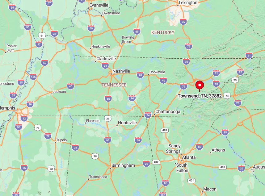
Townsend sits on the quiet western flank of Great Smoky Mountains National Park in Blount County. The park on three sides and Chilhowee Mountain on the fourth mean no through interstate pierces the valley.
Drivers reach the town via a 20-mile ribbon of US 321 that twists past Walland and the Townsend Wye before ending at parkland. The limited access leaves evenings so silent that only river frogs and the slow hum of a pickup on a distant gravel road break the stillness.
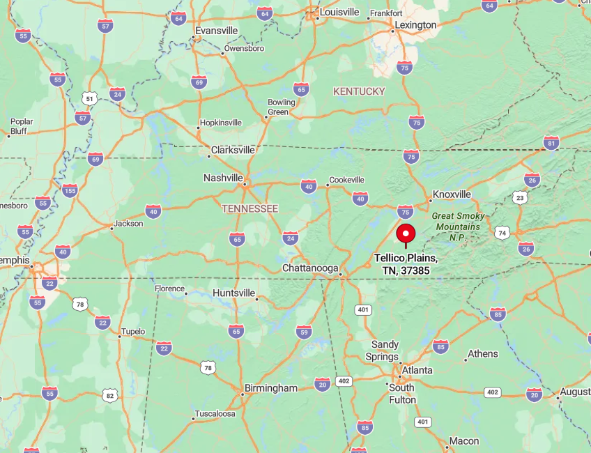
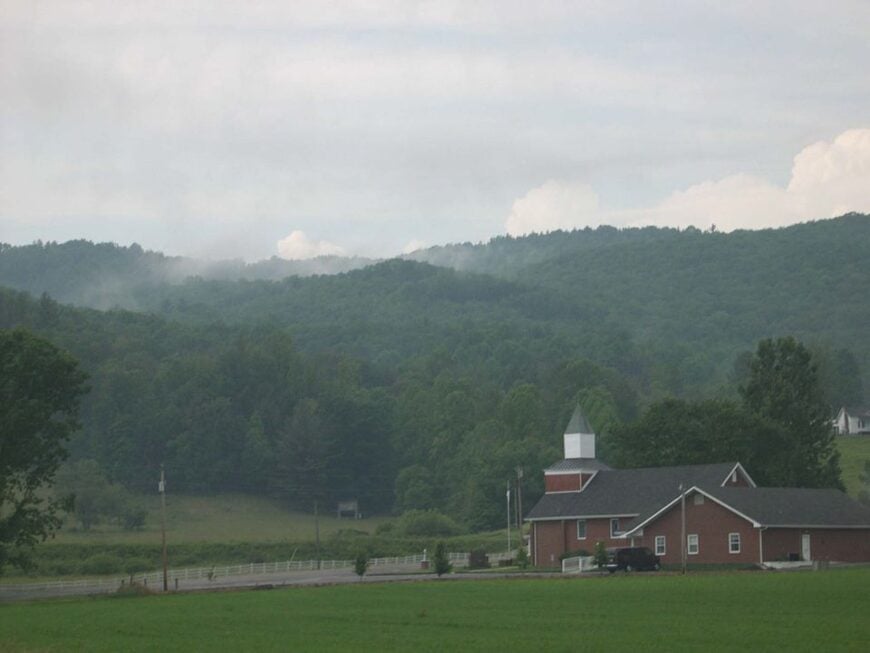
9. Tellico Plains – Gateway to the Cherohala Skyway
Tellico Plains counts roughly 900 residents who wake each morning to the scent of hemlock and river stones. The Cherohala Skyway begins here, tempting motorcyclists and photographers with 43 miles of hairpin overlooks that crest at 5,400 feet.
Anglers cast for trout in Citico Creek while hikers seek hidden waterfalls along Bald River Gorge. Small farms raising cattle, honey, and sorghum share the valley with woodworking shops and the long-standing Tellico Grains Bakery that fuels weekend riders.
The surrounding Cherokee National Forest blankets four fifths of the zip code, so night skies stay charcoal black and cellular bars flicker in and out. Distance from Knoxville and the absence of chain hotels keep the town unusually hushed even on holiday weekends.
Where is Tellico Plains?
🔥 Would you like to save this?
Tellico Plains lies in Monroe County about forty mountain miles southeast of Knoxville. The ridgelines of Starr Mountain and the Unicoi crest wall off easy access from the north and east.
Visitors usually drive State Route 360 or trace Highway 68, both two-lane roads that narrow to one-lane bridges before merging in town. Once the gas stations fade in the rear-view mirror, travelers understand why locals joke that the forest decides who arrives and when they leave.
8. Shady Valley – Tennessee’s Highest Mountain Valley
High in Johnson County, Shady Valley shelters about 700 people in Tennessee’s loftiest mountain basin. Cranberry bogs left from the last ice age line US 421, offering birders rare sightings of northern species and a blazing carpet of red each fall.
Motorcyclists nickname the surrounding road system “The Snake” for its 489 curves in 33 miles, a route that also thrills photographers looking for asphalt slipping into cloud banks.
Employment revolves around Christmas tree farms, small scale cattle operations, and the seasonal cranberry festival that fills the volunteer fire hall with jam jars and fiddle tunes.
Chain restaurants never made it over Iron Mountain, leaving only a vintage diner and a roadside produce stand to serve travelers. Ringed by peaks topping 4,500 feet, the valley holds morning fog like a bowl, masking the rest of the world until the sun climbs above the ridgeline.
Where is Shady Valley?
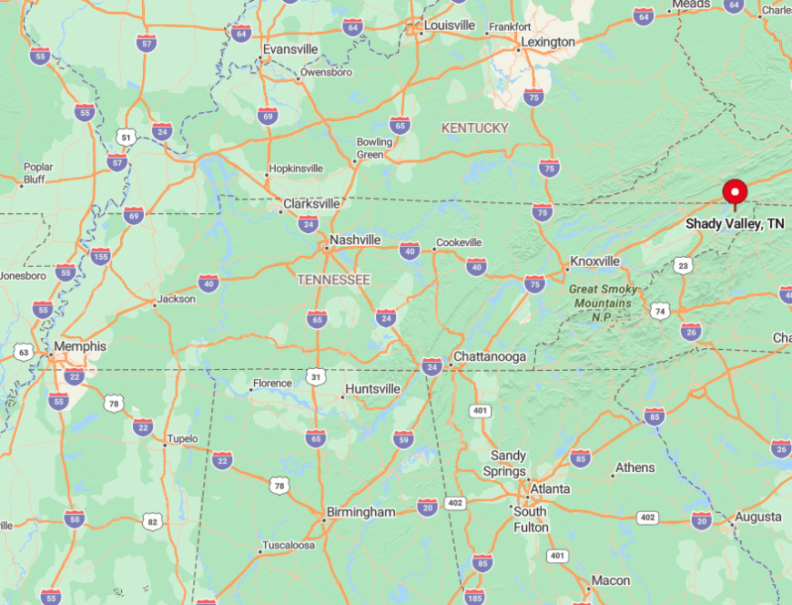
Shady Valley rests along US 421 between Mountain City and Bristol, thirty minutes from the nearest supermarket. Iron, Holston, and Brushy mountains form a natural amphitheater that blocks radio and even some FM signals.
The primary gateway is a set of steep switchbacks that truckers avoid, so traffic stays light year round. Anyone arriving after sunset soon realizes the nearest streetlight may be several miles behind them.
7. Coker Creek – Gold-Rush Hamlet in the Cherokee National Forest
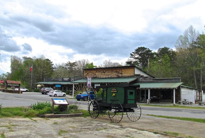
Coker Creek, an unincorporated settlement of roughly 300 residents, traces its roots to the 1830s gold rush that once rattled pans in every stream. Today hobby prospectors still sift the gravel while hikers follow the John Muir Trail to hidden cascades shaded by white pine.
Handmade cedar cabins dot multi-acre parcels where owners raise goats or simply watch mist roll off Unicoi peaks. The few jobs center on seasonal rafting, Forest Service work, and a craft co-op that sells quilts stitched with Cherokee patterns.
Cell phone signals vanish before the pavement turns to gravel, reinforcing a sense of stepping back in time. Thick forest on three sides and the bald spine of Buck Bald Mountain on the fourth seal the hamlet from Tennessee’s faster rhythms.
Where is Coker Creek?
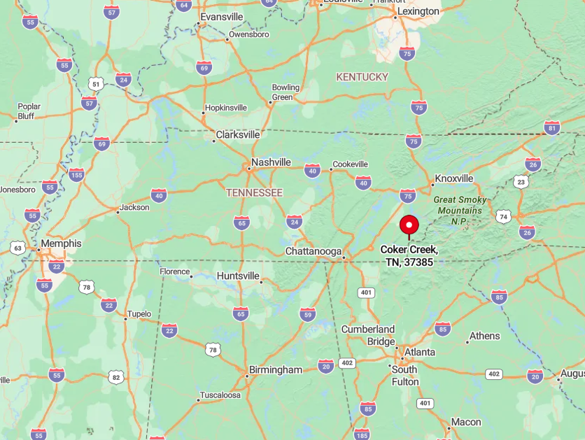
Coker Creek sits in the southeastern corner of Monroe County, ten miles south of Tellico Plains along State Route 68. No interstate reaches within forty miles, and the Cherohala Skyway rises abruptly to the east blocking alternate shortcuts.
Most visitors come by motorcycle or camper, winding through curves that follow the Tellico River before climbing to 2,600 feet. Between switchbacks the road narrows enough that tree limbs brush side mirrors, a natural speed limit that helps preserve the hush.
6. Reliance – Riverside Outpost on the Hiwassee
Reliance gathers only about 150 residents along a quiet bend of the Hiwassee River in Polk County. Anglers wade for rainbow trout at dawn while paddlers wait for the daily TVA release that turns the waterway into a mild whitewater run.
Century-old clapboard buildings like the Watchman’s House and Hiwassee Union Church provide a glimpse of river commerce before railroads faded. Outfitters and the historic Webb Brothers Store supply part-time jobs along with a scattering of vacation rentals perched above the rapids.
More than half the surrounding acreage remains in Cherokee National Forest, so river fog and owl calls replace street noise at sunset. With no grocery, bank, or traffic signal, the settlement feels removed from twenty-first-century bustle despite being only four miles from a highway.
Where is Reliance?
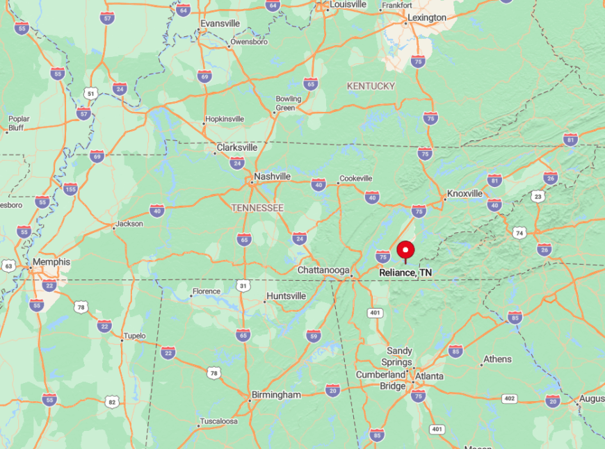
Reliance occupies a horseshoe in the Hiwassee gorge ten miles north of Benton via narrow Highway 315. Tall ridges hem in both sides of the river, leaving space for only one-lane bridges and a single railroad track.
Travelers exit US 64 near the Ocoee and wind along a twisting road that can be closed by rockslides after heavy rain. That vulnerability keeps casual visitors away and leaves the riverbanks to anglers, herons, and the evening whistle of a passing freight train.
5. Roan Mountain – Cloud-Swept Appalachian Balds
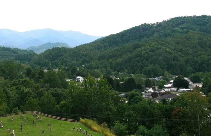
The census counts close to 1,300 residents in Roan Mountain, yet most of the year the high-elevation balds feel emptier than that figure suggests. Summer brings hikers seeking the world-famous rhododendron gardens splashing pink across Cloudland each June.
Winter swaps blossoms for rime ice, attracting photographers who brave the Appalachian Trail for crystalline sunrise vistas. Tourism and seasonal park employment support many locals, complemented by family farms that graze cattle in narrow hollows.
Surrounded by peaks over 6,000 feet and shielded by switchbacks that climb from Hampton, the community seldom sees through traffic. Fog often sweeps across the open balds so quickly that one can stand in sunshine while the valley below disappears, a reminder of the mountain’s isolating power.
Where is Roan Mountain?
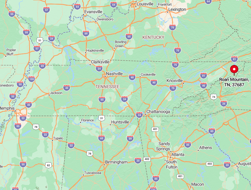
Roan Mountain lies thirty miles southeast of Johnson City in Carter County, reached mainly by US 19E before branching onto State Route 143. The road ascends nearly 3,000 feet in ten miles, a grade that discourages tractor trailers and most commuters.
Adventurous drivers crest Carver Gap then descend into North Carolina, but winter closures frequently sever that route. Those periodic barricades help the village remain a quiet highland pocket even on holiday weekends.
4. Butler – The Town That Moved for Watauga Lake
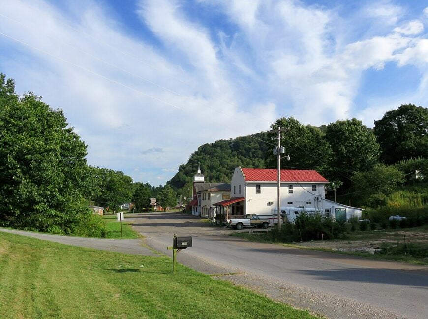
Butler shelters about 800 residents along the northern shore of Watauga Lake where Appalachian hardwoods touch glassy water. The original downtown lies submerged beneath the lake, and locals still dive to see rock foundations when TVA lowers the pool for maintenance.
Today life revolves around fishing, houseboat rentals, and small marinas that supply bait and tank-top souvenirs. Construction and upkeep of vacation cottages provide steady work, joined by a handful of craftsmen who carve cedar furniture from storm-felled trees.
Generous wooded lots slope to mirror-calm coves, so neighbors remain hidden beyond rhododendron thickets. The lake, National Forest land, and steep ridges block development corridors, leaving evenings filled only with loon calls and the gentle chug of a pontoon.
Where is Butler?
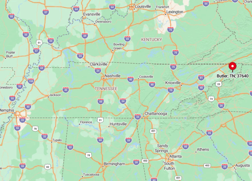
Butler sits in Johnson County off Tennessee Highway 67, roughly halfway between Boone, North Carolina, and Elizabethton. The route hugs shoreline cliffs, and a single two-lane bridge near Sink Mountain serves as the main entry.
When fog settles on the lake, travel slows to a crawl, effectively isolating the community until midday sun burns through. Many residents keep a small boat at the ready because reaching neighbors by water can be faster than by road.
3. Cosby – Hidden Hollers Near the Smokies
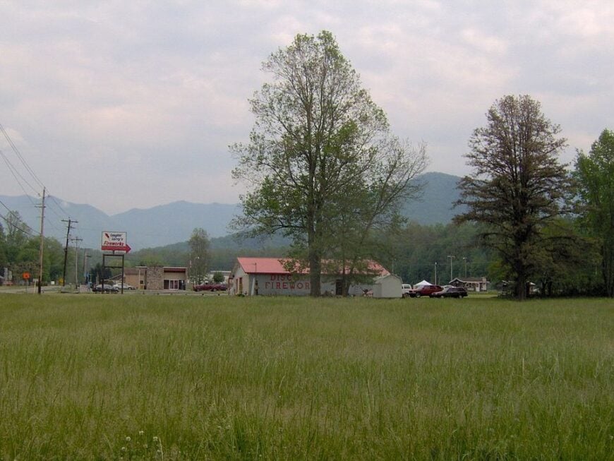
Around 800 people call Cosby home, scattered across fertile hollers where cornfields meet tulip-poplar ridges. The area is known among Smokies aficionados as the park’s quiet front porch, offering solitude on the Low Gap and Snake Den trails even in July.
Family farms grow apples, honey, and sorghum that end up in roadside stands along US 321. Seasonal cabin rentals and a modest moonshine distillery round out the local economy.
Thick hardwood forests and the abrupt rise of Greenbrier Pinnacle block line-of-sight to Gatlinburg’s neon glow only twenty miles away. Narrow lanes such as Old Highway 32 weave through wooded coves, convincing many GPS units to recalibrate.
Where is Cosby?
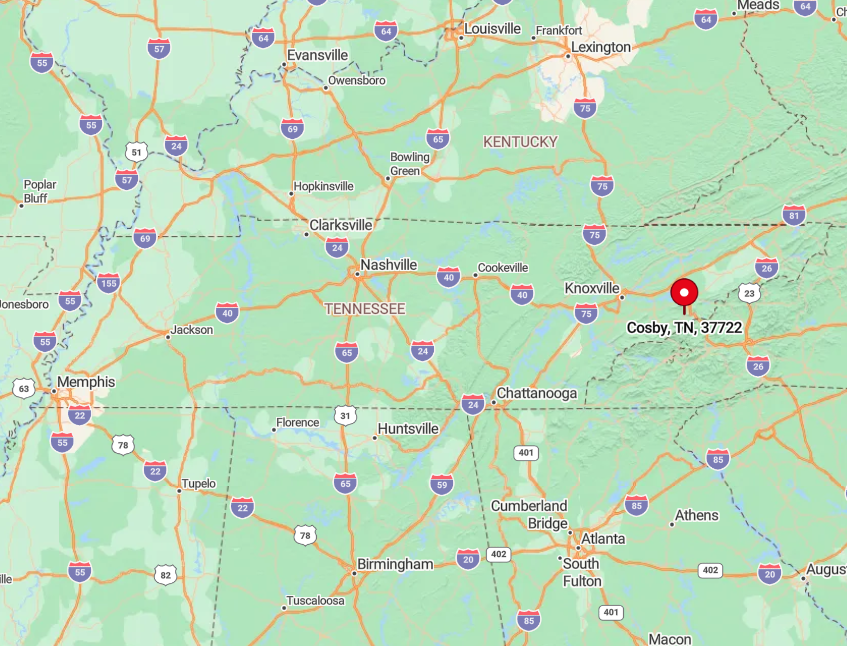
Cosby straddles the Cocke-Sevier county line east of Gatlinburg yet feels far more rural. The sole four-lane approach narrows to two and then one as it nears the park boundary, discouraging tour buses.
Interstate 40 travelers must navigate a series of unsigned back roads or circle thirty minutes through Newport. Those minor inconveniences preserve crisp night skies and coyote songs that drift across bean fields.
2. Turtletown – Rolling Pastures and Quiet Waterfalls
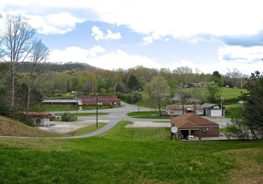
Turtletown numbers barely 150 residents spread across rolling pastures in Polk County’s far southeast corner. Weekend explorers hike the two-mile loop to Turtletown Falls where twin cascades plunge into a mossy canyon perfect for long-exposure photography.
Cattle, hay, and small apiaries provide income, supplemented by seasonal work at the copper basin mine museum in nearby Ducktown. Without a single stoplight or franchise sign, the landscape is dominated by rust-red barns and lazy black-and-white cows.
Forest ridges rise like blue waves around every field, obscuring cell towers and limiting broadband to satellite dishes. The absence of nightlife aside from fireflies makes this a destination for travelers who value sunsets over social calendars.
Where is Turtletown?
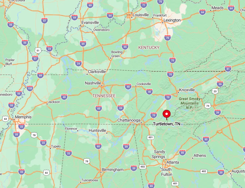
Turtletown rests along Tennessee Highway 68 just north of the Georgia border, thirty minutes from the nearest Walmart in Murphy. The Ocoee River gorge to the west and the Cohutta Wilderness to the south funnel most through traffic elsewhere.
Drivers approach on a winding byway that alternates between forest tunnels and open meadows where deer outnumber cars. Snow or fallen limbs can close the route for hours, reinforcing the community’s quiet rhythm.
1. Trade – Tennessee’s Oldest Settlement Tucked in the Highlands
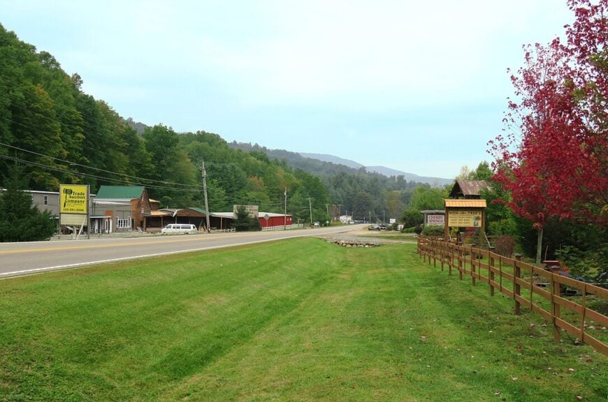
Trade, believed to be Tennessee’s oldest settlement, hosts about 350 people in a broad highland hollow near the North Carolina line. Each July the Trade Mill and Native Heritage Festival fills a hillside with dulcimer music, heritage crafts, and historical reenactors.
The rest of the year residents tend beef cattle, operate small sawmills, or commute to mountain jobs across the state line. Historic buildings such as the 1908 Trading Post and one-room schoolhouse remain as silent witnesses to the community’s bartering past.
Surrounded by Snake, Stone, and Rich mountains, the village sits at 3,400 feet, making it one of the highest communities in the state. Limited development, sparse cell service, and frequent fog banks conspire to keep passing motorists unaware that a town nestles in the valley.
Where is Trade?
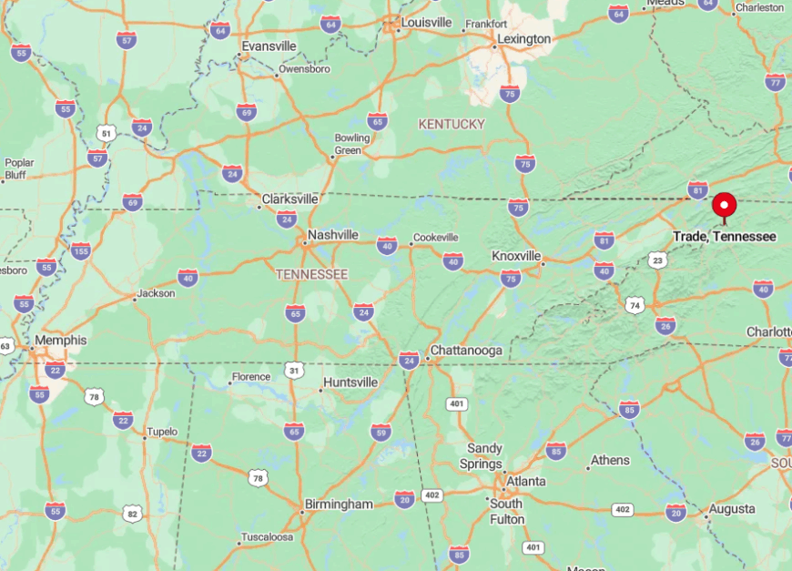
Trade lies on US 421 twelve miles southeast of Mountain City and only two miles shy of the North Carolina border. The winding road gains 1,500 feet from valley floor to crest, a gradient that slows tractor trailers to bicycle speeds.
Beyond the state line the highway tightens even more, so most regional traffic chooses alternate routes. That geography leaves Trade with more grazing horses than passing cars even during peak leaf season.


