Would you like to save this?
Northwest Florida still harbors pockets of shoreline where the Gulf breeze carries more gull calls than car horns and where pine forest meets dune in near silence. Our coastal back roads wind past forgotten fishing shacks, barrier-island hammocks, and low-key villages that quietly resist big-city buzz.
Each spot below shelters fewer than 3,500 full-time residents—most far fewer—yet offers paddling trails, board-walked beaches, and sunsets that linger over near-empty water. We gathered local lore, fresh-caught seafood tips, and travel logistics to build a countdown of 25 places where “busy season” feels like an inside joke.
From a peninsula where horses trot beside the surf to a gate-guarded hamlet laced with brick walks, these towns prove solitude still lives along Florida’s Emerald fringe. Pack binoculars, a cooler, and extra time—because the coast feels bigger when crowds are small.
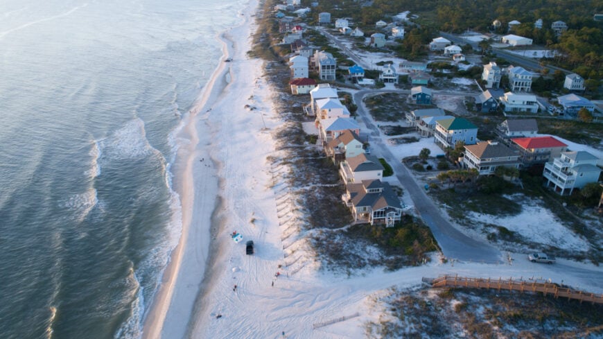
25. Seagrove Beach: Vintage Gulfside Simplicity
Seagrove Beach carries the scent of salt and old pines, a throwback to when families built humble cottages in the shade of live oaks. It’s a place where the ocean hums just beyond quiet porches, and early mornings are best spent barefoot on weathered boardwalks.
Though it’s flanked by busier neighbors, Seagrove keeps to itself with modest scale and a laid-back vibe. You’ll find small diners instead of high-rises, and nature trails that seem to lead to secret pockets of sand.
Many homes still sit tucked behind winding dirt paths and thick stands of scrub oak, giving the town a feeling of coastal retreat more than a tourist draw.
Where is Seagrove Beach?
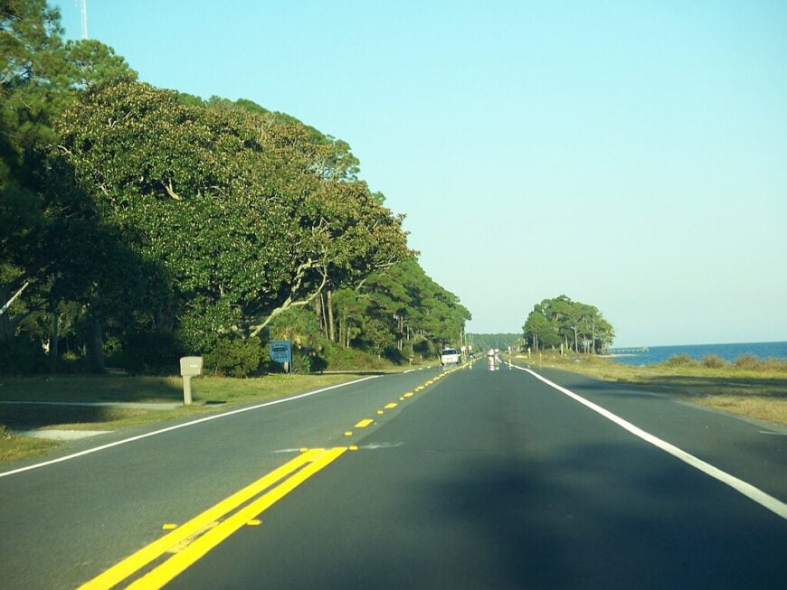
Seagrove Beach lies along Scenic Highway 30A in Walton County, just east of Seaside. Sandwiched between two state parks, it remains quietly tucked into a wooded stretch where the Gulf shimmers through the trees.
The town’s secluded character is enhanced by limited access roads and its protected dune ecosystem, keeping it calm even during peak season.
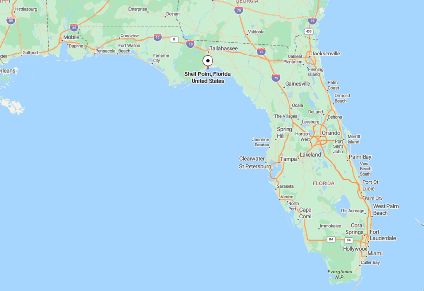
24. Shell Point: Windswept Shore Beside the Bay
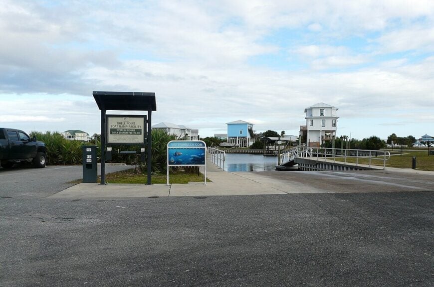
Shell Point nestles quietly along Apalachee Bay, its shoreline shaped by wind, water, and time. Residents fish from backyard docks or watch mullet jump just yards from their porches.
There’s a timeless hush to the place—sea oats bend in the breeze, and tiny waves tap against pilings as if in no rush to reach shore. Golf carts hum past with coolers and cast nets in tow.
With little commercial activity and no traffic lights, Shell Point drifts far from the hurried world, held in place by tides and the slow rhythm of coastal living.
Where is Shell Point?
Were You Meant
to Live In?
This waterfront hamlet is located in Wakulla County, about 30 minutes south of Tallahassee. Nestled at the terminus of Shell Point Road, it feels like the last stop before the Gulf swallows the land.
Its out-of-the-way position beside the saltmarsh makes it a favorite for solitude seekers and seabirds alike.
23. Seacrest: Soft-Spoken Sand and Sea
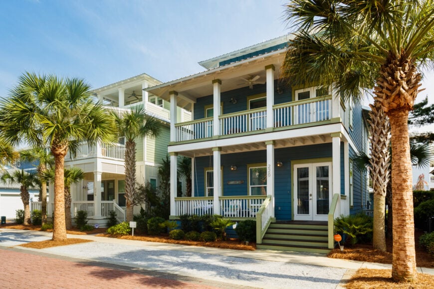
Tucked between flashy neighbors on 30A, Seacrest hides in plain sight behind stretches of dune and sea oats. The community leans toward unmarked trails, porches shaded by palms, and streets designed more for meandering than speed.
There’s a softness to its energy—like the hush before sunrise or the hush after a rainstorm. Vacationers stumble upon it by accident and often never want to leave.
Without a central town square or major hotel, it lingers gently on the edge of discovery, defined more by trees and tide than by tourism.
Where is Seacrest?
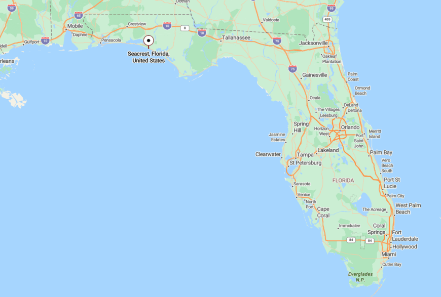
Seacrest sits along Scenic Highway 30A between Alys Beach and Rosemary Beach in Walton County. It hugs the coast with limited signage, and even its beach accesses seem to whisper instead of shout.
Surrounded by development but buffered by careful zoning and tucked-away streets, Seacrest retains a low-profile charm.
22. Panacea: The Marshland’s Quiet Heart
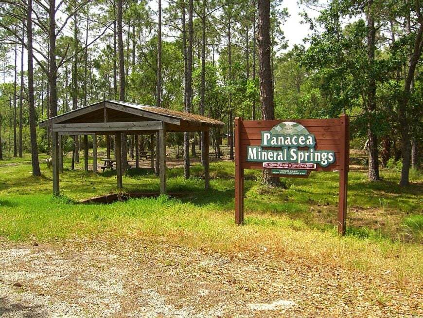

Panacea feels like an old photograph come to life—weathered docks, salt-stained crab shacks, and cypress knees poking up from the shallows. It’s a village of seafood workers and sun-creased front porches, where ospreys call louder than traffic.
The smell of marsh mixes with mullet fry in the air, and every boat returning to Ochlockonee Bay seems to carry the weight of tradition.
Though it has a few roadside markets and motels, Panacea stays modest, content to move slowly through a world that’s racing by.
Where is Panacea?
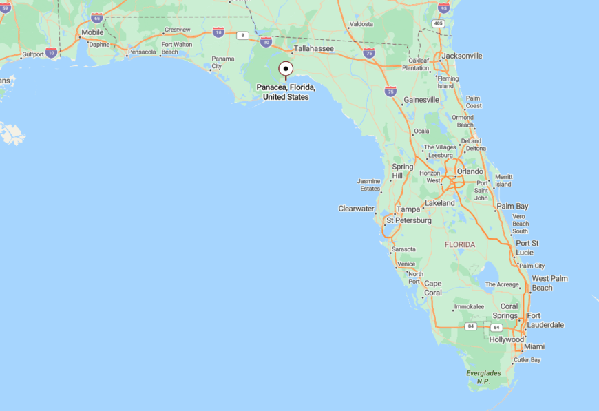
Found in Wakulla County, Panacea hugs U.S. 98 near the mouth of the Ochlockonee River, about 45 minutes south of Tallahassee. It’s easy to pass if you’re not looking—blending into marshland and pine flatwoods without fanfare.
The seclusion stems from its wide open estuary views and sparse development, which keep the town feeling wild and worn-in.
21. Point Washington: Forest Outpost Near the Gulf
Though only a few miles from the buzz of 30A, Point Washington could be a world away with its dense pine forests and backwater creeks. It’s the kind of place where locals wave from their yards and dogs nap under rustling oaks.
Old homes line unpaved roads, and the sounds of the woods—tree frogs, cicadas, distant woodpeckers—outnumber passing cars.
Anchored by a historic church and a scattering of houses, it remains a deeply rooted enclave that prefers quiet over commerce.
Where is Point Washington?
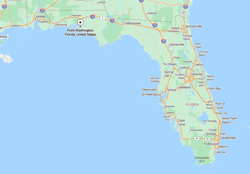
Located just north of Seagrove Beach in Walton County, Point Washington is accessed by County Road 395 through the heart of the state forest. Its proximity to Choctawhatchee Bay adds to the sense of escape.
Surrounded by protected land and water on all sides, the town feels both hidden and hallowed.
20. Eastpoint: Working Waterfront with Wide Horizons
Eastpoint hums with the rhythm of oyster tongers and net-makers, a town of labor more than leisure. Its docks groan under the weight of the day’s catch, while front porches echo with quiet conversations over sweet tea.
The sun sets low across the bay, painting nets and boats in orange light. Here, the modern world feels far away—even though Apalachicola sits just across the bridge.


With its blue-collar backbone and bayside grace, Eastpoint offers a rare kind of coastal solitude.
Where is Eastpoint?

Situated in Franklin County on the north side of Apalachicola Bay, Eastpoint connects to St. George Island via the Bryant Patton Bridge. U.S. 98 runs through it, but most travelers slow down—or stop completely.
Its small-town feel is protected by its water boundaries and deep-rooted culture of fishing and resilience.
19. Sopchoppy: Forgotten Crossroads in the Forest
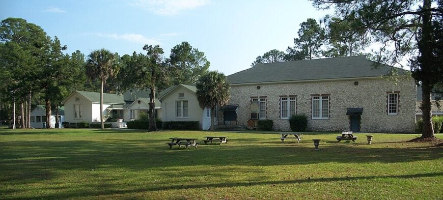
With fewer than 500 residents, Sopchoppy is a town where trains no longer run, but the river still does. Longleaf pines guard its borders, and blackwater creeks twist past quiet homes and an aging depot.
Locals gather at the Worm Gruntin’ Festival each spring—a nod to the art of luring earthworms from the soil—and otherwise let the woods do most of the talking.
Sopchoppy’s calm stems from both its forested setting and its deep-rooted identity as a place content to remain overlooked.
Where is Sopchoppy?
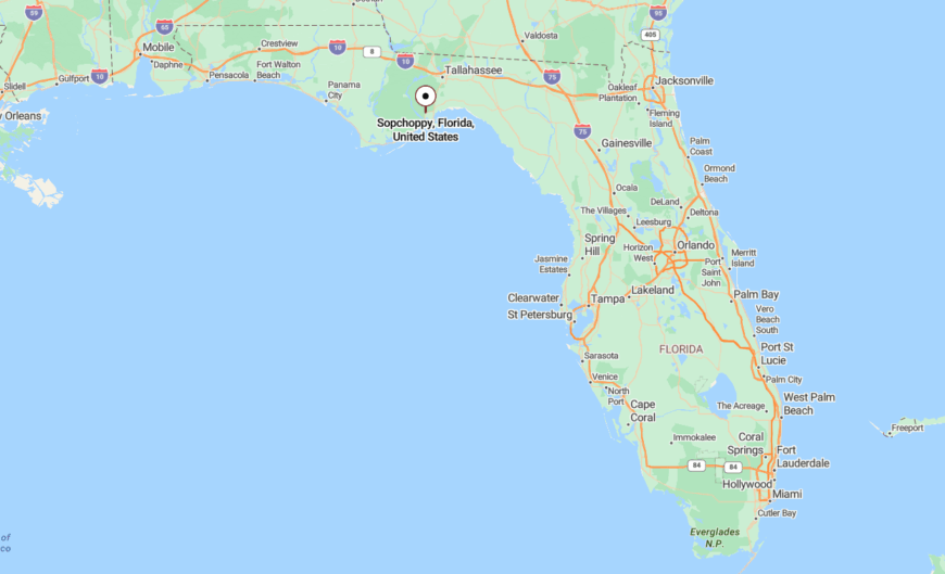
Located in southern Wakulla County along U.S. 319, Sopchoppy rests just west of the Ochlockonee River and north of the national forest that shares its name.
Its placement along the edge of wilderness keeps the noise down and the wildlife near, making it a peaceful outpost in Northwest Florida’s inland pinebelt.
18. Port St. Joe: Quiet Harbor with a Deep Past

Though larger than some nearby towns, Port St. Joe still moves at a gentle rhythm shaped by water and wind. Once a boomtown, it now wears its history like an old fishing hat—faded but still full of character.
Locals launch boats at sunrise and reel in dinner by sunset. Strolls along Reid Avenue pass more Gulf breezes than people.
Despite being a county seat, Port St. Joe remains refreshingly low-key, serving as a calm harbor for those seeking solitude with a side of seafood.
Where is Port St. Joe?
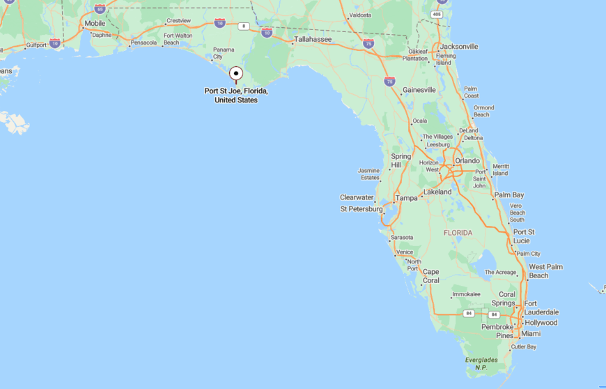
Nestled along St. Joseph Bay in Gulf County, Port St. Joe sits on U.S. 98 between Mexico Beach and Indian Pass. It’s far enough from the interstate to feel forgotten and close enough to the Gulf to smell the salt.
The town’s water-facing layout and lack of high-density development preserve its sense of stillness.
17. Lanark Village: Veteran-Era Seclusion by the Sea
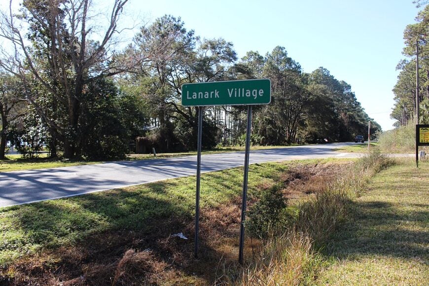
Lanark Village carries the echoes of its military past in tidy rows of whitewashed duplexes and overgrown hedges. It’s a community of artists, retirees, and wanderers living by the lull of the tide.
The rhythm is one of afternoon coffee on screened porches and sunset strolls past pine shadows. Some days, the only sound is wind brushing palmettos.
With no chain stores and few visitors, the village moves by its own gentle clock.
Where is Lanark Village?
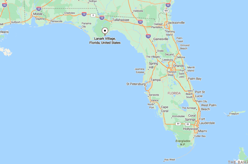
Found just east of Carrabelle along U.S. 98 in Franklin County, Lanark hugs the shoreline of St. George Sound. It was built for WWII veterans but now feels like a quiet time capsule by the sea.
The surrounding forest and marsh help insulate it from the bustle of beach towns further west.
16. Freeport: Crossroads of Water and Stillness
Would you like to save this?
Freeport lies where freshwater creeks meet salty tide, a junction town both known and somehow overlooked. It’s a place of fishing holes, murmuring bayous, and old timberlands where deer often outnumber tourists.
Though it’s grown in recent years, much of Freeport still whispers with the calm of mornings on Four Mile Creek or evenings on Mallet Bayou.
Its proximity to bustle contrasts with its enduring stillness, making it feel like a secret pocket just beyond the map’s edge.
Where is Freeport?
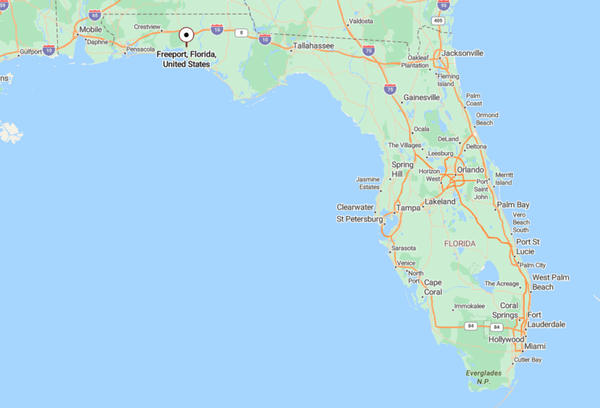
Located in Walton County north of U.S. 98, Freeport sits inland from the beach but close enough to hear seabirds on quiet days. County highways connect it to the coast, yet it avoids the density of nearby resorts.
Surrounded by forest and estuary, it holds tight to its rural soul.
15. Carrabelle: Shrimp Boats and Shrimpier Crowds
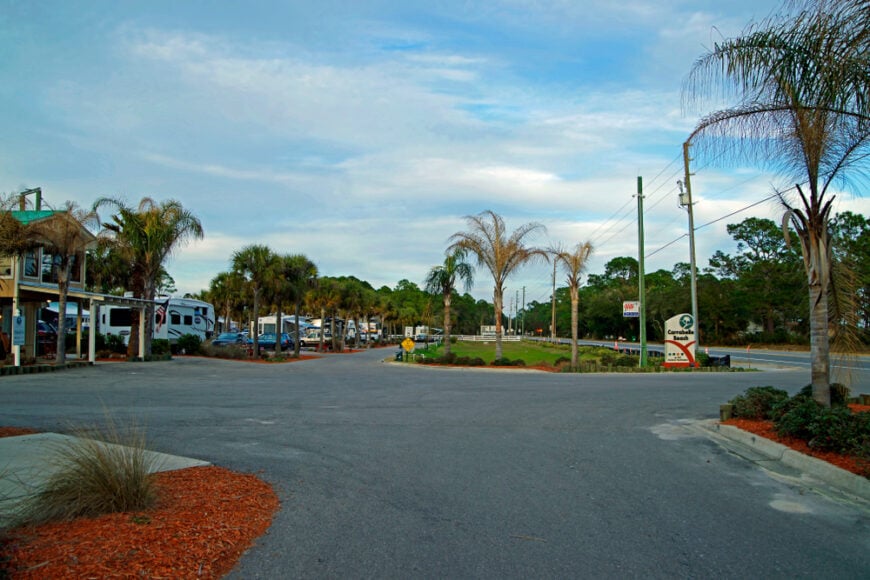
Carrabelle sits quietly at the mouth of the Carrabelle River, where shrimp boats line wooden piers and sea fog rolls in with little warning. The town feels like a novel you once read—salt-rimmed, slow-paced, and too charming to rush.
A scattering of shops and seafood joints mark the compact downtown, while the riverfront invites aimless watching of tides and tarpon.
Even as visitors trickle through, Carrabelle maintains a salty distance from mainstream tourism.
Where is Carrabelle?
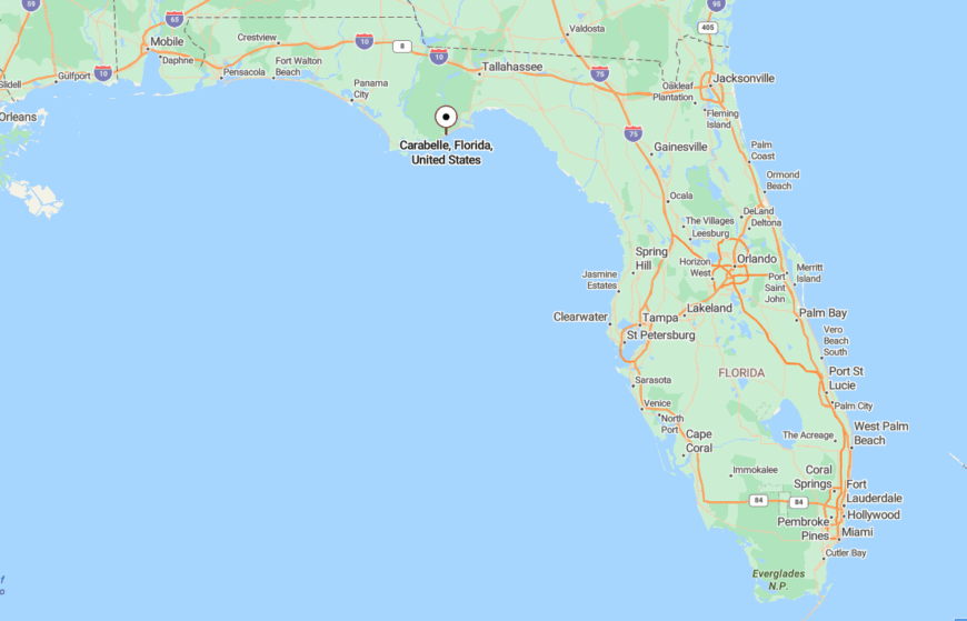
Situated in Franklin County along U.S. 98, Carrabelle rests where river and Gulf meet. It’s east of Apalachicola, but far enough out to feel detached from the tourist flow.
Its watery borders and working harbor make it feel more like a forgotten chapter than a destination.
14. Gulf Breeze: Wooded Inlet with a Breezy Soul
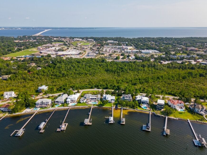
Tucked between Pensacola Bay and the Gulf Islands National Seashore, Gulf Breeze leans into its name with live oaks that sway and sea air that never rests. Though technically a suburb, it acts like a sanctuary.
Quiet neighborhoods back up to estuaries and protected dunes, and the sounds of schools and skateboards blend with egret calls.
Much of its charm comes from what hasn’t changed—backyard marsh views, sleepy inlets, and breezes that carry stories from both shorelines.
Where is Gulf Breeze?
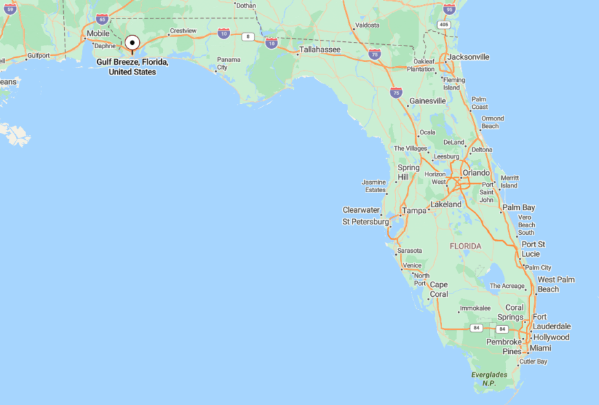
Located on the Fairpoint Peninsula in Santa Rosa County, Gulf Breeze connects to Pensacola via the Three Mile Bridge. Despite the link, it’s bordered by national parks and water on three sides.
The seclusion is less about distance and more about what surrounds it—natural silence buffering suburban sprawl.
13. Valparaiso: Pines, Pilots, and Perfect Stillness
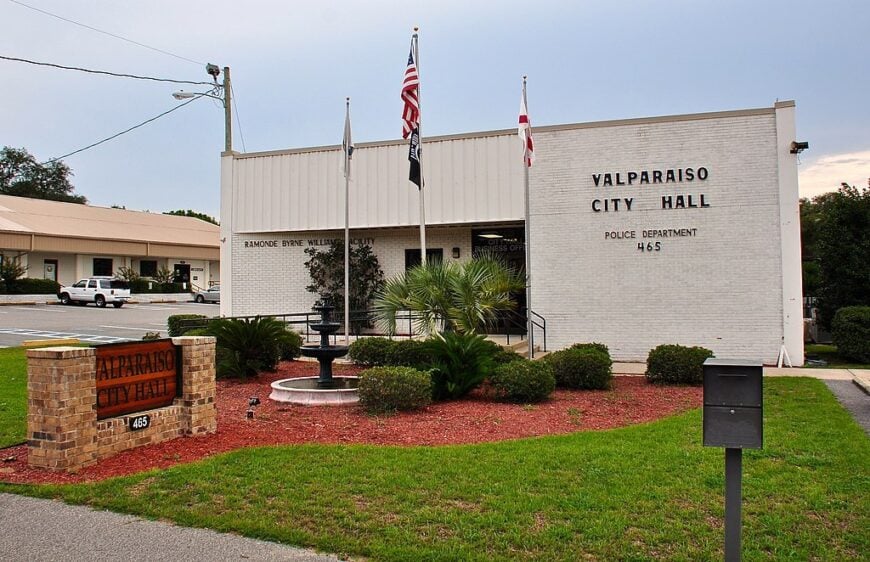
Valparaiso drapes itself over the wooded edge of Choctawhatchee Bay, a town shaped by aviation history and defined by its long views over calm water. Small neighborhoods slope gently toward the shoreline, where fishermen cast in silence.
Its base-adjacent location gives it order, but its streets stay slow and uncrowded. Many homes open onto forest trails or hidden coves.
Even with Eglin Air Force Base nearby, Valparaiso feels wrapped in stillness thanks to its low profile and tucked-away geography.
Where is Valparaiso?
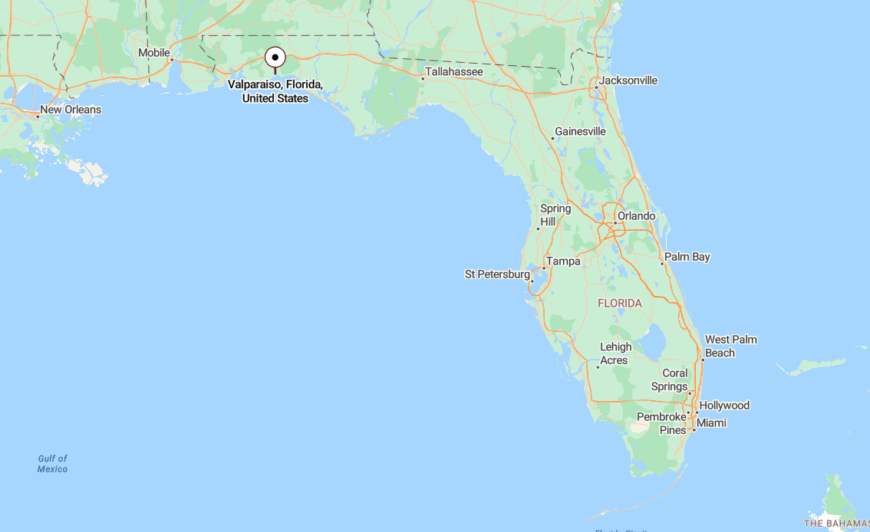
Positioned in Okaloosa County beside Niceville and across the bay from Destin, Valparaiso rests far from the Gulf’s noise. The town edges the twin runways of Eglin but seems untouched by tourism’s buzz.
Its placement beside pine forest and bay keeps its pace as mellow as its breeze.
12. Milligan: The Pines’ Quiet Outpost
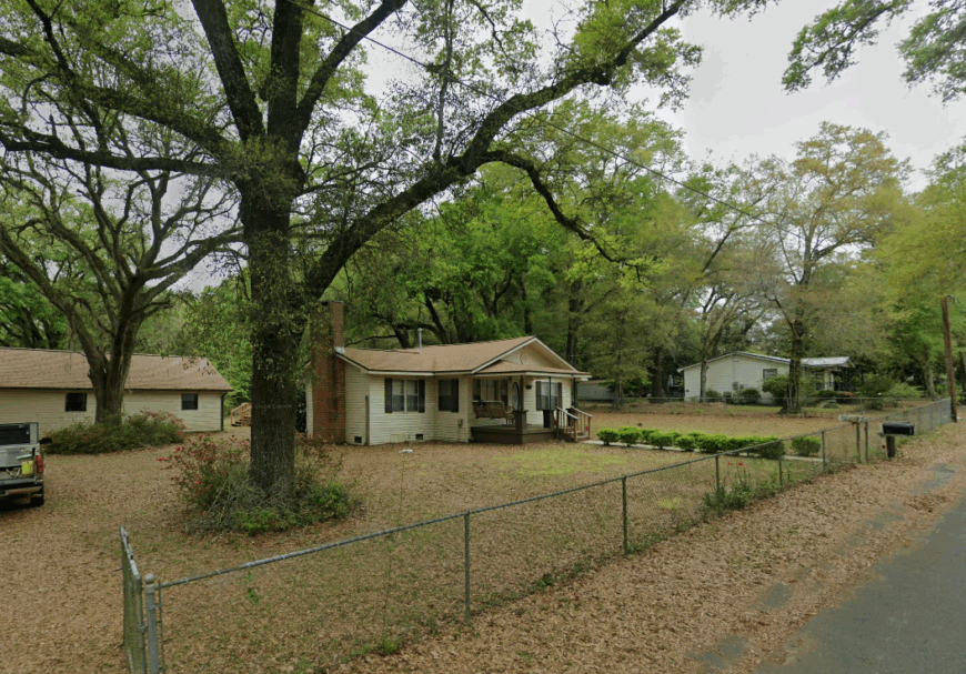
Milligan isn’t a place that shows up in brochures, and that’s the point. Surrounded by vast tracts of pine forest and stitched together with sandy roads, it feels like a whisper between towns.
The post office still serves as a landmark, and wildlife sightings are more common than strangers. Days pass in the hum of cicadas and the shade of longleafs.
Its identity is quiet, unchanging—a place content with remaining overlooked.
Where is Milligan?
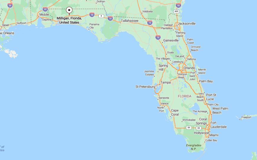
Milligan lies in Okaloosa County near the junction of U.S. 90 and State Road 4, west of Crestview. It serves as a rural waypoint between the woods and the west.
Its inland location and lack of development keep it isolated, with nature as its nearest neighbor.
11. Santa Rosa Beach: Hidden Corners Beneath the Pines
Santa Rosa Beach is bigger than it seems, sprawling behind dune lakes, thick groves, and winding roads. But its best spots stay tucked away—little enclaves where silence lingers longer than signal strength.
Here, kayakers glide past herons, and mornings begin with fog over the bay rather than traffic. It’s a place of slow tides and slow time.
Though it touches popular 30A, Santa Rosa Beach remains a gentle retreat behind the scenes.
Where is Santa Rosa Beach?
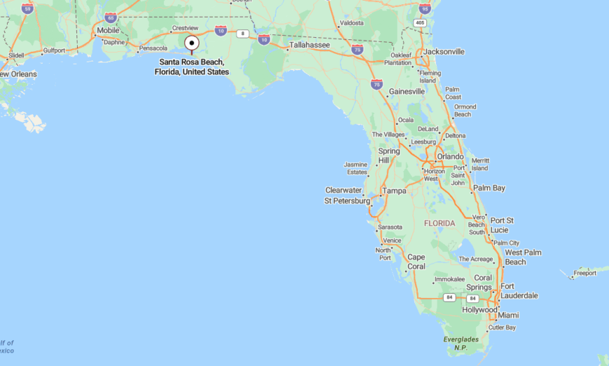
Found in Walton County between Destin and Grayton Beach, Santa Rosa Beach stretches from the Choctawhatchee Bay to the Gulf. Its quieter corners lie north of 30A, where forested roads lead to calm waters.
Surrounded by state forest and preserved lands, it balances access with insulation—a hidden calm beneath the coast’s glamour.
10. Cape San Blas: Untamed Peninsula Paradise
Cape San Blas counts roughly 300 permanent residents who live on a skinny, dune-ribbed finger between St. Joseph Bay and the open Gulf. Days drift by with horseback rides on the beach, scalloping in knee-deep bay grass, and climbs up the relocated Cape San Blas Lighthouse in nearby Port St. Joe.
Vacation rentals and a smattering of bait shops support the tourism economy; otherwise, seafood harvesting and park service jobs rule. No building tops five stories, cell service wavers, and the night sky earns five stars on most stargazing apps, underscoring its seclusion.
Loggerhead turtles outnumber streetlights, and the nearest chain grocery store sits almost twenty miles inland. Our team loves how early risers often walk a mile without meeting another footprint.
Where is Cape San Blas?
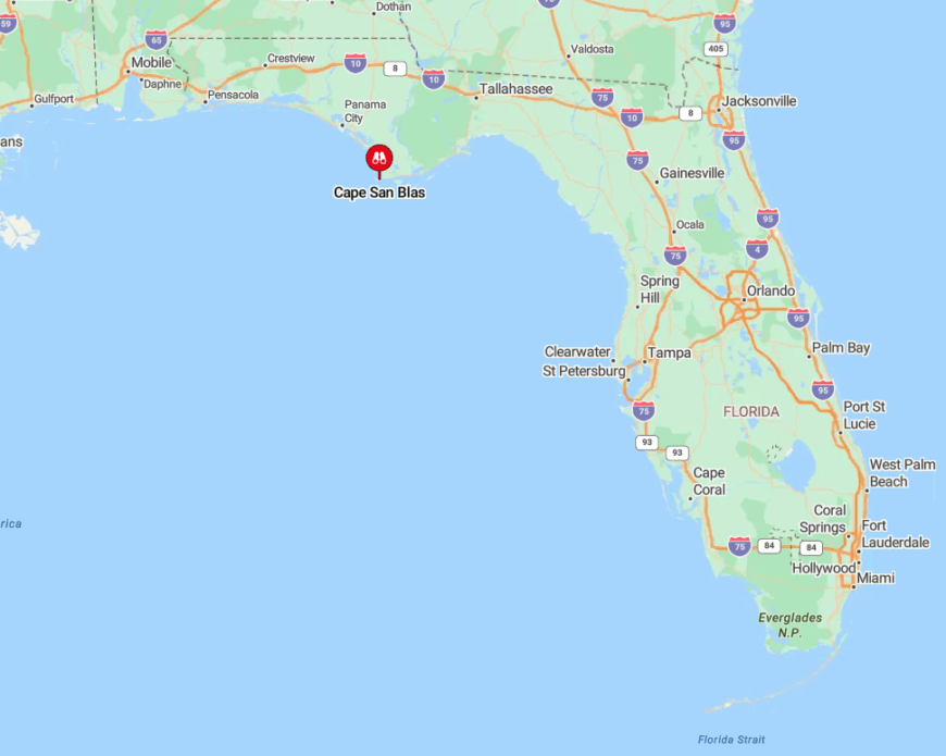
The cape juts southwest from Gulf County, roughly midway between Panama City and Apalachicola. With water on three sides and a single two-lane road, the peninsula feels detached even though it lies only a forty-minute drive from U.S. 98.
Visitors enter via County Road 30E, a ribbon sometimes flanked by bay on one shoulder and Gulf on the other. Travelers without cars can fly into Northwest Florida Beaches International Airport, rent wheels, then follow signs past slash pine and marsh to “the forgotten cape.”
9. Alligator Point: Forgotten Fishing Hamlet
A year-round population of about 400 occupies weathered stilt homes along Alligator Point’s eight-mile spit. Anglers launch skiffs at the public ramp for redfish and speckled trout, while birders wander Bald Point State Park searching for migrating kestrels and monarch butterflies.
Commercial oyster and crab boats still dock on Ochlockonee Bay, making seafood the main industry alongside a sprinkling of vacation rentals. Without a single traffic light and with limited Wi-Fi, the point keeps evenings dark enough for Milky Way portraits.
Tall pines screen cottages from neighbors, and stretches of beach often host more pelican tracks than picnic chairs. We find the hush so complete that wind chimes carry across the entire bay on calm nights.
Where is Alligator Point?
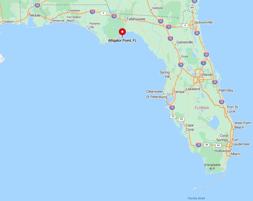
The community occupies the eastern tip of Franklin County, reached by a narrow causeway off U.S. 98 near Panacea. Surrounded by bay, marsh, and open Gulf, it feels like a barrier island even though it remains technically attached to the mainland.
Drivers follow County Road 370 until pavement slips into sand, reinforcing the sense of being at land’s end. Tallahassee’s regional airport sits an hour north; from there, a rental car and a good playlist complete the journey.
8. St. George Island: Quiet Beaches Beyond the Bridge
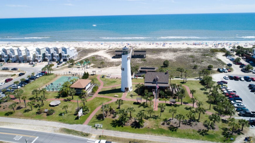
St. George Island hosts about 1,100 full-time residents scattered among pastel cottages and seashell lanes. Families pedal rented bikes along Gulf Drive, anglers cast from Bob Sikes Cut, and early birds comb the low-tide line for Scotch bonnets.
Short-term rentals anchor the local economy, complemented by charter fishing and a growing cluster of art boutiques near the reconstructed lighthouse. The nearest Walmart is an hour away, and development caps limit building height to three stories, keeping the skyline bare.
Even on holiday weekends, a beachgoer can pick a patch of dune-backed sand with no umbrella in sight for fifty yards. We appreciate that island rules still allow leashed dogs on the shore, adding to its laid-back vibe.
Where is St. George Island?
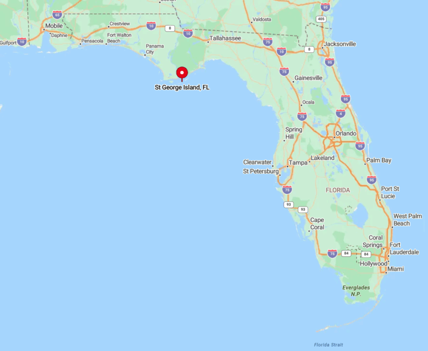
Accessible only by a four-mile bridge from Eastpoint, the barrier island sits just south of Apalachicola in Franklin County. Water surrounds the two-lane entrance, so a single accident can briefly cut the island off, accentuating its separation.
Fly into Tallahassee or Panama City, rent a car, and merge onto U.S. 98 before the causeway delivers you over Apalachicola Bay’s oyster bars. Once across, everything worth seeing fits within a ten-mile stretch, best explored on foot, bike, or golf cart.
7. Indian Pass: Where the Road Literally Ends
Would you like to save this?
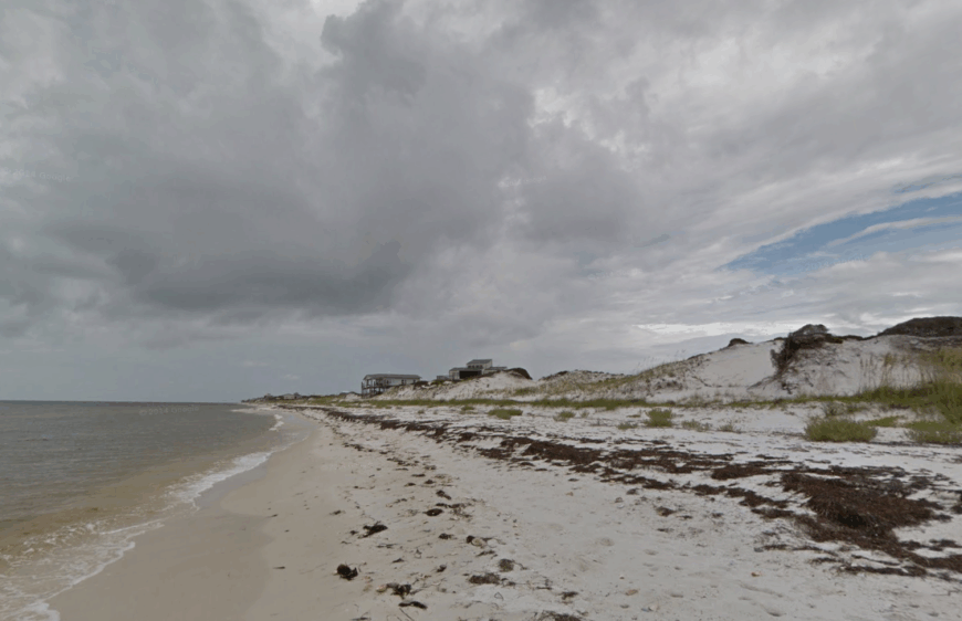
Only around 250 hardy souls claim permanent addresses at Indian Pass, a narrow spit where driftwood piles higher than condominiums.
Days revolve around oysters at the legendary Indian Pass Raw Bar, ferry rides to uninhabited St. Vincent Island National Wildlife Refuge, and dog-friendly strolls on a beach as wide as a football field.
Commercial fishing, charter guiding, and a cluster of vacation cottages supply the modest economy. A lone county road dead-ends at the sand, confirming the area’s out-of-the-way personality.
Cell towers are scarce, and sea oats often sway louder than human voices. Our favorite find: relic bottle fragments from 19th-century trading posts still wash up after big storms.
Where is Indian Pass?
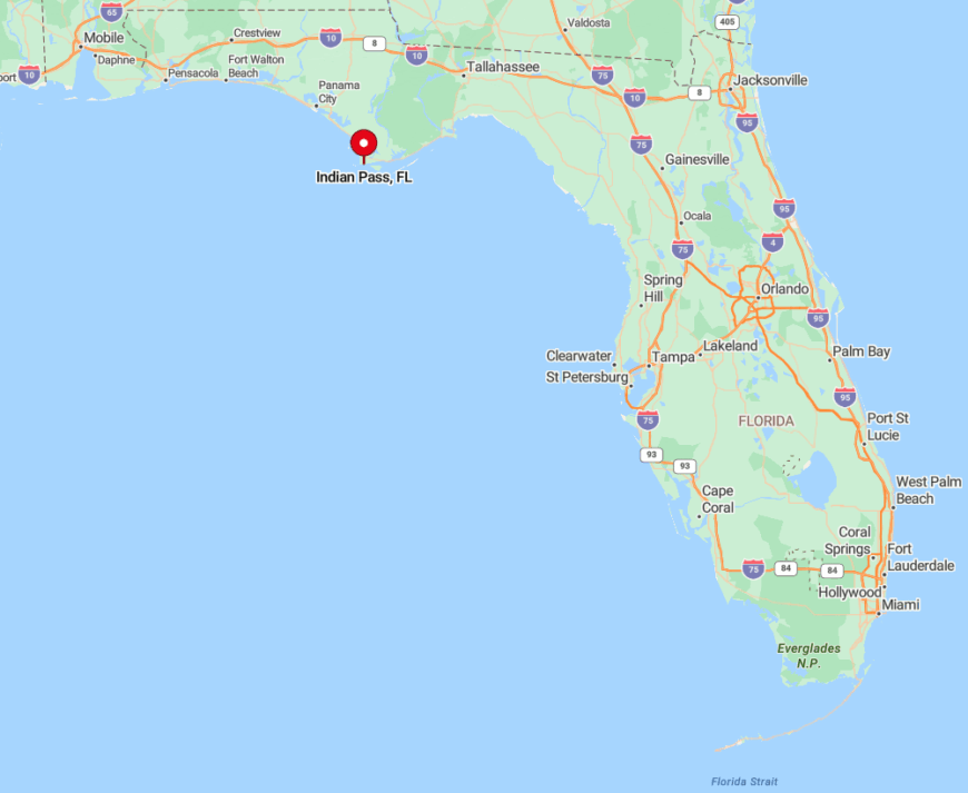
The settlement sits south of Port St. Joe in Gulf County, bracketed by Indian Lagoon to the north and the Gulf to the south. With marsh on one flank and tidal flats on the other, it feels like an island hiding in plain sight.
Visitors follow State Road 30A, then veer onto County Road C-30B until pavement dissolves into oyster shell. The nearest airport sits eighty miles west in Panama City; a rental car remains the only practical option.
6. Dog Island: Boat-Access Wilderness Retreat
Dog Island supports roughly 30 year-round residents who share twelve miles of undeveloped beach with ghost crabs and nesting plovers. Activities center on shelling, surf casting, and hiking old military roads that now serve as sandy footpaths through maritime forest.
With no commercial district, the slim economy leans on a volunteer fire crew, ecological research outpost, and a smattering of off-grid vacation homes powered by solar. Vehicles are rare and streets are unpaved, reinforcing its hush.
Even summer afternoons yield stretches where footprints vanish within an hour of the tide. We often see migrating warblers in live oaks mere steps from the surf—proof that wilderness and shore coexist here.
Where is Dog Island?
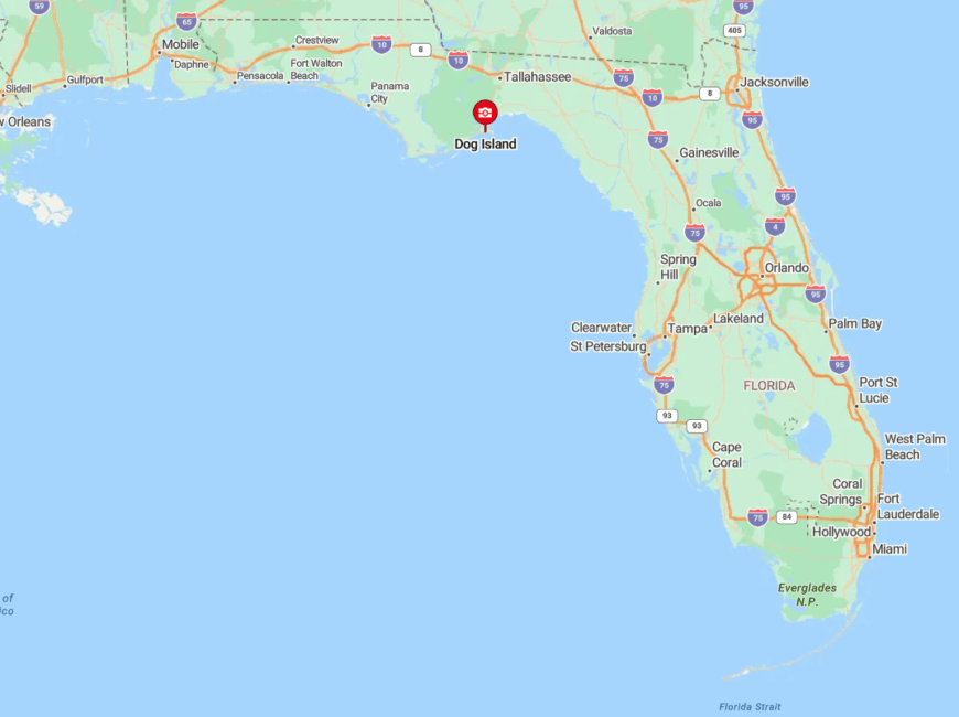
The barrier island lies just offshore from Carrabelle in Franklin County and can be reached only by private plane or a twenty-minute water taxi. Isolation stems from the lack of a bridge and the strict “no services” policy that discourages day-trippers.
The water taxi departs from Timber Island Marina, timed to supply runs and guest arrivals. Visitors should pack all food and gear, as the last grocery store sits seven nautical miles and a world away.
5. Mexico Beach: Rebuilding Small-Town Tranquility
Before Hurricane Michael, Mexico Beach housed about 1,200 residents; today, the figure hovers near 400 as the community reconstructs its five-mile shoreline. Travelers fish from the rebuilt pier at sunset, browse new pastel shops along Highway 98, and kayak out to artificial reefs that survived the storm.
Home construction and hospitality now dominate the local job scene, helped by a stubborn charter-fishing fleet. A strict four-story height cap preserves Gulf views and keeps crowds modest compared with neighboring Panama City Beach.
Empty lots create natural breaks between clusters of cottages, so the town still feels open and airy. We’re partial to Killer Seafood’s comeback gumbo, served from a gleaming trailer while the brick restaurant is rebuilt.
Where is Mexico Beach?
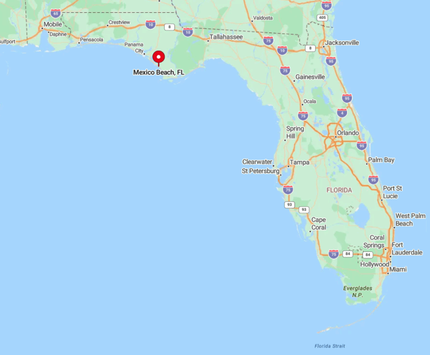
The town sits at the Bay–Gulf county line on U.S. 98, forty minutes east of Panama City yet worlds calmer. Bordered by Tyndall Air Force Base and a deep pine forest, it avoids through-traffic that plagues larger beach metros.
Drivers arrive via Highway 98, but once parked, most people wander everywhere on foot or beach cruiser. Northwest Florida Beaches International Airport lies thirty-eight miles west, with rental cars or shuttle vans completing the final leg.
4. Grayton Beach: Artsy Village in the Dunes
Grayton Beach claims roughly 700 permanent residents who live in weather-worn cottages tucked behind dune-arched lanes. Visitors browse funky art shops like The Zoo Gallery, paddle across Western Lake’s rare coastal dune outfall, and sip cold brews at the storied Red Bar.
Tourism and creative studios anchor employment, supplemented by park service jobs at Grayton Beach State Park. A thick buffer of preserved land keeps Highway 30A traffic at bay, ensuring campfire crackle often eclipses engine noise.
Even in summer, the state-park beach limits daily entrants, granting elbow room on sugar-white sand. We admire how locals still post homemade “Nice Dogs, Strange People” signs, nodding to the village’s quirky charm.
Where is Grayton Beach?
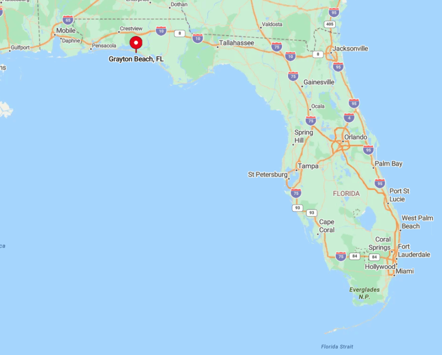
Located halfway between Destin and Panama City along Scenic Highway 30A in Walton County, the village nestles inside a 2,000-acre state park. Dense slash pine and dune lakes encircle the town, cutting it off from sprawl to the west and east.
Visitors fly into Destin-Fort Walton Beach Airport, drive thirty miles, then park bikes for the rest of their stay. Narrow sand lanes and limited public parking keep Grayton blissfully uncrowded.
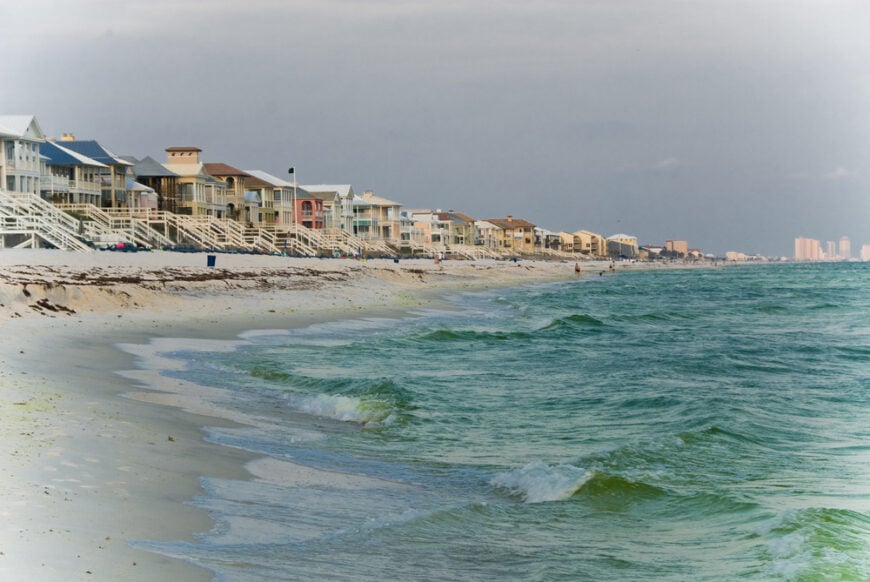
3. Navarre Beach: Emerald Coast’s Sleepy Stretch
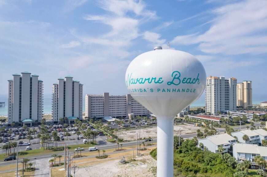
About 1,500 people call Navarre Beach home year-round, enjoying Florida’s longest public pier and sugar sand wide enough for double-wide umbrellas. Snorkelers glide over two near-shore artificial reefs, while cyclists pedal the Gulf Islands National Seashore path flanked by sea-oat dunes.
Defense jobs at nearby Hurlburt Field and tourism rentals sustain the local economy. A strict low-rise ordinance—no building taller than 40 feet—prevents the high-density buildout seen elsewhere on the Emerald Coast.
The protected seashore on both flanks ensures skies stay uncluttered by neon signs. We suggest sunrise visits to the turtle conservation center, which hosts low-key hatchling releases in late summer.
Where is Navarre Beach?
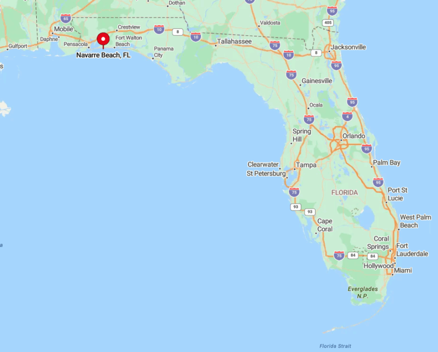
The community sits on Santa Rosa Island, connected to the mainland by the Navarre Beach Causeway south of U.S. 98. With protected national seashore stretching miles east and west, the island remains insulated from heavy commercial zones.
Pensacola International Airport lies twenty-five miles west; a rental car or rideshare crosses the causeway, then Highway 399 parallels the Gulf with nothing but dunes in sight. Once parked, most visitors explore on foot, bicycle, or by paddleboard launched from Santa Rosa Sound.
2. Perdido Key’s Johnson Beach: Secluded National Seashore
Perdido Key’s full-time population nears 2,400, yet Johnson Beach’s eastern half sees only a fraction of those residents thanks to federal protection. Beachgoers stroll boardwalks over scrub, spotting dolphins in turquoise water and ospreys perched on weathered snag posts.
Tourism and Navy Federal Credit Union in nearby Pensacola drive regional employment, but within the seashore, preservation reigns. Low-traffic loops, limited facilities, and a day-use fee discourage crowds, so picnic tables often sit vacant even on Saturdays.
The park’s narrow footprint—Gulf on one side, lagoon on the other—creates a front-row seat to sunrise and sunset without moving the cooler. Our secret tip: hit the old observation bunker trail for panoramic shots of dune ridges almost no one photographs.
Where is Perdido Key’s Johnson Beach?
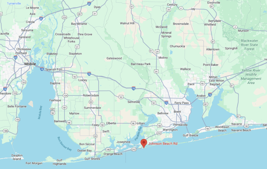
The national seashore lies on the eastern tip of Perdido Key, straddling the Florida-Alabama line southwest of Pensacola. Hemmed in by Big Lagoon and the Gulf, the area leaves only one entry road through a tucked-away gatehouse, heightening the sense of remoteness.
Pensacola International Airport is a forty-minute drive; follow Highway 98 west, then cross Theo Baars Bridge onto the key before signs point to the seashore. Cyclists love arriving via the Perdido Key multi-use path, which often hosts more herons than humans at dawn.
1. Carillon Beach: Gated Gulf Coast Hideaway
Carillon Beach lists fewer than 200 permanent residents within its pastel lakefront and Gulf-front cottages wrapped in brick walkways. Guests paddle Lake Carillon, stroll nearly 4,000 feet of private beach, and listen to the bronze bell tower chime on the hour.
Real estate, boutique weddings, and hospitality services fuel the micro-economy behind its guarded gate. The absence of through-traffic, a design code capping buildings at four stories, and private security ensure serenity even as crowds pack nearby Panama City Beach.
Streets prefer golf carts to cars, and night lighting stays tame so sea turtles can nest undisturbed. We enjoy sunset concerts on the Village Green, where lawn chairs replace stadium seating and the Gulf breeze supplies natural acoustics.
Where is Carillon Beach?
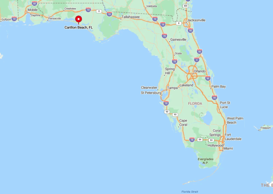
This master-planned village anchors the far western edge of Bay County, just east of the Walton County line along U.S. 98. Bordered by Phillips Inlet to the west and Lake Powell to the north, it feels cocooned despite sitting on a major highway.
Guests check in at a gatehouse, then navigate brick lanes that discourage outside traffic. Northwest Florida Beaches International Airport is twenty minutes away, yet once inside the gates, time slows to the measured rhythm of the bell tower.
Haven't Seen Yet
Curated from our most popular plans. Click any to explore.