Eastern Wisconsin’s shoreline is a study in contrasts. The same lake that sends gales into Milwaukee softens into quiet coves farther north, where cedar windbreaks and clay bluffs create natural walls between people and the wider world. Step off the main highways and the landscape shifts quickly—fields taper into dunes, and fishing shanties appear where the maps show little more than a bend in the road.
In order to come up with the very specific design ideas, we create most designs with the assistance of state-of-the-art AI interior design software.
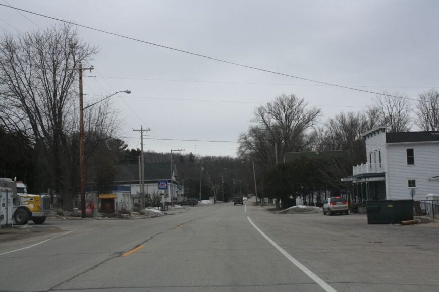
The towns along this coast aren’t built for spectacle. They keep to a smaller scale: crossroads hamlets with one tavern, cottages stitched into pine groves, or a ferry dock that doubles as the town square. Residents rely on farms, fishing, or seasonal work, but the rhythm of life is still set by the lake. Wind, waves, and long winters act as equal partners in the local economy.
Seclusion here doesn’t mean remoteness in miles. Many of these villages sit just beyond vacation corridors, hidden by a bluff line or a turn that most drivers never take. The difference is access: a county road that ends at the water, a causeway that floods with the weather, a harbor that accepts only those who seek it out. The result is a patchwork of settlements that feel distinctly their own, even as they share the same shoreline.
This survey traces twenty-five of these quiet coastal places, moving from ferry landings at the tip of Door County to small neighborhoods tucked into marshland near the Illinois line. Each has its own balance of work and leisure, its own way of staying out of the spotlight. Together, they sketch a different Wisconsin coast—less about resorts and boardwalks, more about the people and places that let the lake set the terms.
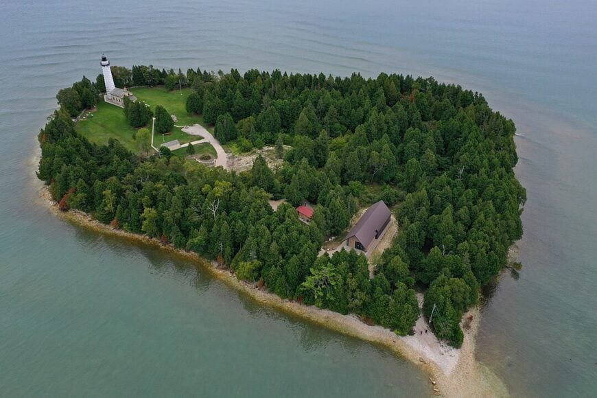
25. Washington Island
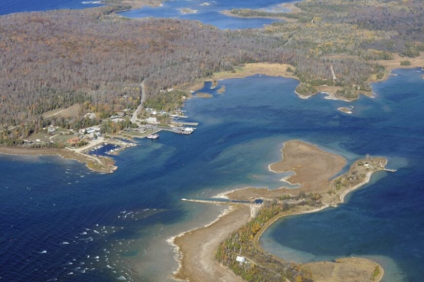
Fishing shacks, cedar windbreaks, and long gravel drives make Washington Island feel like the last dot before open water. The ferry ride alone slows the pulse, and once ashore, the island’s hush settles in with shorebirds and the steady blink of a lighthouse.
Days are simple and elemental: biking quiet lanes to Schoolhouse Beach, hiking through the pines at Rock Island State Park, casting for smallmouth in the chop, or paging through history at the old Stavkirke. A handful of galleries, charter boats, and seasonal cafes carry the summer economy, while winter belongs to woodstoves and locals.
With no bridge and miles of water in every direction, the island stays free of casual traffic. Even in July, starlight outshines streetlight. It’s the kind of place that reminds you how quiet the world can be.
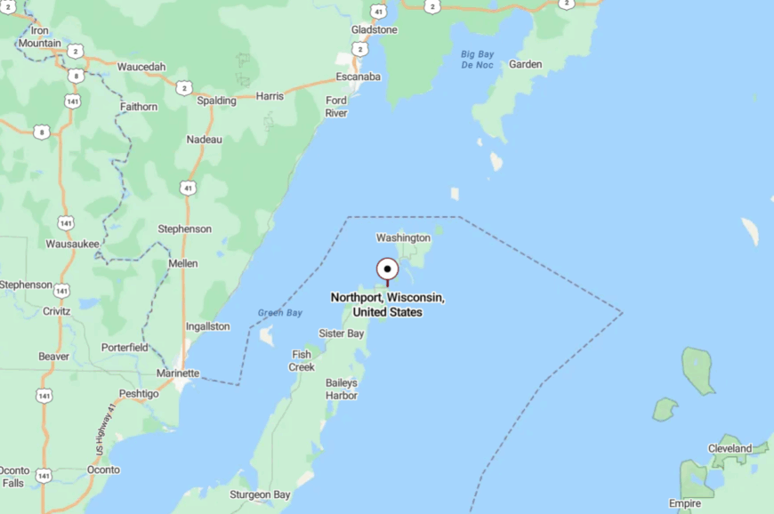
Where is Washington Island?
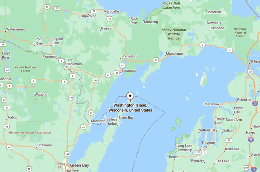
Set at the very tip of Door County, Washington Island sits beyond the strait known as Death’s Door. It’s roughly 7 miles off the mainland from the Northport dock, reached by a car-and-passenger ferry.
Once you roll off the boat, roads narrow into two-lane ribbons through woods and fields. Close enough for a day trip—yet far enough to feel you’ve crossed into another world.
24. Northport
Northport is more a whisper than a town—just a harbor, a curve of shoreline, and a cluster of cottages hiding behind wind-bent trees. The vibe is salt-tinged and unhurried, with gulls wheeling over the ferry slip and fishing skiffs nosing out at dawn.
Visitors linger over picnic tables by the dock, walk the shoreline for beach glass, photograph passing freighters, and watch the ferry shuffle in and out like a clock with a heartbeat. A tiny marina and seasonal stands are about all the commerce you’ll find.
Because it sits at the literal end of the peninsula, no one “passes through” by accident. The traffic quiets the moment the ferry gate closes. It’s a threshold place where the mainland’s noise simply falls away.
Where is Northport?
Northport anchors Door County’s northernmost point on Lake Michigan. It’s about 35 miles north of Sturgeon Bay, reached by following Highway 42 all the way to the water.
The last miles bend and narrow beneath cedar canopies before opening to the harbor. You arrive with the feeling that the road has done all it can do.
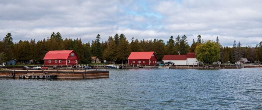
23. Detroit Harbor (Washington Island)
Detroit Harbor feels tucked behind a curtain of masts and marsh, where the ferry sighs and quiet lanes tuck into spruce. The mood is working-waterfront calm: diesel, rope, and the creak of docks, tempered by tea-smooth mornings on the bay.
People stroll the marina, rent bikes, browse tiny island shops, and slip kayaks into eelgrass shallows where minnows flash like mercury. Charter fishing and seasonal hospitality keep the docks humming while winters return the harbor to the locals.
With water on three sides and the rest of the island on the fourth, life moves gently and deliberately. Night comes with halyard taps, and the moon lies flat on the bay. If seclusion had a heartbeat, it would sound like lines against a mast.
Where is Detroit Harbor?
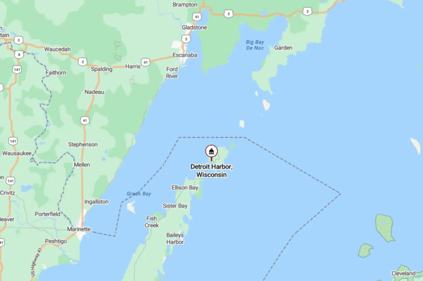
The community sits on Washington Island’s south shore, facing the ferry route from Northport. It’s a short drive north from the island dock along a simple grid of quiet roads.
Every approach is by water first, which keeps the harbor insulated from mainland bustle. Even the air smells different—cleaner, brinier, and slower.
22. Jackson Harbor (Washington Island)
On the island’s far side, Jackson Harbor keeps a low profile behind reeds, fish sheds, and a skinny road that ends at the water. The vibe is spare and beautiful: cedar smoke, old skiffs, and a horizon broken by Rock Island’s lighthouse.
Visitors launch kayaks, birdwatch along the harbor marsh, walk to the old boathouse, or hop the small ferry to Rock Island for trails and ruins. A few guides, caretakers, and seasonal rentals form the modest economy.
The road in is quiet, the road out is the same; there’s nowhere else to go but the lake. On windless evenings, the harbor becomes a mirror. It’s the sort of quiet that makes you whisper without knowing why.
Where is Jackson Harbor?
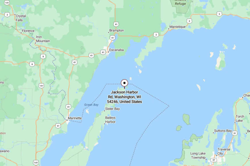
Jackson Harbor sits on Washington Island’s northeast shore, facing Rock Island Passage. From the island ferry landing, it’s a slower cross-island drive on two-lane roads lined with spruce and pasture.
The final stretch dead-ends at the docks and a small county park. You’re surrounded by water, sky, and the simplest kind of stillness.
21. Ellison Bay
Ellison Bay is a high-bluff village where pines lean toward Green Bay and art studios hide behind weathered fences. The mood is hushed and creative: potters at their wheels, carvers at open doors, gulls hanging over a small harbor.
Days slide by with shoreline hikes in Ellison Bluff County Park, gallery browsing, charter fishing runs, and slow dinners that end with sunset at the overlook. Fishing, small inns, and a strong arts scene anchor the economy.
Backroads thread through orchards and cedar thickets, discouraging hurry. Even at peak season, you can hear rigging ping in the breeze. This is where the peninsula finally exhales.
Where is Ellison Bay?
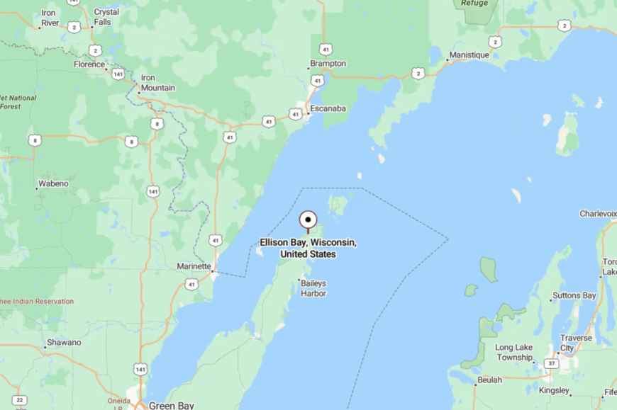
It rests on Door County’s northwest shore, about 8 miles north of Sister Bay on Highway 42. The village is hemmed by bluffland and bay, limiting sprawl.
Most arrivals follow a simple curve down to the marina before the road climbs again into the woods. Close to everything—but it feels like a quiet pocket the highway forgot.
20. Valmy
Valmy sits just inland from the big water, a crossroads of farm lanes wrapped in oak and maple, with the lake’s cool breath pushing through the trees. The vibe is pastoral and practical: tractors in the fields, smoke from a grill, and trail dust from hikers bound for the dunes.
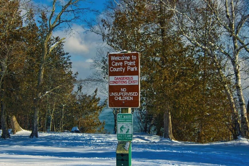
Visitors branch out to Cave Point County Park, Whitefish Dunes State Park, or tiny taverns that still do a perfect Friday fish fry. Farming is the backbone; park traffic is the seasonal bonus.
Because the shoreline here is all parks and bluffs, development stays low and evenings fall softly. Crickets, not car doors, mark the rhythm of night. It’s an inland step that still belongs to the lake.
Where is Valmy?
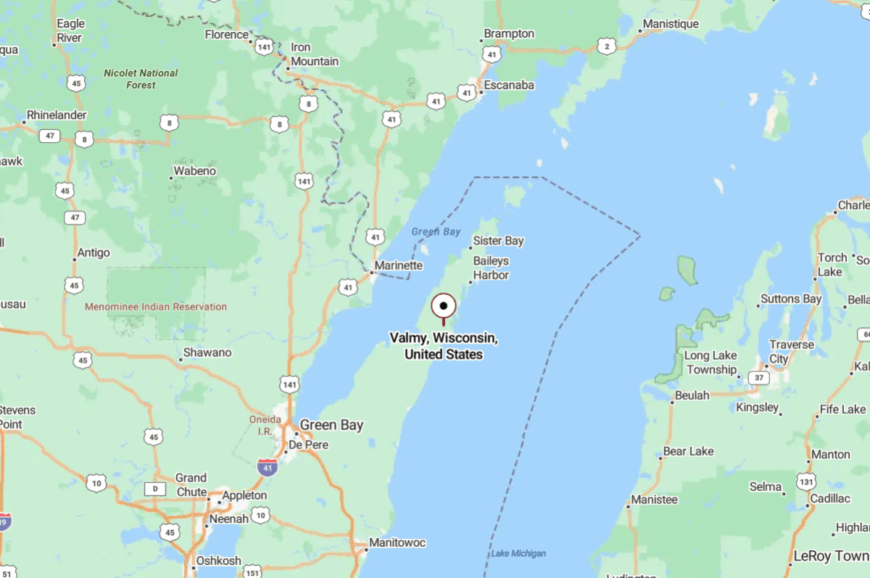
Valmy is on Door County’s Lake Michigan side, a few miles southeast of Jacksonport. Drivers exit Highway 57 and wind east on county roads shaded by hardwoods.
The last stretch dips toward dune country as the trees open to wind and sky. You can feel the lake before you see it.
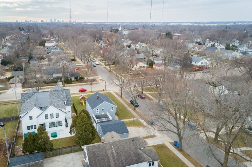
19. Whitefish Bay (Door County)
🔥 Would you like to save this?
Whitefish Bay is a quiet ribbon of cottages and pines perched above the lake’s pale-blue edge. The mood is breezy and elemental—sand underfoot, wind in the grasses, and the soft grit of bluff paths under boots.
Days mean beachcombing, watching surf roll the stones, photographing ice caves in deep winter, and biking quiet backroads to small farm stands. A few rentals and caretaking jobs underpin a low-key economy; most else is self-reliance.
With no business strip and only a handful of access points, the shoreline feels private without trying. Nights are dark, and the lake sings against the stones. If you listen long enough, it sounds like time is slowing down.
Where is Whitefish Bay (Door County)?
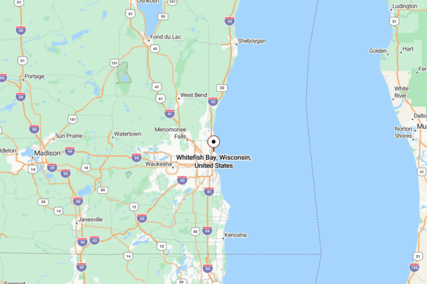
This unincorporated community sits along Lake Michigan just north of Sturgeon Bay. Reach it by turning off Highway 57 toward the lake on local roads that narrow under a pine canopy.
The bluff and water hem in development, keeping traffic light. It’s close on a map but far in spirit.
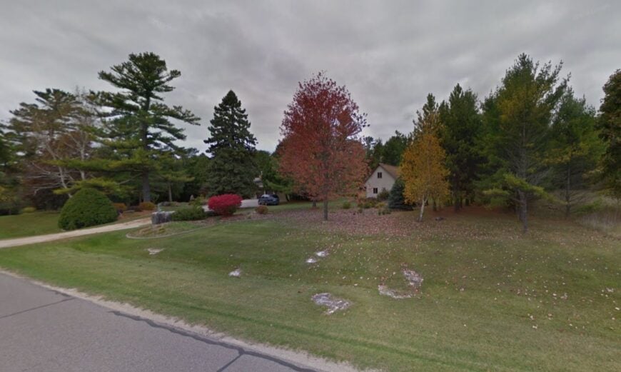
18. Sand Bay (Nasewaupee)
Sand Bay is a hushed pocket on Door County’s west side, facing shallows that warm fast and glitter in evening light. The vibe is cottage-simple: screen doors, herons stalking minnows, and kids netting perch at the pier.
Visitors paddle Sawyer Harbor, stroll the beach at the tip of the bay, explore Potawatomi State Park, or motor across to Sturgeon Bay for supplies before returning to the quiet. Seasonal rentals and small marine work provide the economic hum.
The roads in are slow and end at the water; beyond that, it’s all sky and bay. Nights here carry loon calls and the slap of small waves. It’s a place that keeps your voice low without asking.
Where is Sand Bay?
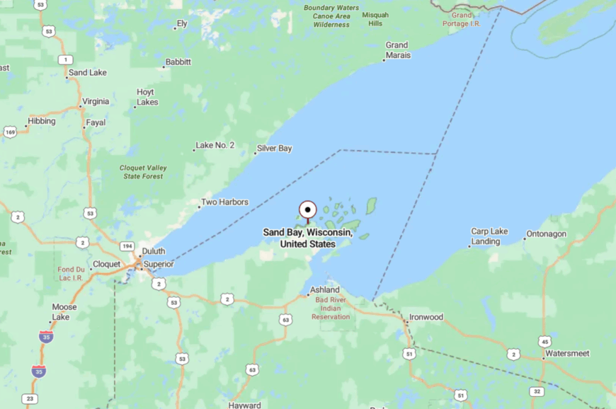
Sand Bay lies southwest of Sturgeon Bay along Green Bay’s scalloped shoreline. Most routes leave Highway 42/57 and meander on county lanes to the shore.
Water and parkland guard its edges, limiting through traffic. You’re minutes from town, yet you’ll swear you’re hours away.
17. Lily Bay
Lily Bay strings a few lakeside roads along Door County’s scrubby, beautiful east coast, where the wind smells of cedar and surf. The mood is spare and sea-bright: gulls, grass, and cottages tucked behind dune rose.
Activities stay simple—casting from rocky points, cycling shaded lanes, taking sunrise walks on pebble beaches, and scanning the horizon for freighters. Work here is seasonal and scattered: caretaking, guiding, and small trades.
The shore is rougher, the access fewer, which keeps the place unbothered even in midsummer. When the wind drops, the lake becomes a pane of glass. It’s the kind of quiet that stays with you long after you leave.
Where is Lily Bay?
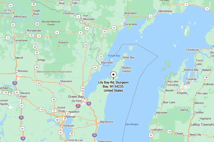
Lily Bay sits northeast of Sturgeon Bay on Lake Michigan’s open coast. Drivers thread from Highway 57 onto narrow township roads until the trees part to water.
With limited public access and no business strip, it remains lightly traveled. The final approach feels like slipping into a secret.
16. Oak Orchard
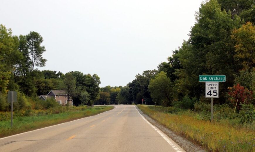
Oak Orchard is a humble lakeside corner of Door County where orchards lean toward the water and clay bluffs hold the wind. The vibe is rural and wave-washed—apple bins, blufftop views, and the sound of swallows weaving over fields.
Visitors beachcomb the long, quiet strand, photograph sunrise from the bluffs, fish for trout in cold seasons, and browse roadside fruit stands in fall. Farming is king, with a few home studios and seasonal rentals tucked out of sight.
Sparse access points and long setbacks keep the shoreline uncluttered. Nights bring a lighthouse glow far down the coast and nothing else. It’s a shoreline made for long walks and slow thoughts.
Where is Oak Orchard?
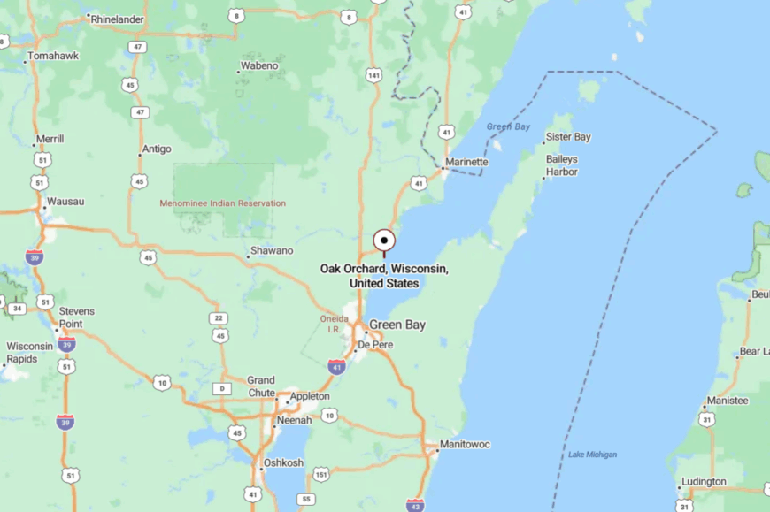
You’ll find it along Lake Michigan in the Town of Clay Banks, south of Sturgeon Bay. County roads slip off Highway 42 and roll toward the lake between orchards and pasture.
With bluffs and farm fields hemming it in, there’s little through traffic. You can almost hear the wind change over the water as you arrive.
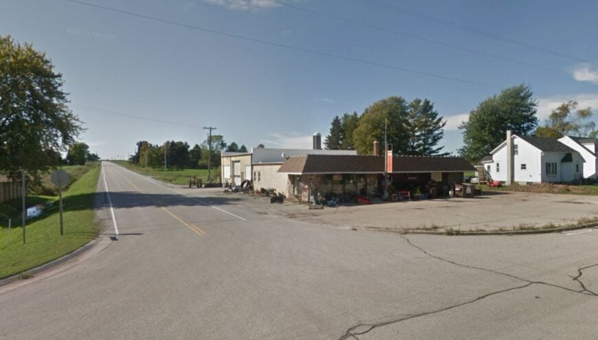
15. Alaska (Town of Pierce)
Alaska is a speck on the map east of Algoma, where fields meet lake breeze and cedar windbreaks hold the snow. The vibe is farm-steady and stripped-back: a few houses, a church, and a road that listens to the weather.
People walk the shore, cast for brown trout in spring, pedal under huge skies, and wander into Algoma for coffee before returning to quiet. Dairy and row crops pay most of the bills; the lake adds a second currency of calm.
With no storefronts and only local lanes, the place stays unbothered by summer traffic. At night, stars hang low over barns and water. It’s the kind of silence that empties your shoulders.
Where is Alaska?
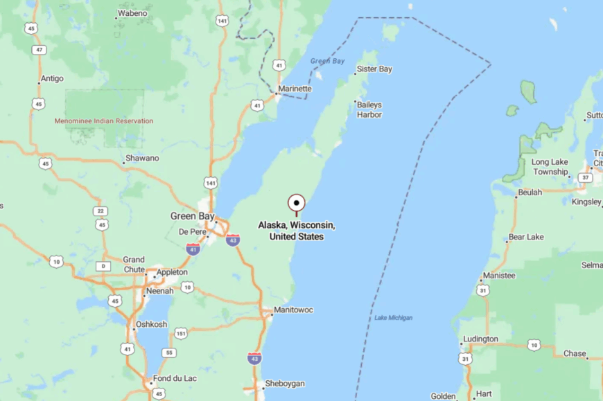
Alaska is an unincorporated community in Kewaunee County, set a few miles inland from Lake Michigan. It lies east of Algoma along Wisconsin Highway 42, where farm fields and woodlots spread toward the horizon.
Drivers reach the settlement by following the highway northeast from Algoma until the landscape opens into scattered houses, a church, and crossroads framed by farmland. Though the lake is close by, the community itself occupies an agricultural pocket just off the shoreline.
14. Two Creeks
Two Creeks is a straight-shot lakeshore hamlet where prairie grasses bow to onshore breeze and country roads run quietly to the water. The mood is wide-open and practical: neat farmyards, a modest park, and a horizon that never seems to end.
Visitors launch kayaks at the public beach, birdwatch in migrating seasons, pedal arrow-straight farm lanes, and stroll the shoreline at dawn. Dairy farming and a few local trades keep things humming at a small-town volume.
With few amenities and long distances between neighbors, evenings settle early and dark. Waves fill the spaces between barns. Two Creeks feels like a pause in time.
Where is Two Creeks?
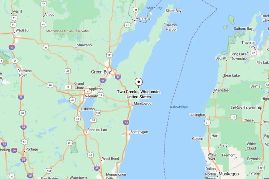
Set on Lake Michigan in Manitowoc County, it lies north of Two Rivers along State 42. The approach is simple: a two-lane highway and then local roads that slide toward the water.
Cornfields and shoreline form a natural corridor with little reason for through traffic to stop. When you do stop, the lake takes over the soundtrack.
13. Cleveland
🔥 Would you like to save this?
Cleveland hides in plain sight on a quiet stretch of lake between Manitowoc and Sheboygan, wrapped in bluffs, fields, and a tidy village grid. The vibe is neighborly and subdued—garden rows, clapboard porches, and gulls coasting the thermals.
People cast from Hika Bay, wander vintage storefronts, bike the backroads, or picnic at the bluff-top park where the lake eats the horizon. Local shops, small industry, and nearby campuses anchor livelihoods.
Without a tourist strip or big marina, summer stays gentle here. After dusk, you hear freight rolling inland and waves combing the stones. It’s understated, steady, and easy to love.
Where is Cleveland?
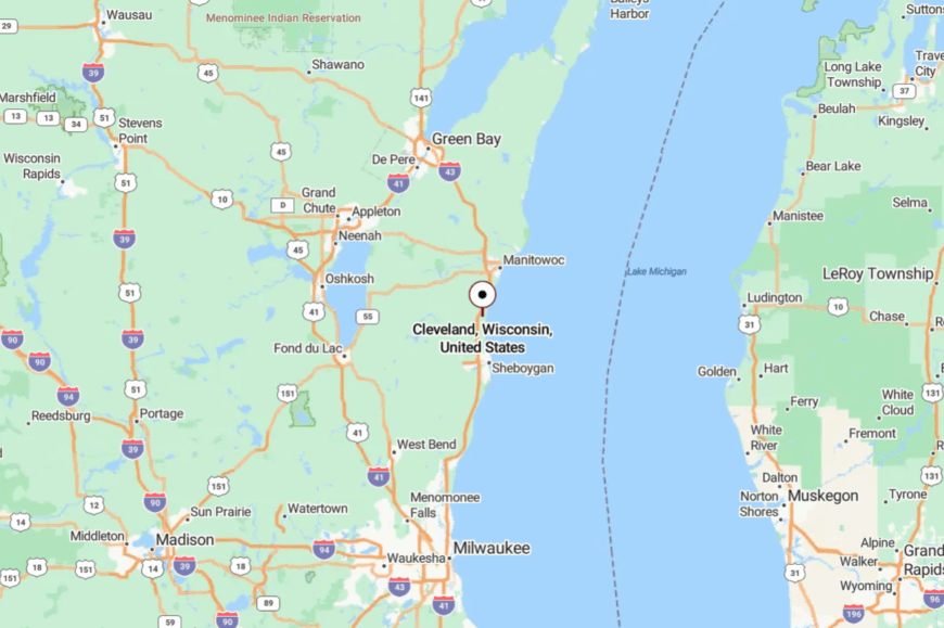
The village sits in Manitowoc County on Lake Michigan’s shore, about 8 miles south of Manitowoc. It’s reached via I-43 with an exit onto county roads that meander to the lake.
Bluffs and farmland narrow the approach and keep traffic light. It’s close to the interstate, yet it feels like a side note the highway forgot.
12. Haven
Haven occupies a quiet notch of shoreline north of Sheboygan where dunes give way to fescue and the lake meets sculpted bluffs. The vibe is open and wind-bright: long grasses, distant fairways, and a beach that seems to go on forever.
Visitors walk the undeveloped strand, watch migrating raptors ride the bluffline, pedal rural lanes, and, in season, catch a glimpse of tournament golf without the bustle. Hospitality jobs and course maintenance mingle with farm work and lake-related trades.
With few houses and only one main access from inland roads, the area stays naturally hushed. Even the wind sounds wide here. It’s the sort of quiet that clears the head.
Where is Haven?
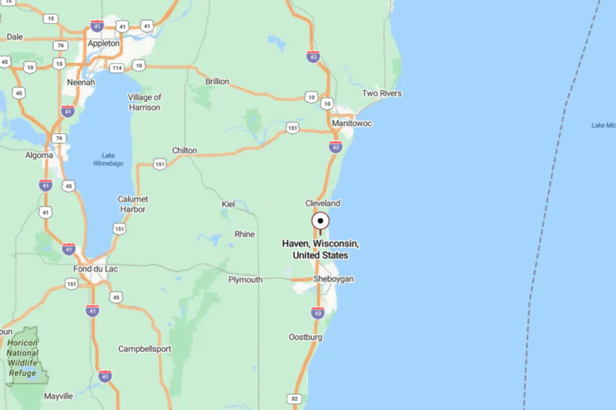
Haven sits along Lake Michigan in Sheboygan County, a few miles north of the city of Sheboygan. Most routes leave County LS or Lakeshore Road and drift toward the water on smaller lanes.
With the lake to the east and fields to the west, there’s nowhere for traffic to wander. Close by on the map, it still feels like the edge of things.
11. Carol Beach
Carol Beach strings a handful of lakefront streets along dunes and cattail marsh just south of Kenosha, where the wind rattles reeds and trains whisper inland. The vibe is quietly residential and nature-forward: sand paths, shorebirds, and a horizon that turns copper at sunset.
People walk the prairie at Chiwaukee, beachcomb on empty mornings, watch storm lines move across the lake, and spot migrating warblers in spring. The economic life is mostly commuter and home-based, with conservation easements protecting the marsh.
With no commercial strip and limited public parking, the shoreline keeps its hush. Nights glow with nothing but moon and lighthouse beams far up the coast. It’s close to a city—and somehow miles away in spirit.
Where is Carol Beach?
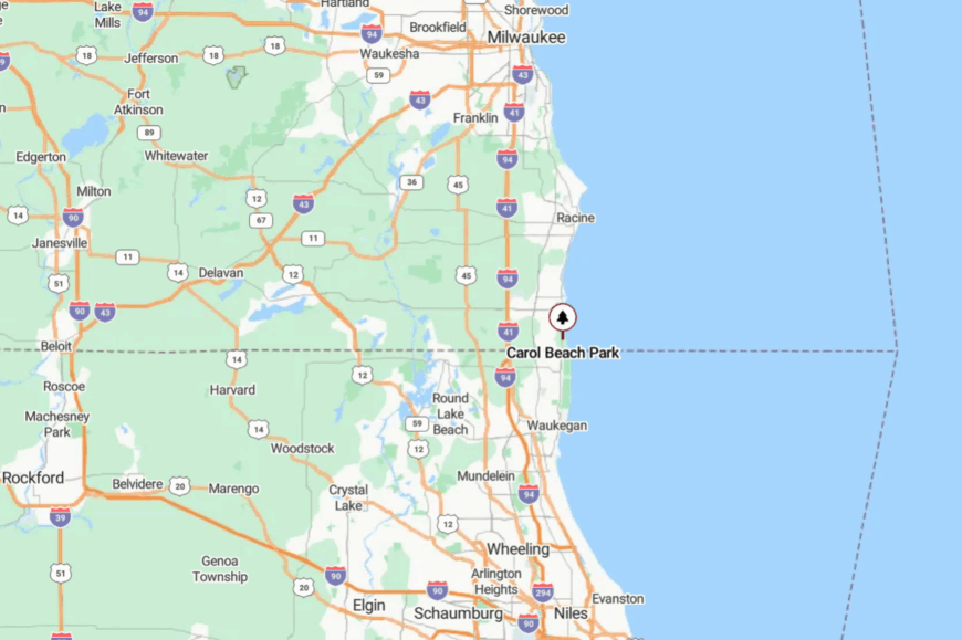
This lakeside neighborhood sits at Wisconsin’s southeastern corner, hugging Lake Michigan south of Kenosha. Access comes via Sheridan Road and a few short residential streets that end at dunes and marsh.
The lake on one side and protected prairie on the other keep it sheltered from through traffic. It’s close enough to reach easily, but far enough to feel like you’ve left everything behind.
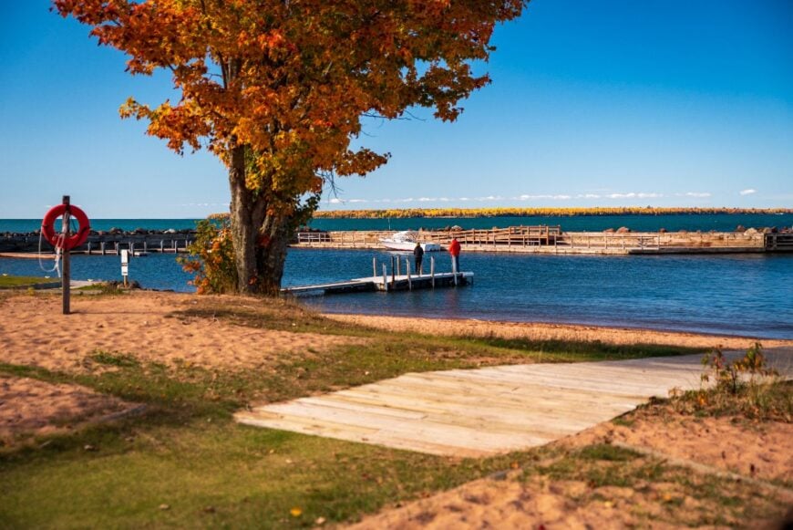
10. Gills Rock
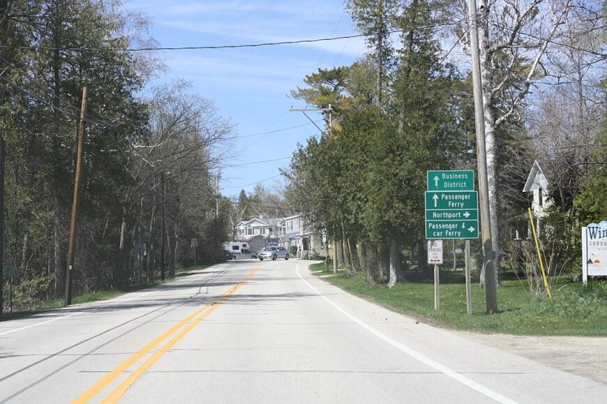
Roughly 150 people live at the northern tip of the Door Peninsula in Gills Rock. Charter fishing for salmon, scuba dives on 19th-century shipwrecks, and sunset picnics at the tiny harbor park keep both locals and guests occupied.
Commercial fishing and seasonal charter services are the main lines of work, with a smattering of artisan shops along Cottage Road. The village is a weather-worn cluster of fish shanties and cedar-edged coves that sits beyond the last major bend in Highway 42.
Only a handful of year-round homes dot the rocky shoreline, so darkness and silence settle quickly after dusk. A hidden gem here is the Death’s Door Maritime Museum, which tells stories of the treacherous strait that begins just offshore.
Where is Gills Rock?
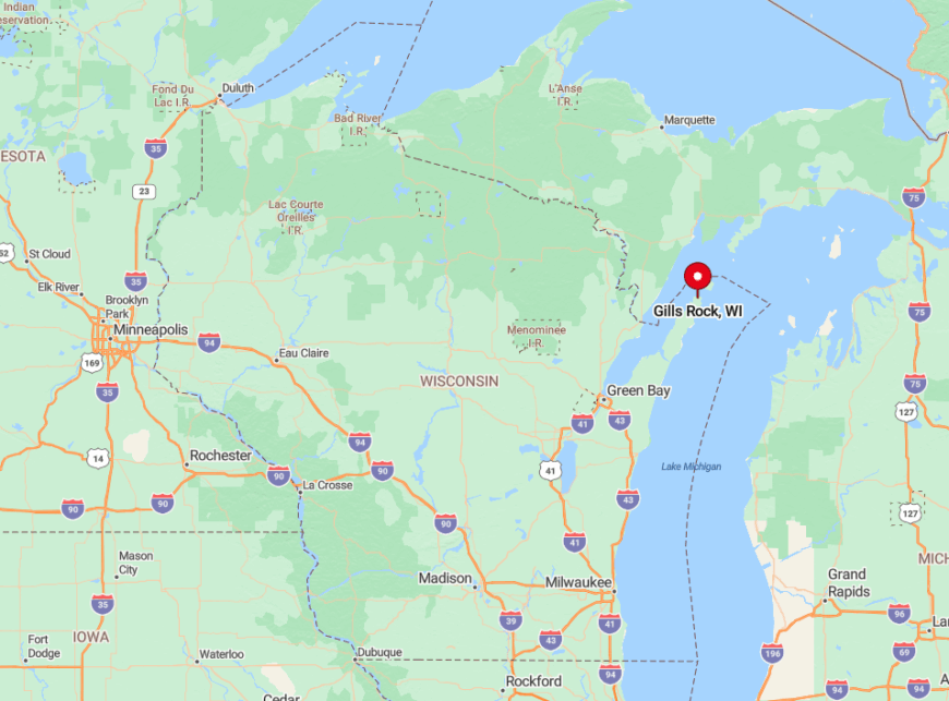
Gills Rock lies at the extreme northern end of Door County, surrounded on three sides by Green Bay and Lake Michigan. Water, cliffs, and a single county road isolate it from the more commercial parts of the peninsula.
Reaching the hamlet requires following Highway 42 through a series of hairpin curves until the pavement ends at the dock. The nearest fuel, grocery, or bus stop is 10 miles south in Sister Bay, so most visitors arrive by car or private boat.
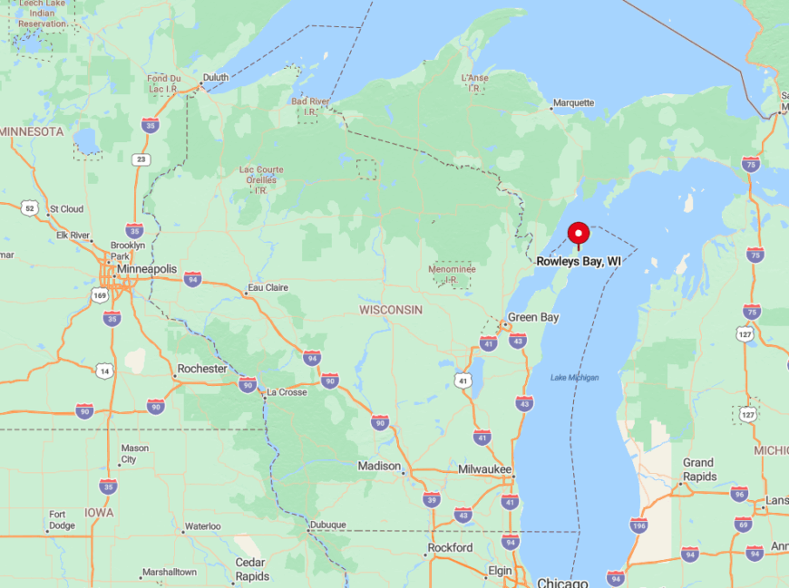
9. Rowleys Bay
Rowleys Bay hosts about 75 permanent residents along its forested shoreline. Paddling the quiet Mink River estuary, bird-watching for bald eagles, and hiking little-used trails in the Bay Shore Blufflands Nature Preserve top the list of activities.
A rustic resort, a kayak outfitter, and seasonal fishing charters anchor a small tourism economy. No large marina, no storefront strip, and conservancy easements protecting the shoreline keep development minimal.
One-acre wooded lots separate neighbors with stands of white pine and hemlock. Even in July the loudest sounds are gull cries and the dip of a paddle, which underlines the bay’s secluded feel.
Where is Rowleys Bay?
🔥 Would you like to save this?
The settlement sits on the northeast shore of the Door Peninsula, ten miles north of Baileys Harbor. Dense forest to the west and Lake Michigan to the east limit access to a single meandering county road.
Drivers follow County ZZ until pavement gives way to gravel near the waterfront cottages. Arrival is by private car or sea kayak since no transit or ferry services operate here.
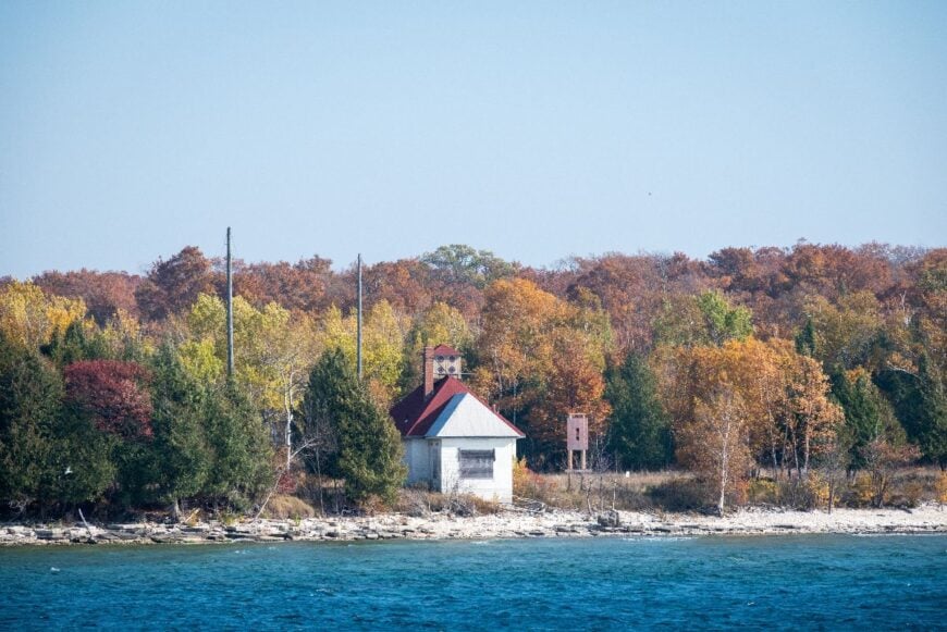
8. Cana Island Light Station

Cana Island projects a lonely charm just off the Lake Michigan shore north of Baileys Harbor. The 89-foot lighthouse, built in the 1860s, rises above cobble beaches and spruce groves where gulls wheel in the spray. The keeper’s house and barns stand in quiet company, reminders of a time when light and fuel were the only lifelines against the lake’s shifting moods.
Visitors cross a quarter-mile causeway that often floods with high water, leaving arrivals to ride a tractor wagon or wade the shallows. Once on the island, the pace slows to climbing spiral stairs, scanning the horizon, or picking agates along the rim of stone. The absence of shops, homes, or roads deepens the sense that you’ve stepped outside the mainland clock.
Cana Island lies about five miles north of Baileys Harbor, reached by turning off Highway 57 onto Cana Island Road until pavement ends at a gravel lot. From there, it’s footpaths and waves that guide the final stretch. Surrounded by water and silence, the light station remains one of Door County’s most secluded corners.
Where is Cana Island?
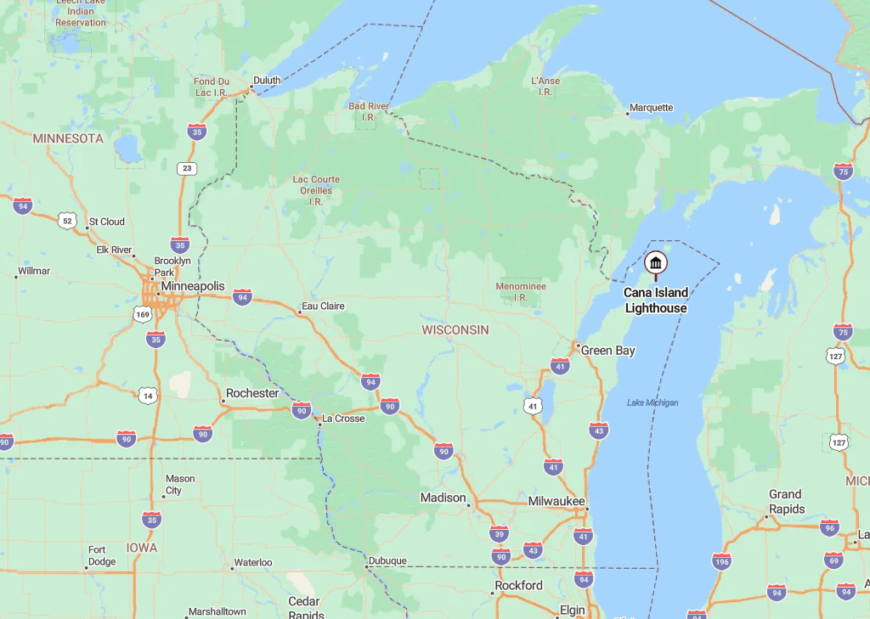
The light station stands just offshore on Lake Michigan’s side of the Door Peninsula, about five miles north of Baileys Harbor. A natural causeway links it to the mainland, though high water often floods the stretch, making passage only by wagon or on foot when conditions are safe.
Visitors reach the trailhead by turning east from Highway 57 onto Cana Island Road, ending at a gravel parking lot. From there, it’s water, wind, and the slow walk across to one of Door County’s most isolated outposts.
7. Jacksonport
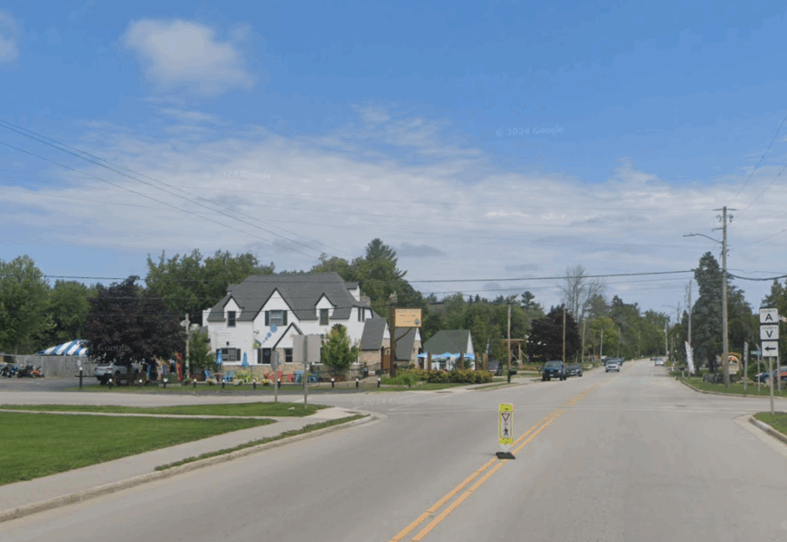
About 750 residents live year-round in Jacksonport. Mornings begin with strolls along Lakeside Park beach, winter brings cross-country skiing in Whitefish Dunes State Park, and Fridays often end with fish fries at the local bakery. Small inns, gift shops, and family farms generate the bulk of employment.
A buffer of state-park forest shields the village from the busy Highway 57 corridor. Wide stretches of sand run north and south with only scattered cottages between pine groves and water. Even during peak tourist weeks the shoreline stays calm, underscoring the town’s secluded nature.
Where is Jacksonport?
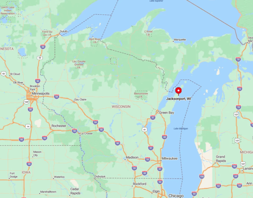
The village rests midway up the Door Peninsula’s eastern shore, twelve miles north of Sturgeon Bay. Tall dunes and pines block cross-roads, so travelers must exit Highway 57 onto County V and intentionally head east.
No public transit or bike trail delivers visitors from the west, keeping casual traffic low. Most people drive, though kayakers sometimes land on the broad beach, adding to the quiet vibe.
6. Little Sturgeon
Roughly 300 residents are spread along the winding shoreline of Little Sturgeon. Days revolve around walleye fishing, canoe trips into Sawyer Harbor, and visits to historic boat sheds on Bay Shore Drive. Commercial fishing, small boat-repair yards, and vacation rentals supply local income.
The hamlet sits beyond a maze of narrow county roads that discourage through traffic. Cottages occupy wooded lots over an acre, leaving neighbors hidden behind cedars and sumac. Natural barriers and working-waterfront habits combine to keep this Green Bay enclave peaceful.
Where is Little Sturgeon?
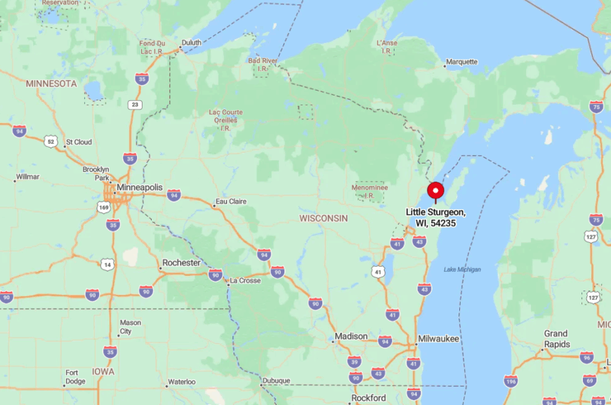
The community lies on Green Bay eight miles southwest of Sturgeon Bay. Wetlands and peninsulas surround it, so County M is the only land route.
Drivers follow signs through the farms of Gardner before pavement narrows under a tree canopy. Arrivals by water tie up at Wave Pointe Marina, but no bus service reaches the village, preserving its seclusion.
5. Dyckesville
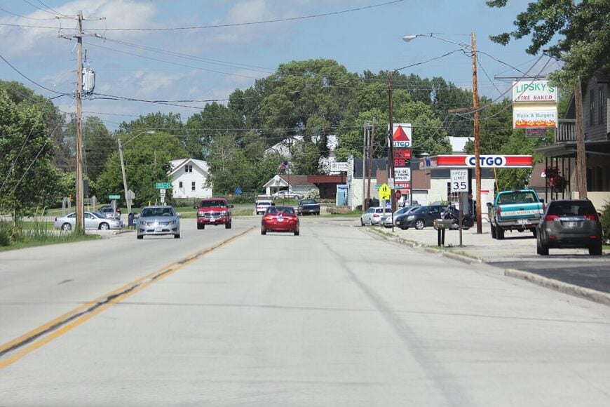
Dyckesville’s steady population of about 525 has held for decades. Locals fish the limestone reef, cycle quiet farm lanes, and meet at the 1890s Lanes Pub for perch sandwiches. Dairy farming and commuting to Green Bay jobs underpin the economy, with a sprinkle of seasonal tourism.
Stone-fenced pastures and wooded bluffs deter suburban expansion from the city. Shallow bedrock along the shore also limits large-scale construction. Darkness and silence persist after sundown, giving the hamlet a hidden character despite its proximity to urban lights.
Where is Dyckesville?
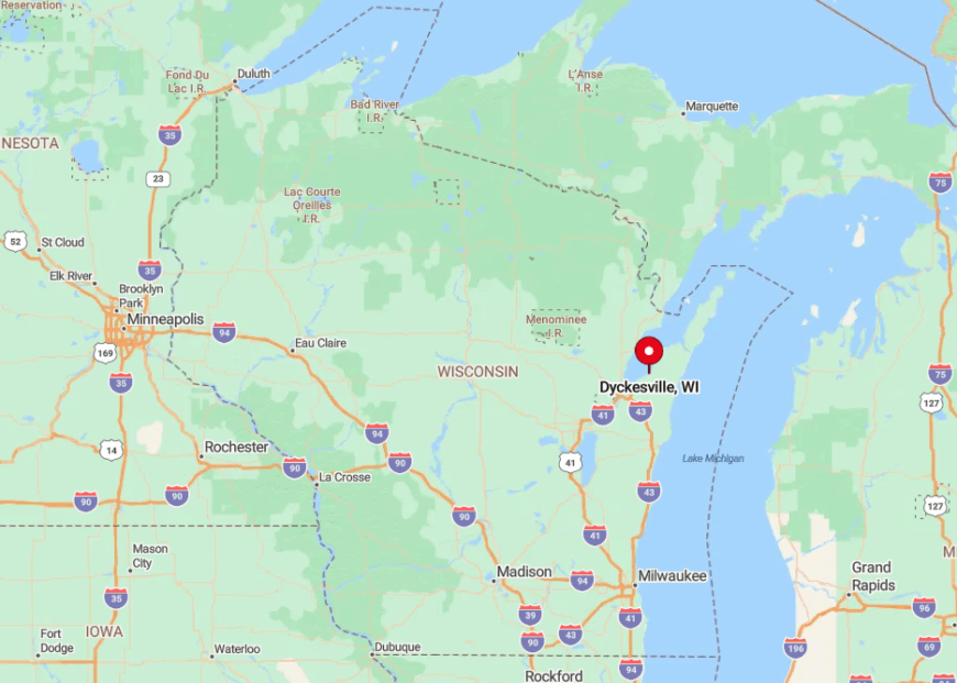
Dyckesville straddles the Brown–Kewaunee county line on the west shore of Green Bay. Highway 57 runs just inland, so most traffic bypasses the village unless drivers turn off onto county roads that descend toward the water.
The community itself sits at a small crossroads with access points leading to the bay. With farmland rising to the west and shoreline bluffs hemming in development, Dyckesville remains lightly traveled despite its proximity to Green Bay.
4. Black River
About 350 people reside along the dune-flanked lanes south of Sheboygan known as Black River. Favorite pastimes include walks on the Kohler-Andrae boardwalks, driftwood hunting, and paddling the slow river to the lake. A small charter-fishing fleet and remote technology jobs supply income.
Homes sit on two- to five-acre parcels hidden by cottonwoods and cattail marshes. No through streets reach the lake, keeping traffic limited to residents and cottage owners. Waves and songbirds dominate the soundscape, making city life feel distant.
Where is Black River?
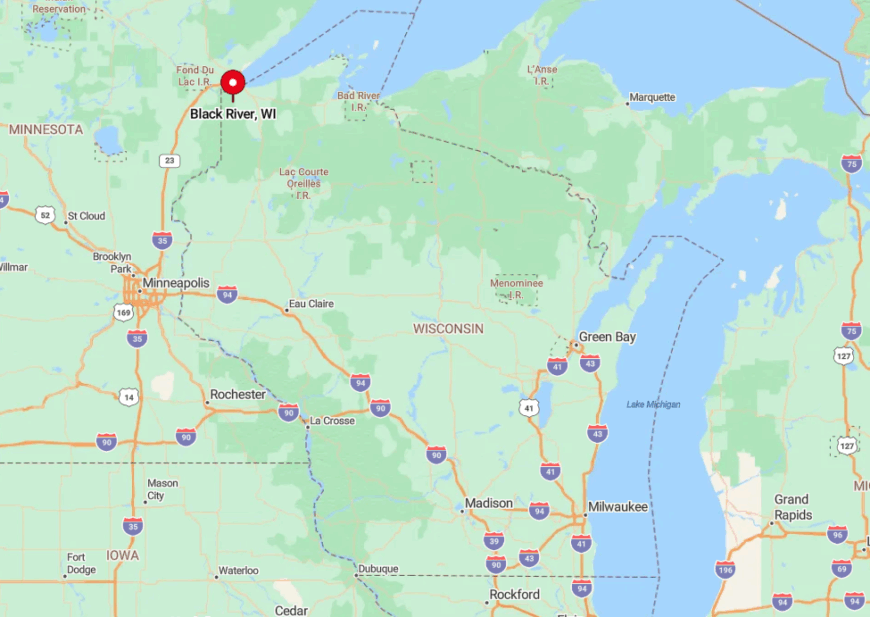
The neighborhood lies three miles south of Sheboygan’s city limits along Lake Michigan. The river, marsh, and protected dunes form a natural barrier that separates it from urban grids.
South Lakeshore Drive, a slow two-lane route, is the only road in and out. Cyclists use the Interurban Trail, but buses do not run here, reinforcing its quiet nature.
3. Lake Church
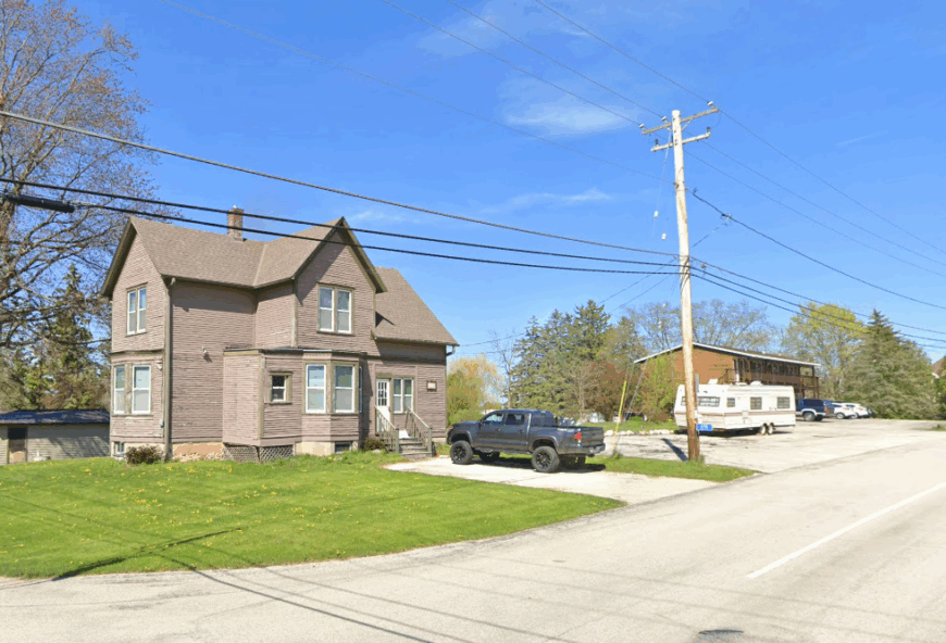
Roughly 80 residents keep Lake Church’s lone intersection lively. Fishing the Harrington lagoon, attending Friday night fish boils at the fire station, and walking undeveloped stretches of Harrington Beach State Park fill local calendars. Small-scale farming and park employment provide work.
Broad fields to the west and protected shoreline to the east insulate the hamlet from highway noise. Without streetlights, stargazers set up telescopes near the historic stone church. The absence of retail strips leaves the settlement hushed once the sun sets.
Where is Lake Church?
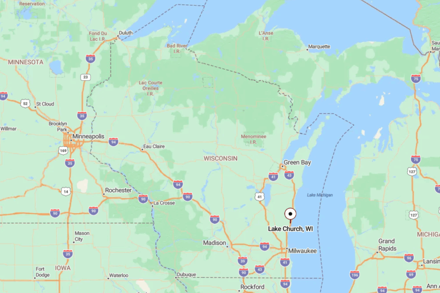
The community stands in Ozaukee County between Port Washington and Belgium on Lake Michigan. Interstate 43 runs three miles inland, so travelers must exit onto State 57 and follow County D east to the lake.
The journey ends at a single four-way stop beside St Mary’s church. There is no transit or marina, so arrival is by car or bicycle, preserving the village’s gentle pace.
2. Red River
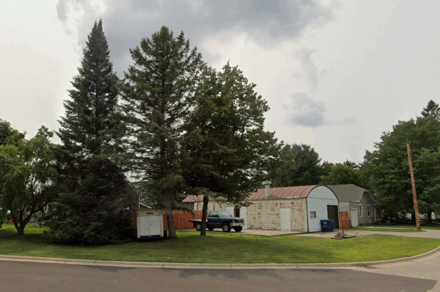
Approximately 275 people dwell along the limestone bluffs of Red River. Weekends feature rappelling down small cliff faces, foraging for morel mushrooms in maple woods, and watching storms roll over the lake. Dairy herds, maple-syrup operations, and a seasonal campground support the local economy.
Homes are widely spaced and screened by forest, while a single cliff-hugging road discourages casual visitors. Rugged topography and limited infrastructure keep this stretch of shoreline exceptionally quiet. The community’s solitude is prized by residents who enjoy unbroken lake views.
Where is Red River?
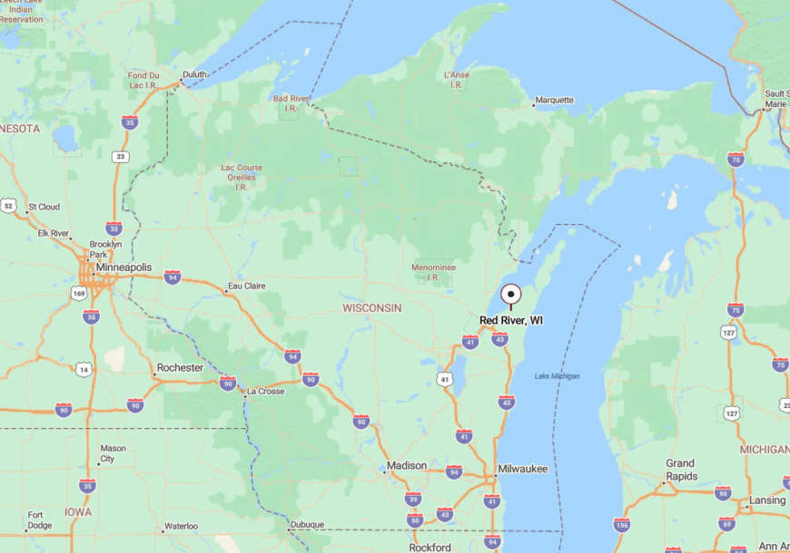
Red River lies along the Bay of Green Bay in Kewaunee County, about 12 miles north of the city of Kewaunee. The shoreline here is a mix of bluffs, woods, and scattered farms that separate the community from inland highways.
Access comes by way of County Road S and other local routes that angle east from State Highway 42. The approach narrows as fields give way to forest and lake views, leaving only a handful of roads that reach the water.
1. Clay Banks
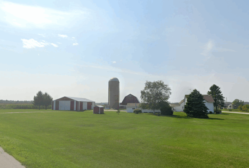
The unincorporated community of Clay Banks claims around 400 residents scattered across orchards and shoreline parcels. Days often involve beachcombing the long pebble strand, photographing migrating tundra swans, and exploring fifty-foot clay bluffs that frame Lake Michigan.
Apple orchards, grain farms, and home-based art studios provide livelihoods. Parcels frequently exceed five acres, and county rules forbid multi-family development, keeping density low.
Without a gas station or streetlights, nights are lit by stars and the glimmer of the lake. The wide, undeveloped beach and quiet roads combine to make Clay Banks one of Door County’s calmest corners.
Where is Clay Banks?
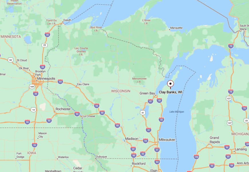
Clay Banks rests eight miles south of Sturgeon Bay along Lake Michigan. The lake borders the east and steep clay bluffs rise to the west, funneling travel onto County U.
Drivers leave Highway 42 at Idlewild Road, then continue until pavement narrows to gravel near the water. No public launch or bus route reaches the community, so private cars or small craft landed on the beach are the only ways in, preserving the area’s seclusion.


