🔥 Would you like to save this?
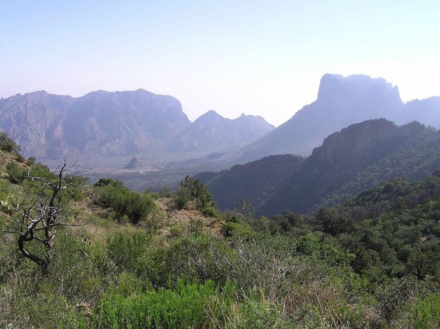
Western Texas still hides places where silence stretches farther than the highways. Scattered across desert basins and tucked between stony ridges, these communities trade four-lane convenience for endless skies and the soft hum of wind over sage.
We have gathered 25 of the most secluded towns in the region, counting down from the best-known hideout to the most out-of-the-way settlement. Each offers room to breathe, a slower clock, and landscapes that linger in memory long after the road dust settles.
In order to come up with the very specific design ideas, we create most designs with the assistance of state-of-the-art AI interior design software. Also, assume links that take you off the site are affiliate links such as links to Amazon. this means we may earn a commission if you buy something.
From ghost-town ruins to spring-fed oases, they prove that remoteness can be a feature, not a flaw. A map may show only a dot, yet every dot below shelters stories worth the long drive.
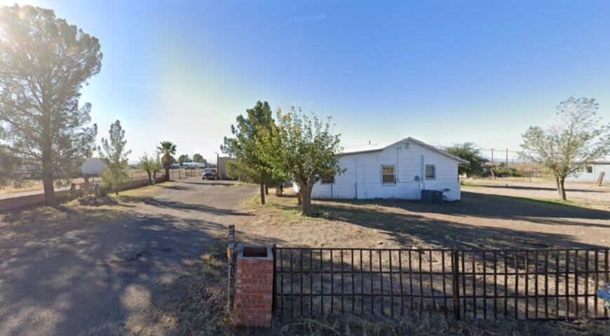
25. Shafter – Ghost Light of Grit and Glint
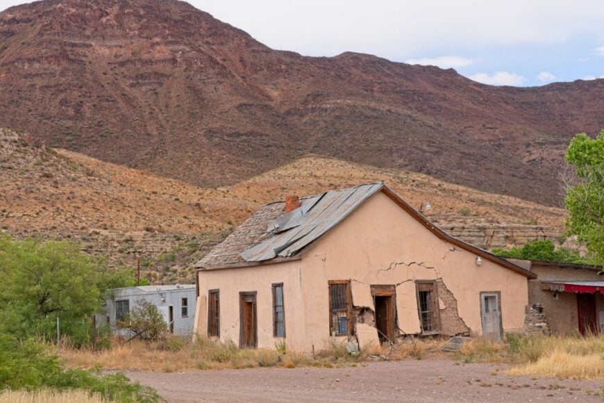
Shafter rests like a memory in the desert, where abandoned mine ruins shimmer in dusk light and tumbleweeds softly brush cracked curbs. Its seclusion comes from being off the beaten path, hand-planted between forgotten silver veins and long stretches of highway.
The mood is lonely and poetic—broken bottles glint in empty storefronts, and desert wind whispers where children once played. Visitors can explore the ghostly Mercur mine, walk the skeletal structures, or climb ridges for panoramic stillness. Ranching and a few caretaking jobs form the economic backdrop.
Even the train whistles fade before they reach town limits. It’s the kind of place where time stands still just long enough to matter.
Where is Shafter?

Set in Presidio County about 35 miles north of Marfa via FM 170 and old county roads. Approaches are gravel and forgotten pavement winding through the open desert.
No services for miles—just dry air, sun-glint, and history. You arrive quietly, with the horizon as your welcome.
24. Van Horn – Crossroads Under the Eagle Mountains
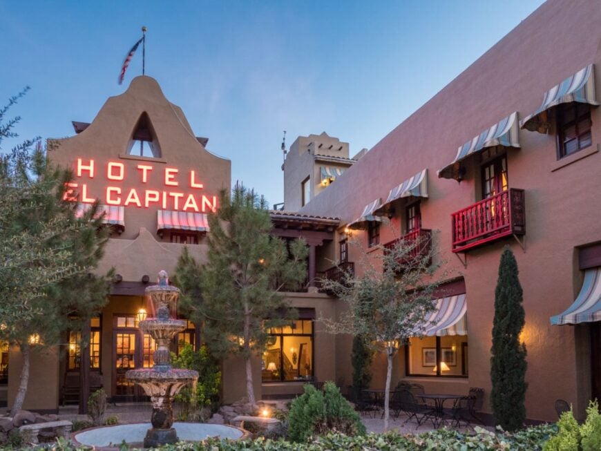
Van Horn is a desert junction town where I-10 meets the mountains, a place where road-weary travelers slow down and locals keep to an easy rhythm. Its seclusion comes from the sheer distances in every direction—El Paso is 120 miles west, and the next small town east is nearly an hour away.
The vibe is a blend of rugged hospitality and wide-open quiet, with vintage motels, old diners, and sunsets that spill across the valley floor. Visitors can explore the Eagle Mountains, visit the historic Clark Hotel Museum, or stargaze from the edge of town where streetlights fade.
Truck stops and small-scale tourism anchor the economy, but the mood remains far from hurried. Van Horn is a reminder that even a crossroads can feel like the middle of nowhere.
Where is Van Horn?

Set in Culberson County in far West Texas, Van Horn sits along I-10 about halfway between El Paso and Fort Stockton. U.S. Highway 90 and Texas 54 branch off toward Big Bend and Guadalupe Mountains National Park.
Surrounded by desert flats and rocky ridges, the town feels pocketed away despite its highway access. Arriving here, you can sense the long miles still pressing in from all sides.
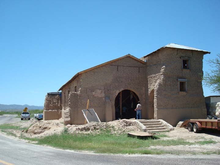
23. Valentine – Heart of Quiet Sand and Sky
Valentine is humbled by scrubby mesquite, dusty roads, and the faint pulse of U.S. 90 rolling just beyond the dunes. Its solitude is sustained by desert terrain and the absence of commercial life—one café, one store, and thousands of quiet miles beyond.
The vibe is introspective, wind-softened, and unadorned—visitors photograph open-range sunrises, peer into historic adobe remnants, or drive toward sand-sculpted riverbeds.
Ranching and a modest gas station anchor life here. No traffic, no hurry, just sunrise and sand and space. It’s the kind of place that reminds you how small your thoughts can get in a gentle way.
Where is Valentine?
Nestled in Jeff Davis County about 60 miles southeast of Alpine along U.S. 90. Access is straightforward highway, but the terrain around it feels removed and spacious.
The town seems to breathe with the desert itself. Arrive, and you’ll sense that something essential has slipped away—in a good way.
22. Ruidosa – Canyon Echo Overlook
Ruidosa anchors itself at the mouth of a narrow canyon, where pine shadows and rocky walls mute the world outside. Its off-grid feel comes from winding mountain roads that drop you into quiet, with no traffic lights and few homes visible at dusk.
The vibe is pensive and listening—wood smoke, creek gurgles, and birdsong are the soundtrack. Hike the canyon trails, cross the creek on wooden bridges, or lean into silence above the rim.
A handful of lodges and ranches supply the local rhythm. Here, every echo teaches patience.
Where is Ruidosa?

Located in Presidio County, about 40 miles west of Marfa via FM 170 and ranch roads. The road descends into a narrow canyon before giving way to village warmth. It feels neither hurried nor haunted—just welcomed by rocks and sky.
21. Fort Davis – Embrace Among Mountains

Fort Davis nestles beneath the Davis Mountains, offering crisp air, starry nights, and a nod to frontier history. Its seclusion owes to elevation—roads snake upward, leaving the heat and traffic behind.
The vibe is historic-quiet, marked by old barracks, pine rattlesnakes, and cowboy sunsets. Visit the old fort, hike the skyline drive, or track elk into nearby canyons.
National park staff, hospitality, and astronomy observatory work keep things moving gently. Nights here feel like being in a painting—refreshed, timeless, and whole.
Where is Fort Davis?

Set in Jeff Davis County about 25 miles northeast of Valentine up State Highway 118. The ascent climbs through juniper and fir, smoothing your pace as elevation gains.
The summit is quiet; the valley just below sweeter in kind. It’s high enough to feel like a world apart.
20. Alpine – Big Sky University Town Minus the Convenience
Alpine lives between remote and inhabited—home to Sul Ross State University, but wrapped by vast ranchland and distant ranges. Its seclusion is relative: two-lane roads bring you in, while the mountains keep edge and noise at bay.
The vibe blends artsy warmth with Western backbone: galleries, thrift stores, and cactus-lined courtyards nestle into the desert palette. Visit the museum, drive out to Big Bend Ranch State Park trails, or catch a folk concert at the university.
Education and small business fuel the local beat. Alpine hums with life, but just whisper-quiet enough to remember how quiet the world can be.
Where is Alpine?

Located in Brewster County at the intersection of US 90 and US 67, about 110 miles east of El Paso. Approaches are scenic, dotted with desert flora and rarely a brake light in sight. You arrive with views of the Chisos Mountains and a slowed heartbeat.
19. Terrell – Ghostly Ruin by the Rail
🔥 Would you like to save this?
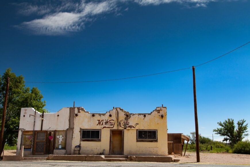
Just a whisper of memory, the ghost town of Terrell stands where rails once crossed desert dreams. Its emptiness feels durable—forgotten rail ties and adobe foundations beneath midday sun.
Visitors roam rusted siding, find wildflowers in broken windows, or rest under mesquite shade where stations once rang.
No living economy remains; the desert reclaims every trace. Even the wind holds its breath here. It’s the kind of place where time says goodbye, softly.
Where is Terrell?

Found in eastern Presidio County along an abandoned spur west of U.S. 90, between Sanderson and Marathon.
Reaching it requires a turn off the highway onto private range roads. If you find it, you’ll know—you’ve stepped into silence.
18. Saragosa – Memorial in the Middle of Nowhere
Saragosa rose from desert clay after a devastating tornado, rebuilt with solemn pride and ghost-street emptiness. Its isolation is shaped by the plains, between sparsely populated counties, and exposed to wide skies.
The tone here is quiet respect and low voices—memorials, open lots, and funeral-bell calm in the evening breeze. Stop by town hall for a moment, trace the paths of loss, or sit under a wind-bent tree in the park.
Agriculture and occasional trucking anchor the economy. It’s a place that teaches what stillness looks like after tragedy has passed.
Where is Saragosa?

Located in Reeves County, about 18 miles east of Pecos along I-10 and TX-17. Exit 140 leads into town.
The land opens wide—space enough to hold stories that whisper back. You arrive quietly and stay that way.
17. Sarita – South Texas Humid Hideaway
Sarita is a tiny settlement embraced by dense brush and distant brush country prairie—a green-of-silence kind of place. Its hush is earned by off-grid roads, low population, and nature’s thick curtain.
The vibe is warm and humid—church services, small markets that close early, and the slow hum of insects at dusk. Visitors might drive out to lace up for a hike in nearby county parks, grab tacos under a porch, or stop for a neighborly chat.
Ranching and local trade sustain folks here. When you leave, the quiet stays behind like a friendly pat on the shoulder.
Where is Sarita?

Located in Kennedy County, about 60 miles southwest of Corpus Christi via State Highway 16 and smaller county roads. The approach winds through sparse ranch lands until the brush thickens and Sarita appears nestled inside. You come in quietly—by design.
16. Presidio – Border Town Wrapped in Mountain Shadows
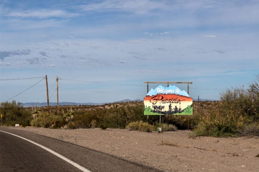
Presidio lives at a desert crossroads where the Rio Grande curves sharply and the Chinati Mountains rise like guardians. Its seclusion is shaped by geography—the nearest sizable U.S. city is hours away, and on the Mexican side, Ojinaga remains a quieter counterpart than any border hub.
The mood is sun-baked and unhurried, with adobe homes, shaded plazas, and the smell of mesquite smoke drifting from backyard grills. You can wander the Fort Leaton Historic Site, follow FM 170 along one of Texas’s most scenic drives, or watch the sky flare pink behind the mountains at dusk.
Trade with Ojinaga, small-scale ranching, and a touch of tourism keep the town running. Presidio is the kind of place where the horizon feels like both a boundary and an invitation.
Where is Presidio?

Set in Presidio County at the far southwestern tip of Texas, Presidio sits where FM 170 and U.S. 67 meet beside the Rio Grande. It’s roughly 60 miles southwest of Marfa by a winding desert highway.
Mountains and riverbanks cradle the town, giving it a sense of refuge. Close enough to reach in a day, but distant enough that the journey reshapes your pace.
15. Sanderson – The Cactus Capital in the Canyon Country
Sanderson nestles between rugged limestone hills, with the Pecos River country to the east and Big Bend country to the south. Its seclusion is rooted in its geography—nearly 100 miles from the nearest Walmart and surrounded by hundreds of miles of ranchland.
The town’s mood is dry, sun-warmed, and subtly artistic, with cactus blooms lining fences and an old railroad depot anchoring Main Street. Visitors can walk the cactus gardens at the Terrell County Visitors Center, hike desert canyons, or explore the remote reaches of the Rio Grande via backcountry roads.
Ranching, hunting leases, and tourism form its livelihood. Sanderson holds a slow charm that lingers, like the last glow on a desert horizon.
Where is Sanderson?

Located in Terrell County, Sanderson lies along U.S. Highway 90 about halfway between Del Rio and Marathon. The drive skirts low mesas and open desert before descending into the town’s sheltered basin.
With no major interstates nearby, it’s a deliberate stop rather than a pass-through. Arriving feels like stepping into a pocket of West Texas where the world still moves at a desert pace.
14. Dell City – Green Patch in the High Desert
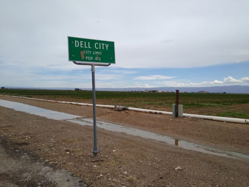
Dell City is an unexpected splash of green in the vast tans and golds of the Chihuahuan Desert, a farming settlement sustained by underground springs. Its seclusion comes from being miles from any major highway, tucked near the New Mexico border in a corner few travelers reach by accident.
The town’s rhythm follows irrigation cycles and harvests of alfalfa, chile, and onions, with tractors the most common traffic on its quiet streets. Visitors can explore the nearby Guadalupe Mountains National Park, birdwatch in desert wetlands, or simply take in the view of fields giving way to endless desert.
Farming is the heartbeat here, though the occasional hiker or photographer wanders through. Dell City is the kind of place where the horizon feels steady, and life moves with the seasons.
Where is Dell City?

Situated in Hudspeth County in far West Texas, Dell City lies about 95 miles east of El Paso, reached by Farm to Market Road 1576. The approach is a long, two-lane stretch that crosses open rangeland before revealing the surprising green of irrigated fields.
The Guadalupe Mountains rise just to the east, forming a jagged backdrop that seals off the horizon. Out here, the nearest stoplight is a memory, and the silence feels absolute.
13. Fort Clark Springs – Desert Frontier Memory

🔥 Would you like to save this?
Fort Clark Springs bears the memory of frontier soldiers with its solitary adobe wall and quiet courtyard. Its solitude stems from desert isolation and absent tourism—accessible, but overlooked.
The mood is contemplative and historical—faded murals, dust motes in sunbeams, and stories written into bricks. Wander the courtyard, trace the compound’s edge, or let the road outside go silent.
Ranching and caretaker roles now form the background. The place holds time, not attention.
Where is Fort Clark Springs?
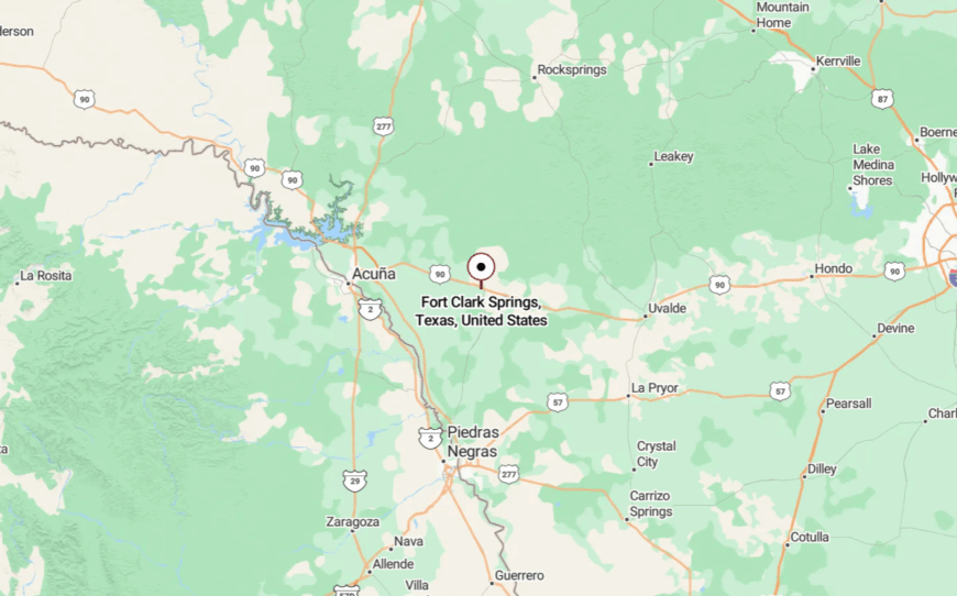
It’s located west of Del Rio, near the Rio Grande but fully off the tourist track, reached via a narrow paved road that peels off U.S. 90.
Once inside, you feel the past in every shadow. The quiet takes over fast—and stays.
12. Garden City – Dusty Crossroads of Quiet Trades
Garden City perches where U.S. 385 meets the Llano Estacado edge, its few buildings breathing under endless sky. Its seclusion comes from being bypassed by travelers—two grocery shelves, one café, and a few passersby anchor daily life.
The vibe is rhythmic and small-town steady—farm boots, dusty porches, and familiar faces in low light. Visitors can buy a burger, browse the local hayyard, or ride out toward distant wind farms at dusk. Farming, oil-field support, and highway stopovers provide livelihoods.
Even commercial radio fades, leaving only cicadas and memory. It’s the kind of place where time stretches its legs.
Where is Garden City?

Located in rural Glasscock County, about 30 miles north of Big Spring and 60 miles south of Lubbock along U.S. 385.
Access is straightforward, but the surroundings are flat—and vast—with little to interrupt the horizon. Arrive, and the sky seems to follow you in.
11. Eden – Hilltop Hamlet Above the Plain
Eden sits atop a small rise in rolling terrain, its heat-rippled grid offering relief from the flat mosaic below. It’s secluded because winds curve and weave rather than slice through—plus it lies off the beaten ranch track, so even locals arrive deliberately.
The mood is midday hush turned to honey—several homes, a church bell, and a crosswind of rustling weeds. Walk the dusty lane, spot jackrabbits in the shade of windmills, or lean on a fence and watch cattle drift across fields.
Ranching is the economic spine. Even the evening breeze feels private here.
Where is Eden?

Found in Concho County roughly 40 miles west of San Angelo via rural roads off US-87. The final stretch meanders through mesquite and prairie before climbing the gentle rise that holds the town.
It’s not signed—but drop off the highway, and you’ll feel Eden before you see it: quiet, small, and distant.
10. Terlingua – Ghost Town on the Edge of Big Bend
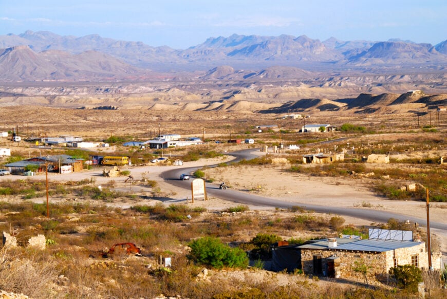
With fewer than 100 full-time residents, Terlingua feels more like an outpost than a town. Visitors wander crumbling mercury-mine ruins, hike Big Bend’s outer trails, or join locals for the famous November chili cook-off under velvet night skies.
Tourism and small-scale hospitality keep the lights on, though many still ranch or guide river trips on the Rio Grande. Empty desert badlands and natural mountain walls swallow nearly every sound, so even the occasional guitar strum at the Starlight Theatre fades quickly into the dark.
Streetlights are absent, letting the Milky Way spill across rooftops in dazzling clarity. The nearest grocery aisle is 80 miles away in Alpine, underscoring just how isolated this corner of Brewster County remains.
Where is Terlingua?

The settlement sits in southern Brewster County, roughly 12 miles west of the main entrance to Big Bend National Park. Vast tracts of protected land on three sides and Mexico to the south block urban sprawl and keep traffic scarce.
State Highway 118 from Alpine then Farm Road 170 deliver the final winding miles, a drive lined with ocotillo and volcanic ridges. Anyone arriving after sundown quickly understands why locals joke that the brightest light is often the moon.
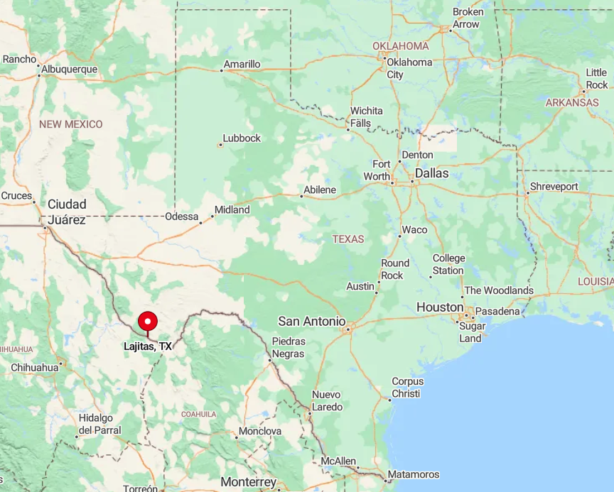
9. Lajitas – Riverside Retreat Between Canyon Walls
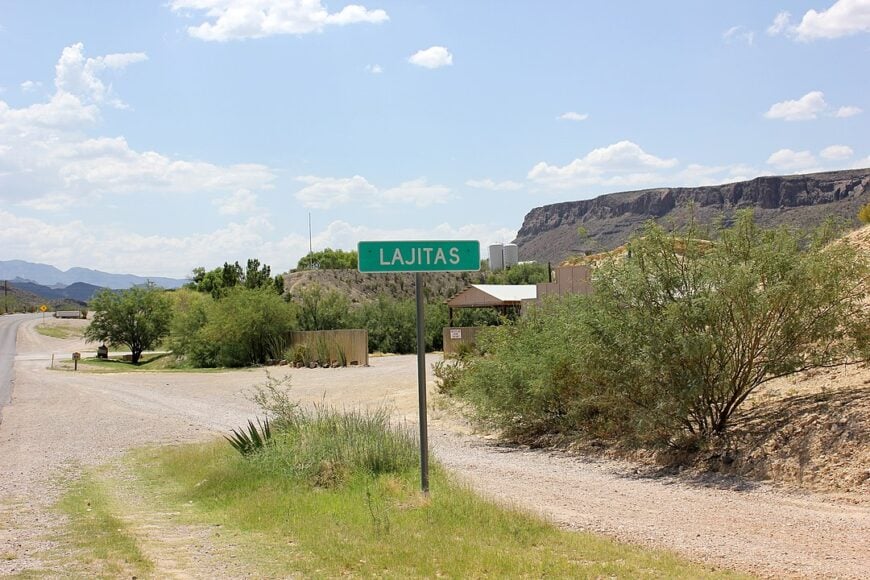
Lajitas claims a population that hovers around 75, though the number swells when the resort is busy. Days revolve around golf at Black Jack’s Crossing, Rio Grande kayak runs, or late-afternoon horseback rides that climb into the Mesa de Anguila for panoramic sunsets.
The resort, outfitters, and a scattering of ranch jobs make up most steady employment. Sheer canyon walls and the twin buffers of Big Bend National Park to the east and Big Bend Ranch State Park to the west wrap the community in natural privacy.
Nights bring an almost theatrical quiet broken only by owls and distant coyote calls. Parcel sizes often exceed a hundred acres, giving residents room to disappear if they wish.
Where is Lajitas?
🔥 Would you like to save this?
Found on Farm Road 170 along a remote bend of the Rio Grande, Lajitas sits halfway between Presidio and Study Butte. The river on one side and rugged mountains on the other leave no space for suburbia.
Reaching town requires a scenic yet lonely drive on FM 170, nicknamed the River Road for its cliff-hugging curves. Cellular service flickers in and out, reminding travelers they have left the grid behind.
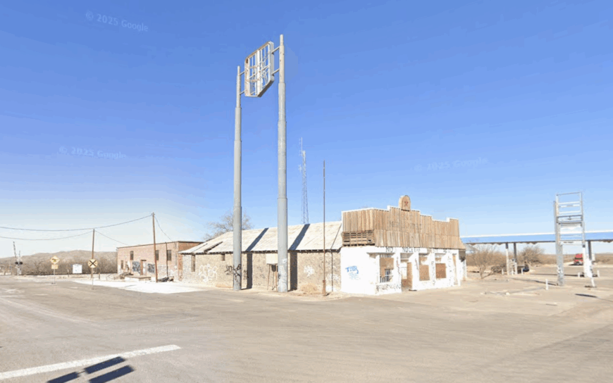
8. Toyahvale – Spring-Fed Oasis in the High Desert
Toyahvale counts roughly 60 residents clustered around Balmorhea State Park’s emerald springs. Most days revolve around swimming in the constant 72-degree water, bird-watching along wetland trails, or scuba diving to photograph endangered pupfish.
Ranching and park employment form the economic backbone, with a roadside café and a dive shop filling the gaps. Beyond the cottonwoods, open ranchland rolls for more than 30 miles without a stoplight, muffling Toyahvale from the wider world.
Dark-sky rules keep outdoor lighting low, so stars reflect on spring pools after dusk. Lot sizes generally top an acre, and curious javelinas outnumber neighbors on evening walks.
Where is Toyahvale?
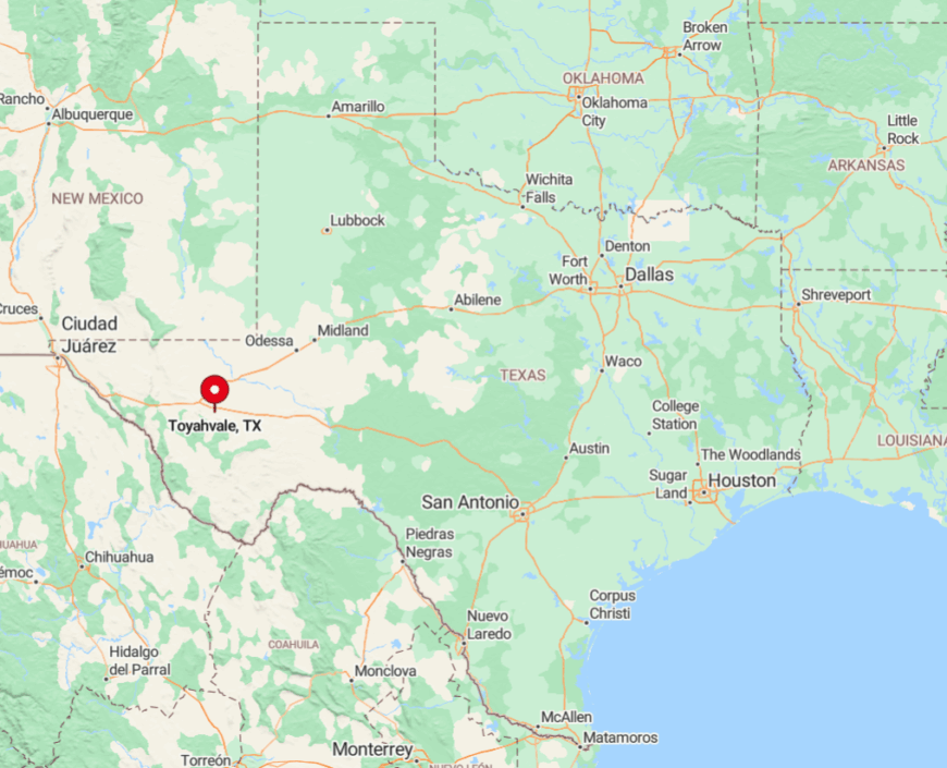
The hamlet rests in Reeves County where State Highway 17 meets FM 3078, about four miles south of tiny Balmorhea. Surrounding prairie and distant Davis Mountains form a natural moat of space and silence.
Interstate 10 lies nearly 40 minutes north, making Toyahvale a deliberate detour rather than a pass-through. Travelers reach the springs by car; the nearest commercial airport is 200 miles away in El Paso.
7. Kent – Wind-Swept Crossroads of Empty Plains
Fewer than 20 year-round residents call Kent home, sharing the landscape with tumbleweeds and a shuttered general store. Activities lean toward star photography, arrowhead hunting on nearby mesas, and hikes into the Eagle Mountains when weather cools.
Ranching dominates what little industry survives, supplemented by a solitary gas station that serves long-haul truckers. Kent’s wide, fenceless plains stretch to every horizon, and prevailing winds whisper through abandoned rail sheds without meeting a wall.
Night brings such quiet that a passing freight train can be heard ten miles off. The absence of schools, shops, or even a post office marks this as a true whistle-stop.
Where is Kent?
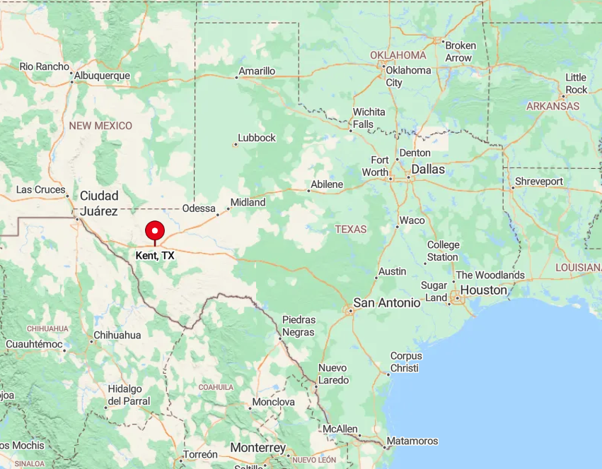
Positioned along Interstate 10 in Culberson County, Kent sits 85 miles east of El Paso and 60 miles west of Van Horn. Despite the highway, exits are few and services fewer, so almost no one lingers unless they plan to.
A lone frontage road leads to scattered homesteads before dissolving into ranch tracks. Venturing beyond requires a high-clearance vehicle and a keen sense of direction; GPS signals fade among the mesas.
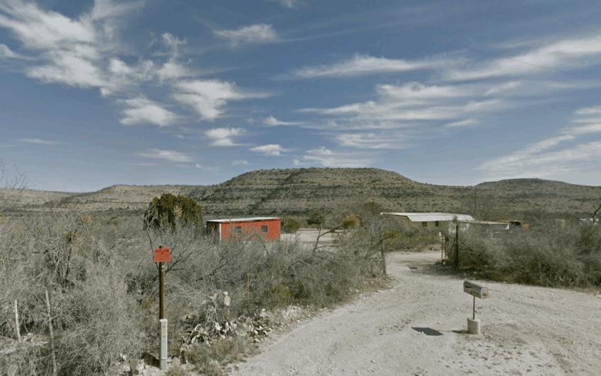
6. Sierra Blanca – Quiet County Seat Without a City Feel
Roughly 500 residents live in Sierra Blanca, yet its adobe courthouse and cluster of cafes hardly create urban bustle. Travelers tour the 1917 county jail, hike the nearby Quitman Mountains, or join locals for Friday-night high-school football that doubles as a community reunion.
County government and ranching remain primary employers, with a scattering of art studios housed in old storefronts. The town curls behind low, arid hills that block both wind and Wi-Fi, insulating it from the traffic racing along I-10 eight miles away.
Chain stores never arrived, leaving only mom-and-pop markets and a single blinking stoplight. Even as the county hub, Sierra Blanca feels more outback than administrative center.
Where is Sierra Blanca?
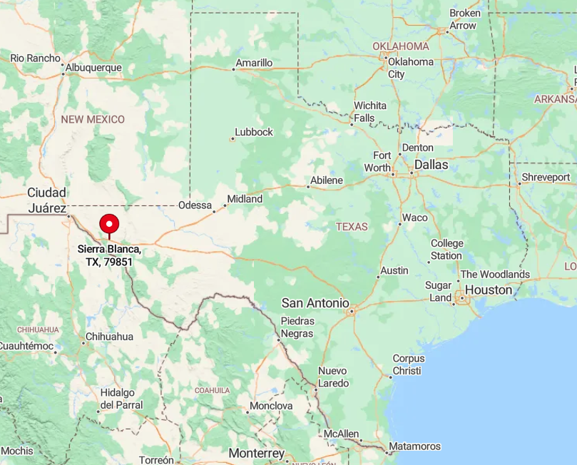
Set in Hudspeth County 90 miles east of El Paso, the town straddles U.S. Highway 80 but remains invisible from the interstate. Sparse settlement between it and El Paso means nocturnal headlights appear like distant campfires rather than city glare.
Access comes via Exit 108 on I-10, then a short cruise south over cattle guards to Main Street. Freight trains still rumble through, yet their echo only underscores how empty surrounding rangeland truly is.
5. Pandale – Pecos River Hideaway for Kayakers
Pandale supports a resident count of about 20, though RV campers inflate the number each spring canoe season. Days center on paddling the Pecos River’s Class II rapids, spotting bighorn sheep on canyon walls, and sharing campfire stories at the lone crossing’s primitive campground.
A few cow-calf operations and a modest hunting-lease business are the only recurring sources of income. Dirt roads dead-end at the river, and half the surrounding acreage remains untouched canyon country alive with creosote and mule deer rather than people.
Nights fall utterly black, punctuated by the plunk of fish surfacing in deep pools. Pandale embodies a frontier mood rarely felt in the lower forty-eight.
Where is Pandale?
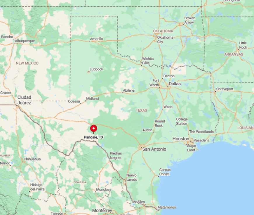
The community lies in Val Verde County, 54 rough-road miles northwest of Langtry and Judge Roy Bean lore. Rimrock and private ranch gates hem in every approach, leaving Ranch to Market Road 1024 as the only semi-paved route.
The last ten miles turn to gravel before descending steeply to the river crossing. Fuel, food, and cell service vanish en route, so visitors pack extra supplies or they go without.
4. Dryden – Forgotten Rail Stop Amid Limestone Bluffs
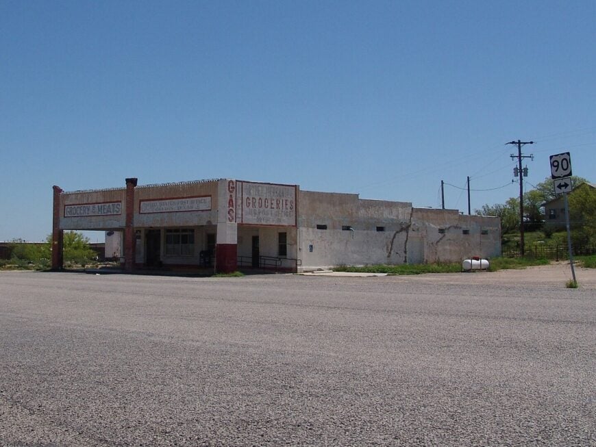
Dryden’s year-round population floats near a dozen, sharing space with sun-bleached storefronts and a century-old railroad water tower. Modern recreation involves exploring limestone bluffs for fossils, hunting invasive aoudad, or photographing the empty rails at golden hour.
Ranching leases and a periodic border-patrol checkpoint provide the only paychecks. Vast government-owned range and private ranches keep density below ten residents per square mile, ensuring conversations carry farther than traffic noise.
Mail arrives three times a week; anything urgent must wait for the next eastbound freight. Visitors soon discover the loudest sound is usually the desert wind rattling loose tin roofing.
Where is Dryden?

The settlement occupies a lonely stretch of U.S. Highway 90, exactly halfway between Sanderson and Marathon in Terrell County. Surrounding terrain is a maze of limestone ridges and arroyos that discourage development.
Passenger train service ended decades ago, leaving the highway as the sole reliable access. Drivers top off in Sanderson, then glide 60 uninterrupted miles before Dryden’s lone shade tree comes into view.
3. Marathon – Gateway Hamlet to Big Bend’s Vastness
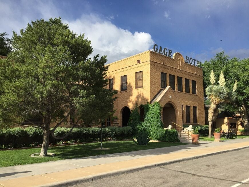
Home to about 400 residents, Marathon balances frontier quiet with a dash of artistic flair. Travelers browse iron-sculpture gardens, birdwatch at Post Park’s cottonwoods, or sip prickly-pear margaritas at the historic Gage Hotel courtyard.
Lodging, guide services, and a small school district anchor local employment, while several ranches fill the gaps. Marathon enforces a strict dark-sky ordinance, and adobe buildings blend with tawny prairie so well they almost disappear at dusk.
The emptiness between town and the distant Glass Mountains reinforces its retreat-like feel. Once night falls, trains rumble past but cellphones often do not, preserving the spell.
Where is Marathon?
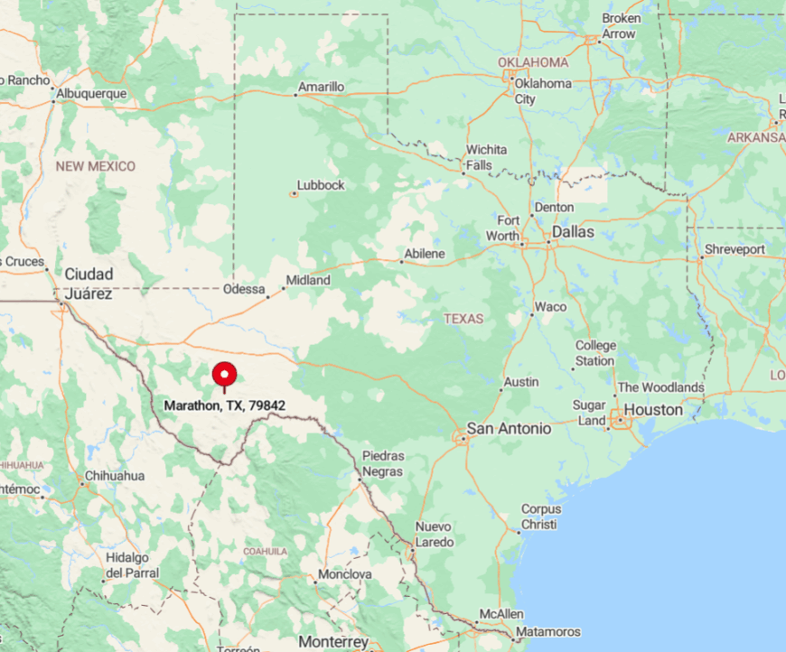
Set in Brewster County at the junction of U.S. Highway 90 and U.S. 385, Marathon sits 30 miles north of Big Bend National Park and 120 miles from the next sizable town, Fort Stockton. Flat grasslands extend in every direction, broken only by ranch gates and the occasional pronghorn herd.
Amtrak’s tri-weekly Sunset Limited stops here, yet most arrive by car after hours of open-road driving. The small public runway two miles south handles single-engine craft for those who prefer to land where the jackrabbits outnumber planes.
2. Mentone – America’s Least-Populated County Seat
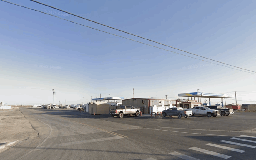
A mere 22 residents keep Mentone functioning as Loving County’s seat of government. Sightseers snap photos of the tiny 1935 courthouse, explore gypsum dunes that gleam at sunrise, or trade stories with deputies at the lone café.
Oil-field support work and ranching supply modest paychecks, though tumbleweeds often roll down Main Street undisturbed. The town sits on flat ranch land miles from any major highway, and half-vacant lots between houses create built-in breathing room.
Streetlights are absent, so the West Texas stars take over after dark. Even the local judge doubles as historian, proof that one person often wears many hats out here.
Where is Mentone?
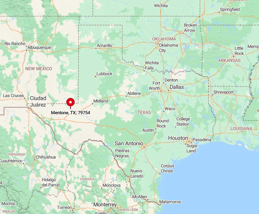
Mentone stands at the crossroads of State Highway 302 and Farm Road 866, 77 miles west of Pecos and nearly 90 miles northeast of Van Horn. Endless fencelines and saltbush separate it from neighboring counties, deterring casual visitors.
Drivers share the road mostly with cattle haulers and oil rigs, both of which fade by dusk, leaving the highway empty. Anyone needing supplies must travel to Kermit or Pecos; in Mentone, silence is the default soundtrack.
1. Redford – Riverbend Settlement Below the Chinati Mountains
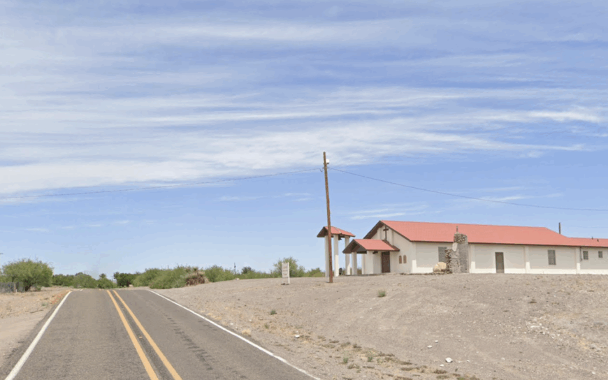
Redford’s population hovers around 80, scattered along a quiet horseshoe bend of the Rio Grande. Residents tend goats, garden in irrigated plots fed by ancient acequias, or launch canoes to drift beneath volcanic bluffs where herons nest.
Ranching and seasonal chili-pepper harvests provide modest income, and a small mission church doubles as a community hall for quinceañeras.
Federal lands, rugged lava hills, and the international border wrap the village in near-complete seclusion, broken only by distant cattle lows or the rustle of mesquite. Street signs are few, crime nonexistent, and stargazing unrivaled thanks to zero commercial lighting. Life here moves by sun and river flow rather than by clock.
Where is Redford?
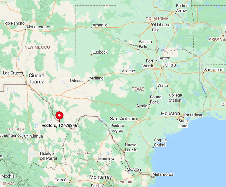
The village rests in Presidio County on Farm Road 170, 18 miles southeast of the town of Presidio and nearly 60 desert miles from Alpine. Chinati Mountains rise to the north, while Big Bend Ranch State Park guards the east, leaving Redford tucked safely out of commuter reach.
Drivers trace FM 170’s curving river berm to arrive; beyond Presidio, no fuel stations interrupt the journey. Those who make the trip cross cattle guards, border-patrol checkpoints, and long stretches where radio silence reigns—a fitting prelude to the solitude awaiting at river’s edge.


