🔥 Would you like to save this?
Western Oklahoma still holds wide spots in the road where prairie grass outweighs pavement and neighbors wave from miles away. Our team rounded up 25 such dots on the map—places where populations rarely cross triple digits, skies stay star-laden, and traffic lights are someone else’s concern.
Each hamlet has its own character: a forgotten Route 66 filling station, a century-old clapboard church, or oil pumpjacks thrumming in the distance. Visitors will find bird-rich canyons, sandstone hills, and hidden fishing holes that never reach a guidebook.
In order to come up with the very specific design ideas, we create most designs with the assistance of state-of-the-art AI interior design software.
These communities aren’t ghost towns, but they aren’t far from it, which is exactly the appeal for travelers or new residents craving elbow room. Pack extra fuel, bring a paper map, and enjoy the quiet side of the Sooner State.
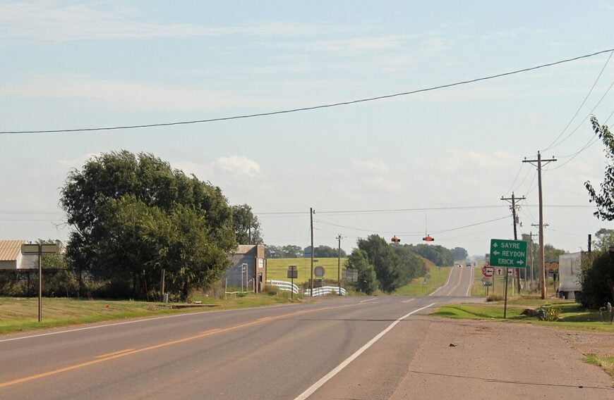
25. Butler, Custer County

Butler is the kind of place where the prairie whispers and nothing interrupts the wind. Home to just a few hundred residents, it sits quietly among golden wheat fields and wide-open sky.
The vibe is humble and grounded, shaped by farming families and weekend strolls to nearby Foss Lake. Fishing, birdwatching, and long drives down unpaved roads are standard weekend fare. There’s no rush here, just the rhythm of harvests and the occasional hum of a grain truck.
Butler’s distance from major highways and its surrounding farmland keeps it out of view and out of mind. On clear nights, stargazers gather by the tailgate to watch the Milky Way rise like a slow flame.
Where is Butler?
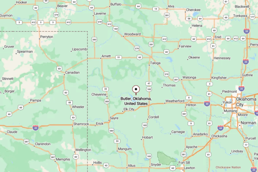
Butler lies in western Oklahoma, about 60 miles west of Hinton and a few minutes from Foss Lake. The journey winds through rolling plains, accessible by county roads off State Highway 33.
It’s quiet country, where you measure distance in time between gas stations. You won’t find many signs—but you’ll know when you’ve arrived.
24. Loyal, Kingfisher County
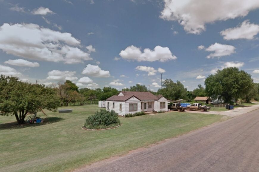
With fewer than 75 residents, Loyal lives up to its name—devoted to quiet days, long traditions, and tight-knit community ties. The town’s charm rests in its simplicity: a grain elevator, a small school, and gently waving fields as far as the eye can see.
The vibe is deeply rural and refreshingly slow, where tractors outnumber cars and neighbors linger to chat. Farming, especially wheat and canola, anchors life here. Local events like holiday parades or school sports light up the calendar, drawing out residents from nearby farms.
With no big stores or through-traffic, Loyal remains virtually untouched by modern sprawl. It’s a place where the quiet is so steady it feels sacred.
Where is Loyal?
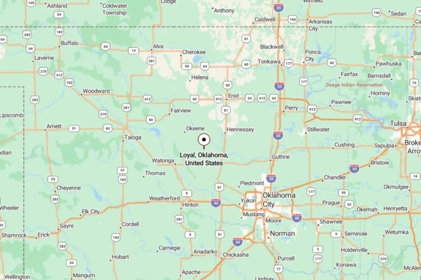
Loyal is tucked into western Kingfisher County, about 18 miles northwest of the town of Kingfisher. Reached by gravel and county-maintained roads, it sits far from the hum of interstates.
The horizon blurs into farmland, making the town feel like a mirage until you’re in it. It’s peaceful not because it’s hard to get to—but because few ever think to go.
23. Carmen, Alfalfa County
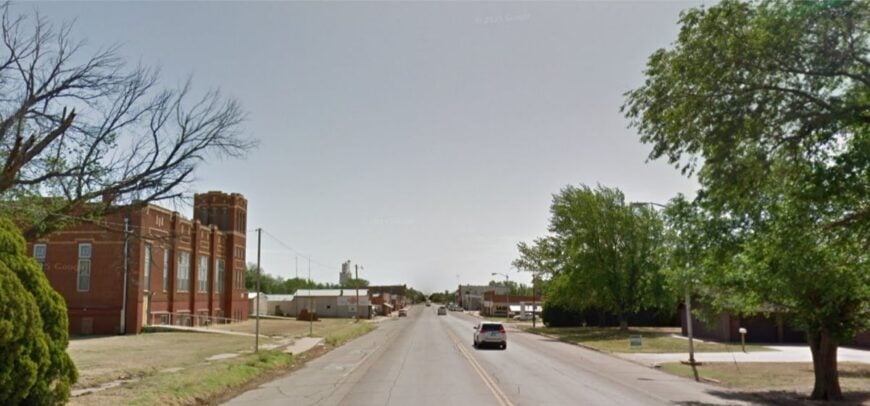
Carmen is a gentle dot on the map, where grain bins rise taller than rooftops and everyone waves as you pass. The town’s historic charm hums beneath quiet mornings and the golden hush of prairie evenings.
Farming and ranching are the mainstays, though visitors might find themselves wandering the edges of the nearby Great Salt Plains. The local school gym hosts events from pancake breakfasts to quilt shows, breathing warmth into the stillness.
Wind often rustles through town with no competition but songbirds and screen doors. Seclusion comes easily here—Carmen isn’t on the way to anywhere. It’s the kind of place that feels both distant and deeply grounded.
Where is Carmen?
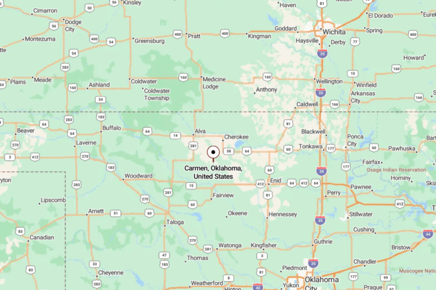
Set in northwestern Oklahoma, Carmen lies about 25 miles east of Woodward. The best way in is a string of narrow, rural roads weaving through wheat fields and oil leases.
There are no billboards or bright lights—just earth tones and silence. The town arrives like a secret kept well.
22. Hollister, Tillman County
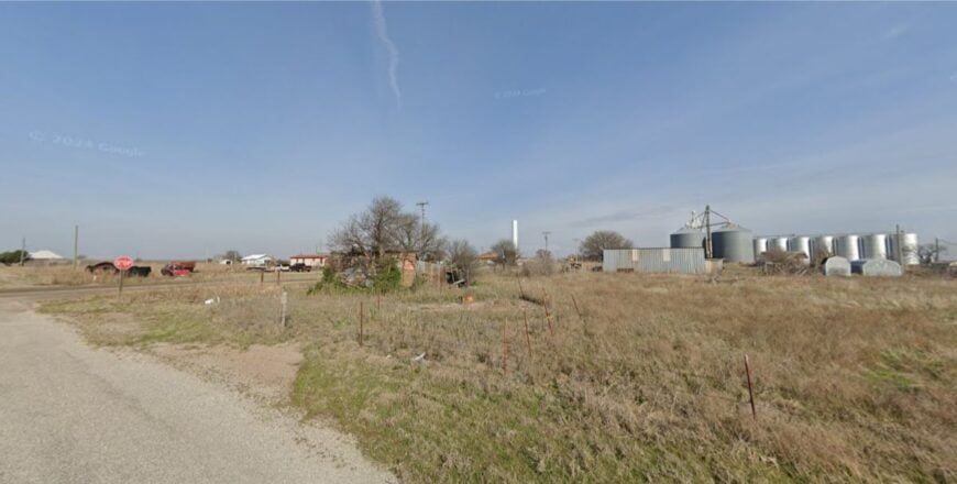
Hollister is a flicker of a town cradled by dusty roads and flat farmland stretching toward every horizon. With fewer than 60 residents, it exudes a kind of hush that even the wind respects.
There’s a charm to its stillness—an old brick schoolhouse, a tiny park with creaking swings, and a post office that serves more as a community hub than a mailroom. Most folks make a living off wheat, cotton, and cattle, often tending to fields that have been in the family for generations.
At sunset, the sky here puts on a show of fire and lavender that rolls out uninterrupted. You won’t find restaurants or shops, but you’ll find peace. It’s a place where silence speaks volumes.
Where is Hollister?
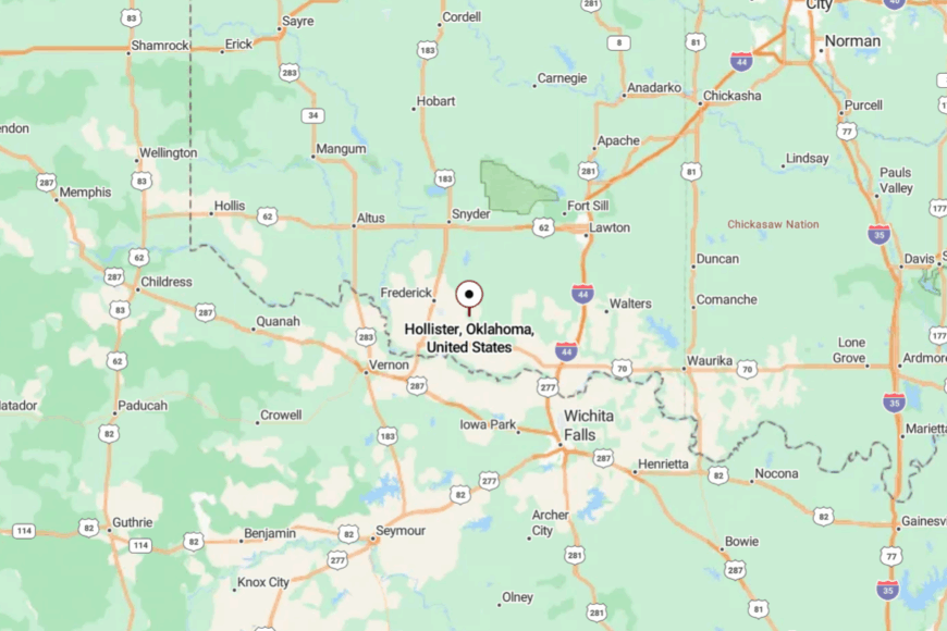
Hollister lies in southern Tillman County, about 12 miles southeast of Frederick. It’s reached via State Highway 5, followed by a short descent into farmland with almost no signage.
The journey passes old silos and barbed wire fences until the town slowly emerges. It’s just far enough from everything to feel like its own world.
21. Foss, Washita County
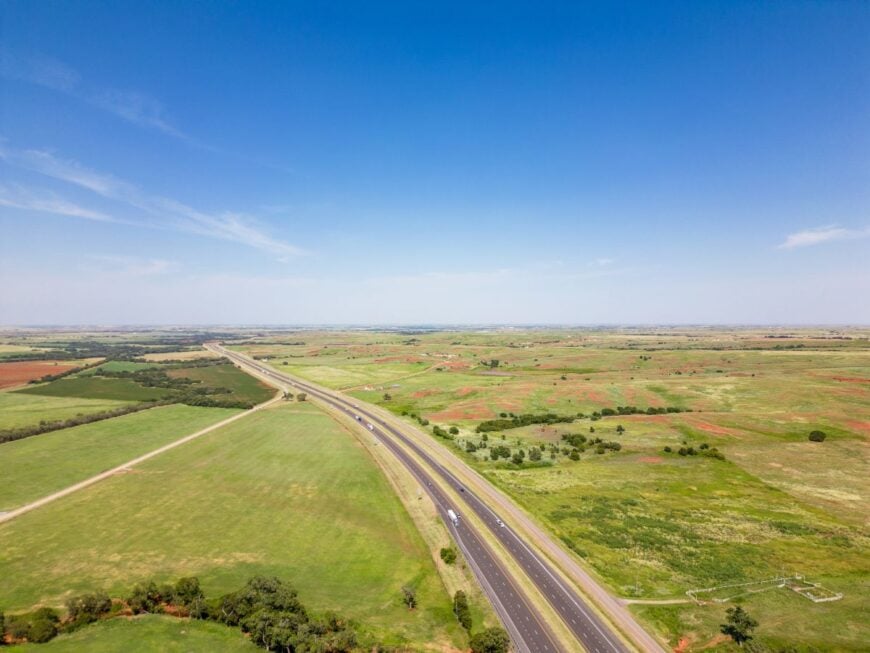
Foss is a weathered gem where memories linger longer than buildings. Once a bustling stop on Route 66, it now holds only echoes—empty storefronts, rusted signage, and stories told over coffee.
Locals find beauty in the stillness, gathering for church, school events, or fishing at nearby Foss Lake. The economy leans on agriculture and a few tourism dollars from lake-goers and history buffs.
Its seclusion lies in the bypass: the highway moved on, but Foss stayed put. Sunsets here stretch forever across the plains, soaking bricks and cottonwoods in a last wash of gold. It’s the kind of quiet that settles into your bones.
Where is Foss?
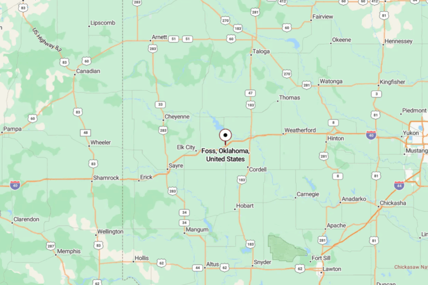
Foss sits in west-central Oklahoma, just north of Interstate 40 between Clinton and Canute. Though near the interstate, it’s tucked away on side roads that most drivers never take.
A short turn leads you back in time—pastures and fences instead of rest stops and fast food. You’ll find it if you’re paying attention.
20. Dill City, Washita County
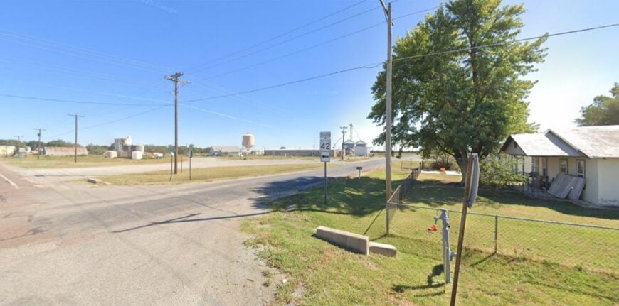
Dill City offers serenity wrapped in farmland, where life runs on the rhythms of wheat, cattle, and weather. Its modest homes cluster near a co-op and a single post office, with long stretches of gravel roads branching out like quiet veins.
The town holds tight to community traditions—church potlucks, fall festivals, and baseball games under big skies. Farming fuels the economy, but heart and history hold it all together.
It’s not a place for drive-throughs or detours—there’s nowhere else to be but here. The silence is steady, and the welcome is warm. For those who seek it, Dill City offers space to breathe.
Where is Dill City?
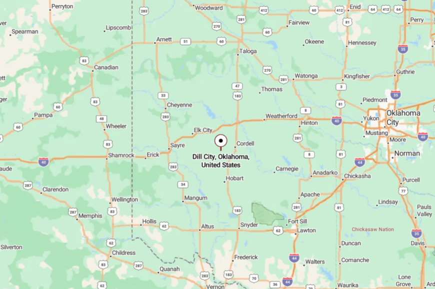
Found in southern Washita County, Dill City is about 12 miles south of Cordell and reached by State Highway 42. The roads narrow quickly as you approach, replaced by dust and grass.
There are no franchises—just fence posts and wind. It’s far enough off-grid to feel like an escape.
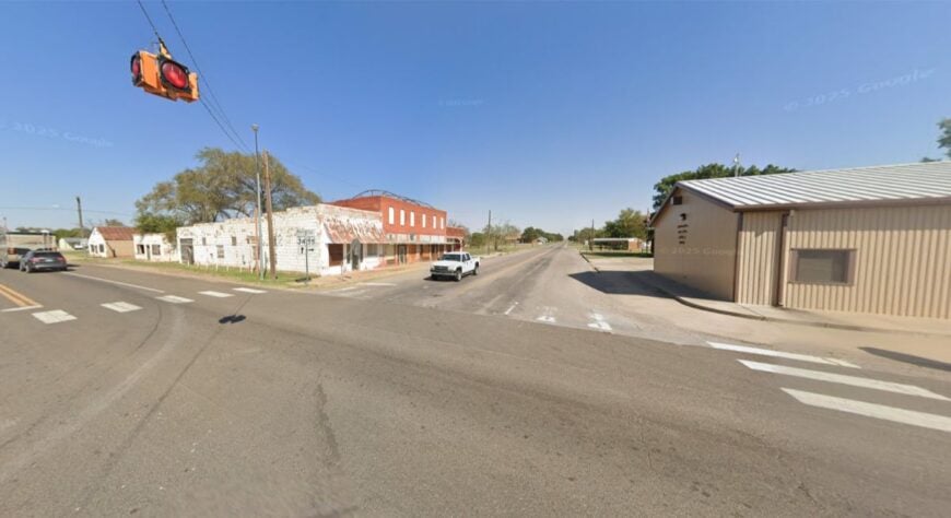
19. Carter, Beckham County
🔥 Would you like to save this?
Carter holds fewer than 250 people, yet its sense of space feels infinite. The land stretches open in every direction, broken only by fence lines and grazing cattle.
Town life centers around a few churches, a school, and a diner that smells like home. The hum of tractors and the whisper of windmills mark the day’s passing. Agriculture rules here, and community is as deep as the topsoil.
You won’t find a crowd, but you’ll find belonging. It’s a place that invites you to stay a little longer than planned.
Where is Carter?
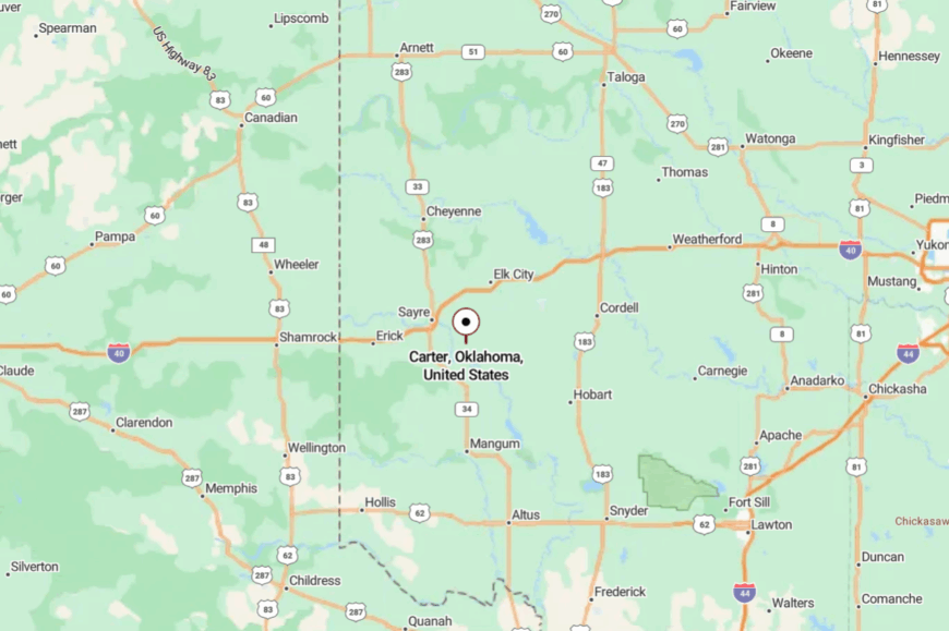
Located in southwestern Oklahoma, Carter lies about 20 miles north of Altus and east of Sayre. Travelers reach it by driving quiet county highways that wind through wheat fields and grazing land.
There’s no obvious entrance—just a gradual shift into calm. It’s the kind of town that finds you before you find it.
18. Canute, Washita County
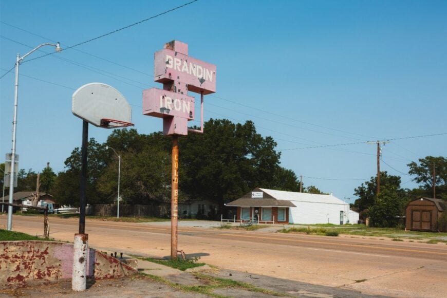
Canute has one foot in history and the other in stillness. Once a vibrant stop on old Route 66, it now stands quietly with a few weathered landmarks and a deeply rooted pride.
The town hosts the occasional antique fair or vintage car show, but most days are slow and sweet. Locals gather at the gas station café to swap stories and watch the road roll by.
Tourism ebbs and flows, but farming keeps the lights on. Seclusion here comes from the bypassed highway and long fields of nothingness. Time lingers longer in Canute.
Where is Canute?
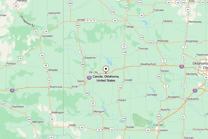
Canute is in Washita County, just off Interstate 40 between Elk City and Clinton. Though close to the highway, it’s buffered by old frontage roads and fields that soften the noise.
Visitors often find it by accident while chasing Route 66 nostalgia. What they discover is a town still holding its place in the dust.
17. Texola, Beckham County
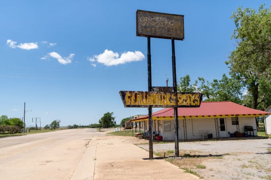
Texola teeters on the edge of Oklahoma—and of being forgotten. With fewer than 10 full-time residents, it’s more memory than town, its empty jailhouse and rusted signage standing like ghosts of an older America.
Yet there’s a charm in its silence: wild sunflowers breaking through sidewalks, the wind whistling down empty streets. Route 66 purists make pilgrimages here, snapping photos and soaking in the solitude.
There’s no economy left—just the hum of a land that won’t quit. It’s a place where the past refuses to fade.
Where is Texola?
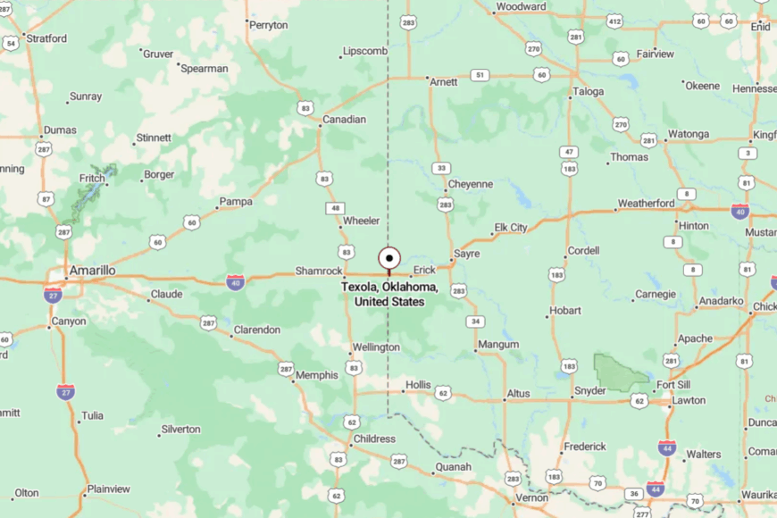
Texola sits on Oklahoma’s westernmost edge, hugging the Texas border just off Interstate 40. You reach it by exiting at Erick, then following old Route 66 west until pavement fades.
Fields press in on all sides, and signs of life are few. It feels like the last stop before nowhere.
16. Strong City, Roger Mills County
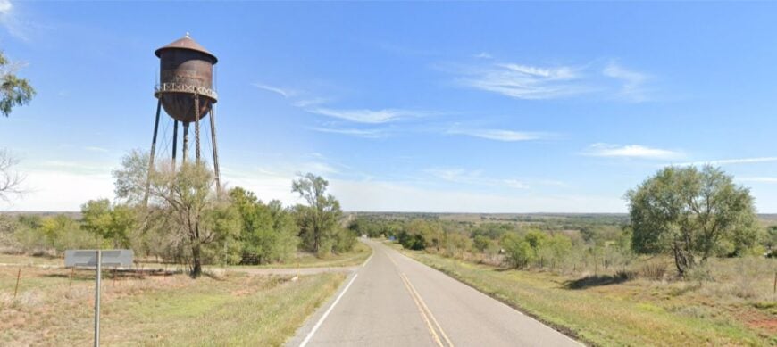
Strong City stands small but proud, tucked among prairie bluffs and deep red dirt. Home to fewer than 50, the town pulses with ranching spirit and neighborly resilience.
Days move slowly here—fence mending, coffee chats at the co-op, and long evening walks under cottonwood shade. The town’s isolation is physical and emotional; it’s miles from noise and years from hurry. History lingers in the old schoolhouse and church, both still lovingly maintained.
This isn’t a tourist stop—it’s a holdout for those who treasure quiet. Strong City lives up to its name by staying rooted.
Where is Strong City?
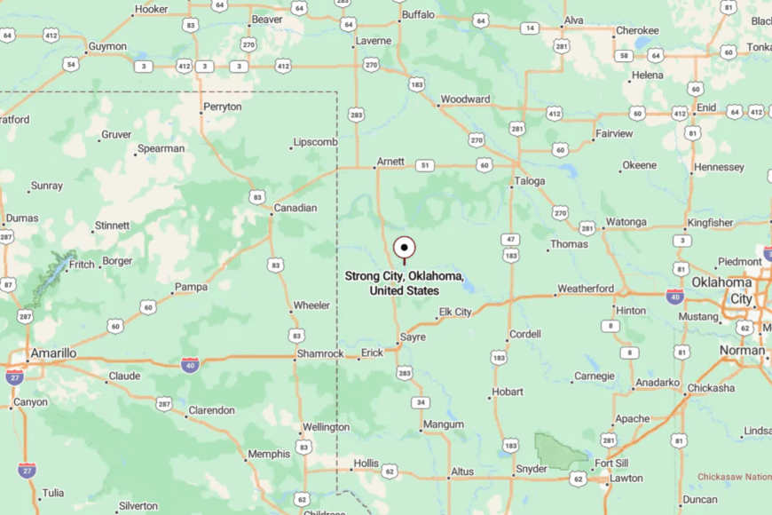
Located in central Roger Mills County, Strong City is about 12 miles east of Cheyenne via a lonely stretch of State Highway 47.
The drive slips through ranch land and shallow creeks, with little to distract but sky. No fast food, no stoplights—just fences and fields. The silence here is earned.
15. Reydon, Roger Mills County
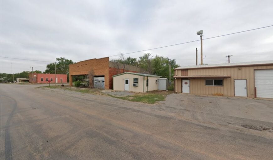
Reydon is a true prairie settlement, where tumbleweeds dance across Main Street and community runs deep in every handshake. Fewer than 200 residents call it home, most connected to ranching or oil. Life centers around the school, the café, and the post office—each a touchpoint of daily rhythm.
The land here feels big, the sky bigger still. Isolation isn’t an inconvenience—it’s a virtue. There’s pride in being hard to find. It’s the kind of place where stars fall slow and neighbors show up fast.
Where is Reydon?
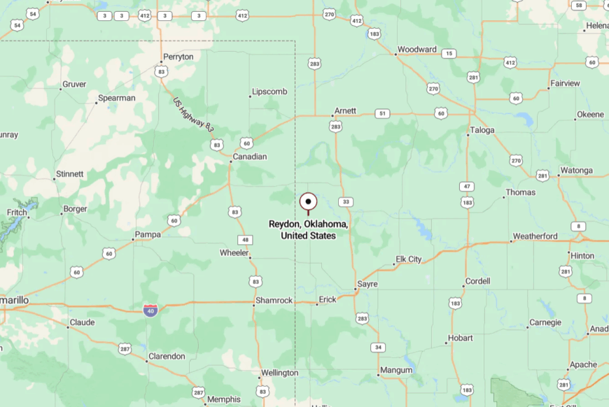
Reydon lies in western Roger Mills County, just east of the Texas border. It’s about 30 miles northwest of Cheyenne, accessible via meandering county roads and quiet state routes.
The last few miles are often empty of cars but full of color. It’s not far from the world—but it feels like it.
14. Alfalfa, Caddo County
Alfalfa is a near-forgotten patch of prairie, its name barely bolder than the fields that surround it. Home to just a handful of residents, the town is all silence and sky, framed by grain elevators and fence lines that stretch to the horizon.
The school is long closed, the post office shuttered, yet a few homes still pulse with life and routine. Seclusion comes naturally here—there are no stoplights, no gas stations, just long gravel roads that echo with the past.
Locals enjoy stargazing, porch-sitting, and the occasional trail ride through sunflower fields. It’s the kind of place that asks for nothing but gives you your thoughts back.
Where is Alfalfa?
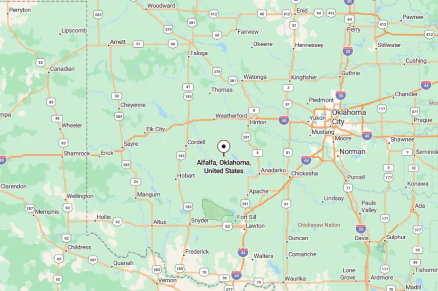
Alfalfa sits in rural Caddo County, about 25 miles west of Anadarko. To reach it, you follow winding county roads through farmland and rolling fields.
There are no major highways nearby—just soft curves and quiet turns. By the time you arrive, you’ve already let go of the noise.
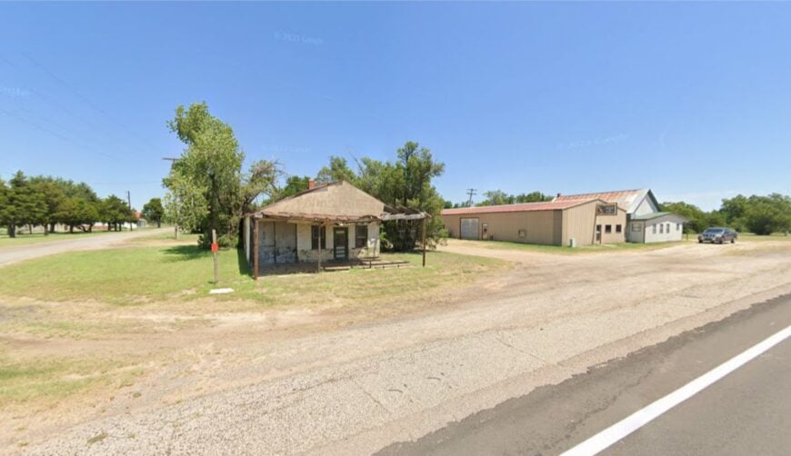
13. Martha, Jackson County

🔥 Would you like to save this?
Martha carries a hush that feels earned—a town of fewer than 200, ringed by cotton fields and open wind. Its streets are lined with modest homes and aging storefronts that remember busier days.
Residents tend gardens, wave from porches, and gather for monthly potlucks in the church hall. Farming dominates life here, especially cotton and wheat, but there’s also a quiet artistry to the hand-painted signs and vintage trucks still in use.
The town’s out-of-the-way location helps it stay serene, nestled in land that feels like it never quite left the past. At dusk, the scent of turned earth and honeysuckle lingers. Martha doesn’t ask for attention—it’s content to simply be.
Where is Martha?
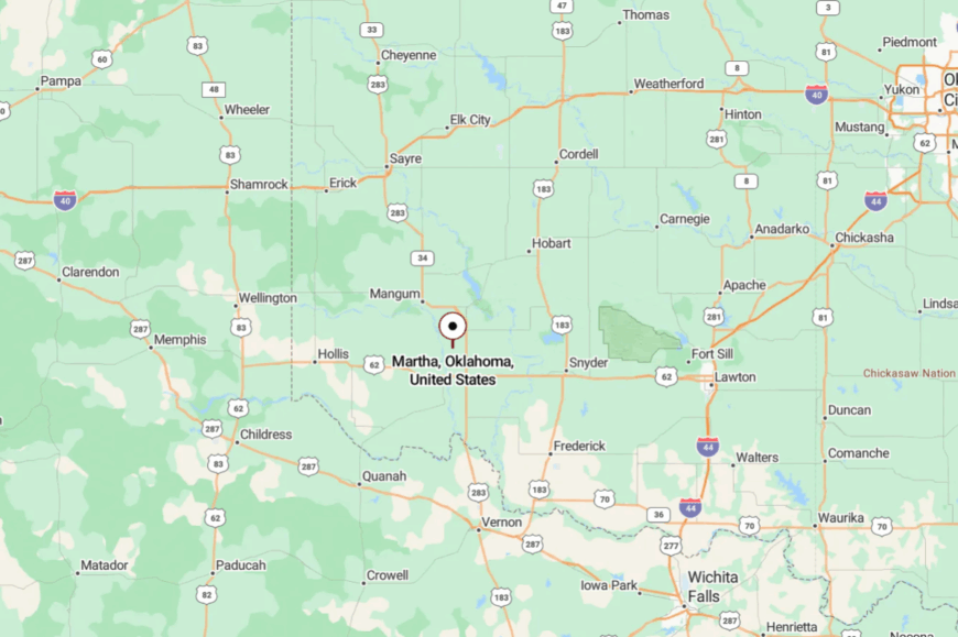
Located in southwest Oklahoma, Martha sits about 10 miles east of Altus off State Highway 62. The route there cuts through cotton country, past fields that glow white in season.
Roads narrow into gravel just outside town, with few signs pointing the way. It’s a place you find on purpose—or by luck.
12. Camargo, Dewey County
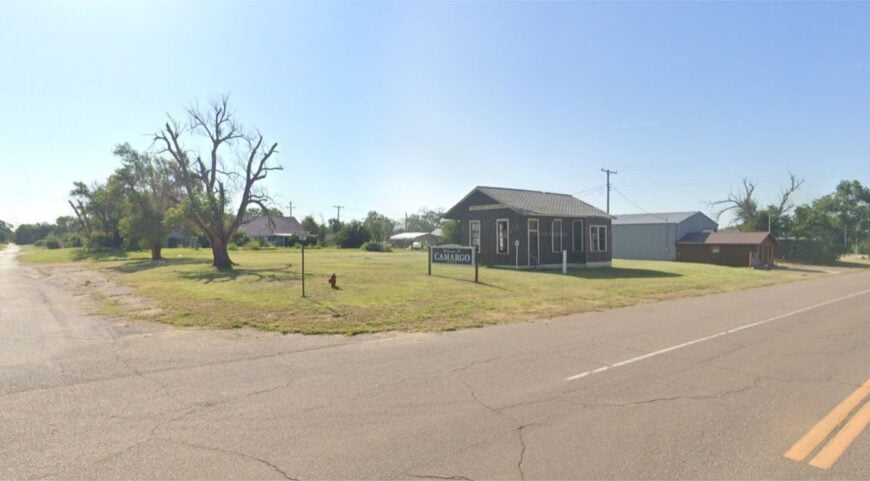
Camargo rests gently along the Canadian River valley, a slender settlement of fewer than 200 surrounded by red hills and sandy bluffs. The air here smells of juniper and mesquite, and mornings break to the call of mourning doves.
Locals fish the river, fix fences, and hold community dinners under wide skies that seem to go on forever. The town’s grain elevators still hum softly, anchoring a farming economy that hasn’t changed much in decades.
Camargo stays hidden due to its distance from major roads and its fold in the landscape. It’s a place that greets you with quiet and lets you stay as long as you like.
Where is Camargo?
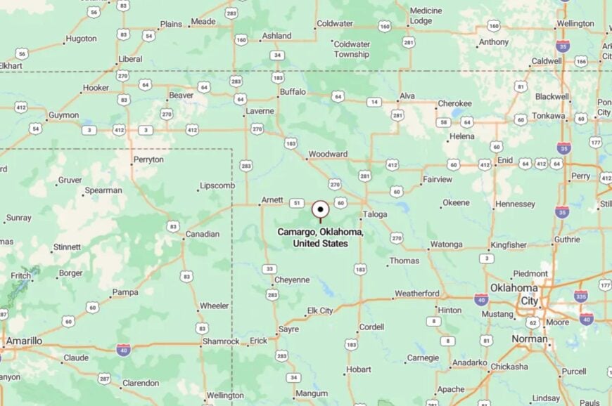
Camargo lies in northwestern Dewey County, about 18 miles northeast of Leedey. It’s reached by a series of backroads that follow riverbeds and twist through ranch land.
The final miles feel more like a country memory than a commute. When you arrive, you feel it in your chest—the hush, the heat, the space.
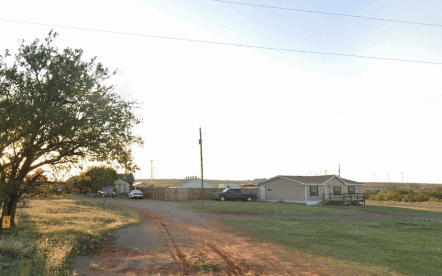
11. Harmon, Ellis County
Harmon isn’t on most maps, and that’s how the locals like it. With fewer than 50 residents, the town clings to a ridge above cropland, its streets unmarked and shaded by aging cottonwoods.
Most days pass with little more than birdsong and the rumble of a passing grain truck. Ranchers and farmers make up the heartbeat here, anchored by a few clustered homes and a tiny chapel that still rings its bell on Sundays.
The town’s remote location keeps it off the radar, tucked into the hills west of Fargo. Evenings arrive quietly, stretching out in golden tones over weathered barns. Harmon reminds you that not all towns are meant to grow—some are just meant to be.
Where is Harmon?
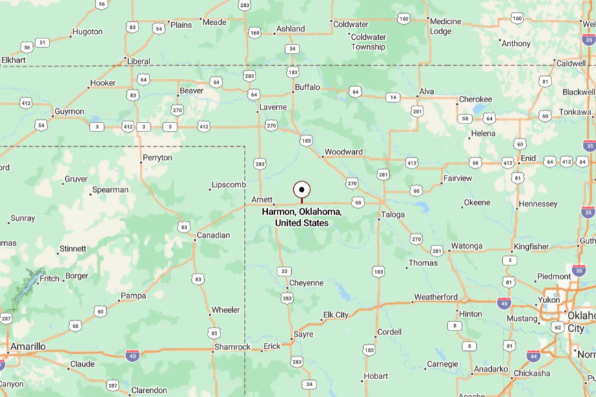
Harmon sits in far western Ellis County, about 10 miles west of Fargo and north of State Highway 15.
Access is limited to gravel roads and faded signs that seem more suggestion than direction. The town is nearly surrounded by private land and fields, making it easy to overlook.
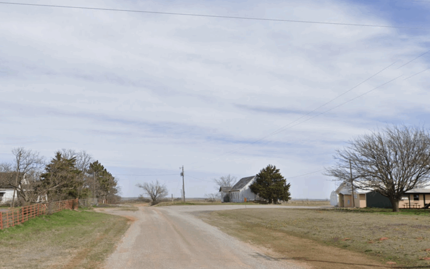
10. Carpenter, Washita County
Home to roughly 90 residents, Carpenter clusters around a white-painted church built in 1914 that still hosts potluck suppers and holiday sing-alongs.
Daytime exploration includes wandering pecan groves along Spring Creek, hunting for turkey and deer in nearby draws, and browsing the tiny volunteer-run library tucked behind the old school gym.
Cattle and wheat remain the backbone of local income, with a few residents commuting to Weatherford for teaching and healthcare jobs. What keeps Carpenter secluded is the combination of acre-spaced homesteads and the surrounding creek bottoms that muffle road noise and hide homes from view.
Nightfall reveals pitch-black skies perfect for telescope owners; locals even host an informal stargazing night on new-moon weekends. Cell service flickers, but the quiet never does.
Where is Carpenter?
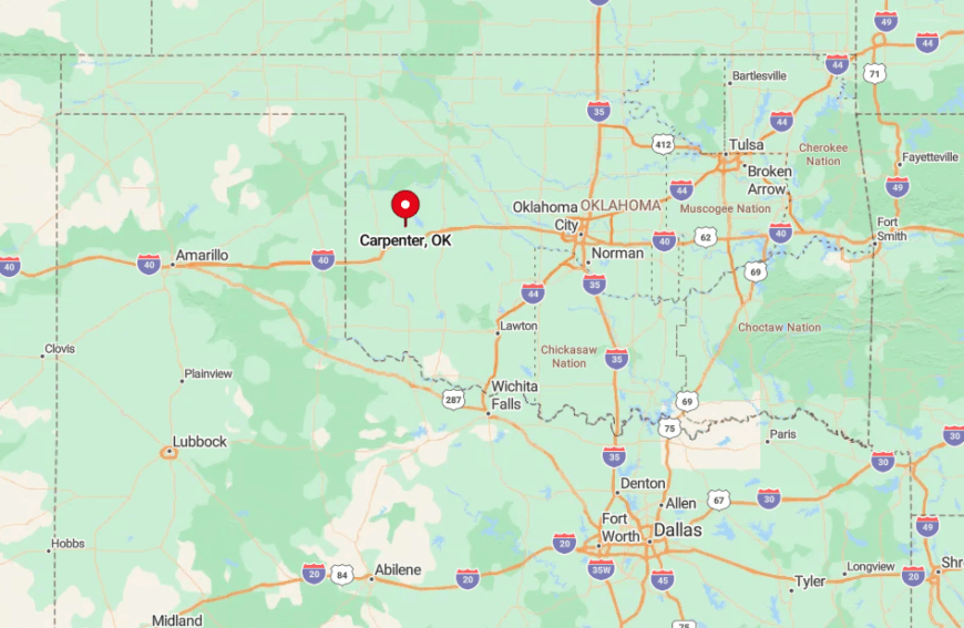
Carpenter sits on a lonely ridge fifteen miles northwest of Clinton, accessed by State Highway 54 and a final stretch of cracked county blacktop. Encircling pecan groves and low ridges block sightlines to any neighboring settlement, heightening its sense of isolation.
Travelers usually reach town by turning west at Corn, then following gravel roads that ford two low-water crossings. The lack of direct interstate access ensures only those who intend to visit ever arrive.
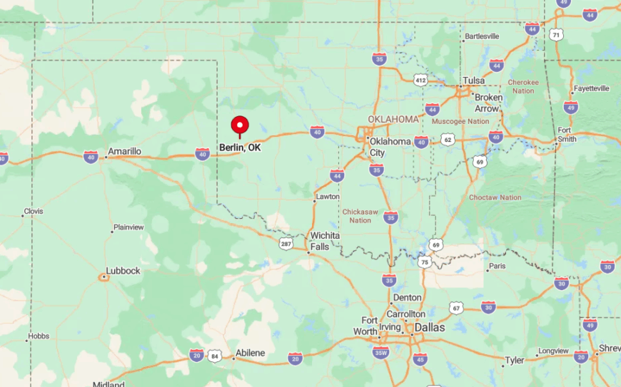
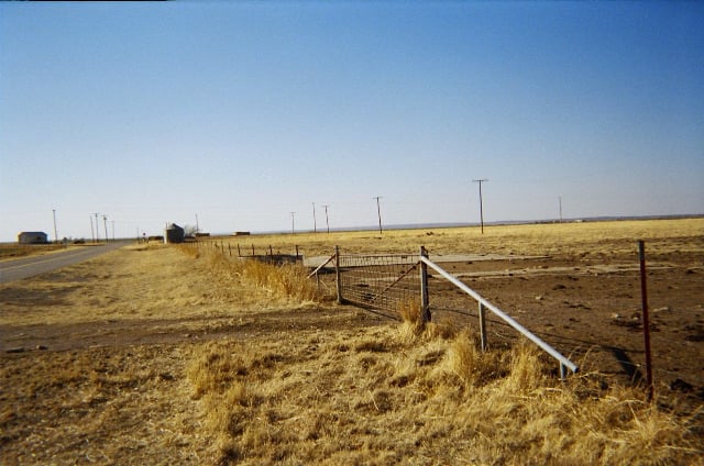
9. Berlin, Roger Mills County
Berlin counts barely 50 year-round residents, many descended from the original homesteaders who arrived in 1896.
Days revolve around ranch work, seasonal controlled burns in the sandhills, and watching coveys of bobwhite quail dart between cedar shelterbelts. Besides cattle, a handful of small oil leases supplement household incomes, their pumpjacks nicknamed after family members.
Seclusion stems from miles of native grass and sandy tracks that require high-clearance vehicles after a rain, discouraging casual visitors. Photographers cherish the abandoned red-brick schoolhouse that glows at sunset, as well as a hidden spring-fed pond a half-mile south of the old depot grade.
Community gatherings happen in a converted shipping container that doubles as a voting precinct and potluck hall.
Where is Berlin?
🔥 Would you like to save this?
Located three miles north of U.S. Route 283 and twelve miles east of the Texas line, Berlin hides in rolling sandhills that swallow sound and signal alike. Its grid of section roads rarely sees more than a handful of trucks each day, preserving deep rural hush.
Travelers exit the highway at a small sign for Berlin Road, then weave west across cattle guards and unfenced pasture. A rising plume of dust is usually the first hint that company is coming.
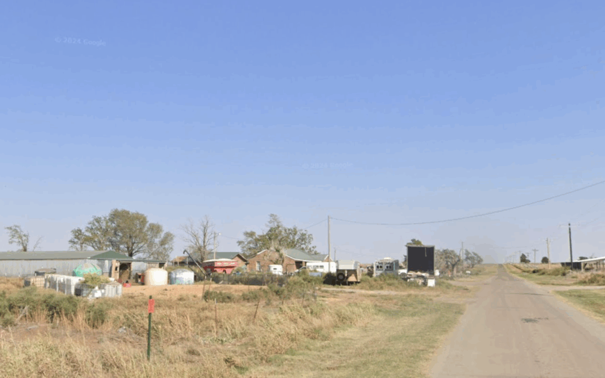
8. Brinkman, Greer County
Fewer than 40 people keep the lights on in Brinkman, a settlement nearly erased during the Dust Bowl yet still dotted with evocative brick shells perfect for urban-decay photography.
Residents pass time tending alfalfa fields, fishing bluegill in the neglected WPA lake east of town, and hosting occasional pop-up farmers markets beside the old bank vault.
Agriculture rules the local economy, with small-scale sorghum plots and cow-calf operations vying for rainfall. Brinkman’s solitude comes from its placement on a disused Santa Fe railbed and a 90-second detour off State Highway 34 that most drivers miss.
The lack of streetlights makes meteor showers spectacular; in August, locals lay quilts on the school basketball court to watch the Perseids. Even the post office is gone, so mail arrives by rural route from Mangum.
Where is Brinkman?
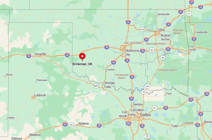
Brinkman lies eight miles north of Mangum in central Greer County, surrounded by gypsum-flecked prairies and sparse mesquite. Only county roads, many still gravel, link it to neighboring towns, restricting traffic to locals and the occasional history buff.
The nearest fuel pump is fifteen minutes away, reinforcing its off-grid flavor. Visitors often reach Brinkman by following the old rail grade visible on satellite maps, a fun scavenger-hunt route for GPS enthusiasts.
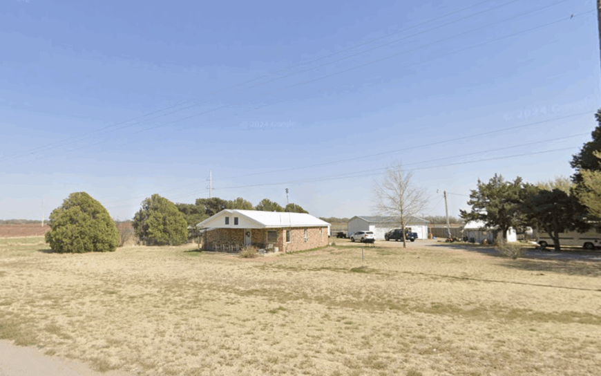
7. Port, Washita County
About 60 residents share Port, where low gypsum bluffs flank miles of unpaved farm tracks and sorghum waves in the wind. Day-to-day life features branding calves at dawn, exploring coyote-carved draws, and gathering for pie auctions at the volunteer fire station.
Cattle, winter wheat, and a cooperative grain elevator underpin the economy, with seasonal custom harvest crews swelling numbers briefly each summer. The town’s seclusion is accentuated by the absence of any state highway, meaning every visit involves at least ten miles of dusty section line travel.
A little-known gem is Port’s natural rock arch tucked in a nearby pasture; ranchers allow respectful hikers to visit if they call ahead. Evenings bring coyotes howling and kettles of migrating sandhill cranes wheeling overhead.
Where is Port?
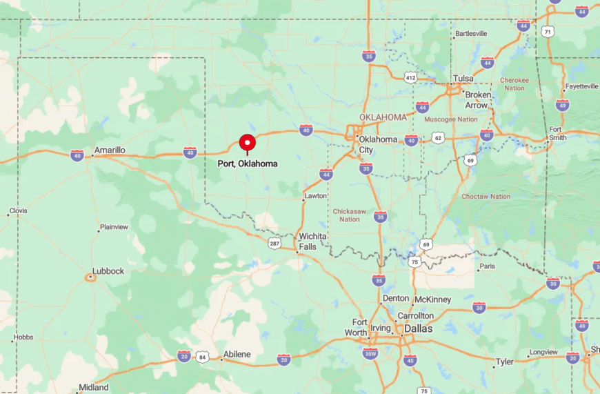
Port is parked twelve miles southwest of Sentinel, accessible only by unsigned county roads that cross two low wooden bridges. Rolling gypsum outcrops block radio towers, leaving FM stations faint and cell coverage spottier still.
Most newcomers arrive via OK-55, then make a five-mile jog south and west across unpaved lanes. The effort filters out all but the most determined travelers, preserving Port’s quiet charm.
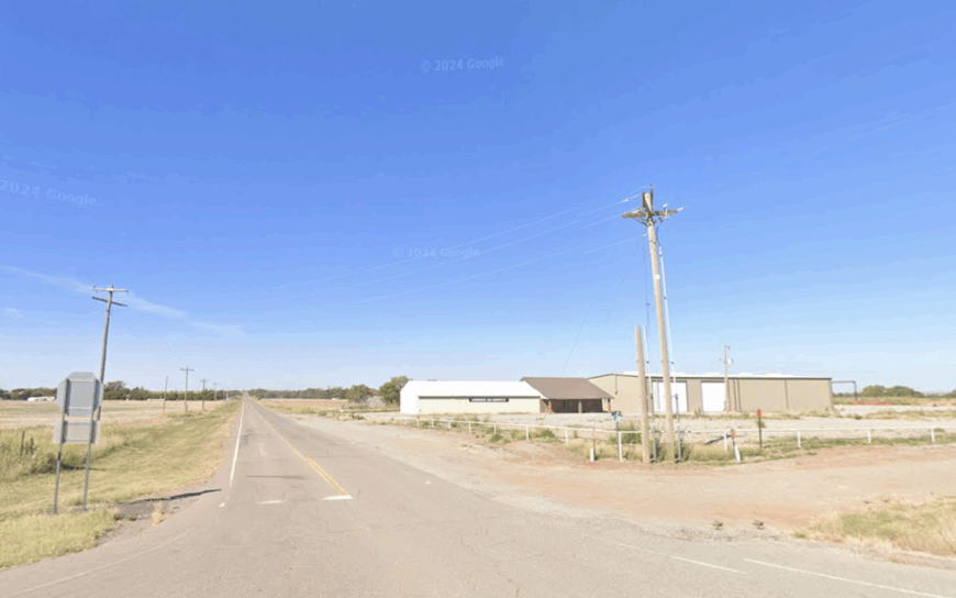
6. Hext, Beckham County
Hext’s head count hovers near 60, yet its historic bones draw Route 66 devotees looking for stone service stations embraced by wild sunflowers. Locals spend weekends restoring vintage gas pumps, hunting quail in nearby draws, and sharing coffee at a converted rail-section house.
Livelihoods revolve around small cow-calf herds, custom hay cutting, and seasonal tourism from Mother Road enthusiasts. Hext stays secluded because modern U.S. 66 was rerouted half a mile north, leaving the original alignment to grass and silence.
An overlooked treat is the century-old cobblestone well near the town park, said to hold the clearest water in the county. Late summer brings a surprise bloom of wild oregano along the right-of-way, perfuming the air.
Where is Hext?
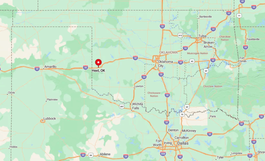
Sitting six miles west of Elk City, Hext hides one mile south of Interstate 40 along the abandoned pre-1937 Route 66 path. Tall prairie grass now blankets the unused roadbed, muffling engine noise from the freeway.
Reaching town requires exiting at Sayre, then backtracking along a frontage lane that dead-ends at Hext Road. The missing through-route means only destination travelers ever pull into town.
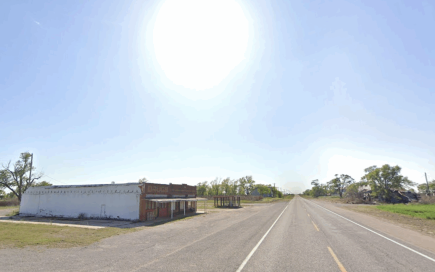
5. Retrop, Washita–Beckham Line
Retrop’s population hovers just over 100, and its skyline is still dominated by weathered grain elevators that glow gold at sunset. Residents host informal photo walks, maintain pocket gardens beside boarded-up storefronts, and kayak a hidden beaver pond east of town when rains oblige.
Wheat and canola fields feed the local coop, while a handful of families run custom harvesting outfits that trail the grain belt north each summer. Seclusion owes to the community’s position several miles from any major town and the almost total absence of through traffic on OK-Retrop Road.
A quirky attraction is the inverted town name—Retrop is “Porter” spelled backward, honoring an early postmaster. Each October, neighbors hold a chili cook-off inside the elevator’s antique scale house, a gathering few outsiders ever witness.
Where is Retrop?
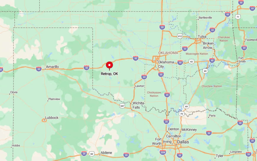
Perched on the county line, Retrop lies eleven miles north of Erick and is reached via a spiderweb of farm roads that switch county maintenance mid-route. Surrounding wheat fields create a sea of tan that blurs the horizon and destination alike, enhancing the feeling of remoteness.
Drivers often navigate by counting elevator legs rising above the crop canopy. Without signage on State Highway 34, even GPS apps occasionally misroute visitors, adding another layer of accidental privacy.
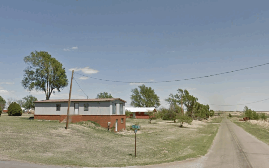
4. Vinson, Harmon County
Approximately 80 people share a 90-square-mile ZIP code in Vinson, where clapboard barns, cotton gins, and a single café punctuate endless plains. Locals enjoy catfishing in the willow-lined Elm Fork of the Red River, bird-watching for scissortail flycatchers, and gathering for domino tournaments at the fire hall.
Cotton remains king, supported by a smattering of cattle and wind-energy lease payments. Vinson’s isolation stems from being twenty miles from the nearest stoplight in Hollis and lacking paved roads in two cardinal directions.
A hidden highlight is the mule-team wagon trail etched into a nearby ridge, still visible after a century and accessible by foot. Visitors quickly learn to wave at every passing pickup—custom dictates it.
Where is Vinson?
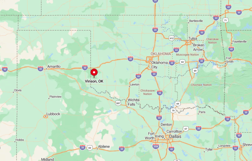
Found in far northwest Harmon County, Vinson sits south of State Highway 9 and requires a drive along SH-9 to reach its mailbox cluster. Surrounding cotton fields stretch unbroken to the horizon, deadening sound and discouraging casual detours.
The closest fuel is in Gould, forcing travelers to plan fuel stops carefully. During harvest, slow-moving module trucks are often the only hint of civilization on the approach.
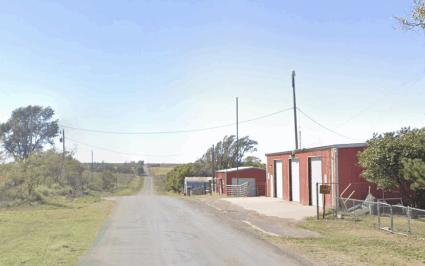
3. Durham, Roger Mills County
Durham’s official roll lists about 95 residents, many occupying one-acre homesteads tucked among tree-choked canyons along the Canadian River breaks.
Popular pastimes include hiking the hidden Fossil Creek Trail, watching bats emerge from sandstone caves, and attending monthly bluegrass jams at the volunteer fire barn. Income sources revolve around cow-calf ranches, custom fence building, and guiding seasonal hog hunts in the brushy bottoms.
Thick cedar stands, a complete absence of streetlights, and canyons that twist radio waves combine to keep Durham in deep hush after dark. The unlit night sky lets observers trace the Milky Way from porch to pasture without even a flashlight.
Locals jokingly advise guests to bring two spare tires—one for the outbound trip and one for the way home.
Where is Durham?
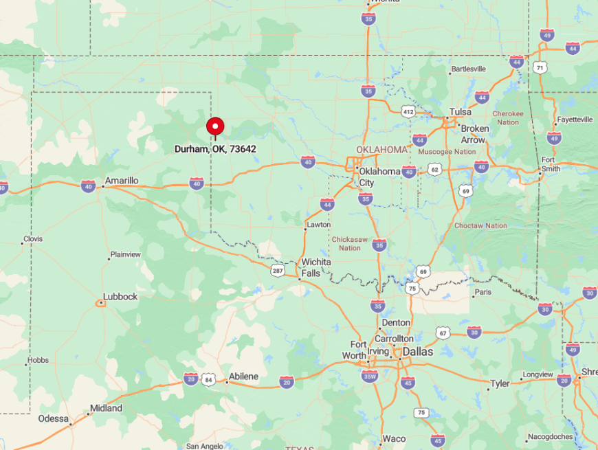
Durham lies twenty-three miles northwest of Cheyenne, accessible via winding State Highway 30 that drops and climbs through river breaks. The final five miles follow a narrow, shoulder-less ribbon that discourages large vehicles, adding to its isolation.
Travelers should fuel in Cheyenne, as no services exist beyond a vending-machine-only rest stop. Once the pavement ends, red dirt roads wind toward ranch gates and canyon overlooks with no traffic for hours.
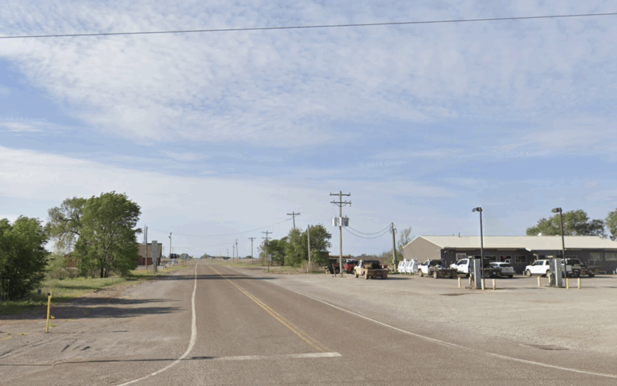
2. Crawford, Roger Mills County
Crawford hosts around 110 people and sits in a bowl of red-sandstone hills speckled with sagebrush and roaming pronghorn. Residents spend free time horseback riding sage flats, exploring petroglyphs etched into hidden canyon walls, and holding Friday fish-fry nights at a converted granary.
Primary incomes come from cow-calf herds, small oil royalties, and a growing market for hedge-post fencing cut from native bois d’arc trees. The town remains secluded due to half the surrounding landscape being raw grassland held in large ranch parcels, with only gravel roads linking to the outside world.
A seldom-visited gem is the natural amphitheater on the north ridge, where acoustic echoes make a lone guitar sound like a concert. Sunsets here splash crimson across stone cliffs, a scene shared mostly with coyotes.
Where is Crawford?
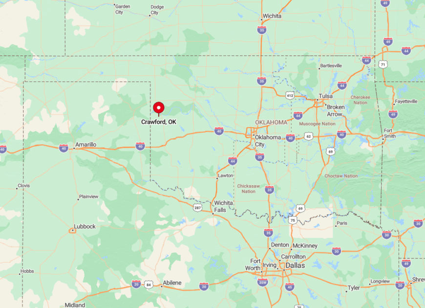
Situated fourteen miles north of Cheyenne, Crawford is reached by turning west off U.S. 283 onto a succession of graded roads that narrow as hills rise. Lack of marked intersections and cell dead zones keep unprepared visitors circling more than once.
The nearest pavement ends five miles short, ensuring dust plumes are the primary traffic sign. Ranch mailboxes line the approach, guiding the final stretch into town.
1. Sweetwater, Beckham County
Sweetwater’s census count rarely tops 100, yet its name suits the cottonwood-lined creek meandering past pasture and pumpjack. Residents fish for channel catfish beneath the low bridge, swing by the two-room school for Friday basketball, and chase spring turkey in mesquite thickets.
Ranching pairs with small-scale oil production to anchor the local economy, while a single general store doubles as café, feed shop, and gossip hub. Seclusion comes from mile-wide lot lines, the absence of any incorporated neighbor for twenty minutes, and a landscape so flat one can watch storms roll in an hour away.
Hidden nearby is Dead Horse Lake, a shallow prairie pothole brimming with migrating pintails each fall—locals guard the location closely. Prairie sunsets here blaze orange behind silhouetted pumpjacks, ending days in perfect stillness.
Where is Sweetwater?
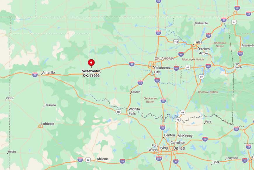
Sweetwater sits on State Highway 30 near the Texas border, thirty miles southwest of Elk City. Surrounding open range means headlights are visible for miles, underlining its isolation.
Travelers typically exit Interstate 40 at Sayre, then drive south through rolling wheat fields before angling west on SH-30. With no stoplights and few farmsteads, the last ten miles feel like a private road to the edge of Oklahoma’s quietest corner.


