🔥 Would you like to save this?
The quiet side of New Mexico hides west of the Rio Grande, where dusty two-lanes cross volcano flats and pine-shaded canyons before ending in small places that barely appear on state maps. Our team picked 25 of these outposts that still feel cut off from the modern rush, each offering distinctive landscapes and simple living.
Old mining hamlets cling to cliffs, ranch towns sprawl across endless grassland, and alpine villages sit beneath snow-dusted peaks. Photographers find unspoiled vistas, history buffs uncover layered stories, and anyone needing true silence will find it after dark.
In order to come up with the very specific design ideas, we create most designs with the assistance of state-of-the-art AI interior design software.
Below is a countdown of Western New Mexico’s most secluded communities, paired with practical notes for those eager to visit or even put down roots. Pack extra water, check the weather, and enjoy the long stretch of empty road between them.
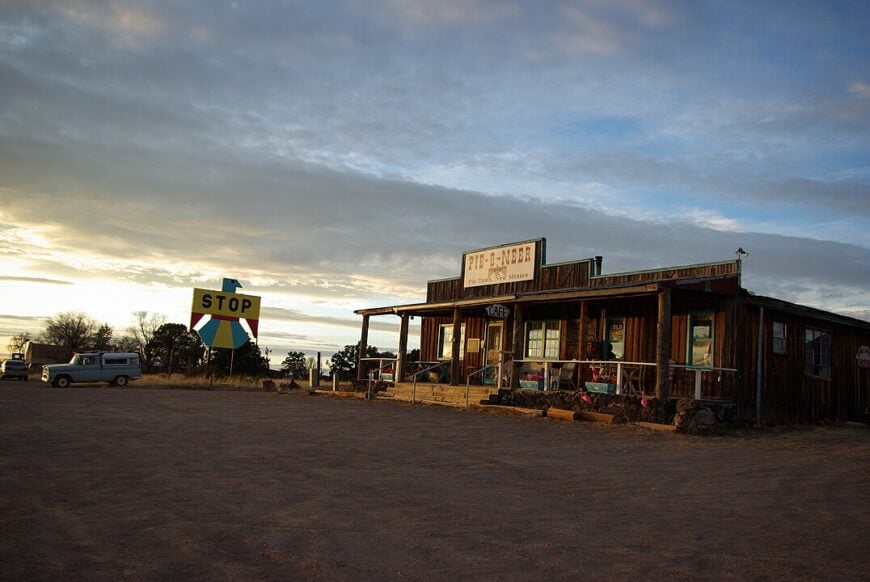
25. Datil – Trailhead to Sky and Lava
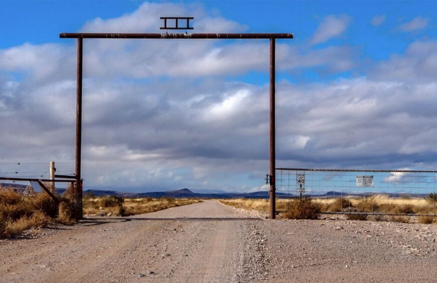
Datil sits high and wind-bright on the Plains of San Agustín, a crossroads where the air smells of piñon and rain on dust. Its seclusion comes from distance—hours of two-lane in any direction and a horizon that never hurries closer.
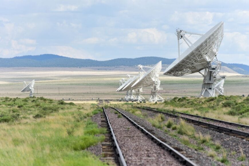
The vibe is ranch-honest and sky-obsessed: pickup beds, porch thermoses, and neighbors who track weather like a second language. Hike the Datil Well Recreation Area, watch pronghorn skim the grasslands, or steer west to the Very Large Array’s white dishes gleaming like moons. Stop for green chile at the café and browse a rack of handmade spurs at the mercantile.
Work here is cattle, road crews, and a little wayfaring trade. Stay past sunset and the stars stack like campfire embers—it’s the kind of place that reminds you how quiet the world can be.
Where is Datil?
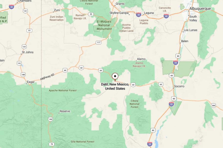
Datil lies in eastern Catron County along U.S. 60, about 60 miles west of Socorro. You reach it by a broad, empty highway that slips between volcanic knolls and far-off mountain rims.
The nearest big-box anything is a long drive away, which keeps the nights dark and the days unhurried. It’s close enough for a weekend, far enough to feel dropped into a bigger sky.
24. Quemado – Windmills and a Blue Lake Down the Road

Quemado keeps its shoulders loose—one main street, a school, and a ring of windmills talking to the breeze. Seclusion comes easy when you’re a dot on U.S. 60 with national forest on three sides and long gaps between neighbors.
The town’s mood is friendly and practical: coffee at daybreak, feed-store chatter, and kids kicking dust down by the diamond. Fish or paddle at Quemado Lake, wander the forest roads for elk sign, browse local lapidary work, or time a visit for a small-town festival.
Cattle and a few shops anchor the economy, with outfitters busy come hunting season. Afternoons smell like juniper and summer thunder. If you like your quiet with a horizon, Quemado wears it well.
Where is Quemado?

Set in west-central Catron County, Quemado sits on U.S. 60 about 20 miles east of the Arizona line. The lake is 18 miles south via NM-32 and a winding forest spur.
Cell service thins as the pavement narrows, and the mesas shoulder out the interstate’s hurry. By the time you reach town, the clock has already slowed.
23. Aragon – River Bend on NM-12

Aragon is a sleepy bend on the Tularosa River where cottonwoods throw big shade and dogs nap in the road. Its remoteness comes from being tucked between mountain shoulders on a highway that’s beautiful but never busy.
The vibe is old-time rural: tidy fences, a clapboard church, and smoke from woodstoves in shoulder seasons. Cast for trout in pocket water, roam forest trails toward the Mogollon Rim, poke around historic homestead sites, or watch elk ghost across hay meadows at dusk.
Ranching and Forest Service work pay most of the bills. Even the mail feels unhurried here. You’ll catch yourself whispering just to match the river’s pace.
Where is Aragon?

Aragon sits along NM-12 in Catron County, roughly 20 miles east of Reserve. Getting there means committing to a curvy two-lane through high meadows and timber.
Tall ridges block signals and any sense of rush. It’s the kind of detour that feels like a reward.
22. Apache Creek – Meadows at the Edge of Wilderness

Apache Creek spreads wide where two valleys meet, a handful of homes stitched together by pasture and sky. Seclusion comes from distance to services and from the protective ring of the Gila’s forested hills.
The feel is soft-spoken—wind in grass, tin roofs ticking cool at night, and the occasional sandhill crane overhead in season. Picnic at Apache Creek Campground, follow deer trails into ponderosa groves, scout petroglyphs with care, or stargaze from a tailgate.
Cattle work and seasonal guiding make up much of the livelihood. Mornings are made for coffee, steam, and meadow fog. The quiet has weight here, in the best way.
Where is Apache Creek?

Find Apache Creek on NM-12 about 7 miles west of Aragon and 12 miles east of Reserve. The approach winds through open range posted with cattle guards and a few mailboxes.
With no services beyond a small store, planning is part of the journey. When the mountains close around you, you’ll know you’ve arrived.
21. Cruzville – A String of Porches in Elk Country

Cruzville is little more than a string of porches, a post box, and gardens tended against the treeline. Its tucked-away feel comes from being the last neighborhood before the road dissolves into the national forest.
The vibe is neighborly and plainspoken—dogs greet you before people do, and everyone waves. Walk the quiet lanes at dawn, glass the hills for elk, fish small beaver ponds, or drive a dirt spur until the map turns green.
Ranching, woodcutting, and school commutes to the Reserve set the rhythm. Even the wind seems polite here. You stay for the views and leave missing the hush.
Where is Cruzville?

Cruzville lies just north of Reserve off NM-12 in Catron County. Short gravel spurs connect homes to the highway, then fade into timber.
The surrounding peaks screen out cell towers and city glow. It’s a pocket of quiet, only a few minutes—and a world—removed from town.
20. Alma – San Francisco River Stop with Big-Backyard Canyons

Alma perches along U.S. 180 where the San Francisco River slips past cottonwoods. Its seclusion shows in the long gaps between porch lights and the way canyon walls steal the last bars from your phone.
The mood is sun-faded and welcoming: a church bell, a small store, and horses flicking tails in a roadside corral. Walk the riverbank, day-hike toward the Mogollon Mountains, hunt wildflowers along ranch roads, or detour to Cooney’s Tomb and the Catwalk area.
Ranching and seasonal tourism gently buoy the place. Evening light turns the cliffs copper and the river to glass. It’s the pause button you didn’t know you needed.
Where is Alma?

Alma sits in northern Catron County on U.S. 180, about 5 miles north of Glenwood. The highway threads a narrow valley with limited pullouts and big views.
Services are sparse; the next gas can be a county away. The farther you drive, the easier your breathing gets.
19. Pleasanton – Orchard Lawns and River Murmur

🔥 Would you like to save this?
Pleasanton gathers along shady lanes near the San Francisco River, a green surprise after miles of rust and tan. Isolation comes from the enclosing hills and the lack of any reason to pass through unless you mean to.
The vibe is pastoral: orchard lawns, low adobe, and irrigation water whispering through ditches. Fish riffles at first light, pedal a gravel bike between hayfields, visit the small cemetery with pioneer headstones, or watch monsoon clouds build over Mogollon Baldy.
Work is ranching and a little hospitality. Nights are clearer than you’ll expect. The quiet folds around you like a quilt.
Where is Pleasanton?

Just south of Glenwood in Catron County, Pleasanton lies a short jog off U.S. 180. The access is a patchwork of paved and gravel lanes shaded by old trees.
With the Blue Range to the west and the Mogollon high country to the east, it’s naturally tucked away. You’ll hear the river before you meet a crowd.
18. Mimbres – Long Valley of Gardens and Ghost Stories

Mimbres stretches up a long green valley, homes tucked between acequias and cottonwoods. Its seclusion stems from being a parallel world to the interstate—close on a map, but a slow hour by winding road.
The mood is homestead-old and artist-new: roadside farm stands, adobe ovens, and studios tucked behind garden gates. Visit the Mimbres Culture Heritage Site, bird along the river, drive NM-35 toward the Gila Cliff Dwellings, or savor chile at a family café.
Small farms, crafts, and park work keep the calendar full enough. When dusk gathers under the trees, the valley seems to hum. It’s a gentle kind of hidden.
Where is Mimbres?

Mimbres sits in Grant County, northeast of Silver City, strung along NM-35. The route climbs and curls through foothills, discouraging hurry.
The Black Range and Gila Wilderness wall off shortcuts from the east and north. It’s reachable—and purposefully out of the way.
17. Gila – River Bend with Wild Country Out the Back Door

Gila keeps to the slow bend of its namesake river: gravel lanes, long porches, and fields stitched with cottonwoods. Seclusion here is geographic and chosen, buffered by wild canyons and a river corridor that meanders more than it moves.
The vibe is agrarian with an outlaw streak—farm stands, tack sheds, and neighbors who fix what breaks. Paddle calm reaches in season, walk the bosque for vermilion flycatchers, loop north to Gila Hot Springs, or head west to the Lower Box for desert vistas.
Farming and a few outfitters shape the workweek. Nights are cricket-loud and starlit. You come for the river and stay for the peace.
Where is Gila?

Gila lies northwest of Silver City in Grant County, about 30 minutes via U.S. 180 and NM-211/153. The last miles narrow to two lanes beneath trees, then give way to farm road pace.
With canyon country hemming things in, detours take time. That delay is exactly the point.
16. Buckhorn – Gate to the High Lonesome

Buckhorn is a crossroads with a good café, a post office, and miles of quiet in all directions. Its off-grid feeling comes from big spacing between ranches and a map full of green and brown instead of exits.
The mood is friendly and spare—coffee mugs, dusty boots, and a bulletin board that actually matters. Drive to the Mangas Mountains for glassing, roll south toward the Burro Mountains on dirt, fish the Gila River near Cliff, or linger over pie in town.
Ranching and road crews hold down most jobs. Afternoon wind rattles the yucca stalks like chimes. You’ll remember the room the land gives you.
Where is Buckhorn?

Find Buckhorn in Grant County, just west of Cliff, reached via U.S. 180 and NM-211. The approach trades highway speed for valley curves and open pasture.
Services thin quickly beyond town, reinforcing the quiet. By the time the café sign appears, you’ve left hurriedly behind.
15. Chloride – Silver-Era Main Street in the Pinyon

Chloride is a living ghost town, one tidy main street of false fronts held together by care and mountain air. Seclusion springs from its cul-de-sac location off NM-52 and the pinyon-juniper hills that cradle it.
The feel is museum-meets-porch: the Pioneer Store Museum, hand-lettered signs, and locals swapping stories under shade. Tour the restored mercantile, wander the smelter ruins, hike Chloride Canyon for petroglyphs, or picnic where Percha Creek runs narrow and cold.
A blend of heritage tourism and ranch life keeps the lights on. Even the shadows seem to linger here. It’s history you can hear in your footsteps.
Where is Chloride?

Chloride sits in Sierra County, 2 miles south of Winston and about 35 miles northwest of Truth or Consequences. You reach it via NM-52, a two-lane ribbon that leaves the river corridor and climbs into quiet hills.
With no pass-through traffic, road noise dies fast. The last turn feels like stepping backstage.
14. Kingston – Black Range Balcony

Kingston climbs a narrow canyon above Percha Creek, stone and adobe tucked into sycamore shade. Its isolation comes courtesy of the Black Range—steep, switchbacking NM-152 and winter storms that close the pass.
The vibe is bohemian-miner: small inns, a historic hall, and trailheads that begin practically at the back door. Walk the creek to old mill sites, climb to viewpoints above the switchbacks, visit the historic churches, or day-trip to Emory Pass for big-shouldered panoramas.
Residents juggle hospitality, art, and forestry work. On still nights, you can hear water and wingbeats. The place feels like a perch above the world.
Where is Kingston?

Kingston sits in Sierra County along NM-152, 9 miles west of Hillsboro and 40 miles from Truth or Consequences. The highway narrows to canyon curves and gains altitude quickly.
Snow and monsoon washouts sometimes pause travel, which is part of its seclusion. When the pines close in, so does the quiet.
13. Hillsboro – Adobe, Orchards, and a Canyon Road
🔥 Would you like to save this?
Hillsboro steadies itself along a cottonwood corridor, adobe walls glowing peach at sunset. Its tucked-away nature comes from the twisting approach on NM-152 and the fact that the interstate chose another valley.
The vibe is artsy-miner: galleries in old storefronts, porch pickin’ on weekends, and a café that knows your order by day two. Visit the Black Range Museum, stroll Percha Creek, hunt agates after rains, or loop to Lake Valley ghost town for a dusty history lesson.
Retirees, artists, and service jobs to travelers keep Main Street humming lightly. After dark, the town falls back to creek-talk. It’s a gentle refuge with a long memory.
Where is Hillsboro?

Hillsboro lies 17 miles west of I-25 via NM-152 in Sierra County, roughly 35 minutes from Truth or Consequences. The highway climbs out of the Rio Grande valley and slips into the Black Range’s first folds.
Big trucks avoid the grades, leaving the road to locals and wanderers. The final miles feel like a deliberate step off the main map.
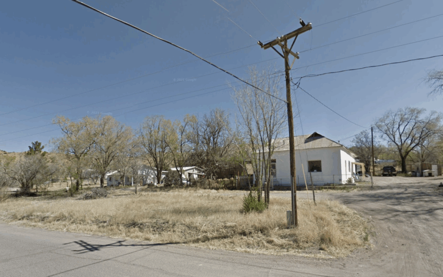
12. Winston – Wide Streets, Big Sky

Winston feels like a Western set left standing after the crew went home—wide streets, tidy false fronts, and not much hurry. Its remoteness is geographic and historic, set far from interstates and ringed by open range and national forest.
The mood is independent but neighborly: a solid café, a feed store, and a community hall that still matters. Drive NM-52 toward Chokecherry Canyon, roam the foothills of the San Mateo Mountains, picnic at nearby Chloride, or watch pronghorn on the flats.
Ranching and a trickle of heritage tourism keep the lights warm. When evening drops, the sky turns cathedral-black. You’ll hear your own footsteps and like it.
Where is Winston?
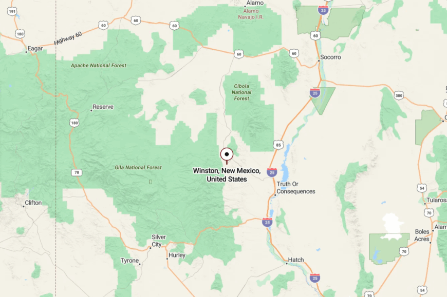
Winston sits in Sierra County, about 35 miles northwest of Truth or Consequences via NM-52. The road leaves the Rio Grande corridor and sails into unbroken country.
Services thin quickly, and the landscape opens even more. By arrival, the day has slowed to Winston’s speed.
11. Monticello – Orcharded Plaza and a Box Canyon

Monticello hides behind a bend, a plaza of old adobes shaded by fruit trees and watered by acequias. Its seclusion is structural—the road passes through a narrow box canyon and simply stops beyond town.
The vibe is timeless and agricultural: apricot-sweet air in June, chili ristras in fall, and hand-mended gates along stone walls. Walk the historic plaza, follow the acequia path beneath willows, drive into Monticello Canyon’s striped walls, or visit tiny chapels that anchor the valley.
Small farms and occasional B&B stays keep the place tended. The hush here feels curated by generations. It’s close to everything you need and far from everything you don’t.
Where is Monticello?

Monticello lies northwest of Truth or Consequences in Sierra County, about 30 miles via NM-52 and County Road A013. The last miles narrow into a canyon that blocks both wind and wanderers.
There’s no through route; the road ends at the village and folds back on itself. That turnaround is the secret to its quiet.
10. Mogollon – A Cliffside Ghost Hamlet Hidden in the Gila

Mogollon has an on-and-off population that rarely tops 20 full-time residents. Visitors wander its boardwalk to examine weathered wooden storefronts and the shuttered Silver Creek Mill. The area offers high-country hikes, ghost-town photography, and summer melodramas staged in the 100-year-old theater.
Mining heritage tourism and a small seasonal café provide the few local jobs that remain. Encased by sheer canyon walls and ponderosa pines, the hamlet sits more than 13 miles up a one-lane mountain road without cell service. Those rugged elements help keep Mogollon feeling like a film set frozen in 1910.
Where is Mogollon?

Mogollon lies in Catron County on the western flank of the Mogollon Mountains within the Gila region of southwest New Mexico. The town sits more than an hour from the closest gas pump, and the surrounding 9,000-foot peaks block most radio signals, reinforcing its isolation.
Drivers reach it by turning north on New Mexico 159 from U.S. 180 at Glenwood and climbing a steep, winding gravel grade. During snowy months the road is officially closed, so summer and early fall are the safest times to make the journey.
9. Pie Town – High-Desert Wide-Open Spaces (and Famous Pie)

Pie Town counts roughly 180 residents spread along a breezy stretch of U.S. 60 at nearly 8,000 feet. The famous cafés serve dozens of homemade pies, while nearby El Malpais lava fields and the Very Large Array radio telescopes invite day trips.
Community events like the September Pie Festival include horned-toad races and a baking contest that draws travelers from several states. Small-scale ranching, highway café work, and artisan crafts make up the limited local economy.
Vast sagebrush plains, distant mountains, and the absence of street lights give the settlement its secluded, big-sky feel. On calm nights the Milky Way stretches horizon to horizon, making stargazing the after-dinner pastime.
Where is Pie Town?

🔥 Would you like to save this?
Pie Town sits in western Catron County about 85 miles west of Socorro. The stretch of U.S. 60 that serves the town crosses open Bureau of Land Management range with few services, adding to the sense of remoteness.
Drivers approaching from Albuquerque pass through long empty valleys before the blue highway signs announcing “Pie Town Next 3 Exits” appear like a punchline. No public bus reaches the community, so arrival is strictly by private car, dual-sport motorcycle, or the occasional long-distance cyclist.
8. Fence Lake – Ranchland Solitude on the Continental Divide

Fence Lake records a population of about 42 residents dispersed across surrounding ranches. Activities center on horseback rides along the Continental Divide Trail, pronghorn spotting at dawn, and evening campfires under endless horizons.
The economy revolves around cattle operations, seasonal hunting guides, and a single feed store that doubles as a post office. With the nearest gas station nearly 40 miles away, supply runs are planned days in advance.
Rolling grasslands broken by lava-rock ridges create both a physical and psychological buffer from modern bustle. Photographers appreciate the solitary roadside chapel whose white stucco glows against stormy skies.
Where is Fence Lake?

Fence Lake rests on State Road 36 in Cibola County near the Continental Divide of the Americas. The settlement is surrounded by unfenced public grazing land and dormant volcano plugs that swallow cellular signals, deepening the seclusion.
To reach it from Grants, travelers head west on NM 53 then south on the lightly trafficked NM 36 through 70 miles of open range. Winter snow or summer monsoon mud can close the last graded roads, so four-wheel drive is advised.
7. Reserve – Forested Enclave at the Edge of the Wilderness

Reserve, the county seat of Catron County, supports roughly 280 inhabitants seated within a forested valley. Visitors fish for trout on the San Francisco River, hike nearby Pueblo Creek Trail, and scan meadows for grazing elk.
Local employment includes Forest Service offices, small motels, and a hardware store that sells everything from chain saws to ice cream. Despite its administrative role, Reserve remains isolated by the 3.3-million-acre Gila National Forest that surrounds it on every side.
Dense ponderosa stands limit sightlines, and night traffic is mostly deer and the occasional logging truck. Such natural barriers foster a calm, frontier atmosphere that rarely changes with the decades.
Where is Reserve?

Reserve lies at the junction of U.S. 180 and NM 12 in far western New Mexico roughly 45 miles east of the Arizona state line. Mountains topping 9,000 feet create a wooded labyrinth that discourages rapid travel in any direction.
The nearest commercial airport is three hours away in Silver City, and no cell tower reaches the valley floor. Most visitors arrive by personal vehicle, though adventurous cyclists sometimes cross the town on the Great Divide Mountain Bike Route.
6. Ramah – Sandstone Mesas and Ancient History in Quiet Country

Ramah claims around 370 residents living between sandstone mesas that glow red at sunset. Day activities include touring El Morro National Monument’s ancient inscriptions, walking the wolf sanctuary, and browsing Navajo rug shops. Agriculture, artisan weaving, and seasonal tourism provide modest income for the community.
Steep bluffs and piñon-juniper forests encircle the settlement, muting outside noise and cell reception alike. Sheep grazing along dirt lanes and the adobe St. Joseph Mission ruin supply postcard moments for those who find the village. Evening silence is broken only by coyotes echoing across the mesa walls.
Where is Ramah?

Ramah sits off State Road 53 in McKinley County about 50 miles south of Gallup. The community is hemmed in by the Zuni Mountains to the north and the vast El Malpais badlands to the east, narrowing travel corridors.
Most travelers exit Interstate 40 at Grants or Gallup and drive an hour along curving two-lane highways. No public transportation serves the area, so private car or a patient thumb on the roadside are the only ways in.
5. Red Hill – Windswept Volcano Fields off the Beaten Path

The scattered ranch outposts of Red Hill support about 25 people across dozens of square miles. Visitors explore cinder-cone craters, search for Apache tears obsidian, and watch dust devils dance across the basalt flats.
Livestock grazing and a seasonal firewood harvest comprise the main economic activity. The settlement sits in treeless high desert between dormant volcanos, leaving nothing to break the sweeping view.
Lack of utilities, minimal signage, and gravel ranch roads reinforce its image as the middle of nowhere. On clear afternoons the San Francisco Peaks in Arizona shimmer 100 miles to the west, underscoring the emptiness.
Where is Red Hill?

Red Hill lies in Catron County just south of U.S. 60 between Quemado and Springerville, Arizona. No store, gas pump, or school marks the spot, and GPS often labels the area simply as “Red Hill Road.”
Reaching it requires a high-clearance vehicle for the final ranch tracks branching off the highway. Summer monsoon washouts can render the area impassable, so travelers watch weather forecasts closely.
4. San Lorenzo – Cottonwood-Lined Oasis in the Mimbres Valley
San Lorenzo counts near 140 residents gathered along the cottonwood-lined banks of the Mimbres River. Attractions include fly fishing for wild trout, visiting the 1890s San Lorenzo Church, and sampling heirloom apples from backyard orchards.
Farming, small-scale art studios, and commuting to Silver City supply most livelihoods. The village’s location below rugged Black Range foothills shields it from cellular towers and highway noise.
Adobe cottages with tin roofs peek through dense foliage, creating a sheltered oasis vibe rare in southern New Mexico. Morning mist rising from irrigated fields adds a hint of magic for early rising photographers.
Where is San Lorenzo?
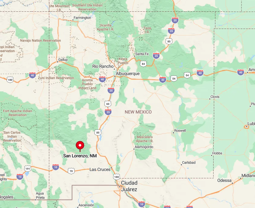
San Lorenzo sits in Grant County along State Road 152 about 25 miles east of Silver City. The approach through narrow Mimbres Valley twists between canyon walls that discourage large vehicles, preserving the settlement’s peace.
Drivers from Interstate 25 crest 8,228-foot Emory Pass before dropping into the valley, a route closed in heavy snowfall. No bus line reaches the community, so travel remains the realm of private cars and local pickup trucks.
3. Glenwood – River Canyons and Hot Springs off Scenic Byway 180

Glenwood has approximately 230 residents nestled beside the San Francisco River on Highway 180. Travelers soak in nearby Heart Bar hot springs, fish for smallmouth bass, and hike the Catwalk, a suspended steel walkway hugging a narrow canyon.
Small lodges, a general store, and outfitting for hunting and rafting form the economic core. Surrounding mesas and wilderness areas block radio towers, letting night skies remain completely dark.
Traffic is so light that bighorn sheep are often seen grazing on the roadside verge. The combination of river canyons and distant infrastructure keeps Glenwood feeling like the last stop on the map.
Where is Glenwood?
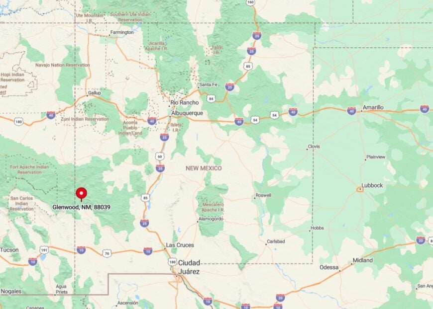
Glenwood stands in Catron County about 65 miles north of Silver City along U.S. 180. Sheer canyon walls to the east and the Blue Range Wilderness to the west isolate the settlement from cross-country routes.
Visitors arrive via the scenic two-lane highway after crossing miles of juniper plains free of cell service. A single private airstrip lies eight miles south for back-country pilots, otherwise access is entirely by road.
2. Bluewater Village – Hidden Lakeside Living Among Sandstone Bluffs

Bluewater Village hosts around 320 residents living in sparsely spaced homes near a tranquil reservoir. Kayaking on Bluewater Lake, watching bald eagles in winter, and hiking among pastel sandstone cliffs top the activity list. Employment rests on state park staffing, seasonal fishing guides, and small ranch operations.
Farmland and public forest buffer the area from Interstate 40 traffic noise despite being only a short distance as the crow flies. The muted atmosphere and mirror-like water offer a retreat that feels thousands of miles from city life. After sundown, only the cry of a great horned owl breaks the silence across the lake.
Where is Bluewater Village?

Bluewater Village lies in Cibola County about 17 miles west of Grants just off State Road 612. Surrounding sandstone bluffs block cellular signals and hide the settlement from the interstate corridor to the south, enhancing seclusion.
Visitors take exit 79 from I-40 then wind north past piñon hills to reach the lake shore community. No public transit operates here, so personal vehicles or the occasional horse trailer are the only means of entry.
1. Luna – Alpine Meadows at New Mexico’s Western Edge

Luna supports roughly 200 residents settled at 7,700 feet in a verdant meadow near the Arizona border. Days fill with fly fishing on the San Francisco River, horseback rides into the Blue Range Primitive Area, and winter cross-country skiing on forest roads.
The small school, a general store, and forestry jobs keep the local economy afloat. Encircling spruce-covered peaks and snowy winters isolate the town for weeks when US 180 closes for drifting snow.
Elk herds graze on the football field at dawn, and night skies blaze with starlight untouched by city glow. These alpine traits lend Luna an almost Swiss charm despite being firmly within New Mexico.
Where is Luna?
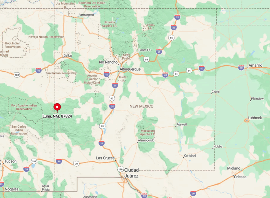
Luna sits in Catron County on U.S. 180 only three miles from the Arizona line. The Black Range to the east and Blue Range to the west create a high mountain pocket that shields it from through traffic.
Travelers drive nearly 70 miles from Springerville, Arizona, or 90 miles from Silver City along curving mountain highways to arrive. Winter closures can leave the town reachable only by snowmobile, emphasizing its end-of-the-road setting.