🔥 Would you like to save this?
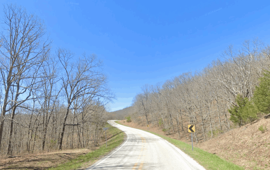
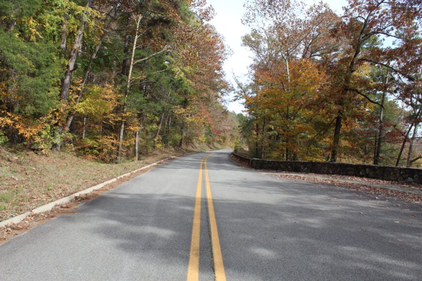
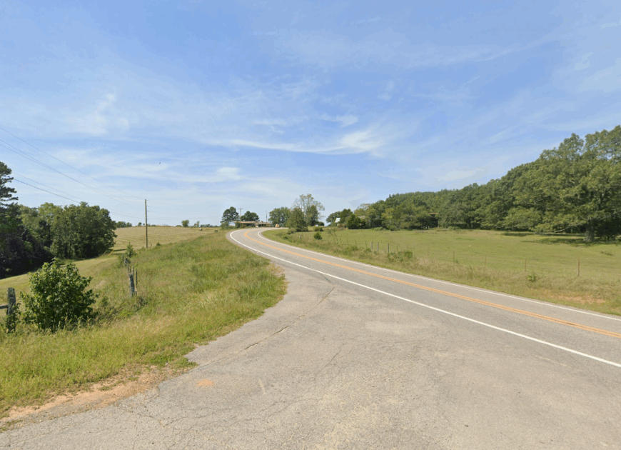
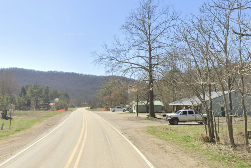
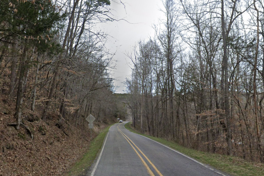
There’s a stretch of Western Arkansas where the roads curve like rivers and the trees never quite give up the sky. You don’t find towns here so much as you arrive at them—accidentally, quietly, with the windows down and the engine cooled. Places like Oark and Kingston aren’t selling a lifestyle; they’re just living one. No curated charm. No curated anything. Just fields left to grow crooked, porches that sag a little in the right kind of way, and general stores that double as post offices, kitchens, and keepers of memory.
The Ozark Highlands shape everything here. They break the wind, reroute the creeks, and keep the cell signal honest. The name “Arkansas” comes from a Siouan word, and “Ozarks” might trace to an old French phrase—aux arcs—“to the arches.” Appropriate, maybe, since these towns arch away from time. In Witter, it’s the quiet that settles first. In Ponca, it’s the river that speaks.
In order to come up with the very specific design ideas, we create most designs with the assistance of state-of-the-art AI interior design software. Also, assume links that take you off the site are affiliate links such as links to Amazon. this means we may earn a commission if you buy something.
You don’t go to these places to be seen. You go because you want the morning to feel earned. Because solitude here is not an escape, it’s the point. So if you’re tracing the backroads of Madison, Newton, or Johnson counties, don’t blink too long. You might just miss the best part.
25. Uniontown: Valley Stillness Beneath the Mountain
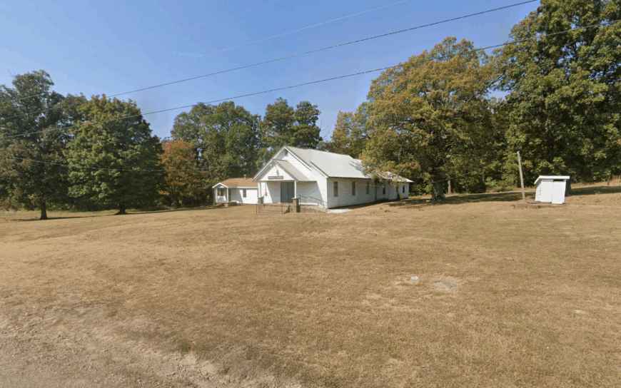
Uniontown is a whisper of a place tucked beneath the shadow of Mount Magazine, where the fields ripple with wind and silence. With fewer than 200 residents, it’s the kind of town you find only when you’re not in a hurry—when you’re watching for hawks or following the curve of a fence line.
It feels cut off not by distance, but by time itself. The roads narrow into gravel, the hills grow steeper, and suddenly, you’re in a world without noise. The post office is quiet, the homes spaced wide, and the natural hush settles in like fog.
Things to do include exploring the Mulberry River, scenic drives through the Boston Mountains, and visiting the nearby Cove Lake Recreation Area. Life here moves slowly—anchored by old farms and the rhythm of the land.
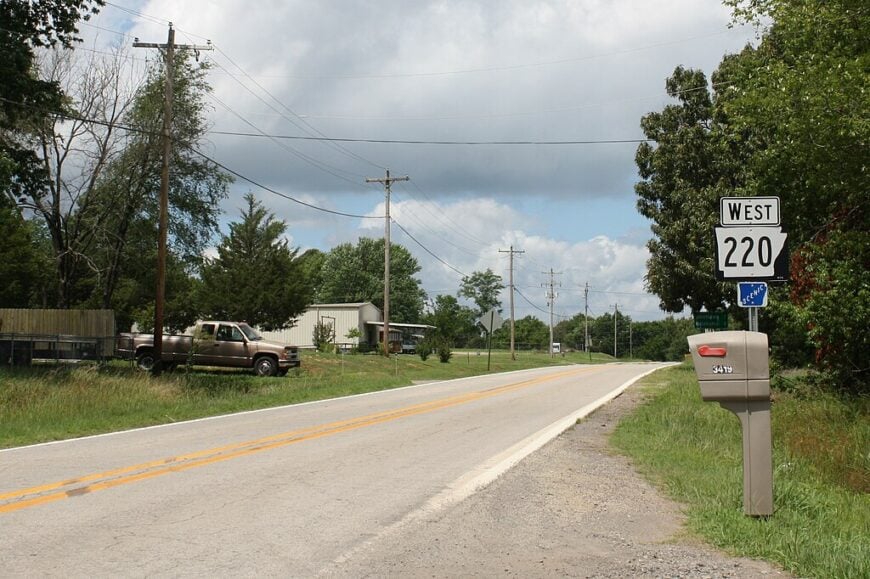
Where is Uniontown?
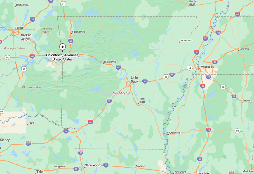
Uniontown sits in western Crawford County, just a few miles from the Oklahoma border. It’s accessed via Highway 220, threading through valleys and dense pinewood.
The route is slow and beautiful—no major highways, just winding roads and long views. That gentle isolation is exactly what makes Uniontown feel so far removed from the rest of the world.
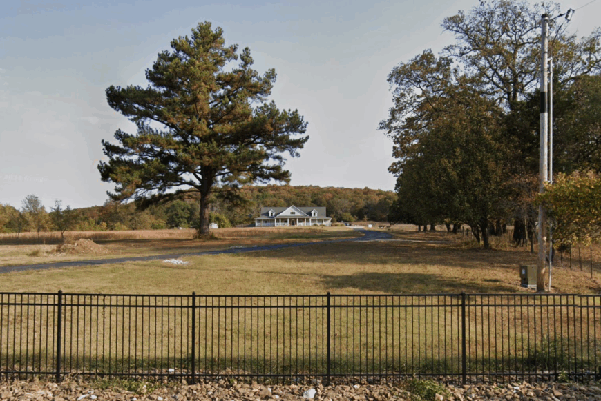
24. Bidville: Where Forest Roads Lead
Bidville is more clearing than town, more echo than buzz. Surrounded on all sides by the Ozark National Forest, it feels like a forgotten settlement hidden between the trees. With just a scattering of homes and ranches, it offers a sense of seclusion that’s more spiritual than geographic.
The roads are unpaved and the pace is unapologetically slow. Here, neighbors might be miles apart, and wild deer outnumber people. The town vibe is rustic and rugged—a little off-grid, a little magical.
You can hike untouched trails, ride horseback under oak canopies, or simply sit and listen to the wind move through leaves. Logging and small-scale agriculture support the locals, but solitude is the town’s true treasure.
Where is Bidville?
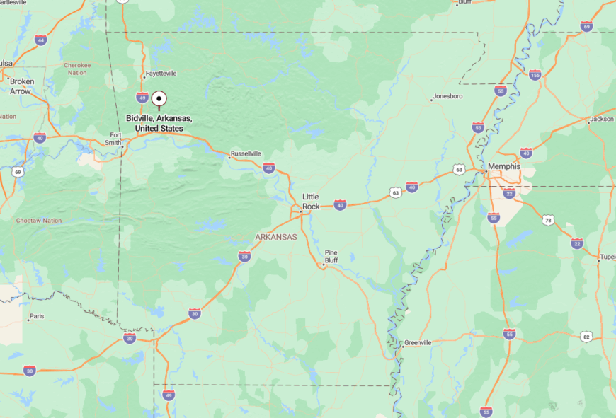
Bidville lies deep in the Ozark National Forest in northeastern Franklin County. To reach it, you’ll follow forest roads that snake up from Cass or down from Boston.
No direct highway leads here—just tree-shrouded gravel paths and old logging routes. That’s what makes Bidville one of Arkansas’s most quietly tucked-away communities.
23. Sulphur City: Ghosts and Green Fields
Sulphur City isn’t really a city—it’s barely a village. Set among the hills of Washington County, its name is grander than its footprint. Time seems to move slower here, as if even the wind forgets to rush.
Its seclusion comes from being bypassed by modern roads and swallowed up by ridgelines. What remains is a quiet crossroads dotted with aging farmhouses, broken fences, and a smattering of barns.
Visitors can wander nearby creeks, explore Civil War relics, or simply breathe in the open country air. Farming once shaped this place—but now, it’s just peace and memory that remain.
Where is Sulphur City?
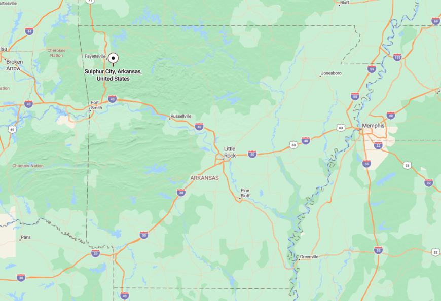
Tucked into eastern Washington County, Sulphur City rests between Fayetteville and Elkins but feels miles further removed. You’ll take backroads from Highway 74, then dip into valleys where cell signal fades.
It’s the kind of place you only reach if you’re looking for stillness—or if you’re lucky enough to get lost.
22. Fallsville: Mist Over the Mountain Pass

Fallsville is a mountaintop whisper, where fog hugs the treetops and gravel roads lead nowhere fast. With fewer than 100 people, this place is more forest than town, perched in the heart of the Ozark Highlands.
Its seclusion stems from elevation and terrain—twisting roads, sharp turns, and endless trees make Fallsville feel wrapped in its own green world. It’s a town you arrive at slowly, thoughtfully, almost reverently.
The nearby Glory Hole Falls and the Buffalo River trails offer quiet outdoor escapes. Locals live simply, often connected to tourism, homesteading, or forest work. But mostly, they live in tune with the wild.
Where is Fallsville?
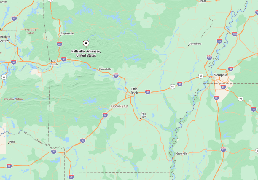
Located in Newton County along Arkansas Highway 21, Fallsville sits atop one of the highest ridges in the region. It’s about 25 miles north of Clarksville, but the drive takes longer than you’d think.
The route is all switchbacks, forest corridors, and bluff views. It’s that difficult approach that makes Fallsville feel so hidden.
21. Boston: Between the Hills and History

Boston is a name that evokes big cities, but this Arkansas version is a quiet crossroad where two-lane roads intersect and then disappear. This old community in Madison County has a sleepy, almost forgotten charm.
The feeling of isolation is tangible here—built not on distance but on disuse. Many buildings are empty, and the few that remain seem held together by memory and time.
Walk the old rail bed, visit the historic Boston Cemetery, or follow the stream-fed hollows into the Ozarks. There’s not much to do in Boston—but that’s exactly the point.
Where is Boston?
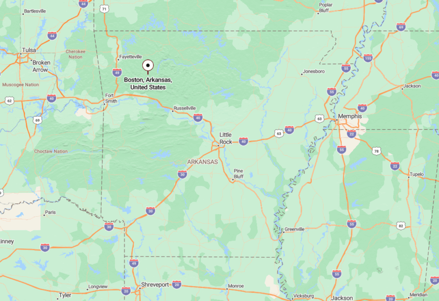
Boston lies off Arkansas Highway 16 in northern Madison County, tucked between Pettigrew and Red Star. The terrain is rugged, and cell service is spotty at best.
Getting here means committing to curves and climbing roads—by the time you arrive, the modern world feels far behind.
20. Red Star: Where the Pines Whisper
Red Star is small even by small-town standards. Just a handful of homes and farms spread across the steep hills of Madison County. It feels more like a mountain hamlet than a proper town.
Seclusion here is a product of elevation and distance. Surrounded by the Ozark National Forest, the town is cocooned by trees, with only narrow roads providing access in or out.
Popular for backcountry hiking, birdwatching, and stargazing, Red Star is a haven for nature lovers. Life here is slow, quiet, and shaped by the seasons.
Where is Red Star?
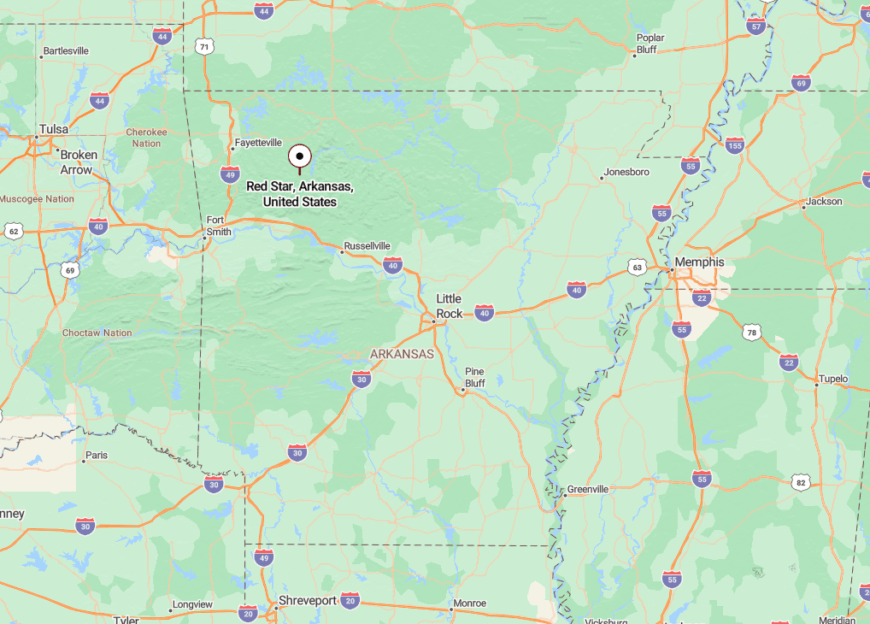
Red Star sits along Highway 16 in north-central Madison County, east of Boston and west of Deer. There’s no gas station, no flashing sign—just a turnoff into the woods.
The remoteness comes not from the map, but from the feeling that you’ve crossed into a place where the forest calls the shots.
19. Cass: Between River and Ridge
🔥 Would you like to save this?
Cass is a blink-and-miss-it kind of place tucked along the Pig Trail Scenic Byway, where the Mulberry River snakes through canyons and the forest leans in close. The air smells like pine and stone, and the only soundtrack is the rush of water and the rustle of leaves.
Its isolation is natural—set deep in the Ozark National Forest and sheltered by steep ridges. The highway bends like a question mark through here, and there are no quick exits or fast lanes, just time slowing down with every mile.
Spend a morning paddling the Mulberry, or wander the trails that start behind the general store. With a scattering of cabins, seasonal lodges, and forest roads, Cass feels more like a gateway to wilderness than a destination itself.
Where is Cass?
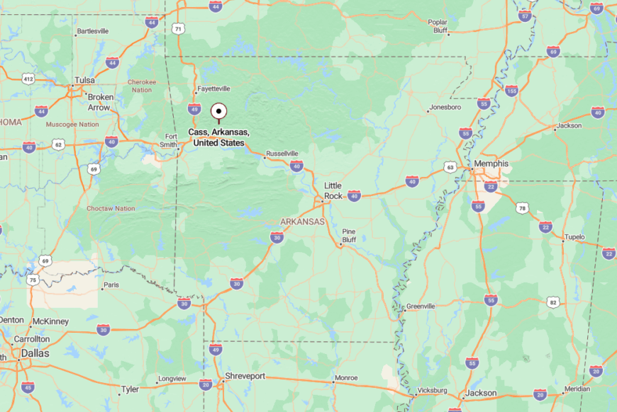
Cass lies in Franklin County along Arkansas Highway 23—better known as the Pig Trail Scenic Byway. It’s about 35 miles north of Ozark and surrounded on all sides by national forest.
The drive there winds through dense woods and over narrow bridges. You don’t just get to Cass—you arrive, the way mist does over mountains.
18. Lurton: Ridge-Top Quiet

Lurton rests on a plateau where wildflowers bloom and hawks soar silently overhead. With just a few homes and a weathered church, it’s a highland settlement that feels more sky than soil.
The town’s remoteness is carved into its bones—surrounded by cliffs and forest, with only a couple of winding roads tracing through. It’s not a place for passing through. It’s a place that stands still.
People here fish, farm, or find comfort in the land. Nearby is the Ozark Highlands Trail and Richland Creek Wilderness, where waterfalls and swimming holes beckon to those who venture off-road.
Where is Lurton?
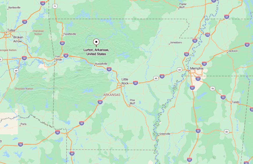
Lurton is tucked into northeastern Newton County, perched along Highway 123 near the edge of the Big Piney Creek valley. It’s about 40 miles from Russellville, but the roads make it feel much farther.
The climb is steep, the trees are thick, and the road narrows until you’re no longer just driving—you’re arriving at somewhere deeply quiet.
17. Nail: A Bend in the Map
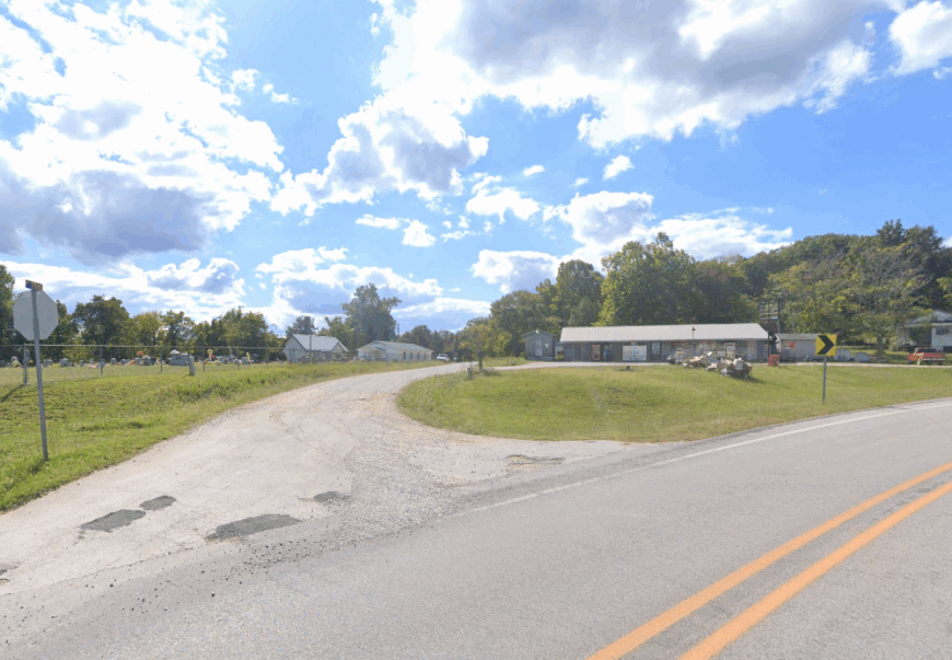
Nail is a small dot on the map—easy to miss, impossible to forget. It sits in a cradle of woods and hills, where mailboxes are handmade and porches sag under the weight of time.
Its secluded nature comes from being nowhere near a major town, and barely near a minor one. The only sign you’ve arrived is the road suddenly quieting, the trees arching inward, and a feeling that the rest of the world has been left behind.
There’s not much to do but listen. Hike into the Ozark backcountry. Watch deer graze through the trees. Let the silence do the talking.
Where is Nail?
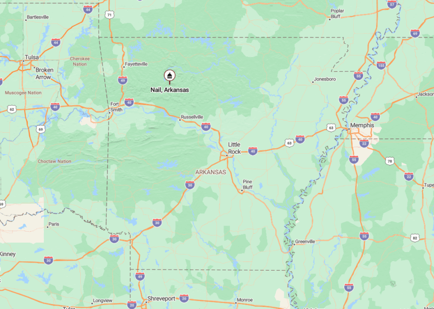
Nail sits in the southern stretch of Newton County, just west of Deer and southeast of Red Star. Reaching it means following Highway 16 until the signs start disappearing.
It’s the kind of place that GPS gives up on. But that’s part of the magic—it exists not in a grid, but in the green folds of the Ozarks.
16. Turner Bend: Riverbend Refuge
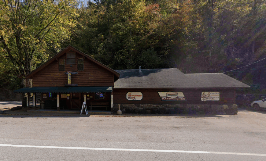
Turner Bend isn’t a town in the traditional sense—it’s more of a landmark where the Mulberry River curves, and a store sits at the heart of a long history of travelers, floaters, and quiet-seekers.
Its isolation is built into the bend of the river and the backdrop of cliffs and forest. With no neighborhoods, no stoplights, and no distractions, it’s a portal into the wilder Arkansas that still holds its breath.
You can rent a kayak, sip a soda on the porch, or hike into the nearby Ozark trails. The general store has been a hub for generations—part outfitter, part gathering place, part relic.
Where is Turner Bend?
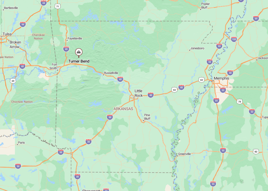
Turner Bend is located along Highway 23 in Franklin County, just south of Cass and nestled beside the Mulberry River. It’s about 30 miles north of Ozark, but there’s little in between but forest and winding road.
It’s easy to miss—but if you’re following the river, you’ll find it when the world gets quiet and the trees grow tall.
15. Harmony: A Bend of Light and Time

Harmony is one of those towns that lives up to its name—not with music, but with stillness. Just a scattering of homes, barns, and pastureland folded into the hills above the Mulberry River, it hums with the quiet rhythm of a place untouched by urgency.
Its seclusion comes not from distance, but from design—tucked off the main roads, shielded by forest and field, and marked only by a modest sign if you happen to notice. There are no shops here, no stoplights, just winding roads and open sky.
You’ll find peaceful drives, hidden trails that dip toward the river, and that particular kind of silence that makes birdsong feel louder. Most folks here work the land, raise cattle, or simply live slow. Harmony doesn’t announce itself—it welcomes you like a whisper.
Where is Harmony?
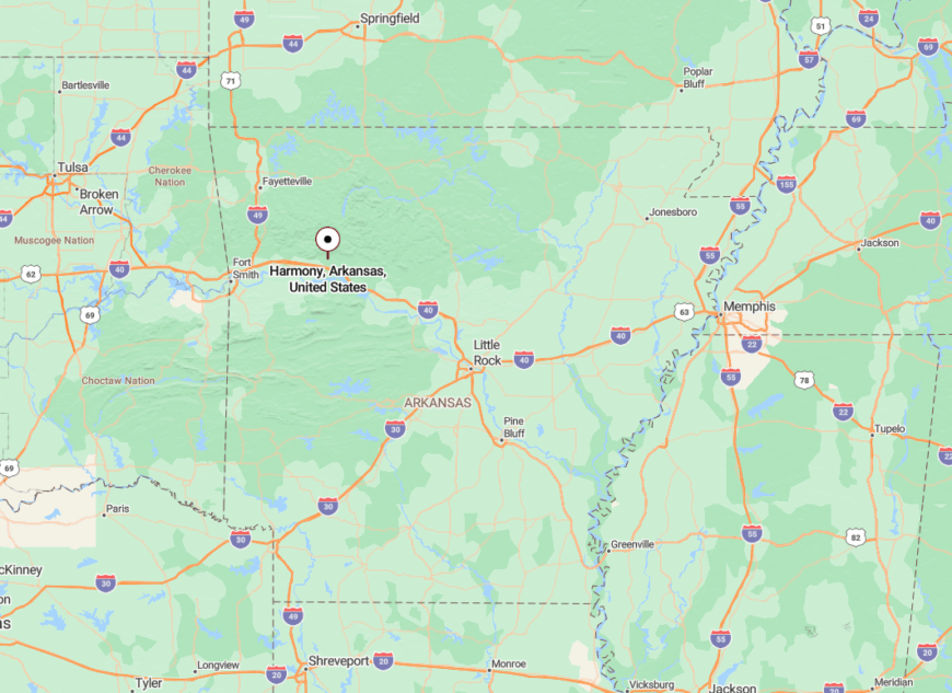
Harmony is located in Johnson County, northwest of Clarksville and just south of the Ozark National Forest. It lies near Highway 103, but you’ll need to follow smaller county roads to find it.
The route winds past hayfields and into tree-lined hills. Once there, the stillness stretches out like a front porch—broad, quiet, and made for staying awhile.
14. Chimes: A Soft Ring in the Hills
Chimes is the kind of place where the road narrows to gravel before you even realize you’ve arrived. The community is small, scattered, and cradled by forest-covered slopes that seem to hush everything around them.
The remoteness is in the geography—miles from major highways, and protected by the steep terrain of the Ozark Plateau. No shops, no signs. Just solitude.
Visitors come for the isolation, the nearby caves, and the whisper of wind through cedar. It’s a hidden place for quiet souls.
Where is Chimes?
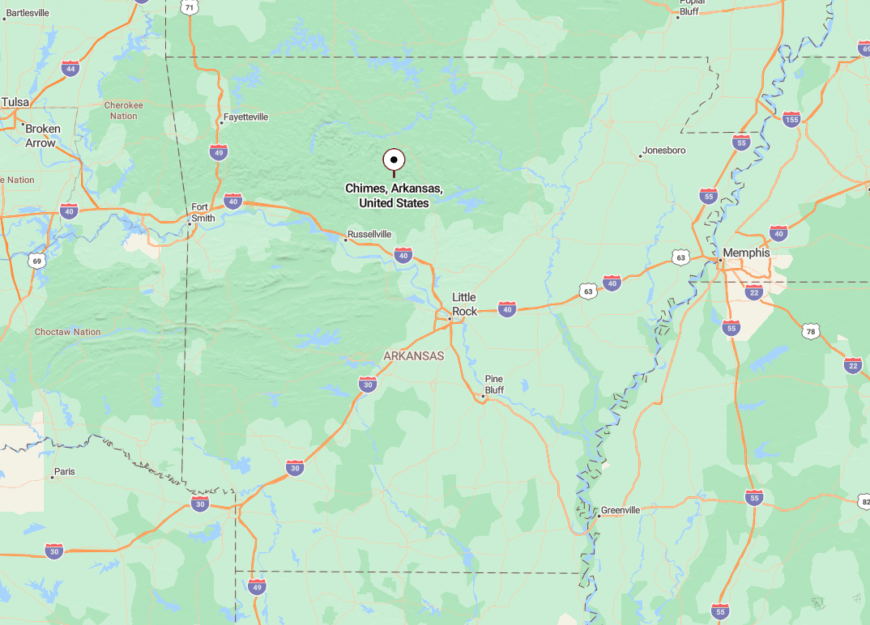
Chimes lies in Searcy County, southeast of Marshall, along a patchwork of gravel roads off Highway 27. It’s about 15 miles from anywhere that sees traffic.
The final stretch winds through thick woods and narrow valleys, giving the sense that you’re not just off the beaten path—you’re where the path ends.
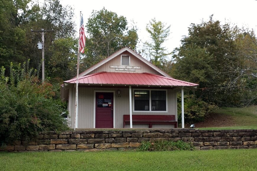
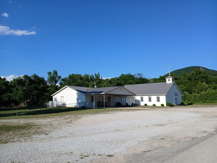
13. St. Paul: The Mist-Laced Edge of the Map
🔥 Would you like to save this?
St. Paul sits quietly at the edge of the Boston Mountains, where the hills break into mist and the streets seem carved out of a slower century. With a population barely over 100, it holds more trees than people, more silence than traffic.
Its sense of seclusion comes from being ringed by forest on all sides, with narrow roads winding out like ribbons from its center. There’s no rush here—just the sound of boots on gravel, roosters in the morning, and the sigh of wind through old pines.
Explore the Ozark Highlands Trail, stop by the tiny town park, or sip coffee at the old-time general store. St. Paul thrives on simplicity, shaped by logging, small farming, and those content with a quieter life.
Where is St. Paul?
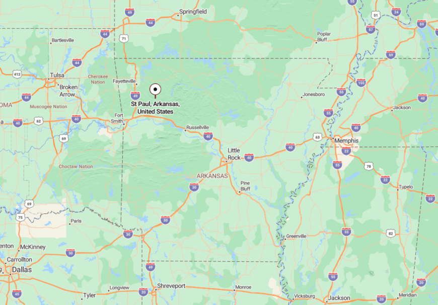
St. Paul is nestled in southern Madison County along Highway 16, about 25 miles east of Huntsville and 15 miles west of Pettigrew. Surrounded by steep ridges and dense forest, the town feels cradled in the hills.
You reach it by way of curving mountain roads that slip in and out of view like forgotten memories. Once you arrive, the quiet settles around you like fog.
12. Parthenon: Postcards from a Time Before
Parthenon has a name that suggests grandeur, but what you’ll find is humbler, sweeter. A single post office. A few porches. The Buffalo River just down the road, moving like memory itself.
Its seclusion comes from being wrapped in the Ozark cliffs, with no major roads leading through. You pass through Jasper, then deeper into the folds of stone and green.
Explore the riverbanks, photograph the bluffs, or just sit and listen to the sound of breeze through sycamore. This place isn’t pretending to be anything. It just is.
Where is Parthenon?
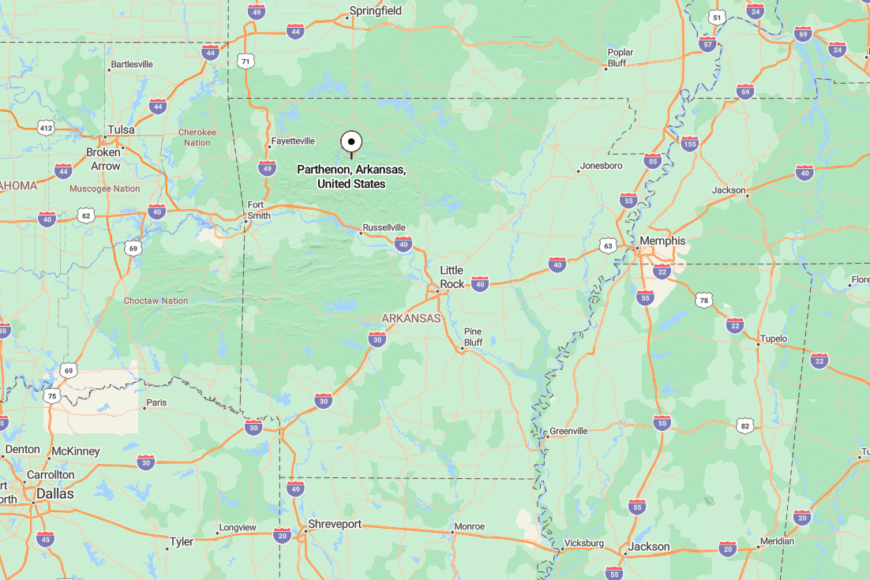
Parthenon is located in Newton County, about 6 miles south of Jasper via a winding stretch of Highway 327. The road in feels like a descent—into quiet, into green, into peace.
By the time you arrive, it’s hard to believe you were ever in a hurry.
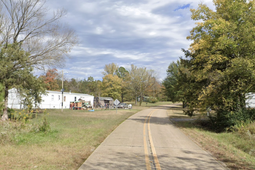
11. Whitener: The Last Light Before Forest
Whitener is a hush in the hills, where trees seem to lean in close and the world grows softer. It’s not on most maps, and even when it is, there’s little to mark its place.
Its seclusion lies in distance from towns and the encircling woods that keep it tucked away. This is a place of gravel roads, spring-fed wells, and the sound of whippoorwills at dusk.
Locals keep to themselves, living off the land or simply with it. Visitors will find no attractions—only peace.
Where is Whitener?
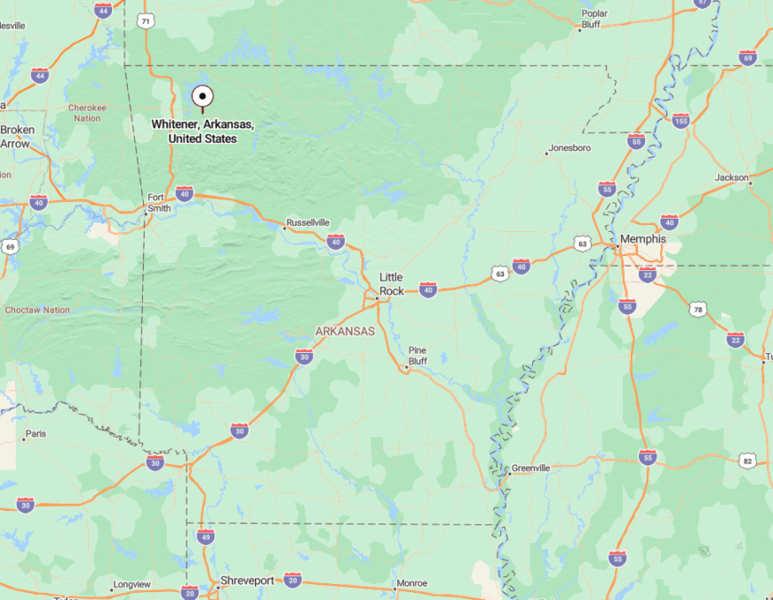
Whitener sits in Madison County, deep in the Ozark National Forest. The easiest way in is through gravel offshoots from Highway 23, though “easy” is relative.
The path narrows until the trees close in. Then, finally, there it is—quiet, content, and nearly invisible.
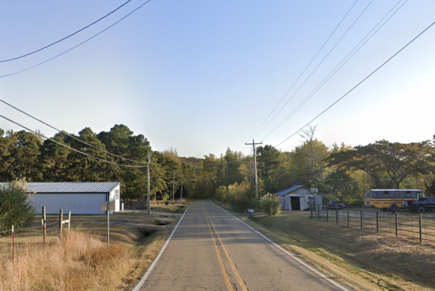
10. New Blaine: Lakeside Peacefulness
New Blaine, with a population of around 170, is a quiet rural community that sits near the shores of Blue Mountain Lake. I love spending time here fishing, boating, and enjoying the serene lake views that are a hallmark of this peaceful area.
The main industries revolve around agriculture and small-scale farming, contributing to its slow-paced lifestyle.
What makes New Blaine truly secluded is its expansive properties bordered by natural beauty, offering residents plenty of space and privacy away from the noise of urban centers.
Where is New Blaine?
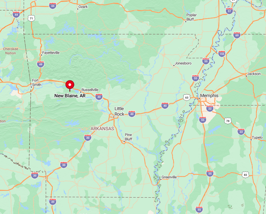
Located in Logan County in western Arkansas, New Blaine is nestled between the Ouachita and Ozark National Forests. Its remote setting is enhanced by the surrounding woodland and the tranquil Blue Mountain Lake, which limit the influx of through traffic.
To get there, I take Highway 22 west from Dardanelle, then head south on Highway 197, enjoying the scenic drive through rolling hills and forested areas.
9. Ozone: High Altitude Seclusion
Ozone, home to approximately 50 residents, is perched atop the Ozark Mountains, offering isolated living with breathtaking vistas. I find myself captivated by the panoramic views and the crisp mountain air whenever I visit.
Outdoor enthusiasts can explore the nearby Ozark National Forest trails, perfect for hiking, biking, and horseback riding. The community thrives on small-scale agriculture and forestry, making it a quiet spot for those who appreciate nature’s tranquility.
Its high elevation and surrounding forests create natural barriers that make it one of the most secluded spots in the region.
Where is Ozone?

🔥 Would you like to save this?
Situated in Johnson County, Ozone is nestled along Arkansas Highway 21 in western Arkansas. Its seclusion is heightened by the winding mountain roads and dense forests that envelop the area.
To reach Ozone, I drive north from Clarksville along Highway 21, ascending into the mountains where the journey itself is part of the adventure. The lack of major highways and minimal traffic make Ozone feel worlds away from the hectic pace of city life.
8. Kingston: Historic Charm Off the Beaten Path
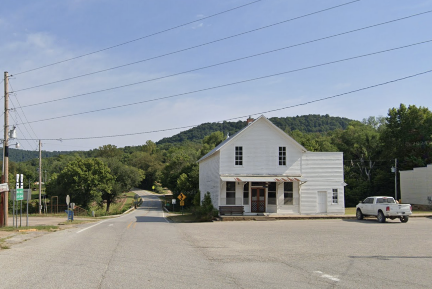
Kingston, with a population of just over 600, is a quaint community that exudes historic charm. I enjoy strolling through the town square, where the vintage buildings tell stories of a bygone era.
Outdoor activities abound, including hiking in the nearby Buffalo National River area and exploring the Kings River. Agriculture and small businesses serve as the main industries here.
Kingston’s seclusion comes from being surrounded by undeveloped land and its location away from main highways, offering a peaceful retreat from urban noise.
Where is Kingston?
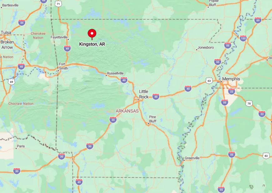
Located in Madison County, Kingston sits at the junction of Arkansas Highways 21 and 74 in western Arkansas. Its off-the-beaten-path location means fewer visitors and a tighter-knit community.
To get there, I often take a scenic drive east from Huntsville along Highway 74, winding through the rolling hills and dense forests that isolate Kingston from larger towns. The tranquil countryside and minimal traffic enhance the sense of seclusion this charming town provides.
7. Witter: Hidden Hillside Haven
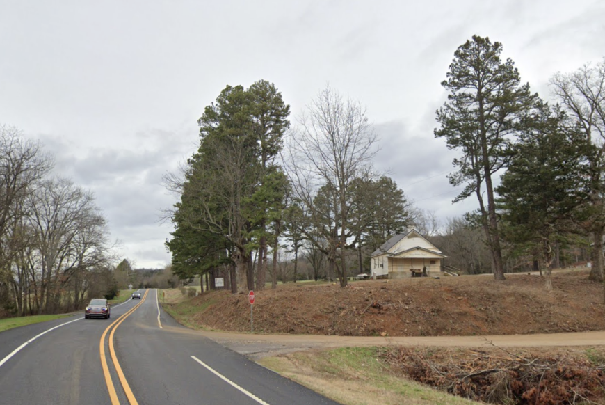
Witter is a tiny unincorporated community with an estimated population of around 200, tucked away in the scenic hills of Madison County. I find peace exploring the expansive acreages and enjoying the quiet environment ideal for a secluded lifestyle.
The area is perfect for outdoor activities like hiking, bird-watching, and simply soaking in the natural surroundings. With no significant industries besides local farming and craftsmanship, Witter offers a simplistic way of life.
Its remote hillside location and limited development make it a true haven for those seeking solitude.
Where is Witter?
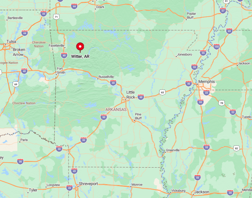
Nestled in the Ozark Mountains of western Arkansas, Witter lies along Highway 23, also known as the Pig Trail Scenic Byway. This area’s seclusion is amplified by the winding mountain roads and dense forests that cloak the region.
Getting to Witter involves a drive through the picturesque Ozark Highlands, usually heading south from Huntsville on Highway 23. The journey through narrow roads and over rolling hills contributes to the feeling of isolation and serenity that defines Witter.
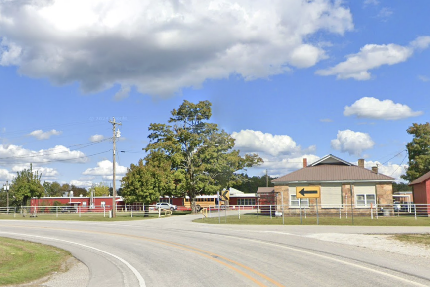
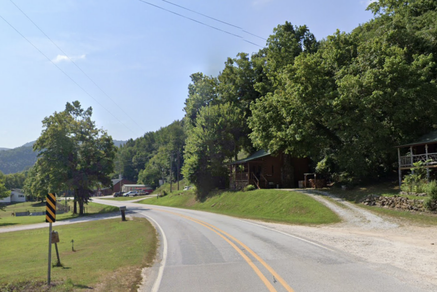
6. Mount Judea: A Quiet Mountain Retreat
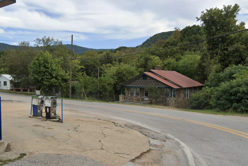
Mount Judea, pronounced “Mount Judy,” is a small community with around 300 residents, nestled in rugged terrain that provides stunning landscapes. I always appreciate the natural beauty here, from the towering bluffs to the clear streams perfect for fishing and picnicking.
Outdoor activities are abundant, including exploring the nearby caves and trails. The main industries are agriculture and small-scale livestock farming.
Mount Judea’s seclusion is due to its surrounding natural barriers and limited access roads, offering privacy and picturesque scenery.
Where is Mount Judea?
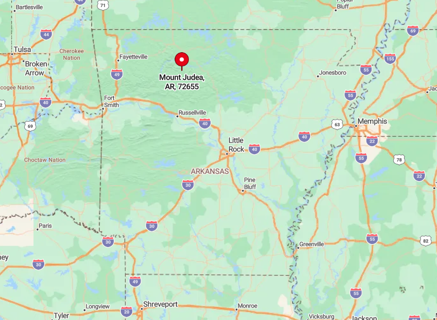
Located in Newton County, Mount Judea sits along Arkansas Highway 123 in western Arkansas. Its secluded nature stems from the winding mountain roads and the Ozark National Forest that envelops it.
To reach Mount Judea, I usually take Highway 7 south from Harrison, then turn onto Highway 123, enjoying the winding roads that lead deeper into the mountains. The remote location and surrounding wilderness make it a peaceful retreat away from the bustle of city life.
5. Deer: Serenity in Newton County
With a population of around 250, Deer is an unincorporated area set amidst the Ozark Mountains, offering a tranquil escape. I enjoy the peaceful atmosphere, where life moves at a slower pace, and the surroundings are dominated by nature.
Outdoor activities include hiking the Ozark Highlands Trail and visiting the nearby waterfalls. Agriculture and forestry are the primary industries, supporting the local economy. Deer’s seclusion is attributed to its large lots and the absence of urban noise, nestled far from major roads and towns.
Where is Deer?

Deer is located in Newton County along Arkansas Highway 16 in western Arkansas. Its remote setting is deep within the Ozark National Forest, enhancing its sense of isolation.
To get there, I often drive south from Jasper along winding roads that cut through dense forests and rolling hills. The journey itself reinforces Deer’s secluded nature, making it an ideal spot for those looking to get away from it all.
4. Ponca: Secluded Beauty by the Buffalo River
Ponca is a small community with a population of fewer than 100 people, known for its proximity to the pristine Buffalo National River. I love visiting Ponca for canoeing, kayaking, and hiking among the towering bluffs and dense woods.
The main industries include tourism related to outdoor recreation and small local businesses. Ponca’s seclusion comes from its location amidst the rugged Ozark terrain and minimal development, providing a peaceful living space close to nature.
Where is Ponca?
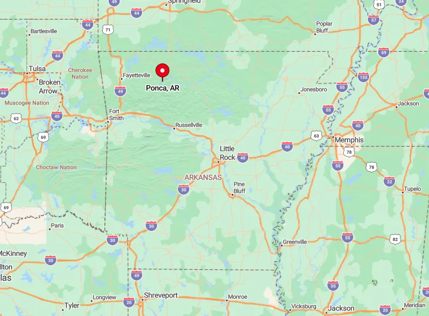
Located in Newton County, Ponca is accessible via Arkansas Highway 43 in western Arkansas. The town’s seclusion is enhanced by the surrounding mountains and the Buffalo River, which limit accessibility.
To reach Ponca, I drive south from Harrison on Highway 43, navigating through winding roads and breathtaking scenery. The limited infrastructure and natural barriers make Ponca a secluded gem for nature enthusiasts.
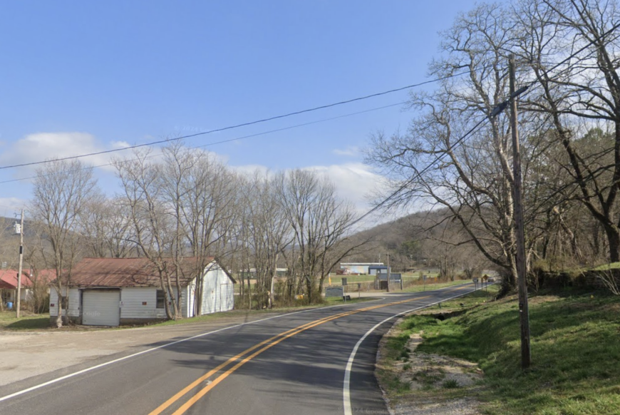
3. Pettigrew: Gateway to Wilderness
Pettigrew is a rural community with an estimated population of around 60, enveloped by forests and mountains that offer untamed natural beauty.
Whenever I’m craving a retreat into untouched nature, Pettigrew is my go-to spot for exploring the Ozark National Forest trails and discovering hidden waterfalls.
The main industries include small-scale agriculture and forestry. Its seclusion is due to being miles away from city life, with vast stretches of wilderness offering a true escape from modern distractions.
Where is Pettigrew?
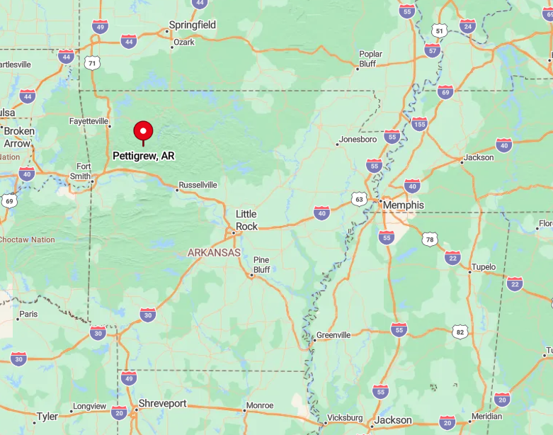
Pettigrew is located in Madison County in western Arkansas, accessible via Arkansas Highway 16. The remoteness of Pettigrew is heightened by its dense forest surroundings and limited connectivity.
To get there, I usually drive east from Huntsville along Highway 16, passing through winding roads that weave through the heart of the Ozarks. The journey into Pettigrew underscores its secluded nature, making it ideal for those seeking solitude.
2. Combs: Tranquility in Madison County
Combs is a peaceful hamlet with a population of about 400, tucked away in the rolling hills of Madison County. I appreciate the serene environment here, perfect for unwinding and enjoying nature.
Activities include exploring the nearby Ozark National Forest trails and fishing in the local streams. The main industries revolve around agriculture and small local businesses.
Combs’ seclusion stems from its expansive lots and its location away from major highways, providing a tranquil setting for those seeking solitude.
Where is Combs?
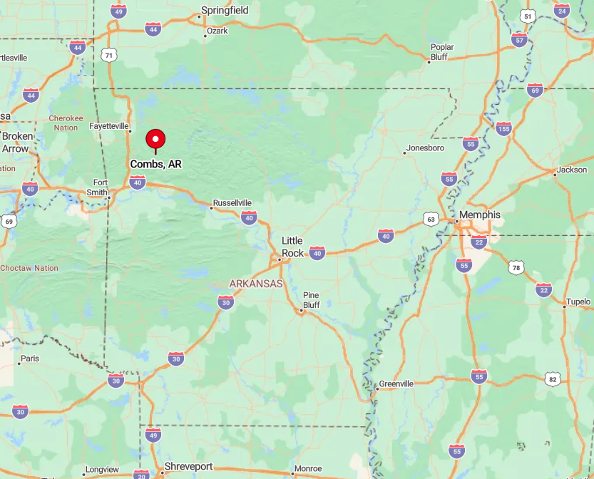
Located in western Arkansas, Combs lies along Arkansas Highway 16 in Madison County. Its secluded nature is due to the surrounding forests and hills that shield it from the outside world.
To reach Combs, I drive east from Fayetteville along Highway 16, enjoying the scenic route through the Ozark Mountains. The lack of heavy traffic and distance from urban centers make Combs a hidden gem for a quiet retreat.
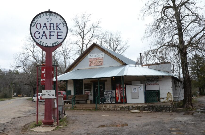
1. Oark: A Hidden Gem in the Ozarks
Oark, an unincorporated community with a population of about 250, is nestled deep within the Ozark National Forest. I find Oark to be a place where time seems to slow down, surrounded by vast acreages and natural beauty.
The historic Oark General Store, the oldest continuously operating store in Arkansas, is a must-visit for its charm and home-cooked meals. The main industries include agriculture and forestry, reflecting the community’s close relationship with the land.
Oark’s seclusion is due to its remote location, far from urban centers, and the enveloping forest that provides a peaceful sanctuary.
Where is Oark?
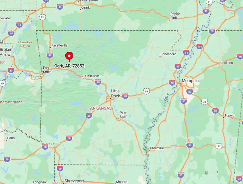
Situated in Johnson County, Oark is accessible via Arkansas Highway 215 in western Arkansas. The town’s seclusion is enhanced by the winding roads and dense Ozark National Forest that surround it.
To get there, I typically take Highway 103 north from Clarksville, then turn onto Highway 215, enjoying the scenic drive along the Mulberry River.
The journey through the forested mountains reinforces Oark’s hidden gem status, making it the perfect destination for those wanting to escape into nature.