Would you like to save this?
West Virginia’s Allegheny Highlands hide a ribbon of tiny settlements where ridgelines outnumber roads and silence still rules the night. Our team gathered ten of the most tucked-away communities, each surrounded by national forest, river bends, or sheer mountains that naturally thin both traffic and population.
These villages prove that seclusion does not mean monotony; trout streams, Civil War sites, and even an enormous radio telescope fill the gaps between chores on the farm. The list counts down from number ten to number one, saving the most isolated spot for last.
Every entry includes a quick sketch of daily life and clear directions for those tempted to visit or relocate. Pack a paper map, because cell bars fade fast in these hills.
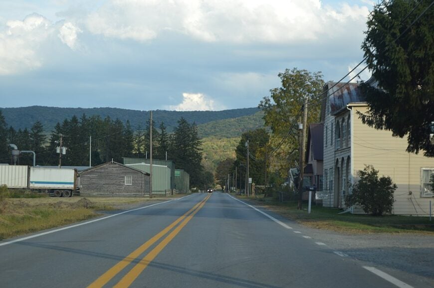
10. Circleville
With fewer than 150 year-round residents, Circleville moves at an unhurried pace beside sweeping loops of the South Branch Potomac River. Anglers wade for smallmouth bass, hikers tackle the nearby High Meadows Trail, and birders scan for bald eagles that nest along the water.
Farm families market grass-fed beef while seasonal outfitters rent kayaks and run shuttles to Spruce Knob. No stoplights, scant cell service, and ridges that wall off outside noise keep the valley hushed after sunset.
Even U.S. Route 33 skirts the edge of town rather than bisecting it, leaving the original village core quiet. That blend of river, farmland, and mountains explains why Circleville still feels worlds apart in the twenty-first century.
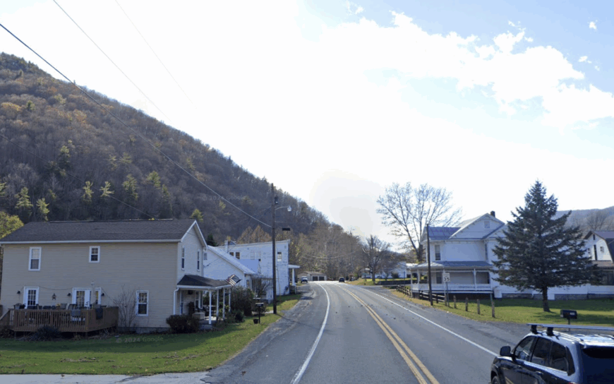
Where is Circleville?
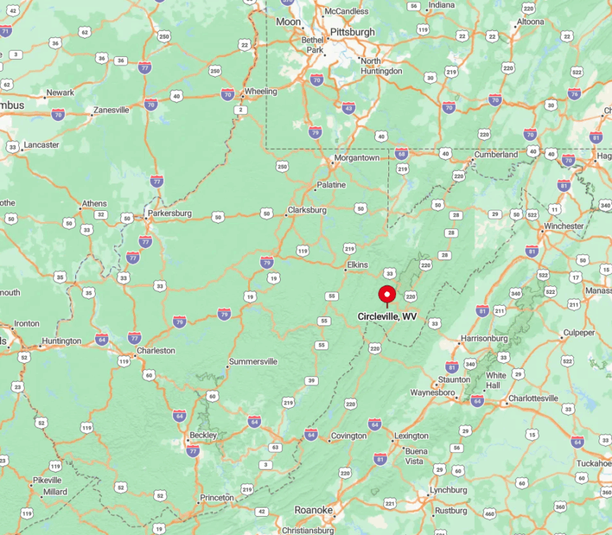
Circleville sits in southern Pendleton County where Route 28/55 meets Route 33, roughly thirty miles east of Elkins. Sheer flanks of North Fork Mountain and Spruce Mountain hem in every approach, limiting growth and radio reception alike.
Drivers thread a series of switchbacks or follow the river’s horseshoe bends to arrive, each turn shedding another bar of cell signal. The closest full-service grocery store lies more than twenty minutes away in Franklin, underscoring the town’s separation.
9. Mingo
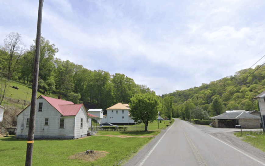
Mingo shelters barely 100 residents at the junction of Seneca Creek and the Dry Fork River, a setting prized by fly-fishers chasing native brook trout. Outdoor plans center on wading the creeks, picking morels in spring, or pedaling the remote Allegheny Trail that slips past town.
A handful of family farms and a small maple-syrup operation supply modest income, while visiting anglers rent the few vacant cabins. Thick forest absorbs road noise, and the nearest gas pump is twelve miles away, giving evenings a true back-country hush.
Electricity reaches every mailbox, yet broadband remains spotty, adding to the off-grid atmosphere. Those who stay year-round cite star-strewn skies and the aroma of woodstoves as daily rewards.
Where is Mingo?
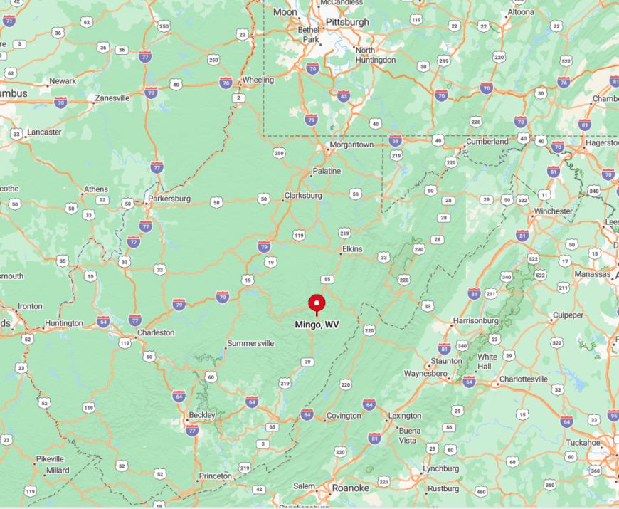
Mingo lurks in a deep Randolph County hollow just off County Route 29, south of the crossroads town of Whitmer. Steep slopes and a single dead-end road make through-traffic nonexistent, protecting its solitude.
Reaching the hamlet requires a careful drive on narrow blacktop that parallels tumbling water nearly the whole way. Visitors coming from Elkins should allow forty-five minutes despite the twenty-mile distance.
8. Upper Tract
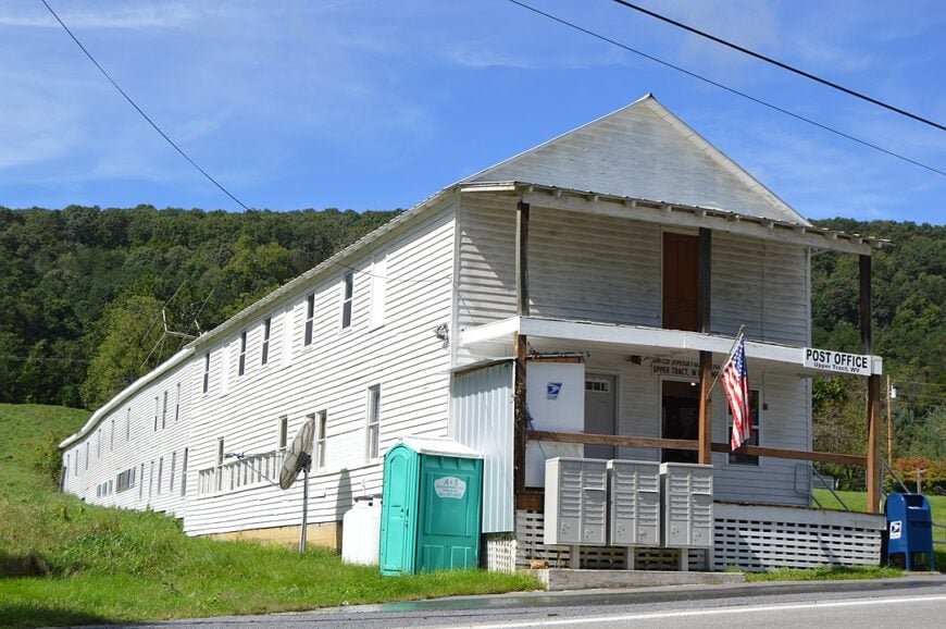
Roughly 350 people claim mailing addresses in Upper Tract, yet homes scatter along the South Branch River so widely that neighbors remain out of earshot. Residents spend weekends spelunking in Smoke Hole Caverns, launching canoes at the public river access, or hunting whitetails on adjacent national-forest land.
Tomatoes, hay, and Angus cattle dominate the local economy, supplemented by a tiny riverside campground. The settlement’s valley is shielded by Cave Mountain to one side and River Knobs to the other, blocking both storms and cellular signals.
With no four-lane highway within twenty miles, tractor engines replace traffic noise as the daily soundtrack. Clear, arid microclimates produce some of the driest weather east of the Mississippi, adding to its uniqueness.
Where is Upper Tract?
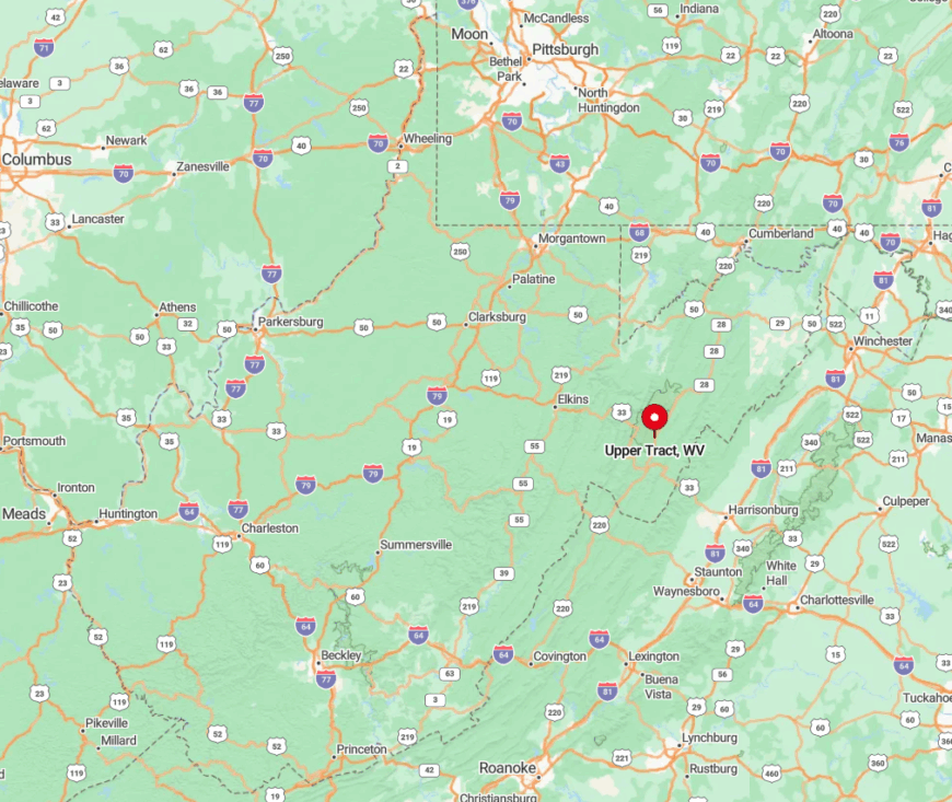
Upper Tract lies along U.S. Route 220 in northern Pendleton County, midway between Franklin and Petersburg. Although the highway follows the river, sheer sandstone walls prevent side roads and commercial sprawl, keeping development low.
Visitors from Harrisonburg, Virginia, cross over 4,000-foot Shenandoah Mountain before descending winding switchbacks into the valley. The nearest interstate interchange is more than an hour away, reinforcing the area’s remoteness.
7. Cabins
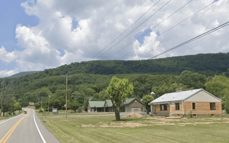
Cabins, named for 18th-century log homes that once dotted the flats, counts about 300 inhabitants spread across fertile bottomland beside the North Fork River.
Summer brings rock climbers to towering Champe Rocks, while autumn hikers trek the unmarked ridge path atop North Fork Mountain for sweeping views few outsiders know.
Small vegetable farms, a native plant nursery, and seasonal guide services form the economic backbone. Sheer cliffs on three sides and the river on the fourth corral sound and slow growth, allowing whip-poor-wills to dominate nightfall.
Mail comes from Petersburg ten miles away, and the lone convenience store closes at dusk. Such natural boundaries explain why Cabins remains easy to miss yet hard to forget.
Where is Cabins?
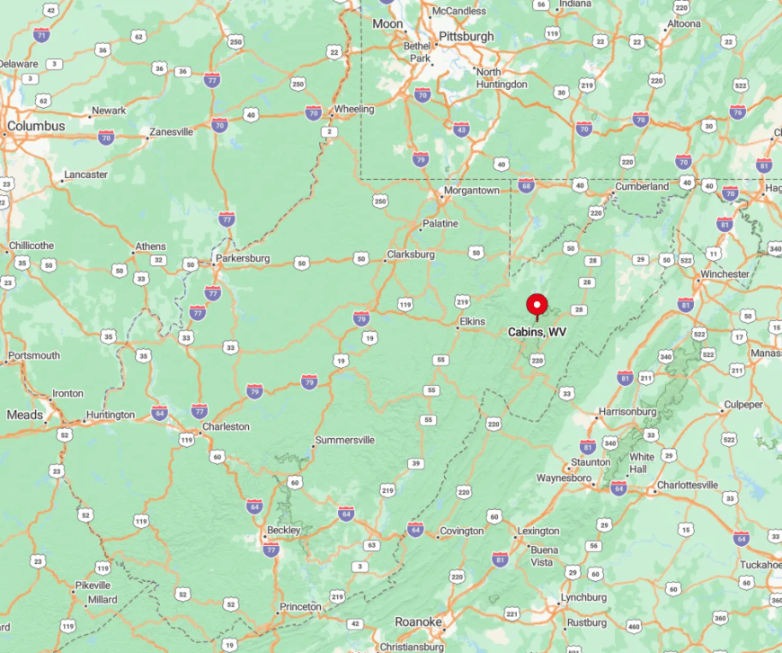
Positioned in Grant County along Route 28, Cabins hides in a notch between sandstone escarpments that rise more than a thousand feet above the river. The road dead-ends into national forest a few miles south, discouraging commuters.
Travelers from Moorefield reach town after twenty minutes of curves shadowed by cliff faces. Public signs are scarce, so first-timers often rely on the wooden post outside the tiny post office to confirm arrival.
6. Bartow
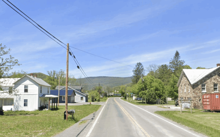
Only about 120 people reside in Bartow, a Pocahontas County crossroads where the Greenbrier River begins its northward journey. History buffs roam the preserved Camp Allegheny earthworks, anglers cast for stocked trout at the river’s headwaters, and cross-country skiers glide along the Highland Scenic Highway in winter.
Timbering and small-scale cattle operations share top billing as primary livelihoods, with a seasonal boost from heritage tourism. Dense red-spruce slopes hem in the settlement, muffling engine noise and screening homes from casual view.
Streetlights are few, allowing Milky Way arches to dominate clear evenings. The absence of any cell tower within ten miles helps keep modern bustle at bay.
Where is Bartow?
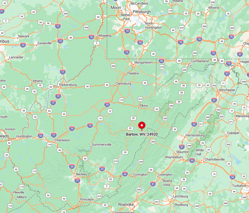
Bartow nestles on U.S. Route 250 near the Randolph–Pocahontas county line, forty-five minutes east of Snowshoe Mountain Resort. The highway climbs over Allegheny Mountain in both directions, acting as a natural gate that filters traffic.
Drivers approach through uninterrupted forest, and winter storms often close the road, enhancing seasonal isolation. A single fuel pump beside the general store signals the spot where civilization briefly reappears.
5. Whitmer
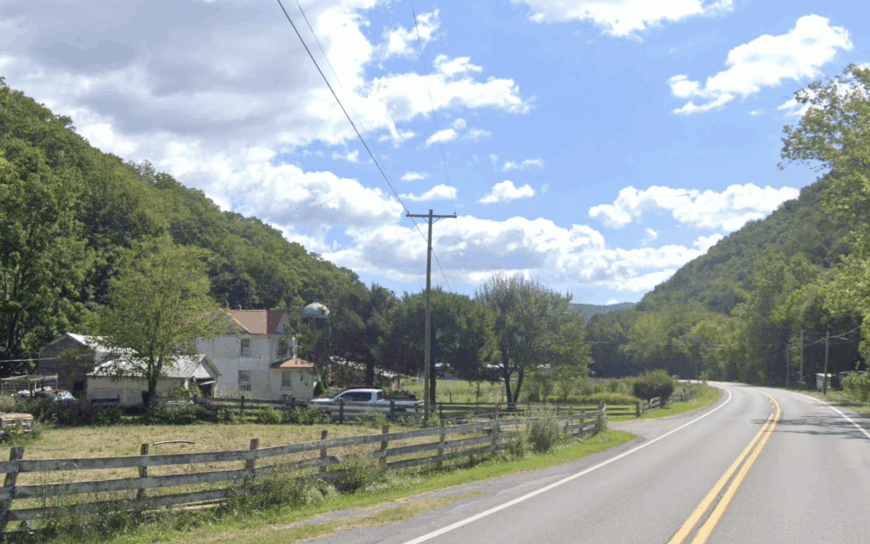
Whitmer’s valley floor holds roughly 100 residents, a scattering of farmhouses, and one white-steepled church reflected in the Dry Fork River. Locals fish riffles for rainbow trout, forage chanterelles in July, or attend the understated homecoming festival every August.


Cattle grazing and small hardwood mills headline the economic scene, each relying on the wide bottomland flats. Towering Shavers Mountain seals the west, while Stuart Knob hems the east, leaving only two gravel lanes for entry and exit.
Mail arrives via rural box route three times a week, underscoring the community’s slowed pace. Distant train whistles echoing from the Cheat Mountain Tunnels provide the few human sounds after dark.
Where is Whitmer?
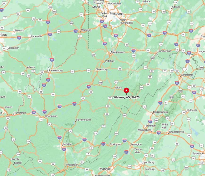
Found along County Route 29 in eastern Randolph County, Whitmer sits about thirty miles southeast of Elkins. The approach follows a narrow gorge where snow lingers into April, and rockslides occasionally close the road, adding to the sense of remoteness.
Visitors must cross two one-lane bridges before reaching the cluster of homes. GPS units often lose reception in the gorge, so paper directions remain handy.
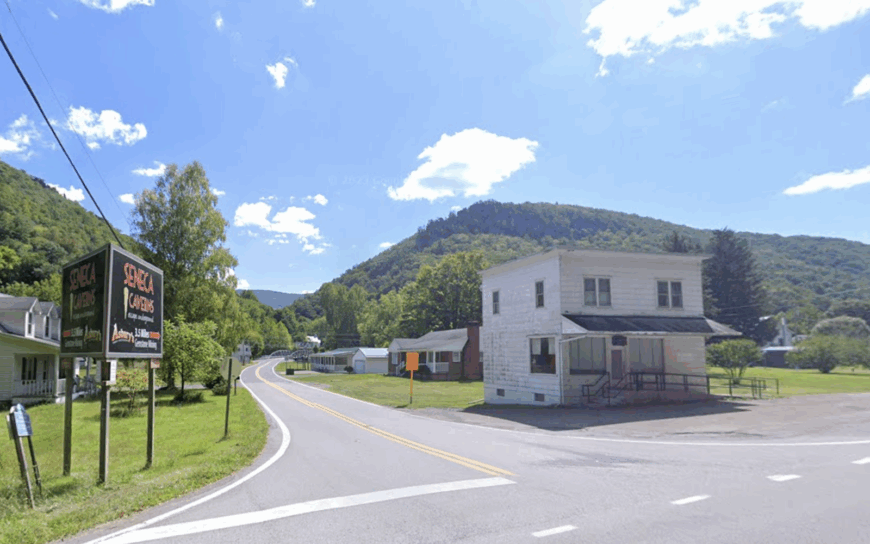
4. Riverton
Would you like to save this?
Fewer than thirty full-time residents occupy Riverton’s riverfront parcels tucked against Seneca Mountain. Vacationers paddle the North Fork, watch peregrine falcons at nearby Nelson Rocks, or reserve a table at the surprise fine-dining gem, the Gateway Restaurant, hidden behind a gas station façade.
Hay fields and a small maple-sugar operation represent the modest economic footprint, supplemented by cabin rentals in peak climbing season. Only the whoosh of river rapids breaks evening quiet, and the single-lane swinging bridge—still used by pedestrians—adds to the out-of-the-way charm.
The settlement’s steep canyon walls block radio signals, leaving FM static as common as song. Such natural barriers have kept Riverton little changed since the 1940s.
Where is Riverton?
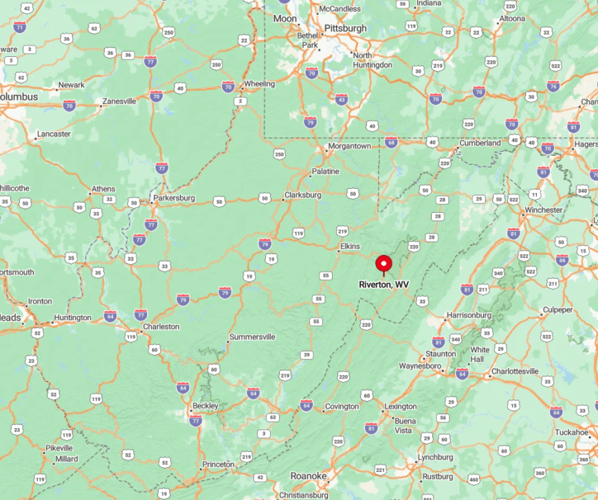
Riverton rests along State Route 33 in central Pendleton County, roughly ten miles west of Seneca Rocks. Sheer limestone cliffs force the road to hug the riverbank, preventing sprawl or side streets.
Arriving drivers wind through the fabled Germany Valley, then descend a tight series of hairpins before spotting the cluster of homes. Snowstorms or high water can briefly sever access, amplifying the town’s hidden quality.
3. Sugar Grove
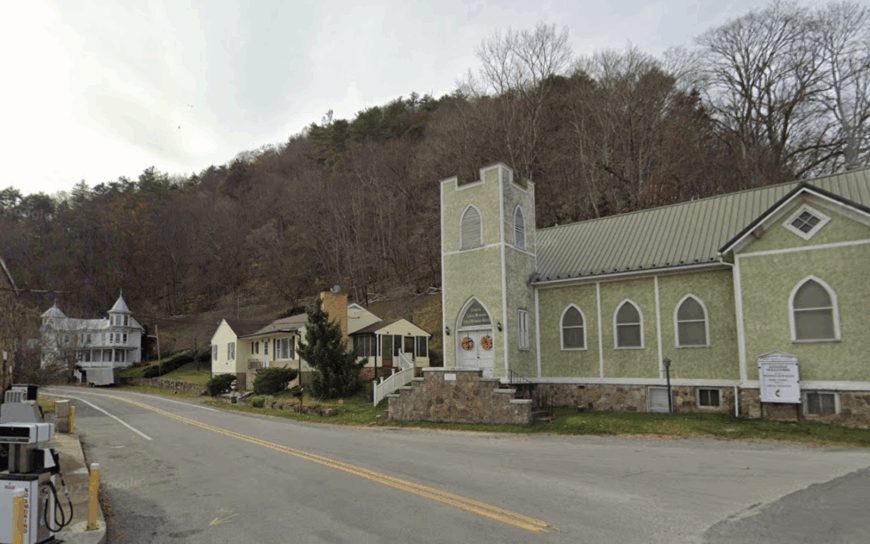
Sugar Grove claims around 200 residents living among broad hayfields beneath the long spine of Shenandoah Mountain.
Weekend pursuits include hiking the Confederate breastworks on Reddish Knob, berry picking at Cool Hollow Farm, or browsing the volunteer-run Books & Beans library-coffee combo inside a former Navy base gatehouse.
Agriculture and U.S. Forest Service jobs top the payroll list, with a sprinkle of remote tech workers who appreciate the hush of the valley. The nearest supermarket sits more than thirty minutes away, and the mountain ridge blocks most cellular and radio traffic.
Darkness settles early as ridges shade the sun, giving residents extra star-watching hours. Even postal addresses share a Franklin ZIP code, revealing how far basic services lie.
Where is Sugar Grove?
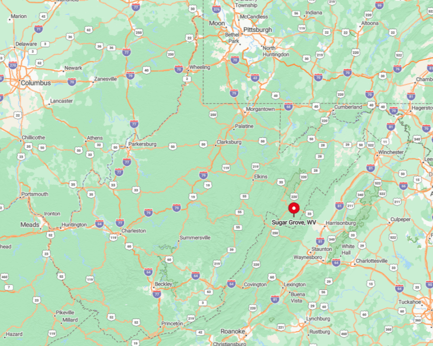
Anchored in southwestern Pendleton County, Sugar Grove sits along State Route 21/4, fifteen miles south of Franklin. Drivers crest Shenandoah Mountain from Virginia or follow Cook Creek Road’s narrow switchbacks from the north.
Both paths require patience, especially in winter when black ice grips shaded curves. The decommissioned Navy antenna farm on the valley floor now serves as an unmistakable landmark guiding newcomers toward town.
2. Helvetia
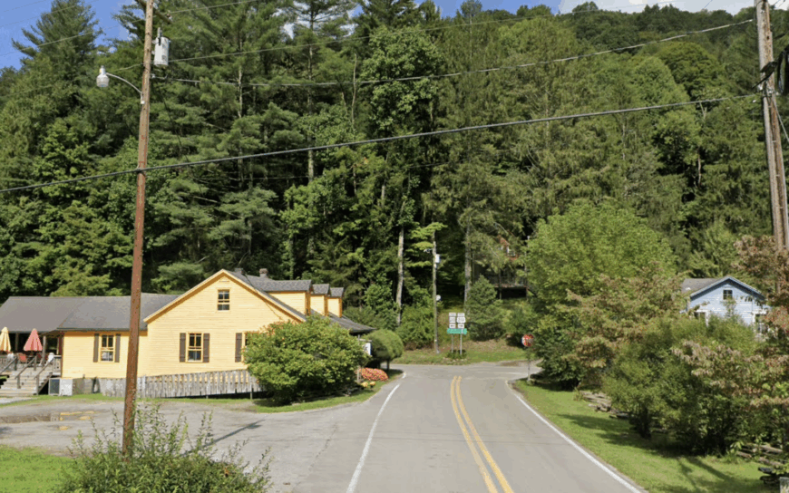
Helvetia, settled by Swiss immigrants in 1869, now counts fewer than 60 permanent residents who keep traditions alive through yodeling clubs and alpine-style Fasnacht masks.
Visitors dine on rösti at the Hütte Restaurant, browse hand-carved masks at the Star Band Hall, or trek the hidden Stalder Slope Trail that locals groom for backcountry skiing. Small family dairies, maple syrup, and craft tourism fuel modest incomes.
The hamlet hides eight miles down a serpentine road that crosses three creeks without guardrails, and the forest canopy closes overhead like a tunnel. No cellular signal and only one public Wi-Fi spot—inside the post office—protect the quiet. Even the church bell echoes for seconds before the sound meets a ridgeline.
Where is Helvetia?
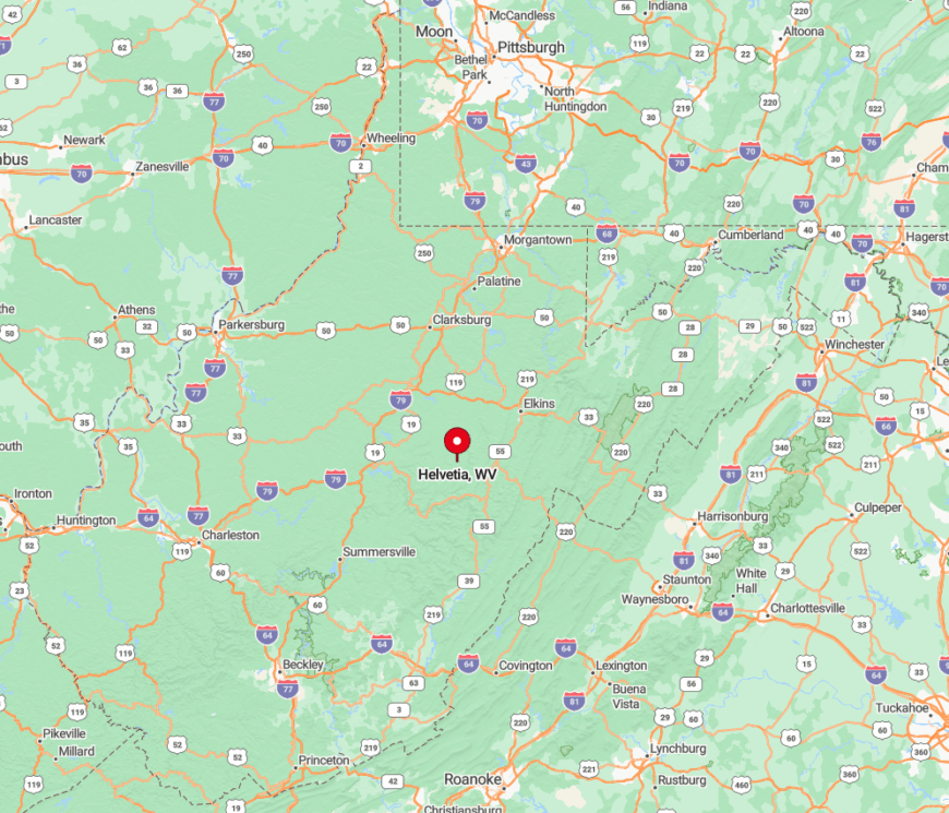
Helvetia lies in southwestern Randolph County, thirty miles from Buckhannon and nearly an hour from the closest four-lane highway. Access is via County Route 46, a route notorious for fog and deer crossings that keep speeds below thirty.
Winter storms can strand vehicles until the county plow makes its lone daily pass. Those determined enough to navigate the curves are rewarded with hand-painted wayfinding signs styled after Swiss canton shields.
1. Green Bank
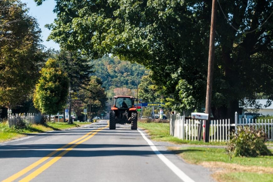
Fewer than 250 people reside in Green Bank, home of the world-famous Robert C. Byrd Green Bank Telescope that dominates a high mountain meadow. Residents stargaze under some of the darkest skies in the East, explore Cranberry Glades, or bike the overlooked Plantation Trail paralleling old logging grades.
Forestry, small beef operations, and jobs at the National Radio Astronomy Observatory make up the employment picture. Because the community sits inside the 13,000-square-mile National Radio Quiet Zone, wireless devices are tightly restricted, creating near-silent airwaves that amplify the sense of separation.
Mountains of the Monongahela National Forest ring the settlement, muting highway rumble and funneling cool breezes across broad pastures. Even tourists must switch off Wi-Fi in their cars, a modern rarity that deepens Green Bank’s serene atmosphere.
Where is Green Bank?
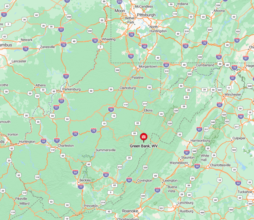
Green Bank rests along State Route 28 in northern Pocahontas County, about twenty miles north of Snowshoe and nearly two hours from the nearest interstate. Ridges topping 4,000 feet hem the valley, and low-power radio restrictions deter new development.
Reaching town involves a steady climb over Cheat Mountain or Allegheny Mountain, both subject to heavy snow from November through March. The stark white dish of the telescope serves as both landmark and reminder of why the airwaves—and the nights—remain wonderfully quiet.