🔥 Would you like to save this?
Salt Lake City’s skyline may draw the crowds, yet just beyond the interstate lie pockets of quiet where time slows and night skies still shimmer with stars. We uncovered hamlets that remain largely untouched by the Wasatch Front’s rapid growth.
Each town on this list keeps its own rhythm—some around a reservoir, others beneath craggy peaks, and a few tucked so deep into canyons that cell service flickers like a campfire. Visitors will find unpaved lanes, century-old cabins, and family names that go back six generations.
In order to come up with the very specific design ideas, we create most designs with the assistance of state-of-the-art AI interior design software. Also, assume links that take you off the site are affiliate links such as links to Amazon. this means we may earn a commission if you buy something.
These places aren’t ghost towns; they’re living communities that simply prefer space over sprawl. Here are ten of the most secluded spots still flying under Utah’s radar, counted down from north to south and mountain to desert.
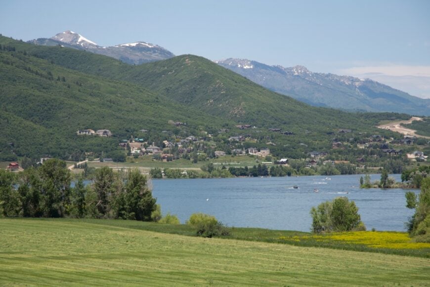
10. Huntsville: Lakeside Stillness on Pineview’s Shore
Roughly 800 residents call Huntsville home, many of whom trace their ancestry to Swiss settlers and Mormon pioneers. Days begin with glass-calm laps on Pineview Reservoir, followed by bike rides along Old Snowbasin Road and evenings at the Shooting Star Saloon—the state’s oldest continuously operating bar.
Tourism tied to boating, fishing, and nearby Snowbasin Resort mixes with small-scale farming and a sprinkling of remote-work professionals. Summer farmers markets line the century-old brick storefronts, and winter brings Nordic skiing on trails groomed by local volunteers.
Despite being only 12 miles from bustling Ogden, the town’s ring of peaks, one-acre zoning, and reservoir frontage muffle outside noise like a natural moat. Limited commercial development keeps night skies dark enough to spot the Milky Way arcing above the water.
Where is Huntsville?
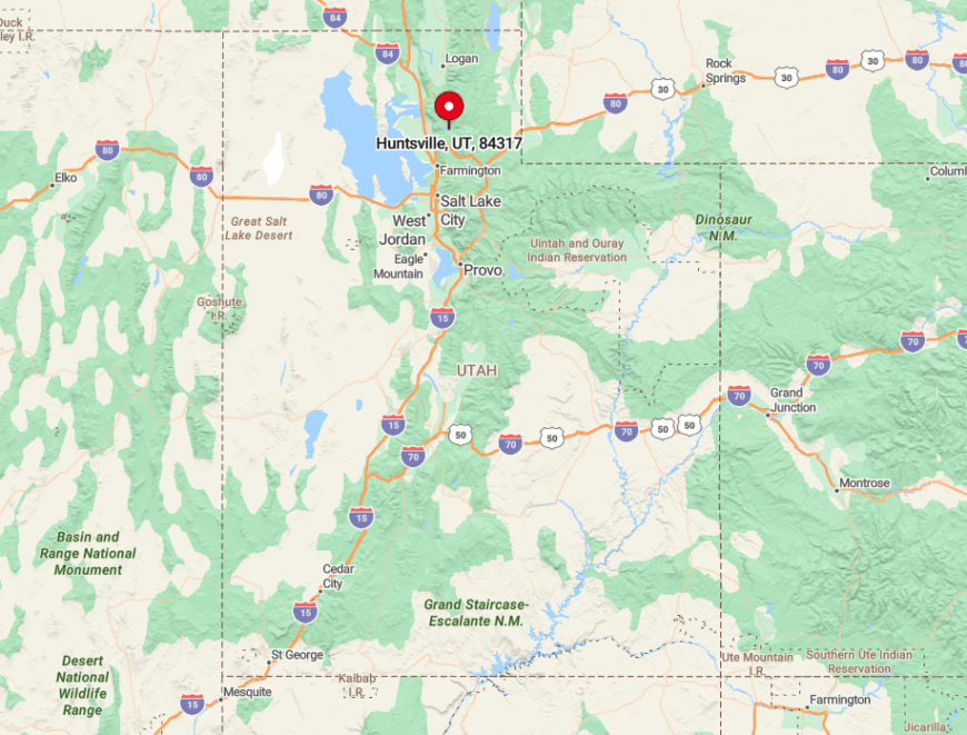
Nestled in Ogden Valley, Huntsville sits on the southeast edge of Pineview Reservoir at 4,900 feet above sea level. The community’s single access route—Utah Highway 39—climbs through a narrow canyon that deters casual traffic and truck corridors.
Visitors typically exit I-15 at Ogden, wind up Ogden Canyon, and crest a ridge that hides the lake like a secret. Once inside the valley, water and mountains form a natural cul-de-sac that preserves Huntsville’s hush.
9. Liberty: Rolling Pastures Beneath Ben Lomond
Liberty’s population hovers around 1,200, yet homes average more than an acre, so neighbors often share more fence line with horses than humans. Locals ride from barn to trailhead in minutes, roping practice at dusk echoing across hay fields flavored by the scent of fresh-cut timothy.
Small-scale ranching and boutique hay operations dominate the economy, supplemented by winter work at nearby Nordic Valley ski area. Hidden gems include a community-run ice rink flooded each December and the Liberty Park Observatory, where amateur astronomers host free stargazing nights.
Seclusion stems from geography: the town rests on a broad shelf beneath Ben Lomond Peak, buffered by the North Fork of the Ogden River and only reachable via a two-lane road that dead-ends at the Cache National Forest boundary.
Wide setbacks and agricultural zoning ward off subdivisions, preserving Liberty’s checkerboard of green.
Where is Liberty?

Liberty lies six miles north of Eden in the upper Ogden Valley, directly below Ben Lomond’s saw-toothed summit. The sole paved artery, North Fork Road, threads through cottonwoods before tapering into gravel at the forest line, discouraging through-traffic.
Drivers typically approach from Ogden Canyon or Trappers Loop, each route involving steep grades that deter commuters. With mountains on three sides and a river on the fourth, Liberty feels like a private pasture tucked behind natural gates.
8. Mountain Green: Hidden Meadows of Weber Canyon
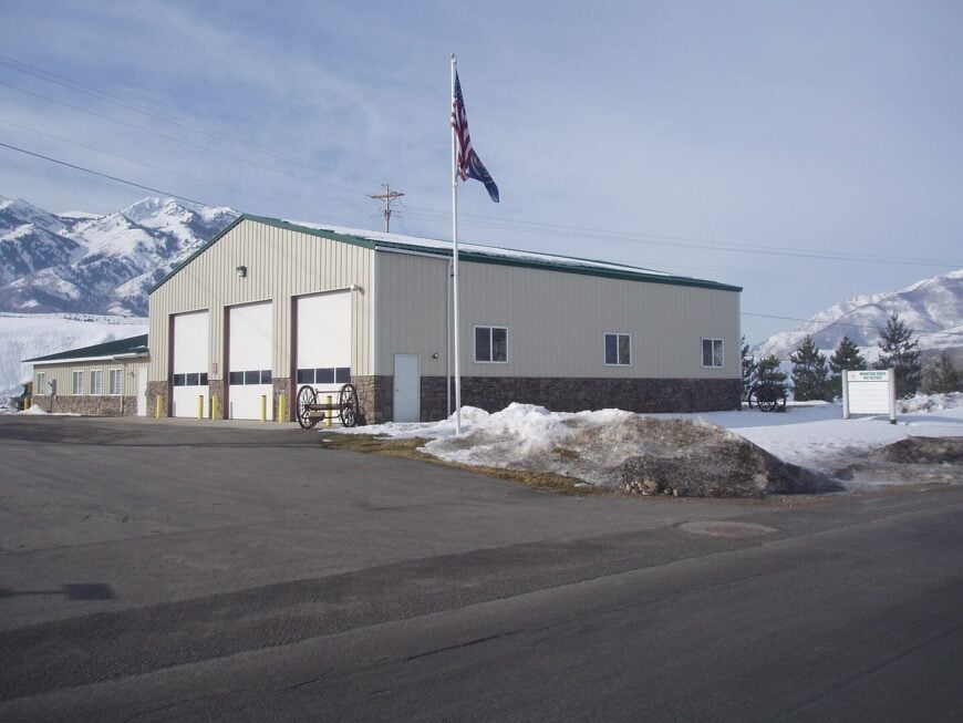
Mountain Green counts roughly 3,200 residents spread across cottonwood-lined hollows and terraced meadows carved by the Weber River. Outdoor life dominates: anglers chase brown trout at sunrise, paragliders launch from Durst Mountain at noon, and locals meet for food-truck Fridays at the community park.
The main economic engines are ranching, construction tied to custom cabins, and seasonal jobs at nearby Snowbasin Resort—just a ten-minute drive but entirely out of sight. A little-known treasure is the historic Trappers Loop Toll Keepers Cabin, a restored 19th-century stopover hidden behind a grove of quaking aspens.
Although only 15 miles east of Layton, the town’s placement in a canyon corridor and absence of commercial strips give it a hushed, end-of-the-road vibe. High ridgelines on both sides act as sound walls, muting freeway noise to a distant whisper.
Where is Mountain Green?
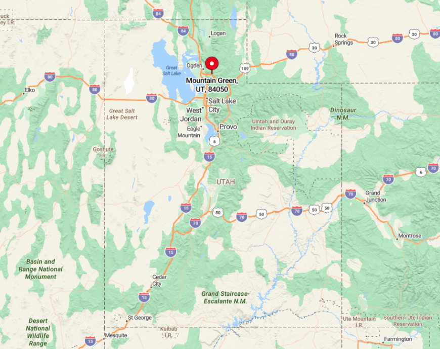
Sitting at 5,000 feet in lower Weber Canyon, Mountain Green is accessed primarily via Exit 103 on I-84, followed by a winding five-mile climb along Old Highway Road. Beyond that junction, pavement narrows and cell reception fades, signaling a transition from corridor to enclave.
Snowbasin’s alpine ridge blocks any direct link to the Ogden Valley, so visitors circle through canyon turns that feel far longer than their mileage. The geography, combined with minimal retail, keeps traffic light and nights still.
7. Wallsburg: A Bowl of Quiet South of Deer Creek

Fewer than 700 people live in Wallsburg, a grassy hollow wrapped by oak-draped hills that act like a natural amphitheater for meadowlarks. Residents tend cow-calf operations, prune orchards, or commute sporadically to Heber City for supplies, returning in time for the volunteer fire department’s famed summer chili cook-off.
Recreation centers on horseback loops along Little Hobble Creek and paddleboarding on nearby Deer Creek Reservoir. The Wallsburg Schoolhouse Museum, open by appointment, holds pioneer diaries that rarely leave the valley.
Seclusion is enhanced by a deliberate absence of gas stations, streetlights, and even a stop sign on Main Canyon Road, which turns to gravel within town limits. With no through-road over the mountains, the community remains a destination rather than a waypoint.
Where is Wallsburg?
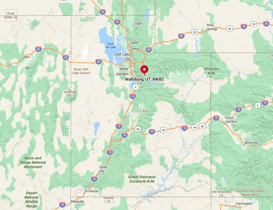
Wallsburg sits eight miles south of Deer Creek Reservoir, accessible only by the curvy Provo–Canyon Road followed by a spur that threads through a narrow notch. Once drivers crest the pass, the valley suddenly opens, and ridges immediately close behind them, creating a sense of sealing the world out.
The nearest grocery store lies 15 winding minutes away in Midway, making weekly trips an intentional outing. Winter storms occasionally close the notch altogether, heightening the town’s feeling of being tucked inside its own snow globe.
6. Cedar Fort: Sagebrush Solitude West of Utah Lake
Home to just over 400 residents, Cedar Fort spreads across a high-desert plain dotted with 19th-century stone cabins and creaky windmills. Days start with sunrise trail rides toward Five Mile Pass and end with root-beer floats at the one-room general store that doubles as a post office.
Cattle grazing and small alfalfa fields fuel the local economy, while tech workers from the Silicon Slopes corridor occasionally moonlight here in off-grid cabins. Each September, the Frontier Days celebration features a parade of mule-drawn wagons down Center Street—a tradition few outsiders witness.
The town’s isolation stems from its location on the west flank of the Lake Mountains, far from major highways and hemmed by Army training grounds that block expansion. Dusty lanes and open range keep light pollution low enough to see satellites tracing the Milky Way.
Where is Cedar Fort?
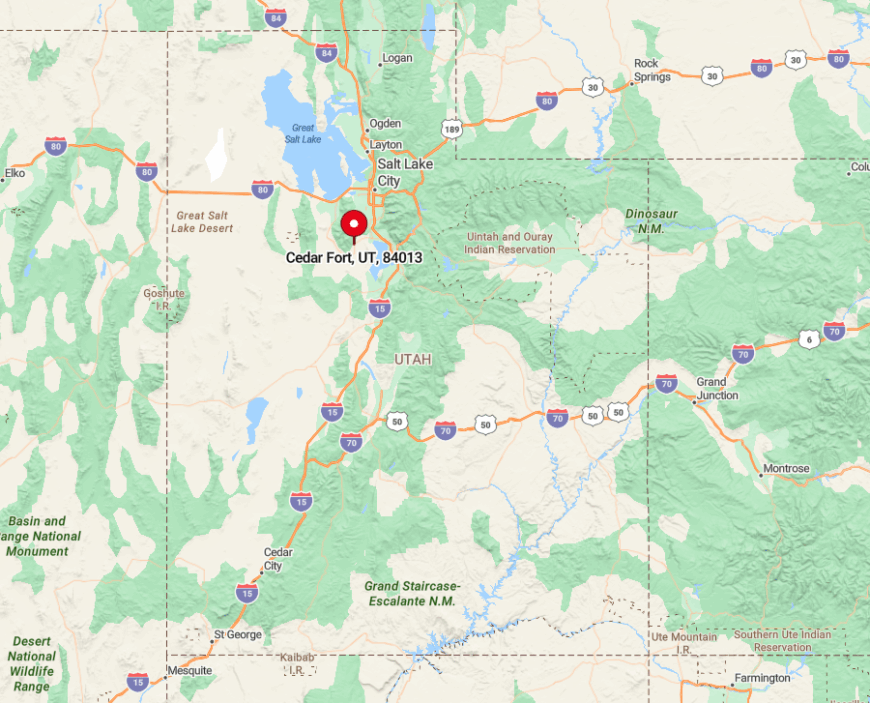
Cedar Fort lies 15 miles west of Lehi, reached by State Route 73, a two-lane ribbon that crosses sagebrush flats where antelope often outnumber cars. Once past the National Guard gates at Camp Williams, cell towers disappear and the landscape widens into uninterrupted desert.
The nearest interstate is I-15, yet a mountain ridge and military buffer ensure no direct sightline or sound. Drivers know they have arrived when the asphalt narrows, and hand-painted wooden signs point to the rodeo grounds instead of fast-food arches.
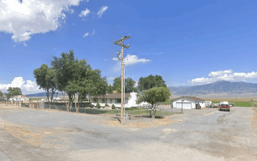
5. Fairfield: Ghost-Town Charm on the Old Pony Express
Fairfield’s 150 residents live amid relics of a cavalry post that once quartered 3,500 soldiers guarding overland mail routes. Visitors picnic beneath locust trees at Camp Floyd State Park, wander through the original Stagecoach Inn, and hunt for chukar on surrounding Bureau of Land Management acreage.
Except for a few boutique horse breeders, the local economy revolves around heritage tourism and weekend events like black-powder musket demos. A hidden perk: residents can check out metal detectors from the park office to search for artifacts in designated zones.
The absence of gas stations, streetlights, and any chain businesses underscores the ghost-town ambience. Open rangeland on three sides and the Cedar Valley’s gravel roads guarantee a slower tempo than the tech boom rumbling just over the hills.
Where is Fairfield?
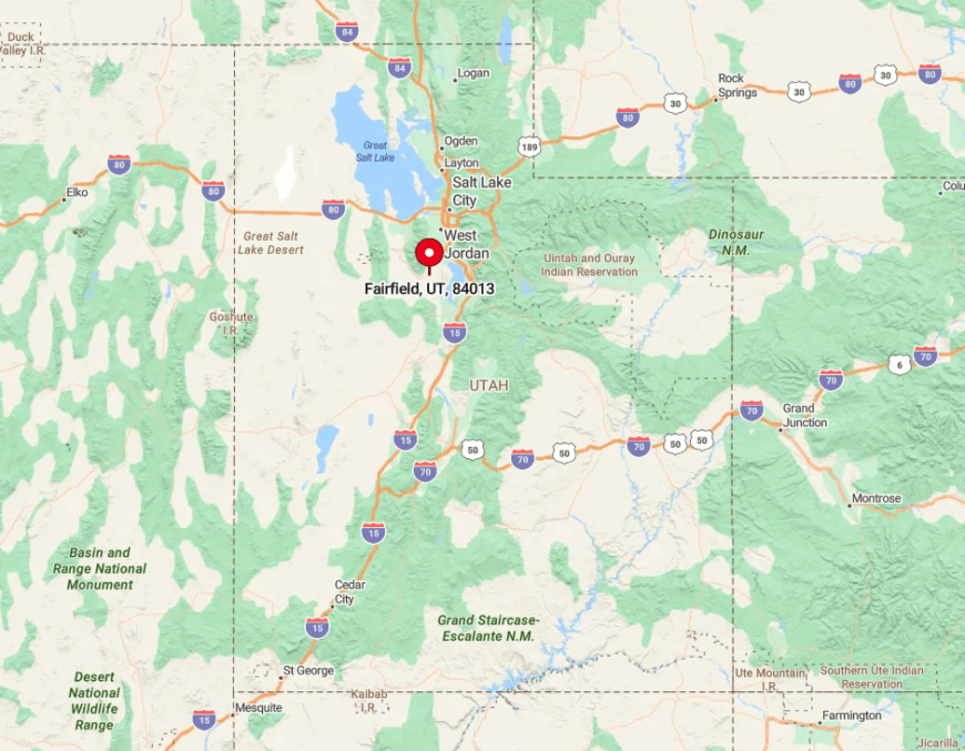
Located 12 miles south of Eagle Mountain, Fairfield sits where the Pony Express route intersects the Cedar Valley foothills. State Route 73 dead-ends into town before dissolving into dirt tracks heading toward the Tintic Mountains.
Without a through-road, visitors must double back the way they came, naturally capping traffic. The nearest grocery store lies 25 minutes away in Saratoga Springs, reinforcing Fairfield’s time-capsule feel.
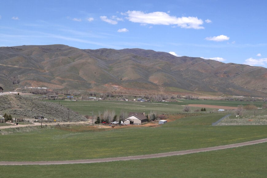
4. Rush Valley: Ranchland Refuge Under the Oquirrhs
🔥 Would you like to save this?
Rush Valley supports about 580 residents spread over broad alfalfa fields and weather-worn barns, all watched by the blue-gray shoulders of the Oquirrh Mountains. Locals host cattle drives down Main Street twice a year, and autumn brings hunters in search of mule deer on adjacent public lands.
Economic life revolves around hay, livestock, and a small limestone quarry that provides steady if modest employment. Amateur astronomers treasure the community’s pitch-black skies, gathering each summer for the informal “Rush Star Party” on a neighbor’s back pasture.
Isolation comes naturally; the valley sits at 5,100 feet, shielded by mountain ridges that block city light and cellular data alike. Evenings are so quiet that the distant whistle of trains in Tooele can seem close enough to touch.
Where is Rush Valley?
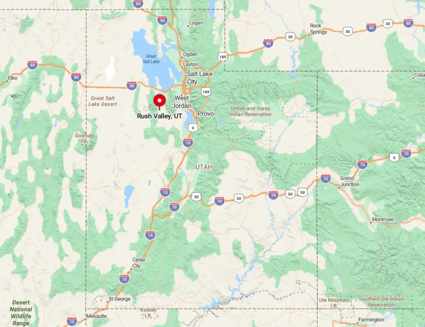
Rush Valley sits 35 miles southwest of Salt Lake City, reachable only by State Route 36 and a turn onto the lightly traveled SR-199. Those two roads meet at the valley mouth, after which the asphalt flattens into open ranchland with no alternate exits.
The lack of intersecting highways prevents commuter shortcuts, preserving rural calm. Winter storms sometimes close Johnson Pass, briefly turning the valley into an island accessible only from the south.
3. Croydon: Stone-Quarry Town in Lost Creek Canyon
About 400 residents inhabit Croydon, a ribbon of homes hugging Lost Creek beneath dramatic limestone cliffs celebrated by climbers. Days revolve around cattle ranching, limestone processing at the local quarry, and weekend tubing on the newly expanded Lost Creek Reservoir.
The single general store hosts Friday-night burger specials that double as town meetings, while the Croydon Round-Up Rodeo each June draws families from miles around. Few outsiders know that the towering rock formation known as Devil’s Slide sits just outside town limits, accessible by a half-mile dirt spur off I-84.
Croydon’s seclusion belies its proximity to the interstate; canyon walls muffle traffic, and sparse signage means many drivers speed past none the wiser. With no stoplights, hotels, or chain restaurants, evenings settle into cricket song echoing off the limestone.
Where is Croydon?

Croydon is located 12 miles east of Morgan along I-84, yet only one exit—Exit 111—serves the community, and it quickly funnels drivers onto Lost Creek Canyon Road. Beyond the overpass, the pavement narrows, cell reception fades, and the canyon twists enough to obscure interstate noise.
Travelers without local knowledge often miss the turn, reinforcing the town’s hidden nature. Approaching from the east requires a 30-mile detour through Henefer and dirt forest roads, discouraging casual visits.
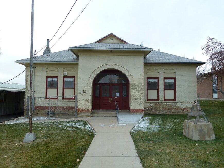
2. Porterville: Quiet Farms Along East Canyon Road
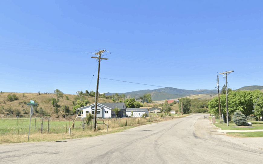
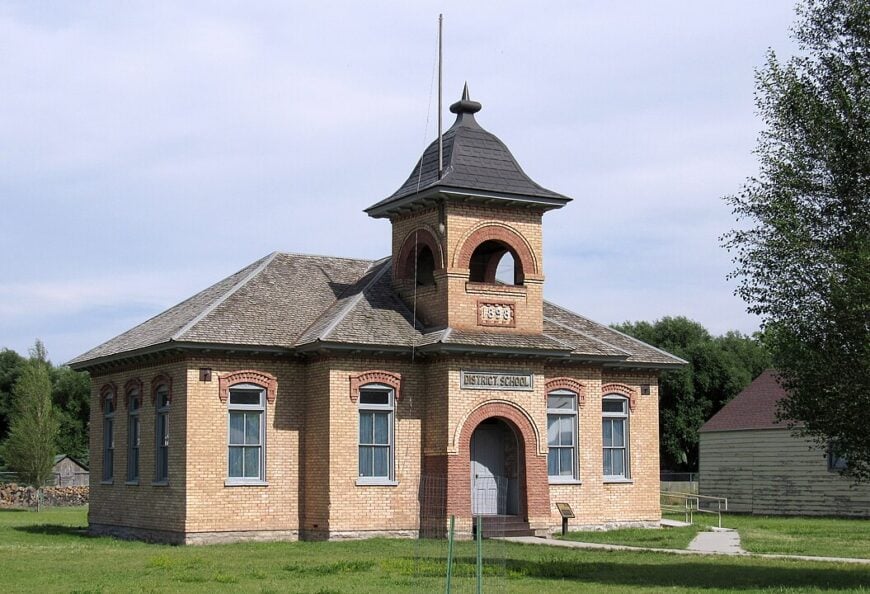
Porterville’s population barely tops 250, spread among century-old farmhouses, apple orchards, and tree-lined lanes where traffic is more likely to be a hay wagon than an SUV. Residents fish for cutthroat trout in East Canyon Creek before breakfast and gather for pie socials at the 1898 LDS meetinghouse.
Agriculture and small-scale honey production remain the economic backbone, supplemented by seasonal visitors headed to East Canyon Reservoir. A seldom-seen gem is the Porterville Rock Church, a pioneer-era sandstone chapel hidden behind cottonwoods just off the main road.
Seclusion is preserved by the surrounding Wasatch foothills and limited cellular coverage that drops to zero inside many homes. Even mail arrives late in the afternoon, evidence of the valley’s easy tempo.
Where is Porterville?
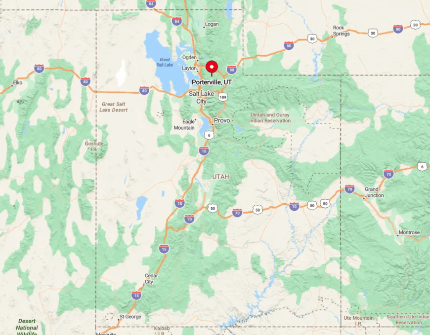
Porterville lies 12 miles southeast of Morgan on East Canyon Road, a narrow route that parallels a creek and offers no shoulder for passing. Approaching from I-84 requires a slow climb through rolling ranchland before the road enters a tight canyon that blocks radio signals.
No paved connection exists to the south until one reaches Summit County, making Porterville a hinge point rather than a thoroughfare. This single-road in, single-road out setup underpins the town’s serene isolation.
1. Stockton: Pine-Speckled Mining Town Turned Hideaway
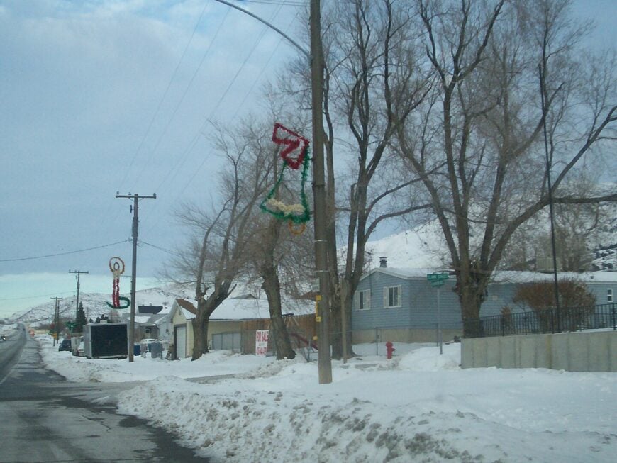
Stockton hosts about 1,600 residents, though five-acre zoning spreads them far enough apart that coyotes often outnumber humans on evening walks. Historic silver-mine headframes loom beside piñon-juniper hills, now popular for off-road exploration and amateur rock-hounding.
The economy blends small ranches, telecommuters, and a growing artisan scene that includes a blacksmith studio inside a former assay office. Anglers slip away to Stockton Reservoir at dawn, and history buffs search for Union Army camp relics dating to the Civil War—the only such encampment in Utah.
Despite sitting only 10 miles south of Tooele, the town is cradled by foothills that shield it from highway glare and suburban expansion. Streetlights are scarce, allowing the scent of desert sage and the glow of distant Milky Way arms to dominate nightfall.
Where is Stockton?
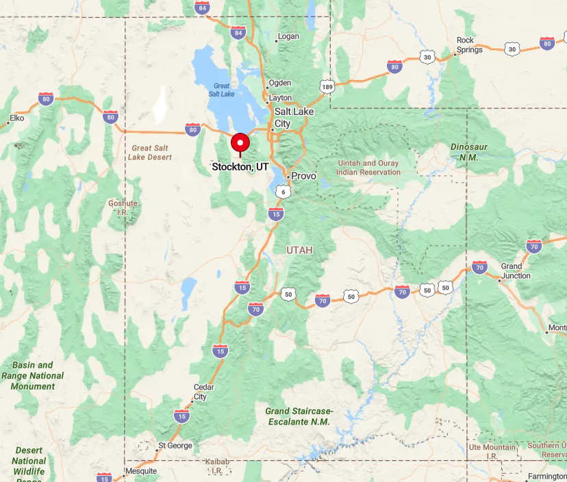
Found along State Route 36 in Tooele County, Stockton is the last notable settlement before roads climb toward the Tintic Mountains and the Great Basin Desert beyond. The highway bypasses the Salt Lake Valley altogether, so travelers must intentionally veer west from I-15 at Lehi or Draper to reach it.
Surrounding BLM land and steep foothills restrict development, preserving the town’s quiet boundary. Those willing to venture further can follow unpaved Ophir Canyon Road into the Oquirrh Mountains, a route that ends at a ghost town and underscores Stockton’s role as gateway to wide-open silence.