🔥 Would you like to save this?
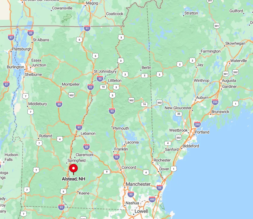
Southwestern New Hampshire is a quilt of hilltop commons, winding rivers, and forested ridges that seem to keep time on their own terms. In these 25 towns, traffic lights are rare, village greens still host church suppers, and gravel lanes slip into the woods without hurry or explanation.
Here, lakes lie glassy under the morning sun, farmhouses lean into centuries-old stone walls, and maples arch over narrow roads in every shade from spring green to autumn fire. The air carries the scent of pine and woodsmoke, and the quiet is deep enough to hear a stream long before you see it.
In order to come up with the very specific design ideas, we create most designs with the assistance of state-of-the-art AI interior design software.
This is a corner of New Hampshire where the land feels both cared for and left to itself—where you can step off the road and be walking in protected forest within minutes, or pause on a rise and see nothing man-made for miles. It is less a destination than a way of living, stitched together from water, wood, and weather.
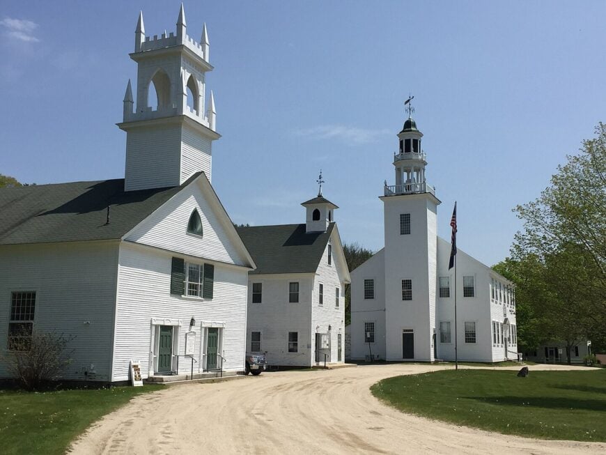
25. Hinsdale: River Bends, Backwater Coves, and Forested Ridges
Hinsdale rests in New Hampshire’s far southwestern corner, where the Connecticut River curves past forested hills and stretches of quiet farmland. Set apart from major highways, it feels tucked away, its back roads winding through pine groves and over old wooden bridges.
Life here moves at an easy rhythm—mornings carry the scent of woodsmoke, and afternoons drift by in the shade of towering maples. Visitors can explore the Ashuelot River Rail Trail, fish at Wantastiquet Lake, step inside the historic Hinsdale Meetinghouse, or browse a general store that still holds its original charm.
The surrounding woods offer miles of hushed hiking trails, where the only sounds are bird calls and the rustle of leaves. Many locals work in small trades or farming, keeping life grounded and close to the land. It’s the kind of place that quietly reminds you how still the world can be.
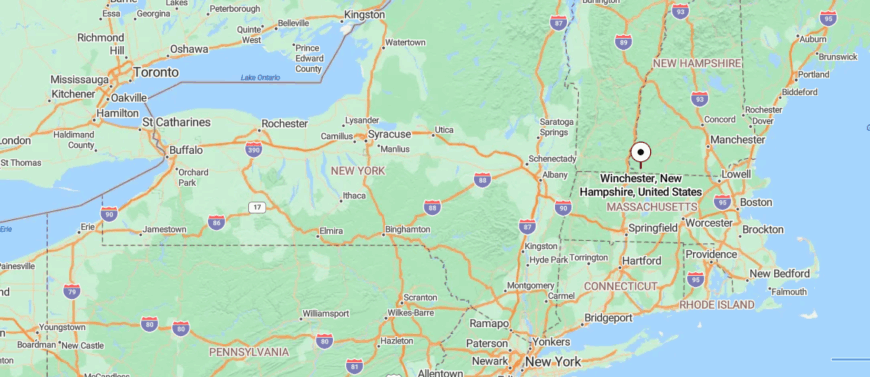
Where is Hinsdale?
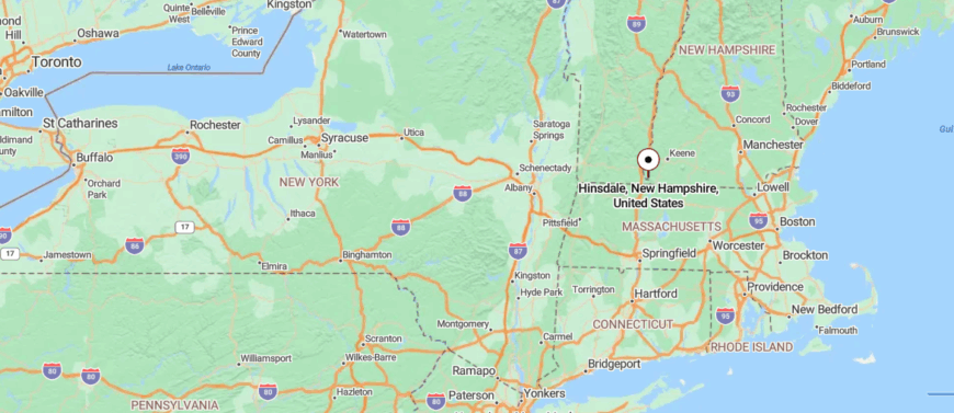
Hinsdale lies in the southwestern tip of New Hampshire, where the Connecticut River meets the Vermont border. It’s about 6 miles southwest of Brattleboro, Vermont, and can be reached by following NH Route 119 through a series of winding, wooded stretches.
The approach takes you past farmland and river views before you reach the small downtown. It’s a place where the state’s edge feels like the edge of the world—close enough to touch three states, yet quiet enough to feel apart from them all.
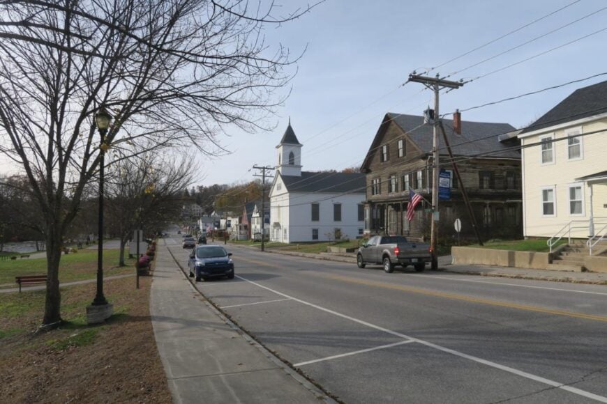
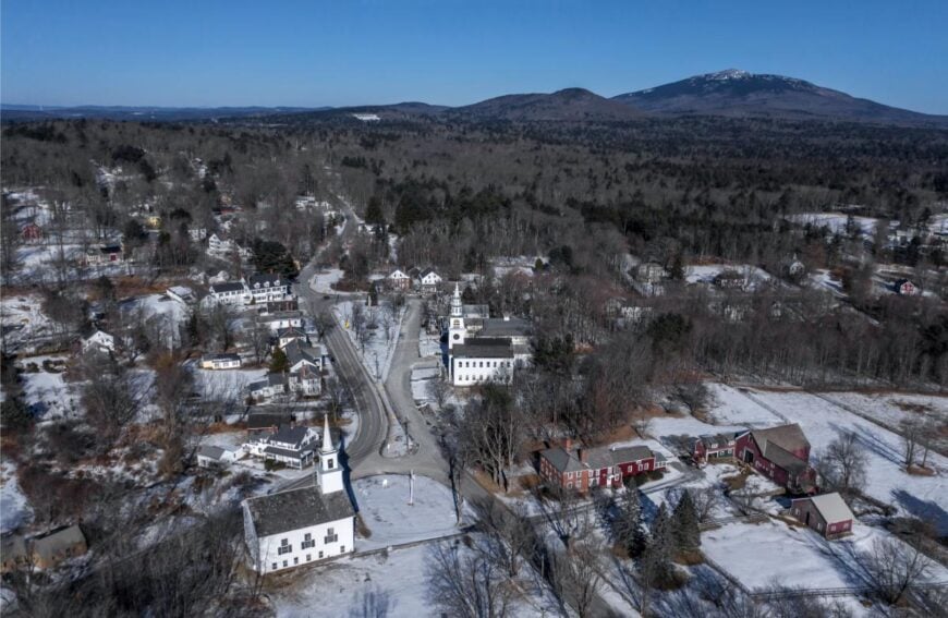
24. Winchester: Quiet Farmsteads Beside the Ashuelot River
Winchester lies in New Hampshire’s southwest corner, where rolling farmland meets the winding Ashuelot River and dense forests stretch toward the Vermont border. Removed from major highways, it keeps a quiet, unhurried pace, its back roads weaving past weathered barns and centuries-old stone walls.
Life here is rooted in tradition—mornings might start with church bells or the distant hum of tractors, and evenings settle under a sky clear enough to see every star. Visitors can hike along the Ashuelot Rail Trail, paddle the calm stretches of the river, explore historic Main Street with its brick storefronts, or stop by a family-run farm stand.
The surrounding countryside offers changing colors with every season, from spring blossoms to fiery autumn foliage. Many residents work in agriculture, local trades, or small-town services, keeping the community closely knit. It’s the kind of place that makes the world feel smaller, simpler, and easier to love.
Where is Winchester?
Winchester rests in the southwestern corner of New Hampshire, just a few miles from the Massachusetts and Vermont borders. It’s about 13 miles southwest of Keene, reached along NH Route 10 as it curves through forested hills and open farmland.
The drive brings you past covered bridges and glimpses of the Ashuelot River before leading into the town center. It’s close enough for a quick trip from the city, yet wrapped in a calm that makes it feel worlds away.
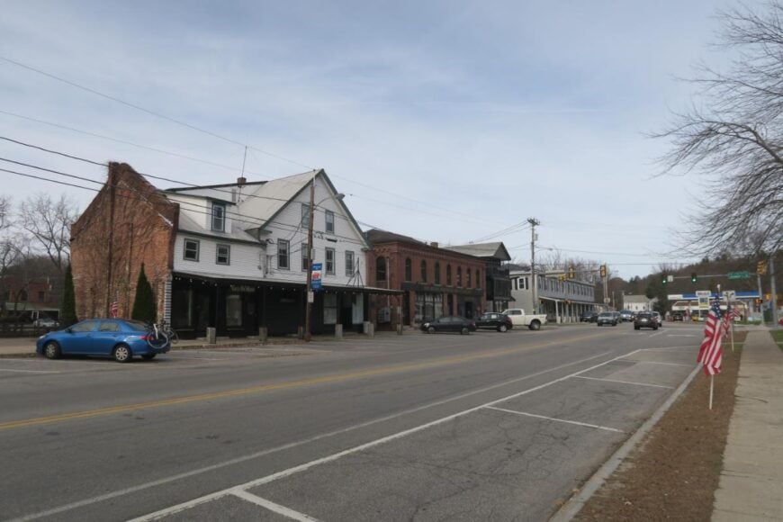
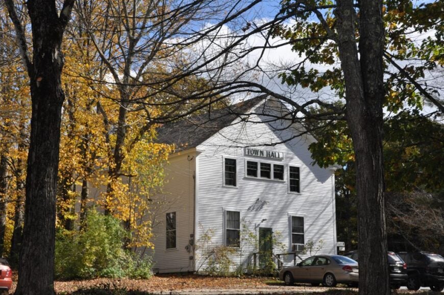
23. Fitzwilliam: Granite-Lined Ponds and Ridge-Top Trails
Fitzwilliam rests in New Hampshire’s Monadnock region, surrounded by quiet lakes, pine forests, and the gentle rise of wooded hills. Tucked far from busy highways, its winding roads pass colonial homes, stone walls, and meadows that seem unchanged for generations.
Life moves with a timeless rhythm—mornings often begin with mist over Laurel Lake, and evenings fade with the sound of crickets in the fields. Visitors can paddle across the lake, hike nearby Mount Monadnock, browse antique shops in the village center, or stop at the historic Fitzwilliam Inn for a meal.
Seasonal festivals and the vibrant fall foliage draw travelers who seek beauty without the crowds. Many locals make their living through small businesses, crafts, or farming, keeping the town’s roots strong. It’s the kind of place where every turn in the road feels like a step back into something simpler and enduring.
Where is Fitzwilliam?
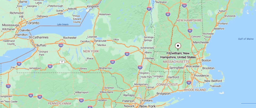
Fitzwilliam sits in the Monadnock Region of southern New Hampshire, just north of the Massachusetts border. It’s about 13 miles south of Keene, reached by following NH Route 12 past forested stretches and quiet ponds.
The approach takes you through rolling countryside with distant views of Mount Monadnock. It’s close enough for an easy drive from nearby towns, yet still holds a stillness that feels far removed from the rush of everyday life.
22. Richmond: Backroad Farms and Forested Wetlands
Richmond sits along New Hampshire’s southern border, where forested hills and winding back roads create a natural buffer from the faster world beyond. Far from major highways, the town feels quietly self-contained, its landscape dotted with old farmhouses, stone walls, and sunlit clearings.
Life here follows the seasons—winters bring woodsmoke and stillness, while summers hum with the sound of insects and the rustle of leaves. Visitors can wander through the preserved grounds of the historic Four Corners area, paddle on small, glassy ponds, or hike wooded trails that seem to go on forever.
The surrounding countryside offers a palette of changing colors, from spring’s fresh greens to the fiery hues of autumn. Many residents work in local trades, farming, or commute to nearby towns, keeping the pace of life steady and familiar. It’s the kind of place that feels both hidden and quietly steadfast, as if it has all the time in the world.
Where is Richmond?
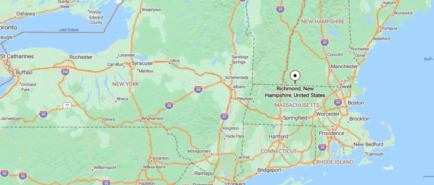
Richmond lies in the far southwestern corner of New Hampshire, touching the Massachusetts border and surrounded by forested hills. It’s about 14 miles south of Keene, reached via NH Route 32 along winding roads that pass woodlands and scattered farmsteads.
The journey feels unhurried, with long stretches of quiet countryside and glimpses of open fields. It’s the kind of place where the road narrows, the trees close in, and the outside world feels pleasantly distant.
21. Troy: Mill History at the Foot of Mount Monadnock
Troy rests at the base of Mount Monadnock, where forested slopes and open meadows frame a small village tucked away from busy roads. Its quiet streets wind past historic brick buildings, old mills, and homes that speak to a long New England history.
Life moves with a measured pace—mornings might start with the mountain glowing in the sunrise, and evenings fade with the sound of wind in the trees. Visitors can hike the nearby trails leading toward Monadnock’s summit, explore the Troy Common with its classic gazebo, or browse local shops and cafés.
Seasonal events bring neighbors together, while the surrounding countryside offers year-round beauty. Many residents work in small businesses, trades, or commute to nearby towns, keeping the community close-knit. It’s the kind of place where the mountain’s steady presence makes the rest of the world feel far away.
Where is Troy?

Troy is nestled in the Monadnock Region of southwestern New Hampshire, just east of Mount Monadnock’s rugged slopes. It sits about 8 miles south of Keene, reached along NH Route 12, where the road passes through rolling farmland and pockets of forest.
The drive offers glimpses of the mountain rising above the treetops, guiding you toward the small town center. It’s close enough to the city for convenience, yet feels tucked into its own quiet corner beneath the mountain’s watch.
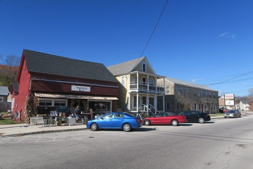
20. Swanzey: Covered Bridges and Quiet River Bends
Swanzey stretches across the rolling hills of southwestern New Hampshire, where covered bridges, quiet rivers, and forested backroads keep it feeling removed from the rush of modern life. Far from major highways, the town’s charm unfolds in its small clusters of historic homes, open fields, and winding country lanes.
Life here flows gently—mornings might bring fog over the Ashuelot River, and afternoons pass under the shade of maples along the village green. Visitors can walk or cycle the Ashuelot Rail Trail, admire the town’s five historic covered bridges, paddle on Wilson Pond, or join seasonal community fairs.
The changing seasons paint the landscape with fresh colors, from spring blossoms to autumn’s rich reds and golds. Many residents work in local trades, small businesses, or commute to Keene, keeping a balance between rural calm and nearby amenities. It’s the kind of place where the past lingers in the air, making each day feel quietly timeless.
Where is Swanzey?
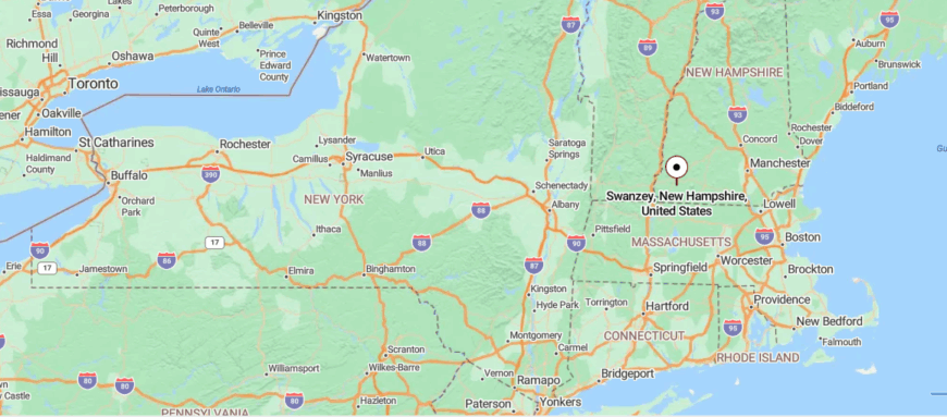
Swanzey lies in the heart of the Monadnock Region in southwestern New Hampshire, surrounding the city of Keene on its southern and western edges. It’s just a few minutes’ drive from downtown Keene via NH Route 10 or NH Route 32, with roads that wind past covered bridges and stretches of the Ashuelot River.
The approach moves through a mix of woodlands, open fields, and small village centers. It’s close to everything in the region, yet still holds pockets of quiet where the river and forest seem to slow time.
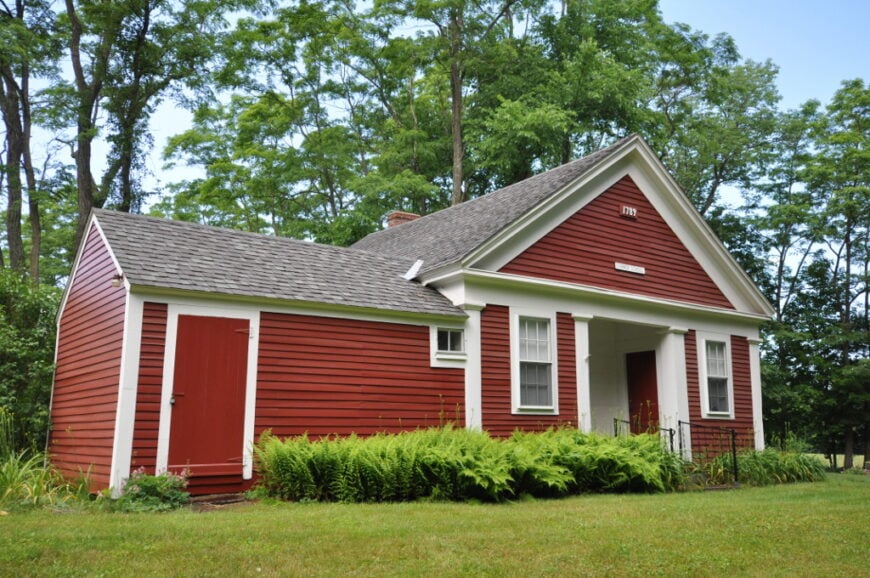
19. Westmoreland: River Views from Orchard-Lined Ridges
🔥 Would you like to save this?
Westmoreland sits high above the Connecticut River Valley, where rolling farmland meets sweeping views of Vermont’s distant hills. Set apart from major highways, its winding roads lead past white-clapboard farmhouses, old stone walls, and fields that seem to stretch endlessly.
Life here follows a steady rhythm—mornings break with the call of meadowlarks, and evenings settle under skies brushed with soft light. Visitors can tour the town’s historic meetinghouse, explore quiet hiking trails, visit local farms for fresh produce, or simply pause at roadside overlooks to take in the scenery.
The seasons transform the landscape, from winter’s quiet drifts to autumn’s blaze of color. Many residents farm the land or work in small trades, keeping the community closely tied to its rural roots. It’s the kind of place where wide-open views make the rest of the world feel far away.
Where is Westmoreland?
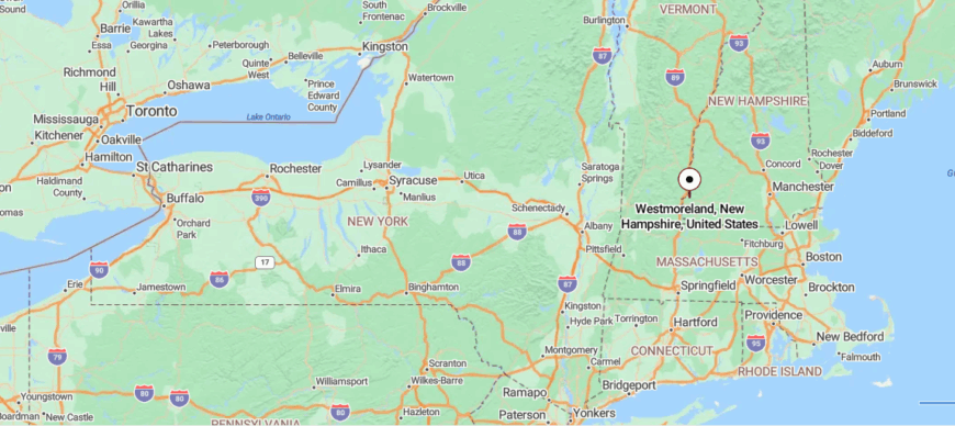
Westmoreland sits along the Connecticut River in southwestern New Hampshire, bordering Vermont to the west. It’s about 10 miles northwest of Keene, reached via NH Route 12 as it follows the river’s edge past farmland and low, wooded hills.
The drive offers open views across the water to the Green Mountains beyond. It’s close enough for an easy trip to the city, yet its wide fields and riverside quiet make it feel a world apart.
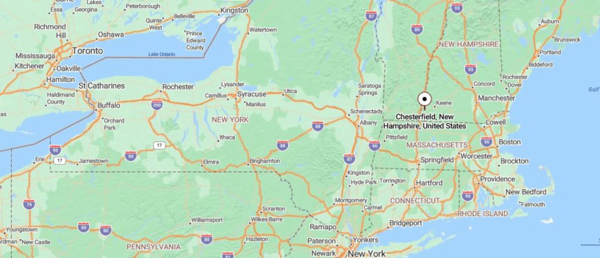
18. Chesterfield: Lakefront Parks and Mountain Lookouts
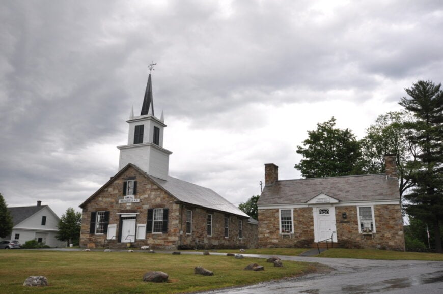
Chesterfield rests between the Connecticut River and Spofford Lake, where forested hills and winding roads keep it feeling gently removed from the pace of modern life. Far from major highways, the town’s landscape blends quiet shoreline, historic homes, and stretches of open countryside.
Life here moves with a calm rhythm—mornings might begin with mist over the lake, and evenings close with the sound of water lapping against the shore. Visitors can swim or kayak at Spofford Lake, hike the trails of Madame Sherri Forest, explore the old Chesterfield Gorge, or wander through the village center.
The scenery shifts beautifully with the seasons, from spring blooms to fiery autumn foliage. Many residents work in local trades, tourism, or commute to nearby towns, keeping the community close-knit yet welcoming. It’s the kind of place where nature and history weave together, making the outside world feel a little more distant.
Where is Chesterfield?
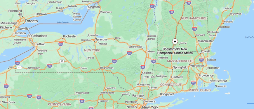
Chesterfield is set in southwestern New Hampshire, bordered by the Connecticut River and Vermont to the west. It’s about 7 miles west of Keene, reached by following NH Route 9 through wooded ridges and glimpses of Spofford Lake.
The road winds between forest and open water, giving way to a small-town center surrounded by hills. It’s near enough for quick access to larger towns, yet its lakeside calm and river views make it feel quietly removed.
17. Gilsum: Quarries, Waterfalls, and Steep Valley Roads
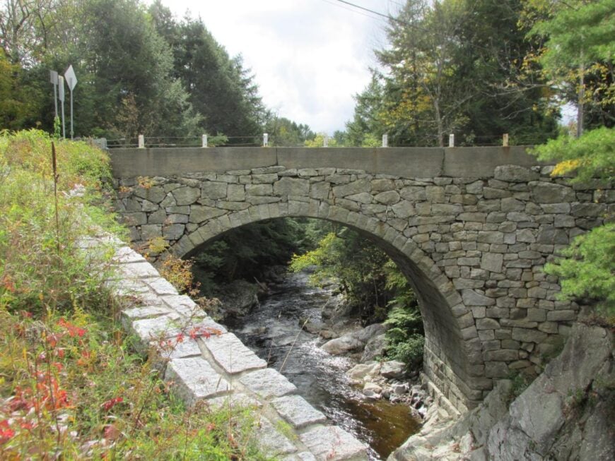
Gilsum lies in the hill country of southwestern New Hampshire, where winding back roads, forested ridges, and quiet valleys create a sense of being tucked far from the world’s hurry. With no major highways cutting through, the town feels deeply connected to its rural roots, its landscape marked by old stone walls, weathered barns, and the steady flow of the Ashuelot River.
Life here moves at a gentle pace—mornings often bring mist rising off the water, and evenings settle into the soft chorus of crickets. Visitors can explore the Gilsum Stone Arch Bridge, wander scenic hiking trails, hunt for minerals at local rock swaps, or fish in clear, cold streams.
The surrounding countryside offers beauty in every season, from spring’s green hills to autumn’s blaze of color. Many locals work in small trades, crafts, or commute to nearby towns, keeping the community grounded. It’s the kind of place where time seems to slow, and nature sets the rhythm.
Where is Gilsum?
Gilsum sits in the Monadnock Region of southwestern New Hampshire, about 8 miles north of Keene. It’s reached via NH Route 10, where the road winds past forested slopes, rocky streams, and old mill buildings along the Ashuelot River.
The approach feels tucked between hills, with the river cutting a narrow path through the landscape. It’s close enough for a short drive to the city, yet the setting feels like a hidden pocket of history and quiet.
16. Sullivan: Quiet Backroads Near Hidden Ponds
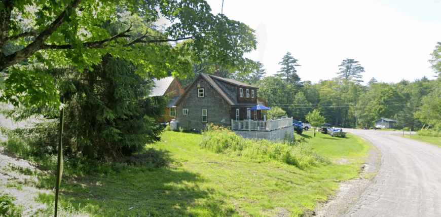
Sullivan rests in the uplands of southwestern New Hampshire, where winding rural roads pass through dense forests, open meadows, and quiet ridgelines. With no bustling highways nearby, it feels removed from the pace of modern life, its small clusters of homes and historic farmsteads blending into the natural landscape.
Life here follows the seasons—mornings might bring mist over stone-walled fields, and evenings fade beneath skies bright with stars. Visitors can hike woodland trails, explore nearby wildlife areas, paddle on small ponds, or take in the simple beauty of the countryside.
The scenery shifts dramatically through the year, from summer’s deep greens to the fiery tones of fall. Many residents work in farming, small trades, or commute to Keene, keeping the town closely tied to its rural roots. It’s the kind of place where quiet is not just a moment, but a way of life.
Where is Sullivan?
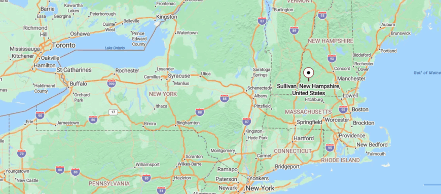
Sullivan rests in the Monadnock Region of southwestern New Hampshire, about 6 miles east of Keene. It’s reached along NH Route 9, where the road climbs through wooded hills and passes small ponds and wetlands.
The approach feels unhurried, with long stretches of forest and glimpses of open sky over the ridgelines. It’s a short trip from the city, yet the quiet hills make it feel far from the bustle.
15. Roxbury: Hillside Homesteads and Seasonal Streams
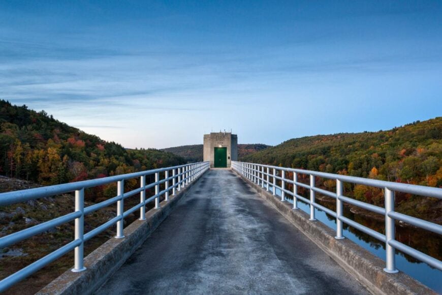
Roxbury is one of New Hampshire’s smallest towns, tucked in the hills east of Keene where winding back roads and thick forests keep it feeling hidden from the wider world. With no commercial center and only a scattering of homes, it blends almost seamlessly into the surrounding wilderness.
Life here is deeply tied to the land—mornings might start with fog over the trees and the distant call of loons, while evenings bring a sky unbroken by city lights. Visitors can hike trails in the nearby Granite Gorge, paddle quiet waters, or explore the area’s historic stone walls and cellar holes left from early settlements.
Each season leaves its mark, from winter’s crisp stillness to autumn’s blaze of color. Many residents commute to neighboring towns or work in small trades, keeping the community close-knit. It’s the kind of place where the silence feels expansive, as if the hills are holding it just for you.
Where is Roxbury?
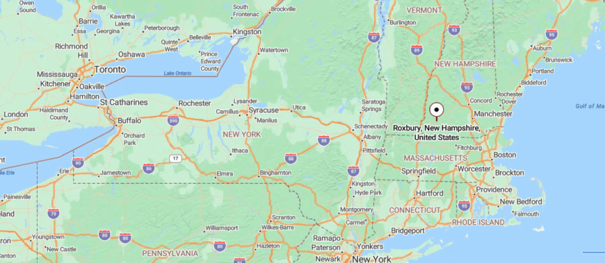
Roxbury lies in the Monadnock Region of southwestern New Hampshire, about 5 miles east of Keene. It’s reached along NH Route 9, where the road winds between forested ridges, small ponds, and granite outcrops.
The approach passes long stretches of quiet woodland with few signs of development. It’s a place close to the city, yet its secluded hills make it feel like a hidden corner of the state.
14. East Alstead: Hills, Orchards, and a Quiet Green
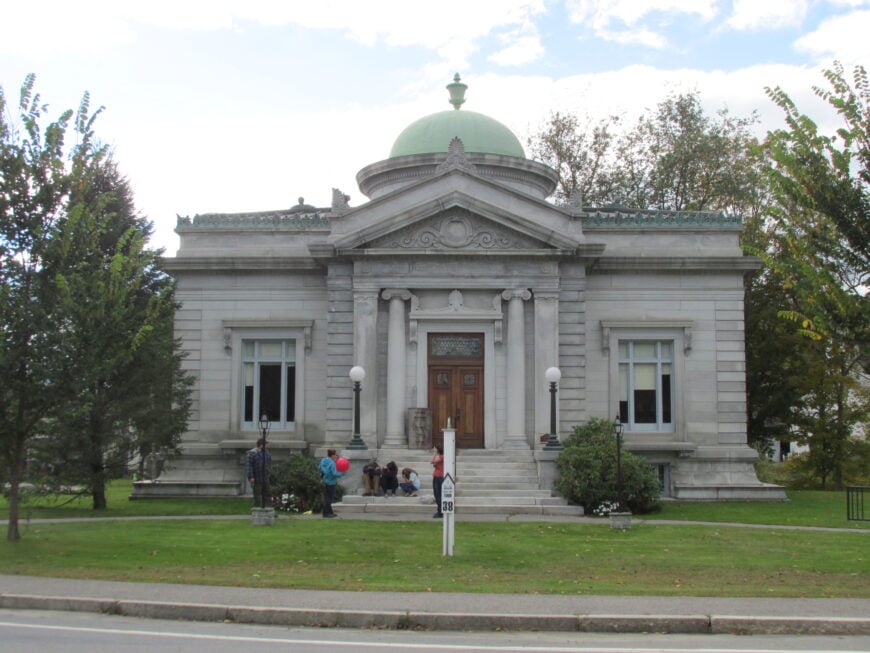
East Alstead sits in New Hampshire’s southwest hills, where winding country roads weave past old farms, quiet ponds, and stretches of forest that seem untouched by time. Far from major highways, the village feels deeply secluded, its pace shaped by the rhythms of nature and the turning seasons.
Life here often begins with mist rising off Lake Warren and ends with sunsets over rolling fields. Visitors can paddle the lake’s calm waters, hike nearby trails, explore historic buildings, or stop at small farm stands for local goods. The landscape changes beautifully through the year, from spring’s fresh greens to the rich golds and reds of autumn.
Many residents work in farming, small trades, or commute to nearby towns, keeping the community close-knit and grounded. It’s the kind of place where the quiet feels like part of the scenery, as enduring as the hills themselves.
Where is East Alstead?
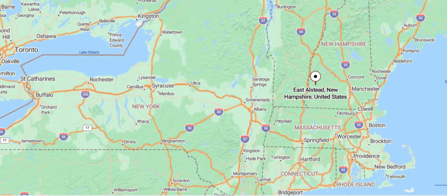
East Alstead is a rural village in southwestern New Hampshire, located within the town of Alstead near the Vermont border. It’s about 17 miles northwest of Keene, reached by following NH Route 12A through rolling farmland and pockets of forest.
The drive passes small lakes and open fields before narrowing into quiet backroads that lead into the village. It’s close enough to connect with neighboring towns, yet its gentle hills and winding roads give it a tucked-away feel.
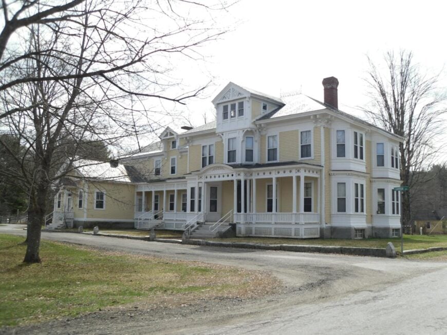
13. Drewsville: A Riverside Hamlet with Covered Bridge Access
🔥 Would you like to save this?
Drewsville, a small village within the town of Walpole, sits along the Connecticut River in New Hampshire’s southwest corner, where rolling farmland meets forested hills and winding back roads. Removed from major highways, it feels quietly set apart, its few homes and historic buildings blending seamlessly into the rural landscape.
Life here moves at a gentle pace—mornings might bring mist drifting over the river, while evenings settle into the hush of open fields. Visitors can explore nearby hiking trails, fish in the river, visit local farms, or enjoy the charm of Walpole’s village center just a short drive away.
The scenery shifts with the seasons, from winter’s crisp white fields to the warm glow of autumn leaves. Many residents work in agriculture, small trades, or commute to nearby towns, keeping the village close to its roots. It’s the kind of place where the stillness feels unbroken, as if it has been waiting there all along.
Where is Drewsville?
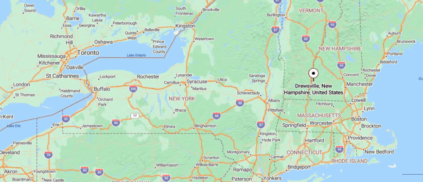
Drewsville is a small village in southwestern New Hampshire, part of the town of Walpole near the Vermont border. It sits about 20 miles northwest of Keene, reached via NH Route 12 along the Connecticut River valley.
The approach follows open farmland and river views before curving into wooded backroads that lead to the village. It’s near enough to larger towns for easy access, yet its quiet roads and rural setting make it feel far removed.
12. Spofford: Lakeside Retreats and Forested Shorelines
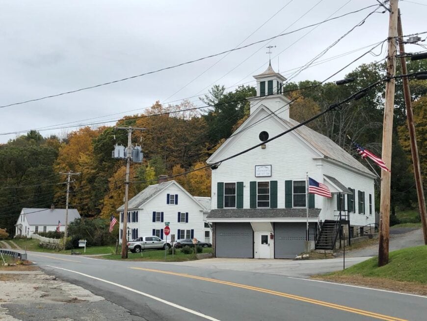
Spofford, a village within the town of Chesterfield, rests along the shores of Spofford Lake, where forested hills rise gently around clear, quiet waters. Set apart from major highways, it feels like a hidden retreat, its winding roads leading past lakefront cottages, old camps, and stretches of pine-shaded shoreline.
Life here often begins with the sparkle of morning light on the water and ends with sunsets casting gold across the hills. Visitors can swim, kayak, or fish in the lake, hike nearby Madame Sherri Forest, or picnic at Chesterfield Gorge. Each season offers its own charm, from summer’s lively waterfront to winter’s frozen stillness.
Many residents work in tourism, small trades, or commute to nearby towns, keeping the community closely tied to the lake’s rhythm. It’s the kind of place where time feels measured by the water’s gentle ripples.
Where is Spofford?
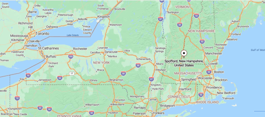
Spofford is a village in southwestern New Hampshire, located within the town of Chesterfield near the Vermont border. It’s about 6 miles west of Keene, reached via NH Route 9 as it winds past forested hills and the shoreline of Spofford Lake.
The drive offers glimpses of the water and surrounding ridges before arriving in the small lakeside community. It’s close enough for a quick trip to the city, yet the lake and quiet woods make it feel like a peaceful retreat.
11. Munsonville: Pond-Side Living in Monadnock Foothills
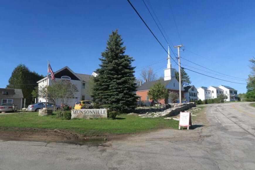
Munsonville, a small village within Nelson, rests along the quiet shores of Granite Lake, where wooded hills and winding back roads keep it feeling far from the rush of modern life. With no major highways nearby, the village unfolds in a mix of lakefront cottages, historic homes, and pine-shaded trails.
Life here follows the water’s rhythm—mornings often begin with mist drifting over the lake, and evenings fade to the soft calls of loons. Visitors can swim, paddle, or fish in Granite Lake, hike the surrounding woodland paths, or explore the charm of nearby Nelson village.
The seasons bring their own beauty, from the deep greens of summer to the fiery reds and golds of autumn. Many locals work in small trades, tourism, or commute to neighboring towns, keeping the community closely knit. It’s the kind of place where the stillness of the lake seems to linger in the air.
Where is Munsonville?
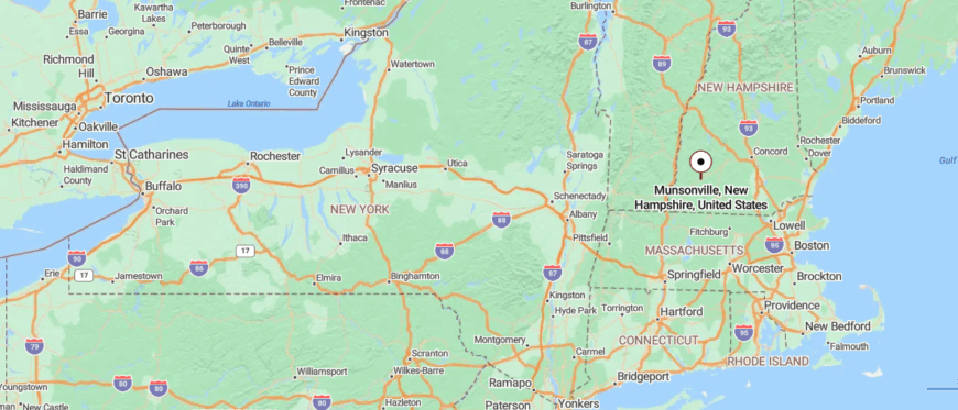
Munsonville is a village in southwestern New Hampshire, part of the town of Nelson in the Monadnock Region. It’s about 9 miles north of Keene, reached via NH Route 9 along winding roads that pass forested hills and the edge of Granite Lake.
The approach offers views of the water framed by tall pines before narrowing into a quiet, clustered village center. It’s just minutes from nearby towns, yet its lakeside setting gives it a feeling of calm seclusion.
10. Washington: High-Elevation Homesteads Amid Protected Wilderness
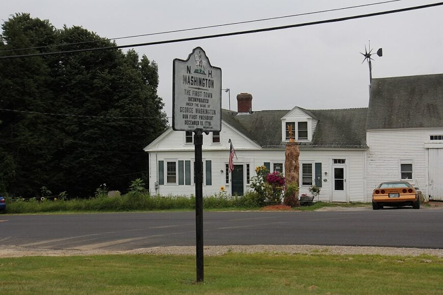
Washington sits above 1,500 feet with a population of about 1,100, giving it one of the highest average elevations in the state. Outdoor life centers on Ashuelot Pond, the trails of Pillsbury State Park, and snowshoe routes that wind through the Lovewell Mountain range.
Small home-based trades, seasonal tourism, and forestry replace big industry, and zoning keeps commercial activity minimal. Many houses are set on dirt spur lanes where old stone walls disappear into woods managed by the Society for the Protection of New Hampshire Forests.
Night skies stay dark enough for Milky Way photography because there are no large towns for miles. The elevation, surrounding conserved acreage, and a web of class-VI roads combine to create a deep sense of seclusion.
Where is Washington?
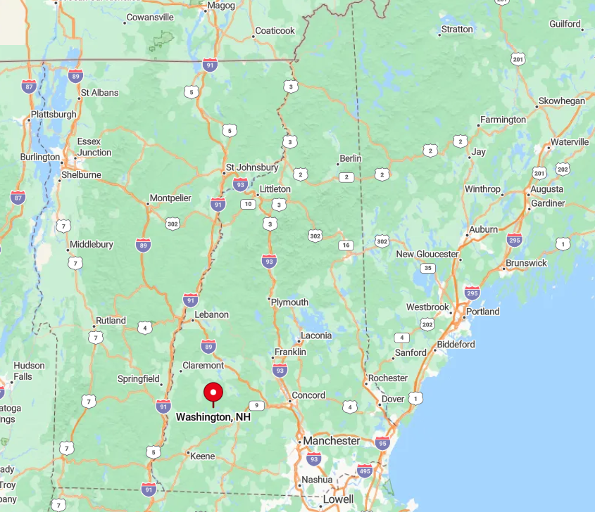
The town rests in the northwest corner of Hillsborough County, thirty miles north of Keene. With forested highlands on all sides and only state routes 31 and 10 skirting the outskirts, through-traffic is rare.
Reaching Washington usually involves a winding drive past lakes and second-growth forest that keeps speeds low and vistas high. Visitors arrive from Interstate 89 via Exit 5 in Warner or from Keene by following two-lane Route 9 to Route 31.
9. Windsor: Secluded Lakeside Cabins at the End of Winding Roads
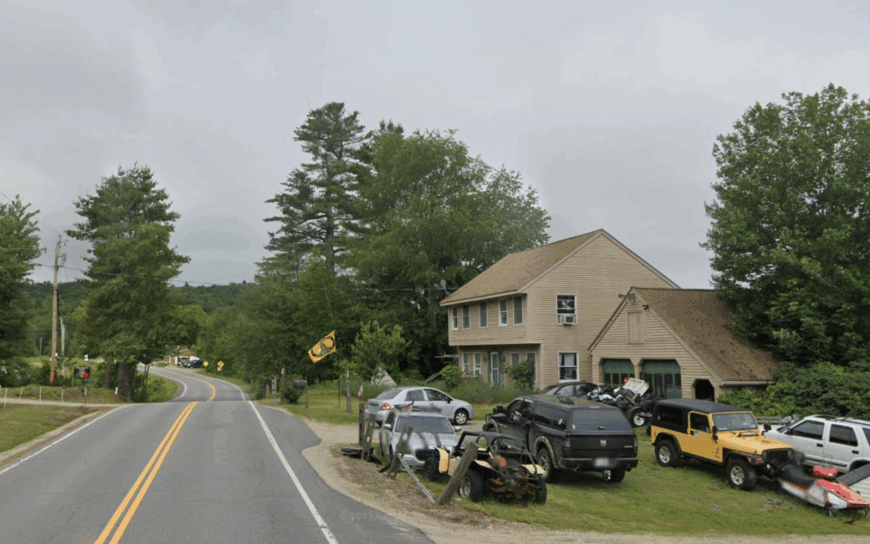
Home to roughly 250 residents, Windsor feels like a summer camp that never grew into a resort town. Hikers explore trails around White Pond while paddlers slip canoes onto Choate and Weeks ponds, both of which forbid gas motors and preserve glassy reflections.
Local income comes mainly from seasonal rentals, a small maple operation, and a nonprofit retreat center hidden in the woods. Dirt roads loop through towering oak and hemlock stands where stone foundations hint at 19th-century farms reclaimed by nature.
Many camps have no power lines in sight, relying on solar panels and generators to keep the lights on. Tight zoning rules and the lack of a village store reinforce the town’s hush.
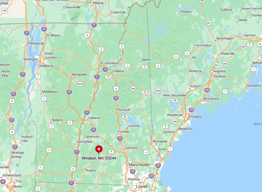
Where is Windsor?
🔥 Would you like to save this?
Windsor lies just south of Washington in the folds of the Monadnock Highlands, reachable by a single paved approach off Route 31. Steep hills and a ring of lakes ensure that no direct shortcut crosses town, so drivers must double back the way they came.
Limited winter maintenance on side roads keeps traffic low for much of the year. Access usually begins at Interstate 89 Exit 6, then follows a patchwork of state highways and local connectors into the hills.
8. Lempster: Wind Turbines Watching Over Remote Ridge Farms
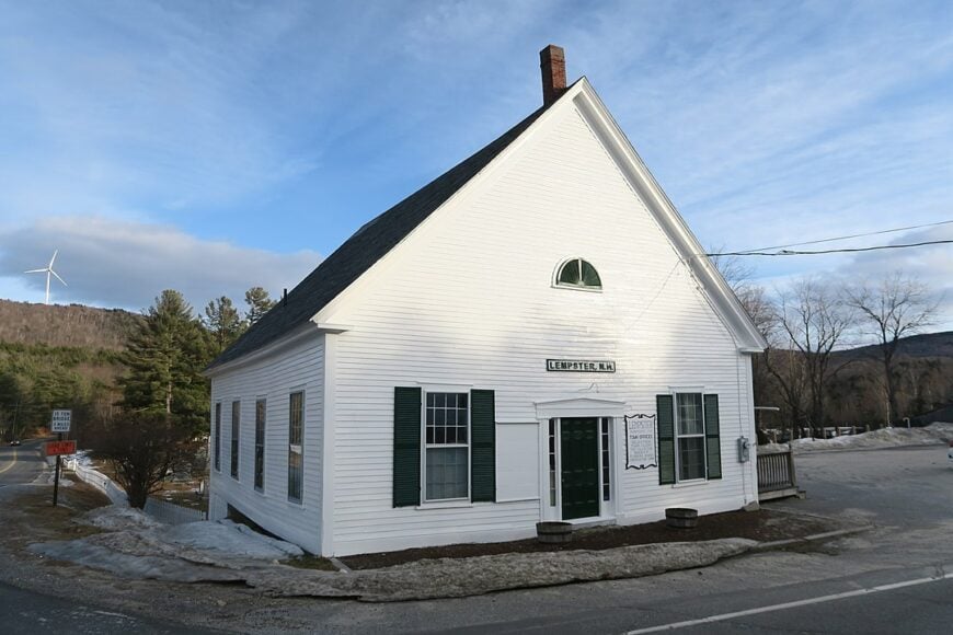
With a population near 1,100, Lempster balances open farmland and rugged ridgelines crowned by a line of 12 wind turbines. Residents fish Long Pond, explore sandstone caves off Lovejoy Road, and snowmobile the corridor from Silver Mountain to Marlow.
Forestry, small-scale agriculture, and turbine maintenance provide modest employment while keeping heavy development at bay. Homesteads perch on ridges where morning fog sits below the fields, offering dramatic views for landscape photographers.
Night skies glow faintly from turbine beacons rather than city glare. The blend of high ground, limited cell service, and miles of dirt roads creates an off-grid feeling only minutes from Route 10.
Where is Lempster?
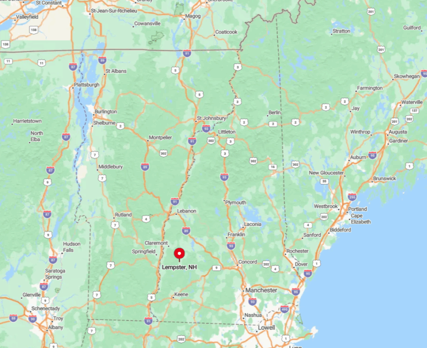
Lempster spreads across the Sullivan County uplands about twenty miles north of Keene. Ridges on three sides block easy passage, funneling travel to a single north-south state route that skirts town limits.
Visitors often ascend from Interstate 91 in Vermont, crossing the Connecticut River, then winding uphill for half an hour. The final approach along Mountain Road rises sharply, a reminder of why the town stays quiet.
7. Alstead: Waterfalls, Wildlife Corridors, and Old Mill Ruins
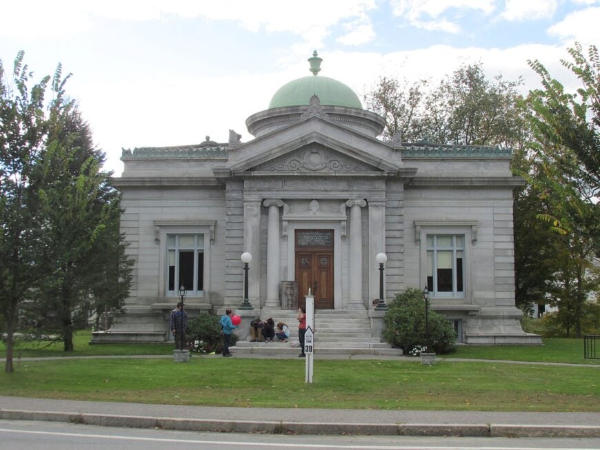
Alstead’s 1,900 residents share their hills with Warren Brook Falls, a 35-foot cascade hidden behind ferns and glacial boulders. Hikers trace beaver ponds on the Acworth-Alstead conservation corridor while birders scan for barred owls in the old hemlock stands.
The town’s economy leans on small agriculture, home workshops, and a single general store that doubles as a post office and coffee stop. Stone mill ruins along the Cold River remind visitors of the textile era, now long gone.
Large tracts of unposted woodland mean hunters, backpackers, and wildlife move freely across town lines. Absence of major retail and a river valley that floods every few decades discourages large-scale construction, preserving a sense of remoteness.
Where is Alstead?
Set along the Cold River in eastern Cheshire County, Alstead is fifteen miles north of Keene via Route 12A. High ridges and a hairpin section known locally as the “Alstead Switchbacks” slow traffic to a crawl.
The nearest four-lane highway is Interstate 91, over twenty miles west across the Connecticut River. Most visitors reach town via Route 123, a scenic but narrow road that discourages tractor-trailers.
6. Langdon: Covered Bridges and Curving Dirt Lanes
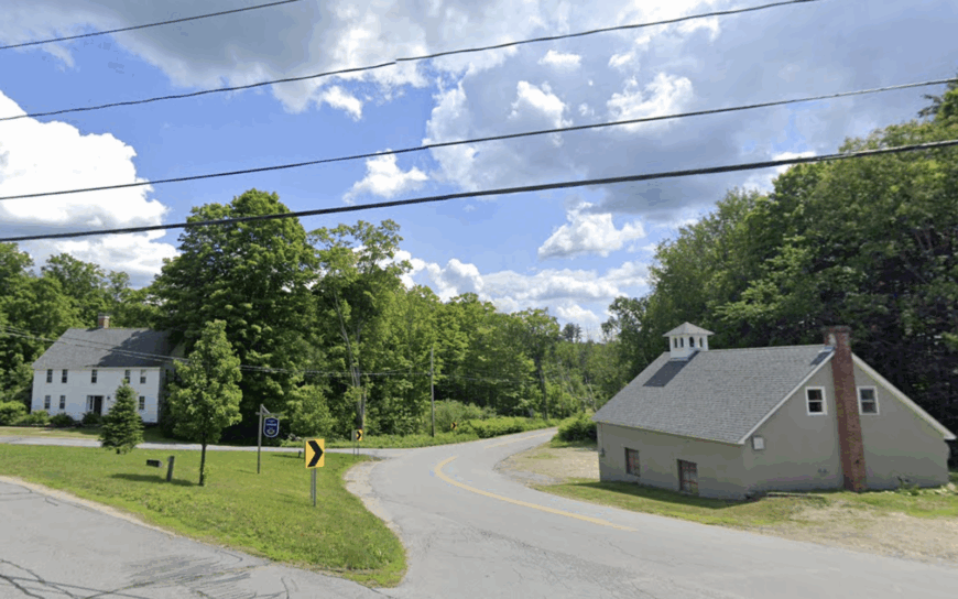
Langdon’s 688 residents live among broad intervals of pasture broken by two historic covered bridges, McDermott and Prentiss, that span the Cold River. Photographers favor early-morning fog rolling off hayfields bordered by sugar maples and centuries-old stone walls.
Dairy and maple syrup operations anchor the local economy, supplemented by telecommuters relying on satellite internet. Class-VI roads serpent between glacial erratics, giving mountain bikers miles of quiet exploration.
The town has no traffic light and only one tiny town-hall complex, keeping nighttime peaceful save for peepers and owls. Thick forest buffers on every boundary ensure neighboring towns feel far away.
Where is Langdon?
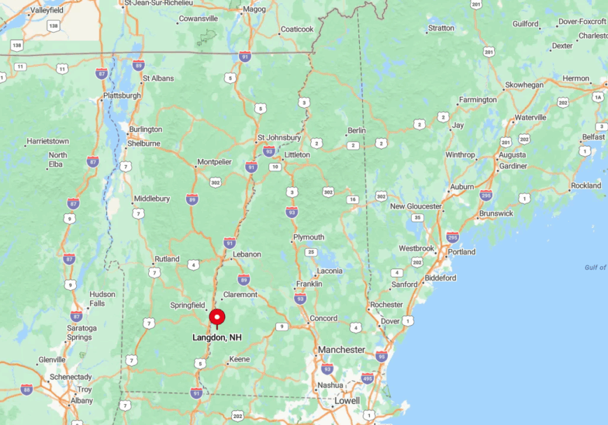
Langdon occupies a secluded bowl between the Alstead hills and the Connecticut River, accessed mainly from Route 12A or Route 123. The Cold River gorge isolates the town’s western edge, leaving just two narrow bridges as entry points.
Cell reception drops as soon as drivers descend into the valley, reinforcing its hidden quality. Travelers often exit Interstate 91 at Bellows Falls, Vermont, then cross into New Hampshire and wind south on backroads to reach Langdon.
5. Marlow: Classic New England Common in a Sea of White Pines
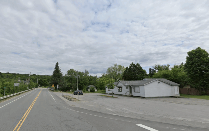
Marlow counts roughly 750 residents clustered around a postcard-ready common dominated by an 1829 white meetinghouse. Kayakers ply the kettle ponds of Bald Mountain State Forest while hikers ascend the Sugar River trail system for sunrise views.
A small furniture maker, a sawmill, and home-office professionals supply most of the tax base. Thick white-pine stands silence highway noise, and the lack of streetlights enables star-filled skies reflected in Village Pond.
Early risers catch loons breaking morning mist just steps from the town library. Sparse development beyond the common keeps the surrounding forest nearly uninterrupted for miles.
Where is Marlow?
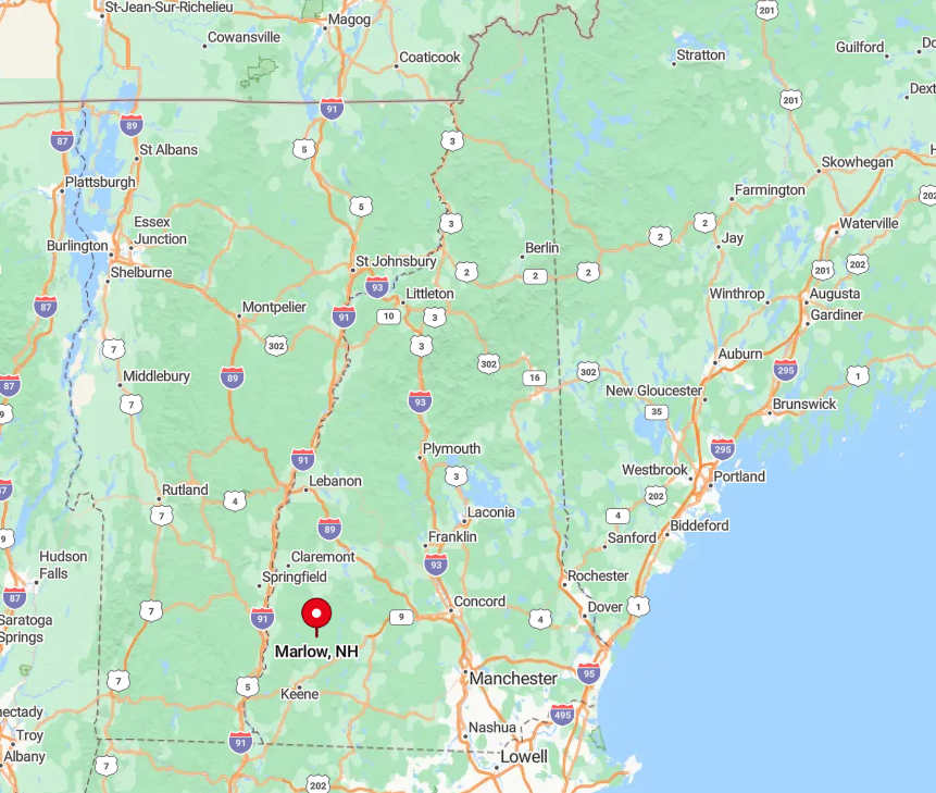
The town sits on Route 10, twenty minutes north of Keene, yet feels far removed once side streets fade to gravel. Hills concentrate traffic onto the single state highway, and winter storms often close lesser roads for days.
Visitors from Interstate 89 must navigate thirty miles of winding state routes that discourage commuter traffic. Marlow’s combination of terrain and limited road network preserves its tranquil character.
4. Surry: Pastoral Meadows Along Quiet Otter Brook
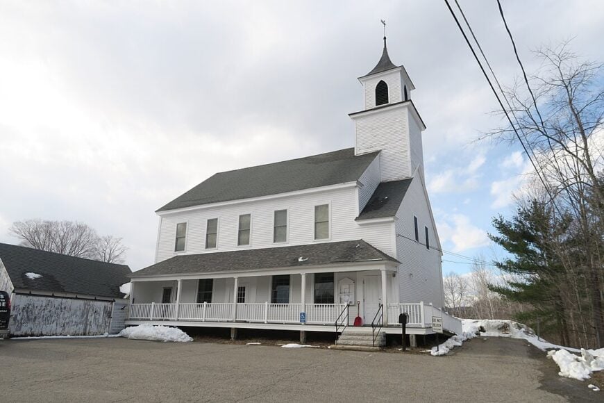
Surry’s population of about 865 enjoys broad meadows along Otter Brook bordered by antique barns and grazing sheep. Anglers cast for stocked trout below Surry Mountain Dam, and hikers follow the Cheshire Rail Trail through stands of white birch to hidden swimming holes.
The absence of any commercial strip means residents rely on farm stands, a volunteer-run library, and a single church fair for local commerce. Large parcels of open land are protected by conservation easements, which keep suburban sprawl at bay.
Early morning fog drifts over hay bales, creating idyllic scenes worthy of watercolor. With no traffic signals and scarcely any night glare, the village rests in near silence after dusk.
Where is Surry?
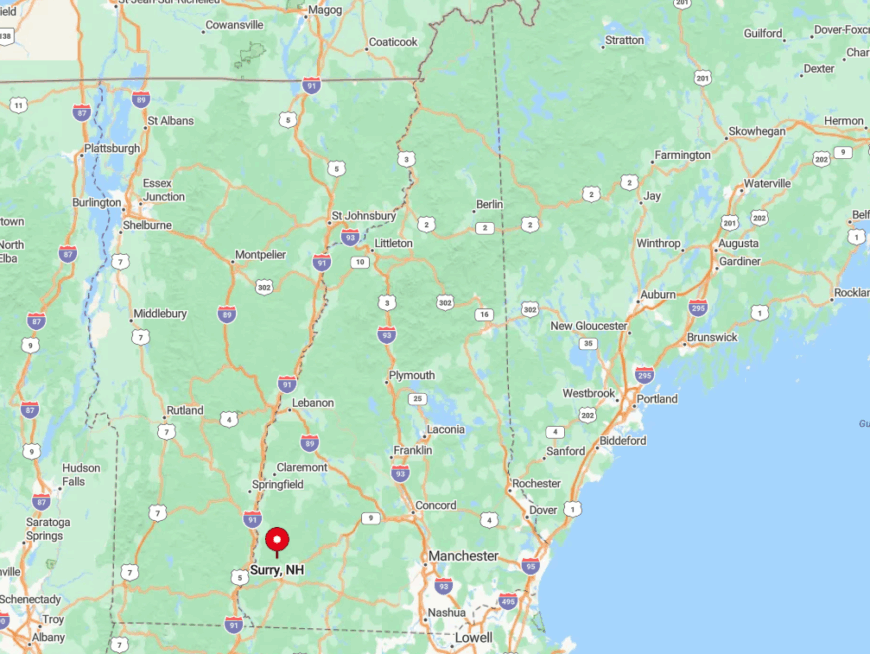
Surry borders Keene to the north, yet is separated by Otter Brook Reservoir and a ring of low hills. Only Route 12A enters town, and it dead-ends at the reservoir, eliminating through-traffic.
Travelers coming from Interstate 91 must detour around Keene, then head up a back road that narrows quickly. This single-direction access makes Surry feel farther from the city than the map suggests.
3. Nelson: Fiddle Tunes and Forest Trails Above Granite Lake
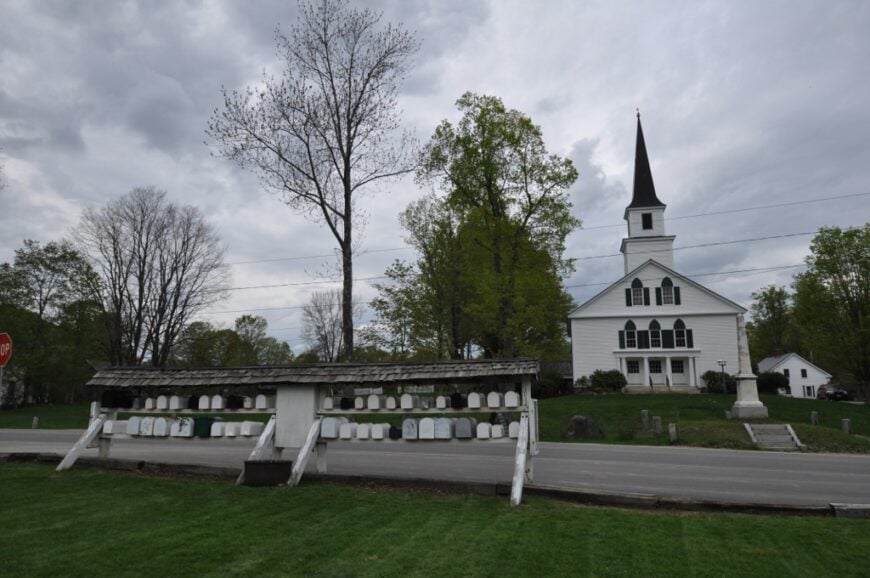
Nelson’s 768 residents gather for a famous Monday night contra dance that has run for more than seventy years in the hilltop town hall. Granite Lake, one of the clearest in the region, invites swimming, paddleboarding, and shoreline trail walks.
Employment centers on a summer camp, a pair of artisan woodworking shops, and remote workers who choose the town for its privacy. Conserved land blankets hillsides, where trails connect to the Harris Center for Conservation Education lands, offering wildlife tracking workshops.
Fog lifting off the lake at dawn provides dream-like photography without crowds. Elevation over 1,300 feet and a single access road to the village green keep the area hushed even in peak foliage season.
Where is Nelson?
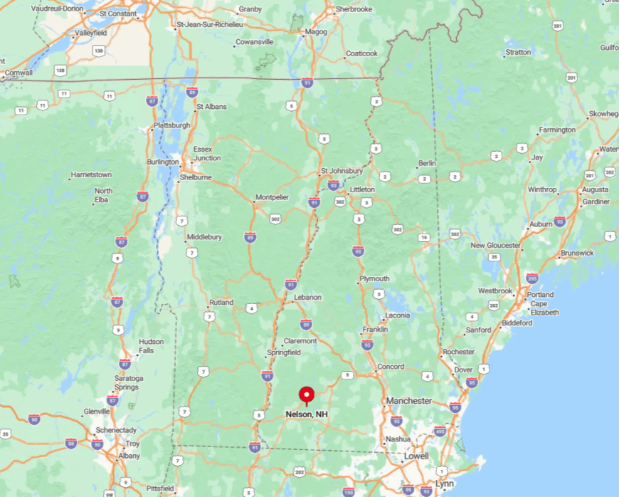
Nelson rises above Granite Lake roughly twelve miles northeast of Keene via Route 9, then Center Pond Road. The climb is steep and winding, discouraging heavy vehicles and casual sightseers.
Snowy months often see the road posted, turning the town into a relative island until spring thaw. Visitors from Interstate 93 must navigate a maze of back roads across the Monadnock plateau, a journey that rewards patience with quiet horizons.
2. Acworth: Hilltop Greens and 18th-Century Farmsteads
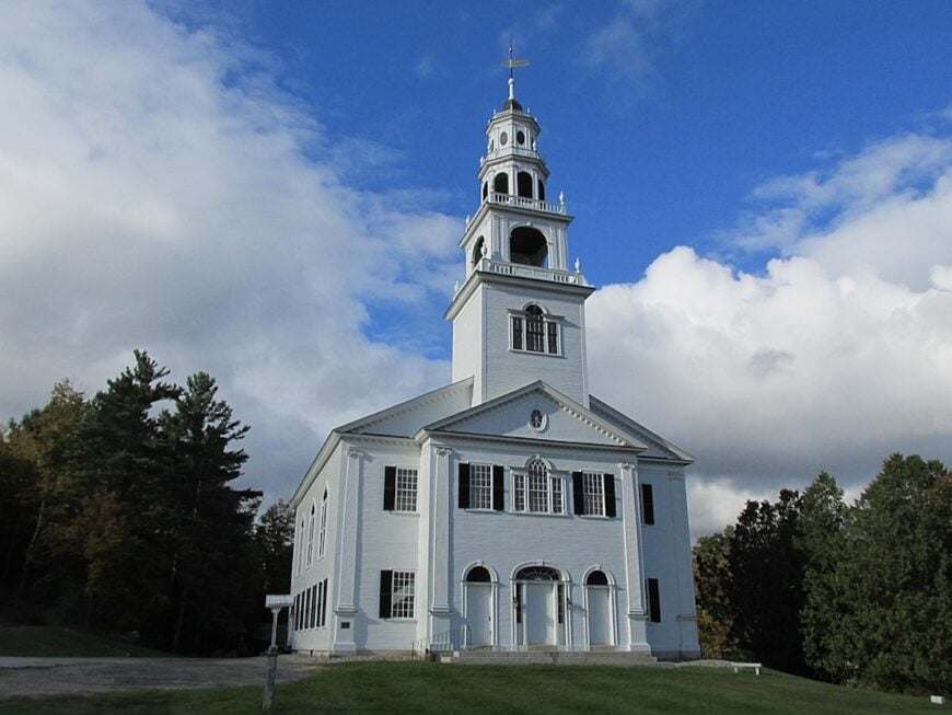
Acworth’s high ridges and narrow roads keep it feeling worlds away, even though it’s just over the hill from busier Cheshire County towns. Centered on one of New Hampshire’s most photogenic village greens, it’s lined with white-clapboard meetinghouses, 19th-century homes, and a library dating to 1824. Gravel lanes lead to farmsteads where weathered barns stand beside stone foundations from colonial days.
Life moves at a rural tempo—mornings carry the scent of cut hay drifting from the fields, and evenings fall quiet except for crickets and the occasional passing pickup.
Visitors can hike the surrounding Class VI roads that roll over hilltops, picnic beside Cold River tributaries, or visit local sugar shacks in maple season. Seasonal fairs draw neighbors together, but most days the village green stands empty beneath towering maples.
Where is Acworth?
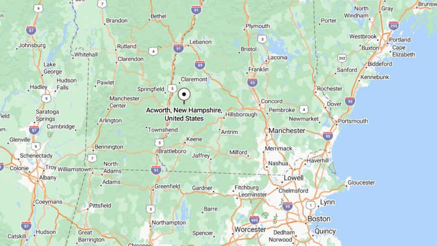
Acworth sits in the uplands of Sullivan County, about 20 miles northwest of Keene. The main approach follows Route 123A, a twisting two-lane that climbs steadily through woods and pastures before cresting into the village.
No direct highway crosses town—reaching Acworth means doubling back the way you came, with the road narrowing to gravel in spots. This isolation, paired with its elevation and surrounding farmland, preserves the quiet charm that has defined it for over two centuries.
1. Stoddard: Lakeside Granite Outcroppings and Endless Pines

Stoddard’s roughly 1,300 residents are scattered among lake camps, century-old farmhouses, and modern cabins set on multi-acre lots framed by granite outcrops and dense white pine.
Paddlers glide across Highland Lake at dawn while hikers thread quiet corridors of the 10,000-acre Andorra Forest protected by the Society for the Protection of New Hampshire Forests. Local livelihoods revolve around small-scale forestry, cottage rentals, and a single general store that doubles as a gas pump and gossip hub.
Bald eagles nest on Island Pond, and moose wander the shoreline shallows, providing rare wildlife viewing. Photographers treasure mirror-still water reflecting autumn color with no power lines in sight. The absence of major highways and the dominance of conservation land keep the township blissfully secluded year-round.
Where is Stoddard?
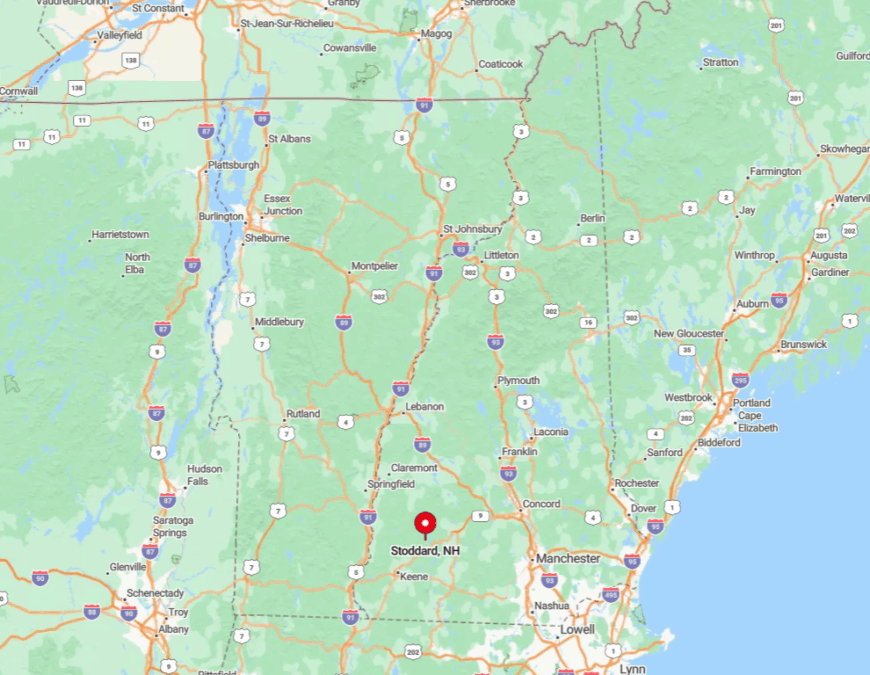
Stoddard sprawls across the high country north of Monadnock Region, bisected only by a curvy stretch of Route 123. Hills, lakes, and unmaintained forest roads block all shortcuts, so even locals plan extra travel time.
The closest interstate access points are I-89 in Warner or I-91 in Brattleboro, each nearly an hour away on two-lane roads. Visitors often arrive by winding past Otter Brook Lake, a trip that signals they have left the rush of the outside world behind.


