🔥 Would you like to save this?
Southwest Iowa is dotted with hamlets that many lifelong Iowans have never seen in person. These places once hummed with rail traffic, coal wagons, or small-town commerce, yet today they sit quietly behind screens of timber or miles of corn.
We invite readers on a leisurely countdown through twenty five of the region’s most secluded spots, where gravel lanes replace stoplights and church suppers still double as town meetings. Each settlement keeps its own cadence, protected by rolling prairie, the Loess Hills, or timbered river valleys that muffle the wider world.
In order to come up with the very specific design ideas, we create most designs with the assistance of state-of-the-art AI interior design software. Also, assume links that take you off the site are affiliate links such as links to Amazon. this means we may earn a commission if you buy something.
Visitors find room to breathe, stargaze, and pick up local lore straight from the porch swing. From a forgotten coal camp to a timber-rimmed crossroads, these are the corners of Iowa that reward curiosity and an unhurried map.
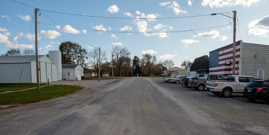
25. College Springs – Tree-Lined Grid Near the State Line
Tucked into the gentle folds of Iowa’s rolling hills, College Springs feels worlds away from the rush of modern life. With no major highways cutting through and fields stretching endlessly in every direction, it’s the kind of place where you hear more wind than traffic.
The town moves at a quiet, steady pace, shaped by generations of farming families who know every inch of the land. Visitors can wander shaded country lanes, explore the historic brick schoolhouse, or spend an afternoon fishing at a nearby pond where the water mirrors the sky.
A small café at the heart of town serves as both diner and gathering place, its conversations as warm as the coffee. Here, life is anchored in agriculture, with fields of corn and soybeans marking the seasons. It’s the sort of place that doesn’t just slow you down—it teaches you the beauty of staying still.
Where is College Springs?
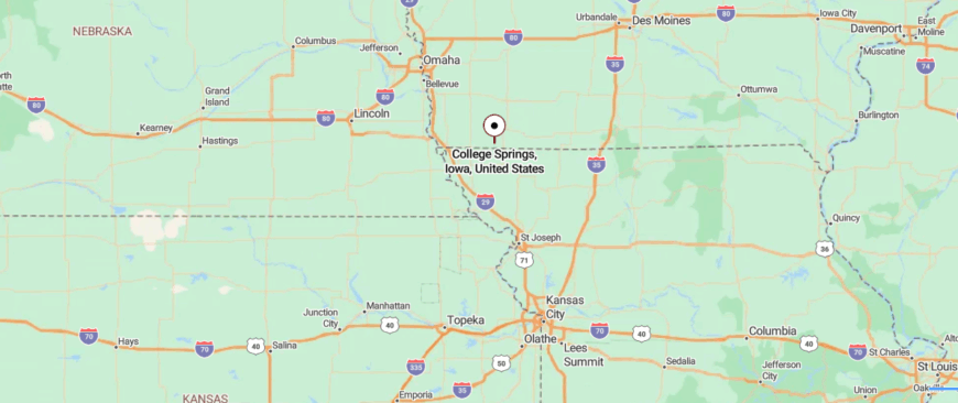
College Springs rests in the far southwestern corner of Iowa, just a few miles north of the Missouri border. It lies about 8 miles south of Clarinda, the nearest larger town, and can be reached by following quiet county roads that branch off U.S. Highway 71.
The drive takes you past open farmland and gentle hills, with little traffic to disturb the stillness. It’s close enough to reach in under an hour from the highway, yet far enough that the world feels like it’s slipped quietly away.
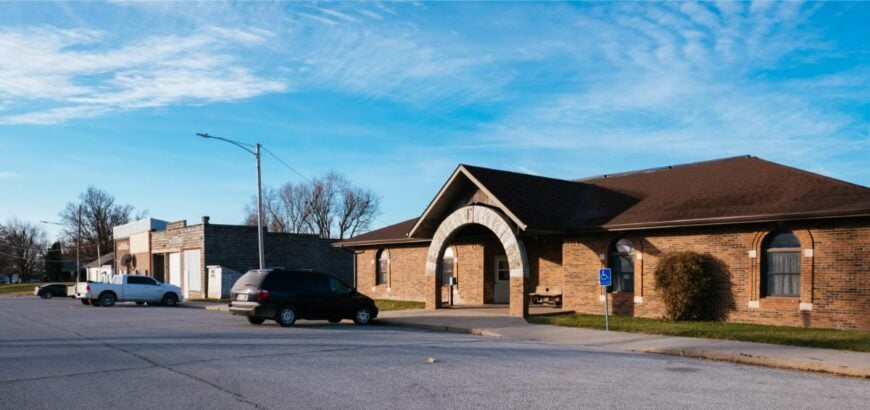
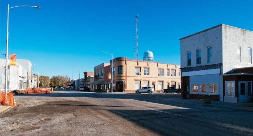
24. New Market – Hillside Settlement With a Busy Ballfield
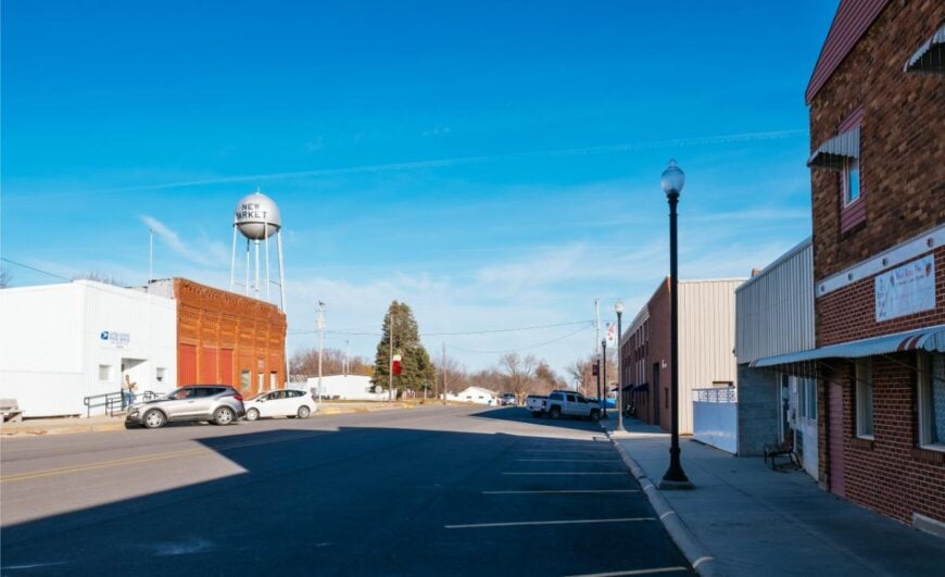
Cradled in the quiet hills of southwest Iowa, New Market rests far from the hum of interstates and city lights. Its small grid of streets is wrapped in farmland, where sunrise spills over fields and the air carries the scent of freshly cut hay.
Life here has a neighborly rhythm, with family farms, the local school, and community events forming the town’s heartbeat. You might spend a morning at the town park, browse the shelves of its modest library, or join in a seasonal festival that draws folks from miles around.
History lingers in its old storefronts and grain elevators, silent reminders of decades past. Agriculture remains the lifeblood, with crops and cattle sustaining both economy and tradition. It’s the kind of place where the world feels comfortably far away, and the quiet has a way of settling in your bones.
Where is New Market?
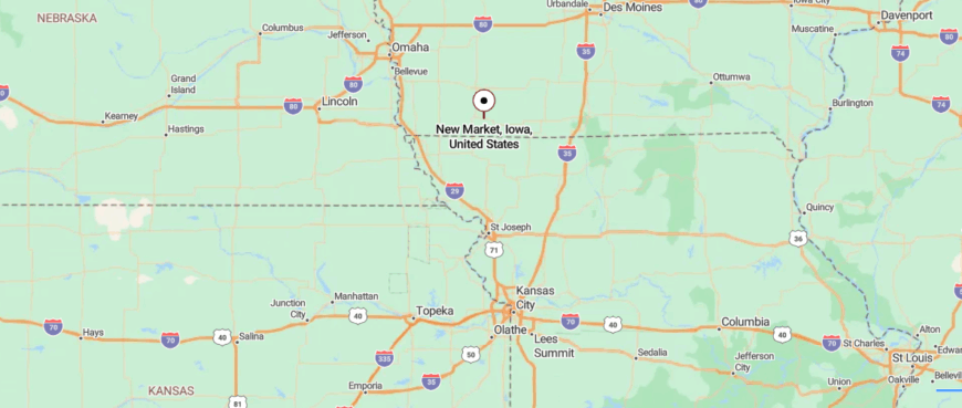
New Market sits in the rolling hills of southwestern Iowa, roughly 12 miles southwest of the larger town of Clarinda. It’s reached by turning off U.S. Highway 71 onto smaller two-lane roads that wind through farmland and tree-lined stretches.
The approach is calm and unhurried, with open views that stretch far in every direction. It’s a place where the pace slows, and the surrounding quiet makes you feel like you’ve stepped away from the everyday world.
23. Lenox – Mixed Heritage Hub With Quiet Side Streets
Surrounded by miles of gently rolling farmland, Lenox sits tucked away in southwest Iowa, where the horizon feels wide and the pace unhurried. The town’s heart beats along Main Street, with its vintage storefronts, small cafés, and a restored opera house that still hosts community events.
Lake Binder lies just beyond the edge of town, inviting afternoons of fishing, boating, or quiet reflection by the water. Summer nights often center around the local ballpark, where the glow of stadium lights draws families and friends together.
Farming remains the backbone of life here, with each season marked by the rhythms of planting and harvest. In Lenox, the calm settles in quickly, wrapping visitors in a sense of belonging that’s hard to leave behind.
Where is Lenox?
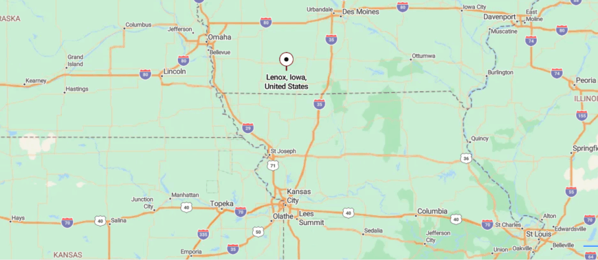
Lenox is located in southwestern Iowa, about 20 miles east of Creston and just north of the Taylor–Adams county line. Travelers reach it via Iowa Highway 49 or U.S. Highway 34, passing through a patchwork of farmland and gently rolling prairie.
The drive feels steady and uncluttered, with long stretches of open sky overhead. It’s the kind of place where the horizon seems to widen, and the quiet settles in around you.
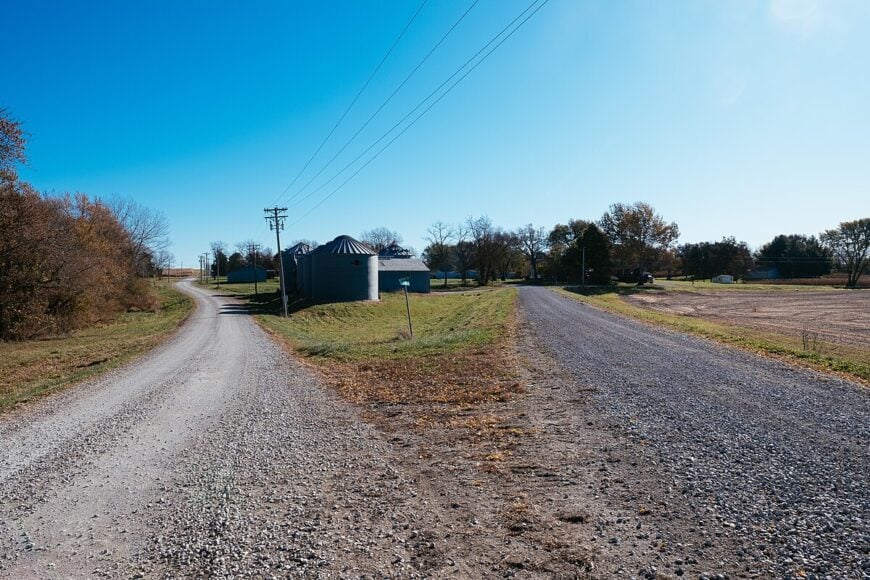
22. Sharpsburg – Grain Bin Hamlet Beside a Country Crossroad
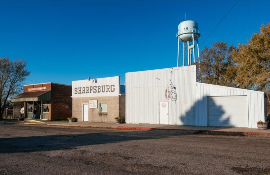
Set deep in the farm country of southwest Iowa, Sharpsburg is the kind of place you reach by roads that wind through endless fields and open skies. With just a handful of streets and no rush of traffic, the town moves to the steady rhythm of the land.
Neighbors gather at the local café or meet along fence lines, sharing stories as easily as they share garden vegetables. Days here might be spent tending crops, walking the quiet gravel roads, or watching a golden sunset fade into a horizon uninterrupted by buildings.
The lifeblood is farming, shaping both work and community ties. In Sharpsburg, life feels stripped down to its essentials—quiet, connection, and the comfort of familiar faces.
Where is Sharpsburg?
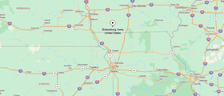
Sharpsburg lies in the heart of southwestern Iowa, about 12 miles southeast of Lenox and a short drive from Iowa Highway 148. You reach it by way of narrow county roads that weave between farm fields and clusters of trees.
The journey is calm, with few cars and wide views of open countryside. It’s close enough to neighboring towns for convenience, yet its stillness makes it feel far removed from the rush of daily life.
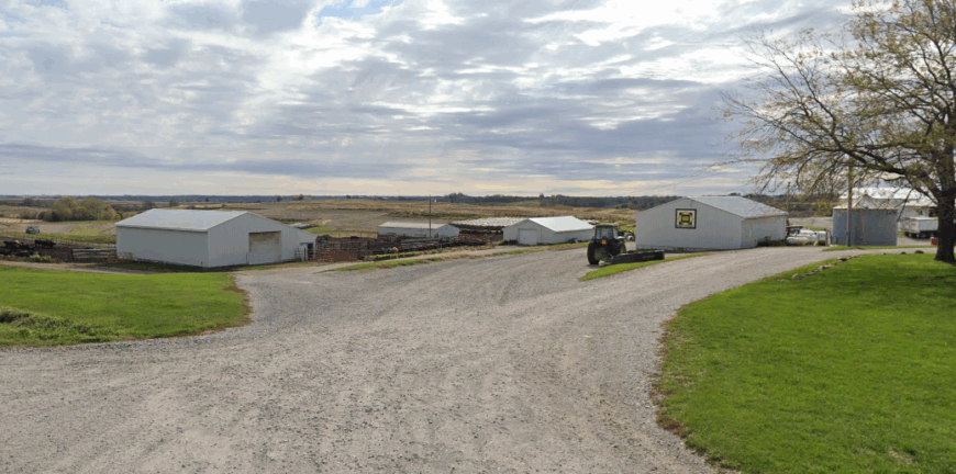
21. Maloy – Tiny Crossroads With a Church and a Memory
Hidden among the quiet backroads of southwest Iowa, Maloy is a place where the world seems to slow to the rhythm of the wind through the fields. With only a few homes and streets, it feels more like a close-knit gathering of neighbors than a traditional town.
Old church steeples and weathered barns tell stories of generations who worked the land and built their lives here. Visitors might take a slow drive through its peaceful lanes, pause to watch deer in the fields, or follow the gravel roads that lead to wide-open views of the countryside.
Ranching and farming remain at the core of daily life, with each season marking its own chapter. Maloy holds a rare kind of stillness—the kind that makes you realize how quiet the world can truly be.
Where is Maloy?
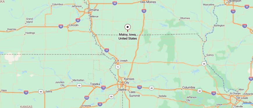
Maloy is tucked into the quiet countryside of southwest Iowa, about 15 miles south of Mount Ayr and near the Missouri border. Access comes via lightly traveled county roads branching off Iowa Highway 2, passing stretches of farmland and rolling hills.
The approach feels unhurried, with only the wind and open fields for company. It’s a small dot on the map where the stillness seems to linger in the air long after you arrive.
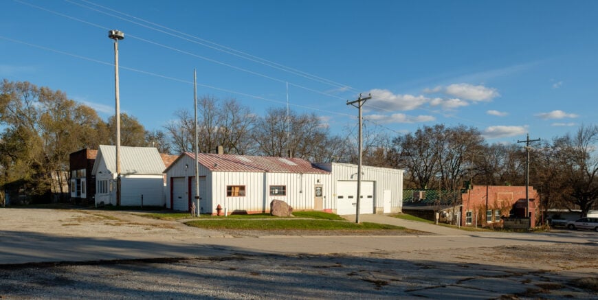
20. Morton Mills – Bluff-Edge Hamlet Above the Middle Nodaway
Tucked away along the gentle curves of rural roads, Morton Mills rests in the rolling farmland of southwest Iowa, far from busy highways or crowded towns. Its few streets are lined with homes that have stood for generations, surrounded by fields where the wind moves in slow, steady waves.
Life here revolves around the land, with farming and livestock at the heart of daily routines. A drive through the area reveals quiet gravel roads, historic barns, and views that stretch clear to the horizon.
Neighbors know one another by name, gathering for community events or lending a hand when needed. In Morton Mills, time feels unhurried, and the silence carries a comforting weight that stays with you long after you’ve gone.
Where is Morton Mills?
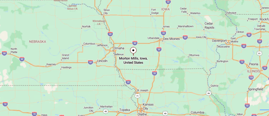
Morton Mills rests in southwest Iowa, about 10 miles northeast of Corning and not far from the East Nishnabotna River. It’s reached by way of rural gravel roads that branch from Iowa Highway 148, winding past fields and quiet groves.
The drive offers few signs of traffic, letting the open countryside set the pace. It’s the kind of place where the world feels far away, and the wide skies seem to stretch endlessly overhead.
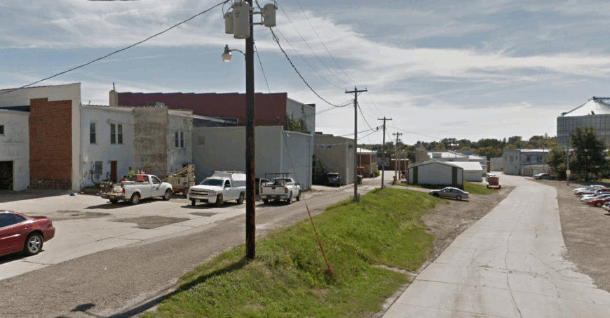
19. Grant – Hilltop Village With a Century-Old Hall
🔥 Would you like to save this?
Set among the winding backroads of southwest Iowa, Grant feels like a small island of community surrounded by an ocean of farmland. With just a few blocks of homes, a historic main street, and fields stretching in every direction, it remains well off the beaten path.
The old town hall and century-old buildings speak quietly of its past, while neighbors keep traditions alive through local gatherings and seasonal events. Visitors might stop to explore its history, walk its peaceful streets, or follow rural trails into the surrounding countryside.
Farming anchors daily life, with each harvest marking the passage of time. Grant holds the kind of quiet that makes you pause, breathe, and feel the pull of simpler days.
Where is Grant?
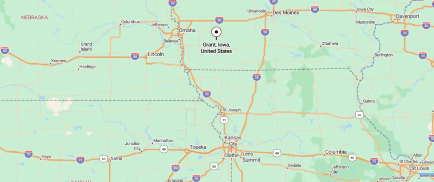
Grant sits in the gentle hills of southwest Iowa, about 16 miles southeast of Atlantic and a short drive from Iowa Highway 48. You reach it by following quiet county roads that curve past farmland and cross small creeks.
The approach is peaceful, with open fields and wind-swept trees lining the way. It’s close enough for a quick trip from nearby towns, yet its calm surroundings make it feel worlds apart.
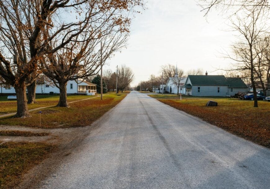
18. Hawleyville – Cluster of Homes in Timbered Lowland
Nestled where gravel roads meet rolling farmland, Hawleyville sits quietly between the larger towns of southwest Iowa, far from the rush of main highways. Its small cluster of homes, a historic church, and surrounding fields create a sense of timelessness, as though little has changed in decades.
The air is filled with the sounds of wind in the crops and the distant call of meadowlarks, offering a calm that’s hard to find elsewhere. Days here often revolve around tending the land, visiting with neighbors, or exploring the scenic rural routes that wind through the countryside.
Farming remains the heartbeat of the community, tying each season to the next. Hawleyville has a stillness that settles deep, leaving you with the feeling you’ve stepped into a quieter chapter of the world.
Where is Hawleyville?
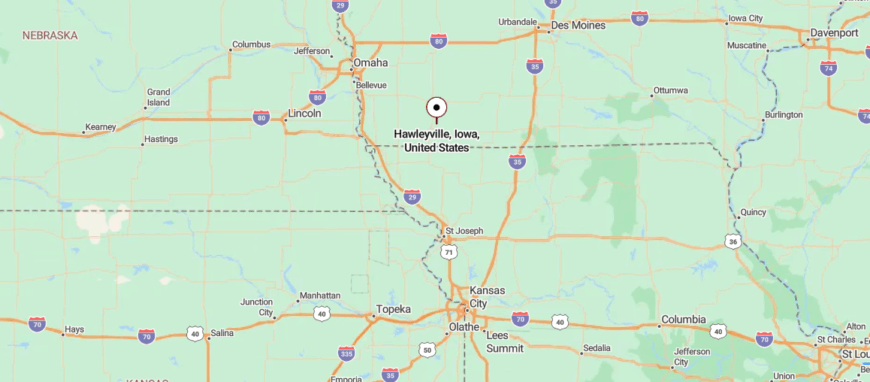
Hawleyville is nestled in the countryside of southwest Iowa, about 8 miles east of Clarinda and just south of U.S. Highway 34. It’s accessed by small county roads that pass between open farmland and pockets of woodland.
The route is simple but unhurried, with long views that give way to a quiet cluster of homes. It’s near enough to larger towns for ease, yet its stillness makes it feel set apart from the everyday.
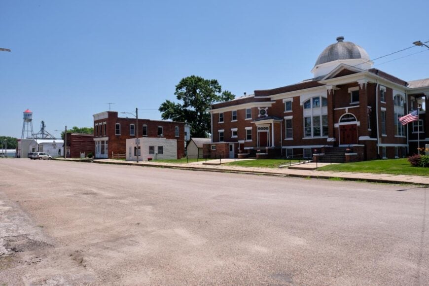
17. Braddyville – Border Village With a Sleepy Main Drag
Resting at Iowa’s southern edge along the Missouri border, Braddyville is a quiet crossroads town surrounded by open farmland and big skies. Its modest streets hold homes, a few local businesses, and gathering spots where neighbors greet each other by name.
The nearby Nodaway River winds through the countryside, offering peaceful spots for fishing, picnicking, or simply watching the water move past. Community life often centers on small-town events, church suppers, and the steady rhythm of farming seasons.
Agriculture remains the anchor, with fields of corn and soybeans stretching far beyond the town limits. In Braddyville, the pace is slow, the horizons are wide, and the quiet feels like an old friend you’re always glad to see again.
Where is Braddyville?
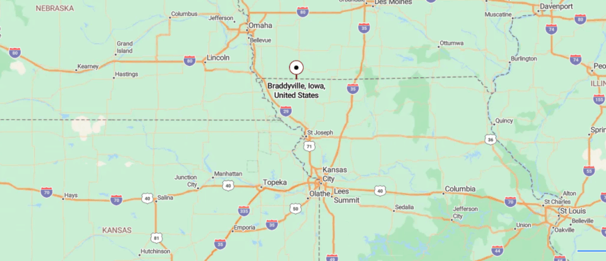
Braddyville sits at Iowa’s southern edge, right along the Missouri border, about 12 miles south of Clarinda. It’s reached by following U.S. Highway 71 and then easing onto quieter local roads that lead into town.
The drive passes a mix of farmland and open prairie, with few interruptions along the way. It’s close enough to cross state lines in minutes, yet its peaceful setting feels far from the pull of busier places.
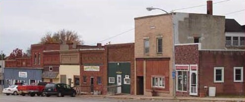
16. Elliott – Prairie-Rimmed Grid Beside a Former Rail Spur
Surrounded by the rolling farmland of southwest Iowa, Elliott sits tucked away from major highways, giving it a peaceful, almost hidden feel. Its small downtown holds a handful of businesses, a historic bank building, and gathering places where neighbors swap news over coffee.
The nearby Nishnabotna River offers quiet fishing spots and scenic drives that wind through fields and wooded bends. Community pride shows in local events, from holiday parades to summertime ball games at the town park.
The backbone of life here is farming, shaping both the economy and the rhythm of the seasons. Elliott carries a calm, unhurried charm that makes it easy to forget the rush of the outside world.
Where is Elliott?
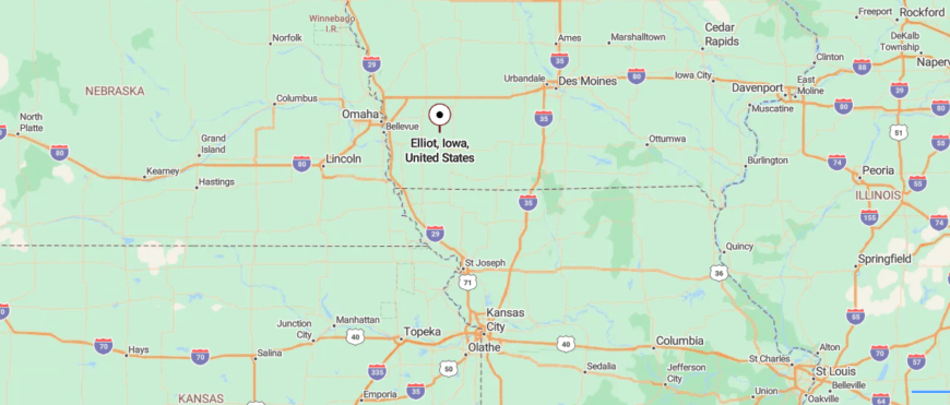
Elliott is located in southwest Iowa, about 12 miles northwest of Red Oak and near the West Nishnabotna River. You reach it via Iowa Highway 48, then turn onto smaller town streets bordered by open fields and scattered trees.
The approach is easygoing, with wide skies and light traffic setting a slower rhythm. It’s near enough for a short drive from neighboring towns, yet its quiet streets feel removed from the rush of daily life.
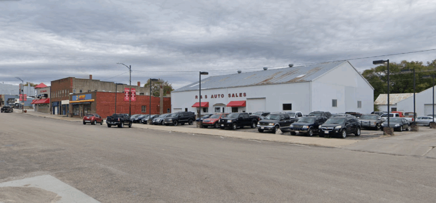
15. Massena – Elevator Town Wrapped in Open Sky
Massena lies in the gentle sweep of southwest Iowa’s farmland, where the horizon feels endless and the days move unhurried. Its streets are lined with long-standing businesses, a café where neighbors gather, and community spaces that host everything from pancake breakfasts to holiday celebrations.
Beyond the town limits, fields of corn and soy sway in the breeze, and nearby Cold Springs State Park offers trails, fishing spots, and shaded campgrounds. The seasons mark time here more than clocks, each bringing its own work, its own joys.
Agriculture remains the backbone, but it’s the close bonds between residents that truly shape daily life. In Massena, you find a stillness that makes you want to linger just a little longer.
Where is Massena?
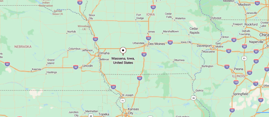
Massena lies in southwestern Iowa, about 16 miles south of Atlantic and just west of Iowa Highway 148. Travelers reach it by way of two-lane roads that wind through farmland and low, rolling hills.
The approach feels steady and open, with long stretches of sky framing the horizon. It’s close enough for an easy trip from nearby towns, yet the surrounding quiet makes it feel comfortably apart from the busier world.
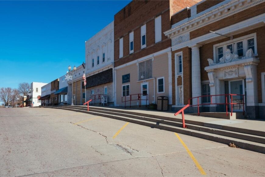
14. Tenville – Near-Empty Grid Hidden by Grain Fields
Tenville sits quietly along a stretch of rural road in southwest Iowa, surrounded by farmland that rolls on toward the horizon. With only a few homes and farmsteads, it feels more like a shared neighborhood in the countryside than a traditional town.
Life here is measured by the changing seasons—planting in spring, harvest in fall, and the calm of winter when the fields rest under snow. Days might be spent tending livestock, driving tractors across open ground, or visiting with neighbors over a fence line.
The pace is slow, the nights are deeply still, and the sense of space is almost endless. In Tenville, the quiet isn’t just background—it’s part of the place itself.
Where is Tenville?
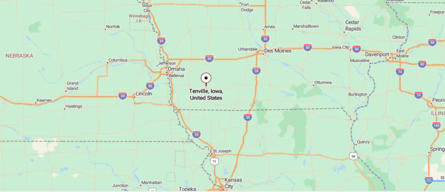
Tenville is a small crossroads community in southwest Iowa, about 7 miles south of Corning along U.S. Highway 148. The route passes through open farmland and gentle hills, with only a few turns before the town comes into view.
Traffic is light, and the scenery shifts slowly, lending a calm rhythm to the drive. It’s easy to reach, yet its quiet setting feels like a pause from the outside world.
13. Stanton – Swedish-Rooted Town With Towering Coffee Pot
🔥 Would you like to save this?
Stanton lies in a pocket of southwest Iowa where hills roll gently into farmland and the air feels unhurried. Its skyline is marked by the whimsical coffee pot water tower, a tribute to the town’s Swedish heritage that runs deep through its festivals, food, and community pride.
A walk through town leads past well-kept homes, the Swedish Heritage Museum, and gathering spots where neighbors meet year-round. Just beyond, country roads wind toward fishing lakes, open fields, and views that stretch for miles.
The rhythm here follows the land, with farming and tradition guiding each season. Stanton leaves you with the sense that life can be both simple and deeply rooted at the same time.
Where is Stanton?
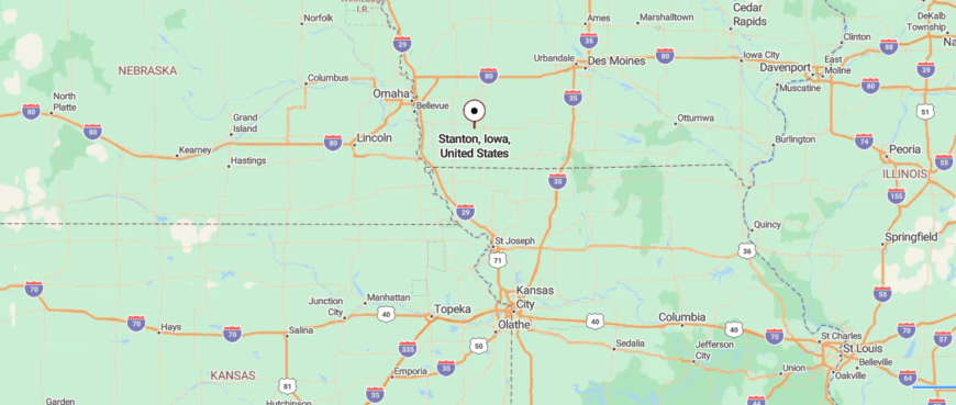
Stanton rests in southwest Iowa, about 10 miles east of Red Oak and just south of U.S. Highway 34. It’s reached by turning onto smaller paved roads that pass between farmland, windbreaks, and gently rolling hills.
The approach is calm and open, with few signs of hurry along the way. It’s near enough for convenience, yet its peaceful surroundings give it the feeling of being set apart.
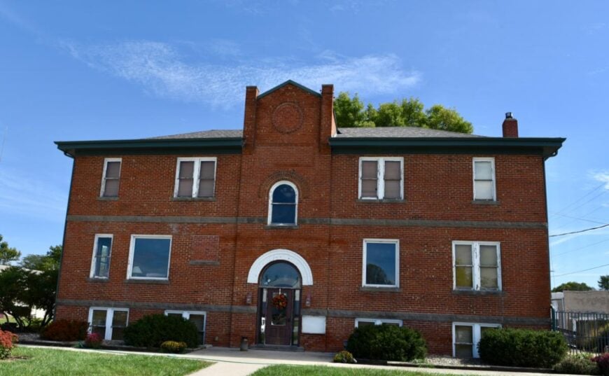
12. Imogene – Irish Catholic Enclave on the Prairie
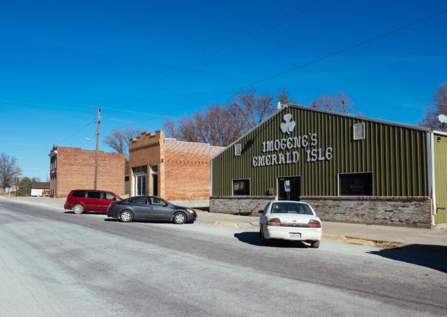
Imogene is tucked deep in southwest Iowa, a place where the road narrows and the horizon opens wide. The steeple of St. Patrick’s Catholic Church rises above the fields, a landmark that has watched over the town for generations.
Life unfolds in small but meaningful ways—farm work at dawn, shared meals at the local café, and community gatherings that fill the calendar. Gravel roads lead to quiet fishing holes and vantage points where the sunsets spill color across the sky.
The land provides not only a livelihood but a shared identity, woven into every season. In Imogene, the pace is unhurried, and the sense of belonging runs deep.
Where is Imogene?
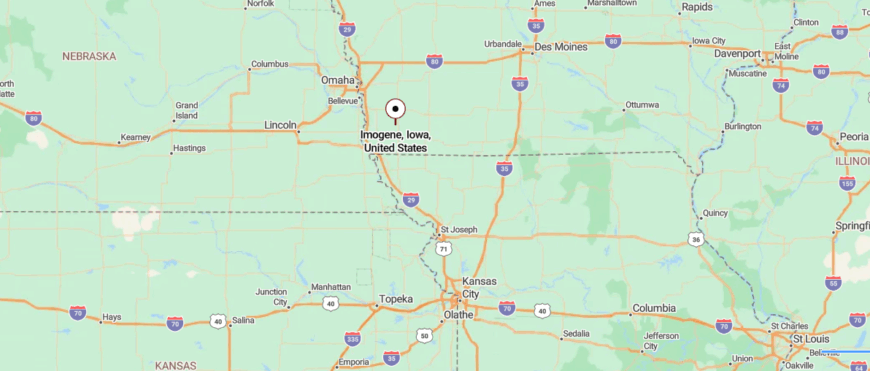
Imogene is nestled in the southwest corner of Iowa, about 12 miles southwest of Shenandoah and close to the Nishnabotna River. It’s reached by way of Iowa Highway 2, followed by smaller county roads that wind through farmland and open fields.
The drive is quiet, with wide horizons and only the occasional passing car. It’s close enough for an easy visit, yet its stillness makes it feel like a world of its own.
11. Essex – Compact Rail Town in a Sea of Corn
Essex lies along the gentle sweep of southwest Iowa, its streets shaded by old trees and framed by fields that glow gold in late summer. The town’s railroad past lingers in brick storefronts and the museum that keeps its history alive.
Locals gather for parades, ball games, and music in the park, filling the evenings with conversation and laughter. A short drive leads to quiet fishing lakes, winding backroads, and the kind of open skies that make sunsets feel like an event.
Life here flows without hurry, each day shaped more by shared moments than by the clock. In Essex, it’s the sense of community that stays with you long after you’ve gone.
Where is Essex?
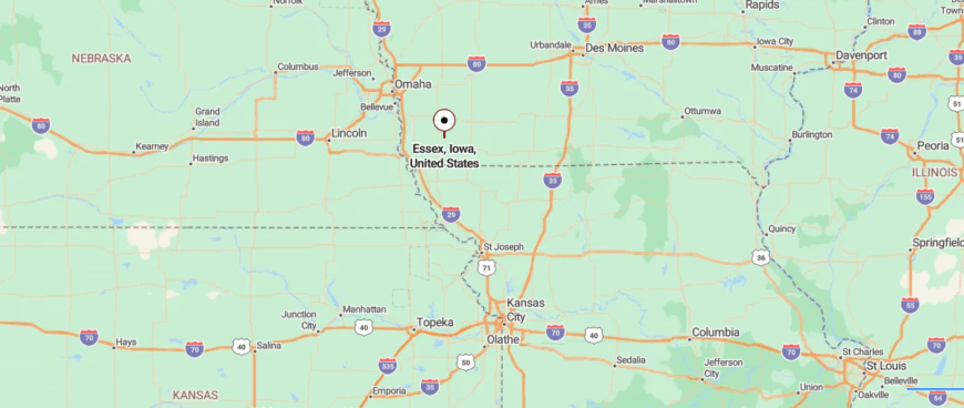
Essex is located in southwest Iowa, about 8 miles south of Shenandoah and just east of U.S. Highway 59. You reach it by way of smooth two-lane roads that pass through open farmland and gentle hills.
The approach is unhurried, with broad skies stretching in every direction. It’s an easy trip from nearby towns, yet its quiet streets give it a sense of being apart from the busier pace beyond.
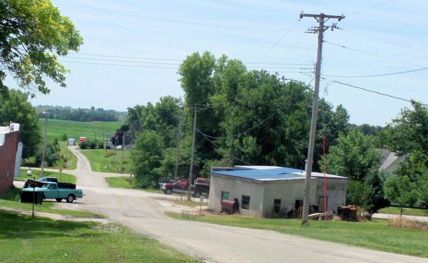
10. Carbon – A Forgotten Coal Hamlet Tucked in the Nodaway Valley
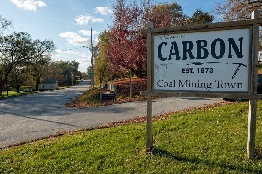
Roughly thirty-five people call Carbon home, far fewer than the hundreds who once labored in its coal shafts. Hikers wander the old company roads to spot stone foundations, collapsed mine entrances, and the Carbon Cemetery where miners’ headstones lean at wild angles.
A handful of residents raise cattle or truck grain to nearby Corning, while others commute to seasonal logging work in the Nodaway River bottom. The town has no stores, only weather-worn cottages spaced generously apart, so night skies stay pitch black and traffic is nearly nonexistent.
Songbirds and the hiss of wind through walnut groves supply most of the ambient sound. All of this makes Carbon feel as if modern Iowa simply flowed around it and never came back.
Where is Carbon?
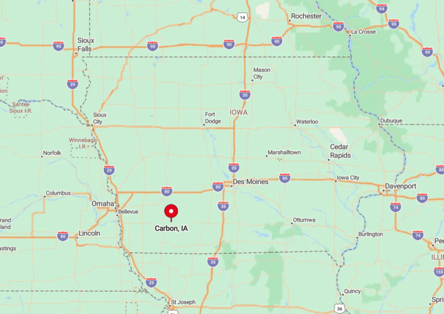
Carbon sits in western Adams County, five gravel-road miles south of Highway 34 and roughly twelve minutes from Corning. Steep wooded bluffs shield the valley from highway noise, and the nearest gas station is two towns away.
Travelers reach Carbon by turning south off Iowa 148 onto a narrow county lane that snakes along the Nodaway River. With no signage bigger than a mailbox, first-timers often miss the turn and have to circle back.
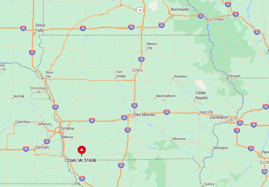
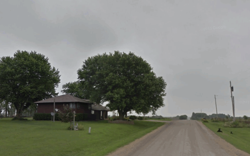
9. Coin – Tiny Grain-Elevator Village on the Missouri Line
Around 180 residents live in Coin, a town where the wooden grain elevator still reigns as the tallest structure for miles. Locals drop by the community center for Friday-night cards or drive north to Shenandoah for groceries, leaving Main Street quiet enough for barn swallows to nest under the café’s shuttered awning.
Soybeans, corn, and seed stock trials dominate the economy, with the elevator’s whistle marking harvest days that can be heard across state lines. Birders come for the prairie potholes west of town, a seasonal stopover for snow and Ross’s geese most outsiders overlook.
Wide farmsteads fill the gap between houses, so porch lights appear as single stars on the horizon after dark. The absence of retail chains or even a working stoplight underscores how far Coin sits from urban churn.
Where is Coin?
🔥 Would you like to save this?
Perched in southern Page County, Coin lies less than two miles north of Missouri on County Road J52. The route sees little more than grain trucks and school buses, preserving a striking stillness.
Visitors usually exit U.S. 71 at Braddyville, then zigzag west through bean fields that hide the village until the elevator finally comes into view. With Omaha ninety minutes away and no public transit, Coin stays isolated by distance as well as by design.
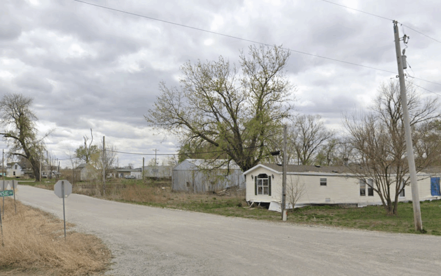
8. Siam – Crossroads Community Wrapped in Rolling Prairie
Siam’s population hovers near fifty, clustered mainly around a white country church at the meeting of two county roads. Summer brings ice-cream socials on the church lawn, while autumn sees locals gather for prairie hikes along the East Fork of the One Hundred and Two River.
Farming and cow-calf operations provide the primary income, though a few residents telecommute thanks to recently buried fiber cable. Because there are no retail fronts, gas pumps, or even a vending machine, the prairie itself supplies both recreation and insulation.
Nightfall delivers a vault of visible constellations, and GPS directions often drop out as hills block cell towers. These factors combine to keep Siam pleasantly removed from the bustle just over the horizon.
Where is Siam?
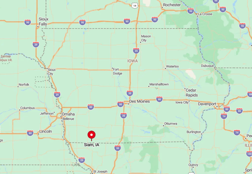
The hamlet is tucked in central Taylor County at the intersection of County Roads J35 and N26, about twelve miles southeast of Bedford. Surrounding pastures roll gently enough to hide the village until travelers crest a ridge and spot the steeple.
Access requires two turns off Iowa 148, both onto gravel that sees more tractors than cars. This indirect route discourages casual pass-through traffic and helps Siam preserve its quiet.
7. Bartlett – Loess Hills Outpost Overlooking Quiet Wetlands
Fewer than sixty people reside in Bartlett, where weathered barns perch against the soaring Loess Hills and overlook backwaters of the Missouri River. Kayakers paddle these backwaters in spring, then climb the hills for panoramic sunsets that paint the floodplain in gold.
Row-crop agriculture remains the mainstay, though niche operations like heritage hogs and native-seed harvesting have taken root. The hills form a natural sound wall, muting even distant freight trains and giving Bartlett a near-total absence of mechanical noise.
Wind rattling cottonwoods and the croak of herons dominate the soundscape. With no convenience store or paved sidewalk, the community feels pleasantly set apart from the twenty-first century.
Where is Bartlett?
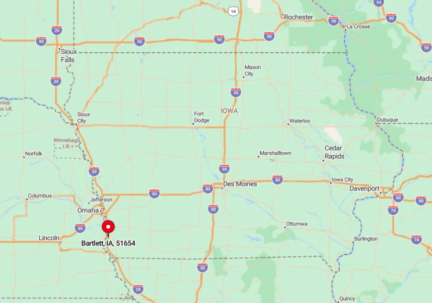
The settlement sits in southern Fremont County along County Road L44, eleven miles south of Tabor and far from any four-lane highway. Drivers leave Interstate 29 at Exit 24, then thread west through fields before climbing into the Loess Hills and descending into the village.
One low bridge and several seasonal flood detours make the trip feel like a voyage rather than a commute. This challenging approach cements Bartlett’s reputation as a hidden perch above the Missouri wetlands.
6. Nodaway – Sleepy Rail-Stop Relic on a Sea of Corn
Approximately seventy residents inhabit Nodaway, a former Burlington line stop now better known for its abandoned brick depot than for moving freight. Summer visitors snap photos of the depot, then bike the flat streets shaded by mature maples that arch like cathedral ceilings.
Grain farming dominates the local economy, though hobby vineyards have appeared on nearby ridges. Surrounding fields stretch unbroken to every horizon, leaving town visually isolated in all directions.
Traffic lights are nonexistent, and only the occasional whistle of a distant locomotive hints at the wider world. That quiet, coupled with the uninterrupted corn panorama, gives Nodaway an almost island-like calm.
Where is Nodaway?
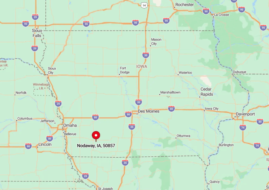
Nodaway lies in southwestern Adams County on Iowa 148, nine miles north of Corning and fifteen miles south of Villisca. Despite being on a state highway, the absence of services discourages most through drivers from stopping.
The nearest bus line or car-rental desk sits forty minutes away in Creston, while the freight rail spur beside the depot has not carried passengers since 1960. Cornfields, not commerce, keep Nodaway cordoned off from busy corridors.
5. Hepburn – Riverside Cluster Along the East Nishnabotna
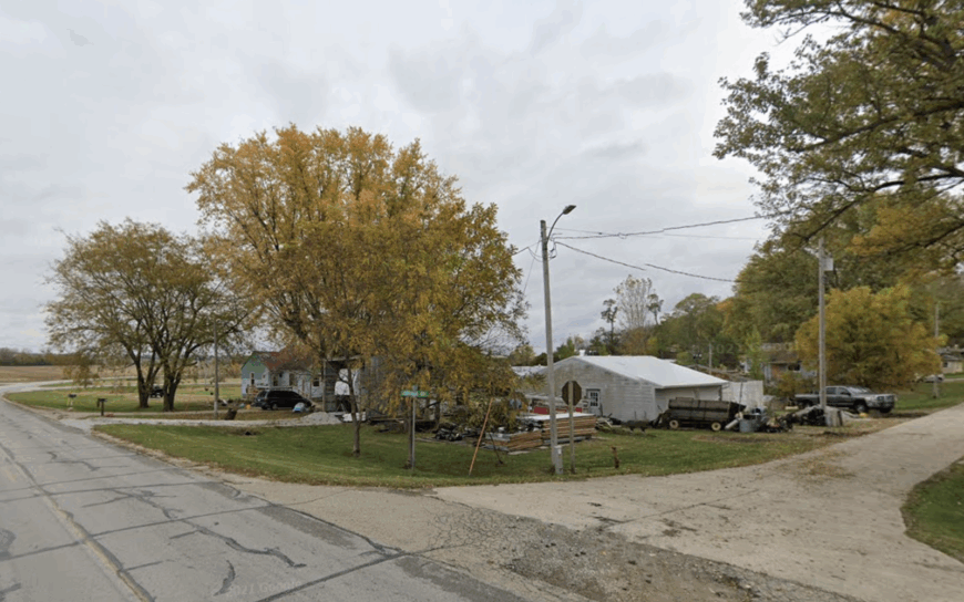
Only about thirty people reside in Hepburn, where a single lane follows the East Nishnabotna River and cottonwoods frame generous yards. Residents fish for channel catfish from homemade docks, host pop-up farmers’ markets in their driveways, and canoe past limestone outcrops locals simply call the Bluffs.
Cow-calf herds and row-crop fields on the surrounding bottomland provide the main livelihoods. Without a commercial strip, fast-driving commuters have little reason to pass through, and the bluffs act as a natural acoustic curtain.
Nights deliver frog choruses instead of freeway roar, and porch gatherings become the evening entertainment. That riverside hush defines Hepburn’s appeal.
Where is Hepburn?
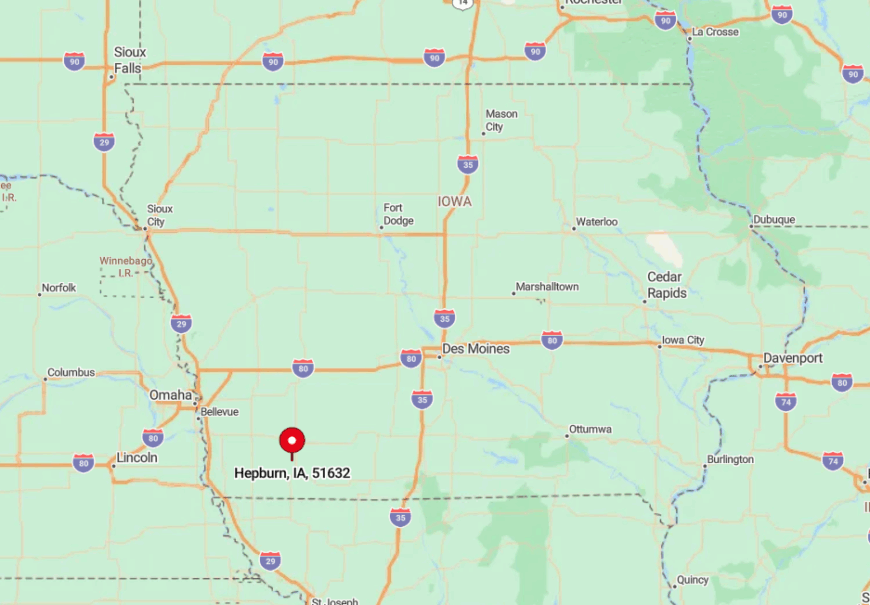
The village sits three miles northeast of Clarinda in Page County, reachable via County Road J20 and a spur that descends to the riverbank. Dense timber hides the houses until travelers edge around the last bend.
Seasonal flooding occasionally reroutes traffic, increasing the settlement’s sense of remove. Lack of signage and a dead-end roadway discourage anyone not intentionally seeking Hepburn.
4. Shambaugh – Danish Roots in a One-Block Downtown
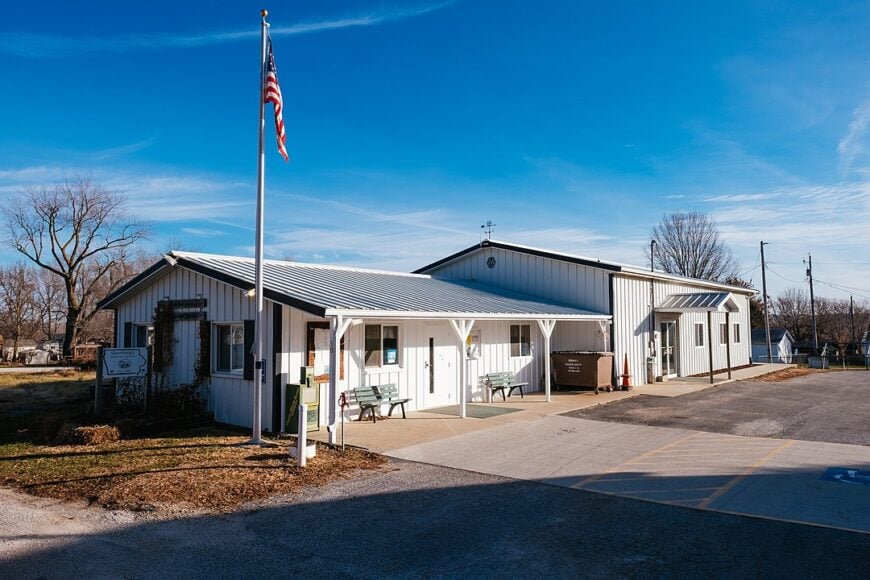
Shambaugh counts roughly 190 residents and anchors its identity around Bethany Lutheran, a Danish-founded church whose spire doubles as the town’s unofficial landmark. Locals tend lilac-rimmed gardens, hold bake sales featuring kringle, and organize lawn-chair concerts beside the old depot museum.
Grain farming and custom harvest crews power the local economy, with a small seed-testing lab operating out of a converted feed store. Homes sit on half-acre lots, creating roomy gaps that keep conversations from carrying beyond the hedges.
The surrounding quilt of corn and hayfields forms a visual moat, and US 71 bypasses town by just enough yards to spare it from highway racket. The resulting peace lets Shambaugh feel timeless even as larger towns grow nearby.
Where is Shambaugh?
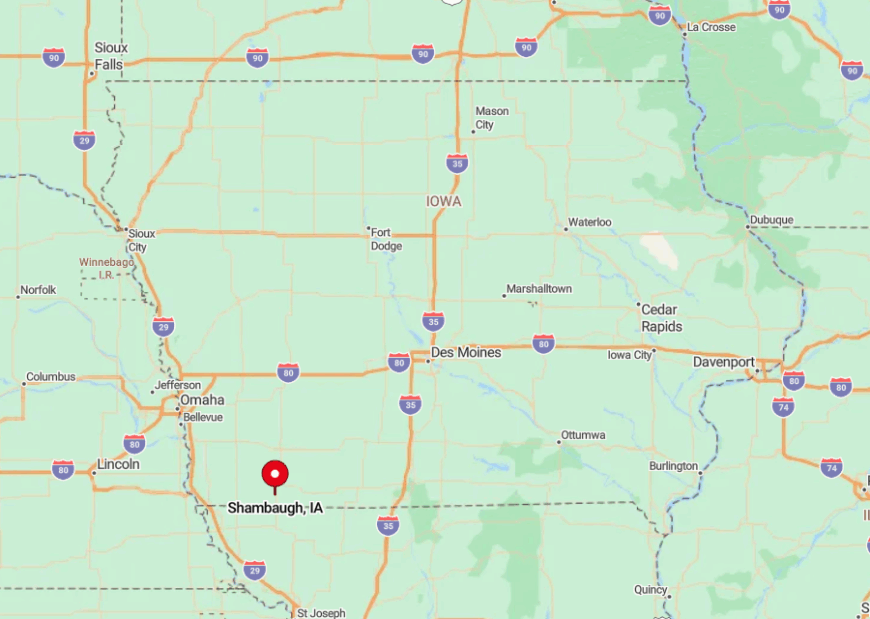
This settlement rests in central Page County, three miles south of Clarinda along a brief spur off US 71. The spur dead-ends at the old rail bed, ensuring no through traffic.
Visitors coming from Des Moines exit Interstate 35 well to the east, then wind across county blacktop for an hour before reaching Shambaugh. That layered route and the surrounding farmland combine to keep the town hushed.
3. Cromwell – Ghostly Grain Bin Village on the Prairie’s Edge
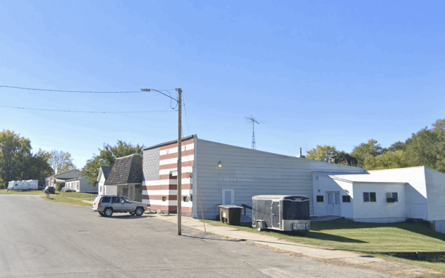
About 105 residents live in Cromwell, a place where rusted steel bins overshadow a deserted storefront row that once served Rock Island rail crews. Today, photographers love the abandoned architecture, while anglers head five miles north to Green Valley State Park for largemouth bass.
Farming and a small grain-drying cooperative form the backbone of local income, with occasional seasonal jobs at the state park. Vast grassland to the west allows prairie breezes to carry scent and sound for miles, leaving the town wrapped in near silence.
Vehicles average fewer than one per minute on the main drag outside harvest season. That low hum of life defines Cromwell’s out-of-the-way charm.
Where is Cromwell?
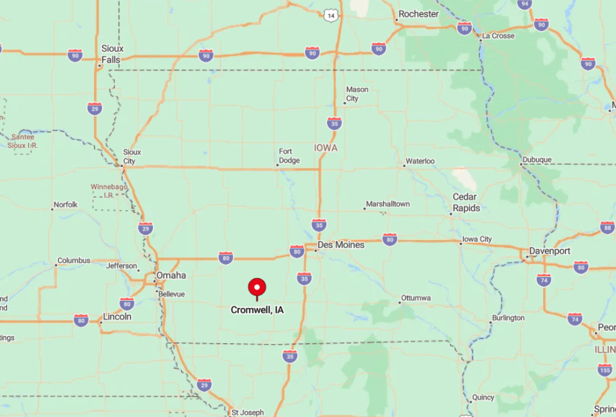
Cromwell lies in northern Union County on County Road H17, ten minutes west of Creston and well south of the nearest four-lane. The old Rock Island alignment now supports only slow-moving grain trains, adding to the sleepy vibe.
Drivers from Des Moines exit Interstate 80 at Stuart, then cover forty rural miles before sighting the first grain bin. Those extra turns leave Cromwell off most GPS default routes, preserving its seclusion.
2. Brooks – Country Church Hub Amid Orchard-Dotted Hills
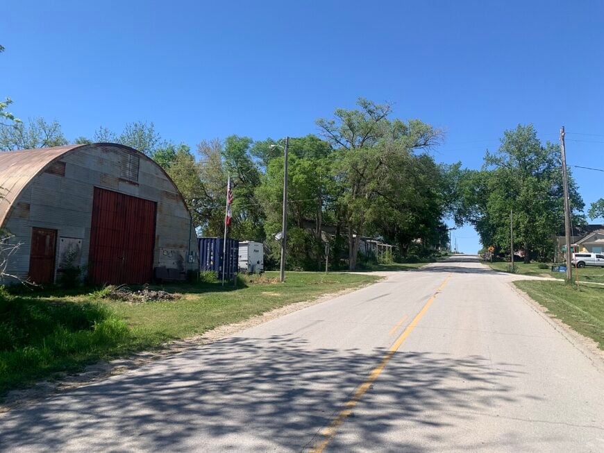
Roughly sixty residents share Brooks, gathering under the white steeple of the United Methodist church that doubles as the community bulletin board. Families host autumn picking days in small orchards that dot the surrounding hills, selling cider from garage-door kiosks and inviting visitors to press their own.
Beef and apple sales, along with part-time work in Corning, account for most household income. Homes perch on high ground, each buffered by broad lawns and windbreaks that hush the landscape.
The lack of commercial lighting leaves the Milky Way plainly visible, and deer outnumber cars on the evening roads. All these traits merge to grant Brooks a postcard serenity hard to find elsewhere.
Where is Brooks?
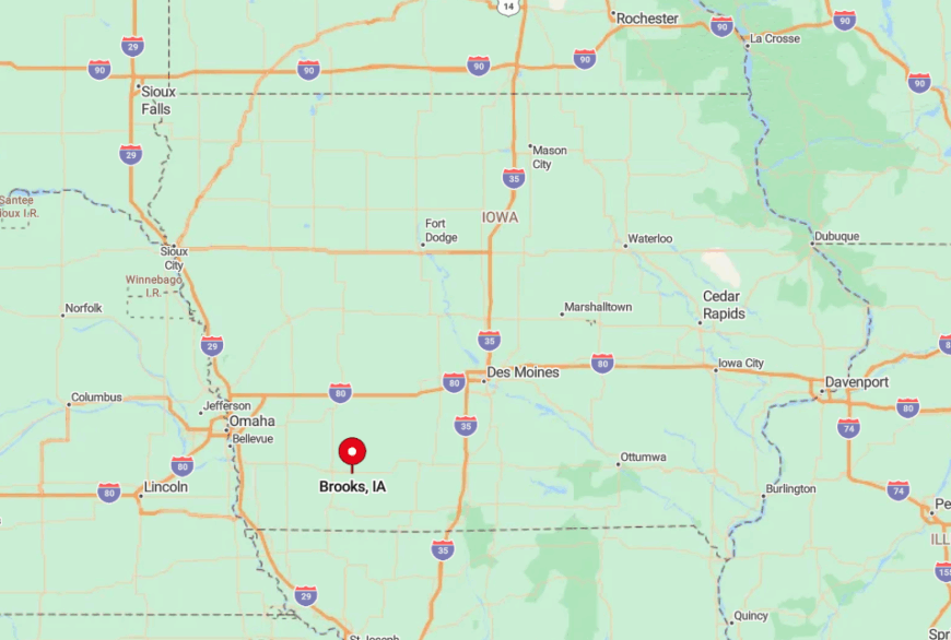
Brooks sits eight miles south of Corning in Adams County, accessible via Old Highway 49 and two miles of gently curving gravel. Hilly terrain masks the village until the church steeple rises over oak tops.
Winter storms sometimes drift snow across the final mile, deterring unnecessary travel. With no gas pumps or cafés on site, Brooks stays quiet except during Sunday service or apple-picking weekends.
1. Guss – Timber-Rimmed Farmsteads Beyond the Blacktop
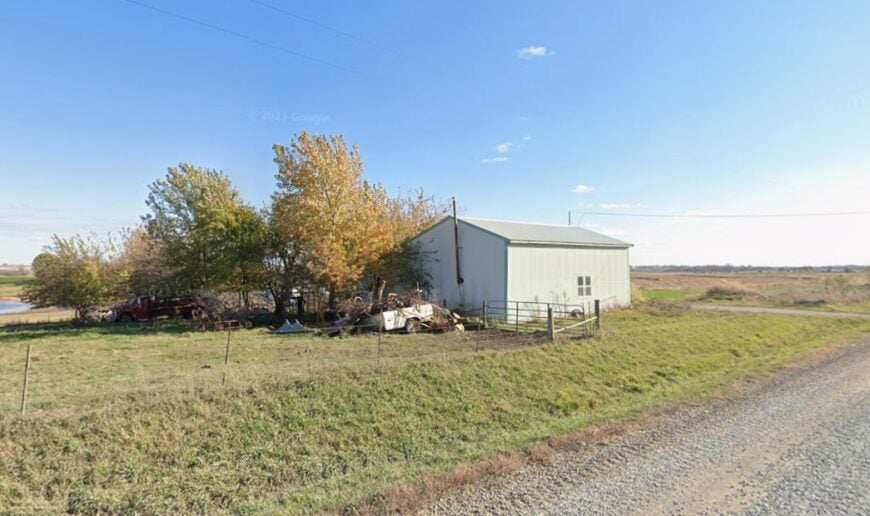
Guss supports fewer than forty residents scattered among century farms hidden by dense oak groves. Hunters slip into the adjoining Sand Creek Wildlife Area for turkey and whitetail, while history buffs explore family cemeteries dating back to the 1850s.
Grain and cow-calf operations remain the chief livelihoods, supplemented by winter firewood sales cut from the surrounding timber. Gravel roads snake through the woods, and GPS often declares “arrival” while travelers still face another half-mile of tree-tunneled lane.
No store, school, or public building marks the center, so the silence feels complete once engines stop. That deep quiet, broken only by barred owls, makes Guss the most secluded stop on our list.
Where is Guss?
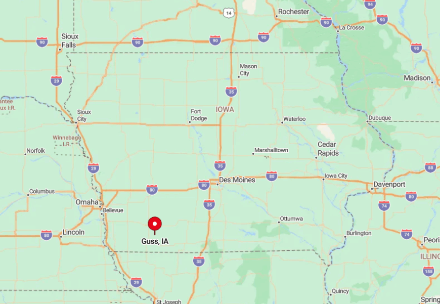
Guss hunkers in north-central Taylor County, five gravel miles west of Highway 71 and eight miles south of Villisca. Tall oaks line each approach, turning even sunny afternoons into green tunnels that swallow cell-service bars.
Visitors generally exit Highway 71 at 270th Street, then follow a patchwork of county roads that narrow to one-lane gravel before reaching the farm cluster. This labyrinth of timbered lanes, plus the absence of through roads, shields Guss from passing traffic and keeps it utterly hushed.