🔥 Would you like to save this?
Southern Wisconsin’s Driftless Area is laced with valleys so deep and ridges so high that cell signals fade and highways detour miles around ancient limestone hills. Tucked inside these folds are villages where porch lights outnumber streetlights and the loudest evening sound is a barred owl calling from the woods.
We gathered 25 of the most hidden spots, each offering quiet lanes, big skies, and a pace that still matches the Kickapoo River’s gentle drift. Photograph mist rising off trout streams, sample cider in century-old orchards, or simply breathe in the cedar-scented air far from traffic and crowds.
In order to come up with the very specific design ideas, we create most designs with the assistance of state-of-the-art AI interior design software.
Our list counts down from the most accessible of the tucked-away hamlets to those nearly swallowed by forested ridges. A two-lane road and a sense of curiosity are all that’s needed to reach them.
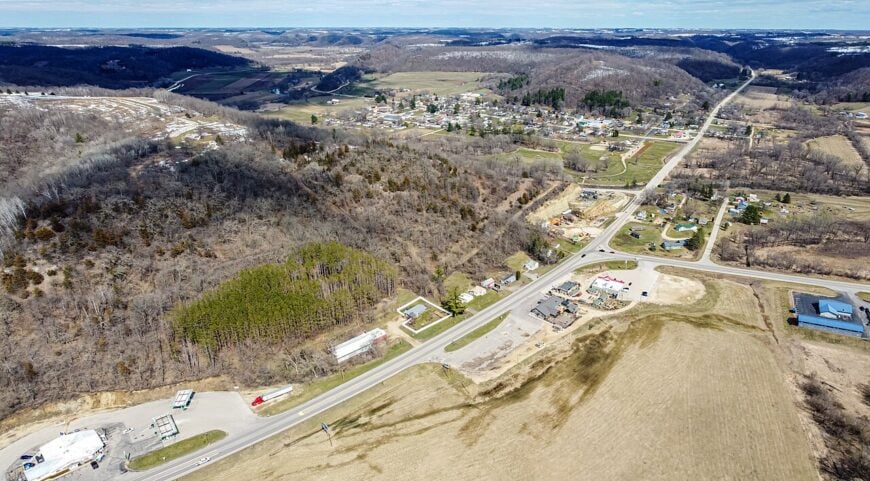
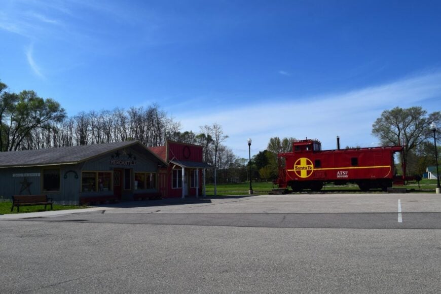
25. La Farge
La Farge feels like a town the Kickapoo River dreamed up—slow, green, and edged with misty hills that mute the outside world. Its seclusion comes from the tight coulees and the way the river and ridges bend roads into meanders, keeping hurry at bay.
On summer mornings, you’ll hear fly lines whisper across the water and the soft creak of porch swings before you hear a single car. Paddle quiet oxbows, hike ridge trails in the Kickapoo Valley Reserve, or linger at a tiny café where conversations unspool like thread.
Wildflowers rim gravel lanes, and at night, the stars crowd in close. Small farms, outfitters, and a few mom-and-pop shops anchor the local economy, with plenty of people working the land or guiding paddlers. It’s the kind of place that teaches your shoulders how to drop again.
Where is La Farge?
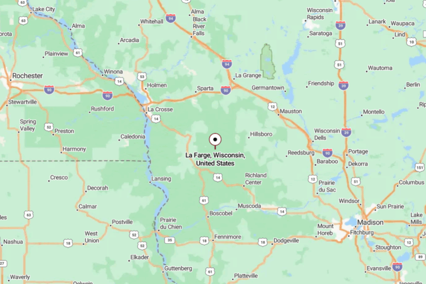
Set in Vernon County in the Driftless heart, La Farge sits along the Kickapoo River in southwestern Wisconsin. It’s a scenic drive from Viroqua and Westby, reached by winding two-lane roads that trace the valleys.
Approaches narrow as you descend into coulees, and cell service flickers, which only adds to the hush. Close enough for a day’s ramble, far enough to feel like you’ve stepped sideways in time.
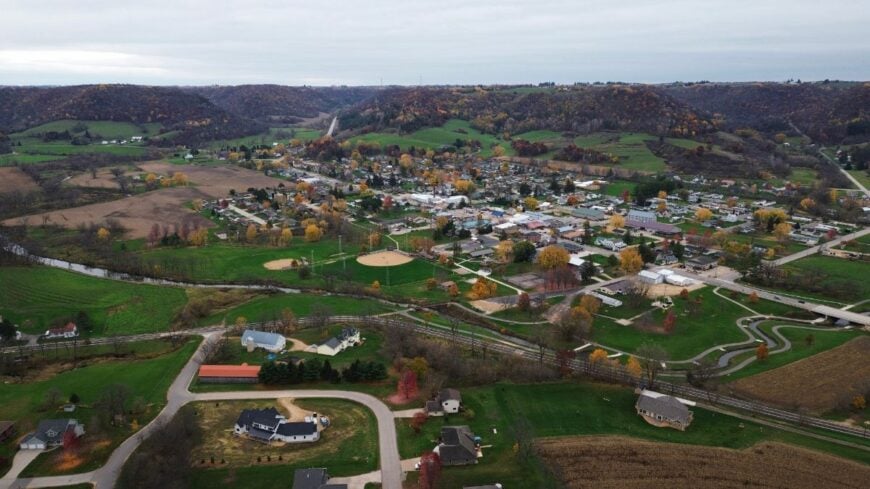
24. Avoca
Avoca is river-quiet: a small village cradled by bluffs and the wide, slow sweep of the Wisconsin River. The landscape keeps it tucked away—broad bottoms, wooded ridges, and just enough distance from major four-lanes to thin the traffic.
People wave from gardens; you can hear red-winged blackbirds before you see the first porch light. Walk the dikes and sandbars, cast for smallmouth at dusk, or time your visit with a sweet, small-town festival.
A few local trades, farming, and seasonal river visitors keep the pace easy. On clear nights, the sky feels almost rural-oceanic, deep and steady. It’s the kind of quiet that makes you notice the river breathing.
Where is Avoca?
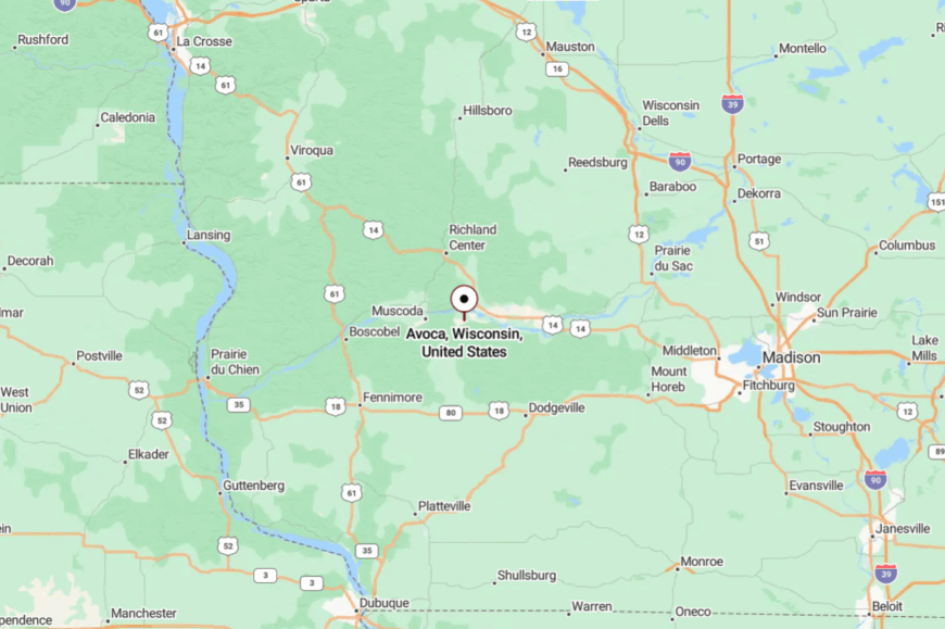
Avoca lies in western Iowa County along the Wisconsin River, in the state’s south-central Driftless edge. It’s roughly a scenic half hour from Spring Green, reached via two-lane country highways.
The last miles roll through open fields and tree-sheltered bends that hide the village until you’re nearly there. Close enough to plan on a tank of gas, yet remote enough that you’ll want to linger.
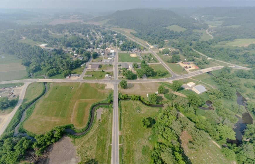
23. Coon Valley
Coon Valley is the sort of place where a trout stream threads right past the park, and the ridges feel like old neighbors keeping watch. Seclusion comes from the steep coulees and the way the roads must respect the land—twisting, narrowing, settling you into an unhurried rhythm.
The village feels gently Nordic and neighborly, with tidy streets and church spires tucked against green hills. Cast a fly on Coon Creek, explore nearby Norskedalen’s heritage trails, or browse a humble main street with a few local stops.
Small businesses and service jobs mix with commuters and farms on surrounding slopes. Evenings bring the flicker of fireflies and the scent of cut hay. It’s a valley that reminds you how good ordinary days can be.
Where is Coon Valley?
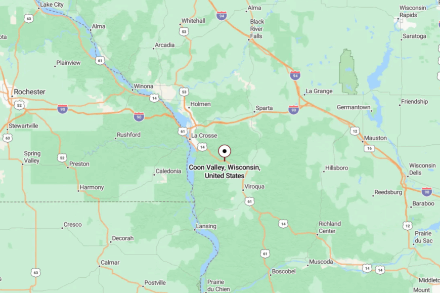
You’ll find Coon Valley in Vernon County, south of La Crosse, where coulees run like fingers through the hills. Two-lane routes dip and rise along the stream, slowing you down as you approach.
The village sits just off larger corridors, making it easy to miss if you’re not looking. Once you drop into the valley, the wider world goes quiet.
22. Ontario
Ontario is a gateway that doesn’t feel like one—forests, cliffs, and the cool breath of the Kickapoo Valley Reserve tightening around a tidy village. Its tucked-away feeling comes from sandstone bluffs and forest roads that trade speed for scenery.
Mornings start with fog lifting from the river; by noon, you’ll hear canoes knocking softly at the landings. Paddle the Kickapoo, hike Wildcat Mountain State Park, or grab pie at a diner where trail dust on your boots is a welcome sight.
Outfitters, park jobs, and small-town services anchor the economy, with farms scattered up the ridges. When the stars come out, the bluffs hold the darkness like a bowl. It’s the kind of place that convinces you to stay one more night.
Where is Ontario?
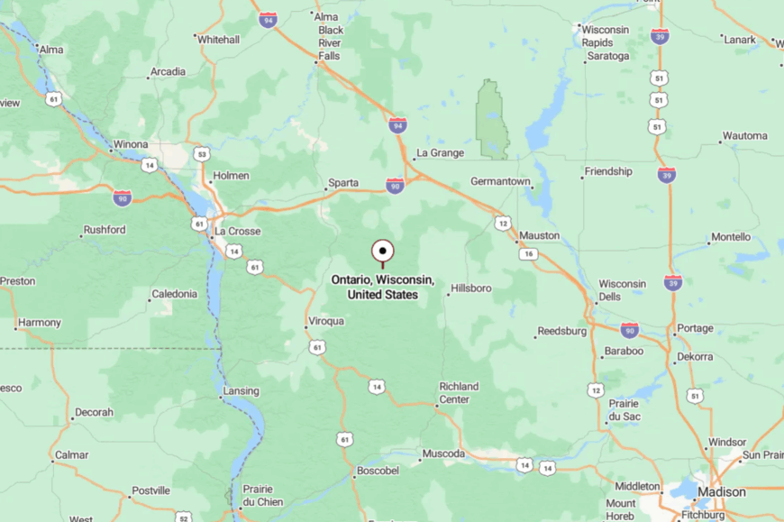
Nestled in northern Vernon County near the Monroe County line, Ontario sits amid state parkland and reserve acreage. It’s reached by curving two-lane highways that follow the river’s whims rather than any straight surveyor’s line.
The last miles feel more like a tour than a commute. You arrive with your shoulders already relaxed.
21. Ferryville
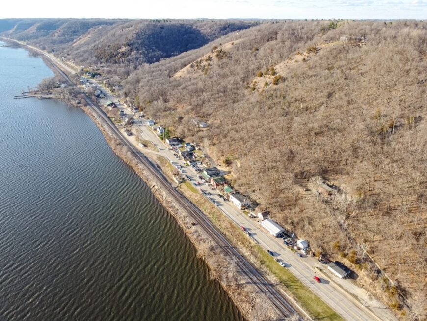
Perched above the Mississippi on the Great River Road, Ferryville manages to feel remote despite the waterway’s long history of travel. The cliffs and river islands create a hushed, bird-rich pocket where eagles ride thermals and towboats hum by like distant thunder.
Stroll a tiny lakeside park, watch the lock traffic, or launch a skiff at daybreak for glassy, pearl-colored water. The vibe is unpretentious—bait coolers, lawn chairs, and neighbors who trade weather notes more than news.
Small-scale tourism and service work mingle with retirees and river hands. At night, the river lights wink like a second sky. It’s where the world slows to the river’s heartbeat.
Where is Ferryville?
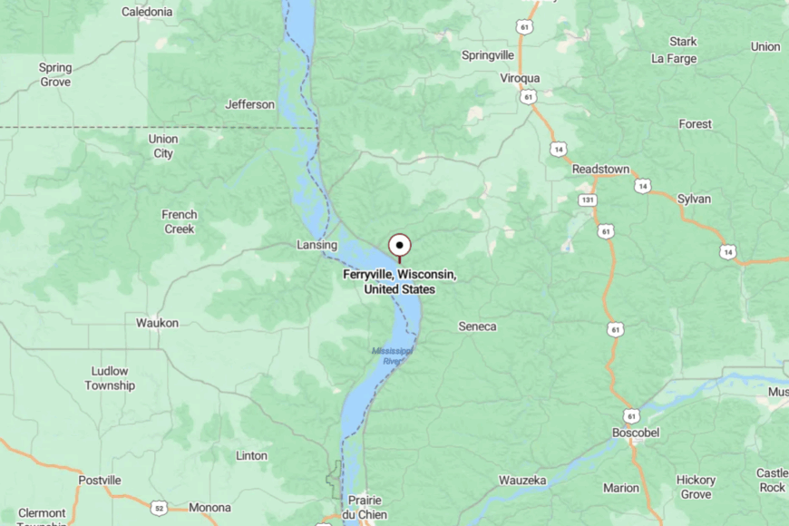
Ferryville sits in Crawford County on Wisconsin’s southwestern edge, right along the Mississippi River’s Driftless bluffs. You reach it on a scenic stretch of the Great River Road, where the water and rail line share the shoreline.
Town appears suddenly between bluff and backwater, with views that make you pull over. It’s close to everything the river offers and far from everything you came to forget.
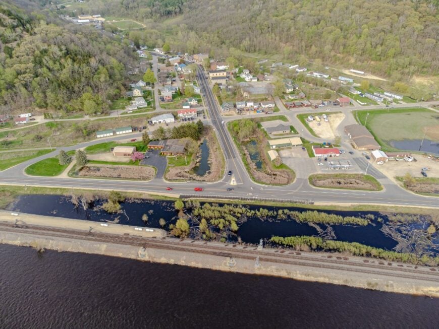
20. Lynxville
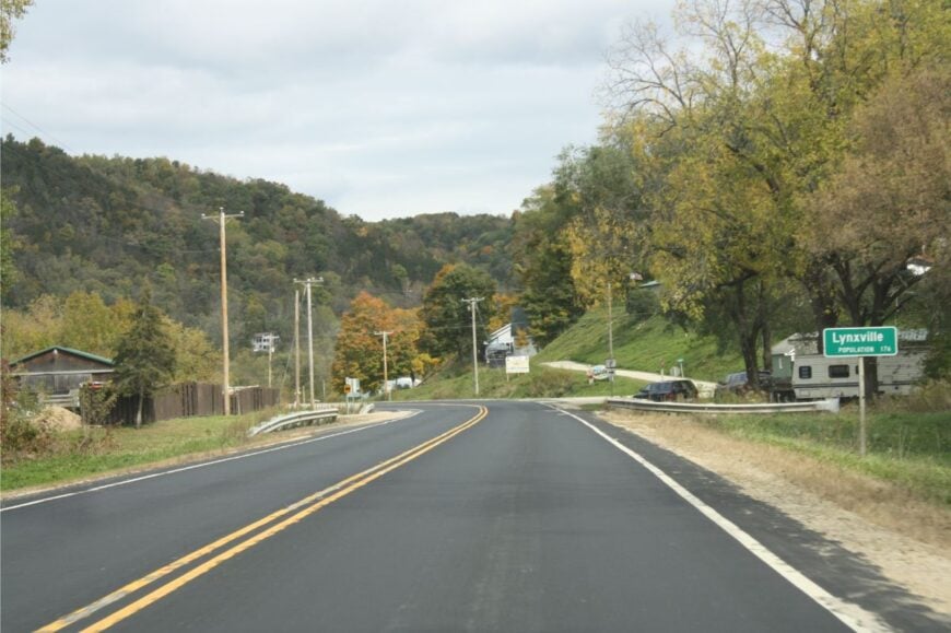
Lynxville is a slender ribbon of homes pinned between bluff and river, and that geography is its secret—the land simply leaves no room for bustle. Freight trains roll by with a low, companionable rumble, and the river’s backwaters are alive with herons and the slow glide of barges.
Drop a line at dawn, sip coffee on a bench facing the islands, or watch boats “lock through” up the road. The town’s vibe is river-casual: boots on porches, minnows in buckets, and a wave for every passing truck.
A few seasonal businesses and river work keep things steady. When fog drapes the channels, Lynxville feels like it’s floating. It’s the kind of quiet that sticks with you.
Where is Lynxville?
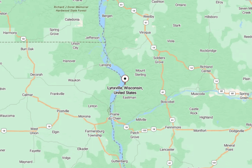
You’ll find Lynxville in Crawford County on the Mississippi, north of Prairie du Chien. The Great River Road threads through the village, tucked tight beneath wooded bluffs.
Approaches are simple but slow, with views that beg you to take your time. It’s a straight shot on the map and a world apart on arrival.
19. De Soto
🔥 Would you like to save this?
De Soto looks west to Grand River sunsets and east to steep green walls—one of those places the Driftless keeps for itself. Its off-grid feel comes from long runs of bluff-shadowed shoreline and the way roads must squeeze between cliff and current.
Fish the main channel at dawn, scan for eagles, or wander prairie overlooks in nearby State Natural Areas. A sleepy river marina and a couple of cafés set the social pace, with farming and service jobs sprinkled nearby.
The air smells like sumac and river willow, and evenings carry the call of owls from the ridge. You’ll leave with river light stitched into your memory.
Where is De Soto?
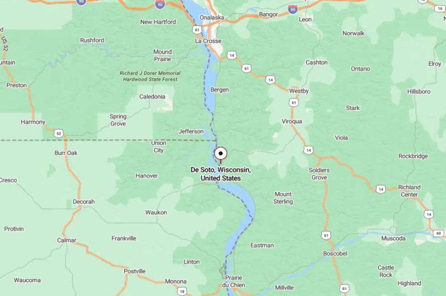
De Soto straddles the Vernon–Crawford line along the Mississippi in far southwestern Wisconsin. It’s reached by a scenic two-lane river highway and a few ridge descents that twist you gently into town.
Landmarks are water, sky, and bluff more than buildings. It’s easy to get to—and even easier to forget what you came from.
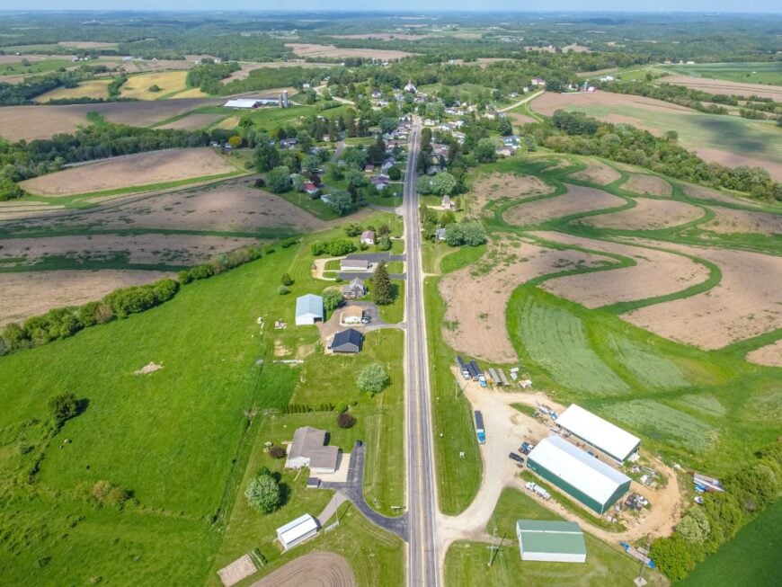
18. Wauzeka
Wauzeka sits where big rivers whisper to each other—near the confluence of the Kickapoo and Wisconsin—yet the village feels tucked out of the way. The broad bottoms keep development diffuse, and the bluffs mute the sound of through-traffic.
Wander floodplain trails, fish backwaters that glow pink at dusk, or poke around a tiny main street where everybody knows which kid rides which bike. Farming and school colors shape local life, with a little river recreation in the mix.
Summer nights hum with crickets and porch talk. It’s a quiet shaped by water and time.
Where is Wauzeka?
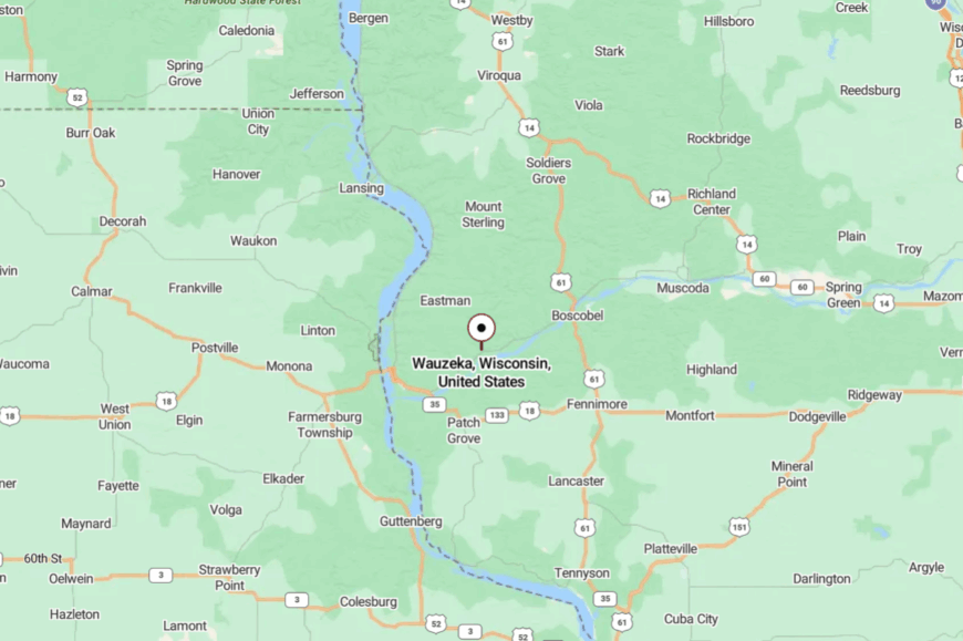
In Crawford County, east of Prairie du Chien, Wauzeka sits just off the main highways in a big green bowl of river country. You get there on county roads and scenic state routes that trace the valley edges.
The last stretch always seems to run beside water. Close by on the map, but it feels like its own small island.
17. Mount Sterling
Mount Sterling lives up to its name—set high enough to catch wind and sky, with valleys unfurling like quilts below. That height gives it an away-from-it-all feeling even when you’re only a few ridges from the next town.
Visit the cooperative creamery, follow ridge roads that dip into hidden hollows, or park at a scenic turnout just to watch the light change. The vibe is farm-practical with a streak of hilltop pride.
Dairying and small trades keep the lights on; breezes keep the porches cool. When the horizon goes lavender, you’ll understand why folks stay.
Where is Mount Sterling?
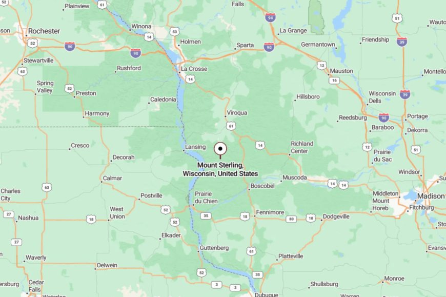
This tiny village crowns a Crawford County ridge in far southwestern Wisconsin. Approaches come on two-lane state and county roads that roll across high ground before dropping suddenly toward town.
The elevation makes for winter drifts and summer views. Getting there is half the point.
16. Highland
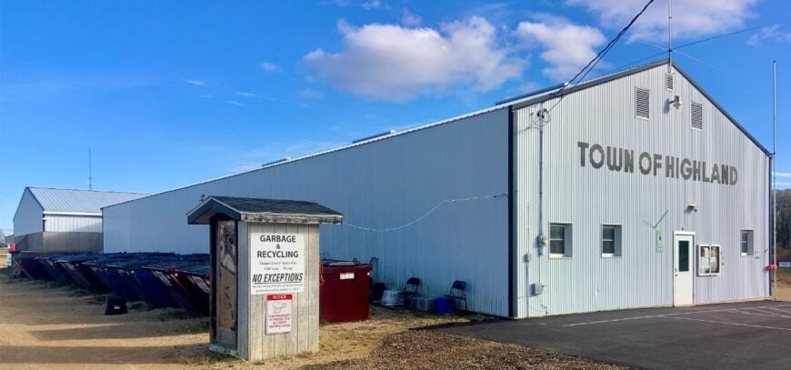
Highland is a hill country crossroads where time decided to linger. Its seclusion comes from being tucked amid rolling oak ridges and kettle-pocked fields, with no interstate for miles and miles.
Grab a coffee downtown, then slip to Blackhawk Lake for loons at dawn and quiet shoreline trails; later, watch tractors mosey along a sun-warm main street. The vibe is friendly-rural—feed caps, slow waves, and the clink of a spoon against a diner mug.
Farming and nearby recreation support local life. By evening, the hills wrap the village in crickets and corn-silk air. It’s a place that makes the ordinary feel golden.
Where is Highland?
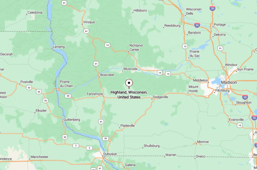
Highland sits in the west-central part of Iowa County, south of the Wisconsin River valley. You reach it on undulating county roads and a couple of state routes that trade speed for scenery.
The last miles roll past farms and hedgerows, the town appearing only at the very end. Close enough for a day trip, but tucked just far enough to feel like a find.
15. Blanchardville
Blanchardville curls along the Pecatonica River like it grew there naturally, brick storefronts and tidy porches facing the water. Its off-the-path feel comes from gentle hills and a web of county roads that discourage straight-line driving.
Browse a small but proud main street, hunt antiques, or wander riverside paths where kingfishers skitter ahead. The vibe blends farmstead practical with a hint of artsy—barn quilts on back roads, a mural or two downtown.
Jobs span schools, local shops, and nearby farms. When evening fog rises from the river, streetlights look like fireflies that decided to stay. It’s the kind of place you remember in sepia.
Where is Blanchardville?
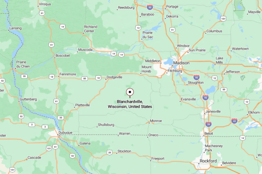
You’ll find it at the gateway to the Driftless in Lafayette and Iowa counties, southwest of Madison. Getting there means gentle grades, river bends, and pretty views that make you tap the brakes.
The village sits just off larger corridors, which keeps things mellow. It’s close enough for a pie run, far enough to feel like a weekend.
14. Bagley
Bagley is a pocket-size river town wedged between bluff and the broad Mississippi, a summer hush settling over its shaded streets. Its solitude comes from a few earnest miles off the main bustle and a shoreline that’s more about backwaters and sandbars than boardwalks.
Launch a jon boat at dawn, watch pelicans raft in the shallows, or wander to a tiny tavern where the day’s talk is wind, water, and fish. The vibe is cabin-casual—coolers, river shoes, and neighbors swapping tools.
Seasonal tourism helps, but the town never feels hurried. Even the trains seem to pass in a lower voice here. It’s a place built for unstructured time.
Where is Bagley?
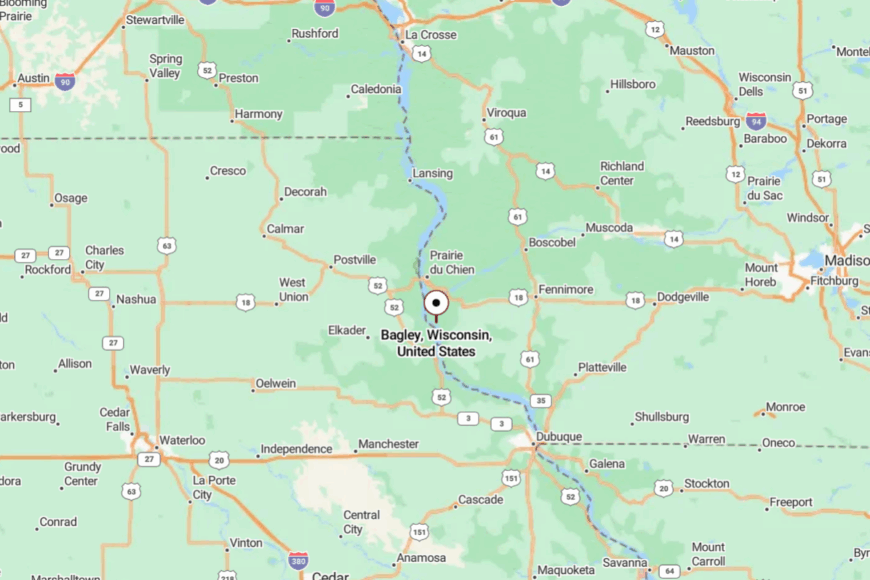
On the Mississippi in Grant County, south of Prairie du Chien, Bagley sits just off the river highway on a quiet bend. Reaching it involves a short dip from the bluffs to the floodplain, where the town appears between cottonwoods.
County roads do most of the guiding, which keeps traffic lights. It’s the kind of detour you’ll repeat on purpose.
13. Woodman
🔥 Would you like to save this?
Woodman is small even by small-town standards—just a scatter of homes, a few streets, and a lot of sky. Its tucked-away feel comes from the big bottomlands along the Wisconsin River and the absence of any real commercial glare.
Walk to the river at first light, listen for cranes across the flats, or sit under a shade tree and measure time by train whistles and cicadas. Stories run deep here, from rail days to river days, but the pace has softened into neighborly quiet.
Farming, a handful of services, and seasonal cabins make up the economy. When dusk smudges the horizon, it’s like someone dimmed the whole world. You won’t be in a hurry to turn it back up.
Where is Woodman?
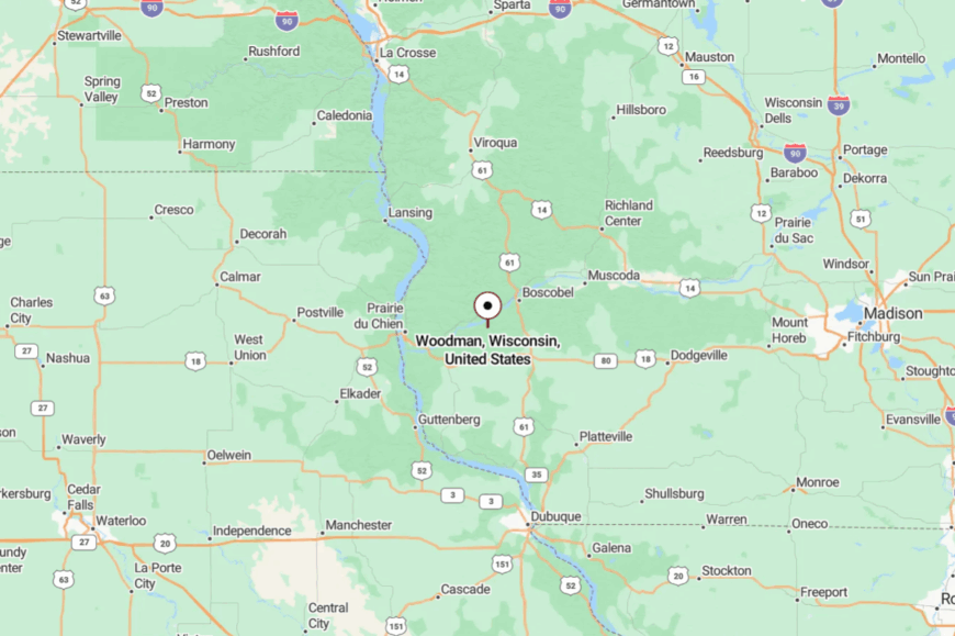
You’ll find Woodman in Grant County near the Wisconsin River, a few calm miles off busier routes.
County highways and a short stretch of gravel bring you the last bit. The village hides behind trees until you’re practically there. It’s close to the water, far from the rush.
12. Cassville
Cassville feels quietly grand—river bluffs at its back, the Mississippi in front, and a tidy grid of streets that know their history. Its seclusion comes from sitting at the end of a river road with the big water as its main boulevard and a seasonal ferry for company.
Visit Stonefield Historic Site and Nelson Dewey State Park, watch eagles tilt on the wind, or walk a sunset shoreline where tugboats glow like embers. The vibe is heritage-proud and river-content, with cafés and museums living comfortably beside bait coolers and camp chairs.
Tourism, parks, and small businesses keep things humming at an easy pace. When night falls, the river becomes a moving mirror. It’s a place that makes time feel layered.
Where is Cassville?
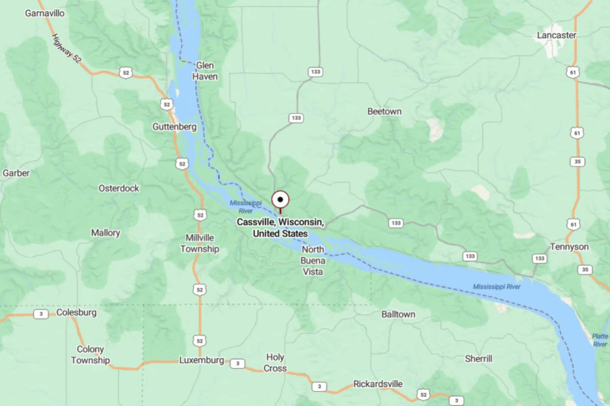
In far southwestern Grant County, Cassville sits on the Mississippi across from Iowa, tucked beneath tall bluffs. You reach it via a scenic two-lane highway that hugs the river; in season, a ferry links it to the opposite shore.
The last miles are views, not billboards. It’s reachable without trouble—and perfectly positioned to feel away.
11. Potosi
Potosi is a bend-in-the-river village with a miner’s backbone and a slow, welcoming stride. Seclusion comes from its position off the main corridors, reached by winding lanes that drop you into a snug valley beside the Mississippi.
Explore the Potosi Brewery and the National Brewery Museum, ramble the bluffs for overlooks, or wander quiet streets where limestone and brick remember the lead-mining days. The vibe is heritage-rich and friendly—part museum town, part fishing base camp.
Local jobs are tied to tourism, small industry, and river recreation. When the last light fades off the water, the town settles like a book closing. It’s the kind of place that reminds you how quiet the world can be.
Where is Potosi?
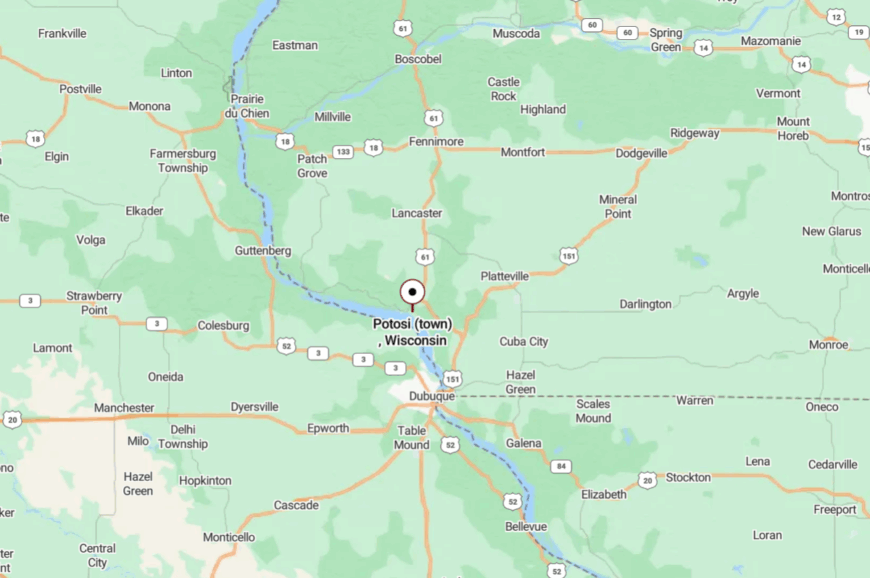
Potosi sits in Grant County near the Mississippi’s broad sweep, southwest of Platteville and Lancaster. You get there on two-lane state and county roads that choose scenery over speed limits.
The approach runs between valley farms and bluffs until the village appears almost all at once. It’s close enough for supper and far enough for starlight.
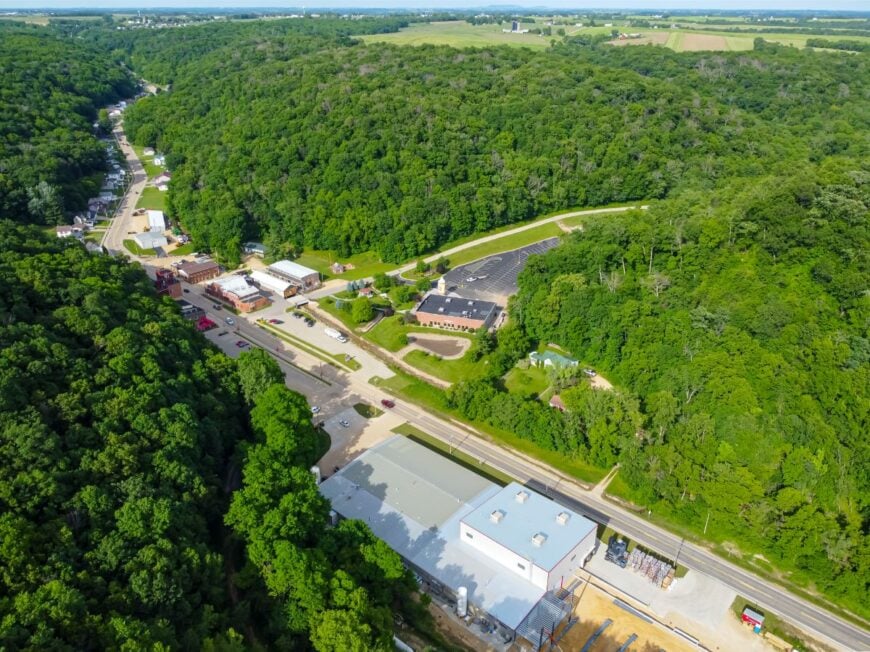
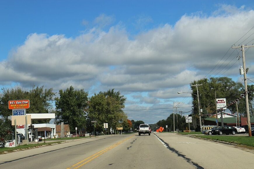
10. Readstown
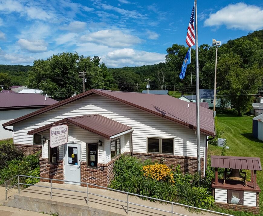
Home to roughly 400 residents, Readstown sits where the Kickapoo River curls beneath wooded bluffs in Vernon County. Anglers cast for smallmouth bass beneath the vintage steel truss bridge while paddlers drift past sandbars that often host a lone blue heron.
Local jobs center on small-scale dairy farms, a sawmill, and family-run antique shops lining Main Street. The village feels tucked away because State Highway 14 bypasses the historic core and truck traffic prefers straighter routes to La Crosse.
Nights bring dark skies ideal for stargazing, helped by the lack of major commercial lighting. We find that early-morning fog rising off the river gives photographers a ready-made soft-focus filter.
Where is Readstown?
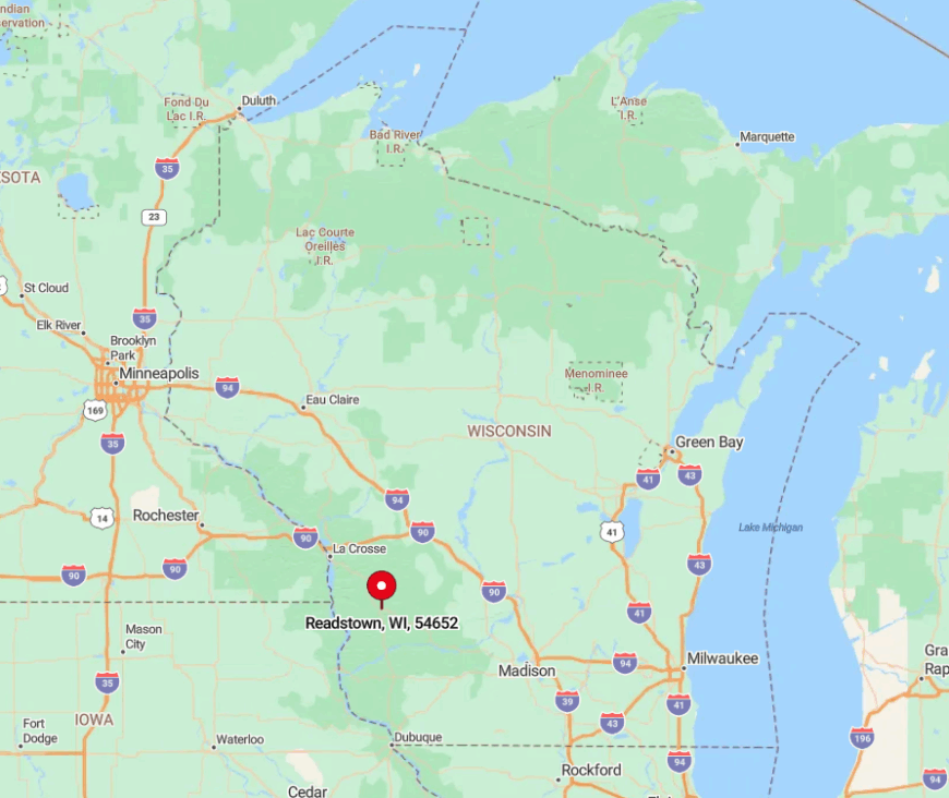
Readstown lies in the heart of Vernon County, about 30 minutes southeast of Viroqua. Hills on three sides muffle road noise and limit line-of-sight to the nearest town, adding to the feeling of remove.
Travelers reach the village by following Highway 61, a scenic but winding route that deters hurried drivers. A single gas station marks the turnoff, so visitors should top off their tank before exploring the gravel ridge roads that thread the surrounding hollows.
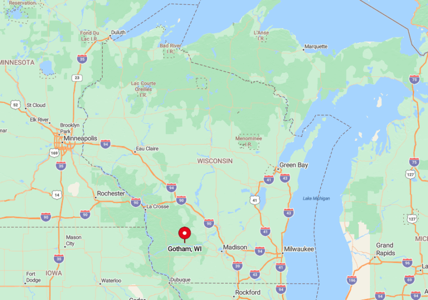
9. Gotham
Gotham, an unincorporated cluster of roughly 180 people, rests where the Wisconsin River meets sandstone bluffs near Richland County’s western edge. Canoeists glide along undeveloped shoreline while birders scan for osprey nesting on the river islands.
Employment revolves around feed stores, a riverfront campground, and nearby quarry work. Gotham remains secluded because it lacks a formal downtown grid; homes and barns scatter along County Road JJ, leaving long stretches of open prairie between neighbors.
Regional tourists speed past on Highway 60 without realizing the hamlet exists a mile south. Our favorite surprise is the pocket-size boat landing that rarely hosts more than two trailers even on holiday weekends.
Where is Gotham?
🔥 Would you like to save this?
Set 15 miles northwest of Spring Green, Gotham hides in a broad river bend that shields it from highway sightlines. The sandstone bluffs block radio reception and create a natural sound barrier, reinforcing the quiet.
County Road JJ provides the only paved access, branching from Highway 60 near a lone farm supply store. Beyond that junction, cell service drops to zero until drivers crest the bluff again.
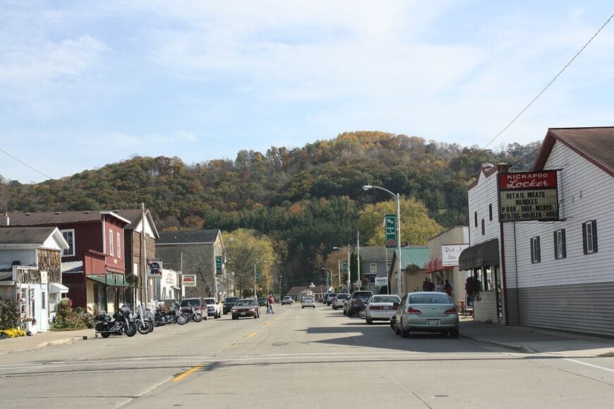
8. Viola
Straddling both Richland and Vernon Counties, Viola hosts about 600 residents who enjoy generous yards bordered by the Kickapoo River. Community softball games, river tubing, and the fall garlic festival keep locals busy without drawing large crowds.
Dairy farming and a small cabinet-making shop anchor the modest economy. Seclusion stems from the encircling ridgelines that block through-traffic and funnel most vehicles onto a single bridge at the village edge.
After sunset, ridge shadows deepen the darkness, making fireflies seem brighter than porch bulbs. We recommend the hidden picnic tables behind the public library that overlook a quiet river eddy rich with painted turtles.
Where is Viola?
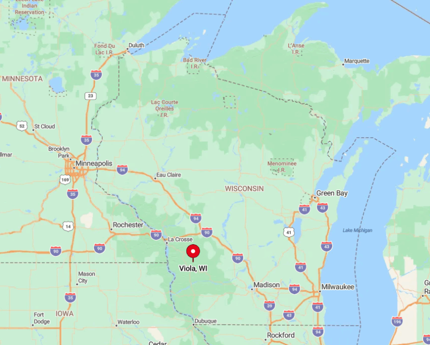
Viola sits 20 miles west of Richland Center at the crossroads of Highways 56 and 131. Both routes twist along river valleys, slowing travel and discouraging big rigs. Visitors typically enter via a one-lane steel span that feels like a time portal to 1950. Public buses do not run here, so arriving by car is the only practical choice.
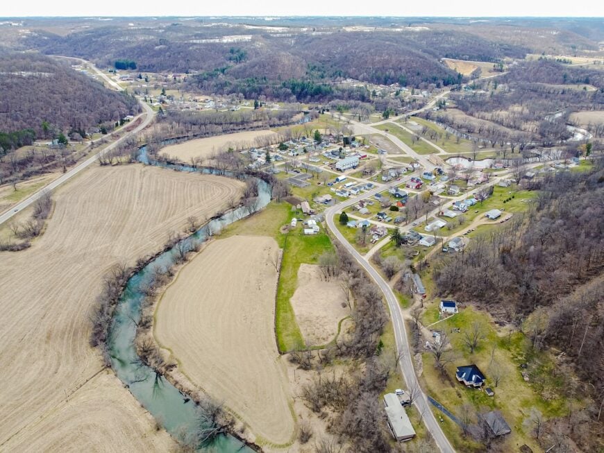
7. Gays Mills
Gays Mills’ population of roughly 480 swells each September when apple lovers climb the ridge to pick Cortlands and Honeycrisps from century-old orchards. Off-season, residents hike bluff-top trails, browse 19th-century storefronts, and kayak the fog-shrouded Kickapoo Valley Reserve.
Orchard work and small fruit-processing sheds provide most local jobs, supplemented by seasonal tourism. Flood relocations pushed many homes to higher ground, leaving the valley floor largely open and undeveloped.
That wide, empty expanse and the distance to the nearest four-lane highway keep urban bustle at bay. Our insider tip: Sunrise from the Crawford County Ridge Trail paints the orchards gold before the first tractor engine starts.
Where is Gays Mills?
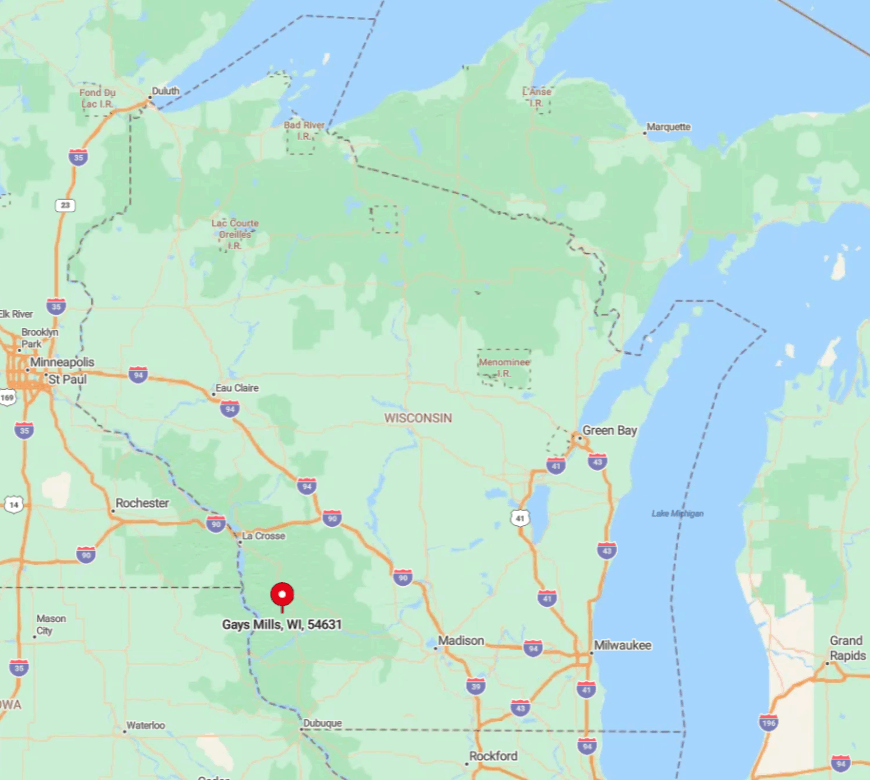
The village lies in Crawford County, 15 miles northeast of Prairie du Chien. High bluffs border the east and west, so radio towers struggle to reach cell phones below. State Highway 171 descends a steep S-curve into town, an approach that deters winter traffic. Snowy days may see only a handful of tire tracks on Main Street.
6. Soldiers Grove
Soldiers Grove counts fewer than 250 residents who live in energy-efficient homes rebuilt on sunlit hillsides after the 1978 flood. Locals fish the Kickapoo, bike the Solar Village loop, and browse weekend artisan markets where hand-woven baskets share tables with maple syrup tapped from surrounding sugar bush.
Employment centers on small organic farms, a solar panel installer, and craft retail. The village’s relocation elevated it well above floodplain roads, leaving the original river corridor largely wild and free of development.
Twisting county routes rather than state highways serve the area, so GPS directions often reroute without warning. We appreciate the public prairie garden behind the community center, a living reminder of the town’s renewable-energy vision.
Where is Soldiers Grove?
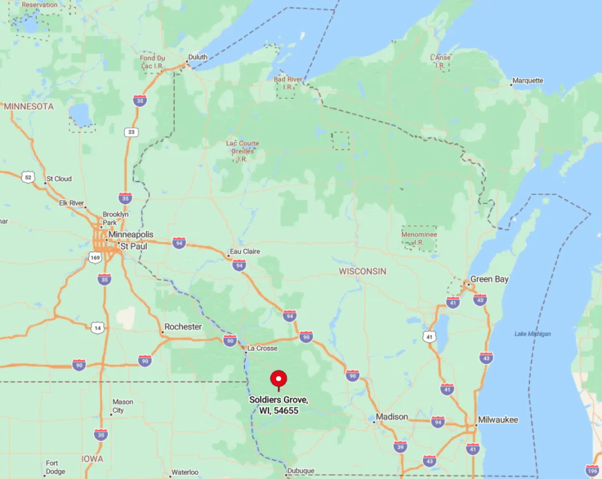
Found 25 miles north of Prairie du Chien, Soldiers Grove occupies a broad, south-facing slope in Crawford County. Dense oak woods to the east and west limit line-of-sight for miles, maintaining the sense of isolation.
Visitors approach by Highway 61, but must exit onto County C, a two-lane ridge road that drops sharply into town. Winter travel may require four-wheel drive as sand trucks rarely reach the steeper switchbacks promptly.
5. Blue River
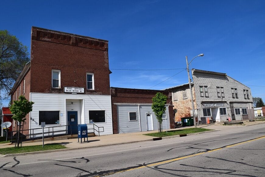
Blue River, population near 430, hugs a quiet bend of the Wisconsin River amid 50 percent undeveloped woodland. Residents launch jon boats at dawn, hike upland oak savannas, and gather at the riverfront park for Friday fish fries. Farming, small-engine repair, and river tourism supply modest livelihoods.
The lack of commercial strip development and the nearest traffic light being 18 miles away contributes to a restful hush. Dense forest buffers the village from Highway 60, so passing drivers glimpse only tree tops and miss the turn.
Our favorite find is the sandbar half a mile downstream where wild lupines bloom each June with no crowds to trample them.
Where is Blue River?
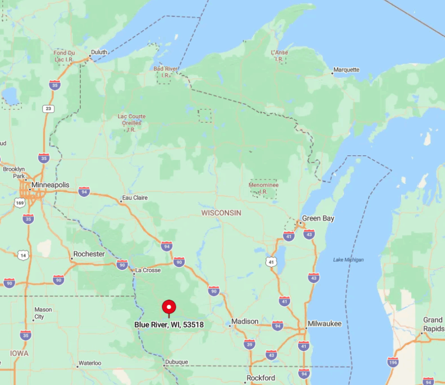
Positioned in Grant County, Blue River sits between Boscobel and Muscoda along a lesser-known stretch of Highway 133. The river’s meandering course forces the road into long detours, stretching travel times and reducing through-traffic.
Reaching the village often involves gravel cutoffs best navigated at low speed. Lack of public transit means visitors should plan their route and fuel stops ahead.
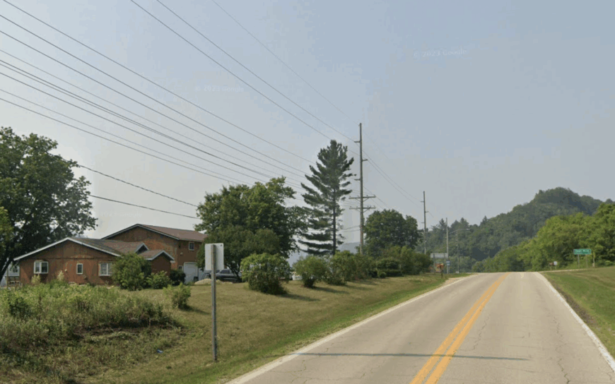
4. Hollandale
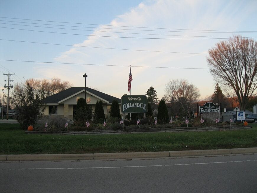
Hollandale claims around 280 inhabitants, spread among painted farmhouses and vintage brick storefronts in rolling dairy country. Locals gather for Friday night softball, sip coffee beneath a century-old tin ceiling at the Cozy Café, and gaze across unbroken ridge vistas perfect for sunset photos.
Dairy herds, a specialty cheese plant, and field-to-market vegetable plots keep the economy humming. Seclusion comes from sitting ten miles off U.S. 151; the final approach winds along ridges instead of a direct spur.
Streetlights end at the village limits, revealing a dark-sky canopy that draws amateur astronomers. We recommend the hidden mural behind the fire station depicting each family farm’s original barn quilt pattern.
Where is Hollandale?
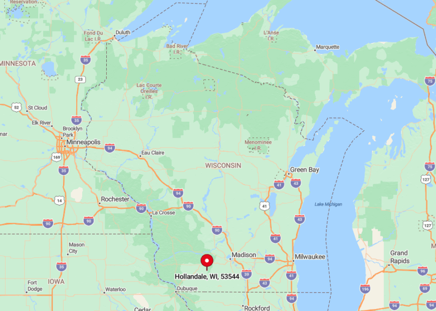
The village lies in Iowa County, 14 miles southwest of Mount Horeb. Surrounding drumlin ridges mask it from the main highway, so many GPS units fail to provide a clear signal until drivers crest the final hill.
County Highway K provides the only paved path, and winter drifting can close it overnight. Locals keep a stack of road-closed signs ready beside the town shop for such occasions.
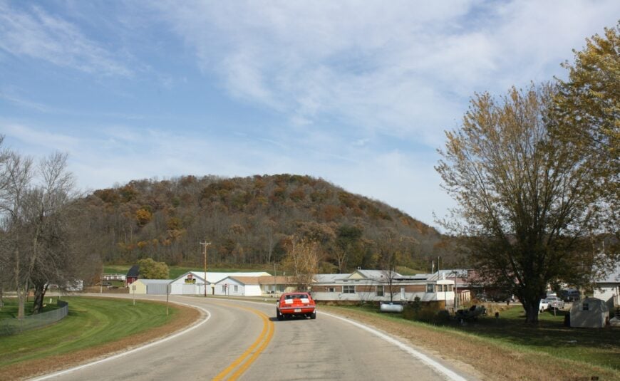
3. Bell Center
Bell Center counts just under 100 residents, scattered across forested bluffs and open fields miles from the nearest four-lane road. Hunters roam the Kickapoo Wildlife Area, while photographers angle for shots of the white-steepled church framed by turning maple leaves.
Logging, hobby farming, and remote work via limited satellite internet form the modest economic base. Its isolation stems from the fact that State Highway 131 bypasses the village entirely, leaving only county lanes that snake through dense hardwoods.
Cell reception drops to one bar if it appears at all, reinforcing the off-grid mood. We love the hidden waterfall on an unnamed creek south of town that roars each spring thaw yet rarely meets a crowd.
Where is Bell Center?
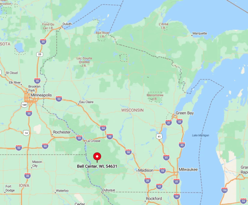
Situated in Crawford County, Bell Center lies roughly 30 minutes north of Prairie du Chien. Bluff walls hem in the valley, blocking both skyline views and radio signals.
Access comes via County B, a narrow road where deer outnumber vehicles at dusk. The nearest gas station is seven miles away in Gays Mills, so topping off before arrival is smart.
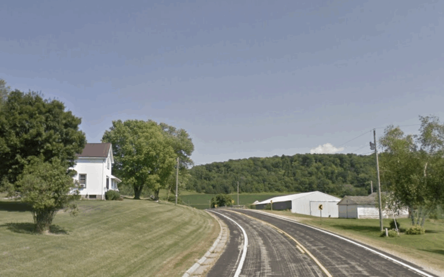
2. Boaz
Boaz’s 150 residents live on roomy river-bottom parcels beside the Pine River, flanked by sweeping pastures and historic limestone buildings. Visitors fish for trout beneath a century-old stone arch bridge, browse the one-room museum devoted to local fossil discoveries, and picnic in shade cast by 200-year-old burr oaks.
Farming and a seasonal quarry supply most jobs, supplemented by artisan woodworkers selling pieces from backyard sheds. Seclusion arises because Boaz sits at the end of a valley road with no direct connection to state highways, ensuring only intentional travelers pass through.
Even the modest traffic of Richland Center seldom filters down the ridge. Our insider favorite is the prehistoric trilobite imprint displayed in the town hall lobby, found in the nearby quarry and unknown to many geology buffs.
Where is Boaz?
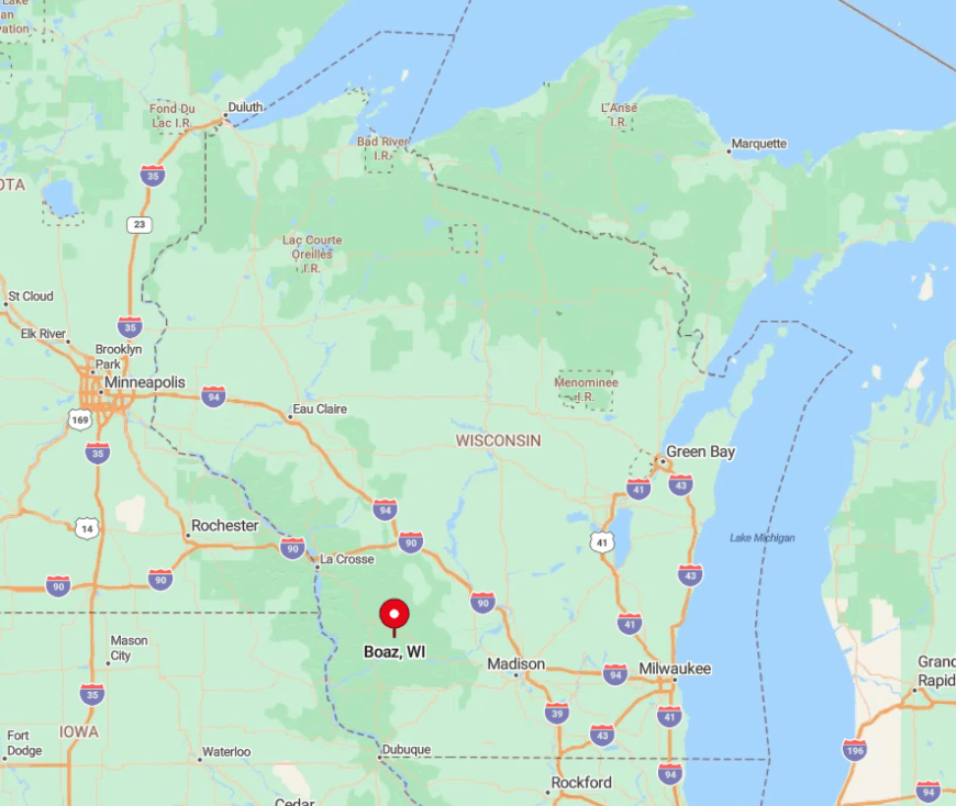
Boaz rests in Richland County, eight miles northwest of Richland Center on County E. Limestone ridges form a natural amphitheater, shielding the village from radio and cell towers on neighboring hills.
Drivers must descend a winding grade that demands low gear, discouraging larger vehicles. The closest bus line stops 12 miles away, so private transport is essential.
1. Avalanche
Avalanche, unofficially counted at about 30 full-time residents, nestles in a wooded Vernon County valley 15 miles southwest of Viroqua. Fly-fishers stalk crystal-clear West Fork trout, photographers capture mist drifting over ridges at dawn, and cyclists tackle unpaved Amish roads where horse-drawn buggies outnumber cars.
The few local jobs revolve around small organic farms, maple syrup operations, and seasonal guide services for anglers. Avalanche’s seclusion comes from being boxed in by steep coulees and connected to the outside world by a single gravel lane that often washes out after heavy rain.
With virtually no commercial development, night skies remain pitch black, broken only by barn light and the Milky Way. Our favorite detail is the hand-painted “Free Books” cabinet perched on a stump at the road fork, stocked weekly by a retired teacher who hikes in from her ridge-top cabin.
Where is Avalanche?
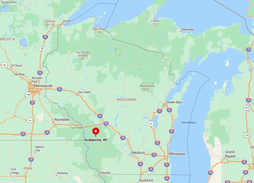
Found in Vernon County’s Driftless heart, Avalanche hides between ridges that shelter it from U.S. Highway 14 traffic. The nearest paved intersection lies five miles away, reached by a serpentine course following the West Fork Kickapoo.
Spring thaws often close the main gravel approach, leaving residents to detour via ridge tracks that add 20 minutes of driving. Visitors should bring a paper map; GPS units frequently lose signal halfway down the valley grade.