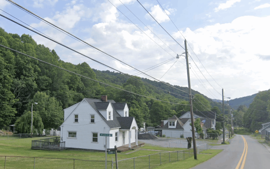
Southern West Virginia is laced with hollows, high plateaus, and hidden valleys that seem to muffle the outside world. Here, tight-knit communities keep old company stores, weathered barns, and forested ridges as everyday scenery, while distant interstates flicker far beyond the treeline.
In order to come up with the very specific design ideas, we create most designs with the assistance of state-of-the-art AI interior design software.
The following 25 towns illustrate how geography, history, and a dash of Mountain State stubbornness can preserve deep quiet even in the twenty-first century. From river-sliced hamlets in Wyoming County to windswept farms on Mercer County’s rim, each place offers fresh air and elbow room in generous supply.
Travelers discover antique rail beds, century-old churches, and trout-filled creeks without queuing for parking, and new residents find neighbors who still share garden produce over the fence. Our tour counts down from tenth to first, shining light on corners where peace remains the local currency.
25. Bud
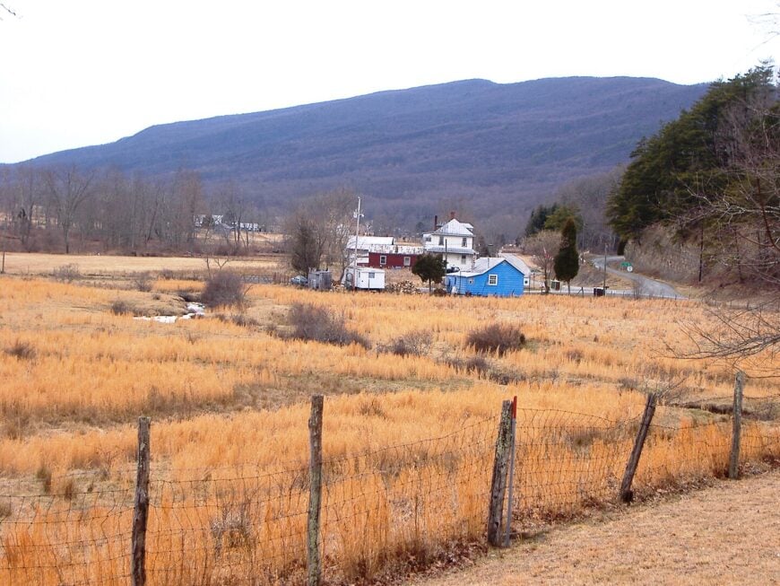
Bud is one of those blink-and-you-miss-it hollows in Wyoming County where homes tuck against steep hillsides and porches overlook a winding creek. Life feels slower here, with evenings marked by the smell of woodsmoke and the distant hum of cicadas.
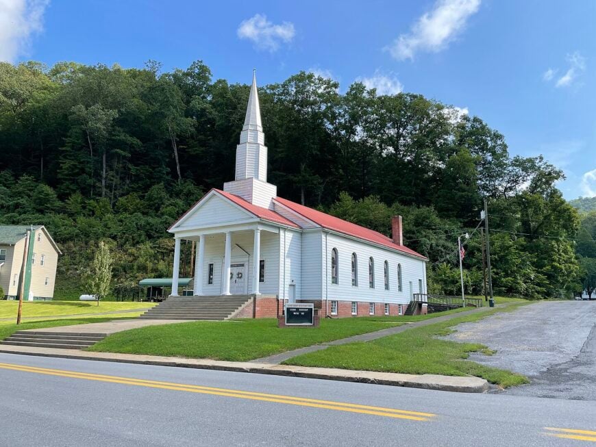
Locals fish Clear Fork Creek, tend tidy vegetable patches, and gather at the community church that has stood for over a century. Coal once anchored the economy, but today, small farming and a few commuters to Oceana or Pineville sustain the town.
There’s an old-time pride in keeping yards neat and swapping stories at the lone general store. The silence is deep, broken only by trucks rattling over gravel roads. Bud is the kind of place where stillness feels stitched into the land.
Where is Bud?
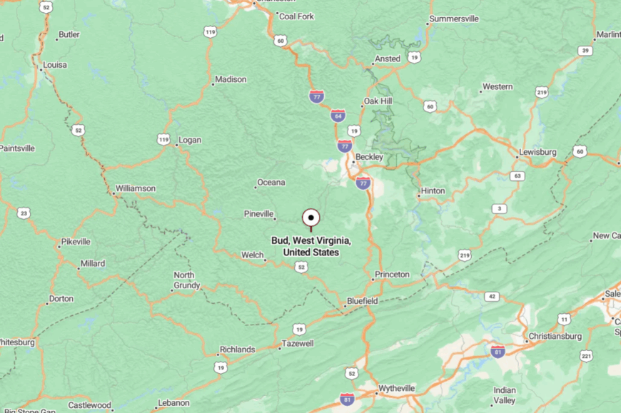
Bud sits in the heart of Wyoming County, about 15 miles south of Mullens. The community is reached by County Route 16, a narrow road that curls beside the creek with few passing lanes.
It’s miles from any four-lane highway, ensuring a pocket of quiet in every direction. By the time you arrive, you’ll feel you’ve slipped into a valley time forgot.
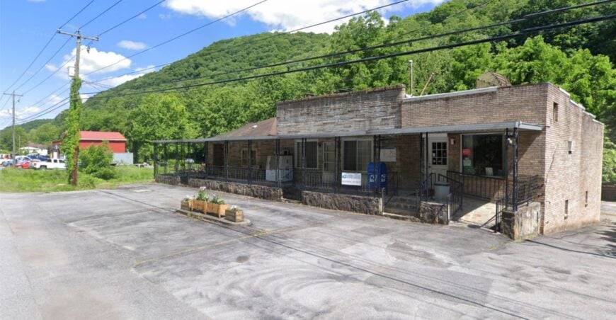
24. Amigo
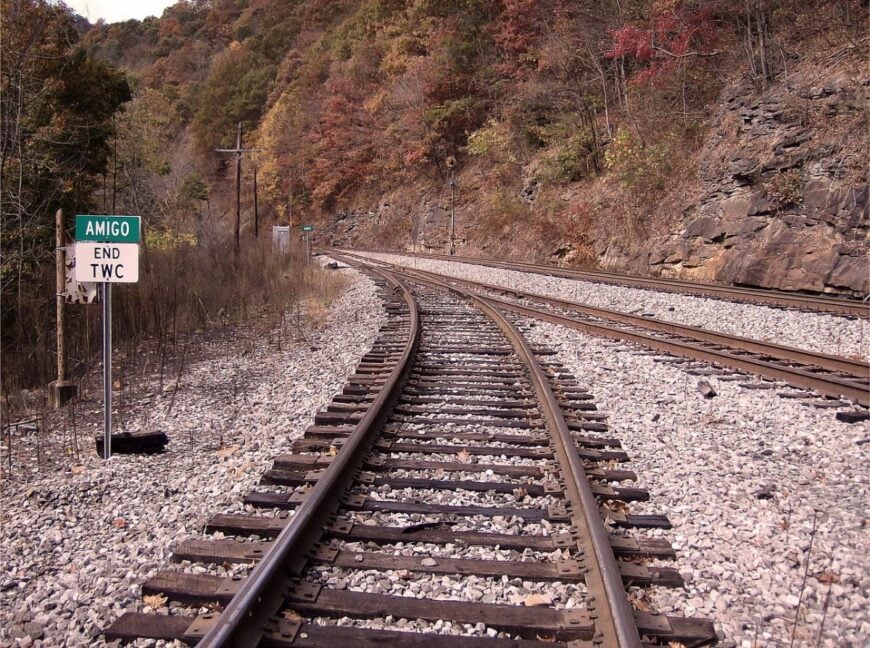
Amigo, in Raleigh County, is a settlement whose name alone feels like a secret greeting. Once home to a bustling coal camp, today it’s a scattering of houses framed by wooded ridges and abandoned rail spurs.
Locals still meet at the historic Amigo United Methodist Church, a clapboard structure that looks almost unchanged from the 1930s. Fishing holes dot the Clear Fork, while the Hatfield-McCoy trails aren’t far for ATV riders.
Work comes from small-scale forestry, farming, and a few jobs in Beckley, but the town remains stubbornly quiet. The absence of chain stores or bright lights adds to its hush. Amigo is the kind of place where a single porch light can feel like a beacon.
Where is Amigo?
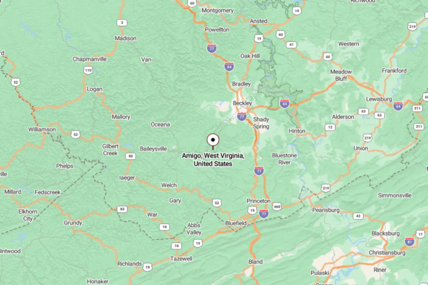
Amigo lies in southern Raleigh County, about 12 miles south of Sophia. It’s reached by winding along County Route 16, a road hemmed in by forested hillsides.
There are no direct interstates nearby, just a gradual descent into hollows where cell service fades. Arriving here feels like uncovering a name on the map that few ever notice.
23. Kellysville
Kellysville is a farm-studded settlement in Mercer County where open hayfields stretch toward low ridgelines. The vibe is pastoral, with barns weathered to silver and cattle grazing in silence.
Neighbors gather at a crossroads diner for biscuits and gravy, swap goods at a seasonal farmers’ stand, and share stories of railroad days gone by. Outdoor time means trout fishing in Bluestone River tributaries, wandering pasture edges with dogs, or picking wild blackberries in summer.
Hay, beef, and a handful of small workshops keep households afloat. Evenings are marked by whip-poor-wills calling from the tree line. Kellysville holds a simplicity that feels rare these days.
Where is Kellysville?
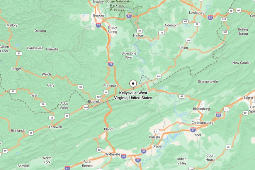
Found in eastern Mercer County, Kellysville sits just off U.S. Route 460 near the Virginia line. The town is quiet despite its proximity to Princeton, tucked slightly off the main road and hidden by rolling farmland.
Travel involves a brief detour onto smaller lanes where fields outnumber houses. It’s a settlement you can miss in a heartbeat, yet it lingers in memory once discovered.
22. Itmann
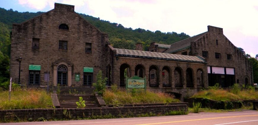
Itmann is a place where coal heritage lingers in brick company houses and the preserved Itmann Company Store, now a historic landmark. The Guyandotte River slides by, slow and green, while forested ridges keep the community hemmed in.
Locals host small heritage festivals, fish along shaded bends, and explore abandoned mining sites overtaken by laurel and ivy. Work comes from scattered coal operations, timber, and local service jobs. The town hums with a pride in its history, yet days are mostly quiet.
Evenings feel timeless, with trains echoing faintly through the valley. Itmann is a reminder of the Mountain State’s backbone—enduring, sturdy, and hushed.
Where is Itmann?

Itmann rests in Wyoming County, about 8 miles from Mullens along the Guyandotte River. It’s accessible by WV-10, a two-lane ribbon threading through hillsides and hollows.
The drive is winding, with few signs of commerce until the store and houses appear. It feels tucked away, wrapped in history and shadowed by ridgelines.
21. Glen Fork
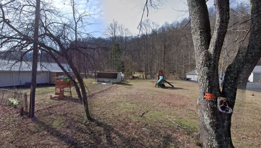
Glen Fork is a small cluster of homes gathered around the confluence of two creeks, their chatter filling the air more than passing cars. The town feels like a forgotten corner, where front porches still double as living rooms on summer evenings.
Neighbors fish for trout, hunt deer in autumn woods, and gather for pie socials at the local church. Timber and part-time mining once defined the economy, though today it’s mostly gardens and retirement checks. Kids roam gravel roads without fear of traffic, and nights are lit only by starlight.
Glen Fork has a rhythm that’s soft, familiar, and almost lullaby-like. It’s the kind of place that makes silence feel like company.
Where is Glen Fork?
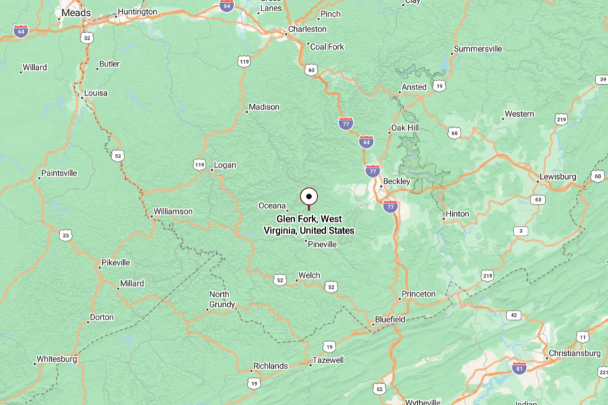
Nestled in Wyoming County, Glen Fork lies about 20 miles northeast of Oceana. WV-971 winds into the hollow, a twisting, tree-lined road where GPS coverage grows faint.
The town is small enough to blink past if you’re not watching carefully. That very elusiveness is what preserves its calm.
20. Kiahsville
Kiahsville, in Wayne County, is little more than a crossroads framed by hills and deep woods. The community vibe is rustic, with clapboard homes, tidy gardens, and an old gas station that doubles as a gathering spot.
Residents fish East Fork Twelvepole Creek, hunt in the surrounding ridges, and meet for gospel sings at a church built over a century ago. Farming and timber provide livelihoods, though many simply live off the land in traditional ways.
Weekends often pass with four-wheel rides down dirt spurs or quiet evenings shelling beans. Kiahsville’s remoteness makes time feel suspended. It’s the sort of place where you measure the day by shadows, not clocks.
Where is Kiahsville?
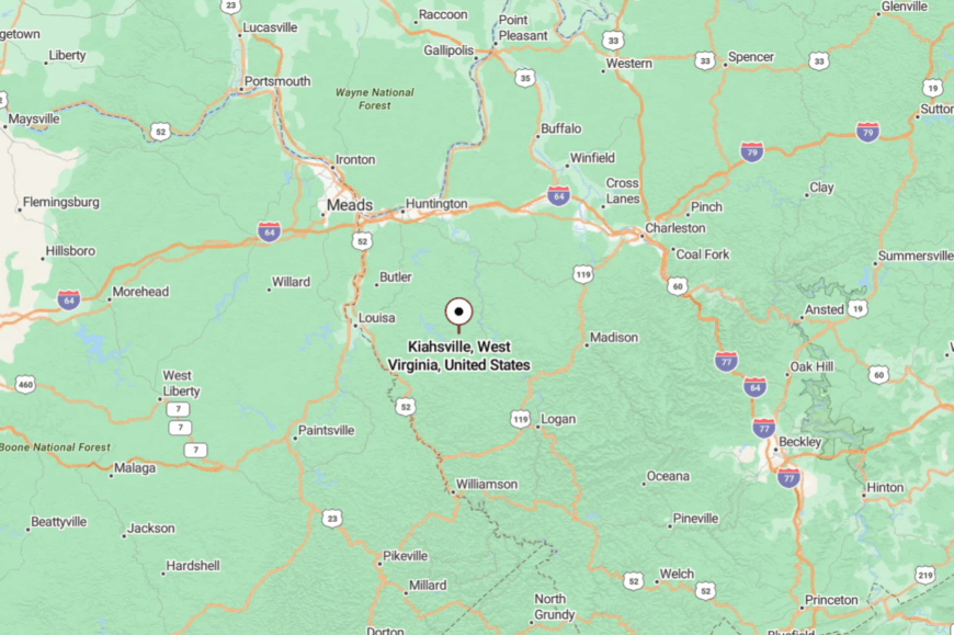
Kiahsville sits in southern Wayne County, about 30 miles from Huntington but separated by ridges and winding valleys. The community lies along WV-152, yet feels far removed from highways and noise.
Getting there means long stretches of two-lane roads through unbroken forest. The trip ends with the sense that you’ve traded modern rush for mountain steadiness.
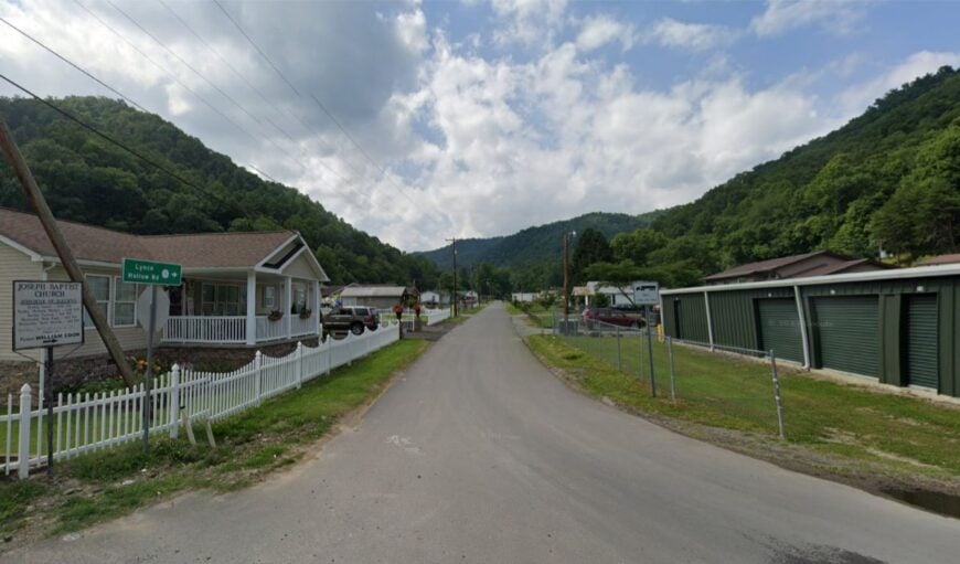
19. Lynco
🔥 Would you like to save this?
Lynco is a coal town reduced to a scatter of homes and church steeples, yet it radiates a quiet dignity. Situated along the Guyandotte River in Wyoming County, its backdrop is all pine slopes and rushing water.
Residents tend family plots, fish for bass in the river, and meet at potluck suppers where recipes pass down generations. Coal jobs linger, but most people lean on seasonal work or commutes to Oceana.
Evenings are hushed but for the river’s murmur and the occasional train horn. Lynco feels like a half-forgotten hymn sung softly in the mountains. It’s a town that whispers rather than shouts.
Where is Lynco?
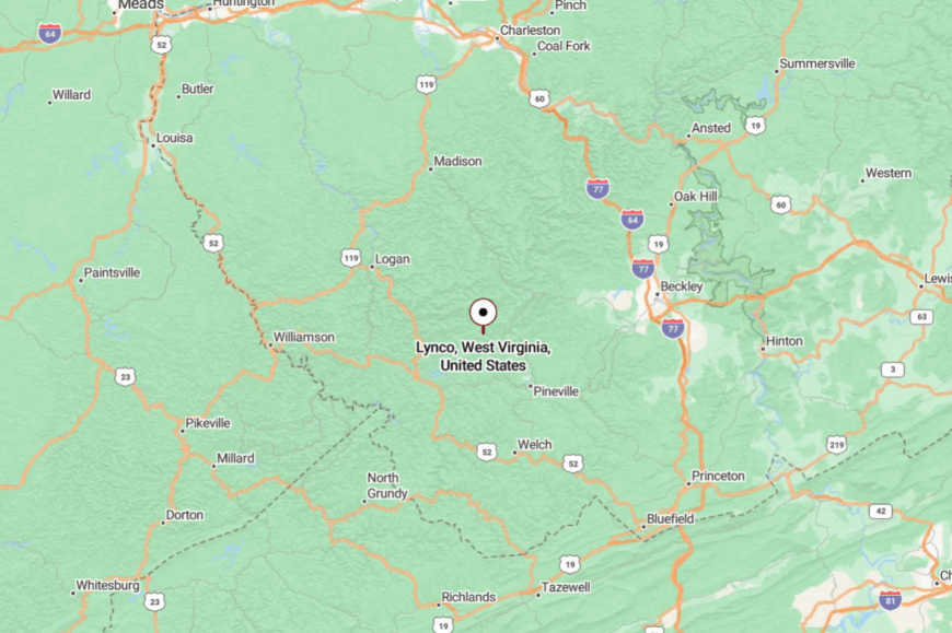
Lynco lies in central Wyoming County, just off WV-85 south of Oceana. The road leading in hugs the river closely, narrowing to the point where trucks hesitate.
Its tucked-away position keeps traffic low and peace high. Arriving here feels like slipping into a valley few outsiders ever find.
18. Saulsville
Saulsville is a tiny spot in Wyoming County where the mountains close in tight around Saulsville Fork. The old high school gym now doubles as a community hub, hosting craft fairs and basketball games.
Locals canoe the Laurel Fork, pick berries along forgotten rail beds, and swap vegetables at roadside stands. Once dependent on mining, the economy now leans toward small farms and commuting. Residents pride themselves on self-sufficiency, whether heating with wood or canning summer produce.
Days are unhurried, filled with the simple beauty of ridge and stream. Saulsville is proof that quiet living endures.
Where is Saulsville?
Located in eastern Wyoming County, Saulsville lies just off WV-97, about 15 miles from Pineville. The road narrows as it enters, with thick forests and creek bends hemming it in.
There are no chain stores or bright signs, only a scattering of porches and mailboxes. The seclusion feels like it has been deliberately preserved.
17. Kermit
Kermit, in Mingo County, sits on the Tug Fork River opposite Kentucky, but it feels worlds away from either side. A historic railroad depot anchors the town, with quiet streets radiating out past weathered storefronts.
People fish the Tug Fork, ride ATVs into surrounding hollows, and gather for local festivals celebrating Appalachian crafts. Coal heritage is strong here, though many now find work across the river in Martin County.
The pace is slow, with kids biking gravel alleys and dogs napping in sunlit yards. At dusk, the river glows copper under sinking light. Kermit carries the hush of borderland solitude.
Where is Kermit?
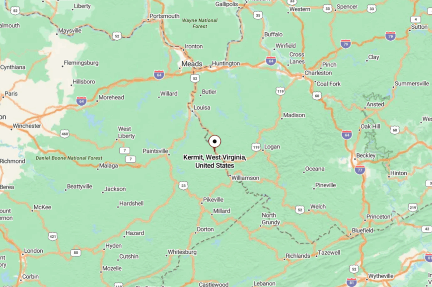
Kermit rests in northwestern Mingo County, directly on the West Virginia–Kentucky line. It’s accessible via U.S. Route 52, followed by a turn across the Tug Fork bridge.
The drive in passes long stretches of forest with little sign of commerce. Once inside town, the border location feels less like a crossing and more like a pause.
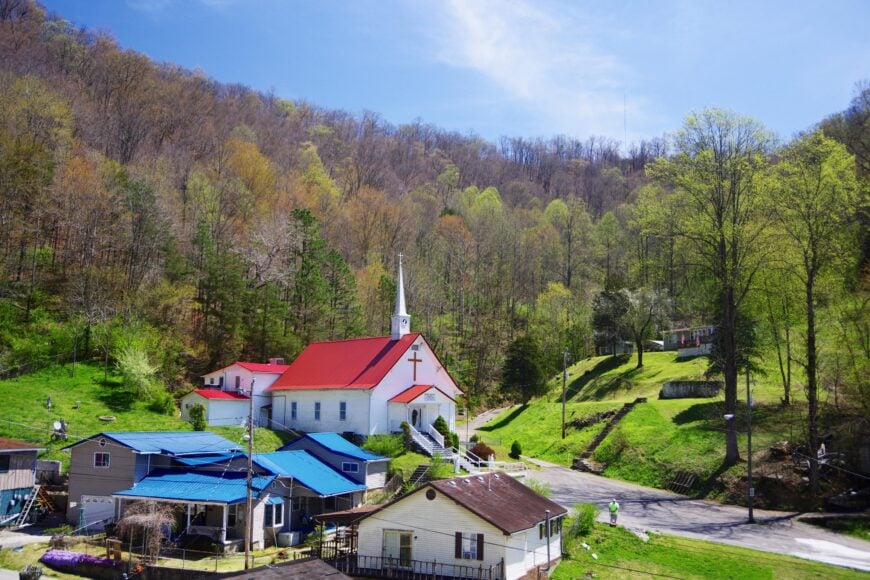
16. Hanover
Hanover is a spread-out community in Wyoming County, nestled in valleys where roads taper off into the woods. Its vibe is unpolished and authentic: front porches crowded with rocking chairs, church bells echoing across hollows, and kids fishing with cane poles in muddy creeks.
Outdoor life revolves around hunting deer, foraging ramps, and four-wheeling along old timber roads. The economy is modest, with scattered jobs in coal and logging, but most rely on gardens and self-reliance.
Nights bring crickets and whip-poor-wills in steady chorus. Hanover is quiet by default, not by design. It’s the kind of quiet that feels woven into daily life.
Where is Hanover?
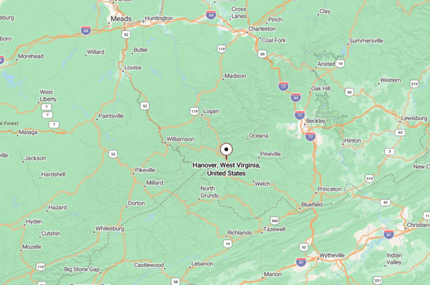
Hanover lies in southern Wyoming County, a dozen miles south of Oceana. It’s reached by WV-10, a curving mountain road that thins as it nears the settlement.
Surrounded by forested slopes, the town feels tucked deep into its own pocket. By the time you arrive, the outside world seems very far away.
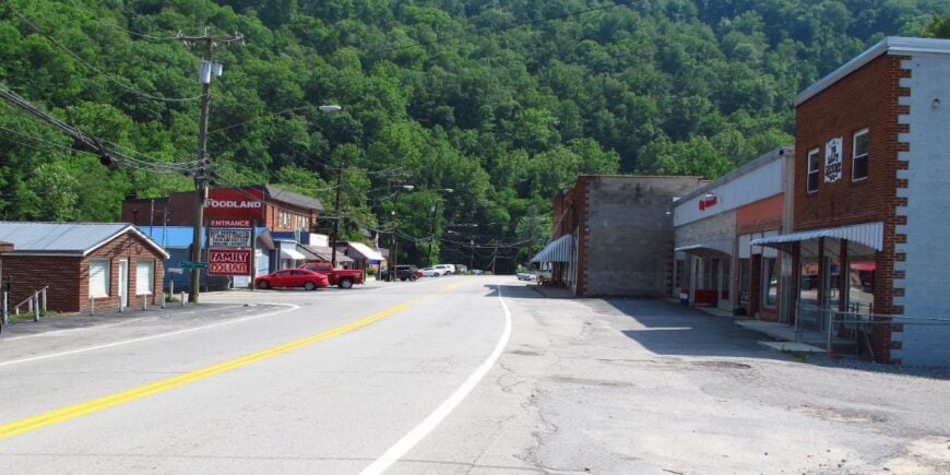
15. Matoaka
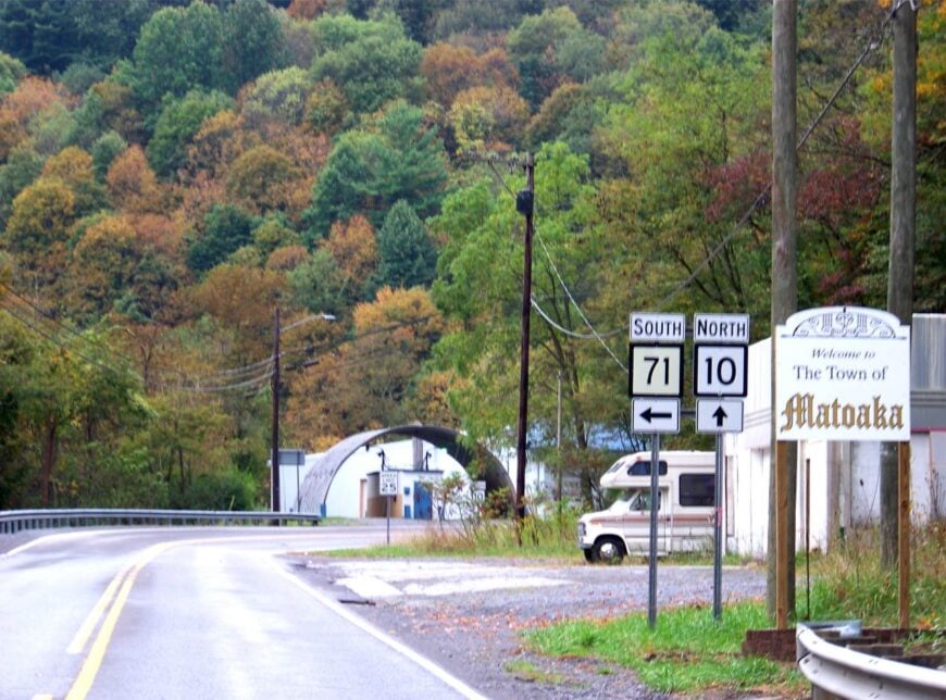
Matoaka, in Mercer County, is a small incorporated town that feels more like a forgotten stage set. Storefronts line a single street where only a few businesses remain, their faded signs adding to the town’s stillness.
Residents fish Pinnacle Creek, hike ridge trails above town, and gather at the old high school gym for occasional events. Coal once powered the town, but today it’s mostly retirees, small shops, and a few commuters to Princeton.
Its seclusion comes from the surrounding ridges that wall in the valley like a hidden bowl. On quiet evenings, only the wind down Main Street stirs the silence. Matoaka holds the beauty of faded grandeur and the peace of being overlooked.
Where is Matoaka?

Matoaka sits in southwestern Mercer County, about 12 miles west of Princeton. The main approach is via WV-10, a twisting two-lane road that hugs the valley.
Its location away from interstates ensures little through traffic. Visitors often feel like they’ve stepped back in time upon arrival.
14. Cyclone
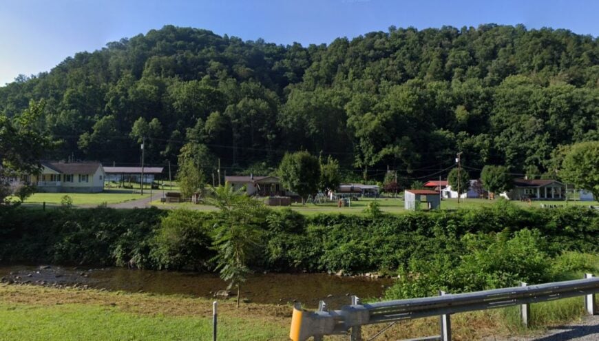
Cyclone, in Logan County, lies where Big Cub Creek meets winding hollows, its very name recalling storms past. The town is sparse, with houses stretched thin along gravel roads under heavy tree canopy.
Locals fish the creek, ride ATVs into the hills, and share meals at a modest café that doubles as a social hub. Employment centers on timber work and farming, with a few commuting to Logan.
Nights are deeply still, with only owls punctuating the silence. Cyclone feels like a tucked-away world wrapped in forest green. It’s a place that makes you aware of how quiet the earth can be.
Where is Cyclone?
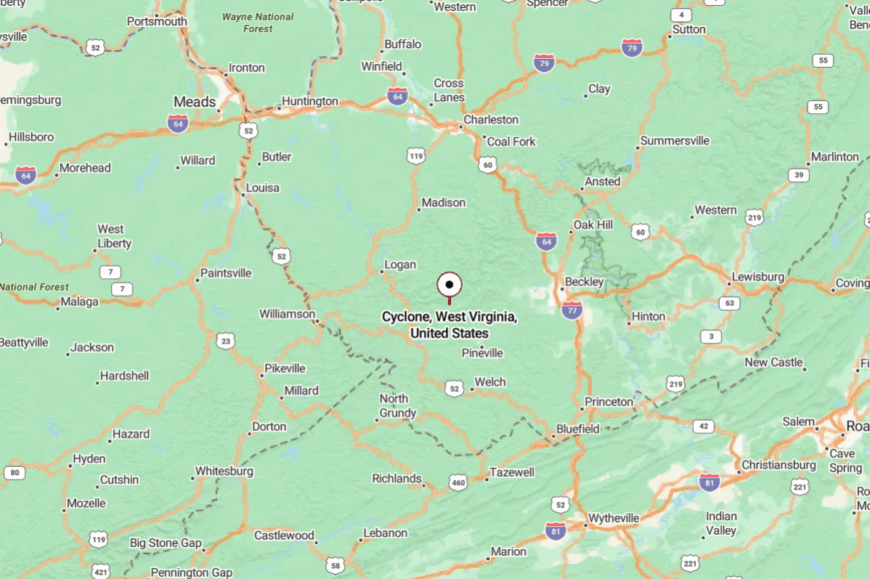
Cyclone rests in southern Logan County, about 20 miles from Man. WV-10 offers the closest access, but County Route 16 winds in and out of the settlement itself.
Steep ridges keep it pocketed from main roads. The drive in feels like being folded into the hills.
13. Gilbert
🔥 Would you like to save this?
Gilbert is a small Mingo County town better known as an ATV haven thanks to its access to the Hatfield-McCoy trail system. But outside of trail season, it is remarkably quiet—just a few diners, an old theater, and residents going about daily life.
Visitors fish the Guyandotte, hike along abandoned mine tracks, or browse local craft fairs. Tourism provides a financial lift, but the town’s heart remains small and deeply Appalachian.
Nights glow softly from porch lights, with the rest of the valley hushed. Gilbert balances hidden quiet with a dash of adventure. It’s the kind of town that welcomes without overwhelming.
Where is Gilbert?
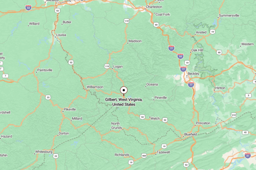
Gilbert lies in western Mingo County, about 30 miles from Logan. WV-80 winds directly into town, shadowed by tall ridges on either side.
The trip is all curves and river crossings. Once you arrive, the valley feels like it could hold you for days.
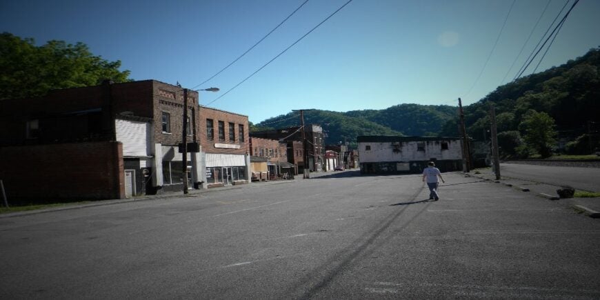
12. War
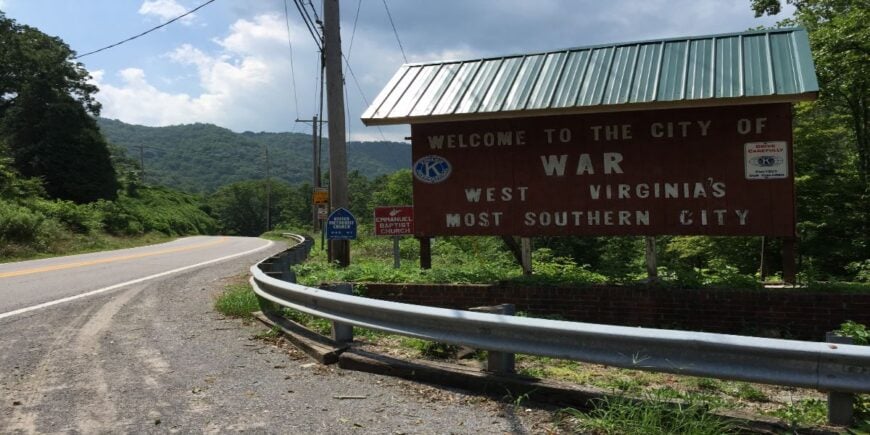
War, with fewer than 700 residents, is the southernmost city in West Virginia and one of its quietest. Old coal buildings stand in dignified silence along the main street, their faded brick telling stories of boom and bust.
People fish War Creek, hunt deer in the surrounding hollows, and attend football games that remain the social high point of the week. Work is limited, relying mostly on small stores, schools, and government jobs.
Life feels pared down, reduced to essentials and memories. The town’s very remoteness is its anchor. War is a place where echoes linger longer than voices.
Where is War?
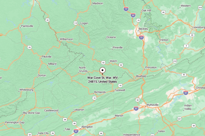
War sits in southern McDowell County, near the Virginia line. The main approach is via WV-16, a winding road that hugs the creek and clings to the mountainside.
The nearest larger town, Welch, is more than 20 miles away over twisting passes. Driving in feels like reaching the edge of the state and finding time has slowed.
11. Iaeger
Iaeger is a small McDowell County town where the Tug Fork curves lazily past weathered storefronts. The vibe is nostalgic, with a downtown that feels paused in the mid-twentieth century.
Locals fish the river, host craft fairs at the community center, and gather for pancake breakfasts at the volunteer fire hall. The town’s quiet is reinforced by its distance from interstates, with coal and small businesses providing what work remains.
Nights are hushed but for train whistles echoing from the valley. Iaeger is the sort of place that holds fast to its roots in silence. It’s a reminder of the resilience tucked into the mountains.
Where is Iaeger?

Iaeger sits in northwestern McDowell County, close to the West Virginia–Kentucky border. WV-80 and U.S. 52 converge here, but neither carries heavy traffic through town.
The ridges surrounding the valley create a natural barrier from the outside world. Arriving feels like stepping into a pause between mountains.
10. Clear Fork
Fewer than 400 people live along the tight ribbon of the Clear Fork of the Guyandotte River, spreading their homes like beads on a string. Angling for smallmouth bass, paddling the calm pools below sandstone bluffs, and hunting mushrooms in the spring woods fill weekends here.
A volunteer-run community center hosts bluegrass jams that rarely make social media but draw residents from three hollows over. Timber cutting and small-scale farming provide most paychecks, with a handful of folks commuting to mines near Oceana.
Steep ridges on both sides of the water, combined with miles of unmarked gravel spurs, keep through-traffic almost nonexistent. Even cell signals fade, leaving songbirds and the distant whistle of Norfolk Southern freight trains as the town’s soundtrack.
Where is Clear Fork?
Clear Fork sits in western Wyoming County, about 18 twisting miles northwest of Mullens. The community hugs a narrow valley where densely wooded slopes block both sight and sound from neighboring settlements.
State Route 971 is the only paved access, and its switchbacks discourage casual detours. Drivers coming from Interstate 77 must budget nearly an hour of two-lane adventure before the first mailbox appears.
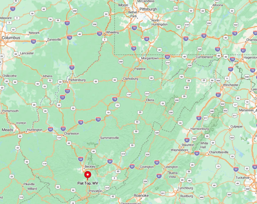
9. Flat Top
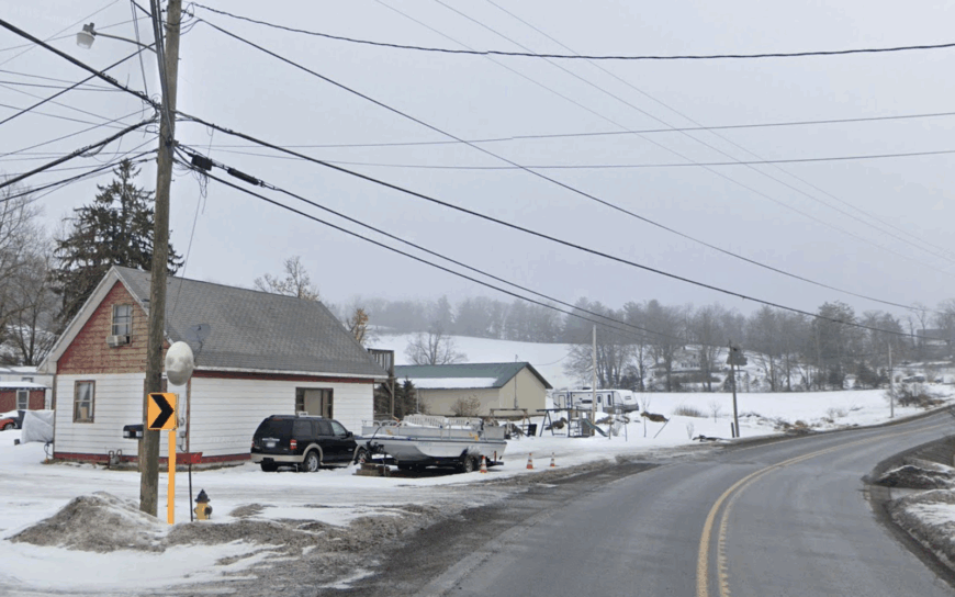
This plateau hamlet in Mercer County counts just over 300 residents scattered across wind-swept hayfields at 3,500 feet above sea level. Locals ride horses along the East River Mountain Trail, picnic at nearby Camp Creek State Park, and gather at the century-old Flat Top Methodist Church for seasonal sings.
Winter brings cross-country skiing on unplowed back lanes, while June sees roadside stands overflowing with heirloom tomatoes ripened in the crisp mountain air. Beef cattle and hay dominate the modest farm economy; a few craftsmen build rustic furniture for galleries in Princeton.
East River Mountain forms a natural barricade to the south, and fog often drapes the plateau, muting any hint of the outside world. Sunsets stretch unbroken across meadows, with only a distant barn roof interrupting the horizon.
Where is Flat Top?
🔥 Would you like to save this?
Flat Top lies along U.S. Route 19, roughly 20 minutes north of Princeton yet psychologically much farther. The elevation alone keeps it cooler and quieter than the bustling commercial strip below.
Access is easiest from Exit 14 on Interstate 77, followed by a gentle climb that leaves cell towers behind. Once atop the plateau, long-range views replace billboards, and the nearest traffic light is miles away.
8. Cool Ridge
About 330 people call Cool Ridge home, their houses sprinkled across rolling pastureland broken by pockets of red spruce. Weekends revolve around trout fishing in Glade Creek, browsing antiques at an honor-system roadside shack, and Sunday dinners served in the fellowship hall of a 1902 white-clapboard church.
Winter’s lake-effect snows from the Alleghenies create perfect sled runs behind the elementary school. Agriculture, part-time forestry work, and seasonal construction near Winterplace Ski Resort power the modest local economy.
A 3,000-foot elevation and miles of buffer forest make the ridge feel like an island in a green sea. Even travelers on the nearby turnpike seldom notice the tiny sign that points uphill toward this quiet perch.
Where is Cool Ridge?
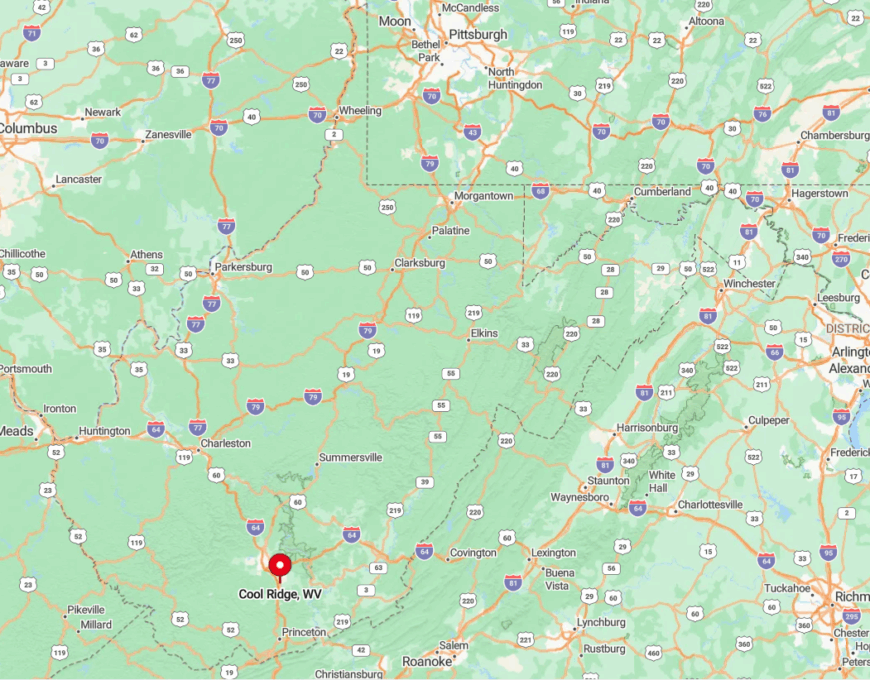
Cool Ridge rests in eastern Raleigh County, about 18 miles southeast of Beckley. Gauley Mountain–like terrain surrounds the settlement, deflecting noise from the West Virginia Turnpike hidden in the valley below.
State Route 21 climbs steadily to reach the ridge, discouraging heavy trucks and timid drivers alike. For visitors, the final mile narrows to a single lane, announcing that solitude is close at hand.
7. Crumpler
Roughly 250 residents occupy the long, shaded hollow of Crumpler in McDowell County, many in re-purposed company houses with broad porches facing Laurel Creek. Off-road enthusiasts flock to the trailhead of the Hatfield-McCoy Pocahontas System, yet find plenty of elbow room once engines go quiet.
Kids still skip stones beneath rust-red rail trestles, and neighbors organize fall apple-butter stir-offs behind the volunteer fire station. A handful of remaining coal jobs and regional timber contracts supplement gardens that produce baskets of half-runner beans each summer.
Dense laurel thickets, sheer shale slopes, and the absence of any state highway keep Crumpler off most GPS grids. Even mail carriers rely on local landmarks, such as “the house with the blue coal chute,” to navigate.
Where is Crumpler?
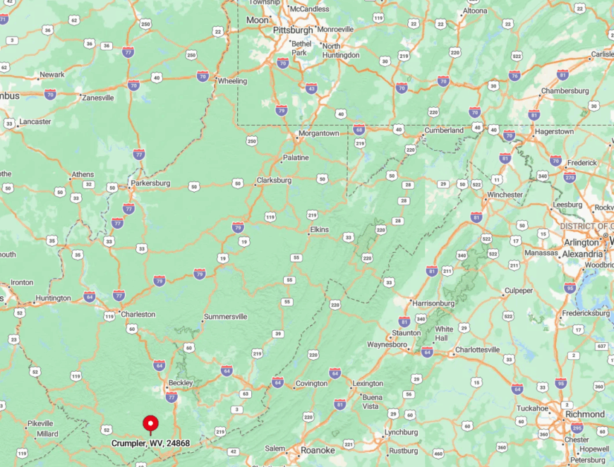
The hollow lies northeast of Welch, tucked between U.S. 52 and State Route 16 yet connected directly to neither. Isolation comes courtesy of single-lane County Route 12, which winds beneath overhanging rock ledges for eight miles before reaching town.
The nearest grocery store requires a 30-minute drive over switchbacks that ban tractor-trailers. Visitors who persist are rewarded with star-filled skies unobstructed by streetlights.
6. Raines Corner
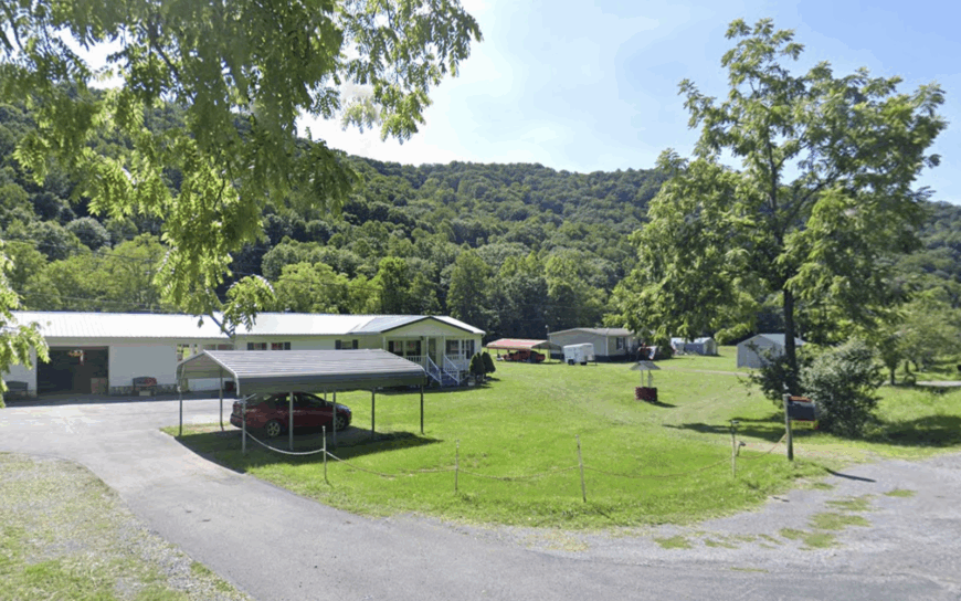
With fewer than 100 households spread across a broad valley in Greenbrier County, Raines Corner feels more like a landscape than a town. Residents organize barn dances in summer, bird-watch along Droop Mountain’s lower slopes, and swap seeds at the spring planting festival held beside an 1890 schoolhouse.
Morning mists rise off Keeney Mountain, creating postcard scenes that photographers rarely discover. Dairy farming and maple-syrup production anchor the local economy, supported by a roadside farm stand on Route 219.
Zero commercial development within a 15-mile radius keeps night skies ink-black and road noise nonexistent. The pace slows even further during autumn when migrating hawks wheel overhead, unnoticed by passing traffic that never appears.
Where is Raines Corner?
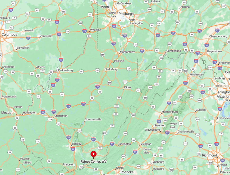
This settlement straddles U.S. Route 219 near the Greenbrier–Monroe county line, yet thick forest screens it from the highway. Droop and Keeney Mountains bookend the valley, creating a natural amphitheater of quiet.
Travelers reach the community via the gentle curves of Route 3 from Alderson, a path lined with pasture and no gas stations. Once there, the nearest chain restaurant lies an hour away in Lewisburg.
5. Rock View
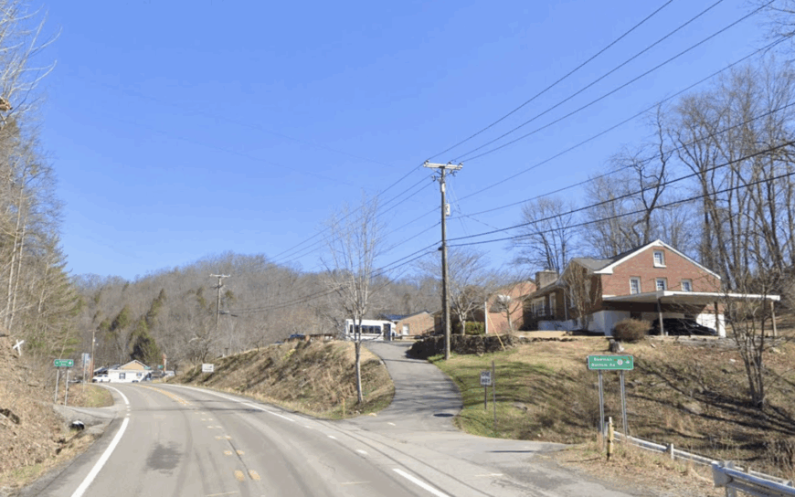
About 350 people inhabit this “string-of-pearls” community along Indian Creek in Wyoming County, each home perched on a spacious parcel with woods in the back yard.
Popular pastimes include bow-hunting for whitetail on ridge-top parcels, kayaking the creek’s gentle rapids, and scouting for morel mushrooms along abandoned logging roads. On Friday nights, the community pavilion hosts cake walks that double as fund-raisers for the volunteer rescue squad.
Small sawmills, family gardens, and a smattering of remote-work tech jobs keep cash flowing without altering the scenery. Forested ridges block outside noise, and the nearest urban center sits 40 minutes away over serpentine roads. Even GPS often reroutes drivers searching for cell towers that simply don’t exist here.
Where is Rock View?
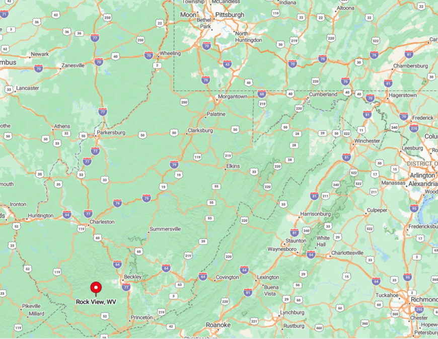
Rock View hugs the banks of Indian Creek just off State Route 85, roughly halfway between Oceana and Pineville. Elevation changes of 1,000 feet on either side pen the community into a quiet corridor.
Access requires careful navigation of hairpin turns that discourage hurried travel. Once inside the valley, only the creek’s chatter competes with birdsong.
4. Nallen
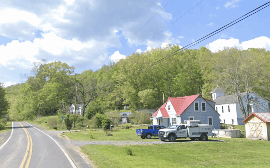
Nallen, tucked into Fayette County’s northern tip, shelters around 200 residents in vintage company houses traced by disused rail beds. Locals fish the Meadow River for muskie, hike hidden sandstone outcrops above Gauley Mountain, and explore the moss-covered ruins of an old lumber mill.
An informal farmers’ market sets up beside the shuttered post office each Saturday spring through fall. Limited logging and nearby rafting-guide gigs offer most employment, though half the town heats with their own firewood.
Fifty percent of surrounding land remains undeveloped woodland, hemming the settlement in leafy silence. The nearest traffic light—and first glimpse of franchise retail—lies 17 miles away in Summersville.
Where is Nallen?
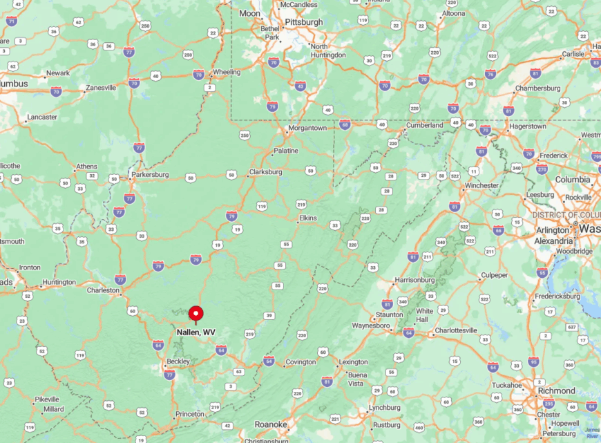
Nallen sits at the confluence of State Routes 41 and 39, though thick timber hides even the road signs. Gauley Mountain rears to the east, while Meadow River’s deep gorge blocks western expansion.
Visitors leaving Interstate 64 at Sam Black Church endure 25 miles of curvy blacktop before the first clapboard store comes into view. Those who make the drive gain access to empty swimming holes known only to residents.
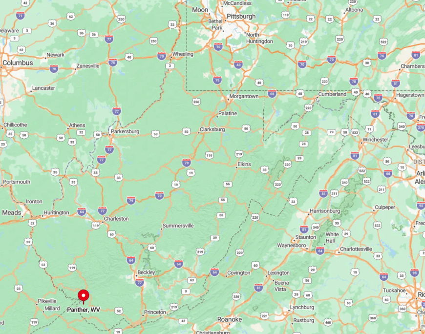
3. Panther
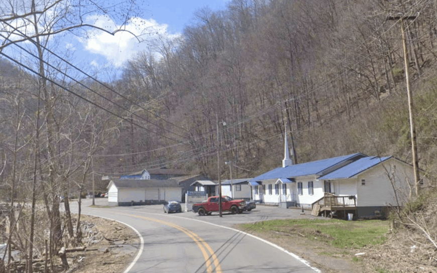
Panther claims roughly 200 inhabitants stretched along the twisting confines of Panther Creek in McDowell County. The namesake state forest offers 7,800 acres for ATV rides, turkey hunts, and waterfalls that seldom appear on maps.
Summer evenings find neighbors sharing pepperoni rolls on porch swings while tree frogs provide harmony. A handful of strip-mine reclamation projects and forest-service posts supply paychecks, with gardens and canning doing the rest.
Dense hardwood slopes rise steeply from backyards, isolating the valley from major towns or highways. Any visitor who loses cell service gains the sight of a night sky that rivals planetarium ceilings.
Where is Panther?
The community lies south of Iaeger, reached only by County Route 3 that shadows Panther Creek for 12 miles. Sheer ridgelines and the state forest boundary form a natural moat against outside bustle.
Travel from U.S. 52 involves a gravel stretch where trucks barely squeeze past. Once inside the hollow, the road ends at a forest gate, reminding travelers they have reached the edge of the map.
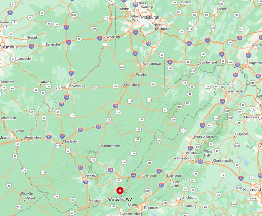
2. Waiteville
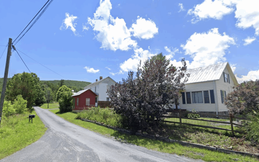
Waiteville, in Monroe County, supports fewer than 150 scattered homesteads across hayfields framed by Peters Mountain. Residents hike to the nearby Hanging Rock Raptor Observatory, ride horses on Jefferson National Forest fire roads, and swap seed potatoes at the century-old general store that doubles as the post office.
Community potlucks feature ramps and morels foraged from the mountain slopes, while autumn brings cider-pressing parties beside the mill pond. Subsistence farming, maple syrup, and a sprinkling of remote-work positions form the economic backbone.
Wide hayfields, gravel lanes, and the hour-long drive to Lewisburg seal the town in a hush that surprises first-time guests. Even the wind seems to slow as it crosses the valley at dawn.
Where is Waiteville?
Waiteville nestles against the Virginia line at the southern foot of Peters Mountain. The settlement’s only paved artery, State Route 17, dead-ends three miles past the post office, leaving no route for pass-through traffic.
Drivers reach it from Union by a series of ridge-climbing switchbacks that deter hurried schedules. Once there, the nearest gas pump is 25 miles away, encouraging visitors to linger rather than rush back out.
1. Coalwood
Fewer than 300 people remain in Coalwood, a hillside mining camp in McDowell County immortalized by Homer Hickam’s “Rocket Boys.” Kids still launch model rockets from the same slate dump that inspired NASA dreams, and hikers trace old mine tramways now overgrown with sassafras.
The annual October Sky Festival gathers space buffs and former miners alike beside the abandoned company store. Occasional surface-mine reclamation projects and small agriculture plots provide limited work, though most rely on pensions and creative side gigs.
The town sits more than 20 miles from the closest four-lane road, and Ridge-and-Valley forests envelop roomy one-acre lots in deep quiet. Long-abandoned tipples and rusting conveyors stand as silent gatekeepers, ensuring Coalwood’s story remains tucked away from hurried modern life.
Where is Coalwood?
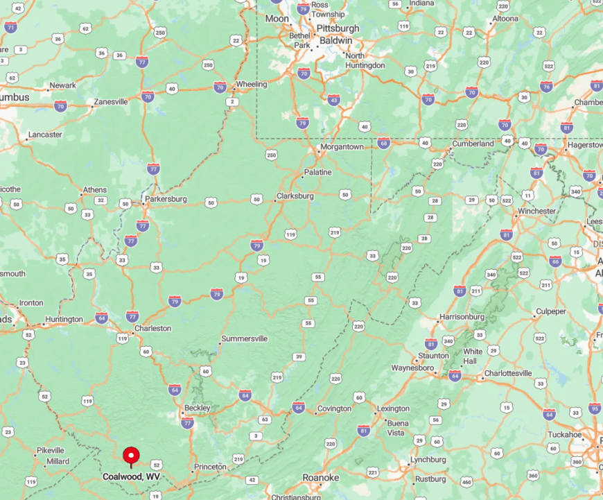
Coalwood lies north of War and southeast of Welch, reached primarily by winding State Route 16 and a final turn onto County Route 2 that hugs steep hillsides. Remote ridges and a web of unmarked gravel spurs deter all but determined visitors.
The nearest airport sits two hours away in Bluefield, with no public transit linking the two. Those who brave the journey find a living time capsule nestled against the hardwoods, safe from the rush of twenty-first-century traffic.


