Would you like to save this?
Southern Oregon keeps its quiet towns tucked between ridges, behind bends in the river, or at the far end of valleys where the road simply stops. They aren’t places you pass through on your way somewhere else — you go there because you mean to. Timber, rail, and the long memory of frontier life still shape the streets and the way people move through them.
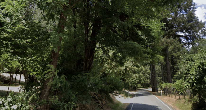
The approach is part of the experience. Leaving the interstate, the sound shifts from engine noise to the low hum of tires on patched two-lane blacktop. Trees lean in, shade deepens, and the occasional mailbox appears between long stretches of green. You feel the land drawing you in before the first building comes into view.
Each town has its own arrangement of history and present-day rhythm. One might gather around a weathered main street where the café doubles as a post office; another might stretch along a riverbank, its backyards opening onto water. What they share is an instinct to keep life scaled to the land.
Southern Oregon has no shortage of scenic drives, but these towns are the real detours. They’re places that hold your attention not with spectacle but with the steady pull of somewhere that knows its own pace.
25. Allegany: Gateway to the Elliott State Forest
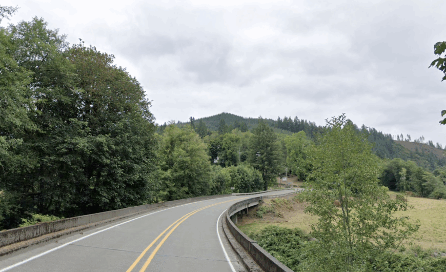
Allegany is a small community deep in the coastal mountains, where the North Fork Coos River winds through a patchwork of forest and river flats. The air here carries a constant scent of spruce and cedar, and the light changes hour by hour as clouds drift over the ridgelines.
Most homes are tucked along the river or up narrow forest lanes, and life moves at the pace of the seasons — salmon runs in autumn, spring blooms along the riverbanks, and long summer days under the dense green canopy. Allegany’s connection to the Elliott State Forest means residents have quick access to hiking, hunting, and fishing in nearly unbroken wilderness.
Its seclusion comes from its geography — you’re surrounded by steep, forested slopes on all sides, with only one road in and out.
Where is Allegany?
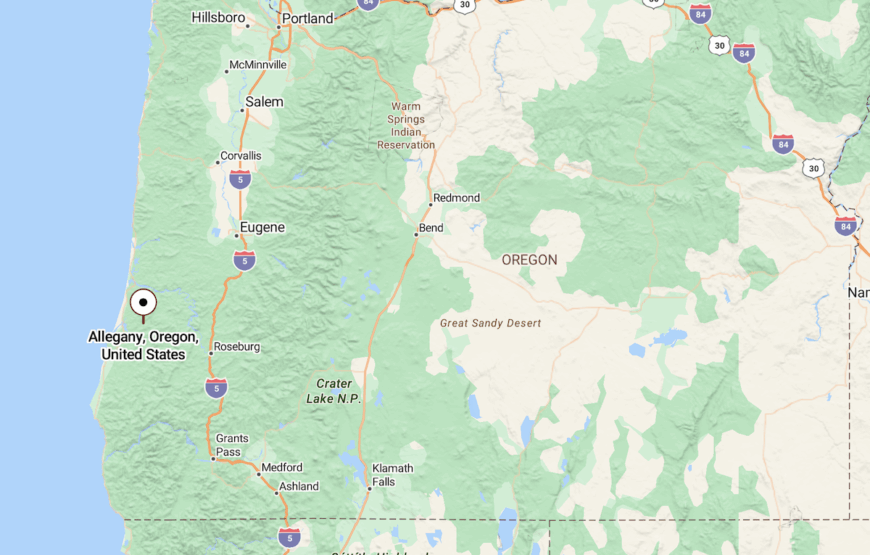
Allegany lies in Coos County, about 14 miles northeast of Coos Bay along Coos River Highway. The road follows the waterway closely, winding past ranches, forest edges, and steep green hills.
Once you leave the city limits, the landscape quickly shifts to dense coastal forest. By the time you reach Allegany, the outside world feels far away.
24. Eden Valley: A Hidden Upland Basin
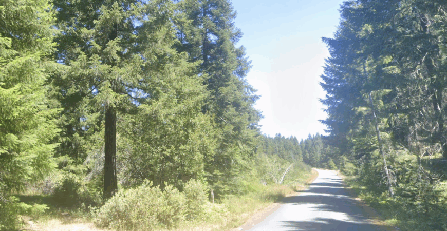
Eden Valley sits high in the Coast Range, a sheltered basin surrounded by Douglas fir and hemlock forest. The valley floor is open pasture, but step a few yards beyond the fence lines and you’re under a cathedral of trees.
The population is small — just a handful of ranches and rural homes — but the sense of place is strong. The forest is a constant companion here, its cool shade offering relief in summer and a muffled quiet in winter. Wildlife is a daily sight, from deer in the fields to owls calling at night.
Its remoteness keeps it off most maps, but that’s part of its draw — there’s a self-contained rhythm to life in Eden Valley.
Where is Eden Valley?
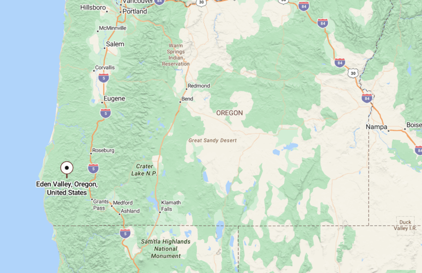
Eden Valley is in Coos County, northeast of Powers and reached by a combination of county roads and forest tracks. It lies in an upland pocket, hemmed in by Coast Range ridges.
Access is slow and winding, with climbs and descents through thick forest before the valley suddenly opens up. That change in scenery is part of its hidden appeal.
23. Glendale: Valley Town Between Forested Ridges
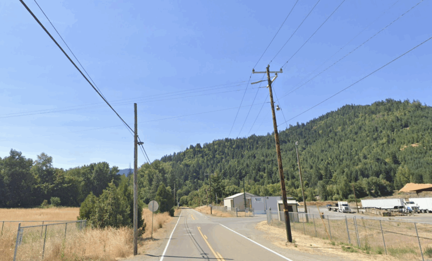
Glendale sits deep in the Cow Creek Valley, where steep green ridges rise sharply on either side and the town’s compact main street feels tucked into a natural corridor. Originally built around timber and the railroad, it still carries traces of its frontier past in weathered storefronts and old mill sites. The surrounding forests remain thick and untamed, giving Glendale the sense of being an island in a sea of trees.
Residential streets slip quickly into wooded draws, and it doesn’t take long before pavement turns to gravel. Locals often head into the hills for hunting, mushroom foraging, or just quiet walks under the canopy. Even with Interstate 5 running just above, there’s a marked contrast between the traffic overhead and the slow, steady rhythm in town.
Community life is centered on small gatherings, school events, and the kind of neighborly connections that thrive in a place where everyone knows the bends in the road by name. The isolation here isn’t about distance so much as the natural boundaries created by the surrounding terrain.
Where is Glendale?
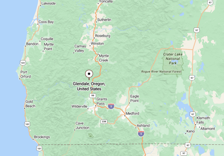
Glendale lies in Douglas County, about 18 miles north of Grants Pass along Interstate 5. The exit leads directly down into the heart of town, where Cow Creek winds quietly past the old rail line.
The surrounding ridges rise close to the town’s edges, creating a sheltered valley that keeps it separate from the sprawl to the north and south. Even brief stops here feel like stepping into a self-contained world.
22. Bancroft: Where the Forest Meets the Creek
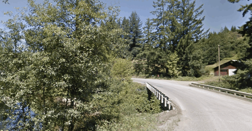
Bancroft is a small, forest-edged community south of Myrtle Point, surrounded by ridges thick with fir and hemlock. The air is cool and damp in the mornings, often carrying the scent of woodsmoke from scattered homesteads.
The land here is a patchwork of small pastures and wooded parcels. Deer and elk are common in the meadows at dusk, and creeks tumble through fern-filled ravines.
Its tucked-away location makes it more a place you happen upon than one you set out to find.
Where is Bancroft?
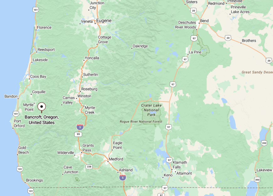
Bancroft sits in Coos County, along Bancroft Road southeast of Myrtle Point. The road follows a gentle climb into the foothills, winding through forested curves.
The setting quickly becomes quiet and green, with the hills closing in as you leave the lowland farms behind.
21. Remote: The Name Says It All
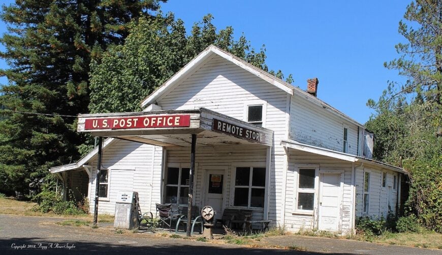
Remote’s name is no exaggeration — this tiny community in the Coast Range is little more than a few homes, a post office, and an enduring presence along the Coquille River. The surrounding forest presses close, with steep slopes on either side.
Life here is shaped by the road and the river, both winding and unpredictable in winter weather. Residents embrace the isolation, relying on nearby Myrtle Point for supplies.
The forest’s constant presence makes Remote feel more like a clearing than a town, a place where the wild remains just beyond the porch.
Where is Remote?
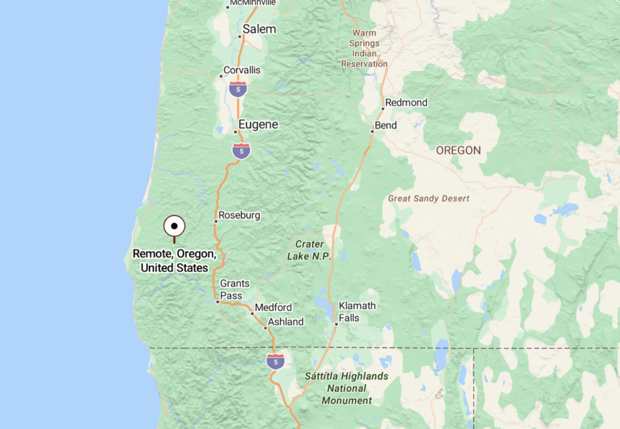
Remote is in Coos County along Highway 42, about 20 miles east of Myrtle Point. It sits deep in the coastal mountains, following the bends of the Coquille River.
Getting there involves a winding drive through river valleys where cliffs and trees crowd the roadside. The remoteness is felt long before the sign appears.
20. Illahe: Remote Bend in the Rogue Canyon
Illahe is more a scattering of riverside clearings than a town, yet it has a history that reaches back to homesteaders, miners, and the Native communities who navigated these waters long before roads arrived. The name comes from a Chinook word for “land” or “earth,” and it fits — this is a place where the river and forest still define the limits of daily life.


Cabins, gardens, and a small historic lodge sit on the narrow strip between the Rogue River and steep, forested slopes. Most visitors arrive by boat or by driving the long, winding road in from Agness, trading cell service and convenience for quiet mornings and a star-heavy night sky.
Fishing, rafting, and hiking are the activities that draw outsiders, but for the few who stay year-round, Illahe offers something rarer: a sense of being stitched directly into the canyon’s rhythm, far from the noise of anywhere else.
Where is Illahe?
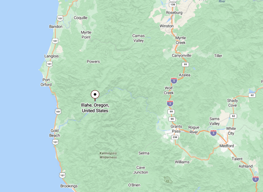
Illahe lies in Curry County, deep within the Rogue River–Siskiyou National Forest. It’s about 27 miles upriver from Agness via the narrow, curving Rogue River Road.
The community sits on a broad inside bend of the Rogue River, surrounded on three sides by steep canyon walls. With no quick route in or out, it remains one of the most isolated settled spots along the lower Rogue.
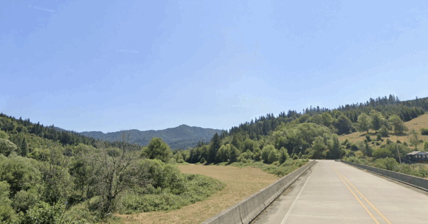
19. Gravelford: Where Two Forks Meet
Would you like to save this?
Gravelford sits at the confluence of the North and Middle Forks of the Coquille River. Its name comes from the original shallow crossing used before bridges spanned the waterways.
Today, it’s a scattering of homes, barns, and fields, framed by ridges cloaked in dense forest. The fertile bottomlands make small-scale farming viable, while the surrounding hills offer seclusion.
Though only a short drive from Myrtle Point, Gravelford feels firmly in the realm of rural quiet.
Where is Gravelford?
Gravelford is in Coos County, northwest of Myrtle Point. It’s reached by following county roads that trace the bends of the Coquille River.
The route is narrow and scenic, with glimpses of water through the trees. Arrival feels less like entering a town and more like finding a long-settled river bend.
18. Sitkum: A Forested Crossroads
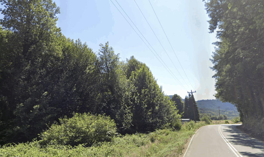
Sitkum is a small settlement deep in the coastal mountains, once a stagecoach stop between Roseburg and Coos Bay. Today, only a few homes and a Grange Hall remain as evidence of its past.
The surrounding forest is thick and largely unbroken, with logging roads branching into the hills. Wildlife is abundant, and winter storms can leave the area feeling particularly remote.
Sitkum’s quiet is absolute — the kind of silence broken only by wind in the treetops or the sound of the river below.
Where is Sitkum?
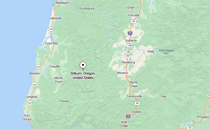
Located in Coos County, Sitkum lies along Sitkum Lane, east of Myrtle Point and well into the forested uplands.
Access is via narrow, winding roads that climb steadily into the hills. The journey underscores just how tucked away the community is.
17. Dora: Valley Farms in Mountain Country
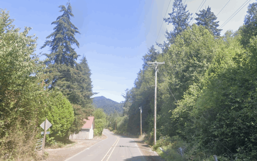
Dora occupies a narrow valley where the East Fork of the Coquille River winds through pastures and woodlots. A few dozen homes and farms make up the community, which is known for its tight-knit residents.
The river supports trout fishing, while the surrounding hills provide hunting grounds and hiking trails. Winters are wet, but the landscape remains green year-round.
Dora’s small size and distance from major roads give it a settled, timeless feel.
Where is Dora?
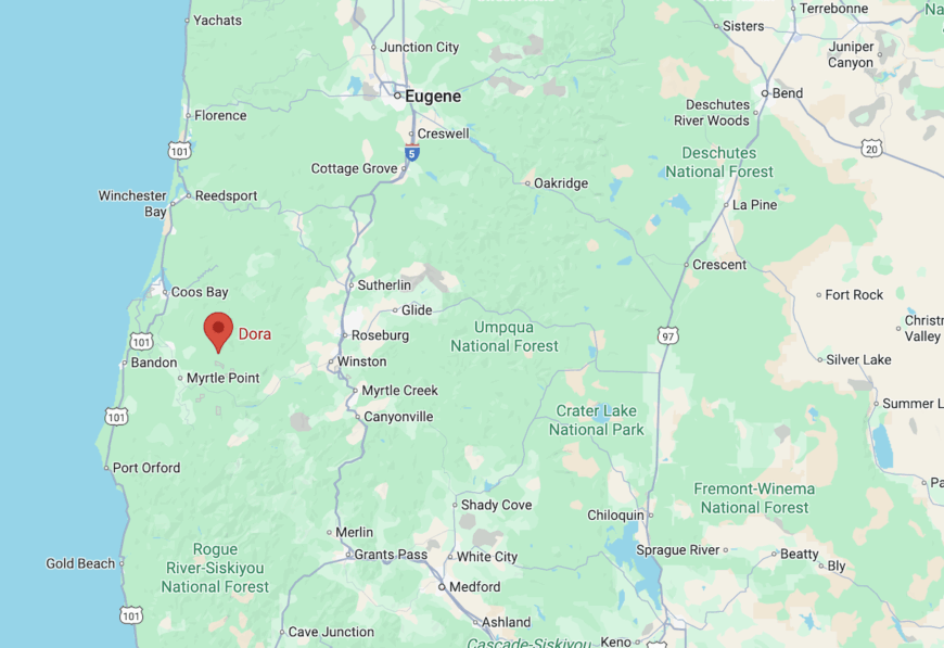
Dora is in Coos County, about 20 miles northeast of Myrtle Point. It’s reached via a combination of rural highways and local roads that follow the river.
The drive in is scenic, passing through a mix of farmland and deepening forest before the valley narrows.
16. Tenmile: Lakeside Edge of the Mountains
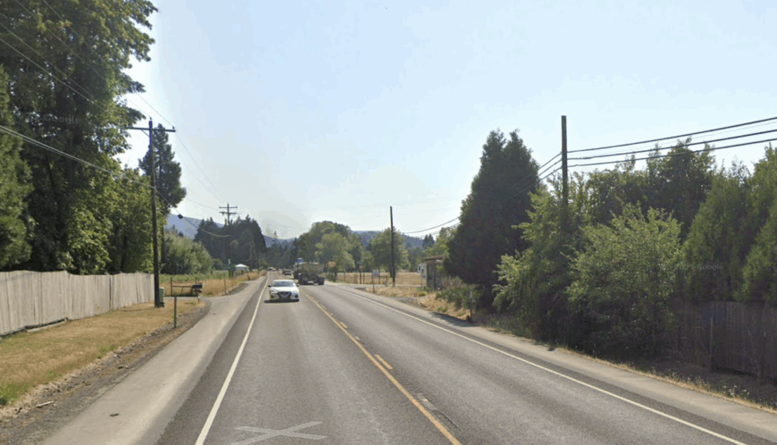
Tenmile takes its name from nearby Tenmile Lake, though the community itself is set further inland along Tenmile Creek. It’s a mix of forest, pasture, and waterway.
Residents enjoy quick access to fishing and kayaking while still living in a quiet, wooded environment. The surrounding coastal hills rise sharply, hemming in the valley.
Its position away from the main lake resorts keeps it quieter than nearby recreation spots.
Where is Tenmile?
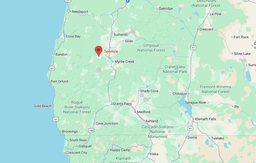
Tenmile is in Coos County along Highway 42, about 15 miles east of Coos Bay. The town marks the transition from lowland coastal plain into steeper forested country.
Approaching from either direction, the road climbs and curves, with the scent of salt air fading into pine.
15. Sunny Valley: Covered Bridge Country
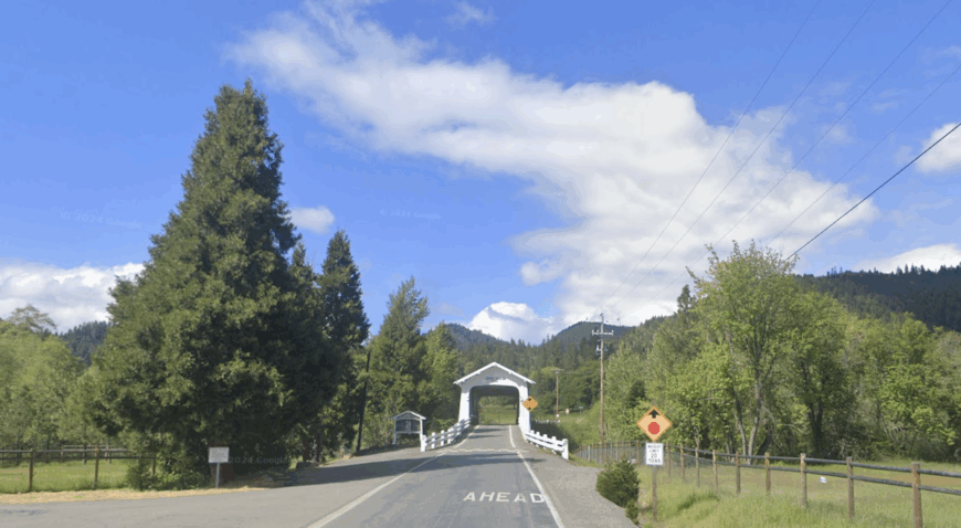
Sunny Valley unfolds in a patchwork of pasture and woodland, ringed by the ridges of the Coast Range. Its best-known landmark, the white-painted Grave Creek Covered Bridge, spans a narrow waterway that once saw stagecoaches and gold miners passing through. Today it serves as a quiet centerpiece, a link between the town’s past and its easygoing present.
Homes here sit on large parcels, often with gardens, barns, and a few grazing animals. Summer heat settles in the valley and draws neighbors outdoors, while winters bring mist that lingers in the hollows. Life moves with the seasons, marked by planting, harvest, and the rhythm of school events and local gatherings.
The pace is unhurried, and the surrounding hills form a natural barrier that keeps through-traffic at a minimum. For residents, that sense of enclosure is part of the appeal — a feeling of being set apart without being cut off.
Where is Sunny Valley?
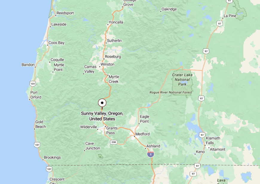
Sunny Valley is in Josephine County, about 15 miles north of Grants Pass along Interstate 5. Exit 71 leads across the Grave Creek Covered Bridge into the heart of the community.
From the bridge, the road opens into a small valley floor, with forest climbing the slopes in every direction. The highway disappears from sight almost immediately, leaving only the sound of the creek and the rustle of leaves.
14. Azalea: Forest Crossroads at Stage Road Pass
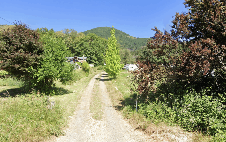
Azalea takes its name from the wild flowers that bloom in pink and white along the forest edges each spring. It sits high in the Coast Range at Stage Road Pass, once an important stop for stagecoaches traveling between Grants Pass and Canyonville. Today it’s a scattering of homes, meadows, and timber stands, linked by winding roads that feel more like long driveways than public routes.
The air here is crisp even in summer, and the elevation brings cooler nights and occasional winter snow. Residents enjoy the quiet, punctuated only by the sound of wind through tall firs and the occasional call of a logging truck on the highway below.
Life is measured and seasonal — gardening, woodcutting, and hikes into the surrounding hills. While small, Azalea retains a certain crossroads energy, a sense that it’s still a pause along a longer journey.
Where is Azalea?
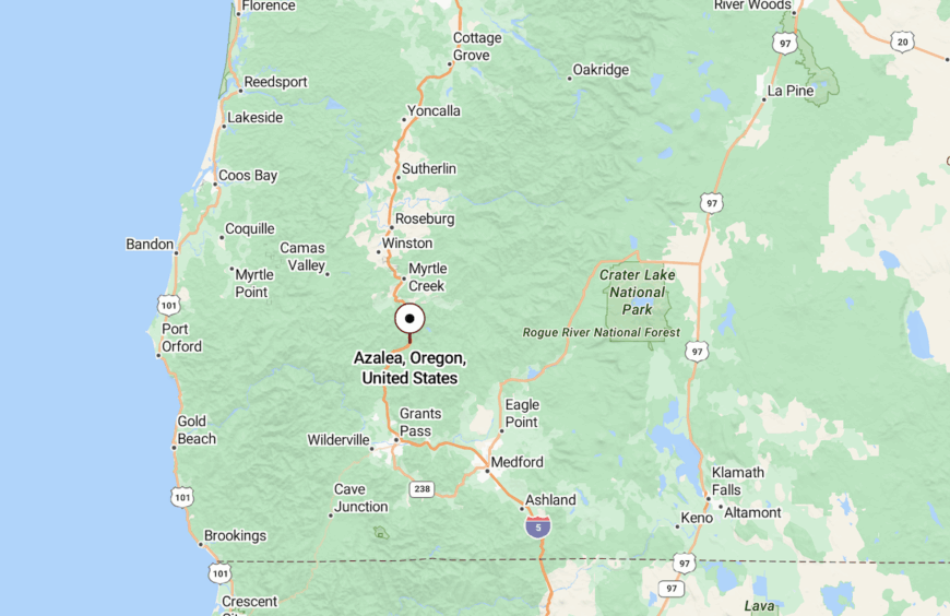
Azalea is in Douglas County, about 16 miles south of Canyonville along Interstate 5. Access is via Exit 88, with the road winding gently into the wooded valley.
The community sits just east of Cow Creek and is hemmed in by forested ridges on all sides. The combination of elevation and tree cover makes it feel removed from the lower valleys despite its highway connection.
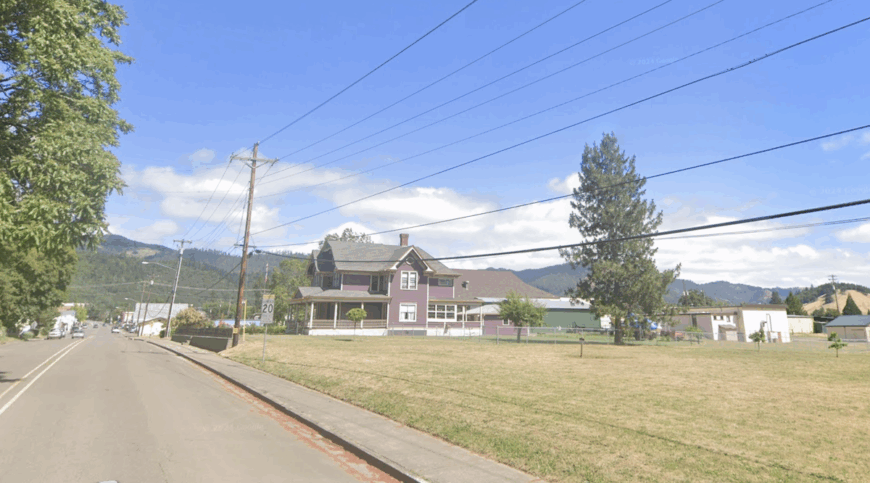
13. Riddle: Timber Hollow Turned Quiet Neighborhoods
Would you like to save this?
Riddle began as a mining and timber hub, its economy once driven by the mills and the railroad that still runs through town. Over time, the pace slowed, leaving behind a main street of historic façades and a scattering of small businesses that serve the surrounding rural area.
Neighborhoods here are shaded by tall oaks and Douglas firs, with backyards that often blend into the forest. The hills rise close, and the sound of freight trains passing through is one of the few reminders of the wider world.
Community life remains tied to the land — gardens, woodlots, and the nearby hunting and fishing grounds. The surrounding forest still defines the view in every direction.
Where is Riddle?
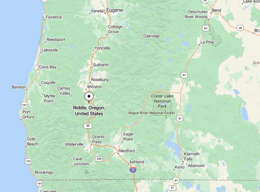
Riddle is in Douglas County, about 21 miles south of Roseburg along Interstate 5. The town lies in the Cow Creek Valley, with steep slopes framing its edges.
From the interstate exit, a short road leads directly into the main street, after which the landscape quickly shifts back to forested ridges and winding rural roads.
12. Eden Ridge: High Ground Over the Coos Basin
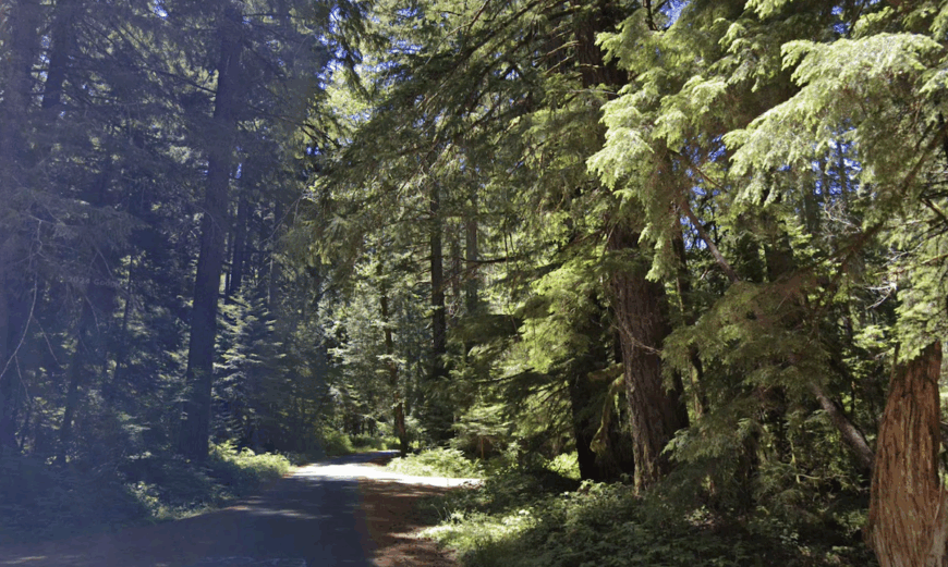
Eden Ridge is a high-elevation settlement perched near the spine of the Coast Range, where forest roads connect a scattering of homes and old logging clearings. The ridge’s elevation brings cool, damp air even in midsummer, and its slopes are thick with Douglas fir, spruce, and hemlock.
From certain points, you can look west toward the ocean on a clear day, though most of the view is an endless sea of green treetops. The roads here twist through forest so dense that even in midday, patches of light feel rare.
Eden Ridge’s remoteness is complete — there are no services nearby, and every trip to town means a long, winding descent to the valley floor.
Where is Eden Ridge?
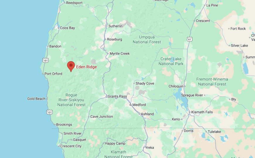
Eden Ridge straddles the line between Coos and Curry counties, north of Powers. It’s reached via Forest Service roads branching off Powers Highway.
The drive climbs steadily into higher forest country, with views expanding as you reach the ridge. Once up top, you’re surrounded by deep woods, far from the lowland noise.
11. Norway: River Bend Along the Coastal Route
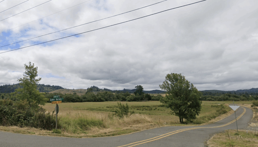
Norway sits on a gentle curve of the Coquille River, its homes and small farms spread between the water’s edge and the wooded slopes above. Once a stop along the old stage route, it now rests quietly between Myrtle Point and Coquille.
The river’s wide bend creates fertile bottomlands, ideal for grazing and crops. The surrounding forests begin almost at the fence lines, giving the area a sense of enclosure.
Norway’s position on a secondary route means it sees little through traffic, preserving its calm, riverside atmosphere.
Where is Norway?
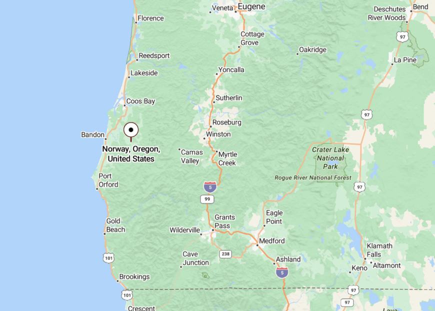
Norway is in Coos County along Highway 42, just a few miles northeast of Coquille. The highway hugs the river here, offering views of pastures backed by steep, tree-covered hills.
From the roadside, the community appears almost as a pause in the valley before the road curves away again toward the coast.
10. Merlin: Gateway to the Wild Rogue Wilderness

Merlin is a small community that I’ve always found enchanting, with a population of around 1,700 people. It’s a haven for outdoor enthusiasts like me, offering activities such as fishing, rafting, and hiking in the nearby Wild Rogue Wilderness.
The town serves as a launching point for river adventures, supporting local industries like guided tours and outdoor equipment rentals. What makes Merlin truly secluded is its surrounding undeveloped lands and large lot sizes, providing plenty of space and privacy for residents.
I love how the community maintains a peaceful atmosphere despite being a gateway to adventure. If you’re seeking a tranquil place with easy access to the wilderness, Merlin might just be the spot for you.
Where is Merlin?

Located in Josephine County, Merlin sits about nine miles northwest of Grants Pass in Southern Oregon. Its seclusion comes from the dense forests and rugged terrain that envelop the town, setting it apart from urban areas.
To get there, you can drive along Interstate 5 and take exit 61, then follow the Merlin-Galice Road that winds through scenic landscapes. The journey itself feels like an escape, and by the time you arrive, you’ll understand why Merlin is considered a hidden gateway to nature.
9. Camas Valley: A Remote Oasis in Douglas County

Camas Valley is a small, unincorporated community that I find beautifully remote, with a population of just over 1,000 residents. The area is perfect for those who appreciate agricultural landscapes and enjoy activities like farming, horseback riding, and hiking in the surrounding hills.
The main industries here revolve around agriculture and forestry, reflecting the community’s connection to the land. What sets Camas Valley apart is its vast expanses of farmland and natural barriers, creating a secluded haven away from the noise of city life.
I admire how the locals embrace a self-sufficient lifestyle, making the most of the valley’s natural resources.
Where is Camas Valley?

Would you like to save this?
Nestled in Douglas County, Camas Valley is situated about 30 miles southwest of Roseburg along Highway 42. Its remote location is accentuated by the surrounding mountains and forests, which provide a natural shield from the outside world.
Getting there involves a scenic drive through winding roads that meander past forests and fields. I always feel a sense of peace as I approach the valley, knowing that a quiet, genuine community awaits.
8. Wolf Creek: Historic Seclusion Near the Siskiyou Mountains

Wolf Creek is a quaint town with a rich history that I’ve always appreciated, home to around 2,000 residents. The town is known for the historic Wolf Creek Inn, where you can step back in time and enjoy a peaceful stay.
Outdoor activities include exploring nearby trails and taking in the natural beauty of the Siskiyou Mountains. The area doesn’t have major industries but thrives on small businesses and tourism centered around its historical sites.
Wolf Creek’s seclusion stems from its location amidst large land parcels and its distance from major urban centers. I feel that the town’s timeless charm and tranquility make it a perfect retreat for those seeking a slower pace of life.
Where is Wolf Creek?

Located in Josephine County, Wolf Creek sits off Interstate 5, about 20 miles north of Grants Pass. Its secluded feel comes from the surrounding forests and the Siskiyou Mountains that rise nearby.
To reach Wolf Creek, you take exit 76 from the interstate and follow the signs into town. I enjoy the drive through this area, as the lush landscapes and winding roads make the journey as enjoyable as the destination.
7. Selma: Hidden Solitude in Josephine County

Selma is a small community that offers a peaceful atmosphere, with a population of just over 1,900 people. I like to visit Lake Selmac nearby, which is great for fishing, boating, and picnicking.
The area is also a gateway to the Oregon Caves, providing unique exploration opportunities. The local economy is modest, with small businesses and agriculture playing key roles.
Selma’s seclusion comes from being surrounded by forests and rolling hills, giving residents plenty of space and privacy. To me, the quiet streets and close-knit community make Selma a charming and restful place.
Where is Selma?

Selma is nestled in Josephine County, about 20 miles southwest of Grants Pass along Highway 199. The town’s secluded nature is enhanced by the dense forests of the Siskiyou National Forest that envelop it.
Getting there involves a scenic drive through mountainous terrain, which I always find refreshing. The winding highway takes you deeper into the countryside, making Selma feel like a hidden gem tucked away from the hustle and bustle.
6. Williams: Rural Charm in the Applegate Valley

Williams is a community that epitomizes rural living, with a population of around 2,200 people. I enjoy the organic farms and vineyards in the area, where you can taste local produce and wines.
The local industries are primarily agriculture and small-scale farming, reflecting the residents’ connection to the land. What makes Williams secluded is its setting in the rolling hills of the Applegate Valley, with spacious lots that offer privacy and stunning views.
I find that the community’s emphasis on sustainable living and natural beauty makes it a special place to unwind.
Where is Williams?

Located in Josephine County, Williams lies approximately 15 miles southwest of Grants Pass. Its seclusion is amplified by the surrounding mountains and forests that create a peaceful barrier from urban areas.
To reach Williams, you can take Highway 238 through the scenic Applegate Valley, which I always find to be a delightful drive. The route is lined with orchards and vineyards, setting the tone for the tranquil atmosphere you’ll find upon arrival.
5. Trail: A Scenic Community Along the Rogue River

Trail is a small community that I’ve come to appreciate for its serene setting, with a population of around 700 residents. The town is nestled along the Rogue River, making it ideal for fishing, kayaking, and enjoying riverside picnics.
There’s no major industry here, but local businesses cater to outdoor enthusiasts and those passing through. Trail’s seclusion is due to its large properties and the surrounding forests, providing residents with ample space and a close connection to nature.
I find that the peacefulness of the river and the quiet ambiance make Trail a perfect spot for getting away from it all.
Where is Trail?

Situated in Jackson County, Trail is located about 30 miles northeast of Medford along Highway 62. The town’s remote feel comes from its location between the dense forests of the Rogue River-Siskiyou National Forest and the river itself.
Driving there involves following the highway as it winds along the river, which I always find to be a calming experience. The journey prepares you for the tranquility that awaits in Trail.
4. Powers: Peaceful Living in the Coastal Mountains

Powers is a secluded town that I’ve found to be wonderfully quiet, with a population of about 680 people. Surrounded by the coastal mountain range, it’s a haven for hiking, bird watching, and exploring the nearby Siskiyou National Forest.
The main industry here is timber, reflecting the town’s deep connection to the surrounding forests. Powers’ seclusion is enhanced by the natural barriers of mountains and undeveloped land, ensuring privacy and a slow-paced lifestyle.
I appreciate how the community embraces its natural surroundings, making it a relaxing retreat for visitors and residents alike.
Where is Powers?

Located in Coos County, Powers sits about 50 miles south of Coos Bay via winding mountain roads. Its remote location is further isolated by the rugged terrain that surrounds it.
To get there, you can take Highway 42 south to Myrtle Point and then follow the Powers Highway deep into the mountains. I enjoy the scenic drive through dense forests, which makes the journey to Powers feel like an adventure into the heart of nature.
3. O’Brien: A Quiet Escape Near the California Border

O’Brien is a small, rural community with a population of around 500 people that I’ve found to be a peaceful escape. The area is characterized by spacious lots and beautiful natural landscapes, making it perfect for hiking, horseback riding, and exploring the great outdoors.
There’s little in the way of industry here, with residents often engaged in small-scale farming or commuting to nearby towns for work. O’Brien’s seclusion comes from its location in a remote part of Josephine County, miles away from urban centers.
Where is O’Brien?

O’Brien is located in Josephine County, just north of the California border along Highway 199. Its remote setting is amplified by the surrounding forests and its distance from larger towns.
To reach O’Brien, you drive through the scenic Redwoods Highway, which is one of the most beautiful drives in the region. The journey takes you through lush forests and mountainous terrain, emphasizing the secluded nature of this hidden gem.
2. Tiller: Seclusion Amidst the Umpqua National Forest

Tiller is an unincorporated community that is one of the most secluded places in Southern Oregon, with a population of just around 250 people.
It’s enveloped by the Umpqua National Forest, offering endless opportunities for hiking, fishing, and wildlife observation. The area has a history rooted in logging, though much of that industry has diminished, adding to its quiet atmosphere.
Tiller’s seclusion is due to the vast forestlands and the lack of nearby towns, making it a perfect spot for those seeking solitude.
Where is Tiller?

Located in Douglas County, Tiller is about 50 miles east of Roseburg, accessible via winding forest roads. Its isolation is deepened by the dense Umpqua National Forest that encircles it on all sides.
To get there, you can take Highway 227 from Canyonville, a route that takes you through pristine wilderness areas. The journey to Tiller is immersive, as the towering trees and quiet roads make it feel like you’ve truly left the rest of the world behind.
1. Agness: A Riverside Haven Hidden in the Wilderness

Agness is one of our favorite secluded spots in Southern Oregon, an unincorporated community with a population of less than 150 people. Nestled along the Rogue River, it’s a paradise for fishing, boating, and enjoying the serenity of the wilderness.
The main industries here are tourism and recreation, though on a very small scale, with lodges and outfitters catering to visitors seeking adventure.
Agness’s seclusion is undeniable, surrounded by dense forests and accessible only via winding scenic roads or even by boat. The remoteness of Agness is its greatest charm, offering a true escape from modern life.
Where is Agness?

Agness is located in Curry County, about 30 miles east of Gold Beach. Its secluded location is deep within the Rogue River-Siskiyou National Forest, far from any major highways. To reach Agness, you can take the Agness Road from Gold Beach, which is a narrow, winding route that I’ve always found adventurous.
Alternatively, some visitors arrive by boat along the Rogue River, embracing the journey as part of the experience. The effort to get there is rewarded by the pristine beauty and tranquility that Agness provides.