Would you like to save this?
The far reaches of Southern Arizona offer a quiet antidote to crowded resort corridors and fast-growing suburbs. Scattered through oak-dotted foothills, high desert grasslands, and granite-walled canyons sit towns where cattle outnumber cars and night skies still glow with ancient starlight.
Our list highlights places that trade convenience for calm, each one holding tight to a sense of space that is getting harder to find. From a mountaintop hamlet reached by switchbacks to a wine country basin with dirt roads and broad horizons, these communities prove that solitude comes in many landscapes.
We share local quirks, back-road directions, and lesser-known outings so readers can appreciate how much life thrives where population numbers remain tiny. Pack water, check your fuel gauge, and explore at a pace set by the desert itself.
25. Redington – Cliffside Ranches on the San Pedro
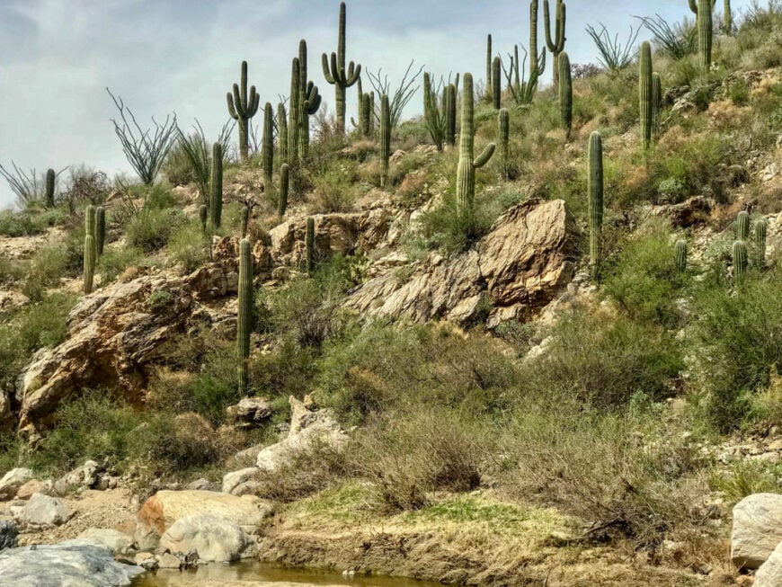
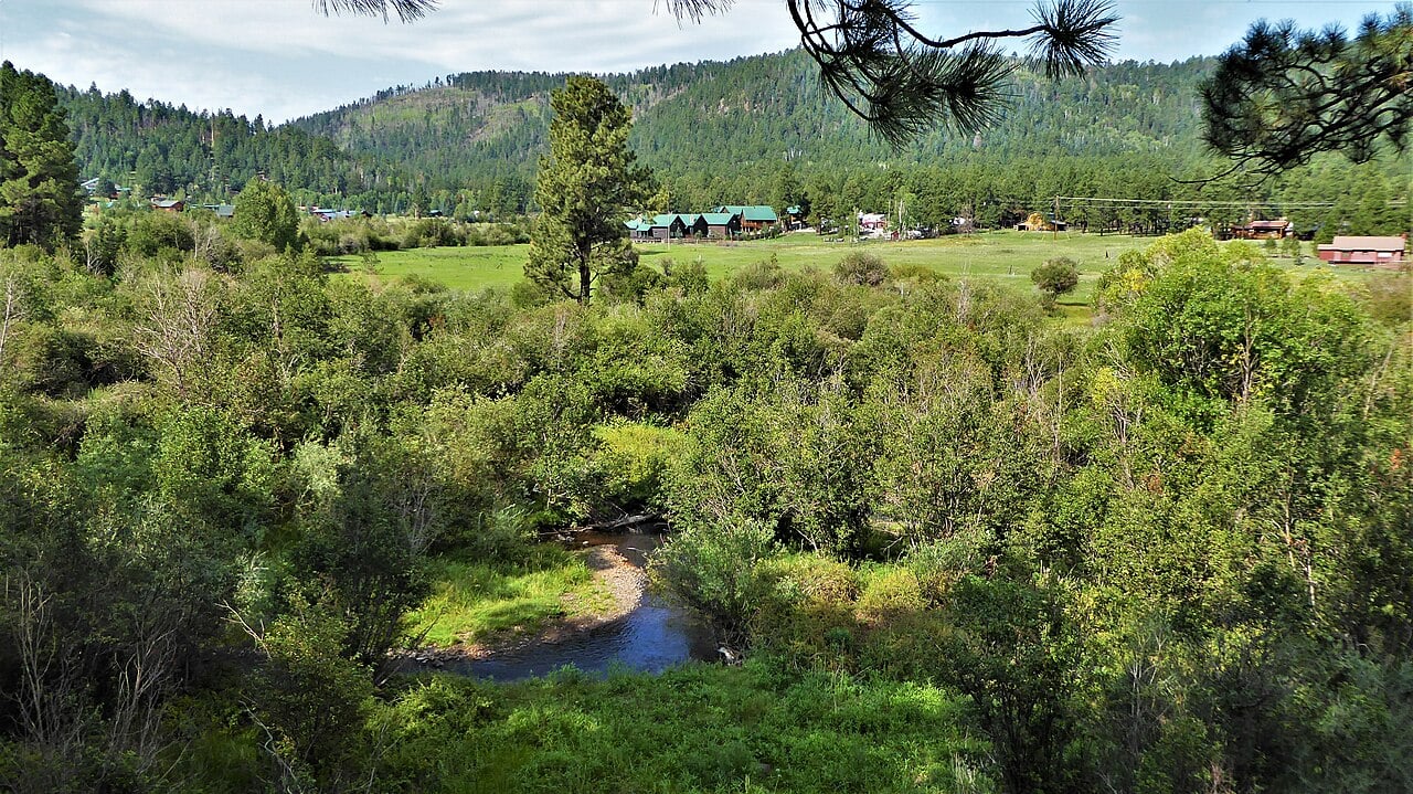
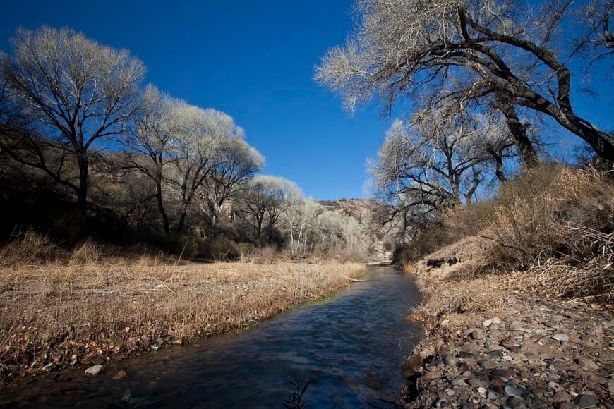
Redington is little more than a scattering of ranches nestled where the Rincon and Galiuro Mountains meet, with fewer than 100 residents across dusty mesa flats. Locals tend livestock, repair fencelines, and listen for the soft trickle of the San Pedro River flowing far below red cliffs.
The town lacks stores, signs, or a true center—just a postmark and a long gravel road. Hawks soar overhead while saguaros cast long shadows on one of Arizona’s most timeless landscapes.
Where is Redington?
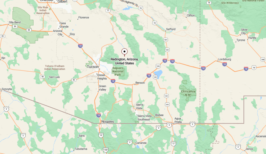
Redington lies at the end of Redington Road, east of Tucson, following 40 miles of washboard dirt that climbs and dips across foothills and dry riverbeds. The road eventually descends to the San Pedro Valley, where mesquite thickets conceal a handful of ranch gates. There’s no cell service, and visitors often see more javelinas than cars.
24. Klondyke – Forgotten Canyons and Historic Echoes
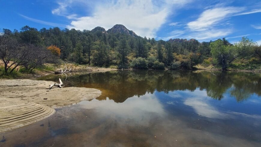
Klondyke is a near-ghost town tucked into Aravaipa Canyon’s remote folds, home to just a few families and a cemetery bearing witness to frontier years. Historic ruins dot the landscape—an old schoolhouse, ranch bunkhouses, and miner shacks slowly returning to dust.
This tiny outpost lives quietly between cliff walls and cottonwoods, with the canyon’s rare jaguars and ocelots sometimes spotted at dawn. Visitors are few, and the sense of stepping out of time lingers long after leaving.
Where is Klondyke?
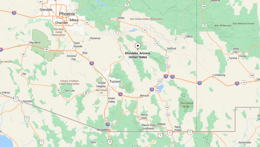
Located in Graham County, Klondyke sits at the west entrance of Aravaipa Canyon Wilderness, far from paved roads. Access is via long gravel tracks from either Mammoth or Willcox, both requiring high clearance vehicles. The isolation is complete, with no services or signage once inside canyon country.
23. Lochiel – Border Hamlet with Wild West Roots
Lochiel clings to the edge of the U.S.–Mexico line in a hidden valley once bustling with mining traffic. Today, it counts just a handful of adobe homes, a shuttered schoolhouse, and a wind-worn church set against oak-draped slopes.
The only visitors tend to be border patrol, birders, or historians tracking the ruins of Fort Crittenden. Deer roam the dusty road, and the silence is pierced only by the occasional gust over the San Rafael Valley.
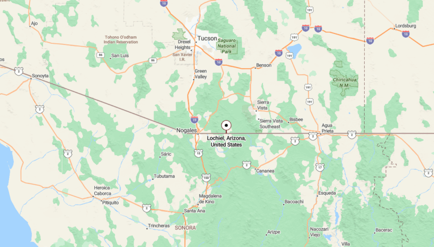
Where is Lochiel?
Would you like to save this?
Lochiel is found at the end of Forest Road 61 in Santa Cruz County, roughly 25 miles southeast of Patagonia. The route twists through the grasslands of the San Rafael Valley, with broad views to both the Huachuca and Patagonia Mountains. The international boundary fence marks the end of the road—and the end of almost all traffic.
22. Vail – Desert Outpost Beyond the Tracks
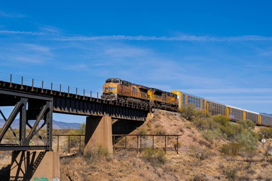
Vail may appear on maps near Tucson, but its old town core remains a quiet outpost beside the Southern Pacific tracks. Beyond the newer developments, original ranch houses and weathered storefronts still mark the true Vail—where trains pass more often than people.
The Rincon foothills rise to the north, blocking expansion, while the dry Cienega Creek winds past sycamores. Nights are silent but for the far-off horn of a passing freight and the call of coyotes.
Where is Vail?
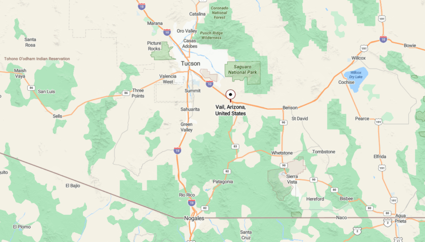
Historic Vail lies southeast of Tucson, near the base of Colossal Cave Mountain Park. While newer subdivisions have crept closer, the old Vail post office, ranch gates, and rural stretches east of Pantano remain secluded. Drivers reach it via Old Spanish Trail or Marsh Station Road, both scenic and light on traffic.
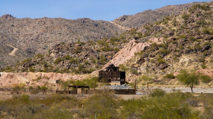
21. Silverbell – Deserted Mine Camp with Rusted Memory
Silverbell is a desert phantom northwest of Tucson, where iron and silver once drew hundreds to a wild mining camp. Today, its crumbling smelter stacks and abandoned buildings whisper to the wind in a basin of cholla and volcanic rubble.
Occasional ATV riders or historians wander in, but otherwise, the site is deserted—save for lizards sunning on rusted gears. The rugged setting and lack of infrastructure lock Silverbell firmly in the past.
Where is Silverbell?
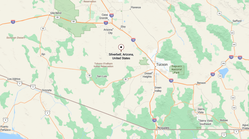
Silverbell is located in Pima County west of Marana, accessible via Silverbell Road—a long, bumpy drive through BLM land. The old mining complex lies deep in the Ironwood Forest National Monument, surrounded by jagged peaks and cactus-covered hills. There’s no signage or services, and few approach without purpose.
20. Bonita – Oak Glens and Cattle Quiet
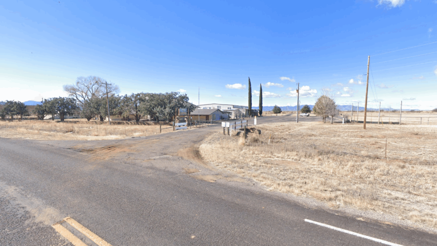
Bonita hides in the high grasslands between the Galiuro and Pinaleño Mountains, home to fewer than 200 residents. Broad fields roll beneath live oaks and windmills, where cattle graze and time keeps its own pace.
Visitors sometimes come to view Willcox Playa from afar, but most pass by without knowing Bonita exists. Without businesses or distractions, it remains a pure ranching enclave untouched by growth.
Where is Bonita?
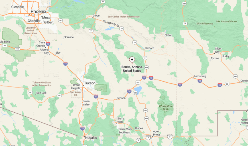
Bonita lies in far northern Cochise County, between Willcox and Safford. Access comes via back roads off U.S. Route 191, climbing into wide pastures framed by distant sky islands. No major highways pass through—just long fences, dirt roads, and wind-blown hills.
19. Arivaca Junction – Dust and Distance by the Tracks
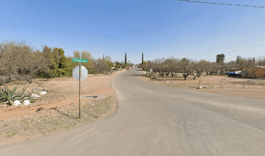
Arivaca Junction isn’t a town so much as a name, a point where tracks and highway meet in the desert southwest of Sahuarita. A scattering of mobile homes, ranch plots, and railroad remnants hint at more active decades gone by.
The wind hums across the arroyos and creosote flats, and the sound of a train echoes for miles. It’s a forgotten curve of land where time slips between rails and mesquite.
Where is Arivaca Junction?
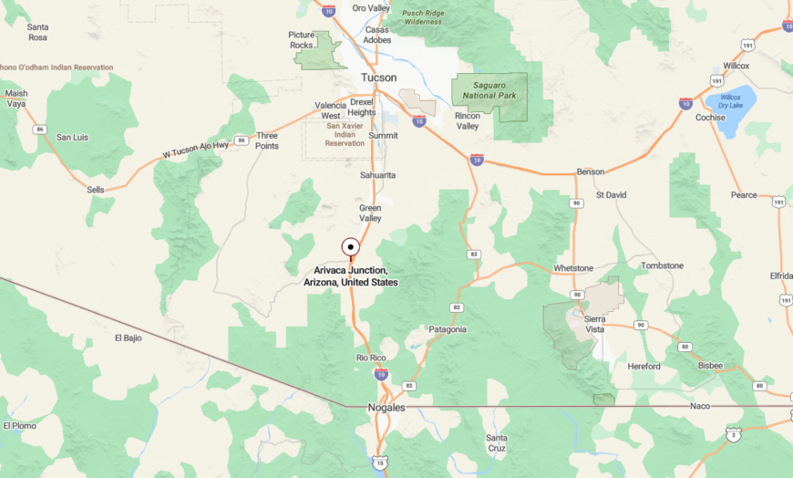
This spot lies along Interstate 19 in Pima County, just north of the Arivaca Road turnoff. The junction is flanked by the Santa Cruz River and flat rangeland that discourages development. One paved road leads in—then out—with little else to mark the place.
18. Sunizona – Quiet Crossroads in the Sulphur Springs
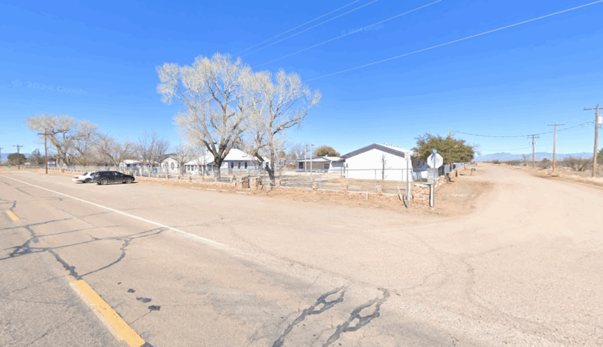

Sunizona is an unincorporated area in Cochise County with wide open lots, a general store, and nearly endless sky. With just a few hundred residents and no stoplights, it feels like a half-forgotten pocket of ranch country.
Mountains ring the valley like silent sentinels, and windmills creak in the dry heat. Neighbors may be a mile apart, but the solitude is shared.
Where is Sunizona?
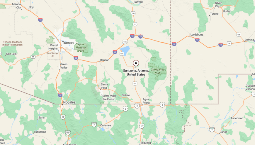
Sunizona sits south of Pearce on Arizona Highway 181, nestled between the Dragoon and Chiricahua ranges. The town exists as a wide spot in the road with scattered homesteads and panoramic desert views. Drivers often reach it via a quiet turnoff from State Route 191.
17. Mescal – Sleepy Depot Beside the Tracks
Mescal is a quiet remnant of railroad days, with a few scattered homes, overgrown lots, and the ruins of an old depot that once served cattlemen and train crews. A handful of ranches dot the brushy hills, and the wind carries the sound of distant locomotives rolling through.
The town gained brief fame as a Western movie set, but since the cameras left, only the sun and dust remain. With no stores, lights, or crowds, Mescal is a place where time dawdles.
Where is Mescal?
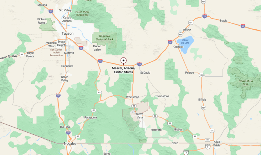
Mescal lies just north of Interstate 10 in Cochise County, about 45 miles east of Tucson. It’s reached by a short loop road from Exit 297, which winds past a few homes and the skeletal remains of Mescal’s rail history. Surrounded by open desert and tucked beneath the Whetstone Mountains, the area feels quietly lost to the world.
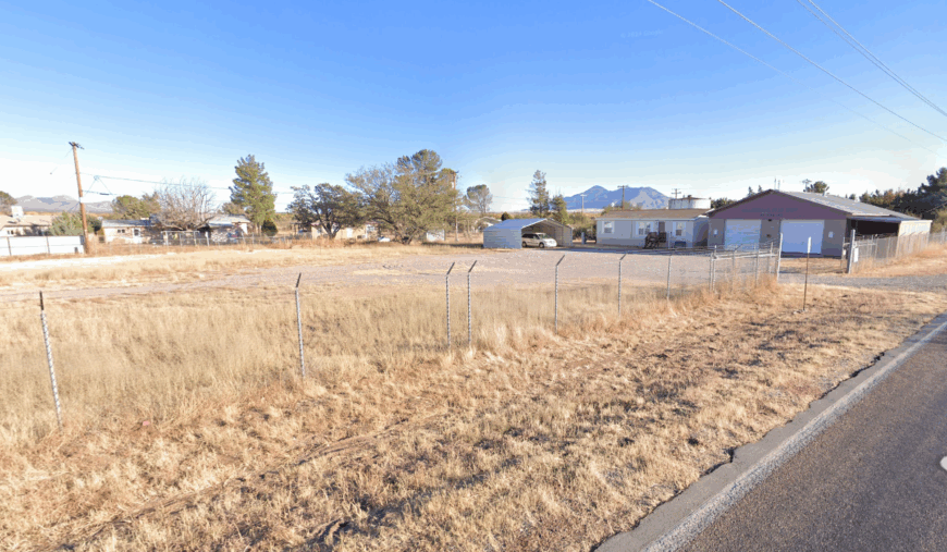
16. Palominas – Borderland Serenity Near the River
Would you like to save this?
Palominas sits just north of the international border in the San Pedro Valley, home to a sparse population and few commercial buildings. The riparian zone draws wildlife photographers and naturalists who value silence as much as the rare birds they seek.
Evenings bring golden light and the rustle of cottonwoods. Life here moves to the rhythm of ranch routines and canyon winds.
Where is Palominas?
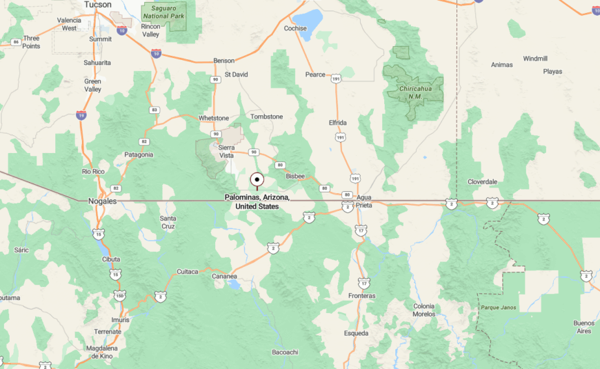
Palominas lies south of Sierra Vista on State Route 92, near Hereford and the San Pedro River. Its homes are scattered across ranch acreage along the valley floor. The Huachuca Mountains form a majestic western wall, muting outside noise and holding the peace in place.
15. Tumacácori – Mission Ruins and Mesquite Stillness
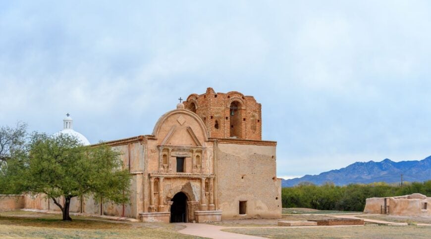
Tumacácori huddles quietly along the Santa Cruz River, its 18th-century adobe mission now a national historical park. Just beyond the visitor center, a few galleries and rural homes mark the edge of this calm community.
With fewer than 300 residents, Tumacácori offers more history than noise. Nights are ink-black, and stars rise over the mission bell tower.
Where is Tumacácori?
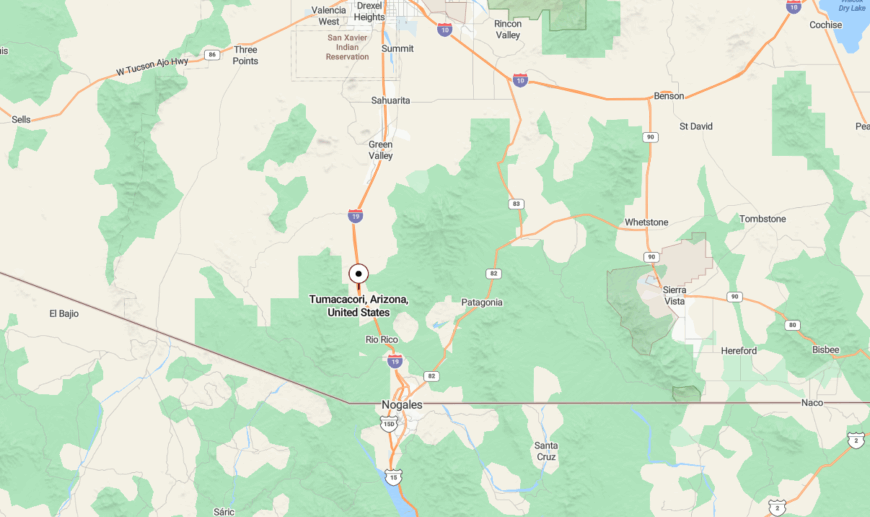
This small settlement is just south of Tubac along Interstate 19 in Santa Cruz County. The historic district and mission site are the main features, and the town spreads into the surrounding mesquite groves. Most visitors arrive from Tucson, but few linger—leaving the quiet intact.
14. Amado – Ranch Posts and Rolling Desert
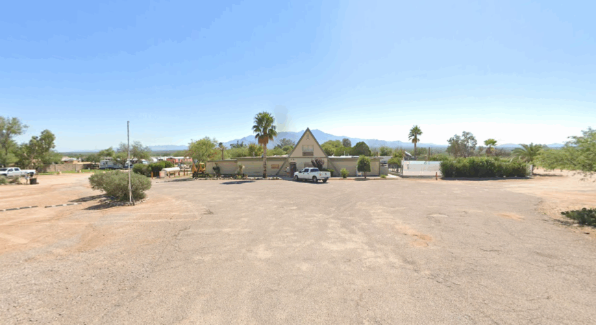
Amado exists in a slow fold of rangeland between Tumacácori and Arivaca, where cattle graze under prickly pears and ocotillo. The town includes a gas station, a quirky steakhouse, and not much else.
The road south leads to wilder places, and Amado acts as a last outpost. Evening winds sweep across the valley and hush the few passing cars.
Where is Amado?
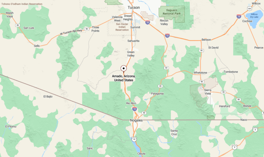
Located off I-19 in Santa Cruz County, Amado sits about 40 miles south of Tucson. The turnoff leads quickly into rural desert terrain, with the Santa Rita Mountains looming to the east. Access is easy, but the feeling is remote.
13. Beyerville – Forgotten Mill Town on the Edge
Beyerville was once a mining support town for the silver boom in nearby Patagonia, but today it is a residential sliver along Sonoita Creek. Just a few homes and a post office remain near the canyon mouth.
The cottonwoods rustle above quiet driveways, and the bustle passed by long ago. What’s left is space, shadow, and the echo of wagons lost to history.
Where is Beyerville?
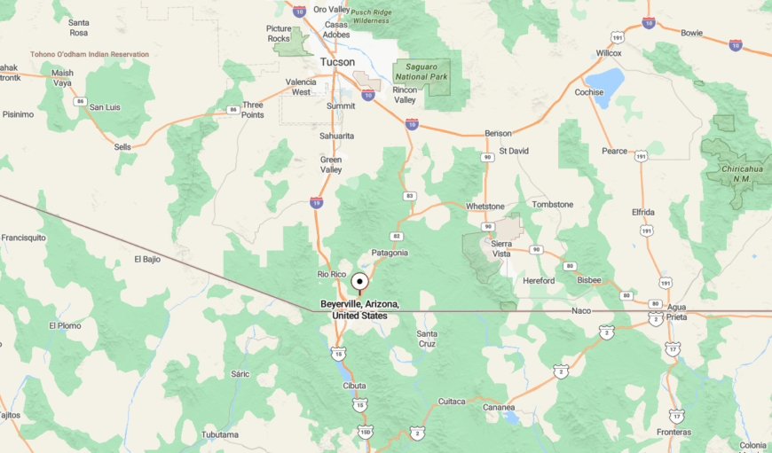
Beyerville is located just east of Nogales along Arizona State Route 82. The road narrows and twists into the hills, where the community rests beneath the brushy slopes of the Patagonia Mountains. The town’s name survives on a few signs—but no services.
12. Hereford – River Crossings and Ranch Country
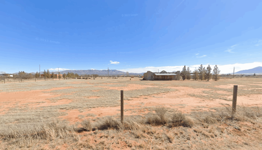
Hereford stretches across Cochise County’s southern edge, where river fords, dry gulches, and old ranch gates dot the land. Fewer than 1,000 people live here, many on large lots hidden behind cottonwood groves and windbreaks.
Nature lovers drift through to explore the San Pedro River, while neighbors wave from horseback. It’s a place more familiar with birdsong than broadband.
Where is Hereford?
Hereford lies just south of Sierra Vista near the U.S.–Mexico border, nestled along Palominas Road and State Route 92. With open views of the Mule and Huachuca Mountains, it feels far from anywhere, though Tucson is just over an hour away. Visitors rarely realize they’ve passed it—unless they slow down.
11. Gleeson – Stone Walls and Desert Solitude
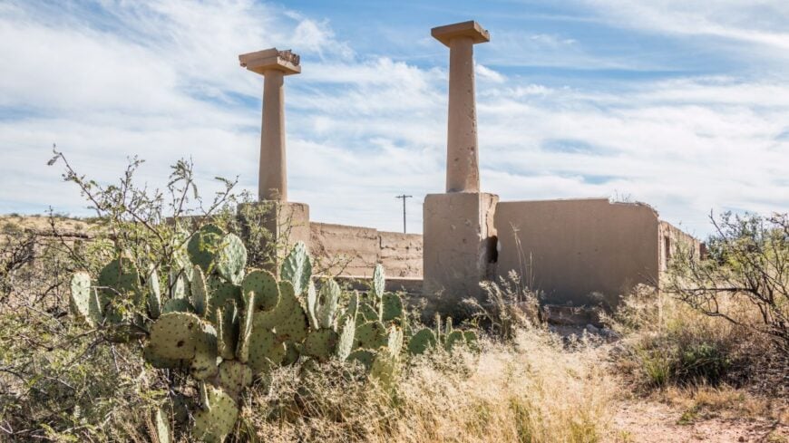
Gleeson is a high-desert ghost town northeast of Tombstone, its remaining homes spread wide around the bones of an old copper mine. The old jail still stands, as do the mine shaft remnants and the occasional rusted truck beneath mesquite.
There are no stores or services, just ranch fences, dust devils, and the creak of an old windmill. Visitors usually leave quietly—caught off guard by how still the desert can be.
Where is Gleeson?
Gleeson is located in Cochise County along Gleeson Road, a scenic drive that runs east from Tombstone to Elfrida. The road passes the town’s historic ruins, and most maps mark it faintly, if at all. Surrounded by desert hills and far from traffic, Gleeson remains pure Arizona quiet.
10. Greaterville – Ruins Among Rolling Oaks
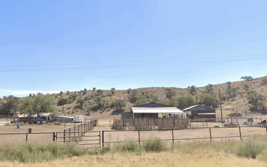
Fewer than 100 residents live amid Greaterville’s oak-studded hills, their homes tucked between weathered stone remnants of a late-1800s mining camp. Day hikers follow old wagon roads to crumbling stamp mills, while birders scan the draw for Montezuma quail and migrating tanagers.
Small-scale ranching and seasonal recreation are the only real economic pursuits, giving the community a low-profile rhythm. Kentucky Camp, a restored mining headquarters run by the U.S. Forest Service, hosts volunteers who share stories of boom-and-bust gold schemes.
Cell service is spotty, stores are nonexistent, and the nearest pavement lies several miles away, so quiet falls quickly once the sun dips behind the Santa Ritas. All of this separation from services and neighbors cements Greaterville’s reputation as one of Arizona’s most tucked-away corners.
Where is Greaterville?
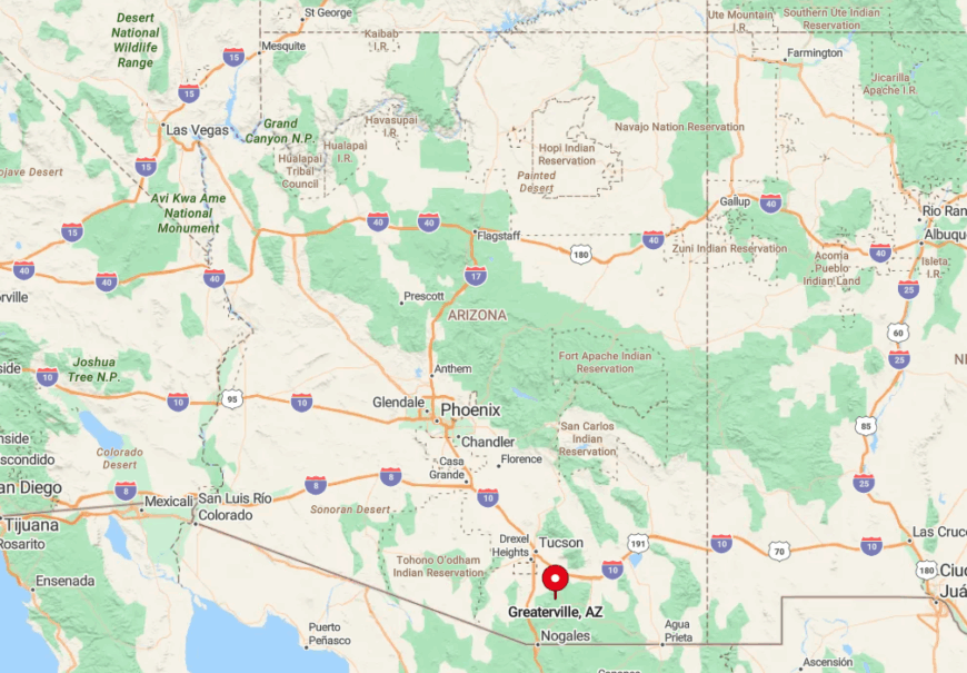
Greaterville rests in the northern foothills of the Santa Rita Mountains, roughly 30 miles south of Tucson and just inside the Coronado National Forest boundary. Box Canyon Road, a graded dirt route prone to washouts, is the primary approach and helps maintain the town’s sense of isolation.
Rugged ridgelines block both noise and city lights, letting dark skies reign after dusk. Drivers typically reach the area from State Route 83, then follow forest roads that wind through rolling oak savanna to the scattered homesteads and ruins.
9. Bowie – Desert Frontier Between Peaks
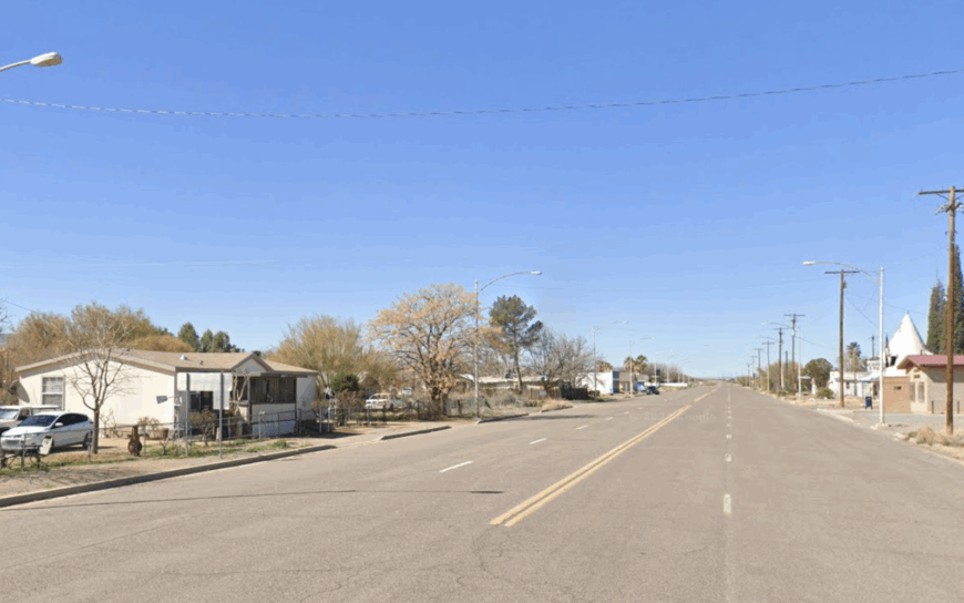
About 450 people call Bowie home, spread across one-acre parcels framed by pecan orchards and volcanic hills. Visitors stop for chile burritos at the family-run café or tour orchard groves that ship pistachios worldwide, the town’s biggest commercial staple.
Rail heritage lingers at the old Southern Pacific depot, yet the pace stays slow since Interstate 10 bypassed Bowie years ago. Nearby Dos Cabezas Mountains create a natural sound barrier and add dramatic backdrops to sunrise walks on levee roads.
History buffs venture to Fort Bowie National Historic Site for adobe ruins and blooming ocotillo in spring. Sparse traffic, broad agricultural buffers, and the hush of desert flats keep Bowie blissfully detached from modern bustle.
Where is Bowie?
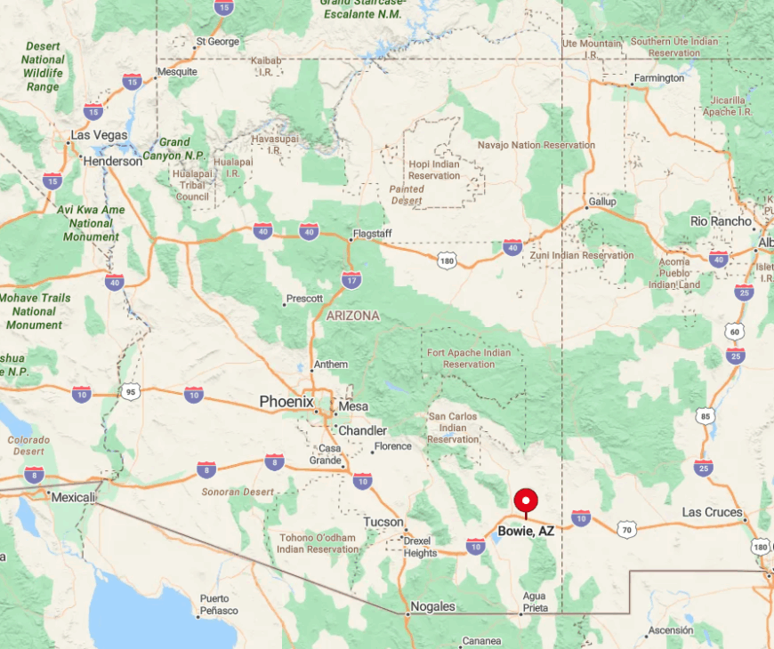
Bowie sits in Cochise County between Willcox and the New Mexico state line, three miles south of I-10 on a spur that sees little through-traffic. The town is ringed by the Dos Cabezas and Winchester Mountains, which reduce radio signals and development pressure.
Amtrak no longer stops, so most arrivals come by car after a quiet 12-mile drive from the Willcox exit. State Route 186 provides the alternate scenic route past apple orchards and lava domes, underscoring just how remote this corner feels.
8. Summerhaven – Mountaintop Hideaway
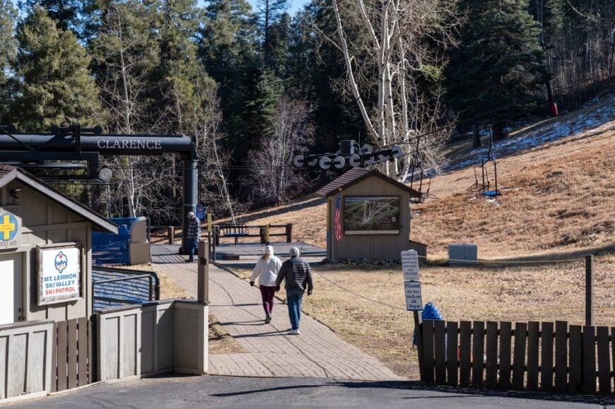
Roughly 400 seasonal residents occupy cabin lots carved into ponderosa slopes nearly 8,000 feet above sea level. Summer days bring hikers to Aspen Trail, cyclists grinding up the Catalina Highway, and families lining up for giant cookies at the tiny village’s beloved bakery.
Small hospitality jobs, the Mount Lemmon Ski Valley lifts, and a scattering of vacation rentals underpin the local economy. Temperatures run 25 degrees cooler than Tucson, and winter snows leave the settlement hushed for weeks.
Towering pines, limited building sites, and a single access road secure the hamlet’s seclusion high over the Sonoran Desert. Nightfall brings the smell of wood stoves and a silence broken only by the breeze through the treetops.
Where is Summerhaven?
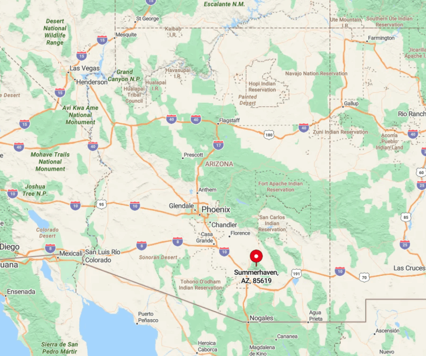
Summerhaven crowns Mount Lemmon in the Santa Catalina Range, 26 paved miles north of Tucson along the Catalina Highway’s hairpin turns. Elevation climbs quickly, isolating the village behind peaks that block both heat and cellphone towers.
The highway dead-ends at the community, so no one passes through unless they intend to. Most travelers allow at least an hour to negotiate the switchbacks before reaching the cool pine air and limited parking within the tiny business district.
7. Pearce – Deserted Mining Relic Turned Quiet Retreat
Fewer than 300 year-round residents remain around Pearce’s weathered false-front buildings and rusted headframes. Photographers wander down Ghost Town Trail for shots of the old jail, while nearby horseback routes cross open rangeland toward the Dragoon Mountains.
Cattle ranching and art studios set in historic mercantile buildings provide modest livelihoods today. The absence of streetlights and the broad Sulphur Springs Valley amplify nighttime stillness and sweeping Milky Way views.
Dragoon and Chiricahua foothills hem in Pearce, discouraging expansion and shielding it from highway noise. As evening falls, only coyotes and freight train whistles mark the passing hours.
Where is Pearce?
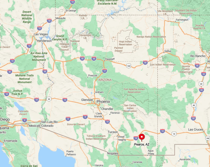
The settlement lies off U.S. 191, 20 miles south of Willcox, with dirt lanes branching toward isolated homesteads and range gates. Its distance from Interstate 10 and the sheltering granite of Texas Canyon keep visitor numbers modest.
Travelers usually exit the interstate at Cochise and follow a two-lane road through mesquite flats until the ghost-town storefronts appear. Limited services mean most people arrive with full fuel tanks and picnic supplies, reinforcing the feeling of departure from the modern grid.
6. Sonoita–Elgin Wine Country Refuge
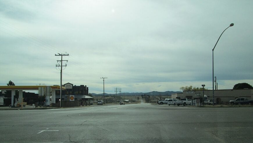
Sonoita and neighboring Elgin together hold comfortably under 1,000 residents across broad 4,000-foot grassland basins. Weekend explorers sip vintages at more than a dozen boutique wineries, ride horses along Arizona Trail segments, and browse saddlemaker shops that serve area ranches.
Viticulture, cattle grazing, and agri-tourism anchor the local economy, yet dirt roads and one-story tasting rooms keep the scenery uncluttered. Broad skies meet golden grasses in every direction, and nightlife consists of coyotes yipping beyond pasture fences.
City lights sit 45 minutes away, and the sound of wind through plains bluestem replaces traffic. That openness, coupled with large rural parcels, helps the twin towns maintain a gently removed character.
Where is Sonoita–Elgin?
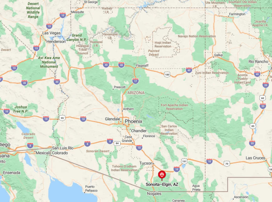
Both communities nestle at the crossroads of State Routes 82 and 83 in Santa Cruz County, roughly equidistant from Tucson, Sierra Vista, and Nogales. Rolling hills form a shallow bowl that blocks outside glow, making stars seem stamped onto the sky.
Visitors generally reach the area by driving south from Interstate 10 through the Mustang Mountains before descending into wine country. The absence of fast-food chains and stoplights along the route signals the entry into quieter terrain.
5. Canelo – Grassland Ghost of the Huachucas
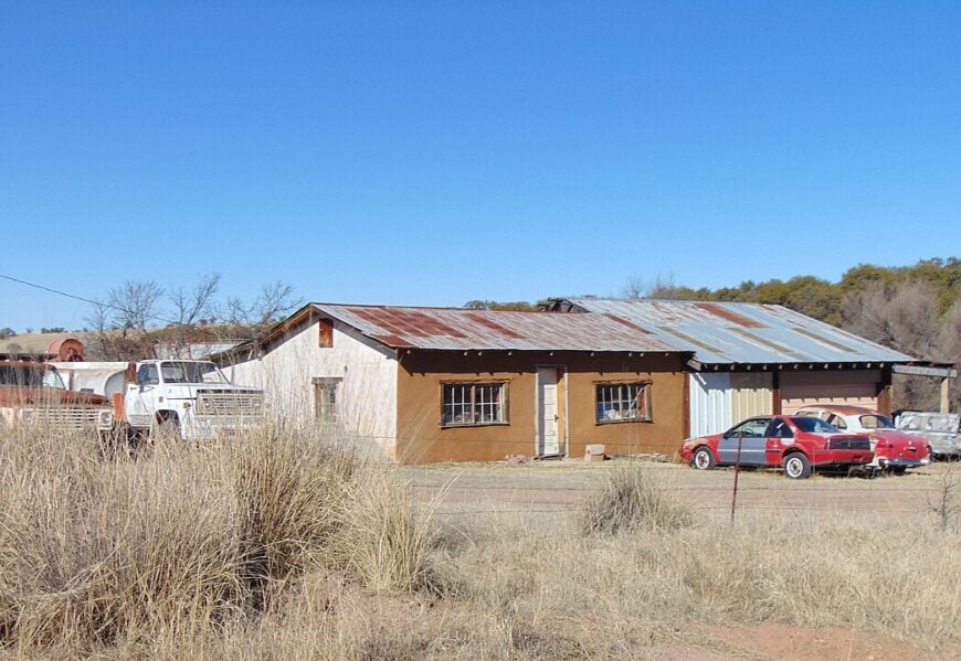
Canelo’s resident count barely reaches double digits, with historic adobe ranch houses scattered through wide-open, high-elevation grasslands. Travelers photograph the 1912 Canelo Schoolhouse and explore oak-lined Canelo Hills Cienega Preserve, where rare orchids bloom after summer rains.
Ranching families and Forest Service staff supply the only regular economic activity, leaving the landscape largely unchanged since territorial days. Surrounded by rolling hills below the Huachuca Mountains, the area sees little through-traffic and virtually no development.
Cell reception drops, and nighttime silence spreads across miles of bunchgrass. These factors combine to keep Canelo feeling like a living set from an old frontier film.
Where is Canelo?
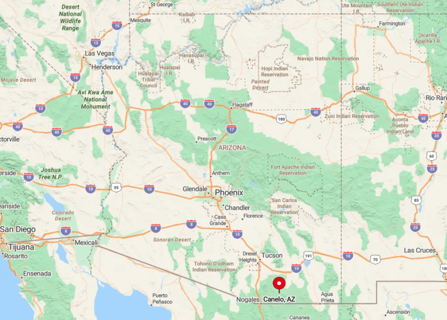
Canelo sits along the gravel-topped Canelo Road halfway between Sonoita and Patagonia in Santa Cruz County. The route crosses National Forest land where livestock gates outnumber houses, reinforcing the back-country mood.
Visitors usually approach via State Route 83, then turn east onto Canelo Road for a scenic 13-mile drive with no services en route. Mountain walls and high mesas isolate the valley, ensuring travelers meet more pronghorn than people.
4. Dragoon – Rocks, Rails, and Rugged Silence
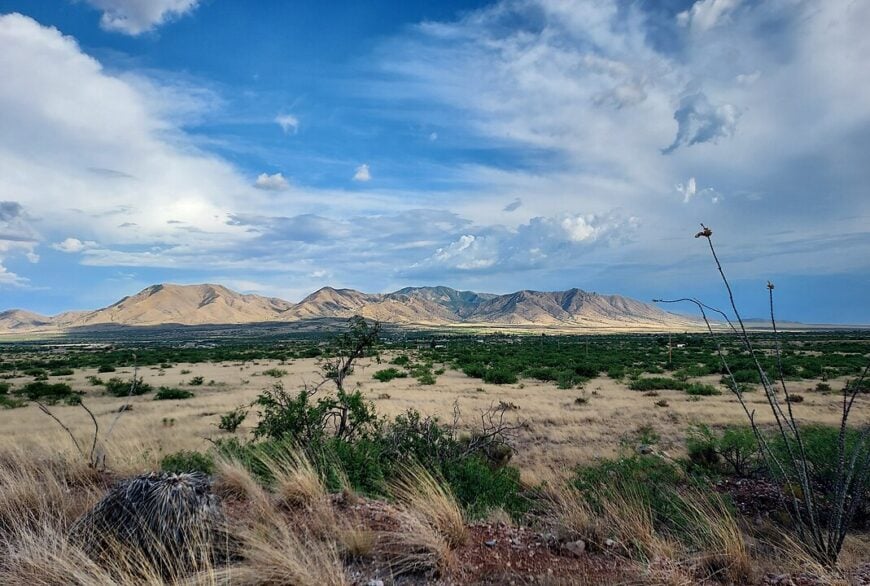
Around 200 residents live near Dragoon’s sculpted granite spires in Texas Canyon, their homes hidden among boulders that glow pink at sunset. Rock climbers seek rare crystalline faces, while railroad aficionados watch freight trains crawl past the tiny whistle-stop depot.
Ranching and a modest art community give the hamlet limited commerce, but there are no stores or gas pumps within town limits. Massive rock formations muffle sound, and the nearest sizable town rests more than 20 miles away.
Most properties sit on multi-acre lots accessed by dirt spurs branching from a two-lane road, reinforcing distance between neighbors. Once dusk settles, only crickets and the occasional train echo through the canyon.
Where is Dragoon?
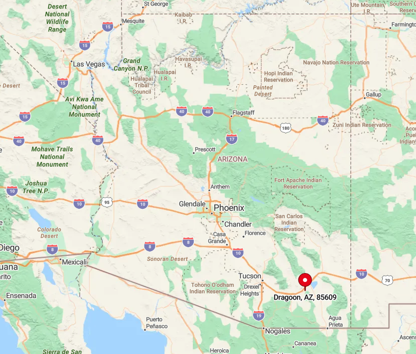
The settlement lies just south of Interstate 10 in Cochise County, reachable by taking the Dragoon Road exit and driving six quiet miles toward the mountains. Granite ridges flank the approach, creating a natural amphitheater that dampens freeway noise.
With no through routes beyond rail lines, casual drivers rarely detour into the area. Those who do often combine a visit with the Amerind Museum, a hidden anthropological collection tucked into a side canyon even deeper within the boulder field.
3. Sasabe – Remote Border Hamlet
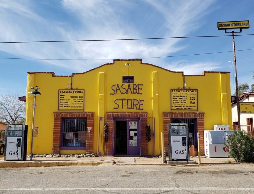
Sasabe counts roughly 100 residents, most of whom steward ranch spreads stretched along a single dusty street beside the international boundary.
Visitors might photograph the Mission San Antonio de Oquitoa replica chapel, pause at the tiny border crossing, or birdwatch in mesquite bosques ringing the Baboquivari Mountains. Cattle ranching remains the core livelihood, supplemented by limited border-station jobs.
Miles of undeveloped desert, minimal infrastructure, and controlled access zones leave the area free of crowds. Nighttime brings velvet darkness and sweeping views of Orion rising over the fenceline. The feeling of cinematic solitude defines Sasabe’s appeal.
Where is Sasabe?
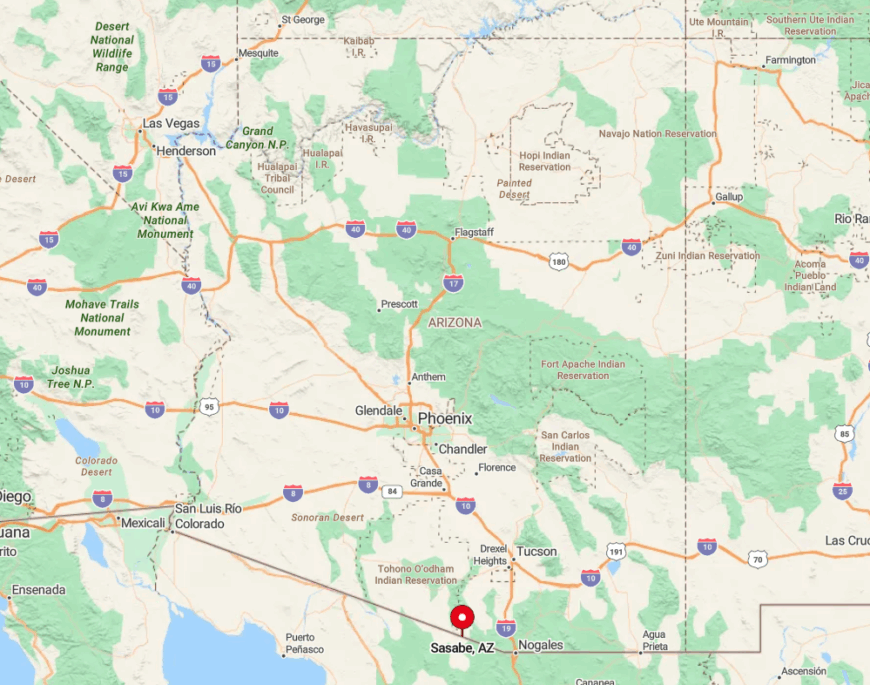
The hamlet sits 80 miles southwest of Tucson, at the terminus of State Route 286 where pavement simply stops at the border gate. Vast stretches of Buenos Aires National Wildlife Refuge to the east and Tohono O’odham Nation lands to the west create a buffer devoid of towns.
Travelers endure long cell-service gaps on the drive, underscoring the remoteness. The only way in is by car along SR 286, a route so lightly used that pronghorn often outnumber vehicles.
2. Portal – Astronomy Outpost in the Chiricahuas
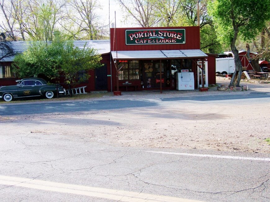
Portal’s human headcount hovers below 250, yet visitors swarm its dark canyon at night for some of the Southwest’s clearest star views. Daytime pursuits include hiking Cave Creek Canyon, photographing elegant trogons, and browsing the self-serve library that local volunteers stock with field guides.
Small inns, a hummingbird research station, and nature tours make up most of the economy, all centered on the surrounding Coronado National Forest. Forested canyon walls and vast public lands create a soundproof bowl that hushes highway noise and blocks city glow.
Amateur astronomers wheel telescopes into driveways, and wildlife photographers set long lenses on porches, both drawn by the same high-contrast skies. The absence of light pollution keeps Portal perpetually on the radar of sky-watchers while preserving its serenity.
Where is Portal?
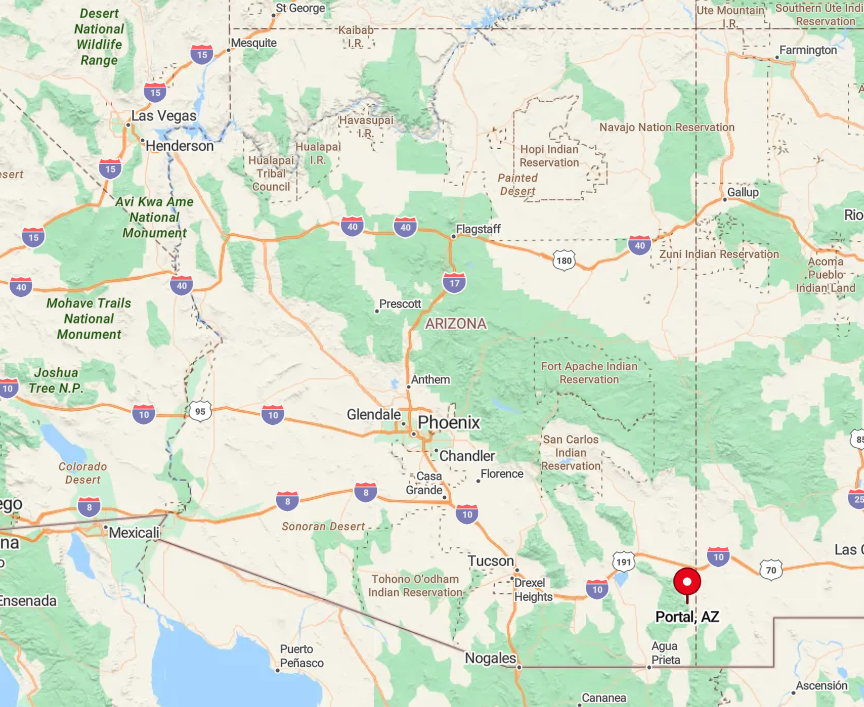
The hamlet nestles against the east slope of the Chiricahua Mountains near the New Mexico line, 50 miles from the closest gas station in Douglas. Access comes via State Route 80 and a 12-mile paved spur that winds through open ranchland before entering the tree-lined canyon.
Granite walls rise sharply on three sides, limiting radio reception and development potential. Visitors planning night observations often arrive before dusk to avoid cattle and wildlife that wander the unlit road.
1. Arivaca – Hidden Desert Ranchland

Arivaca maintains a population under 700, its residents scattered across multi-acre lots rimmed by the Buenos Aires National Wildlife Refuge. Day-trippers paddle at Arivaca Lake, hike the refuge’s Grasslands Trail, or browse handcrafted jewelry at the mercantile-style general store.
Cattle ranching, small-scale arts, and wildlife-based tourism sustain the town financially, though many residents work remotely thanks to recent fiber internet upgrades. The valley sits 60 miles from Tucson, with no streetlights, few businesses, and broad saguaro-studded flats that swallow sound.
Dark-sky advocates cherish the near-total quiet, and nightly coyotes add the only regular soundtrack. All these factors join to keep Arivaca delightfully off the beaten path while remaining rich in natural beauty.
Where is Arivaca?
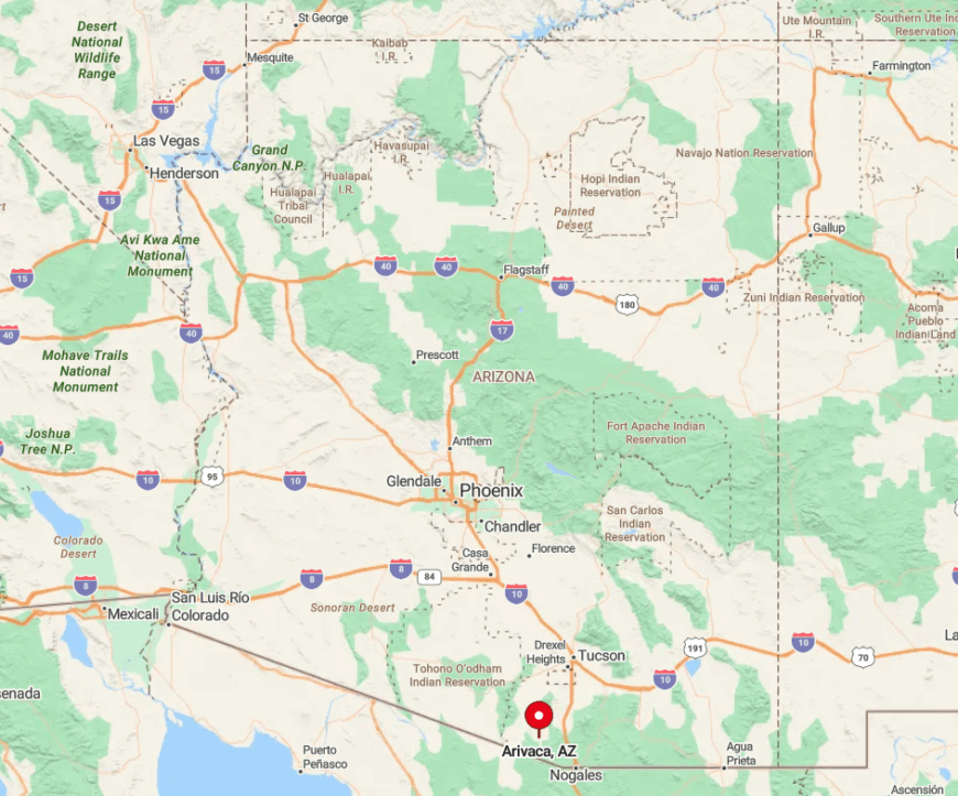
The community lies at the end of winding Arivaca Road, which branches from Interstate 19 near Amado and climbs through rolling mesquite hills for 23 miles before reaching town. Being almost surrounded by refuge land prevents suburban spillover and preserves expansive views across the Altar Valley.
Travelers must drive in and out the same way, since the primitive Ruby-Arivaca Road toward Nogales often washes out. Limited access, government-protected buffers, and a single rustic road make Arivaca one of the most secluded yet welcoming spots in Southern Arizona.