Southeast South Dakota is where the prairie softens into river country, and backroads bend toward places the interstate forgot. Towns here are less destinations than discoveries—spots where the map thins out, and you suddenly realize you’ve traded neon glare for the glow of a farmhouse window.
In order to come up with the very specific design ideas, we create most designs with the assistance of state-of-the-art AI interior design software.
The Missouri carves a border to the south, the Big Sioux draws its meanders along the east, and the James drifts down the middle like a clock running half-speed. Between those rivers lie grid roads, sloughs alive with birds, and grain elevators that rise higher than the steeples. You can measure the stillness by how quickly your cell signal dies.
Life runs on its own rhythm: café hours that sync with church bells, main streets where a single pickup counts as traffic, and baseball diamonds that double as town squares once the lights flick on. The voices you hear most often aren’t engines but wind, crickets, and the low murmur of rivers.
This isn’t ghost-town territory; it’s lived-in, worked-on, and quietly proud. People farm, fish, and make the commute to bigger towns, then hurry home to where the horizon still belongs to them. These 25 places remind you that seclusion isn’t always distance—it’s the art of holding onto quiet.
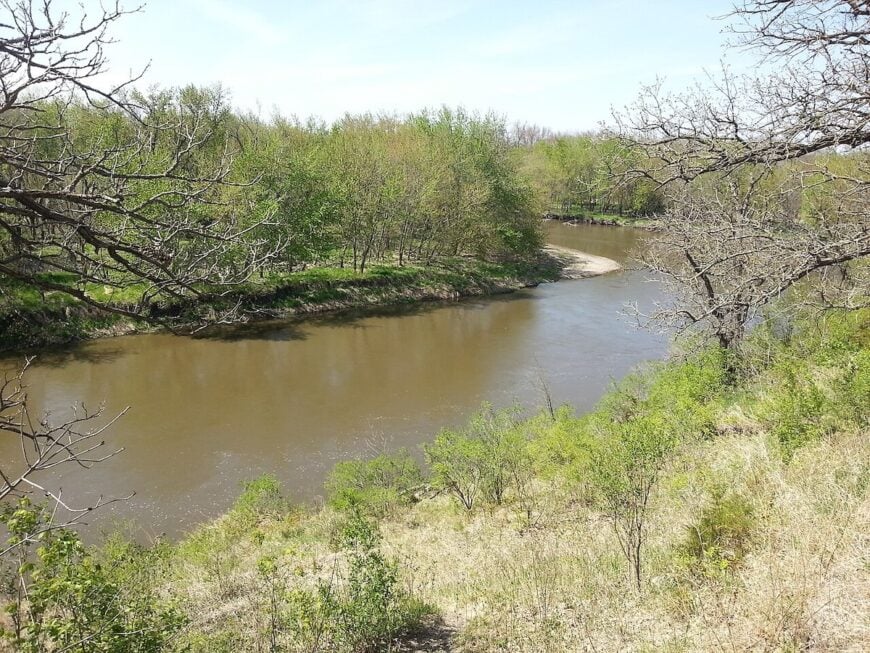
25. Fairview – Big Sioux Bluffs and an Old River Quiet
Fairview dozes along a bend of the Big Sioux, where cottonwoods curtain the river and gravel lanes end at pasture gates. Its seclusion comes from the borderlands—water on one side, Iowa fields on the other, and very little reason for pass-through traffic.
The vibe is humble and sun-faded: a few blocks of houses, tidy gardens, and a grain bin skyline. Cast for smallmouth in shaded runs, walk the old approach to the historic bridge, pedal empty section roads at dusk, or pause for photographs where the bluffs catch the last light.
Most folks farm or commute to Canton or Sioux Falls, then hurry home to the quiet. With so few streetlights, nights spill over with stars. It’s the sort of place that replaces background noise with birdsong.
Where is Fairview?
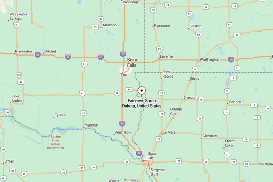
Tucked in the far southeast corner of South Dakota, Fairview sits in Lincoln County on the Big Sioux River. It’s about 30 miles south of Sioux Falls and a few minutes east of Canton.
You reach it via county roads that drop toward the river, trading highway hum for wind in the trees. It’s close enough for a day trip, far enough to feel like you’ve slipped off the map.
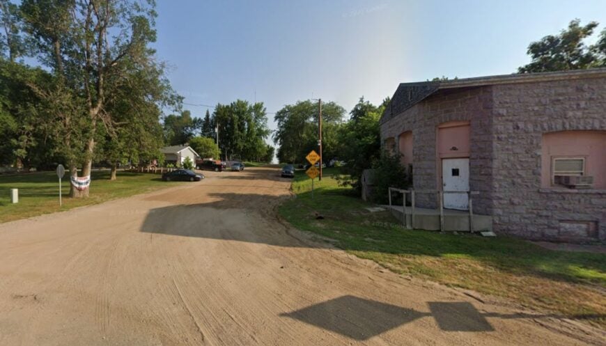
24. Shindler – A Wooded Pocket Just Past the City’s Edge
Shindler hides in a fold of timbered ravines where the prairie dips toward the Big Sioux, and the city’s glow fades to a low halo. The lack of a commercial strip and the tangle of shelterbelts keep it feeling more countryside than suburb.
The vibe is porch-quiet: mown acreages, barn swallows on the wire, and the smell of cut hay drifting in. Stroll country lanes, watch deer step from tree lines at twilight, paddle easy water nearby, or steal a morning at Good Earth State Park’s trails a few miles south.
Many residents work in Sioux Falls, but home is deliberately slow. At night, crickets stitch the dark together. It’s a gentle reminder that peace can live just beyond the stoplights.
Where is Shindler?
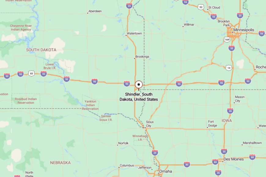
Shindler is in eastern Lincoln County, roughly 8 miles southeast of downtown Sioux Falls. Turn off SD-11 or 57th Street onto smaller county roads that meander through timber and pasture.
The last mile feels rural in an instant as the city’s edge falls away. It sits close to everything, yet settles into its own hush.
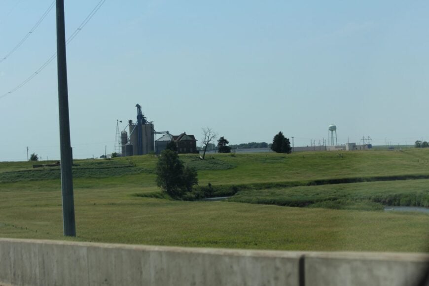
23. Rowena – Elevator, River Bends, and Long Horizons
Rowena looks like a country painting—an elevator, a handful of houses, and a big sky that changes by the minute. Its seclusion stems from being a tiny dot between Sioux Falls and the Iowa line, where SD-42 curves past fields and the Big Sioux sneaks through cottonwoods.
The vibe is utilitarian and restful: trains in the distance, meadowlarks on the fence, and porch chairs that know the shape of their owners. Walk the trails at nearby Beaver Creek Nature Area, photograph sunrise over the grain bins, paddle easy current, or roam gravel on a bike with only wind for company.
Work ties back to farms, elevators, and jobs in town. Nights are black enough to see satellites drifting. It’s the kind of quiet that unknots a week.
Where is Rowena?
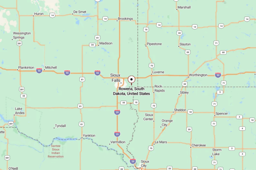
You’ll find Rowena in eastern Minnehaha County, a couple of miles from the Iowa border along SD-42. It’s about 12 miles east of Sioux Falls.
Access is a straight shot on a two-lane highway that narrows to a handful of local streets. By the time you arrive, the only rush is the river.
22. Corson – Prairie Siding with a Soft, Railroad Echo
Corson began as a rail stop and kept the best parts: a country pace and room for the sky to do its work. With no downtown bustle and only a few lanes branching from the tracks, it feels like a place you’re meant to find on purpose.
The vibe is prairie-plain and friendly—trucks at a café door, wind in bluestem, and the train’s low murmur. Hike the nearby Big Sioux Recreation Area, watch storm light roll across fields, follow gravel loops at golden hour, or sit for pie where every face is familiar.
Local livelihoods blend agriculture, small shops, and jobs in Brandon or Sioux Falls. Sunset turns the rails to copper. It’s a little town that leaves the door to the prairie wide open.
Where is Corson?
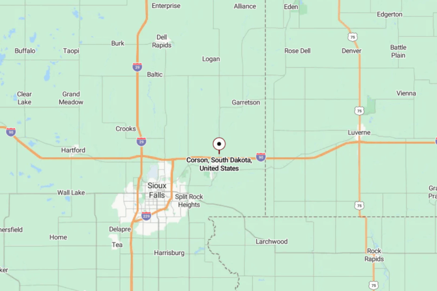
Corson sits just north of Brandon in eastern Minnehaha County, about 12 miles from Sioux Falls. Reach it by exiting I-90 and slipping onto local roads that edge the tracks.
A quick turn puts you among fields and sky. The highway noise fades fast, replaced by meadow wind.
21. Wakonda – Cottonwoods, Ballfields, and Prairie Breezes
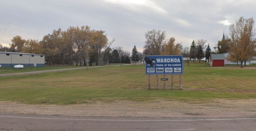
Wakonda feels like a town the highway forgot, and that’s exactly why it stays so calm. The nearest big-box lights are a long drive away, leaving nights to moonlight and cricket song.
The vibe is small-town cheerful: clapboard homes, a couple of cafes, and ballfields that glow softly under summer bulbs. Fish the Vermillion River, cruise farm lanes at sunset, picnic in the city park, or browse a modest museum display on homestead days.
Farming and school life set the rhythm, and everyone waves. The wind talks through the cottonwoods like an old friend. It’s the kind of quiet that fills rather than empties.
Where is Wakonda?
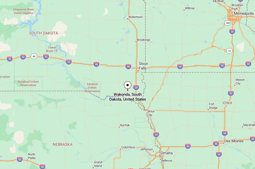
Wakonda is in northern Clay County, roughly 20 miles northwest of Vermillion. It’s reached by SD-19 and then slower township roads that run true across the prairie.
Distances feel longer once the horizon opens. You arrive with a little more sky in your pockets.
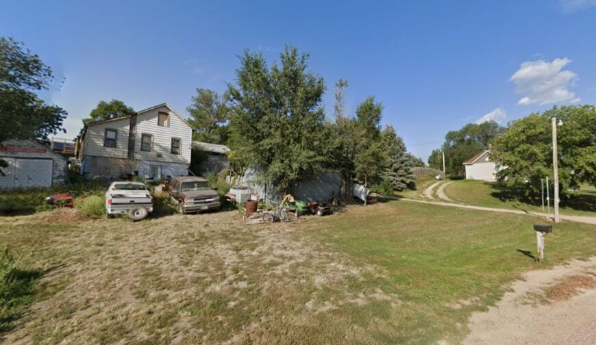
20. Irene – A Tri-County Town with Old-World Calm
Irene spans three counties and still feels small enough to be greeted by first name. Seclusion comes from being a good half-hour from bigger services and framed by miles of cropland and shelterbelts.
The vibe is tidy and neighborly—church suppers, front-porch ferns, and tractors easing down Main like it’s the most natural thing. Walk quiet side streets, birdwatch over sloughs, pedal empty blacktop to a country cemetery, or time a visit with a summer street dance.
Work is a mix of farming, small shops, and commutes to Yankton or Vermillion. Even the wind seems to slow down here. It’s a town that reminds you how gentle a morning can be.
Where is Irene?
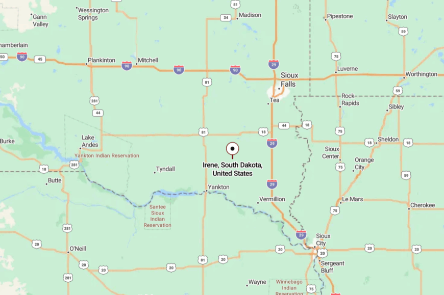
Set where Turner, Yankton, and Clay counties meet, Irene sits about 35 miles northwest of Sioux City and 30 miles northeast of Yankton. SD-46 gets you close before county roads do the final, unhurried miles.
The land opens into big rectangles of field and sky. By arrival, the world has softened at the edges.
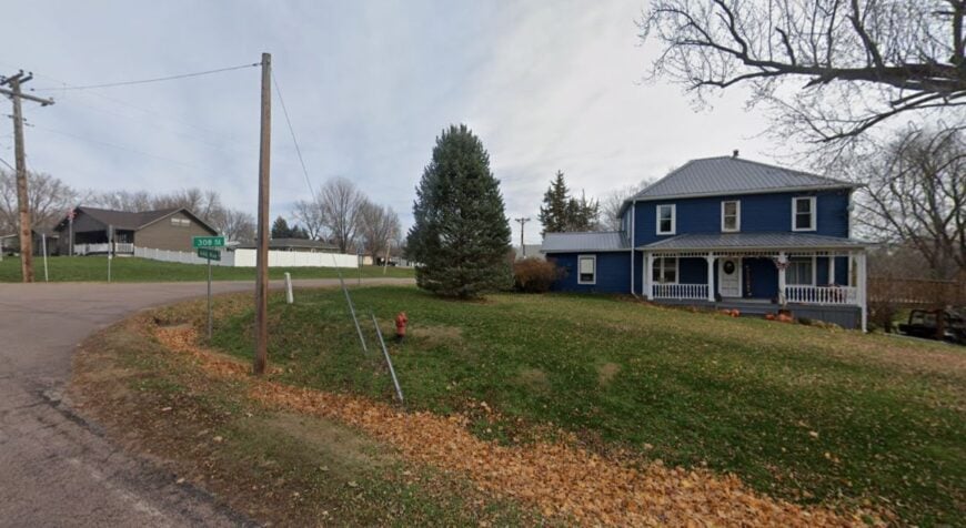
19. Volin – A Prairie Hamlet with a Soft Footprint
🔥 Would you like to save this?
Volin keeps its voice down—no passing traffic, no bright neon, just the steady rhythm of farm life. Its seclusion rests in the long space between towns, and the easy way gravel absorbs the sound of tires.
The vibe is porch-swing friendly: geraniums in coffee cans, dogs asleep in the shade, and kids biking slow loops. Fish small creeks, scout old barns for photo textures, ride gravel to the next township line, or cheer a Friday ball game.
Agriculture keeps the lights on, with a few trades and commutes to Yankton. The silence at night feels like a blanket. It’s a fine place to hear yourself think.
Where is Volin?
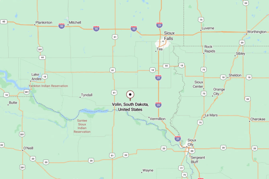
Volin sits in northeastern Yankton County, about 15 miles northeast of Yankton and a few miles south of SD-46. Approach on county roads that wander among corn and hay.
The final turns are by windbreaks and mailboxes, not billboards. It’s close to the river country yet wrapped in its own stillness.
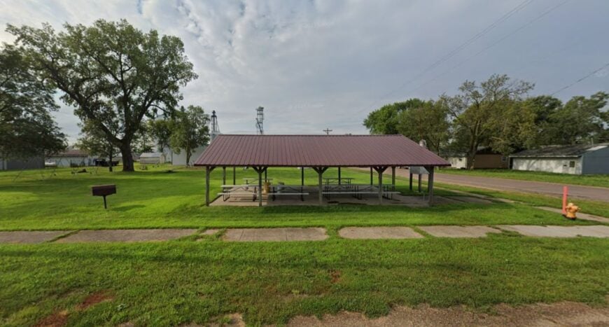
18. Mission Hill – A Ridge, a Steeple, and Miles of Sky
Mission Hill perches lightly on a rise above fields, a cluster of homes and a church spire keeping watch. Seclusion is built in: no main highway, no strip of shops, and plenty of space between neighbors.
The vibe is clean and bright—white fences, mown ditches, and tractors parked nose-to-sunset. Walk the ridge at dusk, glass the fields for deer, bird along the James River bottoms, or follow a gravel loop toward the river bluffs near Yankton.
Folks farm, teach, or work in town, then come home to silence. When the wind settles, you can hear pheasants rustling in the grass. It’s a quiet that feels carefully kept.
Where is Mission Hill?
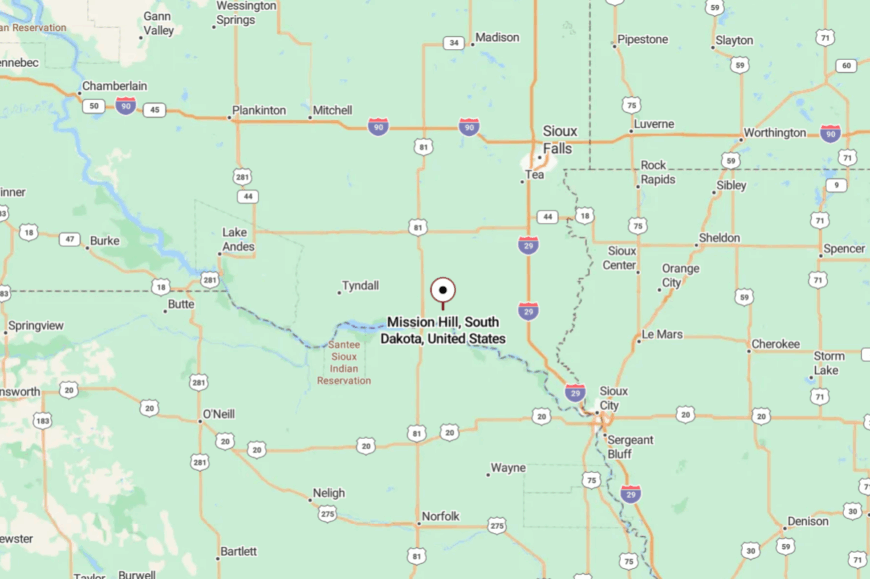
Mission Hill rests in eastern Yankton County about 10 miles northeast of Yankton. The way in is a patchwork of county blacktop and gravel, rising gently onto higher ground.
You’ll pass more shelterbelts than storefronts. The horizon does the welcoming.
17. Utica – Old Storefronts and a River Road’s Pace
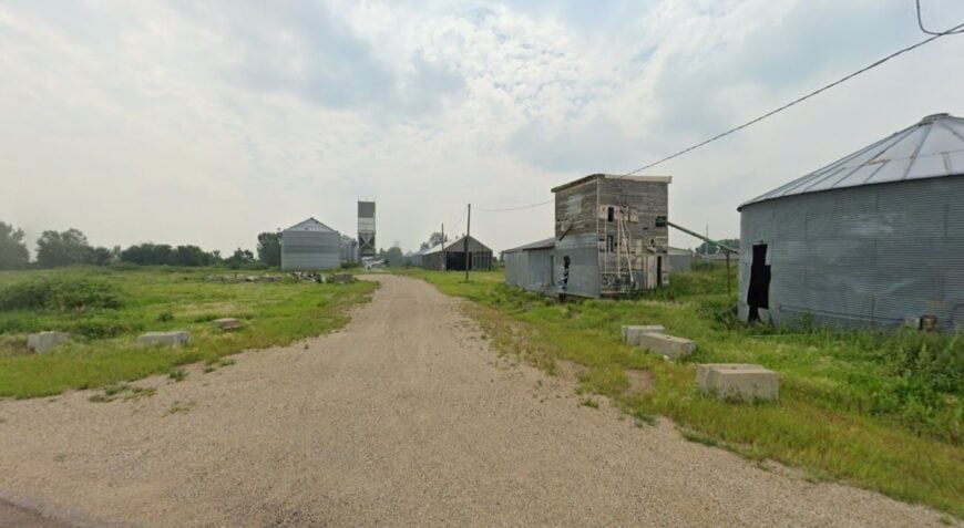
Utica’s brick and clapboard corners look like a slowed-down chapter of prairie history. The town stays secluded because the nearest through-route skims well away, leaving only locals and the curious to wander in.
The vibe is heritage-plain and friendly: flagstones, porch steps, and an easy wave from every passing pickup. Fish the James River, photo old signage in mellow afternoon light, ride a gravel loop into rolling pasture, or circle back for pie at a no-rush café.
Farming and small trades anchor life here. Evening turns the town to amber, and silence arrives on soft feet. It’s the sort of place that asks nothing but time.
Where is Utica?
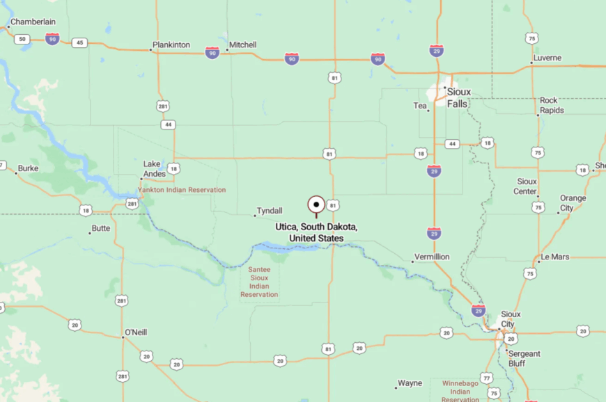
Utica is in northern Yankton County, about 12 miles northwest of Yankton. Reach it by county roads that drift toward the James River and back again.
The last miles are all fields, bins, and sky. You’ll know you’ve arrived when the pace changes.
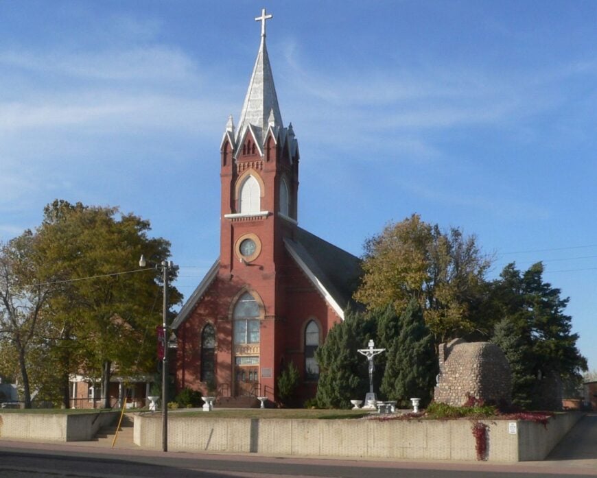
16. Lesterville – Kolaches, Quiet Lanes, and Lamp-Warm Windows
Lesterville wears a gentle Czech influence beneath its prairie plainness, and the result is coziness with elbow room. Seclusion comes from the long drive between neighbors and the lack of any reason to “cut through.”
The vibe is homey: tidy porches, laughter drifting from a tavern door, and church bells that carry farther than traffic. Nibble pastries at a community bake, drift a gravel loop past sunflowers, fish a farm pond with permission, or photograph elevator geometry in evening light.
Farming forms the backbone, with a few shops and trades humming quietly. Night falls quickly here, and windows glow like constellations. It’s easy to linger without planning to.
Where is Lesterville?
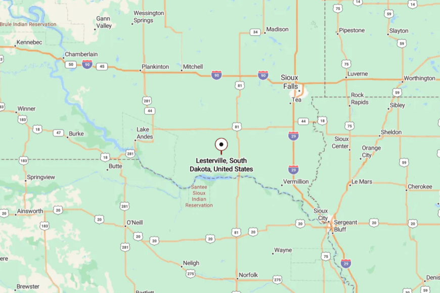
Lesterville sits in northeastern Yankton County, about 18 miles from Yankton and 12 miles from Tabor.
County roads threaded through crops and windbreaks bring you in. There’s no fast approach—only the good kind. The stillness starts before the town sign.
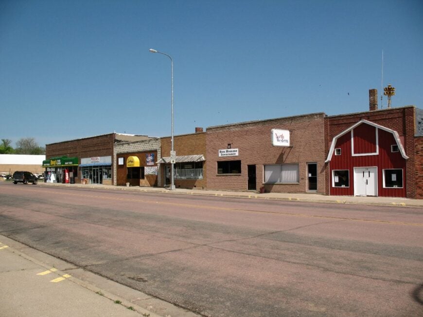
15. Tabor – Brick Streets, Czech Days, and River-Country Calm
Tabor stays small by choice and geography: boxed in by cropland, shaded by shelterbelts, and far from any interstate. Even during its famed Czech Days, the town feels neighborly rather than loud, then returns to its slow heartbeat by Monday.
The vibe is heritage-warm—brick streets, tidy yards, and a cafe where dumplings and stories are served in equal measure. Walk the historic district, bike to roadside shrines and cemeteries, browse a volunteer museum, or chase thunderheads across gravel.
Agriculture underwrites it all, with a dash of festival tourism. When the wind lifts the flag on the square, the whole place seems to breathe. It’s the kind of small town you remember by taste and light.
Where is Tabor?
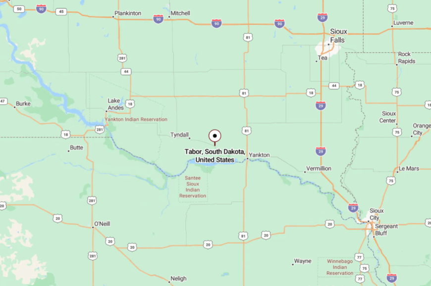
Tabor rests in central Bon Homme County, about 12 miles northwest of Yankton. Take SD-50 or SD-52 and slip south on the county blacktop that narrows to neighborhood streets.
Rows of trees break the wind and the view. It feels rooted and private at once.
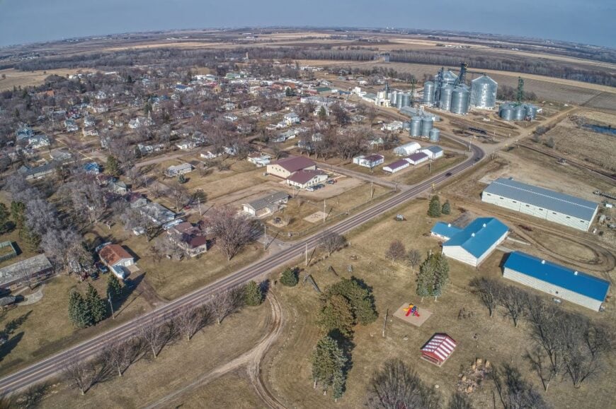
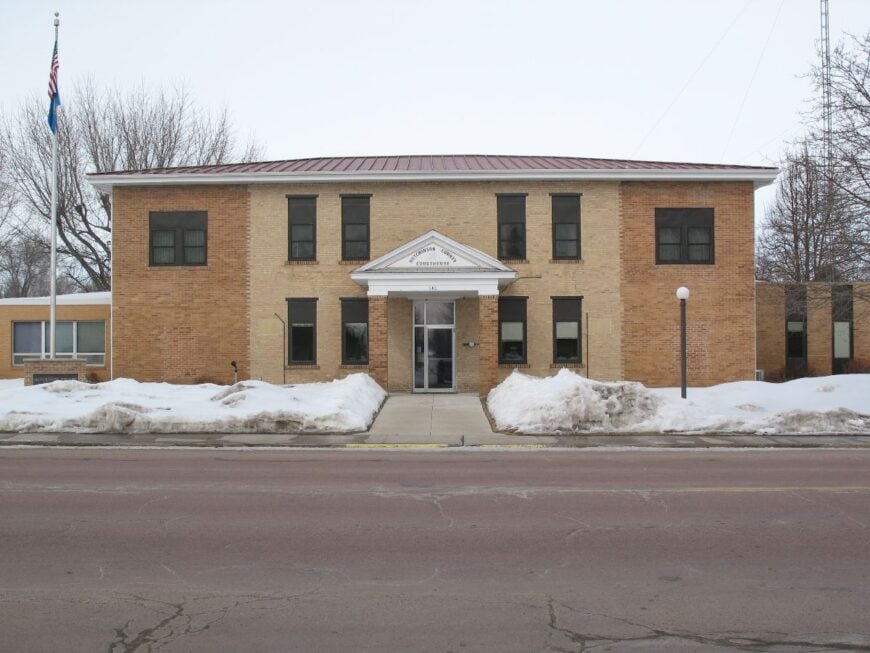
14. Springfield – River Bluffs, Quiet Streets, and Wide Water
Springfield faces the Missouri from a high perch, catching both sunsets and silence. Its distance from larger cities and a gentle, out-of-the-way route keep the pace soft.
The vibe is river-country mellow: brick storefronts, shady parks, and a marina where gulls call the hours. Hike the blufftop overlooks, paddle calm backwaters, camp at the state recreation area, or cast for walleye.
Education, small shops, and recreation round out the farm economy. Evening paints the river bronze, and the streets go whisper-quiet. It’s the sort of view that gives thoughts room to stretch.
Where is Springfield?
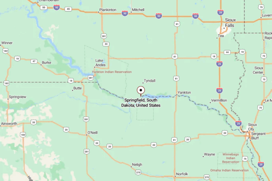
Springfield sits in southern Bon Homme County, about 30 miles west of Yankton along the Missouri River. SD-50 brings you close, then a spur road climbs the bluff into town.
Once you crest the hill, the river takes over the horizon. It’s close to the water, far from any hurry.
13. Hudson – Border River Quiet at the State’s Far Corner
🔥 Would you like to save this?
Hudson tucks into a tight bend of the Big Sioux, where cottonwoods veil the water and gravel lanes simply stop at the bank. Its seclusion comes from geography and intent—right on the Iowa line, with few true “through” roads and long pauses between mailboxes.
The vibe is river-plain and unassuming: bait buckets on porches, grain bins glinting in late sun, and whole afternoons paced by the current. Launch a kayak at first light, glass the treeline for eagles and great blue herons, bike quiet section roads to hilltop views, or cast for catfish when the sky goes violet.
Most livelihoods trace back to farms or commutes to Canton and Sioux Falls, but evenings belong to the river. When stars prick the black water, time itself seems to idle. It’s a small edge-of-the-map place that lets the sound of moving water do the talking.
Where is Hudson?

Hudson anchors the extreme southeast corner of South Dakota in Union County, pressed against the Big Sioux River and the Iowa border. It’s roughly 35 miles southeast of Sioux Falls and about 10 miles east of Alcester.
You reach it by leaving SD-11 or SD-46 for county blacktop that dips toward the river before giving way to gravel. Close enough for a day paddle, far enough that the river is the loudest thing you’ll hear.
12. Olivet – Courthouse on a Hill above the Whispering James
Perched on a rise above the James River, Olivet is a tiny county seat that feels more farmhouse than bureaucracy. Seclusion settles in because no major highway fronts town; approaches are gentle, looping county roads, and the soft hush of river bottoms.
The vibe is heritage-plain—white-frame homes, a courthouse lawn, church bells carrying farther than traffic ever does. Walk the square with a camera, fish quiet eddies on the James, drive ridge roads at golden hour, or picnic beneath old cottonwoods where pheasants skitter through grass.
Farming and county offices keep the lights on, but the prairie sets the pace. When the wind drops, you can hear the river breathing around the bend. It’s a place that trades hurry for horizon.
Where is Olivet?
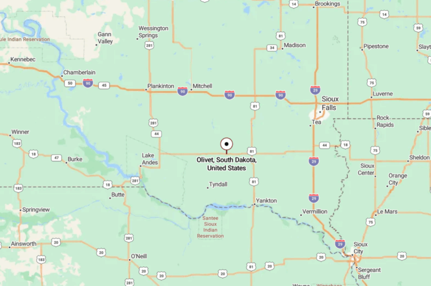
Olivet sits in Hutchinson County in South Dakota’s southeastern quadrant, roughly 20 miles northwest of Yankton. Most visitors angle in from SD-46 or SD-25, then wander the last miles on slow county blacktop.
The route slips from open fields to a modest bluff with wide views. It’s close to the river, but a step apart from everything else.
11. Davis – Elevator, Sky, and a Hamlet Measured in Heartbeats
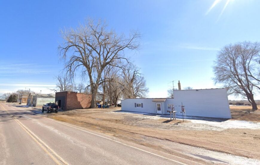
Davis is little more than an old elevator, a handful of homes, and a big sky that changes personality by the hour—and that’s its charm. Seclusion is baked in: miles of section-line gravel, shelterbelts for windbreaks, and no reason for hurried traffic.
The vibe is windswept and honest—clotheslines ticking, meadowlarks throwing notes across fencelines, and a main corner that yawns to the horizon. Ride long gravel squares at sunset, photograph weathered barns and bin rows, bird the prairie potholes after rain, stargaze where the Milky Way shows up uninvited, or day-trip to Newton Hills or Lake Alvin for shaded trails and water.
Farms, custom harvests, and small-town commutes to Parker or Viborg stitch together daily life. When the sun slides under a cloud shelf, the whole prairie glows like a low fire. It’s the kind of place that reminds you how quiet the world can be.
Where is Davis?
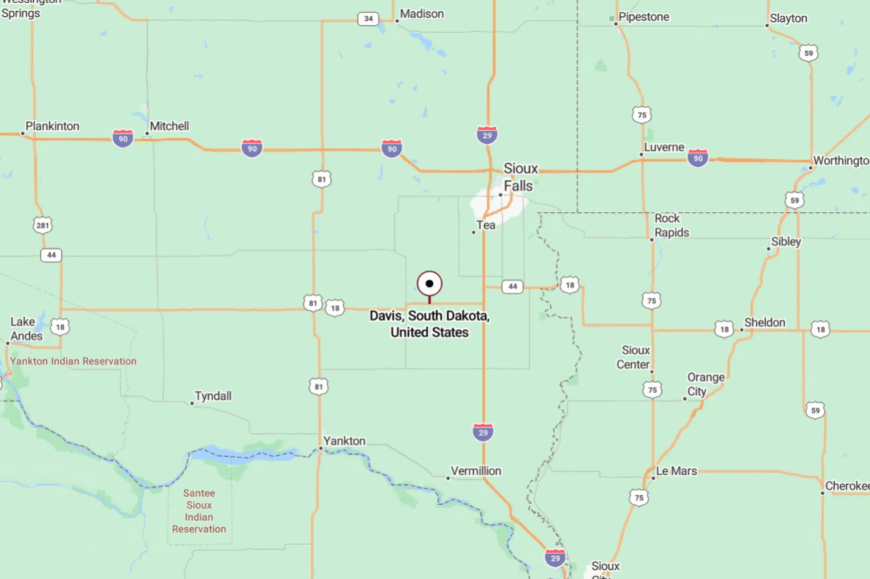
Davis rests in central Turner County, between Parker and Viborg, about 35 miles southwest of Sioux Falls. The simplest approach is via SD-19 or SD-44, then a few easy miles of county road.
The last stretch narrows to gravel, where shelterbelts and creek dips slow your wheels. It’s near enough for a quick escape, far enough that your shoulders drop on arrival.
10. Spink – A Forgotten Crossroads Amid Union County’s Rolling River Bluffs
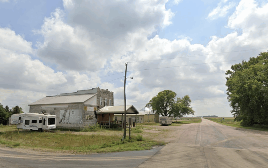
Spink claims roughly 25 year-round residents spread across a lattice of farmsteads and century-old outbuildings. Visitors lean into bluff-top panoramas, bird watching along Brule Creek, and the atmospheric stone St. Peter’s Catholic Church built in 1891.
Agriculture—corn, soybeans, and cattle—provides the main livelihood, with a few locals commuting to Alcester or Elk Point for work. The absence of retail, streetlights, and even a gas pump keeps ambient noise down to wind in the cottonwoods.
A single set of train tracks, once the town’s heartbeat, now sees only occasional freight, adding to the hush. All of this distance from daily bustle lets landscape photographers set up tripods in the middle of a gravel lane without interruption.
Where is Spink?
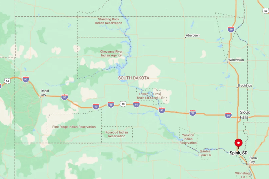
The hamlet sits in north-central Union County, about 15 miles west of the Missouri River and the same distance east of Interstate 29. Deep coulees and treed ravines isolate it from larger towns, so night skies remain ink-black.
Drivers reach Spink by following County Road 13 north from Elk Point, then jogging west on unsigned gravel that weaves through cropland. Winter storms can make those roads dicey, which is why locals keep four-wheel drive trucks and full pantries.
9. Richland – Missouri River Horizons and Miles of Empty Gravel
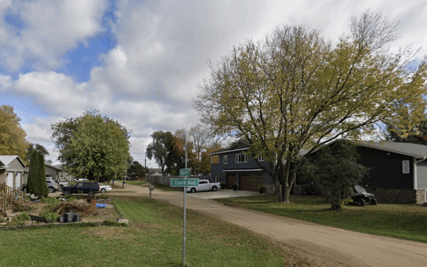
Only around 40 people call Richland home, their houses tucked behind tall shelterbelts that tame prairie winds. Dawn paints the wide Missouri floodplain peach and lavender, inviting early risers to walk levee trails or launch a kayak at the rarely used boat ramp south of town.
Farming and custom hay baling are the economic constants, though a few cabins serve seasonal anglers chasing channel catfish. The nearest state highway hums five miles away, leaving local soundscapes to pheasants and rustling cottonwood leaves.
Old carriage houses and weather-worn barns dot the side roads, offering subject matter for history-minded photographers. Richland’s seclusion stems from the river on one flank and thousands of acres of private cropland on the other, discouraging drive-through traffic.
Where is Richland?
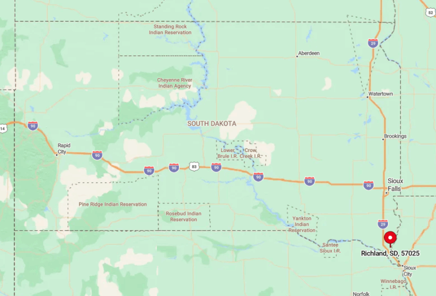
🔥 Would you like to save this?
Richland nestles in northwest Union County, roughly halfway between Jefferson and Vermillion along the Missouri’s east bank. The town lies off SD-19, but travelers must angle onto 472nd Avenue and then rutted gravel to reach the original plat.
With no through street, GPS occasionally misroutes visitors—locals advise following the river levee signs instead. Once there, drivers discover a cul-de-sac of prairie solitude embraced by cottonwoods and open water.
8. Alsen – Clay County’s Swedish Hamlet Hidden in an Ocean of Corn
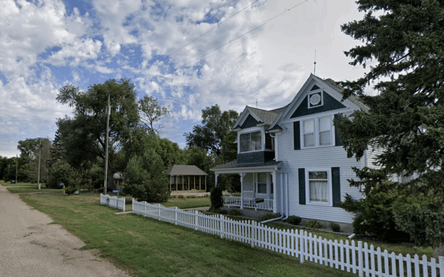
Alsen shelters about 45 residents, many descendants of the original Swedish settlers who built Komstad Covenant Church in 1874. Community events center on that white-steepled landmark and the vintage co-op hall that still hosts midsummer potlucks.
Row-crop farming rules the economy, with seed trials run by South Dakota State University on nearby test plots. Twelve miles of two-lane blacktop separate Alsen from Vermillion’s grocery aisles, making supply runs intentional, not casual.
Around town, shelterbelt forests break up the corn sea, giving sunrise and sunset unobstructed glow across the fields. That straight-line horizon, pierced only by grain bins, makes Alsen a magnet for storm-chasing photographers looking for dramatic shelf clouds.
Where is Alsen?
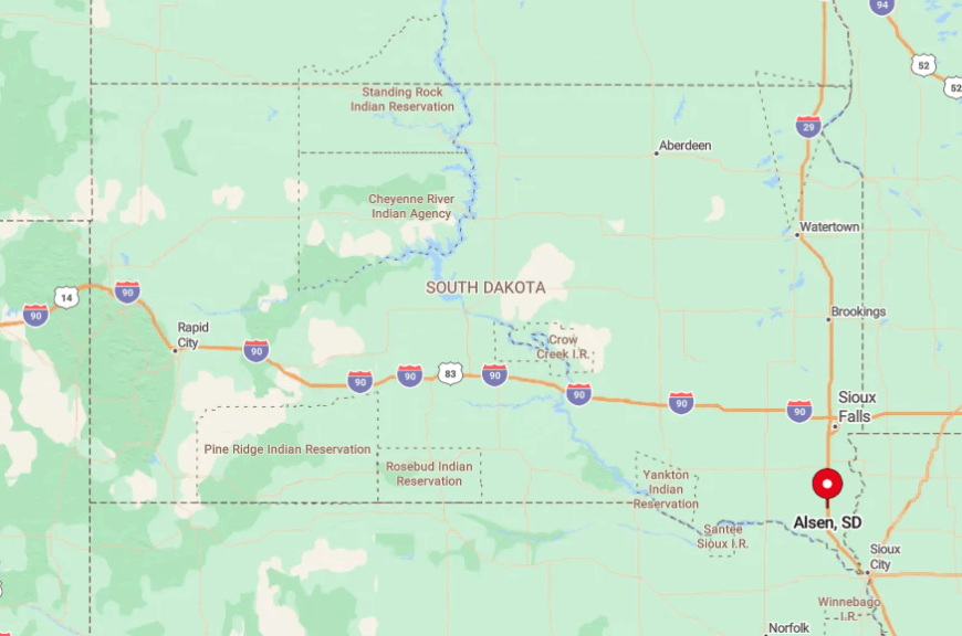
The community lies near the Clay-Union county line, one mile west of SD-19 and four miles south of SD-46. Isolation persists because no major road intersects the grid here; visitors thread a sequence of numbered gravel avenues to arrive.
Vermillion residents typically loop south on University Road, then west past soybean plots until asphalt turns to dust. Cellular reception fades quickly, so travelers often download maps before leaving town.
7. Burbank – Timber-Edged Cabins Above the Quieter Bends of the Big Sioux
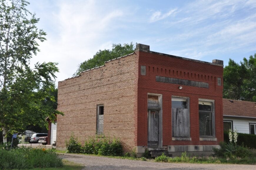
Burbank’s population hovers near 90, scattered among river bluff homes, seasonal cabins, and small hobby farms. Anglers slip kayaks into the Big Sioux where the current slows, while birders track warblers and bald eagles through thick cottonwood stands.
Most locals work in nearby Vermillion, yet weekend bait shops and a lone supper club cater to the fishing crowd. Seclusion arises from the patchwork of private lanes and dead end roads that drop steeply toward the water, discouraging quick detours.
Cabin lots sit behind curtains of timber, muting even farm equipment clatter. Early-morning fog over the river provides a moody backdrop for photographers who venture down the bluff trails.
Where is Burbank?
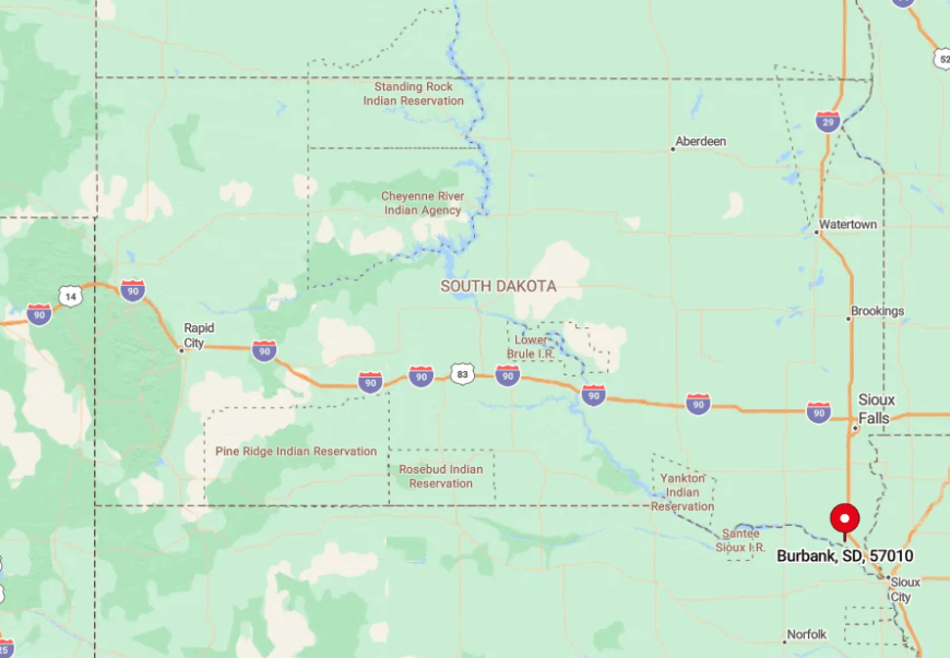
Situated six miles east of Vermillion, Burbank hugs the outside bend where the Big Sioux joins the Missouri. One must exit SD-50 onto 469th Avenue, then follow two miles of twisting blacktop that finally dissolves into gravel above the bluffs.
The road ends at a modest boat launch; beyond that point, only footpaths and deer trails continue. Winter floods sometimes close the final stretch, so locals monitor river gauges before making the drive.
6. Meckling – The ‘Hay Capital’ Where Vast Prairies Swallow the Sky
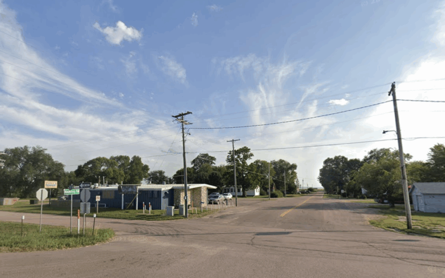
Meckling, self proclaimed “Hay Capital of the Universe,” supports roughly 50 residents and an impressive collection of round-bale sculptures each August during Hay Days. Beyond the festival, travelers find grain elevators, sunflower fields, and prairie dog colonies begging for a telephoto lens.
Alfalfa and grass hay sales dominate the local economy, supplemented by row crops and a small trucking outfit. SD-50 skirts the north edge, yet with so few houses spread miles apart, light pollution remains near zero.
Endless horizon lines make stargazing or Milky Way photography straightforward—no post-processing magic required. That combination of agricultural iconography and open skies defines Meckling’s off-grid feeling.
Where is Meckling?
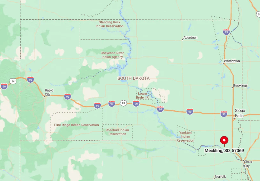
The village sits halfway between Yankton and Vermillion along SD-50, though most addresses lie on side roads south of the highway. Because Meckling lacks a downtown core, newcomers sometimes drive past without realizing it, only to double back for the lone bar-and-grill sign.
Gravel section lines allow access, but spring thaw turns them into soup, so residents rely on four-wheel-drive pickups. BNSF trains rumble by on a parallel track, but no depot stops here anymore, sealing the settlement’s quiet status.
5. Norway Center – One Country Church and a Sea of Pastures
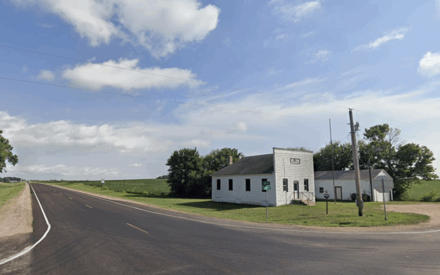
Norway Center lists perhaps 15 inhabitants if every farmhouse light is on, yet its simple Lutheran church still rings the bell for Sunday service. The hilltop cemetery, surrounded by open range, invites sunset silhouettes of wrought iron crosses and marble angels.
Cattle ranching and rotational grazing provide the primary income, supported by seasonal custom harvesting crews. With half the surrounding land left in native grass, meadowlarks and bobolinks deliver the soundscape rather than traffic.
Photographers working with drones can capture tidy fencelines carving curves across rolling green. The absence of retail, school, or post office means visitors usually meet nothing but wind until they reach the churchyard.
Where is Norway Center?
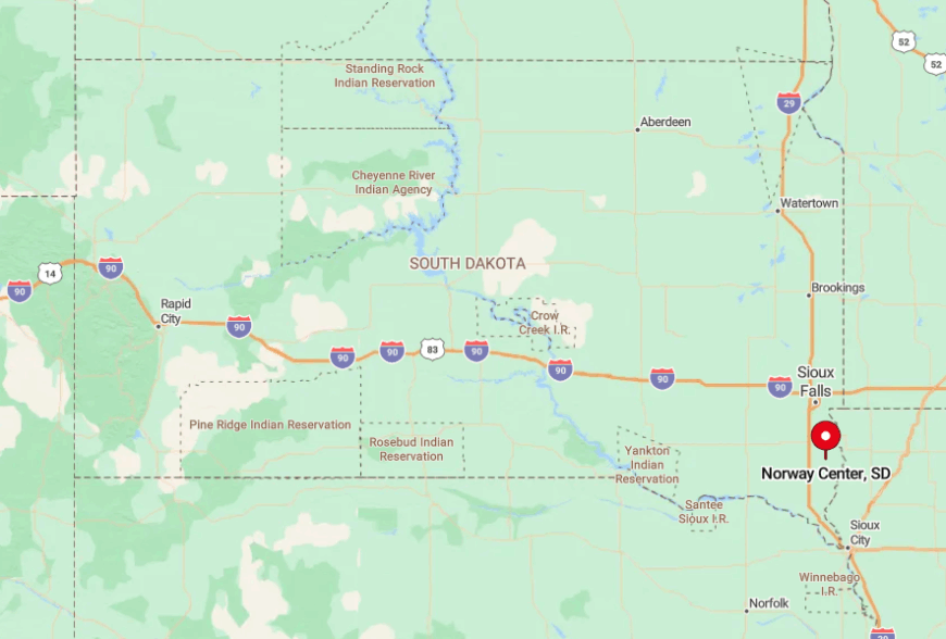
Norway Center is in Lincoln County, not far from the Iowa border, about 10 miles northwest of Hudson. The landmark is the historic Norway Center Store and Lutheran church that anchor the old settlement.
To reach it, most travelers come via SD-11, then turn west on local gravel like 300th Street or 456th Avenue, where pavement gives way to dust and cornfields. The location sits high enough on the prairie that surrounding towns disappear from view, leaving only farmsteads and the church steeple as markers.
GPS often labels the spot simply as “Norway Church,” reflecting how the congregation defines the community. The final miles are on gravel that see more tractors than cars, which helps explain why the place feels so solitary.
4. West Yankton – Quiet Lakefront Living on the Lewis & Clark Backwaters
About 150 residents, many seasonal, claim addresses in West Yankton’s maze of oak-shaded lanes hugging Lewis & Clark Lake. Days pass with paddleboards slicing mirrored water, anglers hunting walleye near the dam, and cyclists tackling the rolling Timber Road loop.
Tourism and lake-service businesses—dock repair, short term rentals, and a local café—outnumber traditional farming ventures here. Despite the recreational draw, the area feels cloistered because cabins sit on acre lots separated by dense timber, and no commercial strip lines the shore.
Morning light filtering through oak branches produces glass-smooth reflections perfect for long exposure shots. Midweek, one can paddle across a cove and only hear red-winged blackbirds.
Where is West Yankton?
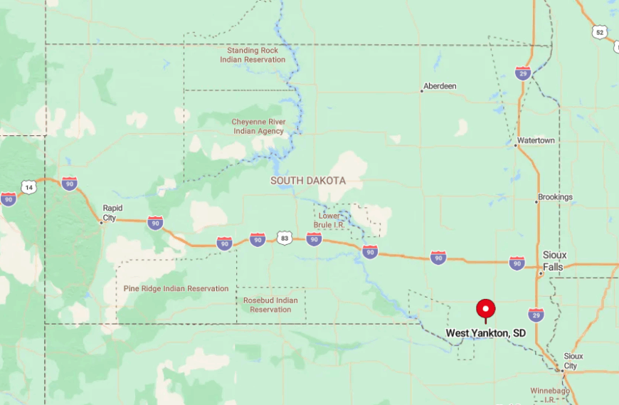
The neighborhood occupies the northern shore of Lewis & Clark Lake, about six miles west of Yankton off SD-52. Visitors exit onto Deer Boulevard and immediately dip into wooded ravines where cell service drops to one bar.
Winding roads loop like spaghetti, ending in cul-de-sacs at the water’s edge, so first-timers often rely on paper maps from the marina. The nearest highway sits high above the lake, shielding the cove from engine noise and headlights.
3. Running Water – Last Stop Before Nebraska and Absolute Stillness
Running Water hosts fewer than 50 full time residents amid clapboard storefronts and abandoned grain bins overlooking the Missouri. Travelers explore bluff-top overlooks, photograph the skeletal remains of the old ferry landing, and hunt agates along the riverbank.
Small scale cattle operations keep the lights on, while a retired couple runs the seasonal bait shack that doubles as an unofficial visitor center. Distance from grocery stores—Niobrara, Nebraska, is 20 miles—adds isolation, and the discontinued railroad line leaves only memories of busier days.
Persistent prairie winds whistle through broken windows, offering an eerie yet peaceful soundtrack for videographers. Sunsets ignite the tallgrass with color, rewarding those who stay past daylight.
Where is Running Water?
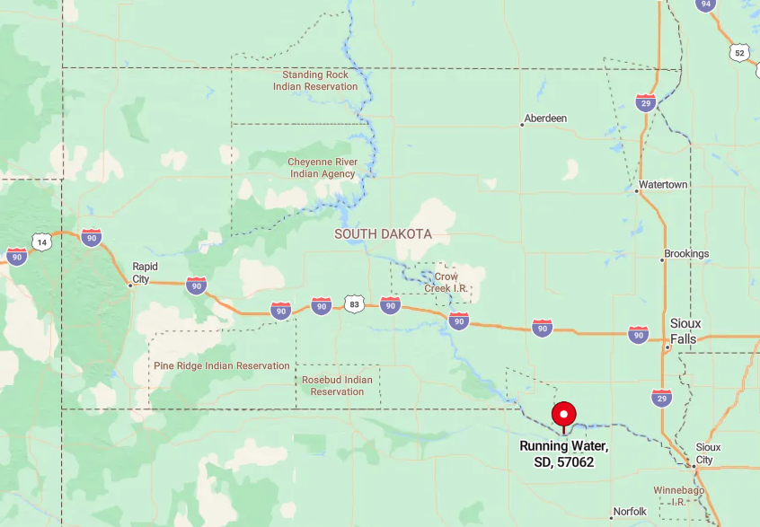
The settlement perches on a high bluff in Bon Homme County, just upstream from where SD-46 meets the Nebraska border. Getting there means driving west from Lake Andes, then south on a paved spur that ends abruptly at the former ferry dock.
The Missouri River wraps around two sides, and chalkstone bluffs hem in the third, trapping quiet like a natural amphitheater. With no bridge and no through-road, visitors must backtrack on the same spur, which keeps traffic negligible.
2. Kingsburg – Bon Homme County’s Hidden German-Russian Farming Enclave
Kingsburg’s headcount hovers near 25, nearly all tied by heritage to the German-Russian settlers who arrived in the 1880s. A handful of ornate iron crosses in the Zion Reformed Church cemetery reflect that lineage and attract historians tracing family roots.
Wheat, milo, and pastureland fuel the local economy, complemented by niche ventures like sunflower-oil pressing done in a refurbished barn. Kingsburg evades notice because its roads parallel rather than intersect major routes, and farmsteads hide behind shelterbelts planted generations ago.
Classic wooden windmills and tin-roofed granaries stand photogenically against expansive skies. Neighbors are distant enough that aurora watchers find dark sky conditions without leaving their porches.
Where is Kingsburg?
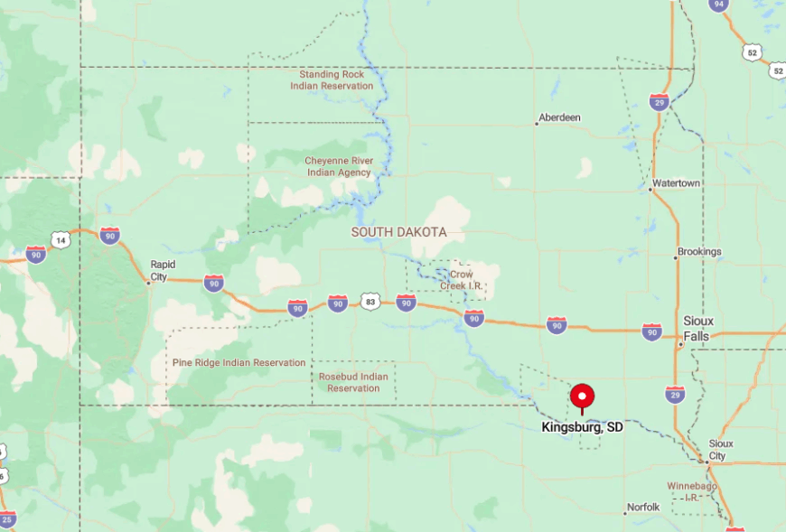
Located 14 miles northwest of Tyndall, Kingsburg sits on 300th Street, a gravel ribbon bordered by wheat stubble most of the year. Access usually involves exiting SD-37 onto 304th Street and driving four miles of unpaved road, where meeting another vehicle is a rarity.
The absence of a town sign means visitors watch for the white church steeple rising above corn tassels. Heavy snow can close the approaches, so locals keep blades on tractors ready for self rescue.
1. Wall Lake – Lone Docks, Loons, and Prairie Sunsets West of Sioux Falls
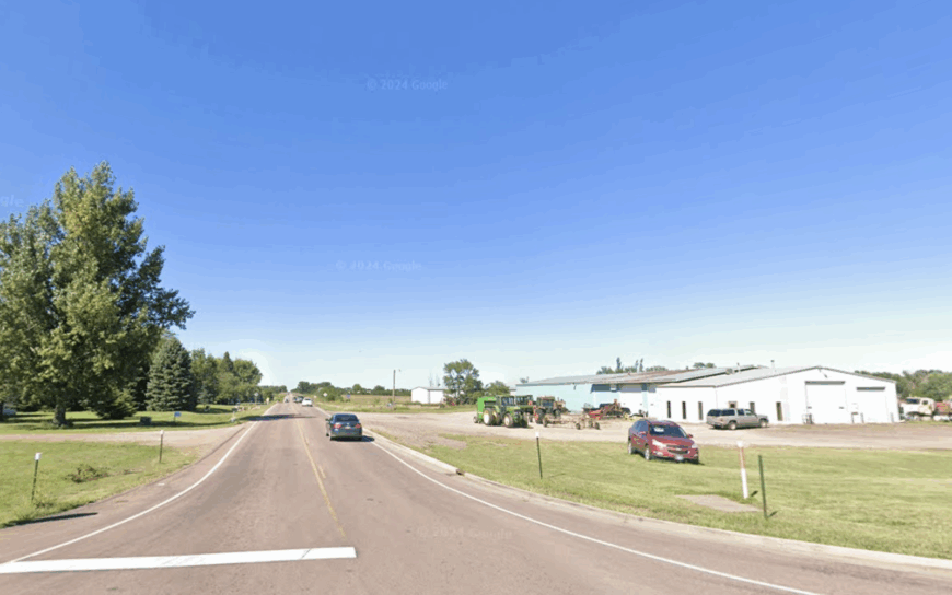
Wall Lake rings in at roughly 120 residents, yet offers the most water frontage per person in Minnehaha County. Fishing for crappie and bluegill, paddling around the sheltered bays, and spotting common loons during migration top the to-do list.
Most livelihoods tie back to Sioux Falls—a 15-minute commute—so the lake community stays quietly residential with no strip malls or bright signage. Gentle hills and cattail marshes shield the shoreline, absorbing city noise and light.
Photographers chase mirrored sunset reflections, while night herons patrol the reeds almost unseen. Because main public access is on the south shore at Wall Lake Park, human traffic stays light even on summer weekends.
Where is Wall Lake?
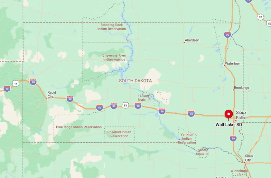
Wall Lake lies 11 miles west-southwest of downtown Sioux Falls, just south of SD-42. A single paved loop circles the lake, branching into gravel drives that dead-end at private docks.
Despite its proximity to the metro, the surrounding farmland creates a buffer that preserves rural tranquility. Arrivals from the city slip off the four-lane highway onto township roads, and within minutes, streetlights give way to fireflies.