Would you like to save this?
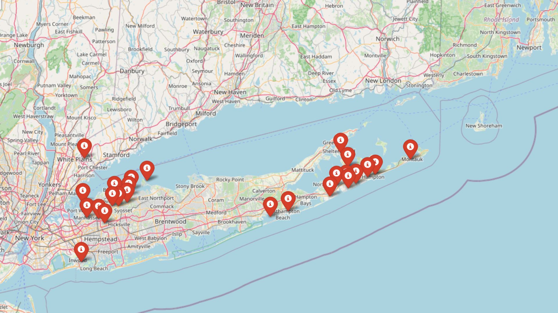
Quiet backroads, forested ridges, and hidden lakes still dominate large swaths of Southeast New York, and a handful of hamlets make the most of that natural buffer. We gathered ten spots where population remains low, traffic lights are rare, and nights are dark enough for stargazing.
Each place has its own character—some hug a reservoir, others perch on a mountaintop—but all share the gift of silence. In many cases, a single two-lane road or a ring of preserved land keeps sprawl away, preserving the slower rhythm locals value.
The following countdown moves from the slightly less remote to the most tucked-away, giving a glimpse of what daily life looks like in these pocket communities. Readers looking for respite from constant motion will find plenty of inspiration—and maybe a new weekend drive—below.
25. Clintondale, Ulster County
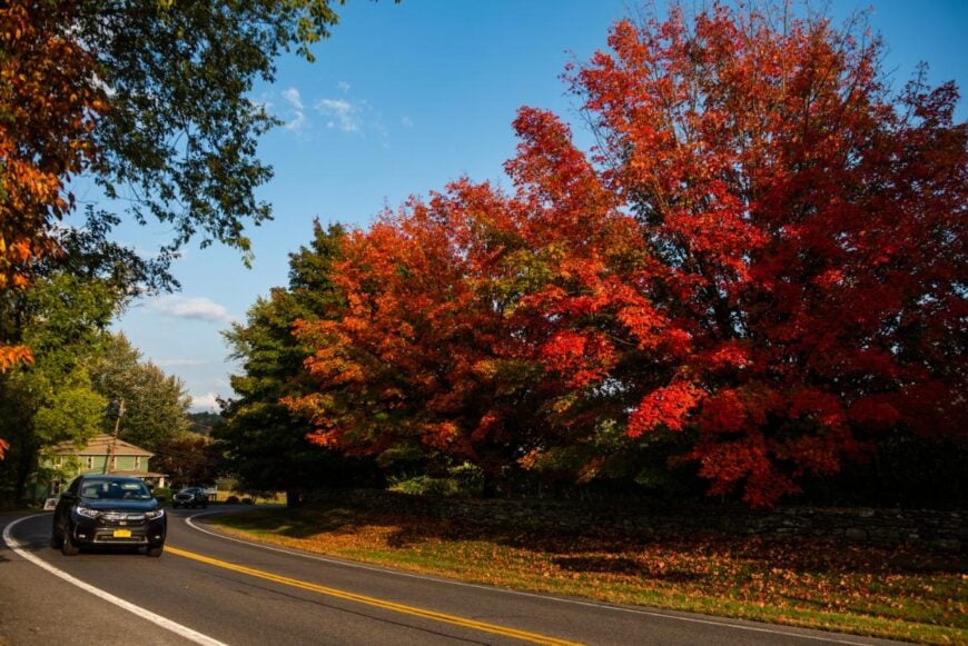
Nestled in the Hudson Valley, Clintondale sits quietly among apple orchards, rolling hills, and views of the distant Shawangunk Ridge. Its rural setting and distance from major highways give it a peaceful, tucked-away feel, even while larger towns are just a short drive away.
Life here follows the rhythm of the seasons—spring blossoms, summer farm markets, autumn harvests, and snowy winter evenings. Visitors and locals alike enjoy touring orchards, hiking nearby trails, or exploring the area’s farm-to-table offerings.
Agriculture, especially apple growing, has long anchored the community’s economy and identity. In Clintondale, the air feels fresh, the views seem endless, and the quiet lingers like a familiar friend.
Where is Clintondale?
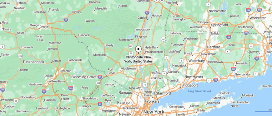
Clintondale is located in southeastern New York, in Ulster County near the Hudson River. It’s about 8 miles south of New Paltz and roughly 80 miles north of New York City, reached by traveling on Interstate 87 and then following quiet local roads.
The approach winds past orchards, rolling farmland, and views of the distant Shawangunk Ridge. It’s close to major routes, yet its rural stillness makes it feel far from the city’s pace.
24. Stormville, Dutchess County
Tucked into the southeastern corner of Dutchess County, Stormville is surrounded by wooded hills, open farmland, and winding backroads that keep it feeling far from the bustle. Its rural setting and lack of busy throughways give the town a quiet, unhurried character.
The seasonal Stormville Flea Market draws crowds for antiques, handmade goods, and local produce, becoming a lively tradition in an otherwise calm place. Outdoor opportunities abound, from hiking nearby trails to fishing in local ponds and streams.
Small farms and family-run businesses remain part of the landscape, preserving its country roots. In Stormville, the pace slows, and the air feels just a little fresher.
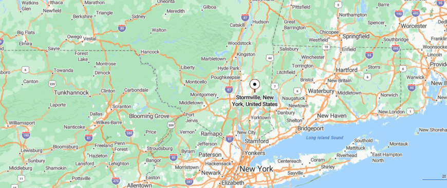
Where is Stormville?
Were You Meant
to Live In?
Stormville is located in southeastern New York, in Dutchess County near the Connecticut border. It’s about 15 miles southeast of Poughkeepsie and roughly 70 miles north of New York City, reached by way of the Taconic State Parkway before turning onto narrow country roads.
The route winds through wooded hills, open meadows, and quiet farms that mark the shift to a slower pace. It’s close enough for a day’s drive, yet far enough to feel completely removed from city life.
23. Roscoe, Sullivan County
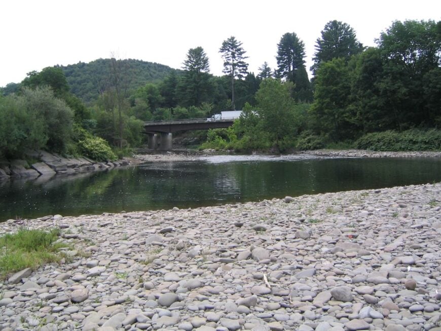
Tucked at the junction of the Beaverkill and Willowemoc Creeks, Roscoe calls itself “Trout Town, USA” for good reason. Anglers from across the Northeast come here each spring to cast in waters that have been legendary since the days of Theodore Gordon, the father of American fly fishing. The hamlet’s main street hums with tackle shops, diners, and outfitters, yet the forested hills that ring the valley keep the pace unhurried.
Life in Roscoe tilts outdoors—whether that means wading into a cold stream, hiking the Catskill foothills, or pedaling along backroads shaded by maple and birch. Seasonal events, from the Trout Parade in June to fall’s cider festivals, add splashes of color and energy without overwhelming the quiet character of the place.
The surrounding state forestland and watershed protections limit sprawl, leaving the hamlet’s edges framed by open meadows, barns, and the soft rush of the rivers. In Roscoe, the sound of water and the smell of pine define the day more than the ticking of any clock.
Where is Roscoe?
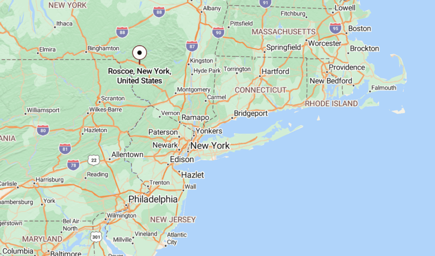
Roscoe sits in southwestern Sullivan County, just off NY Route 17 in the western Catskills. It lies about 15 miles west of Liberty and roughly 125 miles northwest of New York City, a drive that threads through mountain valleys before dropping into the hamlet’s narrow basin.
The approach offers glimpses of sparkling creeks, covered bridges, and forest ridgelines that rise steeply on either side of town. With the Catskill Forest Preserve at its doorstep and two famous trout streams meeting at its center, Roscoe feels both accessible and deeply tucked into the mountains.
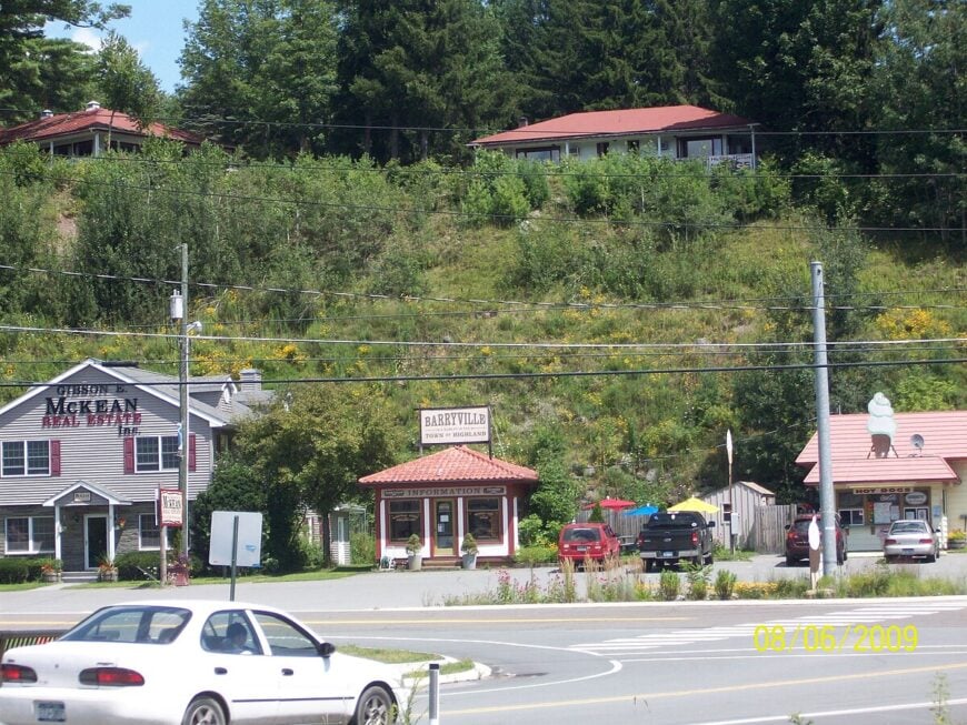
22. Barryville, Sullivan County
Home Stratosphere Guide
Your Personality Already Knows
How Your Home Should Feel
113 pages of room-by-room design guidance built around your actual brain, your actual habits, and the way you actually live.
You might be an ISFJ or INFP designer…
You design through feeling — your spaces are personal, comforting, and full of meaning. The guide covers your exact color palettes, room layouts, and the one mistake your type always makes.
The full guide maps all 16 types to specific rooms, palettes & furniture picks ↓
You might be an ISTJ or INTJ designer…
You crave order, function, and visual calm. The guide shows you how to create spaces that feel both serene and intentional — without ending up sterile.
The full guide maps all 16 types to specific rooms, palettes & furniture picks ↓
You might be an ENFP or ESTP designer…
You design by instinct and energy. Your home should feel alive. The guide shows you how to channel that into rooms that feel curated, not chaotic.
The full guide maps all 16 types to specific rooms, palettes & furniture picks ↓
You might be an ENTJ or ESTJ designer…
You value quality, structure, and things done right. The guide gives you the framework to build rooms that feel polished without overthinking every detail.
The full guide maps all 16 types to specific rooms, palettes & furniture picks ↓
Set along a bend in the Delaware River, Barryville feels like a hidden corner of the Catskills where water, forest, and sky meet in quiet harmony. Surrounded by wooded hills and miles from major highways, it keeps a pace shaped by the river’s steady flow.
Life here centers on outdoor pleasures—kayaking or tubing the Delaware, hiking forest trails, or exploring small shops and cafés along the main road. The farmers’ market and seasonal festivals bring neighbors and visitors together, adding a lively touch to the calm.
Tourism blends with small-scale businesses, while the surrounding wilderness keeps the town’s spirit rooted in nature. In Barryville, the sound of the river stays with you long after you’ve left.
Where is Barryville?
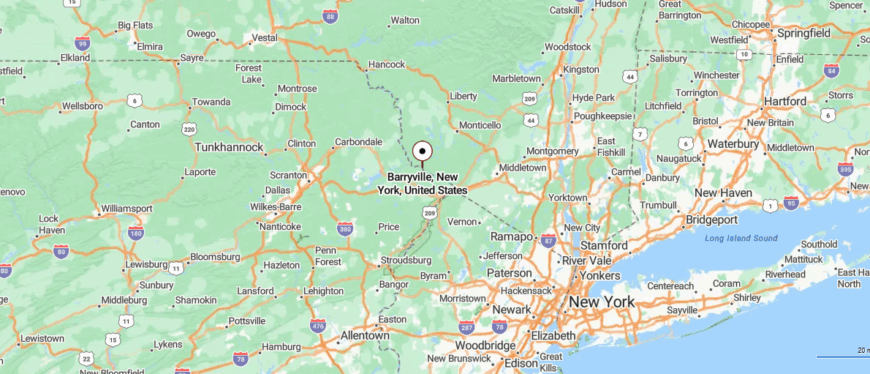
Barryville sits in the southwestern corner of New York’s Sullivan County, along the Delaware River at the Pennsylvania border. It’s about 13 miles southwest of Eldred and roughly 100 miles northwest of New York City, reached by following NY Route 97, a winding scenic byway that hugs the river.
The drive offers forested hillsides, rocky riverbanks, and glimpses of eagles overhead. It’s a riverside haven where the quiet water and wooded slopes make the rest of the world feel far away.
21. Pine Plains, Dutchess County

Surrounded by rolling farmland and distant mountain views, Pine Plains sits quietly in the heart of the Hudson Valley, well away from the rush of larger towns. Its tree-lined streets, historic buildings, and small green create a timeless New England–style charm.
Life here moves with the seasons—summer brings Lake Taghkanic swims, autumn fills the air with the scent of harvest, and winter settles in with a hush over the fields. Visitors can explore nearby state parks, hike quiet trails, or browse the town’s local shops and cafés.
Farming and small businesses remain the backbone of the community, carrying forward traditions that have lasted for generations. In Pine Plains, the calm feels deep and lasting, like the land has been keeping its own steady rhythm for centuries.
Where is Pine Plains?
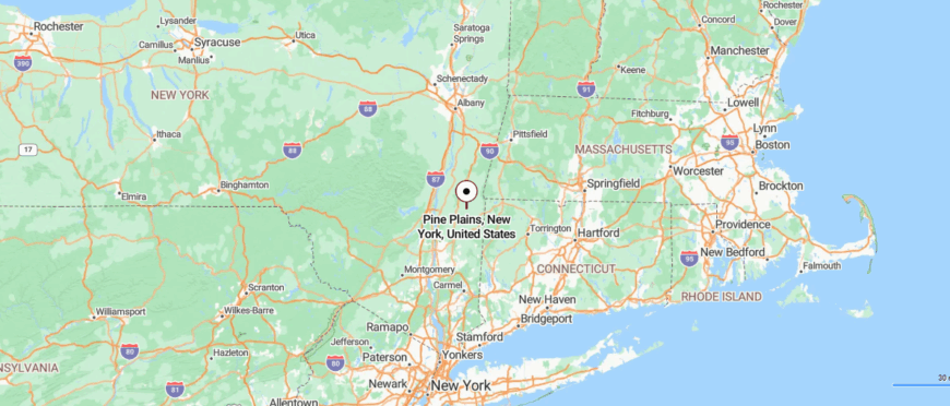
Pine Plains is located in northeastern Dutchess County, in New York’s Hudson Valley. It’s about 20 miles northeast of Poughkeepsie and roughly 100 miles north of New York City, reached by following the Taconic State Parkway and winding local roads through farmland.
The approach passes open meadows, dairy farms, and distant views of the Taconic Mountains. It’s close to main routes, yet its rural landscape and wide horizons give it a peaceful, set-apart feeling.
20. Eldred, Sullivan County
Tucked into the wooded hills of Sullivan County, Eldred feels far removed from the noise of the outside world. Surrounded by forests, lakes, and winding backroads, it carries the quiet of the Upper Delaware region in every season.
Life here centers on small-town connections, with a few local shops, family-run eateries, and community events that bring neighbors together. Outdoor activities are part of daily life—kayaking on nearby lakes, hiking forest trails, or fishing along the Delaware River.
Tourism blends with small businesses, while the surrounding wilderness keeps the pace unhurried. In Eldred, the stillness feels as much a part of the town as the trees that frame its horizon.
Where is Eldred?
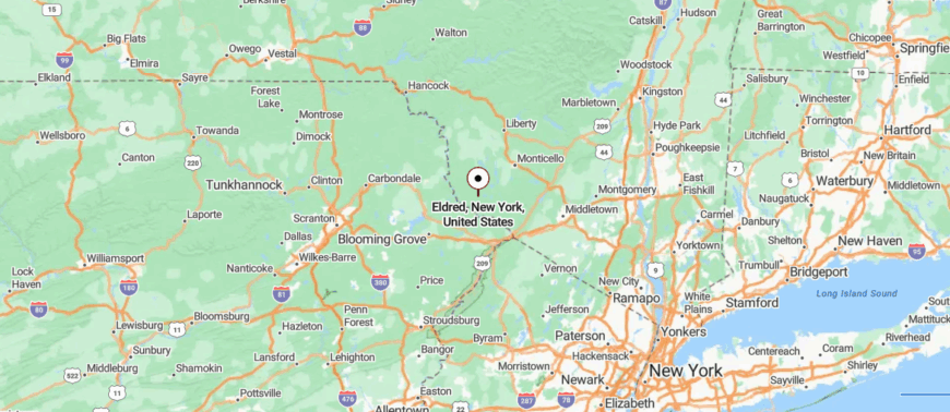
Eldred is set in the southwestern part of New York’s Sullivan County, not far from the Delaware River and the Pennsylvania border. It’s about 15 miles south of Monticello and roughly 95 miles northwest of New York City, reached by following NY Route 55 through wooded hills and quiet valleys.
The drive passes small lakes, country homes, and stretches of forest that open to mountain views. It’s close enough for an easy trip, yet its calm, tucked-away setting makes it feel worlds apart.
19. Hollowville, Columbia County
Set among the quiet backroads of Columbia County, Hollowville feels like a place the world passes by without disturbing. Surrounded by farmland, wooded ridges, and open fields, it sits far from major highways, keeping its rural calm intact.
The hamlet is small, with just a handful of homes, a church, and local gathering spots that reflect its close-knit nature. Nearby, country lanes lead to fishing streams, hiking trails, and scenic drives through the Hudson Valley.
Farming remains a part of the landscape, connecting each season to the land. In Hollowville, the quiet feels unbroken, as if it’s been here as long as the hills themselves.
Where is Hollowville?
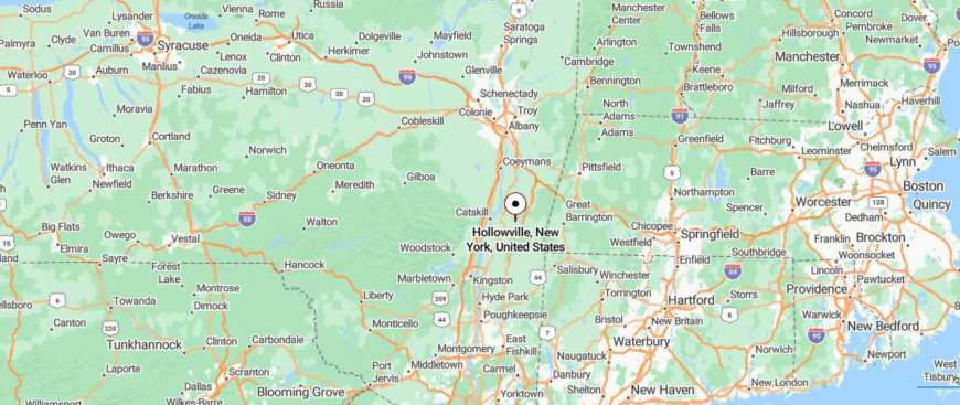
Hollowville is located in the northwest part of Columbia County, in eastern New York. It’s about 6 miles west of Hudson and roughly 120 miles north of New York City, reached by following NY Route 23B and smaller rural roads.
The approach winds past open farmland, quiet creeks, and views of the distant Catskill Mountains. It’s a small, out-of-the-way spot where the stillness of the countryside makes the outside world feel far away.
18. Palenville, Greene County
Tucked at the base of the Catskill Mountains, Palenville feels like the kind of place where the forest and mountains lean in close. Once known as an artists’ haven in the 19th century, it still carries a creative spirit alongside its deep mountain quiet.
The sound of rushing water from nearby Kaaterskill Creek blends with birdsong and wind through the trees. Visitors explore hiking trails that lead to dramatic overlooks, wander to Kaaterskill Falls, or browse small galleries and local cafés.
Tourism and outdoor recreation mix with a tight-knit year-round community. In Palenville, the mountains are never just scenery—they’re part of the rhythm of daily life.
Where is Palenville?
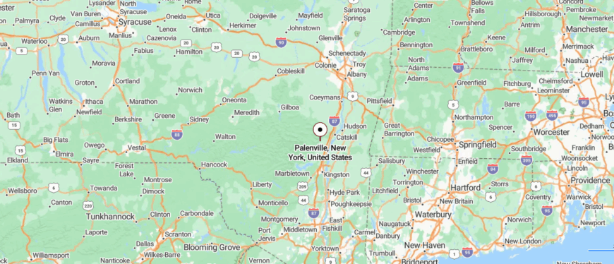
Palenville sits in the southeastern part of Greene County, New York, at the base of the Catskill Mountains. It’s about 10 miles west of Catskill and roughly 120 miles north of New York City, reached by following NY Route 23A as it begins to climb into the mountains.
The drive offers forested slopes, rushing streams, and glimpses of waterfalls tucked into the hillsides. It’s a gateway to the Catskills that still feels quietly set apart from the busier valleys below.
17. Livingston Manor, Sullivan County

Surrounded by forested hills and clear trout streams, Livingston Manor sits quietly in the western Catskills, far from the pace of larger towns. The Willowemoc Creek runs through its center, drawing anglers from near and far while adding a steady, calming soundtrack to daily life.
The town blends small shops, cafés, and art spaces with a strong connection to the outdoors—fly fishing, hiking, and camping are part of the local rhythm. Seasonal festivals and farmers’ markets bring neighbors together, while nearby state parks and wild forest areas keep nature close at hand.
Tourism, outdoor recreation, and small businesses anchor the economy without crowding out the town’s easygoing charm. In Livingston Manor, the water, the woods, and the mountains shape every day.
Where is Livingston Manor?
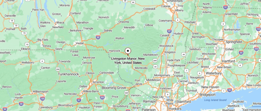
Livingston Manor is located in the southern part of New York’s Sullivan County, along the Willowemoc Creek in the Catskills. It’s about 12 miles west of Liberty and roughly 115 miles northwest of New York City, reached by following NY Route 17 through winding mountain valleys.
The approach passes forested hills, trout streams, and small clusters of homes that hint at its fishing-town heritage. It’s a mountain community where the air feels crisp and the quiet stretches as far as the ridgelines.
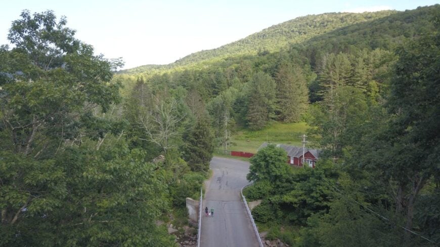
16. Phoenicia, Ulster County
Would you like to save this?
Tucked into the Esopus Creek valley and surrounded by the Catskill Mountains, Phoenicia feels like a place where the mountains stand guard over daily life. Its small main street hums gently with cafés, shops, and outfitters, yet step a block away and the quiet of the forest takes over.
Outdoor adventures define much of its charm—tubing down the creek in summer, hiking nearby peaks, or exploring scenic trails that wind through the hills. Festivals, art shows, and music events add bursts of color to the town’s laid-back rhythm.
Tourism blends with a tight-knit community that treasures its mountain setting. In Phoenicia, the air feels fresher, the nights quieter, and the pace set by the flow of the creek.
Where is Phoenicia?
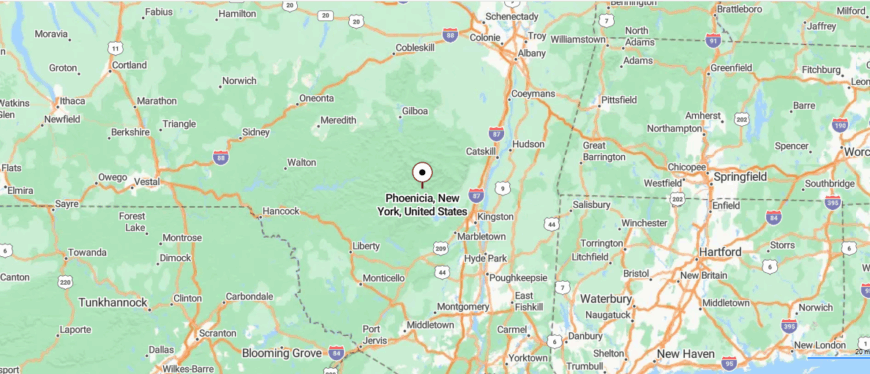
Phoenicia lies in the heart of the Catskill Mountains, in Ulster County in southeastern New York. It’s about 25 miles northwest of Kingston and roughly 125 miles north of New York City, reached by following NY Route 28 through winding valleys and forested slopes.
The drive passes rushing creeks, trailheads, and steep mountainsides that rise close to the road. It’s a place where the peaks close in, the air feels fresh, and the rest of the world seems far away.
15. Ancram, Columbia County
Surrounded by rolling farmland and views of the Taconic Hills, Ancram feels like a quiet corner of Columbia County where time moves with the seasons. Its winding country roads pass historic farmsteads, open fields, and stretches of woodland that keep the town feeling far from busy highways.
Life here centers on farming, local markets, and community gatherings that mark the calendar year after year. Nearby, Bash Bish Falls and state parks offer hiking, fishing, and scenic drives through the countryside.
Agriculture remains the town’s backbone, with generations tending the same land for decades. In Ancram, the quiet feels steady, as if the land and community have been keeping pace together for centuries.
Where is Ancram?
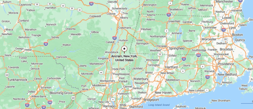
Ancram is located in the southeastern corner of Columbia County, in New York’s Hudson Valley near the Massachusetts border. It’s about 20 miles southeast of Hudson and roughly 110 miles north of New York City, reached by following the Taconic State Parkway and quiet county roads.
The drive passes rolling farmland, winding streams, and distant views of the Taconic Mountains. It’s a rural pocket where open fields and quiet roads make the outside world feel far removed.
14. Accord, Ulster County
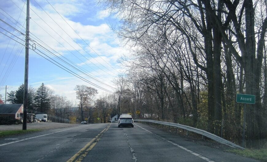
Set in the Rondout Valley between the Shawangunk Ridge and the Catskill Mountains, Accord feels like a place cradled by nature on all sides. Its rural roads wind past farms, orchards, and fields that glow with changing light through the seasons.
Life here blends agriculture, small-town connections, and a growing arts and food scene, with farm markets and local breweries drawing both neighbors and visitors. Outdoor opportunities abound—hiking in Minnewaska State Park, kayaking on quiet waterways, or cycling along scenic backroads.
Farming remains a strong thread in the local economy, tying the present to generations past. In Accord, the beauty of the land shapes the pace of life, slow and rooted.
Where is Accord?
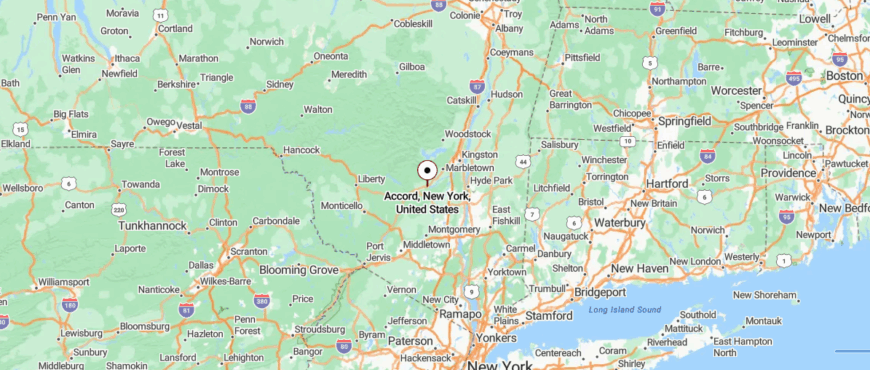
Accord is set in the southeastern part of Ulster County, in New York’s Rondout Valley. It’s about 15 miles southwest of Kingston and roughly 95 miles north of New York City, reached by following U.S. Route 209 through farmland and low mountain ridges.
The approach passes fields, old barns, and views of both the Shawangunk Mountains and the Catskills in the distance. It’s close to well-known trails and parks, yet its quiet stretches make it feel like a place apart.
13. Hillsdale, Columbia County
Surrounded by the rolling farmland and mountain views of Columbia County, Hillsdale feels like a place where open space and history meet. Its small center holds historic buildings, local shops, and cafés, while country roads lead to barns, fields, and distant ridgelines.
Life here moves with the seasons—summer farm markets, autumn foliage drives, winter skiing at nearby Catamount, and spring hikes through wildflower-filled meadows.
Agriculture and tourism both play a role in the local economy, keeping the rural character strong. In Hillsdale, the horizon always seems wide, and the days follow a gentler rhythm shaped by the land.
Where is Hillsdale?
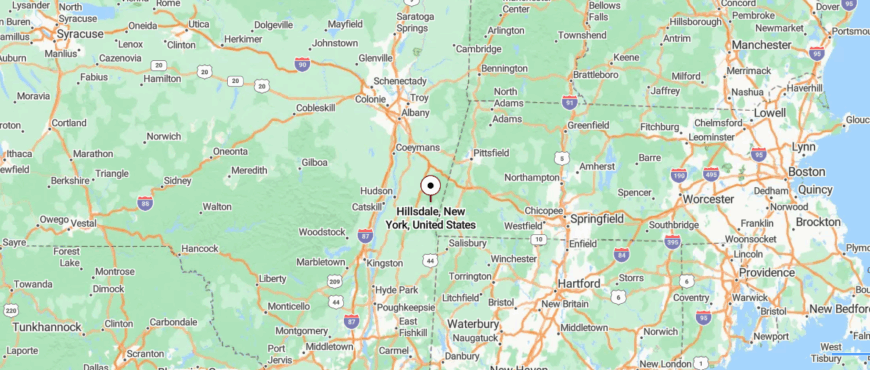
Hillsdale is located in the eastern part of Columbia County, New York, near the Massachusetts border. It’s about 23 miles southeast of Hudson and roughly 120 miles north of New York City, reached by following the Taconic State Parkway and then winding along NY Route 23 through farmland and hills.
The drive offers open fields, forested ridges, and distant mountain views. It’s a place where the wide landscapes and gentle pace make the rest of the world feel far away.
12. Germantown, Columbia County
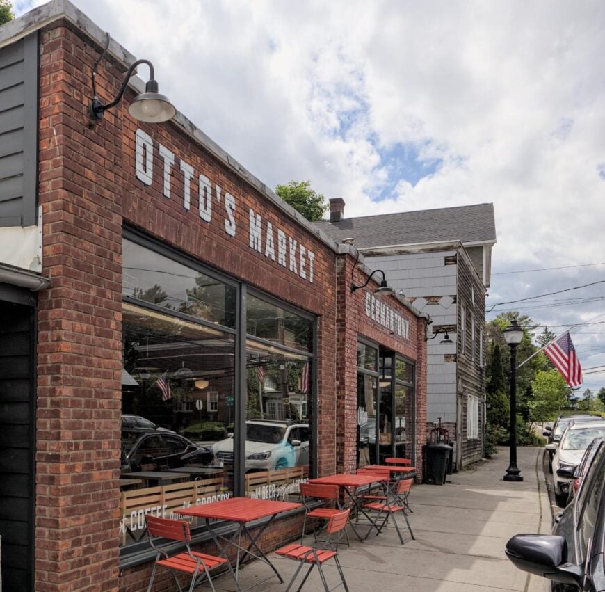
Set along the eastern shore of the Hudson River, Germantown feels quietly anchored between the water and the low, rolling hills beyond. Its rural roads pass farm fields, old homesteads, and stretches of riverfront that keep it feeling far from the rush of larger towns.
Life here blends agriculture, history, and community gatherings—seasonal markets, riverfront walks, and local festivals bring neighbors together. Outdoor opportunities are close at hand, from exploring riverside trails to watching sunsets over the Catskills.
Farming remains a steady presence, tying the landscape to generations past. In Germantown, the quiet is wide and lasting, like the river itself.
Where is Germantown?
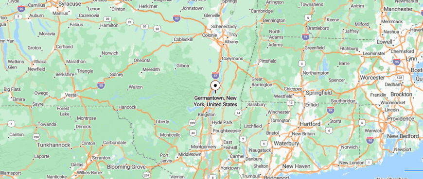
Germantown is located in the western part of Columbia County, New York, along the eastern shore of the Hudson River. It’s about 10 miles south of Hudson and roughly 110 miles north of New York City, reached by following NY Route 9G through a mix of farmland and small hamlets.
The drive offers river views, open fields, and glimpses of the Catskill Mountains across the water. It’s close to main routes, yet its quiet riverfront setting feels set apart from the rush.
11. Taghkanic, Columbia County
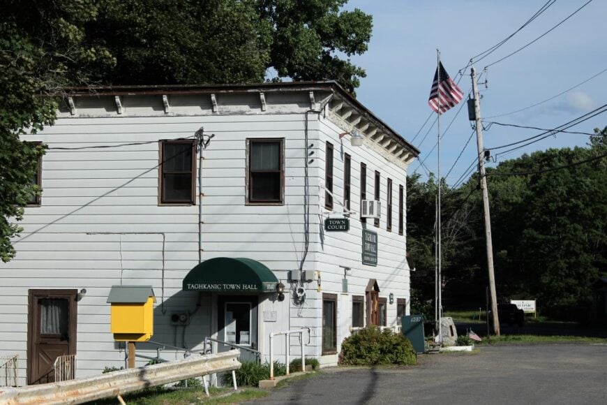
Surrounded by rolling hills, forests, and quiet backroads, Taghkanic feels like a hidden corner of Columbia County where the countryside stretches in every direction. Far from busy highways, its pace is shaped by the rhythm of the seasons and the work of small farms scattered across the landscape.
Life here is rooted in simplicity—neighbors meet at local markets, along rural lanes, or by the water at nearby Lake Taghkanic State Park. Outdoor activities like hiking, swimming, and fishing keep nature close at hand.
Agriculture remains a steady presence, linking the community to generations past. In Taghkanic, the quiet feels deep and uninterrupted, as if it’s been here forever.
Where is Taghkanic?
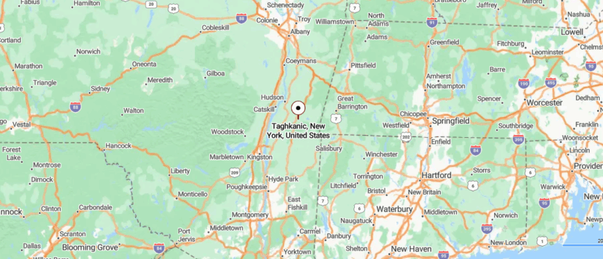
Taghkanic is located in the south-central part of Columbia County, New York, within the Hudson Valley. It’s about 10 miles south of Hudson and roughly 115 miles north of New York City, reached by following the Taconic State Parkway and quiet country roads.
The drive passes open farmland, forested hills, and winding streams that trace the landscape. It’s a rural stretch where wide skies and still roads give it a feeling of being far removed from the city’s pace.
10. Waccabuc, Westchester County
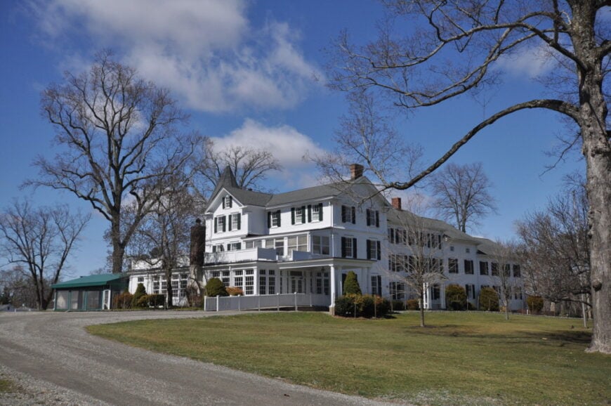
Home to roughly 450 residents, Waccabuc feels worlds removed from the commuter rush only a few miles south. Lake Waccabuc invites quiet paddling at dawn, while horse lovers take advantage of bridle paths that wind past stone walls and century-old farmhouses.
A handful of family-run stables, remote-work professionals, and small hospitality outfits form the area’s modest economic base. Privacy rules here: parcels average several acres and tall hardwoods screen most houses from the road.
There are no sidewalks, no commercial strip, and only one public road circles the 113-acre lake, discouraging through-traffic. Those ingredients combine to explain why locals affectionately call the hamlet “New York’s secret suburb.”
Where is Waccabuc?
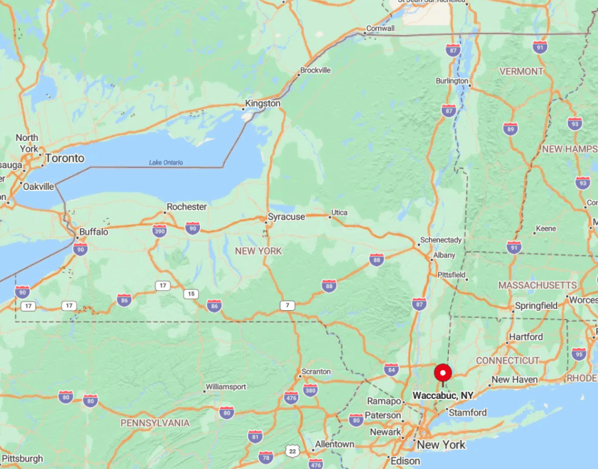
Waccabuc occupies the northeast corner of Lewisboro, about fifteen miles north of White Plains and just west of the Connecticut line. Wooded ridgelines and the Titicus Reservoir discourage shortcuts, so the hamlet sees little more than local traffic.
Visitors exit I-684 at Route 138 and meander along narrow lanes like Chapel Road before spotting weathered signs marking the lake. Train service stops in Katonah five miles away, meaning the last leg is best tackled by car, keeping day-tripper numbers delightfully low.
9. Cragsmoor, Ulster County

Cragsmoor counts around 450 full-time residents, many of whom live in shingle cottages built during its late-1800s artists’-colony heyday. Hiking to Sam’s Point, visiting the Bear Hill Preserve overlook, and touring small private studios give weekend explorers plenty to do without crowds.
The local economy leans on art sales, limited lodging, and forest management jobs tied to the surrounding 5,000 acres of protected land. Because the hamlet sits atop the Shawangunk escarpment at nearly 2,000 feet above sea level, winter snows linger and cell service can be spotty, reinforcing the off-the-grid experience.
Only two narrow roads climb the ridge, and strict zoning allows almost no new construction. Combined, these factors keep Cragsmoor’s turn-of-the-century charm remarkably intact.
Where is Cragsmoor?
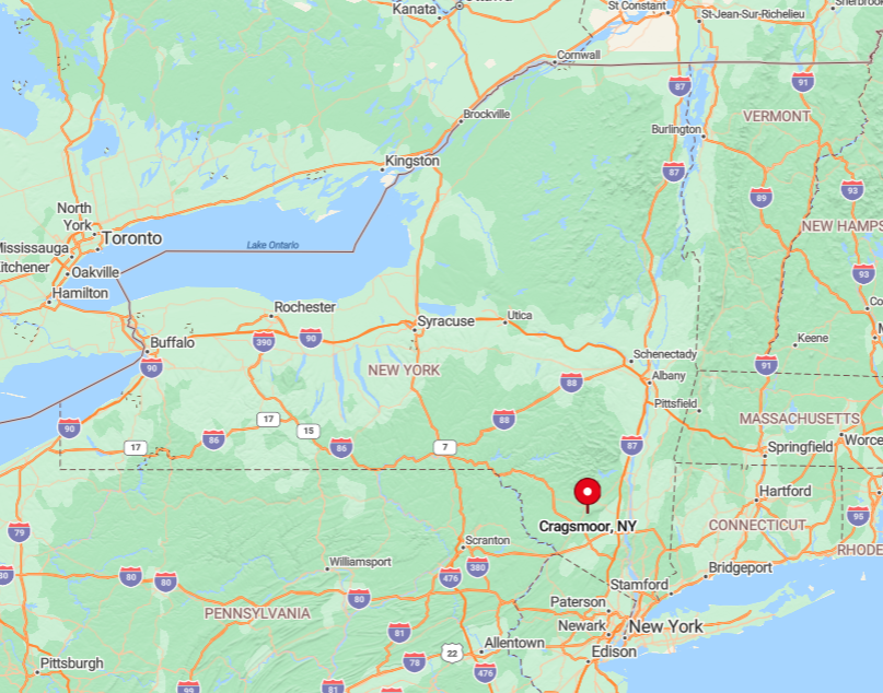
The village crowns the highest point in southern Ulster County, roughly twenty minutes southwest of New Paltz. Steep switchbacks on Cragsmoor Road climb 800 feet in two miles, a natural deterrent to heavy traffic.
The closest highway, Route 52, lies well below the ridge, while the Port Jervis rail line rolls by an entire valley away. Reaching town demands a deliberate detour, so only those who plan the trip ever see its cliff-edge sunsets.
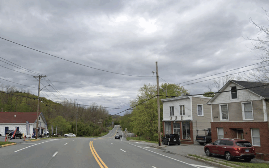
8. Narrowsburg, Sullivan County
About 430 people reside in Narrowsburg, a river hamlet perched on bluffs above the Delaware. Bald-eagle watching at the Big Eddy, tubing downstream, and browsing indie galleries along Main Street fill mellow afternoons.
Tourism and outdoor guiding support most businesses, supplemented by small farms that dot the river valley. The single stoplight and a historic bridge across to Pennsylvania limit traffic, while thousands of acres of state-managed forest curb development pressure.
Nights here are defined by frog song and the distant rumble of the river, not sirens or stadium lights. All told, Narrowsburg’s steep banks and protected floodplain maintain a peaceful buffer few downstate towns can match.
Where is Narrowsburg?
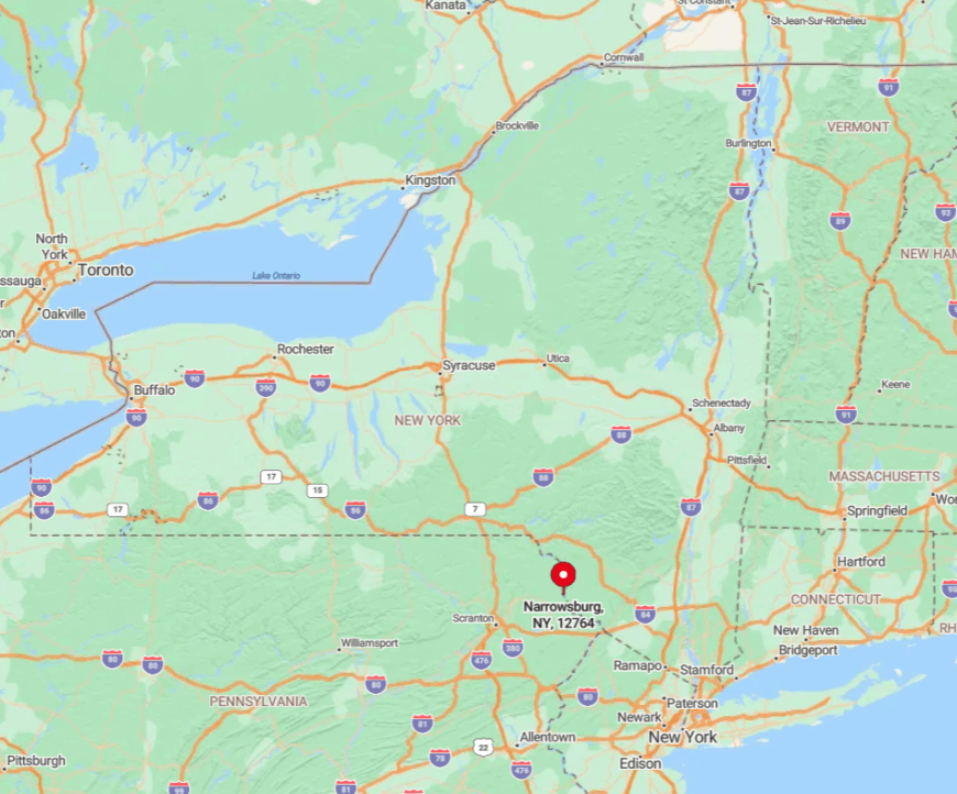
Narrowsburg sits halfway between Port Jervis and Hancock along Route 97’s scenic byway. Hemmed in by the river on one side and wooded hills on the other, expansion is physically challenging.
The nearest four-lane road lies more than twenty miles east, and train service ended decades ago. Most visitors follow winding Route 17B or Route 52, arriving to find parking easier to secure than a cell signal.
7. Wassaic, Dutchess County
Would you like to save this?
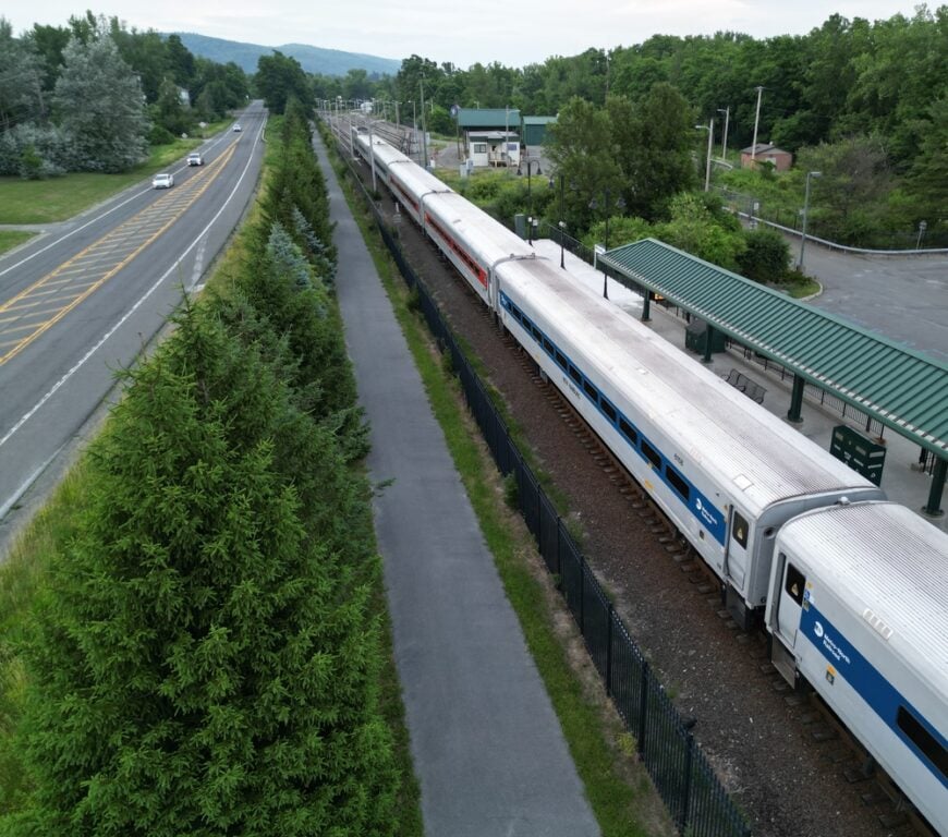
Wassaic’s population hovers near 600, yet art festivals, farm markets, and a quirky sculpture garden lend the village surprising cultural punch. Residents kayak the Tenmile River, bike rural loops through the Harlem Valley, and attend seasonal events at the reclaimed Wassaic Project mill complex.
Agriculture and home-based crafts dominate the local economy, although a few commuters head south via the nearby Metro-North terminus. Rolling farmland and forested ridges wrap the hamlet, while a decommissioned rail spur and large-lot zoning discourage subdivision.
Streetlights remain sparse, preserving clear night skies prized by amateur astronomers. All of this creates a pocket of calm only long-time locals seem to know exists.
Where is Wassaic?
The village lies in southeastern Dutchess County, three miles north of the Connecticut border and twenty miles from Poughkeepsie. Low ridgelines and preserved farms block direct east-west routes, so drivers rely on Route 22 before ducking onto Deep Hollow Road.
The Metro-North Harlem Line ends here, but service is infrequent and stations are unmanned, keeping foot traffic light. Anyone roaming farther must navigate unmarked backroads, which naturally limits accidental discoveries.
6. Arden, Orange County
Fewer than 200 residents live behind the stone gates of Arden, once the private playground of railroad titan E.H. Harriman. Today, neighbors share miles of mossy carriage paths, secluded trout streams, and the ruins of the original Gilded Age estate.
Income comes mainly from remote work, forestry contracts in adjoining Sterling Forest, and a sprinkling of small-scale agriculture. Homes sit on multi-acre parcels thick with hemlock and white pine, so you can’t see the next porch light through the trees.
Public access is limited to a single entrance flanked by historic gatehouses, deterring sightseers. These ingredients make Arden feel like a time capsule hidden in plain sight.
Where is Arden?
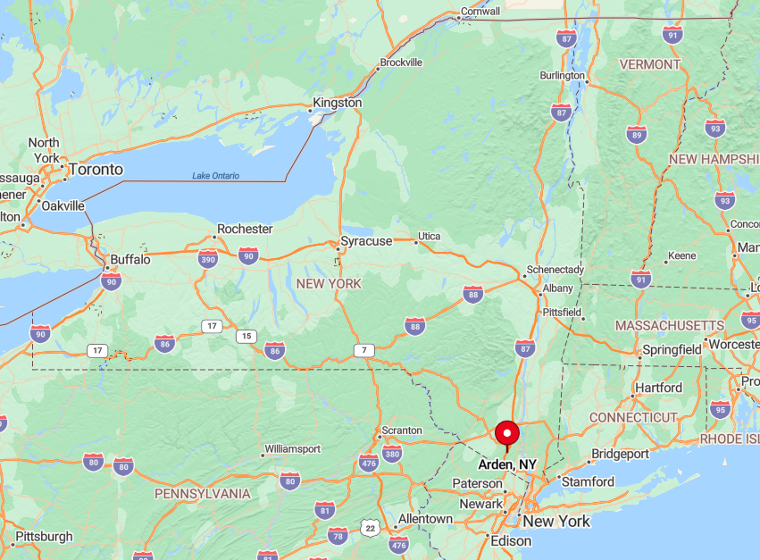
The hamlet lies within Sterling Forest State Park in southern Orange County, eight miles west of the New York Thruway at Harriman. Ringed by parkland on three sides and the Ramapo Mountains on the fourth, it enjoys a natural wall against expansion.
Only Arden House Road threads the hills, and winter weather often renders it slick enough to discourage casual travel. Rail options ended in the 1930s, so the last ascent is always by car, reinforcing its tucked-away appeal.
5. Pine Hill, Ulster County
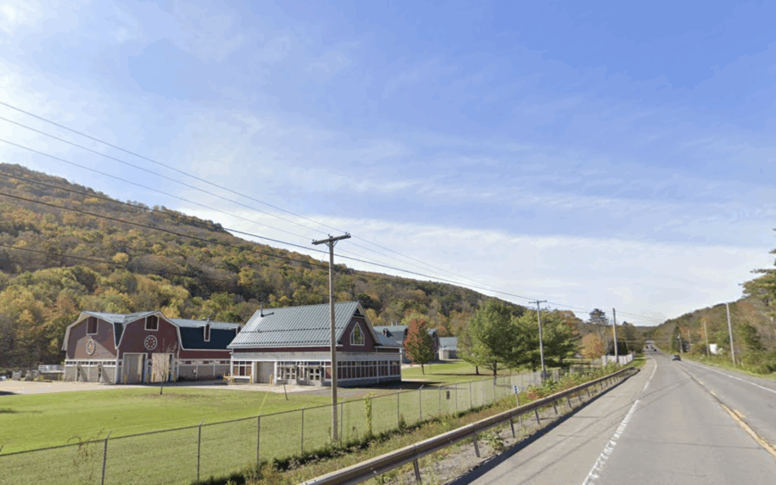
Pine Hill’s 275 year-round residents share their post-Victorian streets with more spruce trees than streetlights. Locals fish spring-fed Pine Hill Lake, ski Belleayre Mountain five minutes up Route 28, and cool off at the historic Morton Memorial Library’s summertime concerts.
Tourism tied to skiing and hiking supports several inns, while a small school district and municipal water plant round out employment. Towering Catskill peaks and state-owned wilderness border three sides of town, freezing development lines in place.
Even Route 28, the main artery, bypasses the tiny downtown by half a mile, keeping engine noise faint. The resulting hush feels especially pronounced once the first snowfall deadens any remaining hum.
Where is Pine Hill?
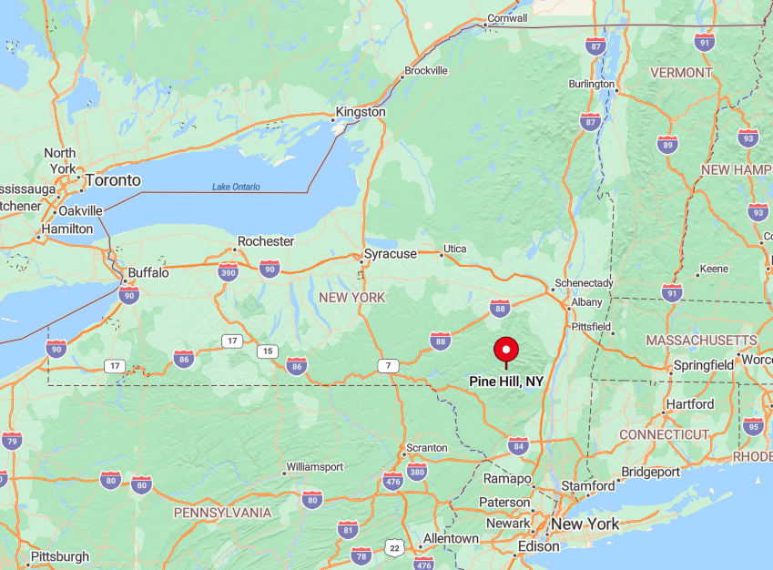
The hamlet sits in the central Catskills, thirty miles west of Kingston on NY Route 28. Flanked by Belleayre Ridge and Mill Brook Ridge, it occupies the narrowest part of the Esopus Creek valley, leaving little flat land for sprawl.
Ulster County Area Transit buses reach Pine Hill twice daily, and that limited schedule alone curbs day visitation. Drivers coming from the Hudson River must tackle an hour of winding mountain road, ensuring the setting stays peaceful even on holiday weekends.
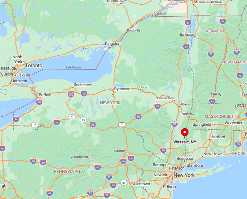
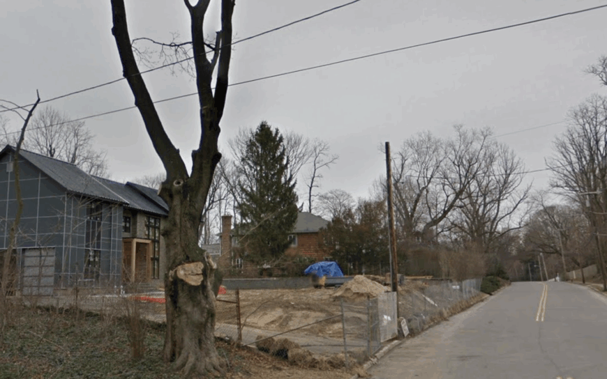
4. Amenia Union, Dutchess County
Amenia Union counts scarcely 150 residents scattered among horse pastures, cornfields, and stone-walled lanes. Weekend antiquing, trail riding on the Oblong Valley Trail, and road cycling along Route 343 occupy most leisure hours.
The local economy rests on equestrian services, family farms, and a historic inn dating to 1740. Ridgelines form a gentle horseshoe around the hamlet, and minimum one-acre zoning keeps house numbers low.
Without a post office or neon sign in sight, the crossroads slips easily past casual travelers. That absence of glare makes firefly shows in June a nightly treat few outsiders witness.
Where is Amenia Union?
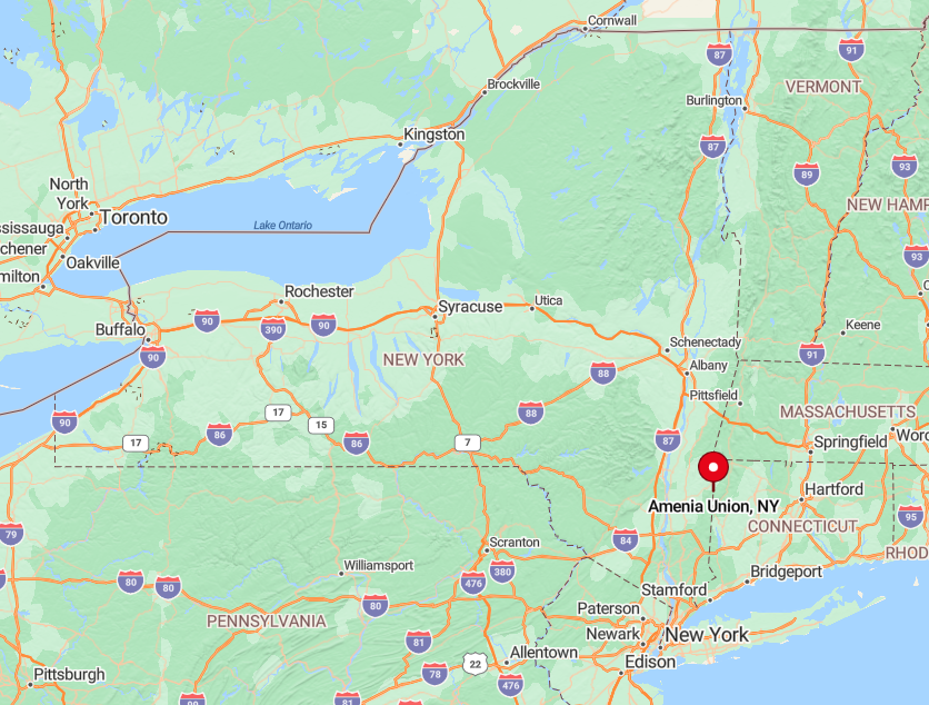
The hamlet straddles the New York–Connecticut line, eighteen miles northeast of Poughkeepsie. Only two paved roads—NY 343 and Quarry Hill Road—lead in, and both twist through farmland that naturally dampens speed.
The nearest train stop is ten minutes away in Wassaic; from there, visitors must drive or bike, thinning the crowd. Farm conservation easements on surrounding acreage further guarantee open views for decades to come.
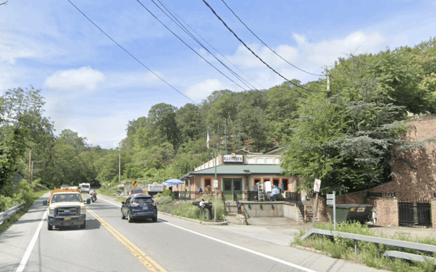
3. Lattintown, Ulster County
Lattintown’s population sits just under 750, yet its landscape of orchards, three-board fences, and red barns feels far less occupied. Residents pick apples at family-run farms, hike little-known Marlboro Mountain ridges, and gather for Friday night bluegrass at the old Grange hall.
Agriculture dominates the economy, supported by seasonal pick-your-own traffic and a handful of home businesses. The hamlet strings along a single two-lane road with no gas station, grocery, or civic center, making unplanned stops unlikely.
Surrounding hills block cell towers, reinforcing the unplugged atmosphere. Sunset glow on the Shawangunk range regularly outshines any man-made light nearby.
Where is Lattintown?
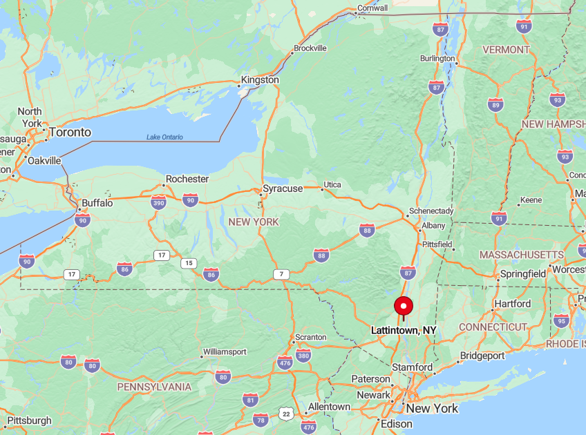
Found eight miles west of the Hudson River and south of the hamlet of Marlboro, Lattintown hugs County Route 11 for roughly three miles. The Marlboro Mountains shield it from the busy river corridor, and orchard belts absorb roadside noise.
State Route 32 lies six miles east, but no direct connector exists, so through-drivers seldom appear. Reaching town requires a deliberate turn, rewarding those who seek orchards heavy with fruit and roadsides lined with sugar maples.
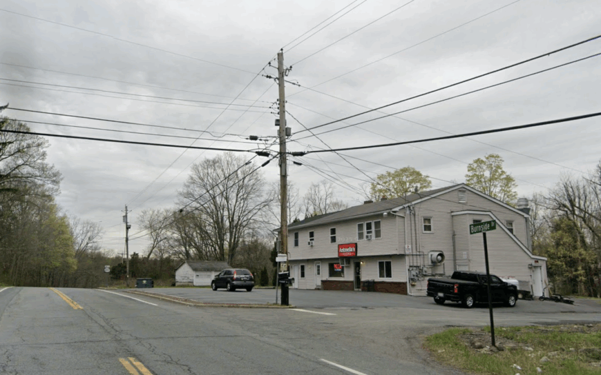
2. Continental Village, Putnam County
Approximately 1,400 people share Continental Village’s wooded hills, yet lakefront cottages remain screened by towering oaks and white pines. Swimming from private docks on Cortlandt Lake, paddling into hidden coves, and hiking the Appalachian Trail two miles west define free time.
Employment centers on home-based businesses, nearby West Point civilian jobs, and caretaking for vacation homes. The community sits on one-acre parcels threaded by steep roads that discourage pass-through traffic.
With no commercial core and minimal street lighting, evenings echo with barred-owl calls instead of delivery-truck brakes. Even longtime Hudson Valley explorers often miss the discreet sign on Old Albany Post Road that marks the entrance.
Where is Continental Village?
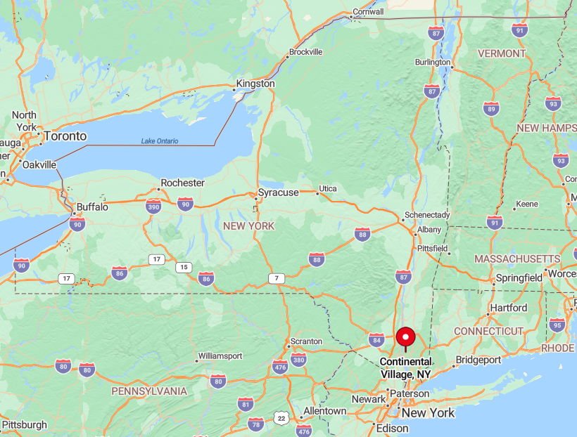
The hamlet lies ten miles north of Peekskill and two miles east of the Hudson River, sheltered by Anthony’s Nose and Canada Hill. Route 9 skirts downhill along the river, leaving Continental Village perched above on winding lanes.
Commuter trains serve Peekskill, but the final stretch requires a car climb that deters casual visits. Two reservoirs bracket the area, preventing any direct highway extension and preserving its lakeside hush.
1. Rock Tavern, Orange County
Rock Tavern’s roughly 1,300 residents enjoy maple-lined lanes, open hayfields, and the distant shimmer of two reservoirs that flank the hamlet. Fishing in Chadwick Lake, birding in Stewart State Forest, and browsing weekend farm stands fill the local calendar.
Economic life revolves around small-scale agriculture, remote employment, and artisan workshops housed in century-old barns. Housing density falls well below 100 units per square mile, and deep setbacks place porches far from the quiet road.
The absence of sidewalks, streetlights, and any corporate signage heightens the sense of separation. Come nightfall, only moonlight gleams off the tin roofs, underscoring why this pocket of Orange County tops our list.
Where is Rock Tavern?
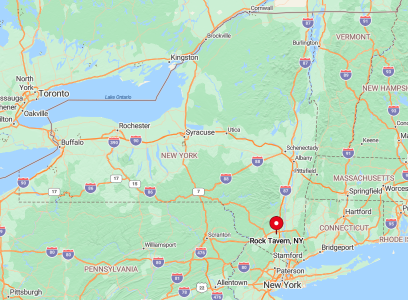
Situated between Washington Lake and Orange Lake, Rock Tavern sits five miles northwest of Newburgh yet feels far deeper in the countryside. State Forest acreage pushes development eastward, while two reservoirs and rolling terrain pen expansion from other directions.
Drivers exit the New York Thruway at Route 17K, then follow Union Avenue as it narrows and curves past stone walls—an approach that naturally slows traffic.
With the nearest bus stop over four miles away and no rail service, only purposeful travelers reach these maple-shaded barns, keeping life here as quiet as the water lapping at the reservoir shore.