🔥 Would you like to save this?
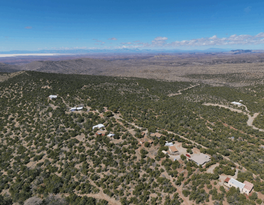
Southeastern New Mexico is a study in contrasts: sprawling gypsum plains give way to pine-shaded hollows, and wide-open desert transitions into narrow canyon corridors. Scattered throughout this varied terrain are communities so small or remote that they rarely make a guidebook.
In these settlements there are no franchised diners—just a single general store or feed supply that may open only a few days a week. Residents track their routines by well pumps and seasonal monsoons rather than traffic counts or Yelp ratings.
In order to come up with the very specific design ideas, we create most designs with the assistance of state-of-the-art AI interior design software.
The draw here isn’t romanticized solitude but the authenticity of local rhythms: ranch fences repaired at first light, water tanks checked midday, and church potlucks that double as town hall meetings. When the cell signal fades, landmarks become your compass—cottonwood groves along dry washes, red-rock outcrops at the horizon’s edge, and switchbacks that climb into dense forest.
Ahead, you’ll find profiles of 25 off-grid communities, each with a snapshot of daily life, the key routes in and out, and practical map references. Consider this your field guide to the under-the-radar towns that give Southeastern New Mexico its distinctive character.
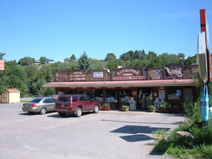
25. Tinnie
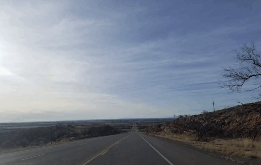
Tinnie sits at about 5,171 feet on the high desert plain—an unincorporated speck where a lone post office, a general store, and a scattering of homes stand against endless sky. Founded in the 1890s and carrying the ZIP code 88351, it’s less a town than a waypoint: a place you stop because you need gas, cold drinks, or a moment’s pause in the hush of Lincoln County.
Life here moves to a deliberate, unhurried rhythm. Ranch trucks roll in at dawn, mail arrives once a day, and conversations at the store’s countertop drift from weather to cattle brands to the week’s lone church service. No neon lights puncture the nights—only meteor showers and distant city glow on the horizon, reminding you just how far from bustle you really are.
Despite its tiny footprint, Tinnie has roots deep in the desert’s memory. It began as Las Cuevas, morphed through names like Cuba and Analla, then settled on Tinnie when the railroad reached the plains. Today, the same rough-hewn barns and wind-scoured corrals stand guard over a landscape unchanged by time, where solitude isn’t an absence but a presence you feel in every breeze.
Where is Tinnie?
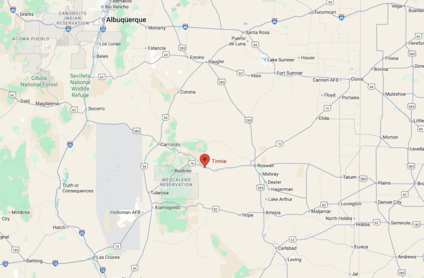
You’ll find Tinnie on U.S. Route 70, about 22 miles east of Ruidoso Downs—hammered out along highway signs but framed more by cottonwoods than by billboards.
For a closer landmark, head four miles east of Hondo: the drive is a straight, sun-bleached ribbon past scrub and mesquite. No turnoffs or gas stations distract you—just the steady desert road leading to a community that exists simply because it’s meant to, not because anyone built it into something else.
24. La Cueva
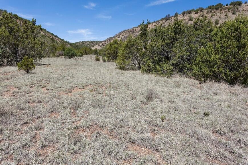
La Cueva is folded gently into a green hollow of Lincoln County, where pine trees lean over old adobe homes and canals carry mountain snowmelt past apple orchards. It’s not on the way to anywhere in particular, which is partly why it’s stayed so quietly itself. A narrow road leads you there, and once you arrive, you’ll find no businesses but a fruit stand in season, no sounds but birds and water gates ticking in the morning.
The landscape is dotted with heritage ranches, small family farms, and trails that slip into hidden ravines. Visitors might wander into the hills, photograph aging barns, or simply sit beneath the orchard trees. A few folks live off the land; others just stay because this is where they feel rooted. It’s the kind of place where the world feels slower—in the best way.
Where is La Cueva?
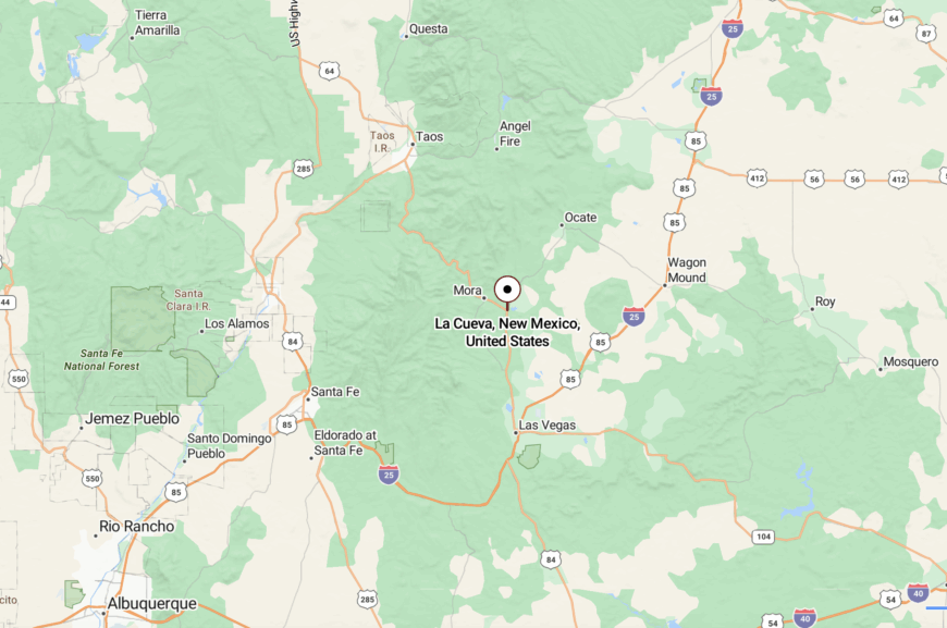
La Cueva is nestled in northern Lincoln County, about 20 miles northwest of Capitan, just off the winding NM 246. The drive curves through meadows and scattered forest, eventually narrowing into a quiet lane with almost no signage. There are no stoplights or gas stations along the way—only the hush of hills and the sound of running water. It’s a place you find not by chance, but because you were meant to arrive slowly.
23. Cerro Blanco
Cerro Blanco feels like it belongs to the sky as much as the earth—a scatter of adobe dwellings set atop a quiet mesa in northern Chaves County. Sparse and sunlit, the settlement sits far from any main road, bordered by silent stretches of juniper, dry gullies, and pale boulders. There are no crowds here, no shops, just the scent of sage on the breeze and the rhythm of days shaped by sun and dust.
Locals spend mornings tending goats, working clay, or walking to springs tucked into canyon clefts. It’s a place that draws those who value solitude and starry nights, where the loudest sound might be an owl passing overhead. Visitors sometimes hike in from the Pecos foothills to find petroglyphs or trace old sheep trails. Life moves gently here, without announcements. It’s the kind of place that settles in your breath and stays there.
Where is Cerro Blanco?
Cerro Blanco lies in northern Chaves County in southeast New Mexico, about 35 miles northeast of Roswell. It’s reached via NM 3 and a web of unnamed dirt roads that slowly climb onto a gravelly mesa. The final stretch winds through quiet pastureland and scattered rock shelves before opening to big sky and deep silence. You’ll know you’re close when your phone goes quiet and the horizon seems to widen with every turn.
22. San Miguel Crossing
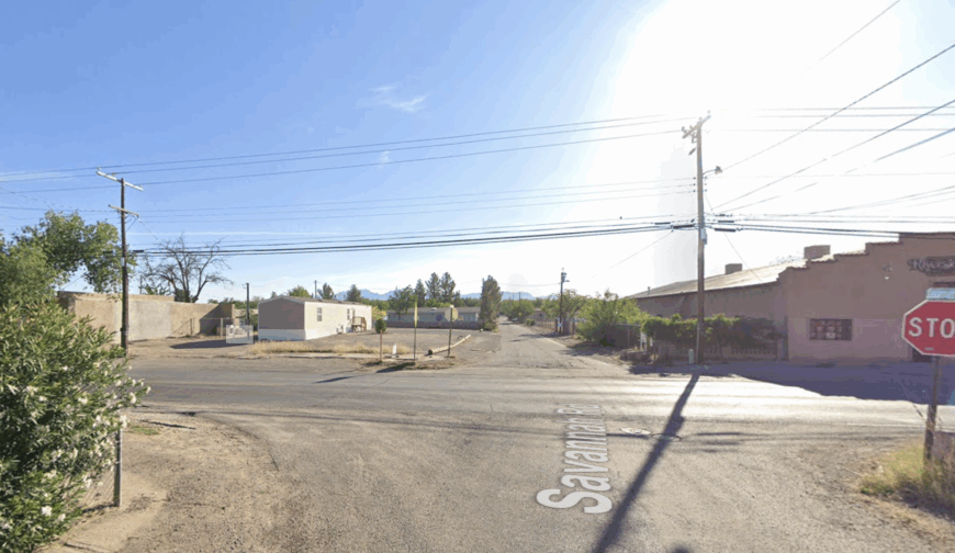
San Miguel Crossing feels like a place held together by memory and moonlight. Tucked along an old trading route where a dry arroyo cuts through scrubby land, it’s more a gathering of stories than structures. A weathered chapel marks the heart of the community, with hand-stacked stone walls and benches worn smooth by time. There’s no commerce here—just a few goat herders, weavers, and sunset painters who choose the silence on purpose.
In spring, wildflowers bloom across the flats, and once a year, locals host a plein-air painting evening under lanterns strung between fence posts. Trails from the crossing fan out toward hidden canyons and petroglyph beds, but most of the beauty is in the stillness itself. The town hums with something soft and unseen. It’s the kind of place that lingers like a dream you half-remember.
Where is San Miguel Crossing?
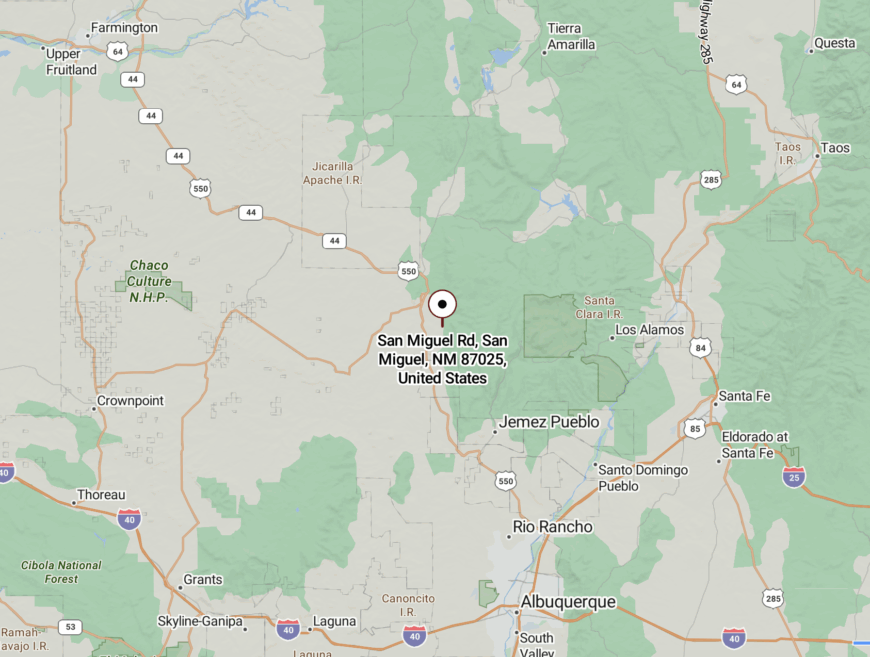
You’ll find San Miguel Crossing in southeastern Lea County, around 30 miles west of Hobbs, veering off NM 128 onto a rough gravel track that bends with the arroyo’s flow. There are no signs, just the slow rise of limestone benches and a sky that seems to press gently downward. The road dips and narrows as the land folds in around you. By the time you arrive, the noise of the world has long since fallen away.
21. Arroyo Verde
Arroyo Verde is a whisper of green in the middle of the desert—an unassuming ribbon of life that follows a seasonal creek south of Hobbs. The town consists of a handful of homesteads nestled beside seep springs, shaded by mesquite and tamarisk that rustle gently in the wind. The sound of birdsong and the hush of moving water replace the clamor of traffic.
Gardens thrive in the sandy loam, and locals gather beneath cottonwoods for storytelling or small folk music nights when the moon is high. There’s no post office, no café—just the rhythm of a place shaped by water and patience. A few residents fish or tend chickens; others simply let the quiet settle into their bones. It’s the kind of place where time pools like shade under a tree.
Where is Arroyo Verde?
Arroyo Verde lies in south-central Lea County, about 25 miles south of Hobbs, accessed via a gravel ranch road branching off NM 18. As you drive, the landscape shifts subtly—brush thickets grow thicker, the air cools, and the dust turns darker with moisture. The road follows the soft bends of the arroyo until the desert gives way to a shaded corridor. You don’t arrive all at once—it feels like you’re let in slowly.
20. Silver Springs Hollow
Silver Springs Hollow feels carved out of a dream—a lush fold of land where springwater still seeps from limestone clefts and cottonwoods shimmer under bright desert sun. It’s a place of stillness and glinting light, where old ranchhouses crouch near pools that have refreshed travelers for centuries.
There’s no central square, no business strip—just footpaths, low bridges, and the gentle hiss of wind in the reeds. Residents tend small gardens or care for horses, their routines tuned to the cycles of rain and runoff. The springs bring life to the land and a hush that feels deeply ancient. You won’t find events or attractions here—only the hush of time held gently. It’s the kind of quiet you remember long after you’ve gone.
Where is Silver Springs Hollow?
Tucked into the limestone hills of northwest Chaves County, Silver Springs Hollow lies about 50 miles north of Roswell, accessible by NM 220 and a narrow, tree-lined hollow road. As the road rises and curves, the landscape tightens, drawing you into shaded glens and soft valleys. GPS can struggle near the springs, and you’ll pass more deer than houses. Arriving feels like discovering a forgotten oasis.
19. Bitter Creek Crossing
🔥 Would you like to save this?
Bitter Creek Crossing lies at the point where land thins and water once wandered—where the desert brushes up against a creek bed that runs only when the clouds allow. A few scattered cabins and an aging ranger station stand as quiet witnesses to time and weather. There’s a kind of poetry here: in the call of quail, the flicker of a distant storm, the moment dusk slides across a flat-topped mesa.
Locals live in sync with the rhythms of the land, practicing dryland farming or raising stock under wide, watchful skies. A single track leads visitors to the edge of this nearly forgotten place, where signs of life are gentle and few. At night, wind whips across the wash, and stars hang low. It’s the kind of place that reminds you to look up more often.
Where is Bitter Creek Crossing?
Bitter Creek Crossing sits in northeastern Lea County, around 40 miles west of Hobbs. To get there, you follow NM 128 until it dissolves into a dirt path that hugs a dry arroyo. The land funnels you through low ridges and sharp bends until you reach a quiet clearing. There’s no fanfare—just a stillness that seems to welcome only those willing to listen.
18. Dry Canyon Haven
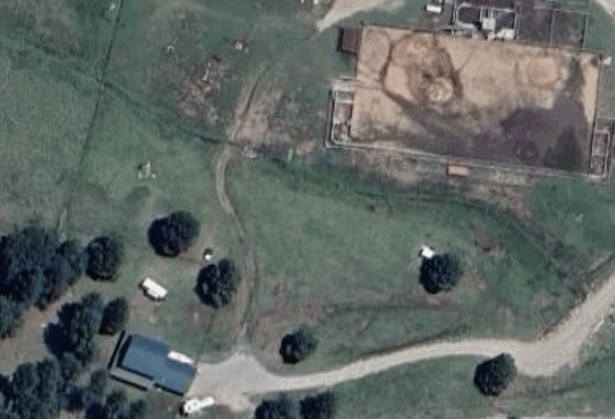
Dry Canyon Haven is a shelter in stone and silence—a ribbon of adobe homes stitched along a canyon floor that only sees water in spring. The canyon walls rise steep and golden, shadowing gardens that bloom briefly before the heat returns. There are no paved streets or stoplights here—just foot trails, the call of canyon wrens, and the rustle of tamarisk in the breeze.
Locals grow herbs, raise hens, and watch the stars from stone terraces that overlook dry pools. Visitors might wander into the folds of the canyon or sit with a thermos beside a whispering seep. There’s a kind of magic in the way the light falls. It’s the kind of place where your breath slows without you noticing.
Where is Dry Canyon Haven?
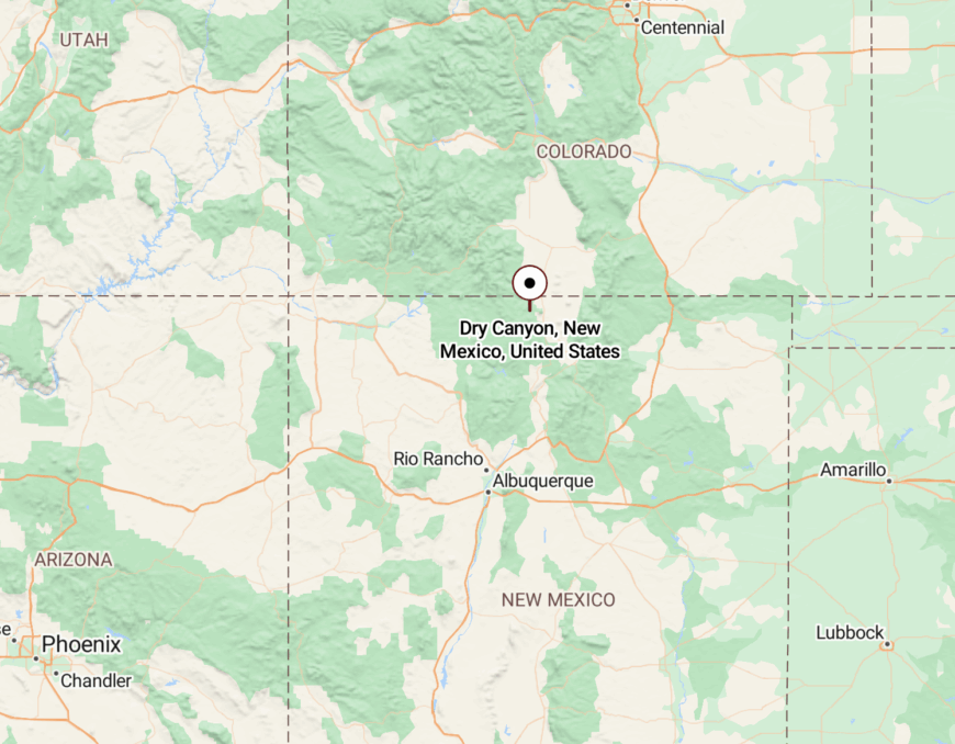
Dry Canyon Haven is located in southeast Chaves County, roughly 30 miles northeast of Roswell. It’s reached via NM 8 and a narrow canyon road that tracks alongside a seasonal creek bed. The way in is steep and winding, often marked more by trees than signage. As the road drops into the canyon, the rest of the world slips softly away.
17. Sunspot
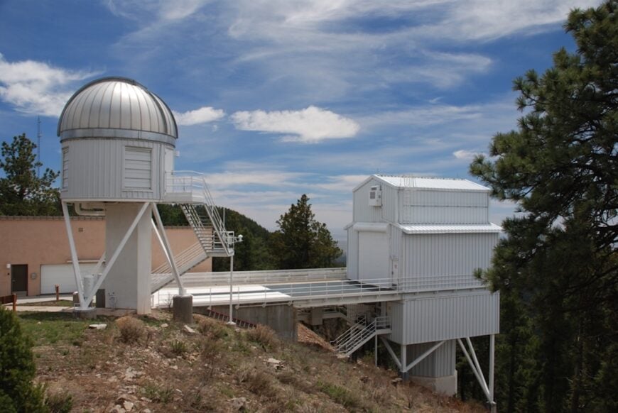
Sunspot feels less like a town and more like a scientific outpost perched at the edge of the sky. A handful of observatory domes and weathered cabins hug the northeast flank of Sacramento Peak, all wrapped in dense Ponderosa pines. At 9,200 feet, the only electric glow at night comes from the cooling fans and the stars themselves, making the silence so complete you can almost hear your own heartbeat.
Life here moves to the sun’s schedule: mornings wake with telescope shutters sliding open, afternoons bring sudden summer storms drumming on metal roofs, and winters can strand you under blankets of snow. There are no shops, no gas pumps, and cell service vanishes well below the treetops—everything you need must be hauled up the narrow mountain road, and everything you leave behind stays behind. Scientists and a small band of year-round residents share this rarefied retreat, where the horizon curves under heaven’s vast dome.
Sunspot isn’t built for convenience; it exists to remind you how small you are in the universe. Between data-collection windows, residents might step onto pine-needle-carpeted ground to gaze at the Milky Way spilling overhead or listen as wind undulates through the branches. It’s a place of deliberate rawness, where solitude is both purpose and reward.
Where is Sunspot?
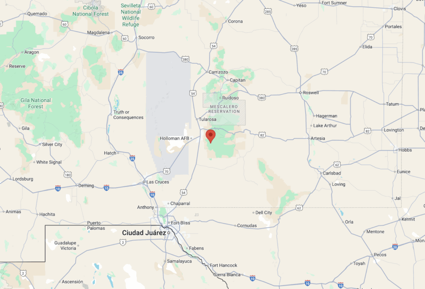
Sunspot sits on the northeast side of Sacramento Peak within Lincoln National Forest, roughly 20 miles southeast of Cloudcroft. The community occupies the summit ridge at about 9,200 feet, where the mountain falls away in all directions under big-sky panoramas.
You reach it via the Sunspot Highway (Forest Road 144/NM 656), a single, narrow ribbon of pavement that climbs steeply through pine forest before giving way to gravel. By the time you leave pavement behind, you’re well above 9,000 feet—and the world below has already slipped from view.
16. Monument
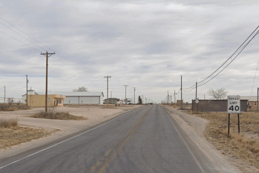
Monument is a speck on the saltbush prairie, where long shadows stretch from solitary mailboxes and wind gusts hum across caliche fields. About 200 residents call it home, their houses far apart and their lives shaped by sky and soil. There are no trees, no hills, just the open breath of the high plains and the occasional thunderstorm rumbling in from the horizon.
The town leans into agriculture and modest oil production, though most commerce flows from Hobbs, twenty miles east. Visitors come for the quiet—or for the prairie dawns that seem to unfold in slow motion. After dark, creosote scents ride the wind. It’s the kind of place where the silence feels earned.
Where is Monument?
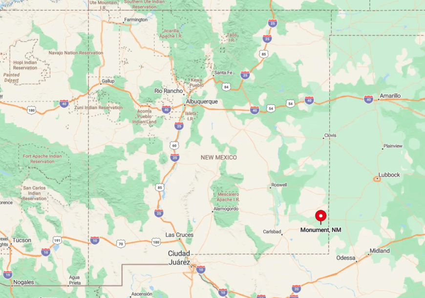
Monument lies at the junction of US 62/180 and NM 8 in Lea County, but the crossing offers little more than a café and post office. From Hobbs or Carlsbad, the drive is flat and meditative, with few landmarks beyond distant fence lines. With the gas pump closed since 2019, travelers plan their visits with care. It’s on the map—but only just.
15. Alto
Alto drapes itself along wooded hills just north of Ruidoso, a forested enclave of hidden homes, winding roads, and quiet trails. Ponderosa pines lean over rooftops, and rooftops are nearly impossible to spot. Tourism supports the area, with second homes, an arts theater, and nearby ski slopes, but even in peak season, the town retains its hush.
You’ll find concerts at the Spencer Theater, kayak trips on Alto Lake, and mountain bike paths threading through Gavilan Ridge. Yet despite these touches of leisure, Alto remains deeply shielded—protected by both forest and intention. Wild turkeys roam freely, and dark-sky ordinances keep the stars close. It’s the kind of place where people come to be part of the silence, not escape it.
Where is Alto?
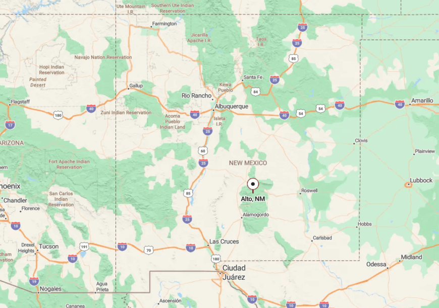
Alto is nestled in the Lincoln National Forest of Lincoln County, about 12 miles north of Ruidoso along NM 48. The road climbs quickly through piney curves, each switchback drawing you further from the bustle of Highway 70. Many arrive via Ski Run Road, which rises above 9,000 feet before descending gently into town. Snow lingers on the shoulders through March—and so does the stillness.
14. Loco Hills
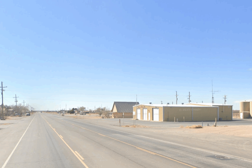
Loco Hills is a windblown outpost along the edge of the Permian Basin—where pump jacks sway like metronomes and pronghorn dart through fence gaps. Fewer than 150 people live here, their homes and trailers spread loosely across a sun-drenched grid. Oil extraction fuels what little economy exists, but most days pass quietly beneath a sky so big it hums.
Fossil hunters and nature watchers sometimes stop en route to Bitter Lake or the old reef beds, but few linger. The sand moves constantly, shifting across driveways and walkways, softening everything into a desert blur. At night, the rigs fall silent and the stars come on strong. It’s the kind of place you remember by how it sounds when it stops.
Where is Loco Hills?
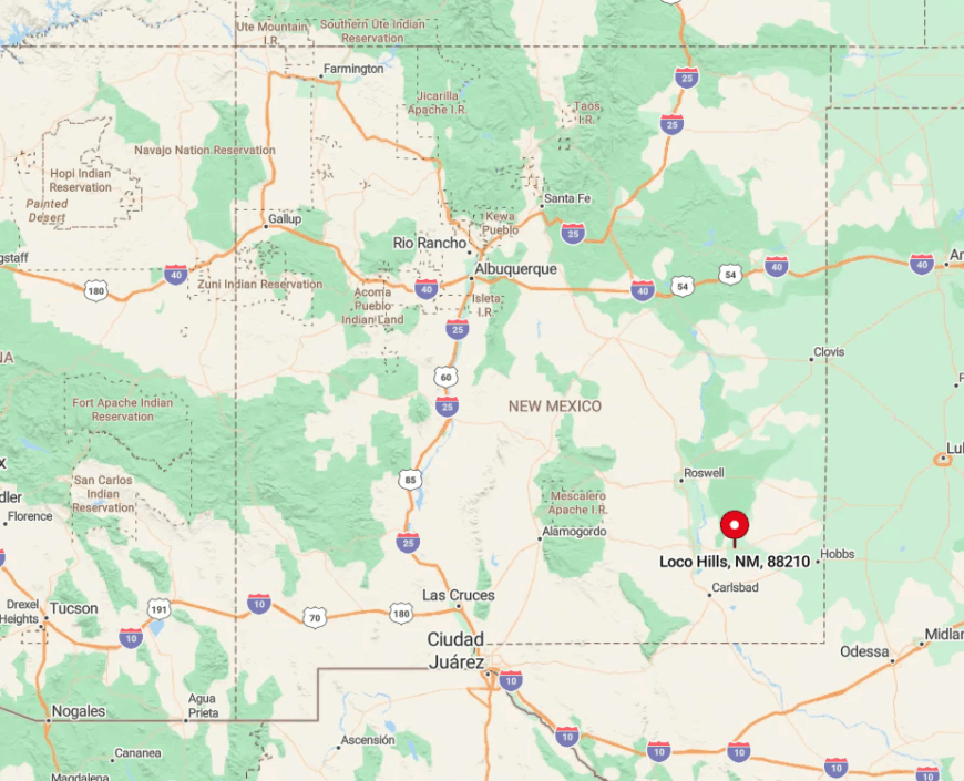
Located along US 82 in Eddy County, Loco Hills sits between Artesia and the Texas border. Though technically on a highway, the flat terrain and total absence of landmarks make travel feel surreal. Most people fuel up in Artesia before heading east into the sands. With no public transport and patchy cell signal, it’s a town you reach on purpose.
13. Arabela
🔥 Would you like to save this?
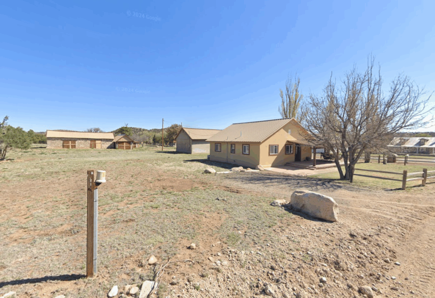
Arabela is a ridge-tucked hamlet where piñon pines cloak the hills and silence clings to the air like woodsmoke. With only about 60 residents, the town drifts between gold-panning legends and the lingering scent of juniper. Its remoteness is shaped not just by distance, but by terrain—steep switchbacks, no cell reception, and a sense of time slowed to the pace of horses.
Locals still ranch cattle, stack firewood for long winters, and ride trails once cut by prospectors toward Nogal Peak. A few vacation rentals now dot the edges, welcoming solitude-seekers and stargazers. Even in summer, the breeze carries cool mountain air and the tap of acorn woodpeckers in the trees. Arabela isn’t hidden out of fear—it’s hidden because it prefers to be.
Where is Arabela?
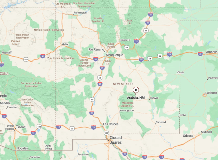
In western Lincoln County, Arabela lies at the end of County Road C001, winding beyond the Lincoln Historic Site and out of easy reach. Drivers come off US 380, then follow a single-lane blacktop that narrows with every bend. Sharp grades and snow-prone passes keep the route quiet and the visitors few. When you get there, it feels like the land is exhaling.
12. Knowles
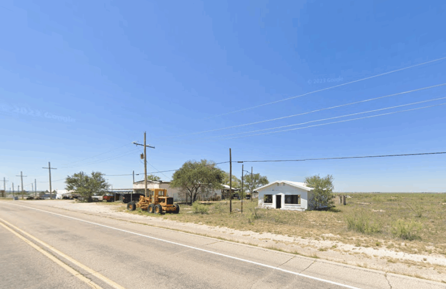
Knowles exists on the edge of perception—just a few homes, a water tower, and sky enough for a dozen towns. About 80 residents live among the mesquite scrub and red dirt, with two-acre lots and no central square. It’s a place built for horse pens and 4-H projects, not tourists or passersby.
Oilfields and ranchland form the backbone of life here, though the closest store is in Hobbs, a good 15 miles away. With no café, no signage, and no service stations, even the essentials require a plan. On clear nights, the stars sharpen over the flats, and dust devils sketch brief spirals along the roads. Knowles doesn’t announce itself—it waits for those who already know the way.
Where is Knowles?
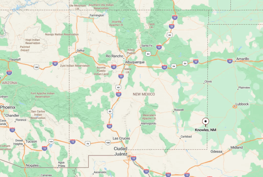
Found 15 miles northwest of Hobbs in Lea County, Knowles sits off State Road 132, followed by a westward turn onto an unmarked caliche track. Mesquite brush conceals the town until the water tower rises like a sentinel. Most people only find it with a GPS ping or local tip. Side roads can turn slick during storms, so good weather and patience are your best companions.
11. Milnesand
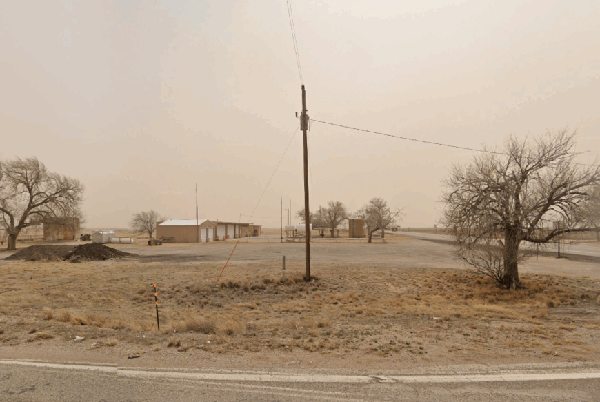
Milnesand is a quiet scatter of homes across the vast Llano Estacado, where short-grass prairie stretches to every horizon. Around 100 people live here, mostly farmers and ranchers tending sorghum and cattle beneath open skies. Once a year in March, birders descend at dawn to witness the prairie-chickens’ rare and mesmerizing dance on ancient leks.
The rest of the year, it’s a place of windmills, grain elevators, and quiet porches facing sunsets. Cell service is spotty, and the nearest stoplight is 20 miles away in Portales. But at night, the Milky Way blazes overhead, and the coyotes’ chorus rises like memory. Milnesand doesn’t need noise—it has space.
Where is Milnesand?
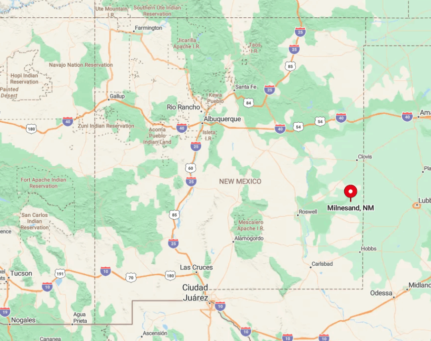
Set in southeastern Roosevelt County, Milnesand sits at the crossroads of NM 206 and NM 262, in a region defined by playa lakes and wide open range. You’ll likely approach from Clovis or Portales, both about 45 minutes away. The final miles stretch across grazing land where cattle wander unfenced, so headlights stay low and alert. It’s the kind of place you don’t notice until you’re already in the middle of it.
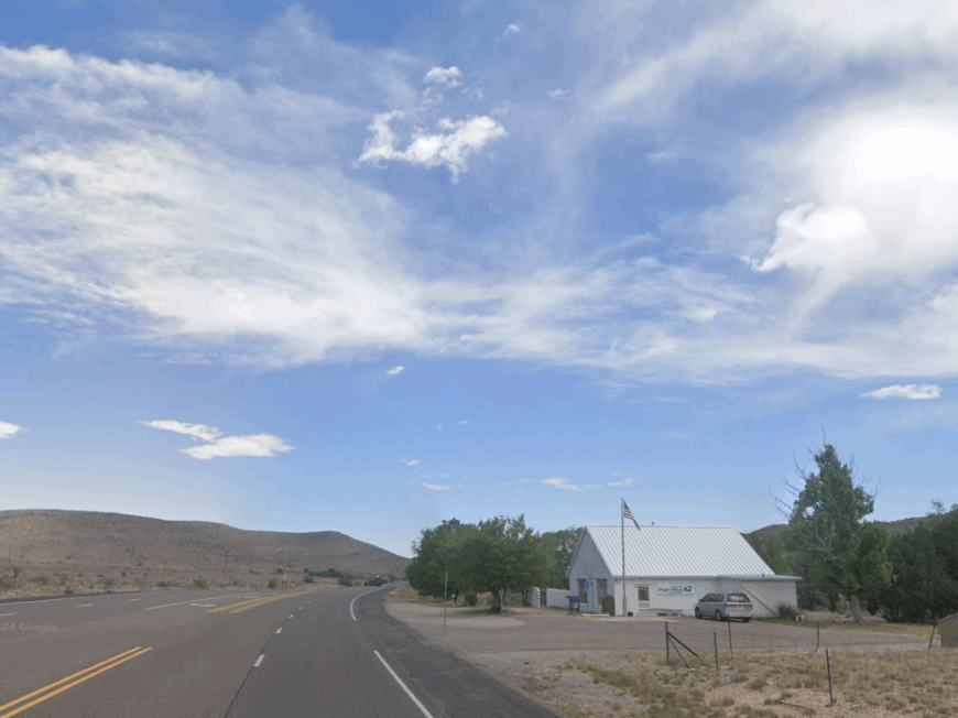
10. Dunken’s Remote Refuge
Dunken feels like the punctuation mark at the edge of the map—a few scattered buildings resting quietly between Roswell and the Guadalupe Mountains. Fewer than a dozen people live here full-time, their routines shaped by open range and long drives. There are no shops, no services, only the occasional hum of a passing truck and the sound of wind through old fence lines.
Ranching and agriculture persist, but slowly, gently, like the land itself. The draw is the space: miles of sky, room to breathe, and the kind of night where stars spill across the whole horizon. A walk through Dunken doesn’t reveal much—just the deep stillness of a place left to be itself. It’s solitude with sunlight on its back.
Where is Dunken?
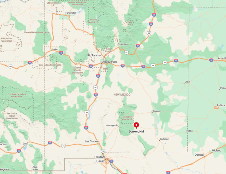
Dunken sits in western Chaves County, nestled between Roswell and the Guadalupe Mountains. Reaching it requires a drive along lesser-known county roads branching from US highways—quiet, scenic, and sparsely marked. No major route leads directly there, which is part of its quiet resistance to the modern world. You don’t pass through Dunken—you arrive because you meant to.
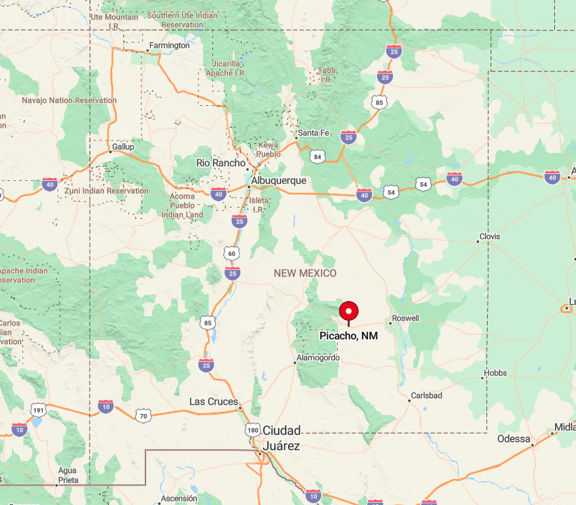
9. Picacho’s Desert Solitude
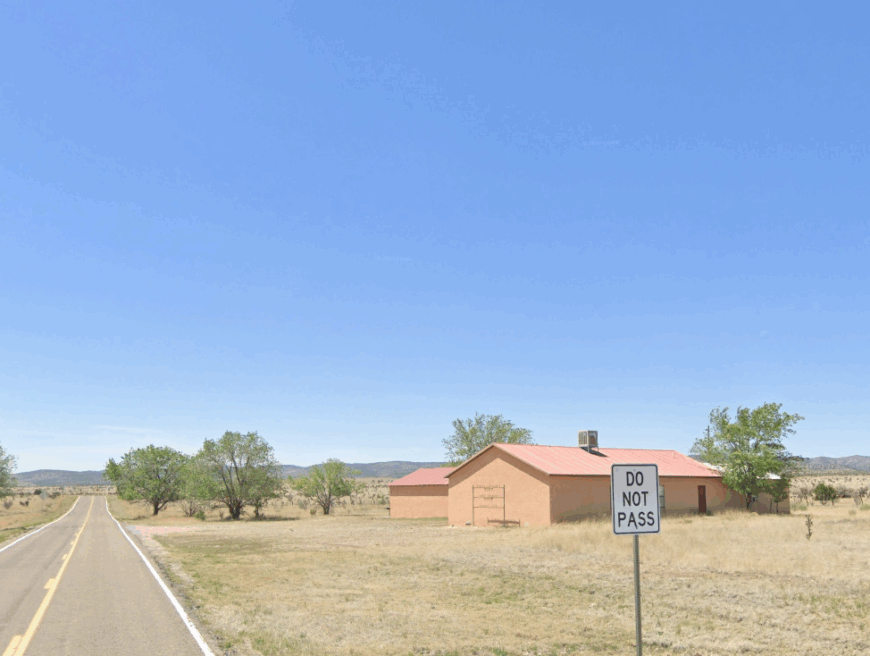
Picacho clings to the edge of nowhere—a soft-spoken farming community draped in desert tones and rimmed by mesas. A few homes and barns stretch across this Lincoln County landscape, where sunsets lay long streaks of gold across furrows and fenceposts.
Farming and ranching are the way of life here, with families cultivating the land as their grandparents did. Solitude is built in—there’s no downtown, no commerce hub, just the kind of quiet that seems to grow in the soil itself. Visitors come for the stillness or to explore the dry creek beds once scouted for gold. Out here, even time seems to pause and rest. Picacho is a place that doesn’t need to say much to be heard.
Where is Picacho?
🔥 Would you like to save this?
Located northwest of Roswell in Lincoln County, Picacho sits along U.S. Route 70, buffered by open fields and low ridgelines. The road in winds through the Tularosa Basin, offering a scenic drive that narrows your focus to the land. No big signs, no gas stations—just a name on a map and a slowness that takes hold as you arrive. The quiet roads invite you to linger longer than you planned.
8. Glencoe’s Rustic Serenity
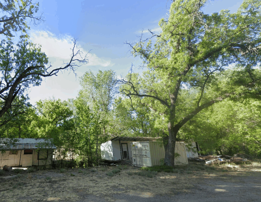
Glencoe rests gently along the Rio Ruidoso, a stretch of land where the river runs slow and the trees arch wide. Adobe homes and handmade fences dot the roadside, and most people here know each other by name and rhythm. The town doesn’t advertise—it reveals itself slowly, through roadside produce stands, old corrals, and the quiet hum of bees in summer.
A few artists live and work here, their crafts inspired by the soft light and ever-present river. Trails thread through cottonwoods, and the nearby hills offer a place to wander and think. Glencoe is rustic serenity, pure and simple. It’s not that the town is hidden—it just doesn’t need attention.
Where is Glencoe?
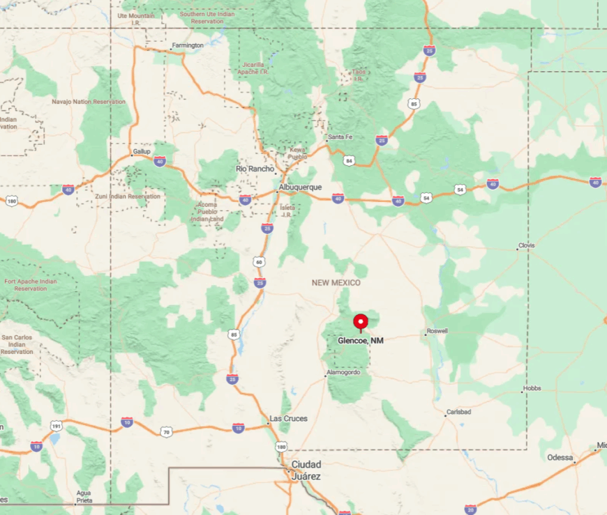
Glencoe lies just east of Ruidoso along Highway 70, tucked within Lincoln County’s forested folds. Though close to tourist towns, it feels a world apart, wrapped in trees and quiet. The Lincoln National Forest acts as a buffer, muffling sound and softening the sky. The road is easy—but the stillness, once you’re there, is harder to leave.
7. High Rolls Mountain Park’s Quiet Respite
High Rolls Mountain Park balances on the cool ridges of the Sacramento Mountains, where pine canopies soften the sun and waterfalls sing after summer rains. The town is small and scattered, with orchards that bloom pink in spring and festivals that smell of pie and woodsmoke.
Here, homes hide behind tree trunks, and the wind carries little more than birdsong and memory. Locals hike, garden, or sip coffee on porches overlooking deep ravines. You won’t find billboards or chain stores—just mountain rhythms and the hush of forest life. Its name might suggest a destination, but it feels more like a pause. It’s the kind of place where you step lightly, as if not to wake it.
Where is High Rolls Mountain Park?
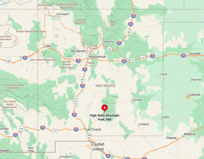
Set in Otero County along U.S. Route 82, High Rolls Mountain Park sits between Alamogordo and Cloudcroft. Elevation and winding roads keep it naturally tucked away, even though the highway is nearby. Drive slow—you’ll want to stop at every overlook anyway. The forest shields it, but the quiet is what holds you.
6. Timberon’s Forested Escape
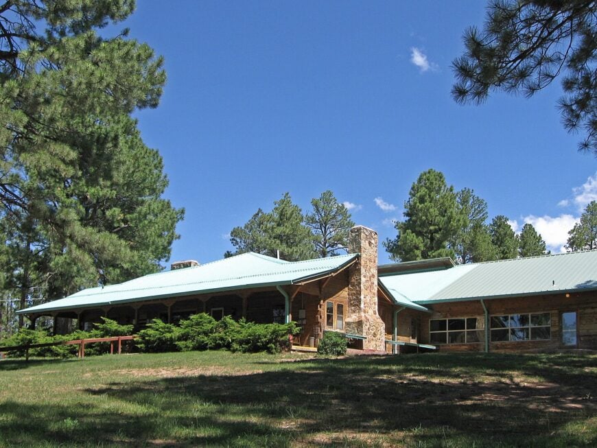
Timberon is a forested settlement stitched into the Lincoln National Forest like a well-kept secret. Homes peek from behind ponderosa pines, and even the streets feel hushed beneath the green canopy. Locals fish at the lake, golf at the edge of silence, or simply watch deer pass through their yards like they own the place.
A small airstrip brings the rare visitor, but most arrive by winding roads that climb and narrow. Tourism exists, but quietly—this is a place for stargazing and stories by the fire. The trees don’t just line the town—they hold it close. Timberon isn’t lost. It’s just where it wants to be.
Where is Timberon?
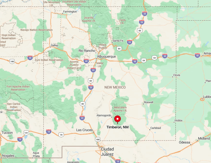
Timberon sits in southern Otero County, reached by a mountain road weaving south from Cloudcroft. The drive passes through dense forest and rises into thinner air and deeper quiet. No major roads lead through—it ends here. Which is just the point.
5. The Secluded Community of Sacramento
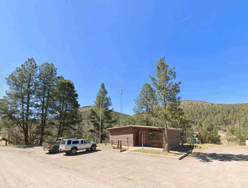
Sacramento is a high-mountain hamlet where silence feels etched into the very rock. The community is small, spread across wide lots beneath towering pines, with elk prints in the driveway and frost on the windows well into spring. Hikers pass through, but few stay—those who do, treasure the solitude.
There are no stores, no schoolhouses—just sky, forest, and the echo of footfalls on old logging trails. Ranching persists quietly in the background, but the loudest sound most days is the wind brushing through firs. The elevation clears your lungs—and your thoughts. It’s a place that doesn’t raise its voice to be heard.
Where is Sacramento?
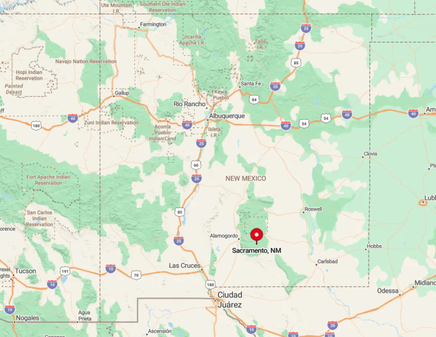
Sacramento rests along State Road 521 in Otero County, southeast of Cloudcroft. The road up is all switchbacks and forest-shadowed bends, with little to break the view but the trees. Visitors must navigate the climb with patience and snow tires in winter. At the top, the world feels both smaller and infinitely more open.
4. Queen: Oasis in the Desert
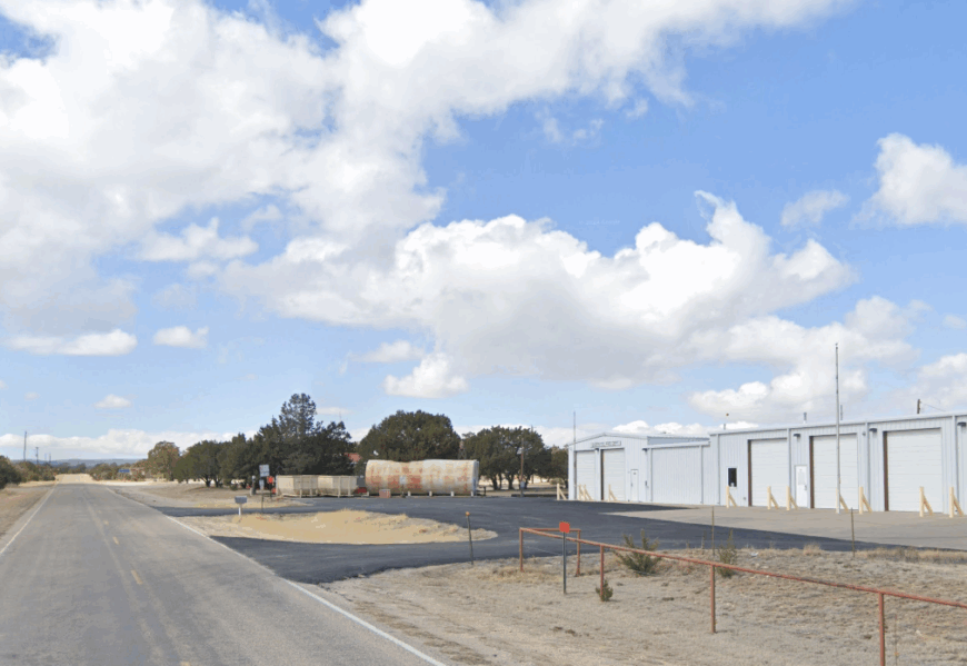
Queen is more terrain than town—a high desert fold in the Guadalupe Mountains where silence stretches in every direction. A few homes scatter across the ridges, their residents drawn by the drama of light and stone. There are no services, no gas stations, just cave entrances, high trails, and skies wide enough to swallow thought.
Wildlife watchers and geologists pass through, but only briefly. The absence of industry has preserved something primal here, something unbothered. Queen doesn’t have a welcome sign—it has wind. It’s the kind of quiet that stays with you.
Where is Queen?
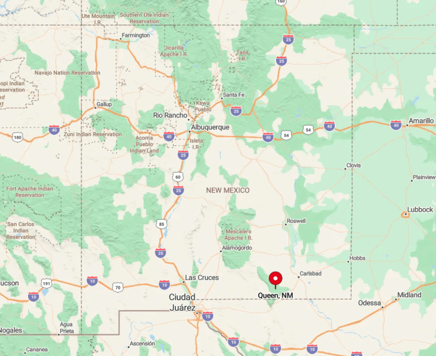
Queen lies in Eddy County, northwest of Carlsbad, reached via State Road 137 and a series of gravel roads that test both patience and suspension. The path in rises through rugged national forest terrain and feels like it shouldn’t lead anywhere. But it does—to a place entirely itself. You don’t get here fast. You get here fully.
3. The Peaceful Village of Weed
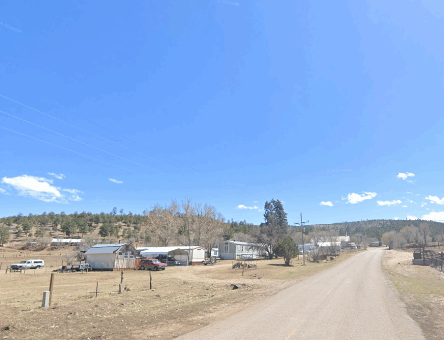
Weed is a dot in the Sacramento Mountains where life rolls at the speed of a pickup on gravel. The café opens when it wants to, the festivals are word-of-mouth, and the nearest grocery is a long curve away. Small-scale agriculture and ranching define daily life, with a bit of bluegrass and conversation thrown in.
Children grow up with mountain trails as playgrounds and elk as neighbors. Summer mornings are sweet with dew, and winters are sharp and silent. It’s a village held together by geography and grit. Weed doesn’t mind being overlooked.
Where is Weed?
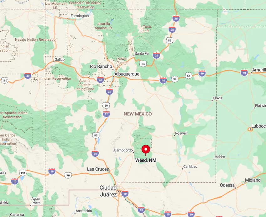
Set in Otero County, Weed is accessible via State Road 24, southeast of Cloudcroft. The road is long and winding, lined with national forest on every side. Snow and rain can turn travel slow, which suits the place just fine. You get there when you get there.
2. Mayhill: A Mountain Retreat
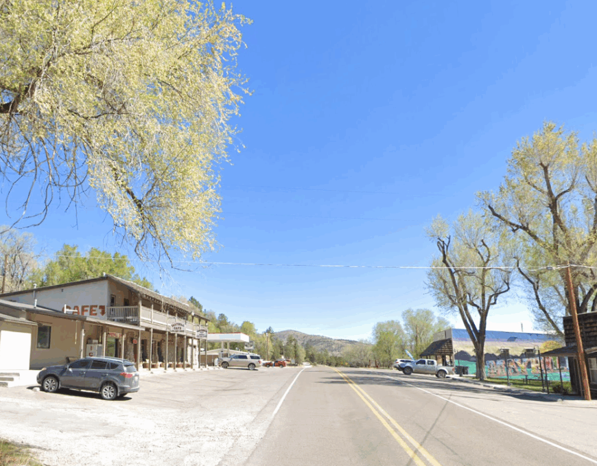
Mayhill nestles in the crook of forested hills where everything seems to lean inward and soften. Campgrounds, RV parks, and a handful of homes form its center, surrounded by pine-shadowed slopes and sky.
The general store sells what you forgot, and the café serves what you need. Locals value privacy and pace, and the land seems to agree. Trails cut through tall grasses, and the wind carries the smell of wet bark and woodsmoke. You don’t come here for action—you come here for stillness. It’s a quiet that makes room for you.
Where is Mayhill?
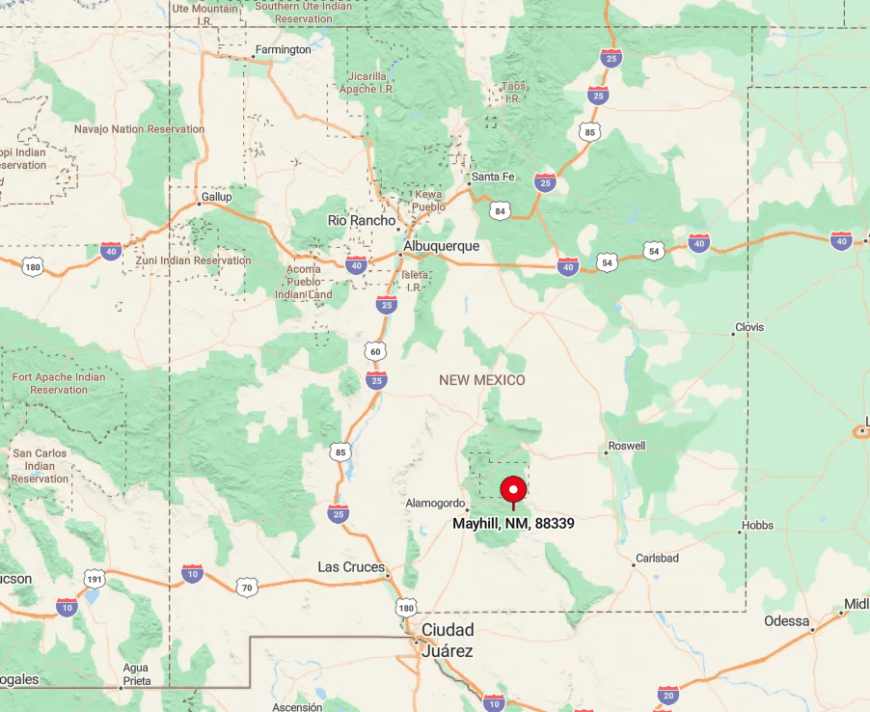
Situated along U.S. Route 82 in Otero County, Mayhill lies east of Cloudcroft in a stretch of road hugged by the Lincoln National Forest. The approach is lined with trees and dappled light, slowing you before you even arrive. The lack of traffic is part of the charm. The moment you park, you’re already unwinding.
1. The Hidden Charm of Pinon

Pinon is what happens when space and silence meet—a wide-open community where fences are long and conversation is rare. The land is raw and honest, with ranching at its core and modern life held at arm’s length. Most homes are tucked behind stretches of open range, and the only calendar that matters is the season.
The night sky stretches deep and clear, and the hush that follows sunset is complete. You don’t come here for convenience. You come for distance—from noise, from rush, from everything else. Pinon is the desert, undiluted.
Where is Pinon?
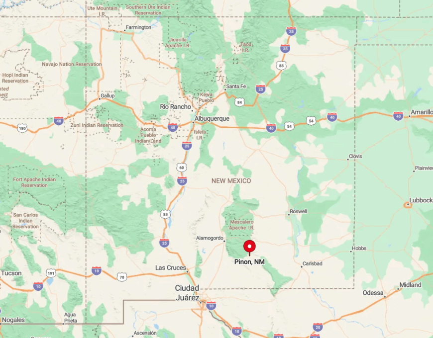
Pinon lies in Otero County, southwest of the Lincoln National Forest, along State Road 24. The route there is a long ribbon of pavement surrounded by vastness—few signs, fewer turns, and even fewer people. It’s the kind of place where the drive is part of the invitation. When you arrive, it’s quiet enough to hear your own thoughts settle.