🔥 Would you like to save this?
Rolling plains, hidden valleys, and pocket-sized hamlets give Southeast Nebraska a quiet character that can surprise those who only know the state by its interstate. Venture a few gravel roads off the main routes, and the land begins to swallow sound, horizons stretch, and front-porch lights grow scarce.
Our team set out to find the corners of this region where the population thins to a handful, where prairie grasses outnumber people, and where the night sky is still headline news. The result is a countdown of 25 places that trade bustle for breathing room without losing the neighborly spirit Nebraska is known for.
In order to come up with the very specific design ideas, we create most designs with the assistance of state-of-the-art AI interior design software. Also, assume links that take you off the site are affiliate links such as links to Amazon. this means we may earn a commission if you buy something.
Each spot offers something special, from ghost-town ruins to creek-carved hollows, yet all share the gift of obscurity. Read on for a tour that rewards those who like their maps with plenty of blank space.
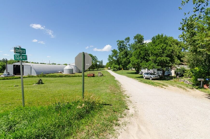
25. Agnew, Lancaster County
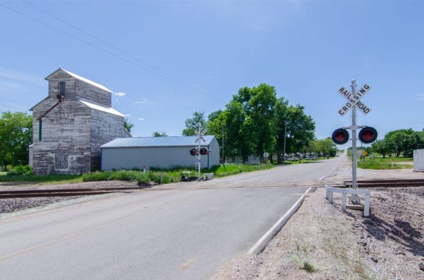
Tucked into corn country north of Lincoln, Agnew feels like a whisper on the wind—a former rail stop where the sound of a passing pickup is news enough for the evening. Its quiet comes from distance and design: no highway frontage, no storefront glow, and shelterbelts that turn gusts into a soft hiss.
The vibe is decidedly rustic—mailboxes on long lanes, dogs that know every tire track, tractors idling like porch talk. Walk the hedgerows for pheasant, trace the faint berm of the old rail grade, or watch storms stack up over the Platte Valley.
A couple of outbuildings double as hobby shops and honey rooms, but agriculture still writes the calendar. Night falls here like a blanket, and the nearest streetlight may be a mile of gravel away. It’s the kind of place that reminds you how quiet the world can be.
Where is Agnew?
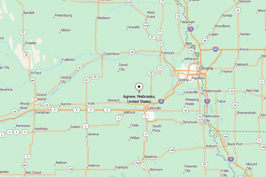
Agnew sits in northwestern Lancaster County, about 18 miles northwest of downtown Lincoln and well off any four-lane route. You reach it by meandering county roads that jog around section lines and rise to wind-combed ridges.
With no commercial strip and only local traffic, the approach itself feels like a slow exhale. Close enough to reach on a whim, far enough to feel like you’ve slipped between map folds.
24. Princeton, Lancaster County
Princeton is where gravel dust hangs in the sun and porch flags are the day’s weather report. The world narrows to fencelines and wheat stubble, with a shuttered elevator reminding you that trains once wrote the news.
It’s quiet here because the road chooses to be—no through route, no reason to hurry—just quarter-section jogs and a single paved spur. Locals fish nearby lakes, host impromptu potlucks in machine sheds, and count meteors like old friends.
A few folks weld or wrench between plantings, but fields still pay most of the bills. Toward evening, meadowlarks do the talking, and the horizon turns the color of cut straw. If you’re looking for room to breathe, Princeton gladly hands you the keys.
Where is Princeton?
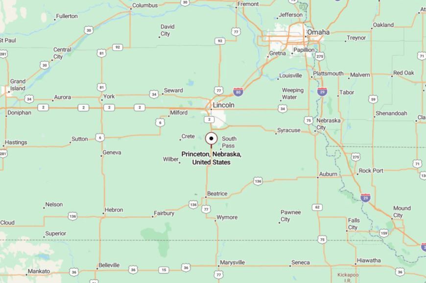
Set in south-central Lancaster County, Princeton rests roughly 20 miles south of Lincoln and a few miles west of U.S. 77. Access is a short paved run that gives way to a tidy grid of gravel lanes.
The town tucks just low enough behind small rises to dodge highway noise and city glow. It’s close enough for a half-tank wander, yet far enough to shed the rest of the world.
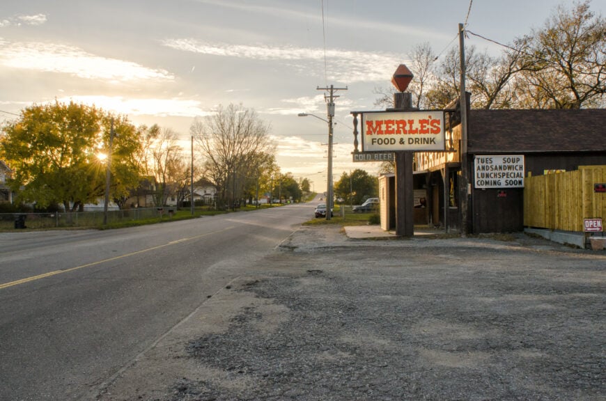
23. Cheney, Lancaster County
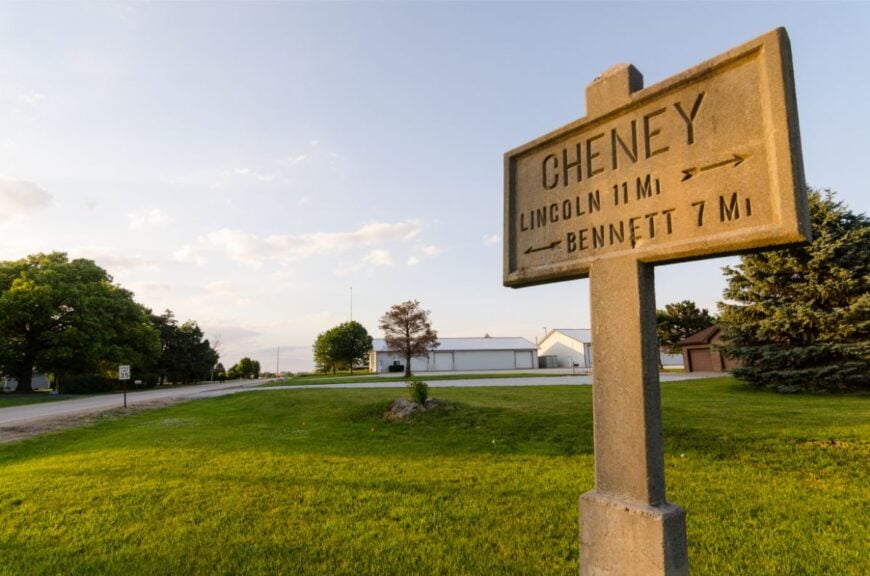
Cheney feels like the edge of a memory: a handful of streets, tall cottonwoods, and the steady rhythm of trains far off. Seclusion comes from sitting between bigger places without belonging to any—no main drag, no neon, just homesteads and a co-op shed.
The mood is gentle and neighborly; morning walkers wave, and somebody always has eggs to spare. Ride bikes on quiet lanes, wander the prairie draw where owls nest, or watch cloud shadows drift toward Yankee Hill Lake.
A few residents commute to Lincoln while others tinker with small trades, but the day still pivots around chores and weather. After dark, the sky opens like a held breath. It’s a small pocket that makes time feel slow again.
Where is Cheney?
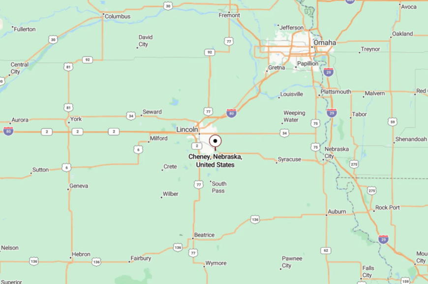
Cheney is tucked in southeast Lancaster County, roughly 10 miles southeast of downtown Lincoln and just south of Nebraska Highway 2. You thread in on county blacktop, then slip onto gravel that loses traffic quickly.
The slight dip of the land muffles the arterial rush from the highway. It’s reachable in minutes, yet the last mile feels wonderfully remote.
22. Emerald, Lancaster County
Emerald is a tiny green pause west of Lincoln where shelterbelts cradle a handful of homes and the prairie smells like rain. Its solitude is honest—no retail, no through route, just a curve of lane and the quiet creak of a windmill.
The vibe leans storybook rural: garden rows, swing sets under elms, and a church bell you can almost hear if you listen hard enough. Stroll the gravel loop at golden hour, glass for deer along the stubble, or picnic on a tailgate as trains whisper on distant tracks.
Farming and small trades keep life steady, and weekends often drift by in the shade. Stars return as soon as the sun slips—bright and plentiful. You leave thinking you misplaced a decade in the best way.
Where is Emerald?
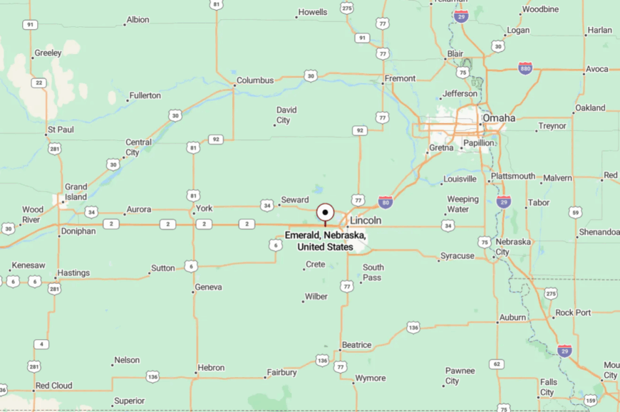
Emerald sits in western Lancaster County, about 8 miles west of downtown Lincoln and north of I-80, but shielded from it by fields and low rises. The approach is a short jog off paved county roads before gravel takes over.
Without commercial lighting or through traffic, the night here feels bigger. It’s a near-city address with a far-country heart.
21. Sprague, Lancaster County
Sprague wears its quiet with pride: a little lake nearby, a grain bin skyline, and streets where you can hear geese before you see them. Seclusion comes from being a small bend in the road surrounded by fields and water, not a destination for anyone in a hurry.
The mood is friendly and plainspoken—coffee at sunrise, fish fry on Fridays, and fireworks reflected in Wagon Train Lake. Paddle the lake at dusk, bird along the cattails, or bike the lazy backroads as red-tails kite overhead.
A mix of farming, commuting, and small-shop work keeps the lights on. When the wind lies down, the silence feels complete. You’ll carry the lake’s hush with you for days.
Where is Sprague?
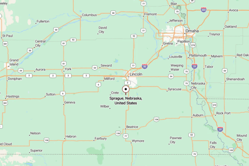
Sprague rests in south-central Lancaster County, around 14 miles southwest of Lincoln and a bit west of U.S. 77. You reach it by a patchwork of county blacktop and short gravel stretches that keep speeds—and stress—low.
The lake and shelterbelts temper highway noise and hide any city glow. Close enough to visit after dinner, far enough to feel like a getaway.
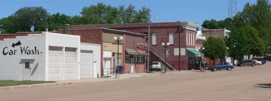
20. Barneston, Gage County
Barneston is a quiet river-country village where mornings begin with meadowlark songs and end with the glow of kitchen windows across the way. Its out-of-the-way feel comes from living at the far southern edge of the county, hugged by pastures and light traffic.
The vibe is old-farmstead cozy: tidy yards, a ballfield that’s seen a century of summers, and a church potluck calendar that still matters. Fish the Big Blue, trace segments of the historic Oto lands, or amble past the grain bins when the evening train horn floats in.
Farming and small local shops form the backbone here. Nights land softly, and the stars do the rest. It’s a place that makes you whisper without knowing why.
Where is Barneston?
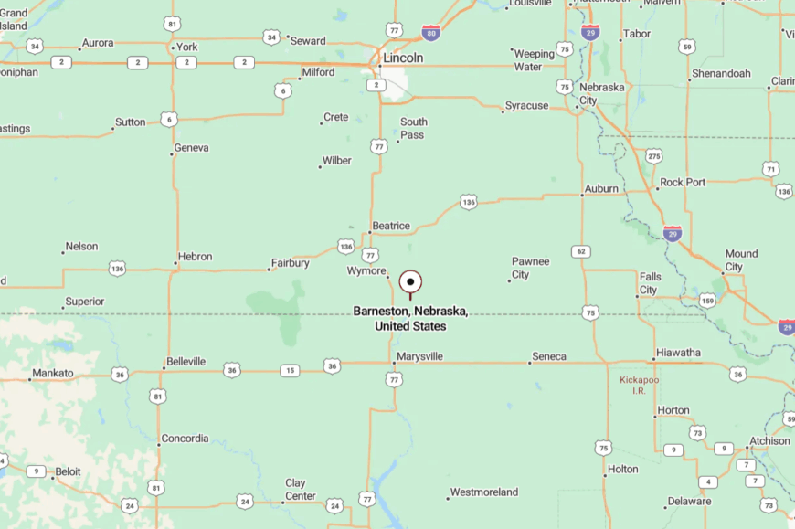
Set near the Kansas line in southern Gage County, Barneston lies roughly 25 miles south of Beatrice and east of U.S. 77. You angle in on county roads that alternate between blacktop and gravel.
With no major junctions, most traffic has somewhere else to be. It’s close to the border but a world apart in pace.
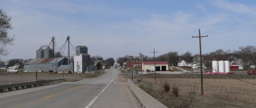
19. Odell, Gage County
🔥 Would you like to save this?
Odell is neat streets and porch swings, a grain elevator that sets the horizon, and crickets loud enough to count. Seclusion here is subtle—no interstate, few strangers, and vast fields that hold the town like cupped hands.
The mood is neighborly and craft-minded: gardens, woodshops, and a café where Friday pie disappears early. Walk the old depot area, birdwatch on backroads, or detour to the Little Blue for a quiet afternoon.
Farming and small manufacturing keep folks busy, with harvest bringing a gentle hum to the edge of town. After dark, you can hear a dog bark two blocks over. Odell lingers with you like the last warm ember in a fire ring.
Where is Odell?
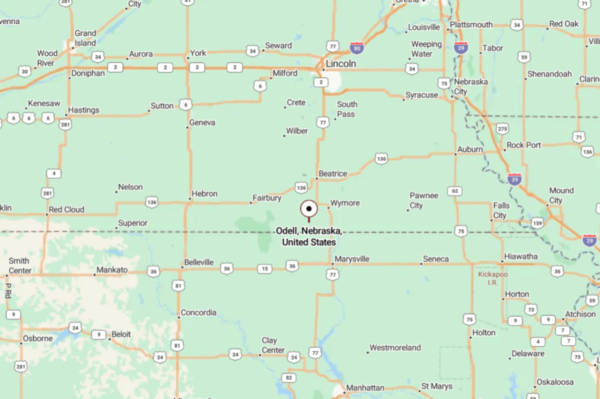
Odell sits in southwestern Gage County, about 12 miles west of Wymore and near the Kansas border. It’s reached via state spurs and then quieter county roads, the kind that let you watch hawks hunt.
With fields on every side and few lights to spill, the town stays tucked after sundown. Near the state line, but almost in its own time.
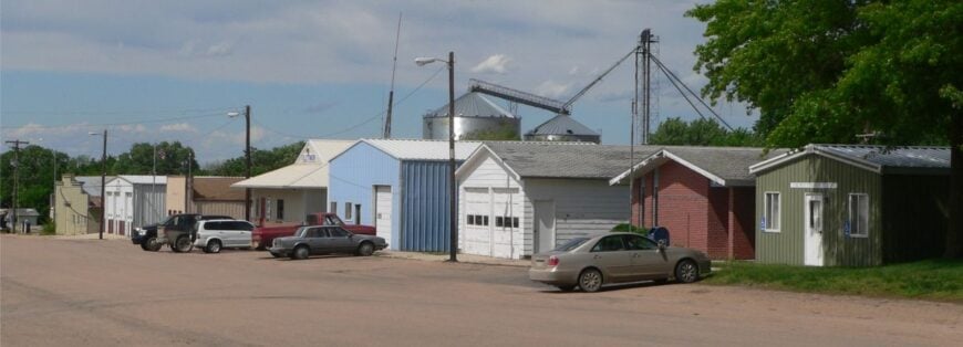
18. Clatonia, Gage County
Clatonia feels like a postcard that never left—white steeple, tidy streets, and a sleepy main drag where the day’s pace is set by the sun. Its seclusion is practical: no big corridors, just section roads and a two-lane that empties fast after chores.
The vibe is quietly social—church dinners, garden swaps, and roadside chats that stretch into dusk. Fish a farm pond with permission, walk the tree-sheltered grid, or drive out to watch lightning roll over the prairie.
Grain and cattle anchor the local economy, with a handful of trades rounding it out. Twilight paints every tin roof gold. You’ll catch yourself waving at everyone, and they’ll wave back.
Where is Clatonia?
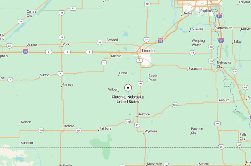
Clatonia lies in western Gage County, about 20 miles southwest of Beatrice and a few miles east of Nebraska 15. You arrive on low-traffic county roads that slip to gravel past town.
A shallow rise and shelterbelts soften whatever noise the highway carries. It’s within reach, yet still has its quiet corner.
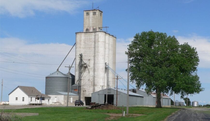
17. Filley, Gage County
Filley is a small circle of streets set among tallgrass and terraces, where windbreaks hum and the water tower keeps watch. The isolation is gentle but real: no chain stores, scant through traffic, and fields that push the horizon wide.
The mood blends heritage and handiwork—historic stonework in the area, tidy porches, and weekend tinkering in well-kept sheds. Walk to the small dam lakes, cast for bass, or follow section roads lined with sunflowers. Farm work and a few local services form the day-to-day heartbeat.
When the sun sets, the whole sky seems to belong to the town. It’s a place that keeps your voice low and your eyes up.
Where is Filley?
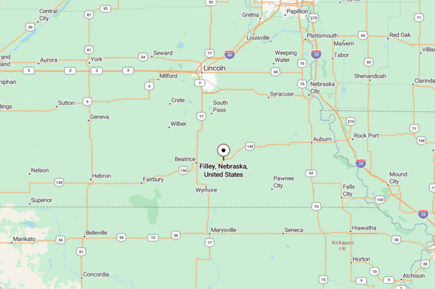
Set in eastern Gage County, Filley is roughly 12 miles east of Beatrice and south of Nebraska Highway 4. Paved county roads yield to quiet lanes that circle the village and end in fields.
With no major junctions nearby, the only cars you see likely live there. Close enough for errands, far enough to feel like a hideaway.
16. Virginia, Gage County
Virginia is a grain-elevator silhouette and a cluster of homes where the mailbox names haven’t changed in decades. Seclusion comes from distance and scale: a tiny grid with long gaps between neighbors and no reason for strangers to pass through.
The vibe is front-porch friendly and unhurried; dogs nap in shady yards, and gardens trade tomatoes for sweet corn. Drive a sunrise loop past hay bales, listen for whip-poor-wills near the creek, or stargaze from the edge of town.
Farming sets most clocks; side hustles happen in garages where the lights burn late. After rain, the streets smell like cool gravel and cut alfalfa. If you crave simple, Virginia understands.
Where is Virginia?
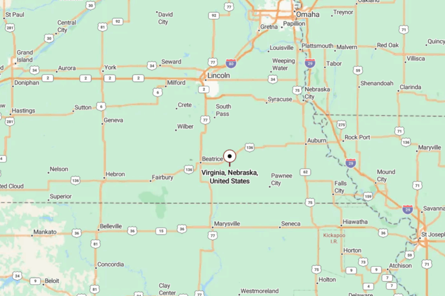
Virginia sits in southeast Gage County, roughly 22 miles southeast of Beatrice and a few miles north of the Kansas line. A couple of county roads connect it to Highway 4, then the landscape closes in to fields and fencerows.
With minimal lighting and no commercial strip, nights stretch long and quiet. It’s close to the routes you know, just not on them.
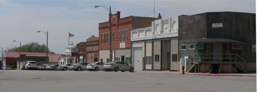
15. Elk Creek, Johnson County
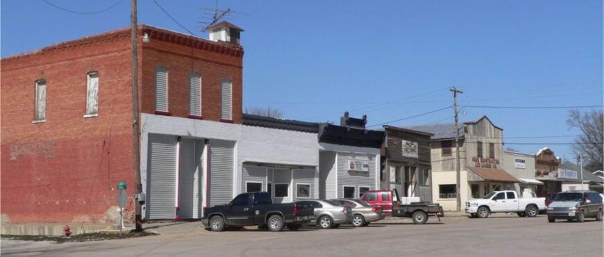
Elk Creek is a pocket-sized village where cottonwoods lean into the sky and the creek whispers through low timber. Its tucked-away feel comes from sitting between hills and out of sight of any busy road, the kind of place you find because someone told you how.
The vibe runs woodsy and old-time—screen doors, smoke from a brush pile, and tractors easing across low crossings. Explore backroads for deer and upland birds, visit small historical markers, or cast a line where the creek pools under roots.
Farming and ranch work hold the community together, with a few folks commuting to bigger towns. By night, crickets crowd the soundtrack. It’s an easy place to get quiet inside.
Where is Elk Creek?
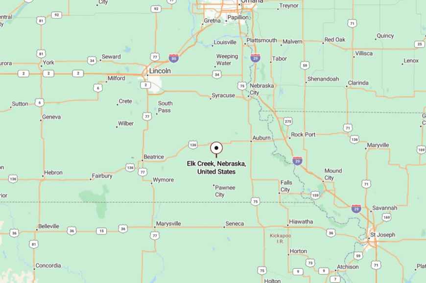
Elk Creek lies in eastern Johnson County, about 12 miles southeast of Tecumseh and a few miles north of the Nemaha County line. You reach it on two-lane county roads that narrow to gravel near town.
The low hills and tree belts keep the highway hum at bay. It’s a short drive on the map and a long way in spirit.
14. Sterling, Johnson County
Sterling is a valley town where the streets rise to meet the hills and the wind braids through cottonwoods. Seclusion stems from its detour-worthy position—off the main corridors and buffered by folds of prairie.
The mood is classic small-town Nebraska: a tidy main street, ball games at dusk, and coffee that tastes better because someone you know poured it. Walk a loop past handsome old houses, bird the shelterbelts, or drive gravel out to ridge-top overlooks.
Agriculture and school life set the rhythm, with trades and commuting filling the gaps. The sunsets stretch on and on. It’s the kind of place that keeps its promises.
Where is Sterling?
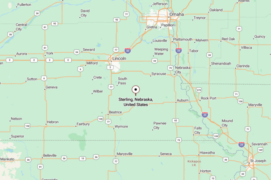
Sterling sits in north-central Johnson County, roughly 30 miles southeast of Lincoln and 12 miles northwest of Tecumseh. Access is a patchwork of state and county roads that thin to low traffic as you approach.
The surrounding hills protect it from the larger world’s noise. Near enough for errands, but the last miles do the work of slowing you down.
13. Cook, Johnson County
🔥 Would you like to save this?
Cook gathers around a few quiet blocks, where porch swings creak and the shade of big maples turns noon into morning again. Its off-grid feeling comes from modest size and a location between ridges that hide it from hurry and glare.
The vibe is neighborly and hands-on—raised beds, chalk on sidewalks, and a café where the grill knows your order. Trace the old rail spur, walk to the edge of town for sunset over terraces, or explore nearby wildlife areas on gravel loops.
Farming and small-shop work keep days honest. After the evening train in the distance, crickets take over. Cook makes unhurried feel like a plan.
Where is Cook?
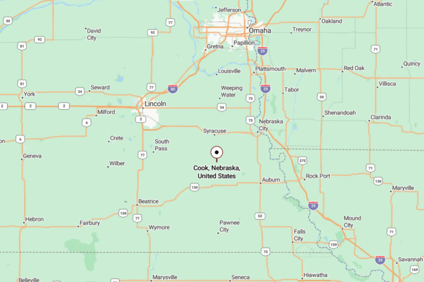
Cook lies in north-central Johnson County, about 35 miles southeast of Lincoln and 10 miles north of Tecumseh. You arrive via Highway 50 and then quieter roads that settle into the folds of the land.
Those same folds hush the world beyond. It’s easy to access, but easier to forget what you came to escape.
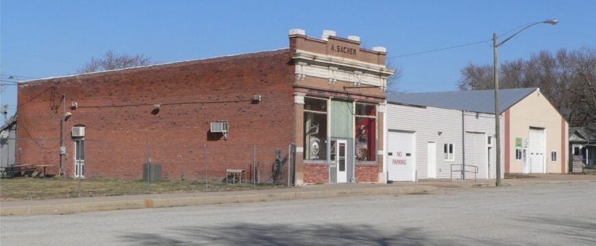
12. Burchard, Pawnee County
Burchard is all soft edges—tree-lined streets, a little lake out the way, and a horizon stitched with hay bales. Seclusion here is simple math: few people, fewer businesses, and miles of pasture between you and bustle.
The vibe is country-calm with a hint of storybook: kids on bikes, garden hose arcs, bell tower chiming the hour. Fish Burchard Lake, scan the fencerows for bobolinks, or wander quiet roads past limestone culverts.
Ranching and row crops set the workday, with weekend potlucks filling the rest. When dusk lands, the sky becomes a slow-moving ocean. It feels like someplace you always meant to find.
Where is Burchard?
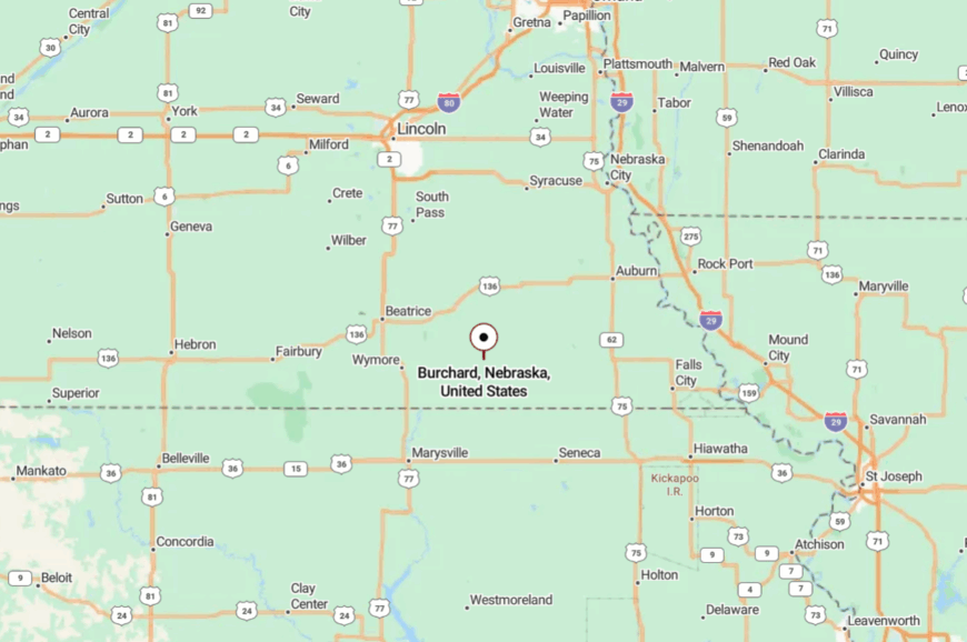
Burchard sits in western Pawnee County, roughly 10 miles west of Pawnee City and near the Kansas line. You reach it by two-lane county roads that turn to gravel as soon as you blink.
With little through traffic and low lighting, the place goes hushed early. Close on the map, far when it comes to pace.
11. Steinauer, Pawnee County
Steinauer is a hilltop village with a church steeple that owns the skyline and streets that remember every parade. Its solitude comes from elevation and distance—perched above a quilt of pastures, an extra handful of miles from any major route.
The vibe is heritage-rich and warmly kept: brick sidewalks, flower boxes, and a community hall where dances still happen. Walk the ridge for long views, picnic under old oaks, or follow gravel until the world turns to meadow.
Agriculture underwrites the year, and local festivals add their own heartbeat. Nights ring with coyotes and the far clack of a train. It’s the sort of place where a wave from a stranger turns into a conversation.
Where is Steinauer?
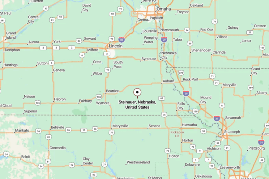
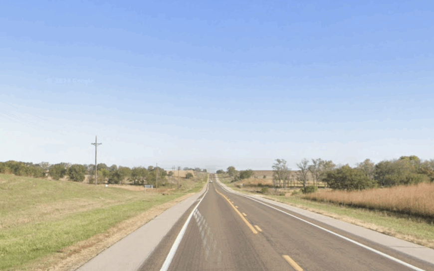
Steinauer lies in northwestern Pawnee County, about 12 miles northwest of Pawnee City and 60 miles south of Lincoln. County roads climb in switchbacks to the village, then slide away to quiet gravel.
Those ridges keep the rest of the world down in the draws. It’s near enough for a Saturday drive, and far enough to feel genuinely away.
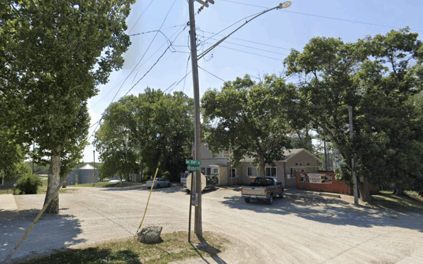
10. Howe, Nemaha County
Howe claims an estimated population of roughly thirty residents who occupy century-old farmsteads scattered among oak-lined bluffs above the Nemaha River.
Locals enjoy bird-watching along the wooded river corridor, hunting for morel mushrooms in spring, and walking the abandoned Missouri Pacific rail grade that once ran through town.
Dryland corn and cattle grazing remain the dominant economic pursuits, though a small specialty-crop greenhouse has recently taken root on the south edge of the hamlet. Visitors will find no storefronts, only a weathered depot turned storage shed and a one-room schoolhouse hosting the annual pie social.
The absence of commercial traffic, coupled with a fifteen-mile gap to the nearest highway, keeps engine noise to a whisper. Dense timber on three sides completes a sense of enclosure that makes Howe feel more retreat than a community.
Where is Howe?
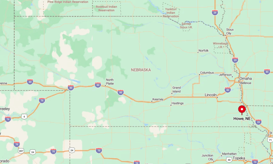
This forgotten siding sits in eastern Nemaha County, five gravel turns north of State Highway 136 and about eleven miles west of the Missouri River. Bluffs shield the settlement from distant road glare, and the river floodplain prevents subdivision creep.
Reaching Howe means exiting at Auburn, then following county roads that narrow from asphalt to crushed limestone. Travelers often report spotting deer or turkey long before they see another vehicle.
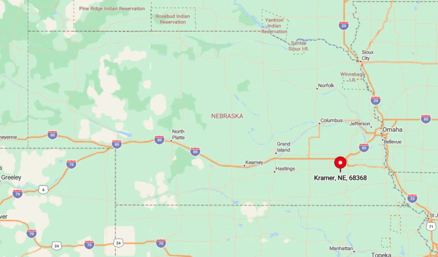
9. Kramer, Lancaster County
With a population hovering near twenty-five, Kramer is an unincorporated crossroads southwest of Lincoln where four gravel lanes meet a shuttered grain elevator.
Residents fish bass and bluegill at nearby Wagon Train Lake, attend Friday steak night at the volunteer fire hall, and ride horseback along hedgerow-lined section roads. Dryland soybeans form the backbone of the local economy, complemented by a handful of home-based welders and custom harvesters.
The prairie is wide and unfenced here, and mile-square fields framed by shelterbelt trees create natural privacy for every homestead. No retail lights, no through traffic, and no public utilities beyond power make nights remarkably quiet. Even the wind seems to pause among the shelterbelts, heightening the sense of isolation.
Where is Kramer?
🔥 Would you like to save this?
Kramer rests in south-central Lancaster County, twelve miles from the nearest four-lane highway and eighteen miles from downtown Lincoln. The town’s recessed position below the ridge of Salt Creek conceals it from most passing traffic.
County Road 600 is the only paved approach, and beyond that, a grid of gravel routes discourages casual detours. During harvest, a single grain truck may be the day’s lone visitor.
8. Martell, Lancaster County
Roughly sixty people call Martell home, and nearly all live on acre-plus lots strung along quiet gravel lanes that dip into prairie ravines. Stargazers prize the area for its dark-sky conditions; monthly gatherings near the former Martell School often feature community telescopes trained on the Milky Way.
Grain farming dominates employment, though a small goat-milk soap enterprise ships orders nationwide from a converted barn. Wildlife photographers frequent the cedar breaks south of town, where coyotes and barred owls make regular appearances.
Seclusion stems from the maze-like topography: draws and ridges shield properties from one another and the state highway three miles away. Night traffic is so light that residents commonly step onto gravel roads to watch elk bugling in fall without fear of headlights.
Where is Martell?
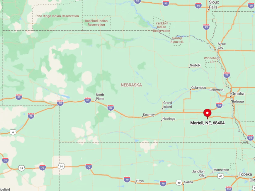
Martell lies sixteen miles southwest of Lincoln, tucked just off Nebraska Highway 33 in a shallow bowl created by Prairie Creek. The nearest services are in Denton, seven miles east, reinforcing the sense of remove.
Access involves descending a series of switchbacks where cellular reception disappears. First-time visitors often miss the unmarked turn, a fact that locals admit keeps the peace.
7. Wyoming, Otoe County
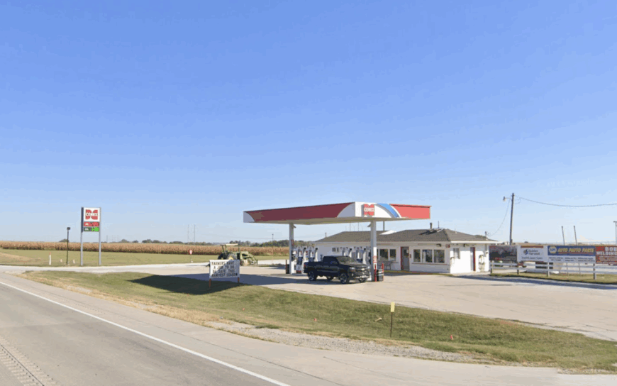
Wyoming is more remnant than town, with perhaps five year-round residents and a scattering of vacant limestone foundations testifying to a busier past.
Explorers comb the surrounding hills for glacial erratics, picnic beside century-old cottonwoods, and photograph the abandoned 1880s church whose bell still rings on Memorial Day.
Nearby cattle pastures and a rotational grazing research station provide the primary livelihoods, while hobby vintners cultivate cold-hardy grapes on south-facing slopes.
More than half the land within two miles remains undeveloped grassland, offering sweeping vistas broken only by distant barns. Lack of retail, mail delivery, or paved roads keeps visitors rare. When fog pools in the valley at dawn, the village seems to vanish completely.
Where is Wyoming?
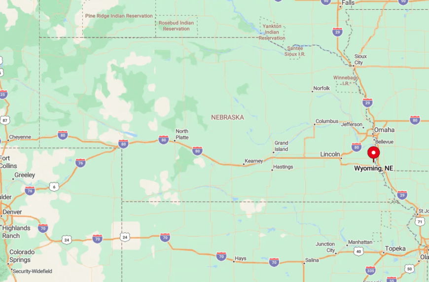
Set in north-central Otoe County, Wyoming, lies nine gravel miles west of Highway 50 and thirteen miles northeast of Tecumseh. Rolling pasture blocks radio signals and mutes highway noise.
Drivers approach via county roads that narrow to two tire tracks as they near the site. During spring thaw, locals advise using four-wheel drive or waiting until afternoon to let the ruts firm up.
6. Liberty Countryside, Gage County
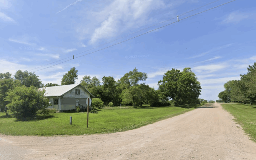
The farmsteads surrounding Liberty support about fifty residents spread over a six-mile radius of grassy ridges and tree-lined creeks. Residents kayak short stretches of Wolf Creek, host summer barn dances, and share venison jerky at the cooperative meat locker in town.
Grain sorghum, cow-calf operations, and custom haying anchor the rural economy. Fields are punctuated by ribbon-like shelterbelts that blunt prairie winds and offer nesting spots for pheasants.
Wide spacing between homes and a complete absence of streetlights preserve a near-pristine quiet after sunset. Even during October soybean harvest, combines are heard only as a distant hum drifting through cottonwoods.
Where is Liberty?
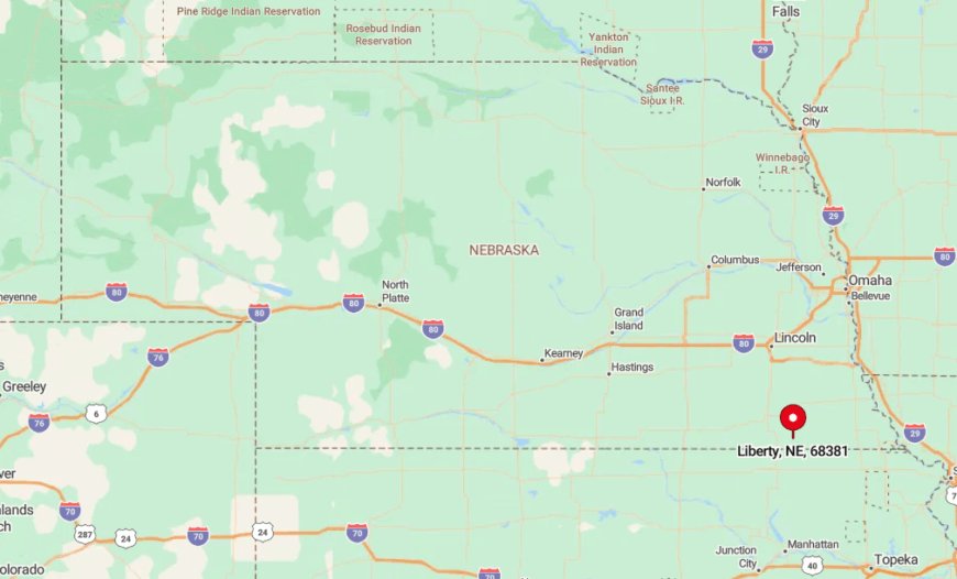
Liberty sits in southeastern Gage County, four miles north of the Kansas line and fifteen miles southwest of Beatrice. Outlying acreages occupy hilltops that overlook timbered draws, placing them beyond the reach of highway glare.
The sole paved approach is Nebraska Highway 8; from there, travelers weave through gravel that often carries more farm implements than cars. GPS routinely drops signal in the creek bottoms, reinforcing the off-grid feel.
5. Lewiston Hills, Pawnee County
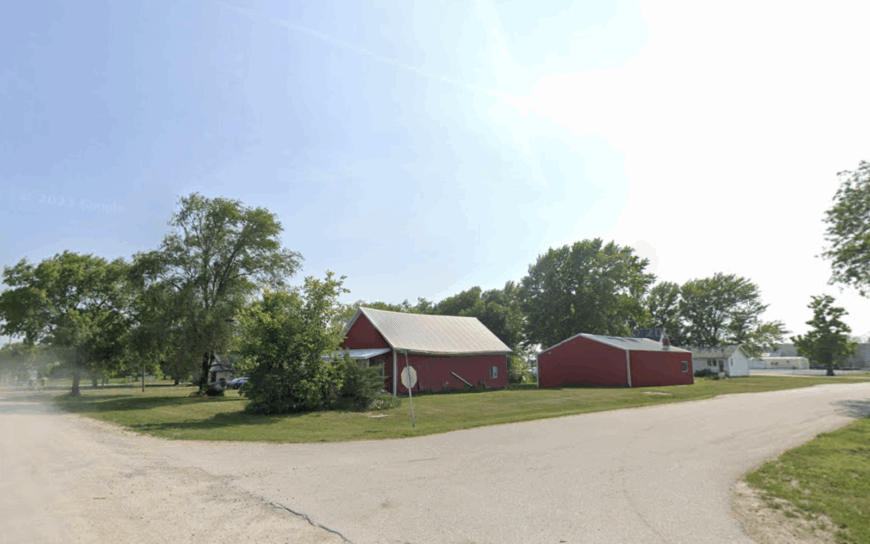
The Lewiston Hills host fewer than sixty full-time residents clustered among patchwork hayfields and wooded draws that wrap around the village of Lewiston itself. Locals hike the Pony Creek Trail, watch turkey vultures ride thermals, and meet for Sunday potluck in the community center.
Mixed farming and small-scale livestock operations offer modest employment, though many also commute to Tecumseh’s ethanol plant. The topography rises to gentle knobs that act as natural sound barriers, so each hilltop farmhouse enjoys big-sky views unspoiled by neighbors or traffic.
Prairie grasses sigh in the wind while coyotes provide the nighttime soundtrack. Even mail carriers rarely catch a glimpse of more than one house at a time.
Where is Lewiston?
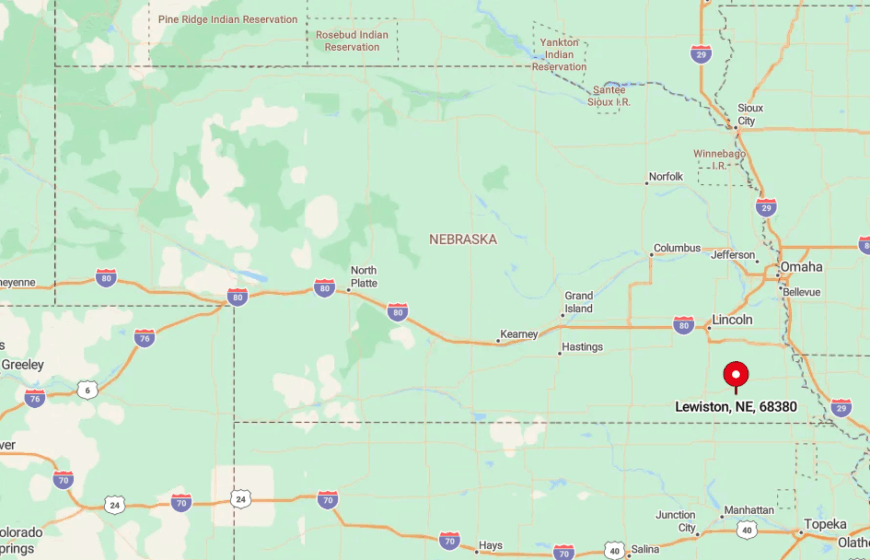
This elevated district spreads west of Lewiston in north-central Pawnee County, roughly ten miles south of the Nemaha River. The hills form finger-like ridges separated by timbered ravines, preventing line-of-sight between most residences.
County Road 625 snakes along the ridge crest, its gravel switchbacks deterring high-speed travel. Winter snow often leaves the route impassable until late morning, adding one more layer of isolation.
4. Rock Creek Valley near Burr, Otoe County
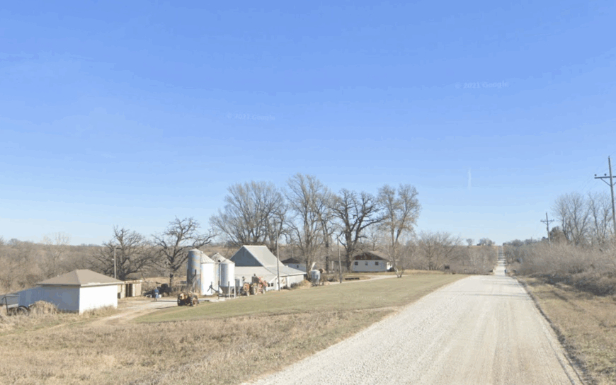
Only about forty people reside along the bends of Rock Creek, where conservation easements keep row crops at bay and restore tallgrass prairie. Anglers target smallmouth bass in root-laden pools, while birders tally prairie chickens dancing on nearby leks each spring.
Economic life centers on cow-calf herds and a single organic vegetable farm that supplies Lincoln farmers’ markets. Conservation land borders private holdings on three sides, discouraging development and hunting pressure, so wildlife sightings are common.
The valley’s winding topography hides homesteads behind cottonwood groves that absorb sound. With no bridges south of the creek, half the area remains a virtual cul-de-sac.
Where is Rock Creek?
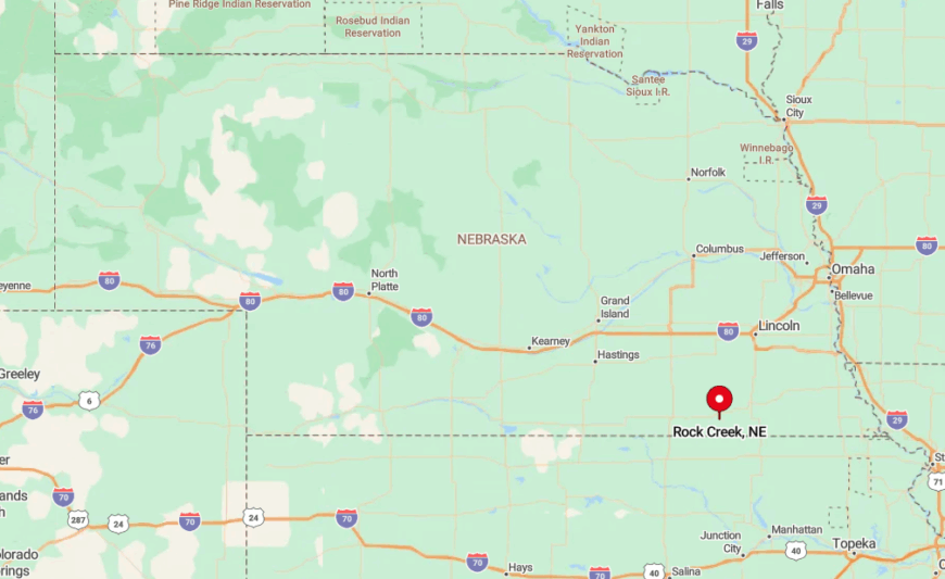
The valley begins two miles north of Burr in western Otoe County and extends six miles west toward Firth. High bluffs isolate the basin from the regional road grid, leaving two gravel entrances that often flood during heavy rain.
Reaching the lower homesteads requires fording shallow crossings or taking a circuitous detour through Gage County. Those who make the trip are rewarded with silence broken only by creek riffles and meadowlark calls.
3. Plum Creek Hollow, Richardson County
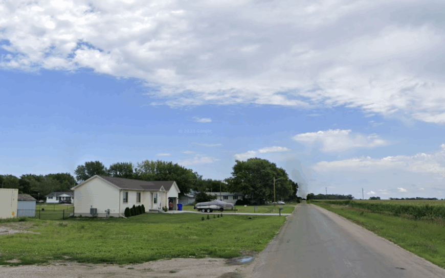
An estimated thirty-five residents inhabit cabins and century farms tucked inside Plum Creek Hollow, a deep forested ravine carved through loess hills. Weekend pursuits include foraging for pawpaws, scouting for morels, and exploring a hidden waterfall that flows after heavy rains.
Small-scale hardwood logging and pasture leasing form the modest economic backbone, augmented by a maple-syrup shack that sells out each March. The hollow’s steep walls, cloaked in oak and hickory, block both wind and radio towers, cocooning the community in natural quiet.
No grid power reaches two of the cabins, which rely on solar setups and spring water. Night skies glow only with starlight filtered through the canopy.
Where is Plum Creek?
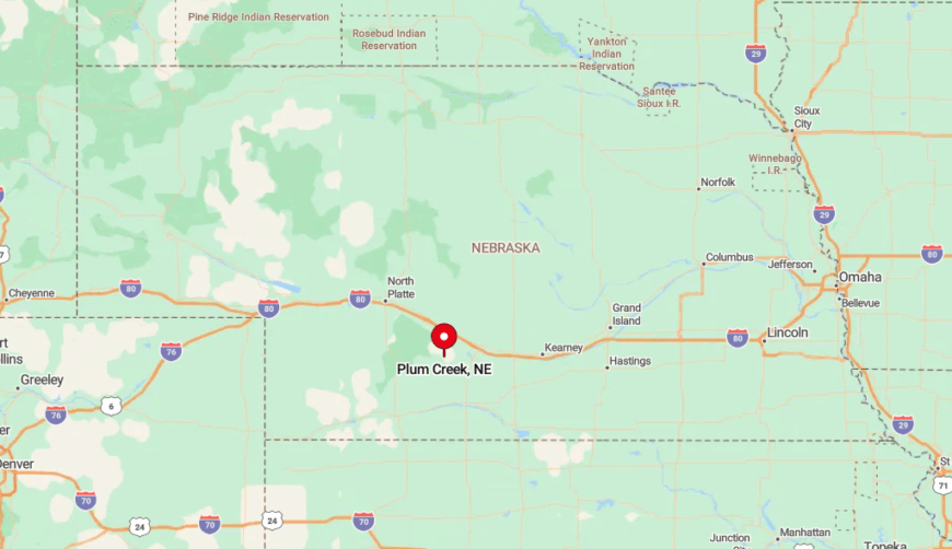
The hollow lies eight miles west of Falls City in northern Richardson County, just north of the Tall Oaks Wildlife Refuge. Access follows a single-lane gravel track that descends into the ravine with hairpin turns unsuitable for trailers.
Heavy rains can render the last half-mile muddy enough to require four-wheel drive. The tough approach keeps casual visitors away and wildlife close.
2. Crab Orchard Prairie, Johnson County
Approximately forty-five people live amid the tall-grass expanses outside Crab Orchard, where sheltering timber stands edge fields and create an almost uninterrupted horizon of pasture and sky.
Residents host evening bonfires followed by silent prairie walks to listen for whip-poor-wills, and bird-banding volunteers monitor Henslow’s sparrows each summer. Dryland wheat and custom grazing leases underpin the local economy, with a seed-stock cattle breeder supplying genetics nationwide.
The rarity of artificial light and the prairie’s natural sound-dampening combine to craft a hush that feels almost archival. In late July, lightning bugs gather in waves across the grasses, creating a living aurora. Passing cars average fewer than five per day on most nearby roads.
Where is Crab Orchard?

This sweep of grassland stretches north and west of Crab Orchard in eastern Johnson County, about nineteen miles east of Fairbury. Low ridges shelter the area from U.S. Highway 136, muting highway drone.
Approaches consist of section roads that alternate between gravel and dirt, which discourages through traffic. Cell reception fades past the first ridge, leaving prairie silence intact.
1. Spring Creek Ridge, Jefferson County
Spring Creek Ridge hosts close to twenty year-round residents whose homes perch on an elevated gravel ridge overlooking rolling wheat fields and the meandering Spring Creek. Locals organize stargazing nights beside an abandoned silo, hunt pheasant in CRP grasslands, and harvest wild plums along fence lines.
Dryland wheat and custom no-till drilling provide the primary income streams, with a single beekeeper adding varietal honey to regional farmers’ markets. The ridge rises high enough that no urban glow breaches the horizon, and a twenty-mile gap to the nearest sizeable town keeps populations sparse.
Wheat fields act as a buffer from wind noise, while the ridge’s elevation allows breezes to carry away the little sound that exists. Residents often describe hearing train whistles from Fairbury, ten miles away, more clearly than a neighbor’s pickup.
Where is Spring Creek?

Situated in northern Jefferson County, the ridge sits fourteen miles northwest of Fairbury and six miles south of the Little Blue River. The only direct route is a nine-mile stretch of gravel that climbs steadily from the river valley, deterring casual exploration.
With no intersecting roads for several miles, travel is limited to locals and the occasional delivery truck. Visitors who brave the climb are greeted by a 360-degree view of wheat, sky, and almost nothing else.