🔥 Would you like to save this?
Southeast Maine remains a patchwork of islands, tiny plantations, and unorganized townships where spruce forests tumble to the sea and gravel lanes outnumber paved roads.
We gathered 25 of the quietest places in the region, each one offering a different shade of solitude: cliff edged islands, blueberry barrens, forgotten coastal headlands, and a famously small mainland enclave.
In order to come up with the very specific design ideas, we create most designs with the assistance of state-of-the-art AI interior design software. Also, assume links that take you off the site are affiliate links such as links to Amazon. this means we may earn a commission if you buy something.
Visitors and potential residents alike will find hiking paths that skirt lighthouses, working lobster wharves where the daily catch still dictates the rhythm of life, and skies dark enough for the Milky Way to steal the show.
Some of these towns host fewer than fifty full-time neighbors, others rely on a weekly mail boat, and all of them sit well outside the buzz of Route 1 tourism.
Whether someone seeks an off-grid summer retreat or a remote year-round community, these 25 locations illustrate just how much breathing room remains along Maine’s eastern shore.
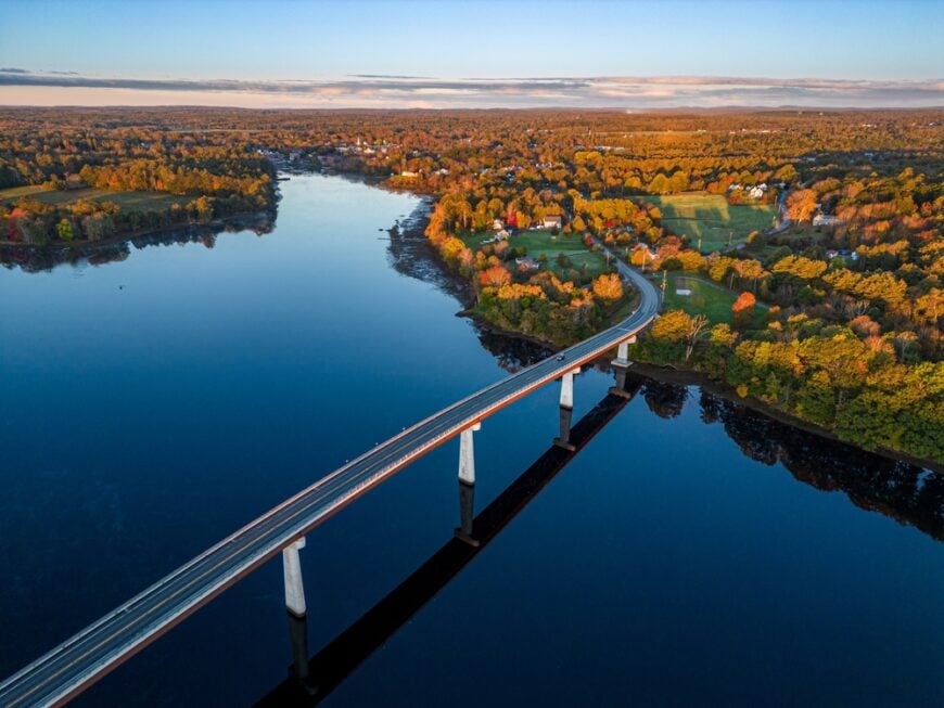
25. Machiasport

Hidden beyond the bends of Maine’s easternmost backroads, Machiasport sits where the land gives way to rocky coastline and open sea. Far from bustling tourist routes, its sparse cottages and fog-wrapped coves make the town feel more like a secret than a destination.
The air carries a hush—briny, steady, and steeped in centuries of tidal life. You might stroll the windblown bluffs of Jasper Beach, explore weathered battlements at Fort O’Brien, or wait for lobster boats to glide into harbor with the day’s blue-gray catch.
Many here still earn their living from the sea, their days charted by tides instead of clocks. It’s the kind of place that makes you believe solitude can be a beautiful thing.
Where is Machiasport?
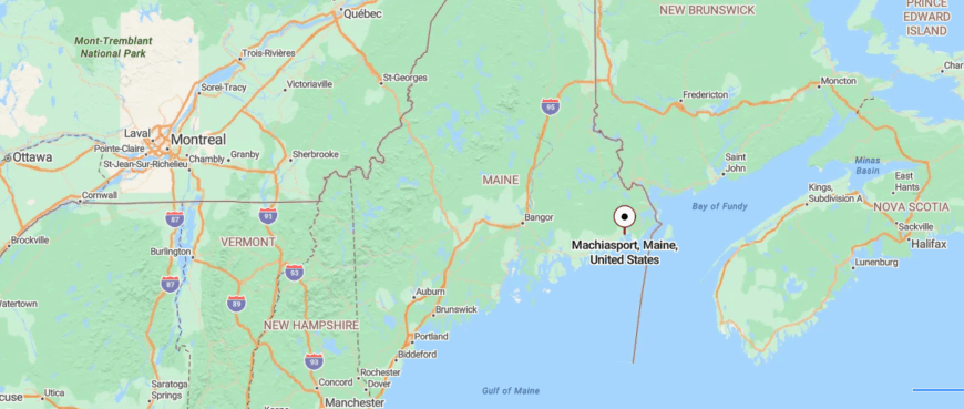
Machiasport, Maine lies in remote Washington County on the state’s easternmost reach, where the Machias River flows into open Atlantic waters. Around 90 miles east of Bangor and away from the main corridor of U.S. Route 1, it feels tucked beyond the usual path.
Travelers approach via winding coastal roads that slip past marshes, pines, and sparsely settled villages. It’s a destination where the world goes hushed, as if distance itself wraps around you.
24. Roque Bluffs
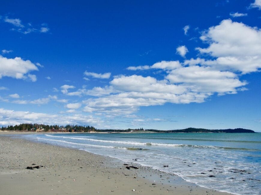
Roque Bluffs rests at the edge of Down East Maine where winding rural roads fade into wild coastline and seawinds keep the modern world at bay. Just beyond the blueberry barrens, it offers the kind of hush where every gull call echoes and salt seems stitched into the air.
With its cedar-shingled cottages and tide-shaped coves, the town feels quietly timeless. At Roque Bluffs State Park, visitors comb sand-pebble beaches, kayak across Simpson Pond, or wander spruce-lined trails in near solitude.
Many who live here still work the sea, harvest berries, or rely on a short burst of summer visitors. It’s a place that reminds you life doesn’t have to move fast to feel full.
Where is Roque Bluffs?
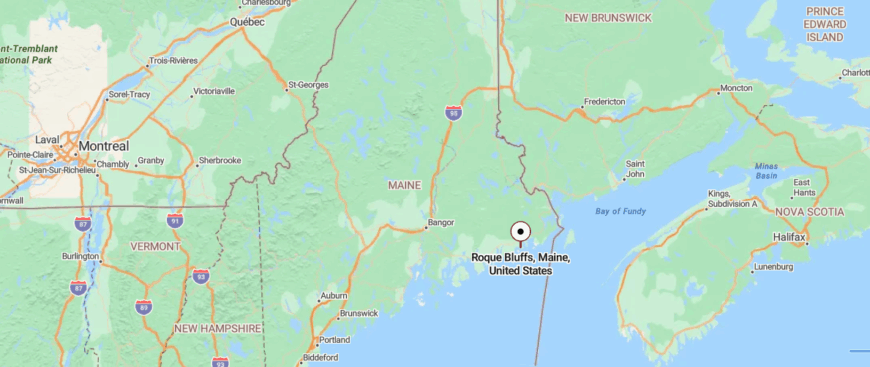
Roque Bluffs, Maine rests on a quiet finger of land jutting into Englishman Bay along the Down East coastline. Nearly 95 miles east of Bangor and a good stretch off Route 1, it keeps itself hidden beyond the usual stream of coastal travelers.
The final approach comes by way of a meandering back road that winds through blueberry fields and forests until it suddenly spills out toward rocky beaches and tidal coves. It’s a place where arrival feels like slipping into a secret pocket of the world, out of step with everything else.
23. Whitneyville
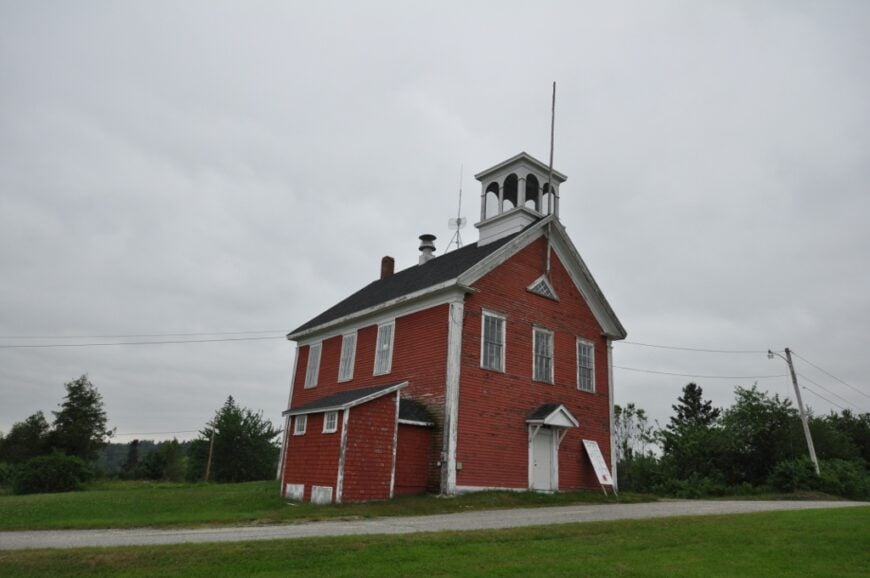
Far inland from Maine’s better-known coastal villages, Whitneyville lies tucked among forests and winding rivers where GPS signals flicker and logging roads stretch into silence. The town itself is small—just a scatter of clapboard homes, a faded mill, and the steady rush of Machias River cutting through its heart.
There’s a rugged charm to everyday life here, built on grit, timber, and generations of hard work. Visitors can fish for brook trout, walk the banks of the river, or explore nearby trails once cut by loggers driving massive booms downstream.
Locals still find work in forestry, seasonal tourism, and trades that honor the land’s resources. It draws you in softly, like a place that knows how to keep its own steady rhythm no matter what rushes by elsewhere.
Where is Whitneyville?
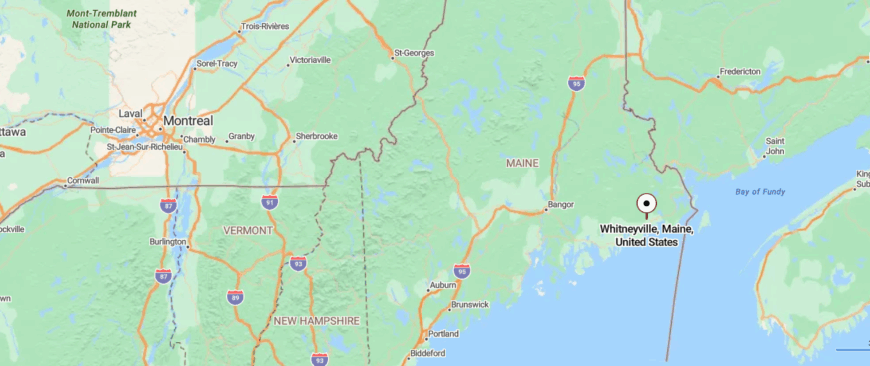
Whitneyville, Maine sits inland along the Machias River in the heart of Washington County’s timber country. Positioned about 85 miles east of Bangor and a short turn north from Route 1 near Machias, it stays quietly tucked away from the coast-bound traffic.
Getting there means following a two-lane country road that threads through woodlands and river bends before reaching the small cluster of homes and mill history. The journey isn’t long, but it gently untethers you from the wider world.
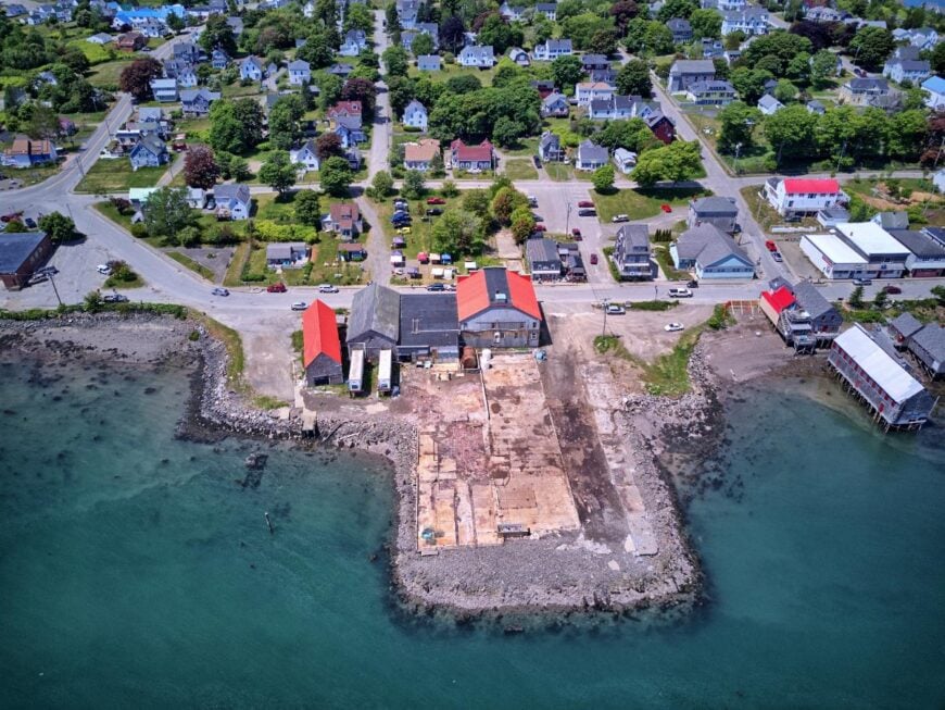
22. Jonesport
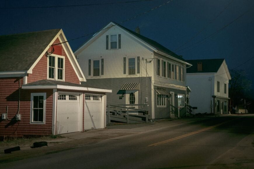
Out on a wave-battered peninsula where Route 187 seems to run out of land, Jonesport sits surrounded by endless ocean and sky. Isolation isn’t just geography here—it’s a way of life defined by weathered docks, lobster traps, and boats rocking in tidal currents.
The village hums quietly with the work of fishermen whose families have hauled from these waters for generations. Visitors stop to watch the boats unload on Moosabec Reach, wander windswept Sandy River Beach, or take a short ride to Beals Island to explore salt-stung trails.
Fishing remains the heartbeat of the local economy, anchoring the days in the pull of tides and seasons. This is the kind of town where wild beauty outnumbers people, and the horizon always seems to promise another secret.
Where is Jonesport?
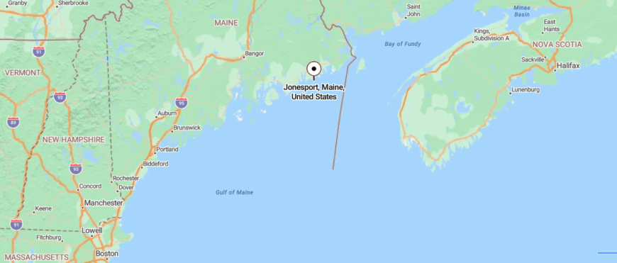
Jonesport, Maine stretches across a working harbor and string of islands on the outer edge of Washington County’s jagged shoreline. Located roughly 80 miles east of Bangor and several miles off U.S. Route 1, it sits beyond Maine’s busier tourist loops.
Visitors reach it by following a narrow coastal road that crosses salt marshes and bridges until the land breaks into sea. By the time you arrive, it feels less like you’ve traveled somewhere and more like you’ve slipped into a world apart.
21. Beals

Reached by a narrow bridge that rises above the tides of Moosabec Reach, Beals sits almost entirely surrounded by the Atlantic, feeling more like its own rugged world than a town pinned to a map.
The island’s contours are stitched with fishing wharves, lobster pounds, and dirt roads edged by stacks of weathered traps. Life here follows the rhythm of the sea—quiet in winter, bustling with boat engines and gull cries when summer sun breaks through the fog.
Visitors wander to Lookout Point for views across the reach, explore tidal pools on remote shorelines, or catch sight of working boats making their long hauls home. Most residents are tied to fishing, boatbuilding, or maritime trades that pass down knowledge like heirlooms.
Where is Beals?
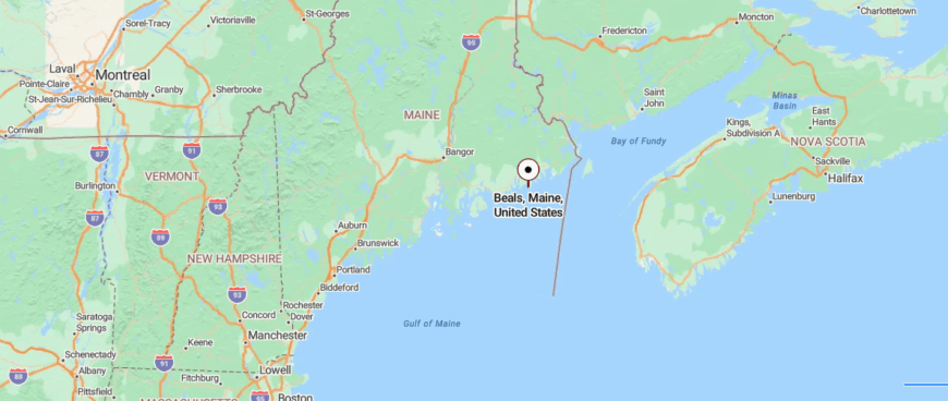
Beals, Maine clings to a cluster of rocky islands just off Jonesport on the extreme Down East coast. Sitting nearly 85 miles east of Bangor and accessible only after turning off Route 1 and crossing the long bridge over Moosabec Reach, it sits truly at the land’s end.
The trip winds through fishing villages and tidal flats before the road finally gives way to island causeway. Once there, the sweep of sea and sky makes it feel as though the mainland — and all its noise — is a distant thought.
20. Lubec
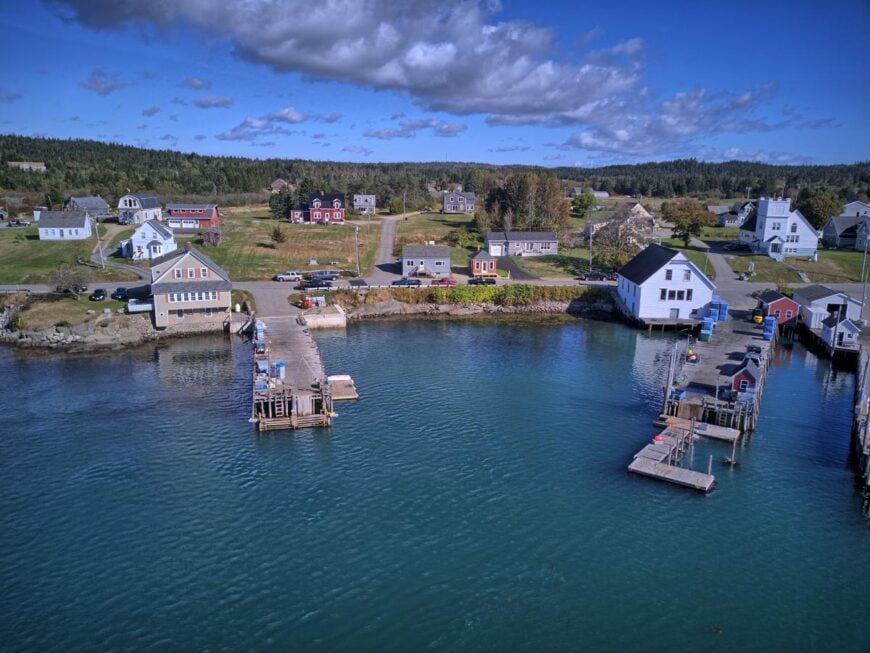
Poised at the easternmost edge of the United States, Lubec sits shrouded in sea mist where the sun greets America before anywhere else. Cut off by long stretches of rural road and looking across the turbulent Bay of Fundy to Canada, it feels like the end of one world and the quiet beginning of another.
The town is a tapestry of clapboard homes, weathered wharves, and a harbor that fills and empties with some of the world’s highest tides. Visitors wander West Quoddy Head Lighthouse, hike cobblestone beaches, or cross to Campobello Island for windswept trails and Roosevelt history.
Fishing and seasonal tourism anchor the livelihoods here, though the pace remains unhurried even in summer’s height. It’s the kind of place where the ocean seems to breathe for you—and the silence stays with you long after you leave.
Where is Lubec?
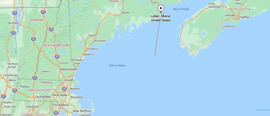
Lubec, Maine stands at the very tip of the state’s easternmost coastline, looking directly across a narrow channel to Canada’s Campobello Island. Situated about 100 miles east of Bangor and well beyond the well-traveled stretch of Route 1, it marks the true end of America’s Atlantic road.
Reaching it requires following a ribbon of winding shoreline highways that meander past fishing coves, salt-sprayed cliffs, and historic lighthouse stations. By the time you arrive, the rest of the world already feels a long way behind you.
19. Cutler
🔥 Would you like to save this?
Set deep along a ragged stretch of Down East shoreline, Cutler feels removed not just by distance but by the wildness that surrounds it—towering spruces, sheer cliffs, and seas that thunder against dark rock.
Reached via a solitary road that ends at its tiny harbor, the village seems more a gathering of working boats than of people. On fog-heavy mornings, lobster buoys bob like scattered jewels and the only sounds are gulls and diesel engines rumbling out to sea.
Hikers venture to the Bold Coast Trail for sweeping headland views, tidewatchers linger along Little River, and birders scan the skies for puffins offshore. Most who remain earn their living from lobster, clams, or seaweed, each tide marking another shift in the workday.
Where is Cutler?
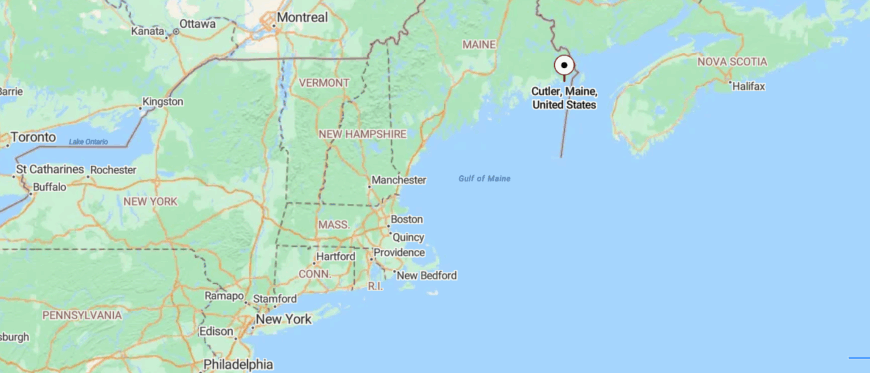
Cutler, Maine lies along a rugged stretch of Washington County’s Bold Coast, where jagged cliffs drop sharply to the Atlantic below. Positioned roughly 95 miles east of Bangor and far off the major highway routes, it stays well beyond Maine’s regular travel circuits.
The drive in follows narrow byways that weave through dense spruce forests before revealing a small harbor guarded by fishing boats and windswept headlands. It’s a destination that feels discovered rather than arrived at — as though you’ve crossed into a world carved by tides and solitude.
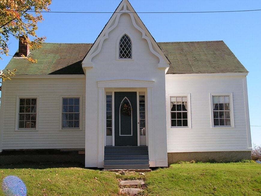
18. Harrington
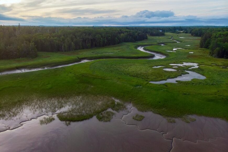
Harrington rests quietly between sprawling blueberry barrens and winding tidal inlets, far from Maine’s traveled roads. Simple clapboard homes and a weathered wharf hint at a life paced by tides rather than clocks.
Morning fog drifts in from the Harrington River, softening the boundary between land and sea as egrets pick their way through marsh grasses. Visitors may paddle the calm river, stop by the small historical society, or watch seals surface near the river mouth.
In late summer, tractors roam berry fields while boats work the inshore waters for lobster and clams. Blueberry farming and fishing still support many who call this place home. It’s a town that reminds you slowness isn’t something to escape—but something to savor.
Where is Harrington?
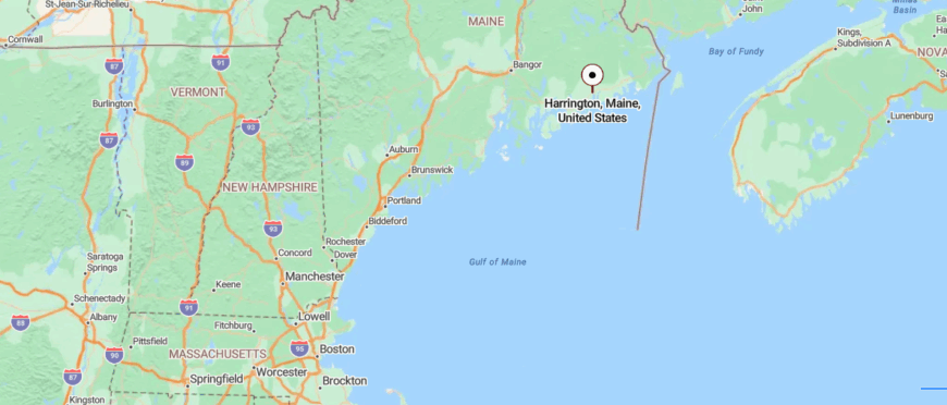
Harrington, Maine rests along a sheltered bend of Pleasant Bay on the Down East shoreline, surrounded by tidal rivers and blueberry land. About 75 miles east of Bangor and several turns south of Route 1, it keeps its distance from the more traveled coastal circuit.
The approach rolls over farm fields and through pockets of dark pine before the road slips quietly toward harbor and marsh. It’s not far in miles — but it feels like a place time decided to slow down for.
17. Addison
Addison unfolds across a patchwork of salt marshes, hidden tidal creeks, and blueberry-covered hills that keep it quietly tucked away from the rest of Down East Maine.
Reached by narrow backroads that twist through field and forest, the town feels both expansive and remote, shaped more by shoreline and sky than by structure. At dawn, soft fog creeps up the Pleasant River and gulls wheel over aging docks that speak more of work than of welcome.
Visitors might hike through Tide Mill Creek Preserve, launch a kayak into silvery Addison Harbor, or explore old cemeteries that speak of long maritime histories. Lobstering and blueberry farming still shape most days, threading modern life to centuries of tradition.
Where is Addison?

Addison, Maine sits tucked along the jagged shores of Wohoa Bay in Washington County, where salt marshes, tidal inlets, and islands knit into a quiet coastal maze. Roughly 80 miles east of Bangor and several winding miles off the main Route 1 corridor, it keeps itself just out of easy reach.
To arrive, travelers follow narrow back roads that twist through wild blueberry barrens and spruce forests before rounding the final turn toward open sea. It’s close enough to find — yet distant enough to feel worlds away.
16. Steuben
Tucked behind thick spruce forests and winding coastal roads, this Down East harbor town stays hidden from Maine’s tourist maps. Weathered docks lean into Pigeon Hill Bay as lobster boats rumble out before dawn, trailing gulls in their wake.
Silence here is broken only by wind in the trees and the distant slap of waves on granite shore. Wanderers hike the Petit Manan Wildlife Refuge, explore tide pools along rocky beaches, or watch seals bob in the surf.
Most locals still make their living from the sea, their routines tied to tides and seasons. In a world that rarely slows down, Steuben reminds you some places never hurried to begin with.
Where is Steuben?
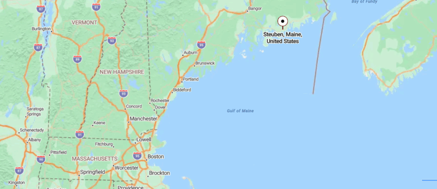
Steuben, Maine rests along the rocky edge of Gouldsboro Bay, tucked between tidal flats and forested headlands on the Down East coast. Located about 70 miles east of Bangor and a few quiet turns south of Route 1, it avoids the flow of more familiar seaside traffic.
Reaching it involves a rural drive that winds past weathered barns, stretches of wild blueberry fields, and long views of the sea appearing just when the road bends. It’s the kind of place that doesn’t announce itself — it simply waits to be found by those willing to wander a little farther.
15. Gouldsboro
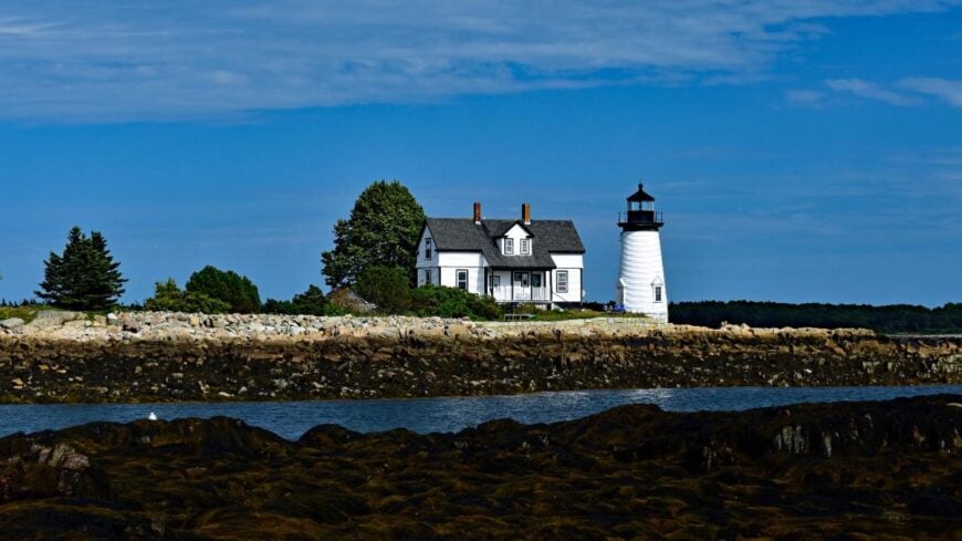
Hidden along a maze of peninsulas and inlets, this quiet coastal stretch feels like a place the modern world forgot to hurry through. Narrow roads weave past crumbling granite quarries, weathered fishing shacks, and forests that creep right down to tidewater.
The air tastes of salt and pine, carried in on breezes that seem to speak only in whispers. Visitors may wander Corea’s working harbor, explore Schoodic Point’s crashing cliffs, or search for sea glass on tucked-away beaches.
Lobstering still anchors most households, with traps stacked high along rutted drives and boats tracing familiar routes across Frenchman Bay. Gouldsboro lingers in the heart as a reminder that some of Maine’s wildest beauty lies far from its postcards.
Where is Gouldsboro?
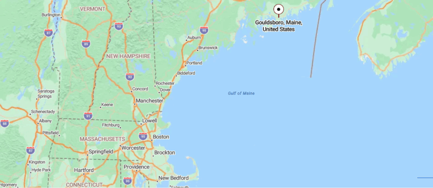
Gouldsboro, Maine stretches along a rugged peninsula on the eastern side of Frenchman Bay, forming part of the quieter Schoodic portion of the Down East coast. About 45 miles east of Bangor and hidden a few turns off Route 1, it stays just beyond the reach of the crowds heading toward Bar Harbor.
Travelers reach its scattered harbor villages by following narrowing roads that wind past tidal inlets, weathered shingled homes, and thick stands of spruce. It’s a place where the landscape slowly steals the noise from your thoughts, leaving only sea, sky, and stillness.
14. Winter Harbor
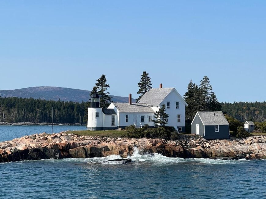
Perched on the edge of the Schoodic Peninsula, this harbor town feels cradled between crashing surf and deep evergreens, far removed from Maine’s busier coastal bustle.
A handful of shingled storefronts, art studios, and fishing docks mark the village, surrounded by the vast wild sweep of Acadia’s lesser-visited side. In the mornings, lobster boats cut across calm waters while fog curls over rocky ledges like a whispered secret.
Exploring Schoodic Point’s jagged coastline, biking its looping park roads, or browsing handmade crafts becomes less activity and more quiet ritual. Tourism mingles gently with maritime tradition, sustaining locals without ever disturbing the town’s steady rhythm.
Where is Winter Harbor?
Winter Harbor, Maine lies on the Schoodic Peninsula, facing the open Atlantic across from Mount Desert Island’s more crowded shores. Roughly 45 miles east of Bangor and a turn south off Route 1, it sits just outside the familiar loops of Acadia traffic.
Getting there involves a drive along narrowing shoreline roads that pass lobster traps, spruce woods, and sudden ocean vistas. It’s close enough to see the busier world across the bay — yet distant enough to feel like a refuge held apart.
13. Franklin

🔥 Would you like to save this?
Tucked along backroads between forested hills and tidal flats, this inland coastal town slips easily under most travelers’ radar. The landscape shifts quietly from mossy woods to the wide sweep of Taunton Bay, where saltwater mingles with river and marsh.
Porch lights glow on old farmhouses, and the rhythms of life still follow logging trucks, school buses, and the rise and fall of the tide. Wandering visitors might kayak winding estuaries, explore hidden shell heaps from ancient Wabanaki camps, or hunt for antiques in unassuming roadside barns.
Blueberry farming and small-scale fishing still support many families who’ve stayed for generations. In Franklin, the quiet isn’t empty—it’s rich with the kind of stillness that lets you hear your own thoughts again.
Where is Franklin?
Franklin, Maine rests along the northern rim of Taunton Bay, where forested hills slip gently toward quiet tidal flats. Located about 40 miles east of Bangor and south of Route 1 at a sleepy crossroads, it stays tucked behind the better-known coastal detours.
Reaching it means following a winding stretch of country road that threads through tall spruce, blueberry fields, and weathered farmsteads before reaching the water’s edge. It’s the sort of place you arrive at slowly — and leave feeling like you’ve stepped out of the rush of time itself.
12. Sorrento
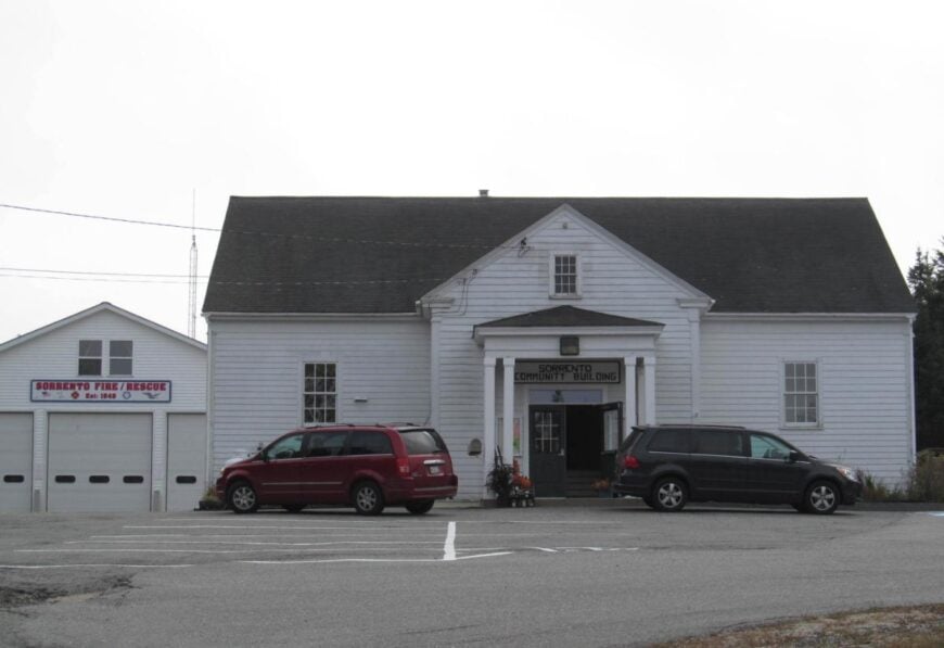
Reached by a winding coastal road that skirts coves and spruce-topped bluffs, this tiny seaside enclave feels tucked away in its own time-worn corner of Frenchman Bay. Elegant old cottages perch above granite shores, whispering of a bygone summer colony now gently surrendered to peace and quiet.
Fog rolls in like a soft curtain each morning, muffling gull calls and slowing the pace of every passing hour. Visitors kayak glassy waters, explore tidal islands, or simply sit on weathered porches watching lobster boats trace their daily paths.
Seasonal tourism mixes with fishing to sustain those who remain year-round. Sorrento makes its mark not with noise, but the rare hush that reminds you why people once came here to escape the world.
Where is Sorrento?
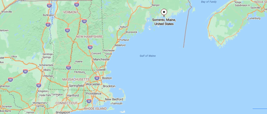
Sorrento, Maine occupies a small peninsula on Frenchman Bay, gazing across the water toward the distant mountains of Acadia. Around 40 miles east of Bangor and south of Route 1 near Sullivan, it remains off the main tourist circuit despite its postcard-worthy setting.
Visitors reach it by traveling a narrowing coastal road that slips past summer cottages, tidal coves, and quiet stands of spruce before ending at the village’s edge. It’s a place where the world seems to pause — caught between sea breeze, silence, and sky.
11. Sullivan
Cradled between sea and mountains, this stretch of coastal Maine lingers just out of sight from the hurried traveler. Long tidal flats reach toward the shimmering expanse of Frenchman Bay, while Schoodic Mountain rises behind like a silent guardian.
Life here feels stitched together with salt air, forest trails, and the soft creak of old wharves bowing to changing tides. Wanderers explore Tunk Lake’s pristine waters, hike nearby peaks, or search for fossils in rock ledges exposed at low tide.
Fishing and small-town trades still support many families who have known these inlets for generations. In Sullivan, time seems to widen rather than rush, inviting you to let the world fall quiet for a while.
Where is Sullivan?
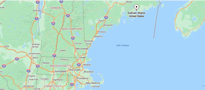
Sullivan, Maine stretches along the head of Frenchman Bay, where granite ledges and tidal flats look out toward Mount Desert Island’s distant peaks. Situated about 40 miles east of Bangor and set just off Route 1, it sits close enough to the main road to be found — yet far enough from the crowds to remain quiet.
Reaching its shorefront requires turning down a series of winding side roads that pass farmhouses, marshes, and weathered stone walls before meeting the bay. It’s a place where the hum of travel fades into the soft rhythm of wind, tide, and time.
10. Eastport
Perched on Moose Island and surrounded almost entirely by the Bay of Fundy, Eastport feels like the ocean has claimed it more than the land has. Wooden piers, clapboard storefronts, and weathered canneries line the waterfront, echoing its long history as a sardine-packing capital. Today, fishing boats and aquaculture pens anchor the economy, while artists’ studios fill the gaps left by vanished factories.
The town’s rhythm follows the tides, which here rise and fall nearly 25 feet, leaving fishing vessels perched on mud flats one moment and afloat the next. Visitors walk the historic downtown, watch whales in Passamaquoddy Bay, or cross the short causeway to Shackford Head State Park for headland trails and Fundy panoramas.
Even in summer, Eastport feels less like a tourist stop and more like a living seaport where neighbors still know each other by boat as much as by name.
Where is Eastport?
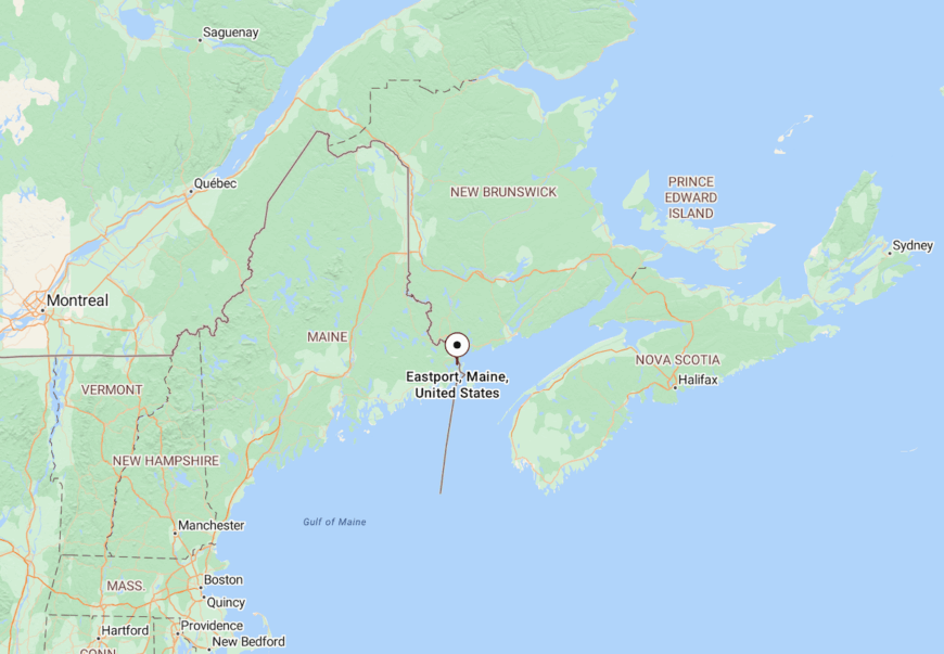
Eastport, Maine lies at the far eastern tip of Washington County, just across a narrow channel from Canada’s New Brunswick. It sits about 120 miles east of Bangor, accessible by Route 190 and a short causeway that connects Moose Island to the mainland.
The approach winds past tidal flats and marshes before revealing the compact harbor town tucked against the bay. With Canada visible across the water and the Atlantic stretching wide to the south, Eastport feels like the true edge of coastal Maine.
9. Trescott Township
Trescott Township in Washington County counts roughly 230 residents spread over more than 46 square miles, leaving plenty of elbow room. The township borders the famed Bold Coast Trail, so days fill with cliff hike panoramas, tidepool rambles, and seabird photography at Bog Brook Cove Preserve.
Wild blueberry cultivation and lobster fishing are the primary livelihoods, with seasonal field crews and working waterfronts lending subtle bustle in summer. There are no incorporated villages, chain stores, or streetlights, which helps night skies stay coal black.
Setbacks of 10 acres or more are common, and most homesteads rely on private wells and generators during winter storms. All told, Trescott delivers textbook coastal isolation while still sitting on the continental mainland.
Where is Trescott Township?

🔥 Would you like to save this?
Located east of Cutler and west of Lubec, Trescott forms a long finger that juts toward the Bay of Fundy. Although U.S. Route 1 passes six miles inland, secondary roads end abruptly at coves, forcing long detours and reinforcing the remote feel.
Salt marshes, steep headlands, and expanses of blueberry barrens block easy north-south travel, so even locals plan errands carefully. Drivers usually reach Trescott by turning off Route 189 or Route 191 and following narrow paved lanes that soon lose their centerline.
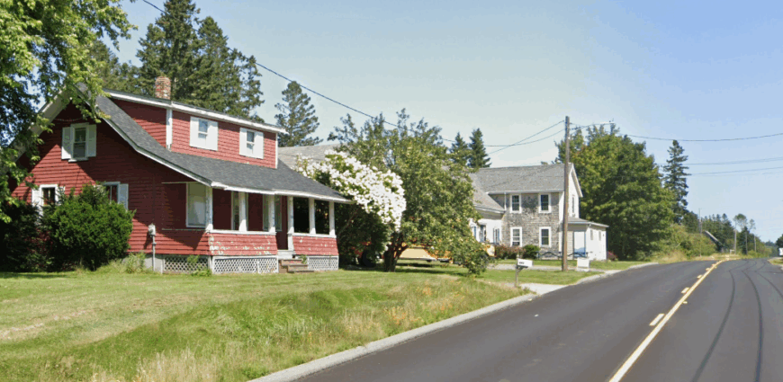
8. Edmunds Township
Home to roughly 300 people, Edmunds Township balances dense spruce stands with sweeping mudflats at the head of Cobscook Bay. Outdoor options roll from tidal kayaking in Reversing Falls to quiet walks along the Cobscook Bay State Park loop where moose tracks appear in campground sand.
Residents often rely on small scale fishing, clam harvesting, and seasonal guiding for income, with a few working remotely through patchy internet connections. The township’s population density hovers below 20 people per square mile, and many houses sit tucked behind half-mile driveways invisible from the road.
Streetlights stop at the park entrance, and night silence is broken only by loon calls. Visitors find that the lack of built-up waterfront keeps the bay views unusually open.
Where is Edmunds Township?
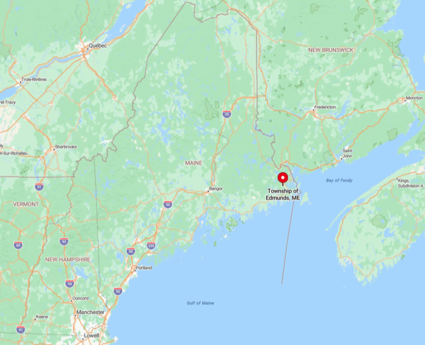
Edmunds lies midway between Eastport and Machias along a quiet bend of U.S. Route 1, yet thick woods mask most of its homes from passing traffic. Secondary roads often end at tidal creeks, blocking shortcuts to neighboring communities.
The nearest full grocery store is 18 miles away, and the border station at Calais sits a 40-minute drive north, adding to the township’s apartness. Arrival is simplest by car along Route 1, though many travelers miss the turn for South Edmunds entirely.
7. Swan’s Island
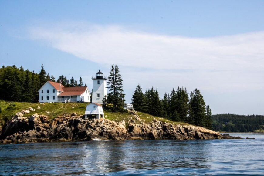
Swan’s Island supports about 330 year-round residents scattered across 7,000 acres of granite ridges and sheltered coves. Days flow with lobster boat departures at dawn, beachcombing at fine-sand Carrying Place Beach, or tracing spruce-lined Island Road by bicycle.
Lobstering remains the economic anchor, supplemented by seasonal rental cottages and a modest boat-building shop near Atlantic. Large lots, an absence of hotels, and strictly limited zoning keep crowds away even in July.
Outdoor evening concerts at the restored Odd Fellows Hall offer casual community gatherings without the bustle found across the bay in Bar Harbor. Quiet corners like Mill Pond, where eider ducks outnumber people, underline just how secluded this working island feels.
Where is Swan’s Island?
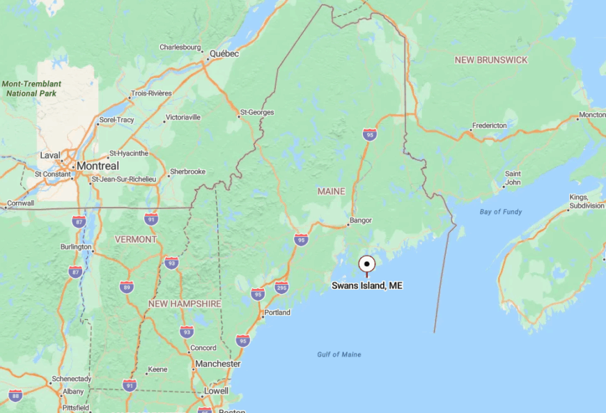
The island floats six miles south of Mount Desert Island, forming a guard at the mouth of Blue Hill Bay. Access hinges on the Maine State Ferry that sails from Bass Harbor several times daily, though winter schedules shrink to two or three runs.
With no bridge and only one public dock, visitors must plan around tidal freight deliveries. Once ashore, a web of narrow asphalt and gravel lanes curves through spruce, eliminating any sense of mainland hustle.
6. Great Cranberry Island
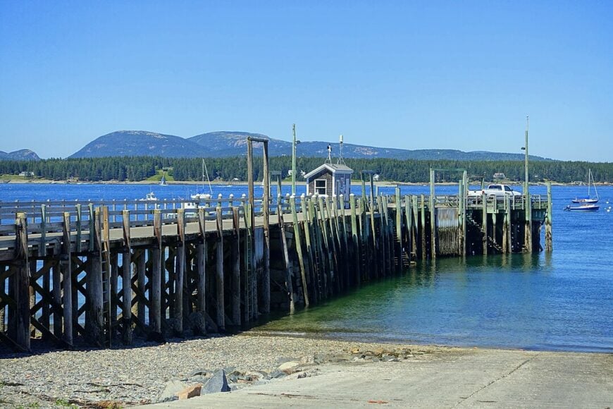
Great Cranberry Island counts roughly 80 full-time inhabitants, giving a population density of about 30 people per square mile on its two square miles of land. Attractions include the historic Cranberry House museum, gentle meadow walks to Whistler Cove, and plein-air painting sessions overlooking open Atlantic swells.
Lobster fishing and small home-based art studios are the leading income sources, with seasonal cranberry bog harvests providing a nod to the island’s name. A single paved road runs the island’s length, and most homes sit on multi-acre parcels bordered by wild rose hedges.
The lack of cars after sunset and the absence of commercial signage preserve dusk quiet worthy of a nature preserve. Even in August, seekers of solitude can wander the grassy spit at Preble Cove without meeting another person.
Where is Great Cranberry Island?
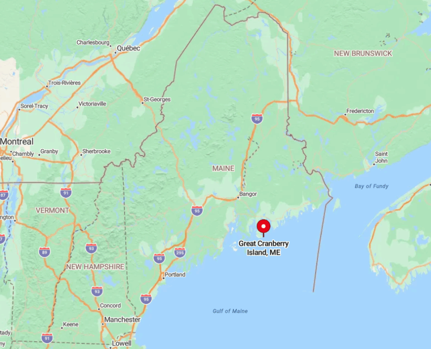
This island rests directly south of Southwest Harbor in the Cranberry Isles township. Passenger ferries leave from Northeast Harbor and Southwest Harbor, a 20-minute ride that doubles as a wildlife cruise past seals and porpoises.
Freight must arrive on a separate barge, which operates only a few days each week, adding logistical hurdles that discourage heavy development. Once the last ferry departs at dusk, Great Cranberry reverts to deep quiet broken only by bell buoys offshore.
5. Frenchboro on Long Island
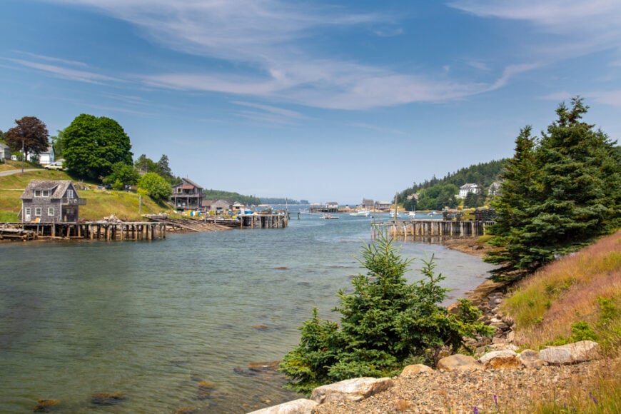
Frenchboro, the lone village on Long Island in Blue Hill Bay, hosts around 40 year-round residents whose clapboard homes cluster around Lunt Harbor. The nine-mile Frenchboro Preserve Trail system loops through mossy spruce forest to sea bluffs where razorbills ride updrafts, giving hikers surprising variety for such a small island.
Lobstering underpins the local economy, with family boats tying up at docks no cruise ship could ever reach. Roughly 90 percent of the island’s 8,400 acres remain undeveloped, so deer, hare, and spruce grouse outnumber people.
Even summer nights stay dark enough that neighbors trade meteor shower sightings over VHF radio. Limited ferry service keeps day-tripper numbers low, turning the deep natural harbor into a soundscape of lapping water and gull cries.
Where is Frenchboro?
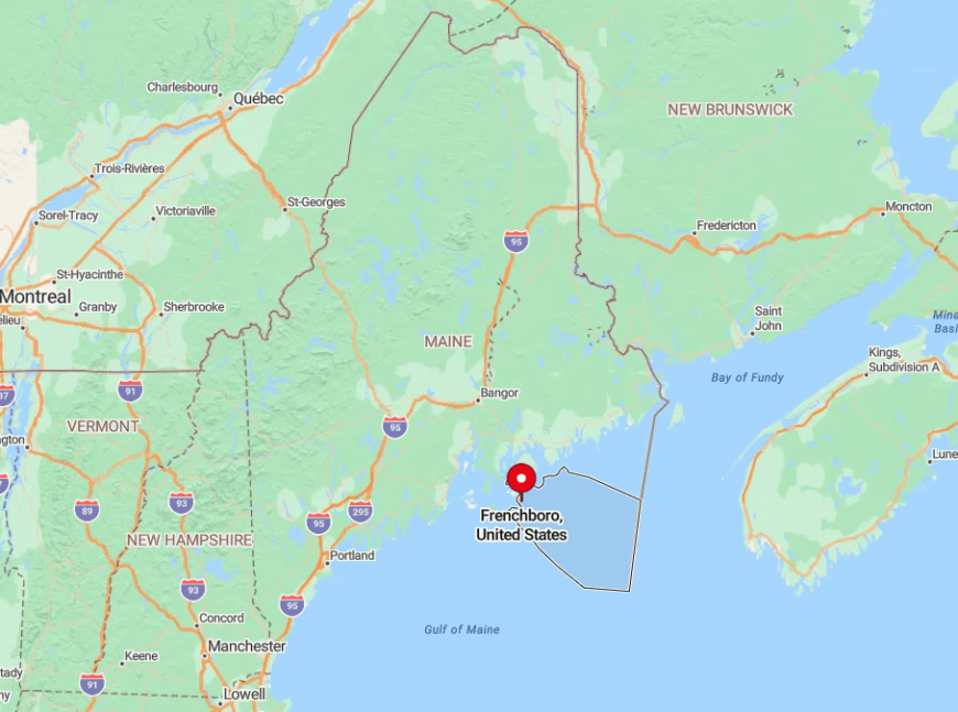
The island lies 12 miles southwest of Mount Desert Island, surrounded by the tangle of ledges that mark Blue Hill Bay. A state-run mail boat from Bass Harbor calls year round, though only twice a week during winter, while a private water taxi fills in gaps for those willing to pay.
Fog and heavy seas often postpone crossings, explaining why grocery runs require backup plans. Once ashore, the single lane that rings Lunt Harbor ends at dirt tracks leading to trailheads, emphasizing the island’s limited footprint.
4. Isle au Haut
Isle au Haut maintains a permanent population just under 60, with roughly half the land protected as part of Acadia National Park. Locals and visitors hike rugged Duck Harbor Mountain, picnic at Deep Cove, or cycle the narrow north-island loop road that threads spruce forest and tidal ponds.
Lobster fishing remains the dominant livelihood, complemented by a small general store and seasonal park campground. Most homesteads sit on one-acre clearings ringed by evergreens, and minimal street lighting safeguards star filled skies that have tempted astrophotographers for decades.
Park land limits new construction, insulating the island from overdevelopment. Even at the village wharf, the hush between mail boat arrivals feels almost staged.
Where is Isle au Haut?
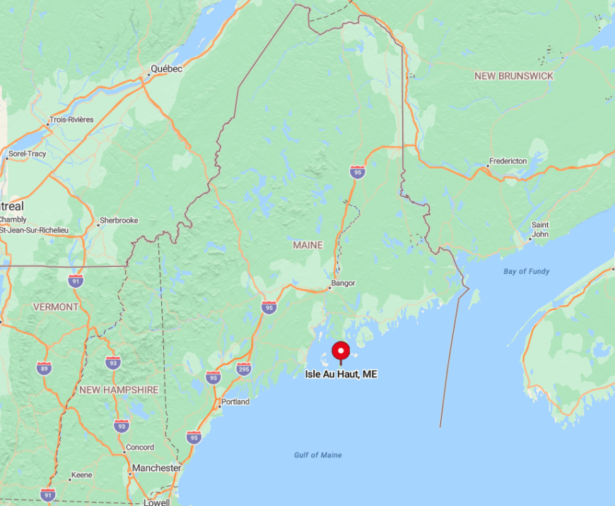
Positioned roughly 7 miles south of Stonington in outer Penobscot Bay, the island is reachable only by the Isle au Haut Boat Company ferry, a 55-minute ride that carries passengers, freight, and the day’s mail.
Weather and sea state often dictate whether the boat reaches the town wharf or lands at Duck Harbor, adding a layer of logistical adventure. No cars are available for rent, so visitors rely on bicycles or footpaths, magnifying the sense of removal. With the mainland horizon barely visible, the island feels set adrift in its own quiet world.
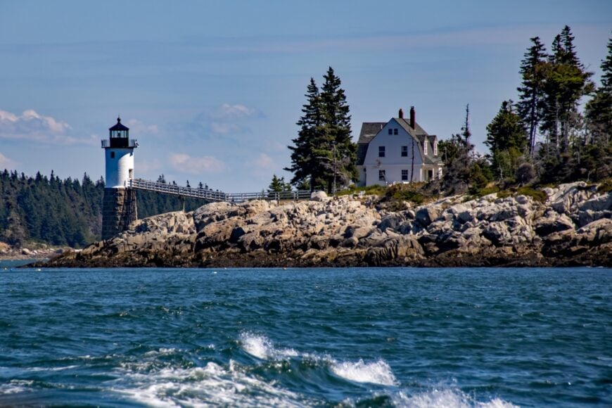
3. Criehaven (Ragged Island Township)
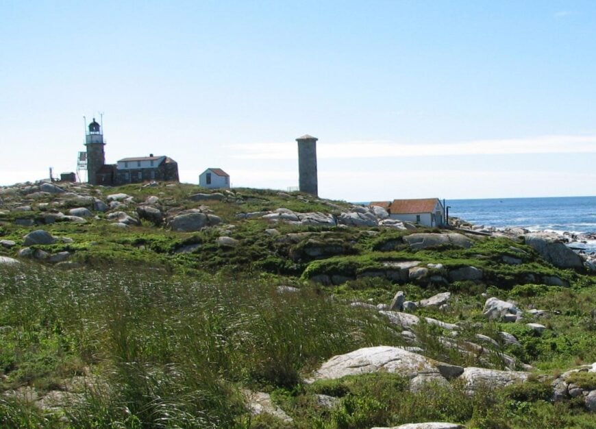
Criehaven, known administratively as Ragged Island Township, supports only a handful of seasonal residents and rarely more than ten winter caretakers. The landscape mixes mile-wide open meadows with stands of spruce and a postcard-ready lighthouse perched on the eastern bluff.
Traditional lobster fishing provides the seasonal economic heartbeat, though most cottages run off generators or solar panels, underscoring the off-grid ethos. There are no stores, restaurants, or municipal services; neighbors barter fuel deliveries and share a communal wood-splitting shed by the old schoolhouse.
More than half the archipelago remains wild, so ground-nesting seabirds have reclaimed large sections of shoreline. The absence of commercial ferry service keeps day visitors practically nonexistent.
Where is Criehaven?
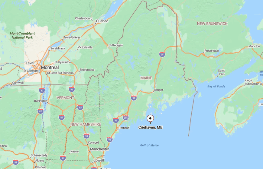
The township sits about 15 miles southeast of Rockland, beyond the outermost islands of Penobscot Bay. Travel requires a chartered lobster boat, private yacht, or, for those in a hurry, a short hop on a chartered seaplane that lands in the protected western cove.
Heavy fog can strand guests for days, which locals view as part of the charm. Once the boat’s engine fades, wind in the grass takes over as the loudest sound.
2. Matinicus Isle Plantation
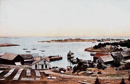
Matinicus hosts roughly 140 year-round residents across five square miles, making it Maine’s most remote fully-inhabited island community. Watching sunrise from South Sandy Beach, photographing gray seals at Wooden Ball Island, or visiting the one room Matinicus Library give visitors a look into an insular maritime culture.
Lobstering dominates daily life, and every home seems to carry spare traps or buoys stacked by the driveway. Vacant lots fill with beach rose and juniper, leaving panoramic ocean views in almost every direction. With no bar or hotel, evenings revolve around potlucks at the church hall or family bonfires on the granite shore.
At night, the darkness feels complete, broken only by the sweep of Matinicus Rock Light 5 miles offshore.
Where is Matinicus Isle Plantation?
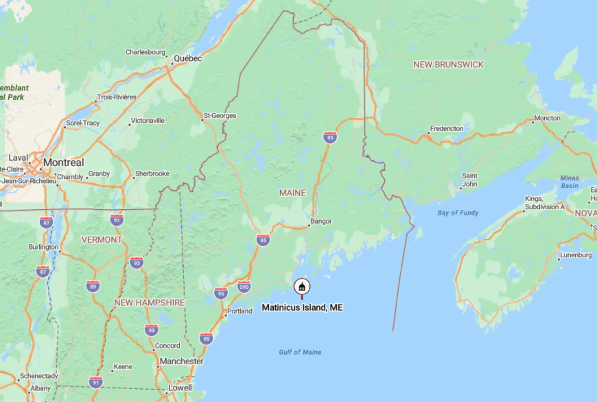
The island lies 20 miles from the mainland, farther out than any other year-round settlement in the Gulf of Maine. A mail boat from Rockland runs roughly twice a month in winter and weekly in summer, while Penobscot Island Air provides brief but weather-dependent flights to a small gravel runway.
Thick fog or heavy seas often delay both, reinforcing the island’s independence. Once arrivals step off the vessel, everyone travels on foot, bicycle, or the occasional pickup truck that bumps along narrow tracks flanked by wildflowers.
1. Monhegan Island: Artists’ Outpost 12 Miles Offshore
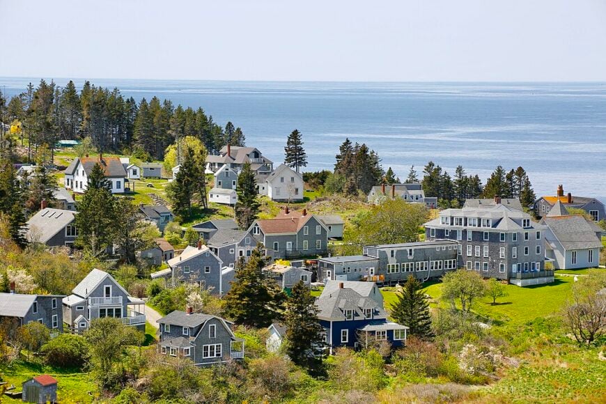
Monhegan’s resident count hovers just under 70, yet its reputation as an artists’ colony spans more than a century. Visitors fill days hiking 12 miles of cliff top trails, sketching craggy headlands at Lobster Cove, or touring small studios that open their doors in summer.
Fishing and boatbuilding underwrite the local economy, with tourism playing a seasonal supporting role that never quite overwhelms village character. The absence of cars maintains a gentle pace: wheelbarrows and hand carts serve as moving vans along the dirt paths that snake between weathered cottages.
Large house lots and a ring of protected land keep development at bay, preserving expansive meadow vistas visited by monarch butterflies each September. Even at peak season, it takes only a few minutes to find a quiet bench overlooking the Atlantic with nothing but surf for company.
Where is Monhegan Island?
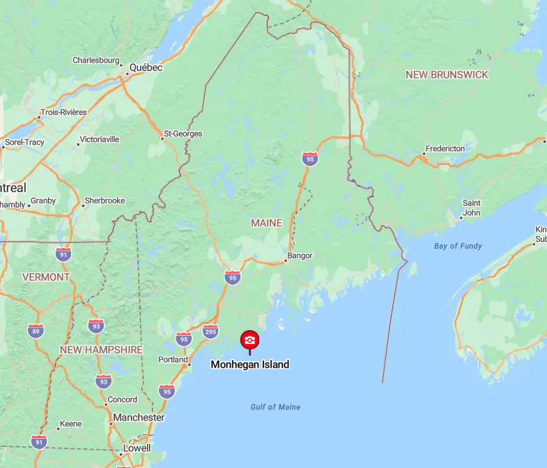
Monhegan floats 12 nautical miles off Port Clyde, a journey reached only by scheduled passenger ferries from Port Clyde, New Harbor, or Boothbay Harbor. The hour-long crossing can feel longer on choppy seas, but harbor porpoise sightings often compensate.
With no airstrip and no car ferry, the island remains free of motor traffic other than a couple of service trucks. Once the last afternoon boat departs, Monhegan settles into a hush broken only by gulls and the low hum of island generators.