🔥 Would you like to save this?
Northwest Massachusetts hides some of the quietest towns in New England, places where night skies stay black, main streets see more deer than cars, and neighbors know each other by the sound of a pickup on a dirt road.
Our list explores ten such communities, each tucked behind ridgelines or wrapped in deep forest that muffles the outside world. Readers will find century-old farmhouses, kettle-pond mornings, and ridge-top cabins that trade urban convenience for wide horizons.
In order to come up with the very specific design ideas, we create most designs with the assistance of state-of-the-art AI interior design software. Also, assume links that take you off the site are affiliate links such as links to Amazon. this means we may earn a commission if you buy something.
The region’s rolling highlands once fueled logging and small-scale farming, and those roots remain visible in stone walls, hayfields, and sugar shacks still firing in March.
These spots also serve as gateways to hidden waterfalls, forgotten orchards, and unmarked trailheads locals guard with a wink. Consider this a road map to seclusion in the northern Berkshires and hilltown high country.
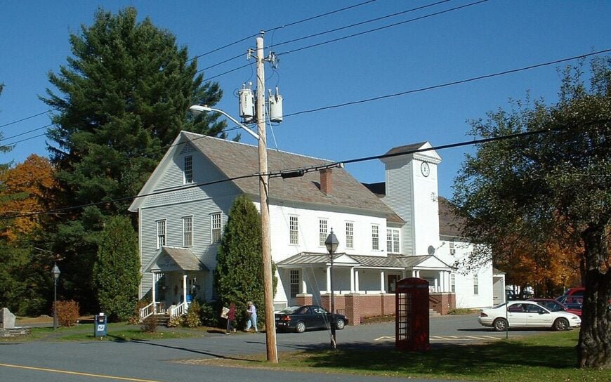
25. Colrain – Orchards in the Hills, Stillness in the Bones

Colrain hides in the folds of the northern Berkshires, where apple orchards run up hillsides and dirt roads cross old stone bridges. Its 1,600 residents are scattered across a wide stretch of Franklin County, giving the town the feel of a series of quiet hollows rather than a single place.
You’ll find rustic barns, crumbling foundations overtaken by moss, and winding drives that seem to lead only to sky and trees. Life here is centered on the land—organic orchards, small homesteads, and tucked-away artisans working in reclaimed barns.
Visitors often hike Catamount Hill, picnic by the Green River, or browse pottery at roadside studios. Cell service fades early, and the hills muffle most noise. It’s the kind of place where a single sunrise can keep you company all day.
Where is Colrain?

Colrain sits along the Vermont border in northwestern Franklin County, about 15 miles northwest of Greenfield. The town is reached by Route 112 and a maze of narrow local roads that dip and rise through forested ridgelines.
The closest interstate access lies well to the east, leaving Colrain isolated by distance and terrain. It’s close enough to drive to, but distant enough to feel like the mountains are keeping secrets.
24. Ashfield – Lakeside Cabins and Covered Bridges

Ashfield balances charm and isolation like a well-worn canoe on quiet water. Its center holds a classic New England village green, but step away from the main road and you’re swallowed by forest, hills, and the hush of rural life.
The town wraps around Ashfield Lake, where loons call at dusk and summer cottages disappear behind maple trees. With a population of just over 1,700, it feels spacious—homesteads here are often buffered by pastures or stone walls.
Visitors hike Bear Swamp Reservation, explore Chapel Brook Falls, or linger over pie at Elmer’s Store. Locals include organic farmers, writers, and musicians who traded city noise for woodstove warmth. Ashfield has that rare, humming stillness that stays with you long after you leave.
Where is Ashfield?

Located in the hilltown belt of western Franklin County, Ashfield sits about 25 miles west of Northampton. It’s accessible via Route 116, which winds up through tree-lined switchbacks and remote farms.
The road slows you down, encouraging a deeper breath with every curve. By the time you crest the ridge and drop into town, the rush of elsewhere has already faded.
23. Charlemont – A Quiet Trail Town in the Trees

Charlemont feels like a hidden chapter in a book you thought you’d finished—a valley town where forested hills crowd in close and the Deerfield River whispers through. Though it’s best known to adventurers as the home of whitewater rafting and Berkshire East Mountain Resort, the residential heart of Charlemont is tucked away in side roads and shadowed ravines.
Homes perch on ledges above creeks, and old sugarhouses lean into the trees. Outside of ski season, the town is remarkably quiet—its post office still a gathering place and neighbors waving from pickups. Visitors come to hike Mohawk Trail State Forest or bike the rolling back roads that vanish into the woods.
Most locals work in hospitality or outdoor education, often with deep roots in the hills. It’s the kind of place where even adrenaline finds a place to rest.
Where is Charlemont?

Charlemont lies in western Franklin County along the Deerfield River, about 15 miles west of Greenfield. Route 2 (the Mohawk Trail) winds through town, but steep slopes and sharp curves keep traffic slow.
Many homes and cabins lie hidden above or below the main drag, accessible by narrow dirt lanes. You can get there without much effort—but staying feels like stepping into another world.
22. Middlefield – High Pastures and Hidden Roads

Middlefield is all sky and slope—windswept fields, quiet hollows, and weathered homes perched above the Westfield River gorge. With fewer than 500 residents, it’s one of the least populated towns in the region, and that lack of bustle is part of its charm.
The soundscape here is dominated by wind in the trees, the chirp of frogs at twilight, and the occasional creak of a screen door. Hiking Tolland State Forest or photographing Glendale Falls are favorite local pastimes.
Economic life centers on farming, forestry, and working from home—many residents are creatives or retirees drawn by the silence. Dirt roads outnumber paved ones, and streetlights are rare. It’s a place that asks nothing of you but still gives you peace.
Where is Middlefield?

Middlefield sits in the southern edge of the Berkshire hilltowns, about 20 miles west of Northampton and 30 miles east of Pittsfield. Reaching it requires a slow drive up Route 143, which threads through narrow ravines and open pastureland.
Its location on a high ridge means weather rolls in quickly and visitors often lose cell service on the way up. By the time you arrive, the rest of the world feels miles below.
21. Cummington – Old Stone Walls and Long Shadows
Cummington clings to the ridgeline like a well-kept secret, its quiet broken only by wind through birch trees and the occasional passing tractor. The town’s layout sprawls across forested uplands and scattered fields, with the Westfield River running cold and clean through its southern edge.
At its center is a small cluster of buildings—church, post office, library—but beyond that, the woods close in. Nature trails at Petticoat Hill and the walking paths of the William Cullen Bryant Homestead offer rich solitude and deep history. Farming, arts, and a bit of remote tech work make up the local economy.
What keeps Cummington secluded isn’t just the geography—it’s the way the community prefers it that way. It’s a place where shadows grow long and silence holds weight.
Where is Cummington?

Perched along the Hampshire-Berkshire border, Cummington is about 25 miles northwest of Northampton. It’s reached via Route 9, which winds up from Williamsburg and climbs steadily into the hills.
Cell signals waver, and gas stations vanish after the valley floor. By the time you reach the crest, it feels like the world has narrowed to trees, stone, and sky.
20. Worthington – Forest Farms and Forgotten Roads

Worthington sits at the edge of the world—or at least, it feels that way. Tucked high in the Berkshire Hills, it’s a place where forests close in, pastures roll gently away, and unpaved roads lead to old farmhouses that seem grown from the earth itself.
The town’s layout is loose and rural, with more trees than signs and more barns than storefronts. People here hike in Fox Den Wildlife Management Area, tend to maple taps in spring, or attend a community supper at the Five Eyed Fox.
With a population of around 1,100 and no fast food in sight, Worthington moves at its own careful pace. Small farms, self-employed trades, and remote workers form the backbone of life here. It’s a town that asks you to slow down—and rewards you with quiet.
Where is Worthington?

Worthington sits in northwestern Hampshire County, about 30 miles northwest of Northampton and 20 miles east of Pittsfield. The main access is via Route 112, a winding road through valleys and dense forest.
Most homes lie off secondary roads, many of which turn to gravel as they climb into the hills. It’s just far enough from anywhere to feel like nowhere.
19. Shutesbury – Lake Fog and Library Silence
🔥 Would you like to save this?
Shutesbury wears the woods like a blanket—thick, quiet, and sheltering. Its tight-knit community is wrapped around Lake Wyola and sprawling conservation land, where dirt roads curl through hardwood forest and summer cabins peek from behind ferns.
Though not far from Amherst in miles, Shutesbury feels distant in spirit. The town hosts poetry readings at its tiny hilltop library and stargazing parties at unlit fields where the Milky Way cuts clearly through the sky.
Locals kayak the lake, hike Rattlesnake Gutter, or simply disappear into the trees. Many residents are artists, teachers, or retirees, supported by a mix of remote work and seasonal tourism. It’s a place where quiet isn’t a side effect—it’s the point.
Where is Shutesbury?

Shutesbury is nestled in the uplands east of Amherst, straddling the Franklin-Hampshire County line. It lies about 15 miles northeast of Northampton, accessible via winding local roads from Leverett or Pelham.
There are no direct highways—just canopied lanes and ridge-climbing routes. It’s surprisingly close to everything, but it still feels completely apart.
18. Sandisfield – Pines, Ponds, and Time Forgotten

Sandisfield is the kind of place that seems to exhale—softly, slowly—through its deep pine forests and still glacial ponds. Located in the southern tip of the Berkshires, this town covers more square miles than Boston, yet holds only around 900 residents.
Homes are few and far between, often hidden behind dense woods or lining quiet stretches of Route 57. Visitors canoe the peaceful Lower Spectacle Pond, stroll through York Lake State Forest, or take backroad drives past old stone walls and sugar shacks.
The absence of streetlights, chain stores, and traffic makes nightfall feel like a retreat into another century. Local life leans on trades, remote work, and seasonal rentals. It’s the kind of town where nothing happens—and that’s exactly what people come for.
Where is Sandisfield?

Tucked into the southeastern corner of Berkshire County, Sandisfield is about 30 miles south of Pittsfield and 25 miles northwest of Hartford, Connecticut. Route 57 is the main artery, a quiet, winding road that threads through forest and wetland.
The town’s large area and minimal infrastructure make it feel bigger and lonelier than its population suggests. You don’t just arrive in Sandisfield—you disappear into it.
17. Chesterfield – Ridge Farms and River Paths

Chesterfield stretches across a high plateau west of the Connecticut River Valley, a town defined by its quiet ridges, historic farmsteads, and cool riverbanks. The Westfield River curls through the town’s southern edge, carving deep pools for swimming and feeding lush summer meadows.
Houses often sit at the ends of long dirt driveways, framed by sugar maples and dry-laid stone walls. Locals gather for the Chesterfield 4th of July Parade or meet at the General Store for hot cider in fall.
With no stoplights and limited cell service, the pace is slow and personal. Farming and crafts still thrive, supported by people who value work done by hand. Chesterfield is less a destination than a mood—still, thoughtful, enduring.
Where is Chesterfield?

Located in western Hampshire County, Chesterfield lies about 20 miles west of Northampton and just north of Worthington. Route 143 crosses through, though most of the town lies on side roads and unpaved routes up steep hills.
The climb into town is gradual, marked by open pasture and forest. It’s a place you reach intentionally—and once there, you tend to stay a while.
16. Montgomery – Quiet Cliffs and Unmarked Trails

Montgomery is a cliffside town that never quite reveals itself at once. Tucked against the edge of the Berkshire escarpment, its homes cling to winding roads that overlook the Middle Branch of the Westfield River. Rock outcrops, hemlock groves, and steep, shadowed valleys make it feel wilder than nearby towns.
With fewer than 900 residents, it offers ample solitude—just birdsong, creek noise, and the occasional woodsmoke drifting from a chimney. Residents explore Tekoa Mountain, walk hidden trails, or fish deep river pools.
Employment leans on trades, with some residents commuting to Westfield but returning each evening to their patch of peace. Montgomery doesn’t announce itself—it just waits quietly to be found.
Where is Montgomery?

Montgomery lies in Hampden County, perched on the high ridge between Westfield and Huntington. It’s just 10 miles northwest of Westfield, but the steep roads and dense woods create a buffer that feels much greater.
Route 20 grazes the southern edge, but the town’s heart lies far above it, reached only by local roads that twist uphill. It’s a place where elevation and trees seem to conspire to keep the quiet in.
15. Becket – Pines, Poetry, and Pond Reflections

Becket is a town of pine stillness and pond reflections, where art and nature meet in long stretches of quiet. The forest is thick here, broken only by the occasional dirt road or flicker of light across Center Pond.
While the Jacob’s Pillow Dance Festival brings a summer heartbeat, the rest of the year hums at a slower rhythm—ice fishing, autumn hikes along the Appalachian Trail, or reading by wood stove glow. The town has a strong artist community, alongside loggers, gardeners, and remote workers who value solitude with a creative spark.
Cabins sit nestled in groves, and trails vanish into hemlock hollows. Becket offers that rare blend of retreat and inspiration—where every quiet moment feels like a page waiting to be written.
Where is Becket?

Becket lies in central Berkshire County, about 15 miles southeast of Pittsfield and just west of the Hampden County line. Route 20 cuts through, but the town itself splinters into gravel side roads that disappear into woods and ridgelines.
Though near the Mass Pike (I-90), it avoids the noise and rush thanks to thick forest buffers and steep terrain. It’s easily reached—but purposefully forgotten.
14. Goshen – Ridge-Tucked and Pond-Ringed

Goshen rests in the highlands like a secret whispered between lakes and trees. Tucked between DAR State Forest and the Chesterfield Gorge, it’s a town wrapped in blue water and rustling hardwoods.
Its small population lives amid deep stillness—one that deepens in winter when the lakes freeze and smoke curls above rooflines. Locals cross-country ski around Highland Lake, hike the shady ridges of the DAR, or sip coffee by woodstoves as the snow piles up.
There’s little commercial presence—just a post office and small library anchoring the civic spirit. Most income comes from forestry, home businesses, and retirees. Goshen is the kind of place where morning fog clings to the ground and nobody minds if the road washes out—it just means fewer visitors.
Where is Goshen?

Situated in northwestern Hampshire County, Goshen is about 20 miles west of Northampton and just north of Chesterfield. Route 9 passes through, though most homes lie beyond it on wooded ridges and narrow drives.
Surrounded by state forest and high-elevation ponds, it feels sheltered from the world. When you arrive, it’s like stepping inside a snow globe—still, enclosed, and peaceful.
13. Tyringham – A Valley Village from a Dream

🔥 Would you like to save this?
Tyringham is what happens when the world forgets to build—and beauty fills the space instead. A narrow glacial valley cuts through low hills and farmland, where a scattering of white clapboard homes and the stone Tyringham Cobble rise like a painting.
A meandering stream, winding roads, and footbridges make the whole village feel cinematic. You’ll find Appalachian Trail hikers resting in the meadow, birders peering into hedgerows, and almost no through traffic. Farming, remote work, and seasonal stays shape its quiet rhythm.
The town’s old Shaker heritage lingers in its clean lines and spiritual hush. It’s a place that doesn’t need anything added—only time to be felt.
Where is Tyringham?

Tucked in southern Berkshire County between Lee and Monterey, Tyringham lies about 6 miles southeast of Stockbridge. It’s accessible via a narrow turnoff from Route 102, but the roads quickly narrow into single-lane valley routes.
Surrounded by ridges, forest, and protected land, Tyringham feels naturally enclosed. It’s a pocket of the past, preserved in hush and hill shadow.
12. Lanesborough – Between a Mountain and a Mirror Lake
Lanesborough straddles the line between a quiet town and a wilderness threshold. Tucked between Mount Greylock to the north and the glassy expanse of Pontoosuc Lake to the south, it’s a stretch of land where nature keeps people apart—in the best way.
While a few houses hug Route 7, most of the town vanishes into forested hills, old farm plots, and steep, unpaved roads. Locals hike to the summit of Greylock, snowshoe along Balance Rock, or simply cast a line into the lake’s early morning stillness.
Work includes a blend of tourism, trades, and old-rooted family businesses. There’s a peaceful, misty stillness here—especially at dawn, when the fog holds the town in its palm.
Where is Lanesborough?

Located in northern Berkshire County, Lanesborough lies just south of Mount Greylock and north of Pittsfield. Route 7 cuts through, but beyond it lies a maze of steep climbs, backroads, and hidden hilltop cabins.
Despite being close to urban services, its geography shields it from the bustle. It’s a borderland—between mountain and lake, noise and silence.
11. New Marlborough – Woods Wide Enough to Disappear

New Marlborough is a town built out of quiet—its five villages spaced by meadows, woods, and time. Stone walls edge maple groves, and old roads stretch unbroken for miles without seeing a single car.
The landscape here is generous: open fields for deer to cross, still lakes for birds to skim, and enough silence to feel sacred. Visitors kayak Umpachene Falls, picnic near Thousand Acre Swamp, or catch folk concerts at the Meeting House in summer.
Most homes sit on acreage, many owned by artists or remote professionals who came for a season and never left. Farming and conservation shape daily life, alongside a small trickle of tourism. In New Marlborough, the land doesn’t just hold you—it absorbs you.
Where is New Marlborough?

Resting in the southernmost corner of Berkshire County, New Marlborough is about 10 miles southeast of Great Barrington. It’s reached via Routes 57 or 183, which pass through miles of forest and open countryside before dipping into town.
With no central downtown and five scattered villages, it feels like several towns held together by wilderness. It’s close to the Connecticut line—but far from anywhere that feels busy.
10. Rowe – A Lakeside Hamlet Lost in the Trees
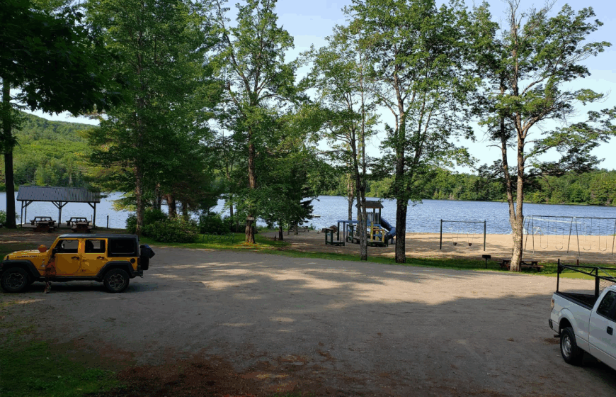
Rowe counts roughly 400 year-round residents scattered around 130-acre Pelham Lake. Summer afternoons invite paddling or casting for bass, while crisp evenings draw walkers onto the three miles of shoreline paths within Pelham Lake Park.
The local economy leans on small farms, a seasonal camp, and telecommuters who favor fiber-optic lines over city lofts. Old farmhouses sit on lots larger than one acre, and the surrounding Mohawk Trail State Forest adds a 15-mile cushion of mountains that shields the town from bright lights and traffic noise.
Yankee Rowe, once the first nuclear plant in New England, now serves as an odd historical footnote rather than an industrial hub. All told, Rowe feels more like an outpost than a suburb, perfect for residents who prefer crickets to car horns.
Where is Rowe?

The town lies in Franklin County’s northwest corner, just south of the Vermont border and west of Charlemont. Dense hardwood ridges and limited road connections funnel nearly all visitors along a single approach, Zoar Road, which twists beside the Deerfield River before climbing into town.
That isolation means no through-route for commuters, a key reason darkness settles early and stars shine bright. Reaching Rowe typically involves a 30-minute drive from Interstate 91 in Greenfield, followed by a steady uphill climb.
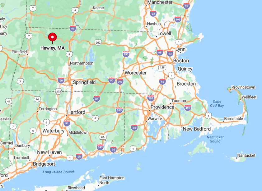
9. Hawley – Hilltop Meadows Above the Mohawk Trail
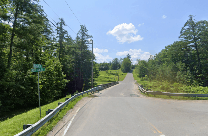
Hawley’s population hovers near 350, spread across a lattice of gravel lanes and high pastures overlooking the Deerfield River valley. Visitors hike to the fire tower on Stump Sprouts Nordic Center trails in winter or wander the boardwalk at the rare Atlantic white-cedar bog protected by The Nature Conservancy in summer.
Limited dairy farming and maple sugaring provide modest local income, complemented by seasonal lodging at tiny hill-farm cottages. Commercial strips never reached these uplands, leaving fields framed by split-rail fences and spruce windbreaks that hush the landscape.
Cell reception is spotty by design, and the nearest convenience store sits almost ten miles away on the Mohawk Trail. Residents value that remoteness as part of everyday life, not a weekend novelty.
Where is Hawley?
🔥 Would you like to save this?
Perched on a plateau south of Route 2, Hawley straddles the Franklin–Berkshire county line. Thick spruce stands and 2,000-foot bumps such as Parker Hill block sightlines to neighboring towns, keeping the horizon mostly trees and sky.
Access comes via the narrow East Hawley Road that climbs out of Charlemont, a route often closed after heavy snow until plows catch up. Those willing to brave the switchbacks are rewarded with meadows that feel worlds apart despite being only 35 miles from Amherst.
8. Monroe – The Deerfield River Bend Nobody Notices

Only about 120 people call Monroe home, most of them within earshot of the rushing Deerfield River below the Harriman hydro tailrace.
Anglers follow locals down informal paths to cast for trout where cold Dunbar Brook joins the main stem, while hikers tackle the steep Dunbar Brook Trail to twin waterfalls hidden in hemlock forest.
Employment centers on hydroelectric maintenance, small forestry outfits, and remote tech work that rides on recently installed high-speed internet. Surrounded by 50 percent state-owned wild land, the settlement sits behind ridges that deflect road noise and create near-constant birdsong.
Yard lights are rare, so the Milky Way stretches unbroken across the valley on clear nights. That combination of river music and almost complete silence draws residents who prize solitude over amenities.
Where is Monroe?
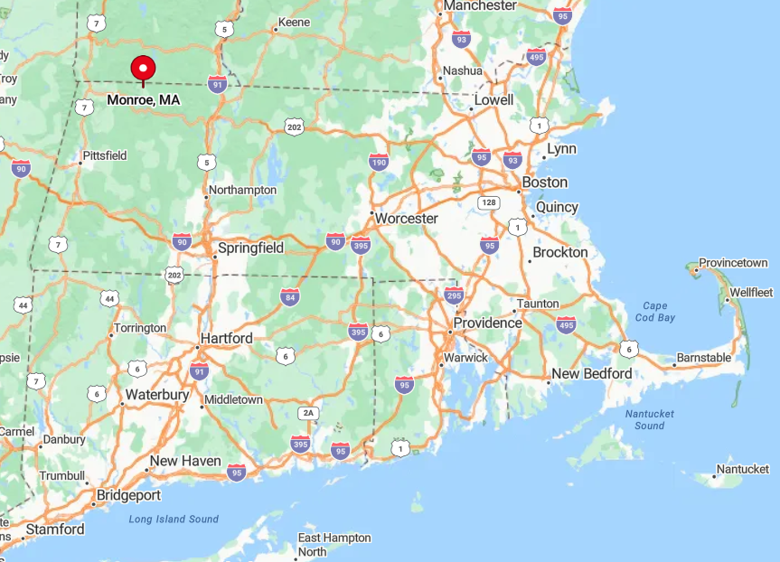
The town occupies Massachusetts’ northwest tip, wedged between Vermont and the Berkshire highlands. Only one public road, Kingsley Hill Road, connects Monroe to Route 2, and it follows a winding river cut that discourages casual detours.
Heavy snow or spring floods can limit access, reinforcing the town’s “nobody notices us” reputation. Most arrivals start from the Route 8 corridor in North Adams, then follow a 25-minute drive along hairpin turns bordering the river.
7. Savoy – Granite Ridges and Sky-High Privacy
Savoy supports close to 700 inhabitants spread across broad, windswept ridgelines rising above 2,000 feet. Weekend explorers head to Savoy Mountain State Forest for backcountry campsites at Tannery Falls and panoramic views from the Berry Hill fire tower.
Lumbering and small-scale specialty agriculture, such as ginseng plots on shaded slopes, remain the principal livelihoods. Granite outcrops and stone barrens scatter the ridges, acting as natural screens that hide houses from the scant traffic on Route 116 below.
Even the village center is little more than a white-clapboard church and a town garage, leaving nights hushed except for coyotes. Clear air and sweeping sky make meteor showers an event shared from porch chairs rather than social feeds.
Where is Savoy?

Savoy sits midway between Adams and Plainfield on the Berkshire Plateau. The town’s elevation and tangle of secondary roads discourage pass-through driving, so most visitors arrive intentionally rather than by accident.
Steep grades on Black Brook Road often close in winter, making Route 116 the lone reliable entry. From Pittsfield, expect a 40-minute ascent through tight ravines that opens suddenly onto expansive hilltop farms.
6. Heath – Old Apple Orchards on the State Line
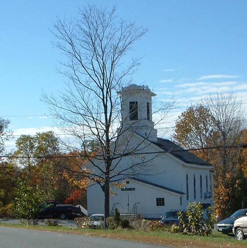
Heath records about 720 residents occupying less than 40 homes per square mile, many tucked between aging apple rows that still bear fruit in September. The annual three-day Heath Fair brings ox-pulls, fiddle contests, and blue-ribbon pies, serving as the town’s primary commercial moment each year.
Family dairy barns and craft maple operations anchor the small economy, supplemented by online work that relies on fixed-wire broadband rolling out along dirt lanes.
Seclusion stems from thick northern hardwoods that blanket the hills, creating a green wall between Heath and Vermont’s busy Route 5 corridor just over the ridge.
A labyrinth of stone walls crisscrosses the forest floor, reminders of 1800s pastures now reclaimed by sugar maple and beech. Visitors often remark that cell-phone clocks jump to Vermont towers before disappearing entirely.
Where is Heath?

The town occupies Massachusetts’ northwest border, adjacent to Halifax, Vermont, with the Green Mountains visible to the north. Only Branch Hill Road links Heath to the outside world in winter, and it winds through steep ravines prone to drifting snow.
That limited access keeps traffic counts in the single digits most days. Travelers usually exit Interstate 91 at Greenfield, then follow 20 miles of two-lane blacktop climbing steadily toward the ridge.
5. New Ashford – Hidden Valley Between Two Berkshire Peaks

New Ashford’s headcount sits near 230, giving every resident plenty of elbow room among sugar maple stands below Mount Greylock’s southern shoulder. Hikers park at the Hopper Trail lot to summit Greylock, and back-road cyclists favor the shaded climb over Brodie Mountain Road through golden birch in October.
Livelihoods include small timber outfits, hospitality at nearby ski resorts, and home-based graphic design studios that rely on satellite internet. The town lacks a commercial core entirely, instead offering mailboxes clustered at crossroads and a tiny one-room town hall.
Dense hardwoods absorb highway noise from distant U.S. Route 7, leaving evenings filled only with barred owl calls. Even the local volunteer fire station reports more alarms for downed trees than for structure fires.
Where is New Ashford?

Positioned in a narrow valley between Mount Greylock and Brodie Mountain, the town is hidden just west of the Berkshire Scenic Rail Trail. Steep slopes and conserved forest parcels wall it off from the bustle of Williamstown and Pittsfield on either side.
Access relies on New Ashford Road off Route 7, a twisting climb that can ice over quickly, effectively gating visitors in shoulder seasons. Most residents plan supply runs around weather forecasts, knowing a single storm can turn the route into a slow procession behind plows.
4. Windsor – High Plateau of Pines and Pastures

About 830 people inhabit Windsor’s high plateau, where open hayfields meet stretches of white pine that whisper in a constant breeze. The crown jewel is Notchview, a Trustees-managed reserve offering 40 kilometers of groomed Nordic ski trails and nesting habitat for bobolinks in summer.
Sheep farms and a heritage dairy or two still operate, while nearby Notchview’s ski center provides seasonal employment. Elevation near 2,100 feet and minimal light pollution create perfect astrophotography conditions, celebrated during informal stargazing nights at Windsor Jambs State Forest.
The plateau sits miles from any fast-food sign, reinforcing a sense of wrap-around tranquility. Neighbors wave from tractors more often than from sedans.
Where is Windsor?

Windsor perches on Berkshire County’s eastern rim, about 12 miles northeast of Pittsfield. The only state highway, Route 9, skirts the southern edge, leaving most interior roads gravel and slow.
Winter storms can drop a foot of snow here while Pittsfield sees flurries, making four-wheel-drive nearly mandatory. Visitors usually approach via Route 9, then turn north on River Road for the final ascent onto the plateau.
3. Plainfield – Stone Walls and Stillness on the Hill

Plainfield lists roughly 630 citizens spread across moss-lined lanes bounded by nineteenth-century stone walls. Hikers explore the quiet of Deer Hill State Reservation or paddle Plainfield Pond at sunrise when mist hangs low.
Residents earn income through artisan woodworking, home-based software coding, and organic CSA shares that supply nearby hilltowns. The lack of retail beyond a volunteer-run library and post office means evenings stay silent, save for tree frogs.
Surrounding hardwood hills block broadcast signals, so radio static often replaces commercial stations. Overgrown cellar holes beside trails remind explorers that more people lived here before larger farms pulled out a century ago.
Where is Plainfield?

The town sits atop a ridge at 1,600 feet, straddling the Franklin and Hampshire county line west of Cummington. Steep grades on Main Street deter casual drivers, while limited cell coverage dissuades those needing constant connectivity.
Reaching Plainfield involves a winding trip up Route 116 followed by a turn onto Central Street that narrows to one lane in spots. Snowy nights can leave the ridge cloud-wrapped, creating an island in the sky until plows arrive.
2. Peru – Foggy Ponds at the Heart of the Highlands
Peru hosts close to 820 residents whose mornings often start with fog curling over kettle ponds like Garnet and Phelon. Kayakers find loons on still water, and foragers seek wild blueberries along the Middlefield-Peru State Forest trails. Logging crews and seasonal cabin rentals form the backbone of the modest local economy.
Houses sit on generous acreage buffered by spruce and fir, and the nearest gas pump lies more than fifteen minutes away, preserving deep quiet after dusk. Long stretches of gravel corridors mean headlights are a rare sight, even at dinner time.
Locals still trade stories of garnet mining on Garnet Hill, a forgotten enterprise that left shards glittering in forest duff.
Where is Peru?

Located near Berkshire County’s geographic center, Peru rises over 2,000 feet on a broad upland between Hinsdale and Worthington. Its interior roads meet state routes only at the town’s extreme edges, limiting pass-through traffic.
Heavy snow and persistent fog frequently reduce visibility, adding a natural barrier that keeps casual travelers away. Most visitors arrive via Route 143, then follow East Windsor Road past stone foundations that disappear into spruce.
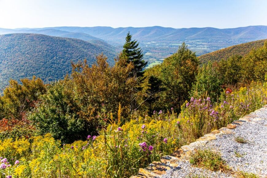
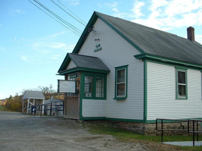
1. Florida – Ridge-Top Cabins Above the Clouds
Florida, Massachusetts count just under 700 residents living along wind-swept ridges that often sit above morning cloud inversions. Scenic pull-offs on Whitcomb Summit showcase sunrises over the Hoosac Range, while hardy hikers seek the hidden vista at the western portal of the historic Hoosac Tunnel.
Employment is limited to state highway maintenance, small-scale logging, and work at nearby Berkshire East Ski Area in the valley below. Steep, forested slopes and large swaths of protected land shield cabins from the bustle of Route 2, even though that highway technically runs through town.
Nighttime traffic is minimal because tractor-trailers avoid the hairpin turn, leaving residents to fall asleep to the wind in the pines. Florida’s high perch and uninterrupted dark sky make meteor showers feel close enough to touch.
Where is Florida?
The town straddles the spine of the Hoosac Range in northern Berkshire County, directly east of North Adams. With elevations topping 2,000 feet, dense spruce forests cloak both sides of the ridge, limiting development along the famous Mohawk Trail hairpin.
Access primarily comes from Route 2, yet sharp grades and winter weather often slow travel to a cautious crawl, discouraging through-traffic. Those who crest the summit find an alpine-like hush only 20 minutes from city conveniences, a contrast that defines Florida’s enduring appeal.