Would you like to save this?
Forested ridgelines cut long shadows over valleys that the Columbia and its tributaries have been shaping for millennia. Here, the roads coil through basalt gates, dip beneath cedar canopy, and surface beside meadows where the wind has a language of its own. Northern Oregon still hides pockets where the clock feels tuned to daylight and weather, not deadlines.
Some of these places sit within sight of Mount Hood’s flanks; others are folded into the dark green creases of the Coast Range. The draw isn’t just the scenery—though that’s constant—but the way each community holds its ground against the blur of the interstate. Gravel shoulders give way to orchard rows, café tables look out on quiet streets, and trailheads appear without fanfare or signage.
Familiar industries—farming, logging, river guiding—still pay the bills in many of these towns, but there’s an undercurrent of craft: wine pressed in backyard sheds, honey sold on the honor system, chainsaw-carved benches in front yards. Visitors may notice the absence of billboards, chain storefronts, or even cell signal in stretches, but locals see it as a filter that keeps the pace steady.
This is a Northern Oregon you can reach in an afternoon from Portland but might not stumble into by accident. The turns are subtle, the towns unhurried, and the quiet deliberate. Step in, and the modern rush fades fast.
25. Bridal Veil
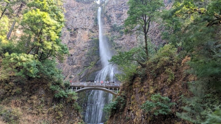
This tiny hamlet of roughly 50 souls perches quietly in a fern-fringed hollow, where the mist seems to linger forever. Few passersby pause here as the forest muffles both sound and traffic.
In the hush, the roar of Bridal Veil Falls is a secret constant, and explorers wander old mill ruins or linger over hearty breakfasts in log-warmed cafes. With no chain storefronts and shielded by moss-coated stone walls, time here feels slowed. Residents mostly tend to hospitality for gorge hikers or care for the historic fish hatchery.
It’s a place where the forest hums with memory—and where the world beyond feels distant.
Where is Bridal Veil?
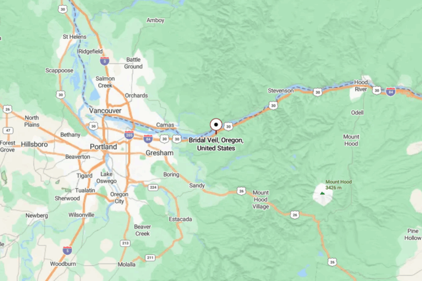
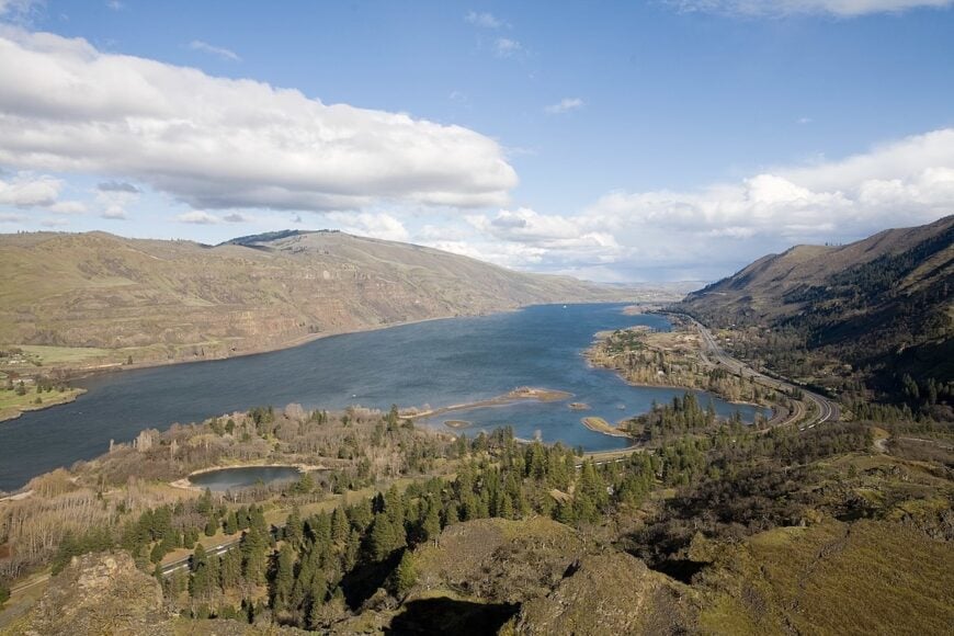
Tucked into the Columbia River Gorge’s lush folds, Bridal Veil is about 25 minutes east of Portland on the Historic Columbia River Highway. You reach it by a winding forest road that curls past basalt cliffs and trailheads.
Though close to the gorge’s bustle, the dense canopy and narrow lanes feel like a veil between worlds. It’s within reach—but far enough to feel like you’ve slipped into another time.
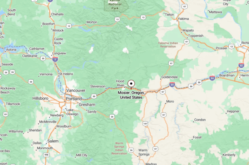
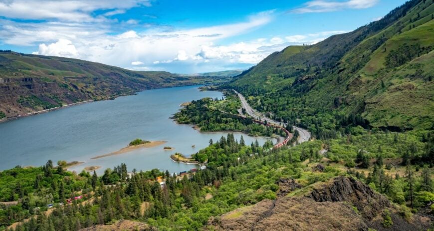
24. Mosier
A handful of dwellings cling to the slopes above the Columbia, where the wind whispers across vineyards and river spray. Mosier’s hush is nurtured by its tilting orchards and stone-strewn trails rather than traffic.
Hikers and cyclists drift along the Twin Tunnels trail, pausing to photo-frame the gorge. The town hums softly with wine tasting rooms, kayakers, and artists rather than highways. Viticulture and small-batch cidering help keep the land alive and intimate.
It’s a place where solitude feels like home. It’s the kind of place that reminds you how quiet the world can be.
Where is Mosier?
Were You Meant
to Live In?
Mosier sits in Wasco County along the Columbia River Gorge, just five miles east of Hood River off I‑84 and the Historic Highway. The railway and cliffs cradle it in a narrow fold, and the road twists gently into the town.
Though the freeway hums nearby, forested slopes and orchards soften the intrusion. It’s easy to reach, yet still tucked out of plain sight.
23. Rowena
Clinging to a rim of wildflowers above the river, Rowena feels like painted silence—life in the slow lane. Segmented switchbacks bloom with wild rhododendron, and passersby often glance only at the view and move on.
Locals wander wildflower trails, birdwatch along the crest, or linger for golden-hour vistas. Farming is modest, centered on orchards and small lodgings, but the land does the whispering here.
In Rowena, every breeze seems to trace a memory. It’s a place where solitude feels like home.
Where is Rowena?
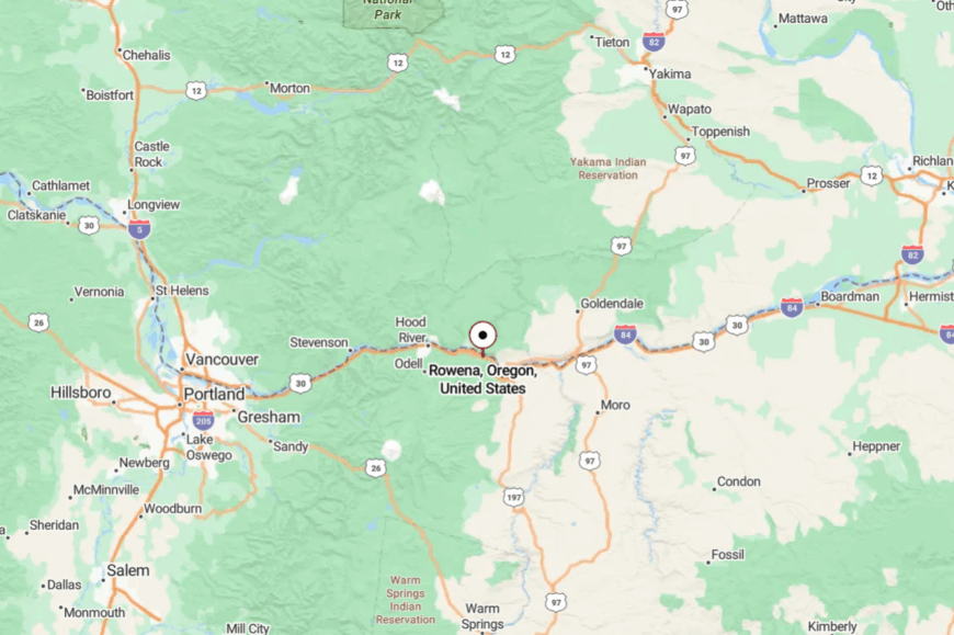
Rowena lies in Wasco County, just west of The Dalles and roughly 80 miles east of Portland, standing along I‑84 and the Historic Columbia River Highway. The highway offers glimpses of your destination, but final access is via a quiet turnout atop a bend in the gorge.
The winds pass through the switchbacks, long before traffic does. It feels distant, yet never hard to find.
22. Wren
Home Stratosphere Guide
Your Personality Already Knows
How Your Home Should Feel
113 pages of room-by-room design guidance built around your actual brain, your actual habits, and the way you actually live.
You might be an ISFJ or INFP designer…
You design through feeling — your spaces are personal, comforting, and full of meaning. The guide covers your exact color palettes, room layouts, and the one mistake your type always makes.
The full guide maps all 16 types to specific rooms, palettes & furniture picks ↓
You might be an ISTJ or INTJ designer…
You crave order, function, and visual calm. The guide shows you how to create spaces that feel both serene and intentional — without ending up sterile.
The full guide maps all 16 types to specific rooms, palettes & furniture picks ↓
You might be an ENFP or ESTP designer…
You design by instinct and energy. Your home should feel alive. The guide shows you how to channel that into rooms that feel curated, not chaotic.
The full guide maps all 16 types to specific rooms, palettes & furniture picks ↓
You might be an ENTJ or ESTJ designer…
You value quality, structure, and things done right. The guide gives you the framework to build rooms that feel polished without overthinking every detail.
The full guide maps all 16 types to specific rooms, palettes & furniture picks ↓
At the junction of two rural highways, Wren barely flickers on maps—yet its old general store and church still stand watch. The hush is rooted in its railway ghost-town legacy and four-family beginnings.
Neighbors here trade freshly baked pies across church potlucks, and the old bridge is a favorite shaded picnic spot. Once a small agricultural hub, today it’s home to quiet homesteads and walkers tracing railroad memories.
The forest frames its stillness, and the air hums with sparrows and soil. It’s a place that preserves the hush of yesteryear.
Where is Wren?
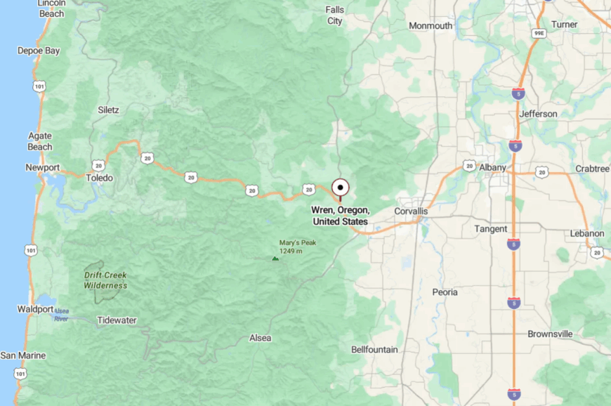
Wren is in Benton County at the junction of U.S. 20 and Oregon Route 223, near the Marys River. Reaching it feels like stepping off the main map—only narrow country roads lead you past farms and forest.
Despite being on a state route, the area holds a fringe-town stillness. It’s reachable, but feels like a secret among locals.
21. Tiernan
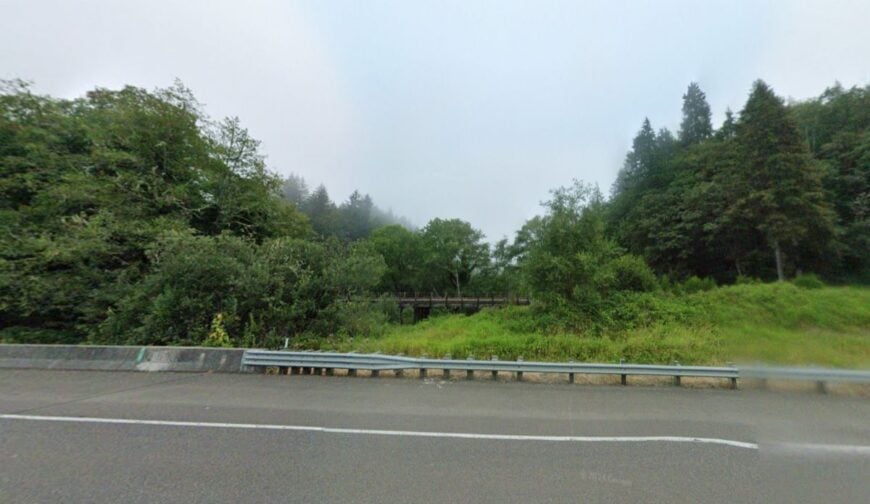
Tucked five miles west of Mapleton, Tiernan hides beneath the cathedral canopy of the Siuslaw National Forest. The rail line that once linked communities now disappears into the green, quiet surroundings around the old mill-town station.
Today, it feels like a pause between trees: fern-soft hills, a lone driveway, the scent of cedar. The forest hum is the only traffic, and locals gather at the skeletal station platform for bird-listening or trail prep.
There’s no industry, only forest and visitors who arrive to hike or float. It’s a place where the forest speaks clearer than words.
Where is Tiernan?
Tiernan lies in Lane County, about five miles west of Mapleton along Oregon Route 126, tucked into the heart of the Siuslaw National Forest. The road narrows, the trees dip lower, and the forest swallows the horizon.
Though signed, it feels like entering a private glade. It’s near civilization—yet far enough to feel like a hidden grove.
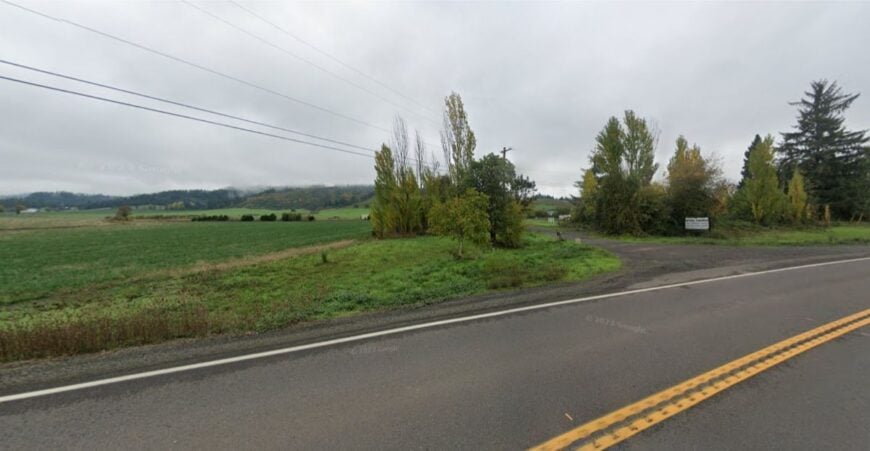
20. Kernville
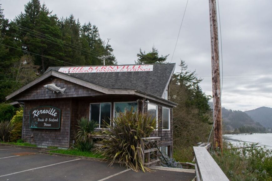
Once a booming cannery outpost, old Kernville now lingers only in ghost-town frame and canopy shadows. Accessible only by winding backroads, it feels carved from memory.
You walk past boarded buildings, breathe the old cannery air, or trace the river swells that once powered commerce. Today, economic life trickles from logging and silence.
The stillness there echoes with stories untold.
Where is Kernville?
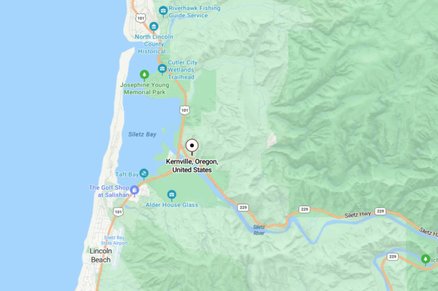
Kernville is in Lincoln County near the junction of U.S. 101 and Oregon Route 229, where the Siletz River meets Siletz Bay. A narrow, folding road off the highway leads you down to quiet ruins.
Though coastal, the bend in the bay and low population keep traffic—and sound—at bay. You can arrive in minutes, but feel as though you drove hours away.
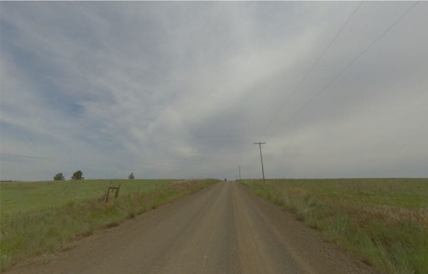
19. Bethel
Bethel feels frozen in a frontier lullaby—now home only to a lone church where once a school stood, white walls breathing solitude. Its decline began when the railroad bypassed it, and today nothing but vineyards whisper where children once learned.
Local winemakers tend pinot vines in gentle hillside rows, but otherwise, the hush is near-absolute. It’s a place with one story left to tell.
Quiet roads wind past the old crossroads, now flanked by farmland and forest edges.
Where is Bethel?
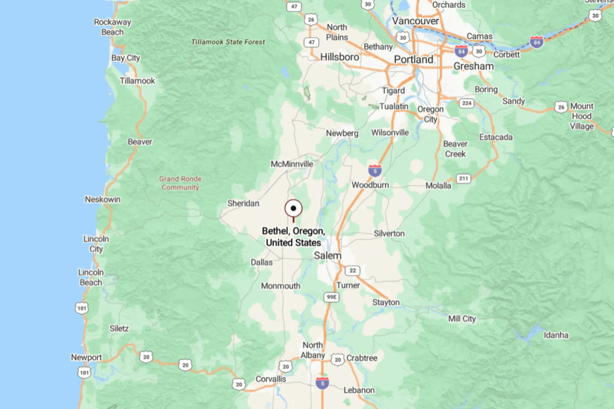
Bethel sits in Polk County at the base of the Eola Hills, within Plum Valley, west of Salem on routes between Amity and Monmouth. The back roads to it twist quietly through vineyards until asphalt gives way to pasture.
Its silence is a remnant of a past that still lingers in the soil. It’s nearby, yet the railway’s absence softened its echo long ago.
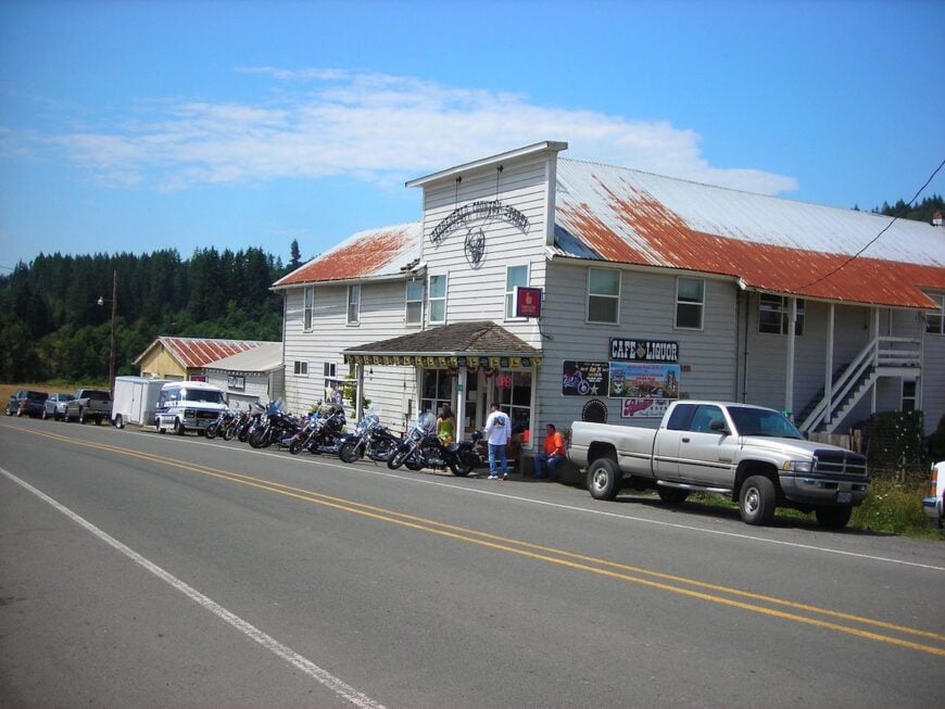
18. Friend
A ghost town you can still visit, Friend survives as a lone store, old schoolhouse, and cemetery—cradled by empty fields and quiet air.
The rails that once linked it ran cold in 1928, and silence reigns where freight trains once stood. Today, the remaining buildings are mementos: the Friend Store still stands, where locals stop by for a nod and a memory.
The church bell hasn’t rung in years, yet the wind through the pasture carries its echo. The place is nearly still, with open sky that feels untouched. In the hush, every board creaks a story.
Where is Friend?
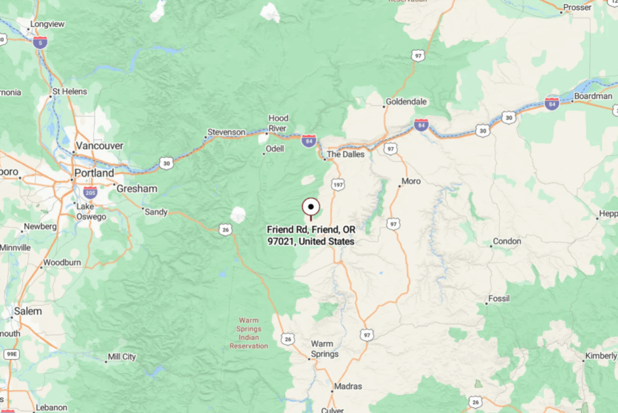
Friend is in Wasco County, Oregon, where the old Great Southern Railroad once ran from Dufur to here, now just a dot on the map. A gravel side road takes you in, lined by fields that stretch down to the Dufur valley, and the town seems to drift in a quiet fog.
The journey feels like a step into the past, with empty land and silence as your company. It’s reachable by car, but the approach feels timeless.
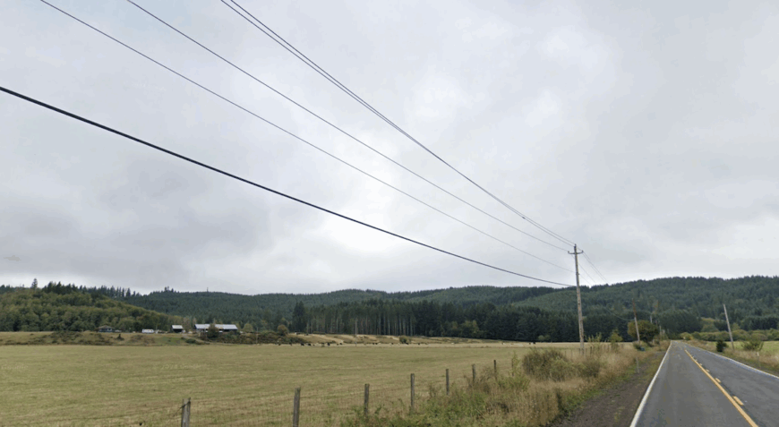
17. Birkenfeld
A ribbon of pasture and cedar groves along the upper Nehalem, Birkenfeld keeps its pace slow: hay fields stitched to timber parcels, barns with weathered cupolas, and a grange hall that still fills for pie auctions.
Summer means elk tracks in the dew and a tractor humming somewhere beyond the tree line. The fire siren doubles as a town clock; when it sounds, neighbors appear before cell service can catch up.
Small cattle operations, specialty hay, and a few forestry contracts carry most households, with roadside coolers offering eggs and honey on the honor system. Nights settle dark and starry, the highway too distant to disturb the frogs.
Where is Birkenfeld?
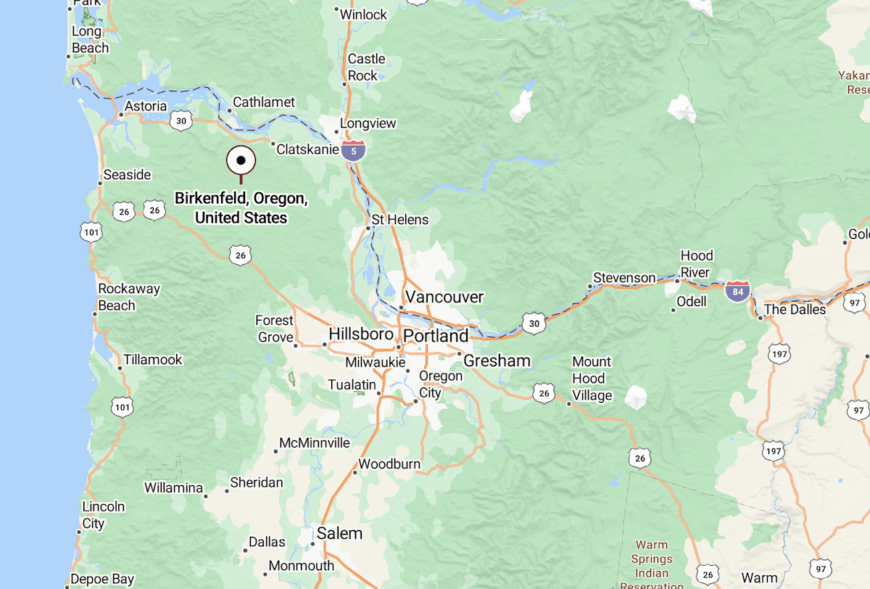
In Columbia County on OR-202 between Mist and Jewell, about 65 miles northwest of Portland. Approaches twist along the Nehalem River with few turnouts and no shoulders, keeping through-traffic light.
The nearest services are in Vernonia or Clatskanie; public transit does not reach the valley.
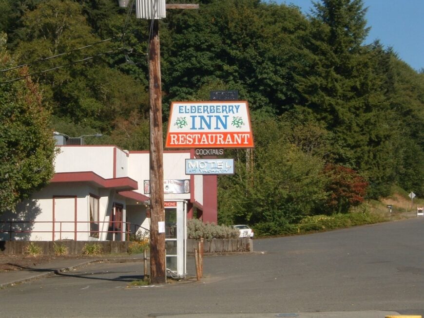
16. Vesper
Would you like to save this?
Vesper clings to a narrow shelf above the Nehalem, a scatter of old farmsteads, a one-time store, and mailbox clusters that mark where lanes slip into forest. Morning fog sifts through spruce and alder, and by noon the canyon warms enough for swallows to work the river bends. Even on summer weekends, engines are rare; you hear ospreys before you hear a car.
Work here runs to small woodlots, haying, and commuting one or two days a week to Astoria. The rest is maintenance of fences, orchards, and the quiet.
Where is Vesper?
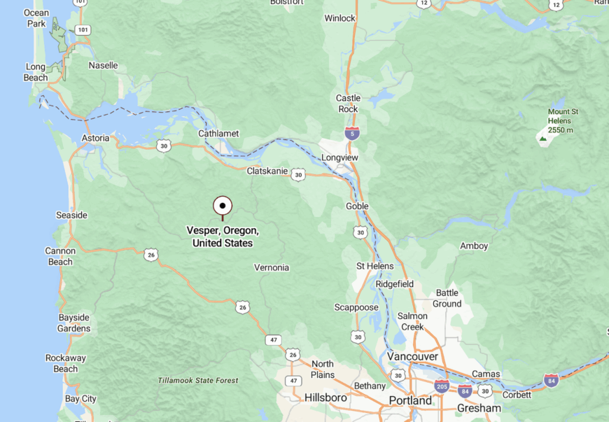
An unincorporated community in Clatsop County along OR-202, 22 miles southeast of Astoria and 14 miles northwest of Jewell. The road shadows the river with limited passing lanes and frequent blind curves; there’s no alternate route and no bus service. Fuel and groceries are a half-hour away on either end.
15. Elsie
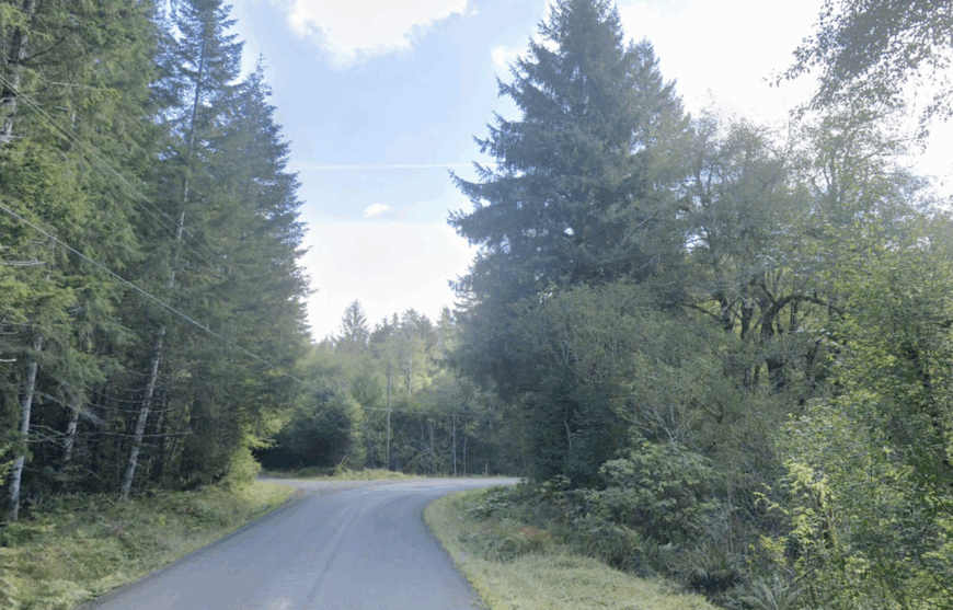
At the junction where highway travelers downshift for the Coast Range, Elsie amounts to a few homes tucked behind hemlock, a classic café, and a road sign most people miss.
The forest presses close; step off the shoulder and ferns swallow the sound of trucks within seconds. Hunters know the side spurs by name, anglers measure the seasons by river levels, and weekend cyclists treat the grade like a pilgrimage.
Locals mix part-time forestry, guiding, and kitchen shifts at the highway stop. After dusk, headlights thin to a trickle and the woods reclaim the corridor.
Where is Elsie?
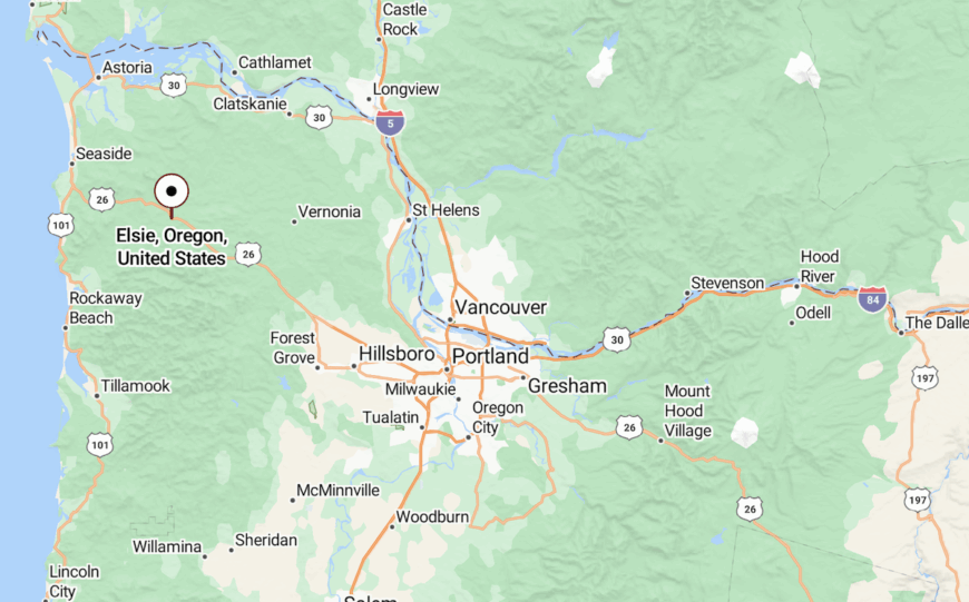
On US-26 at the junction with OR-103 in Clatsop County, 25 miles east of Seaside and 60 miles west of Portland. The closest towns with services are Seaside and Banks; the Necanicum headwaters drain the surrounding slopes.
Shoulders are narrow, winter chains are common, and there is no public transit.
14. Hamlet
Hamlet isn’t a main street so much as a glade—scattered homesteads, a historic schoolhouse, and garden plots folded into the Necanicum’s upper forks.
The quiet runs deep: no storefronts, no neon, just gravel driveways and wind in the Sitka spruce. Come fall, chanterelles stack in paper bags on porch steps; by spring, the garden deer have told you what fencing needs mending.
Income is a patchwork—craft timber, nursery starts, remote work when the weather cooperates with the signal. Evenings belong to owls and creek noise.
Where is Hamlet?
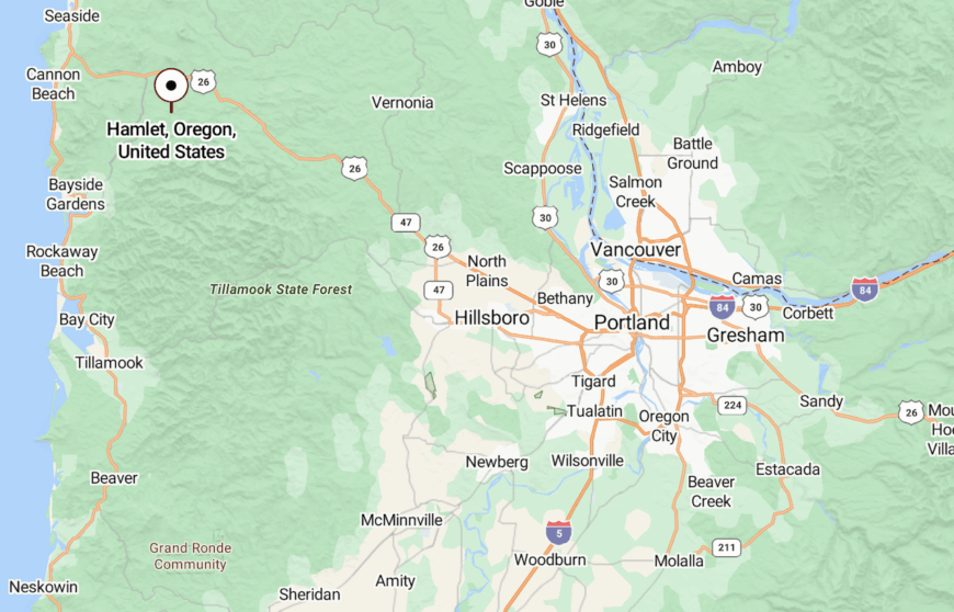
Hidden in eastern Clatsop County off Hamlet Road, between Jewell and the Necanicum headwaters, roughly 20 miles inland from Cannon Beach.
Access is by single-lane county roads with tight bridges; GPS can reroute unpredictably under the canopy. Nearest services sit in Seaside or Astoria.
13. Dee
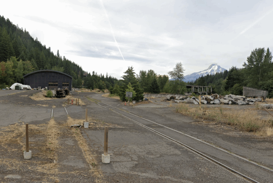
Once a mill town, Dee now spreads across orchard benches where pears and apples stitch the slopes above the East Fork Hood River. Trains no longer whistle; instead, wind rattles ladder racks and the river keeps a steady hush below.
On clear evenings, Mount Hood hangs immense over treelines, and the valley smells like fruit and irrigation.
Packing houses and seasonal harvest anchor the calendar; a few tasting rooms and farmstands draw cyclists off the Fruit Loop. After dark, the valley goes mostly lamp-free—stars over trellis rows.
Where is Dee?
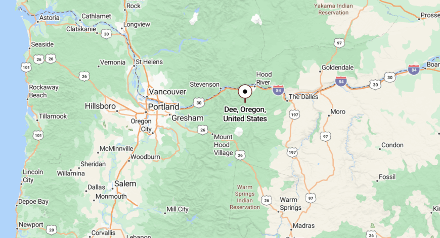
In Hood River County, along Dee Highway (OR-281), 10 miles south of Hood River and a few miles downstream from Parkdale. Steep canyon walls and the river constrain access to a single paved approach; transit stops short at Odell.
Roads narrow near bridges, and winter storms can drop limbs across the grade.
12. Government Camp

At tree line on Mount Hood, Government Camp is a pocket of A-frames and lodge lights that wink on against early snow. Mornings start with wax benches and thermoses; afternoons drift to trailheads, alpine lakes, or timberline hikes when clouds lift.
Even on busy ski days, step a hundred yards into the forest and the highway drone fades to the hiss of wind through fir.
Jobs revolve around lifts, lodges, and guiding, with a shoulder season quiet enough to hear ravens talking to themselves over the ridges.
Where is Government Camp?
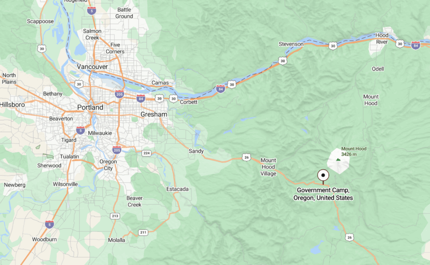
An unincorporated community in Clackamas County on US-26 near the OR-35 junction, about 53 miles east of Portland at roughly 4,000 feet. It’s the hub for Timberline and Skibowl access.
Winter traction is often required; there’s limited parking and no fixed-route transit beyond Mount Hood Express connections from Sandy.
11. Marmot
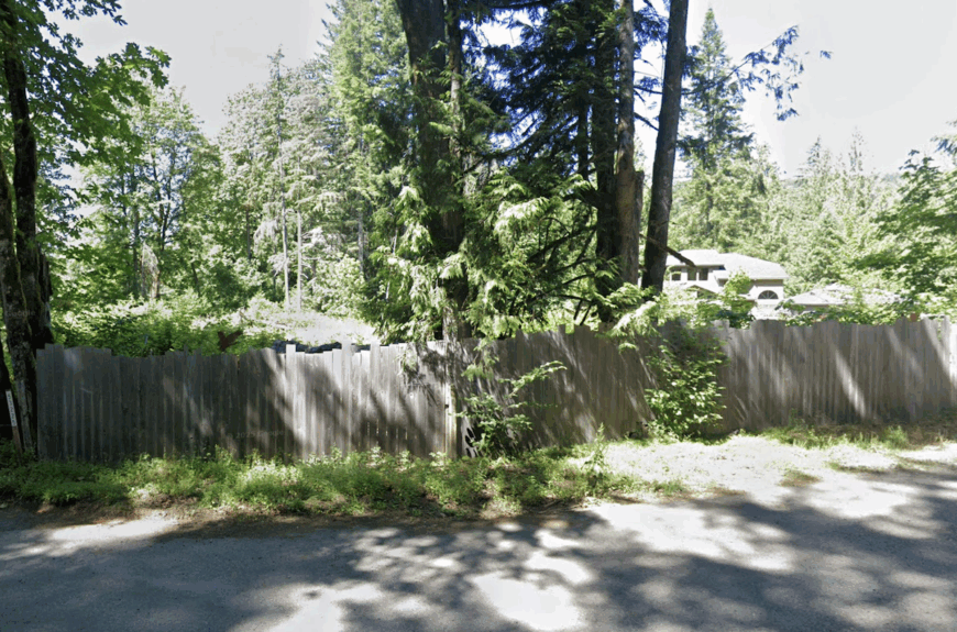
Marmot is a scatter of river-scented cabins and meadow lots along the old Barlow Road, set back from the Mount Hood Corridor just far enough to go quiet.
The Sandy River braids through alder bottoms nearby; deer cut across lawns at dawn and vanish into vine maple the moment a door latch clicks. Neighbors swap chainsaw files and river levels more often than headlines.
Many commute intermittently to Sandy, while guides and craftspeople fill in the rest. Night brings real dark—no streetlights, only porch bulbs and the Milky Way.
Where is Marmot?
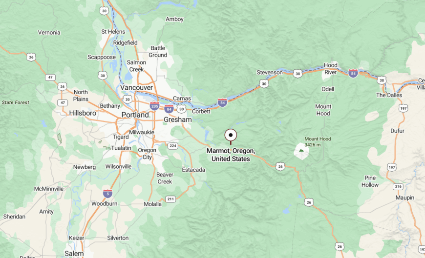
In Clackamas County, 7 miles east of Sandy, reached via Barlow Trail Road / Marmot Road south of US-26. The route is two-lane and winding with narrow bridges; there’s no transit and limited winter maintenance beyond the main corridor. The Sandy River and steep timbered slopes limit any cut-throughs, keeping traffic minimal.
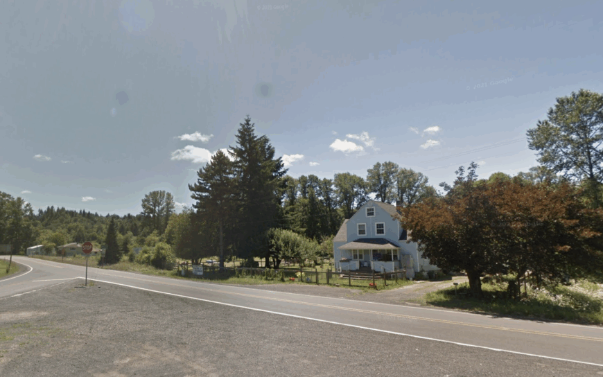
10. Timber

Timber claims fewer than 200 year-round residents, most of whom live on one-acre homesteads bordered by Douglas-fir stands that hush even the faint whir of passing log trucks.
Weekend wanderers ride gravel spurs on mountain bikes, pick chanterelles along South Fork Dairy Creek, or try the unmarked swimming hole behind the decommissioned mill pond.
Small-scale logging and specialty lumber milling remain the chief paychecks, while a handful of remote tech workers share satellite internet from a high ridge repeater. The absence of streetlights keeps the Milky Way bright enough to navigate by, and cell service drops to one bar before the county line.
A single country store doubles as a post office and bulletin board, reinforcing neighborly ties. All of this distance from chain stores and highways is exactly what lends Timber its sense of retreat.
Where is Timber?
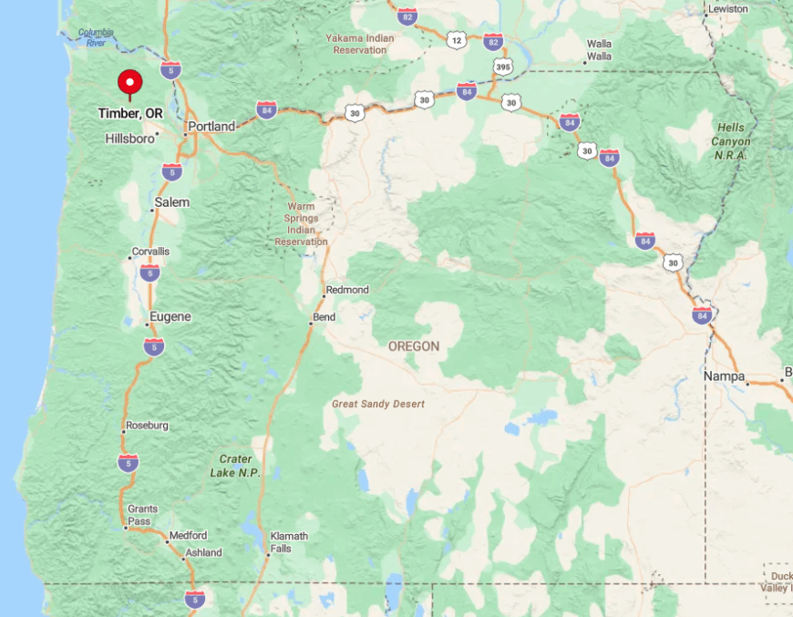
The hamlet sits in Washington County’s Coast Range foothills, twenty twisting miles west of Hillsboro and just over the summit from Vernonia. Low passes, thick evergreen cover, and a web of private timberland gates block any direct route, guaranteeing light traffic.
Travelers reach Timber via Oregon Route 6, then follow Timber Road as it narrows to gravel past milepost 28. Winter storms can fell trees across the only paved approach, so residents keep chainsaws in their truck beds as a matter of habit.
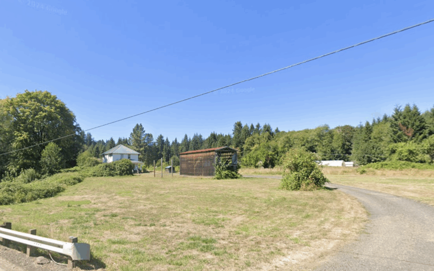
9. Mist
Mist supports well under 100 people spread across rolling pasture and fog-draped cedar groves where elk browse at dawn. Anglers drift the Nehalem River for steelhead, while locals host summer barn dances that raise money for the century-old Mist-Birkenfeld Volunteer Fire Department.
Hay ranching and boutique grass-fed beef sales anchor the tiny economy, supplemented by seasonal tree farming. More than half the surrounding acreage remains forested or fallow, and no retail strip disrupts the hush that settles once twilight fog pours off the hills.
Power outages still merit a town-wide potluck at the grange hall. That timeless quiet is Mist’s greatest draw for anyone who values head-clearing space.
Where is Mist?
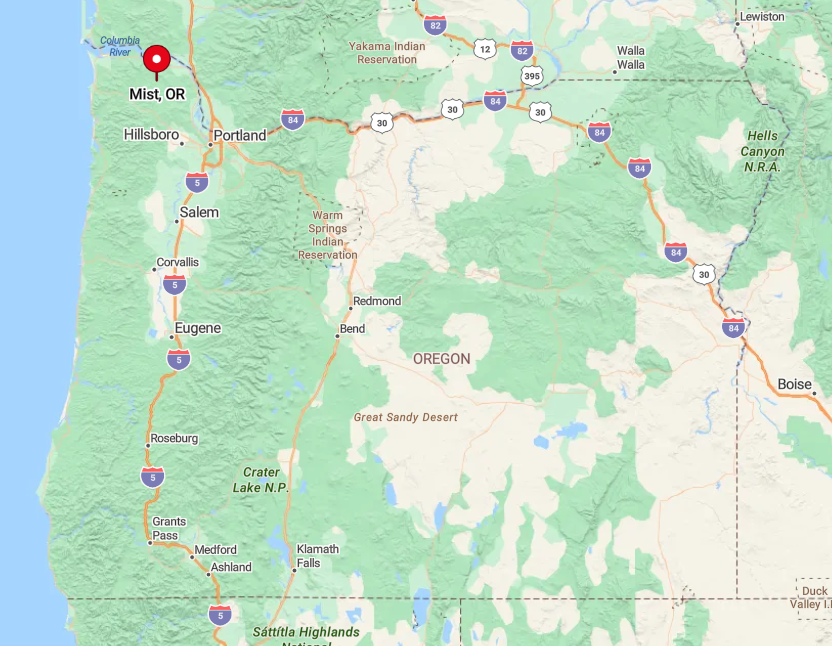
Positioned in Columbia County between the Nehalem and Clatskanie river valleys, Mist sits roughly 40 miles northwest of Portland yet feels worlds apart. Tree-shadowed Route 47 serves as the sole paved thread through town, and the nearest traffic light is 25 minutes away in Rainier.
Dense stands of cedar and low-slung cloud layers muffle sound, heightening the sense of separation. Public transit does not reach this far, so visitors rely on personal vehicles or cycle on the quiet highway shoulder.
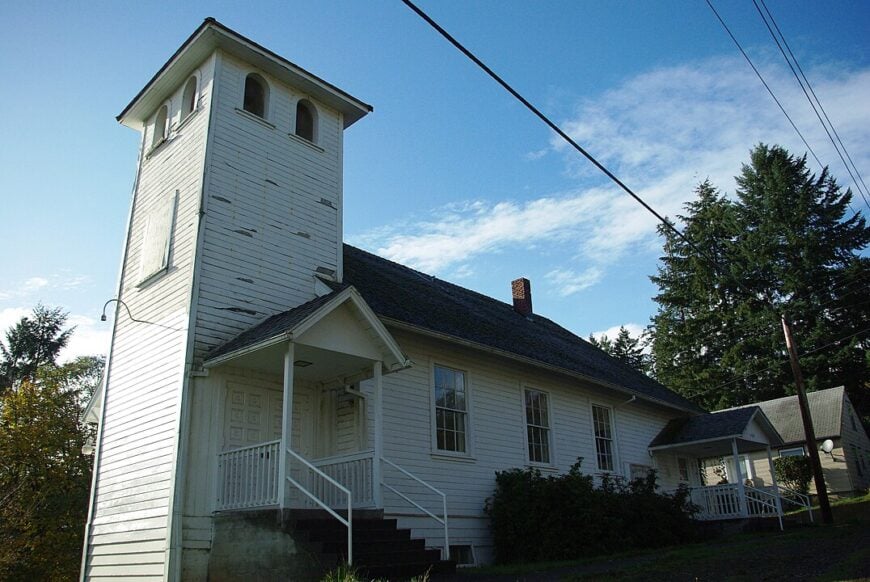
8. Jewell
Home to about 200 residents, Jewell clusters around a crossroads where a single gas pump and café greet hunters, birders, and Coast Range loggers.
Daytime diversions include viewing Roosevelt elk at the Jewell Meadows Wildlife Area, photographing the seldom-visited Murtaugh Falls, or hiking Knott Creek’s fern-lined canyons. Timber harvesting and state wildlife employment provide steady, if modest, incomes, complemented by family farms that sell honey and grass seed.
The nearest major highway lies 14 miles away, and thick ridgelines rise on every side, drowning out coastal tourist traffic. Even in midsummer, a hush settles by 8 p.m. when logging crews quit, broken only by elk bugles and barred owl calls. This buffer of public land and steep terrain keeps Jewell securely tucked away.
Where is Jewell?
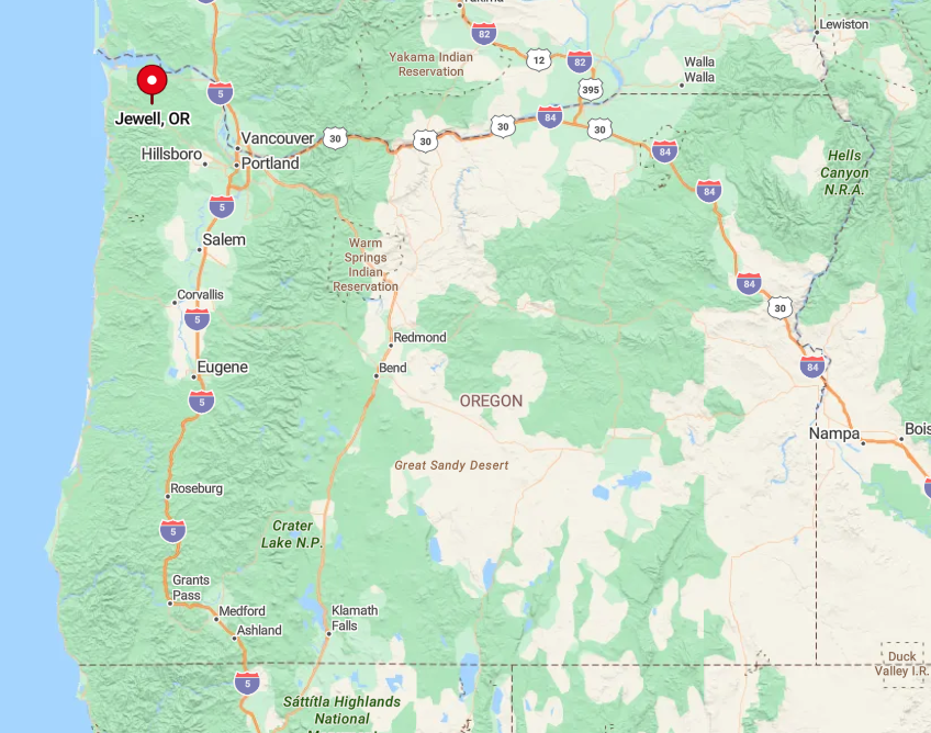
Jewell rests in Clatsop County along Highway 202, midway between Astoria and Mist, but the serpentine road deters hurried drivers headed for the beach. With the Coast Range crest to its west and Plum Creek timberlands ringing the valley, expansion is naturally limited.
Visitors from Portland take U.S. 26 to the picturesque Timber Junction, then drift south on 103 where cell service disappears. Most arrive by car, though adventurous cyclists favor the low-traffic loop connecting Jewell to Birkenfeld and Vesper.
7. Cherry Grove
Would you like to save this?
Roughly 600 people call Cherry Grove home, their houses scattered across a fertile valley dotted with century-old pear and apple trees. Families picnic at Walker Flat Bridge, fly-fish for cutthroat in Little Beaver Creek, or browse the honor-system farm stands that appear each August.
Agriculture and heritage orchards supply the main livelihood, with a growing side trade in small-batch cider pressed at backyard sheds. Twelve rural miles separate Cherry Grove from the shops of Forest Grove, and hills thick with second-growth fir act as a green curtain against outside noise.
Nights remain dark enough for meteor watching, and mailboxes sit on gravel turnouts instead of sidewalks. That blend of distance and farmland openness fosters the quiet that many residents prize.
Where is Cherry Grove?
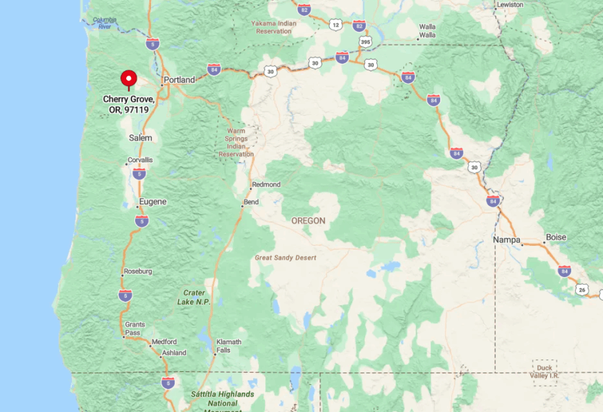
The settlement lies in Washington County at the terminus of Southwest Cherry Grove Drive, past where the pavement ends and GPS signals flicker. It occupies a pocket valley beneath the ridge of Patton Mountain, making any approach a climb on winding two-lane roads.
Public buses stop nine miles short, so visitors arrange carpools or tackle the hill by bicycle. Once inside the valley, roadside fruit stands and vintage barns quickly replace any hint of suburbia.
6. Parkdale
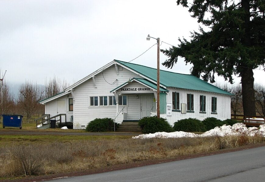
Parkdale, with about 340 residents, spreads across an elevated plain framed by Mount Hood to the south and the Hood River Valley below. Tasting rooms pour hard cider made from local heirloom apples, while the historic Mount Hood Railroad still offers seasonal excursion rides that begin and end beside the tiny depot museum.
Orchard work and agritourism jobs dominate the paycheck scene, though the Cooper Spur ski area provides winter shifts. Being 16 miles from Hood River’s activity yet ringed by farmland means few reasons exist for through traffic, and snowfall can close the highway segment at night.
Clear air and open sightlines give stargazers an unobstructed view of the northern lights on rare appearances. That mountain shadow and deliberate isolation define Parkdale’s peaceful mood.
Where is Parkdale?
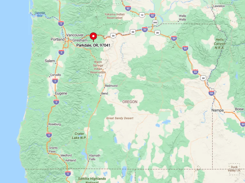
Located in Hood River County, Parkdale sits along Oregon Route 35 on a volcanic bench at 1,700 feet elevation. East and west access is limited by the East Fork Hood River and forest service land, so driving up from the Columbia Gorge is the only practical route.
The Hood River County shuttle reaches Odell but not Parkdale, leaving personal vehicles as the primary means of arrival. It’s perch above the valley floor, combined with forest reserves, keeps city lights and highway rumble far below.
5. Rhododendron
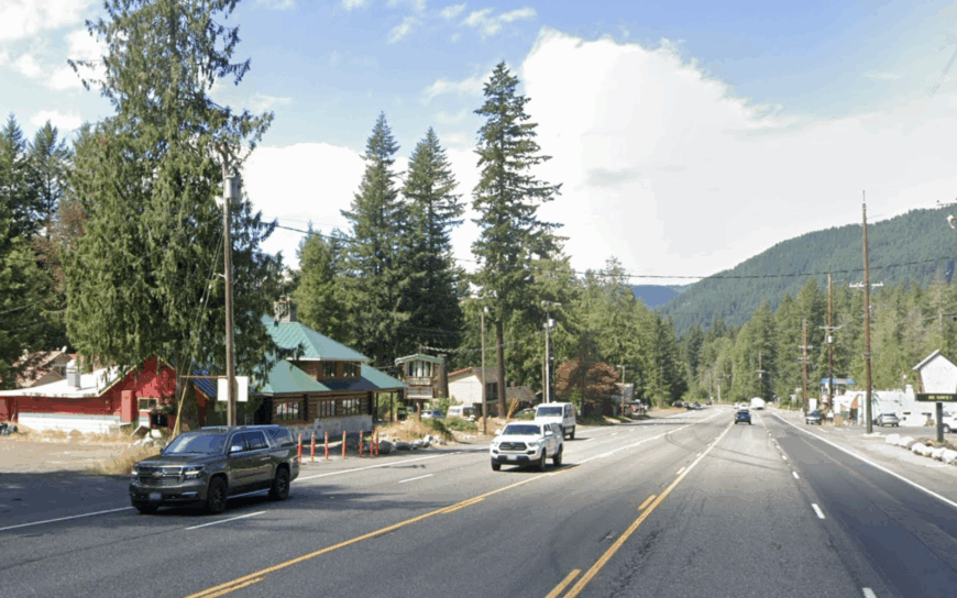
Only around 500 full-time residents live in Rhododendron, their cabins tucked among moss-cloaked hemlocks along the Zigzag River. Popular pastimes include hiking the historic Barlow Road segment, casting for cutthroat trout, and sipping coffee at the century-old inn that doubles as a trailhead hub.
Lodging and seasonal guiding form the core economy, with many households renting out A-frames to skiers in winter. Dense forest buffers the community from the hum of Highway 26, and no neon signs or stoplights break the night darkness.
Sound carries so little that river water often drowns out conversation at porch level. That sense of concealment makes Rhododendron feel far deeper in the wilderness than its map distance suggests.
Where is Rhododendron?
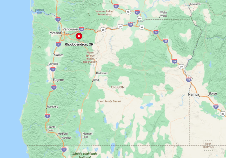
Rhododendron occupies a narrow shelf on the south side of Mount Hood within Clackamas County, roughly 40 miles east of Portland. The Zigzag River canyon and steep forested slopes prevent any side roads from connecting, funneling all access through one blinking-light intersection on the highway corridor.
Winter chains are mandatory during storms, which further discourages through traffic. Visitors can ride the Mount Hood Express bus from Sandy, but most rely on cars laden with skis, fly rods, or mountain bikes.
4. Buxton
Buxton counts about 1,400 people scattered along the Banks-Vernonia Trail and several gravel spurs that disappear into alder groves. Cyclists pause at the refurbished Buxton Trestle, campers fill Stub Stewart State Park’s hike-in sites, and locals share homemade jam at the community hall’s Saturday swap.
Small family farms and trail-related tourism provide the limited commerce here, with a few residents commuting to Hillsboro’s tech parks only three days a week. The state park’s 1,000 forested acres on one flank and expansive ranch land on the other keep new development at bay.
Minimal lighting and long sightlines across the pasture create wide skies alive with bats and barn owls come dusk. All told, Buxton remains comfortably off the urban radar.
Where is Buxton?
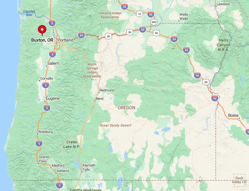
The community sits along Highway 47 in northwest Washington County, 30 miles from Portland but effectively shielded by the Chehalem Mountains and Coast Range foothills.
The Portland and Western Railroad right-of-way now forms the Banks-Vernonia trail, a non-motorized path that limits vehicle access directly through town.
Transit routes end in Banks, seven miles south, making personal vehicles or bicycles the only options. Even then, dense forest and limited signage persuade many drivers to pass by without noticing Buxton at all.
3. Hemlock
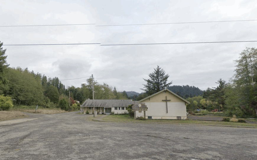
Hemlock’s population hovers around 250, most living on roomy homesteads laced with Sitka spruce and bordered by fern-rich ravines. Residents beachcomb for agates at nearby Short Beach, forage for chanterelles on mossy slopes, or share stories over coffee at the converted one-room schoolhouse community center.
Dairy farming and small-batch cheese production anchor the local economy, complemented by artisan woodworkers who craft surfboard blanks from storm-fallen cedar. The community sits seven winding miles inland from Highway 101, and coastal hills shield it from beach traffic and cellular towers alike.
Ocean fog drifts in each evening, muting all sound except distant breakers when the wind shifts. That isolation allows Hemlock to retain a near-forgotten coastal calm.
Where is Hemlock?
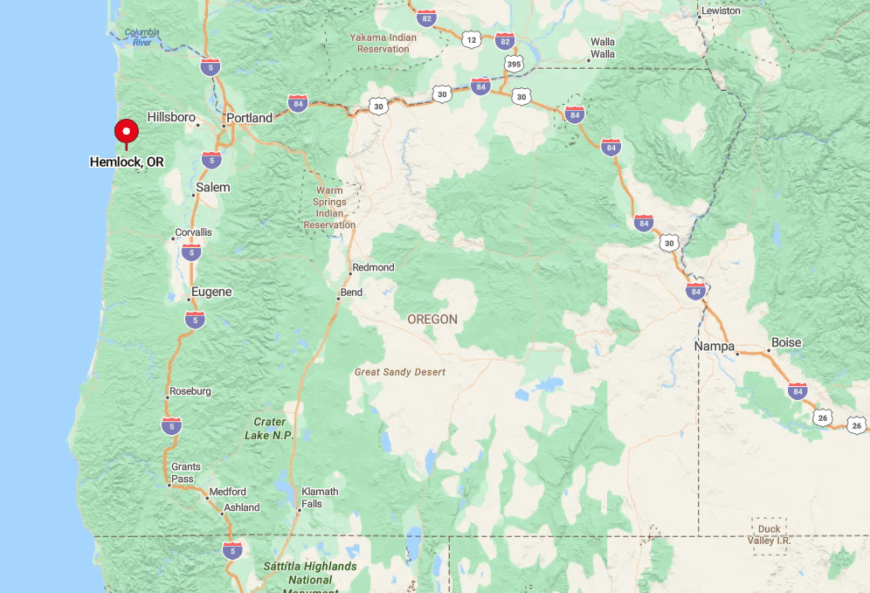
Found in Tillamook County, Hemlock lies east of Cape Lookout on Sandlake Road, which narrows to single-lane bridges as it climbs inland, steep grades and blind corners slow even local drivers, reinforcing the unhurried vibe.
The Tillamook Wave bus serves Pacific City but not Hemlock, so reaching town requires a private vehicle or a long bike ride through forest corridors. Once there, visitors notice that mailboxes are grouped at the county road because delivery trucks decline to navigate the final driveways.
2. Brightwood
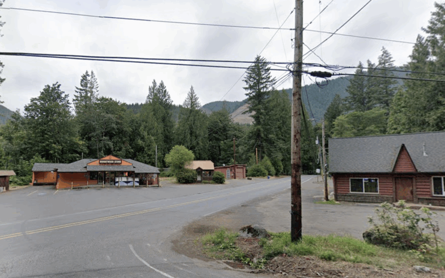
Brightwood’s 800 residents live on acre-plus lots shaded by cedar and fir along the Salmon River, where anglers stalk winter steelhead and kids wade in mellow summer pools. The Brightwood Tavern hosts bluegrass jam nights, while nearby Wildwood Recreation Site offers a hidden underwater viewing window into a salmon stream.
Guiding, hospitality, and U.S. Forest Service postings provide the primary wages, with some craftspeople selling cedar furniture to Portland shops. Forested bluffs and a bend in Highway 26 place the town out of sight and earshot of most traffic, and streetlights are rare enough that stargazing becomes an impromptu evening event.
Bear tracks occasionally cross driveways in the quiet dawn, reminding everyone how close wilderness lies. This gentle separation keeps Brightwood serene despite its proximity to ski resorts.
Where is Brightwood?
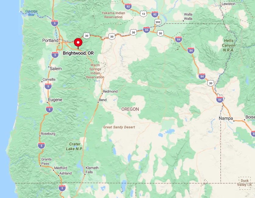
Brightwood sits in Clackamas County along the Mount Hood Corridor, approximately 38 miles east of Portland. The Salmon River gorge walls and heavy timber act as natural sound barriers, while access roads loop off the highway in subtle curves that tourists often miss.
The Mount Hood Express bus stops two miles away, encouraging most arrivals by car. Once past the tiny welcome sign, travelers find themselves enclosed by green walls until the river emerges beside the single-lane bridge.
1. Odell
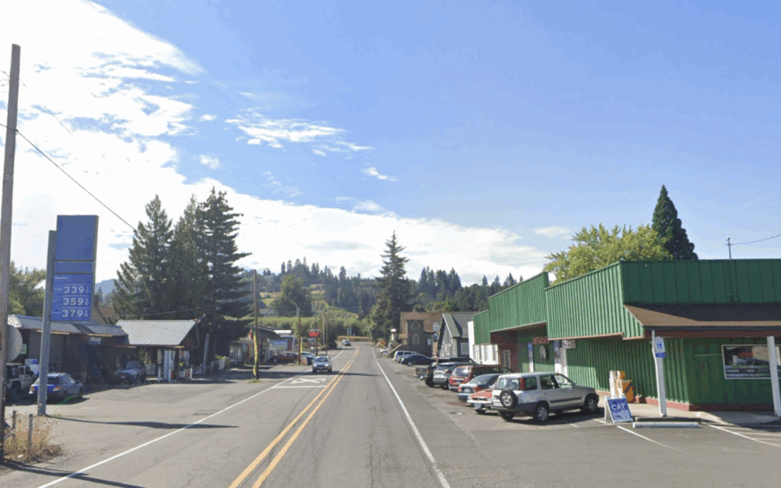
Odell hosts just over 2,000 residents, yet the population spreads across wide orchard blocks that make the town feel far smaller. Tasting rooms pour pear wine, cyclists roll through on the Hood River County Fruit Loop, and the annual Odell Daze parade celebrates tractors as proudly as floats.
Fruit packing, cold storage, and agricultural support services are the backbone industries, with seasonal jobs lining up during harvest. Hills on three sides block city glare, so night skies stay crisp enough for amateur astronomers who meet behind Wy’east Middle School once a month.
Traffic tends to bypass Odell for Highway 35, reducing noise to a few farm pickups and school buses. Spacious parcels and that buffer of hills give Odell a calm rarity for any place within ten minutes of Interstate 84.
Where is Odell?
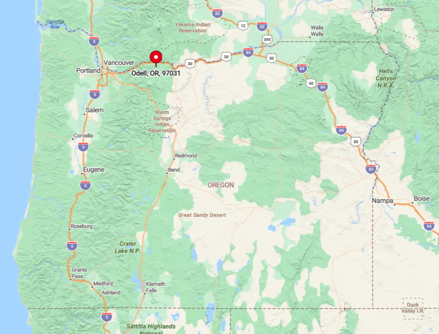
Odell lies in Hood River County, five miles south of the Columbia River and slightly west of Route 35. The community sits on a low plateau surrounded by orchard-covered hills that rise just high enough to block direct lines of sight to the freeway.
Drivers exit Interstate 84 at Exit 62, then wind through vineyard-lined backroads to reach town. Lack of rail service and limited bus schedules make personal vehicles the norm, though confident cyclists enjoy the scenic climb from Hood River’s waterfront.