🔥 Would you like to save this?
In the back roads of Northern Connecticut, solitude can still be found this close to the Boston–New York corridor. Tucked between state forests, high ridgelines, and sprawling reservoirs, a collection of small towns keep their porch lights low and their pace even lower.
The following countdown highlights 25 of our favorite places where visitors swap traffic sounds for rustling leaves and distant loon calls. Pack a paper map, because cell reception fades quickly once the pavement narrows.
In order to come up with the very specific design ideas, we create most designs with the assistance of state-of-the-art AI interior design software.
25. Bolton
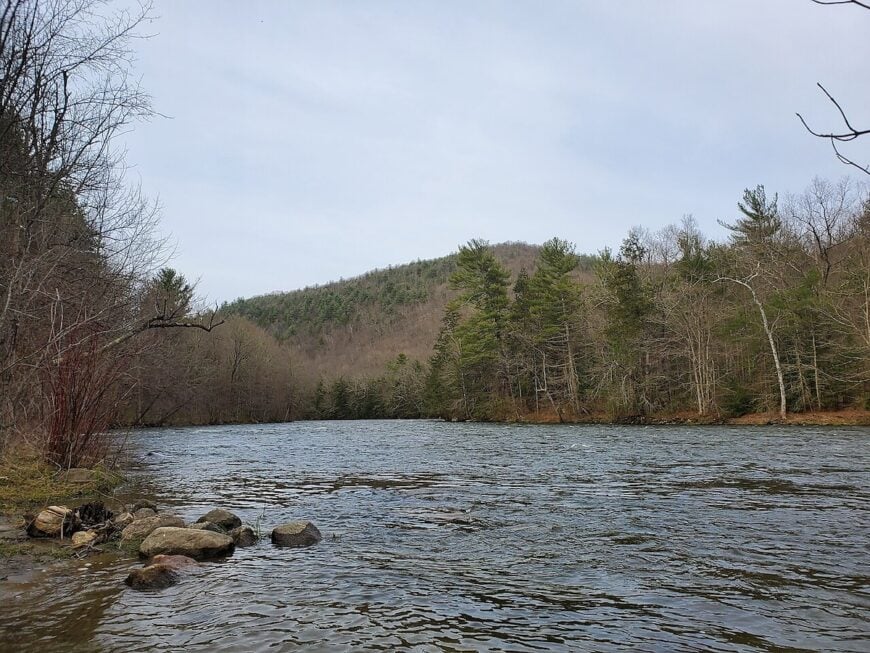
Bolton is a town where ridgelines rise like old shoulders and fog slips easily through the trees. With just over 5,000 residents spread among glacial hills and pine woods, it feels like a place paused between past and present—unbothered, unhurried, and just out of sight.
Wooden homes perch above narrow lanes, and the trails of Bolton Notch State Park trace ancient paths carved by time and footsteps. From the peaks, you can see distant towns—and still hear nothing but the hush of wind through oak leaves. Mornings arrive slowly here, and the stars linger longer at night.
Where is Bolton?
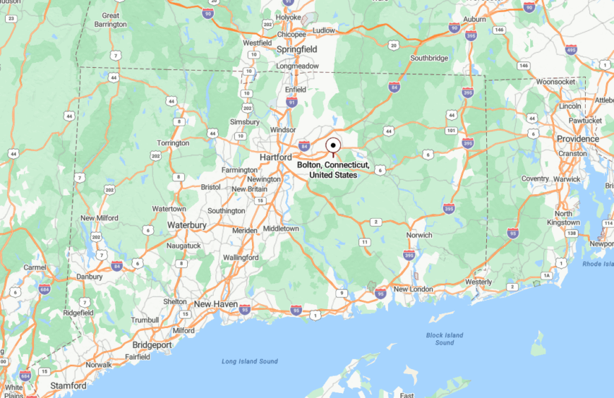
Bolton is in Tolland County, in the northeastern quadrant of Connecticut, just east of Manchester and west of Coventry. Though I-384 grazes its southern edge, the interior is a world away—accessible mainly by Routes 44 and 85, both quiet and tree-lined.
No rail lines stop here, and development has remained cautious. Visitors tend to be hikers or wanderers—those seeking elevation, quiet, and roads that curve toward stillness.
24. East Windsor Hill
East Windsor Hill feels like a preserved chapter of a forgotten book—an old river village where weathered elms lean toward brick homes and fog curls gently off the Connecticut River. Though now a historic district within the larger town of South Windsor, this quiet corner has a deeply independent spirit and a timeless hush.
Visitors pass under sugar maples that have stood for centuries, pausing by old theological school buildings and whitewashed churches. Horses graze along broad fields near the riverbank, and steeples rise without fanfare.
Life here is composed of morning walks, shared nods, and the long stillness between church bells.
Where is East Windsor Hill?
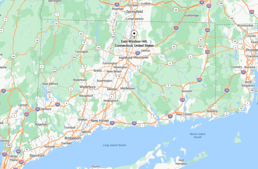
East Windsor Hill lies in Hartford County, along the eastern bank of the Connecticut River, just south of the Massachusetts border. It’s accessed via Route 5 or smaller river roads that twist through farmland and protected wetlands.
With no major commercial development and protected historic zoning, the district remains quiet and visually unchanged. Amtrak lines pass nearby—but they don’t stop. East Windsor Hill exists like a place glimpsed from the past, and never hurried forward.
23. Morris

Morris offers a tranquil sweep of farmlands and water views that make it feel like a gentle pause in the landscape. Around 2,200 people call it home, many living on multi-acre lots where barns still outnumber businesses.
Bantam Lake laps at the town’s edge, drawing quiet kayakers and weekend stargazers to its open shoreline. Hikers roam White Memorial Conservation Center while kids fish in sun-dappled shallows.
With its combination of open fields, wooded back roads, and lake breezes, Morris feels more like an escape than a destination.
Where is Morris?
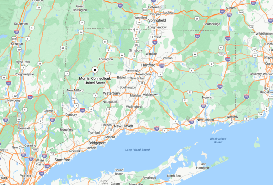
Located in central Litchfield County, Morris sits just south of the larger town of Litchfield and west of Route 63. There are no direct interstate links, so travelers must exit far and follow narrow, scenic roads.
The closest hub is Torrington, about 20 minutes northeast. Morris feels more distant than it is, thanks to its uncluttered horizons and calm country pace.
22. Somersville
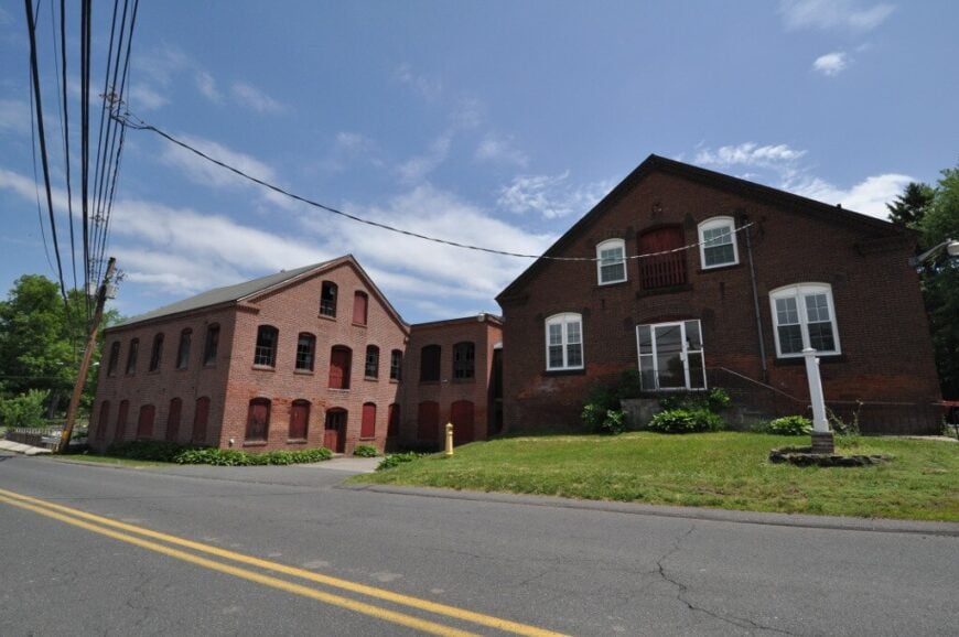
Somersville is a historic mill hamlet nestled within the rural town of Somers, where time pools in the still waters of the Scantic River and clapboard homes lean gently into shade. Though only minutes from the Massachusetts border, this little pocket feels deeply set apart—quiet, wooded, and hidden from the thrum of modern routes.
The remains of 19th-century textile mills line the riverbanks, now softened by moss and mist. Locals walk the old canal paths, fish where sluice gates once churned, or simply sit on wide porches listening to the woods settle in for the evening.
Even the light in Somersville seems slower—filtered through tall trees and the weight of history.
Where is Somersville?
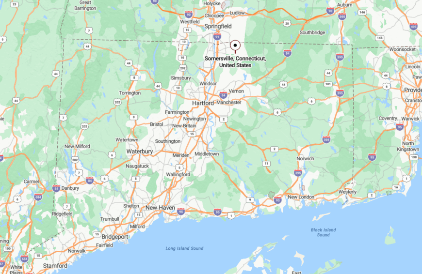
Somersville is in north-central Connecticut, a historic district within the town of Somers, in Tolland County. It lies just south of the Massachusetts border, surrounded by rolling farmland, quiet forests, and the Scantic River Valley.
You reach it by slipping off Route 190 or Route 83, down narrowing roads with names like Main and School. There are no interstate ramps nearby, no commercial plazas—just the sound of river water and gravel under tires.
21. Ashford
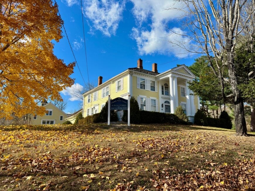
Ashford holds roughly 4,200 residents scattered among dense woods, winding brooks, and steep New England ridgelines. It’s the kind of town where the post office doubles as a meeting spot and where dirt roads outnumber paved ones.
The Air Line Trail crosses through, while Bigelow Brook babbles alongside several hidden campsites and hiking paths. Natchaug State Forest forms the town’s green heart, providing endless space for walking, fishing, and listening to wind move through pine.
The blend of forest silence and unplanned growth gives Ashford an organic, backwoods feel. It’s a place made more of trees than sidewalks.
Where is Ashford?
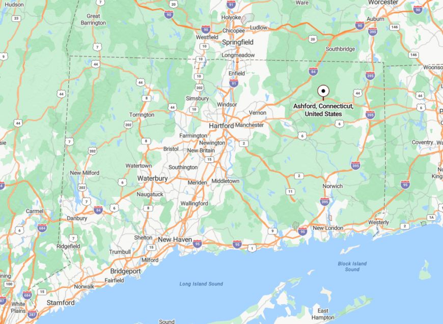
Ashford sits in Tolland County in north-central Connecticut, just east of UConn’s main campus in Storrs. Though close in miles, it feels far removed once you enter the forest corridors that define its edge.
Travelers exit I-84 at Exit 72 and follow Route 89 through winding country until the trees close in. Once you pass the forest signposts, cell signals begin to fade and the silence deepens.
20. Winchester Center
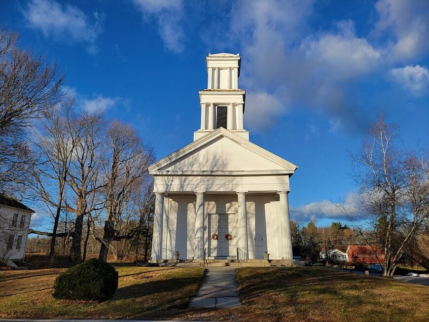
Winchester Center is a quietly folded village where weathered farmhouses line wide fields, and silos cast long shadows at sunset. Though part of the larger town of Winchester, this hamlet feels like a separate world—a place where the wind carries the scent of hay and the roads seem to curve away from time.
Life moves slowly here. Horses graze along split-rail fences, the post office serves as a de facto town square, and distant church bells echo through pine woods. Tourists rarely wander in, which suits the locals just fine.
The result is a place that feels untouched—not forgotten, just perfectly content with its stillness.
Where is Winchester Center?
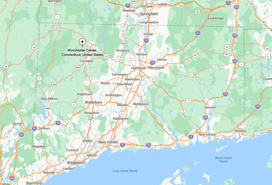
Winchester Center lies in Litchfield County, west of the bustling mill village of Winsted. You’ll find it by veering off Route 263 or Route 8 and following a network of old roads that taper gently into countryside.
Surrounded by forestland, wetlands, and quiet hills, the center is shielded from any main corridor. GPS might bring you close, but paper maps and instinct often finish the job.
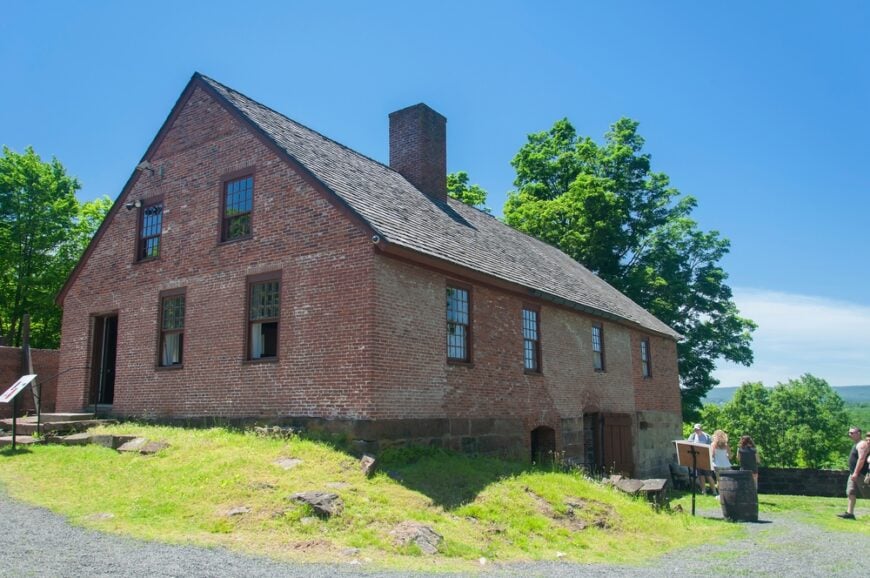
19. East Granby
🔥 Would you like to save this?
East Granby hides in plain sight along the edge of the Farmington Valley, with barns, ridgelines, and narrow roads that weave between them like memory threads. Fewer than 5,500 people live here, many descended from tobacco farmers and ironworkers.
The town’s most dramatic views come from the Metacomet Ridge, where the New England Trail climbs steep basalt cliffs for sweeping vistas of patchwork fields. Cyclists love the Farmington Canal Heritage Trail, and naturalists explore East Granby Farms and wetlands.
Despite its proximity to larger towns, East Granby feels buffered by history and geography. You can see the Hartford skyline from its cliffs, but you won’t hear it.
Where is East Granby?
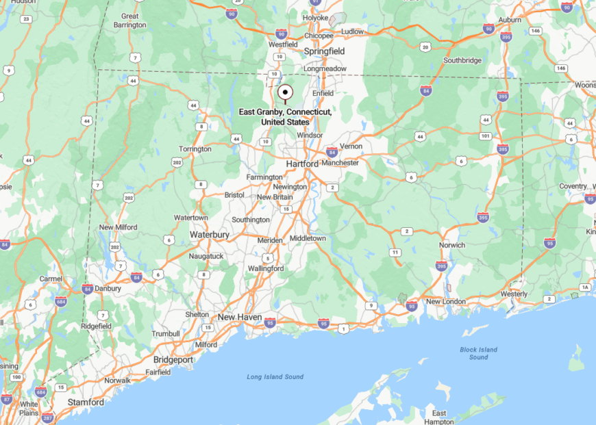
East Granby sits between Granby and Windsor Locks, northwest of Hartford in Hartford County. Route 20 crosses through, but its two-lane quiet keeps traffic light and scenery intact.
You reach it most directly via I-91, exiting near Bradley International Airport and heading west into farm country. Soon, the subdivisions vanish and the old stone walls return.
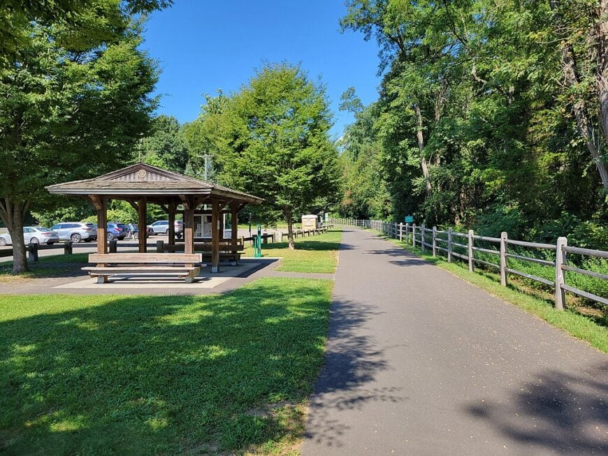
18. Unionville
Tucked inside Farmington’s boundaries, Unionville retains the feel of a self-contained village from another century. It curls around the Farmington River with an old train depot, narrow lanes, and sleepy storefronts.
Fly fishers gather at dawn while kayakers glide past stone foundations half-swallowed by ivy. The rail trail runs alongside and the old mills—some converted, some left to crumble—anchor the village in its past.
Unionville thrives quietly on local bakeries, river outfitters, and the occasional writer hiding in plain sight. Its calm never left, even as the world moved on.
Where is Unionville?
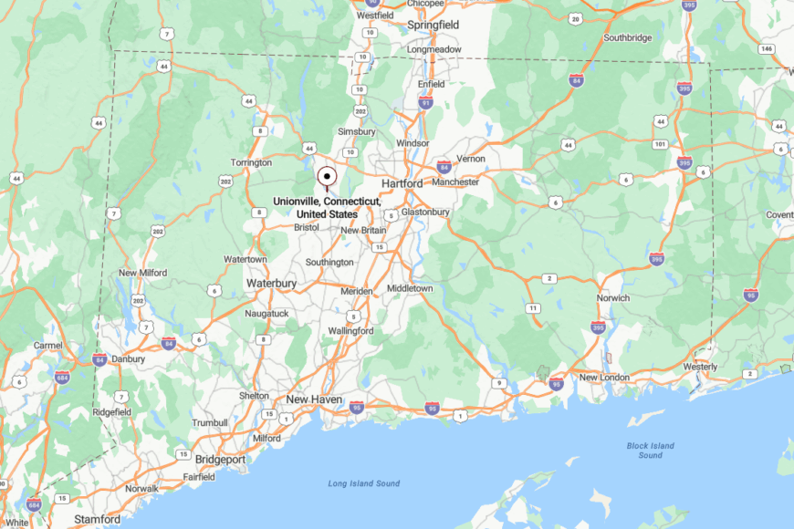
Unionville is in central Connecticut, part of the town of Farmington in Hartford County. Though minutes from Route 4, the area’s river bends and lack of modern sprawl give it a back-pocket seclusion.
Most visitors arrive via Route 177 or the Farmington River Trail. The deeper into the village you go, the more time seems to unravel.
17. Pomfret
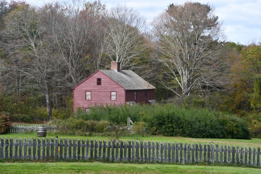
Pomfret is defined by its canopy—tall white pines, red oaks, and maples that hold the light just above your head. With around 4,200 people, it feels quietly prosperous but never busy.
The Airline Trail slices through, inviting cyclists and dog-walkers alike, while Mashamoquet Brook State Park and Wolf Den preserve offer storybook escapes into the forest. Antique shops, historic churches, and a long-standing boarding school give Pomfret a scholarly calm.
The town’s historic districts and backroads suggest a place that knows exactly who it is—and is in no hurry to change.
Where is Pomfret?
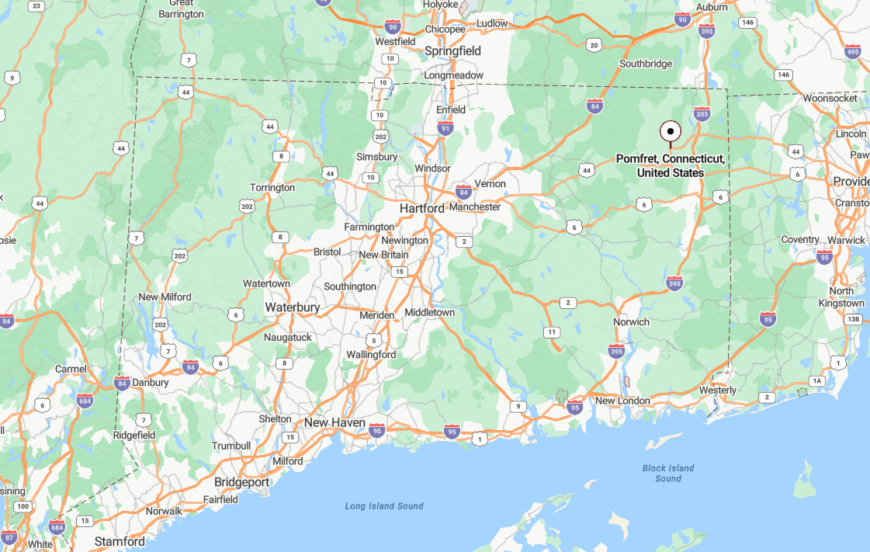
Pomfret is in Windham County, part of Connecticut’s “Quiet Corner” where towns seem sewn into the hills. It lies northeast of Willimantic, accessible via Routes 101 and 169.
Most visitors arrive via U.S. 44, which threads through with little fanfare. Once off the main drag, the hush returns quickly—so does the sense of being somewhere far away.
16. Harwinton
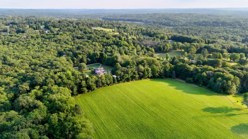
Harwinton stretches quietly across Litchfield County hills, its meadows opening wide under rows of sugar maples. With about 5,400 residents, it remains a spacious town with more stone walls than sidewalks.
Locals tend family farms, ride horseback on country trails, or picnic along Leadmine Brook. The pace is rural and steady, anchored by seasonal fairs and hiking paths that lace into nearby Roraback Wildlife Management Area.
Though not far from Torrington, Harwinton’s ridges and thick groves offer the feeling of a town hidden in plain view.
Where is Harwinton?
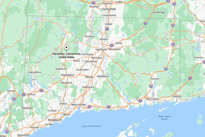
Harwinton is in northwestern Connecticut, bordered by Torrington and Burlington, just off Route 118. It’s reached by veering west off Route 8, where the terrain rises and traffic fades.
As the hills take hold and the forest thickens, you begin to feel the shift—a softness that signals you’ve stepped out of the rush.
15. Stafford
Stafford rests quietly among the rolling shoulders of the northern Tolland hills, where town life blends into thickets of pine and the murmurs of Furnace Brook. With about 11,500 residents spread across multiple villages, it somehow keeps its hush—thanks to narrow roads, aging mills, and steep woodland ridges.
Stafford Springs, the historic center, offers slow walks past Victorian storefronts, mineral springs once famed for healing, and a 19th-century opera house that still echoes with song. Outside town, meadows roll toward Shenipsit State Forest and the Willimantic River, where fly fishers cast at first light and rarely see another soul.
Despite its size, Stafford clings to its rural shape—a town of hidden hollows, porchfront stillness, and valleys where time softens at the edges.
Where is Stafford?

Stafford lies in Tolland County, on Connecticut’s north-central shoulder near the Massachusetts border. Though Route 190 crosses its lower reaches, the town center is tucked beyond sharp turns and tree-shadowed slopes.
Most visitors arrive via winding routes off I-84, especially from Exit 70, then pass through farm curves and forest hush to get there. As elevation rises and radio signals dim, the world feels suddenly further behind than the map suggests.
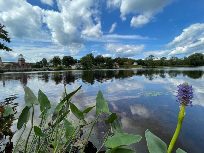
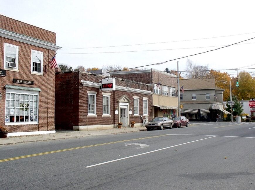
14. New Hartford
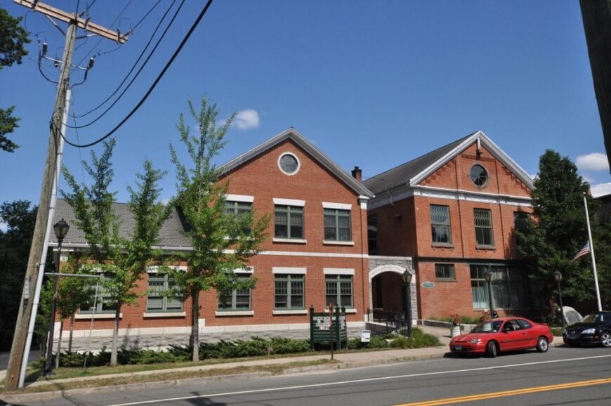
New Hartford blends wild riverbanks, upland forests, and distant views into one of northern Connecticut’s most quietly dramatic towns. With about 6,500 residents spread across five distinct villages, it somehow feels smaller than it is—thanks to long gravel driveways, sparse signage, and acres of preserved woodlands.
The Farmington River’s west branch carves through town, drawing anglers and paddlers into its misty gorge, while locals wander the trails at Satan’s Kingdom and hike up through Nepaug State Forest. Shops and cafés are few, but charming—the kind of places with handwritten signs and long-time regulars.
Despite its proximity to busier towns, New Hartford keeps itself tucked in, framed by hills, shadowed by hemlocks, and never in a rush.
Where is New Hartford?
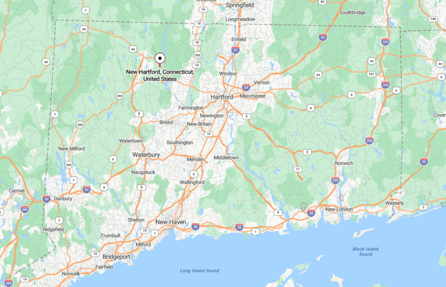
New Hartford sits in Litchfield County, just west of Canton and north of Torrington, along Routes 44 and 202. Though these routes pass through, they do so quietly—no chain hotels, no commercial sprawl, just bends in the road and stretches of forest.
The nearest interstate, I-84, lies nearly 20 miles south, and the nearest rail stop even farther. This separation by elevation and topography keeps the town quiet and its backroads even quieter.
13. Canaan
🔥 Would you like to save this?
Canaan carries the quiet weight of history, resting between broad valleys and high ridgelines in Connecticut’s far northwest. Fewer than 1,200 residents live here, many along roads where weathered barns lean into the wind and mailboxes sit beneath towering maples.
The town’s rhythm moves with the seasons—maple tapping in spring, hayfield walks in summer, and misty hillside views in fall. Visitors fish at Wangum Lake, stroll past colonial stone fences, or simply let the silence settle in on gravel backroads.
Though often confused with its more visited neighbor, North Canaan, this version of Canaan feels further removed—a town forgotten by time and content to stay that way.
Where is Canaan?
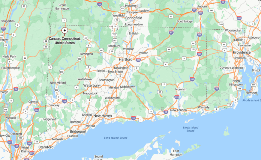
Canaan lies in Litchfield County’s far northwest corner, bordered by Norfolk and Cornwall, and edged by the Housatonic River. Drivers usually arrive via Route 63 or Route 126, both narrow two-laners flanked by farms and woodland.
The closest urban center is Torrington, nearly 30 minutes away. With no direct interstate access or rail stops, the journey to Canaan feels like slipping into a landscape painting.
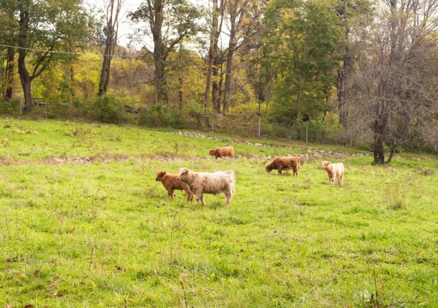
12. Chaplin
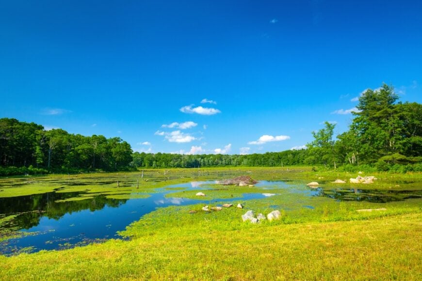
Chaplin hums with a timeless hush, its old farmhouses and forest glades nestled quietly between the Natchaug River and endless acres of eastern hardwoods. With around 2,300 residents, the town is known more for its stone bridges and historic homes than for movement.
You’ll find fishing holes along the Natchaug, thick-trunked trees at Diana’s Pool, and Civil War gravestones leaning into the earth. The Chaplin Museum and old town hall whisper stories from another century.
Even during fall foliage season, the roads stay calm, the porches stay still, and the woods seem to listen.
Where is Chaplin?
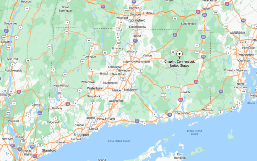
Chaplin is in Windham County, in Connecticut’s Quiet Corner, bordered by Hampton and Mansfield. The town stretches along Route 198 and Route 6, though both pass more deer than cars.
The lack of direct access from major highways preserves its pace. Most visitors stumble upon it only after they’ve already slowed down.
11. Goshen
Goshen spreads across rolling hills west of Torrington, where farms sit beneath open sky and wind moves freely across long meadows. With about 3,000 residents, it still feels like a place where tractors set the schedule.
Known for the Goshen Fair and hand-crafted cheeses, it also offers tranquil escapes like Tyler Lake, Ivy Mountain trails, and panoramic drives along West Street Ridge. Artists and organic farmers thrive in the open landscape, quietly tending their corners of land.
Despite its size, Goshen maintains a sense of rural remove, as if buffered by elevation and old habits.
Where is Goshen?
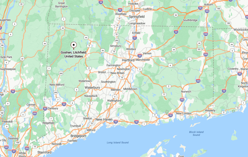
Goshen is in Litchfield County, northwest of Torrington and just west of Route 63. The town is ringed by low peaks and winding rural roads, with no highways or fast routes nearby.
To reach it, travelers wind upward from Litchfield or northwest from Thomaston. As the trees thicken and cell service flickers, the world thins out behind you.
10. Norfolk
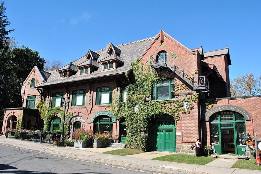
Norfolk holds a year-round population of roughly 1,600 residents. Visitors hike Haystack Mountain, paddle Wood Creek Pond, and catch indie concerts at the 19th-century Infinity Hall. Local income stems from eco-tourism, small arts organizations, and limited logging tied to the surrounding Great Mountain Forest.
Three state parks—Haystack Mountain, Dennis Hill, and Campbell Falls—wrap the village in 6,000 acres of protected green. With fewer than fifty people per square mile and no interstate within fifteen miles, daily life feels hushed even in peak foliage.
Photographers come for dawn mist curling along dirt roads and for silence broken only by hermit thrush calls.
Where is Norfolk?
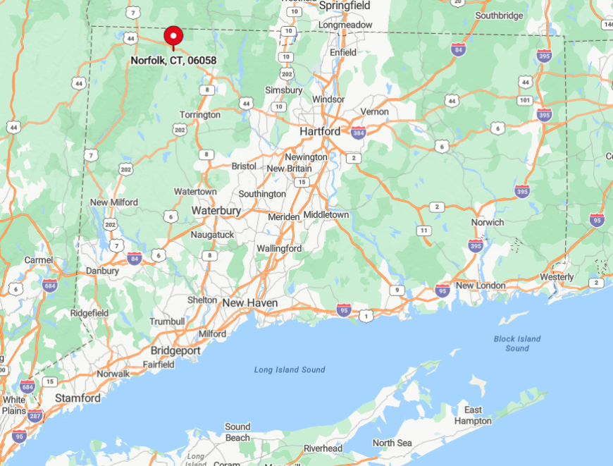
Norfolk sits in Connecticut’s northwest uplands, near the Massachusetts border in Litchfield County. Surrounded by 1,500-foot ridgelines and shielded from major corridors, the hamlet remains one of the state’s highest and coldest spots.
Drivers reach the green by following Route 44 west from Winsted or east from North Canaan after winding through forest for twenty minutes. The closest rail stop is in Wassaic, New York, a forty-minute car ride away, which keeps spontaneous day-trippers to a minimum.
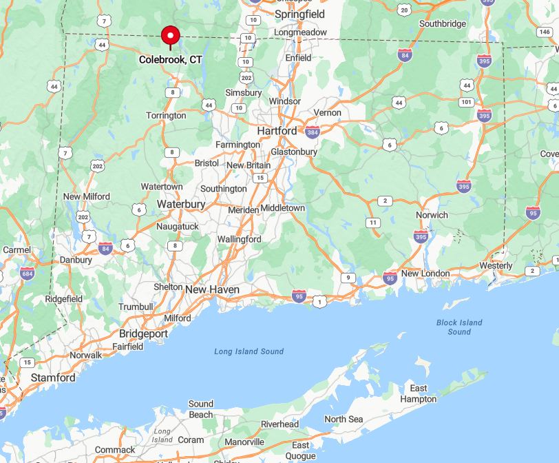
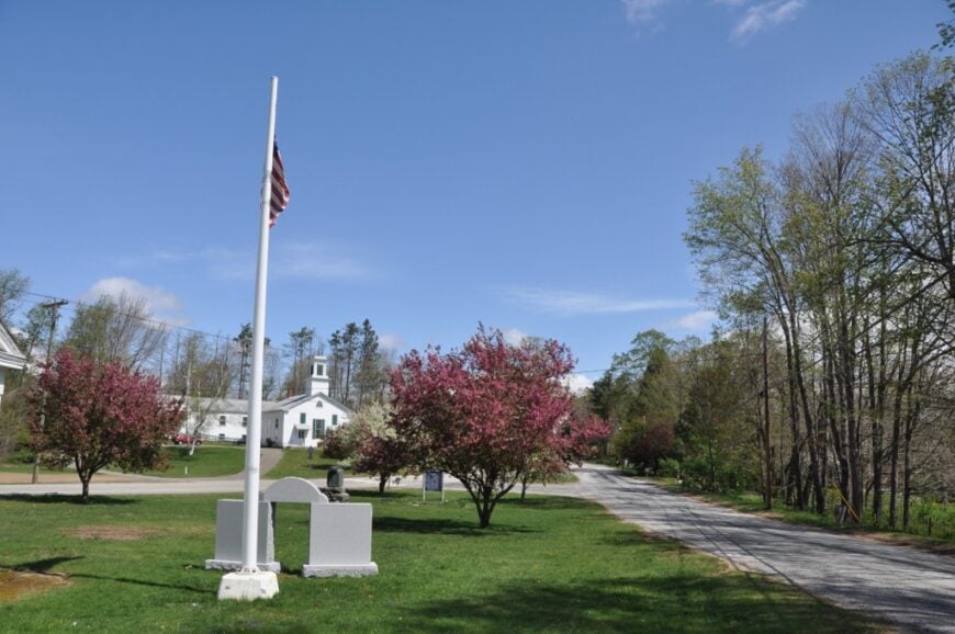
9. Colebrook
Colebrook counts about 1,400 inhabitants dispersed across stone-lined lanes and long meadow lots. Afternoons might include casting a fly at Colebrook River Lake, buying maple syrup at Hall Brook Farm, or biking empty stretches of Stillman Hill Road.
Micro-agriculture, seasonal Airbnb rentals, and small construction outfits form the economic base. The town lacks a traditional Main Street; instead, antique barns and a modest general store punctuate miles of pasture.
Minimum one-acre zoning and sweeping pine stands create deep sightlines with almost no traffic noise. The resulting quiet feels more Adirondack than New England suburb.
Where is Colebrook?
🔥 Would you like to save this?
Colebrook lies just north of Winsted, wedged between the Massachusetts line and state Route 8. While Route 8 hums five miles away, the absence of on-ramps within town preserves its slowdown pace.
Travelers exit the interstate in Winchester or Sandisfield, then weave through wooded hollows to arrive. Winter often brings deeper snow than the lowlands, adding a further buffer that discourages casual commuters.
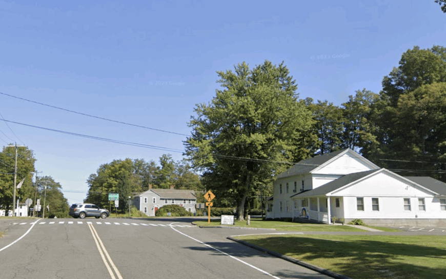
8. Union
Union is home to only about 850 people, making it Connecticut’s smallest town by population. Locals and guests fish Mashapaug Lake, wander the 9,000-acre Bigelow Hollow State Park, or hunt mushrooms along the Nipmuck Trail.
Employment leans on state-park staffing, family farms, and a decades-old country store that doubles as a breakfast spot. More than half of Union’s 29 square miles remains undeveloped woodland.
With Hartford thirty miles south and no evening traffic sounds, nights settle into near-total stillness. Camera enthusiasts capture glass-smooth reflections at dawn when loons echo across the water.
Where is Union?
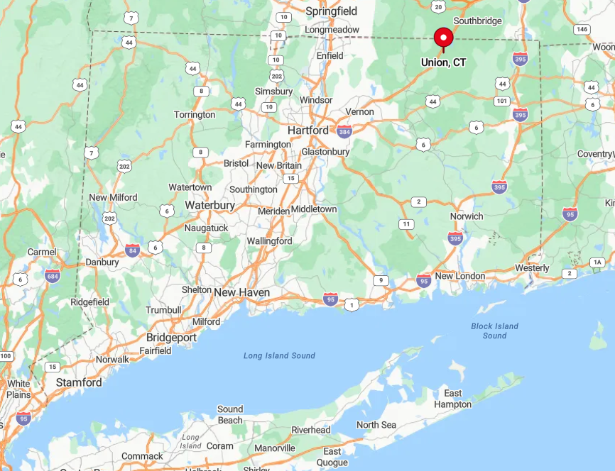
Union occupies Connecticut’s northeastern corner near both the Massachusetts and Rhode Island borders. Thick forest belts and the bark-covered hills of the Quinebaug Highlands act as natural walls that hide it from surrounding suburbs.
Access comes by way of Exit 74 on Interstate 84, followed by seven miles of twisting Route 190 and Buckley Highway. The lack of bus routes or rail service means visitors usually arrive with camping gear, ready to stay awhile.
7. Hartland
About 2,100 residents share the steep ridges of Hartland, a long, narrow township upstream of the Barkhamsted Reservoir. Weekends revolve around kayaking the reservoir’s northern coves, picnicking in Peoples State Forest, and chasing fall color on picturesque Center Hill Road.
Work largely connects to small-scale forestry, outdoor guiding, and commuting to Springfield or Hartford thirty minutes away. Strict one-acre zoning around the public-water supply has blocked commercial strips and dense subdivisions.
Fog often rises from the reservoir at sunrise, muffling sound and giving hilltop homesteads an almost alpine hush. Even cellphone signals fade in spots, underscoring just how removed the town feels.
Where is Hartland?
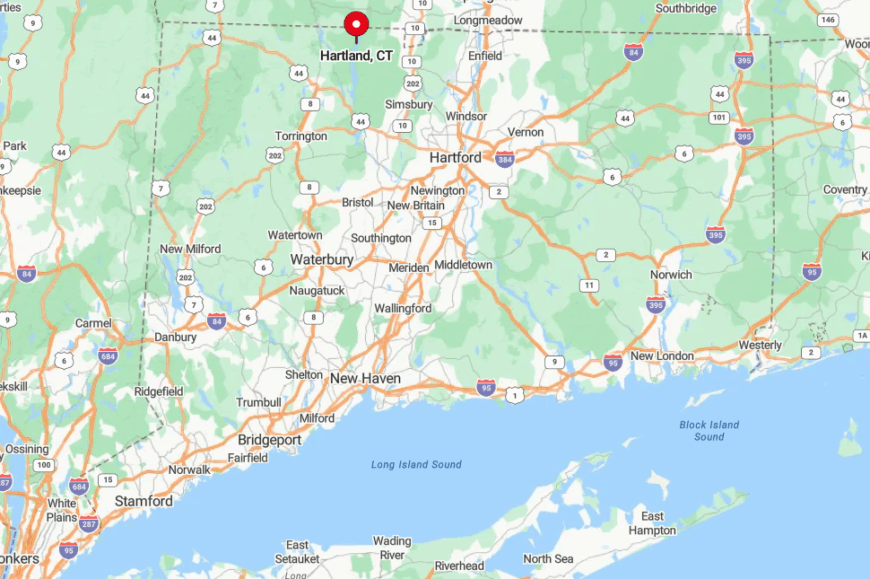
Hartland straddles the border of Hartford and Litchfield Counties in north-central Connecticut. Two reservoir arms create natural barriers, while only Route 20 threads through from end to end.
Drivers usually exit Interstate 91 in Windsor and climb twenty windy miles past tobacco fields and state forest to reach the village center. Winter storms can close the route entirely, reinforcing the sense of isolation for days at a time.
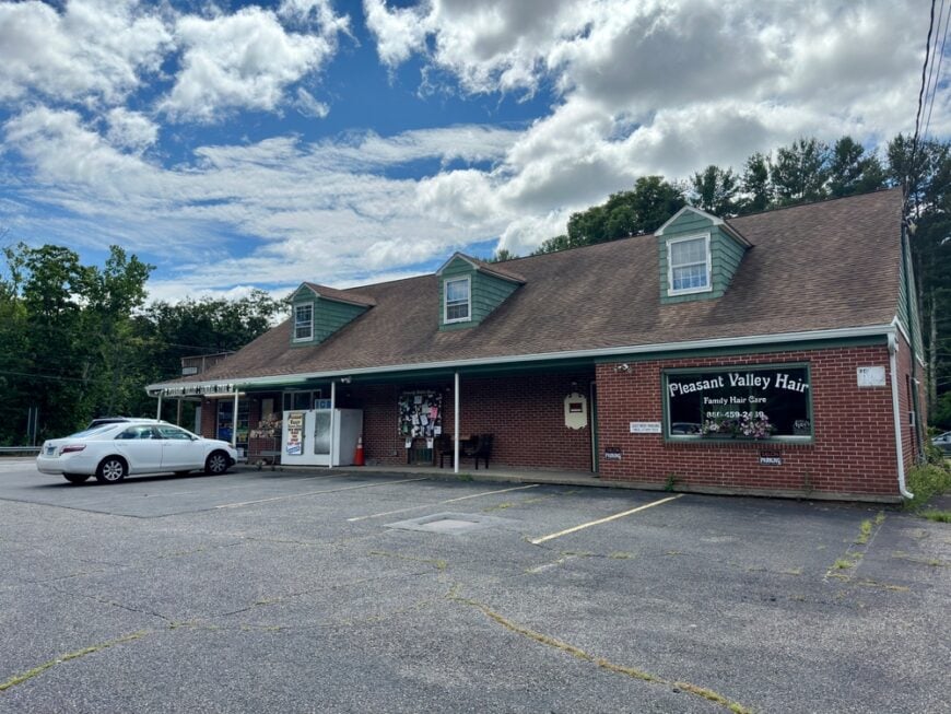
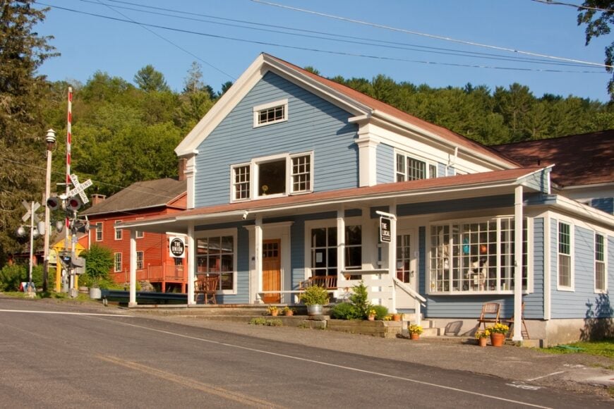
6. Barkhamsted
Roughly 3,700 people live in Barkhamsted, yet most homes perch far from one another along the Farmington River’s west branch. Anglers chase trophy trout in the river gorge, hikers follow the 51-mile New England National Scenic Trail, and families picnic beside the historic stone Saville Dam.
The economy mixes outdoor recreation services with a few cottage industries and volunteer-run shops in Riverton village. Only one traffic light exists in town, underscoring the light development footprint.
Towering hemlocks and unbroken forest corridors block views of neighboring communities, lending the roads a back-of-beyond feel. Dawn’s first light over the river canyon provides moody images prized by landscape photographers.
Where is Barkhamsted?
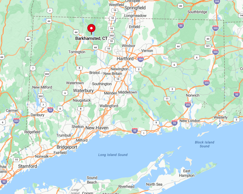
Barkhamsted hugs the Farmington River in Litchfield County, about 25 miles northwest of Hartford. The river’s steep valley and the reservoir system cut the settlement off from fast travel lanes on both Route 8 and Interstate 84.
Visitors enter via Route 20 or Route 318, each narrowing to a two-lane country road before crossing the iconic steel bridge into Riverton. With no bus lines or rail stops, arrival generally requires a car and a willingness to slow down.
5. Cornwall
Cornwall supports about 1,300 residents spread among several small hamlets linked by forested roads. The famous West Cornwall Covered Bridge draws artists year-round, as do Mohawk Mountain’s ski trails and the Housatonic’s paddling runs.
Local income comes from specialty agriculture, a growing number of remote workers, and hospitality tied to the Appalachian Trail. An estimated seventy percent of the town remains under tree canopy, much of it protected by land-trust easements.
This heavy timber cover absorbs highway noise and frames nearly every vista with green walls. Autumn mornings find photographers lining the riverbanks to catch crimson maples reflecting under the wooden bridge.
Where is Cornwall?
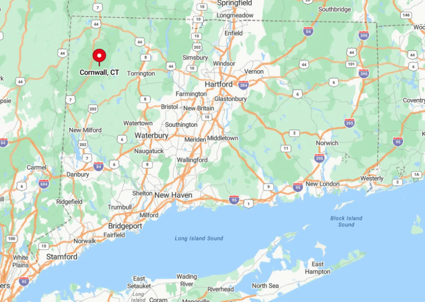
Cornwall sits in Connecticut’s far northwest quadrant, hugged by the Housatonic River on two sides. Its winding topography keeps any straight shot to Interstates 84 or 91 at least forty minutes away.
Drivers typically reach it using Route 7 or Route 4, both narrow and scenic. Cell coverage drops in several valleys, so paper maps still come in handy.
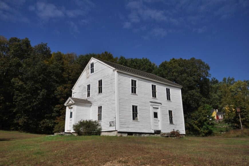
4. North Canaan (Falls Village)
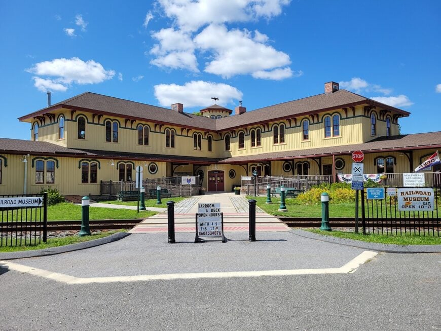
Falls Village, the historic center of North Canaan, is home to just over 1,100 people. Daytime diversions include photographing the 60-foot Great Falls, browsing vinyl at the Old Canaan Market, and catching folk music at the Music Shed.
The area relies on small hospitality venues, off-grid retreats, and heritage rail tourism linked to the Berkshire Line. High ridges of schist flank the Housatonic River, creating a green amphitheater that muffles outside sound.
Chain stores never arrived, leaving a one-block main street lined with Victorian storefronts. Even during leaf-peeping season, visitors often have the waterfall overlook to themselves.
Where is North Canaan?
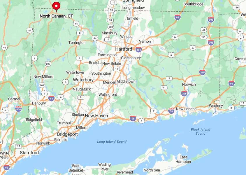
The village lies along Route 7 in the northwest corner, six miles south of the Massachusetts line. Steep river bluffs and protected forest preserve its valley seclusion.
Metro-North riders must disembark in Wassaic, then drive forty minutes north via country roads to reach the falls. Cyclists following the Rail Trail can also arrive under their own power, though they’re likely to share the path with more deer than people.
3. Eastford
Eastford counts around 650 residents scattered over 29 square miles. People spend weekends walking the Air Line Trail, bird-watching at Bebbington Pond, or wandering through 1,400-acre Natchaug State Forest.
The local economy is limited to a family diner, a general store, and a handful of cottage artisans. Unpaved back roads outnumber paved ones, so rush-hour noise is nearly absent.
Tall hardwood stands and stone bridges dating to the 1800s make every corner worthy of a camera. On clear nights, the Milky Way is visible right from the town green.
Where is Eastford?

Eastford sits in Tolland County, about 40 miles east of Hartford. Surrounded by state forest on three sides, it feels like a pocket sewn into the region’s larger woodland quilt.
Access comes via Route 44 or 198 after leaving Interstate 84 in Ashford, ten miles away. Without streetlights, visitors often rely on headlights and starlight for the final miles.
2. Woodstock
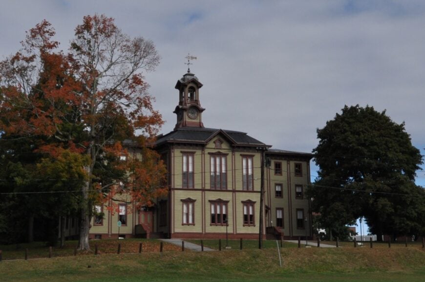
Woodstock hosts roughly 8,000 residents yet maintains a distinctly agrarian spread over 62 square miles. Highlights include sunrise atop Roseland Park’s overlook, antique hunting along Route 169, and concerts on the lawn of 1846 Roseland Cottage.
Dairy farms, small vineyards, and a growing wedding venue scene support the local economy. Hilltop churches and colonial homesteads sit far from retail clusters, leaving sightlines uncluttered by signage.
Rolling meadows dip into hardwood valleys, giving photographers open eastern skies perfect for dawn color. With no direct interstate access and limited cell towers, Woodstock still moves at a pre-digital tempo.
Where is Woodstock?
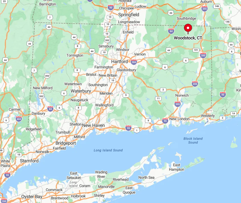
The town lies in Connecticut’s Quiet Corner, bordering Massachusetts and just west of Rhode Island. Interstate 395 runs five miles east, but Woodstock offers no entrances, preserving its rural calm.
Drivers exit in Putnam or Thompson and wind along Route 171 past hayfields to arrive. The lack of through rail service or bus lines reinforces the separation from urban centers.
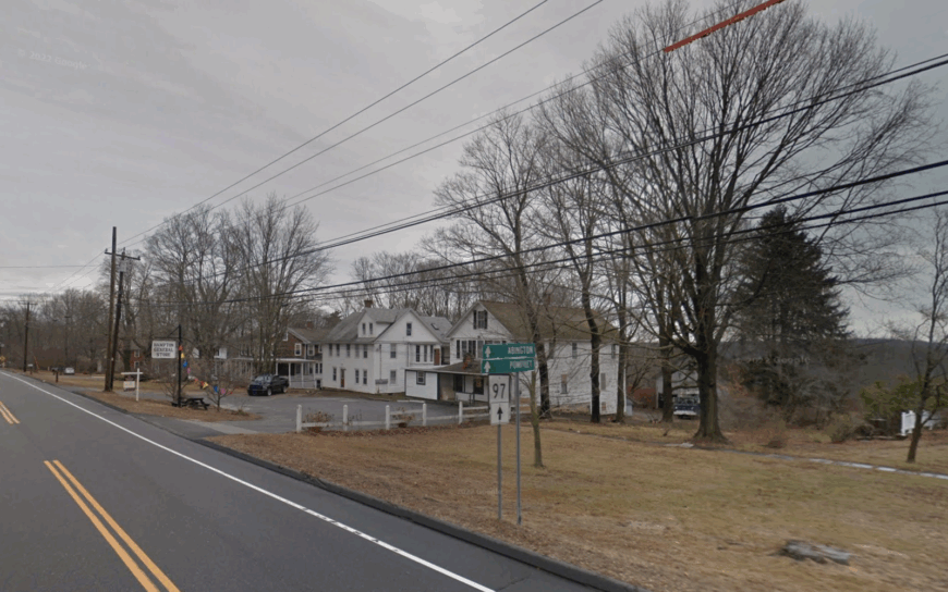
1. Hampton
Hampton shelters about 1,800 residents among hayfields, forest preserves, and historic farmhouses. Locals stargaze at Sheepskin Hollow Preserve, paddle Pine Acres Lake, or attend contra dances at the 1870 community hall.
Jobs are tied to small farms, remote telework, and the Goodwin State Forest conservation center. Streetlights are almost nonexistent, and homes sit on multi-acre parcels reached by narrow lanes.
As night falls, skies turn pitch-black, revealing constellations rarely seen elsewhere in southern New England. Photographers frequently frame old barns in silhouette against the summer Milky Way.
Where is Hampton?
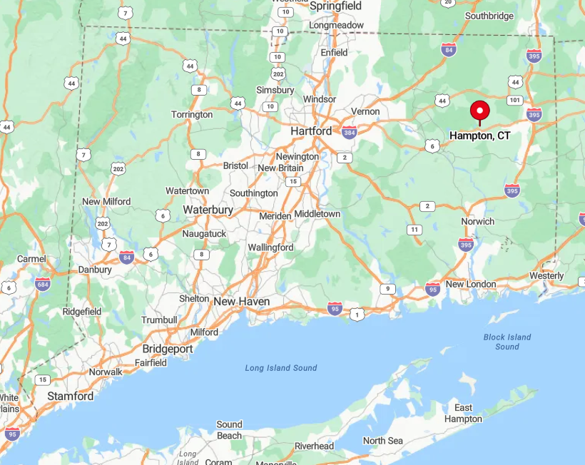
Hampton rests in Windham County, equidistant from Hartford and Providence yet firmly off the beaten path. Miles of Joshua’s Trust holdings and the Natchaug River break any direct line to surrounding towns.
Visitors leave Route 6 in Chaplin or Brooklyn and follow winding paved farm roads with minimal signage. The absence of public transit ensures that only those intent on quiet country nights make the trip.


