Would you like to save this?
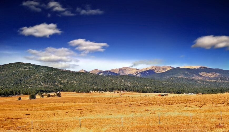
Northeast New Mexico stretches from the volcanic uplands near the Colorado line to the Canadian River’s broken canyon country in the south. It is a region of high mesas, extinct cinder cones, and valleys where grasslands give way to the first timber of the Sangre de Cristo Mountains. The climate shifts with elevation—shortgrass prairie on the plains, alpine meadows in the mountain corridors—making the geography as varied as its history.
This corner of the state carries traces of every era that has passed through it. Spanish colonial land grants still shape property lines; the remnants of the Santa Fe Trail cut faint paths across the rangeland; and in the far north, railroad sidings and depot towns mark the push of 20th-century commerce. Small communities remain linked to ranching, seasonal hunting, and the work of living far from distribution hubs.
Culture here is defined by persistence. Local calendars revolve around branding seasons, school sports, and the few annual gatherings that draw far-flung neighbors into one place. Churches and post offices often double as social centers, and histories are preserved in mural walls, small-room museums, and the oral accounts of families who have been in the same valley for generations. Spanish, English, and older regional dialects all find their way into the same conversation.
Set between the Sangre de Cristo high country and the plains that fall toward Texas and Oklahoma, these towns sit in landscapes that outsiders rarely cross by accident. Each location—whether tucked along a mountain road, at the edge of a volcanic field, or anchored to a river bend—offers its own balance of remoteness and rootedness. Together, they form a map of the region’s quieter spaces, where history and geography are inseparable.
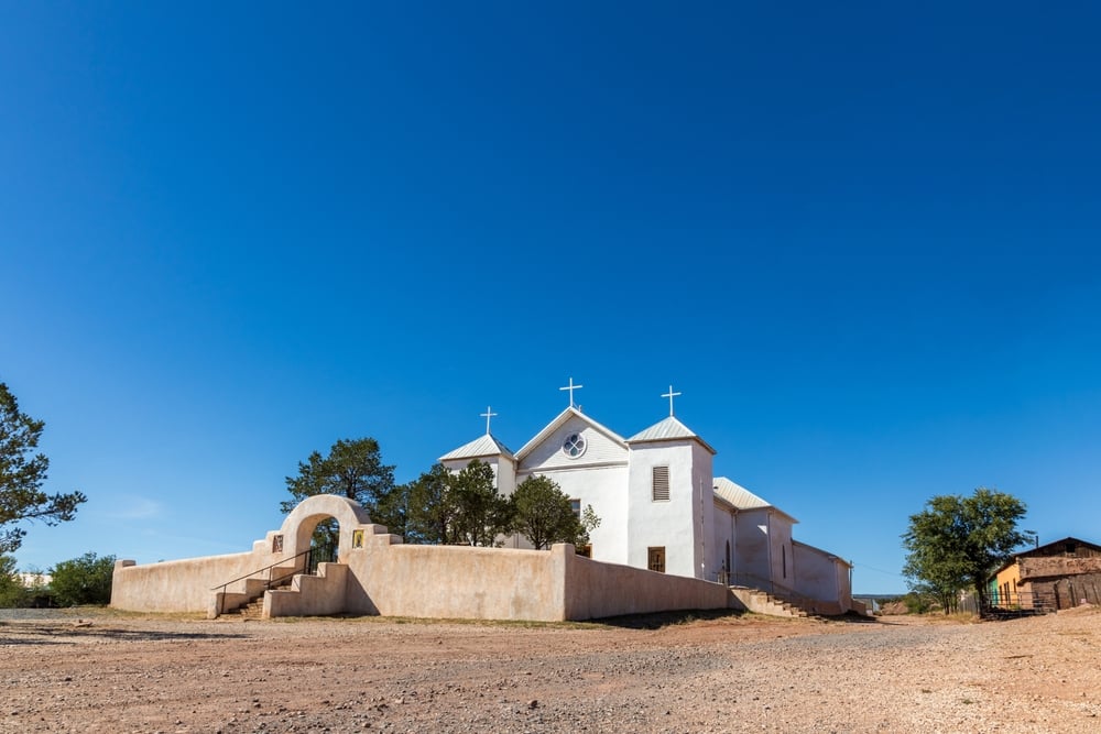
25. Trementina – Mesas, Arroyos, and a Church Bell in the Wind
Trementina is a scatter of adobe, chapel, and ranch gates tucked among sandstone mesas and blue grama grass. It feels hidden because it sits far from interstates and is surrounded by big private ranches and BLM land where the pavement simply ends.
The vibe is old-New-Mexico humble: wind through cottonwoods, a lone pickup easing down a caliche lane, and stars sharp as pinpricks. Wander the little churchyard, explore Canadian River overlooks, picnic beneath junipers, or roam the backroads toward remote box canyons.
Work here is ranching, fence-mending, and the quiet daily rhythm of stock tanks and weather. Even the light seems slower, turning walls the color of bread crust at dusk. It’s the kind of place that reminds you how quiet the world can be.
Where is Trementina?

Trementina sits in northeastern San Miguel County, roughly 45 miles northeast of Las Vegas, New Mexico. Most folks reach it by taking NM-104, then turning onto county roads that thread through open ranchland.
There’s no through route; you drive in with a purpose and leave the same way you came. Close enough for a day trip, far enough to feel like you’ve stepped off the map.
24. Ocate – A Crossroads Town Ringed by Quiet Timber
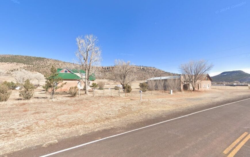
Ocate gathers at a modest junction where two-lane roads meet and spruce-lined ridges keep the horizon close. Seclusion comes from the long miles between towns and the sweep of private meadowlands and state forest that hem it in.
The mood is whisper-soft: wood smoke on cold mornings, horses flicking tails in pasture, and the creak of a ranch gate. Drive NM-120 for golden aspen in fall, poke around the old mercantile, fish nearby streams after summer rains, or follow dirt spurs toward Dawson Ridge overlooks.
Ranching and logging odds and ends anchor the economy. Even on holiday weekends, traffic is a rumor rather than a reality. Ocate feels like a pause between breaths.
Where is Ocate?
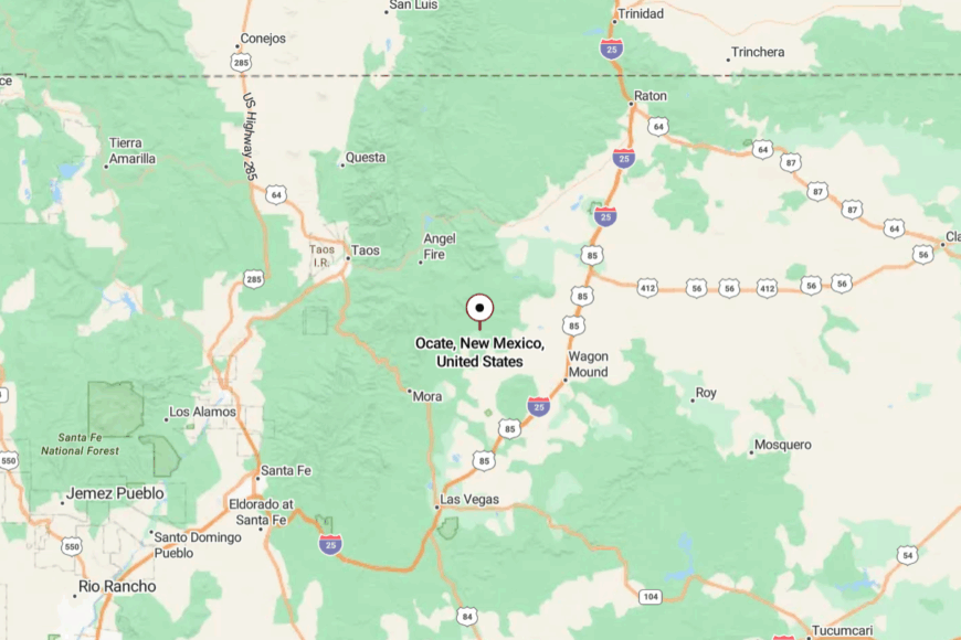
You’ll find Ocate in Mora County, where NM-120 meets NM-442, about 20 miles west of Wagon Mound. Approaches are all two-lane roads that rise and roll across meadow and timber.
Snow and spring mud can slow things down, keeping casual passersby away. It’s close to the mountains, yet far from any hurry.
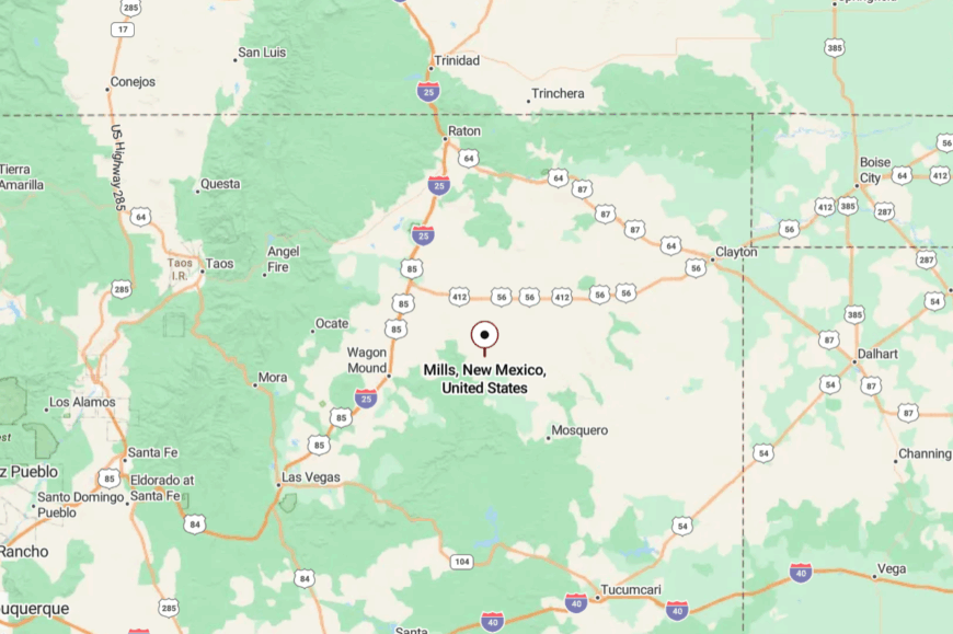
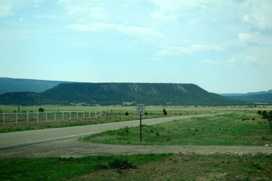
23. Mills – Gateway to a Forgotten Canyon
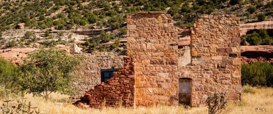
Mills is a tiny settlement with empty boardwalks and wind-polished signs, best known as the doorstep to Mills Canyon on the Canadian River. It stays secluded because there’s little reason to pass through unless you’re bound for those cottonwood bottoms or the rim’s stone ruins.
The feel is pleasantly ghosted: meadowlarks, distant cattle, and a sky that seems three sizes too big. Hike the canyon rim, camp under towering cottonwoods, explore remnants of the historic orchard era, or watch pronghorn in the shortgrass.
Ranching and seasonal recreation are the only real “industries.” Evening light pours off the mesa in wide bands of copper. Mills is the lone front porch of a very large, very quiet backyard.
Where is Mills?
Would you like to save this?
Mills sits in Harding County on NM-39, about 12 miles north of Roy. The road rolls over open range, then drops toward the Canadian River country.
A graded spur heads west to Mills Canyon—impassable after heavy rains. It’s easy enough to reach, but it feels a long way from anywhere the moment you arrive.
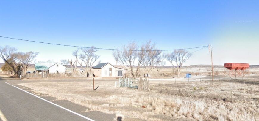
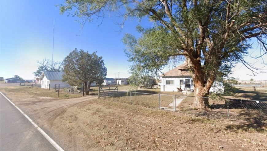
22. Solano – One Street, Big Sky

Solano is little more than a street, a post-office memory, and a handful of homes facing an ocean of prairie. Seclusion is baked into the place: miles of ranchland in every direction and only a ribbon of highway tying it to the map.
The vibe is pure plains—wind in the wire, barn swallows under eaves, and neighbors who measure distance in gates, not miles. Photograph storm light on wheat stubble, glass for antelope at daybreak, explore abandoned outbuildings, or day-trip to the mesas near the Canadian.
Work is ranch chores and long-haul drives for supplies. After sunset, the Milky Way seems to float just above the fenceline. Solano is small on purpose.
Where is Solano?
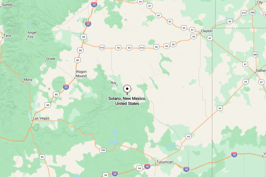
You’ll find Solano along NM-39 in Harding County, about 20 miles south of Roy. It’s a straightforward two-lane approach with long gaps between services.
Side roads quickly turn to gravel and wander toward the river breaks. It’s close enough for a Sunday drive, but far enough that time slows down.
21. Bueyeros – Dust, Juniper, and the Canadian’s Edge
Bueyeros keeps a low profile on the high plains, tucked near the broken country where the Canadian River starts cutting canyons. Its seclusion comes from distance and dirt: the last miles often run on graded roads with few signs and fewer travelers.
The mood is old-ranch steady—corrals, windmills, and the scent of rain on dust. Walk to little ridge tops for far views, scout prairie dog towns, seek wildflowers in spring, or point a camera at weather rolling in from Texas.
Livelihoods revolve around cattle and the work the land asks. When the wind stops, the silence is so complete you can hear grasshoppers click. Bueyeros is the sound of the plains at rest.
Where is Bueyeros?

Set in far eastern Harding County, Bueyeros lies about 25 miles east of Mosquero via NM-102 and county spurs. Pavement gives way to gravel before you arrive, which keeps traffic scarce.
Summer storms can briefly turn the clay slick. Once there, you feel held by the sky and distance.
20. Seneca – A Quiet Bend on the Dry Cimarron Way

Seneca is a quiet crossroad north of Clayton where windmill vanes turn and meadowlarks own the fence posts. It’s secluded by choice and geography—north toward the Dry Cimarron, south to the caprock, and not a single big box in sight.
The vibe is clear and spare: a church, a few homesteads, and the hush of grassland. Watch deer drift through draws at dusk, roll north on NM-406 to red-cliff overlooks, picnic under cottonwoods, or chase summer thunderheads with a camera.
Work is ranching, plus the long drives that come with it. Nights here are ink-dark and generous with stars. Seneca is the soft-spoken kind of solitude.
Where is Seneca?

You’ll find Seneca in Union County, roughly 22 miles north of Clayton along NM-406. The highway narrows to a country lane flanked by pasture and windmills.
There’s no alternate route; it’s a there-and-back trip through open land. It’s close enough for an afternoon, yet distant enough to reset your senses.
19. Sedan – Wind-Polished Plains at the State Line’s Door
Sedan sits near the New Mexico–Texas line, a scattering of homes and grain bins where horizons run unbroken. Seclusion comes from the long distance to services and the way county roads stitch between ranch gates like thread.
The mood is sun-warmed and uncomplicated: quiet porches, dogs on shade-side decks, and the companionship of big sky. Drive NM-421 past old windmills, watch for pronghorn, photograph storm cells, or hunt for relics of early homesteads on permissioned land.
Ranching is the backbone here. When night arrives, the only glow is lightning far away over the plains. Sedan is the feeling of space made visible.
Where is Sedan?
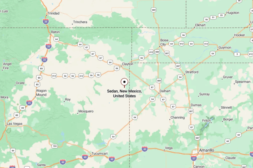
In southeastern Union County, Sedan lies about 36 miles south of Clayton via NM-406 and NM-421. The approach is all two-lane and ranch country; services are few.
Summer rains can briefly rattle the low-water crossings. You’ll know you’re close when the road straightens and the sky gets even bigger.
18. Mount Dora – A Siding, a Sign, and a Big, Empty Beautiful
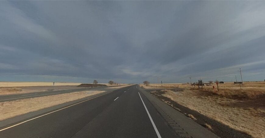
Mount Dora is a ghost of a town on US-64/87, little more than a siding and a name where the prairie meets an old volcanic field. Its seclusion is obvious—no services, no crowds, just wind and train horns drifting across grass.
The vibe is cinematic and spare: weathered posts, cheatgrass, and the sense you’ve found a backstage door to the plains. Stop for photos at golden hour, scan for raptors working the thermals, or trace old fence lines that vanish into heat shimmer.
There’s no industry beyond cattle on distant leases. Sunset turns the land copper and the rails silver. Mount Dora is proof that emptiness can be a destination.
Where is Mount Dora?
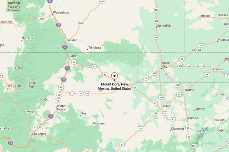
Mount Dora sits about 17 miles west of Clayton on US-64/87 toward Grenville. It’s a simple highway pull-off with expansive views and little else.
Side tracks and ranch roads are private; the highway is your guide. Close to the route, but far from distraction.
17. Miami – Green Pastures Between Hills and History
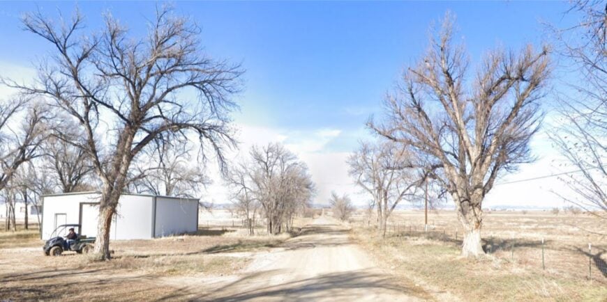
Miami is a tiny hamlet of farms and pasture tucked between Springer and the old Santa Fe Trail country near Cimarron. It feels secluded thanks to a web of quiet county lanes and the way low hills shelter it from highway noise.
The vibe is hushed and neighborly—irrigation ditches, red barns, and morning light on haystacks. Bird along the ponds, follow NM-21 to historic ranch sites, picnic by cottonwoods, or drive to the nearby Coyote Creek hills for cool shade.
Work is hay, cattle, and the school runs into Springer. Even the breeze seems to slow here. Miami is as gentle as a porch swing.
Where is Miami?
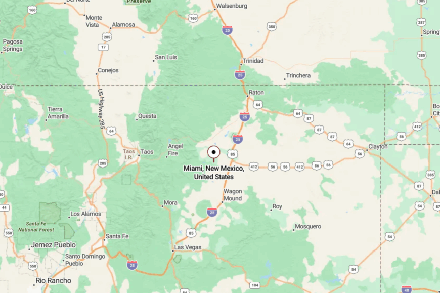
You’ll find Miami in Colfax County along NM-21, roughly 14 miles south of Springer. The road threads pastureland and skirts low ridges, with no fast way through.
Most travelers are locals; pass-through traffic is rare. It’s the sort of detour that feels like a secret.
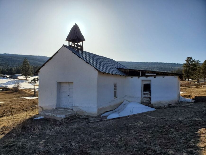
16. Rayado – Philmont’s Quiet Doorstep
Would you like to save this?
Rayado gathers around a historic ranch site where tall cottonwoods mark the old trail and the mountains lift just beyond. It stays secluded because it’s at the end of a quiet spur with protected lands and working ranches locking the landscape in place.
The vibe is storied and still: adobe, picket fences, and the hush of a place that remembers the 1800s. Tour the historic Rayado structures (seasonal), fish on permissioned waters, hike nearby canyons, or day-trip to Cimarron Canyon’s cliffs.
Ranching and heritage education are the modest anchors. When evening falls, the trees whisper like they’re telling you what they’ve seen. Rayado is history you can hear.
Where is Rayado?
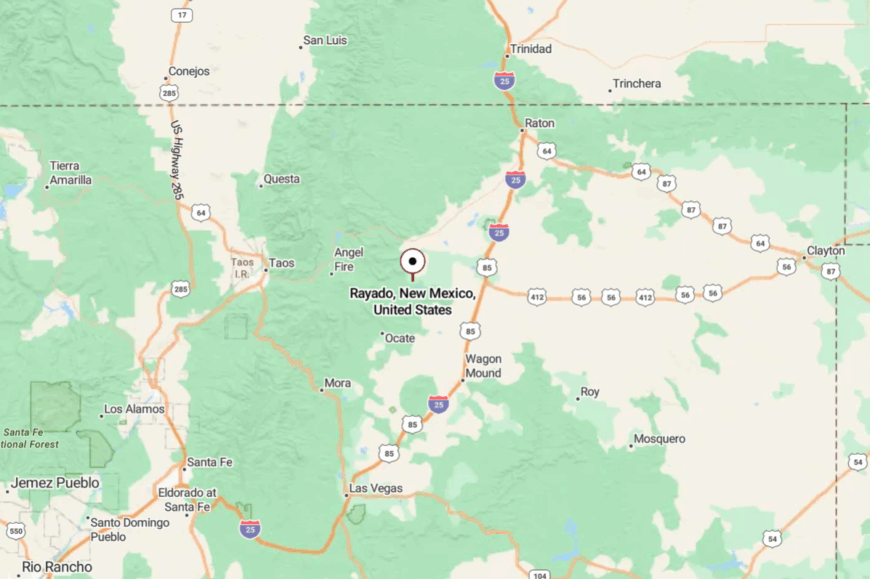
Rayado sits about 7 miles south of Cimarron in Colfax County, reached via NM-21. The two-lane narrows and meanders through meadows before ending near the historic complex.
There’s no through road, which keeps it calm. You feel tucked in by mountains and story.
15. Ute Park – Pines, River Murmur, and a Pocket of Peace
Ute Park is a thin ribbon of cabins and pines tucked where the Cimarron River tightens between hills. Seclusion comes from the canyon walls themselves, which muffle sound and hide homes from the highway’s quick glance.
The vibe is river-quiet—screen doors, fly rods, and the peppery smell of ponderosa bark in the sun. Cast for trout in the riffles, watch elk at dawn, wander to canyon overlooks, or linger with a book on a porch swing.
Lodging and seasonal services dot the roadside; otherwise, it’s all pines and water. Nights bring cool air off the river and the hush of a thousand needles. Ute Park is a whisper along the road.
Where is Ute Park?

Set between Cimarron and Eagle Nest on US-64 in Colfax County, Ute Park lies about 8 miles west of Cimarron. The highway tightens to a canyon run with few shoulders and fewer distractions.
Side streets dead-end at forest or riverbanks. It’s close enough to reach in an hour, but it feels like a tucked-away camp.
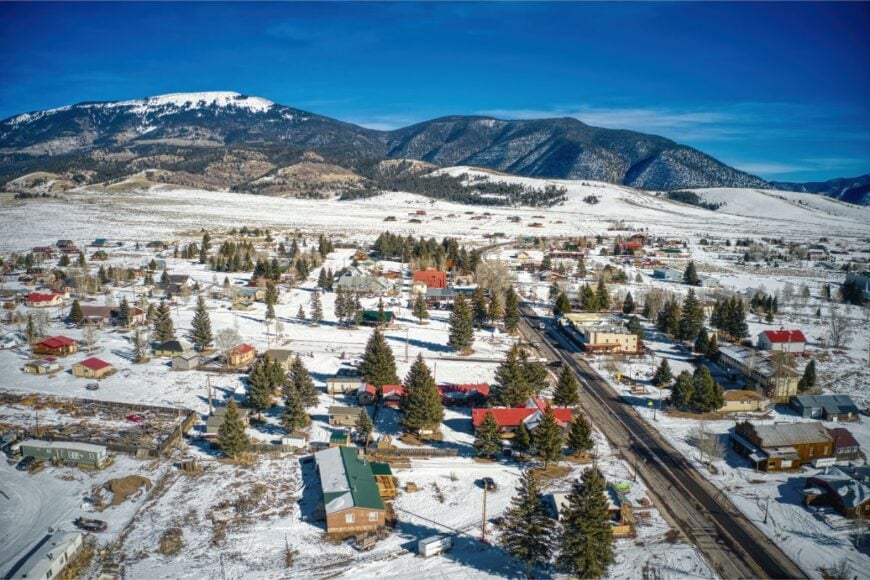
14. Black Lake – Meadows Under Big Peaks
Black Lake is a spread-out community of meadows, ponds, and timber south of Angel Fire, where cranes bugle and fog lifts slowly. Its secluded feel comes from being up a side valley with only a curving two-lane road in and no town center to draw crowds.
The mood is alpine-pastoral: cattle bells, hayfields, and the breath of the Sangres over your shoulder. Watch sunrise steam off the water, ride gravel spurs into the hills, picnic in willow shade, or spot elk at dusk along the fence lines.
Ranching and cabin caretaking shape most days. When stars come out, they seem to rest on the meadow’s surface. Black Lake is the gentle edge of the high country.
Where is Black Lake?
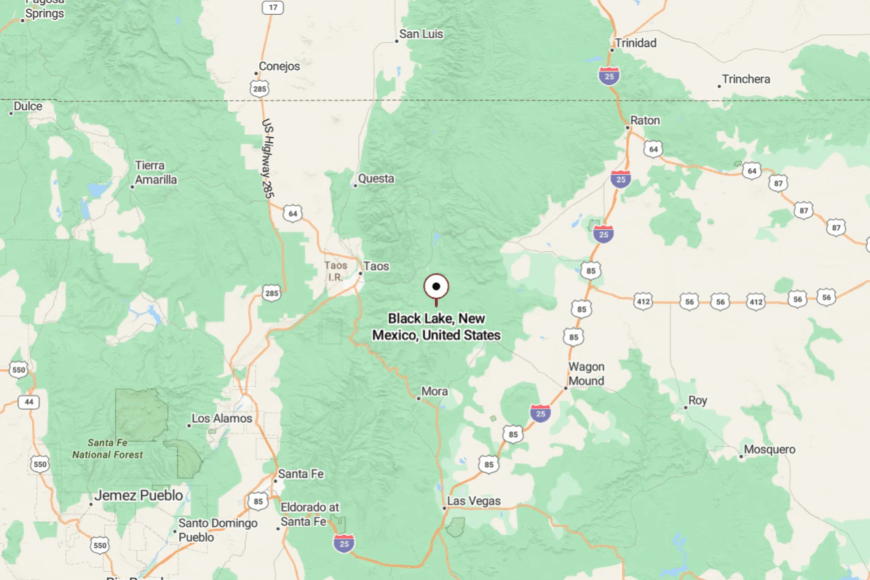
You’ll find Black Lake along NM-434 in Colfax County, about 12 miles south of Angel Fire. The road narrows, winds, and climbs—beautiful, but slow by design.
There’s no bypass and no strip of shops to break the quiet. It’s close to ski country, yet feels a world apart.
13. Eagle Nest – A Small Lake Town Ringed by Mountains
Eagle Nest sits on the shore of its cold, clear namesake lake, a compact village backed by the ramparts of the Sangre de Cristo. It feels secluded because every road crosses a pass or a canyon, and development stops at timberline and water’s edge.
The vibe is lacquered with mountain air—bait shops, porch coffee, and the soft clink of boat hardware at dawn. Fish for trout and kokanee, stroll the lakefront, hike into the Moreno Valley hills, or day-trip to Cimarron Canyon’s hoodoos.
Outfitters, cabins, and seasonal cafés are the economic anchors. When afternoon storms clear, the lake mirrors bruised clouds and the town glows. Eagle Nest is a small circle of light in a wide bowl of peaks.
Where is Eagle Nest?
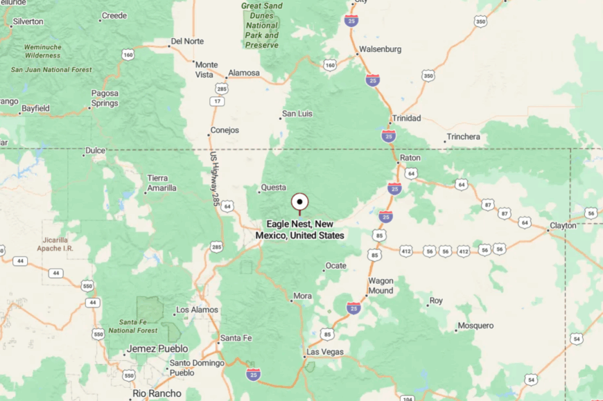
In Colfax County on US-64, Eagle Nest sits roughly 28 miles east of Taos and 11 miles west of Cimarron. Approaches crest at high passes with sweeping views and winter snow.
Streets end at the shoreline or the forest; there’s nowhere for sprawl to go. Close to the route, far from the rush.
12. Nara Visa – Rails, Mesquite, and Route 54 Quiet

Nara Visa is a near-ghost along US-54 where the railroad still hums and mesquite creeps toward the ties. Seclusion is its default: the next big grocery is a long drive either way, and the plains don’t hurry anyone along.
The vibe is Route-66-adjacent nostalgia without the crowds—faded signage, a café light at dusk, and trains sliding by like slow rivers. Photograph relic gas stations, scan the grasslands for pronghorn, follow section-line roads to windmills, or chase summer lightning on the horizon.
Ranching and highway services are about it. Nights drop fast and cool on the open flat. Nara Visa is the quiet chapter in a long road story.
Where is Nara Visa?
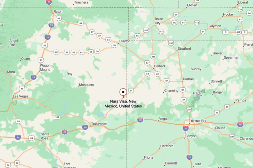
You’ll find it in far eastern Quay County, about 45 miles east of Tucumcari on US-54 near the Texas line. The drive is straight and spare, with big-sky views and few turnoffs.
Side roads quickly become gravel and wander into pasture. It’s easy to reach—and easy to feel far away.
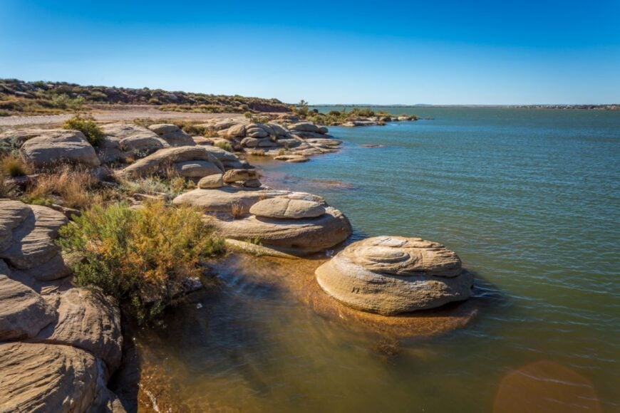
11. Conchas Dam – A Lake Community at the End of the Road
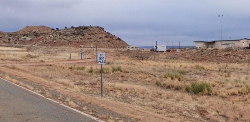
Conchas Dam is a tiny, scattered community wrapped around coves and sandstone ledges on Conchas Lake. Its seclusion stems from the water itself—miles of shoreline and state parkland—plus the fact that every approach dead-ends at the reservoir.
The vibe is lake-casual and low-key: fishing talk at the marina store, herons stalking shallows, and houseboats rocking themselves to sleep. Launch a boat at the west or north area, hike to petroglyphs with a view, fish for walleye and bass, or photograph sunrise from the dam overlook.
The economic rhythm is state park staffing, weekenders, and a few local services. At night, the lake quiets until you can hear carp roll in the coves. Conchas Dam is a distance measured in ripples.
Where is Conchas Dam?
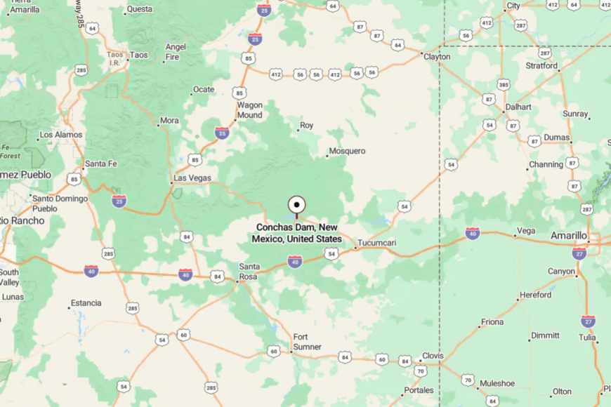
Straddling the Quay/San Miguel line, Conchas Dam sits about 30 miles northwest of Tucumcari via NM-104 and NM-386. The last miles are two-lane turns through piñon and sandstone bluffs.
There’s no through traffic—only folks bound for water or home. It’s close enough for a weekend, far enough to feel like vacation starts at the turnoff.
10. Farley: Ranch Country’s Hidden Haven

I recently discovered Farley, a quiet unincorporated community with a population of just around 25 people. This tiny spot in the heart of ranch country is perfect if you’re looking to experience true tranquility.
There’s not much in terms of tourist attractions, but that’s part of its charm; the vast open spaces are ideal for horseback riding and enjoying the serene landscape. The main industry here revolves around cattle ranching, which has been the lifeblood of the community for generations.
What makes Farley so secluded is its remoteness and the miles of ranchlands that surround it on all sides. I love how you can stand in Farley and feel like you’re a world away from the noise and rush of modern life.
Where is Farley?

Farley is located in northeastern New Mexico, about 40 miles northwest of Clayton. Its seclusion is due to its position off the main highways and the rural roads that lead you there. Getting to Farley involves a scenic drive through open plains and rolling hills, which I find incredibly peaceful.
The nearest significant town is Springer, but even that is a small community, reinforcing Farley’s standing as a hidden haven in ranch country. The isolation and minimal traffic make it an ideal spot for those seeking solitude.
9. Gladstone: Expansive Horizons and Rural Seclusion

Gladstone is an unincorporated area that I’ve always found fascinating due to its vast open landscapes and incredibly small population, which hovers around 15 residents. This place is all about embracing the simplicity of rural life.
Activities here are centered around the great outdoors; it’s a fantastic area for stargazing, hiking, and simply enjoying the unobstructed views of the horizon. Agriculture and ranching are the mainstays of the local economy, with sprawling farms dotting the landscape.
The seclusion of Gladstone is amplified by its sparse population and the endless stretches of land that separate it from busier locales. I appreciate how visiting Gladstone feels like stepping into a peaceful, unspoiled corner of the world.
Where is Gladstone?

You’ll find Gladstone situated along U.S. Route 56 in northeastern New Mexico, roughly midway between Clayton and Springer. Its remoteness is partly due to the lack of significant development in the area and the considerable distances between neighboring towns.
Reaching Gladstone involves a drive through sweeping plains that seem to go on forever, which I find both calming and inspiring. The absence of heavy traffic and the simple, quiet roads add to the sense of seclusion that defines this rural community.
8. Maxwell: Quiet Village Near Wildlife Refuge

Maxwell is a quaint village with a population of around 230 people, and it’s one of my favorite quiet spots in Northeast New Mexico.
The village itself might be small, but it’s located near the Maxwell National Wildlife Refuge, which offers plenty of opportunities for bird watching, fishing, and experiencing local wildlife.
Agriculture is the primary industry here, with many residents involved in farming and ranching. The combination of its small size and proximity to the refuge gives Maxwell a serene atmosphere that’s hard to find elsewhere.
I enjoy the peacefulness that comes from being close to such a pristine natural area while still having a tight-knit community nearby.
Where is Maxwell?

Maxwell is located along Interstate 25, about 20 miles south of Raton. Despite being near a major highway, the village maintains its secluded feel due to the surrounding open spaces and the low volume of local traffic. Its location near the wildlife refuge further sets it apart from busier areas.
Getting to Maxwell is straightforward if you’re traveling along I-25, but once you arrive, you’ll notice how the expansive landscapes and quiet streets create a sense of isolation.
I find that the ease of access combined with the seclusion makes Maxwell a unique destination for those seeking a quiet retreat.
7. Wagon Mound: Seclusion Under the Landmark Butte

Wagon Mound is a small town with about 300 residents, and it’s named after a nearby butte that resembles a covered wagon. I’ve always been drawn to its historical charm and the way it seems frozen in time.
There’s not a lot of hustle and bustle here, which makes it perfect for leisurely walks and enjoying the local scenery. The main industries include small-scale farming and ranching, and the town has a few historic buildings that hint at its past significance along the Santa Fe Trail.
Its seclusion is enhanced by the natural barrier of the butte and the minimal traffic that passes through. I appreciate how Wagon Mound offers a peaceful lifestyle under the watchful eye of its namesake landmark.
Where is Wagon Mound?

Situated in Mora County along Interstate 25, about 40 miles north of Las Vegas, New Mexico, Wagon Mound is easy to find yet remains off most travelers’ radars. Its location beneath the prominent butte provides a sense of enclosure and seclusion.
Despite its proximity to the interstate, the town sees little through traffic, contributing to its quiet atmosphere. Reaching Wagon Mound is simple enough, but once you’re there, the combination of historic ambiance and natural surroundings makes it feel pleasantly remote.
6. Roy: Rural Retreat Amid Ranchlands

Roy is a small village with approximately 230 residents, nestled amidst the expansive ranchlands of Harding County. I find Roy to be the epitome of rural charm, with wide-open spaces and a close-knit community.
Outdoor activities like hunting, hiking, and exploring the natural landscape are common pastimes here. The primary industries are ranching and farming, which contribute to the village’s laid-back and traditional way of life.
Roy’s seclusion stems from its geographic location surrounded by vast ranches and the lack of major developments nearby. I enjoy visiting Roy to experience the tranquility and simplicity that comes with such an unspoiled rural environment.
Where is Roy?

You’ll find Roy located at the junction of State Highways 39 and 120 in northeastern New Mexico. Its remote setting is heightened by the significant distances to the nearest larger towns and the sparsely populated surroundings.
Getting to Roy requires a purposeful journey through scenic countryside, which I personally think adds to the experience. The minimal traffic and the expansive landscapes that envelop the village contribute to its sense of isolation. For me, Roy offers a genuine escape into rural life, far from the distractions of busier places.
5. Mosquero: Historic Charm in Rugged Terrain

Mosquero is a village with a population of about 90 people, and it’s one of those places where history seems to come alive. I’ve been impressed by the historic murals that adorn the buildings along Main Street, depicting scenes from the area’s past.
Outdoor enthusiasts can explore the rugged hills and canyons that surround the village, which are great for hiking and photography. The main industries include ranching and some small local businesses.
Mosquero’s seclusion is a result of its location amid challenging terrain and its distance from major urban centers. I appreciate the village’s quiet atmosphere and the glimpse it offers into a bygone era.
Where is Mosquero?

Located in Harding County, Mosquero sits along State Highway 39, about 50 miles northeast of Las Vegas, New Mexico. Its setting among hills and canyons enhances its secluded feel, as the terrain naturally limits accessibility.
The drive to Mosquero includes winding roads through picturesque landscapes, which I find both beautiful and calming.
The relative isolation of the village provides a peaceful retreat, making it perfect for anyone looking to step away from the fast pace of modern life. I always enjoy the journey to Mosquero as much as the destination itself.
4. Grenville: Tiny Village on the High Plains

Grenville is a sparsely populated village with only about 25 residents, located on the high plains of northeastern New Mexico. I find Grenville’s simplicity and quietness to be its most appealing qualities.
While there aren’t any major attractions, the expansive skies and open landscapes are ideal for those who appreciate nature’s subtle beauty. Agriculture and ranching are the primary activities here, reflecting a lifestyle that hasn’t changed much over the decades.
Grenville’s seclusion comes from its tiny population and its location far from busy highways and larger towns. I enjoy the sense of peace that envelops you when you visit this remote village.
Where is Grenville?

You’ll find Grenville along U.S. Route 64/87, about 25 miles east of Clayton. Its position on the high plains contributes to its feeling of isolation, with vast stretches of land in every direction.
Access to Grenville is relatively straightforward, but the lack of developments and minimal traffic make the journey feel like you’re venturing into a quiet corner of the world. I think the remoteness of Grenville is perfect for anyone seeking solitude and a chance to reconnect with the simplicity of rural life.
3. Des Moines: Peaceful Living Beneath the Sierra Grande

Des Moines is a small town with around 150 residents, situated at the base of the impressive Sierra Grande mountain. I love the breathtaking views and the tranquility that comes from being so close to such a majestic natural feature.
Outdoor activities abound here, including hiking up the mountain, exploring ancient lava flows, and wildlife watching. The main industries are ranching and services related to the local community and travelers passing through.
Des Moines’s seclusion is enhanced by its vast open spaces and the natural barrier provided by the mountain. For me, the peaceful living in Des Moines is unmatched.
Where is Des Moines?

Des Moines is located at the junction of U.S. Highways 64 and 87, about 35 miles west of the New Mexico-Texas border. Its remote location beneath the Sierra Grande and near the edge of the Capulin Volcano National Monument adds to its sense of isolation.
Getting there involves a drive through expansive plains, which I always find serene. The town’s distance from major cities and its surrounding natural features make it an ideal spot for those seeking a secluded environment. I often recommend Des Moines to friends looking for a quiet getaway with stunning landscapes.
2. Capulin: Serenity at the Foot of a Volcano

Capulin is a quiet community with about 60 residents, nestled near the Capulin Volcano National Monument. I find the proximity to this extinct volcano to be one of the most intriguing aspects of the town.
There’s plenty to do here if you enjoy nature: hiking the volcano’s rim, picnicking, and exploring the diverse wildlife. The local economy revolves around tourism related to the volcano and traditional ranching activities.
Capulin’s seclusion comes from its small size and the natural barriers created by the volcanic terrain. I feel a sense of peace every time I visit, thanks to the serene environment at the base of the volcano.
Where is Capulin?

Capulin is situated along U.S. Highway 64/87, about 30 miles east of Raton. Its location near the volcano and away from larger towns contributes to its secluded atmosphere. Accessing Capulin is straightforward, but the surrounding volcanic fields and minimal development make it feel remote.
I enjoy the quiet roads that lead to the town, surrounded by unique geological features. For anyone fascinated by volcanoes and seeking a tranquil setting, Capulin is a must-visit. It’s become one of my favorite spots for peaceful reflection.
1. Folsom: A Hidden Gem Amidst Volcanic Landscapes

Folsom is a small village with a population of around 55 people, and it’s truly a hidden gem in Northeast New Mexico. What captivates me about Folsom is its rich history and proximity to significant geological sites.
Nearby, you can explore the Folsom Museum, which showcases local artifacts and stories, and visit the Folsom Falls for a serene nature experience. The main industries are ranching and some tourism, particularly from those interested in the area’s archaeological significance.
Folsom’s seclusion is due to its location near ancient volcanic formations and the expansive rural vistas that surround it. Every time I’m in Folsom, I feel like I’ve stepped into a peaceful retreat far removed from the modern world.
Where is Folsom?

Folsom is located near the junction of State Roads 325 and 456, about 40 miles northeast of Raton. Its position in the shadow of ancient volcanoes and away from major highways enhances its secluded feel.
Getting to Folsom involves traveling through scenic rural landscapes, which I find both calming and picturesque. The village’s isolation is a big part of its charm, offering an escape for those who wish to immerse themselves in history and natural beauty.
I highly recommend exploring Folsom if you’re looking for a quiet destination with a unique backdrop.