🔥 Would you like to save this?
Northeast Georgia still shelters pockets where the mountains muffle highway hum, night skies stay ink-black, and a lone porch light counts as civilization. Our look at 25 of those hideaways highlights communities that value quiet farms, trout-cold creeks, and backroads so twisty the state never bothered with center lines.
Each town is small enough that neighbors wave from pickups, yet rich enough in scenery to make visitors linger. We hope the notes below help travelers and future residents understand why these villages feel a world apart while remaining within a morning’s drive of Atlanta.
In order to come up with the very specific design ideas, we create most designs with the assistance of state-of-the-art AI interior design software.
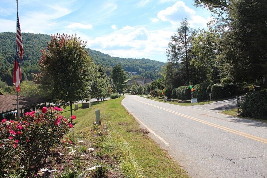
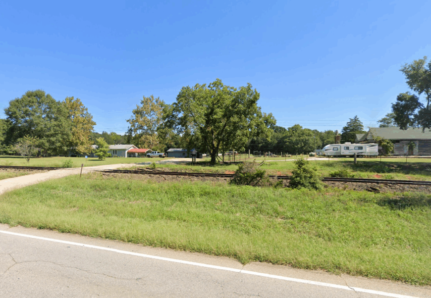
25. Wiley – A Hamlet Nestled by Rail and Ridge
Wiley is the kind of place where trains pass without stopping and the wind whispers through pine groves older than memory. With fewer than 300 residents and a scattering of homes along old U.S. 441, it’s a town often missed—but never forgotten by those who find it.
The mornings smell of woodsmoke and honeysuckle, and the hum of life moves slow. A single post office, a weathered church, and a corner store speak volumes in their quiet endurance.
Hemmed in by low ridges and stitched with narrow roads, Wiley feels pocketed in time—where the mountain still rules and the highway only brushes the edge.
Where is Wiley?
Wiley rests in Rabun County, tucked between Lakemont and Clayton just off Historic U.S. 441. The town sits below the eastern slope of Glassy Mountain, giving it a tucked-away feel despite its proximity to through routes.
Its setting between hills and lake-fed valleys makes it easy to pass by—but a stop reveals a place shaped more by railways and ridges than rush hours.
24. Clermont – Farmland Framed by Foothills
Clermont sits amid pastures and peach trees where Hall County curves gently toward the Appalachians. With about 1,000 residents, it feels more like a settlement than a town—a handful of antique shops, churches, and front porches facing open fields.
The pace is gentle, the skyline is low, and traffic often pauses for tractors. On clear days, Yonah Mountain looms like a sentinel just over the fields.
This is a place where stories are told on rocking chairs and storms are watched from screen doors—quiet, grounded, and deeply rooted.
Where is Clermont?
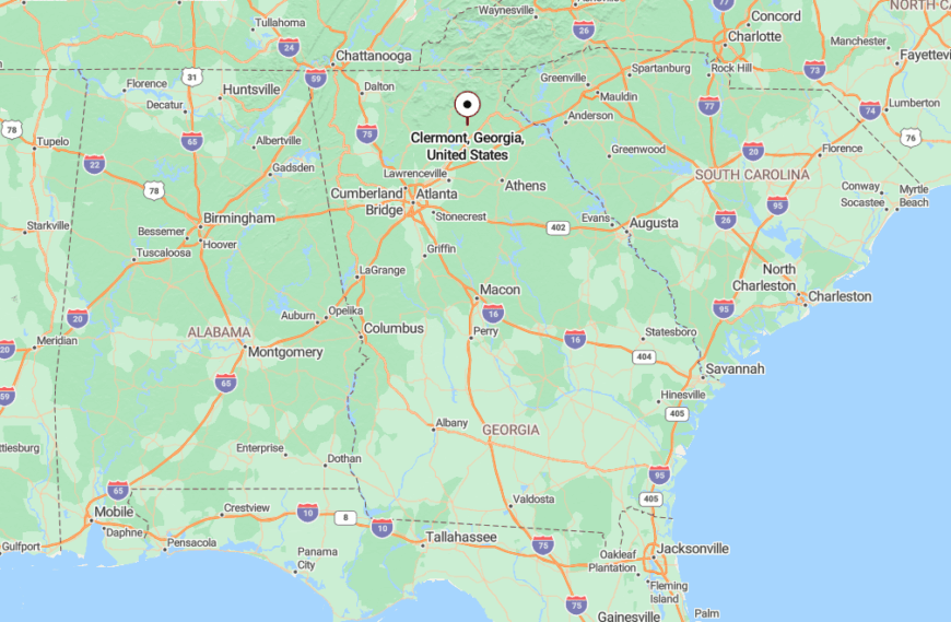
Clermont lies along GA-284 in northern Hall County, north of Gainesville but worlds calmer. The town is nestled between Cleveland and Lula, offering wide-open views and backroad connections.
Its isolation stems from gently rolling terrain and a lack of commercial sprawl, which preserves the town’s rural rhythm.
23. Dewy Rose – Whisper of a Crossroads
Dewy Rose is less a town and more a gentle breath in Elbert County’s farmland—just a few hundred folks and one blinking light. Wildflowers line the fences, and the mornings come with mist rising off hay bales and long, sloping fields.
Locals gather at the gas station to chat about weather, deer sightings, or last week’s church supper. It’s a place where time stretches and weekends arrive unnoticed.
Even the name sounds like a memory. Dewy Rose is where quiet lives easily and the loud world seems too far to matter.
Where is Dewy Rose?
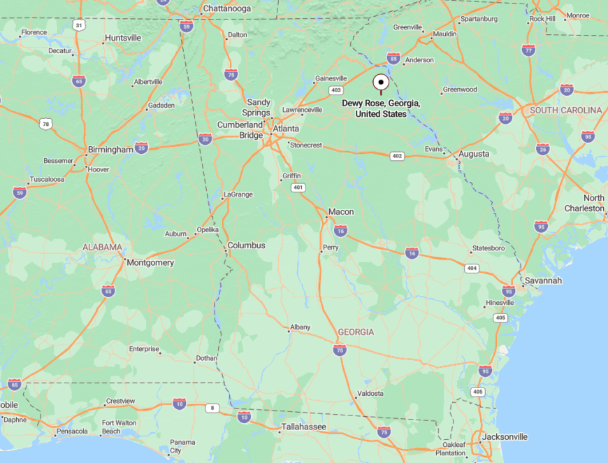
Located on State Route 17 southeast of Royston, Dewy Rose sits midway between Elberton and Hartwell in northeast Georgia. It occupies a gentle ridge surrounded by cotton and cattle farms.
The town’s remoteness is preserved by the lack of major roads or commercial chains, leaving its quiet edges untouched.
22. Bowersville – Stillness Between the Rails
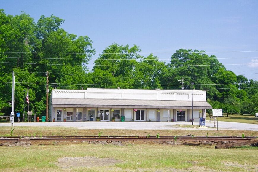
Bowersville once thrived with the rail line, and though the trains still pass, life here moves at a different pace. With fewer than 500 residents, this Hart County town clings gently to its depot-era charm.
Children ride bikes down sleepy streets, and elders chat beside closed storefronts that haven’t changed in decades. On summer nights, porch fans hum in rhythm with the crickets.
Bowersville feels wrapped in memory, where every rusted hinge and bent fence post has a story to tell.
Where is Bowersville?
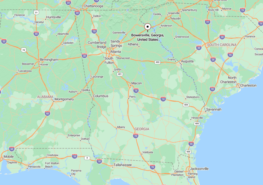
Bowersville is in Hart County, northeast of Lavonia and just west of Hartwell. State Route 17 passes nearby, but the town itself nestles beyond the highway curve.
Its seclusion comes not from distance but from rhythm—a town that stayed quiet long after the tracks grew silent.
21. Mountain City – Misty Hills and Hidden Roads
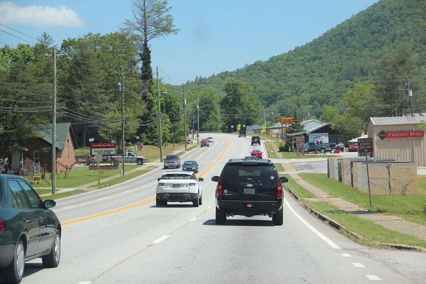
Mountain City sprawls softly across a bowl of low ridgelines in northern Rabun County. Despite being near Clayton, its twisting neighborhood roads and frequent fog give it a hushed, secretive feel.
Home to just under 1,000 people, it’s dotted with century-old homes, garden plots, and gravel driveways curving into the trees. Locals wave from porches, and dogs roam yards without fences.
It’s the kind of place where the morning mist lingers until midday and cell service never quite arrives.
Where is Mountain City?
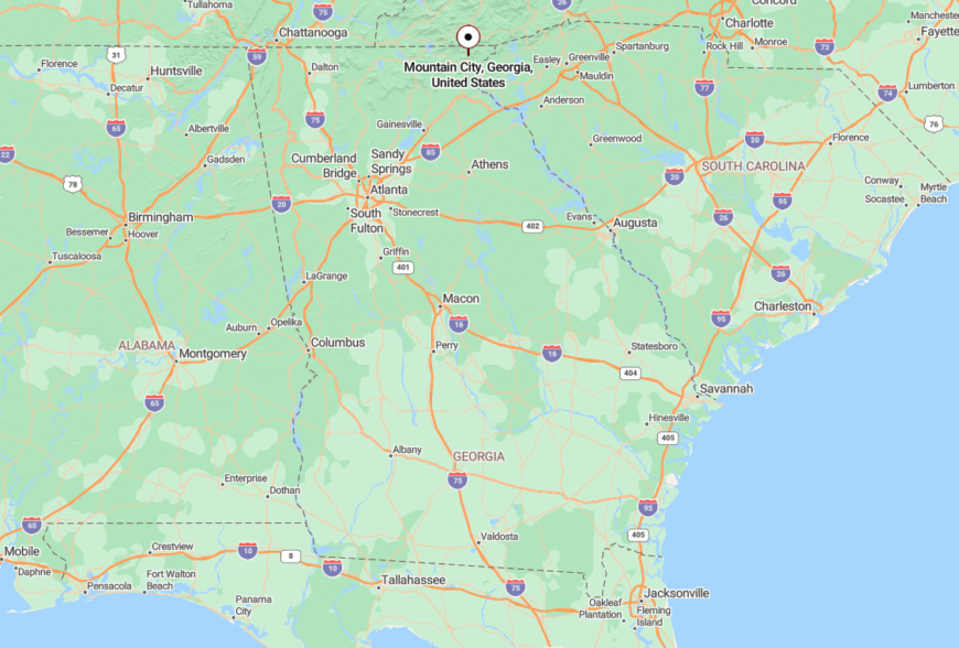
Mountain City sits directly on U.S. 441 just north of Clayton, but its neighborhoods scatter behind the ridges. The town clings to old mining paths and former logging roads, giving it an off-grid texture.
Despite being on a main route, its quiet topography keeps it feeling far from any kind of rush.
20. Demorest – A Town with a Sleepy College and Slower Clock

Demorest is home to Piedmont University, but you’d never guess it from the calm. Tucked into the curves of the Soque River, the town stays still even when classes are in session.
The post office shares space with a coffee shop, and evenings bring more owls than traffic. Students mingle with retirees on slow walks under crepe myrtles and brick sidewalks.
Demorest doesn’t shout—it drifts. A soft-spoken village with a campus heart.
Where is Demorest?

Demorest lies in Habersham County along Historic U.S. 441, just south of Clarkesville. Though close to commerce, it holds its quiet core tightly around the college and river bend.
Its quiet is shaped by its modest scale, the curve of hills, and the river that slows everything down.
19. Colbert – Porch Swings and Gravel Drives

🔥 Would you like to save this?
Colbert sits just east of Athens but feels like it’s part of another century. About 600 residents call this spot home, and life here revolves around porches, gardens, and the soft clink of wind chimes.
Each yard has a story, and each road ends with a view of oaks or open pasture. The general store doubles as a gossip mill and a place to grab a sandwich.
Colbert’s calm is its greatest wealth—an unspoken luxury of slow days and even slower change.
Where is Colbert?
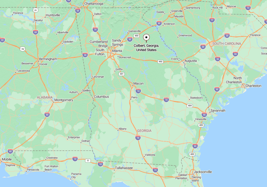
Colbert is in Madison County, just off GA-72, northeast of Athens. Though geographically close to suburban growth, it resists it through modest zoning and rural spacing.
Its seclusion comes from its small scale, spaced homes, and roads that curve away from the noise.
18. Ila – Where the Breeze Always Finds You

Ila feels like a whisper in the wind—barely a dozen blocks long, surrounded by soybeans and pines. With fewer than 400 people, it holds onto its small-town soul with remarkable grace.
Farmers haul feed in pickup beds, and school events double as town-wide gatherings. The days pass with a rhythm tied to seasons, not schedules.
The land breathes here, and those who stop feel it too.
Where is Ila?

Located at the junction of GA-98 and GA-106 in Madison County, Ila sits quietly between Commerce and Danielsville. No interstates approach it, and no fast-food chains dot its corners.
Its seclusion is wrapped in farmland and old roads that feel as patient as the people who drive them.
17. Toccoa Falls – A College, a Cascade, and Complete Calm

Home to both a college and one of Georgia’s tallest free-falling waterfalls, Toccoa Falls remains surprisingly serene. Though students buzz nearby, the sound of rushing water and songbirds tends to outnumber their footsteps.
Homes cluster gently beneath tall poplars, and the town blends forest and learning in equal measure. The falls themselves seem to quiet the place like a church bell.
Toccoa Falls moves to a gentler beat—carved by water, time, and quiet belief.
Where is Toccoa Falls?

Just north of downtown Toccoa in Stephens County, Toccoa Falls sits at the edge of Toccoa Falls College. The area is nestled in forest and gently sloping terrain, giving it a sheltered feel.
Its calm comes from being close yet apart—from a waterfall that hums in place of traffic.
16. Yonah – A Shadow Beneath the Mountain

Yonah is more than a name—it’s a hush beneath the looming face of Yonah Mountain. The community wraps gently around the base, with homes, vineyards, and quiet farms leaning into the shade.
You’ll find roadside flower stands, one-lane bridges, and the soft smell of earth and dew. The mountain watches over all, its presence like a hushed lullaby.
It’s a place that doesn’t try to be seen. It just is.
Where is Yonah?

Yonah rests between Helen and Cleveland in White County, tucked into the foothills of its namesake mountain. There are no welcome signs—just a gentle curve in the road and a change in the light.
Its tucked-away nature stems from the folds of land and lack of signage, making it feel like something you discovered by chance.
15. Carnesville – County Seat in No Hurry

Carnesville is the seat of Franklin County, but you’d never guess it from the pace. Downtown still boasts its century-old courthouse and not much else—just quiet sidewalks, a few antique shops, and the occasional dog asleep in a doorway.
The Little Estatoah River murmurs past farms and through woodlots. Locals wave at every passing car, because they recognize most of them.
It’s a town that knows exactly who it is and never rushes to explain.
Where is Carnesville?

Carnesville is just off I-85, but it feels like it’s on another timeline. Located northeast of Commerce, it’s surrounded by rolling farmland and timber tracts.
The proximity to the highway doesn’t steal its stillness—thanks to zoning, trees, and a culture that prefers slow over sprawling.
14. Lavonia – Where Porch Lights Still Matter

Lavonia has a train depot, a town square, and just enough traffic to count on one hand. The lake lies just out of sight, and the downtown hums only when the barbecue smoker’s running.
Church bells still toll the hour. Neighbors drop by with baskets of cucumbers and leave with mason jars of pickles.
Lavonia isn’t hidden by hills—it’s shielded by simplicity.
Where is Lavonia?

Lavonia is in Franklin County just south of the South Carolina line, along I-85. Though close to Hartwell Lake and the interstate, it’s buffered by trees, quiet roads, and a steady sense of itself.
Its calm comes not from distance, but from its resistance to change.
13. Baldwin – A Ridge Town Above It All

🔥 Would you like to save this?
Baldwin straddles a ridge high enough to steal sunsets. About 3,500 people live here, though it feels smaller thanks to the winding hills that shape each neighborhood.
You’ll find winding gravel roads, old fruit stands, and a skyline that includes distant peaks more often than steeples.
Even the light feels thinner here—slower, warmer, more permanent.
Where is Baldwin?

Located in both Banks and Habersham counties, Baldwin sits just off U.S. 441 atop a ridgeline. The town feels like it watches over the rest of northeast Georgia.
Its lofty elevation and tree-fringed borders create a sensation of floating just above the noise.
12. Burton – A Lakeside Trace of Old Georgia

Burton isn’t quite a town, but a lakeside scattering of cottages, cabins, and long-held family land wrapped around the quiet coves of Lake Burton. With no official post office or town square, it lingers like mist on water—present, yet always just out of reach.
Fishermen rise before the fog lifts, and families paddle canoes to neighbors instead of driving. The homes are hidden behind dogwoods and rhododendrons, and visitors rarely find it unless they know who to ask.
Burton is made of memories more than maps—stitched together by kin, cabins, and the lake’s endless hush.
Where is Burton?

Burton lies west of Clayton in Rabun County, off Lake Burton Road and Moccasin Creek Road. It nestles along the shoreline of Lake Burton, shielded by curving inlets and national forest slopes.
The absence of a formal town center and the winding access roads give it a sense of delightful dislocation—close to nothing, but rich in quiet.
11. Wolf Fork – Hollow of Woodsmoke and Whisper

Wolf Fork is a hollow more than a town, where mailboxes line gravel lanes and smoke curls from stone chimneys each autumn. Life here pulses with the seasons—garden plots in spring, canning in summer, and woodcutting before the first frost.
The land folds around itself in a soft embrace, and homes perch on hillsides or sink into valleys where no cell towers reach. Nights bring stars instead of headlights, and neighbors gather not at stores but at kitchens and front steps.
Wolf Fork feels stitched into the land—private, peaceful, and proudly apart.
Where is Wolf Fork?

Wolf Fork is nestled in Rabun County between Dillard and the North Carolina border, tucked deep into a narrow valley off Kelly’s Creek Road. Accessible by winding country roads and hidden behind tall ridgelines, it’s not marked on most maps.
Its isolation owes much to geography—knotted hills, dense woods, and a valley that holds more stillness than sound.
10. Suches – The Valley Above the Clouds

With only a few hundred residents, Suches is one of the smallest settled pockets in Georgia’s Blue Ridge. Visitors and locals fish for wild trout in Rock Creek, pedal gravel bikes along Cooper Gap, and hike straight onto the Appalachian Trail at Woody Gap.
Family timber plots and small-scale trout hatcheries provide the area’s modest economic base, with seasonal tourism from motorcyclists staying at Two Wheels of Suches adding extra revenue. The hamlet sits 2,800 feet above sea level inside the Chattahoochee National Forest, keeping summertime temperatures pleasantly mild.
No traffic light, minimal cell service, and a single general store remind travelers how far they have left city commotion behind. Tall ridgelines on every side block both noise and sightlines, giving Suches its nickname, the Valley Above the Clouds.
Where is Suches?
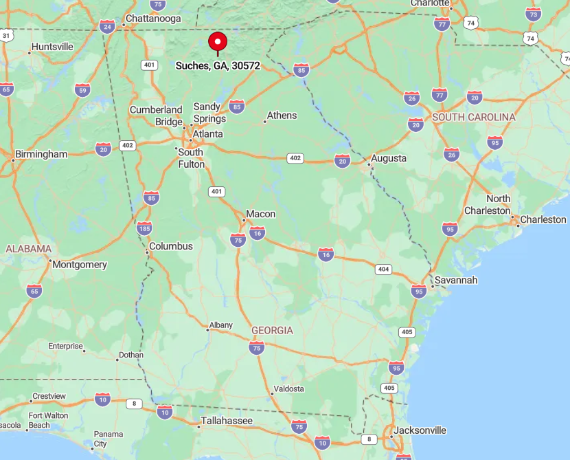
Suches lies in Union County, roughly halfway between Dahlonega and Blairsville on State Route 60. Because the road twists for miles over mountain passes, the sixteen-mile drive from either town can take forty minutes, reinforcing the sense of remoteness.
Public transportation is nonexistent, so arrival requires a car or an adventurous motorcycle. Atlanta residents generally follow GA 400 to Dahlonega before climbing past tree tunnels and switchbacks into the high valley.
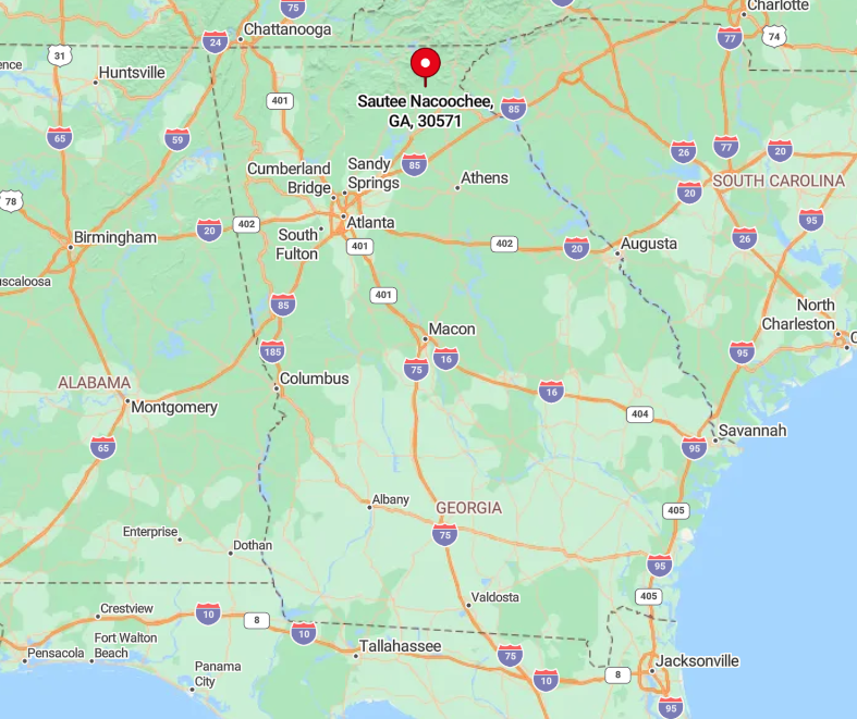
9. Sautee Nacoochee – Historic Alpine Hideaway

About 700 people make their homes in Sautee Nacoochee, a pastoral bowl encircled by soft-shouldered peaks. Day trippers browse folk-art galleries in the 1875 schoolhouse, sip muscadine at Yonah Mountain Vineyards, and ramble across the ancient Nacoochee Indian Mound.
Agriculture, boutique wine production, and heritage tourism form the community’s modest income stream. The nearest city is Gainesville, but its bustle feels distant thanks to fifteen miles of farm-lined backroads.
No chain stores, no billboards, and spotty mobile coverage enhance the hush of the valley. Even the post office shares space with an art studio, underscoring how thoroughly this enclave has resisted sprawl.
Where is Sautee Nacoochee?
🔥 Would you like to save this?
The village occupies a pocket off Georgia Highway 17 in White County, minutes south of the Alpine-themed town of Helen, yet quietly separate from its traffic. Low ridges ring the basin, muting noise and limiting sight lines so that only neighboring peaks appear above the tree line.
Most arrivals follow GA 365, then curve through Clarkesville before dropping into the valley, a route that deters casual through-traffic. Those who make the trip are rewarded with pastoral views that seem unchanged since the 1800s.
8. Tallulah Falls – Gorge-Side Ghost of a Resort Era

Fewer than 200 full-time residents live in Tallulah Falls, a onetime Victorian resort perched at the lip of its namesake gorge. Today, guests peer over swinging bridges at six thundering waterfalls, paddle quiet coves on Tallulah Lake, and trace bygone railbeds on the Shortline Trail.
Seasonal park employment and small lodging outfits make up much of the local economy, with a smattering of antique shops rounding it out. The town sits between two sprawling tracts of protected land, Tallulah Gorge State Park and the Panther Creek backcountry, which halt development at the edge of Main Street.
Streetlights dim at 10 p.m. to preserve night skies, and the roar of the river replaces traffic noise. This natural moat of sheer cliffs and forest keeps the hamlet isolated, even though US 23 passes nearby.
Where is Tallulah Falls?
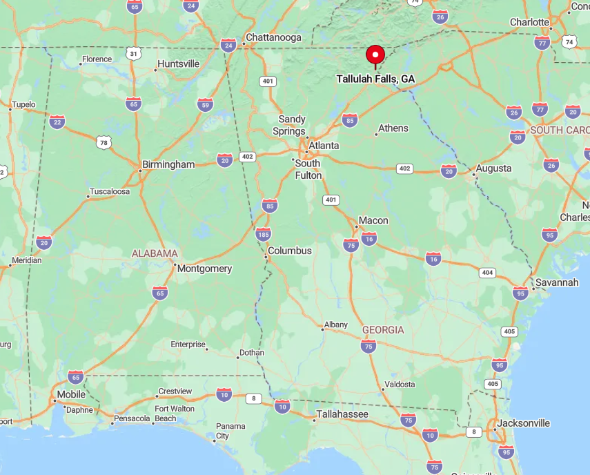
Tallulah Falls straddles the Rabun-Habersham county line in northeast Georgia, roughly 90 minutes northeast of Atlanta. The gorge plunges nearly 1,000 feet, creating walls that funnel roads to one narrow bridge, a bottleneck that limits casual visitors.
Amtrak trains whistle past but no longer stop, so access is primarily by automobile along US 23/441. Those seeking deeper quiet can leave the pavement for Terrora Circle’s unpaved loop, a hidden overlook known mostly to locals.
7. Rabun Gap – Valley of Quiet Farms

Around 600 residents dot Rabun Gap, a broad valley wedged between parallel blue-ridged spines near the North Carolina border. Activities revolve around barn concerts at the historic Rabun Gap-Nacoochee School, roadside farm stands selling heirloom apples, and gentle hikes to Becky Branch Falls.
Cattle farming, the boarding school, and a handful of artisan woodworking shops serve as the primary sources of income. Highway 441 skirts the eastern ridge, yet the community itself hides along old US 23, where fields extend to the tree line.
Tractors outnumber cars on most mornings, and fog lingers late over the pastures. The enclosing mountains mute highway noise, lending the valley a pocket-world hush.
Where is Rabun Gap?
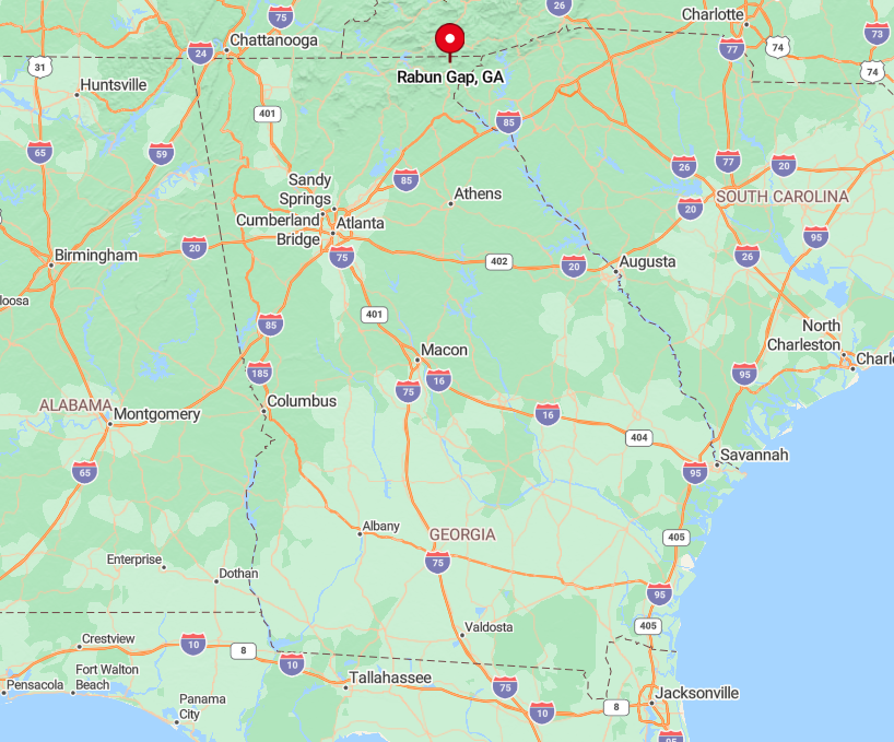
Rabun Gap lies eight miles north of Clayton, Georgia, and two miles south of the North Carolina state line along the Little Tennessee River watershed. The town’s position between steep walls discourages expansion and keeps GPS signals spotty.
Reaching the valley from Atlanta usually means two hours on 441, then a turn onto Betty’s Creek Road, a twisting two-lane road shaded by tulip poplars. Once inside, travelers find that ridges block most radio stations, a subtle reminder of the isolation.
6. Lakemont – Cabin Docks and Curving Pines

Lakemont counts only a few hundred permanent residents scattered among 1920s lake cottages and modern cabins tucked into white pine slopes.
Weekends bring paddlers to Lake Rabun, shoppers to the century-old Lakemont Village general store, and photographers to Minnehaha Falls, a cascaded fan hidden off Bear Gap Road. Rentals, small marinas, and seasonal craft fairs provide the bulk of local employment.
The settlement hugs serpentine shoreline roads that lack center lines and forbid speeds over 25 miles per hour. Dense forest between houses ensures that lake views appear only in sudden blue glimpses. Absence of public boat ramps and scant signage keep casual crowds away, preserving a near-private feel.
Where is Lakemont?

Lakemont sits west of US 23/441 in Rabun County, accessed only by Lake Rabun Road or one-lane backroads from Tiger. Hairpin turns and blind ridges make the six-mile drive feel longer, dissuading day-trippers.
No public transit ventures this deep, so arrival requires a personal vehicle, ideally with good brakes for the descent to the water. The payoff is dawn mist rising off the lake, occasionally broken by a lone antique wooden runabout.
5. Batesville – Crossroads in the Clouds

Batesville is little more than a four-building junction at 2,100 feet, yet roughly 150 residents claim mailing addresses along its adjoining ridges.
Anglers cast for stocked trout in the Soque River, travelers refuel with smoked barbecue at the iconic Batesville General Store, and ceramic lovers browse folk pottery at Mark of the Potter housed in a 1930s gristmill. Mountain crafts, hospitality, and small-scale agriculture sustain the community.
Scenic Highway 197 curves past rhododendron thickets with no passing lanes, limiting traffic flow. National forest land borders both sides of the highway, leaving development to a few cleared homesteads.
Evening silence settles quickly once the store’s porch lights dim, underscoring how sparsely populated these uplands remain.
Where is Batesville?

Batesville occupies the top of a ridge in Habersham County, halfway between Clarkesville and Lake Burton. The ascent along Highway 197 climbs more than 900 feet in ten miles, a natural filter for hurried motorists.
GPS occasionally drops in the tight curves, so seasoned visitors watch for the weathered wooden sign that simply reads Batesville. Those without a car can reach Clarkesville by regional bus, but will still need a ride for the final stretch into the clouds.
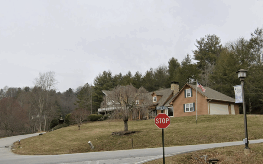
4. Tiger – One-Blink-and-You-Miss-It Mountain Hamlet

Home to roughly 450 people, Tiger clusters around an old brick schoolhouse that now hosts a farmers market and folk museum. Visitors sample cider and apple brandy at Tiger Mountain Vineyards, pick seasonal produce at family orchards, and listen to bluegrass at the Tiger Drive-In Theatre.
Agriculture, boutique wine production, and heritage tourism provide modest local income. The hamlet sits 12 winding miles west of the nearest four-lane highway, hidden behind orchards that scent the air each fall.
A solitary flashing light at the main crossroads is the community’s only traffic device. Orchard-laden hills and forest buffers shield Tiger from the bustle of nearby Clayton.
Where is Tiger?
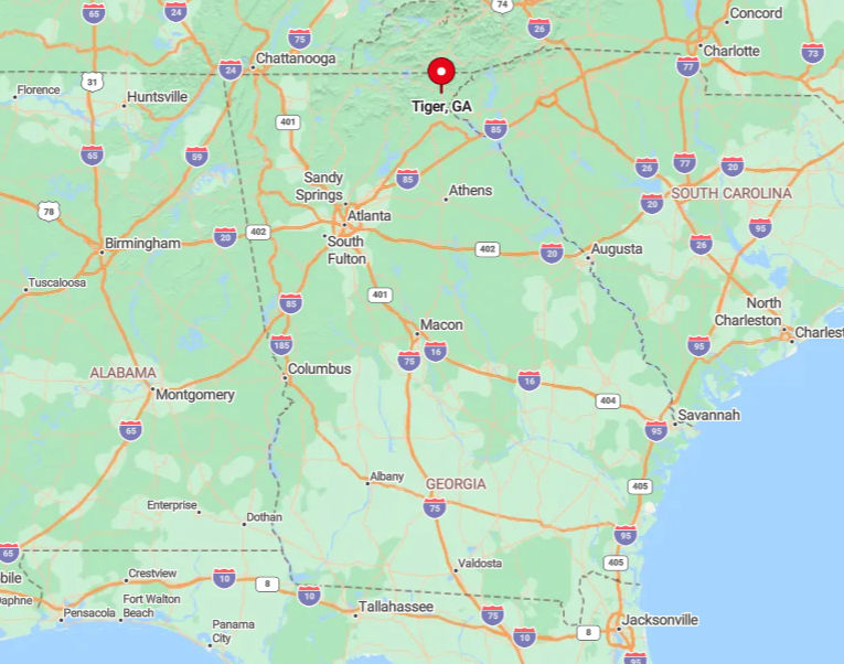
Tiger is located off Old 441 in Rabun County, just south of Clayton, yet insulated by ridges and farmland. The quickest route from Atlanta is US 441, followed by a descent along curvy East Boggs Mountain Road into the valley.
No scheduled buses or trains serve the area, making private vehicles the sole mode of arrival. Many locals point curious travelers to Stonewall Creek Falls, an unsigned cascade hidden off Bridge Creek Road that even some county residents have never seen.
3. Sky Valley – Georgia’s Highest Town
Around 500 full-time residents share Sky Valley, a mountaintop resort town sitting at 3,400 feet, the highest incorporated spot in Georgia. Golfers play a course that drops 500 feet between tee and green, hikers tackle the Rabun Bald trail, and winter visitors occasionally sled the state’s only public snow tubing run.
Hospitality and second-home maintenance dominate the job market, with a few farms in the lower hollows rounding out the economy. The town occupies a natural bowl ringed by 4,000-foot summits, which block cell towers and most FM signals.
Cool temperatures, starry nights, and strict lighting ordinances create an alpine calm rare in the Southeast. A single gated entry road and a handful of spur drives discourage through traffic, reinforcing the elevated seclusion.
Where is Sky Valley?

Sky Valley sits on the extreme northern edge of Rabun County, bordering North Carolina via a gap in the Blue Ridge. Access requires a climb up GA 246 from Dillard, a route featuring ten switchbacks in five miles.
Weather can close the road with ice, making four-wheel-drive prudent during winter and adding to the town’s isolation. Those who make the ascent often detour to Mud Creek Falls, an 80-foot cataract hidden just beyond the city limits.
2. Turnerville – Sleepy Hollows of the Soque
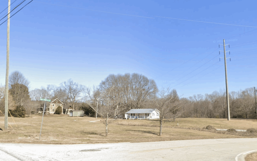
Turnerville’s population hovers near 350, most residing on acre-plus homesteads shaded by white oaks and sourwood. Locals wade the Soque River for trophy trout, browse Appalachian quilts at the Old Clarkesville Mill, and visit Hemlock Falls via the lightly used Lake Burton Fish Hatchery trailhead.
Small farms, guide services, and a power substation tied to Nacoochee Hydro Plant form the area’s modest economic base. The unincorporated community lies off Georgia Highway 17 yet remains hidden by mixed hardwood forest.
Absence of commercial strip malls and only intermittent cell coverage preserves its tranquil character. Even during peak leaf season, many pass by unaware of the settlement tucked behind river bends.
Where is Turnerville?
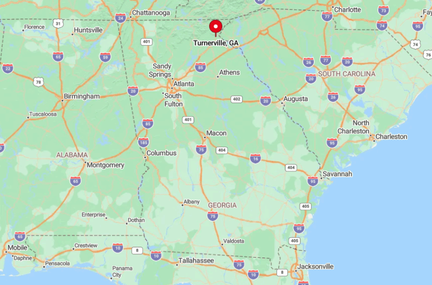
Turnerville rests in Habersham County about eight miles north of Clarkesville and fifteen miles from the tourist crowds of Helen. Shelter Ridge and Goshen Mountain create a natural sound barrier, muffling highway traffic before it reaches the river valley.
Reaching the area requires exiting Highway 17 onto Orchard Road, a narrow two-lane road flanked by pastures and only a handful of directional signs. The quietest approach is via Pitts Lane, a gravel cut-through known mainly to fly-fish guides hauling drift boats.
1. Persimmon – Forest-Carved Farms Near the Chattooga
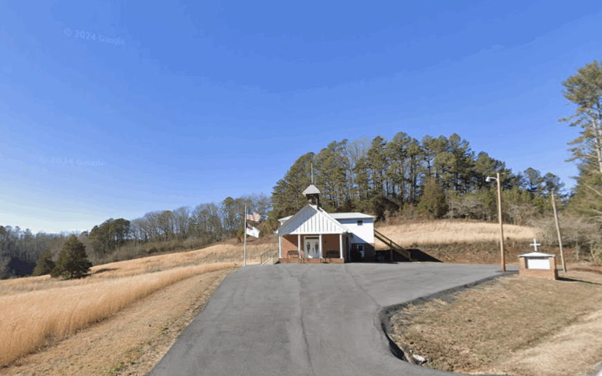
Persimmon is a loosely defined settlement of fewer than 200 residents spread across rolling hollows in western Rabun County. Days revolve around tending small farms, kayaking the nearby Chattooga Wild and Scenic River, and meeting neighbors at the historic Persimmon Community Center built from local chestnut logs.
Subsistence farming, guided river trips, and the sale of heirloom fruit trees provide limited sources of income. Much of the land is bounded by the Chattahoochee National Forest, preventing subdivision and commercial growth.
Gravel roads weave through ridges thick with persimmon and sourwood, keeping travel speeds low and dusting cars with red clay. With no cell service and barely any road signs, visitors often rely on paper maps, underscoring how deeply tucked away the hamlet remains.
Where is Persimmon?
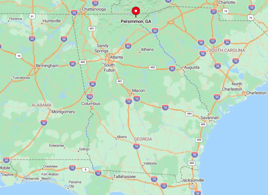
Persimmon lies west of Clayton along Persimmon Creek Road, which snakes toward the South Carolina border and the chatty rapids of the Chattooga River Corridor. Isolation stems from a lack of paved connectors to major highways and a topography of steep knobs that hide houses from one another.
Reaching the area from Clayton requires a 25-minute drive along Warwoman Road, followed by eight miles of gravel that narrows to one lane in places. Those continuing beyond the community reach the canyon rim of Three Forks, a hush-filled confluence known mostly to whitewater insiders.


