🔥 Would you like to save this?
The Quiet Corner of Connecticut is laced with back roads that slip past stone walls, kettle ponds, and Colonial farmhouses. Tucked into those woods and fields are small towns where porch lights twinkle miles apart and cricket song replaces highway noise.
Residents measure commutes in tree-lined minutes rather than clogged exits, and visitors often feel as though they stepped back a century. Our roundup starts with a nearly forgotten mill hamlet and ends in the state’s least-populated municipality, highlighting places where acreage is plentiful and streetlights are rare.
In order to come up with the very specific design ideas, we create most designs with the assistance of state-of-the-art AI interior design software.
Each community offers its own blend of history, scenery, and breathing room, yet all share a welcome isolation from the coastal hustle. For those craving distance, these 25 spots prove that real seclusion still exists only an hour or two from Boston or Hartford.
25. North Franklin – Sloped Fields and Long Shadows Beyond the Edge
North Franklin isn’t marked by monuments or milestones—it’s marked by quiet turns, split-rail fences, and roads that dip gently between wooded hills and open sky. Old farmhouses perch just beyond view, their chimneys trailing smoke in the colder months while hayfields lie golden in the sun.
You won’t find stores or signs here, only the steady hush of a town that lets the land do most of the talking. The houses are spaced far, the fields are wide, and the sense of space lingers like morning fog in the low places.
It’s the kind of countryside that seems to watch the world without ever needing to join it.
Where is North Franklin?
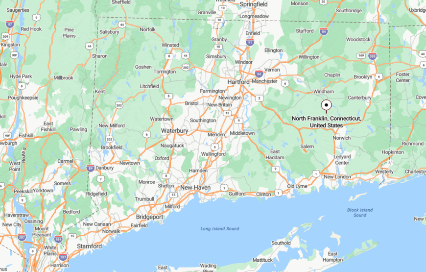
North Franklin lies in the upper third of the town of Franklin, nestled between Lebanon and Sprague, just west of Route 207. While technically near several town centers, its backroads—like Pleasure Hill and Meeting House Hill—wind through hills and tree stands that keep the area visually and spiritually apart.
With no development pressure and few reasons to pass through, North Franklin offers that rarest of modern qualities: space to simply exist, quietly and without urgency.
24. West Thompson – Riverbend Stillness and Forest Light
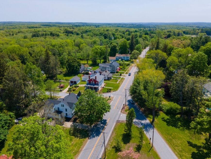
West Thompson winds along a stretch of the Quinebaug River that seems built for quiet—deep woods, glassy water, and looping trails where the loudest sound is often your own footfall on pine needles. The West Thompson Lake and dam hum softly in the distance, offering sanctuary to birds, boaters, and anyone chasing stillness.
The few homes here are scattered and often tucked beneath tree cover, with mailboxes leaning into wildflowers and driveways disappearing behind thickets. This isn’t a place for passing through—it’s a place for staying awhile, or for staying forever.
Everything here feels gently set apart, as if the river itself pulled back just enough from the world to make room for solitude.
Where is West Thompson?
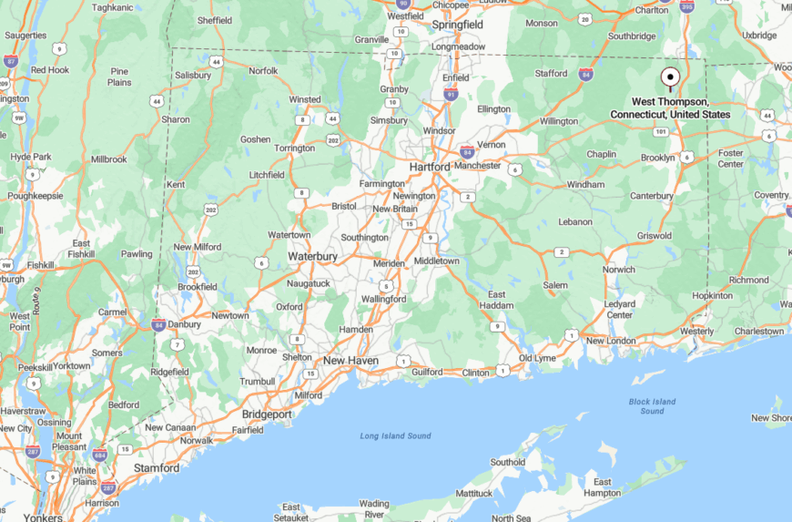
West Thompson is located in the northwest quadrant of the town of Thompson, wrapped around the federal flood control area of West Thompson Lake. It’s reached via quiet local roads that branch off Route 193, dipping into forest as they approach the water’s edge.
Because most of the surrounding land is either state-managed or conserved, there’s no commercial traffic and almost no through-roads, giving the entire area a sense of intentional quiet.
23. Abington – One Crossroads, Infinite Quiet
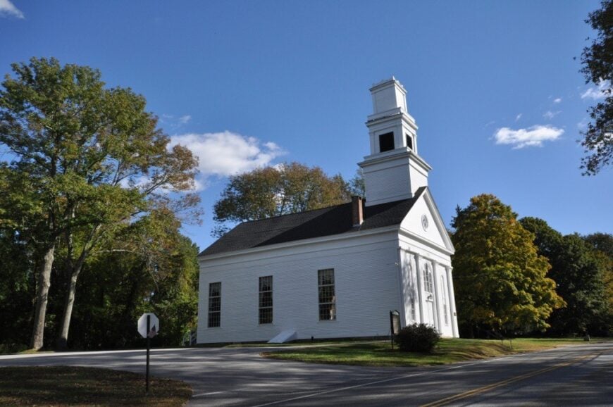
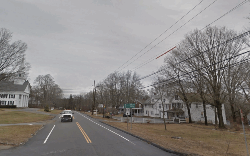
Abington rests at a simple country crossroads, where a historic church, an old library, and a few timeless homes make up the entire village. There are no streetlights, no stores, and no reason to rush through—just the gentle weight of stillness hanging over fields and fences.
The past is ever-present here, not in a museum sense, but in the lived quiet of farms still run by hand and roads that have never widened. It’s the kind of place where you recognize the rhythm of the wind before you notice the hour.
Even locals speak of Abington as a little sacred, a soft place between places, where the land seems to remember every footstep that’s passed through.
Where is Abington?
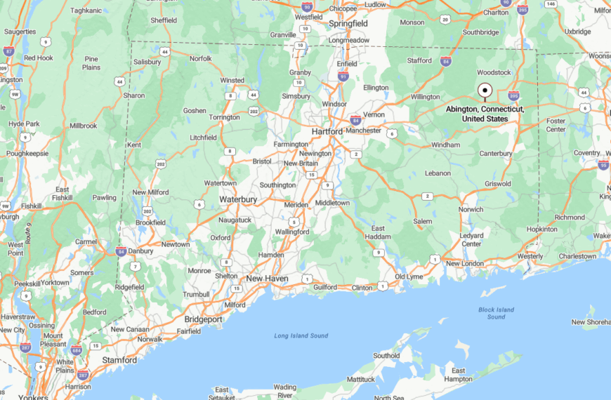
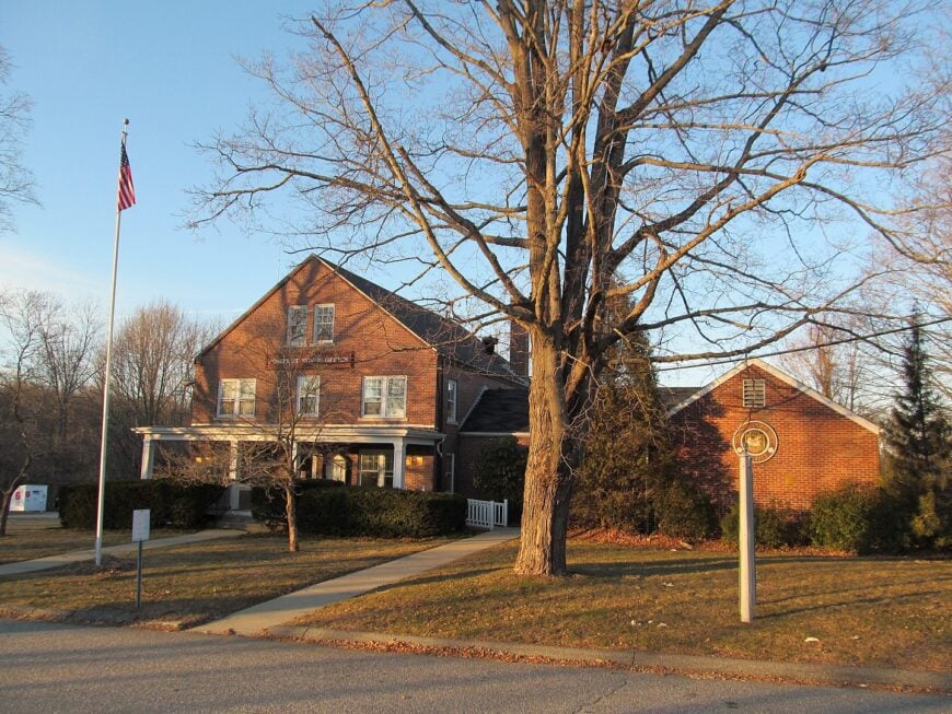
Abington is a historic district within the town of Pomfret, located along Route 97 just south of Pomfret Center and north of Hampton. The road narrows here, the fields widen, and even GPS systems tend to lag just slightly.
It’s far enough from any major intersection to go unnoticed by outsiders, and that’s part of what makes it feel so naturally protected.
22. East Killingly – Forest Gaps and Forgotten Farms
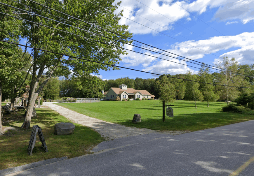
East Killingly is the kind of place where the forest pauses just long enough to let a farmhouse breathe, then folds back in to swallow the horizon. Old dirt roads twist their way past collapsing stone walls and fields that haven’t been planted in decades.
Here, you’ll find chickens in yards, stacked wood by the door, and the occasional American flag flapping on a creaky porch. There’s no town green, no commercial center—just glimpses of quiet life between the trees.
It’s not a place you find unless you mean to, and even then, it’s hard to tell where the woods end and the living begins.
Where is East Killingly?
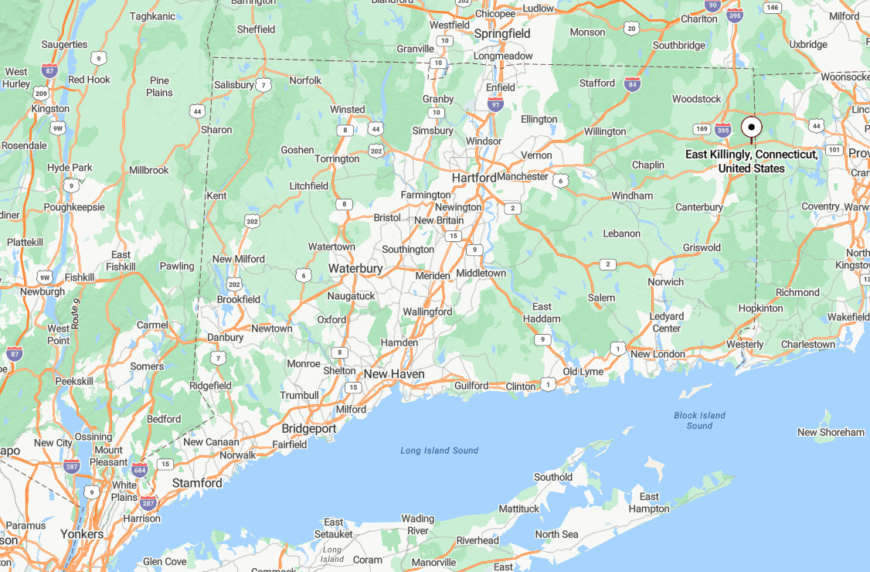
East Killingly lies in the rural eastern arm of the town of Killingly, right up against the Rhode Island border. It’s bounded by forest on nearly all sides, with access primarily via Routes 101 and 94, both winding, two-lane roads flanked by woodlots and old tobacco sheds.
There’s no direct link to nearby commercial centers, and the lack of signage makes the area feel more like wilderness than neighborhood.
21. Mashamoquet Valley – A Hidden Hollow Between Hills
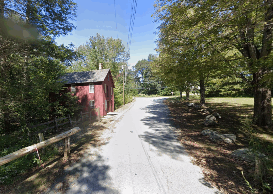
The Mashamoquet Valley is one of those Connecticut places that feels carved out of silence itself. It holds within its shelter old forest trails, a covered bridge, and brooks that whisper down from the ridgelines above.
Generations of locals have known it as a quiet sanctuary, whether for walking, birdwatching, or simply breathing deeply in the pine air. Time slows here—not metaphorically, but palpably, like fog rising from the forest floor.
The land seems to have forgotten that cities exist, and it encourages you to do the same.
Where is Mashamoquet Valley?
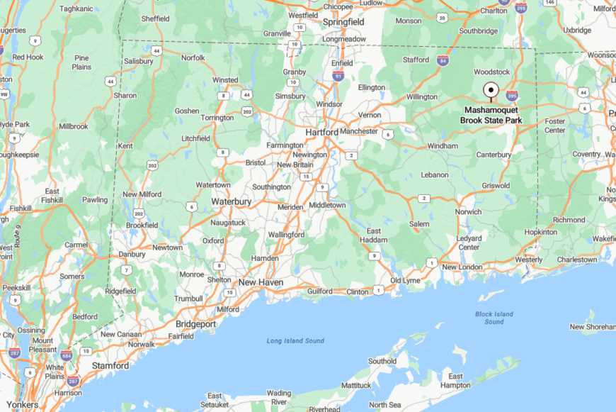
The valley sits within Pomfret, largely protected as Mashamoquet Brook State Park, and stretches between Routes 44 and 169. Travelers find it by following signs for the park and then entering a world where the roads narrow and the cell service fades.
Sheltered by dense hardwood canopy and bounded by preserved acreage, the valley is both geographically and spiritually set apart.
20. Phoenixville – A Pocket of Pines in Eastford’s Quiet Woods
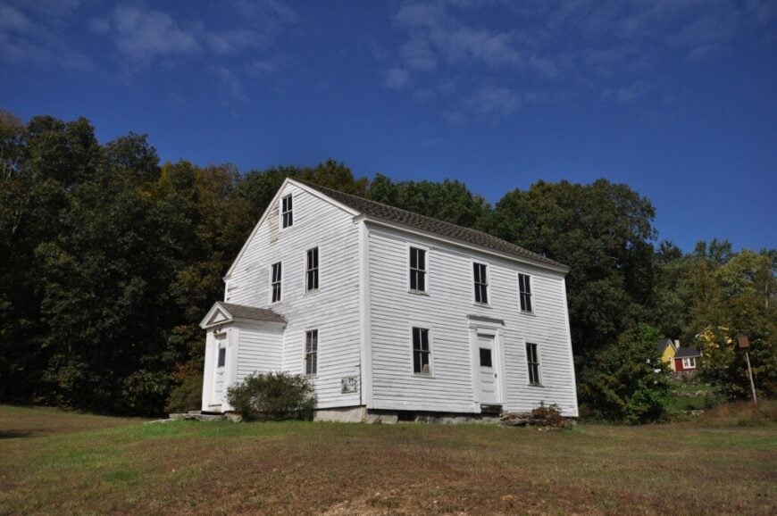
Phoenixville whispers through the woods like a forgotten hymn—its roads narrow, its houses sparse, and its rhythm utterly unhurried. Remnants of 19th-century industry lie moss-covered in the underbrush, but the forest has long since reclaimed center stage.
Today, it’s a cluster of quiet homes beneath tall white pines, each one looking like it belongs to the land more than to the grid. Visitors come to hike, to think, or to disappear for a while.
Phoenixville isn’t a town—it’s a hush, tucked deep in the folds of Eastford’s woods.
Where is Phoenixville?
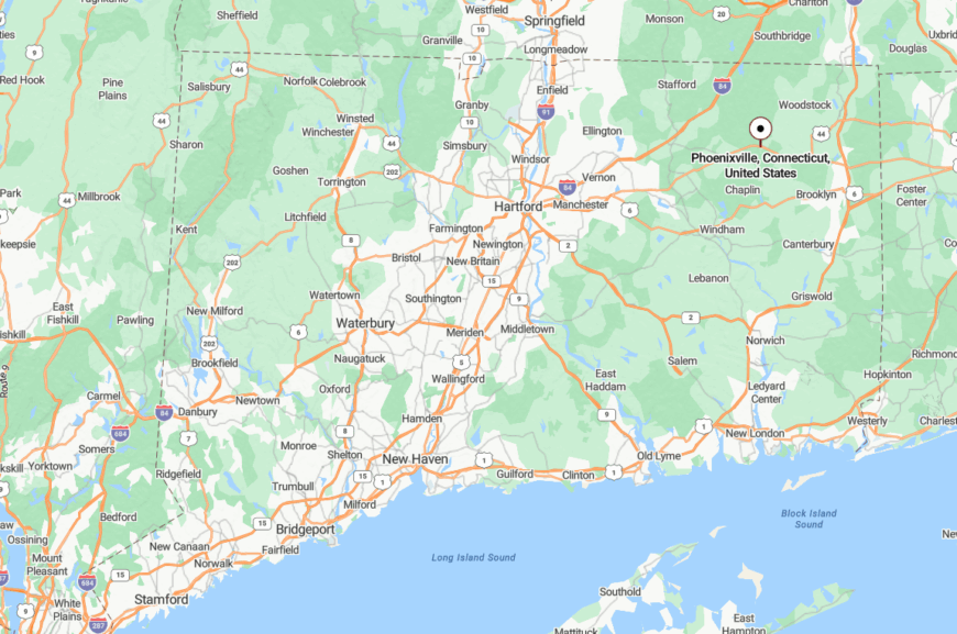
Phoenixville is located in southern Eastford, at the intersection of Routes 198 and 244, though you wouldn’t know it from the lack of traffic or signage. Even Google Maps offers just a name, not much more.
With conservation land hemming it in and few modern developments creeping near, it remains a place untouched by time or noise.
19. Westford – Sloping Fields and Long Afternoon Shadows
🔥 Would you like to save this?
Westford is all bendy lanes, ridge-top views, and homesteads that seem to sprout from the hills like they were planted there. Cows graze beneath wide skies, and mailboxes lean gently toward dusty roads, shaded by trees older than the houses they face.
There’s no main street, no post office, and no rush to modernize. Life here is defined by long afternoons and the kind of quiet that stretches across generations.
Even the air feels older in Westford—still, earthy, and full of memory.
Where is Westford?
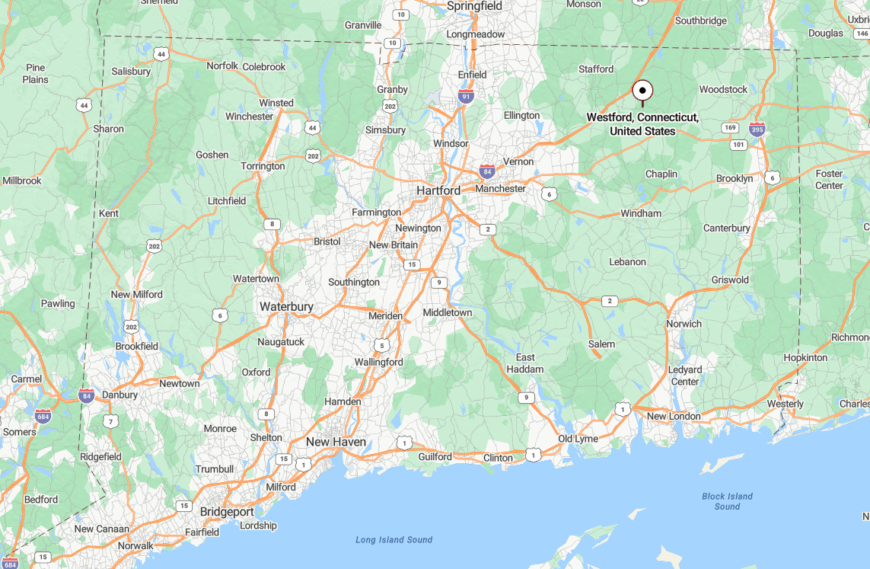
Found within the town of Ashford, Westford is spread across rural lanes that split from Route 89, climbing slowly into forest-framed highlands. Though it isn’t far from the UConn campus, the woods between make it feel worlds away.
The roads narrow, the cell signal drops, and suddenly you’re in a place that seems to prefer things exactly as they’ve always been.
18. Mount Hope – A Ridge-Laced Quiet Above the Pines
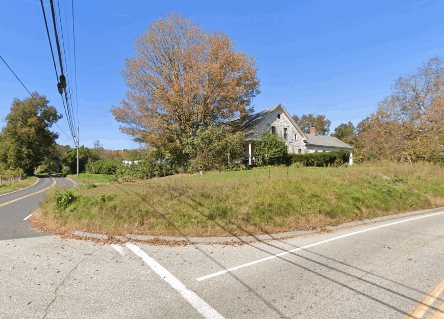
Mount Hope is a quiet ridge straddling the highlands of northern Mansfield, where old farms and forested bends rise above the lowland towns. The name might suggest grandeur, but what you’ll find instead is gentleness—sunlight sifting through pine needles, and horses grazing in dew-soaked pastures.
There’s no town square, no central gathering spot—just a scattering of homes tucked along winding lanes that seem more interested in following the land than cutting through it. Mornings arrive in layers of fog, and evenings fall softly, with barely a sound save the wind against wood siding.
Mount Hope feels like a place the world forgot—and those who live here quietly hope it stays that way.
Where is Mount Hope?
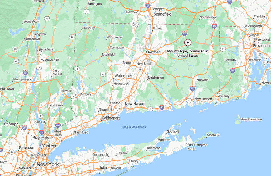
Mount Hope stretches across the northern edge of Mansfield, near the border with Ashford, centered around Mount Hope Road and its quiet tributaries. Though UConn’s campus lies only a few miles south, thick forest buffers and sparse development keep this corner feeling wonderfully apart.
Its elevation and distance from any commercial zone give it a ridge-top stillness, where nature speaks louder than traffic and time moves just a little slower.
17. Scotland – Stone Walls and Stillness South of the Maples
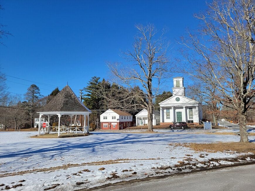
Scotland is a place where time seems to have paused somewhere after the plow and before the strip mall. Stone walls stretch like stitched seams across green fields, and white churches rest at the center of farm-lined roads.
Life here unfolds quietly—chores in the morning, porches in the evening, and skies full of starlight at night. There’s no sprawl, no signal clutter, and very little noise except the occasional rustle of wind through tall grass.
It’s the kind of town that doesn’t need to be advertised, because it was never trying to be found.
Where is Scotland?
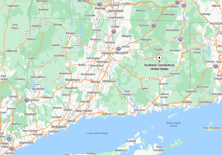
Located just south of Windham and east of Lebanon, Scotland rests between Routes 97 and 14, with no direct access to highways and only one blinking light in town. The rolling fields that surround it serve as a natural buffer from anything fast or crowded.
Because it sits quietly between better-known places, Scotland remains untouched by time and unbothered by traffic.
16. North Sterling – Boundary Pines and a Backwoods Feel
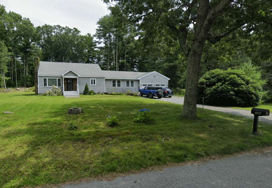
North Sterling feels like the edge of something—perhaps a state, or perhaps the last stretch of real quiet before the world picks back up again. It’s all pines and winding dirt lanes, the kind of place where you lose your signal and gain your breath.
Homes are set far back from the road, often hidden behind long gravel driveways and thick groves of oak and maple. You’re more likely to pass a deer than another driver.
North Sterling is not a destination—it’s a retreat, hidden in plain sight on the border.
Where is North Sterling?
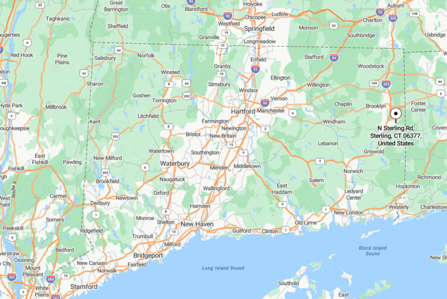
This rural corner of Sterling hugs the Rhode Island line, stretching north from Route 14A into dense forest and conservation land. Only a handful of county roads provide access, and many end in woodland trailheads or family farms.
Its boundary location and lack of through-traffic keep it sheltered and semi-forgotten—just the way it likes it.
15. Puddin Lane (Mansfield) – A Hidden Hollow with a Name to Remember
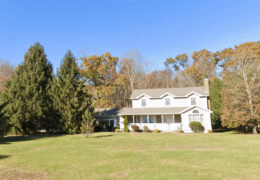
Puddin Lane may sound like folklore, but it’s a very real corner of Mansfield where winding roads dip through woods and wetlands in quiet, easy curves. The houses are spaced like thoughts—just far enough apart to allow the land to breathe.
In the fall, the whole hollow turns gold, with light filtering through oak limbs and wild turkeys stepping across the road. It’s the kind of place where you instinctively slow down, even if no sign tells you to.
Puddin Lane isn’t known for much, and that’s what makes it feel so beautifully distant from everything else.
Where is Puddin Lane?
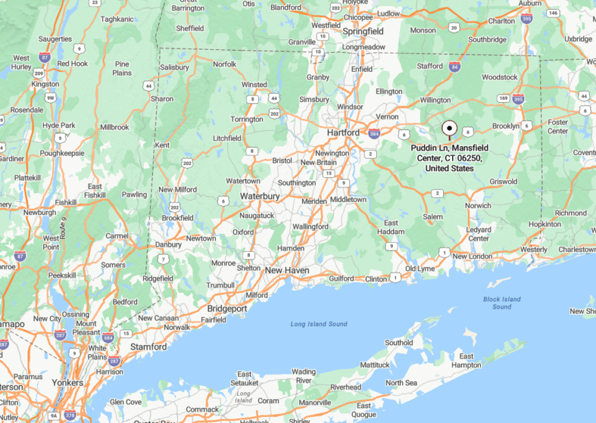
Puddin Lane branches off Route 195 near Mansfield Hollow, crossing into one of the town’s least-traveled valleys before reaching the edge of the state forest. It’s hemmed in by conservation land and steep hills that keep through-traffic out.
With no commercial presence and only a few mailboxes to mark it, Puddin Lane is the kind of spot you find once and never forget—even if the map barely mentions it.
14. Warrenville – A Bend in the River with an Old-Soul Feel
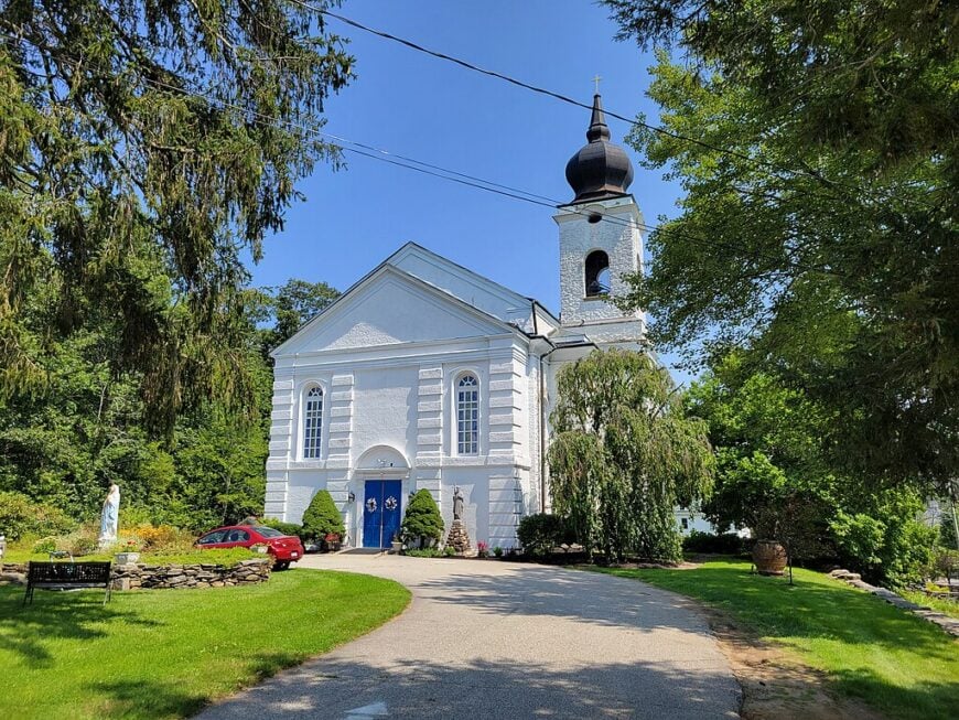
Warrenville may be just a bend in the road to some, but to those who know it, it’s a still, deep breath of country rhythm. A white steepled church, an old mill site, and a ribbon of river mark its heart.
The Mount Hope River runs slow and steady through the village, bordered by stone bridges and soft meadows. Evenings here bring cricket sounds, not car horns.
It’s not a town in the modern sense—it’s a place to be still and to stay a while.
Where is Warrenville?
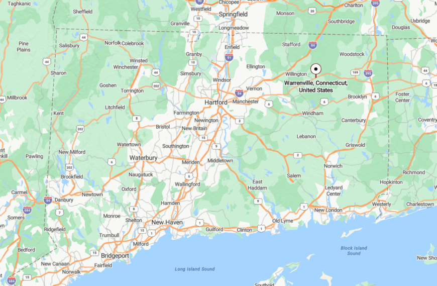
Located in southern Ashford along Route 89, Warrenville lies just north of the Route 44 corridor, yet stays cloaked in trees and old farm lots. Its small cluster of buildings and the nearby state forest absorb much of the outside world.
The result is a village that feels like a secret turn off the main road—one you’re lucky to stumble upon.
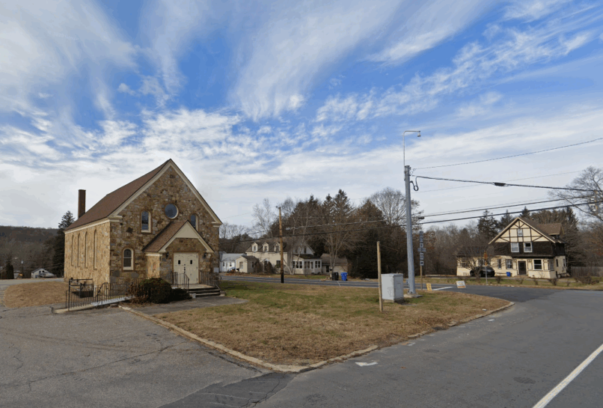
13. Eagleville – River Mist and Early Light
🔥 Would you like to save this?
Eagleville may be known to geographers as a “census-designated place,” but it feels more like a quiet fold in the hills where the Fenton River carries morning fog and the scent of moss-covered stone. Even the buildings—small cottages, weathered homes—seem reluctant to speak too loud.
There’s a sleepy rhythm to life here. The day begins with birdsong and ends with the clatter of crickets. The road signs say Mansfield, but Eagleville speaks in its own gentle dialect of light and stillness.
For those willing to notice it, it’s a rare blend of hush and home.
Where is Eagleville?
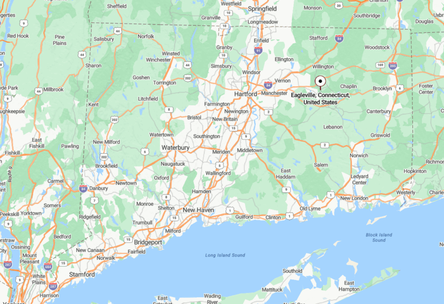
Eagleville lies in southern Mansfield along Route 275, near the Willington border, just southeast of UConn’s main campus. But while campus life buzzes nearby, Eagleville stays remarkably undisturbed thanks to its location in a riverbend buffered by wetlands and woods.
There are no chain stores here, and most travelers pass by without seeing the small world nestled along the Fenton.
12. Tatnic – Lost in Pines Between State Lines
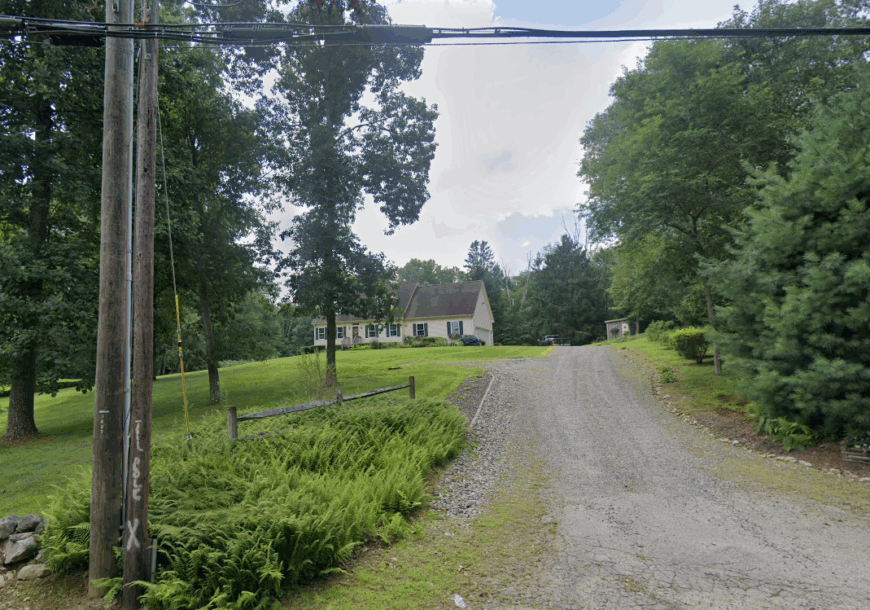
Tatnic is the kind of place that shows up on hand-drawn maps and in family stories, not on highway signs. Hidden within the woods between Killingly and the Rhode Island border, it’s all sugar maples, pond reflections, and faint paths worn into the forest floor.
The homes are few and mostly old—some still with original stone chimneys, others nearly invisible behind thickets. A small stream winds quietly through the underbrush, and even the birds seem to sing a little softer here.
If Connecticut has secret places, Tatnic is one of them.
Where is Tatnic?
Tatnic lies in the southeastern corner of Killingly, reached via Tatnic Road and a series of rural spurs that cross near the Rhode Island line. The area is bordered by Moosup Valley State Park Trail and thousands of wooded acres that form a natural buffer.
Its geographical obscurity and lack of signage give it a timeless, tucked-away feel, far from any modern trace.
11. Windham Center – A Colonial Green Kept Hidden by Time
Windham Center’s village green holds centuries in its soil—white churches, towering trees, and colonial houses that seem untouched by time. It’s quiet here, dignified, and just far enough from Willimantic to feel like its own small world.
The roads slow as they circle the green, and porches sag just enough to prove they’ve stood through all seasons. There’s no rush, only reverence.
At sunset, the whole place turns to gold, and for a moment, history feels like home.
Where is Windham Center?
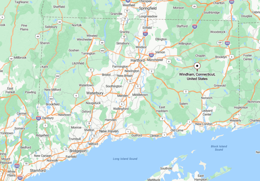
Windham Center is located southeast of Willimantic, where Routes 14 and 203 meet in a loop of preserved architecture and open lawn. Though it’s only minutes from busier roads, the layout and landscaping create a shield of timelessness.
This small green holds one of Connecticut’s oldest preserved hearts, and yet it sits quietly, waiting for those who take the slower turn.
10. Fabyan (Thompson) – A Forgotten Mill Hamlet
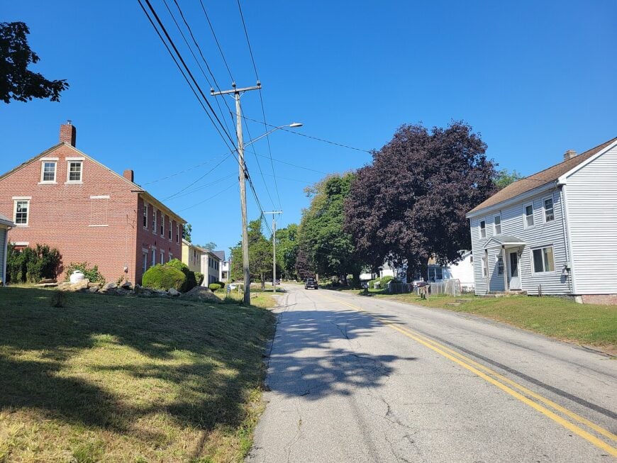
Home to only a few dozen full-time residents, Fabyan once revolved around a mid-1800s textile mill whose brick shell still stands beside the Quinebaug River. Today the draw is quiet recreation: anglers cast for trout along shaded river bends, while gravel bikers loop through neighboring French River Wildlife Management Area.
Small-scale farming and remote work make up most local income, with a handful of artisans selling woodcrafts from barn workshops. The hamlet feels secluded because surrounding forest and hayfields create a natural sound barrier, and Thompson’s zoning discourages dense development.
At night the only glow comes from the occasional passing freight train. Weekends find photographers capturing sunrise mist over the abandoned dam that once powered the mill.
Where is Fabyan?
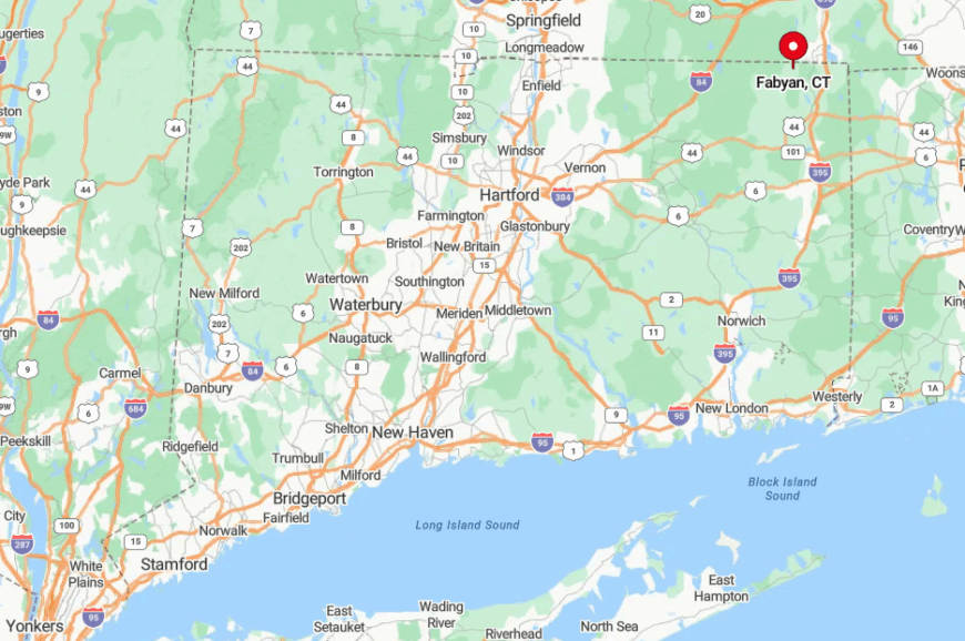
Fabyan occupies the northwest corner of Thompson, less than two miles from the Massachusetts line. Dense white pine stands and limited paved access keep it visually and acoustically separate from busier Route 12.
Travelers exit I-395 in Putnam, then wind nine slower miles on country lanes to reach the village green. With no stores or gas stations on site, arrival feels like crossing an invisible border into an earlier era.
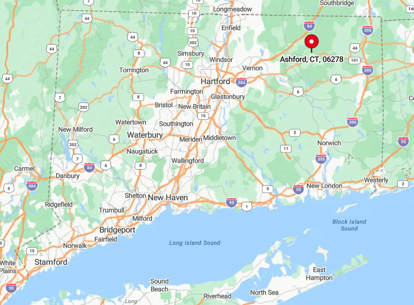
9. Ashford – Forest-Framed Farmsteads
Ashford’s 4,300 residents are scattered over 39 square miles, giving the town a density under 60 homes per square mile. Locals paddle sun-dappled Lake Chaffee at dawn, hike Westford Hill’s woodland trails, and gather for bluegrass on the lawn of the 1789 Church Farm Center for the Arts.
Agriculture, small woodworking shops, and the seasonal Maple Festival underpin the modest economy. Thick stands of hemlock and Joshua’s Trust preserves ring many homesteads, muffling traffic from distant I-84.
Route 89, the main north-south ribbon, can sit empty for minutes at a time, especially after dark. Fall foliage tunnels along that road turn every curve into a postcard scene.
Where is Ashford?
🔥 Would you like to save this?
The town lies in eastern Tolland County, bordered by Union to the north and Mansfield to the south. Its center sits a solid 15 minutes from the nearest interstate exit, so spur-of-the-moment visitors are rare.
Drivers usually leave I-84 at Exit 72, then meander through state forest to reach Ashford Center’s white steeple. Limited cell coverage in the northern half adds one more layer of happy disconnection.
8. Woodstock – Lakes, Orchards, and Long Vistas
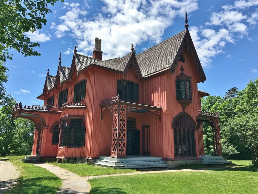
Roughly 8,200 people share Woodstock’s 62 square miles, though five-acre zoning means most can’t see their neighbors. Families spend summer days swimming at Lake Bunggee, apple-picking at Woodstock Orchards, and wandering the mansion grounds of historic Roseland Park.
Agritourism and heritage tourism drive the local economy, supplemented by remote professionals drawn to fiber-optic internet quietly threaded underground. The town remains secluded because it sits more than 20 miles from the nearest freeway and is buffered by three sizable lakes and thousands of protected forest acres.
Hilltops on Child Hill Road serve photographers with 50-mile views across undulating hardwood canopy. After sunset, the Milky Way is bright enough to reflect in Wappaquasset Pond.
Where is Woodstock?
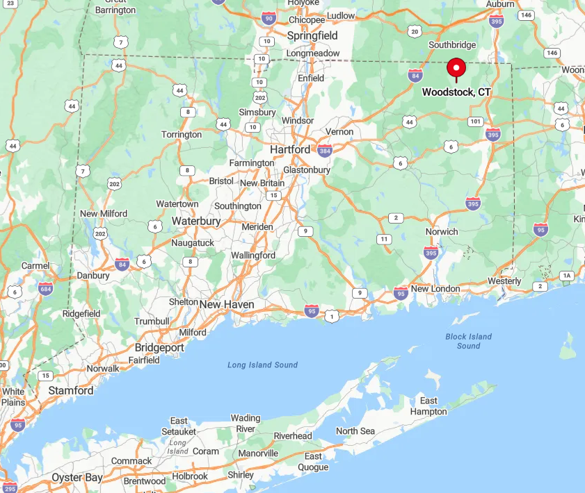
Woodstock occupies Connecticut’s northern tip, hugging the Massachusetts state line for almost ten miles. Access requires secondary highways—most people arrive via Route 169, a National Scenic Byway known for stone walls and sugar maples.
The lack of interstate ramps within town limits preserves a slow rhythm of life. Public transit is nonexistent, so arrival practically mandates a personal vehicle.
7. Canterbury – Colonial Crossroads Frozen in Time
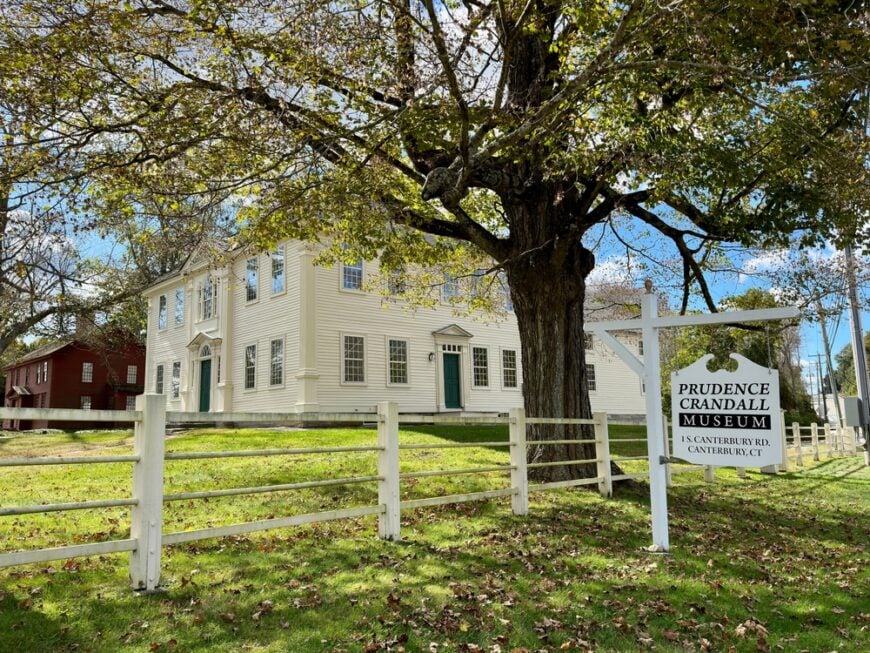
Canterbury’s 5,100 residents cluster around a broad green edged with 1700s taverns and a still-functioning general store. Visitors wander the Prudence Crandall Museum, picnic beside the Quinebaug River, or bike the flat farm roads that radiate from the center.
Agriculture remains a backbone industry, supported by several dairy operations and a growing farm-brewery scene. With the nearest interstate more than 15 miles away, tractor engines are louder than traffic, and silo tops often outnumber cell towers on the horizon.
Conservation-minded trusts have secured hundreds of acres of meadow, ensuring open views for generations. Early mornings reveal layer upon layer of fog drifting across hayfields as red-tailed hawks ride the thermals overhead.
Where is Canterbury?
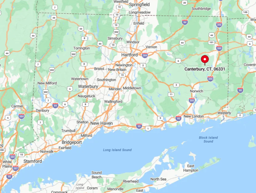
The town sits in southern Windham County, bracketed by the Quinebaug and Little Rivers. State Routes 14 and 169 intersect in the village yet remain two-lane roads devoid of rush hour snarls.
Reaching Canterbury generally means exiting I-395 in Plainfield and driving ten scenic miles east. That final leg, framed by maples and stone walls, signals entry into a place where time ambles.
6. Sterling – Hidden on the Rhode Island Line
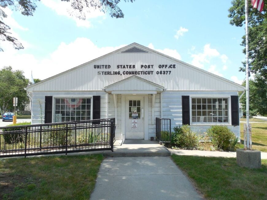
Sterling hosts about 3,700 people across 27 square miles, translating to one home every 16 acres. Residents ride horses along the Moosup Valley State Park Trail, kayak quiet stretches of the Moosup River, and patronize family-run sugar shacks each March.
Small equine facilities and specialty lumber mills provide most local jobs, while many commute to small Rhode Island cities just over the border. Vast wildlife management areas form a natural buffer, and long gravel drives disappear into mixed hardwood forest, so passing cars are seldom seen or heard.
Nightlife centers on firehouse suppers and stargazing parties near Ekonk Hill. Coyotes, not sirens, carry the evening soundtrack.
Where is Sterling?
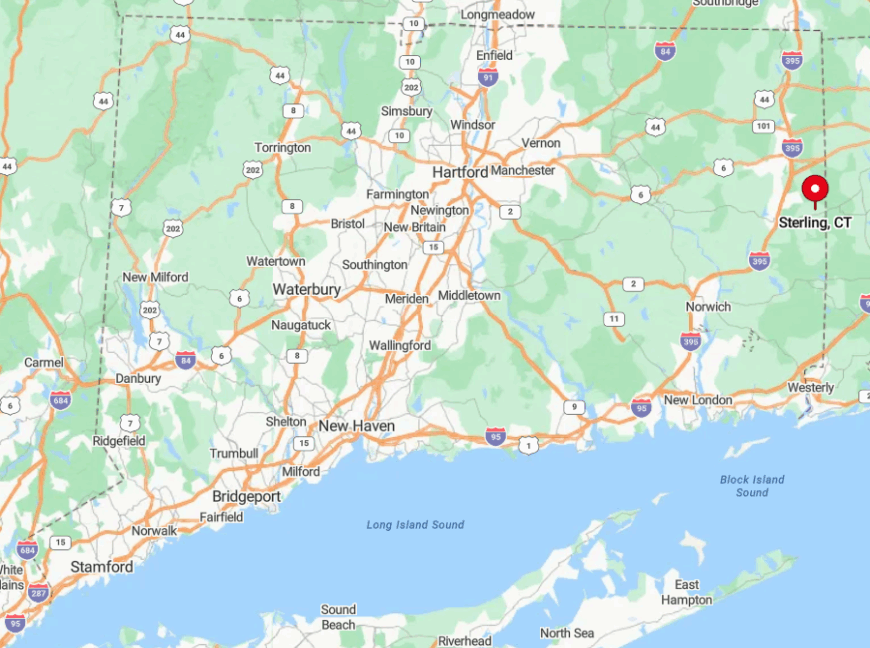
Nestled against Rhode Island in the southeast corner of Windham County, Sterling is reached by Route 14A or Route 49, both rural roads flanked by stone foundations of vanished farmsteads. Interstate travelers exit I-395 nearly 12 miles away, then cross rolling terrain with spotty GPS coverage.
The state line wraps around Sterling on two sides, adding to the sense of being tucked away in a corner. With no commercial airport within 40 miles, arrival remains an intentional journey.
5. Chaplin – Covered Bridges and Quiet Riverbanks
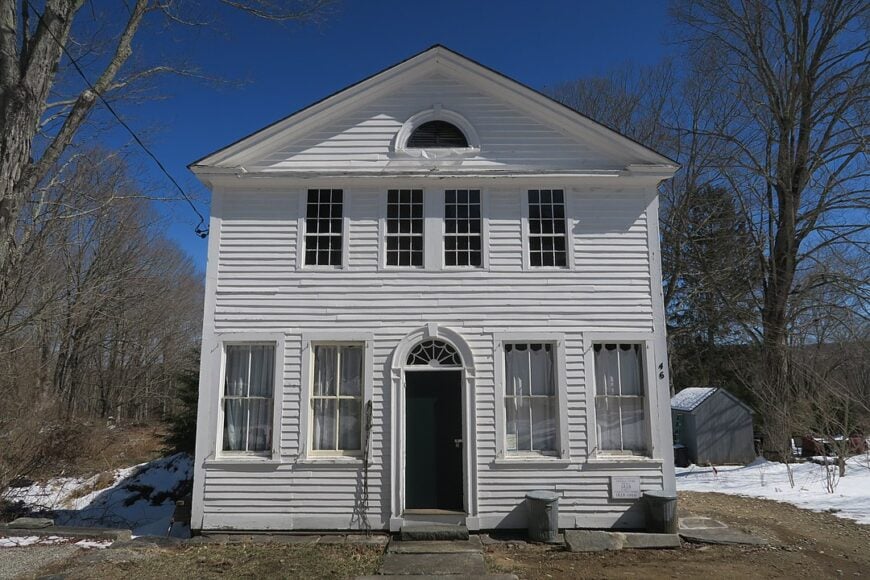
Chaplin counts roughly 2,300 residents, many living near the 19th-century Chaplin Historic District where saltbox homes line the Little River. Visitors photograph the moss-covered Comstock Bridge at sunrise, angle for trout beneath its timber span, and explore Goodwin State Forest’s 14 miles of trails.
Employment centers on small farms, the local school district, and home-based artisans who sell quilts and turned bowls at seasonal markets. Half the town’s acreage is forest or farmland, keeping average lot sizes generous and neighbors well spaced.
From October through April, Main Street traffic rarely reaches double digits per hour. Late autumn mist rising off the river gives the district a storybook hush.
Where is Chaplin?
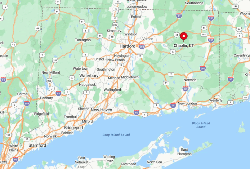
The town lies between Mansfield and Hampton along Route 198, about 12 miles east of UConn’s main campus yet psychologically much farther. Thick forest shields Chaplin from university bustle, and no interstate penetrates the area.
Drivers usually leave I-84 at Exit 69, then weave southward on two-lane blacktop to the covered bridge. Public transportation stops short well before that bridge, reinforcing the quiet mood.
4. Pomfret – Stone Walls and Protected Meadows
Approximately 4,200 residents share Pomfret’s 40 square miles, many on horse farms framed by miles of dry-laid fieldstone walls. People come here to ride the Airline Trail, stroll through the 700-acre Connecticut Audubon Bafflin Sanctuary, and sip cider in an 1830s carriage barn at Pomfret Cider Mill.
Boarding stables, boutique inns, and small tech consultancies run from home offices make up much of the local economy. A ridgeline blocks noise from busy Route 44, and preservation easements prevent sprawl, so sunrise photographers can set up on Wolf Den Road without a single car spoiling the shot.
Even the volunteer fire siren rarely breaks the morning birdsong. In spring, pink lady’s-slippers dot the sanctuary’s pine floor, a sight missed by highway travelers who speed past miles away.
Where is Pomfret?
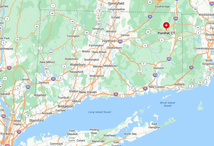
Pomfret sits south of Putnam along Routes 44 and 169, both scenic rather than speedy. The nearest interstate access lies 15 minutes north, ensuring only deliberate visitors arrive.
Multiple hilltops screen cell towers, preserving unbroken skylines beloved by painters. Those entering from the west via scenic Mashamoquet Brook State Park often remark that the tree canopy darkens their GPS long before they reach the village.
3. Eastford – The Town Without a Stoplight

Eastford’s population hovers near 1,700, and the town’s lone country store doubles as post office, deli, and morning news hub. Residents hike Crystal Pond Park, fish in the hidden kettle ponds of Natchaug State Forest, and gather for contra dances at the Ivy Glenn Memorial Hall.
Forestry, small farming, and telecommuting sustain the economy; there isn’t a single chain restaurant within town limits. Encircling forest keeps traffic nonexistent, and with no traffic lights or big-box stores, night skies remain ink-black.
The daily soundtrack is wind in white pines, punctuated by the distant whistle of the Shore Line East train far outside the border. Even UPS drivers admit to missing driveways among the towering Norway spruces.
Where is Eastford?
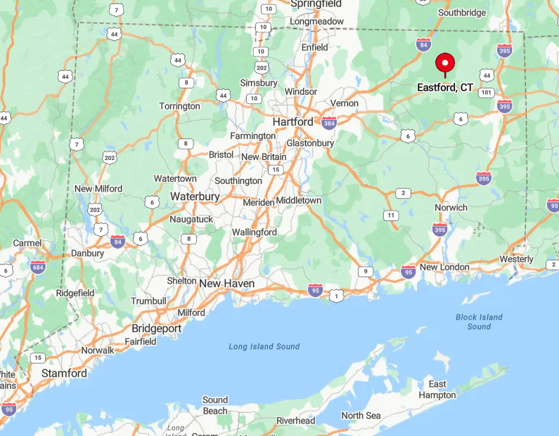
Eastford lies in central Windham County, just north of Route 44 yet worlds away from its busier segments near Willimantic. Visitors exit I-84 at Exit 74 and traverse 14 meandering miles through woodland to reach the general store.
Sparse signage and dense evergreens give first-timers the impression of venturing into uncharted territory. Cell reception improves only near the town line, adding a final reminder that civilization sits somewhere behind the trees.
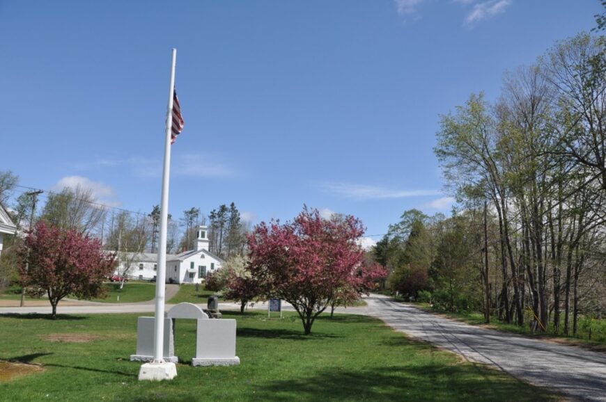
2. Hampton – Historic Homes on Endless Green
About 1,800 people live around Hampton’s 18th-century village green, where a white-sheathed meetinghouse faces weathered barns across a sweep of open lawn. Locals kayak Pine Acres Lake, volunteer at the Hampton Antiquarian Society, and slow their cars to a crawl each June during the mile-long lavender farm bloom.
Micro-dairy operations and remote office work dominate the tax rolls, supplemented by seasonal B&B income. Fifty percent of town land remains undeveloped forest, and the nearest metropolitan glow is Hartford, 35 miles west, making night skies star-rich.
Historic house lots run an acre or more, and rolling hayfields stretch to distant tree lines. Country roads post 25-mph limits yet see fewer cars per hour than most city streets observe per minute.
Where is Hampton?
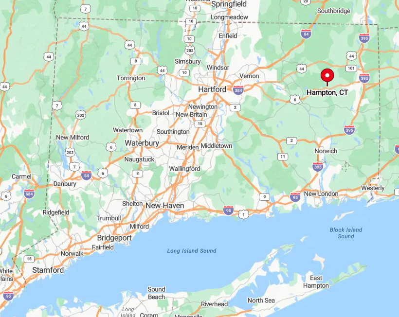
Hampton rests south of Pomfret along Route 97, nowhere near an interstate ramp or rail stop. Drivers typically exit I-395 in Dayville, then wend west for 20 minutes past cornfields and dairy barns.
The lack of alternate routes means GPS almost always suggests the same gentle approach, heightening the sense of arrival. With only one blinking caution light in town, visitors quickly grasp why locals still call it “the quietest of the quiet towns.”
1. Union – Connecticut’s Wildest Corner
Union tops out at roughly 785 residents—fewer than 30 people per square mile—most living on multi-acre parcels ringed by the 9,000-acre Nipmuck State Forest.
Recreation here is elemental: backpackers circle Breakneck Pond on the blue-blazed Nipmuck Trail, paddlers glide across Mashapaug Lake at Bigelow Hollow State Park, and birders seek saw-whet owls in remote hemlock groves.
The scant economy revolves around the century-old Traveler Restaurant, where diners leave with free used books, plus family timber operations and a handful of solar-powered home offices.
Union’s seclusion stems from vast protected forest, an absence of cell towers in many hollows, and limited county roads that dead-end into state land. After dusk, route signs vanish into darkness broken only by deer eyeshine. Even in high summer, hikers can walk an hour without meeting another human.
Where is Union?
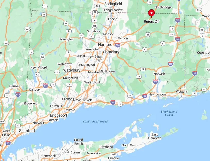
Union occupies Connecticut’s extreme northeast corner, brushing both the Massachusetts border and the edge of Hampden County. Only Interstate 84 skirts its southern reach, and the sole exit spills drivers directly into pine woods with no gas station in sight.
Beyond that interchange, travelers rely on Route 190 and gravel spurs that often shift to dirt as they climb toward Breakneck Pond. With most of the town wrapped by forest and state park, Union truly feels like the last wild stop before crossing into rural Massachusetts.