🔥 Would you like to save this?
Northeast Arizona often slips under the radar, yet its high plateaus and pine cloaked mountains hide hamlets where silence still rules the day. Scattered ranch gates, gravel lanes, and sky wide meadows set the stage for places that feel closer to the nineteenth century than the present.
Photographers chase morning fog, anglers stalk cold trout streams, and stargazers claim skies so dark that the Milky Way looks painted on. Because services are scarce, locals rely on small markets, seasonal outfitters, and plenty of self sufficiency, which only deepens the sense of distance.
In order to come up with the very specific design ideas, we create most designs with the assistance of state-of-the-art AI interior design software.
The following 25 towns sit far from traffic and bright lights, each offering a different flavor of quiet for those willing to travel a little farther.
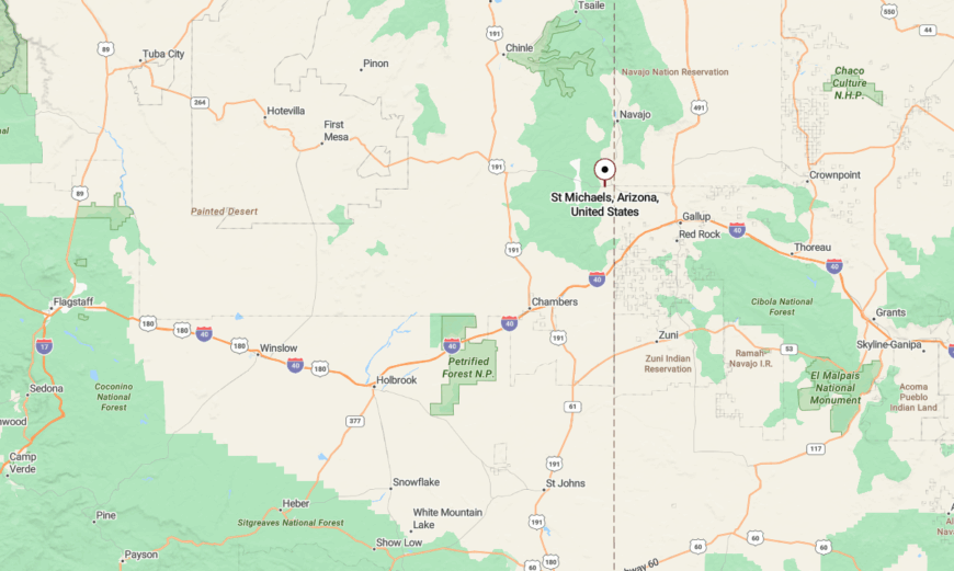
25. Chambers: Windswept Crossroads with a Desert Soul
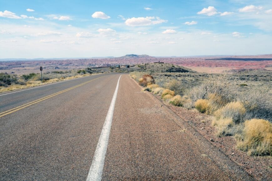
Chambers is a scattering of homes and ranches strung along a lonely stretch of I-40 where the Painted Desert begins to rise. The landscape is dry and vast, with rust-colored mesas on the horizon and a sky that rarely holds a cloud.
Despite the highway, Chambers feels more like a high-desert whisper than a waypoint, with most travelers passing through unaware of the quiet lives unfolding just off the road.
Visitors explore nearby petroglyph sites, Navajo trading posts, and hike to forgotten viewpoints in the Painted Desert. Ranching and seasonal work support locals, but time moves at a different pace here—slow, wind-tossed, and steeped in solitude. It’s the kind of place that reminds you how much space Arizona still holds.
Where is Chambers?

Chambers rests in the far northeast quadrant of Arizona, just west of the New Mexico border along I-40. It’s about 60 miles east of Holbrook and serves as a jumping-off point to Navajo Nation lands and desert mesas.
Though technically accessible via a major road, Chambers’ minimal services and open terrain give it a windswept sense of being “in between” everywhere. The long views and desert hush stay with you long after you leave.
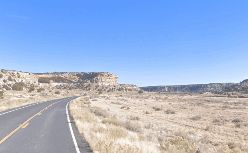
24. Lupton: Red Rocks and the Road That Time Forgot
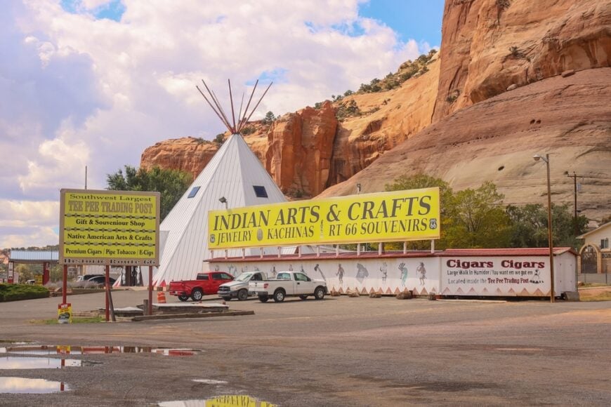
Nestled beside weathered cliffs and deep-red boulders, Lupton hugs the Arizona–New Mexico line like a town hidden in rock. Though Route 66 once passed through, Lupton now stands quiet, its few homes and trading posts framed by stone that glows at sunset.
Surrounded by Navajo land and rimmed by rock walls, the town remains small, with little but dust and silence filling the air between structures. It’s the sort of place that feels carved into time.
Stop at roadside shops for turquoise jewelry, photograph sandstone spires, or follow little-known trails into the desert. Lupton’s economic lifeblood is tourism from the past, but what keeps people lingering is the stillness. It’s not forgotten—but it is wonderfully overlooked.
Where is Lupton?
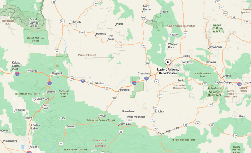
Lupton lies at the very edge of Arizona, right where Interstate 40 crosses into New Mexico. It’s about 18 miles east of Chambers and 35 miles from Gallup, tucked against towering cliffs of the Colorado Plateau.
Despite its location on a highway, Lupton feels detached, its isolation more emotional than geographic. Here, the land speaks louder than traffic.
23. Saint Michaels: A Sacred Pause Near Window Rock
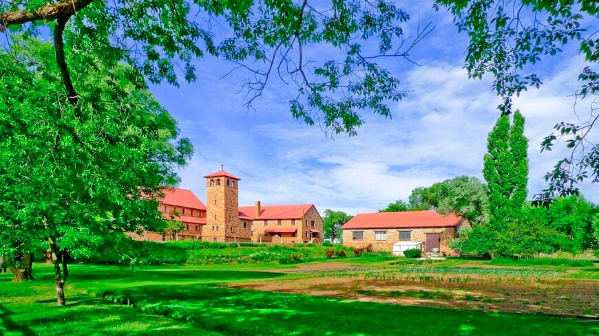
Saint Michaels is a quiet community rooted in Navajo tradition, where spiritual landmarks and old missions rise from red earth. Though it’s near tribal government offices in Window Rock, the town itself remains hushed and deeply reverent.
Its seclusion comes from its cultural focus and the surrounding mesas that create a kind of spiritual stillness. Life here moves around ceremonies, family, and the rhythms of land and livestock.
Visit the historic Franciscan Mission, explore canyon paths, or join seasonal events that blend Indigenous tradition with community spirit. Saint Michaels isn’t flashy—it’s thoughtful, sacred, and grounding. It’s a place to listen, not to speak.
Where is Saint Michaels?
Located just south of Window Rock and east of Ganado, Saint Michaels sits near the Arizona–New Mexico line on Navajo Nation land. It’s accessed via U.S. Route 264, which winds through desert valleys and high plateaus.
The journey in is marked by sandstone formations and quiet pastures, culminating in a place where tradition outweighs time. It’s close to governance, but far from the noise.
22. Indian Wells: A Whispering Settlement in Juniper Hills

Indian Wells feels more like a memory than a map dot, nestled in the rolling terrain between Holbrook and the distant mesas. Dirt roads snake past juniper trees and abandoned schoolhouses, creating a silence that’s hard to shake.
Its remoteness stems from being unmarked by signs or gas stations—visitors arrive only if they already know it exists. The surrounding land is vast and dotted with sheep, windmills, and sky.
Enjoy the quiet beauty of open range, ride horseback through arroyos, or sit beneath a piñon pine as clouds tumble overhead. Indian Wells holds space more than population, and that’s exactly its pull. It’s where stories settle into the earth.
Where is Indian Wells?
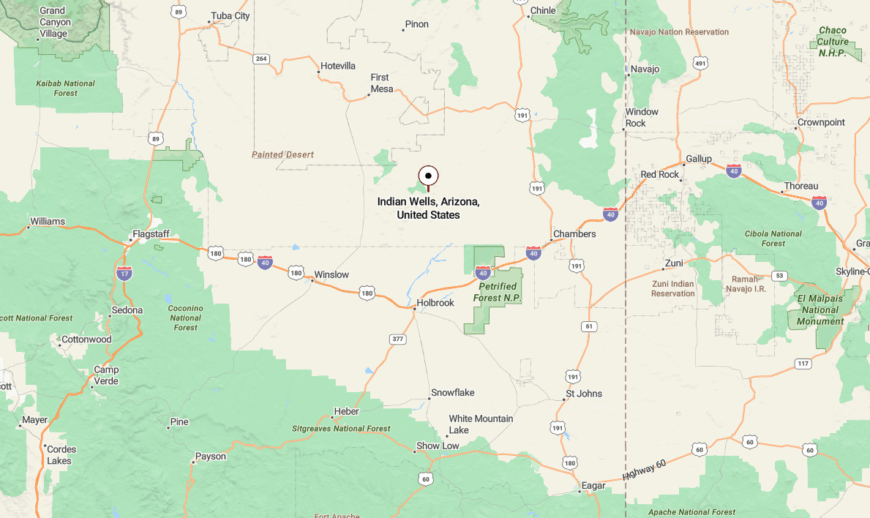
Tucked into the northwest edge of the Navajo Nation, Indian Wells is about 25 miles southeast of Holbrook via rough county roads. It lies well south of major highways and is often bypassed on maps.
The drive in is slow and unpaved, winding past rock outcrops and sagebrush fields. You don’t stumble upon Indian Wells—it welcomes only the intentional traveler.
21. Steamboat: Clifftop Hamlet Wrapped in Sacred Stone
Steamboat is a rugged, high-desert settlement wrapped in red sandstone cliffs and stories. Its name comes from a rock formation resembling a paddleboat, but its soul belongs to the land and the people who’ve lived there for generations.
Surrounded by buttes and mesas, it’s shielded from noise and sprawl. Homes perch on rock shelves or nestle in canyons, and the air smells like dust, sage, and rain.
Explore Steamboat Canyon, visit ancient rock art, or join in local celebrations that mix modern and ancestral customs. Life is quiet, deliberate, and rooted in tradition. Steamboat is a place that doesn’t just sit on sacred land—it lives in harmony with it.
Where is Steamboat?
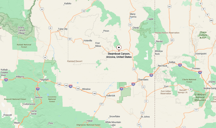
Steamboat is located about 30 miles southwest of Chinle, off Navajo Route 59. It sits high in canyon country, far from tourist routes and out of sight from busy roads.
Getting there involves a winding journey across open range and past mesas that glow pink at dusk. It’s the kind of drive where the sky feels larger than your destination.
20. Greasewood: A Tangle of Silence on the High Plains
Greasewood is a spread of modest homes and winding fence lines on the edge of nowhere, where wind whistles through sage and sky. Though maps list it, few travelers pass through.
Its isolation is both geographic and atmospheric—unpaved roads, no major services, and the vastness of the surrounding landscape make it feel like a town held in the breath between dust storms.
Locals herd sheep, gather wild herbs, and share stories around firepits. There’s not much to do here except be here—and that’s the point. Greasewood reminds you that stillness has its own kind of gravity.
Where is Greasewood?
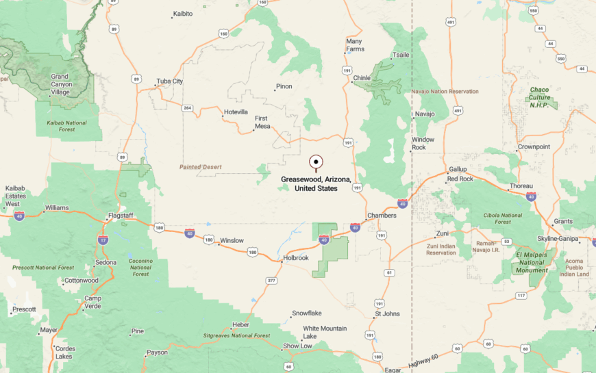
Found west of Ganado and north of Indian Wells, Greasewood lies off Navajo Route 15, on the western fringe of the Navajo Nation. It’s over 40 miles from the nearest large grocery store.
Sparse dirt roads lead across flatlands to this small, hardy community. Once you arrive, the silence makes it hard to leave.
19. Dennehotso: Bluffside Solitude North of the San Juan
🔥 Would you like to save this?
Dennehotso is a windswept place of cliffs, clouds, and Navajo sheep camps set in sandstone country. Its handful of homes cling to the northern edge of Arizona near the Utah line.
The land surrounding it stretches far and flat until it hits the Bluff cliffs, making the town feel pinned between sky and stone. Most days pass quietly, with little but wind and grazing animals stirring the dust.
Climb nearby ridges, visit petroglyph panels, or take sunrise photos across a landscape that seems unmarked by time. Dennehotso is solitude made tangible.
Where is Dennehotso?
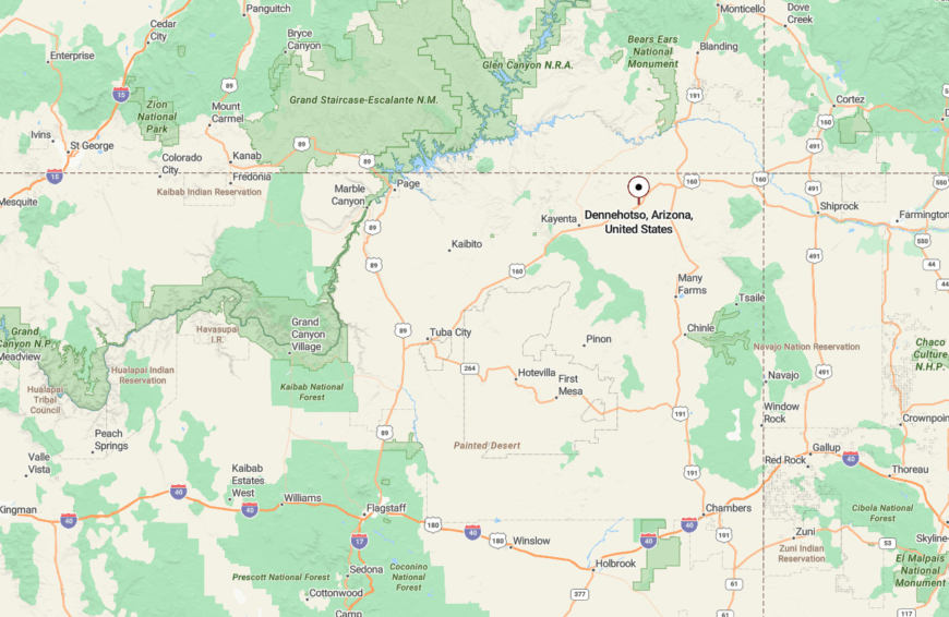
Located about 20 miles south of Bluff, Utah, Dennehotso is reached via U.S. Route 191. It lies in the far northeastern corner of Arizona, near the San Juan River’s dry tributaries.
The drive in follows open road with no towns for miles, then rises slightly into a bluffside community caught between two worlds. You feel like you’re at the edge of something ancient.
18. Rock Point: Canyon-Lined Outpost with Quiet Strength
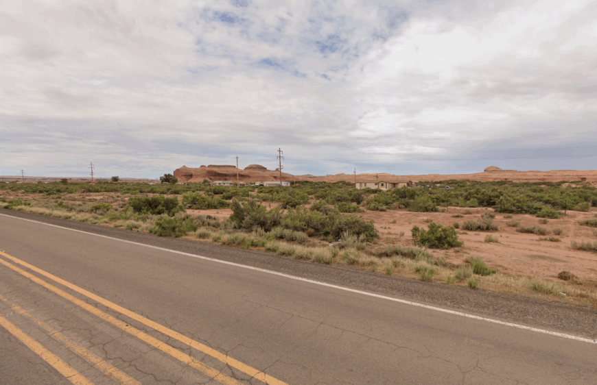
Rock Point is a humble settlement set between canyon walls and cliff shadows, defined more by space than infrastructure. The sandstone shapes nearby seem to watch over the town like quiet guardians.
Its seclusion lies in its lack of through-roads and the surrounding geography—steep cliffs and badlands that make the area feel naturally fortified. Homes are scattered, and the sky feels endless.
Hike narrow canyons, photograph sunrise over jagged ridgelines, or listen to the silence bounce off the stone. Rock Point has a way of making you hear your own heartbeat.
Where is Rock Point?
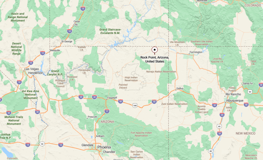
Rock Point is located just off U.S. 191 between Many Farms and Mexican Water in northeastern Arizona. It sits near the base of Chinle Wash in a sculpted red-rock valley.
The drive in is scenic and open, but the town itself feels like a fold in the land—hidden until you’re right on top of it.
17. Nutrioso: Meadowed Retreat in Elk Country
Nutrioso is a quiet ranching community nestled in a mountain basin where elk roam freely and aspens shimmer in the breeze. With just a handful of homes scattered across forest-edged meadows, it feels more like a well-kept secret than a town.
Its remoteness stems from its elevation—nearly 7,700 feet—and its distance from urban centers. The surrounding Apache National Forest buffers Nutrioso with green walls, muffling sound and deterring heavy traffic.
Explore nearby Aker Lake, hike forest trails to overlook points, or sip coffee while watching mule deer graze at sunrise. Most residents live off the land or commute to Springerville, but the real draw here is the pace—unhurried, quiet, and deeply connected to the seasons. It’s the kind of place that feels like it belongs to a different rhythm entirely.
Where is Nutrioso?
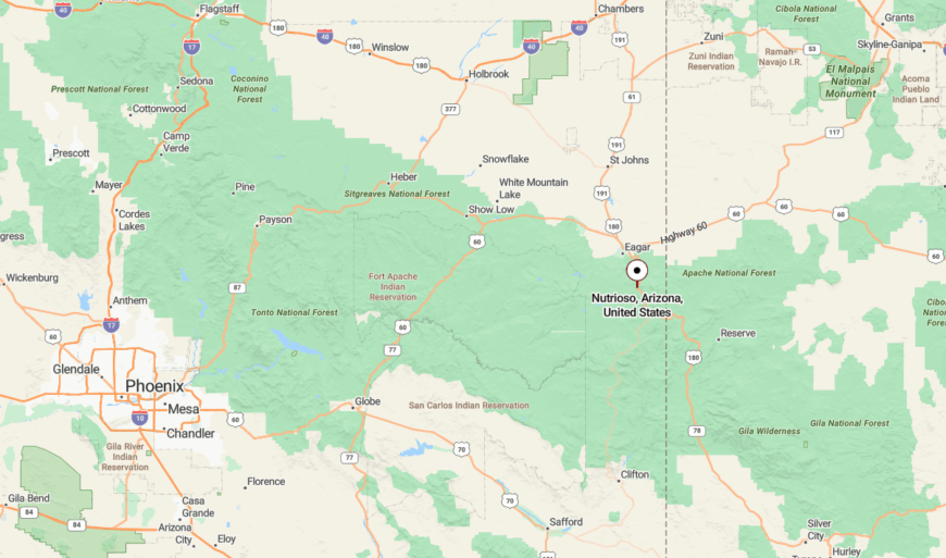
Nutrioso lies just 10 miles south of Springerville along U.S. Route 180/191 in eastern Apache County. Despite its proximity to the highway, the town’s sparse development and mountainous setting grant it a deep sense of detachment.
The road winds gently through alpine meadows and pine groves, and by the time you reach Nutrioso, you’ll feel like the noise of the outside world has melted away.
16. Wide Ruins: Deserted Beauty and Ancient Echoes

Wide Ruins carries history in its very name, referencing the ancestral village nearby. Today, it’s little more than a few homes and a post office, but the land holds stories that go back centuries.
It feels hidden in plain sight—vast, open, and oddly quiet. There’s a sense that every stone has witnessed something older than memory.
Visit the ruins themselves, marvel at the petroglyphs, or walk among desert flowers after a rare rain. Wide Ruins is a town made for reflection, not distraction.
Where is Wide Ruins?
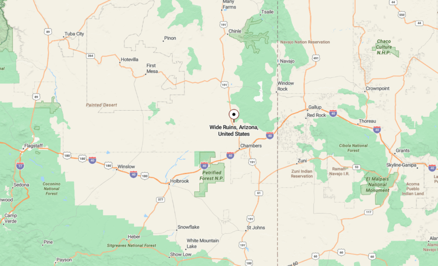
Set along State Route 191 between Sanders and Ganado, Wide Ruins rests in central Navajo Nation country. It’s about 40 miles south of Chinle.
Though technically on a highway, few stop. The flatness, the silence, and the deep past all work together to make this place feel like a page from a forgotten book.
15. Cornfields: High-Desert Stillness in the Navajo Heartland
Cornfields is a quiet community where traditions grow like the crops the town is named for. It’s not large—just a scattering of homes between fields, but its cultural roots run deep.
The surrounding terrain is a mix of brush, sandstone, and wide blue skies. The town’s slow pace and lack of commercial development make it feel like a step back in time.
Visit the Cornfields Chapter House, attend local events, or hike short trails into neighboring mesas. Cornfields offers no spectacle, just honest, daily beauty.
Where is Cornfields?
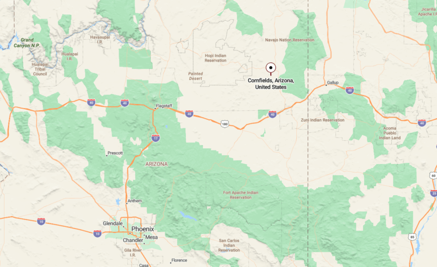
Cornfields is found off Indian Route 15, about 18 miles west of Ganado. It’s nestled between sagebrush flats and sandstone buttes in the center of the Navajo Nation.
The drive in passes sheep camps, trading posts, and long fences that disappear into distance. There’s no rush here—just rhythm.
14. Burnside: A Junction of Stillness and Sacred Space

Though it lies near a road junction, Burnside remains whisper-quiet, a town where movement feels optional and skies stretch wide. Homes dot the landscape, separated by grazing lands and ridgelines.
Burnside feels spiritual and solemn, surrounded by mesas that feel older than time. The town doesn’t call attention to itself, and that’s part of its strength.
Take scenic drives to nearby canyons, stop at historic churches, or simply breathe the dry desert air. Burnside is a place where your thoughts have space to settle.
Where is Burnside?

Burnside sits at the junction of U.S. Route 191 and Route 264, near Ganado. Despite being a crossroad, it remains one of the least traveled places in the area.
The land rolls gently, and distance blurs direction. Even when you’re moving, Burnside makes you feel like you’ve paused.
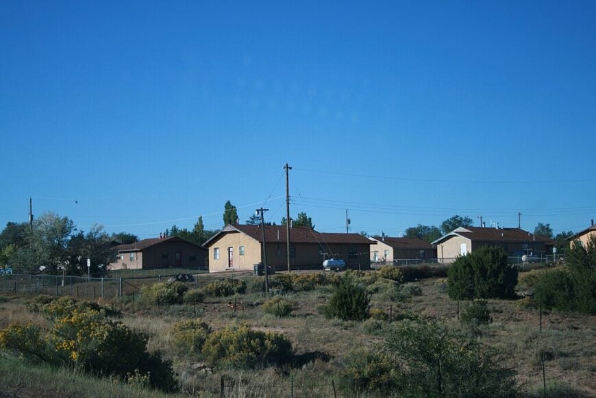
13. Nazlini: Canyon-Carved Calm Behind the Mesas

🔥 Would you like to save this?
Nazlini rests in a secluded canyon bowl, tucked far off the main roads, with cottonwoods, cliffs, and creekbeds shaping its borders. It’s small, quiet, and beautifully remote.
The town is surrounded by Navajo Nation land, with little development and lots of open sky. You’ll find silence here—rich, deep, and grounding.
Explore local canyons, visit the chapter house, or follow the seasonal creek through stone corridors. Nazlini holds space like a sacred container, softly closed to the outside world.
Where is Nazlini?
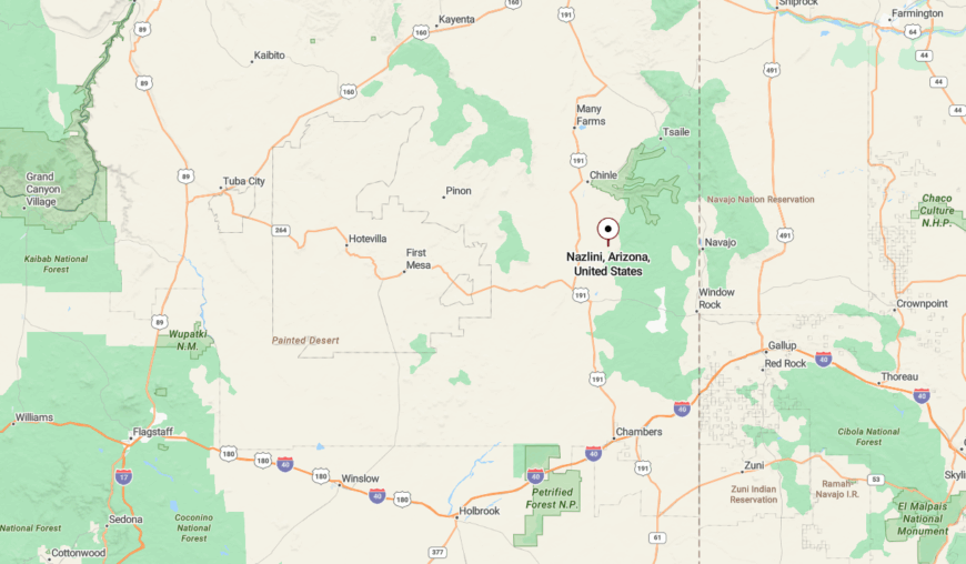
Nazlini is about 15 miles west of Ganado via Navajo Route 27. It’s surrounded by mesas and dry washes, with no highways or businesses nearby.
The road winds and dips, often unpaved. The more you drive, the more the world seems to fall away behind you.
12. Klagetoh: Red Earth Community Steeped in History
Klagetoh is a peaceful village centered around an iconic stone mission church, surrounded by sandstone mesas and time-softened trails. With just a few homes and no commercial hub, it feels like a quiet fold in the land.
The town’s heart is cultural and spiritual, with weaving traditions, ceremonies, and landscapes that speak to ancestral presence.
Visit the church, admire local textiles, or take long walks under vast skies. Klagetoh is small, but it leaves a large impression.
Where is Klagetoh?
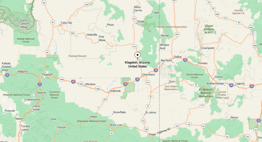
Klagetoh lies about 16 miles south of Ganado off U.S. Route 191. It’s ringed by red cliffs and has no direct services.
It’s the kind of place you only find when you’re looking—and even then, it surprises you with how deeply it stays with you.
11. Keams Canyon: Quiet Canyons, Ancient Voices
Keams Canyon sits where cliffs meet silence, a place shaped by Hopi and Navajo histories. With only a handful of structures and no tourist scene, it feels held in sandstone arms.
Shadows shift across the canyons through the day, and wind carries the hush of past centuries. It’s remote, a bit eerie, and deeply moving.
Visit historic trading posts, hike narrow side canyons, or simply sit at the overlook and listen. Keams Canyon doesn’t show off—but it doesn’t need to.
Where is Keams Canyon?
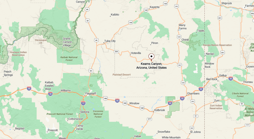
Keams Canyon is located about 85 miles northeast of Winslow, accessed by State Route 264. It’s tucked between mesas on Hopi land, far from cities or major routes.
The approach feels cinematic—miles of high desert give way to cliffs and sudden stillness. It’s close enough to reach, but far enough to feel like you’ve left everything behind.
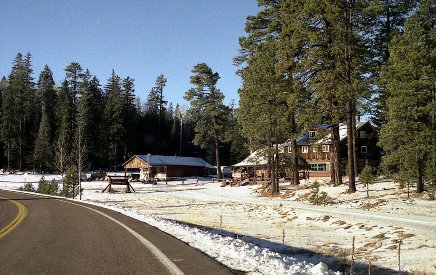
10. Greer: High-Altitude Haven in the White Mountains
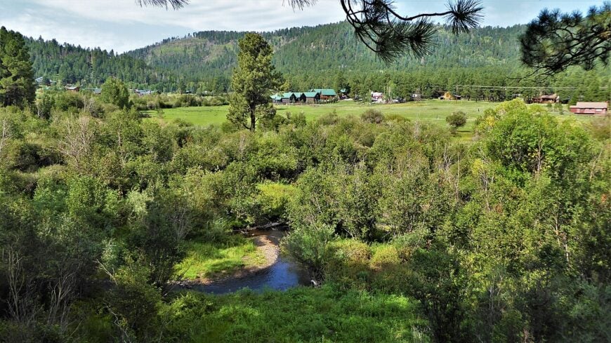
Greer has fewer than 100 year-round residents, making it feel like a private alpine hamlet. Visitors cast flies for rainbow trout in the Little Colorado River, hike through spruce and fir forest, and wait at dawn for elk to wander into misty meadows perfect for photographs.
Family-owned cabin rentals, a small lodge, and seasonal guide services supply the limited local economy alongside forest service jobs. There are no chain stores, just a tiny market that closes early and a café that keeps winter hours.
Most homes are log cabins set on multi-acre parcels tucked between tall trees, so neighbors remain out of view. An 18-mile drive of switchbacks separates the village from the next community, sealing Greer in quiet high-altitude seclusion.
Where is Greer?
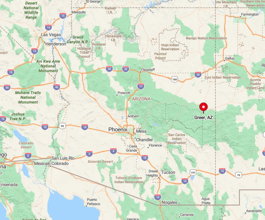
Greer sits at 8 500 feet in the White Mountains of Apache County, reached by State Route 373 off State Route 260. Tall ridges surround the basin, and winter snows often close the road, which limits casual visitors.
The nearest town with full services is Springerville, roughly 18 miles north. Drivers should fuel up before leaving Eagar, then follow the two-lane forest route into what feels like a world apart.
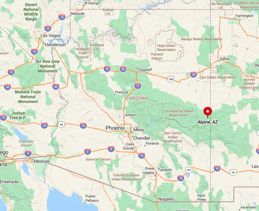
9. Alpine: Meadows, Pines, and Mile-Wide Skies
Alpine counts roughly 145 permanent residents spread across grassy valleys bordered by the Apache-Sitgreaves National Forests. Outdoor pursuits dominate, from horseback rides through spring wildflowers to snowshoe treks toward 11 000-foot Escudilla Mountain and an annual Independence Day rodeo.
The modest economy leans on ranching, a pair of cafés, and a general store that doubles as the local gathering spot. Without stoplights or big-box retail, commercial distraction never intrudes on the wide horizon.
Winter storms close the nearby passes several times each season, deterring casual traffic and leaving locals to their own routines. Distance from population centers grants Alpine a hush broken only by wind in the pines and the squeak of a screen door.
Where is Alpine?
🔥 Would you like to save this?
The village lies at the junction of U.S. 191 and U.S. 180, 28 miles south of Springerville and more than three hours from the nearest interstate. Surrounded on all sides by national forest, it forms a pocket of green that feels insulated from Arizona’s desert lowlands.
Mountain highways twist through canyons and over 9 000-foot passes, which adds both beauty and isolation. Travelers reach Alpine by following U.S. 60 east to Springerville, then turning south on U.S. 191 into high meadow country.
8. Aripine: Tiny Ranching Outpost on the Mogollon Rim
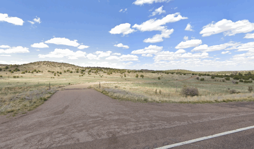
Aripine has fewer than 50 year-round residents living in a loose cluster of homes on one- to five-acre spreads. Days revolve around tending cattle, mending weather-beaten barns, and exploring hidden Rim canyons on horseback.
Cattle ranching and seasonal logging provide the only steady paychecks, with no stores or fuel pumps inside the settlement. Even the school bus must rumble 25 miles to pick up children, underscoring the outpost’s remoteness.
Rolling ponderosa-covered hills wrap the community in green walls that block both radio signals and highway noise. All of this grants Aripine a storybook stillness that feels a century removed from modern Arizona.
Where is Aripine?
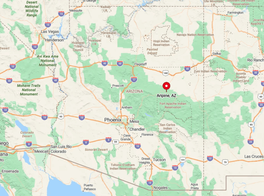
The hamlet rests off County Road 3140, about 25 miles southwest of Snowflake and well south of State Route 277. It hides behind a maze of graded ranch roads that turn muddy during summer monsoons, deterring spontaneous visitors.
Lack of paved routes and dense forest keep traffic counts to a whisper. Four-wheel-drive is advised, and GPS can be unreliable, so most guests arrive with written directions from locals.
7. Concho: Rolling Grasslands Meet Pioneer History
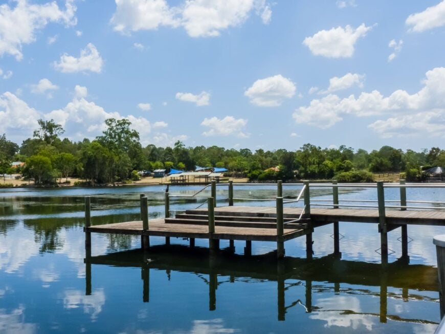
Concho claims roughly 800 full-time residents scattered across adobe homesteads, modular ranch houses, and abandoned school buildings that whisper of territorial days. Activities center on fishing Concho Lake, bird-watching on the rippling grasslands, and photographing rusted farm implements at sunset.
Ranching and a small cluster of convenience stores provide modest employment, while many households commute to Show Low or St. Johns for work. Half the surrounding land remains undeveloped open range, so night skies stay brilliantly dark.
Dirt lanes stretch toward distant buttes, reminding travelers how far they are from retail corridors. That openness, mixed with lingering pioneer relics, makes Concho feel like a forgotten chapter of Arizona history.
Where is Concho?
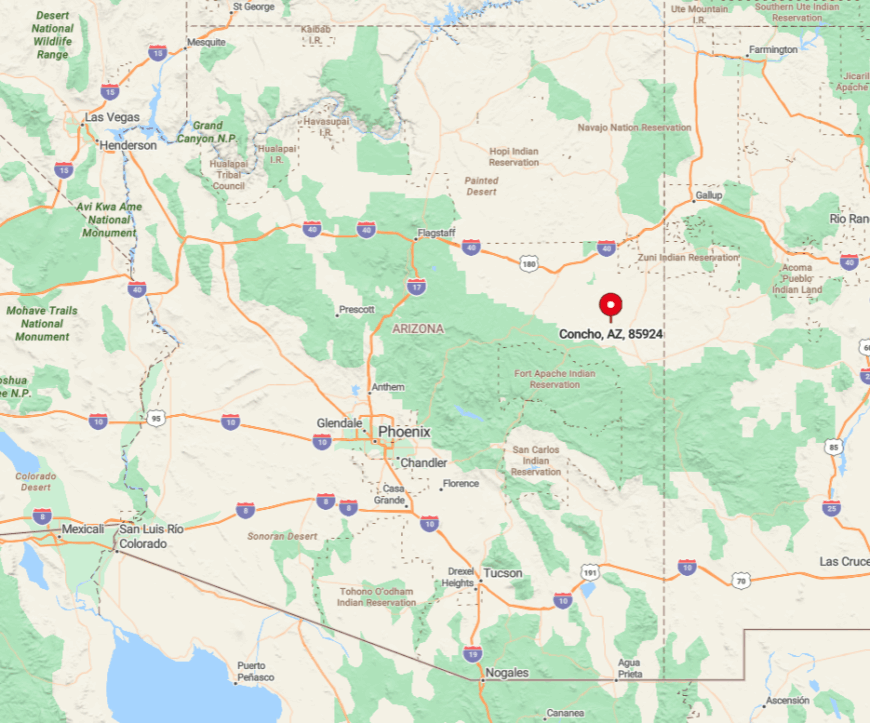
Concho is 28 miles northeast of Show Low, reached by State Route 61 after leaving U.S. 60 at Vernon. The town rests on rolling prairie at 6 300 feet, with no large settlements for nearly thirty miles in any direction.
Its quiet stems from a bypassed rail line and the absence of major highways, leaving only local ranch traffic. Visitors generally approach from Show Low’s airport, then follow a two-lane road that passes through open ranch country into Concho’s sparse grid of streets.
6. Forest Lakes: Cabin Community Lost in Tall Ponderosas
Forest Lakes supports fewer than 500 winter residents who occupy cabins on acre-plus lots woven through ponderosa forest at 7 500 feet. Summer brings anglers to nearby Woods Canyon Lake and hikers to the Rim Lakes Vista Trail, yet the neighborhood stays hushed once evening chill sets in.
Small property management firms, seasonal fire crews, and a single general store form the backbone of employment. The area lacks streetlights, keeping owls and stargazers equally happy.
Dirt roads end abruptly at wilderness boundaries, discouraging through traffic. Thick evergreens and frequent monsoon mists lend the settlement a sense of being swallowed by the forest.
Where is Forest Lakes?
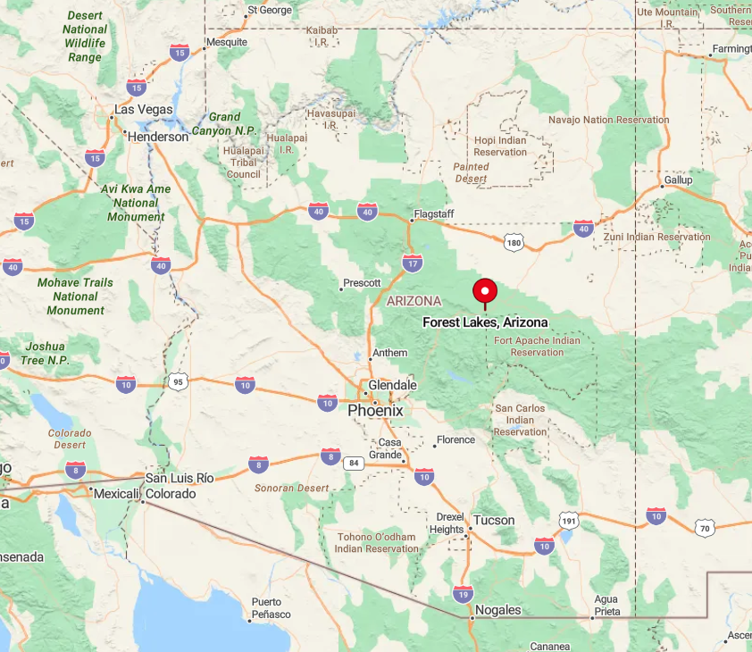
The community straddles State Route 260 midway between Payson and Heber, but it sits 45 miles from the nearest stoplight in either direction. Sheer cliffs of the Mogollon Rim rise just south, blocking radio signals and funneling snowfall, which increases the sense of isolation.
Only two paved entrances connect the grid of cabin lanes to the highway, and both can close during heavy snow. Most travelers reach Forest Lakes by climbing SR 260 from Payson, climbing nearly 3 000 feet in less than an hour.
5. Clay Springs: Rim Country Quiet on the Edge of Nowhere

Clay Springs reports about 350 residents who occupy cedar-rimmed ranches, hobby farms, and a smattering of mobile homes along a single county road. Locals ride horses across red-soil buttes, hunt mule deer, and gather at the volunteer fire station for monthly potlucks.
Employment comes from small sawmills, ranching, and commuting to nearby Show Low. Natural barriers of juniper ridges and dry washes create a patchwork landscape that screens one homestead from the next. Even cell service fades in and out, a reminder of the settlement’s remove from modern infrastructure.
Clear desert light and open range make Clay Springs a favored stop for photographers chasing lone mailboxes and distant thunderheads.
Where is Clay Springs?
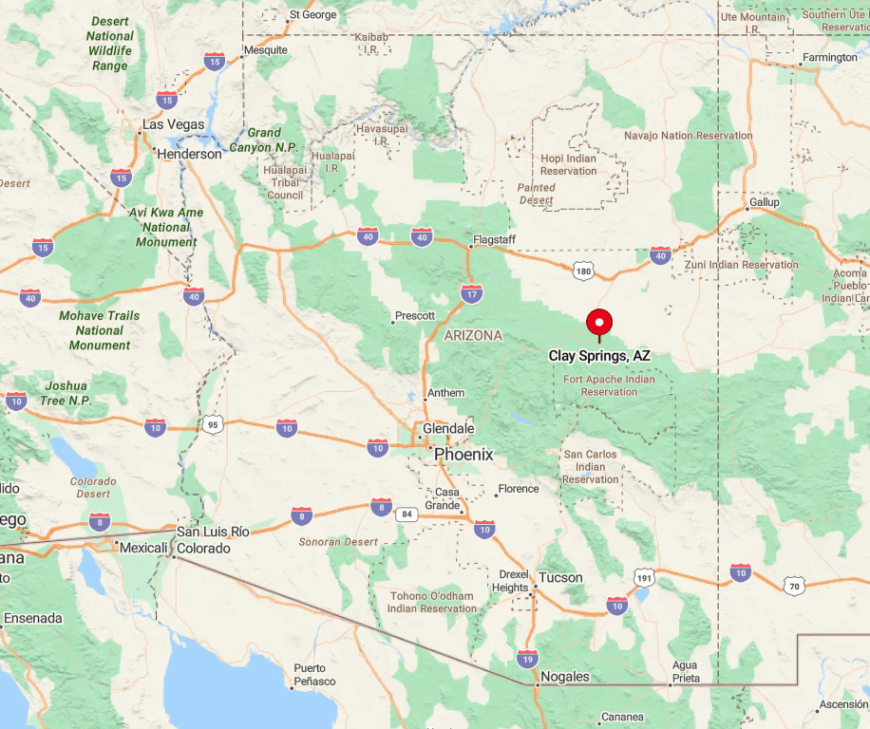
The community lies 16 miles northwest of Show Low on State Route 260, yet it sits far enough from larger towns to feel detached. Surrounding national forest closes in quickly, and rough dirt tracks branch off the highway then vanish at canyon rims.
With no adjoining communities on side roads, travel here is mostly purposeful rather than incidental. Visitors usually fly into Show Low Regional Airport, rent a vehicle, and follow a two-lane ribbon through juniper hills to reach Clay Springs.
4. Pinedale: Fog-Kissed Valley of Whispering Pines
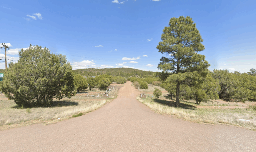
Pinedale hosts roughly 550 residents living in historic log cabins and new timber homes scattered on two-acre tracts. Morning fog pools in the bowl-shaped valley, creating dreamy scenes of smoke curling from chimneys while ravens wheel overhead.
Logging heritage lingers in the small mill remnants, though present-day work revolves around part-time tourism and remote employment. The absence of retail strips keeps the valley free of neon and traffic noise.
Dense pines muffle sound, and the only nighttime glow comes from woodstove embers. Winding forest lanes that dead-end at trailheads emphasize just how tucked away Pinedale remains.
Where is Pinedale?
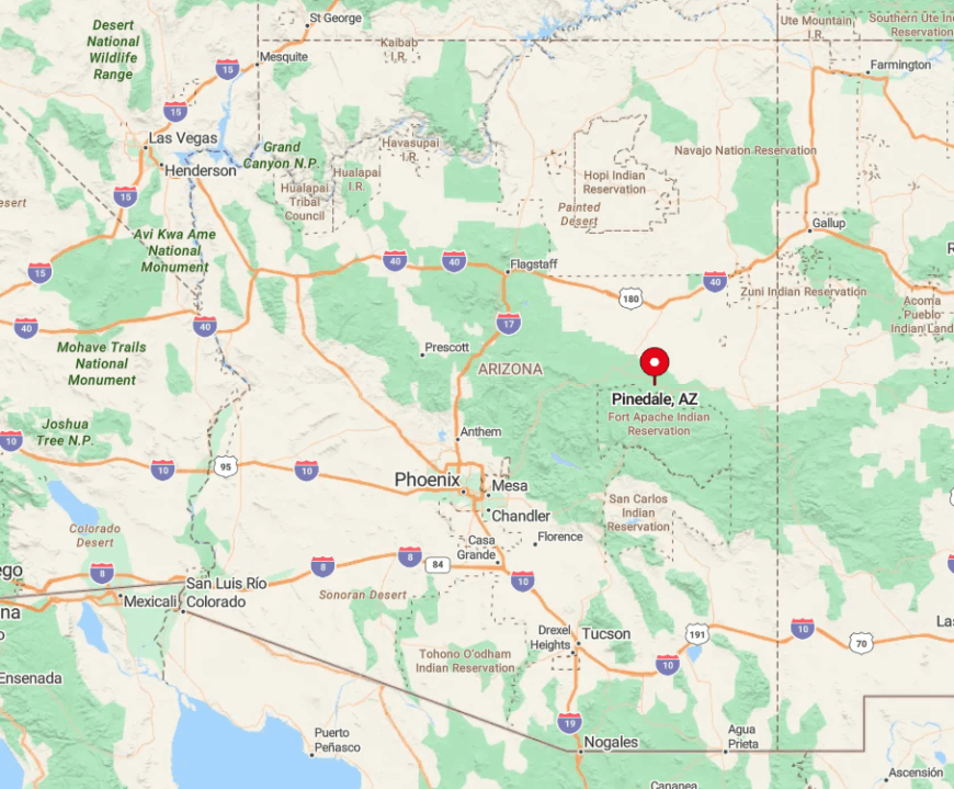
The village sits 12 miles west of Show Low along County Road 130, hidden south of State Route 260. Rim Country ridges flank the valley, forcing travelers onto a single paved road that meanders through forest before dropping into town.
Snow or fallen trees can close the route, creating brief periods when the community is effectively cut off. Most guests exit SR 260 at Pinedale Road, then descend through a tunnel of tall pines that conceals the settlement until the final bend.
3. Linden: Hidden Horse-Property Enclave West of Show Low
Linden counts about 2 200 residents spread across spacious ranchettes where horses outnumber streetlights. Activities include trail riding on cedar-studded mesas, target shooting on private ranges, and small gatherings at the community center.
Income comes from equine boarding, home-based businesses, and commuting to Show Low’s hospital and schools. Without commercial zoning, the landscape remains uncluttered by signage or parking lots.
Twelve miles of open pasture separate Linden from city amenities, preserving dark skies that invite backyard telescopes. Shielding mesas and an absence of through roads help the enclave retain an under-the-radar feel.
Where is Linden?
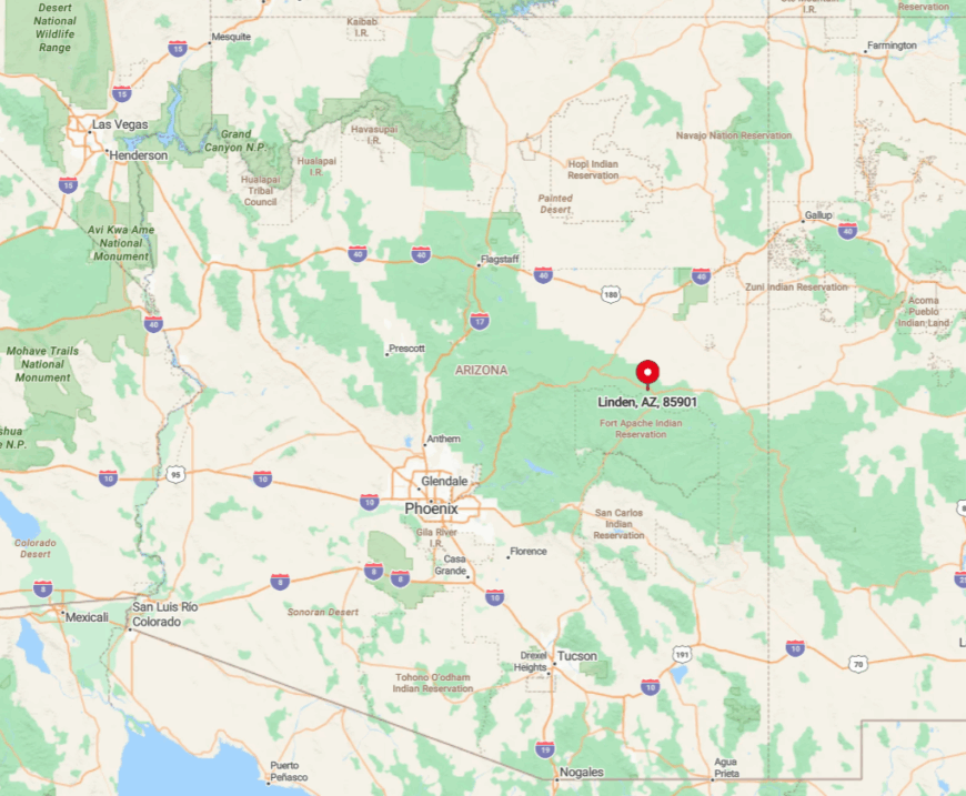
Linden sits along State Route 260 west of Show Low, but homes sprawl north and south along unpaved lanes that fade into BLM land. The community is hemmed in by juniper hills and seasonal washes, which discourage road building and keep traffic low.
Only one small convenience store serves the area, so most errands require a drive into town. Visitors exit U.S. 60 at SR 260, then watch addresses grow sparse as the highway climbs toward the cedar highlands of Linden.
2. Heber-Overgaard: Dark-Sky Retreat for Stargazers
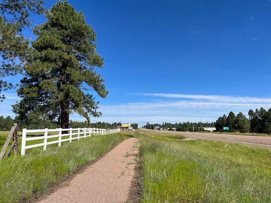
The paired census-designated places of Heber and Overgaard support roughly 2 800 residents who share a love of cool summers and breathtaking night skies. Visitors attend local star parties, hike the Highline Trail, and stock up at the Heber Country Store before heading into surrounding forest.
Cabin rentals, a sawmill, and seasonal tourism form the economic base, supplemented by retirees with remote income. Eighty percent of the surrounding land is undeveloped, allowing Milky Way arcs to shine bright above silhouetted pines.
Streetlights are scarce, and a community ordinance restricts lumen output to protect sky quality. Distance from urban glow makes the settlement a magnet for astrophotographers seeking pristine conditions.
Where is Heber-Overgaard?
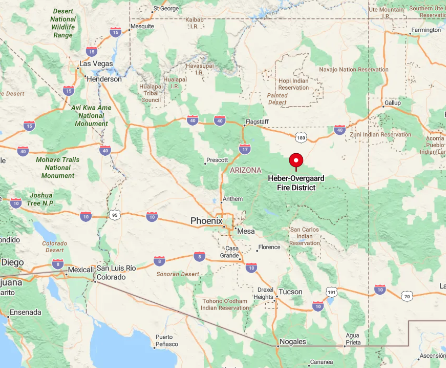
The towns straddle State Route 260 about 35 miles west of Show Low and 55 miles east of Payson, with no city lights within a sizable radius. Set atop the Mogollon Rim at 6 600 feet, they are ringed by Apache-Sitgreaves National Forest and a patchwork of ranch land.
Curving Rim highways limit commercial freight traffic, so the area stays quiet even during peak travel seasons. Most visitors arrive via SR 260, climbing through juniper flats into towering pine country before dropping into the twin towns.
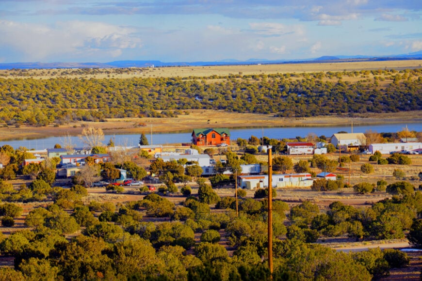
1. White Mountain Lake: Lakeside Lots with Miles of Open Range

White Mountain Lake records about 2 400 residents dotted around a quiet reservoir that mirrors sunrise in glassy stillness. Days are filled with kayaking, paddle-boarding, and casting for largemouth bass, while evenings bring the call of coyotes across sweeping high-desert plains.
A small golf course, a volunteer fire department, and vacation rentals provide limited employment, with many locals commuting to Show Low for work. Homes sit on generous lots surrounded by open range and distant volcanic cones, so even neighbors feel distant.
Streetlights are absent, leaving star fields to dominate the night. The lake’s private access gate reduces random visitors, giving the area an exclusive hush despite its proximity to town.
Where is White Mountain Lake?
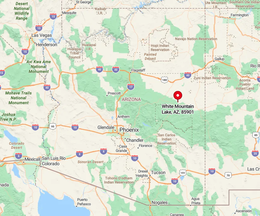
The community lies 15 miles northeast of Show Low, reached by State Route 77 and then a signed county road that loops past cinder cones and sage flats. High-desert openness keeps it visually separate from the pine forests to the west, enhancing the feeling of space.
No through roads connect to adjoining towns, and the shoreline is gated for resident use, which limits traffic to owners and their guests. Travelers fly into Show Low Regional Airport, rent a car, then follow a straight two-lane road that ends at the lake’s dam and quiet neighborhoods.


