Eastern Texas is a land where pavement gives way to pine needles and rivers do more of the talking than highways. The region holds a patchwork of hamlets tucked into timberland, places where feed stores still count as gathering halls and a hand-painted sign is more likely than a billboard. Life slows to the pace of porch swings and cattle gates, framed by the quiet insistence of forests and the broad backs of rivers that shape the land.
In order to come up with the very specific design ideas, we create most designs with the assistance of state-of-the-art AI interior design software.
This corner of the state has always been more crossroads than destination. Trails once cut by Caddoan traders and Spanish explorers now trace out as farm-to-market roads, two-lane blacktop threading through creeks, prairie breaks, and lowland swamps. The towns strung along them keep their scale modest: school gyms as civic centers, gas stations doubling as newsstands, and post offices as the last piece of federal infrastructure.
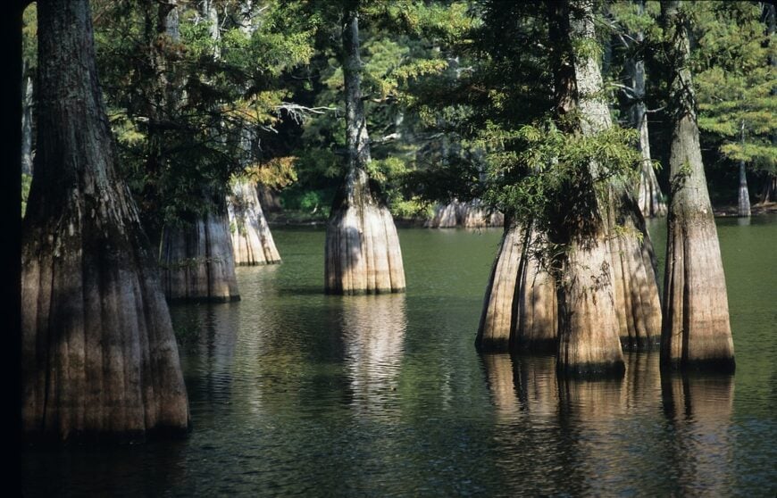
The geography itself does the heavy lifting for seclusion. The Angelina and Neches Rivers carve out long stretches of hardwood bottomland; Sam Rayburn and Toledo Bend expand into watery labyrinths of coves and cypress. In between, the Big Thicket and Davy Crockett National Forest swallow whole counties with pine and post oak, hemming in settlements so thoroughly that cell towers barely matter. These towns aren’t hidden by choice—they’re simply folded into the terrain.
To travel here is to leave behind the hum of interstates and accept that most roads dead-end at water or woods. What you find instead are communities that never chased size: cemeteries older than courthouses, diners serving the same catfish plates for generations, and skies where stars reclaim the night. Eastern Texas doesn’t ask to be hurried through; it waits patiently, the quiet stitched into every pine stand and river bend.
25. Douglass – A One-Stop Hamlet Along the Angelina River
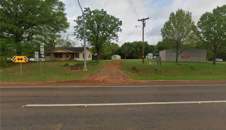
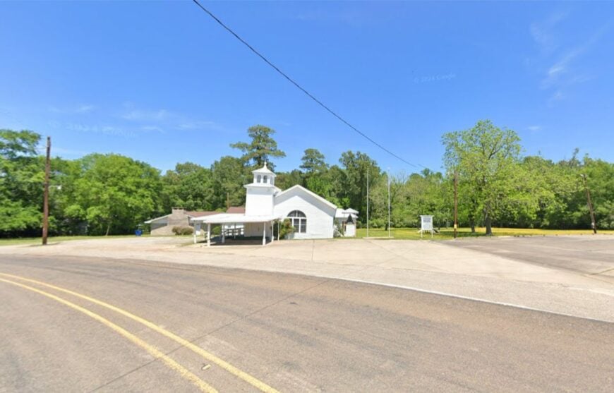
Life in Douglass drifts at the pace of its winding river, where cattle pastures press against the tree line and neighbors still wave from pickup windows. The community revolves around its small school, a single café, and the rhythm of Sunday services.
The lack of stoplights or big-box stores amplifies its quiet charm, and the nearest grocery run means driving into Nacogdoches. Anglers launch boats, while families picnic under towering pines that shade the Angelina River bottoms.
Douglass remains tied to farming and ranching, its economy as modest as its landscape is generous. What lingers most is the sense that nothing here is rushed—only lived, steadily and simply. It’s the kind of place where silence itself feels like an old friend.
Where is Douglass?
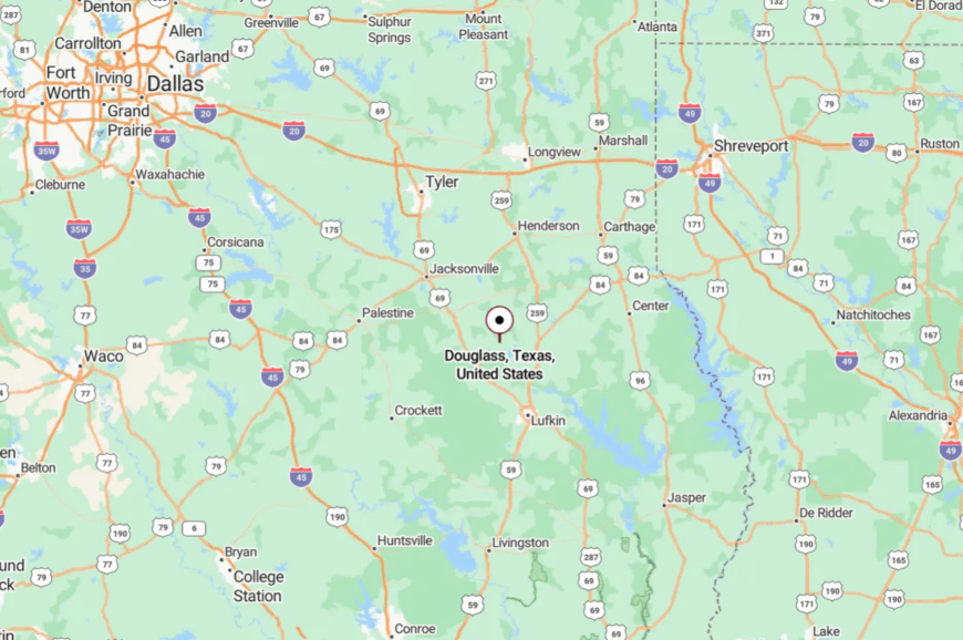
Douglass lies in Nacogdoches County, about 15 miles west of Nacogdoches, tucked against the bends of the Angelina River. Travelers reach it by Farm-to-Market Road 225, a two-lane ribbon threading through pine woods and ranch gates.
With no highway frontage, the hamlet is easy to bypass unless you’re looking for it. Arrive, and you’ll feel like you’ve slipped into a pocket of time that the modern world forgot.
24. Chester – Tiny Timber Town Where Freight Trains Outnumber Cars
Chester counts barely 300 souls, its main street lined with modest houses shaded by pecan and pine. Once tied to logging camps, the town still wears its timber heritage proudly, though today most residents commute or tend small farms.
Life here is unhurried: kids gather for high school ballgames, church potlucks fill the social calendar, and evenings end on front porches where the only sound is crickets. Visitors can explore the old depots, hunt the nearby hardwood bottoms, or simply drive quiet backroads that stretch endlessly under East Texas skies.
The lack of commercial sprawl means you’ll find only one café and a gas station—just enough to keep the wheels turning. In Chester, seclusion isn’t dramatic—it’s ordinary, lived every day like a soft rhythm. And that’s the beauty of it.
Where is Chester?
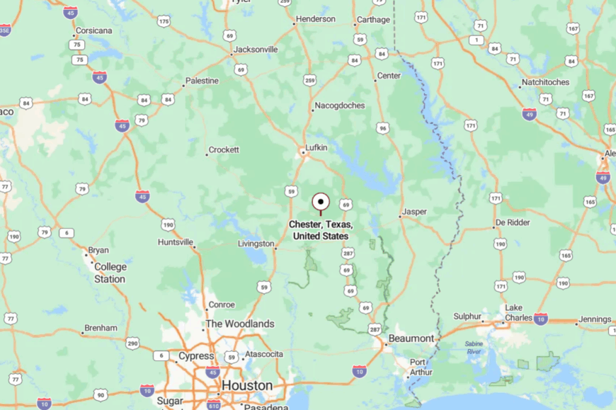
Chester sits in Tyler County, 14 miles west of Woodville, straddling U.S. Highway 287. It’s a speck on the map between Woodville and Corrigan, surrounded by thick pine stands that muffle highway noise.
Most travelers speed past without a glance, leaving the town to itself. If you slow down and turn off the main road, you’ll find that the stillness lingers in the air like morning fog.
23. Chireno – Spanish Roots Beneath the Pines

Founded in the early 1800s, Chireno whispers of its Spanish heritage through weathered cemeteries and timeworn churches. With only a few hundred residents, it remains a crossroad town where farming, ranching, and timber form the backbone of daily life.
Days unfold slowly—kids fish in farm ponds, elders swap stories at the general store, and the air smells faintly of woodsmoke in autumn. Travelers find interest in the Chireno Historical Museum, backroad birdwatching, and the shaded creeks that curl through the surrounding pine flats.
Without major industry, the settlement feels untouched by hurry or growth, content in its smallness. Nights are lit by fireflies rather than streetlamps, a quiet reminder of how far removed it is from modern clutter. Chireno feels less like a town and more like a pause in time.
Where is Chireno?

Chireno is tucked into Nacogdoches County, 15 miles east of the city of Nacogdoches, along State Highway 21. The route meanders through rolling pastureland and forests before narrowing into quiet streets.
With no interstate access, most outsiders arrive only on purpose. It’s close enough to reach, but far enough to feel like you’ve left everything behind.
22. Apple Springs – A Crossroads in the Pines

Apple Springs is little more than a cluster of homes and churches, yet it serves as a gathering spot for the ranch families scattered across Trinity County. The town’s heart beats at the volunteer fire hall and the high school gym, where Friday nights bring the loudest cheers you’ll ever hear in such a small place.
Surrounded by deep pine forest and hemmed in by creeks, it feels sheltered, almost hidden. Travelers can hike trails through Davy Crockett National Forest, hunt deer in season, or grab catfish plates from the roadside café.
With no chain stores or traffic lights, its simplicity becomes its charm. Apple Springs doesn’t try to impress—it simply exists, steady and genuine. Here, time doesn’t pass quickly; it simply settles in.
Where is Apple Springs?

Apple Springs sits in Trinity County, about 20 miles east of Crockett, perched at the junction of State Highways 94 and 357/2501. Two-lane roads carve through pine thickets before spilling into the tiny crossroads.
The absence of nearby interstates ensures most travelers skip it altogether. Yet for those who arrive, the hush of the forest wraps around you like a familiar quilt.
21. Broaddus – Quiet Shores on Sam Rayburn Reservoir

Broaddus holds fewer than 300 residents, but its claim to fame is its nearness to Sam Rayburn Reservoir, where boat ramps and quiet coves offer sanctuary to anglers and birdwatchers. The town itself is spare—a scattering of churches, one school, and a gas station where everyone seems to know your name.
Logging and small-scale ranching form the economic base, though lake tourism brings a trickle of weekenders. Those visitors find trails in Angelina National Forest, crappie fishing, and the charm of a town too small for stoplights.
At dusk, cicadas drown out conversation, and the lake glimmers like a hidden sea. Broaddus is a reminder that seclusion isn’t just about distance—it’s about how still a place can feel.
Where is Broaddus?

Broaddus is tucked in San Augustine County, about 25 miles southeast of Lufkin, along Highway 147. Reaching it means leaving four-lane highways behind, trading them for narrow routes through rolling timberland.
The town’s proximity to Sam Rayburn gives it a lakeside hush while keeping it off any through-route. Here, water and woods conspire to make you forget the rest of the world.
20. Colmesneil – Piney Woods Town with a Railroad Soul

Colmesneil wears its railroad past quietly, with the echoes of steam engines lingering in the rusting tracks and historic depots. Fewer than 700 residents call it home, their lives woven around small ranches, timber jobs, and the rhythm of church bells.
The town is ringed by tall pines and hardwood bottoms, muffling any sense of rush from the outside world. Visitors can stroll the old town square, explore heritage cemeteries, or join in for the Dogwood Festival held nearby in Woodville.
With no chain stores and only a handful of shops, Colmesneil’s economy remains tied to its woods and fields. Evenings settle in with the smell of pine resin and the song of whip-poor-wills. It feels like a place stitched together by memory and silence.
Where is Colmesneil?

Colmesneil rests in Tyler County, about 10 miles north of Woodville, along U.S. Highway 69. Though the highway touches it, the surrounding national forests quickly swallow passing traffic.
Travelers find themselves on winding two-lane roads bordered by pines that seem to close in like curtains. It’s a crossroads you can reach with ease—but just as easily pass by without noticing.
19. Kennard – Forest Outpost at the Edge of the Davy Crockett

🔥 Would you like to save this?
Kennard is a speck in Houston County with only a few hundred residents, its quiet streets pressed tight against the Davy Crockett National Forest. The town center holds a café, a post office, and a school, but little else; the woods are the true anchor here.
Locals live from ranching, timber, and guiding hunters who come for whitetail season. Visitors wander forest trails, paddle Ratcliff Lake nearby, or stop by the ranger station that doubles as a community hub. With no commercial bustle, the pace here is measured by sunrise and the return of cattle at dusk.
Nights belong to cicadas, barred owls, and a canopy of stars with no streetlamps to challenge them. Kennard reminds you what it feels like when wilderness outnumbers people.
Where is Kennard?

Kennard sits in eastern Houston County, 15 miles east of Crockett, reached by Highway 7. Travelers weave through miles of pine forest before spotting the modest town square.
The surrounding Davy Crockett National Forest hems the settlement in on nearly all sides. Arriving feels less like finding a town and more like stumbling on a clearing in the trees.
18. Joaquin – A Border Hamlet on the Sabine

Joaquin rests quietly on the Sabine River, its roots stretching back to logging camps and ferry crossings. Today it counts just over 800 residents, many tending small farms or commuting to nearby Center.
Its main street holds only the essentials: a diner, a few shops, and the ever-present church steeples. Visitors can fish the Sabine, trace Civil War history through old cemeteries, or follow dirt roads into the bottomlands where deer and herons thrive.
Surrounded by hardwood thickets and cut off from major highways, Joaquin feels more Louisiana bayou than Texas town. The evenings hum with frogs and the murmur of the river more than with traffic. It’s a place where the borderlands whisper their own kind of magic.
Where is Joaquin?

Joaquin sits in Shelby County, near the Louisiana line, about 17 miles northeast of Center. State Highway 84 skirts the town, but most routes into Joaquin narrow to two-lane roads and farm tracks.
Its location along the Sabine River ensures natural barriers on one side and thick forest on the other. By the time you arrive, you already feel like you’ve slipped into a forgotten corner of the map.
17. San Augustine – The “Oldest Town” Few Ever Visit

San Augustine wears the title “Cradle of Texas Independence,” yet it remains largely untouched by modern bustle. The brick courthouse square hosts antique shops and diners that close early, while streets radiating outward lead to pecan groves and cattle ranches.
History buffs wander restored log cabins, Spanish mission sites, and the weathered cemeteries shaded by live oaks. Small-town life revolves around farming, forestry, and the courthouse that still anchors civic life. Despite its deep roots, the town feels far removed from the state’s growth corridors.
Nights are hushed, and starlight easily outshines the dim glow of storefront bulbs. San Augustine proves that even history itself can hide in plain sight.
Where is San Augustine?

San Augustine lies in deep East Texas, about 35 miles east of Nacogdoches, at the junction of U.S. Highways 21 and 96. Though the highways meet here, the surrounding forests and hills blunt the flow of passersby.
Travelers often bypass it en route to the lakes, leaving the courthouse square nearly untouched. It feels central on the map, yet peripheral in the modern world.
16. Martinsville – A Roadside Hamlet Lost in the Pines

Martinsville is less a town than a collection of homes, churches, and a high school that ties the community together. Its population barely tips a few hundred, yet neighbors remain bound by shared roots and country rhythms.
With no commercial district, life is measured by church socials, Friday-night football, and the steady pull of logging trucks headed elsewhere. Visitors may find charm in exploring farm roads, hunting the surrounding woods, or pausing at the century-old cemeteries scattered in the pines.
It’s a quiet, working-class settlement, where voices carry easily on the evening air and fireflies mark the fields. There’s no tourism, no hustle—just life pared down to essentials. In Martinsville, seclusion comes from never having reached beyond the basics.
Where is Martinsville?

Martinsville sits in northeastern Nacogdoches County, about 12 miles east of Nacogdoches on Highway 7. The route itself is rural, running through pine flats and hay meadows before narrowing to a cluster of crossroads.
With no highway bypass, you pass directly through—if you even notice. The isolation here is less about distance and more about its refusal to be anything larger than it is.
15. Hemphill – A County Seat Surrounded by Forest and Water

Though Hemphill is Sabine County’s seat, it feels more like a sleepy village tucked between lake and forest. Its brick courthouse anchors a modest square, while the rest of town sprawls into scattered homes and a few diners.
Many residents live off logging, ranching, or guiding fishing trips on Toledo Bend Reservoir. Visitors find interest at the Sabine County Museum, the Patricia Huffman Smith NASA museum, or by launching boats into the countless coves.
The surrounding Sabine National Forest presses against the town limits, softening outside noise and isolating the community. Even as a seat of government, Hemphill feels like a remote frontier outpost. Nights are ink-dark, broken only by the glow of the courthouse clock.
Where is Hemphill?

Hemphill lies in Sabine County, about 15 miles east of Milam, reached by State Highway 87. It is encircled by the Sabine National Forest on one side and Toledo Bend on the other, limiting through-traffic.
Travelers from Lufkin or Jasper must take winding two-lane roads, often losing signal as they near town. Arriving feels like stepping into a village surrounded by natural walls.
14. Tenaha – Crossroads with More History than Noise

Tenaha sits at the junction of U.S. Highways 59 and 84, yet it remains startlingly quiet despite the crossroads. Fewer than 1,200 people live here, their days rooted in ranching, small shops, and a handful of schools.
The old town square holds brick storefronts and faded murals, whispering of a busier past. Travelers can explore Civil War-era cemeteries, local diners, or the annual community festivals that still fill the streets.
Despite its crossroads, truckers and travelers alike often bypass Tenaha, leaving it with an emptiness that feels both eerie and inviting. Evenings settle under an expanse of stars that seem too big for such a small place. Tenaha feels like a town waiting for company—but not minding the solitude.
Where is Tenaha?

Tenaha is located in Shelby County, about 10 miles north of Center, where Highways 59 and 84 intersect. While it technically sits on a major route, the absence of development keeps the flow of life slow.
Long stretches of pine forest flank every approach, with only the occasional farmhouse breaking the green. It feels like a crossroad where time paused.
13. Timpson – Whistle-Stop with Porch Swing Charm

🔥 Would you like to save this?
Timpson is the kind of place where the train still defines the day, though only freight passes now through the heart of town. Its 1,000 residents cluster around a square with antique shops, cafés, and century-old churches.
The surrounding countryside rolls with cattle pastures, hardwood creeks, and forgotten farm roads that seem to vanish into the trees. Visitors can stroll the historic district, fish in nearby Lake Murvaul, or join the annual Frontier Days festival that briefly wakes the quiet streets.
Logging and small-scale ranching remain the backbone of its economy, giving it a grounded, working-class spirit. Evenings invite conversation on porch swings, the only soundtrack a passing train or cicadas. Timpson holds the charm of a place that has never chased size.
Where is Timpson?

Timpson rests in northern Shelby County, about 30 miles north of Nacogdoches, on U.S. Highway 59. Though the highway cuts through, it bypasses the heart of town, leaving downtown oddly hushed.
Winding farm roads connect it to nearby lakes and forests, each turn leading farther from noise. By the time you arrive, the world feels a step further away.
12. Zavalla – A Gateway to Pines and Lakes

Zavalla is a timber town of about 600 souls, pressed tight against Angelina National Forest and the southern shore of Sam Rayburn Reservoir. The main street holds a few shops, churches, and a school, while most of life unfolds in the woods and on the water.
Locals fish for bass, guide duck hunters, or work small logging outfits. Visitors find boat ramps, forest hiking trails, and blueberry picking in summer. Despite its lake access, Zavalla has escaped heavy tourism, leaving it unhurried and almost hidden.
Nights here are quiet, save for boat motors echoing across the reservoir. It’s the kind of place where life feels more tied to the natural calendar than any clock.
Where is Zavalla?

Zavalla sits in Angelina County, about 25 miles southeast of Lufkin, along U.S. Highway 69. The road passes directly through, yet pine forest hems in every direction, hiding the settlement from wider notice.
With the national forest and reservoir bordering the town, it feels more like a clearing than a hub. Even when you’re there, it feels tucked away.
11. Pineland – Timber Settlement in the Deep Woods

Pineland counts fewer than 1,000 residents, its roots tied to the sawmills that once thrummed at the edge of Sabine County’s forest. The mills have quieted, leaving a small, working-class community where logging still lingers as the main trade.
A scattering of homes, a school, and a few local cafés make up the town proper, while surrounding pine woods reclaim old logging spurs. Visitors can fish Lake Sam Rayburn, explore the Sabine National Forest, or stroll through downtown.
Pineland itself remains almost invisible, bypassed by vacationers bound for the lake. Evenings bring the steady whisper of pines rather than the clamor of traffic. Pineland feels like a town swallowed by the forest, content to remain there.
Where is Pineland?

Pineland rests in Sabine County, about 10 miles south of Hemphill, just off U.S. Highway 96. Though the highway touches its edge, dense pine forest quickly surrounds and hides the settlement.
Travelers often pass through without stopping, mistaking it for another woodland bend. Yet for those who linger, the woods make sure the modern world stays far away.
10. Weeping Mary – A Freedmen’s Hamlet Lost in Cherokee County Fields

Home to fewer than 100 residents, Weeping Mary traces its roots to formerly enslaved families who carved one-acre homesteads from fertile prairie after the Civil War. Today, neighbors share potluck suppers at Bethel Church, pick pecans along Sandy Creek, and watch barn owls patrol the hayfields after dusk.
Agricultural work and small-scale cattle operations remain the main livelihoods, though many residents drive to Rusk for supplies or part-time jobs. There is no store, post office, or streetlight, so the nighttime hush is broken only by coyotes and the distant rattle of a farm gate.
Starwatchers relish the ink-black sky, and historians stop to photograph the hand-hewn church pews that date to the 1880s. Wide pastures on every side keep the community insulated from traffic on U.S. 69 nearly ten miles away, reinforcing its unlikely serenity.
Where is Weeping Mary?

Weeping Mary sits in southern Cherokee County, a few miles west of Alto and just off State Highway 21. The settlement is reached by turning onto County Road 2907, where the pavement gives way to narrower lanes that wind past hayfields and pecan groves.
There are no commercial signs or highway frontage to catch a driver’s eye—only the small white church and nearby cemetery signal the heart of the community. With U.S. 69 running through Alto to the east, Weeping Mary feels tucked away, separated from passing traffic by fields and woodland.
9. Sacul – The Pine-Shrouded Whistle-Stop You’ll Miss if You Blink

With barely 170 inhabitants, Sacul greets visitors with a row of early-1900s brick storefronts whose ghost signs still advertise five-cent sodas. Locals gather for bluegrass jams inside the old depot each April when the Sacul Heritage Festival revives the otherwise sleepy main street.
Timber, small poultry farms, and weekend hunting leases fuel the town’s modest economy, though many houses now serve as artists’ retreats and Airbnb cottages.
Enormous loblolly pines and a tangle of dirt roads muffle modern noise, and freight trains rumble through only a few times a week—just enough to remind folks the tracks still work.
After sundown, fireflies sparkle above Mill Creek, and the only glow comes from a single lamppost outside the volunteer fire station. The absence of chain stores, street signals, and broadband deadens any urge to hurry, preserving Sacul’s hidden status.
Where is Sacul?

🔥 Would you like to save this?
Sacul lies 15 miles southeast of Nacogdoches on State Highway 204, yet its downtown sits a quarter-mile south of the pavement, unseen by most drivers. Thick forest on all sides shields the settlement, and GPS service tends to cut out as soon as pines close overhead.
Visitors should exit onto FM 1648, trace the rail spur, and prepare for loose gravel before parking beside the empty depot. Nacogdoches Regional Airport is the nearest airfield, so a car remains the simplest route to reach the whistle-stop.
8. Milam – Historic Sabine River Outpost with More Cypress Knees than Neighbors

Roughly 1,500 people claim Milam addresses, yet houses scatter so widely along Toledo Bend Reservoir’s inlets that the town feels far smaller. Anglers launch at Fin & Feather Resort, while history buffs track down the crumbling 1912 courthouse that once served Sabine County before the seat moved.
Fishing guides, lake-side cabin rentals, and heritage tourism support the local economy, supplemented by small timber outfits working the surrounding pine flats. Dense forest, serpentine water channels, and a maze of farm-to-market roads isolate hamlets like Fairmount and Laurel within the greater Milam postal zone.
Nights arrive to the creak of cypress limbs and the splash of gar under the docks rather than any traffic roar. The quiet makes Milam a natural hideout for weekend anglers and full-time residents alike.
Where is Milam?
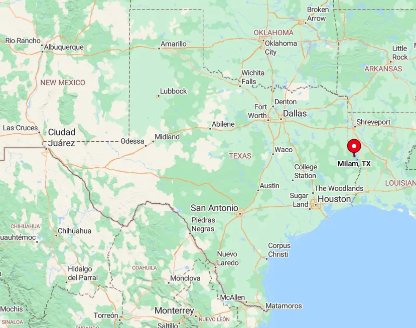
Milam stands on State Highway 87 near the Louisiana line in Sabine County, yet many residences lie ten miles or more down waterfront spurs that dead-end at coves. Toledo Bend Reservoir laps around the community, forcing drivers to detour over long bridges or circle back through Hemphill for supplies.
Travelers from Lufkin take U.S. 96 south, then weave east on FM 83 before Highway 87 delivers them to the old town square. Once there, gravel turnoffs and unmarked lanes are the only paths to most addresses.
7. Spurger – Big Thicket Hideaway Where Front Porches Face Endless Forest

Spurger counts about 1,000 residents scattered along County Road 92 and neighboring lanes, each homestead buffered by a curtain of Big Thicket hardwoods. Weekends bring canoeists to nearby Village Creek, peach buyers to Kirby’s farm stand, and pie-eating contests at the Spurger Fire Department fundraiser.
Small timber jobs, cattle grazing, and a smattering of beekeeping constitute the area’s income streams, with the school district acting as the largest single employer. The town center lacks stoplights, and its lone café, the Dairy-Mart, closes at 7 p.m., so the forest quickly reclaims the soundscape.
Deer wander across mail routes at dawn, and whip-poor-wills deliver nightly lullabies from the pines. A 45-minute drive to the nearest four-lane highway keeps Spurger comfortably off most travelers’ radar.
Where is Spurger?

Positioned in Tyler County roughly 40 miles north of Beaumont, Spurger sits at the crossroads of FM 92 and FM 1013 yet remains surrounded by the protected Big Thicket National Preserve.
Heavy timber and flood-plain bogs mean few roads breach the area, which limits through-traffic even during tourist season. Visitors usually reach town via U.S. 69 to Woodville, then follow a winding two-lane drive that loses cell reception halfway.
Houston’s Hobby Airport lies two hours southwest, so private car remains the only sensible option.
6. Weches – Houston County Crossroads Guarded by Mission Ruins and Tall Oaks

Weches holds around 300 residents who share a single convenience store, one post office, and a whole lot of sky. Outdoor days center on hiking the El Camino Real trail segment or photographing the 1690 Spanish Mission Nuestra Señora de la Purísima Concepción, hidden behind a pasture gate.
Small-scale ranching and seasonal hunting leases comprise the bulk of income, with a few residents commuting to Crockett for work. Giant post oak savannas surround the settlement, their broad canopies swallowing noise from distant farm machinery.
Nights fall quietly save for the hoot of barred owls and the soft ring of a dinner bell calling hands in from the pasture. The nearest fast-food sign sits twenty miles away, underscoring how removed Weches feels from the modern bustle.
Where is Weches?

Located at the junction of State Highways 7 and 21 in northern Houston County, Weches is geographically central yet psychologically remote. Wide ranch spreads and the Davy Crockett National Forest to the east limit development and keep light pollution low.
Drivers coming from Dallas exit Interstate 45 at Buffalo, then endure an hour of winding two-lane roads before reaching the mission site. With no public transit and minimal signage, those oak groves ensure only purposeful travelers arrive.
5. Ratcliff – The Forgotten Logging Camp Beside Davy Crockett National Forest

Ratcliff’s population hovers near 200, many of whom are descendants of the Four C Lumber Company workers who felled the pines a century ago. Remnants of the old sawmill line Idlewild Road, and locals swim or paddle across 45-acre Ratcliff Lake, an artifact of that logging era.
Today the U.S. Forest Service, seasonal campgrounds, and small guiding outfits provide most employment, supplemented by cattle grazing on cleared tracts. With 160,000 acres of Davy Crockett National Forest hemming it in, the settlement sees almost no drive-through traffic or cellular coverage.
Nights echo with tree frogs and wind in the tall shortleaf pines rather than engines. The vast woodland buffer grants Ratcliff a seclusion that feels nearly primeval.
Where is Ratcliff?
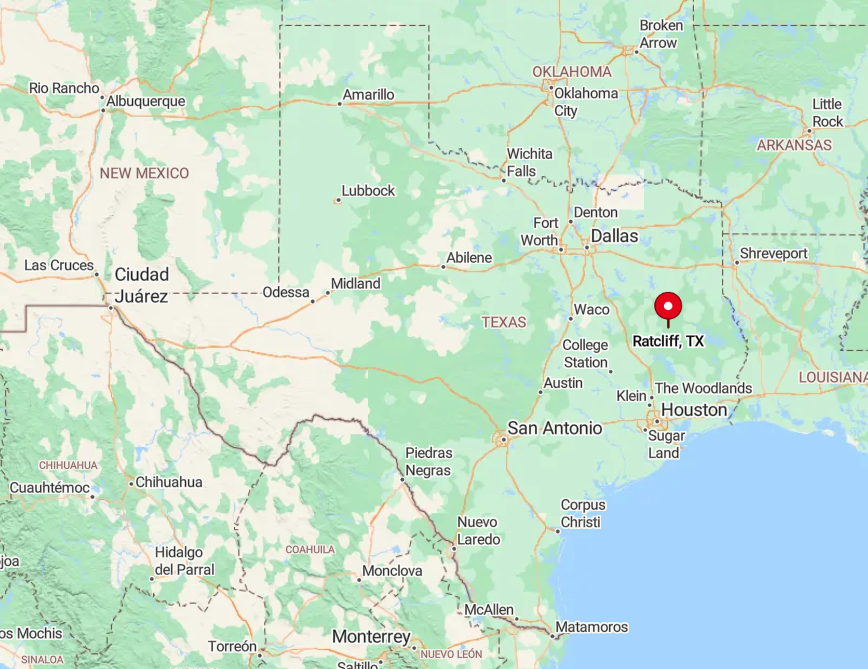
Ratcliff sits along State Highway 7, twenty miles east of Crockett, yet the thick national forest renders it a pocket of civilization inside a green sea. Only a single fuel station and the forest-service ranger office mark the turnoff, so many motorists pass without noticing.
Travelers from Lufkin can approach by Highway 103 and FM 227, a route that detours around the forest and loses radio stations along the way. Those without a car must rely on distant Greyhound stops, making private wheels the only reliable gateway.
4. Geneva – Sabine County Settlement Where Time Slows on Farm-to-Market 330

Geneva’s census rolls list barely 900 people, yet even that count feels generous amid the sweeping ranches and hardwood bottoms that dominate Sabine County.
Visitors tip their hats at the 1880s Geneva Baptist Church, stroll century-old cemeteries shaded by chinquapin oaks, and browse quilts at the volunteer fire-hall market.
Cattle ranching, hay production, and forestry services keep this crossroads humming at a gentle pace, while weekenders come for crappie fishing on nearby Six Mile Creek.
More than half the surrounding land remains undeveloped, so neighbors sit a pasture or two apart and share news through porch conversations rather than social media.
After dusk, whippoorwills trade calls across the bottoms, and the brightest object on the horizon is often the Milky Way. That lack of light or commercial glare makes Geneva a haven for anyone craving a slower heartbeat.
Where is Geneva?

Found along FM 330 between Hemphill and Milam, Geneva hides ten miles inside backroads that hug the Sabine National Forest boundary. The absence of state highways forces travelers onto a ribbon of two-lane asphalt that twists amid creeks and pine ridges, deterring casual traffic.
The simplest approach is to exit Highway 21 at Milam, follow FM 330 south, and watch for the weathered barn with a hand-painted “Slow Down” sign. With no nearby airports or bus stations, self-driving is the only practical method of arrival.
3. Dialville – Quiet Cherokee Prairie with More Cattle than People

Dialville claims roughly 400 residents spread across rolling grasslands where Brahman cattle outnumber humans three to one. Locals spend weekends at bass tournaments on Lake Jacksonville, gather for barbecues at the community center, and shop seasonal produce at Elberta Peach Orchard a few miles up the road.
Ranching and small poultry operations serve as the backbone of the economy, while retired folks maintain the historic schoolhouse turned events hall. A solitary blinking traffic light on U.S. 69 signals the town, yet most homes sit a mile or more down gravel lanes that fade into open pasture.
The absence of commercial strips, along with sweeping prairie skies, creates a sense of limitless space. Sunrise and the lowing herd, not car horns, mark the start of each day.
Where is Dialville?
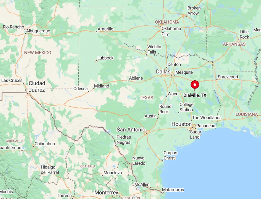
Situated six miles south of Jacksonville in Cherokee County, Dialville occupies a high plain just west of the Neches River corridor. Thick fencerows and private ranch gates block any direct east-west passage, so through-traffic sticks to the highway and bypasses town entirely.
Visitors exit U.S. 69 onto FM 855, then meander past hay bales and cattle guards before spotting the old gymnasium. The nearest passenger rail and commercial flights are in Tyler, forty miles north, reinforcing the hamlet’s quiet stance.
2. Etoile – Lakeside Hamlet Hidden in Angelina National Forest

Etoile hosts about 700 residents who share shoreline access to Sam Rayburn Reservoir, Texas’ largest lake that sits entirely within state borders. Days revolve around crappie fishing from stilted cabin decks, schooling white bass in early spring, and kayaking the glassy creeks that thread Angelina National Forest.
Small bait shops, a combination general store, and seasonal guide services comprise the business district, while forestry provides steady employment.
Towering pines form a curtain between State Highway 103 and the waterfront cabins, shielding the community from vacation-towing traffic that speeds between Lufkin and Jasper.
After dark, the sky flickers with such commandingly bright stars that French settlers supposedly named the spot Etoile—“star.” The enveloping forest and water on three sides give the town a secluded peninsula feel despite its convenient lake access.
Where is Etoile?
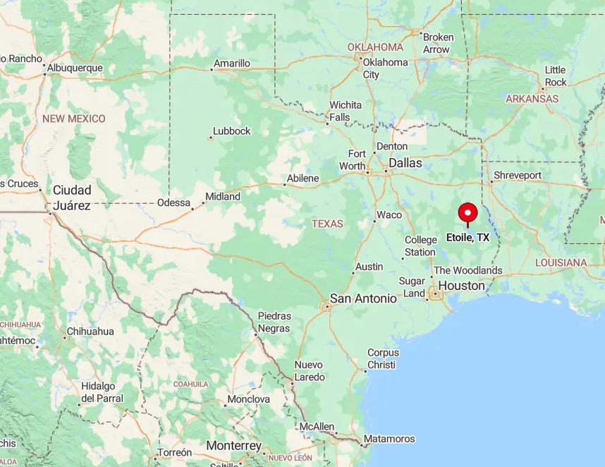
Etoile rests on a wooded rise along Highway 103, twenty miles east of Lufkin, yet almost all residential lanes turn south toward the lake and dead-end at sheltered coves. Angelina National Forest borders the east and north, leaving only one paved road in or out.
Travelers without a boat or vehicle have few options; the closest bus stop is in Lufkin, and marina shuttles operate only for guests. Those who make the drive are rewarded with birdsong and lapping water replacing any urban racket.
1. Deadwood – Panola County Backroads Where Legends and Live Oaks Linger

Deadwood is a scattered community of about a hundred residents tucked into cattle country and pine breaks near the Louisiana line. Weekends lean rural—fixing fences, riding trails along FM 31, or trading talk under moss-draped oaks. The Deadwood Cemetery, begun in the 1840s on the LaGrone homestead, anchors the settlement and serves as its historical core.
Ranching, small timber work, and a few heritage stops keep the economy modest. Outlaw tales float around, but the famous graves and courthouse drama belong to Jefferson; Deadwood’s draw is its landscape—long drives lined with yaupon and loblolly, ranch gates marked with welded brands, and skies dark enough to track satellites.
Evenings quiet to the buzz of katydids and the sound of cattle. With Carthage holding the nearest neon lights, the night here arrives unbroken and stays that way.
Where is Deadwood?

Deadwood sits in southeast Panola County at the junction of FM 31 and FM 2517, roughly ten miles east of Carthage. FM 31 carries drivers south across the Texas–Louisiana line, where it meets LA 765 in DeSoto Parish at the historic International Boundary Marker.
Shreveport travelers reach Carthage by U.S. 79, then follow FM 31’s winding route to the cemetery gate and the weathered “Deadwood” sign. No public transit serves the area, and that lack of access helps preserve its enduring quiet.


