Would you like to save this?
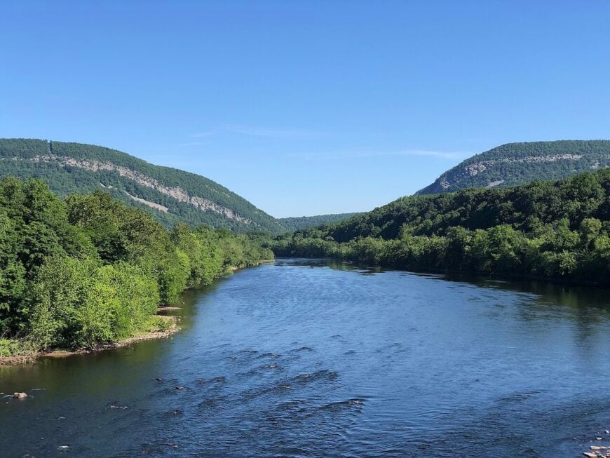
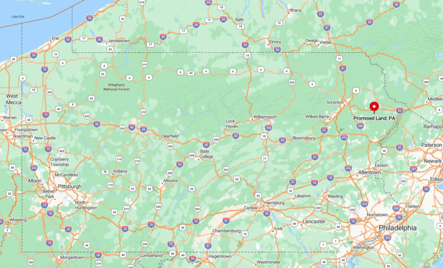
Eastern Pennsylvania is a region where geography does the talking. Blue Mountain runs like a spine along its western edge, the Delaware River sketches its eastern border, and in between you find ridgelines, hollows, and creeks that once decided where towns would rise. These natural boundaries still shape how quiet the place feels.
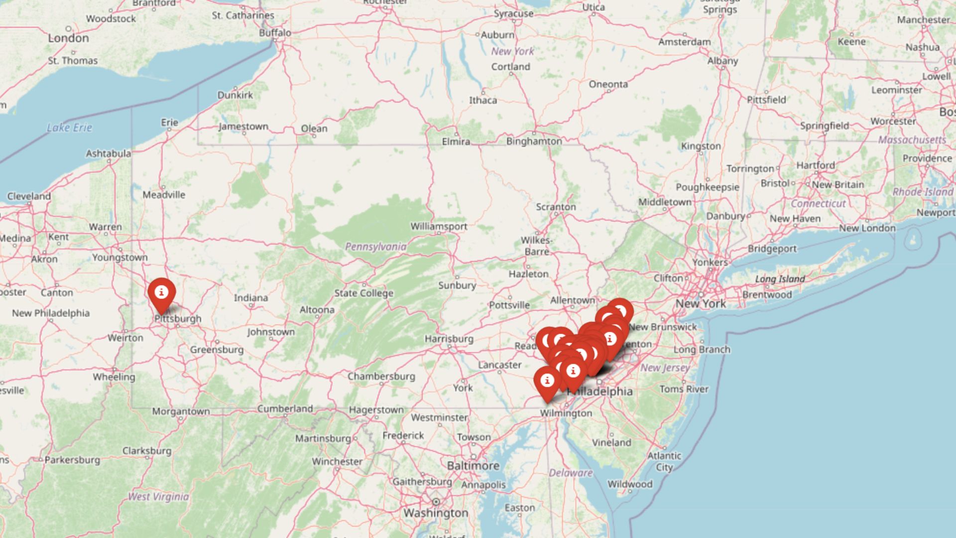
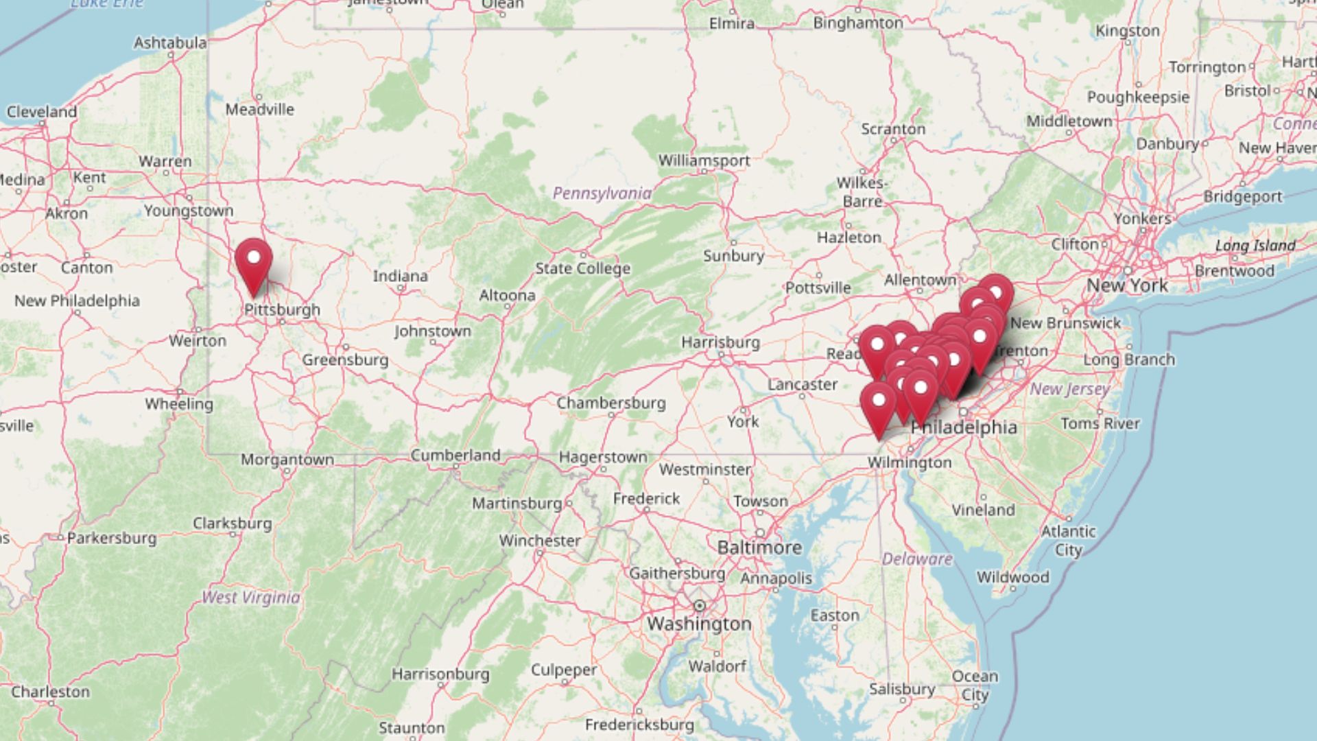
The 25 secluded towns gathered here remain defined by that geography. Some cluster around trout streams like Bowman and Fishing Creek, where roads run out at the forest edge. Others lean against the Delaware’s bends, their porches staring at New York across the water. A few perch high on the Pocono Plateau, where winter comes sooner and cell signals fade out before the pavement does.
What unites them is distance—distance from four-lane highways, from chain stores, from the kind of sprawl that smooths over local character. You arrive by way of covered bridges, single-lane roads, and directions that reference barns or old slate quarries. The towns are small, but they still hold on to their creameries, fire halls, and general stores, anchoring life at a local scale.
Traveling through these 25 locations you will notice details that bigger maps ignore: a trailhead that ends in waterfalls, a valley where cornfields meet stone walls, a bend in the Delaware that catches morning fog. Together they form a portrait of Eastern Pennsylvania at its most private, a region where quiet isn’t just preserved—it’s lived.
25. Eagles Mere, Sullivan County
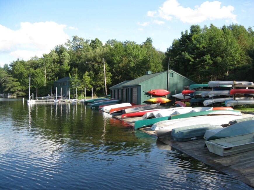
Eagles Mere circles a spring-fed mountain lake like a string of storybook porches, protected by hemlocks that swallow road noise whole. Its seclusion is baked into the plateau—no chain stores, few neon signs, and long winter nights bright with stars.
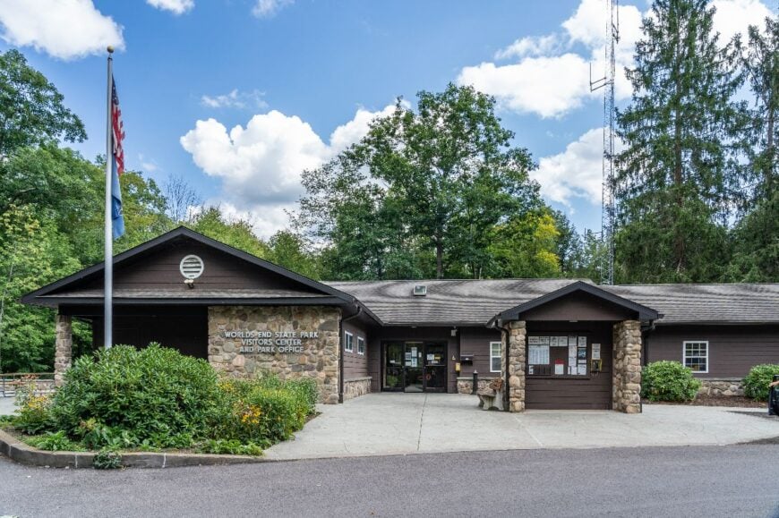
The town’s pace feels gently Edwardian: wooden sailboats scudding across the water, screen doors thumping, and a museum that remembers when the lake hosted a toboggan slide. Wander the Laurel Path beneath cathedral pines, rent a canoe for mirror-still mornings, duck into the historical museum, or day-trip to nearby Worlds End State Park for canyon views.
Summer cottages, small inns, and a handful of galleries quietly anchor the economy. When dusk paints the lake copper and loons call from the far shore, time seems to loosen its grip. It’s the kind of place that reminds you how quiet the world can be.
Where is Eagles Mere?
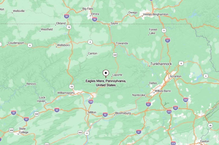
Perched on the Sullivan County highlands, Eagles Mere sits about 10 miles southwest of Dushore and roughly 35 miles northeast of Williamsport. Most travelers exit I-180 near Muncy and wind up PA-42 and PA-487 through forested switchbacks.
There’s no fast route—just two-lane blacktop and rising ridgelines. Close on the map, far in feeling.
24. Forksville, Sullivan County
Forksville huddles beside a covered bridge where the Loyalsock Creek elbows past a handful of clapboard storefronts. Seclusion comes from the deep gorge and a ribbon of road that follows the water’s bends, slowing everything to creek speed.
The vibe is old-time rural: smoke from the barbecue pit, fly-rods stacked by the door, and hikers powdering their boots with dust from Worlds End State Park. Cross the 1850 iron-and-wood bridge, hike Canyon Vista, fish the cool runs for trout, or order a slice of peanut-butter pie at the general store.
Small eateries, guiding, and park-season work make up most livelihoods. By evening, the creek becomes the town’s only soundtrack. Forksville feels like a postcard someone forgot to mail.
Where is Forksville?

You’ll find it along PA-87, 12 miles south of Dushore and about 28 miles northeast of Muncy. The approach tracks the Loyalsock through tight curves and rock walls, with few opportunities to pass.
Winter brings shaded ice and extra patience. The geography itself is the village’s quiet gatekeeper.
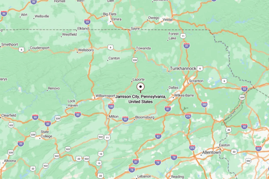
23. Jamison City, Columbia County
Jamison City sits at the pavement’s end, where the last mailbox gives way to state forest and the night belongs to whip-poor-wills. Its off-grid aura comes from being tucked against the headwaters of Fishing Creek with no through-route to anywhere else.
The mood is hushed and woodsmoke-scented: camp porches, old hunting cabins, and a store that seems to appear only when you need it. Ramble into State Game Lands 13, chase waterfalls above Sullivan Falls, bike shaded forest lanes, or cast for native brookies in pocket water.
A few rentals, seasonal camp jobs, and timber work are about the size of the local economy. Darkness here is still properly dark. Jamison City is for folks who like the road to run out.
Where is Jamison City?
Would you like to save this?
Hidden north of Benton, the hamlet hangs off PA-487 via Elk Grove and forest roads. It’s roughly 30 miles north of Bloomsburg, but those are patient miles on two-lane and gravel.
No bus lines, no shortcuts—just trees and creek crossings. It’s close enough to reach, but far enough to feel like you’ve left everything behind.
22. Bear Creek Village, Luzerne County
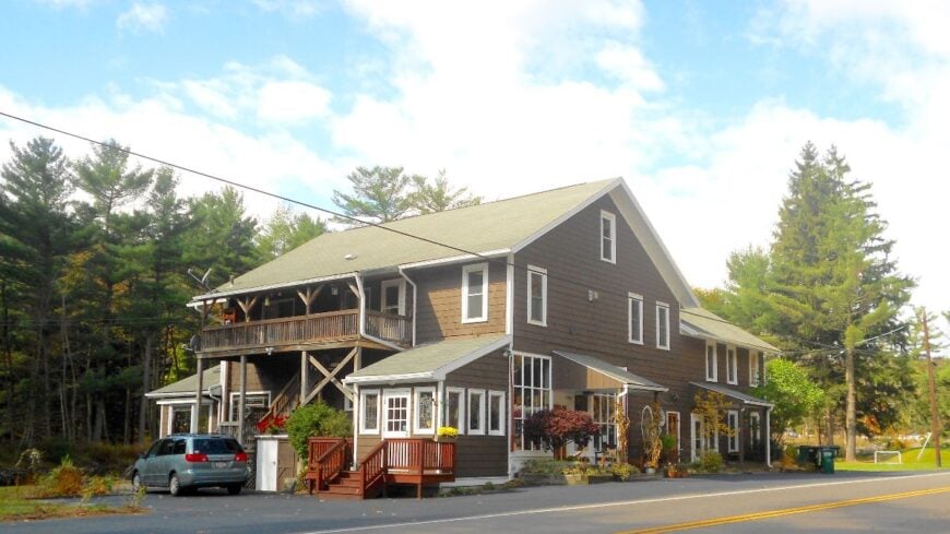
Bear Creek Village is a lakes-and-larches kind of place, wrapped by Pinchot State Forest and the vast Bear Creek Preserve. Seclusion comes from conservation land on nearly every flank and a purposeful lack of commercial strip.
The vibe is Adirondack-light: shingled cottages, loons echoing at dawn, and canoes ghosting across tannin-dark water. Stroll the dam and spillway, hike conservation trails carpeted with clubmoss, ski quiet roads after a snowfall, or picnic where blue herons hunt.
Public-sector forest work, caretaking, and a few small services keep the lights on. Nights are punctuated by barred owls instead of traffic. The village feels like a secret tucked between two pages of forest.
Where is Bear Creek Village?
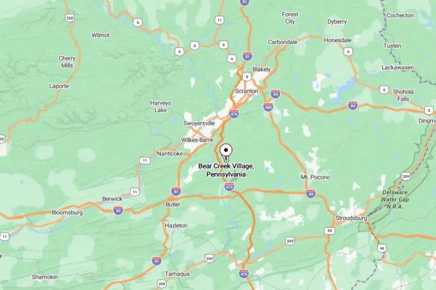
Ten miles southeast of Wilkes-Barre, Bear Creek sits along PA-115 on the edge of the Pocono Plateau. The climb from the valley and the absence of cross routes muffle casual traffic.
Travelers peel off I-81 or I-476 and slow to a two-lane glide among pines. Water, woods, and elevation do the rest.
21. Jeddo, Luzerne County

Jeddo is a pocket-size coal patch town folded into a hollow above Hazleton, where clapboard houses step neatly along the hill. Its tucked-away feel comes from narrow approaches that leave the borough a deliberate destination rather than a pass-through.
The vibe is plainspoken and historic: old company homes, a tiny borough hall, and quiet lanes where kids still ride bikes in the street. Walk evening loops past tidy porches, birdwatch along nearby reclaimed barrens, explore Eckley Miners’ Village down the road, or grab pierogi in Freeland.
Today, many residents commute; the rest work in small trades that keep the town humming at low volume. Twilight softens the edges of the hill, and the day folds small. Jeddo proves that quiet doesn’t need to be far to feel far.
Where is Jeddo?

Just north of Hazleton, Jeddo sits a couple of miles off PA-940 and PA-309 on local connectors. The last approach narrows to shoulderless blacktop with steep banks, naturally discouraging speed.
It’s about 7 miles from I-80, but the final minutes feel older than the map suggests. A snug valley keeps it that way.
20. Weatherly, Carbon County
Weatherly rests in a bowl between Broad Mountain and Spring Mountain, a borough of gingerbread porches and church spires cupped by forest. Seclusion comes from terrain—there’s no interstate exit here, just a couple of narrow feeders winding in.
The vibe is firmly small-town: a rail park where kids clamber over cabooses, evening walkers circling the square, and leaves that turn half the sky to fire in October. Bike the rail-trail toward Lehigh Gorge, hike Roundhead Mountain for valley views, fish the Black Creek, or order soup-and-a-sandwich at the corner luncheonette.
Light manufacturing and school jobs mingle with commuters to Lehighton and Hazleton. After dark, you can hear the creek long before a car. Weatherly is a cupped hand of quiet in the hills.
Where is Weatherly?
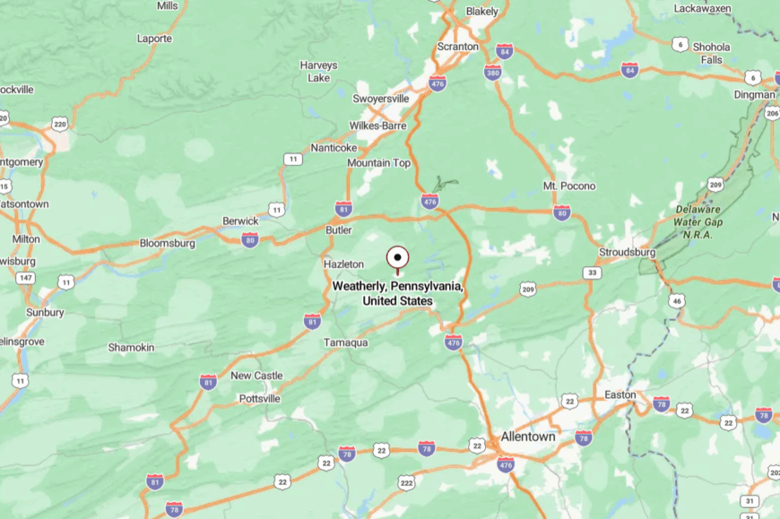
About 12 miles northwest of Jim Thorpe, Weatherly links to PA-93 and US-209 via two-lane connectors like Buck Mountain Road and Hudson Drive. Steep grades and bends slow the pace as you rise into town.
The nearest interstates (I-80/I-81) are a drive away, which keeps through-traffic thin. The mountains politely hold the edges.
19. Buck Hill Falls, Monroe County
Buck Hill Falls spreads along a hemlock gorge where streams lace mossy stonework built a century ago. It feels secluded because it is—a private community woven through deep woods with gatehouse entries and no commercial strip.
The vibe is vintage resort quiet: lawn games on the green, footbridges over cataracts, and stone cottages with smoke curling from chimneys. Hike miles of community trails, golf a classic mountain course, chase waterfalls in neighboring State Game Lands, or sip tea on a terrace while ravens tumble overhead.
Hospitality, maintenance, and seasonal events share space with retirees and remote workers. Night here sounds like water on rock. Buck Hill Falls is where the Poconos keep their voice down.
Where is Buck Hill Falls?

Set in Barrett Township, about 18 miles north of Stroudsburg, Buck Hill sits off PA-191 between Canadensis and Mountainhome. Approaches twist through the forest with few straightaways and fewer signs.
From I-380 or I-80, expect a steady climb into cooler air. It’s an easy drive that feels like a gentle unspooling.
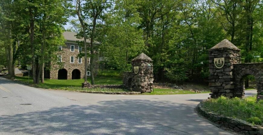
18. Canadensis, Monroe County

Canadensis gathers itself at a crossroads in a high, cool pocket of the Poconos, ringed by spruce and ferny ravines. Its seclusion stems from elevation, winding approaches, and an economy that never chased bigness.
The mood is camp-town cozy: roadside diners with thick mugs, outfitters stacking canoes, and summer cabins blinking porch lights at dusk. Wander along Brodhead Creek, hike to evergreen views in State Game Lands, visit the local greenhouse for mountain-grown blooms, or loop the byways toward Skytop and back.
Small inns, guiding, and garden centers keep things humming without raising the volume. Short days and long shadows make evenings feel properly alpine. Canadensis is a crossroads you pass on purpose.
Where is Canadensis?
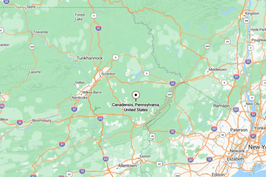
At the junction of PA-447 and PA-390, Canadensis sits about 25 miles southeast of Scranton and 15 miles north of Mount Pocono. Routes climb and curl, naturally easing the pace.
Most travelers peel off I-380 or I-84 and settle in for two-lane scenery. The mountain air arrives before the town does.
17. Greeley, Pike County

Greeley strings along woodland lanes between the Lackawaxen and Delaware Rivers, a scatter of cabins with names on their gates. Its off-the-map feel comes from state land and camps on all sides, with no big-box anything for many miles.
The vibe is piney and low-key—campfire smoke, quiet ponds, and sand-bottom creeks flashing with brook trout. Paddle the Lackawaxen on a slow day, hike to Stairway Lake, browse a roadside farm stand, or photograph mist lifting from the river at sunrise.
Summer camps and outfitters share the calendar with year-rounders who like long drives to short lines. Night here is mostly stars and crickets. Greeley is the pause between the ridge and the river.
Where is Greeley?

Along PA-590 in central Pike County, Greeley lies roughly 10 miles northwest of Milford and 9 miles east of Lackawaxen. The road undulates through forest and past kettle ponds with few shoulders and fewer services.
Most visitors arrive via US-6 before dropping into narrower byways. It feels lightly hidden even when you’re standing in it.
16. Lackawaxen, Pike County

Would you like to save this?
Lackawaxen sits at a river confluence where eagles nest on the bluffs and John Roebling’s aqueduct spans the Delaware like a slim, old-world secret. Seclusion leans on geography: steep banks, tight curves, and a web of roads that ribbons the river rather than crossing it.
The town’s texture is river-worn—canoes dragged over cobbles, the Zane Grey Museum’s porch chairs, and trains curving along the opposite shore. Float a gentle stretch of the Delaware, walk the towpath over the Roebling Bridge, fish for shad and smallmouth, or scan the sky at the eagle observation areas.
Guiding, small museums, and a marina keep money local. Evening fog rolls up from the water, and the day softens. Lackawaxen is where the river remembers how to whisper.
Where is Lackawaxen?

In northeastern Pike County, the hamlet sits where the Lackawaxen River meets the Delaware, about 14 miles northeast of Hawley. Access is via PA-590 and river-hugging lanes with narrow bridges.
There’s no quick hop across; the water decides your route. You arrive slower, and somehow more ready.
15. Milanville, Wayne County
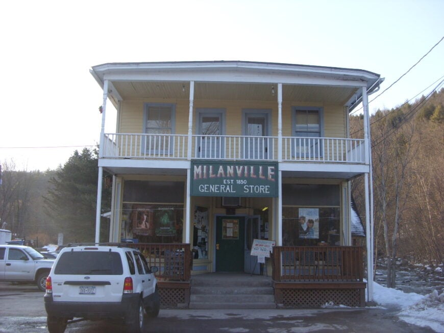
Milanville faces the Delaware with a line of tidy porches and meadows that roll right down to the riffles. Its seclusion comes from being a bridge or two away from anywhere, plus a lattice of backroads that prefer wandering to wayfinding.
The vibe is agrarian and artsy: plein-air painters on the bank, barn sales in summer, and a café that knows your name by the second cup. Wade for smallmouth in warm months, walk to Skinners Falls for foam and photos, browse farm stands, or watch mist burn off the river from a porch swing.
Small farms and seasonal rentals share space with longtime families. Nights are lit by lightning bugs more than streetlamps. Milanville is gentleness pinned to a bend in the river.
Where is Milanville?

Set in Damascus Township near the New York line, Milanville lies about 14 miles northeast of Honesdale. Approach via PA-371/652 and local lanes that drop to the river in slow curves.
The nearest big bridge crossings are miles away, so traffic stays light by default. It’s the kind of corner that keeps its calm by making you look for it.
14. Damascus, Wayne County

Damascus spreads along a riverside shelf with hayfields to the west and the Delaware glittering to the east. Seclusion is twofold: a low population and a border river that sharply limits drive-throughs.
The mood is work-boot pastoral—feed stores, tidy barns, and a diner where waders lean against pickup beds after morning floats. Put in a canoe below the bridge, browse the farm co-op, fish evening mayfly hatches, or wander upland lanes for views into New York.
Dairy and guiding set much of the local rhythm. After sunset, the river’s murmur fills the gaps between crickets. Damascus wears its quiet like a well-loved jacket.
Where is Damascus?
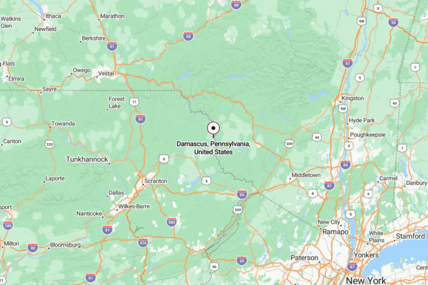
Along PA-371/191, about 20 miles northeast of Honesdale, Damascus sits opposite Callicoon, NY. Approaches are winding, with blind hills and long views across pasture.
With few crossings and no highways, the river becomes a calm moat. It’s a straight line on a map and a lovely detour in real life.
13. Starrucca, Susquehanna County
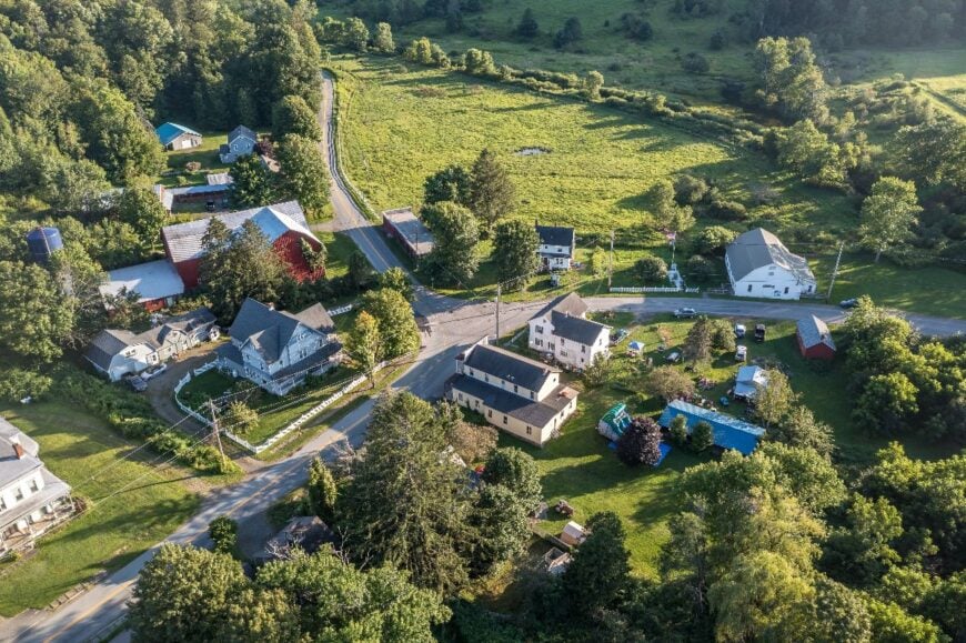
Starrucca tucks into a crease of hills where its namesake creek braids through alders and farms. Seclusion lingers because no major routes bother to come this way; the borough dozes at the end of a set of quiet township roads.
The vibe is properly country: church suppers, tractors at sunrise, and a post office that knows everyone by their dogs. Walk shaded lanes along the creek, birdwatch the hedgerows, detour to the mighty Starrucca Viaduct in nearby Lanesboro, or angle for wild browns in pocket water.
Farming, small trades, and long commutes make up the week’s work. When fog lifts off the creek, the day arrives soft as flannel. Starrucca is small on purpose.
Where is Starrucca?
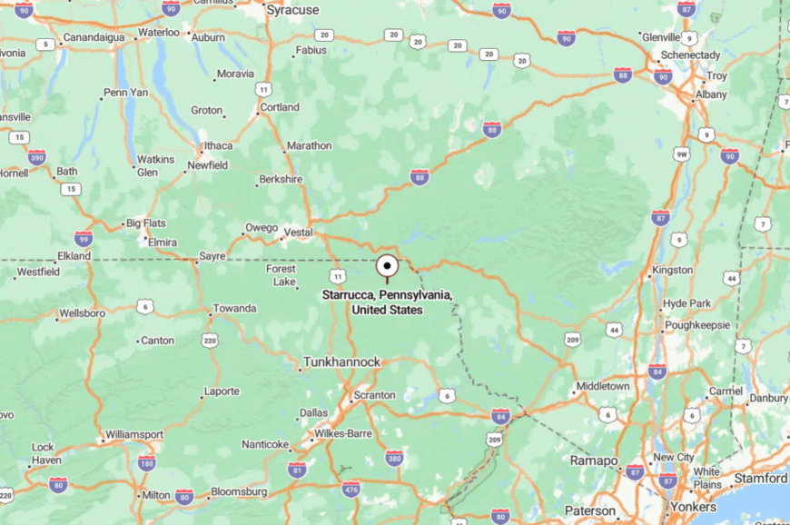
In the far northeast of Susquehanna County, Starrucca sits about 18 miles northeast of Montrose and 12 miles west of Susquehanna Depot. Drivers peel off PA-29 onto township roads that narrow and rise.
Winter keeps traffic honest; summer keeps it slow. It feels tucked between hills that the map barely shows.
12. Noxen, Wyoming County
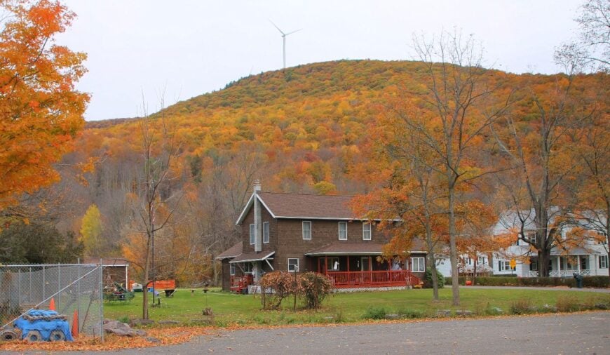
Noxen gathers where Bowman Creek slides out from the highlands, a trouty, tea-colored stream that writes the town’s lullaby. Its secluded feel comes from being pressed against game lands and far from interstates, with most folks arriving for a reason, not a shortcut.
The vibe is porch-swing simple—fire company carnivals, church bake sales, and anglers swapping hatch notes outside the store. Fish Bowman Creek, climb to the old fire tower, wander Ricketts Glen’s waterfalls a few ridges over, or spot eagles over the Susquehanna flats.
Trades, timber, and school jobs share calendars with guides. After dark, the creek and peepers take over the soundtrack. Noxen is proof that “small” and “alive” pair just fine.
Where is Noxen?
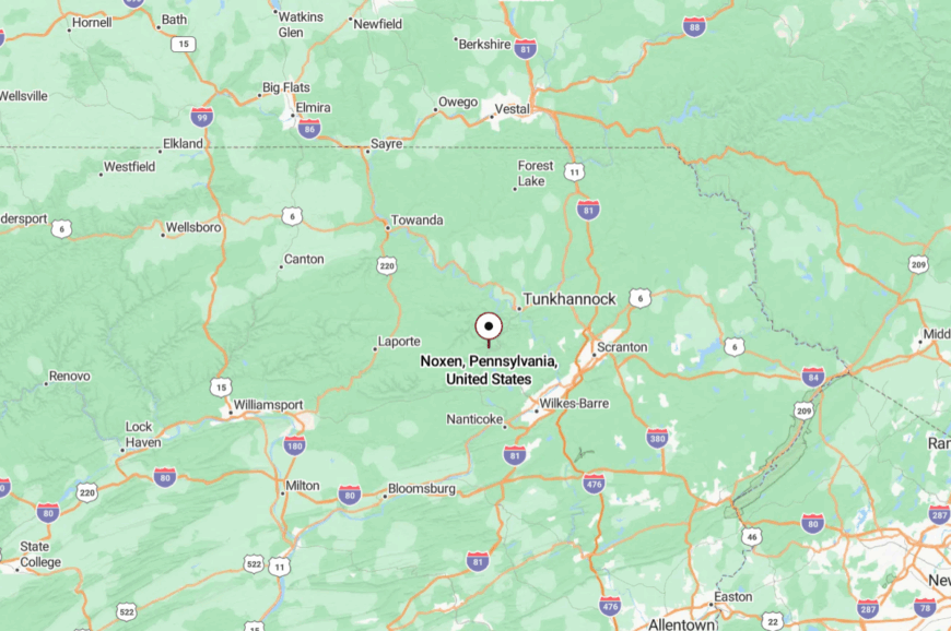
On PA-29, about 25 miles northwest of Wilkes-Barre, Noxen sits near the foot of the Poconos’ northern tier. The approach rolls through farms, then tightens as hills lean in.
With I-81 and I-80 well offstage, only local traffic finds these bends. It’s an easy drive that ends in an easier pace.
11. Birchrunville, Chester County
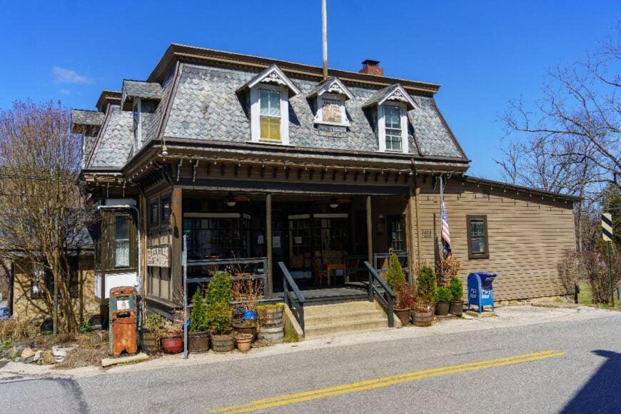
Birchrunville is a hamlet of stone walls, springhouses, and a single crossroads shaded by old maples—rural Chester County at a whisper. Seclusion comes not from distance but from design: weight-restricted bridges, narrow lanes, and steep hollows that keep big traffic out.
The vibe is quietly refined—artisans in carriage houses, a beloved country store, and creekside meadows where barn swallows skim at dusk. Browse the historic district, walk along Birch Run under sycamores, linger over a farm-to-table supper, or time your visit for the annual arts fair that spills gently onto the green.
Horse farms, small workshops, and remote work sustain the week. When evening light sifts through the leaves and the creek talks to stones, hurry feels impossible. Birchrunville is a secret kept politely.
Where is Birchrunville?
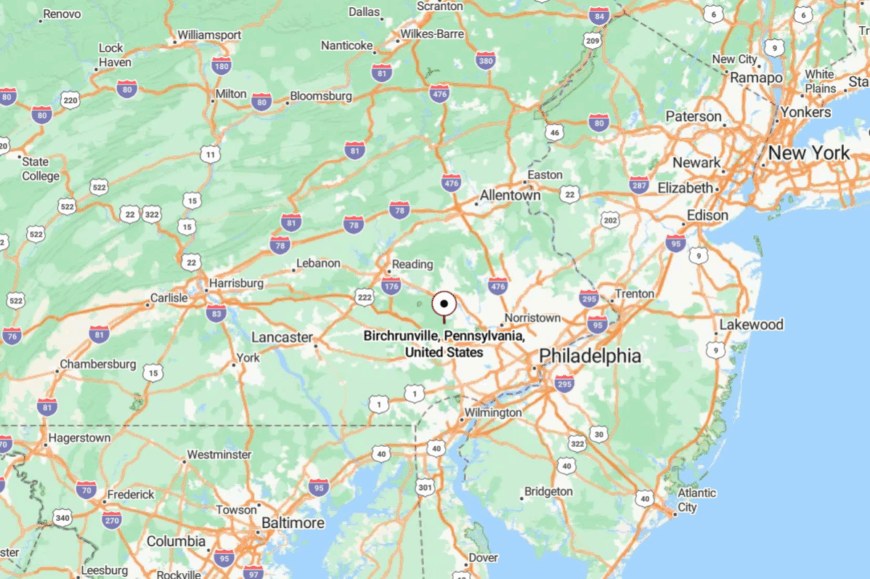
Tucked in West Vincent Township north of PA-401, the hamlet sits about 10 miles west of Phoenixville and 8 miles north of Exton. Access comes by way of one-and-a-half-lane roads like Flowing Springs and Hollow Road, with a few old bridges acting as natural speed governors.
There’s no direct highway; visitors detour off PA-100 or US-202 and then slow willingly. It’s near everything—and blissfully apart from it.
10. Lehigh Tannery, Carbon County
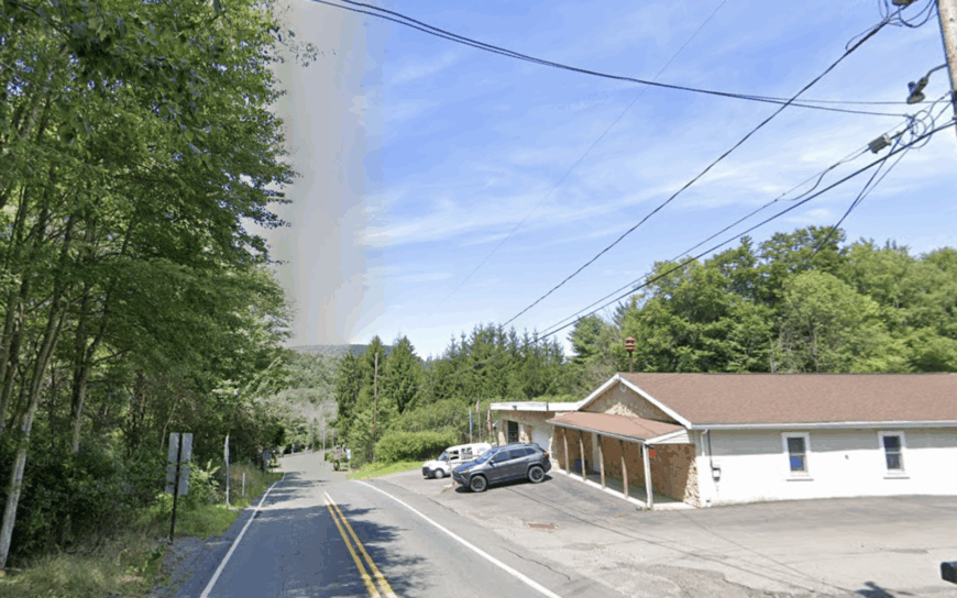
Home to roughly 60 year-round residents, Lehigh Tannery sits along a sweeping bend of the Lehigh River where hikers step directly onto the Delaware & Lehigh rail-trail and anglers wade for wild trout.
We find abandoned tannery foundations beside riverside cabins, while whitewater outfitters meet paddlers at a hidden put-in that never feels busy. Seasonal rentals and a small cluster of artisans selling woodcraft make up the scant local economy, with most services in White Haven eleven miles away.
A single forest-service lane substitutes for a main street, and steep canyon walls absorb nearly every cell signal, reinforcing the sense of isolation. Outdoor recreation, from biking to cross-country skiing, replaces nightlife, and black bears are spotted more often than delivery trucks.
The settlement’s antiquated charm, combined with the surrounding 6,000 acres of game lands, keeps Lehigh Tannery firmly off the beaten path.
Where is Lehigh Tannery?
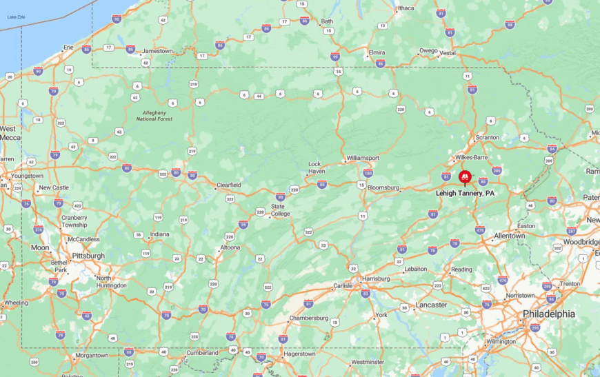
The cabins hug the western rim of Lehigh Gorge, south of the I-80 split but a solid 25 minutes from the nearest exit. Because the only access is by Rockport Road, a graded gravel track that closes after heavy snow, spontaneous visits are rare.
Travelers typically park in White Haven and follow the D&L Trail by bike or arrange a shuttle through a local outfitter. The gorge’s rugged topography and absence of paved roads seal Lehigh Tannery into its own quiet world.
9. St. Peters Village, Chester County

St. Peters Village counts about 200 permanent residents, most living in 19th-century stone cottages clustered above French Creek. Visitors scramble over house-sized boulders in the creek’s gorge, browse a tiny bakery known for molasses shoofly pie, and explore the ruins of an iron forge once powered by nearby chromite veins.
A handful of galleries and an inn employ locals, but tourism never overwhelms thanks to a strictly limited parking area. Thick hardwood forest, protected by the adjacent State Game Lands 43 and French Creek State Park, blocks encroaching development.
Streetlights are absent, and the closest highway interchange is 17 rural miles away, which preserves dark skies and hushed evenings. Together these factors grant St. Peters a lost-in-time atmosphere rare in southeastern Pennsylvania.
Where is St. Peters?

The village lies in northern Chester County, roughly equidistant from Pottstown and Exton but accessible only by twisting St. Peters Road. Dense tree cover and the creek’s rocky gorge isolate the settlement from suburban sprawl that begins just a few ridges south.
Drivers exit Route 100 or Route 23, then wind ten more miles through farmland before stone façades appear. Limited parking and narrow lanes keep traffic to a trickle, allowing the creek’s rush to remain the loudest sound.
8. Andreas, Carbon & Schuylkill Counties
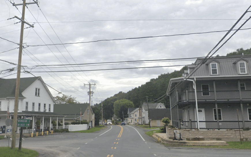
Around 800 people live in Andreas, spread among Victorian farmhouses, converted slate-quarry cottages, and two hillside wineries that pour Chambourcin with sunset views.
Weekends bring cyclists to the D&L Trailhead at nearby Slatington Gap and birders to Bake Oven Knob’s raptor lookout, yet the village itself stays quiet save for a seasonal farmers’ stand selling heirloom apples.
Small vineyards and family farms form the economic backbone, while a microbrewery in a former feed mill adds a modest nightlife option. No chain restaurants or strip malls intrude, and population density hovers below 100 houses per square mile.
Tree-covered ridges to the north and former quarry lands to the south act as natural buffers, muffling highway noise. All told, Andreas feels tucked into its own vineyard-draped pocket of the Blue Mountain foothills.
Where is Andreas?
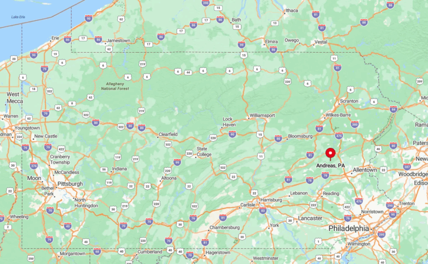
The crossroads straddles the Carbon-Schuylkill county line, nine miles west of Palmerton and nearly 30 miles from the Lehigh Valley’s busiest exits. Approaches follow Route 895, a two-lane byway that threads farm fields and old slate pits before dipping into the hamlet.
Public transit does not reach this far, so visitors drive or cycle in, passing only a handful of mailboxes along the way. With no commercial sprawl and mountains hemming it on three sides, Andreas remains blissfully secluded.
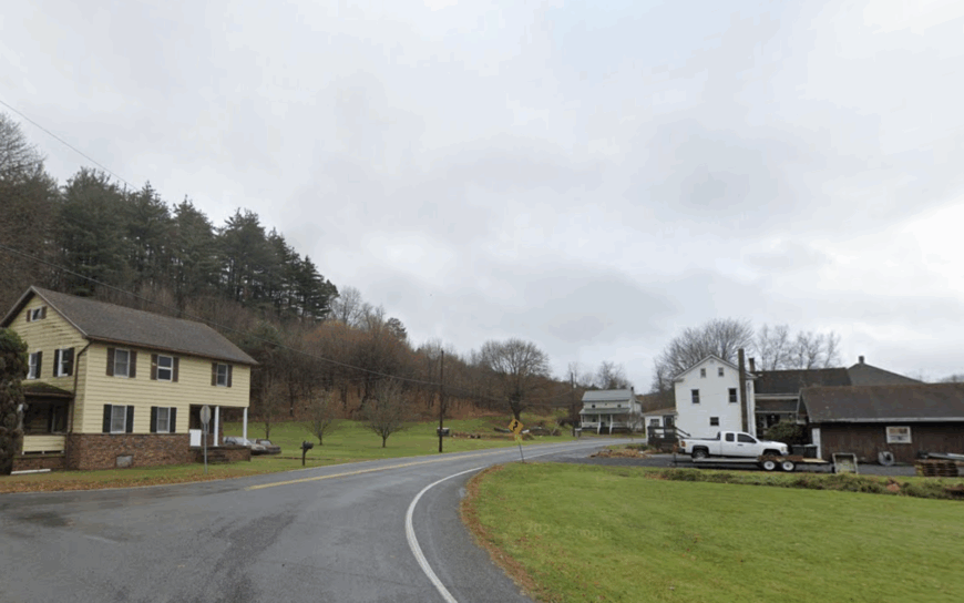
7. Germansville, Lehigh County

Germansville hosts about 750 residents in stone farmsteads and cedar-clad homes nestled among rolling cornfields beneath Blue Mountain. Locals gather at a single general store for scrapple sandwiches, fish for perch at nearby Ontelaunee Park, or attend the annual tournament at the Germansville Rod & Gun Club.
Agriculture—mostly feed corn and dairying—dominates employment, supplemented by maple syrup producers who tap the ridge’s sugar maples each spring. The village sits 25 minutes from Allentown’s bustle, yet a web of twisting township roads discourages casual traffic.
Large wooded tracts shield it from light pollution, turning clear October nights into prime stargazing events. Combined with zoning that favors one-to-three-acre lots, these factors give Germansville a sense of breathing room hard to replicate closer to the metro core.
Where is Germansville?
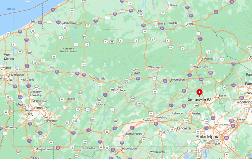
Set in northwestern Lehigh County, the community rests just south of Bake Oven Knob but far from any four-lane highway. Travelers leave Route 309 at New Tripoli, then meander six miles along Mountain Road, flanked by silos and hedgerows.
Absence of public transit and winter-slick switchbacks limit through traffic, leaving tractors as the most common vehicles on dawn patrol. Those natural and logistical barriers cement Germansville’s peaceful reputation.
6. Zion Grove, Schuylkill County
With a population close to 350, Zion Grove dots its rural crossroads with clapboard houses, a volunteer fire hall, and fields of corn and Christmas trees that stretch to the horizon.
Weekend visitors stop at Knoebels’ covered-bridge campground 30 minutes away or hike Weiser State Forest’s Roaring Creek Tract, returning to Zion Grove for pie at a kitchen that operates out of a converted barn.
Farming remains the chief livelihood, though seasonal tree-cutting and small-batch maple operations fill winter calendars. The nearest four-lane road lies 18 miles off, and cell coverage fades behind the ridges of Little Mountain, keeping digital intrusion at bay.
Evenings feature little more than peepers in the creek and the distant hum of a combine. That lack of distraction highlights Zion Grove’s enduring tranquility.
Where is Zion Grove?
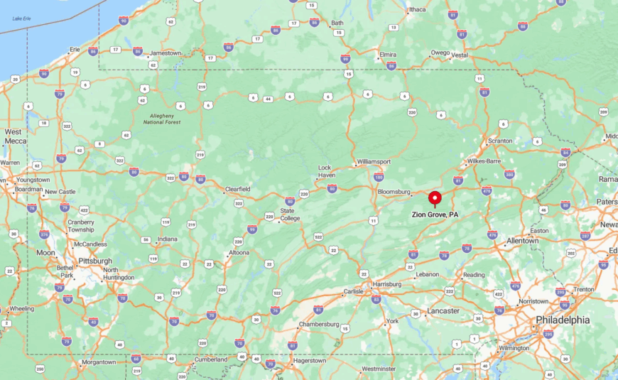
The hamlet sits in northern Schuylkill County, roughly halfway between Hazleton and Bloomsburg but reached only via Route 339, a winding two-lane. Appalachian ridges flank both sides, and tight S-curves naturally slow traffic.
Drivers leaving I-81 at Nuangola face a rural 25-minute trek past hay bales and pole barns before spotting Zion Grove’s modest steeple. Those topographic bottlenecks keep the settlement hushed year-round.
5. Starlight, Wayne County
About 400 permanent residents call Starlight home, living on ridgetop homesteads that overlook the West Branch of the Delaware River. Guests book rooms at century-old inns, fish legendary cold-water runs, or browse the quirky two-room library housed in a former blacksmith shop.
Employment centers on hospitality, fly-fishing guiding, and sustainable forestry, while a revived maple-syrup cooperative bottles award-winning amber nearby. Dense hardwood stands wrap the village, and the closest chain supermarket is a 30-minute drive south to Honesdale.
Night skies live up to the town’s name thanks to the ridge’s elevation and lack of ambient light, making meteor showers a community event. The blend of historic charm, outdoor recreation, and geographic remoteness sustains Starlight’s secluded allure.
Where is Starlight?

Starlight rises on a ridge just east of Pennsylvania Route 191, a serpentine road bordering New York’s Catskill foothills. Limited public transport and winter road closures across the river discourage casual passage.
Visitors usually exit I-84 at Milford, then meander nearly an hour north through forest and farm valley. Those winding miles, coupled with river and ridge barriers, keep Starlight well off tourist trails.
4. Lake Como, Wayne County
Lake Como supports fewer than 300 year-round residents, most living in clapboard cottages that line its glassy, spring-fed lake. Summer brings kayaking, pickerel fishing, and evening swims at the community beach, while autumn features back-road foliage drives straight into Hancock, New York.
Small dairy herds and a boutique goat-cheese creamery anchor the sparse local economy, joined by two B&Bs that host birdwatchers chasing bald eagles along the Delaware flyway. Gravel roads rim the lake, and zero streetlights protect the region’s famous star-studded sky.
With no commercial strip within 20 miles, deliveries arrive once weekly, and residents often grow their own vegetables. The resulting mix of self-reliance and lakeside calm defines Lake Como’s seclusion.
Where is Lake Como?
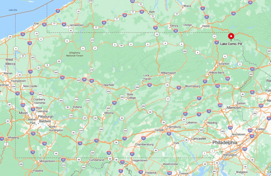
Nestled just south of the New York border, Lake Como sits off Route 247, a narrow ribbon threading dairy pasture from Forest City to Union Dale. The absence of major bridges over the Delaware in this stretch forces most visitors to approach from the south, lengthening travel time.
Public buses stop 18 miles away in Honesdale, so access is strictly by car. Rolling farmland and a lack of through-roads create a natural buffer that keeps traffic at a whisper.
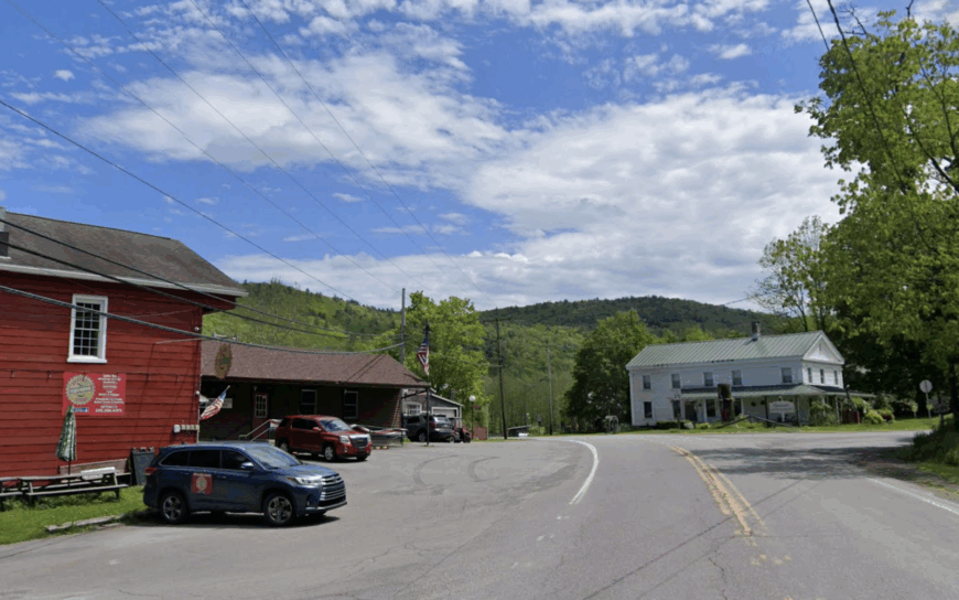
3. Promised Land Village, Pike County

Only about 75 residents occupy Promised Land Village through winter, their off-grid cottages scattered among 12,000 acres of state-park wilderness. Visitors kayak Promised Land Lake, hike the Bruce Lake Natural Area, or watch loons glide past a secret nesting island known mostly to locals.
Seasonal employment revolves around park services and a handful of family-run cabin rentals, with no permanent commercial center in sight. Lot sizes start at one acre, and many cabins power lights via solar panels or propane lanterns, deepening the feeling of retreat.
Forest in every direction deadens highway rumble, and after dusk the nearest glow appears on the horizon over Scranton, 30 miles west. Such raw surroundings cultivate a quiet rare even in the Poconos.
Where is Promised Land?
The settlement perches on the Pocono Plateau off Pennsylvania Route 390, midway between Newfoundland and Blooming Grove. Steep grades and snow-packed winters often close smaller park roads, leaving a single plowed route in and out.
The closest interstate, I-84, sits 14 curvy miles away, and cell reception vanishes beside dense hemlocks. That geographic isolation, combined with state-park boundaries, ensures Promised Land Village remains a true hideaway.
2. Shohola Falls Hamlet, Pike County

Shohola Falls Hamlet counts roughly 150 inhabitants living in cedar cabins tucked within earshot of its roaring 50-foot waterfall. Day-trippers hike the Shohola Marsh Trail, watch osprey fish the reservoir, and photograph night-fog rising over the hemlock gorge.
Local jobs stem from a tiny outfitter, a seasonal canoe livery, and trout-hatchery work downstream, but large-scale commerce never took root here. A 70-percent undeveloped buffer of state game lands, plus a 15-mile drive to Milford, keeps crowds light even on holiday weekends.
Residents share a communal picnic pavilion instead of a town square, and evenings echo with nothing louder than the falls themselves. The hamlet’s wilderness envelope preserves both wildlife habitat and a meditative hush.
Where is Shohola Falls?

Found off Route 6 near the New York border, the hamlet hides behind a gate on Old Shohola Falls Road that deters casual sightseers. Dense forest and the broad Delaware River sever direct routes, so motorists approach from the west via Lords Valley.
No bus or rail service reaches this corner, and winter icing can make the final gravel mile impassable without four-wheel drive. These natural choke points seal Shohola Falls into its own watery sanctuary.
1. Equinunk, Wayne County
Equinunk’s permanent population hovers near 250, residing in 19th-century farmhouses scattered along a quiet bend of the Upper Delaware River. Anglers cast for smallmouth bass, paddlers drift past bald-eagle nests, and history enthusiasts explore the Equinunk Historical Society’s log building stuffed with canal memorabilia.
Small-scale agriculture and river guiding supply most jobs, with one general store doubling as both post office and coffee stop. The village lies a full 25 miles from the nearest traffic light, and surrounding state game lands swallow cell signals, emphasizing its remoteness.
Multi-acre parcels and a covered bridge over Equinunk Creek enhance the timeless feel. All this combines to make Equinunk a frontier-like outpost in an otherwise busy Northeast corridor.
Where is Equinunk?

The hamlet rests in northern Wayne County, just south of the New York line, reached by River Road after it narrows to a winding lane between cliffs and the Delaware. With the nearest bridge crossing 12 miles upstream, most visitors approach from the Pennsylvania side, ensuring minimal through traffic.
Public transit ends in Honesdale, an hour south, so arrival requires a car and a willingness to navigate unmarked county roads. River bluffs, game lands, and distance from major arteries keep Equinunk peacefully detached from modern rush.