🔥 Would you like to save this?
Northern Georgia’s high country is dotted with pockets of quiet where cell-service bars vanish, gravel roads outnumber paved ones, and night skies still look like velvet. These out-of-the-way communities never make glossy travel magazines, yet photographers, anglers, and solitude-seekers whisper about them over campfires.
Our countdown explores 25 of those mountain hamlets, moving from the merely tucked-away to the truly hidden. Each offers its own mix of misty dawns, vintage barns, and back-road charm, while earning its seclusion through distance, topography, or both.
In order to come up with the very specific design ideas, we create most designs with the assistance of state-of-the-art AI interior design software.
We share a snapshot of daily life, what there is to do, and how to reach each spot without turning the writing into a marketing brochure. Pack a paper map and enjoy the quiet side of the Blue Ridge.
25. Epworth – Rolling Hills and Railroad Whistles on the Edge of the Wilderness
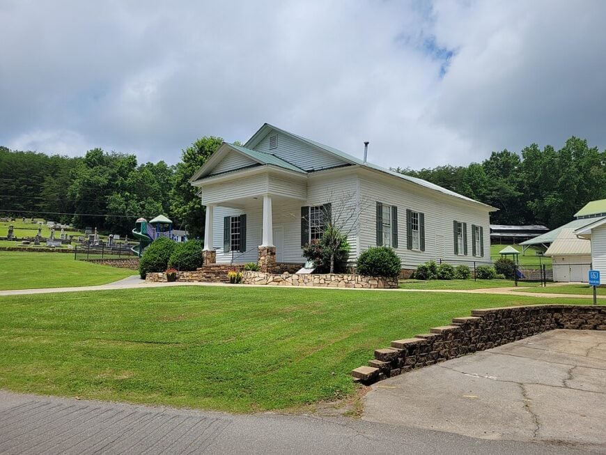
Epworth sits quietly just south of the Tennessee line, where long pastures meet forested ridges and the morning train still blows through like it has for a century. With fewer than 500 residents, this unincorporated spot remains little more than a few crossroads, a handful of homes, and fields edged with wildflowers.
Time feels paused here. Tractors idle at dusty corners, and the old Methodist church still opens its doors on Sundays to a thinning congregation.
Epworth’s stillness comes not from isolation by distance, but from being overlooked entirely—a dot on the map where nothing flashy ever happened, and that’s exactly why it’s stayed so peaceful.
Where is Epworth?
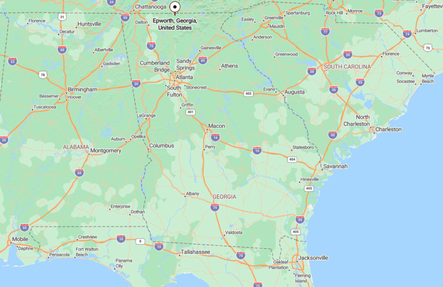
Epworth is nestled in southern Fannin County along Georgia Highway 5, just minutes from the Tennessee border and halfway between Blue Ridge and McCaysville.
Despite its location, most travelers speed past without notice, never taking the quiet turn-offs where the real heart of the town hides behind the tree line and gentle bends in the road.
24. Morganton – Lake Mist and Forgotten Corners Near Blue Ridge
Though it once served as a county seat, Morganton has long since returned to its sleepy roots. Just a few streets, an old brick city hall, and views across the misty waters of Lake Blue Ridge give this spot its simple charm.
Locals still fish the coves at dawn or gather for small-town festivals few outsiders hear about. Its lakefront isn’t packed with resorts—it’s front porches and jon boats instead of marinas and mansions.
Morganton’s hush owes to its tucked-away position along a quiet bend in the road and a bypassed shoreline, where the water and hills absorb the noise of the modern world.
Where is Morganton?
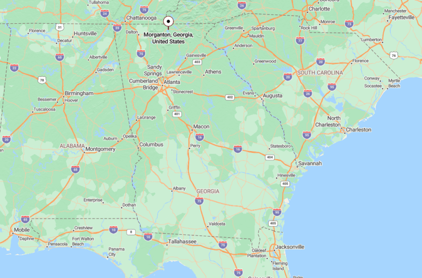
Morganton lies in central Fannin County, about six miles east of downtown Blue Ridge, just off Highway 60 and close to the shores of Lake Blue Ridge.
Though near popular recreation spots, it remains shielded by hills and backroads that funnel most traffic elsewhere, preserving its peaceful lake-town rhythm.
23. Rabun Gap – A Mountain Hollow Watched Over by Ridgelines
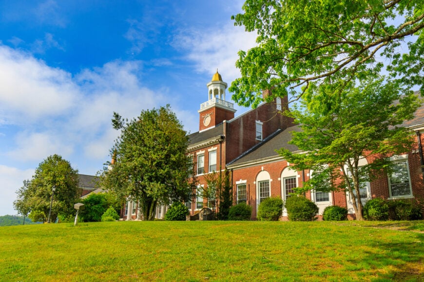
Rabun Gap rests in a narrow valley surrounded by steep wooded slopes, where old barns lean into the wind and morning fog clings like a shawl over the fields.
It’s known mostly for the historic Rabun Gap-Nacoochee School, but outside the campus, the landscape is a quilt of pasture, forest, and homestead—quiet, slow, and utterly unbothered.
The mountains here don’t just rise—they shelter, and it’s that natural bowl that keeps the town hidden from the rush on nearby highways.
Where is Rabun Gap?
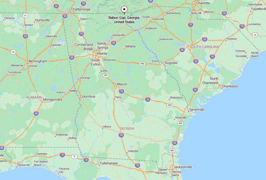
Found in northern Rabun County between Dillard and Mountain City, Rabun Gap sits just off U.S. 441, though you wouldn’t guess it from the tranquility that settles over the valley.
The surrounding peaks create a tucked-away feel, and the narrow feeder roads discourage all but intentional travelers.
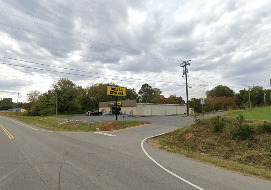
22. Pine Log – An Echo of Yesteryear in Bartow’s Wooded Hills
Pine Log whispers of the past. With a scattering of homes, a church, and a historic school building turned community center, this little settlement feels suspended in amber.
Families here still gather for summer cookouts at Pine Log Creek, and quiet drives reveal fields broken only by hand-built fences and the occasional deer trail.
The seclusion isn’t geographical—it’s cultural. Pine Log simply never grew, never chased the modern world, and remains the kind of place where people still wave from their front porch.
Where is Pine Log?
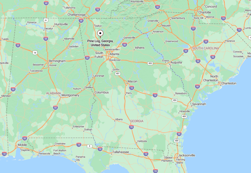
Pine Log lies in northern Bartow County, nestled between Adairsville and Fairmount near the foothills of the Appalachian range.
Accessed by narrow county roads off U.S. 411, it’s far enough from urban sprawl to feel truly rural, but close enough to vanish under the radar.
21. Tennga – A Border Blip with Rail Ties and Mountain Views
Tennga is little more than a blink between Georgia and Tennessee—hence the name—but what it lacks in size it makes up for in mood.
A rail line slices through town with regularity, but that’s the only sound louder than a whip-poor-will. The surrounding hills roll gently outward, cradling pasture, pine, and stillness.
Here, folks measure time by seasons, not schedules, and the only real “traffic” is the occasional crossing guard arm descending with a soft clank.
Where is Tennga?
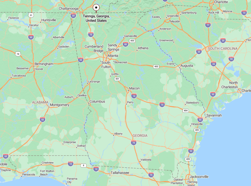
Tennga lies at the northernmost edge of Murray County, straddling the Georgia-Tennessee border along U.S. Highway 411.
Despite the highway, it’s easy to pass by without ever seeing the small roads and sleepy homes tucked just out of sight from the blacktop.
20. Young Harris – Hidden Hillside Charm Between Two Colleges and a Cloud
Young Harris may host a college, but it’s hardly bustling. Tucked in a valley hemmed by Brasstown Bald and other soaring peaks, the town floats in and out of mountain mist.
The streets feel borrowed from another era—quiet, lined with cottages and the scent of woodsmoke in fall. Students and locals alike seem to savor the quiet as much as the views.
The seclusion comes from elevation and topography; the town is folded into the land like a secret kept by the hills.
Where is Young Harris?
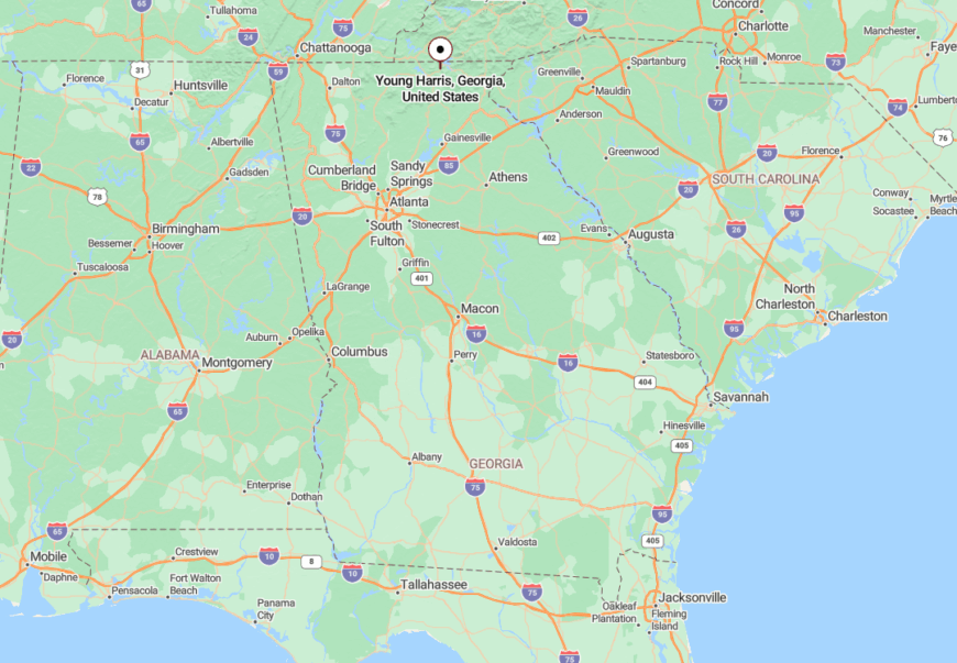
Young Harris sits in Towns County, just west of Hiawassee along U.S. 76, in Georgia’s northeastern corner near the North Carolina border.
Though technically connected by highway, the surrounding mountains mute the outside world, and the town seems to disappear into the landscape with surprising ease.
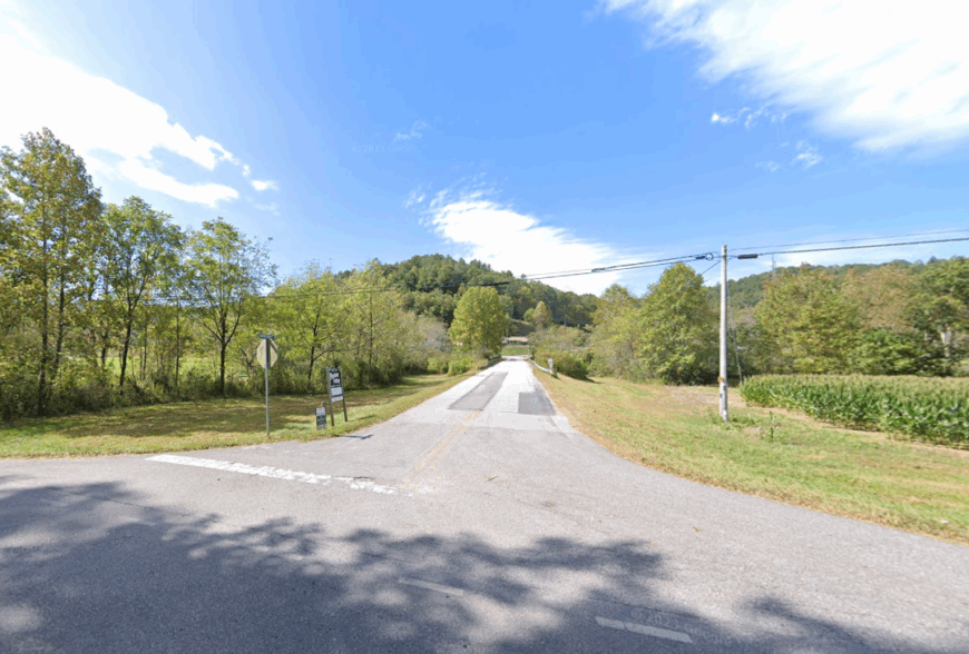
19. Gaddistown – Forest Trails and Whispering Streams Below Blood Mountain
🔥 Would you like to save this?
Gaddistown isn’t so much a town as a glen—a leafy, quiet hollow where forest trails emerge beside gurgling streams and black bears outnumber tourists.
You’ll find a few homes tucked between laurel thickets and winding gravel lanes, but not much else. Nature calls the shots here.
The silence is elemental—broken only by rain on leaves or a lone hiker’s footsteps. If you weren’t looking for it, you’d never know it was here.
Where is Gaddistown?
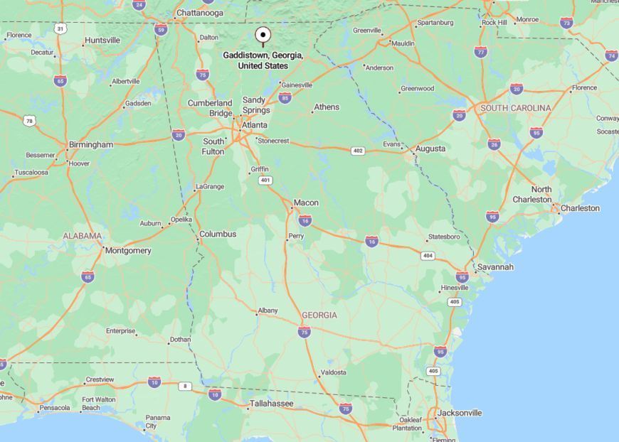
Located in Union County southeast of Suches, Gaddistown is accessed by gravel forest service roads and primitive trails just west of Blood Mountain.
It sits entirely within the Chattahoochee National Forest, and getting there requires commitment and a good suspension.
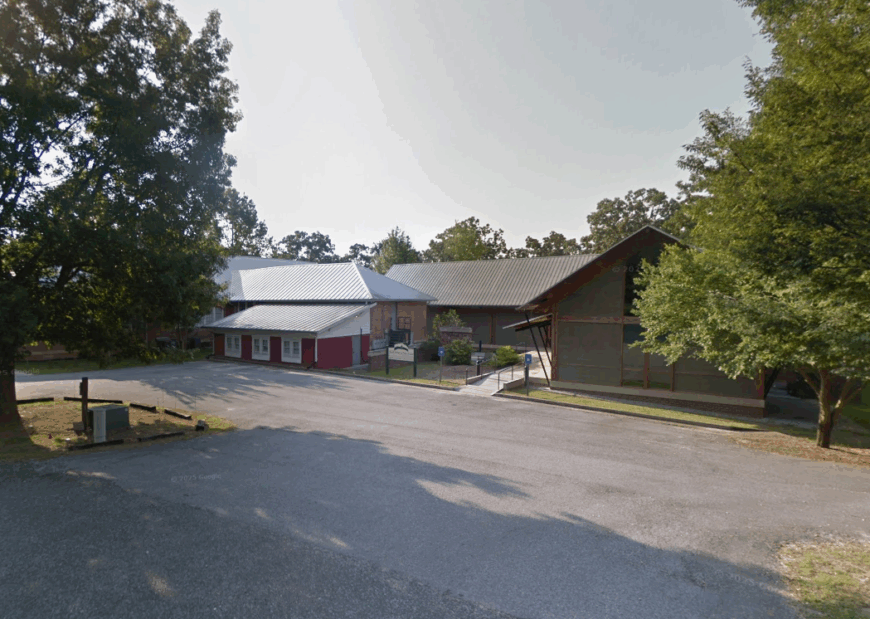
18. Turnerville – Waterfalls, Ferns, and Forgotten Crossroads in Habersham County
Turnerville is the kind of place where old gas stations sit shuttered but still admired, and where you can hear a creek before you see a house.
Its biggest attraction—Tallulah Falls—is technically nearby, but Turnerville itself lives off to the side, down backroads flanked by blooming rhododendrons and low stone walls.
It’s a lovely secret, nestled in the foliage and missed by most maps and minds.
Where is Turnerville?
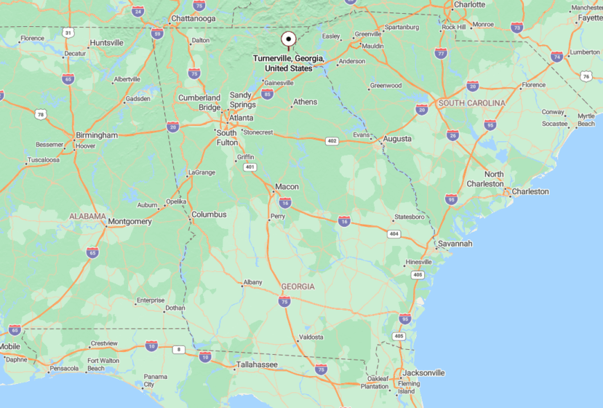
Turnerville lies in northeastern Habersham County, about five miles southeast of Clarkesville off Georgia Highway 197.
Surrounded by woods, waterfalls, and winding roads, the town’s charm is its invisibility—you only find it if you slow down and look for it.
17. Sautee Nacoochee – Fog-Kissed Valley with Historic Roots and Timeless Quiet
Sautee Nacoochee, with its iconic Indian mound and white-steepled church, feels like something out of a painting. The valley holds stories in its soil and stillness in its air.
Artisans and gardeners outnumber business owners, and the morning mist often lingers until noon. The soundtrack is wind, chickens, and the faint clink of pottery from hillside studios.
The land hums with Appalachian memory, and though Helen lies just down the road, this pocket remains unbothered by its touristy cousin—a quiet cradle of craft, culture, and peace.
Where is Sautee Nacoochee?
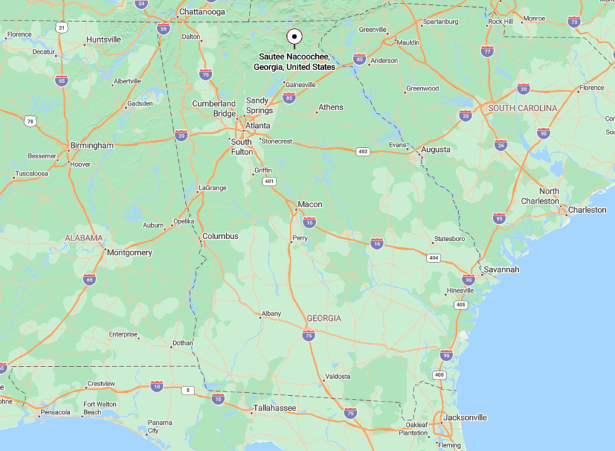
Sautee Nacoochee rests in White County, just a few winding miles east of Helen via Georgia Highway 17, where the Unicoi foothills roll into storybook farmland.
Its separation is more spiritual than physical—the valley shelters itself with mist, forest, and a fierce sense of place, leaving through-traffic behind and letting quiet take root.
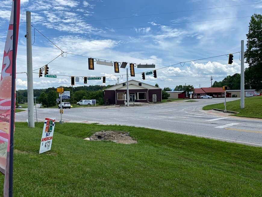
16. Talking Rock – A Whistle-Stop Town with Quiet Charm and a Storied Creek
With fewer than 100 residents and a name born from Cherokee legend, Talking Rock is as quaint as it is quiet. Antique shops open in century-old buildings, while a peaceful creek trickles behind them, the only sound some afternoons.
The town’s heart beats slowly, centered around a single street where festivals draw neighbors more than tourists. The passing train still rolls by, but most days, you’ll hear more birdsong than boxcars.
Talking Rock stays secluded not because of remoteness—but because of restraint. It never tried to be more than what it is: a still, small town where stories flow like the water it’s named for.
Where is Talking Rock?
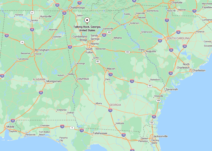
Talking Rock lies in northern Pickens County just off Highway 515, between Jasper and Ellijay. Though the highway hums nearby, the town sits quietly just beyond earshot.
Its tucked-away position on Talking Rock Creek and modest footprint leave it out of most travel plans—perfect for those who want to linger somewhere unhurried.
15. Ivylog – A Half-Hidden Hamlet in a Bowl of Blue Mountains
Ivylog isn’t a town so much as a memory folded into the mountains. A few homes, a timeworn church, and views that stretch across meadows into the mist mark this spot as something rare and untouched.
The land dips gently toward Ivy Log Creek, framed by distant ridgelines that color from green to blue with the light. Even longtime Union County residents speak of it softly, as if guarding a secret.
What keeps Ivylog quiet is how the landscape hugs it—gently closing it off from the modern world like a hand around a flickering candle.
Where is Ivylog?
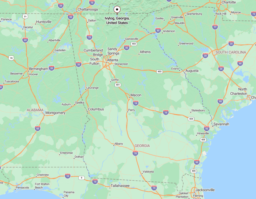
Ivylog sits in far northern Union County near the North Carolina border, a short drive from Blairsville on U.S. 19.
Though not far in miles, its rural curves and lack of development make it feel far removed—just a church bell, a breeze, and the hush of mountains all around.
14. Mineral Springs – Gentle Valleys and Still Waters Off the Main Road
Tucked between ridges and skirted by slow creeks, Mineral Springs lives up to its name: soft, clear, and full of quiet flow. Few people live here full-time, but those who do speak of deer at dusk and stars thick enough to make wishes on.
Old cemeteries rest beneath mossy oaks, and handmade mailboxes peek out from roadside thickets. It’s a place where you might find a bent rocking chair on a porch with no one in sight.
Mineral Springs isn’t marked by commerce or signage. It exists in a hush, folded gently into the lowlands where gravel crunches under tires and time wanders slowly.
Where is Mineral Springs?
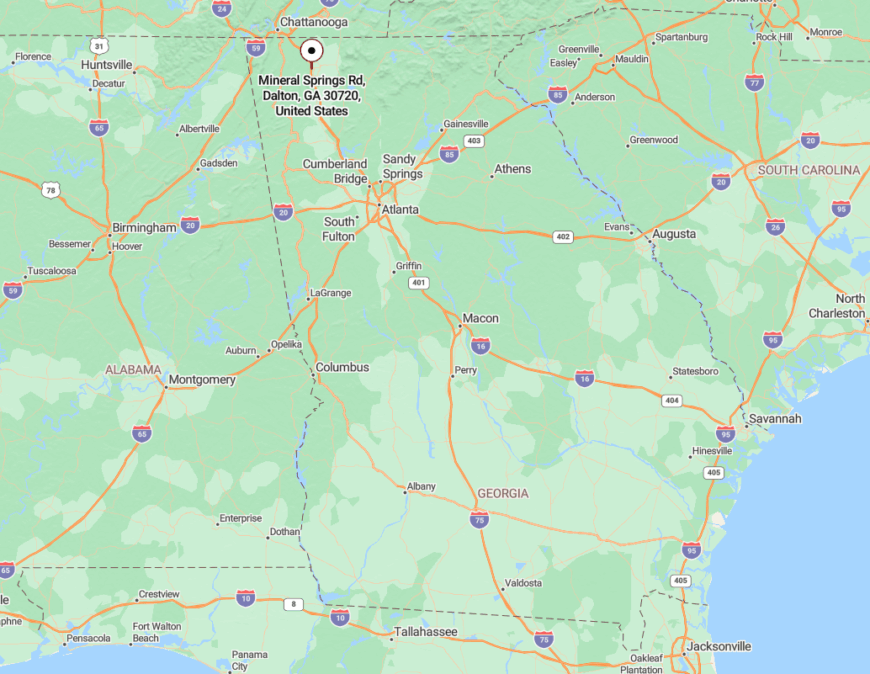
This small community lies in western Catoosa County, between Ringgold and the edge of the Chattahoochee National Forest.
Reaching it requires veering off Highway 151 onto a winding route of backroads. There are no tourist signs, just a gradual retreat into stillness.
13. Murrayville – Farm Roads and Hillside Horizons Near the Chestatee
🔥 Would you like to save this?
Murrayville feels like the middle of nowhere—and for locals, that’s the highest praise. Rolling pastures stretch toward misty woods, and barns wear silvered wood like armor from another time.
It’s a place of cattle gates, gravel pull-offs, and afternoon shadows sliding down from the hilltops. The Chestatee River murmurs nearby, known more to farmers than floaters.
Though just a whisper from Gainesville, Murrayville lives in a different world—rural, rhythmic, and wrapped in layers of quiet.
Where is Murrayville?
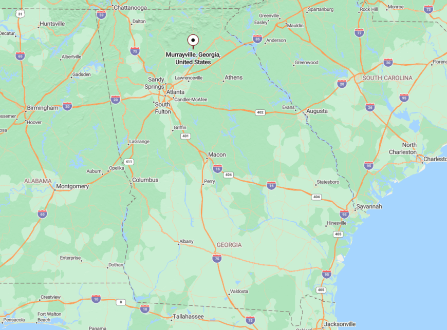
Murrayville sits in northwestern Hall County, about 15 miles north of Gainesville, accessible via GA-60.
The town’s location—midway between lake country and high mountains—keeps it off main tourist trails. Its farmland and forest buffers preserve a pocket of seclusion right under the radar.
12. Coosa – River Crossings and Timeworn Tranquility in Floyd County
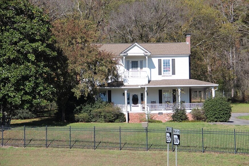
Coosa’s roads lead nowhere quickly—and that’s part of the charm. Settled near the confluence of three rivers, this quiet bend in the land holds scattered homes, quiet woods, and wide skies.
It’s a place where fenceposts tilt, church bells ring on Sundays, and families still keep backyard hens. The silence is not eerie, but earned—a gift from geography and time.
The Coosa River cradles this community like a comma in a sentence long forgotten, pausing life just long enough for peace to settle in.
Where is Coosa?
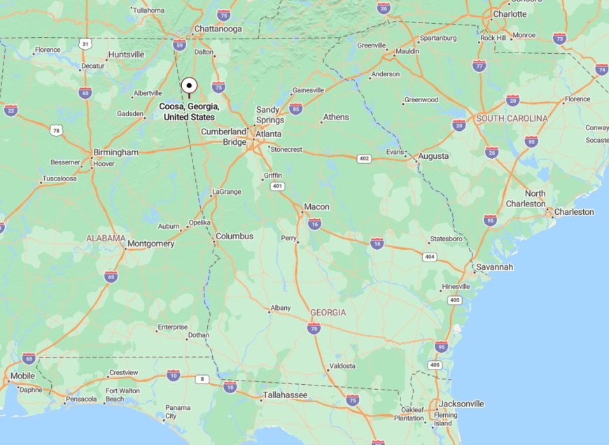
Coosa lies in western Floyd County, about 10 miles west of Rome, where Georgia Highways 20 and 100 briefly converge before slipping back into farmland.
Surrounded by fields, forest, and backwater bends, the town feels miles farther than it is. The rivers shield it like a moat, allowing it to rest in its own rhythm.
11. Red Bud – A Woodland Hamlet Where Springtime Lingers
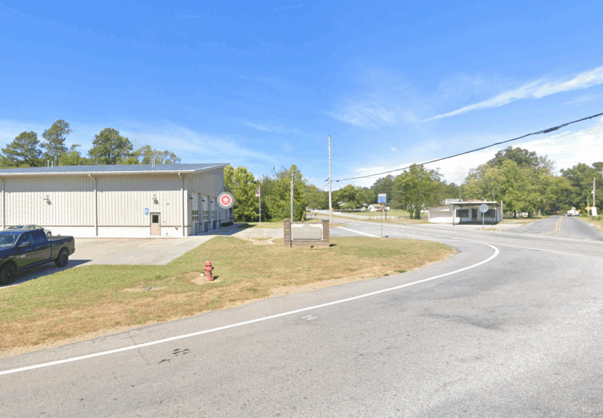
Named for the trees that bloom in violet haze each spring, Red Bud is a soft-spoken place in Gordon County’s eastern hills. It’s mostly farmland and forest now, stitched together with old roads and new wildflowers.
The community holds little in the way of commerce but offers everything in terms of quiet: woodland walks, breezy fields, and the distant hum of bees.
Red Bud’s beauty is seasonal, but its stillness is constant. It’s the kind of place that feels like a breath held gently between one ridge and the next.
Where is Red Bud?
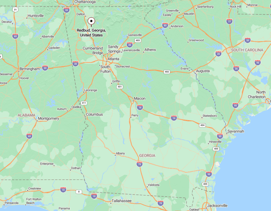
Red Bud lies in northeastern Gordon County, several miles east of Calhoun along Red Bud Road near the edge of the national forest.
Its isolation is owed to a lack of major roads and a geography that curves with the land rather than cutting through it. Here, the world slows down—and stays that way.
10. Tate City – Georgia’s Tiny, Road’s-End Hideaway on the Tallulah River
With roughly two dozen full-time residents, Tate City feels more like a clearing in the forest than a town. Visitors wade the Tallulah River for native brook trout, hike to nearby Chimney Top Gap, or photograph the tin-roof cabins scattered beneath 4,000-foot peaks.
Logging once ruled here; today, the local economy revolves around a sprinkling of vacation rentals, seasonal hunting guides, and a single self-service firehouse. No gas pumps, stores, or streetlights interrupt the scenery, letting crickets and river rapids supply the soundtrack.
Towering ridgelines seal the hamlet from radio signals and traffic noise, underscoring why many Georgians have never heard of it. Those who do find Tate City often return for the honest stillness that hangs in the air.
Where is Tate City?
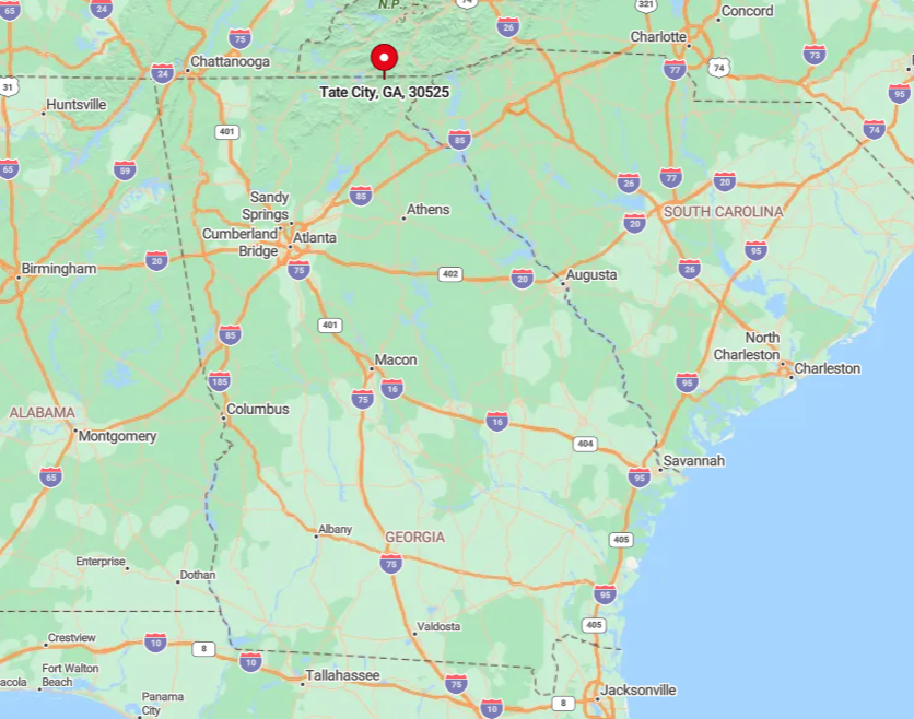
Tate City sits at the extreme northern tip of Rabun County, five miles up a narrow gravel spur off Georgia Highway 76. Hemmed in by the Southern Nantahala Wilderness on three sides, the settlement’s only approach is FS Road 70—a lane so tight that two pickups can’t pass without negotiation.
Rain-slick rock ledges and unguarded drop-offs discourage casual sightseeing, which keeps visitor numbers low. Most travelers reach the area via Clayton, then budget forty slow minutes for the final twelve miles.
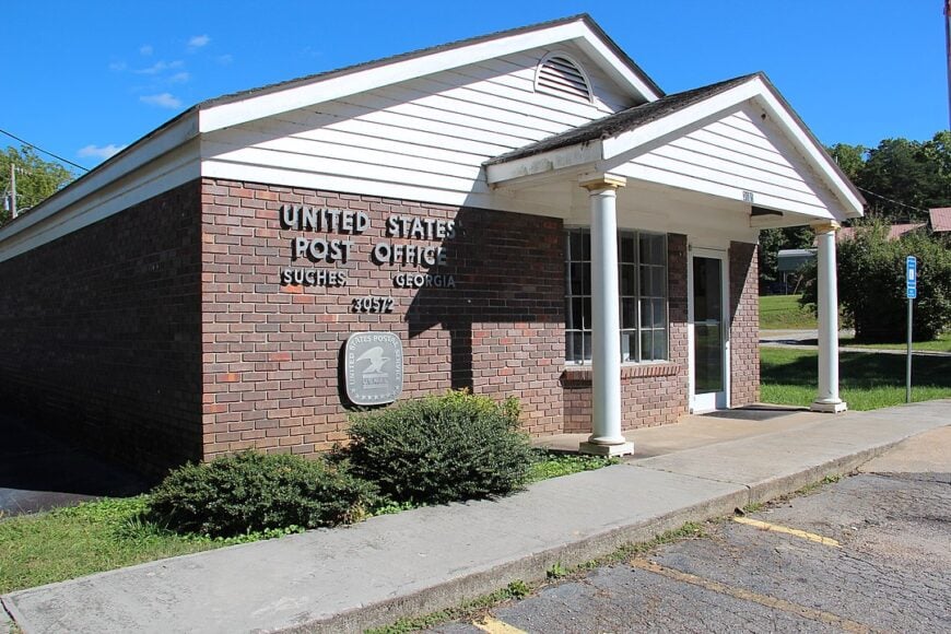
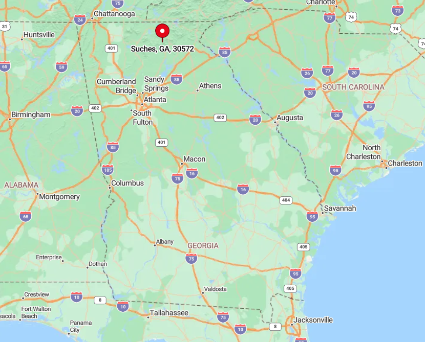
9. Suches – The “Valley Above the Clouds” Ringed by Misty Ridges
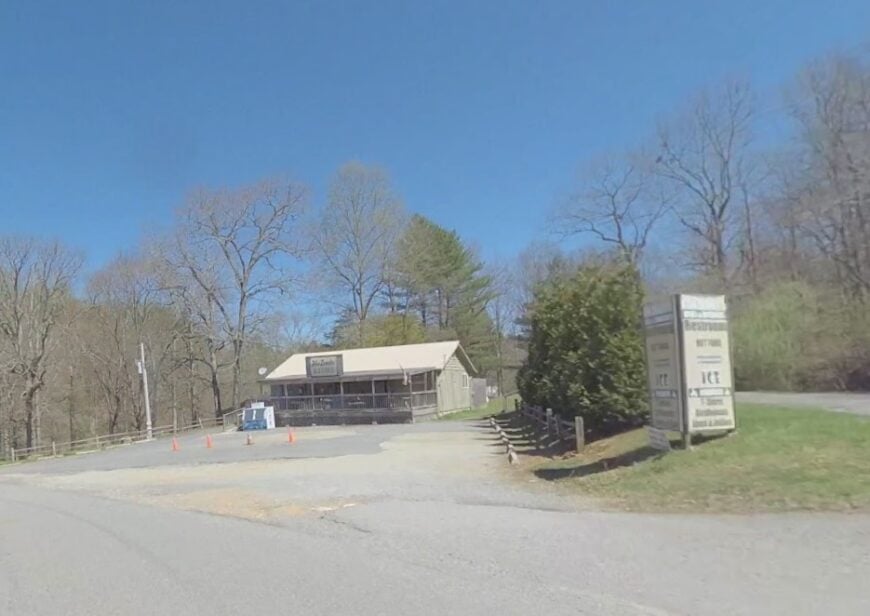
Home to about 900 people spread across hilltop farms, Suches earns its nickname when morning fog pools below the pastures like a white sea. Cyclists tackle the twisting Wolfpen Gap Road, anglers cast into Cooper Creek, and shutterbugs wander rust-red barns backed by layered peaks.
Agriculture—chiefly cattle and hay—still pays many of the bills, supplemented by a handful of mom-and-pop cabin rentals and the annual Sorghum Festival. What keeps crowds thin is elevation: the settlement sits over 2,800 feet, a lofty perch by Georgia standards, and highways approach only from opposite ridges.
Town amenities are limited to a single general store with a gas pump that closes at sundown. Between the long drive and unpredictable mountain weather, the valley’s hush stays intact.
Where is Suches?
🔥 Would you like to save this?
Suches lies in Union County, roughly halfway between Dahlonega and Blairsville, yet more than fifteen curvy miles from each. Georgia 60 climbs two ridges before plunging into the valley, discouraging hurried traffic.
Public transit is nonexistent; most visitors arrive via private car or motorcycle, planning fuel stops in the larger towns beforehand. Once inside the basin, farm lanes replace through-roads, and cloud inversions often block any distant view of civilization.
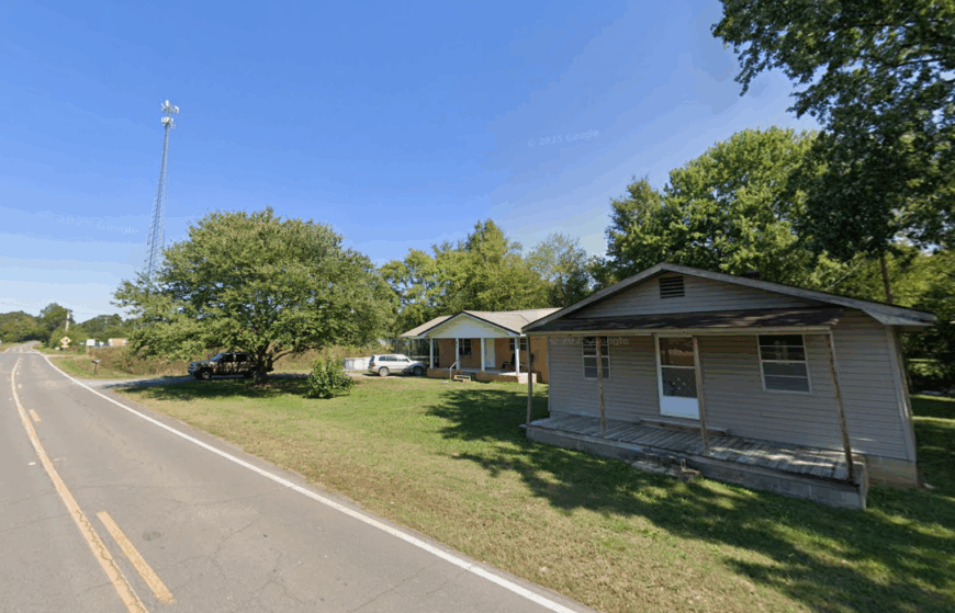
8. Dial – Historic Homesteads Along a Gentle Bend of the Toccoa River
Dial counts barely 150 residents, many living in clapboard farmhouses dating back to the late 1800s. Paddlers drift the Toccoa’s slow oxbows, anglers stalk rainbow trout, and photographers line up wide shots of open meadows framed by white-rail fences.
Small-scale ranching and vacation rentals form the primary income stream, with a historic church doubling as a community hub on Sunday afternoons.
Dial’s separation stems from geography: the river curls on three sides while the Chattahoochee National Forest hems in the fourth, and there’s not a single fast-food sign within ten miles.
Twilight brings the glow of fireflies instead of streetlamps, and the loudest sound may be a screen door closing. That unhurried rhythm draws people craving porch swings over nightlife.
Where is Dial?
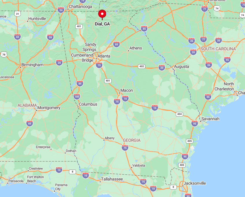
Set in southeastern Fannin County, Dial sits off Aska Road, ten miles south of Blue Ridge’s rail depot. The final approach crosses a one-lane truss bridge, after which asphalt gives way to gravel following the riverbank. No state highway passes through, and GPS directions often fail in the forested bends, so paper maps remain wise.
The closest grocery store is twenty minutes away, which keeps traffic light and preserves the sense of being tucked between water and woods.
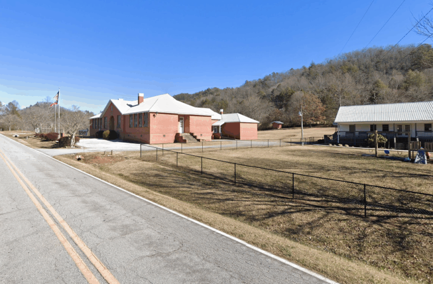
7. Crandall – Quiet Foothill Crossroads at the Edge of the Cohutta Wilderness
Approximately 1,200 residents call Crandall home, yet the settlement feels empty thanks to broad valley fields stretching toward the Cohutta Mountains. Outdoor options pivot around horseback trails, dispersed camping near the wilderness boundary, and leaf-peeping along Holly Creek in autumn.
Poultry farms and timber harvesting dominate the local economy, with a solitary country diner providing the main social venue. Spacious vistas and a lack of big retailers underscore how far Crandall sits from commercial corridors. Cell reception fades near the wilderness, adding another layer of isolation.
It’s a landscape where pick-ups outnumber sedans, and a starry sky remains normal rather than novel.
Where is Crandall?
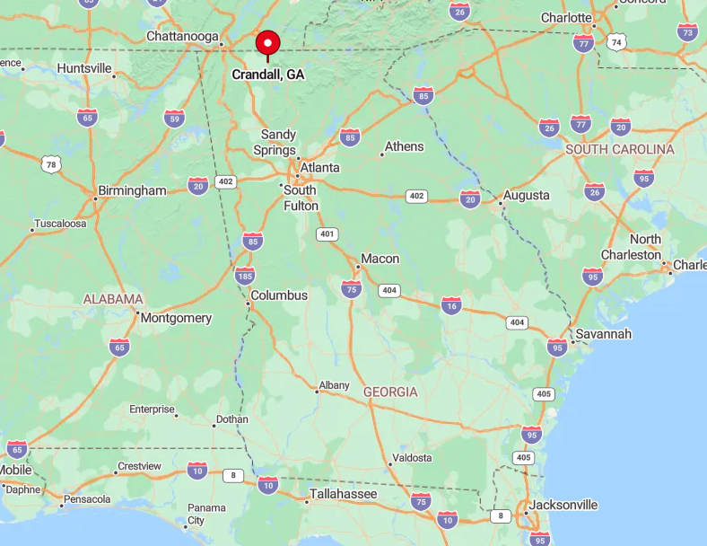
Crandall occupies northern Murray County at the junction of Georgia 2 and Georgia 411, though the wider world mostly speeds past en route to Chattanooga. Venture west on Old Highway 2 and pavement quickly narrows, climbing into the Cohuttas where seasonal closures are common.
The absence of a direct interstate exit keeps traffic sparse; most visitors detour forty minutes from I-75 at Dalton. Once past the last gas station, road signs give way to forest service markers, confirming that you’re on the frontier of a 37,000-acre wilderness.
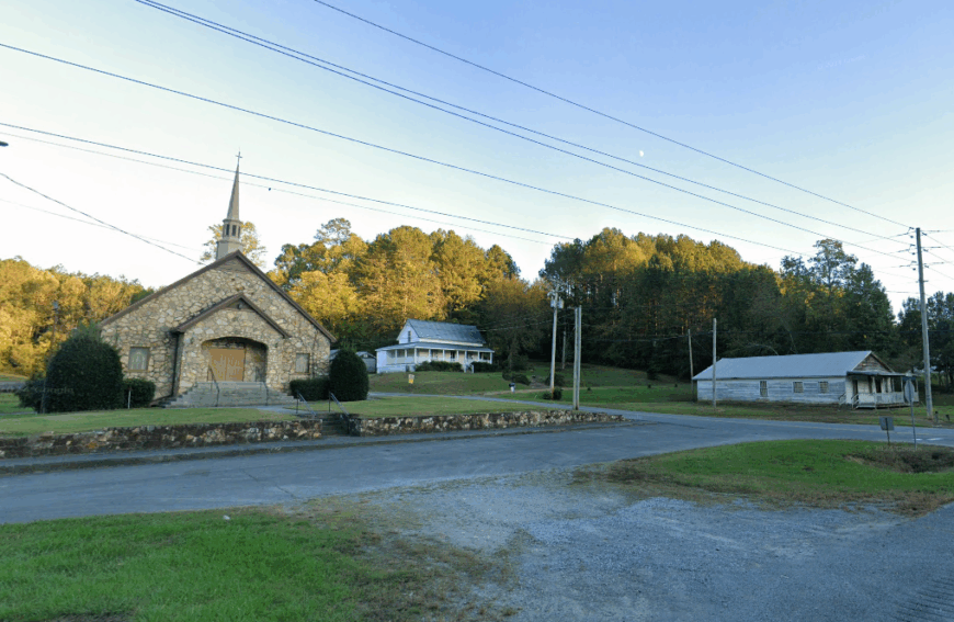
6. Persimmon – A Hidden Rabun County Valley Draped in Old-Growth Forest
Fewer than 100 people reside among Persimmon’s mossy creek banks and hemlock groves, many on land held by the same families for generations. Daytime activities include hunting Moreland Gap for mushrooms, fly-fishing Persimmon Creek, and photographing weather-beaten barns beneath a thick canopy.
Income stems chiefly from small cattle herds and handcrafted woodwork sold at weekend markets in Clayton. Thick forest walls, one-lane bridges, and scarce signage deter casual explorers, ensuring that silence reigns once dusk arrives.
Power outages last longer here, and neighbors rely on each other more than on agencies miles away. It feels like a chapter pulled from an Appalachian folktale, where time and cell signals travel slowly.
Where is Persimmon?
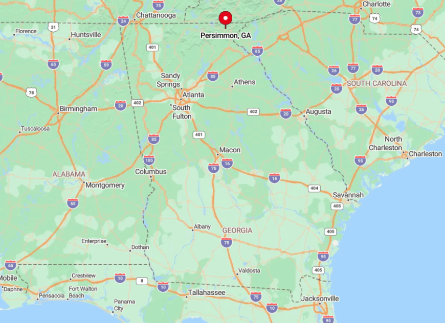
Reach Persimmon by turning west off Warwoman Road just east of Clayton, then following Persimmon Road as it shrinks to a ribbon skirting the creek. Elevation shifts and dense foliage erase distant landmarks, making the valley feel sealed off.
The route ends at a forest service gate below Courthouse Gap, prohibiting through traffic and leaving only local vehicles on the single-track pavement. Travelers should top off fuel in Clayton; once in the hollow, there’s nowhere to spend money even if you tried.
5. Cisco – Rugged Farmsteads Nestled Between Ridges and National Forest
With a population hovering near 120, Cisco spreads across rolling pastureland punctuated by weathered barns and black-gum trees. Anglers drift the Conasauga River, hikers tackle the nearby Grassy Mountain Fire Tower trail, and birders scan fence posts for indigo buntings.
Local livelihoods revolve around cattle, hay, and a modest lumber operation that supplies rough-cut boards to surrounding counties. State Route 2 bypasses the heart of the community, while thick hardwood ridges block any skyline hint of suburbia, preserving a curtain of quiet.
Nights showcase cricket song and Milky Way arcs rather than porch lights. For visitors, the reward is a pastoral panorama minus tour buses or souvenir shops.
Where is Cisco?
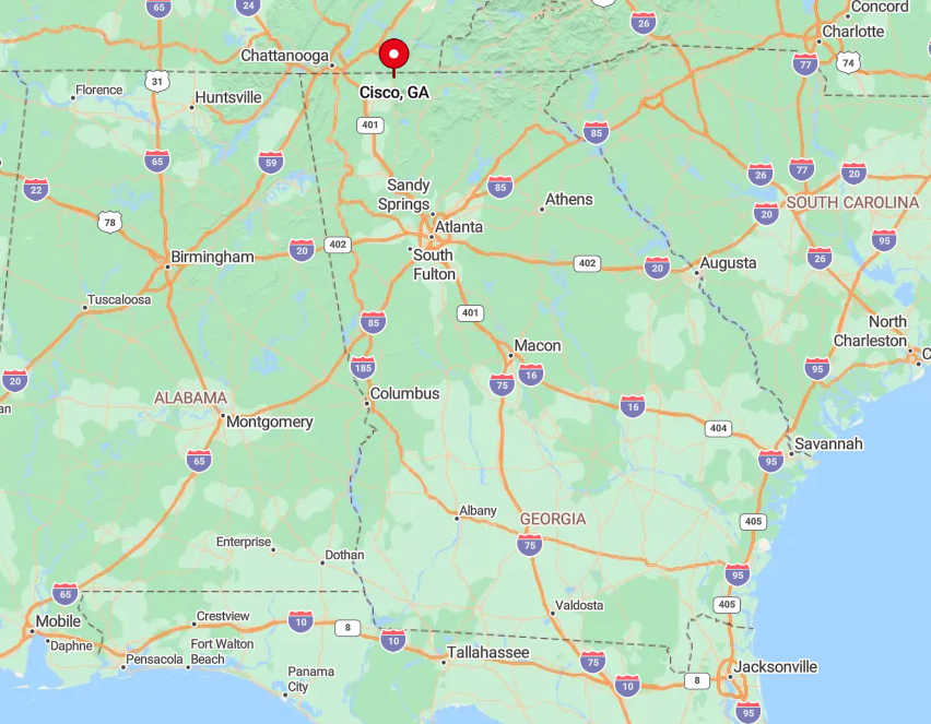
Cisco lies in far western Murray County, ten miles east of the Tennessee line and a good thirty minutes from the nearest chain grocery in Dalton. Georgia 2 becomes a roller-coaster ribbon as it threads between the Cohutta and Big Frog ranges, keeping speeds low.
Public transit doesn’t reach this corner, and the closest interstate exit is thirty miles south on I-75. Arrive prepared; once you leave the interstate, gas stations and restaurants thin out quickly.
4. Rising Fawn – Northwest Georgia’s Stone-Bluff Sanctuary
Roughly 3,000 residents scatter along Rising Fawn’s valleys below Lookout Mountain’s sandstone cliffs. Outdoor lovers climb at Cloudland Canyon State Park, ride gravel bikes through Johnson Crook Road, or photograph golden pastures framed by towering rock faces.
The economy balances between small-scale agriculture, heritage tourism, and a few bed-and-breakfasts housed in renovated farmsteads. Despite U.S. 11 skirting the edge, most side roads dead-end at bluffs or creek crossings, making through-traffic scarce.
The sheer walls of Lookout Mountain mute highway noise and cast long afternoon shadows, deepening the secluded feeling. Evening brings the flicker of porch lights across broad meadows but little else to suggest the twenty-first century.
Where is Rising Fawn?
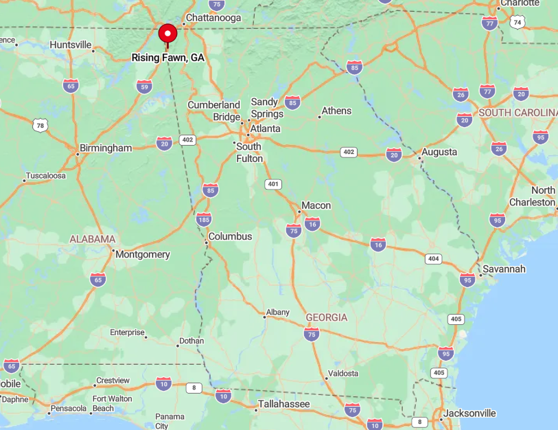
This Dade County enclave lies just south of the Tennessee state line and west of Trenton, yet Lookout Mountain acts as a natural barrier to urban sprawl. Access comes via a short hop from I-59, followed by winding back roads that circle beneath limestone overhangs.
Once on county roads, travelers encounter more tractors than cars, and GPS sometimes reroutes due to rock-fall closures. Scenic isolation remains intact because no direct road crosses Lookout Mountain here; to leave, you must backtrack the same path.
3. Cherry Log – Storybook Cabins Between Ellijay and Blue Ridge
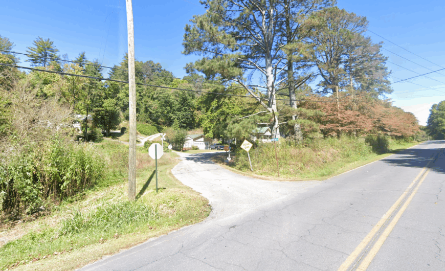
Around 1,800 folks reside in and around Cherry Log, though cabins outnumber year-round homes. Visitors stroll the Benton MacKaye Trail, sample smoked trout at the Pink Pig barbecue, or capture late-afternoon light on mossy log walls.
Tourism and seasonal rentals form the major income source, complemented by small apple orchards that extend Ellijay’s famous harvest northward. Cherry Log’s seclusion comes from its pocketed hollows and dense hardwood canopy that mask cabins from the nearby four-lane.
Even locals joke that blinking at the wrong moment means you’ll miss the turnoff. That discreet profile lets guests fall asleep to whip-poor-wills rather than highway hum.
Where is Cherry Log?
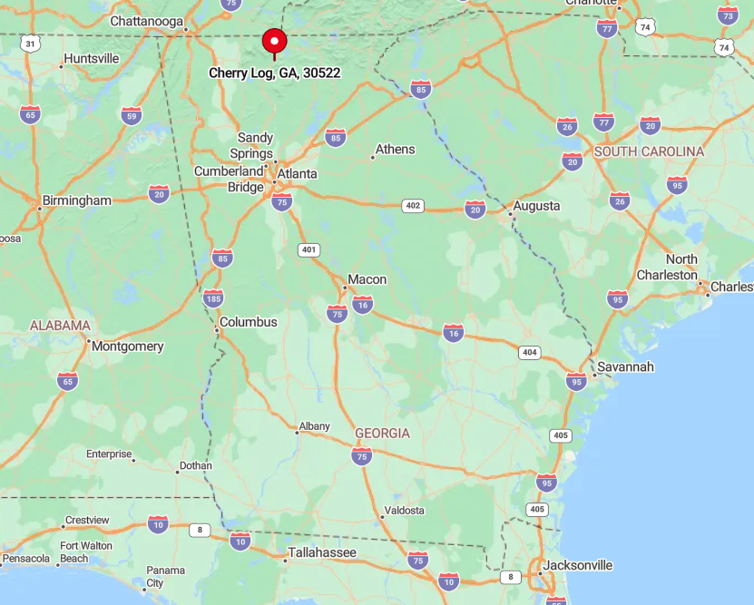
Found along Georgia 515 between Ellijay and Blue Ridge, Cherry Log hides behind a low ridge, accessed by a discreet right turn onto Boardtown Road. Once over the railroad tracks, lanes narrow and curve beneath tulip poplars that blot out the wider world.
Blue Ridge is only eight miles away, but the short distance feels longer because cell coverage drops in the hollows. Most visitors arrive by car; a vintage rail line still runs excursions nearby, yet it doesn’t pause in Cherry Log, preserving the hush.
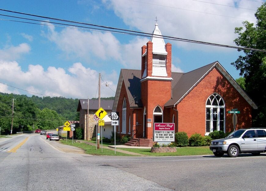
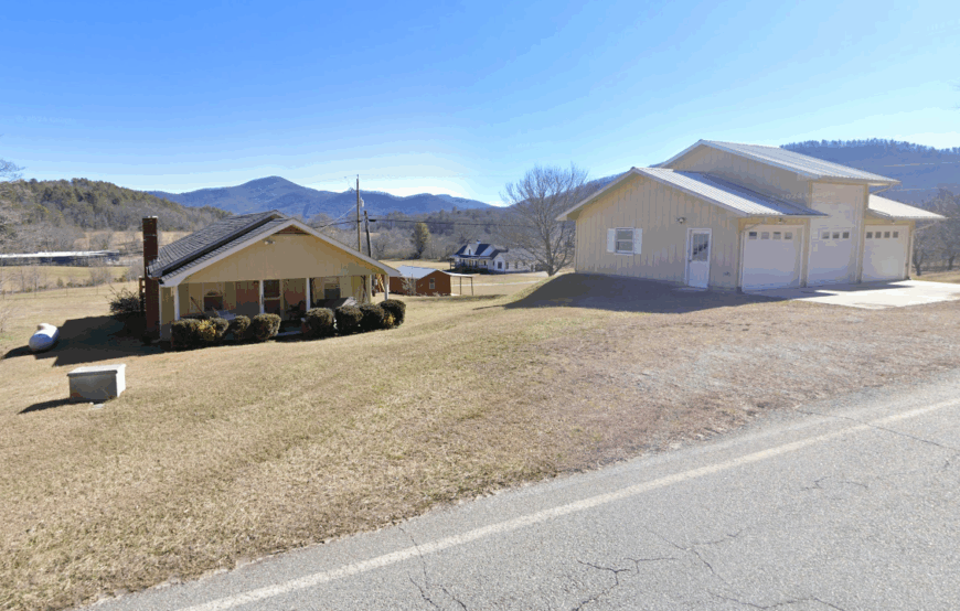
2. Mineral Bluff – River Valleys and Vintage Rail Lines Off the Tourist Path
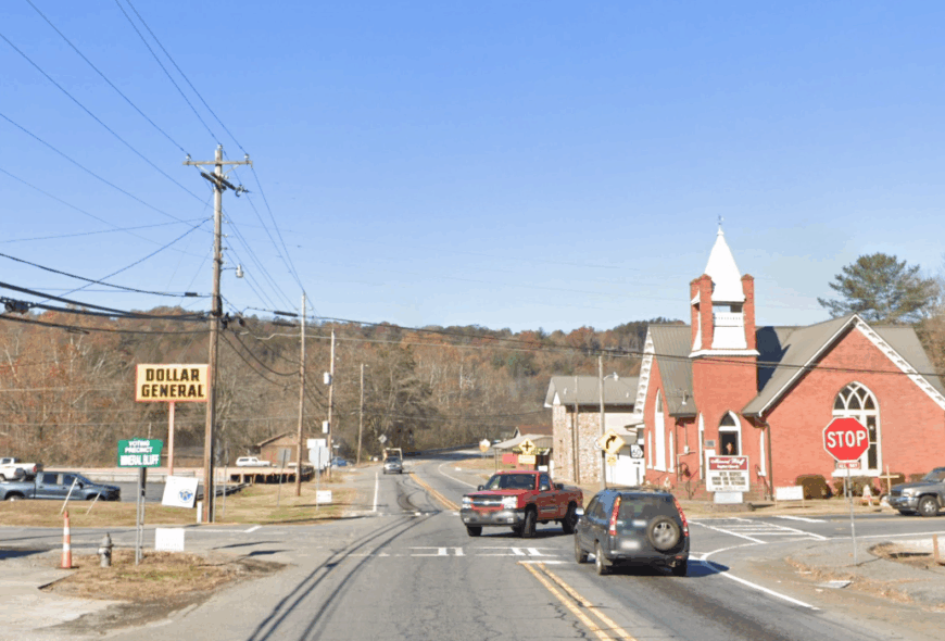
Mineral Bluff hosts roughly 250 permanent residents and a handful of tidy streets anchored by an 1887 depot. Kayakers paddle the Toccoa’s slower stretches, rail enthusiasts photograph the turntable used by scenic excursions, and early risers capture fog lifting off river pastures.
Timber and light tourism feed the local economy, while many residents commute to Blue Ridge for work. Although only four miles from that bustling town, Mineral Bluff avoids crowds because Highway 60 bypasses the center, and no lakeside resorts draw weekenders here.
Broad fields offer an unhurried vibe rare in the region’s busier lake communities. Old rail whistles and rooster calls dominate the soundscape.
Where is Mineral Bluff?
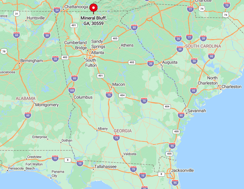
Situated in northeastern Fannin County, Mineral Bluff lies east of Blue Ridge, reached via a quick jog off Highway 60 onto Spur 60. The rail line curves away from major roads, which keeps casual drivers unaware of the hamlet’s presence.
Travelers heading north from Atlanta exit U.S. 76 far earlier, leaving Mineral Bluff free of through traffic. A small parking lot at the depot welcomes those who make the deliberate detour.
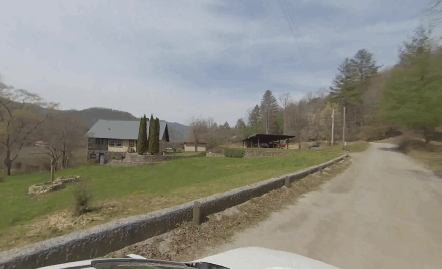
1. Wolf Fork Valley – A Secluded Meadow Basin Below Rabun’s Tallest Peaks
Wolf Fork Valley claims perhaps fifty year-round residents, most living on cattle farms tucked beneath Rabun Bald and Standing Indian Mountain. Photographers frame split-rail fences, horses grazing in golden light, and layer upon layer of ridges fading blue toward the horizon.
Livelihoods focus on hay, beef cattle, and a single seasonal maple-syrup operation tucked in the forested upper slopes. Seclusion stems from surrounding peaks that block radio towers, plus the absence of any retail strip or lodging complex; dusk reveals only barn lights scattered across the basin.
The valley’s wide-angle vistas come without traffic jams or tour buses, leaving mule deer to roam the hayfields unbothered. For many, the quiet feels eagle-aerie high, even though elevations hover around 2,000 feet.
Where is Wolf Fork?
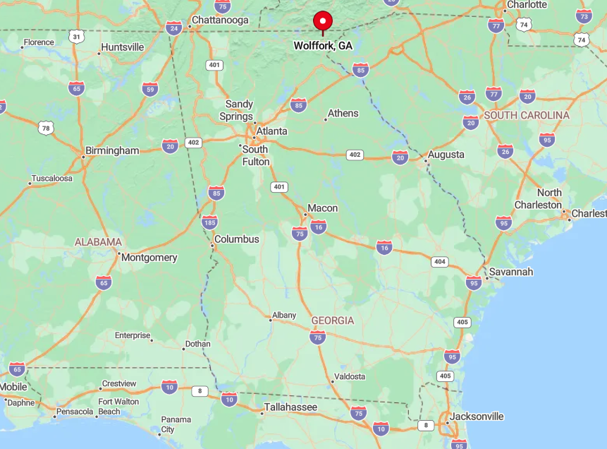
Find Wolf Fork by heading north from Dillard on Georgia 246, then dipping onto the narrow Wolf Fork Road that loops six miles through meadows before dead-ending near the Appalachian Trail corridor.
Encircled by the Nantahala and Chattahoochee National Forests, the basin has no outlet besides the road you entered on, reinforcing its hidden nature. GPS works only intermittently, and winter snows can close the pass toward Highlands, North Carolina.


