🔥 Would you like to save this?
Wide bays, rocky headlands, and miles of whispering pines still shape large stretches of Northern Michigan. Scattered among these landscapes sit 25 small waterfront towns where the night sky beats the streetlights and a passing fishing skiff counts as traffic.
We gathered the places that stay quiet even in peak vacation season, each with its own pocket of history, scenery, and community pride. From end-of-the-road hamlets on Lake Superior to snug coves on Lake Huron, these villages remind travelers that fresh air and still water remain the region’s greatest luxuries.
In order to come up with the very specific design ideas, we create most designs with the assistance of state-of-the-art AI interior design software. Also, assume links that take you off the site are affiliate links such as links to Amazon. this means we may earn a commission if you buy something.
Our countdown highlights what residents enjoy every day: empty beaches at sunrise, lighthouses untouched by crowds, and backroads that meander through hardwood forests rather than billboards.
The farther one drives, the calmer the shoreline gets, so let us start at number 25 and head toward the most secluded spot of all.
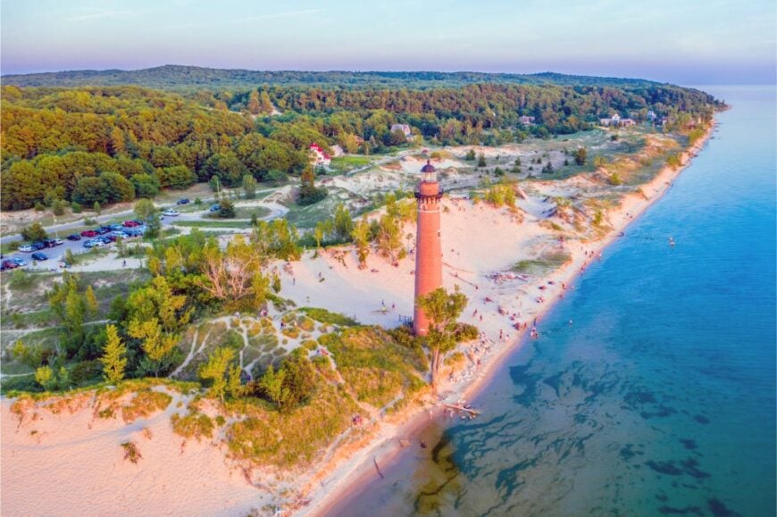
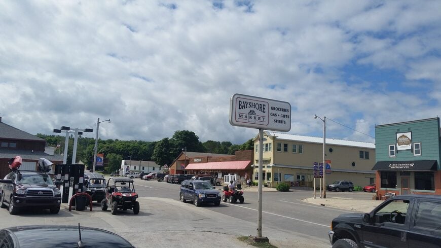
25. Langston – Forest-Floor Hamlet on Indian Lake

Langston hides quietly in the forested corners of Montcalm County, far from major roads and almost invisible to passersby. Surrounded by dense woods and narrow gravel lanes, it feels less like a town and more like a clearing someone stumbled upon long ago and never left.
Life moves slowly here—marked by the rhythm of the seasons, the flicker of porch lights at dusk, and the gentle hush that settles over the trees. You might fish along the edges of Indian Lake, pedal a stretch of the Fred Meijer Heartland Trail, or stop at a roadside stand offering jars of local honey.
There’s no downtown, no crowds—just family farms, open skies, and neighbors who know your name. People here make a living from the land or retreat into its quiet, whether through work or retirement. It’s not a place that seeks attention. It’s the kind of place that reminds you how good it feels to go unnoticed.
Where is Langston?
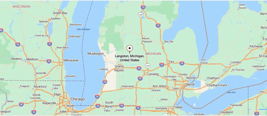
Langston, Michigan is tucked into the rural stretches of Montcalm County in the western part of the state. It sits about 35 miles northeast of Grand Rapids, reached by winding back roads off M-66 that pass through forested land and quiet farmland.
The drive takes you past lakes, wooded patches, and scattered barns, with fewer signs of town the farther you go. It’s a quiet dot on the map where the trees grow thick and time seems to slow.
24. Cedar Bluff – Cedar-Fringed Cliffs Above Lake Michigan
Perched on a quiet rise above the Lake Michigan shoreline, Cedar Bluff is the kind of place that’s tucked behind forested bends and easy to overlook unless you’re looking for stillness. It’s surrounded by dense cedar groves, winding backroads, and just enough distance from larger towns to feel like its own world.
The lake breeze carries the scent of pine and water, and the silence is often broken only by birdsong or the creak of a dock. Visitors might hike a bluffside trail, search for stones along the beach, or stop by a seasonal farmstand with fresh berries and local preserves.
There’s no bustling main street—just cabins, cottages, and people who live close to the land or come here to rest. A handful farm, a few run small businesses, and many simply stay for the solitude. It’s the kind of place that gently reminds you how far away the rest of the world can feel.
Where is Cedar Bluff?
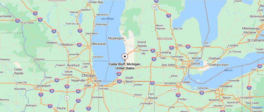
Cedar Bluff, Michigan is tucked along the shoreline of Lake Michigan in the state’s northwest corner, near the forested edges of Leelanau County. It’s about 30 miles west of Traverse City, reached by following M-72 and then a narrow lakeside road that winds through pines and dunes.
The drive offers glimpses of water through the trees and long, quiet stretches without a single store in sight. It’s close enough to the lake to hear the waves, but far enough to feel completely apart from everything else.
23. Brimley – Bays, Birch Forest, and Ojibwa Heritage
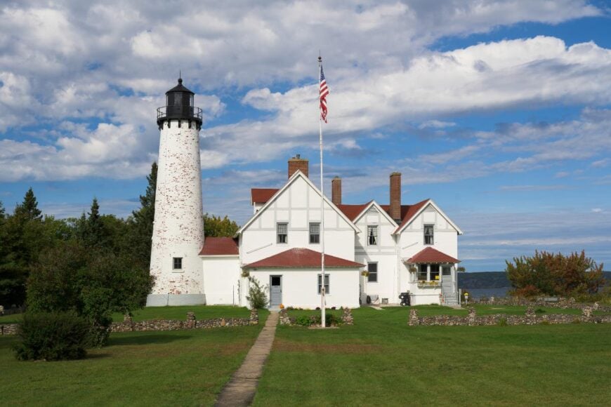
Brimley rests on the edge of Lake Superior’s Whitefish Bay, where pine forest meets water and roads grow quieter the farther north you travel. Though just a short drive from Sault Ste. Marie, it feels worlds apart—buffered by shoreline, woods, and a pace that never hurries.
Mornings arrive with the cry of gulls and the smell of cold mist off the bay, while evenings end in fiery lake sunsets that feel almost private. Visitors can walk the beaches of Brimley State Park, fish along the Waiska River, explore Point Iroquois Lighthouse, or hike through the Hiawatha National Forest just beyond town.
Fishing and tourism shape the seasons here, with a rhythm as fluid as the waves. Locals move easily between dock and diner, trail and porch. It’s
Where is Brimley?
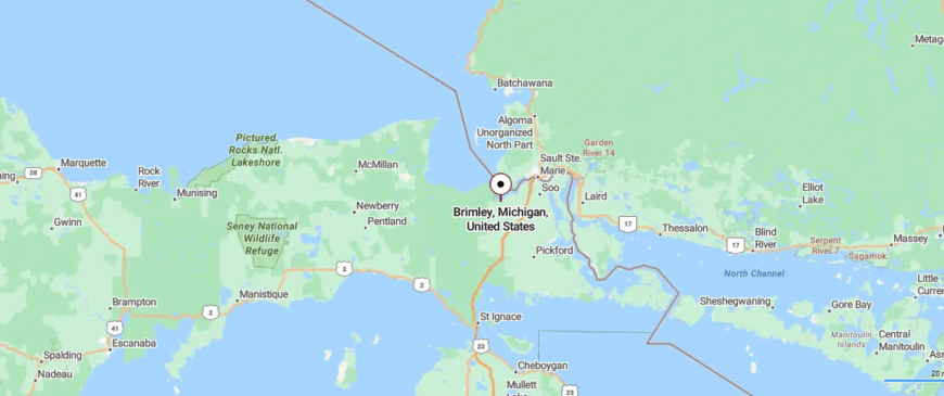
Brimley, Michigan sits along Lake Superior’s Whitefish Bay in the eastern Upper Peninsula, where forest meets shoreline. It’s about 20 miles southwest of Sault Ste. Marie, reached by turning off M‑28 onto quiet M‑221.
The drive winds through wooded stretches and open lakeside fields with few signs of town until you arrive. It’s close enough for a day trip, but distant enough to feel like a hidden corner of the North.
22. De Tour Village – Where the Great Lakes Divide
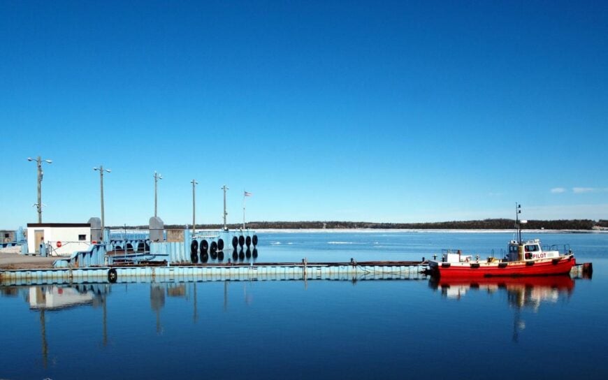
At the far eastern tip of Michigan’s Upper Peninsula, where the St. Marys River meets Lake Huron, De Tour Village feels like the end of the road—and that’s exactly what it is. Reached by long forested highways and hugged by open water, it’s a place where ferries come and go, but most of the world does not.
The air is crisp with lake breeze, and the pace is quiet, steady—anchored by lighthouses, docks, and the sound of passing freighters slipping through the channel. Visitors walk the rocky shoreline, visit the DeTour Reef Lighthouse, kayak the gentle waves, or take the ferry across to Drummond Island for even more solitude.
Fishing and tourism sustain the seasons here, along with a deep-rooted sense of maritime life. Locals wave easily, tell stories slowly, and measure time by sun and tide. It’s the kind of place that makes the edge of the map feel like the center of peace.
Where is De Tour Village?
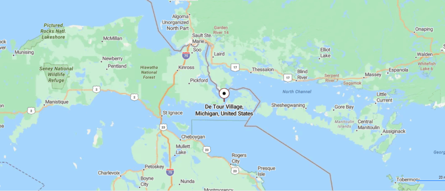
De Tour Village, Michigan rests at the far eastern tip of the Upper Peninsula, where the St. Marys River meets Lake Huron. It’s about 55 miles northeast of Sault Ste. Marie, reached by following scenic M‑134 along the lakeshore.
The road winds through quiet woods and open stretches before ending at a harbor dotted with freighters and shoreline views. It’s the kind of place that feels like the end of the map—in the best way.
21. Nahma – Ghost-Era Waterfront on Big Bay de Noc
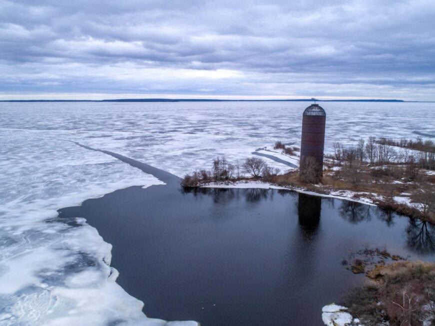
You don’t pass through Nahma—you arrive there slowly, on purpose, down a winding road that ends in trees and water. Hidden within the folds of Hiawatha National Forest and resting quietly against Big Bay de Noc, the town feels folded into the land itself.
The old sawmill days are long gone, but echoes remain—in the creak of the docks, the shape of the inn, the stories passed around fire pits. Spend a morning kayaking through still coves, walk the fern-lined forest trails, or sit on the porch of the Nahma Inn listening to loons call across the bay.
A few locals run small businesses, others fish or welcome guests in the summer season, but most are here for what Nahma offers: quiet, distance, and deep-rooted calm. It’s not flashy or forgotten—just deliberately slow. And once you breathe in that cool lake air, you might not want to leave. It’s the kind of place that doesn’t ask for attention, just appreciation.
Where is Nahma?
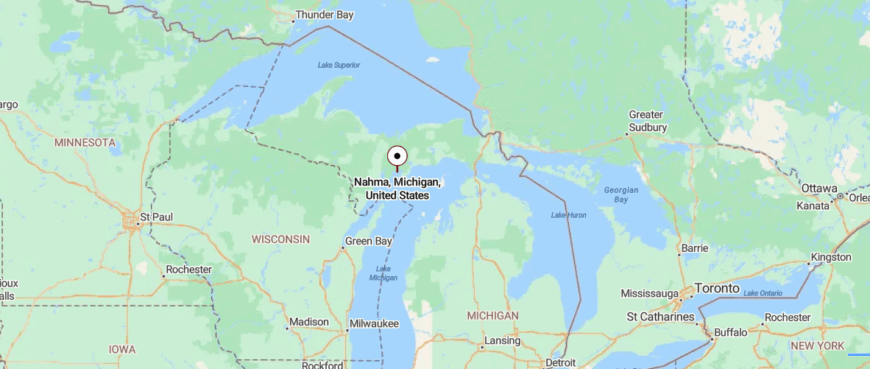
Nahma, Michigan sits on the southern edge of Big Bay de Noc in the Upper Peninsula, where the Sturgeon River meets Lake Michigan. It’s about 25 miles east of Escanaba, reached by quiet county roads winding through the Hiawatha National Forest.
The drive passes dense pines, inland lakes, and scattered signs of the area’s lumbering past. It’s a peaceful spot where the forest thins just enough to let the lake in—and everything else fade out.
20. Skanee – Slate Cliffs and Solitude on Huron Bay
Skanee rests quietly along the southern shore of Lake Superior’s Keweenaw Bay, cradled between deep forest and cold, endless water. Reaching it means winding through miles of wooded highway in Michigan’s Upper Peninsula, where the signal fades and the silence deepens.
The town is small—just a scattering of homes, a post office, and the sound of waves brushing against rock. Visitors come to hike the nearby trails of the Huron Mountains, explore the towering slate cliffs at Abbaye Point, or spend a day fishing beneath a wide northern sky.
Logging and small-scale tourism keep things moving, but life here feels almost untouched, shaped more by nature than by time. Pines whisper overhead, and the lake never rushes. It’s the kind of place that reminds you the most remote places often hold the most peace.
Where is Skanee?
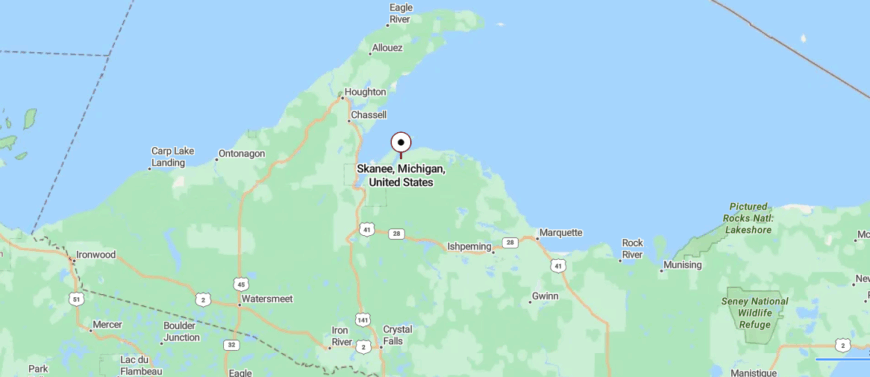
Skanee, Michigan sits quietly on the northern shore of Huron Bay in Baraga County, where the deep waters meet the rugged Huron Mountains. It’s roughly 14 miles northeast of L’Anse or about 83 miles northwest of Marquette via winding backroads.
The route follows quiet forest roads through pine-covered hills and along slender ribbon lakes before finally reaching the small harbor community. Out here, the woods and Superior combine to hush the world—it’s a place where the map ends, and the stillness begins.
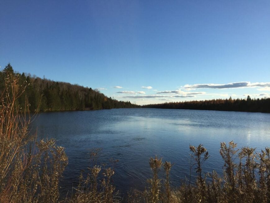
19. Trout Lake – Pines, Rails, and Quiet Water
🔥 Would you like to save this?
Tucked in the eastern Upper Peninsula, Trout Lake is wrapped in thick forest, still water, and the kind of quiet that settles in your bones. Far from highways and framed by wilderness, the town is small and spare—just a few streets, a general store, and the steady presence of pines and birch.
You can hear loons call across the lake at dawn, watch fog drift low over the water, or follow trails that disappear into Hiawatha National Forest. Visitors fish for walleye and pike, paddle the glassy shoreline, snowmobile through endless backcountry, or stop by the local diner where the coffee’s strong and the stories run long.
Logging shaped its past, and tourism—slow and seasonal—shapes what remains. Life here is quiet, sincere, and deeply tied to the land. It’s the kind of place that reminds you how deeply still the world can be.
Where is Trout Lake?
Trout Lake, Michigan lies in the eastern Upper Peninsula, tucked beside its namesake lake in the southwest corner of Chippewa County. It’s about 30 miles north of the Mackinac Bridge, reached by following M‑123 through forests and low wetlands.
The road winds past stretches of the Hiawatha National Forest before arriving at the quiet lakeside community. It’s a peaceful pocket where the trees, water, and sky seem to slow everything down.
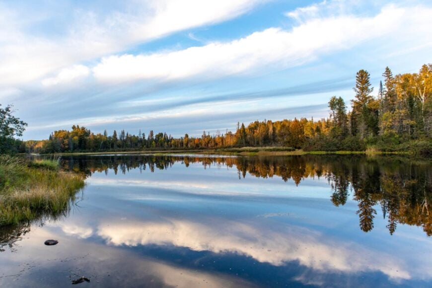
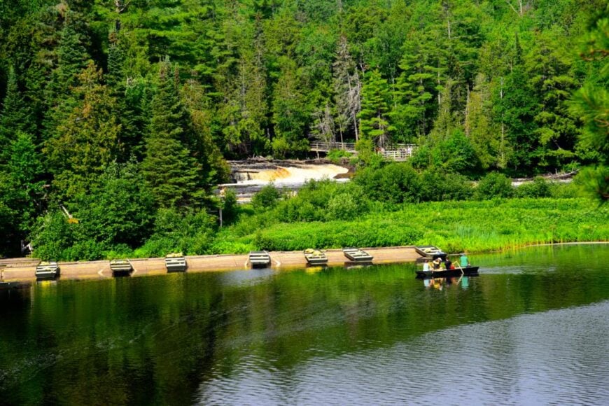
18. Germfask – Backdoor to Seney’s Wild Marshlands

Germfask lies quietly in the heart of Michigan’s Upper Peninsula, surrounded by marshland, forest, and the winding flow of the Manistique River. Tucked between long stretches of wilderness and far from fast-moving roads, it feels like a town paused somewhere in time.
Life here is slow and grounded—marked by birdsong, river mist, and the hum of tires on gravel. Visitors come to paddle the river, hike into Seney National Wildlife Refuge, fish under wide skies, or camp beneath stars unspoiled by city light. Many locals still live by the land—farming, guiding, or welcoming summer travelers passing through.
There’s no rush in Germfask, no noise that doesn’t come from nature. It’s the kind of place that reminds you how wild and gentle the world can be, all at once.
Where is Germfask?
Germfask, Michigan lies in the heart of Schoolcraft County in the Upper Peninsula, surrounded by forest and tucked along the Manistique River. It’s about 30 miles north of US‑2, reached by following M‑77 through stretches of marshland and dense pine.
The road winds quietly past the Seney National Wildlife Refuge, with few buildings and long pauses between signs of life. It’s a place where the river moves slow and the silence settles in.
17. Michigamme – High Pines and a Sleeping Lake
There’s a stillness in Michigamme that you feel before you arrive. Set deep in Michigan’s western Upper Peninsula and pressed between forest and lake, it lies far from major roads, with nothing but quiet for miles in every direction.
The town curves gently around Michigamme Lake, where mist rises in the morning and loons call across glassy water. You might paddle along the shoreline, wander the rugged trails of Craig Lake State Park, or step into the local gallery housed in an old storefront filled with handmade things.
The bones of its mining past remain, but now the rhythm is shaped by nature and the few who stay year-round—artists, anglers, and those who’ve learned to listen to the quiet. Here, seasons arrive with weight, and time moves like wind through pine. It’s the kind of place that doesn’t just feel removed—it makes you forget where else you were going.
Where is Michigamme?
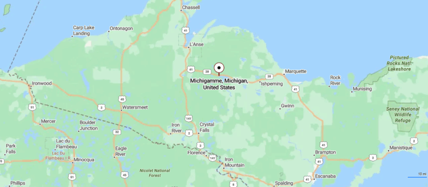
Michigamme, Michigan sits in western Marquette County, along the northern edge of Lake Michigamme in the Upper Peninsula. It’s about 37 miles west of Marquette, reached by turning off US‑41/M‑28 onto quiet local roads.
The route winds through thick forest and over narrow bridges before opening to lake views and a scattering of homes. It’s the kind of place where the water is wide, the trees are tall, and the world slows down.
16. Helmer – Lakeside Stillness at the End of Nowhere
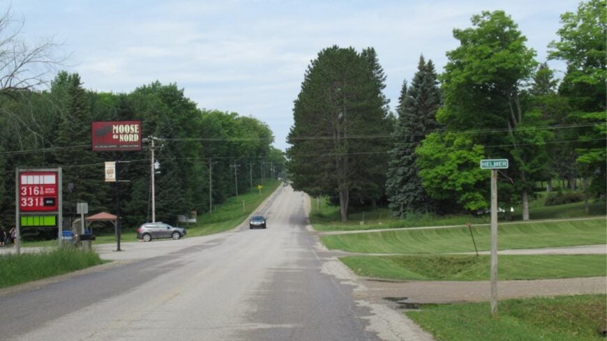
Helmer sits quietly on the edge of Manistique Lake, nestled deep in Michigan’s Upper Peninsula where forests press in and roads grow narrow and winding. With no flashing signs or busy intersections, the town feels like it’s been gently folded into the landscape.
Time slows here, marked by the ripple of water and the soft creak of a dock beneath your feet. Visitors can paddle the calm shoreline, fish for bass at dawn, bike country roads under open sky, or stop into the historic Helmer House Inn for coffee and stories from another era.
A mix of seasonal tourism and quiet retirement life sustains the area, though nature remains its truest anchor. Helmer doesn’t offer spectacle—it offers space, stillness, and a sense of staying hidden on purpose. It’s the kind of place that reminds you some corners of the world were never meant to be found in a hurry.
Where is Helmer?
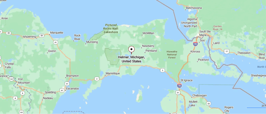
Helmer, Michigan sits in eastern Luce County, along the northeastern shore of Manistique Lake and surrounded by state forest. It’s about 11 miles southwest of Newberry, reached by following county road H‑44 through quiet woods and wetlands.
The route passes few signs of life until the trees part and the lake appears beside scattered cabins. It’s a peaceful stretch where the forest meets the water, and everything else fades away.
15. McMillan – Birch-Lined Stillness Near East Lake
McMillan rests quietly in the eastern Upper Peninsula, surrounded by thick forests, inland lakes, and long stretches of road where the signal fades and the silence begins. It’s not on the way to anywhere—you go there only if you mean to—and that’s part of its charm.
The town itself is small and hushed, with a few homes, a church, and the kind of sky that opens wide above the trees. Visitors might canoe along East Lake, walk wooded trails, watch sandhill cranes near the wetlands, or stop in for a meal at the lone roadside café that still carries stories in its walls.
Life moves with the rhythm of nature here—anchored by tourism, small businesses, and those who stay for the quiet. The seasons shape everything, and no one seems in a rush to beat the clock. It’s the kind of place that reminds you how far away you are—and how right that can feel.
Where is McMillan?
McMillan, Michigan lies about 10 miles west of Newberry along M‑28 in Luce County’s Upper Peninsula. It’s reached via a stretch of highway framed by dense pine forest and wetlands, with few signs of settlement until the small community appears.
The route’s quiet rhythm mirrors the place itself—sparse cabins, tall trees, and the slow pulse of the Tahquamenon River nearby. It’s close enough to reach by car, but tucked far enough into the woods that the world beyond seems distant.
14. Curtisville – Hidden Hamlet Along the Au Sable Forks
Curtisville hides deep in the forests of Alcona County, where pine and oak stretch wide and the roads narrow into gravel long before you arrive. It’s barely marked—a small scattering of homes, an old community hall, and the kind of stillness that comes only from distance.
The town feels rustic and rooted, with trails worn more by deer than by people and sunlight that filters gently through the trees. Visitors might fish the nearby Au Sable River, wander through the Huron National Forest, pick berries along the roadside, or join a weekend craft sale hosted by locals.
Most who stay work with their hands—logging, farming, or simply living close to the land. There’s no rush here, just the steady presence of woods, wind, and time. It’s the kind of place that reminds you some of the quietest towns carry the deepest sense of home.
Where is Curtisville?
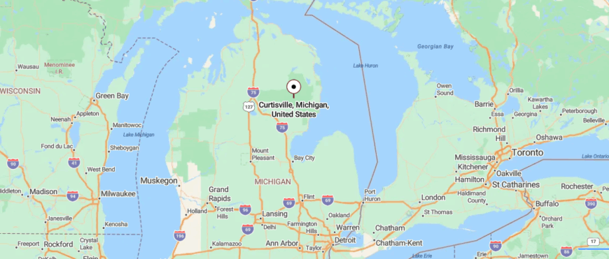
Curtisville, Michigan is a small community in the southwest corner of Alcona County, surrounded by the Huron National Forest and near the Au Sable River. It’s about 15 miles west of Oscoda, reached by turning off M‑65 onto quiet forest roads.
The drive winds through wooded terrain and open clearings with few signs of modern life. It’s a quiet pocket where trees and riverbank make everything feel far away.
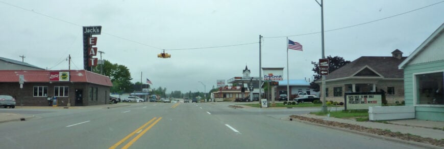
13. Gould City – Ghost Traces Along Lake Michigan’s Curve
🔥 Would you like to save this?
Gould City sits quietly in the heart of Michigan’s Upper Peninsula, surrounded by deep pine forest and miles of open road that lead only to stillness. It’s far from major highways and even farther from crowds, with a landscape shaped by trees, water, and a sense of pause.
The town is small but steady—just a few streets, an old church, and a general store where stories are traded over coffee. Visitors come to fish inland lakes, ride snowmobiles through dense woods, hike the nearby trails, or spot wildlife on winding backroads.
Logging and tourism still shape much of daily life, though many residents are here simply for the solitude. The air smells like pine and woodsmoke, and time moves slowly, like mist lifting from the trees. It’s the kind of place that reminds you how beautiful the middle of nowhere can be.
Where is Gould City?
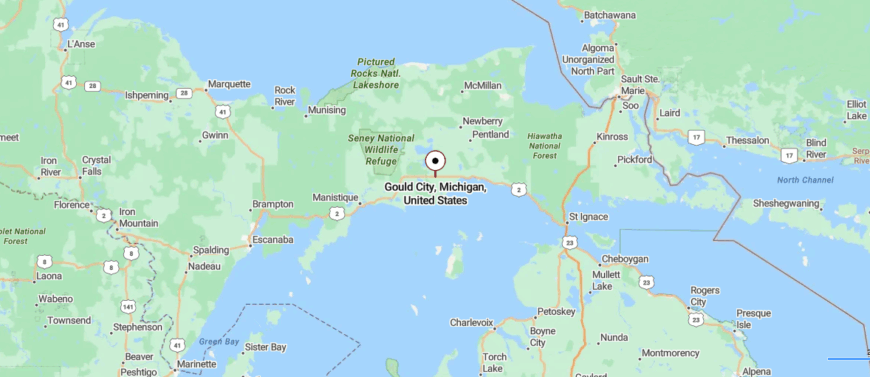
Gould City, Michigan is tucked into Mackinac County in the Upper Peninsula, just south of US‑2 and surrounded by forest and wetlands. It’s about 30 miles east of Manistique, reached by turning onto South Gould City Road from the main highway.
The drive cuts through long stretches of pine woods before a small cluster of homes and buildings appears. It’s a quiet place where the forest presses in and time seems to slow.
12. Au Train – Waterfall Trails and Inland Seclusion
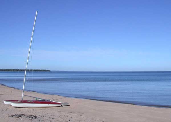
You won’t find Au Train by accident—it’s the kind of place where the road narrows, the trees close in, and the lake suddenly appears beside you like a secret. Tucked along the southern edge of Lake Superior, it’s surrounded by dense forest, still water, and not much else.
The town is quiet and relaxed—just a general store, a few cabins, and the sound of waves meeting sand. Most people come to paddle the slow-moving Au Train River, walk the driftwood-covered beach, fish at the mouth of the bay, or hike the North Country Trail nearby.
A handful of locals run outfitters or small rentals, while others stay simply because they like the quiet. It’s not built for attention, just for being close to sky, trees, and water. And once you’ve stood at the shoreline with nothing but breeze and lake ahead of you, it’s hard to imagine needing anything more.
Where is Au Train?
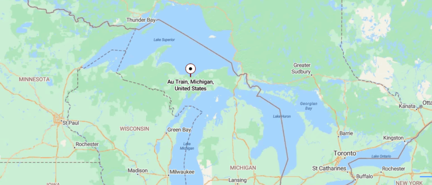
Au Train, Michigan sits along the southern shore of Lake Superior in Alger County, where the Au Train River meets the bay. It’s about 38 miles west of Marquette, reached by following M‑28 through stretches of forest and quiet roadside scenery.
The road passes waterfalls and woods before opening to lake views and a scattering of homes. It’s close enough for a day’s drive, but far enough to feel like you’ve truly escaped.
11. Rapid River – Pines, Popple Trees, and Great Bay Silence
Set near the northern shore of Little Bay de Noc, Rapid River feels tucked away in the forested arms of Delta County—quiet, spread out, and softened by pine and water. Though not far from Escanaba, the town feels like its own slow world, buffered by winding roads and long stretches of open sky.
There’s a peaceful hush here, where the river flows steady, the breeze carries the scent of cedar, and time seems to drift like the water itself. Visitors cast lines from the dock, hike the trails at Peninsula Point, snowmobile through Upper Peninsula backcountry, or grab a pasty from the corner shop before sitting to watch the lake turn gold at dusk.
Logging, farming, and small-town tourism shape the rhythm of daily life, though nothing moves too fast. It’s a place built around patience, and presence. It’s the kind of place that reminds you just how still and grounded a life can feel.
Where is Rapid River?
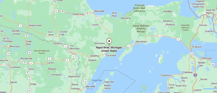
Rapid River, Michigan is tucked into Delta County’s Masonville Township in the Upper Peninsula, sitting where the Rapid and Tacoosh rivers meet Little Bay de Noc. It’s about 20 miles north of Escanaba and reached directly via U.S. Highway 2.
The drive offers long stretches of lakeshore forest with few signs of life before arriving at the small riverside community. It’s a quiet place where the water flows deep, the trees stand tall—and time seems to slow.
10. Big Bay – Rugged Peninsula Living on Lake Superior
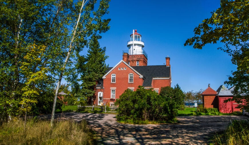
Roughly 300 people call Big Bay home, a number that expands only slightly during summer cabin season. Visitors spend daylight hours touring the cliffside Big Bay Point Lighthouse, casting for splake at the local harbor, or hiking to Alder Falls along County Road 550.
Logging and small-scale tourism stand as the main economic anchors, with a handful of outfitters guiding anglers and snowmobilers. Nights settle into true darkness because the village sits at the very end of a peninsula, bordered by Superior on three sides and dense state forest on the fourth.
Cell service drops, paved roads thin, and the endless horizon erases any hint of a nearby city. That isolation grants Big Bay its enduring reputation as Marquette County’s quietest shoreline.
Where is Big Bay?
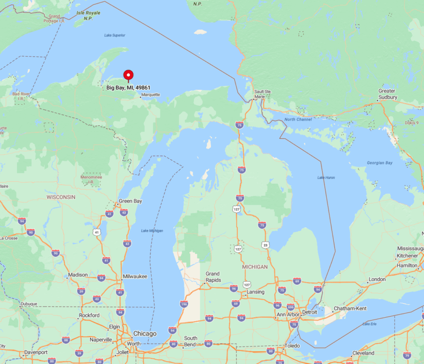
Big Bay rests 30 miles northwest of Marquette in Michigan’s Upper Peninsula, tucked at the tip of the Huron Mountains shoreline. A single two-lane route, County Road 550, winds past granite outcrops and spruce stands before dead-ending in town.
With Superior blocking further travel, the community feels like an island reached by land. Drivers should plan an hour from Marquette’s airport and bring supplies, as the nearest grocery of size lies back in the city.
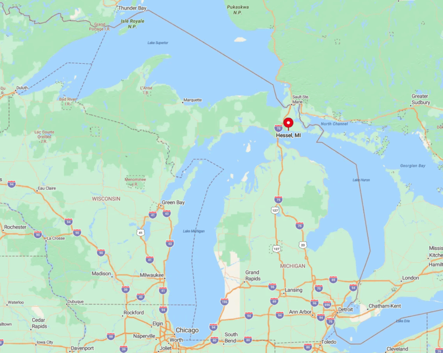
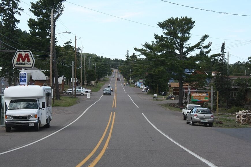
9. Hessel – Cedar-Strip Boats and Quiet Channels on Lake Huron
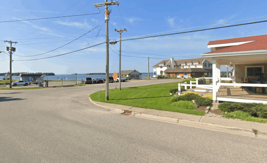
Hessel’s population floats near 800, yet most days only a few dozen people drift along its marina boardwalk. Classic Chris-Craft and locally built cedar-strip runabouts glide through the Les Cheneaux Islands, while paddlers trace hidden channels thick with wild rice.
Wooden boat restoration and seasonal tourism supply the bulk of jobs, supported by a long-running boat show each August. The archipelago shields Hessel from wave action and casual motorists alike, limiting noise to gulls and the occasional boat whistle.
Modest cottages sit back from the water on acre-plus parcels, making neighbors easy to see only if both head to the dock at the same time. Evening stillness often rolls in with lake fog, underlining the town’s pocket-size remoteness.
Where is Hessel?
🔥 Would you like to save this?
Hessel sits on the northern shore of Lake Huron, 25 miles northeast of St. Ignace and the Mackinac Bridge. M-134 is the only paved artery, threading through cedar swamps before popping out at the harbor.
Beyond that highway lies a maze of island channels that deter large crowds and maintain the village’s slow tempo. Travelers typically exit I-75, follow the shoreline east, and find themselves alone on the dock within forty minutes.
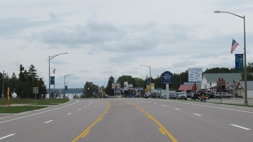
8. Copper Harbor – End-of-the-Keweenaw Serenity
Just over 100 year-round residents inhabit Copper Harbor, clustered around a natural bay ringed by volcanic basalt. Mountain bikers tackle the renowned Flow Trail system by day, while photographers frame lonely piers against Superior’s sweeping blues.
Handmade crafts and heritage tours linked to the 1840s copper boom form the modest commercial core. What keeps the hamlet secluded is the 47-mile drive from Houghton on US-41, a road that narrows, twists, and finally ends beneath the town’s welcome sign.
No chain stores, stoplights, or alternate routes exist beyond that point. With cliffs to the north and dense hardwood forests to the south, Copper Harbor feels like the edge of Michigan in every direction.
Where is Copper Harbor?
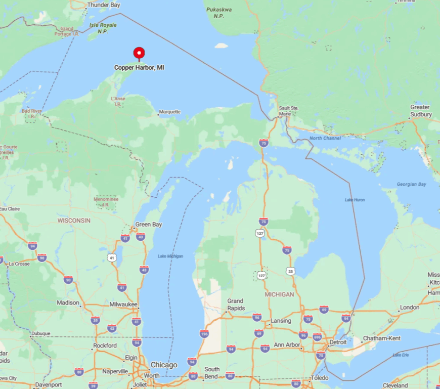
The village occupies the farthest tip of the Keweenaw Peninsula jutting into Lake Superior. US-41, famous for its timber tunnel near Delaware, serves as the only direct link to larger towns.
Lake effect snow piles high and spring melt often keeps traffic light until June, reinforcing a sense of cutoff. Visitors should anticipate a scenic hour-plus drive from Houghton or Hancock and plan fuel accordingly, as the last gas pump closes early on weeknights.
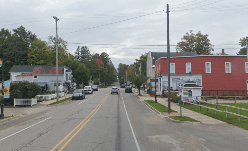
7. Naubinway – Wild North-Shore Fishing Haven
Around 150 permanent residents watch over Naubinway’s single-lane harbor, where antique gill-net tugs still steam out before dawn. Beachcombers roam the sweeping sands at Hog Island Point and anglers gather at Epoufette Bay for lake trout and salmon.
Commercial fishing and modest charter operations remain the backbone industries, supplemented by a small heritage museum that honors maritime history. Seclusion stems from Naubinway’s distance to any sizeable town, with the nearest traffic light nearly 40 miles away in St. Ignace.
Thick stands of jack pine press close to US-2, hiding the shoreline and discouraging casual pull-offs. After sunset, the only glow comes from boat cabin lights moving across the horizon.
Where is Naubinway?
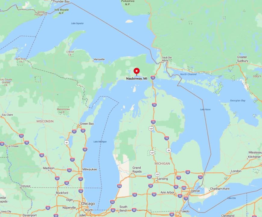
Naubinway lies along Lake Michigan’s far north shore on US-2, 35 miles west of the Mackinac Bridge. The highway skirts dunes and dense forest, separated from the village by a narrow harbor road.
Frequent lake effect fog and sparsely spaced services keep visitor counts low for much of the year. Drivers heading from I-75 should expect about forty-five minutes of uninterrupted shoreline to reach the harbor.
6. Alden – Torch Lake’s Hidden Caribbean-Blue Corner
With an estimated 120 full-time residents, Alden offers more boat slips than storefronts. Days revolve around jumping from the pastel-painted Dockside boathouses into Torch Lake’s famously turquoise water or cycling quiet dirt roads that weave past hillside orchards.
Small-scale hospitality and cottage maintenance employ many locals, joined by a scattering of artists who sell lake-inspired ceramics. Unlike busier nearby villages, Alden’s public beach and roomy waterfront lots keep crowds dispersed even during the hottest July weekend.
The lake lacks public campgrounds on its eastern shore, curbing transient traffic and preserving a hush after twilight. Combine that with limited street lighting and stargazing here becomes a nightly ritual.
Where is Alden?
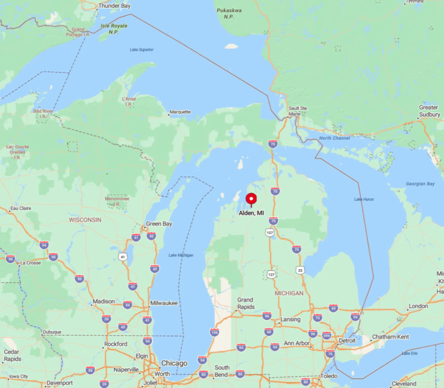
Alden sits on the southeast elbow of Torch Lake, about 25 miles northeast of Traverse City. Only two paved roads, Helena and Cairn Highway, lead into town, both ending at the water.
Undeveloped stretches of forest and farmland hem in the village, discouraging through traffic. Visitors typically follow M-88 to the well-marked turnoff, then roll slowly into a world of neon-blue shallows and quiet docks.
5. Good Hart – Tunnel-of-Trees Seclusion Above Lake Michigan
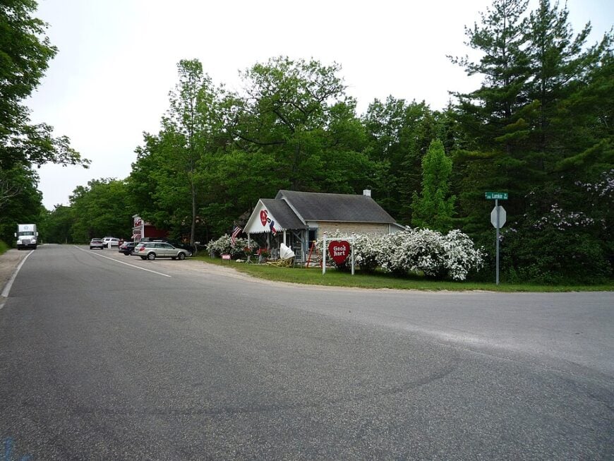
Good Hart’s year-round headcount hovers near 70, anchored by a one-room general store that doubles as post office and bakery. Travelers linger along M-119’s famous Tunnel of Trees, stop for whitefish pot pies, and photograph century-old barns perched on bluffs high over Lake Michigan.
Small cottage upkeep, artisanal foods, and seasonal art fairs supply most local income. The absence of streetlights, stop signs, and large parking lots helps maintain an almost pastoral quiet.
Dense maples and hemlocks screen expansive lakefront parcels from the road, so even passing cars rarely glimpse a rooftop. That blend of foliage cover and bluff elevation grants Good Hart a privacy rare on this popular coast.
Where is Good Hart?
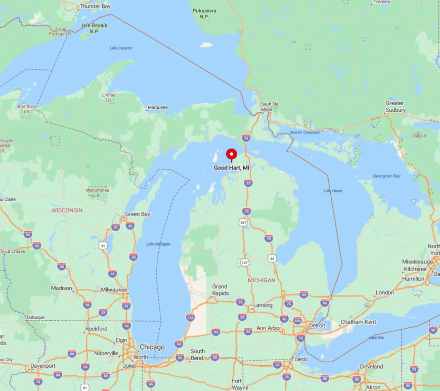
The hamlet sits 15 miles north of Harbor Springs along M-119 in Emmet County. The route narrows to a canopied lane where sightlines seldom exceed a few hundred feet, making fast travel impossible.
Because no direct inland road connects to major highways, visitors must commit to the winding shoreline drive. Most reach the store after a slow thirty-minute cruise through shadowy hardwoods that feel far removed from resort bustle.
4. Presque Isle Harbor – Twin Lighthouses and Untouched Shores
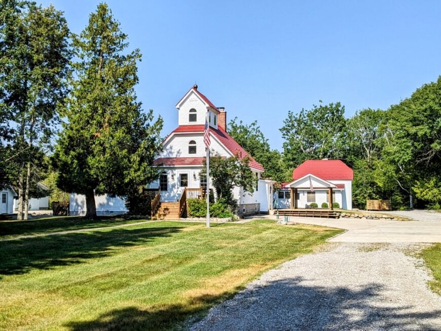
Presque Isle Harbor counts roughly 250 neighbors who share access to two 19th-century lighthouses, sandy spits, and a protected marina. Daytime activities include climbing the Old Light’s iron spiral stairs, beach glass hunting at North Bay, and paddling secluded Thompson Harbor State Park just south of town.
Limited marine services and heritage tourism form the main economic activity, with over half the surrounding shoreline held in conservancy. Once cars leave County Road 638, they meet gravel spurs that dead-end at private drives or trailheads, leaving miles of forest untouched.
The lack of lodging chains and nearby airports means nightfall brings little more than rolling surf and lighthouse beams. Residents often report hearing loons before they ever hear a passing engine.
Where is Presque Isle Harbor?
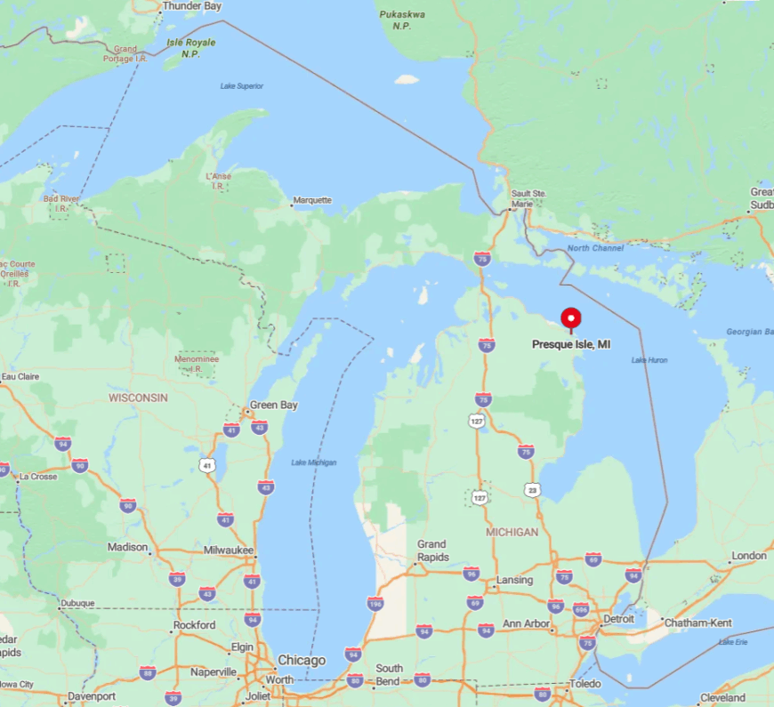
This township cluster rests on Lake Huron, 17 miles north of Alpena via US-23 and County Road 638. The harbor nestles between two long peninsulas, creating natural barriers against both weather and development.
Visitors usually exit US-23, pass through thick cedar swales, then emerge at the New Presque Isle Light where parking is limited. Without commercial flights nearby, most arrive by car, adding to the destination’s off-the-map feel.
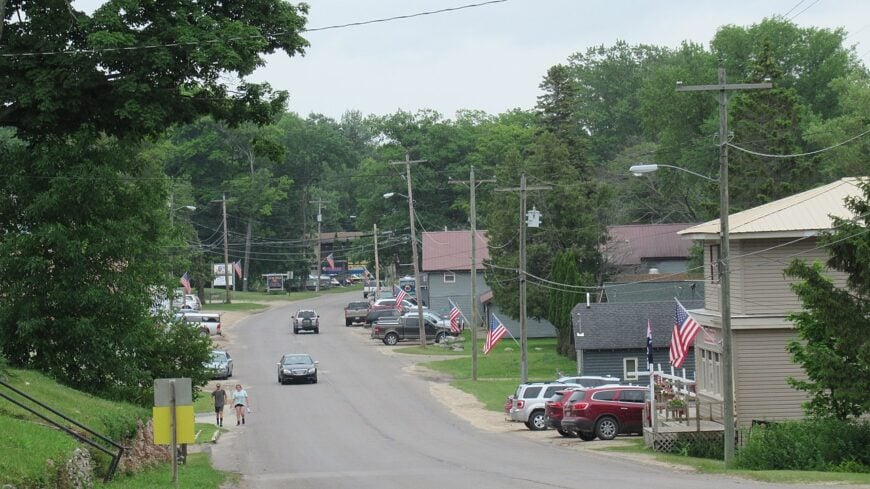
3. Grand Marais – Sand Dunes and Star-Filled Skies on Superior’s Edge
Grand Marais supports about 350 residents who enjoy front-row seats to the Grand Sable Dunes and a harbor sheltered by a lone breakwater light. Hikers tackle the eastern terminus of Pictured Rocks National Lakeshore, while winter visitors trade boots for fat-tire bikes on snow-packed backroads.
Hospitality, charter fishing, and small craft breweries make up the primary economic mix. The nearest stoplight is over 60 miles away, and once daylight fades, the Milky Way outshines porch bulbs due to the absence of urban glow.
Rugged dune fields and state forest create physical buffers around the village, funneling travelers onto a single entry road. That road often closes in heavy snow, adding to the sense of living on Superior’s very edge.
Where is Grand Marais?
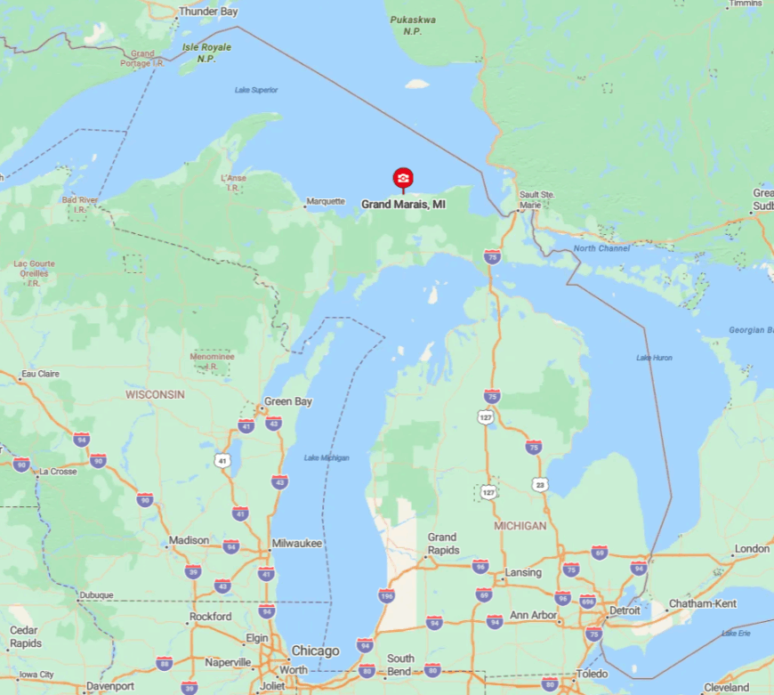
The village sits on Lake Superior’s south shore at the terminus of M-77, about 90 minutes from Munising or Newberry. Past Seney, the route enters Hiawatha National Forest where cell service flickers and gas stations vanish.
With Superior covering three sides and miles of dunes to the west, expansion remains impractical. Drivers should top off tanks in Seney and savor a final paved mile that ends beside the distinctive red-roofed light.
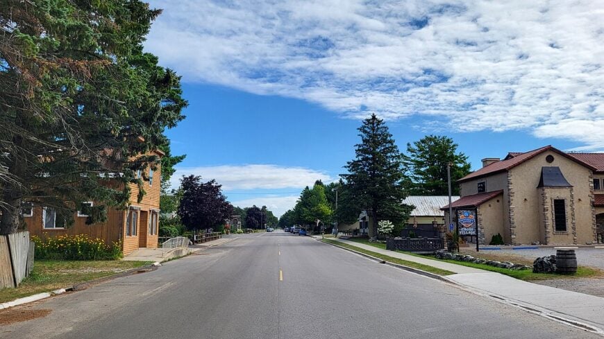
2. Curtis – Chain-of-Lakes Refuge in the Upper Peninsula
Approximately 600 people inhabit Curtis, spread across an isthmus flanked by South Manistique and Big Manistique Lakes. Anglers rent pontoons from mom-and-pop bait shops, birders scan reed beds for sandhill cranes, and snowmobilers converge on groomed trails each January.
Seasonal recreation and cottage services form the core economy, supported by a modest school and volunteer fire hall. The village’s shallow bays absorb engine noise, and surrounding wetlands thwart new construction, preserving a low skyline broken only by maple crowns.
Loons and frogs dominate the nighttime chorus, reminding visitors how far they are from freeway hum. Even during summer, boat motors give way to quiet by dusk as speed limits drop on the chain waters.
Where is Curtis?
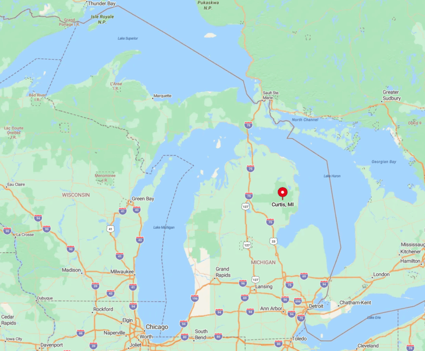
Curtis is nestled in Mackinac County, 65 miles northwest of the Mackinac Bridge, accessible primarily via M-77 and H-33. The final approach narrows to a causeway surrounded by cattails, reducing space for development or traffic flow.
With no state trunkline highway within 25 miles, accidental pass-throughs are rare. Most travelers plot a dedicated route from US-2 or M-28, then slow to the village’s 25-mile-per-hour pace as soon as the lakes come into view.
1. Cross Village – Historic Bluff-Top Haven Above Lake Michigan
Roughly 300 residents look out over Lake Michigan from Cross Village’s grassy bluffs crowned by an iconic white steeple. Sightseers picnic at the state beach, browse Anishinaabe art at the Three Pines Studio, and savor whitefish at the century-old Legs Inn perched on the cliff’s edge.
Limited dining, small-scale farming, and heritage crafts support the local economy through short summer seasons. The absence of commercial sprawl, paired with wind-bent birches and pebble beaches, keeps man-made noise to a minimum.
Bluffs rise between the shoreline and M-119, hiding cottages from road view and granting homeowners sweeping vistas unspoiled by nearby buildings. Evening winds whistle through the pines, underlining Cross Village’s ranking as Northern Michigan’s most secluded lakeside retreat.
Where is Cross Village?
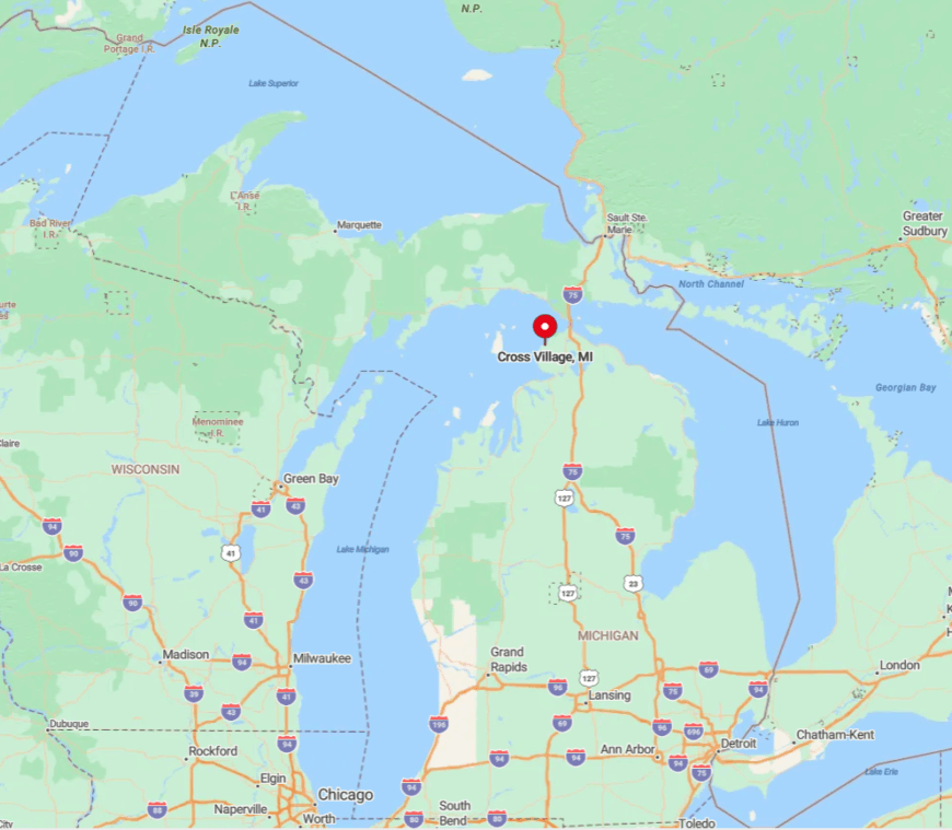
Cross Village lies 20 miles north of Petoskey along M-119’s scenic bluff route. The winding highway discourages speed and offers no direct inland detours, ensuring only deliberate travelers reach the bluff-top lawn.
With Lake Michigan on one side and hills on the other, expansion remains physically limited. Most visitors exit US-31 at Petoskey or Levering, then follow shoreline curves for half an hour before spotting the steeple against open water.