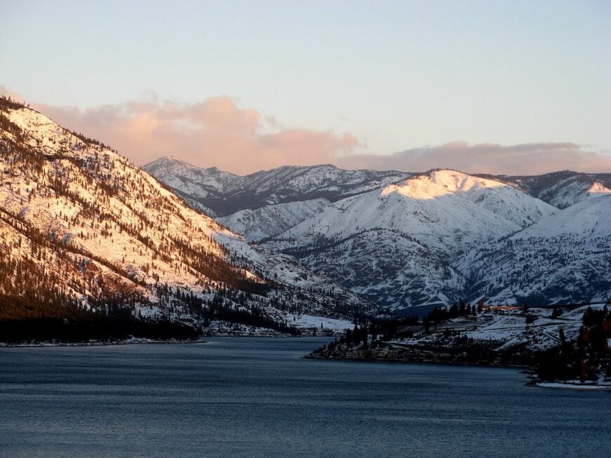
Lakes in Eastern Washington stretch for miles without a town in sight, and when a settlement does appear, it often clings to a single dock or a bend in the road. The surrounding basalt walls and pine ridges act as buffers, keeping outside noise at bay.
In order to come up with the very specific design ideas, we create most designs with the assistance of state-of-the-art AI interior design software. Also, assume links that take you off the site are affiliate links such as links to Amazon. this means we may earn a commission if you buy something.
Life in these places is defined by distance. Stores may be hours away, roads can vanish into gravel switchbacks, and ferries carry just a handful of cars across water that feels endless. The effort it takes to reach them is part of their character—seclusion preserved by geography itself.
Here, the pace is unhurried because it can be. Evenings fall to the sound of waves instead of traffic, and a starlit sky is often the brightest light for miles. Locals know every boat on the water, every ridge on the horizon, and every silence worth keeping.
These 25 lakeside towns remain apart by choice or by accident of terrain. Together they form a map of retreats tucked against rivers, reservoirs, and high mountain lakes—places where seclusion isn’t an escape but the essence of daily life.
25. Keller
Keller, Washington rests within the Colville Indian Reservation, surrounded by the rugged mountains and forests of Ferry County. Its seclusion comes from winding roads and the vast Columbia River, which keep it far removed from the pace of larger towns.
The atmosphere is rooted in tradition, where Native culture and small-town living shape daily rhythms. Visitors can fish or boat on Lake Roosevelt, hike the nearby mountain trails, or join in local gatherings that celebrate community and heritage.
Ranching, forestry, and tribal enterprises have long provided the foundation for life here. Keller leaves you with the sense of a place where remoteness deepens connection to both land and spirit.
Where is Keller?

Keller rests in northeastern Washington, within Ferry County’s rugged mountains. It lies about 90 miles northwest of Spokane, reached by U.S. Route 2 before turning onto WA Highway 21, a winding road that descends toward the Sanpoil River valley.
The drive passes forests, ridgelines, and open stretches where the land feels untouched and wide. By the time you arrive, Keller feels quietly tucked away, close to the wild heart of the state yet far from its noise.
24. Rice
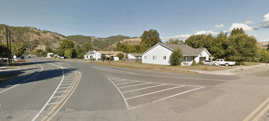
Rice, Washington lies quietly along the Columbia River, tucked between steep hills where the road narrows and the world seems to fall away. Its seclusion comes from its small size and riverside setting, far from the hum of highways or the pull of nearby cities.
The pace here is slow and steady—boats drift on the water, neighbors wave from porches, and evenings carry the sound of crickets across the valley. Visitors can launch a canoe on the river, explore the backroads that wind into forested ridges, or stop by small community gatherings that keep traditions alive.
Farming, ranching, and river life have long anchored the people who stay, binding them closely to the land and water. Rice lingers in memory as a riverside town where quiet feels like a way of life.
Where is Rice?
Rice sits in Stevens County in northeastern Washington, tucked along the Columbia River’s curving shoreline. It lies about 15 miles south of Kettle Falls, reached by following U.S. Highway 395 as it winds between forested slopes and glimpses of water.
The road in feels steady and quiet, tracing the edge of the river before narrowing near the settlement. By the time you arrive, the wide water on one side and wooded ridges on the other make it feel both sheltered and apart.
23. Inchelium
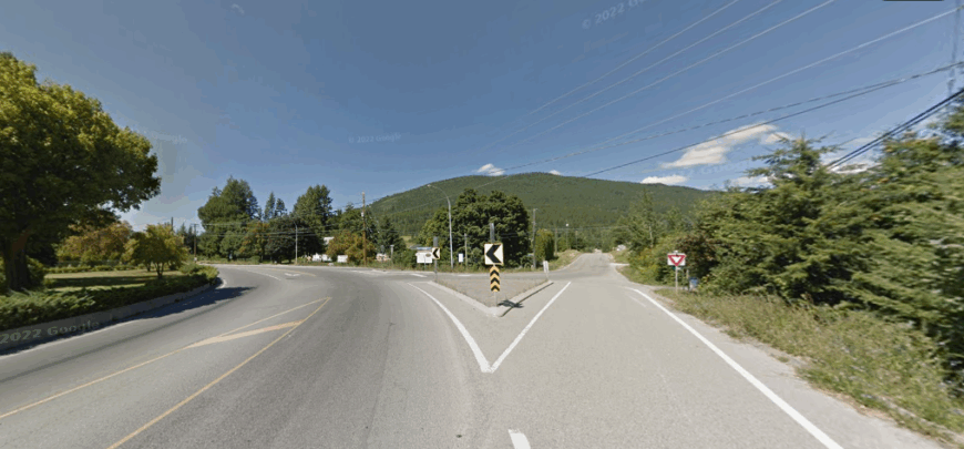
Inchelium, Washington rests on the eastern edge of the Colville Indian Reservation, where the Columbia River bends wide and forested hills rise in every direction. Its seclusion comes from the long, winding roads that lead in, making it feel like a hidden place you only find if you’re seeking it.
The town carries a deep sense of heritage, with the culture and traditions of the Colville Confederated Tribes woven into daily life. Visitors can fish or boat on Lake Roosevelt, walk the quiet trails through pine forests, or join local events that celebrate Native history and community.
Work here often ties back to the land—whether in forestry, ranching, or tribal enterprises that sustain families. Inchelium leaves you with the feeling of a place where the stillness of the river and the strength of tradition go hand in hand.
Where is Inchelium?
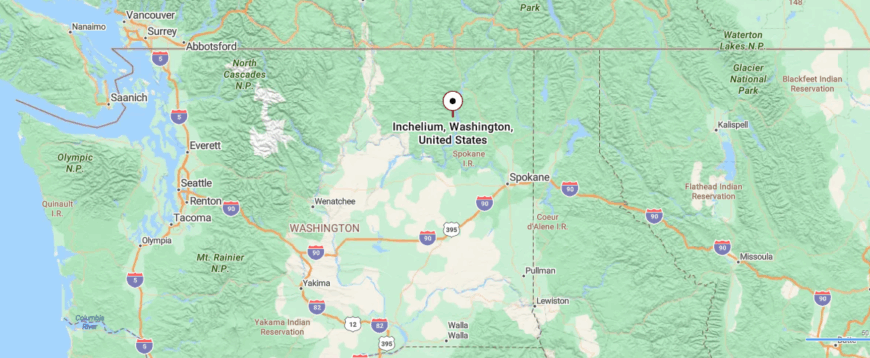
Inchelium rests on the Colville Indian Reservation in Ferry County, eastern Washington, tucked along the eastern shore of the Columbia River. It’s about 30 miles southwest of Kettle Falls, reached by WA Highway 21 and then a ferry crossing or winding forest roads that trace the water.
The journey carries you through stretches of pine forest and quiet lakeshore, where traffic thins and the land feels expansive. By the time you reach town, the river and hills seem to fold around it, giving a sense of deep seclusion shaped by water and forest.
22. Cedonia
Cedonia, Washington sits quietly along the Columbia River in Stevens County, a dot on the map that feels far removed from busier places. Its seclusion comes from the winding country roads that lead through farmland and forest before reaching this small community.
The rhythm of life here is steady—fields stretch wide, church bells mark the hours, and the river flows past with unhurried grace. A visitor might spend time fishing along the Columbia, driving the rural backroads, or exploring the hills that rise just beyond town.
Farming has long been the anchor, with generations tending the same soil that has shaped the valley for centuries. Cedonia leaves you with the sense of a town content in its stillness, where simplicity becomes its own kind of beauty.
Where is Cedonia?
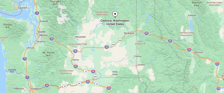
Cedonia is a small riverside community in Stevens County, northeastern Washington, settled along the Columbia River valley. It sits about 12 miles south of Kettle Falls, reached by U.S. Highway 395 as it threads between the river and the hills.
The drive is lined with farmland, patches of pine forest, and long views of the water beside the road. When you arrive, Cedonia feels quietly anchored to the river’s bend, a place where the steady flow sets the rhythm of life apart from the rest.
21. Loon Lake
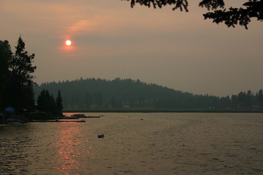
Loon Lake, Washington rests in the forested hills of Stevens County, where a broad glacial basin holds clear water ringed by cabins and campgrounds. Its seclusion stems from distance to larger cities and the quiet perimeter roads that keep traffic light.
Life here leans toward recreation—fishing for trout and bass, summer swimming at sandy public beaches, and ice fishing huts that appear when winter seals the surface. Families return generation after generation to the same lots, giving the shoreline a sense of continuity rare elsewhere.
The atmosphere blends rustic cabins with small clusters of shops that support seasonal visitors. Evening quiet returns quickly after sunset, broken only by loons calling from the darkened bays.
Where is Loon Lake?
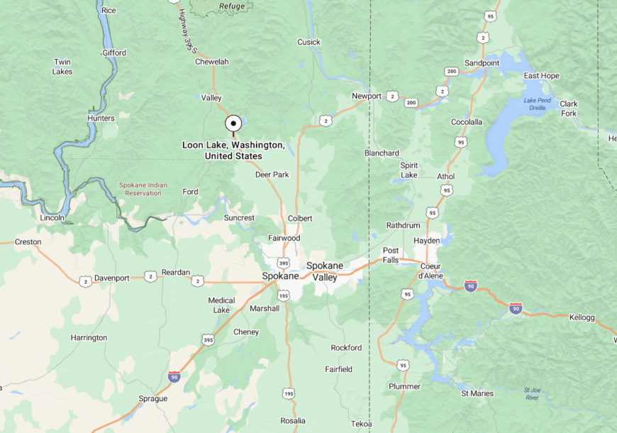
Loon Lake lies about 35 miles north of Spokane, just off U.S. Highway 395 in southern Stevens County. A short turnoff drops to the water’s edge, where county roads loop around the shoreline.
The drive alternates between pine forest and farmland, giving way suddenly to open water. By the time you reach the settlement, the lake fills the horizon, holding the town in its secluded basin.
20. Northport
Northport, Washington rests at the northern tip of Stevens County, where the Columbia River bends wide and the Selkirk Mountains rise in the distance. Its seclusion comes from its borderland location, far from larger cities, giving it the feel of both a gateway and a hideaway.
The town carries a frontier-like character—historic brick buildings line Main Street, and the river remains as central to daily life as it was a century ago. Visitors can fish or boat on the Columbia, explore the trails that climb into the Selkirks, or join the community during seasonal festivals that bring neighbors together.
Once a hub for mining and timber, the economy now leans on small businesses, recreation, and the enduring spirit of a rural border town. Northport leaves you with the sense of a place where history and wilderness meet, holding onto both grit and quiet charm.
Where is Northport?
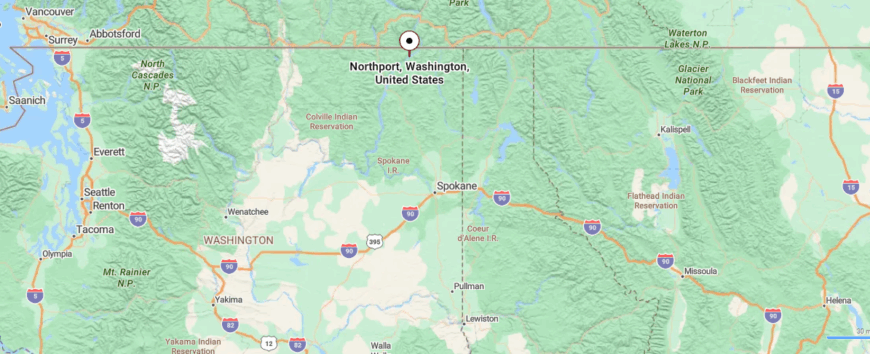
Northport rests in Stevens County at the far northeastern edge of Washington, just a few miles from the Canadian border. It’s about 20 miles north of Kettle Falls, reached by following State Route 25 (SR-25) as it winds along the Columbia River’s edge.
The approach carries you past stretches of forest and river bluffs, with the water never far from view. When you arrive, Northport feels like the end of the road, a riverside town where the landscape itself marks the quiet boundary of the state.
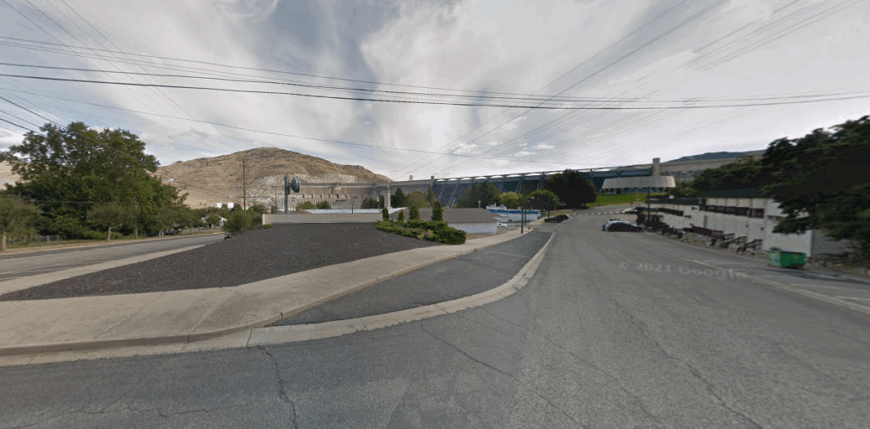
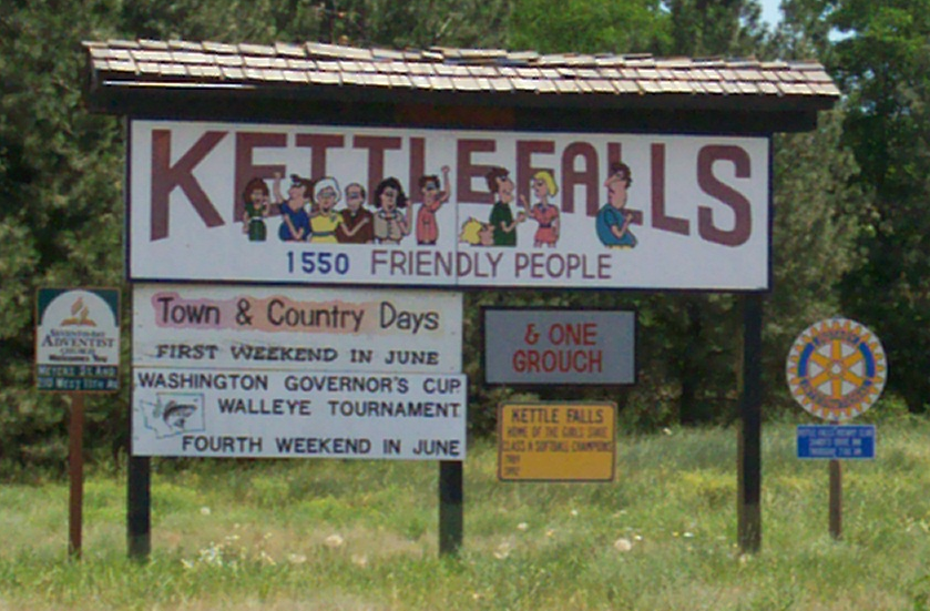
19. Kettle Falls
🔥 Would you like to save this?
Kettle Falls, Washington stands where the Columbia River once poured over mighty falls now buried beneath Lake Roosevelt, a place where history and landscape intertwine. Its seclusion comes from being surrounded by forested ridges and long stretches of water, set apart from the larger towns to the south.
The atmosphere carries both memory and resilience—Native peoples once gathered at the falls for fishing, and echoes of that heritage remain in the land and stories. Visitors today can boat or fish on Lake Roosevelt, hike the Colville National Forest trails, or explore the historic mission nearby.
Logging, farming, and tourism form the backbone of life here, keeping the community closely tied to both land and water. Kettle Falls leaves you with the feeling of a town shaped by what was lost and what endures, quiet yet deeply rooted.
Where is Kettle Falls?
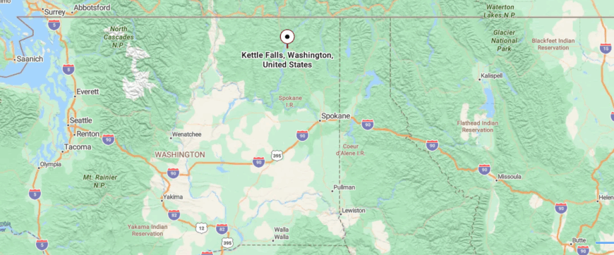
Kettle Falls sits in Stevens County in northeastern Washington, where the Columbia River bends near the mouth of the Colville River. It’s about 9 miles north of Colville, reached by U.S. Highway 395 as it winds through forested valleys and open stretches of farmland.
The approach opens into wide views of water and hills, a reminder of the falls that once roared here before the dam. By the time you arrive, the mix of river, history, and quiet hillsides makes it feel like a place where the past still lingers in the air.
18. Fort Spokane
Fort Spokane, Washington lies where the Spokane River meets the Columbia, a place wrapped in forested bluffs and echoes of history. Its seclusion comes from the wide stretches of water and the remote hillsides that make it feel like a hidden crossroads of land and river.
The atmosphere blends quiet wilderness with the weight of the past, as remnants of the old military post still stand beneath towering pines. Visitors can wander the historic fort grounds, hike riverside trails, launch a boat onto Lake Roosevelt, or camp where the night sky opens wide with stars.
Tourism and outdoor recreation now shape much of its rhythm, carrying forward the stories of both settlers and tribes who once lived here. Fort Spokane lingers in memory as a place where history and solitude flow together, as steady as the rivers that meet at its edge.
Where is Fort Spokane?
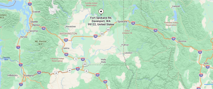
Fort Spokane lies in Lincoln County, eastern Washington, where the Spokane River meets the Columbia. It’s about 50 miles west of Spokane, reached by U.S. Highway 2 before turning onto WA Route 25, a road that winds down toward the river confluence.
The approach passes high plateaus that drop suddenly into canyon country, with sweeping views of water and basalt cliffs. By the time you arrive, the historic grounds feel set apart by both land and river, a place where quiet and history linger together.
17. Roosevelt
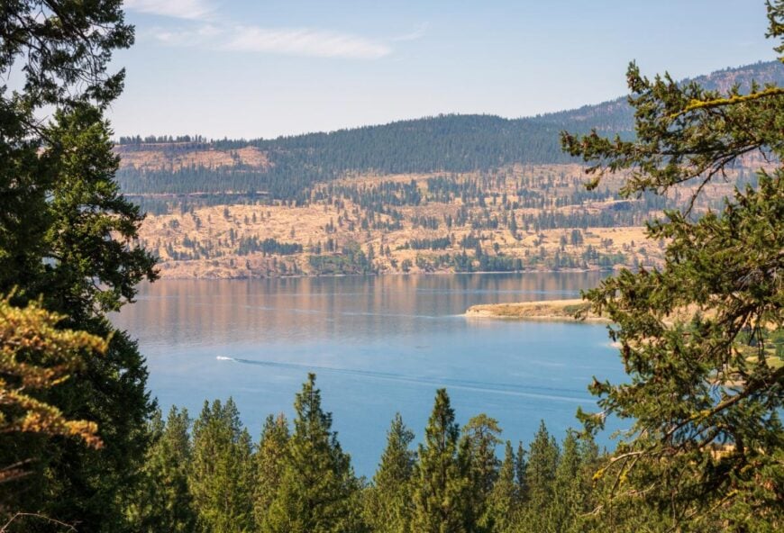
Roosevelt, Washington rests along the Columbia River in Klickitat County, where wide waters and open desert hills create a sense of vast quiet. Its seclusion comes from being far from major towns, tucked between stretches of sagebrush and the steady winds that sweep the gorge.
Life here is shaped by simplicity—grain silos rise against the horizon, freight trains echo through the valley, and the river itself feels like the town’s anchor. Visitors can launch a boat on the Columbia, watch the windsurfers further upriver, or explore the open roads that seem to run endlessly across the plateau.
Farming and river trade have long been the backbone of daily life, tying families to both soil and water. Roosevelt leaves you with the feeling of a place where space and silence stretch as far as the eye can see.
Where is Roosevelt?
Roosevelt sits in Klickitat County in south-central Washington, stretched along the Columbia River’s northern shoreline. It lies about 30 miles east of Goldendale, reached by U.S. Highway 97 before turning onto WA Route 14, which follows the river through wind-swept canyons.
The road in runs parallel to broad water and barren ridges, where gusts sweep across the open gorge. When you arrive, Roosevelt feels like a place shaped by the river and the wind—remote, spare, and set apart from the noise of elsewhere.
16. Coconully
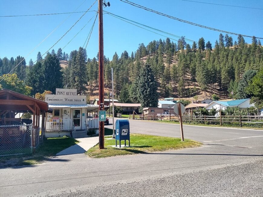
Conconully, Washington tucks into a high valley in Okanogan County, where two adjoining lakes—Upper and Lower Conconully—hold the town like cupped hands. Its seclusion comes from the last quiet miles of county road that climb past sage hills and ponderosa benches before the pavement gives way to shoreline.
Days revolve around water and seasons: trout rising in the still mornings, ice huts dotting the coves in deep winter, and small boats nosing along reed edges at dusk. The pace stays neighborly—a handful of cafés and tackle shops, cabins tucked in the trees, and a state park that never feels overrun.
Logging and ranching once defined the valley, but today the rhythm is weekend anglers, snowmobilers, and families who return to the same docks year after year. Night brings dark skies and the hush of wind filtering through pines that climb the surrounding slopes.
Where is Coconully?
Conconully sits about 18 miles northwest of the town of Okanogan in north-central Washington. The approach follows Conconully Road as it leaves the river plain and winds into foothills, with views opening suddenly to the twin lakes and the small grid of streets between them.
Most visitors arrive from US-97 via Okanogan, then make the steady climb into the valley; others thread in from the Sinlahekin Wildlife Area on slower backroads. By the time you reach town, ridgelines and water bracket the horizon, and traffic noise has long since fallen away.
15. Deer Lake
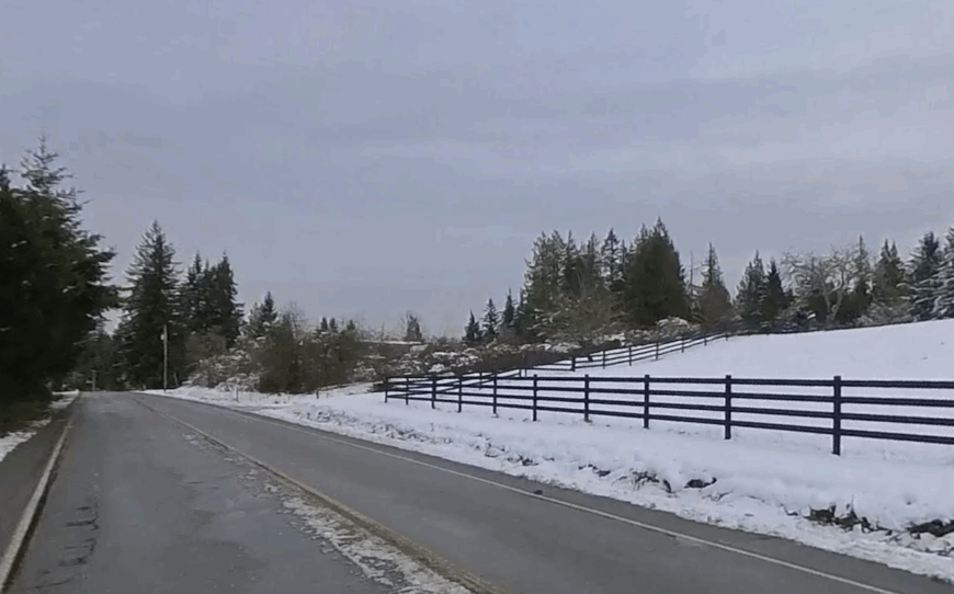
Deer Lake spreads across southern Stevens County, surrounded by wooded ridges that keep it hidden from main roads. Its seclusion comes from geography—long inlets, narrow approaches, and the kind of winding lanes that discourage casual traffic.
The lake has been a summer haven since the early 20th century, with rustic resorts and cottages still scattered along its shore. Anglers come for kokanee and rainbow trout, while boaters and swimmers share quieter bays that feel a world away from Spokane.
Local life is a mix of permanent residents who guard the stillness year-round and seasonal families who swell the shoreline during warm months. Either way, the lake sets the pace, with dawn fishing trips and dusk campfires shaping the daily rhythm.
Where is Deer Lake?
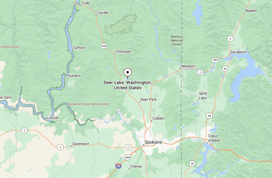
Deer Lake sits about 45 minutes north of Spokane, reached by County Road E Deer Lake Road branching east from U.S. Highway 395. The approach winds through forested foothills before opening suddenly to water.
The shoreline road wraps around coves and wooded points, often dipping close enough to hear the waves. By the time you arrive, the sense of seclusion is strong—traffic thins, ridges rise, and the lake feels like its own hidden world.
14. Evans
Evans, Washington rests quietly along the Columbia River in Stevens County, where forested ridges slope down to meet the water’s edge. Its seclusion comes from being a riverside community tucked far from major towns, with winding highways and thick pines holding it apart.
Life here is marked by a steady calm—neighbors gathering at the post office, the hum of boats on the river, and the soft rhythm of rural living. Visitors can fish or launch a kayak on the Columbia, camp beneath the trees, or follow scenic drives that wind through the Selkirk foothills.
Farming, ranching, and small trades remain the backbone, tying families to both land and river. Evans leaves you with the feeling of a place where the beauty of the water and the quiet of the hills exist in perfect balance.
Where is Evans?
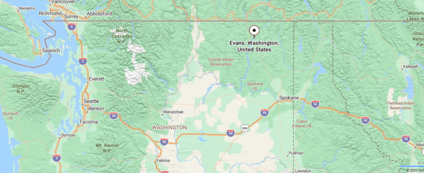
Evans lies in Stevens County in northeastern Washington, set along the east bank of the Columbia River. It’s about 9 miles north of Colville, reached by U.S. Highway 395 as it threads through valleys where forest and farmland meet.
The road follows the river’s bends, offering glimpses of water and wooded slopes that grow quieter the farther you drive. By the time you arrive, Evans feels like a riverside pocket where life moves to the steady rhythm of the current.
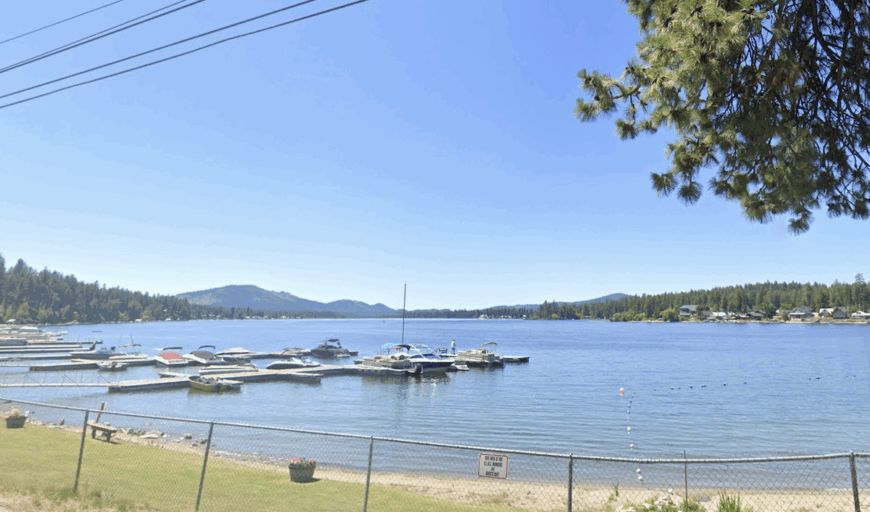
13. Diamond Lake
🔥 Would you like to save this?
Diamond Lake, Washington spreads across southern Pend Oreille County, a large natural lake ringed by wooded hills and quiet residential roads. Its seclusion comes from being tucked between ridges, with access limited to a few approach roads that circle the shoreline.
Life here is defined by the water—anglers cast for trout and bass, paddleboards glide across calm bays, and families return each summer to cabins that have stood for generations. Despite its popularity with seasonal visitors, the lake retains a hush once evening falls, broken only by owls and the occasional loon.
The shoreline hosts a blend of year-round homes and rustic retreats, but much of the perimeter remains shaded by pine forests, keeping the atmosphere close to wild. Diamond Lake endures as a retreat where the lake itself is both playground and boundary.
Where is Diamond Lake?
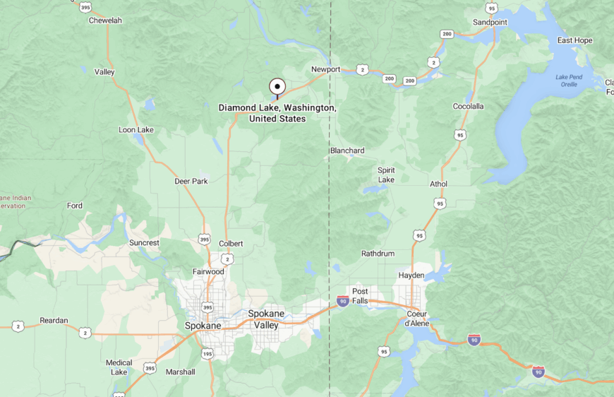
Diamond Lake lies about 7 miles southwest of Newport in Pend Oreille County, reached by U.S. Highway 2 before turning onto Diamond Lake Road. The approach passes through rolling forest before dropping into the broad valley that holds the lake.
The water stretches nearly four miles long, framed by ridges that shelter it from wind and outside noise. By the time you arrive, the lake feels self-contained, with no through traffic and only the sound of water carrying across its surface.
12. Curlew Lake
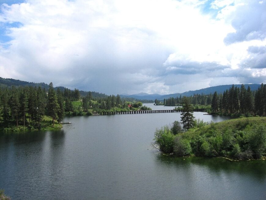
Curlew Lake stretches six miles through Ferry County, framed by low mountains that guard its quiet edges. Its seclusion comes not from sheer distance but from being tucked into a valley north of Republic, away from any major traffic corridors.
The lake is known for its clarity and steady fishing—rainbow trout, tiger muskies, and perch draw steady but modest numbers of anglers. Resorts, campgrounds, and cabins dot the western shore, yet much of the lakefront remains forested, keeping the balance tipped toward quiet.
Daily life revolves around the water: kids swimming at docks, kayaks sliding across glassy mornings, and evenings when campfires echo across the valley. Curlew holds its charm by remaining just busy enough to support visitors but never large enough to lose its stillness.
Where is Curlew Lake?
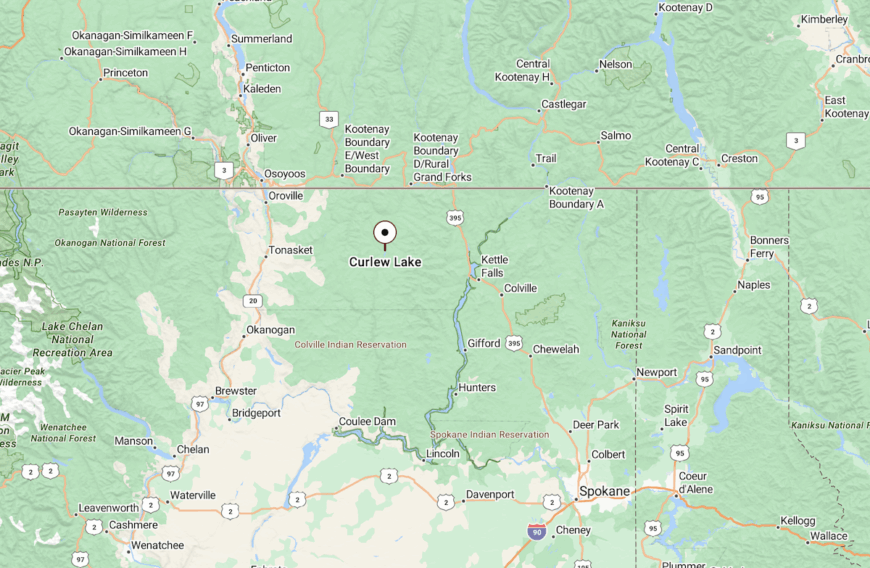
Curlew Lake sits about 5 miles north of Republic in Ferry County, reached by State Route 21 before turning onto Curlew Lake Road. The route follows the valley floor until the water spreads into view.
The approach is lined with forest and open meadows, gradually narrowing as you descend to the shoreline. By the time you arrive, the ridges on either side fold close, enclosing the lake and giving it a distinctly secluded feel.
11. Bossburg
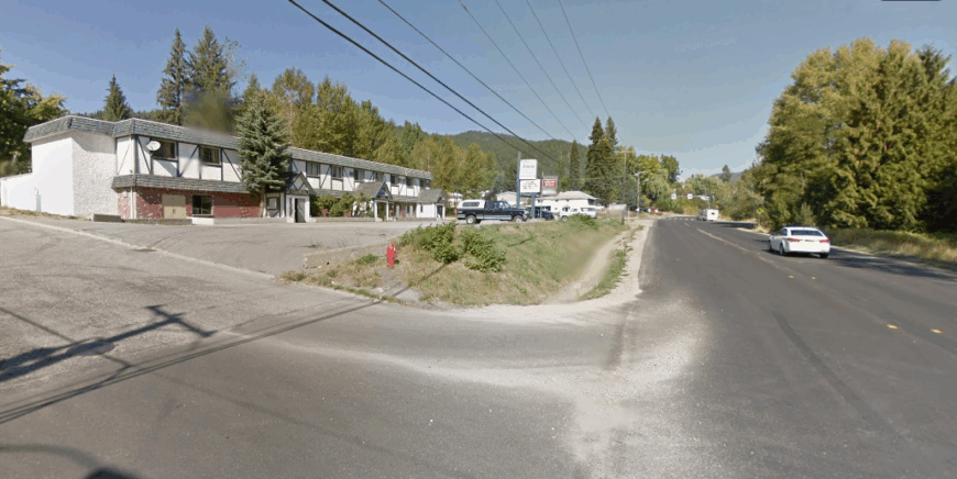
Bossburg, Washington sits quietly along the banks of the Columbia River, near the Canadian border, where the hills and water together create a sense of being tucked away. Its seclusion comes from its small size and its location along winding stretches of highway that few pass without intention.
The town carries echoes of its past—once known for mining and river trade—now softened into a quieter rural rhythm. Visitors can fish along the Columbia, explore the forested ridges nearby, or wander the old townsite that hints at earlier days of bustle.
Today, life leans on farming, small trades, and the steady connection to the river itself. Bossburg leaves you with the quiet impression of a place that remembers its history while holding fast to its solitude.
Where is Bossburg?
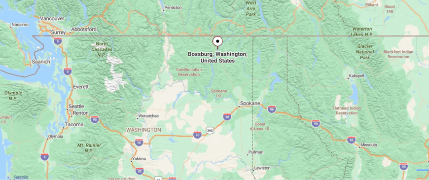
Bossburg is a small community in Stevens County, northeastern Washington, set along the Columbia River just south of the Canadian border. It’s about 10 miles north of Kettle Falls, reached by U.S. Highway 395 as it curves between steep hills and the wide river.
The drive is lined with forested slopes and long stretches of water, where the scenery feels both vast and quiet. By the time you reach Bossburg, the river’s steady presence and the closeness of the hills give it a sense of being tucked into its own hidden bend.
10. Stehekin
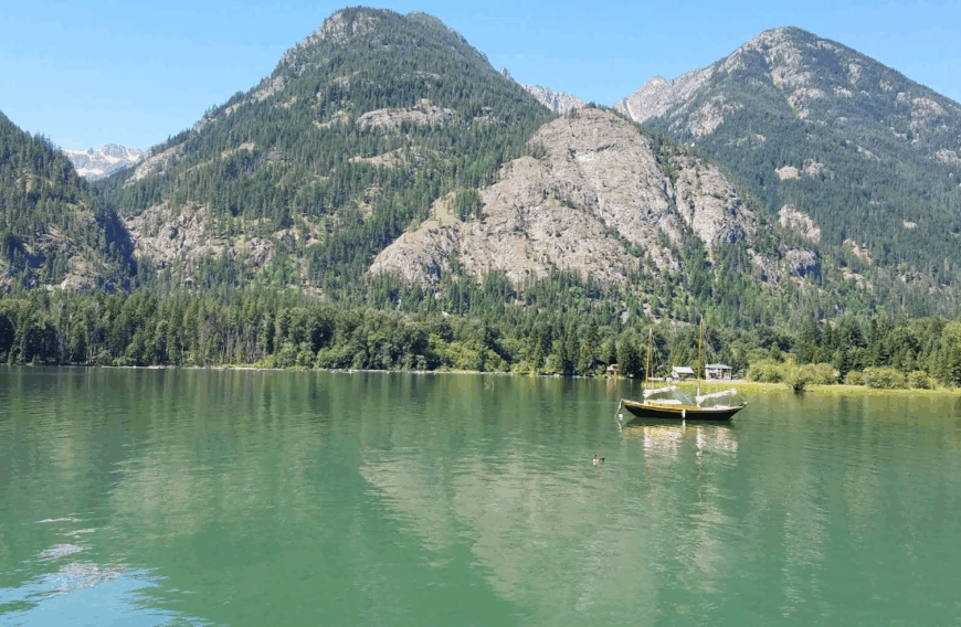
Stehekin supports fewer than 100 year-round residents. Visitors spend days paddling the sapphire water, casting for cutthroat trout, or walking five minutes from the landing to a bakery famous for warm cinnamon rolls.
Seasonal jobs with the National Park Service and a pair of family-run lodges dominate the local economy, while a tiny school and craft shops round it out. Freight arrives by barge, so residents often share supplies and repair gear themselves instead of driving to a hardware store.
The village has no road connection to the rest of Washington, insulating it from car traffic and spur-of-the-moment tourists. Evenings settle into profound quiet broken only by lake birds and the distant rumble of Rainbow Falls.
Where is Stehekin?
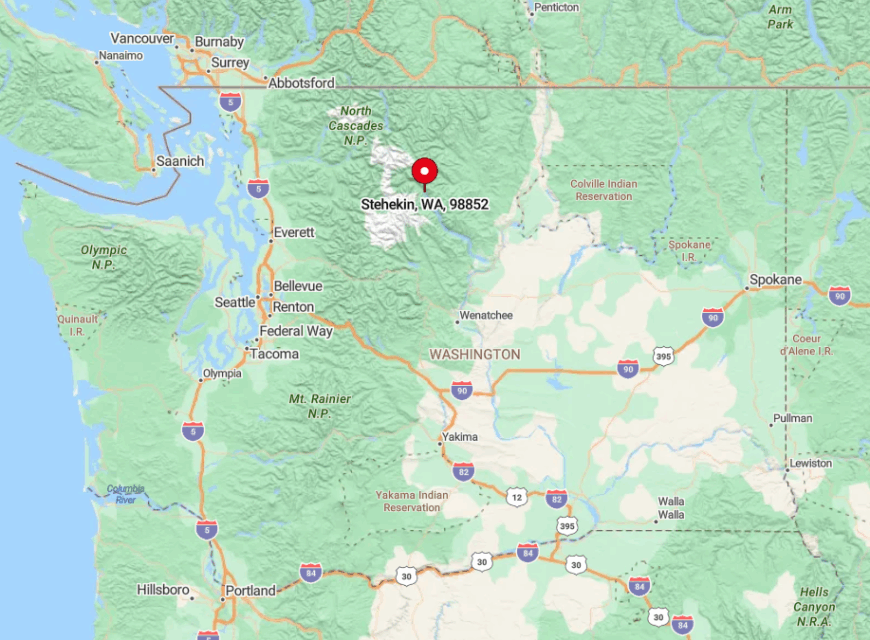
Stehekin sits at the glacier-carved head of 50-mile-long Lake Chelan in the heart of the North Cascades. Fifty water miles separate it from the highway town of Chelan, and terrain on either side rises in sheer granite walls that block any hope of a road.
Most travelers arrive on the Lady of the Lake ferry, a floatplane, or the single dirt airstrip that hugs the valley floor. Strong hikers can cross Cascade Pass on foot, a multiday trek that underscores just how tucked away this hamlet remains.
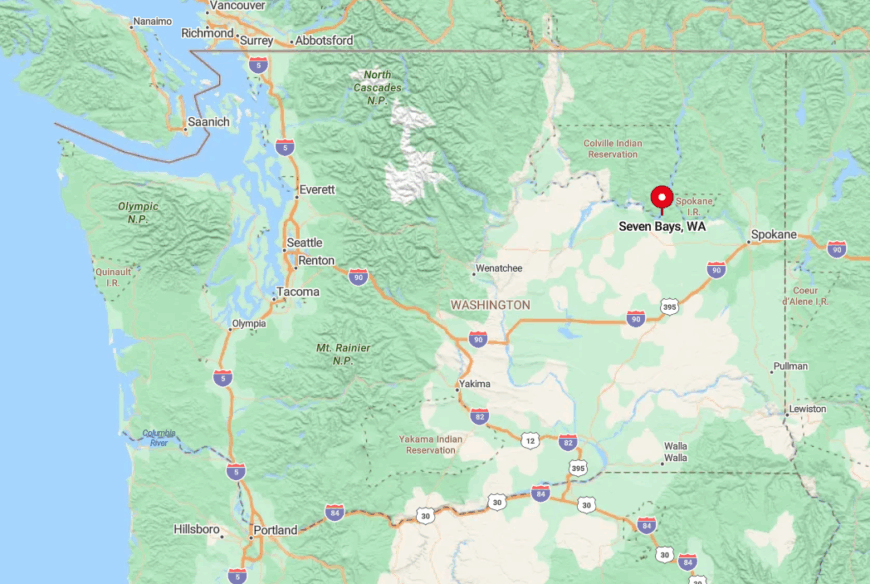
9. Seven Bays
Roughly 110 people claim permanent addresses in Seven Bays. Days revolve around the sheltered marina where sailboats share slips with fishing skiffs, and nearby coves invite swimming in warm summer water.
Small-scale tourism, property maintenance, and the Lake Roosevelt Resort fuel local income, with ranching still present on surrounding plateaus. Homes perch on acre-plus lots among ponderosa pines, so neighbors are close enough for a wave yet distant enough for privacy.
The shoreline remains largely undeveloped thanks to federal management of the reservoir, keeping light pollution low and night sounds limited to crickets. That balance of access to a dock and miles of empty shoreline makes Seven Bays feel like a private camp.
Where is Seven Bays?
🔥 Would you like to save this?
The village lies on the west side of Lake Roosevelt about 35 miles north of Davenport in Lincoln County. A looping county road ends at the marina, making the community a destination rather than a drive-through.
Hills shield it from Highway 25 traffic, adding an extra layer of hush. Spokane residents typically reach it via SR-25 and a final stretch of two-lane pavement that drops toward the water.
8. Lincoln
Lincoln’s year-round population hovers near 60. Mornings start with coffee on decks built atop basalt cliffs where bald eagles cruise the updrafts, while afternoons see anglers launching from a modest public ramp.
Locals find work in guide services, small construction outfits, and remote tech positions that rely on fixed wireless internet. The settlement sits 15 sinuous miles from the nearest store, and winter snow can briefly close the only access grade, so self-reliance is second nature.
With no streetlights and only scattered cabins, stargazing rivals that of designated dark-sky parks. Visitors often miss the faint petroglyphs etched into lakeside rock faces a short kayak paddle west of town.
Where is Lincoln?
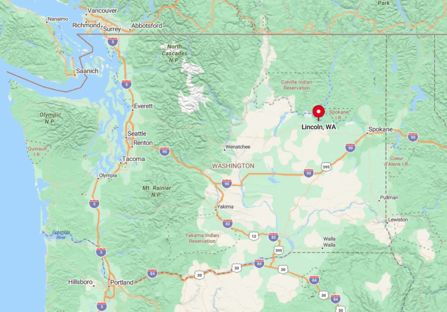
Lincoln occupies a lofty bench above the Columbia River on the southwest reach of Lake Roosevelt. The single road in, Lincoln Boat Launch Road, drops from SR-25 and winds past wheat fields before hugging a cliff line to the shoreline.
That isolation by topography keeps casual travelers from stumbling upon the village. Most arrive towing boats, prepared for the steep descent and equally steep climb back out.
7. Marcus
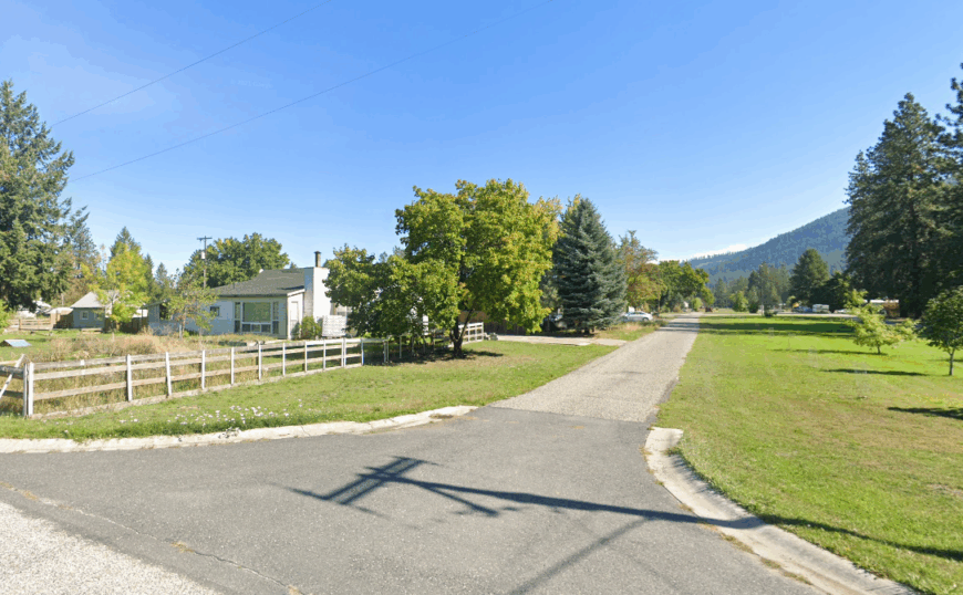
About 190 residents make up Marcus, a historic settlement shifted uphill when Lake Roosevelt flooded the original townsite in 1941. Wooden boardwalks and century-old façades give Main Street a frontier flavor, while anglers share gossip at the public fishing dock just steps away.
Employment centers on small logging outfits, the school district, and summer tourism tied to nearby Colville National Forest. Freight trains pass within earshot yet highway sounds fade thanks to thick fir and cedar that border town.
With no chain stores and only one café, evenings often end with cribbage games at the volunteer fire hall. The resulting atmosphere feels more like a friendly outpost than a tourist stop.
Where is Marcus?
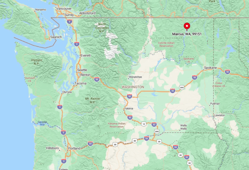
Marcus nestles on a gentle bend of Lake Roosevelt twenty miles south of the Canadian border along Highway 395. Forested ridges on either side funnel traffic away, so through-drivers rarely pause.
Access is simple by car, but limited lodging means most overnight guests secure a vacation rental or camp across the bridge at the quiet Marcus Island campground. The lack of motels discourages bus tours, preserving the easy pace locals value.
6. Hunters
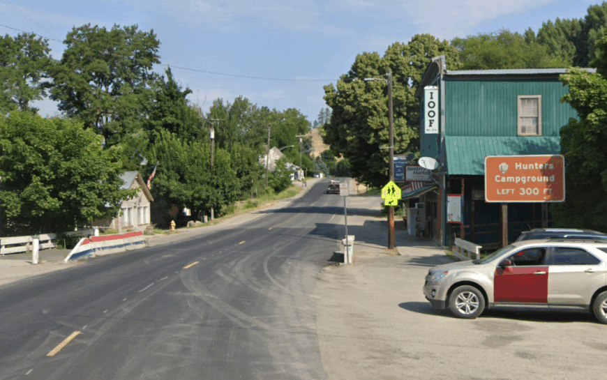
Hunters records roughly 330 inhabitants spread along orchard rows and lakefront lanes. Travelers drop into the valley for walleye fishing, cider tasting at family groves, or shoreline hikes where mule deer graze at dawn.
Agriculture leads the economy, supported by a small cluster of seasonal lake cabins that create hospitality work in summer. The nearest traffic light lies over 20 miles away, and a patchwork of private land and tribal trust land keeps new construction sparse.
With minimal light glare, the Milky Way casts reflections on Roosevelt’s teal bays after dark. Residents often gather at the unassuming grange hall for potlucks and bluegrass jams that rarely make tourist brochures.
Where is Hunters?
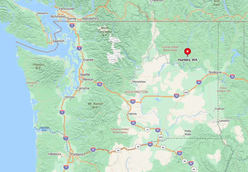
Hunters sits on the east bank of Lake Roosevelt between the Spokane Indian Reservation and the town of Springdale. SR-25 reaches it by hugging the waterline, but few drivers venture farther once the pavement turns inland.
Rugged hills to the east and the wide Columbia to the west create a natural buffer that limits expansion. Spokane locals generally make the hour-plus drive along rural highways, then descend a final series of curves to the hidden bays.
5. Daisy
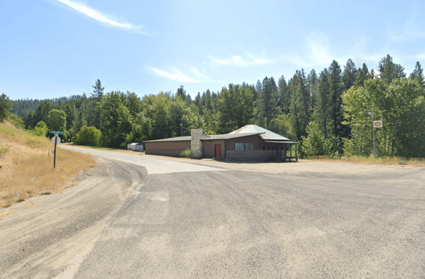
Fewer than 70 permanent residents call Daisy home. Summer brings a trickle of families to simple cedar cabins that front open meadows where elk linger at dusk, while anglers troll for kokanee in the reservoir’s cool north arm.
Work revolves around ranching, forestry, and caretaking seasonal properties; the closest grocery store sits a winding 25-minute drive away in Kettle Falls. A single narrow county road ends at the water, and cellular service is intermittent, encouraging evenings filled with conversation rather than screens.
Meadows, cedar thickets, and only one public boat launch keep visitor numbers extremely low. Locals treasure hidden swimming holes just upriver at China Bend where warm back-eddies invite float sessions in mid-summer.
Where is Daisy?
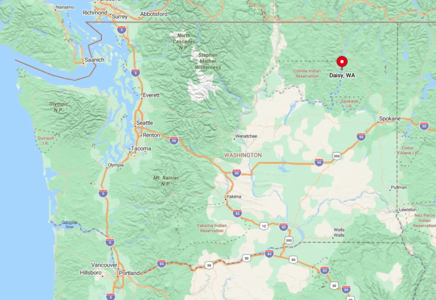
Daisy rests along the Columbia about eight miles north of Rice in Stevens County. Low forested ridges hem it in on three sides, while the lake blocks the fourth, making it feel like a pocket universe.
Drivers reach it by a spur off Northport-Flat Creek Road that narrows to single lane in places. Winter snow occasionally shuts that spur, which reinforces the town’s secluded nature.
4. Gifford
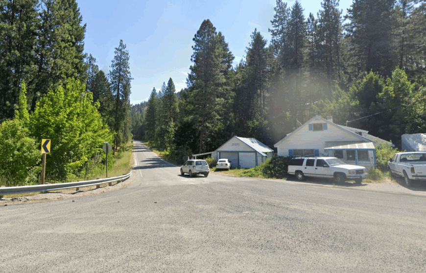
Gifford lists roughly 55 residents in census counts. The community clusters around a ferry landing where free state ferries shuttle a few cars at a time across the Columbia, allowing spur-of-the-moment trips to the reservation side for groceries or powwow events.
Jobs include ferry operations, small logging contracts, and remote work now possible thanks to a recent fiber line. Surrounded by hills on every flank, Gifford shelters in a natural bowl that mutes wind and amplifies birdsong.
Nighttime silence is broken only by the occasional ferry horn and owl calls. Locals often watch meteor showers from the gravel turnaround above the dock where headlights are rare after 10 PM.
Where is Gifford?
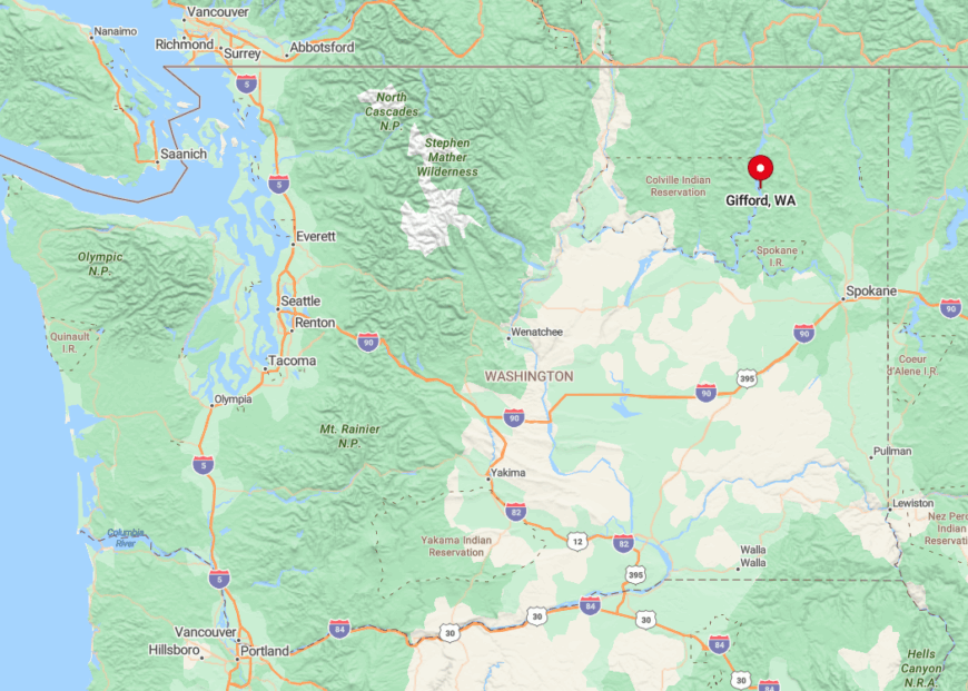
The village lies 17 miles south of Inchelium on the east shore of Lake Roosevelt. State Route 25 passes high above, with a short spur descending to the ferry slip, so through-traffic bypasses the settlement entirely.
The Columbia River forces most routes to detour many miles, making the ferry an essential yet lightly used link. Visitors usually approach from the west via Highway 25, then ride the five-minute crossing to discover just how removed Gifford feels.
3. Cusick
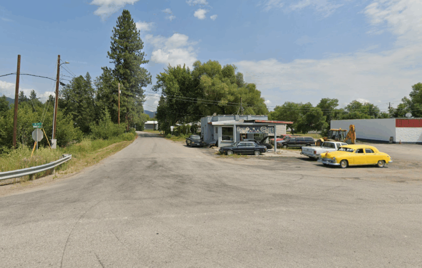
Approximately 210 people live in Cusick where the Pend Oreille River widens into backwater channels rich with cattails and osprey nests. Canoeists weave through marshes, anglers chase smallmouth bass, and birders scan for the occasional great gray owl that winters nearby.
Timber once dominated the economy, but today tribal administration, a biomass plant, and home-based artisans provide most paychecks. Homes sit on generous parcels carved from former Kalispel prairie, and the nearest big-box retail sits 50 miles south in Newport.
The confluence of river and lake buffers the town from highway noise, so fog horns from migrating swans are often the loudest morning sound. Early summer brings huckleberry foraging on surrounding hillsides, a tradition shared by both tribal and non-tribal families.
Where is Cusick?
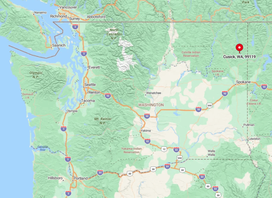
Cusick occupies a gentle bend of the Pend Oreille River in northeast Washington just minutes from the Idaho border. Highway 20 skirts past but an oxbow of water largely hides the community from travelers focused on mountain passes ahead.
Access involves a short detour across a low bridge onto River Road, which dead-ends north of town and keeps traffic minimal. Spokane residents make the quiet 70-mile trip in about 90 minutes, yet many locals still prefer the weekly supply run over daily commutes.
2. Deer Meadows
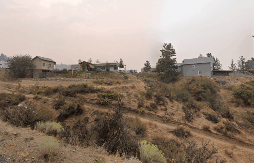
Deer Meadows counts around 125 full-time residents spread across high prairie lots overlooking Porcupine Bay. Days fill with bass fishing, trail rides on dusty jeep tracks, and sunset photography as the plateau lights up in gold and crimson.
Construction trades, small ranch holdings, and vacation rentals support the economy, with solar panels and rain-harvest systems common for off-grid cabins. The plateau’s broad openness means houses sit far apart, and a patchwork of public Bureau of Reclamation land prevents dense development.
Gravel drives snake toward hidden swim beaches, many known only to locals. With such sparse habitation, coyotes often trot the main road at dusk unbothered by passing trucks.
Where is Deer Meadows?
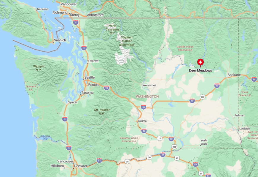
The settlement rests 16 miles northwest of Creston, perched 600 feet above Lake Roosevelt on wheat country’s edge. Only one paved route, Deer Meadows Road, connects it to State Route 25, making every trip an intentional one.
Bluffs drop sharply to the water, so no through-road follows the shoreline, reinforcing the sense of a hilltop hideaway. Spokane visitors usually travel via US-2 before turning north, then watch the landscape widen into sweeping vistas with no city lights in sight.
1. Coulee City
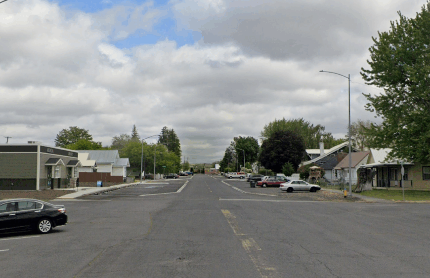
Coulee City hosts roughly 600 residents tucked along the western shore of Banks Lake. Visitors fish for rainbow trout at the city park, walk the basalt rim of Dry Falls just minutes away, or join Wednesday night sailboat races that seldom make regional news.
Agriculture and outdoor recreation power the local economy, aided by small cafés that serve both farmers and anglers. Despite proximity to Grand Coulee Dam, the town remains slow paced, with two-block main streets and sidewalks that empty soon after sunset.
Basalt cliffs wrap around the lake basin, blocking sightlines to the highway and giving the shoreline a pocket-world feel. Few commercial chains operate here, so residents rely on farmers’ markets and a venerable general store that has served the community for over a century.
Where is Coulee City?
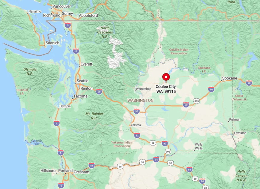
The town sits at the south end of Banks Lake where US-2 intersects SR-155 in Grant County. Surrounding coulees act as natural walls, and the nearest urban hub, Moses Lake, lies 50 rural miles away.
Travelers generally enter via US-2, crest a ridge, and see the blue reservoir appear suddenly beneath volcanic cliffs. Rail lines bypass the area entirely, and with no commercial airport nearby, Coulee City maintains the hush that defines these eastern Washington retreats.