🔥 Would you like to save this?
Western Michigan’s shoreline is dotted with enclaves where the pace drops and the sound of waves replaces traffic. Some sit behind leafy dunes, others perch on high bluffs, yet all share a gift for staying under the radar.
Our list counts down 25 coastal spots along Lake Michigan that keep crowds at bay through limited access, deep woods, or simple distance from major hubs. Each one offers its own mix of beaches, trails, and local lore, often sustained by small-scale tourism, light agriculture, or a handful of family businesses.
In order to come up with the very specific design ideas, we create most designs with the assistance of state-of-the-art AI interior design software.
Read on to meet villages where sunset strolls rarely cross another footprint and where the lake’s horizon feels like private property.
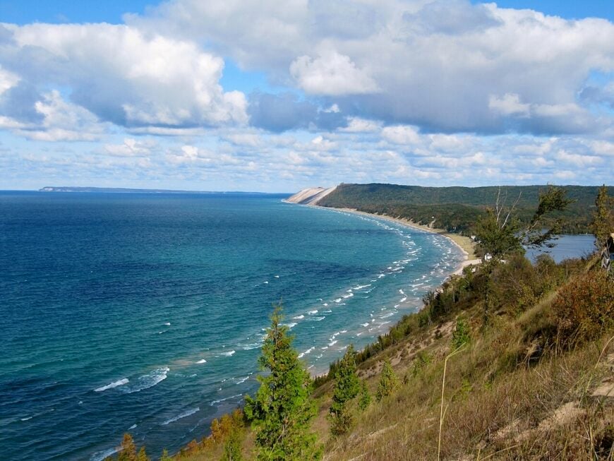
25. Norwood: Wave-Cut Ledges and Whisper-Quiet Shore
Norwood keeps its profile low behind a curtain of maples and old orchards, where narrow lanes find their way to stony, teal water. It feels secluded because the highway runs inland, parking is limited, and bluff-top neighborhoods end in stairways rather than boardwalks.
The vibe is wind-in-the-grass simple—cedar scent after rain, gulls riding thermals, and the rhythmic hush of surf on limestone ledges. Comb the wave-cut shelves for Petoskey stones, slip a kayak in on a calm morning, hike the quiet beaches at nearby Fisherman’s Island State Park, or bike rolling farm roads at golden hour.
Small-scale agriculture, cottage trades, and a handful of telecommuters make up most livelihoods. After dusk, the lake becomes a dark sheet of breath and stars. It’s the kind of shoreline that teaches you to talk softer.
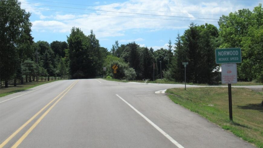
Where is Norwood?
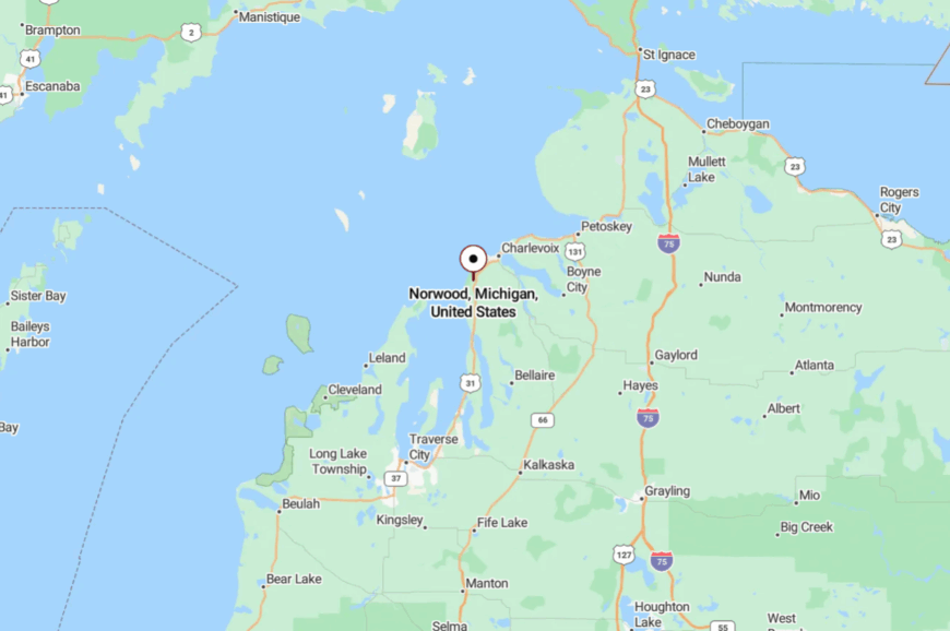
Norwood sits in Charlevoix County on Lake Michigan, about 6 miles south of the City of Charlevoix and west of US-31. You reach it by turning off the highway onto Norwood Road, then easing along Lake Shore Drive as it narrows beneath trees.
With dunes and state parkland bracketing the coast, there’s no true through-route to draw extra traffic. Close on the map, it still feels like the edge of the world when the waves are the only noise.
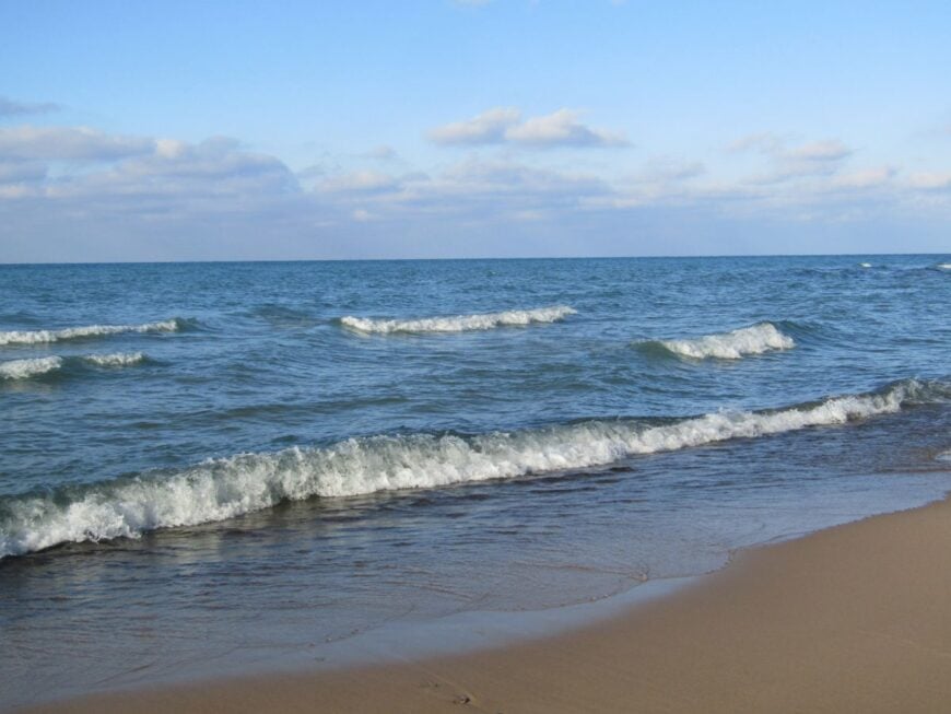
24. Lake Michigan Beach: Low-Key Shoreline with Big-Sky Sunsets
Lake Michigan Beach keeps a small footprint beneath tall oaks and cottonwoods, with cottages tucked behind dune grass. It feels hidden because public access is modest, parking is scarce, and most streets end in sand instead of commerce.
The vibe is family-simple—coolers, kites, and beach chairs carried down quiet stairways to wide, nearly empty water. Walk the shoreline at dawn, swim over sandbars that glow turquoise, birdwatch along Johnson Road’s wetlands, or detour for farm-stand peaches on the ride home.
Seasonal rentals and local service trades shape the workweek; the rest is waves and weather. Nights are dark enough for meteors, punctuated by the slow blink of distant freighters. You come for an afternoon and start dreaming of a week.
Where is Lake Michigan Beach?
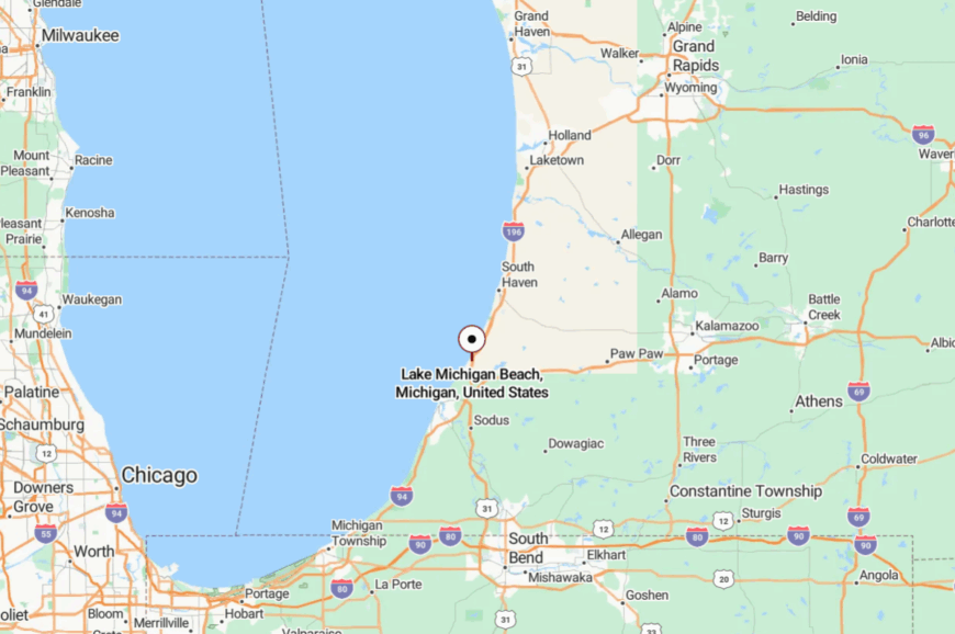
You’ll find it in Hagar Township, Berrien County, roughly 12 miles north of St. Joseph and a few turns off I-196. The approach follows Red Arrow Highway before narrowing to neighborhood lanes that fade into dune shadow.
With no marina or boardwalk to draw crowds, casual visitors rarely wander in by accident. It’s close to everything on a map, and far from it in spirit.
23. Harbert: Artful Cottages Beneath Old Beach Pines
Harbert wears its quiet like a well-loved sweater—gallery signs, cedar shakes, and sandy lanes that hush tires to a whisper. Its seclusion stems from deep lots, private beach associations, and a stretch of Red Arrow Highway that favors farm stands over strip malls.
The vibe is artsy-but-unfussy: espresso in the morning, a walk to the water at noon, maybe a gallery talk at dusk. Browse small studios, picnic at Harbert Road beach stairs, bike the back roads past orchards, or linger over dinner at a roadside bistro.
Hospitality, caretaking, and creative trades form the local backbone. When the lake turns silver at twilight, the whole shore falls still. It’s an easy place to misplace your watch.
Where is Harbert?
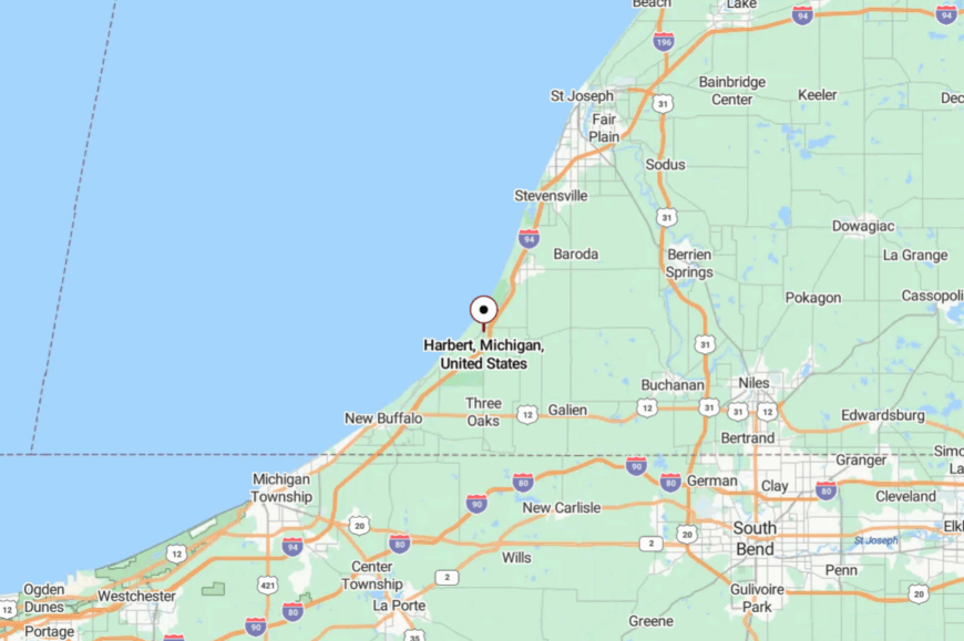
Harbert sits between Sawyer and Lakeside in southwest Berrien County, five minutes west of US-12. From the highway, Harbert Road slips through woods and over low dunes to the bluff.
The Galien River flats and private associations limit cut-through traffic. It’s a short detour that feels like a long exhale.
22. Union Pier: Classic Beach Lanes with Quiet, Leafy Shade
Union Pier feels tucked away despite its name—paved lanes turn to sand, and lake breezes thread through old-growth oaks. Seclusion comes from cottage streets that dead-end at stairways and from a shoreline buffered by private associations.
The vibe is classic Harbor Country: wraparound porches, vintage inns, and bikes clattering over weathered boardwalks. Hunt for beach glass at dawn, grab a cinnamon roll from a neighborhood bakery, paddle a calm morning shoreline, or browse a pocket-sized bookshop.
Small inns, cafés, and property management keep locals busy between summer weekends. At night, the surf drowns out the world beyond the trees. It’s the kind of quiet you plan your year around.
Where is Union Pier?
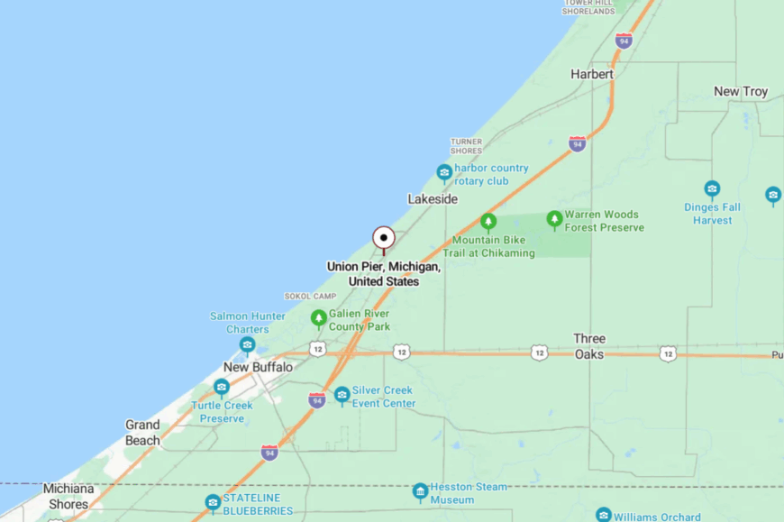
The village lies just north of New Buffalo, a mile west of US-12 and about 75 minutes from Chicago by car. Turns onto Town Line, Union Pier, or Lakeshore roads bring you through a canopy to the bluff.
With the lake on one side and wetlands on the other, there’s no straight-through route. It’s reachable in an hour, yet it feels like you’ve slipped into a hidden cove.
21. Sawyer: Dunes, Pines, and a Back-Porch Pace
Sawyer keeps its head down behind blueberry fields and a wall of dunes tied to Warren Dunes State Park. Its hidden feel stems from small roads that veer away from the lake and a lack of big waterfront lots to advertise the shore.
The vibe is woodsmoke and farm stand—craft beer, live oaks, and the thud of screen doors after sunset. Hike Warren Dunes’ high ridges, swim the park’s sweeping beach, sip a flight at a local brewery, or browse vintage finds in a rambling antique barn.
Farming, hospitality, and a few light industrial shops make up the economy. Even summer Saturdays leave plenty of room between towels. The dunes keep the world at arm’s length.
Where is Sawyer?
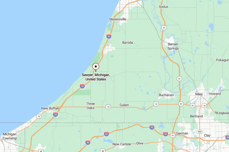
Set in Berrien County, Sawyer sits just off I-94/US-12, a few minutes inland from Lake Michigan. From downtown, small roads drift west toward parkland and dead-end beneath bluffs.
The Galien River valley and tall dunes block direct routes along the shore. You’re near the interstate—but it feels like you’ve stepped into a backcountry beach town.
20. Pier Cove: Pocket Beach and Orchard Bluffs
Pier Cove is a blink-and-miss hamlet where a tiny creek meets the lake beneath fruit-country hills. Its seclusion owes to a single, small public access and a bluff-top neighborhood with no commercial strip.
The vibe is hushed and neighborly: low voices on stairways, gulls wheeling over the cove, orchards perfuming the air in spring. Skip flat stones across the mouth of Pier Cove Creek, photograph ice shelves in winter, bike the rolling ridge to West Side Park, or pick cherries a mile inland.
Orchards and seasonal rentals carry most of the load. When the sun slides behind the bluff, waves take over the conversation. It’s small in size and large in peace.
Where is Pier Cove?
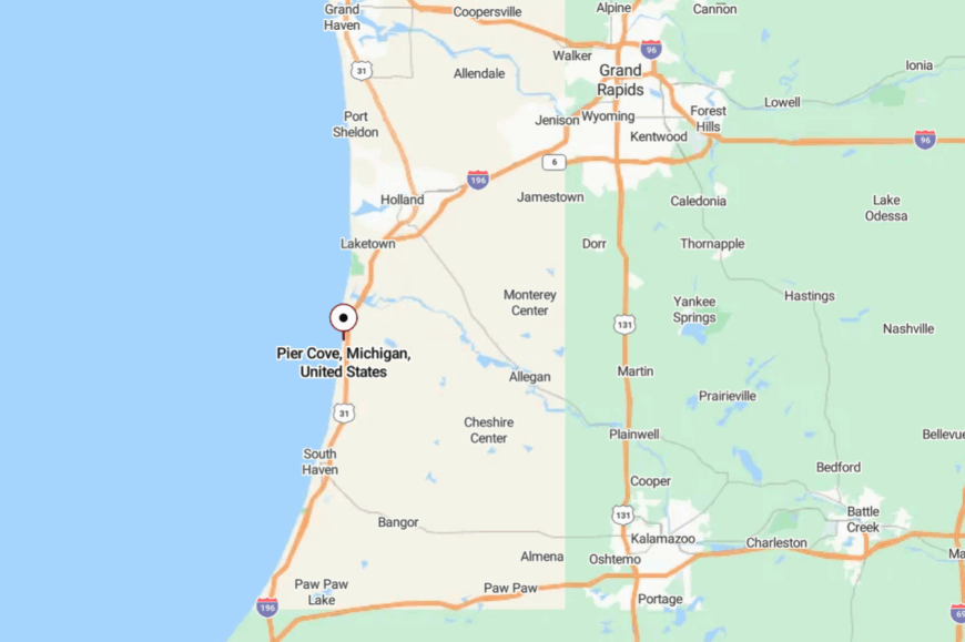
Find it along Lakeshore Drive in Allegan County, south of Saugatuck and north of South Haven. Access comes via 124th Avenue to Lakeshore, then a short descent to the bluff.
With farmland inland and steep dunes on the water, there’s nowhere for traffic to go but slow. It’s a pinpoint on the map that feels like a private overlook.
19. Palisades Park (Covert Township): Vintage Boardwalks in a Private Dune World
🔥 Would you like to save this?
Palisades Park hides a historic cottage colony in the folds of towering dunes—boardwalks, footpaths, and lake breezes instead of streetlights and strip malls. Seclusion comes from private roads, thick forest cover, and a bluff that discourages casual day-use.
The vibe is timeless: cedar shingles, porches strung with lights, and kids running barefoot to the beach. Stroll the ridge-top paths at sunset, beachcomb for fossils, paddle a clear morning shoreline, or birdwatch in nearby Van Buren State Park.
Seasonal caretaking and cottage trades set the tempo, with most work happening quietly behind the pines. Nights go properly dark here. It’s a little world that asks you to whisper.
Where is Palisades Park?
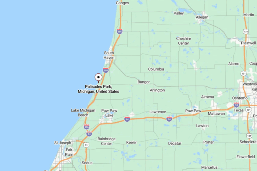
The community sits just south of South Haven in Van Buren County, west of M-140 and a few minutes off Blue Star Highway. Narrow lanes curl through forest to bluff-top overlooks and private beach stairs.
With state parkland next door and no public marina, it sees little pass-through traffic. Close on a map, far in the soul.
18. Saugatuck Shores: A Peninsula Between Dunes and Deep Water
Saugatuck Shores is a quiet peninsula of lanes shaded by birch and maple, set between Lake Michigan’s dune wall and the Kalamazoo River channel. It stays secluded because there’s one way in, one way out, and nothing to sell but the view.
The vibe is pine-scented and low-key: kayaks on sawhorses, herons stalking the shallows, the low clink of halyards at dusk. Paddle the back bays, walk the lighthouse pier across the channel, beach it at nearby Oval or Saugatuck Dunes, or watch storms roll up the big lake from a bluff-top overlook.
Marine trades and property care keep a modest local economy humming. After dark, you hear only rigging and frogs. It’s a harbor village that learned to keep its voice down.
Where is Saugatuck Shores?
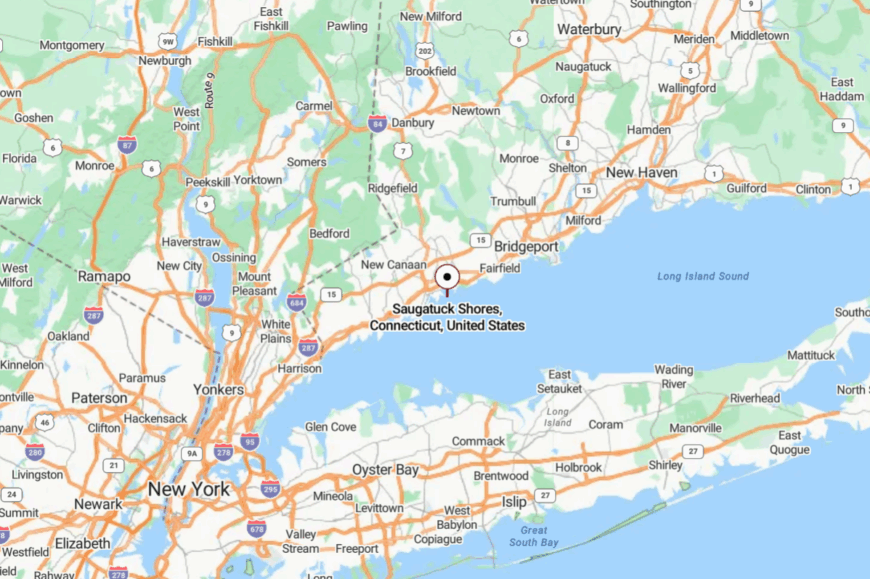
It’s in Saugatuck Township, Allegan County, across the river from downtown Saugatuck and accessed by quiet residential roads off Blue Star Highway. The peninsula is hemmed by water and dunes, so there’s no through route to anywhere else.
Most visitors come by car, though dinghies bob up from moorings on calm evenings. It’s minutes from restaurants, yet it feels a world apart.
17. Port Sheldon (Pigeon Lake): Working Harbor Wrapped in Woods
Port Sheldon clusters around Pigeon Lake—a snug harbor tucked behind dunes where fishing tugs and kayaks share the same water. Its off-the-map feeling comes from miles of protected shoreline, a lack of tourist strips, and forest roads that simply stop at the sand.
The vibe is practical and peaceful: gulls, boat wakes, and the slap of halyards on masts. Walk the jetty for sunset, hike the Port Sheldon Natural Area, launch a kayak up the Pigeon River, or cast for steelhead at the channel.
Marine work, light industry inland, and cottage trades make the week hum. When the lake goes glassy at dusk, everything slows to a whisper. It’s a harbor that keeps its head down.
Where is Port Sheldon (Pigeon Lake)?
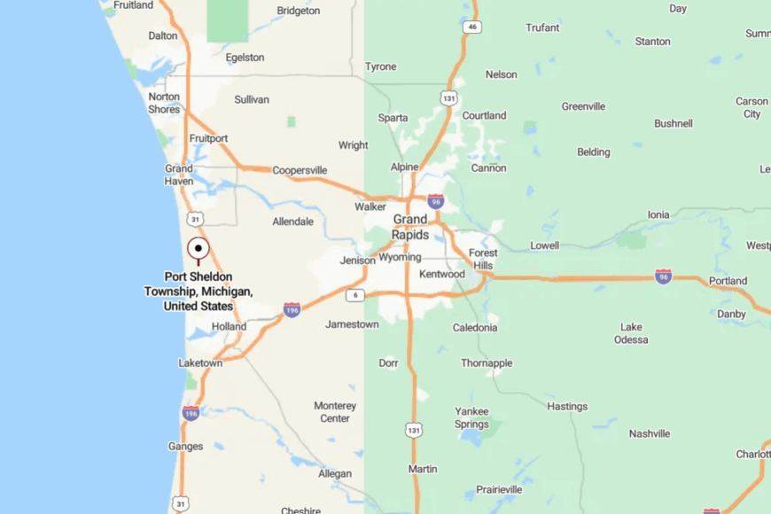
You’ll find it in Ottawa County between Holland and Grand Haven, west of US-31 via Port Sheldon Street. The final miles narrow to wooded lanes that end at small parking lots and a long jetty.
With dunes to the west and preserves to the east, traffic disperses fast. It’s easy to reach—and even easier to forget the clock.
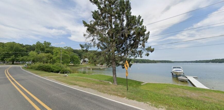
16. Sylvan Beach (White Lake Channel): A Historic Cottage Colony by the Pier
Sylvan Beach lines the south side of the White Lake channel, a pocket of shingled cottages with porches facing the light. Its seclusion follows from private roads, limited parking, and a channel-side location that most travelers bypass for bigger beaches.
The vibe is vintage lake life: screen doors, garden flags, and the distant call of the lighthouse horn on foggy mornings. Watch boats thread the channel, walk the pier to the light, explore White River’s backwaters by kayak, or pedal Old Channel Trail beneath big maples.
Seasonal caretaking and a handful of local trades keep things tidy. Evening brings the soft blink of the beacon and not much else. It’s summer distilled to its quietest notes.
Where is Sylvan Beach?
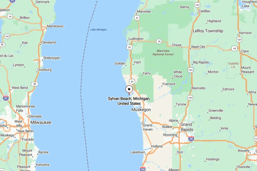
It’s tucked at the Lake Michigan mouth of White Lake, on the Whitehall side of the channel in Muskegon County. Access comes via Old Channel Trail and narrow neighborhood lanes that end at the pier.
With the lake on one side and water on the other, it isn’t on the way to anywhere. You arrive on purpose—and leave reluctantly.
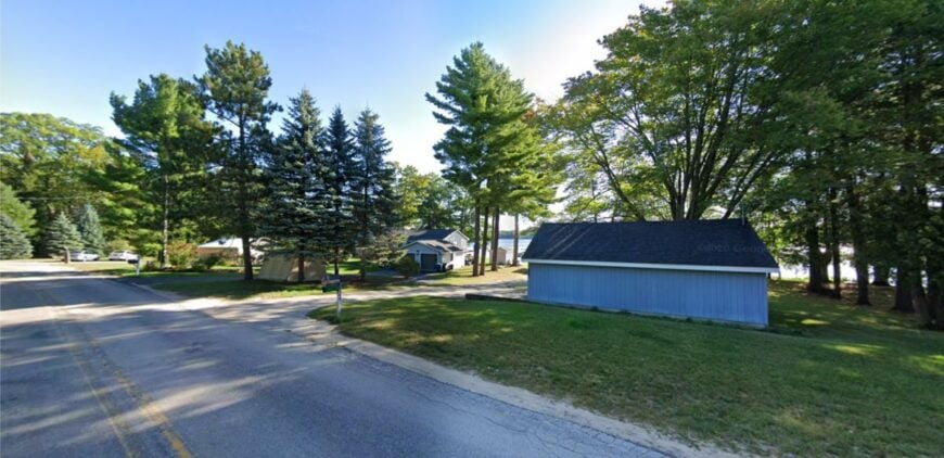
15. Stony Lake: River Meets Lake at the Edge of the Dunes
Stony Lake drifts toward Lake Michigan through a cedar-lined outlet, where a tiny bridge and low dunes frame a remarkably quiet shore. Its seclusion stems from back-road access and a small public beach that keeps numbers low even in July.
The vibe is woodsy and informal: canoes nosing into cattails, hammocks strung between pines, and the distant roar of the big lake. Paddle the outlet to the beach, hunt agates after a storm, hike Silver Lake State Park’s northern trails, or fish for bass at daybreak.
Cottages, campground work, and small lake services shape local life. Nights are cricket-loud and human-soft. It’s the sort of place where time moves like water.
Where is Stony Lake?
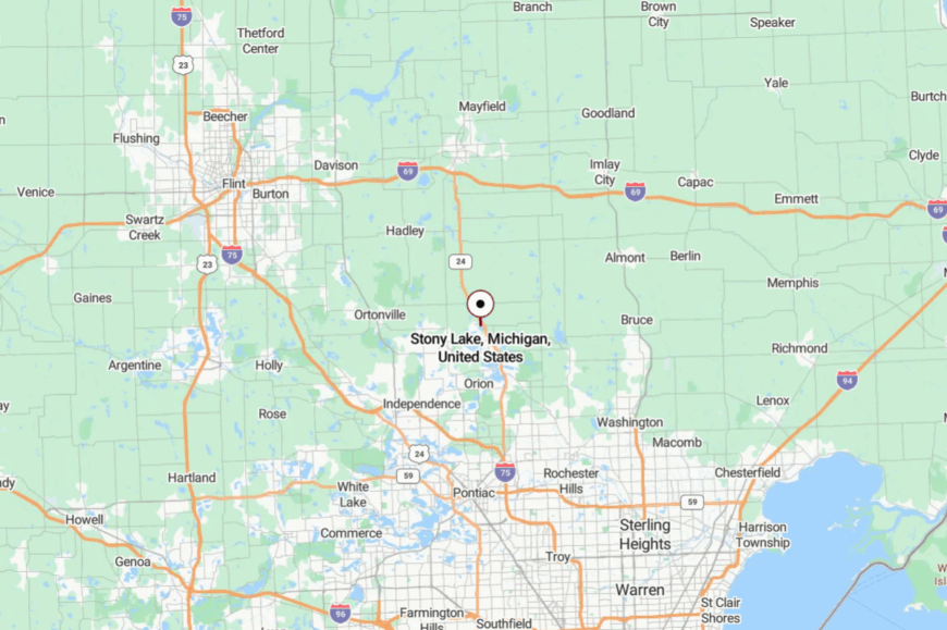
Find it in Oceana County between Montague and Pentwater, west of US-31 along scenic back roads. The final approach follows a twisting lane to the outlet bridge and a pocket parking area.
Dunes and wetlands block any straight-through traffic. It’s easy to miss, and that’s exactly why it stays peaceful.
14. Bass Lake (Mason County): Cedar Shores North of Ludington
Bass Lake curls behind the Lake Michigan dunes, a clear bowl of water rimmed by cedar and sand. Seclusion here comes from dune ridges that hide it from the highway and a lack of big marinas to draw crowds.
The vibe is cabin-calm: screen porches, loons after dark, and paddles dipping in glassy coves. Paddle the channel to the big lake beach, hike Nordhouse Dunes Wilderness just up the shore, fish the weedlines for pike, or wander into Ludington State Park for sunset.
Cottage upkeep and seasonal forestry work anchor a quiet economy. When the wind lays down, you can hear owls across the water. It’s a pocket lake with a big capacity for calm.
Where is Bass Lake?
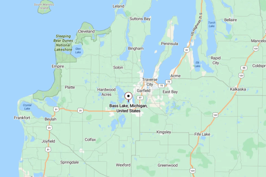
It sits a few miles north of Ludington in Summit Township, Mason County, west of US-31 via Chauvez or Meisenheimer roads. The last turns slip through woods and over low dunes before the water appears.
With federal wilderness nearby and few services on-site, traffic thins fast. It’s a close-by corner that feels wonderfully far.
13. Epoufette: Bluffs, Blue Water, and a Harbor Lost in Time
🔥 Would you like to save this?
Epoufette clings to a crescent of turquoise water where jack pines meet a pocket-size harbor and gulls hang in the wind. It feels secluded because there’s no downtown to speak of—just scattered cottages, a shutter-quiet marina, and long gaps of forest in every direction.
The vibe is endearingly old-school U.P.: fish shanties, woodsmoke on cold nights, and the steady hush of Lake Michigan rolling under the bluff. Spend a morning picnicking at the Epoufette Bay overlook, descend the stairs at nearby Cut River Bridge for a gorge-side hike, cast from shore when the water lays down, or wander inland sand roads into Hiawatha National Forest.
Summer brings a trickle of travelers, but many locals are charter captains, caretakers, or retirees who prefer the off-season’s deeper quiet. Streetlights are few, so the Milky Way takes center stage when the fog lifts. It’s the kind of harbor that makes you lower your voice without being asked.
Where is Epoufette?
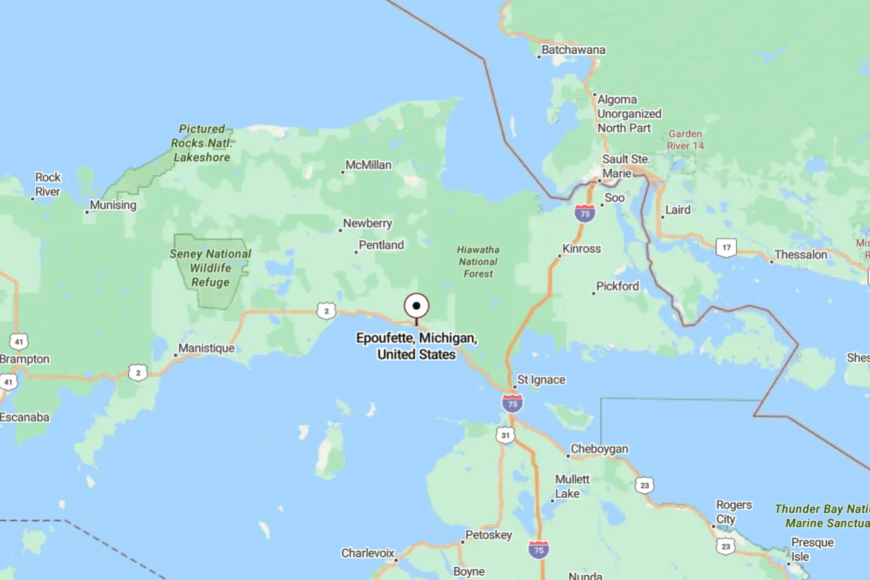
Epoufette sits on Lake Michigan’s north shore in Mackinac County, roughly 35 miles west of St. Ignace and the Mackinac Bridge. It’s tucked along US-2, yet the highway rides high on the bluff and slips past with only a couple of turnouts and a tiny harbor road.
Most visitors simply pull off at the scenic overlook and then drop down a short local lane to the water. Close to the route yet hidden by trees and elevation, it’s near enough to reach but far enough to feel like you’ve left everything behind.
12. Elberta: Harbor Quiet Across from Frankfort’s Lights
Elberta faces Frankfort across Betsie Bay, but its streets nap in the shade while the bustle stays over the channel. Seclusion comes from the old rail grade and broad bay that buffers the village from highway flow.
The vibe is heritage-harbor calm: historic facades, working slips, and a lighthouse view that never gets old. Bike the Betsie Valley Trail, climb the dune at Elberta Beach, cast for salmon from the breakwall, or watch storms roll in from the iron catwalk.
A shipyard, small cafés, and marina services anchor the economy. After dark, the only glow is the lighthouse and a scatter of porch lamps. It’s the quiet side of a postcard.
Where is Elberta?
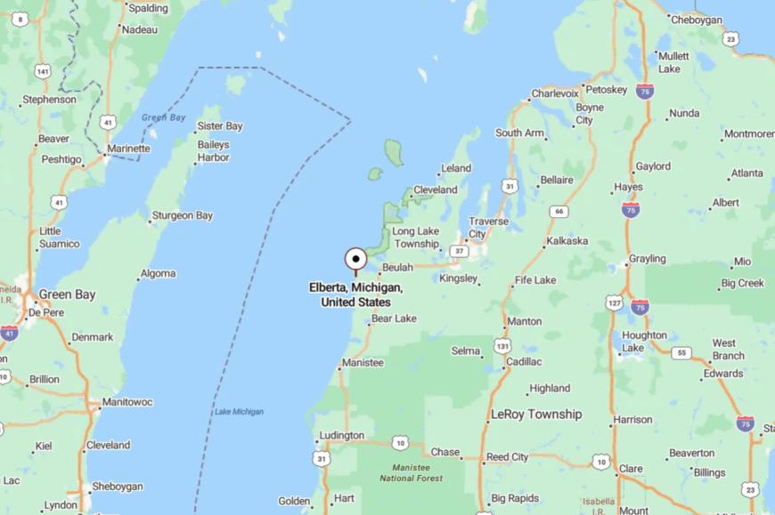
Elberta sits in Benzie County on M-22/M-168, 40 minutes west of Traverse City via US-31. The road skirts Betsie Bay before a short jog to the lakefront.
With the bay and dunes hemming things in, there’s no freeway rush—just water on three sides. It’s close to everything you’d want, and perfectly apart from it.
11. Glen Haven: Time-Capsule Village in the Dunes
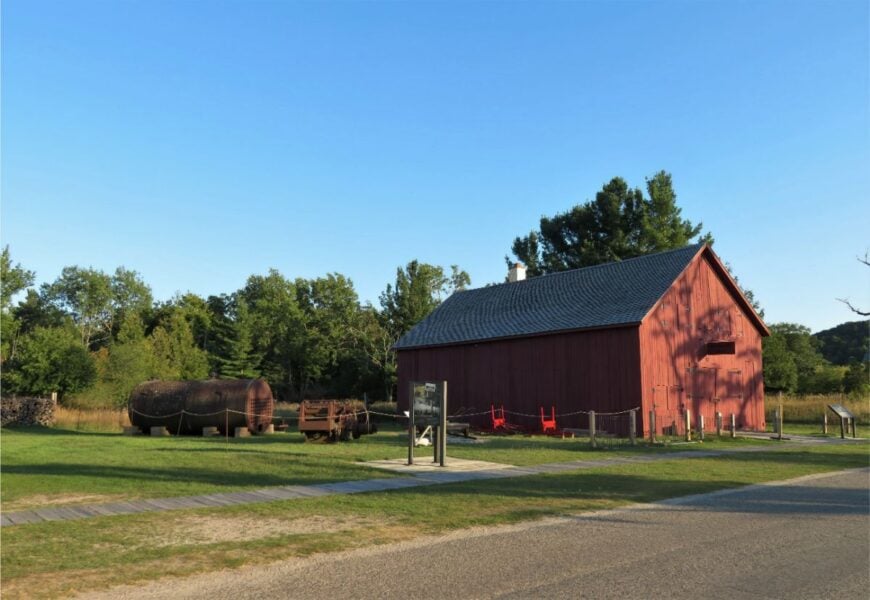
Glen Haven is a preserved lakeshore village—weathered boathouse, blacksmith shop, and a sandy street that wanders straight to turquoise water. It feels secluded because it’s surrounded by Sleeping Bear Dunes National Lakeshore, with no commercial sprawl and only a handful of buildings between forest and shore.
The vibe is beautifully spare: sailboats ghosting past the lifesaving station, sugar sand squeaking underfoot, and wind tracing ripples through beach grass. Tour the restored historic sites, walk the Pierce Stocking overlooks nearby, beachcomb along Sleeping Bear Bay, or hike the Dune Trail when evening cools the sand.
Park staff, seasonal guides, and a trickle of cottage caretakers make up most local work. As the sun drops behind North Manitou, the day goes silent in one long breath. It’s a living postcard that never raises its voice.
Where is Glen Haven?
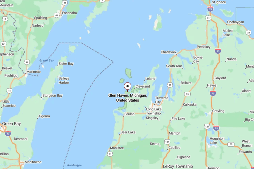
Glen Haven sits on Lake Michigan in Leelanau County, just west of Glen Arbor and an hour northwest of Traverse City. M-109 loops through the National Lakeshore to a small parking area by the beach and historic district.
With federal dunes on three sides and the bay on the fourth, there’s nowhere for traffic to hurry. It’s easy to reach, and even easier to forget there’s a world beyond the sand.
10. Grand Beach: Leafy Lakeside Hideaway Near the Indiana Border
Roughly 300 people call Grand Beach home, though summer brings a few more cottage owners zipping along golf-cart lanes. Visitors fill days with shoreline walks, rounds at the historic nine-hole course, and bike rides under tulip poplars that arch over private roads.
Short-term rentals and hospitality jobs supplement property management and construction as leading sources of income, while many residents are retirees. Seclusion comes from the gated layout, one-acre lots, and a lack of commercial corridors, which combine to mute outside noise even in July.
Dense dune vegetation screens homes from each other and from the lake, reinforcing a feeling of being tucked away. Even longtime Harbor Country vacationers can spend years nearby without discovering the village’s quiet beach access points.
Where is Grand Beach?
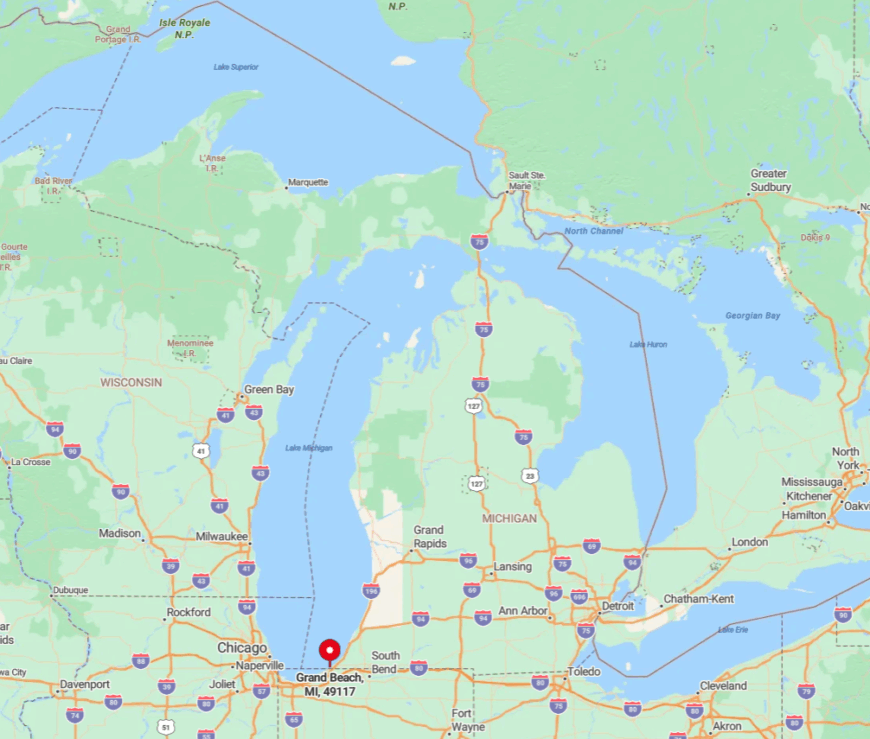
The village sits in the southwest corner of Michigan’s shoreline, just north of the Indiana state line and three miles from U.S.-12. Chicagoans reach it in under two hours, yet the last mile winds through woods that hide the entry gate from the highway.
Because Grand Beach is bordered by Lake Michigan to the west and Chikaming Open Lands preserves to the east, pass-through traffic is nonexistent. Arrivals use a single signed entrance on Grand Beach Road, which limits casual sightseers and keeps the beach pleasantly empty.
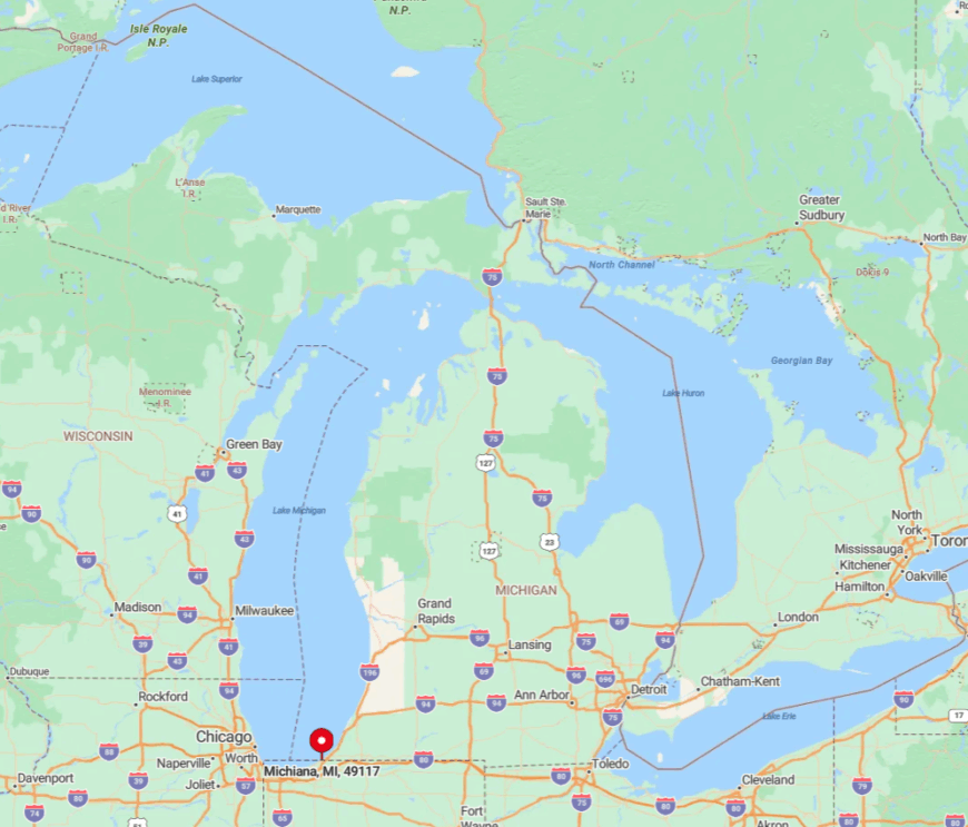
9. Michiana: Storybook Cabins Tucked Among Old-Growth Oaks
About 200 year-round residents live among Michiana’s split-log cottages and cedar shake cabins that date to the 1920s. Popular pastimes include morning beach glass hunts, evening bonfires at Stop 41, and wandering the sandy footpaths that link cottages without need for pavement.
Seasonal rentals and tiny local inns create modest hospitality work, while many homeowners telecommute or commute to nearby New Buffalo. Michiana feels hidden because streets dead-end at the lake and are named for Native tribes rather than numbered, confusing GPS-guided day-trippers.
Towering oaks and pines form a canopy that obscures rooftops even from neighboring lanes. The absence of restaurants or storefronts ensures nights stay as quiet as the 1930s postcards still sold at the tiny village office.
Where is Michiana?
🔥 Would you like to save this?
Located directly north of Grand Beach, Michiana straddles the state border; half the village actually lies in Indiana. Its Michigan side is reached by the narrow Grand Beach-Michiana Road that sees mostly local traffic.
Wide dunes on the lakefront and the Galien River wetlands to the east discourage through routes, leaving the neighborhood isolated. The nearest Amtrak stop is New Buffalo, six miles south, followed by a short taxi ride beneath thick tree cover.
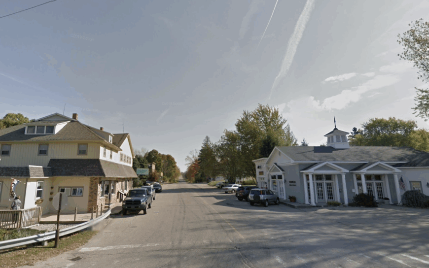
8. Lakeside: Quiet Harbor Country Hamlet With Endless Private Beach
Fewer than 100 permanent residents occupy Lakeside’s gently rolling lakeshore, where estate gates hide century-old mansions on five-acre parcels. Days revolve around beachcombing, paddleboarding over sandbars, and browsing the single antiques barn on Red Arrow Highway.
Real-estate services and caretaking for second homes create most jobs, supplemented by a couple of boutique inns. Seclusion thrives thanks to pocket-size public access stairs that blend into dune grass, keeping crowds concentrated in neighboring Warren Dunes State Park instead.
No stoplights or strip malls interrupt the two-mile stretch of shoreline, so night skies stay dark enough for meteor shows. Even on holiday weekends, beach walkers can travel a mile without meeting another towel.
Where is Lakeside?
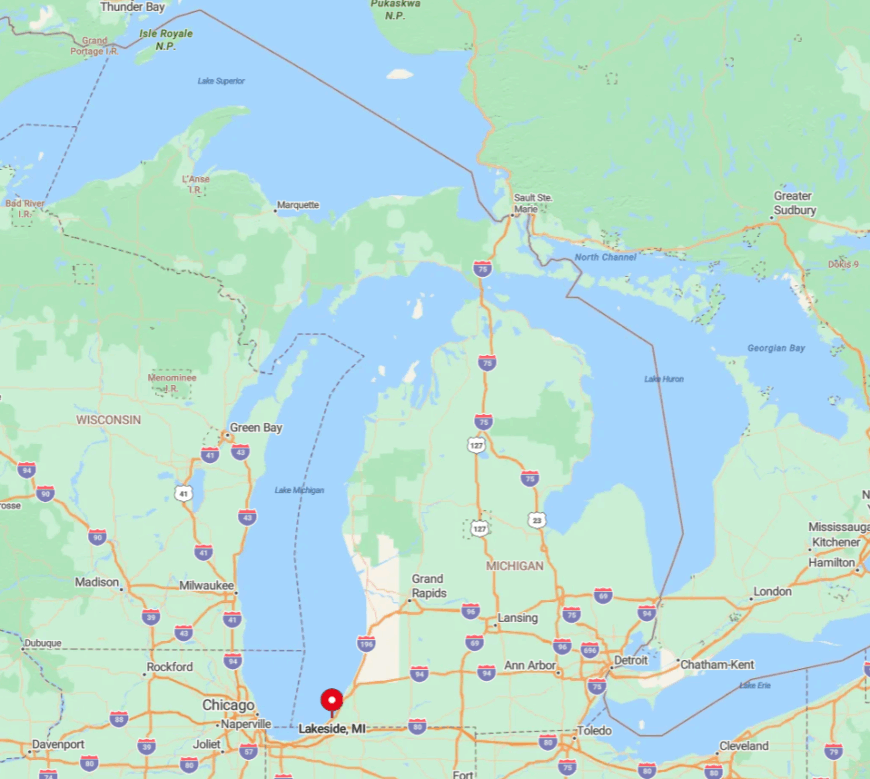
Lakeside sits between Union Pier and Sawyer in Berrien County, yet lacks a formal village center. U.S.-12 traffic skirts a mile inland, leaving the lakeshore shielded by a ridge of oaks and poplars.
Visitors exit at the discreet Lakeside Road sign, descend past orchards, and cross the vintage interurban rail line before reaching the lake. The nearest interstate, I-94, is seven miles away, which helps maintain a low visitor count.
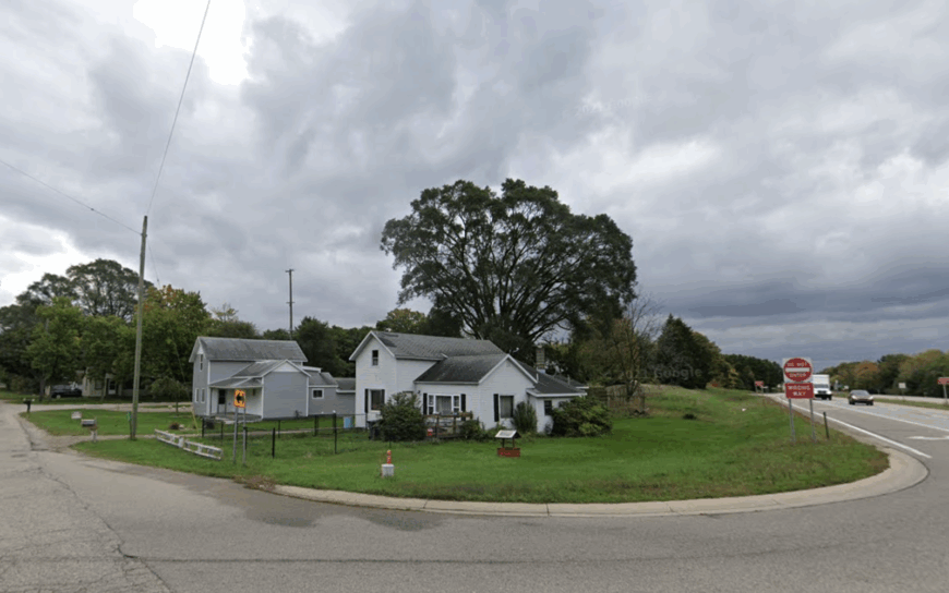
7. Glenn: The “Pancake Town” Where Orchards Meet Empty Shoreline
About 450 residents live in and around Glenn, nicknamed “Pancake Town” after delivering thousands of flapjacks to 19th-century shipwreck survivors. Today, travelers swing by the single crossroads market for blueberry syrup before hiking lonely bluff trails that drop to wide, little-known beaches.
Orchard work, small-batch jam production, and charter fishing make up the bulk of local income. Glenn remains secluded because no public campground or marina advertises its shoreline, and cell service often fades near the lake.
Farm fields ring the hamlet, providing a visual buffer that hides modern development. In spring, pink apple blossoms frame views that look unchanged since horse-and-buggy days.
Where is Glenn?
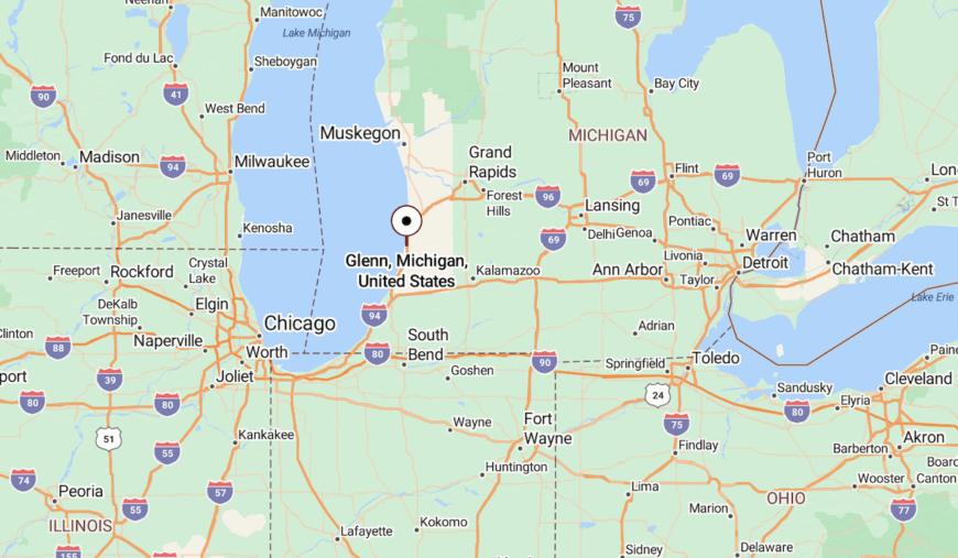
This settlement lies halfway between South Haven and Saugatuck on the Blue Star Highway, yet an absence of large signs causes many drivers to speed past. A single paved road, Lakeshore Drive, heads west through orchards before ending at a small bluff-top parking pad.
Surrounding parcels are protected as fruit farms, so no alternate routes reach the water. Most visitors rely on personal vehicles, exiting I-196 at the sleepy Glenn interchange and following the scent of blooming cherries.
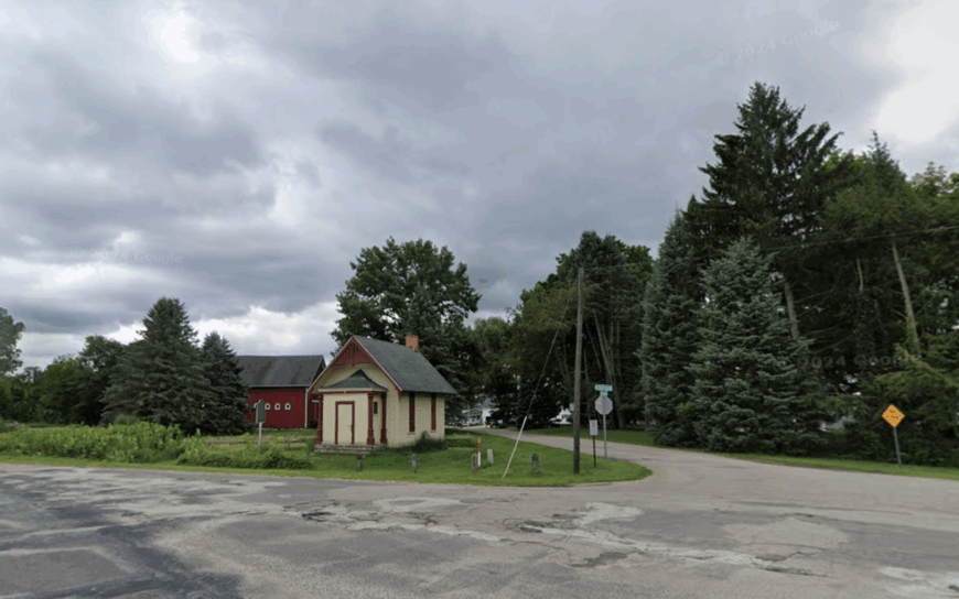
6. West Olive: Hidden Dune Forests Between Holland and Grand Haven
Approximately 4,000 residents spread across West Olive’s ZIP code, though only a fraction live close to Lake Michigan amid thick jack pines. Favorite diversions include hiking in Ottawa County’s Kirk Park, horseback riding on sandy bridle trails, and surf-casting for steelhead at the Pigeon River mouth.
Agriculture and light manufacturing east of U.S.-31 provide steady employment, while lakeside areas revolve around homebuilding and nature tourism. Isolation stems from the wide parklands and private preserves that interrupt the shoreline for miles, creating natural buffers from nearby resort towns.
Residential lots often exceed two wooded acres, so houses seldom peek through the foliage. Even at sunset, the mile-long Kirk Park beach often hosts more gulls than people.
Where is West Olive?
The unincorporated community occupies a long stretch of shoreline 10 minutes north of Holland and south of Grand Haven. Because access roads dead-end at the lake and parking is limited, beach traffic disperses quickly.
The nearest public transit is an Indian Trails bus stop in Holland; most travelers drive U.S.-31 and slip west along county roads that narrow to forest lanes. Lack of clear signage past the main highway keeps spur-of-the-moment crowds from finding the best dunes.
5. Duck Lake Heights: Bluff-Top Cottages Above Turquoise Water
Only about 150 full-time residents live along the single bluff road of Duck Lake Heights in Fruitland Township. Locals kayak through the narrow channel linking spring-fed Duck Lake to Lake Michigan, search for Petoskey stones on little-known beaches, and picnic at nearby Muskegon State Park.
Small carpentry crews handle cottage upkeep while part-time residents support a handful of cleaning and landscaping businesses. The enclave stays secluded thanks to state-owned land surrounding three sides and a steep bluff that deters casual beachgoers.
Homes rest on deep lots carved from old orchards, leaving dense hedgerows that hide decks and fire pits. Evening skies often glow aqua as the shallow channel reflects sunset, a sight known mainly to neighborhood residents.
Where is Duck Lake Heights?
The community sits 12 miles north of Muskegon, reached by Scenic Drive before climbing a bluff that parallels Lake Michigan. Heavily forested Duck Lake State Park flanks the south, while undeveloped dunes guard the north, eliminating through traffic.
Visitors must navigate a gravel switchback down to the small public access lot, which only fits a dozen cars. Absence of lighting and signage means first time arrivals often miss the turn and drive on toward Whitehall, leaving the beach blissfully empty.
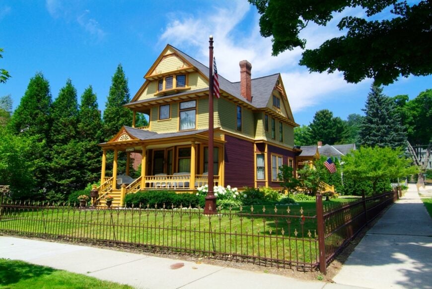
4. Pentwater: Sleepy Harbor Village Wrapped in State Forest
Around 900 residents occupy pastel cottages and century-old storefronts circling Pentwater Lake’s marina. Art fairs on the village green, sailing regattas, and sunset concerts make up the social calendar, while hikers lose themselves in the surrounding Pere Marquette State Forest.
Charter fishing, boutique retail, and a few light-industrial shops provide year-round income. Development is capped by state-owned woods and dunes that hem the village, keeping expansion at bay.
Main Street ends at a wide pier where anglers share space with migrating monarchs, yet parking remains easy even in August. Locals often claim that Pentwater feels like a resort town from fifty years ago because its boundaries can’t grow.
Where is Pentwater?
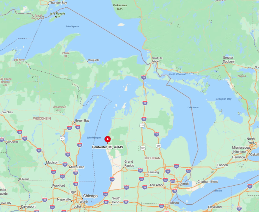
Found in Oceana County, Pentwater sits just west of U.S.-31 but remains out of sight thanks to a low ridge of pines. Travelers exit at Monroe Road and wind three miles past blueberry fields before the first glimpse of sailboat masts.
The nearest airport is in Muskegon, forty miles south, so most visitors arrive by car or by boat through the channel from Lake Michigan. With forest to the north and south and federal dunes to the west, no additional highway can be built, preserving the village’s hush.
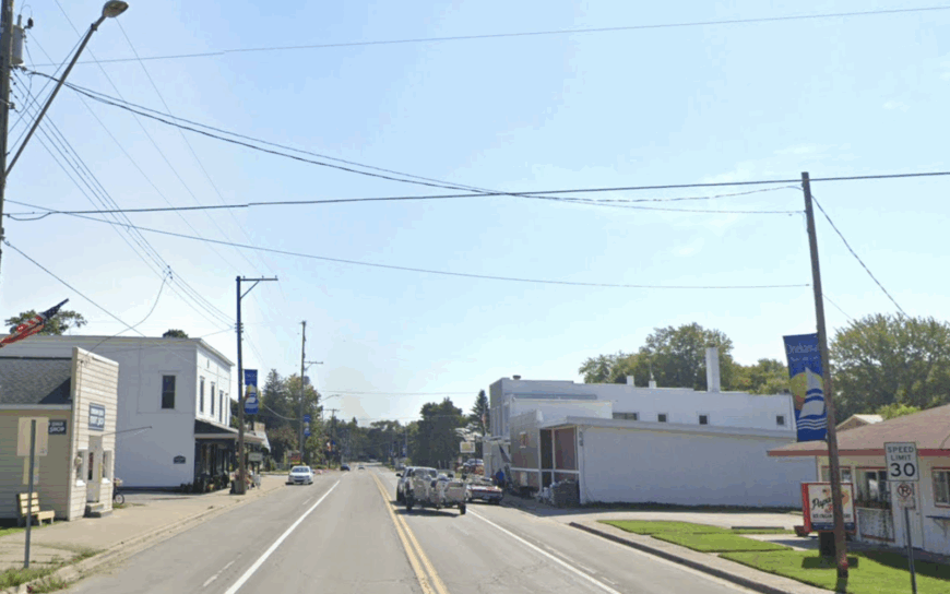
3. Arcadia: High Cliffs and Wide Horizons in Manistee County
Arcadia’s population hovers near 275, many descended from lumber families who settled beside a deep harbor. Highlights include climbing the 120-step staircase at Inspiration Point, beach-combing among lichen-flecked rocks, and birding across miles of protected coastal prairie.
Agriculture, cottage rentals, and the Arcadia Bluffs Golf Club anchor the local economy. The village is secluded because steep moraine cliffs block any direct lakefront road, forcing traffic inland.
Residential development remains sparse, with meadows stretching to the horizon beyond each farmhouse. Even the golf course keeps fairways separated by tall native grasses that swallow outside noise.
Where is Arcadia?
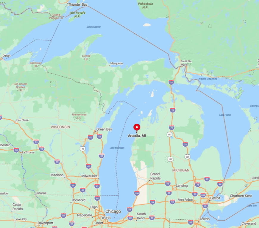
Arcadia lies along M-22 between Manistee and Frankfort, yet the bluff obscures lake views from the highway, causing many drivers to pass without stopping. Only a single spur, 13 Mile Road, reaches the waterfront, ending at a tiny harbor parking lot.
To the east, thousands of acres of Grand Traverse Regional Land Conservancy prairie ensure no alternate routes exist. Most visitors access Arcadia via personal vehicle, taking U.S.-31 to Joyfield Road, then dropping to M-22 for the final scenic miles.
2. Onekama: Twin-Lake Tranquility Where Portage Meets Michigan
About 400 residents live around Onekama’s two-mile-long Portage Lake, connected to Lake Michigan by a historic channel dredged in 1871. Sailing races, pickerel fishing, and quiet paddles through lily pads occupy summer afternoons, while hikers explore the forested hills that frame both lakes.
Tourism and marina services lead the economy, supplemented by cherry orchards on the surrounding moraine. Seclusion arises from large waterfront parcels and zoning that limits commercial strips to a couple of intersections.
The dual-lake layout diffuses visitors over ample shoreline, so beaches seldom feel busy. After Labor Day, the only sounds on Main Street are gulls circling over the channel lighthouse.
Where is Onekama?
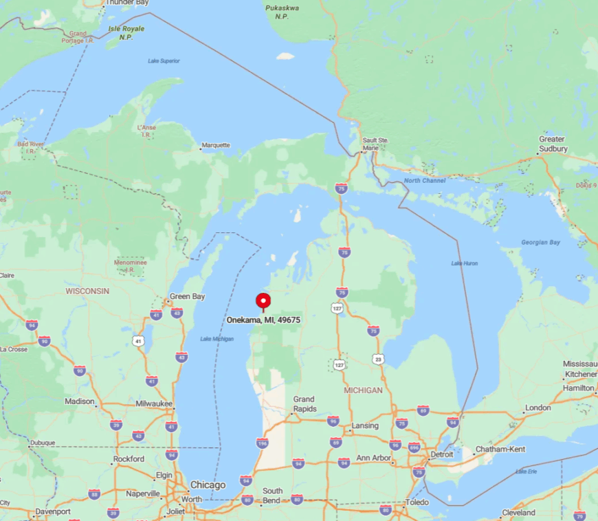
Situated 15 minutes north of Manistee, Onekama sits along scenic M-22 yet is buffered from the highway by Portage Lake. Drivers must loop around the lake’s eastern shore to reach the village, a detour that filters spontaneous traffic.
The nearest airport lies in Manistee, but limited flights mean most arrivals come via U.S.-31 and the curving county roads through hardwood forest. With state forest to the north and Lake Michigan dunes to the west, no direct shortcut exists, preserving calm even in peak season.
1. Good Hart: Tunnel-of-Trees Serenity on a Bluff Above the Big Lake
Roughly 250 full-time residents cluster around Good Hart’s tiny post office and general store, both framed by sugar maples that blaze red each fall. Favorite activities include photographing the historic Episcopal church, beach-combing at Middle Village Park, and driving the famed Tunnel of Trees on M-119.
Small retail, artisan studios, and cottage maintenance form the core local industries, often supplemented by online work. The hamlet’s bluff-top perch keeps development minimal; lots drop steeply toward the lake, making large-scale building impractical.
Heavy forest blocks cell signals and muffles road noise, enhancing the sense of removal. Even in mid-July, drivers may travel ten miles on M-119 before encountering another car.
Where is Good Hart?
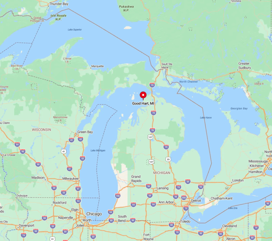
Good Hart sits in Emmet County, 15 miles north of Harbor Springs along the twisting M-119 corridor. Lake Michigan forms its western edge, while dense state forest hems in the east, leaving only the single two-lane road for access.
Because RVs and tour buses avoid the sharp curves and low branches, visitor numbers stay low. Most travelers arrive via Pellston Regional Airport, rent a car, and meander north through the Tunnel of Trees, emerging to find Good Hart as quiet as ever.


